7 minute read
Colville/Native People
VISITORS’ GUIDE • GRAND COULEE DAM AREA • 2020-2021 Colvilles — Native People
VISITOR
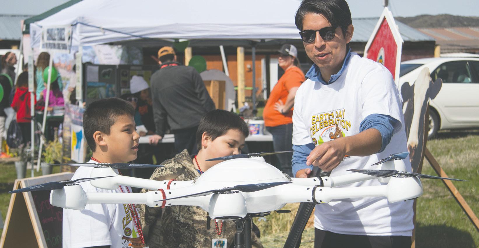
Colville Tribal member Nathan Moses, whose M3 Consulting Group uses drones in agriculture in Eastern Washington, displays one to kids attending the Colville Tribes’ annual Earth Day Celebration at the powwow grounds on the Colville Indian Agency in 2018.
For hundreds of years before explorers and settlers reached the lands of the Columbia Plateau, numerous tribes of native people occupied the territory of Eastern Washington.
Up to the mid-1850s, the ancestors of the Colville Confederated Tribes were nomadic, but life changed for them with the coming of settlers in the 1800s. Today, the Colville Confederated Tribes is made up of 12 different bands of Indians. Eleven bands are from eastern Washington state, and one band, the Nez Perce, is from northeast Oregon. The 12 bands are: Wenatchi, Entiat, Chelan, Methow, Okanogan, Nespelem, San Poil, Lakes, Moses, Palus, Nez Perce and Sweelpoo.
How did these Native Americans live?
As nomadic peoples, the different bands followed the seasons and their sources of food.
Deer and other big game plus dried salmon were the primary food of winter. Small groups lived in the mountains and hunted the abundant game.
In the spring, the native people congregated in slightly larger groups to gather camas and other roots in the lower valleys. Through the summer and fall, the Columbia River provided abundant salmon and other fish, which encouraged large concentrations of Salish-speaking Colville people. 30
How did the different bands come to be called the “Colville” Tribes?
Many different tribes fished and traded goods with each other in the area of Kettle Falls, Washington. In the 1820s, non-native people learned that the Indians excelled at trapping and stalking game for the large fur trade. For this purpose, a new fort was established at Kettle Falls by a man named Simpson.
The new post was to be called Fort Colvile, after the leading member of the committee of directors in London, Andrew Wedderburn Colvile. Andrew Colvile, who was in the rum and molasses business, never set foot in America. He had, however, advanced Simpson to his position of leadership.
Trading took place at Fort Colvile almost daily. From 1826 to 1887, Indians traded beaver, brown or black bear, grizzly, muskrat, fisher, fox, lynx, martin, mink, otter, raccoon, wolverine, badger and wolf. Beaver and otter were most important, but martin and bear became popular after the 1840s. As many as 20,000 pelts a year went out of Fort Colvile.
The word “Colville” was used by government officials, not the aboriginal Indians, who never met Andrew Colvile. As time went on, and for convenience, the term “Colville” came more and more to be used as a designation for the native people of this area. Because of Fort Colvile, all neighboring bands were eventually confederated as Colville Indians.
By executive order of President Ulysses S. Grant on April
Continued on page 31
VISITORS’ GUIDE • GRAND COULEE DAM AREA • 2020-2021 9, 1872, the Colville Indian Reservation was formed and became the permanent home to the 12 bands.
St. Paul’s Mission, near Kettle Falls today, includes the original site of Fort Colvile, once the second largest center for fur trading in the Northwest, and a rustic log missionary church. Nearby is the Kettle Falls Historical Center Building, which features native American crafts, history and a retail shop. The exhibit is open weekends in May, and Wednesday through Sunday, 11 a.m. to 5 p.m. from June 1 through Labor Day.
The original reservation
How big is the Colville reservation?
The Colville Indian reservation is 2,300 square miles — about 1.4 million acres. It is bigger than the state of Rhode Island.
How many Colvilles are there today?
More than 9,000 people are members of the Confederated Tribes of the Colville Reservation.
How is the reservation
community of people, are a sovereign nation governed by their own administrative and judicial branches within the boundaries of the reservation. Leading the tribal membership is a 14-member business council, elected from the four reservation districts of Omak, Nespelem, Keller and Inchelium.
Where is the tribal government located?
Tribal headquarters are located on the Colville Indian Agency campus near the town of Nespelem.
What are some

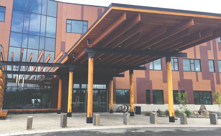
When were the cultural/ boundaries of religious the Colville practices reservation The Colvilles’ 155,000 square foot headquarters on the established? is located about 12 miles north of Grand Coulee Dam. reservation?
was in existence for less than Proud of their heritage, three months of 1872 when other executive orders and the Indian culture and religions are very much alive agreements began to take portions of the reservation and active on the Colville reservation. There are the for public domain. Over a 10-year period, the Colville Seven Drums and the Indian Shaker religions as well as Indian Reservation was reduced to its present size, less the Indian Winter Chinook Dances, the annual spring than half the original. thanksgiving Root Feasts, and the memorial giveaways
Continued on page 32
Colville Tribal Museum
governed today?
Today’s Colvilles, an enterprising and progressive
of the
in honor of the deceased.
2019 Hours:
9:30am –5pm Tuesday—Saturday May 14 th through November 2 nd
Today, many of the young and elder tribal members continue to celebrate seasonal events such as the annual Sunflower Festival at the Paschal Sherman Indian School in Omak, the July 4th Powwow Celebration at Nespelem, the powwow at the Omak Stampede in August and other traditional gatherings. At these events, and at a number of locations on the reservation, members display traditional bead and buckskin items often done in designs handed down for generations.
In Nespelem, the powwow takes place in the Tribe‘s “Circle,” a traditional gathering place. Indians arrive from reservations in Montana, Idaho, Washington and Oregon to join in the festivities. Authentic ceremonial dress, stick games, dozens of teepees and a long-established rodeo make the celebration memorable. This Annual Fourth of July Celebration lasts for 10 days. The public is invited to attend the powwows and other tribal-sponsored activities,
VISITOR

The newly refurbished Colville Tribal Museum in Coulee Dam is just east of Harvest Foods.
Is there a tribal museum?
The Colville Tribal Museum is open from 8:30 a.m. to 5 p.m., Monday through Sunday, until Labor Day, then on Monday through Friday 8:30 a.m. - 5 p.m. for fall and winter throug December 26.
The museum first opened in 1995, and is located in Coulee Dam at 512 Mead Way. During 2009, the exhibit gallery was closed for renovation. In March 2011, themuseum became a reality for the 12 bands of the Confederated Tribes of the Colville Indian Reservation, representing the Okanogan, Nespelem, Sanpoil, Chief Joseph Band of the Nez Perce, Chelan, Wenatchi, Entiat, Methow, Lakes, Colville, Palus and Moses peoples.
What is sold in the gift shop?
The Museum Gift Shop features such items as traditional clothing, beaded items, books, silver and turquoise jewelry, and Pendleton Woolen Mills items, such as bags, cups and coats and blankets.
The inventory includes tribal members’ artwork, beaded items, and items with the tribal seal. The museum merchandise is always changing to include new items and artwork. The public is invited to the free museum. Donations are accepted.
What can visitors see and do on the reservation?
While traveling through the Colville Reservation, visitors are invited to visit the tribal headquarters near Nespelem or the other reservation communities. Just another two miles north, in the town of Nespelem, is a memorial to Chief Joseph who was sent to the reservation in 1884 with 150 of his band of Nez Perce Indians. Joseph, famous for his intelligence and peacekeeping efforts, is best remembered for the heroic march by his people in the late 1800s in an effort to resist the gradual and painful takeover of Indian land by non-Indians.
From Nespelem, take Cache Creek road over a quiet and picturesque mountain pass to Keller on the San Poil arm of Lake Roosevelt. There is a free ferry across Lake Roosevelt here, which has been in operation since 1948. Farther east, over another forested mountain pass, is the scenic community of Inchelium. If traveling west, continue from Nespelem on Highway 155 over beautiful Disautel Pass to Omak in the sunny Okanogan Valley.
There are 18 well-stocked lakes on the reservation with limited fishing as well as hunting for non-members. Information about these sporting activities is available from the Tribal Fish and Wildlife Department in Nespelem
Spectacular View Grand Coulee Dam

Come Stay With Us!
(509) 634-2110.


