AMERICANS WITH DISABILITIES ACT TRANSITION PLAN
St. Louis County, Missouri
March 2023
ADA Transition Plan Table of Contents Table of Contents 1. INTRODUCTION & LEGISLATIVE MANDATE ..........................................................................................2 A. INTRODUCTION.................................................................................................................................2 B. LEGISLATIVE MANDATE.....................................................................................................................2 2. POLICIES, PROCEDURES AND PRACTICES..............................................................................................3 A. OVERVIEW.........................................................................................................................................3 B. LIVING DOCUMENT...........................................................................................................................5 C. IMPLEMENTATION SCHEDULE WORK PLAN .....................................................................................5 3. TRANSPORTATION FACILITIES ADA TRANSITION PLAN ........................................................................5 A. PROJECT DEVELOPMENT...................................................................................................................5 B. LONG TERM STRATEGIES ..................................................................................................................7 C. IMPLEMENTATION SCHEDULE ..........................................................................................................7 4. TRANSPORTATION FACILITIES 5-YEAR WORK PLAN .............................................................................9 5. TRANSPORTATION FACILITIES ADA SELF EVALUATION.......................................................................34 A. METHODOLOGY TO SELF-EVALUATION..........................................................................................34 B. DATA COLLECTION ..........................................................................................................................34 C. DATA ANALYSIS ...............................................................................................................................34 D. REVIEW OF POLICIES, PROCEDURES & STANDARDS.......................................................................35 E. APPROACH TO BARRIER ANALYSIS..................................................................................................35 F. SUMMARY FINDINGS ......................................................................................................................57 G. BARRIER ANALYSIS AND RANKING....................................................................................................62 H. PROJECT STUDY STREET LIST...........................................................................................................70 I. NOTICE OF PUBLIC MEETING ..........................................................................................................82 6. BUILDING FACILITIES ADA TRANSITION PLAN.....................................................................................83 A. PROJECT DEVELOPMENT.................................................................................................................83 B. LONG TERM STRATEGIES ................................................................................................................83 C. IMPLEMENTATION SCHEDULE ........................................................................................................84 7. BUILDING FACILITIES LIST....................................................................................................................85 8. DEFINITIONS........................................................................................................................................99
1. INTRODUCTION & LEGISLATIVE MANDATE
A. INTRODUCTION
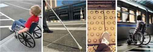
The Americans with Disabilities Act (ADA) is a comprehensive civil rights law providing protections for persons with disabilities in both employment and the provision of goods and services. The ADA states that its purpose is to provide a "clear and comprehensive national mandate for the elimination of discrimination against individuals with disabilities." The ADA seeks to dispel assumptions about disabilities and to assure equality of opportunity. The ADA prohibits discrimination in access to jobs, public accommodations, government services, public transportation, and telecommunications.
Access to civic life by people with disabilities is a fundamental goal of the ADA. To guarantee that this goal is met, Title II of the ADA requires state and local governments to make their programs and services accessible to persons with disabilities (28 Code of Federal Regulations 35.149-35.151). This requirement extends not only to physical access at government facilities, programs, and events -- but also to pedestrian facilities in public rights-of-way.
This ADA Transition Plan identifies a work plan to remove barriers over time by addressing compliance of pedestrian facilities in the public rights-of-way through specific projects in response to expectations set forth in Title II of the Americans with Disabilities Act (ADA).
The Department of Transportation and Public Works also maintains 35 owned buildings and 17 leased spaces. The Department is in a constant state of renovation and adapting to current best practices. All new renovations undergo strict ADA compliance review and comply with the ADA.
B. LEGISLATIVE MANDATE
The development of a Transition Plan is a requirement of the federal regulations implementing the Rehabilitation Act of 1973, which require that all organizations receiving federal funds make their programs available without discrimination toward people with disabilities. The Act, which has become known as the "civil rights act" of persons with disabilities, states that:
“No otherwise qualified handicapped individual in the United States shall, solely by reason of handicap, be excluded from the participation in, be denied the benefits of, or be
ADA Transition Plan March 2023
subjected to discrimination under any program or activity receiving federal financial assistance.” (Section 504)
Subsequent to the enactment of the Rehabilitation Act, Congress passed the ADA on July 26, 1990. Title II of the ADA covers programs, activities, and services of public entities. The Department of Justice's Title II regulation adopts the general prohibitions of discrimination established under Section 504 and incorporates specific prohibitions of discrimination for the ADA. Title II provides protections to individuals with disabilities that are at least equal to those provided by the nondiscrimination provisions of Title V of the Rehabilitation Act.
Title II of the ADA provides that public entities must identify and evaluate all programs, activities, and services and review all policies, practices, and procedures that govern administration of the entity's programs, activities, and services. This report establishes an ADA Transition Plan, focused specifically upon pedestrian access and public rights-of-way.
2. POLICIES, PROCEDURES AND PRACTICES A. OVERVIEW
This document is the ADA Transition Plan policy for the St. Louis County Department of Transportation and Public Works. The Department performed a self-evaluation of existing Arterial and Collector pedestrian facilities within the right-of-way between 2011 and 2015 to establish a baseline for required improvements in the public roadway right-of-way. The Department will be completing evaluations of our building facilities in 2024.
The following policies, procedures, and practices have been adopted by St. Louis County for ADA compliance:
1. St. Louis County government’s assurance that persons with disabilities have access to all its programs, services, activities, and employment process can be found on the County government website at:
https://stlouiscountymo.gov/st-louis-county-departments/administration/personnel/adadisabilities/
2. The St. Louis County government ADA/Disabilities webpage contains a public Notice under the ADA, forms to request accommodation or to register accessibility complaints, an ADA grievance procedure guidance together with links to the Commission on Disabilities, the Access and Functional Needs Registry, and Transportation Matrix.
ADA Transition Plan March 2023
3. New pedestrian facilities in the public right-of-way will be completed in a manner that, to the maximum extent practicable, complies with current ADA access requirements.
4. Alterations to existing pedestrian facilities in the public right-of-way will be completed in a manner that, to the maximum extent practicable, complies with current ADA access requirements.
5. The St. Louis County Department of Transportation and Public Works will publish and maintain an ADA transition plan to bring existing facilities into compliance with ADA requirements.
6. The Department adopted the Proposed Accessibility Guidelines for Pedestrian Facilities in the Public Right-of-Way (United States Access Board – July 2011), referenced as PROWAG, accessibility guidelines as currently recommended best practices for the public right-of- way, incorporating PROWAG into the Departments manuals and construction standard details in 2014.
7. St. Louis County has a designated ADA Coordinator and the Department’s Acting Director shall be the authority for all Transportation and Public Works roadway corridor matters. Contact information and forms can be found on the St. louis County website at:
https://stlouiscountymo.gov/st-louis-county-departments/administration/personnel/adadisabilities/
8. The Department assigns a high priority to the maintenance of accessible features in the pedestrian accessible corridor. Staff has a clear awareness of this policy and the means to act when a feature is discovered out of compliance.
9. The County solicits all engineering services contracts for transportation infrastructure with a provision specifically requiring compliance with Title II of the ADA.
10. The Department continuously provides staff training.
11. The Department is implementing a tracking system to log complaints received related to existing pedestrian accessible ADA facilities.
12. All future County building facility projects will be designed in accordance with current ADA accessibility standards.
13. All future potential leased facilities will be evaluated for ADA compliance in order to qualify for leased space.
14. All building evaluations will follow the four priorities in the Department of Justice ADA title II regulations.
a. Priority 1 - Accessible approach and entrance
b. Priority 2 - Access to goods and services
c. Priority 3 - Access to public toilet rooms
d. Priority 4 - Access to other items such as water fountains and public telephones
ADA Transition Plan March 2023
15. The Department will initiate ADA upgrades immediately in response to public feedback identifying accessibility deficiencies when funding permits.
16. The Department shall periodically review and update the ADA Transition Plan.
17. The ADA Transition Plan will be factored annually into the Department’s Capital Construction Program Appropriation Request for review and approval by the St. Louis County Council. The Department’s annual budget is subject to final approval of the Council.
B. LIVING DOCUMENT
In time, the ADA requirements will change due to case law and new regulations. The Department’s programs, services and activities will also change over time. When changes occur that impact the Department’s ADA implementation, this document is to be amended to address such updates. Action items can be incorporated in the ADA Transition Plan Implementation schedule and notes can be incorporated regarding the vetting process. In time, this document serves as a historical account of the changes made to serve, in an appropriate manner.
St. Louis County will continuously accept input on our Transition Plan and will use the comments received to shape changes to the Transition plan.
C. IMPLEMENTATION SCHEDULE WORK PLAN
The Transportation Facilities ADA Transition Plan provides a five-year construction project program. Project scopes can include both existing pedestrian facility upgrades and consideration of new pedestrian facility improvements. The Implementation Schedule includes all programmed projects, including those without pedestrian facility impacts. This transition plan will be updated annually to document the Department’s good faith effort to comply with the ADA.
The Building Facilities ADA Transition Plan provides our current work plan to inventory and bring existing facilities up to ADA compliance.
3. TRANSPORTATION FACILITIES ADA TRANSITION PLAN
A. PROJECT DEVELOPMENT
ADA Transition Plan March 2023
The Department of Transportation and Public Works prioritizes ADA Transition Plan implementation for pedestrian facilities under St. Louis County maintenance within roadway right-of-way. The St. Louis County Action Plan for Walking and Biking recommendations for pedestrian and bicycle facilities along County corridors will also be considered during project development as some components have direct impact to existing facilities with ADA Transition Plan benefits.
During project planning, development, and scoping process, the Department will determine the scope of ADA Transition Plan improvements which can be incorporated. Considerations include:
1) Does the funding source support ADA Transition Plan improvements?
2) Historic impacts
3) Existing vs needed property rights
4) Opportunity cost, a.k.a., Benefit-Cost vs. other needs
5) Obstacles and Barriers to access
6) Topographic difficulties
7) Technically infeasible direct conflicts
The Department shall include ADA Transition Plan upgrade into future planned projects. However, the typical ADA scope of work will vary based on the type of project. Below are typical project types and scoping elements:
1) Pavement Preservation and Capital Improvement Projects ADA Scope
a. STP - Surface Transportation Program with federal funding participation:
i. Replace non-compliant curb ramps
ii. Correct non-compliant pedestrian access route slabs
iii. Remove obstacles or barriers to provide compliant pedestrian access
iv. Upgrade pedestrian signal infrastructure.
b. Concrete Replacement/Mill & Overlay Projects without Federal Funding
Participation:
i. Replace non-compliant curb ramps within existing rights-of-way.
ii. Non-compliant pedestrian access route slab offset correction in running direction.
c. Intermediate Pavement Preservation Projects (Crackseal, Seal Coat, Cape seal, etc.):
i. minimum ADA improvements as required by PROWAG.
2) Pedestrian Access Route Projects (Sidewalk and Shared Use Path)
ADA Transition Plan March 2023
a. Replace non-compliant curb ramps
b. Correct non-compliant pedestrian access route slabs
c. Remove obstacles or barriers to provide compliant pedestrian access
d. Upgrade pedestrian signal infrastructure.
3) Bridge and Culvert Projects
a. Correct non-compliant existing ADA facilities within disturbed area.
4) Intelligent Transportation System (ITS) Projects
a. Disturbed ADA elements in the pedestrian access route will be replaced with compliant elements to the maximum extent practicable.
B. LONG TERM STRATEGIES
1) The Department is actively implementing a data management system for the storage, management, retrieval, and analysis of all data used to assess the performance of the Department’s ADA Transition Plan. Full implementation is scheduled in 2025.
2) The Department shall develop workflows for post-construction monitoring to regularly review its progress and expenditures on ADA transition plan compliance improvements implementation.
3) Each completed project with ADA component improvements will be inventoried to collect the number of curb ramps, pedestrian access route areas, and APS push button signal systems, constructed, modified, or removed.
4) The Department has not yet completed an ADA inventory of pedestrian facilities along local roadways, also known as subdivision streets. The Department will begin an inventory of pedestrian facilities along local roadways in 2023.
C. IMPLEMENTATION SCHEDULE
It is not financially feasible to immediately remove all barriers to access. The County’s workplan for future work will maximize ADA improvements as detailed above until all barriers have been addressed. The 5 year work plan detailed below will be updated annually to account for progress and to provide for inclusion of new information.
The County reserves the right to modify barrier removal priorities in order to allow flexibility in accommodating community requests, requests for reasonable modifications from persons with disabilities, changes in County programs, and funding constraints and opportunities. It is the goal of this Transition Plan to provide access to the programs, activities and services provided by the County. Interim measures will be explored and implemented in order to provide programmatic access to the public pending the implementation of physical barrier removal projects.
ADA Transition Plan March 2023
Based on our ADA Self Evaluation, we anticipate the cost to reach compliance as of December 2022 is $252 Million. The County anticipates approximately $4 Million/year in pedestrian ADA upgrades. Therefore, pedestrian access routes within St. Louis County maintained right of way should be fully compliant in 63 years. Note that spending for construction of new pedestrian facilities is in addition to ADA improvements. In addition to utilization of local funding, the County will seek additional funding through federal and state grants when available. The following chart details the countywide projects which are programmed to address improvements and the proposed schedule in years.
ADA Transition Plan March 2023
5 YEAR TRANSPORTATION WORK PLAN
Project Details
LIMITS: Ballas Road from Dougherty Ferry Road to Manchester Road
PROJECT: Ballas Road Resurfacing - Project No: AR-1683
SCOPE: Replace curb ramps. Replace Accessible Pedestrian Signal (APS), countdown timer systems
LIMITS: Barrett Parkway Drive from Manchester Road (excluding Manchester Road) to Centeroyal Drive
PROJECT: Barrett Parkway Area Pavement Improvements - Project No: AR/CR1818
SCOPE: Replace curb ramps, replace broken sidewalk, grind or replace adjacent sidewalk slabs with more than 1/4" vertical displacement
Construction Year
2023
2023
LIMITS: Barrett Station Road from Barrett Office Drive to 725 feet north of N. Barrett Pkwy. Drive (excluding Manchester Road Intersection)
PROJECT: Barrett Parkway Area Pavement Improvements - Project No: AR/CR1818
SCOPE: Replace curb ramps, replace broken sidewalk, grind or replace adjacent sidewalk slabs with more than 1/4" vertical displacement
2023
LIMITS: Bayless Avenue from Union Road to Lemay Ferry Road
PROJECT: Bayless Avenue Resurfacing - Project No: AR-1693
SCOPE: Replace curb ramps, replace broken sidewalk, grind or replace adjacent sidewalk slabs with more than 1/4" vertical displacement Replace Accessible Pedestrian Signal (APS), countdown timer systems
LIMITS: Dielman Road from Olive Boulevard to Page Avenue
PROJECT: Dielman Road-ARS Infrastructure - Project No: AR-1554
SCOPE: Curb ramps, sidewalk, APS; New Facilities being added: ADAcompliant curb ramps
2023
2023
Transition Plan March 2023
ADA
5 YEAR TRANSPORTATION WORK PLAN
Project Details
LIMITS: Eddie and Park Road from Gravois Road to Sappington Road
PROJECT: 2021 CRS Collector Overlay Area C - Project No: CR-1831
SCOPE: Replace curb ramps, replace broken sidewalk, grind or replace adjacent sidewalk slabs with more than 1/4" vertical displacement
Construction Year
2023
LIMITS: Hanna Road from Big Bend Road to Valley Park city limits
PROJECT: 2021 CRS Collector Overlay Area C - Project No: CR-1831
SCOPE: Replace curb ramps, replace broken sidewalk, grind or replace adjacent sidewalk slabs with more than 1/4" vertical displacement
2023
LIMITS: Keller Road from Bauer Road to Butler Hill Road
PROJECT: 2021 CRS Collector Overlay, Area B - Project No: CR-1830
SCOPE: Replace curb ramps, replace broken sidewalk, grind or replace adjacent sidewalk slabs with more than 1/4" vertical displacement
2023
LIMITS: Lackland Road from 200 feet east of Concourse Drive to 800 feet each of Schuetz intersection (excluding Schuetz intersection)
PROJECT: Lackland Road Resurfacing - Project No: AR-1841
SCOPE: n/a
LIMITS: Lackland Road from 1000 feet west of Schuetz Road to 800 feet west of Schuetz Road
PROJECT: Lackland Road Culvert C-2-116 - Project No: AR-1714
SCOPE: Sidewalk
2023
2023
Transition Plan March 2023
ADA
5 YEAR TRANSPORTATION WORK PLAN
Project Details
LIMITS: Lockwood Avenue from N. Holmes Ave to 200 feet east of N. Holmes Ave
PROJECT: Lockwood Avenue Culvert C-4-224 - Project No: AR-1713
SCOPE: Sidewalk
LIMITS: McKelvey Road from Ameling Road to Glenpark Drive
PROJECT: McKelvey Road Resurfacing - Phase I - Project No: AR-1497
SCOPE: Replace curb ramps, replace broken sidewalk, grind or replace adjacent sidewalk slabs with more than 1/4" vertical displacement; New facilities: shared-use path.
LIMITS: Midland Boulevard from Lindbergh Boulevard to Woodson Road
PROJECT: Midland Boulevard (West) Resurfacing - Project No: AR-1472
SCOPE: Replace curb ramps, replace sidewalk at curb ramps
Construction Year
2023
LIMITS: N. Barrett Parkway Drive from Barrett Station Road to 230 feet north of Manchester Road
PROJECT: Barrett Parkway Area Pavement Improvements - Project No: AR/CR1818
SCOPE: Replace curb ramps, replace broken sidewalk, grind or replace adjacent sidewalk slabs with more than 1/4" vertical displacement
2023
2023
2023
LIMITS: Pottle Avenue from Telegraph Road to Magoffin Road
PROJECT: 2021 CRS Collector Overlay, Area B - Project No: CR-1830
SCOPE: Replace curb ramps, replace broken sidewalk, grind or replace adjacent sidewalk slabs with more than 1/4" vertical displacement
2023
Transition Plan March 2023
ADA
5 YEAR TRANSPORTATION WORK PLAN
Project Details
LIMITS: Suson Hills Drive from Tesson Ferry Road to Wells Road
PROJECT: 2021 CRS Collector Overlay, Area B - Project No: CR-1830
SCOPE: Replace curb ramps, replace broken sidewalk, grind or replace adjacent sidewalk slabs with more than 1/4" vertical displacement
Construction Year
2023
LIMITS: Valcour Avenue from Heege Road to Gravois Road
PROJECT: 2021 CRS Collector Overlay Area C - Project No: CR-1831
SCOPE: Replace curb ramps, replace broken sidewalk, grind or replace adjacent sidewalk slabs with more than 1/4" vertical displacement Replace Accessible Pedestrian Signal (APS), countdown timer systems
LIMITS: West Port Plaza Drive from Glenmeade Drive to Lackland Road
PROJECT: West Port Plaza Drive - Marine Avenue Resurfacing - Project No: AR1548
SCOPE: Replace curb ramps, replace broken sidewalk, grind or replace adjacent sidewalk slabs with more than 1/4" vertical displacement Replace Accessible Pedestrian Signal (APS), countdown timer systems
LIMITS: West Port Plaza Drive from Interstate 270 to Page Avenue
PROJECT: West Port Plaza Drive Intersection Improvements - Project No: AR1673
SCOPE: Replace existing curb ramps, sidewalk. Replace Accessible Pedestrian Signal (APS), countdown timer systems
2023
LIMITS: Airport Road from Interstate 170 to 395 feet west of North Florissant Road
PROJECT: Airport Road Resurfacing - Project No: AR-1692
SCOPE: Replace curb ramps, replace broken sidewalk, grind or replace adjacent sidewalk slabs with more than 1/4" vertical displacement Replace Accessible Pedestrian Signal (APS), countdown timer systems
2023
2023
2024
Transition Plan March 2023
ADA
5 YEAR TRANSPORTATION WORK PLAN
Project Details
LIMITS: Allen Road Bridge from 350 feet east of bridge to 600 feet west of bridge
PROJECT: Allen Road Bridge No. 329 - Project No: CR-1274
SCOPE: n/a
LIMITS: Ameling Road from Bennington Place to McKelvey Road
PROJECT: Bennington-Mckelvey-Ameling Road Resurfacing - Project No: AR-1680
SCOPE: Replace curb ramps, replace broken sidewalk, grind or replace adjacent sidewalk slabs with more than 1/4" vertical displacement.
Construction Year
LIMITS: Bauer Road from 1300 feet west of Keller Road to 800 feet west of Keller Road
PROJECT: Bauer Road Culverts C-5-194 and C-5-195 - Project No: CR-1677
SCOPE: n/a
LIMITS: Baxter Road from Manchester Road to Clayton Road
PROJECT: Baxter Road (South) ARS Resurfacing - Project No: AR-1555
SCOPE: Replace curb ramps, replace broken sidewalk, grind or replace adjacent sidewalk slabs with more than 1/4" vertical displacement Replace Accessible Pedestrian Signal (APS), countdown timer systems; New facilities: shared-use path, ADA-compliant curb ramps
LIMITS: Bayless Avenue from 250 feet east of Interstate 55 to 700 feet east of Interstate 55
PROJECT: Bayless Avenue Bridge No. 419 - Project No: AR-1686
SCOPE: Replace existing curb ramps, sidewalk
2024
2024
2024
2024
2024
Transition Plan March 2023
ADA
5 YEAR TRANSPORTATION WORK PLAN
Project Details
LIMITS: Bennington Place from McKelvey Road to Ameling Road
PROJECT: Bennington-Mckelvey-Ameling Road Resurfacing - Project No: AR-1680
SCOPE: Replace curb ramps, replace broken sidewalk, grind or replace adjacent sidewalk slabs with more than 1/4" vertical displacement
Construction Year
LIMITS: Bernadine Drive from Tara Subdivision to Tara Subdivision
PROJECT: CRS Rehabilitation - Sappington Acres No. 2 & Tara - Project No: CR1885
SCOPE: n/a
LIMITS: Berry Road from Berry Road - Big Bend Road Intersection to Grove Avenue
PROJECT: Berry Road-Big Bend Road Intersection Improvements - Project No: AR-1724
SCOPE: Replace existing curb ramps, sidewalk. Replace Accessible Pedestrian Signal (APS), countdown timer systems
2024
LIMITS: Big Bend Boulevard from 600 feet north of Pacific Avenue to 250 feet south of Greenwood Boulevard
PROJECT: Big Bend Boulevard at UPRR-Greenwood-Pacific - Project No: AR-1670
SCOPE: Curb ramps, sidewalk
LIMITS: Big Bend Road/Big Bend Boulevard from 215 feet west of Berry Road to 313 feet east of Berry Road
PROJECT: Berry Road-Big Bend Road Intersection Improvements - Project No: AR-1724
SCOPE: Replace existing curb ramps, sidewalk. Replace Accessible Pedestrian Signal (APS), countdown timer systems
2024
2024
2024
2024
Transition Plan March 2023
ADA
5 YEAR TRANSPORTATION WORK PLAN
Project Details
LIMITS: Bimini Drive from Sappington Acres Estates No. 2 Subdivision to Sappington Acres Estates No. 2 Subdivision
PROJECT: CRS Rehabilitation - Sappington Acres No. 2 & Tara - Project No: CR1885
SCOPE: n/a
LIMITS: Buckley Road from 250 feet north of bridge to 250 feet south of bridge
PROJECT: Buckley Road Bridges No. 528 & 528-P - Project No: CR-1772
SCOPE: New facilities to be constructed: new box culvert with ADA-compliant sidewalk
Construction Year
LIMITS: Cathy Drive from Tara Subdivision to Tara Subdivision
PROJECT: CRS Rehabilitation - Sappington Acres No. 2 & Tara - Project No: CR1885
SCOPE: n/a
LIMITS: Chesterfield Parkway West from Interstate 64 to Clarkson Road Southbound Exit Ramp
PROJECT: Chesterfield Parkway West (South) Resurfacing - Project No: AR-1768
SCOPE: Replace curb ramps, replace broken sidewalk, grind or replace adjacent sidewalk slabs with more than 1/4" vertical displacement Replace Accessible Pedestrian Signal (APS), countdown timer systems
LIMITS: Coral Ridge Drive from Sappington Acres Estates No. 2 Subdivision to Sappington Acres Estates No. 2 Subdivision
PROJECT: CRS Rehabilitation - Sappington Acres No. 2 & Tara - Project No: CR1885
SCOPE: n/a
2024
2024
2024
2024
2024
Transition Plan March 2023
ADA
5 YEAR TRANSPORTATION WORK PLAN
Project Details
LIMITS: Creve Coeur Mill Road from Prichard Farm Road to Interstate Drive (excluding Interstate Drive Intersection)
PROJECT: Creve Coeur Mill Road Resurfacing - Project No: AR-1563
SCOPE: Replace existing curb ramps, sidewalk. Replace Accessible Pedestrian Signal (APS), countdown timer systems
Construction Year
2024
LIMITS: Dandridge Drive from Sappington Acres Estates No. 2 Subdivision to Sappington Acres Estates No. 2 Subdivision
PROJECT: CRS Rehabilitation - Sappington Acres No. 2 & Tara - Project No: CR1885
SCOPE: n/a
LIMITS: Dietrich Road from 315 feet north of Carman Road / Dietrich Road Intersection to 470 feet north of Carman Road / Dietrich Road Intersection
PROJECT: Dietrich Road Sidewalk Project - Project No: CR-1731
SCOPE: Sidewalk
2024
2024
LIMITS: Edgecliffe Drive from Sappington Acres Estates No. 2 Subdivision to Sappington Acres Estates No. 2 Subdivision
PROJECT: CRS Rehabilitation - Sappington Acres No. 2 & Tara - Project No: CR1885
SCOPE: n/a
2024
Transition Plan March 2023
ADA
5 YEAR TRANSPORTATION WORK PLAN
Project Details
LIMITS: Faraday Drive from Tara Subdivision to Tara Subdivision
PROJECT: CRS Rehabilitation - Sappington Acres No. 2 & Tara - Project No: CR1885
SCOPE: n/a
LIMITS: Gail Court from Lavinia Meadows Subdivision to Lavinia Meadows Subdivision
PROJECT: CRS Rehabilitation - Sappington Acres No. 2 & Tara - Project No: CR1885
SCOPE: n/a
LIMITS: Galena Court from Tara Subdivision to Tara Subdivision
PROJECT: CRS Rehabilitation - Sappington Acres No. 2 & Tara - Project No: CR1885
SCOPE: n/a
LIMITS: Hanley Road from Page Avenue to Canton Avenue
PROJECT: Hanley Road (A) Resurfacing - Project No: AR-1716
SCOPE: Replace existing curb ramps, sidewalk, Replace Accessible Pedestrian Signal (APS); New facilities to be constructed: ADA-compliant curb ramps, ADA-compliant landing pads at bus stops
LIMITS: Heintz Road from 240 feet north of bridge to 500 feet south of bridge
PROJECT: Heintz Road Bridge No. 513 Replacement - Project No: CR-1282
SCOPE: New facilities to be constructed: 6-foot-wide sidewalk on bridge
Construction Year
2024
2024
2024
2024
2024
Transition Plan March 2023
ADA
5 YEAR TRANSPORTATION WORK PLAN
Project Details
LIMITS: Hudson Drive from 100 feet east of bridge to 50 feet west of bridge
PROJECT: Hudson Drive Bridge No. 105 - Project No: CR-1774
SCOPE: n/a
LIMITS: James S. McDonnell from 300 feet west of bridge to 300 feet east of bridge
PROJECT: James S. McDonnell Bridge No. 164 Replacement - Project No: AR-1518
SCOPE: n/a
LIMITS: James S. McDonnell Boulevard from Byasse Drive to 143 James S. McDonnell Boulevard
PROJECT: JS McDonnell Culvert Replacement - Project No: AR-1850
SCOPE: n/a
LIMITS: Jennings Station Road from 260 feet southwest of Hord Avenue to Halls Ferry Road
PROJECT: Jennings Station Road (North) ARS Resurfacing - Project No: AR-1604
SCOPE: Replace curb ramps, replace broken sidewalk, grind or replace adjacent sidewalk slabs with more than 1/4" vertical displacement, Replace Accessible Pedestrian Signal (APS); New facilities to be constructed: ADA-compliant curb ramps, ADA-compliant landing pads at bus stops
Construction Year
2024
2024
2024
2024
Transition Plan March 2023
ADA
5 YEAR TRANSPORTATION WORK PLAN
Project Details
LIMITS: Jennings Station Road from West Florissant Avenue to Emma Avenue
PROJECT: Jennings Station Road Inlet Rehabilitation - Project No: AR-781(C)
SCOPE: n/a
LIMITS: Kehrs Mill Road from 0.3 miles east of Clarkson Road to 0.3 miles east of Clarkson Road
PROJECT: Kehrs Mill Road Retaining Wall Replacement - Project No: AR-1836
SCOPE: Replace existing sidewalk in front of the retaining wall
Construction Year
LIMITS: Mallory Drive from Tara Subdivision to Tara Subdivision
PROJECT: CRS Rehabilitation - Sappington Acres No. 2 & Tara - Project No: CR1885
SCOPE: n/a
LIMITS: McKelvey Road from Dorsett Road to Bennington Place
PROJECT: Bennington-Mckelvey-Ameling Road Resurfacing - Project No: AR-1680
SCOPE: Replace curb ramps, replace broken sidewalk, grind or replace adjacent sidewalk slabs with more than 1/4" vertical displacement Replace Accessible Pedestrian Signal (APS), countdown timer systems
LIMITS: McKelvey Road from Glenpark Drive to Creve Coeur Mill Road
PROJECT: McKelvey Road Resurfacing - Phase II - Project No: AR-1718
SCOPE: Replace existing curb ramps, sidewalk, Replace Accessible Pedestrian Signal (APS); New facilities: new sidewalk.
2024
2024
2024
2024
2024
Transition Plan March 2023
ADA
5 YEAR TRANSPORTATION WORK PLAN
Project Details
LIMITS: North Hanley Road (A) from St. Charles Rock Road to Natural Bridge Road
PROJECT: North Hanley Road (A) Resurfacing - Project No: AR-1482
SCOPE: Curb ramps, sidewalk, APS
LIMITS: North Villanova Drive from Near 7101 N. Villanova Drive to Near 7101 N. Villanova Drive
PROJECT: North Villanova Drive Sinkhole Repair - Project No: CR-1846
SCOPE: n/a
LIMITS: Palmyra Court from Tara Subdivision to Tara Subdivision
PROJECT: CRS Rehabilitation - Sappington Acres No. 2 & Tara - Project No: CR1885
SCOPE: n/a
LIMITS: Pickwick Drive from Tara Subdivision to Tara Subdivision
PROJECT: CRS Rehabilitation - Sappington Acres No. 2 & Tara - Project No: CR1885
SCOPE: n/a
LIMITS: Prichard Farm Road from At bridge, 0.10 miles south of Rte. 141 to At bridge, 0.10 miles south of Rte. 141
PROJECT: Prichard Farm Road Bridge No. 233 Slopewall Repair - Project No: AR1861
SCOPE: N/A
Construction Year
2024
2024
2024
2024
2024
Transition Plan March 2023
ADA
5 YEAR TRANSPORTATION WORK PLAN
Project Details
LIMITS: Spanish Pond Road from Gene Crayton Avenue to 350' west of Entrance to Spanish Lake Park
PROJECT: Spanish Pond Road ADA Improvements - Project No: CR-1676
SCOPE: New facilities to be constructed: ADA-compliant curb ramps, sidewalk, pedestrian bridge over railroad tracks.
Construction Year
2024
LIMITS: TBD from Castle Point Subdivision to Castle Point Subdivision
PROJECT: Castle Point Improvements - Project No: CR-1847
SCOPE: New facilities to be constructed: pedestrian paths on some streets within the subdivision; detailed final scope yet to be determined
2024
LIMITS: Three Court Drive from Tara Subdivision to Tara Subdivision
PROJECT: CRS Rehabilitation - Sappington Acres No. 2 & Tara - Project No: CR1885
SCOPE: n/a
LIMITS: Vorhof Drive from 75 feet east of bridge to 75 feet west of bridge
PROJECT: Vorhof Drive Bridge No. 106 - Project No: CR-1775
SCOPE: n/a
LIMITS: Wrenfield Drive from Sappington Acres Estates No. 2 Subdivision to Sappington Acres Estates No. 2 Subdivision
PROJECT: CRS Rehabilitation - Sappington Acres No. 2 & Tara - Project No: CR1885
SCOPE: n/a
2024
2024
2024
Transition Plan March 2023
ADA
5 YEAR TRANSPORTATION WORK PLAN
Project Details
LIMITS: Wyncrest Drive from 100 feet east of bridge to 100 feet west of bridge
PROJECT: Wyncrest Drive Bridge No. 266 - Project No: CR-1292
SCOPE: n/a
LIMITS: Big Bend Boulevard from 275 feet west of Big Bend Blvd. / E. Lockwood Avenue Intersection to N. Laclede Station Road
PROJECT: Big Bend Boulevard Resurfacing - Project No: AR-1794
SCOPE: Replace curb ramps, replace broken sidewalk, grind or replace adjacent sidewalk slabs with more than 1/4" vertical displacement
Replace Accessible Pedestrian Signal (APS), countdown timer systems
LIMITS: Big Bend Road from Couch Avenue to S. Kirkwood Road
PROJECT: Big Bend Road ARS Resurfacing - Project No: AR-1800
SCOPE: Replace curb ramps, replace broken sidewalk, grind or replace adjacent sidewalk slabs with more than 1/4" vertical displacement
Replace Accessible Pedestrian Signal (APS), countdown timer systems
LIMITS: Carrico Road from 100 feet east of culvert to 100 feet west of culvert
PROJECT: Carrico Road Culvert C-1-253 - Project No: CR-1656
SCOPE: n/a
LIMITS: Chieftain Drive from 50 feet east of culvert to 50 feet west of culvert
PROJECT: Chieftain Drive Culvert C-2-83 - Project No: CR-1779
SCOPE: n/a
Construction Year
2024
2025
2025
2025
2025
Transition Plan March 2023
ADA
5 YEAR TRANSPORTATION WORK PLAN
Project Details
LIMITS: Conway Road from 400 feet east of S. Woods Mill Road to 400 feet west of S. Woods Mill Road
PROJECT: S.Woods Mill-Conway Intersection - Project No: AR-1829
SCOPE: Replace existing curb ramps, ADA upgrades to traffic signals.
Construction Year
LIMITS: Craig Road from Olive Boulevard (excluding Olive Boulevard Intersection) to Lackland Road
PROJECT: Craig Road Resurfacing - Project No: AR-1562
SCOPE: Replace curb ramps, replace broken sidewalk, grind or replace adjacent sidewalk slabs with more than 1/4" vertical displacement Replace Accessible Pedestrian Signal (APS), countdown timer systems
LIMITS: Ferguson Ave from Street Charles Road Road to Page Avenue
PROJECT: Ferguson Ave Resurfacing - Project No: AR-1795
SCOPE: Replace curb ramps, replace broken sidewalk, grind or replace adjacent sidewalk slabs with more than 1/4" vertical displacement; New facilities to be constructed: ADA-compliant curb ramps, ADAcompliant landing pads at bus stops
LIMITS: Franklin Road from 50 feet north of culvert to 50 feet south of culvert
PROJECT: Franklin Road Culvert C-3-25 - Project No: CR-1780
SCOPE: n/a
LIMITS: Green Knoll Drive from 50 feet north of culvert to 50 feet south of culvert
PROJECT: Green Knoll Drive Culvert C-4-314 - Project No: CR-1782
SCOPE: n/a
2025
2025
2025
2025
2025
Transition Plan March 2023
ADA
5 YEAR TRANSPORTATION WORK PLAN
Project Details
LIMITS: Holly Springs Drive from 50 feet east of culvert to 50 feet west of culvert
PROJECT: Holly Springs Drive Culvert C-2-430 - Project No: CR-1778
SCOPE: n/a
LIMITS: Kingsland Avenue from Olive Boulevard to Delmar Boulevard
PROJECT: Kingsland Avenue ARS Resurfacing - Project No: AR-1717
SCOPE: Replace curb ramps, replace broken sidewalk, grind or replace adjacent sidewalk slabs with more than 1/4" vertical displacement Replace Accessible Pedestrian Signal (APS); New facilities to be constructed: ADA-compliant curb ramps, ADA-compliant landing pads at bus stops
LIMITS: Larimore Road from Trampe Avenue to Gerona Street
PROJECT: Larimore Road Sidewalk - Project No: CR-1844
SCOPE: New facilities to be constructed: ADA-compliant curb ramps and sidewalk
Construction Year
2025
LIMITS: Mason Road from 100 feet north of Mason Ridge Road to North side of Clayton Road
PROJECT: Mason Road Resurfacing and Multi-use Trail - Project No: AR-1746
SCOPE: Replacement of curb ramps and pedestrian ADA upgrades to traffic signals. New facilities to be constructed: ADA-compliant curb ramps, ADA-compliant landing pads at bus stops, shared-use path
2025
2025
2025
Transition Plan March 2023
ADA
5 YEAR TRANSPORTATION WORK PLAN
Project Details
LIMITS: McKelvey Road from Interstate 270 to Natural Bridge Road
PROJECT: McKelvey Road Resurfacing - Project No: AR-1753
SCOPE: Replace curb ramps, replace broken sidewalk, grind or replace adjacent sidewalk slabs with more than 1/4" vertical displacement Replace Accessible Pedestrian Signal (APS), countdown timer systems
LIMITS: Midland Blvd from Page Avenue to Canton Avenue
PROJECT: Midland Blvd Resurfacing - Project No: AR-1797
SCOPE: Replace curb ramps, replace broken sidewalk, grind or replace adjacent sidewalk slabs with more than 1/4" vertical displacement
Replace Accessible Pedestrian Signal (APS); New facilities to be constructed: ADA-compliant curb ramps
LIMITS: Midland Boulevard from East side of Woodson Road to West side of North & South Road
PROJECT: Midland Boulevard (East) Resurfacing - Project No: AR-1471
SCOPE: Replace curb ramps, replace broken sidewalk, grind or replace adjacent sidewalk slabs with more than 1/4" vertical displacement, install ADA pedestrian upgrades at traffic signals. New facilities to be constructed: new curb ramps.
LIMITS: New Ballwin Road from Oak Leaf Manor Court / Big Bend Road Intersection to 170 feet north of New Ballwin Road / Twigwood Drive
Intersection
PROJECT: New Ballwin Road ARS Resurfacing - Project No: AR-1747
SCOPE: Replace curb ramps, replace broken sidewalk, grind or replace adjacent sidewalk slabs with more than 1/4" vertical displacement Replace Accessible Pedestrian Signal (APS), countdown timer systems
Construction Year
2025
2025
2025
2025
Transition Plan March 2023
ADA
5 YEAR TRANSPORTATION WORK PLAN
Project Details
LIMITS: New Florissant Road from Washington Street to Lindbergh Boulevard
PROJECT: New Florissant Road Resurfacing - Project No: AR-1796
SCOPE: Replace curb ramps, replace broken sidewalk, grind or replace adjacent sidewalk slabs with more than 1/4" vertical displacement
Replace Accessible Pedestrian Signal (APS), countdown timer systems
LIMITS: North Elizabeth Avenue from South of Pershall Road to Chambers Road
PROJECT: North Elizabeth Avenue ARS Resurfacing - Project No: AR-1736
SCOPE: Replacement of curb ramps and Replace Accessible Pedestrian Signal (APS). New facilities to be constructed: ADA-compliant curb ramps
Construction Year
LIMITS: Palisades Drive from 50 feet east of culvert to 50 feet west of culvert
PROJECT: Palisades Drive Culvert C-3-260 - Project No: CR-1781
SCOPE: n/a
LIMITS: Paul Avenue & Elizabeth Avenue from Bermuda Drive to Chambers Road
PROJECT: Paul Avenue-Elizabeth Avenue Resurfacing - Project No: AR-1735
SCOPE: Replace curb ramps, replace broken sidewalk, grind or replace adjacent sidewalk slabs with more than 1/4" vertical displacement
Replace Accessible Pedestrian Signal (APS), countdown timer systems
LIMITS: Redman Road from Old Halls Ferry Road to Lewis & Clark Boulevard (MO Rte. 367)
PROJECT: Redman Road Resurfacing - Project No: AR-1745
SCOPE: Replace curb ramps, replace broken sidewalk, grind or replace adjacent sidewalk slabs with more than 1/4" vertical displacement
Replace Accessible Pedestrian Signal (APS), countdown timer systems
2025
2025
2025
2025
2025
Transition Plan March 2023
ADA
5 YEAR TRANSPORTATION WORK PLAN
Project Details
LIMITS: Redman Road from 200 feet south of Old Halls Ferry Road / Redman Avenue Intersection to 690 feet north of Old Halls Ferry Road / Redman Avenue Intersection
PROJECT: Redman Road Resurfacing - Project No: AR-1745
SCOPE: Replace curb ramps, replace broken sidewalk, grind or replace adjacent sidewalk slabs with more than 1/4" vertical displacement
Replace Accessible Pedestrian Signal (APS), countdown timer systems
LIMITS: Twillman Avenue from 50 feet east of culvert to 50 feet west of culvert
PROJECT: Twillman Avenue Culvert C-1-127 - Project No: CR-1777
SCOPE: n/a
LIMITS: Washington Street from Street Pierre Street to Fatima Court
PROJECT: Washington Street Resurfacing - Project No: AR-1719
SCOPE: Replace existing curb ramps, sidewalk, Replace Accessible Pedestrian Signal (APS)
Construction Year
2025
LIMITS: Weidman Road from Manchester Road (excluding Manchester Road Intersection) to Turtle Cove Drive
PROJECT: Weidman Road ARS Resurfacing - Project No: AR-1743
SCOPE: Replace curb ramps, replace broken sidewalk, grind or replace adjacent sidewalk slabs with more than 1/4" vertical displacement Replace Accessible Pedestrian Signal (APS), countdown timer systems
2025
2025
2025
Transition Plan March 2023
ADA
5 YEAR TRANSPORTATION WORK PLAN
Project Details
LIMITS: Baumgartner Road from East intersection with Old Baumgartner Road to West of Telegraph Road
PROJECT: Baumgartner Road Resurfacing - Project No: AR-1749
SCOPE: Replacement of curb ramps. New facilities to be constructed: ADAcompliant curb ramps, ADA-compliant pedestrian buttons and pedestrian signal heads
LIMITS: Bennington Place from Marine Avenue to Fee Fee Road
PROJECT: Bennington Place Resurfacing - Project No: AR-1752
SCOPE: Replacement of curb ramps and pedestrian ADA upgrades to traffic signals. New facilities to be constructed: ADA-compliant curb ramps, ADA-compliant landing pads at bus stops
LIMITS: Charbonier Road from Howdershell Road / Shackelford Road to Lindbergh Boulevard
PROJECT: Charbonier Road Resurfacing - Project No: AR-1744
SCOPE: Replacement of curb ramps. Replace Accessible Pedestrian Signal (APS). New facilities to be constructed: ADA-compliant curb ramps, fill in sidewalk gap from church to the pedestrian traffic signal, ADAcompliant landing pads at bus stops.
LIMITS: Dorsett Road from Progress Pkwy. to Old Dorsett Road
PROJECT: Dorsett Road - 270 to Old Dorsett - Project No: AR-1840
SCOPE: Replacement of existing curb ramps, Accessible Pedestrian Signals (APS). New facilities to be constructed: ADA-compliant curb ramps, ADA-compliant landing pads at bus stops
LIMITS: Hanley Road from 300' North of Edgebrook Lane to Manchester Road
PROJECT: Hanley Road-Laclede Station Resurfacing - Project No: AR-1819
SCOPE: Replacement of existing curb ramps. New facilities to be constructed: ADA-compliant curb ramps, ADA-compliant pedestrian buttons and pedestrian traffic signal heads
Construction Year
2026
2026
2026
2026
2026
Transition Plan March 2023
ADA
5 YEAR TRANSPORTATION WORK PLAN
Project Details
LIMITS: Lackland Road from Craig Road to East of Concourse Road
PROJECT: Lackland Road Resurfacing - Craig to east of Concourse - Project No: AR-1565
SCOPE: Replace curb ramps, replace broken sidewalk, grind or replace adjacent sidewalk slabs with more than 1/4" vertical displacement, Replace Accessible Pedestrian Signal (APS)
LIMITS: Laclede Station Road from Newport Avenue to 300' North of Edgebrook Lane
PROJECT: Hanley Road-Laclede Station Resurfacing - Project No: AR-1819
SCOPE: Replacement of existing curb ramps. New facilities to be constructed: ADA-compliant curb ramps, ADA-compliant pedestrian buttons and pedestrian traffic signal heads
LIMITS: Laclede Station Road from Watson Road to Weil Avenue
PROJECT: Laclede Station Road - Watson to Weil - Project No: AR-1838
SCOPE: Replacement of existing curb ramps. New facilities to be constructed: ADA-compliant curb ramps, ADA-compliant pedestrian buttons and pedestrian traffic signal heads
LIMITS: North Hanley Road from Natural Bridge Road to Interstate 70
PROJECT: North Hanley Road (F) Resurfacing - Project No: AR-1821
SCOPE: Replace curb ramps, replace broken sidewalk, grind or replace adjacent sidewalk slabs with more than 1/4" vertical displacement Replace Accessible Pedestrian Signal (APS), countdown timer systems
LIMITS: Old Jamestown Road from Jamestown Elementary School to Cedarcrest Creek Drive
PROJECT: Old Jamestown Road Sidewalk Phase III - Project No: AR-1842
SCOPE: New facilities to be constructed: ADA-compliant sidewalk
Construction Year
2026
2026
2026
2026
2026
Transition Plan March 2023
ADA
5 YEAR TRANSPORTATION WORK PLAN
Project Details
LIMITS: Olive Boulevard from Ferguson Avenue to Skinker Boulevard
PROJECT: Olive Boulevard - Ferguson to City Limits - Project No: AR-1822
SCOPE: Replacement of curb ramps and pedestrian ADA upgrades to traffic signals. New facilities to be constructed: ADA-compliant curb ramps
Construction Year
LIMITS: Reavis Barracks from Intersection with Grant's Trail to Intersection with Lemay Ferry Road
PROJECT: Reavis Barracks Green Park Bridge - Project No: AR-1289
SCOPE: New facilities to be constructed: new pedestrian connection to Grant's Trail from south of existing Reavis Barracks Rd Bridge (north of current shopping center)
LIMITS: Sulphur Spring Road from Manchester Road to Big Bend Road
PROJECT: Sulphur Spring Road Resurfacing - Project No: AR-1826
SCOPE: Replacement of existing curb ramps, ADA upgrades to traffic signals. New facilities to be constructed: ADA-compliant curb ramps
2026
2026
2026
LIMITS: West Florissant from Lucas-Hunt Road to Solway Avenue
PROJECT: West Florissant (A) Resurfacing (Lucas-Hunt to Solway) - Project No: AR-1827
SCOPE: Replace curb ramps, replace broken sidewalk, grind or replace adjacent sidewalk slabs with more than 1/4" vertical displacement Replace Accessible Pedestrian Signal (APS), countdown timer systems
LIMITS: West Florissant Ave from Stein Road to Solway Avenue
PROJECT: West Florissant Great Streets/ West Florissant Ave & Chambers Rd Intersection Improvements - Project No: AR-1665/AR-1810
SCOPE: Replacement of all sidewalk, all curb ramps, and all traffic signals (including Accessible Pedestrian Signal equipment). New facilities to be constructed: ADA-compliant shared-use path, wayfinding signage, lighting for pedestrians, and ADA-compliant landing pads at bus stops.
2026
2026
Transition Plan March 2023
ADA
5 YEAR TRANSPORTATION WORK PLAN
Project Details
LIMITS: Woodson Road from Kempland Place to Brown Road
PROJECT: Woodson Road Resurfacing - Project No: AR-1828
SCOPE: Replacement of existing curb ramps, ADA upgrades to traffic signals. New facilities to be constructed: ADA-compliant curb ramps, ADAcompliant landing pads at bus stops
LIMITS: Big Bend Boulevard from Interstate 44 to South Elm Avenue
PROJECT: Big Bend Boulevard - I-44 to South Elm - Project No: AR-1851
SCOPE: Replacement of curb ramps and pedestrian ADA upgrades to traffic signals. Full ADA upgrades to existing sidewalk. New facilities to be constructed: ADA-compliant curb ramps
LIMITS: Chain of Rocks Drive from Jennings Station Road to St. Louis City Limits
PROJECT: Jennings Station Road - Chain of Rocks Drive - Project No: AR-1855
SCOPE: Replacement of curb ramps and pedestrian ADA upgrades to traffic signals. Full ADA upgrades to existing sidewalk. New facilities to be constructed: ADA-compliant curb ramps, shared-use path
LIMITS: Dorsett Road from Marine Avenue to McKelvey Road
PROJECT: Dorsett Road - Marine to McKelvey - Project No: AR-1839
SCOPE: Replacement of curb ramps and pedestrian ADA upgrades to traffic signals. Full ADA upgrades to existing sidewalk. New facilities to be constructed: ADA-compliant curb ramps, shared-use path
LIMITS: Hanley Road from Dale Avenue to Bruno Avenue
PROJECT: Hanley Road - Dale to Bruno - Project No: AR-1853
SCOPE: Replacement of existing curb ramps and pedestrian ADA upgrades to traffic signals. Full ADA upgrades to existing sidewalk. New facilities to be constructed: ADA-compliant curb ramps, ADA-compliant landing pads at bus stops
Construction Year
2026
2027
2027
2027
2027
Transition Plan March 2023
ADA
5 YEAR TRANSPORTATION WORK PLAN
Project Details
LIMITS: Hawkins Road from New Sugar Creek Road to 100 feet south of Summerlake Estates Drive
PROJECT: Hawkins Road-New Sugar Creek Road - Project No: AR-1820
SCOPE: Replacement of curb ramps and pedestrian ADA upgrades to traffic signals. Full ADA upgrades to existing sidewalk. New facilities to be constructed: ADA-compliant curb ramps, shared-use path
LIMITS: Howdershell Road from Interstate 270 to Utz Lane
PROJECT: Howdershell Road - I-270 to Utz - Project No: AR-1854
SCOPE: Replacement of curb ramps and pedestrian ADA upgrades to traffic signals. Full ADA upgrades to existing sidewalk. New facilities to be constructed: ADA-compliant curb ramps
LIMITS: Jennings Station Road from Halls Ferry Road to Chain of Rocks Drive
PROJECT: Jennings Station Road - Chain of Rocks Drive - Project No: AR-1855
SCOPE: Replacement of curb ramps and pedestrian ADA upgrades to traffic signals. Full ADA upgrades to existing sidewalk. New facilities to be constructed: ADA-compliant curb ramps, shared-use path
LIMITS: New Halls Ferry Road from Lindbergh Boulevard to Cougar Drive
PROJECT: New Halls Ferry Road Sidewalk - Project No: AR-1857
SCOPE: New facilities to be constructed: ADA-compliant curb ramps and sidewalk
Construction Year
LIMITS: New Sugar Creek Road from Edgewood Lane to Hawkins Road
PROJECT: Hawkins Road-New Sugar Creek Road - Project No: AR-1820
SCOPE: Replacement of curb ramps and pedestrian ADA upgrades to traffic signals. Full ADA upgrades to existing sidewalk. New facilities to be constructed: ADA-compliant curb ramps, shared-use path
2027
2027
2027
2027
2027
Transition Plan March 2023
ADA
5 YEAR TRANSPORTATION WORK PLAN
Project Details
LIMITS: Pennsylvania Avenue from Page Avenue to State Route 180
PROJECT: Pennsylvania Avenue - Page to 180 - Project No: AR-1824
SCOPE: Replacement of existing curb ramps. Full ADA upgrades to existing sidewalk. New facilities to be constructed: ADA-compliant curb ramps, buffered bike lanes
LIMITS: South Woods Mill Road from Interstate 64 to Brooking Park Drive
PROJECT: South Woods Mill - I-64 to Brooking Park - Project No: AR-1825
SCOPE: Replacement of existing curb ramps. New facilities to be constructed: ADA-compliant curb ramps, ADA-compliant landing pads at bus stops, buffered bike lanes, sidewalk
LIMITS: Yaeger Road from Milburn Road to Yaeger Road
PROJECT: Yaeger Road - Milburn Road Roundabout - Project No: AR-1860
SCOPE: Replacement of existing curb ramps. Full ADA upgrades to existing sidewalk. New facilities to be constructed: ADA-compliant curb ramps
Construction Year
2027
2027
2027
Transition Plan March 2023
ADA
5. TRANSPORTATION FACILITIES ADA SELF EVALUATION
A. METHODOLOGY TO SELF-EVALUATION
The method of conducting the self-evaluation for St. Louis County Department of Transportation and Public Works involved three key elements. This section discusses the approach used for each step:
1) Collection of physical data on the ADA compliance of public rights-of-way to include curb ramps, signals, island refuge locations and sidewalks.
2) A review of policies, practices, and procedures.
3) Barrier ranking of the inventory collected based on both activity level and impedance level of any ADA compliance issue identified.
B. DATA COLLECTION
In 2011, St. Louis County engaged Cole & Associates, Inc. to perform the County’s self-evaluation for pedestrian infrastructure along Arterial and Collector roadways within the public right-ofway. Cole completed their analysis and provided final deliverables to the County in 2017.
The technology utilized to collect ADA compliance data was originally developed through a pilot program funded by the Federal Highway Administration. The Ultra-Light Inertial Profiler (ULIP) is mounted on a Segway. The device’s displacement laser, three accelerometers, optical trigger, distance measurement instrument, and gyroscope are designed to measure the sidewalk surface at a rate of 10,000 records per second. Together, these devices capture highly accurate information about cross and running slope and small surface variations. A mounted computer, or Toughbook tablet, offers an interactive display during data collection. The technical precision offered by this technology was identified as a best practice in ADA Compliance at Transportation Agencies: A Review of Practices (NCHRP 20-07 Task 249), a National Cooperative Highway Research Program study.
C. DATA ANALYSIS
St. Louis County’s ADA sidewalk and curb ramp data provides staff with geographic data with, 1) positional accuracy, the digital representation of a barrier conforms to the actual location found in the field; and 2) attribute accuracy, the digital representation of a barrier is represented in a manner that best represents actual conditions found in the field (% running slope, % cross-slope, inches of vertical separation, etc.).
Guidance in defining the method with which to assess the data was found in Designing Sidewalks and Trails for Access (FHWA, 1999). This report advises that grade and cross-slope “should be measured over 2 ft. intervals, the approximate length of a wheelchair wheelbase, or a single
ADA Transition Plan March 2023
walking pace.” Adherence to Federal Highway Administration interpretation of features in the data set provided quality assurance in the attribute accuracy of the resulting database. Once the field data collection and validity checks were performed, the raw data was processed so it could be stored in the County’s GIS database.
St Louis County is currently in the process of implementing a modern asset management platform to allow reporting and analysis of the collected data in a live environment. This system is anticipated to be in service by 2025.
D. REVIEW OF POLICIES, PROCEDURES & STANDARDS
A thorough review of policies, procedures and standards was conducted. Policies and standards were updated subsequent to the review to ensure compliance with ADA requirements. County policies and standards will continue to be regularly reviewed and updated in the future to ensure compliance with the ADA. A training session was also held with department staff to discuss St. Louis County Department of Transportation and Public Works’ practices. During this training, the purpose of ADA, the self-evaluation process and information relating to the needs of persons with disabilities in service situations was conveyed.
E. APPROACH TO BARRIER ANALYSIS
The barrier analysis results in a combined activity and impedance score for every sidewalk and curb ramp. A high activity score is representative of areas where pedestrian activity is likely to be greatest based on demographic, land use, and transportation conditions. A high impedance score is representative of areas where the quality of existing pedestrian infrastructure is poor for persons with disabilities, based on barriers documented in the sidewalk and curb ramp inventory.
ACTIVITY SCORE
Activity factors that describe the likelihood of disability community usage of an area’s pedestrian facilities are based on the following ten activity score categories (summing to a maximum possible 100 points).
ADA Transition Plan March 2023
a. Places of Public Accommodation: The ADA emphasizes the importance of “walkways serving local government offices and facilities” as such, these locations, along with community centers, social service providers, libraries, and hospitals are prioritized. This activity score category is determined by the proximity (expressed in linear feet) to these destinations.
b. Transit: Dependable, accessible public transportation is especially important for people with disabilities, many of whom rely on it to get to work and actively participate in their communities. This activity score category is determined by the distance (expressed in linear feet) to the nearest bus stop location.
ADA Transition Plan March 2023
Weight Proximity (feet) Value 10 0-500 100% 501-1500 70% 1501-2640 40% 2641+ 10%
Weight Proximity (feet) Value 20 0-500 100% 501-1500 50% 1501-2640 20% 2641+ 0%
c. Park Facilities-Recreation: There are numerous parks in St. Louis County with a broad range of amenities and features, including pools, community centers, hike/bike trails, etc. The County is committed to providing access to its parks, recreational facilities, and programs, for people with disabilities. This activity score category is determined by the proximity (expressed in linear feet) to these destinations.
d. Schools: Parents often consider “good” schools as an important factor when buying a new home. How their children get to and from school is part of that equation. The County is committed to working with the school district through safety improvements to increase the number of children who walk to school. This activity score category is determined by the proximity (expressed in linear feet) to these destinations.
ADA Transition Plan March 2023
Weight Proximity (feet) Value 10 0-500 100% 501-1500 70% 1501-2640 40% 2641+ 0%
Weight Proximity (feet) Value 10 0-500 100% 501-1500 70% 1501-2640 40% 2641+ 0%
e. Retail: Removing barriers to retail establishments facilitates equality of opportunity and full participation in civic life for people with disabilities. This activity score category is determined by the proximity (expressed in linear feet) to these destinations.
f. Hospitals and Medical Facilities: Removing barriers to medical establishments facilitates equality of opportunity and medical access for people with disabilities. This activity score category is determined by the proximity (expressed in linear feet) to these destinations.
ADA Transition Plan March 2023
Weight Proximity (feet) Value 20 0-500 100% 501-1500 70% 1501-2640 40% 2641+ 0%
Weight Proximity (feet) Value 10 0-500 100% 501-1500 70% 1501-2640 40% 2641+ 0%
g. Housing Density: Higher density communities with mixed land-use patterns tend to have higher levels of pedestrian activity. This activity score category is determined by Comprehensive Land-Use Plan densities based on housing type.
h. High-Volume Streets: Higher density communities with mixed land-use patterns tend to have higher levels of pedestrian activity. This activity score category is determined by Comprehensive Land-Use Plan densities for street types.
CURB RAMP IMPEDANCE SCORE
Activity scores are then combined with sidewalk and curb ramp impedance scores representing the areas of greatest constraint on mobility in the public rights-of-way. The impedance score calculations follow design guidance found in the ADA PROWAG Proposed Guidelines on dimensions and details for new construction and alterations of both sidewalks and curb ramps.
The Curb Ramp Impedance Score focuses on curb ramp characteristics that directly affect the usability of a ramp and determines whether the facility’s features represent a low, medium, or high barrier to accessibility. The curb ramp impedance score is determined by two levels of consideration – locations where curb ramps are warranted but missing (priority 1); or, locations where curb ramps exist but have non-standard features (priority 2).
Existing curb ramps with non-standard features (priority 2 locations) mean that: 1) the ramp width is too narrow; 2) the top landing is either missing or too narrow; 3) the ramp slope is
ADA Transition Plan March 2023
Weight Indicator Value 10 Multi-Family 100% Single-Family 25%
Weight Indicator Value 10 Arterial 100% County 50% Local 0%
too steep; etc. Impedance factors that describe the barriers to accessibility at priority 2 ramp locations are based on the following twelve factors (a possible 95 points):
a. Ramp Surface Obstructions: Space is needed at the top and bottom of ramps so that people using wheelchairs can align with the running slope and maneuver from ramps, including when making turns (which is difficult on sloped surfaces). PROWAG R304.2.1 & R304.3.1 defines obstructions in the pedestrian environment as objects that limit the vertical passage space, protrude into the circulation route, or reduce the clearance width of the curb ramp.
b. Detectable Warning Surface (DWS): Raised tactile surfaces used as warnings employ textures detectable with the touch of a foot or sweep of a cane to indicate hazards or changes in the pedestrian environment. PROWAG R208 & R305 specifies that tactile surfaces used as detectable warnings must also provide color contrast with surrounding surface materials.
ADA Transition Plan March 2023
Weight Indicator Value 5 no obstruction 0% obstruction 100%
Weight Indicator Value 10 present 0% non-standard 100%
c Gutter Lip: Vertical changes that exceed ¼ inch in elevation at the bottom of a ramp can cause front casters to swivel and impede the momentum needed to propel the chair up-slope at a curb ramp threshold. PROWAG R302.7.1 specifies that transitions from ramps to gutter and streets should be flush and free of changes in level.
d. Top Landing Panel Size: Landings allow wheelchair users space to maneuver off the curb ramp and onto the sidewalk. Curb ramps without landings force wheelchair users entering the ramp from the street, as well as people turning the corner, to travel on the ramp flares. Furthermore, people who are continuing along the sidewalk will not have to negotiate a surface with a changing grade or cross slope. PROWAG R304.2.1, R304.3.1 &R407.6 specifies that landings with a minimum length of 48 inches, the length of an occupied wheelchair, will provide sufficient turning space. Landing length is measured in the direction of travel to and from the ramp. Landings at a minimum of 48 inches wide prevent pedestrians from having to cross the curb ramp flare. If ramps change direction at landings, commonly known as parallel ramps, the minimum landing size should be 60 inches by 60 inches. This additional space helps avoid trapping the footrest of a wheelchair between opposing up-slopes.
ADA Transition Plan March 2023
Weight Indicator Value 5 0”-1/4” 0% ¼”-1/2” 20% ½”+ 100%
Weight Indicator Value 10 48”+ 0% 36”-47” 40% 0”-35” 60% none 100%
e. Top Landing Panel Slope: Level landings at the tops of curb ramps make it possible to change direction after completing the ascent, rather than during the rise, and to avoid traveling across the compound slope of a side flare when using the sidewalk rather than the curb ramp. PROWAG R407.6 specifies that ramps shall have level landings at bottom and top of each ramp and each ramp run. Landings are considered “level” when their slopes in the two perpendicular directions of travel do not exceed 2%.
f. Ramp Width: The minimum clear width of curb ramps is 48 inches. PROWAG R304.5.1.
ADA Transition Plan March 2023
Weight Indicator Value 15 0-2% 0% 2.1% 100%
Weight Indicator Value 15 48”+ 0% 36”-47” 50% 0”-35” 100%
g. Ramp Flare Slope: The flared sides of curb ramps provide a graded transition between the ramp and the surrounding sidewalk. Flares are not considered an accessible path of travel because they are generally steeper than the ramp and often feature significant cross-slopes with excessive rate of change of cross-slope. Flares with no adjoining walkable surface are excluded from evaluation. PROWAG R302.7.4 specifies that a 10 percent flare slope is acceptable.
h. Ramp Panel Running Slope (Grade): The ramp panel running slope is the sloped transition between the street and the sidewalk. Steep grades are difficult to negotiate for people who use walking aids and manual wheelchairs because more energy is needed to travel on sloped surfaces. PROWAG R304.2.2, R304.3.2 & R304.4.1 specifies that the ramp panel running slope should not exceed 8.33%.
ADA Transition Plan March 2023
Weight Indicator Value 5 0-10% 0% 10.1-12% 50% 12.1%+ 100%
Weight Indicator Value 15 0-8.33% 0% 8.34-12% 50% 12.1%+ 100%
i. Ramp Panel Cross Slope: A curb ramp allows people who use wheelchairs and other wheeled devices to negotiate the elevation change between the roadway and the sidewalk without having to negotiate the curb. People with mobility impairments often have difficulty negotiating a grade and cross slope simultaneously. Since the grade of the ramp will be significant, the cross slope should be minimized. PROWAG R302.6 specifies that ramp panel cross slopes should not exceed 2%.
j. Gutter Running Slope (Grade): The gutter is the roadway surface immediately next to the curb ramp that runs along the curb. At a curb ramp, the grade of the gutter is generally counter to the grade of the ramp. Excessive grade differences between gutter and ramp can cause a wheelchair to tip forward or flip over backward. According to PROWAG R304.5.4, the running slope of the gutter – measured parallel to the path of travel – should not exceed 5 percent. If the gutter running slope exceeds 5 percent, the rate of change of grade is likely to exceed 13 percent, depending upon the grade of the ramp.
ADA Transition Plan March 2023
Weight Indicator Value 10 0-2% 0% 2.1-5% 50% 5.1%+ 100%
Weight Indicator Value 5 0-5% 0% 5%+ 100%
k. Gutter Cross Slope: People with mobility impairments often have difficulty negotiating a grade and cross slope simultaneously. Since the grade of the ramp and gutter will be significant, the cross slope of both the ramp and gutter should be minimized. PROWAG R304.5.3 specifies that gutter cross slopes should not exceed 2%.
l. No Ramp: Where public pedestrian access routes are provided and pedestrians are directed to street crossings, curb ramps must be provided to eliminate a substantial barrier.
ADA Transition Plan March 2023
Weight Indicator Value 5 0-2% 0% 2.1-5% 50% 5.1%+ 100%
Weight Indicator Value 100 no ramp 100% 0 ramp present 0%
Signal Impedance Score
Focuses on pedestrian street crossings with accessible traffic signals’ characteristics that directly affect the usability of pedestrian street crossing and determines whether the facility’s features represent a low, medium, or high barrier to accessibility. The signal impedance score is determined by two levels of consideration locations where pedestrian signals are warranted but missing (priority 1); or, locations where pedestrian signals exist but have nonstandard features (priority 2).
a. No Button Present: Where pedestrian signals exist but have non-standard features, these considered a priority. Pushbuttons should be provided at each signalized pedestrian street crossing to eliminate a substantial barrier.
b. Button Height: Button heights in the pedestrian environment provides for a mounting height of approximately 42 inches, but no more than 48 inches, above the sidewalk. PROWAG section R209 states that pushbuttons must comply with section 4E.08 of the Manual of Uniform Traffic Control Devices (MUTCD).
ADA Transition Plan March 2023
Weight Indicator Value 100 No Button 100% 0 Button Present 0%
Weight Indicator Value 10 0”-9.9” 50% 10”-48” 0% 48.1”+ 50%
c. Button Diameter: Button diameter in the pedestrian environment provides for a minimum diameter of 2 inches. PROWAG section R403.4 requires operable parts be able to operate with one hand and shall not require a tight grasping.
d. Button Pressure: Button pressure in the pedestrian environment provides for a maximum operable force. PROWAG section 403.4 requires operable parts be able to operate with one hand with a force that does not exceed 5 lbs.
e. Button Contrast: Button contrast in the pedestrian environment provides for a visually contrasting button compared to the button housing mechanism. Visual contrast and a locator tone enable blind or visually impaired pedestrians to locate the pushbutton. PROWAG requires that pushbuttons shall have a visual contrast with the body background of at least 70 percent.
ADA Transition Plan March 2023
Weight Indicator Value 10 0”-1.99” 100% 2”+ 0
Weight Indicator Value 5 0 lbs – 5 lbs 0% 5lbs + 100%
Weight Indicator Value 15 yes 0% no 100%
f. Locator Tone: There shall be a locator tone complying with section 4E.09 of the Manual of Uniform Traffic Control Devices (MUTCD).
g. Closed Fist Option: Pedestrian pushbutton shall be operable with a closed fist per PROWAG requirements.
h. Clear Floor Space: The pushbutton shall be mounted adjacent to a clear floor space or a landing on the pedestrian access route leading to the crosswalk. The clear ground space shall be at least 36 inches by 48 inches.
ADA Transition Plan March 2023
Weight Indicator Value 15 yes 0% no 100%
Weight Indicator Value 10 yes 0% no 100%
Weight Indicator Value 10 yes 0% no 100%
i. Clear Floor Space Slope: The slope no more than 2% in any direction, and shall be provided with a stable, firm and slip resistant surface from which to operate controls. This clear floor space may overlap entirely with the pedestrian access route
j. Clear Floor Space Running Slope (Grade): Grade is defined as the slope parallel to the direction of travel. Both powered and manual wheelchairs can become unstable and/or difficult to control on sloped surfaces. PROWAG specifies that the ground space adjacent to the pushbutton be no greater than 2 percent.
ADA Transition Plan March 2023
Weight Indicator Value 10 0-2% 0% 2-4% 20% 4-6% 40% 6%+ 100%
Weight Indicator Value 10 0-2% 0% 2-4% 20% 4-6% 40% 6%+ 100%
k. Directional Information: These provide directions, warnings, or other information for pedestrian street crossings.
Island Impedance Score
Island Impedance Score focuses on cut-through pedestrian refuge island characteristics that provide adequate stopping, queuing and passing places for pedestrian refuge safety. Facility location and characteristics determine whether the facility’s features represent a low, medium, or high barrier to accessibility. There shall be a flush landing within the cut and the edges of the cut shall be aligned perpendicular to the street being crossed, or parallel to the direction of the pedestrian access route if the pedestrian access route is not perpendicular to the street. The island impedance score is determined by two levels of consideration –locations where an island cut-through is warranted but missing; or locations where an islands cut-through exists but has non-standard features.
a. Detectable Warning Surface (DWS): Raised tactile surfaces used as warnings employ textures detectable with the touch of a foot or sweep of a cane to indicate hazards or changes in the pedestrian environment. PROWAG R208.1 or R208.2 specifies that tactile surfaces used as detectable warnings must also provide color contrast with surrounding surface materials.
ADA Transition Plan March 2023
Weight Indicator Value 5 yes 0% no 100%
Weight Indicator Value 15 present & contrasting 0% non-standard 100%
b. Refuge Island Width: The recommended minimum accessible route width is 60 inches. PROWAG R305.2.4 requires a five foot by five foot space as the minimum required for two persons traveling in opposite directions to wait, out of the street, for opportunities to continue crossing the street.
c. Refuge Island Floor Running Slope (Grade): The access route running slope is the sloped transition between the street and the sidewalk. Steep grades are difficult for people who use walking aids and manual wheelchairs to negotiate because more energy is needed to begin and to travel on sloped surfaces. PROWAG R302.5 specifies that the access route running slope should not exceed 5%.
ADA Transition Plan March 2023
Weight Indicator Value 15 60”+ 0% 48”-60” 50% 0”-47” 100%
Weight Indicator Value 15 0-5% 0% 5.1-12% 50% 12.1%+ 100%
d. Refuge Island Floor Cross Slope: The pedestrian access route within the island refuge area allows people who use wheelchairs and other wheeled devices to negotiate the elevation change along the route without having to negotiate changing slopes. People with mobility impairments often have difficulty negotiating a grade and cross slope simultaneously. Since the grade of the ramp will be significant, the cross slope should be minimized. PROWAG R302.6 specifies that island refuge cross slopes should not exceed 2%.
e. Gutter Lip: Vertical changes that exceed ¼ inch in elevation at the bottom of a ramp can cause front casters to swivel and impede the momentum needed to propel the chair up-slope at a curb ramp threshold. PROWAG 302.7.1 specifies that transitions from ramps to gutter and streets should be flush and free of changes in level.
ADA Transition Plan March 2023
Weight Indicator Value 15 0-2% 0% 2.1-5% 50% 5.1%+ 100%
Weight Indicator Value 10 0”-1/4” 0% ¼”-1/2” 20% ½”+ 100%
f. Gutter Running Slope: The gutter is the roadway surface immediately next to the island entry point. At an island entry point, the grade of the gutter may be counter to the grade of the island entry. Excessive grade differences between gutter and island entry can cause a wheelchair to tip forward or flip over backward. According to PROWAG R304.5.4, the running slope of the gutter – measured parallel to the path of travel – should not exceed 5 percent. If the gutter running slope exceeds 5 percent, the rate of change of grade is likely to exceed 13 percent, depending upon the grade of the island access route.
g. Gutter Cross Slope: People with mobility impairments often have difficulty negotiating a grade and cross slope simultaneously. Since the grade at the island entry and gutter will be significant, the cross slope of both the island entry point and gutter should be minimized. PROWAG R304.5.3 specifies that gutter cross slopes should not exceed 2%.
h. No Cut-Through: Where street crossing direct pedestrian access to refuge islands, refuge must be provided to a safe crossing.
ADA Transition Plan March 2023
Weight Indicator Value 10 0-5% 0% 5%+ 100%
Weight Indicator Value 15 0-2% 0% 2.1-5% 50% 5.1%+ 100%
Weight Indicator Value 100 none 100%
Sidewalk Impedance Score
Focuses on sidewalk characteristics that directly affect the usability of a sidewalk and determines whether the facility’s features represent a low, medium, or high barrier to accessibility.
The score is based on the number and severity of incidents of each of the following barriers over a given block face: fixed obstructions, changes in level, cross slope, and running slope. Scores are further adjusted by the ratio of non-standard features relative to the total length of the block face (a possible 100 points maximum).
a. Fixed Obstructions: Obstructions and protrusions in the pedestrian environment are defined as objects that limit the vertical and horizontal passage space, protrude into the circulation route, or reduce the clearance width of the pedestrian access route.
PROWAG R402.2 states that a minimum clear width of 48 inches be preserved in the sidewalk area. Additionally, PROWAG R402.2 states that objects projecting from walls that have leading edges between 27” and 80” should not protrude more than 4” into walks and passageways. Freestanding objects mounted on posts or pylon may overhang a maximum of 12” from 27” to 80” above the ground.
ADA Transition Plan March 2023
Weight Indicator Value Calculation 10 Obstruction Present 100% (((# incidents * Value) / Total Block Length) * Weight)
b. Changes in Level: Changes in level are defined as vertical height transitions between adjacent surfaces or along the surface of a path. Federal accessibility standards (PROWAG R302.7.2) permit changes in level less than ¼ inch high to be vertical but require changes in level between ¼ inch and ½ inch to have a maximum bevel of 50 percent. A ramp is required for changes in level that exceed ½ inch.
c. Cross Slope: Cross slope is defined as the slope measured perpendicular to the direction of travel. Changes in cross slope are commonly found at driveway crossings without level landings. Steep cross slopes can make it difficult for wheelchair or crutch users to maintain lateral balance and can cause walkers and wheelchairs to veer downhill or into the street. PROWAG R302.6 does not permit cross slopes to exceed 2%.
d. Running Slope (Grade): Grade is defined as the slope parallel to the direction of travel. Both powered and manual wheelchairs can become unstable and/or difficult to control on sloped surfaces. PROWAG R302.5 & R407.2 specifies that any sidewalk that is greater than 5 percent is considered a ramp. Allowances are made to permit the grade of the sidewalk to be consistent with the grade of adjacent roadways.
ADA Transition Plan March 2023
Weight Indicator Value Calculation 30 ¼”-1/2” 5% (((# incidents * Value) / Total Block Length) * Weight) ½”-3/4” 25% ¾”-1” 80% 1”+ 100%
Weight Indicator Value Calculation 30 2-4% 5% (((Linear Feet * Value) / Total Block Length) * Weight) 4.1-6% 25% 6.1-8% 50% 8%+ 100%
ADA Transition Plan March 2023 Weight Indicator Category Value Calculation 30% 5-8.33% 5% (((Linear Feet * Value) / Total Block Length) * Weight) 8.34-10% 10% 10.1-12.5% 50% 12.6%+ 100%
F. SUMMARY FINDINGS
The following tables represent a summary of findings regarding the information gathered.
ADA Transition Plan March 2023
SUMMARY 1. Sidewalk Obstructions Obstructions 945 Vegetative obstructions 5,616 2. Sidewalk Changes in Level Total 114,893 0.25”- 0.49” 86,073 instances 0.50”- 0.74” 26,495 instances > 0.75” 2,325 3. Non-standard Sidewalk Cross Slope Total: 295.16 miles 2 - 4%: 148.38 miles 4.1 - 6%: 66.98 miles 6.1 - 8% 27.63 miles 8.1 - 10% 15.88 miles > 10% 36.29 miles
SIDEWALK DATA
ADA Transition Plan March 2023 SIGNAL DATA SUMMARY
Pedestrian Pushbutton Pushbutton exists 1,041 No pushbutton 30
1.
Pushbutton Size Diameter > 2” (standard) 471 Diameter < 2” (nonstandard) 570
2.
Pushbutton Height Height < 42” (nonstandard) 272 Height 42 - 48” (standard) 636 Height > 48” (nonstandard) 133
3.
Pushbutton Contrast Yes (standard) 284 No (non-standard) 757
4.
Locator Tone Yes (standard) 588 No (non-standard) 453
Clear Floor Space Yes (standard) 99 No (non-standard) 942
5.
6.
ADA Transition Plan March 2023
1. Ramp Type Data Perpendicular ramp configuration 4,488 Parallel ramp configuration 1,473 Blended transition ramp configuration 96 Island perpendicular ramp configuration 575 Island parallel ramp configuration 2 No ramp configuration 379 Total ramps 7,013 2. Flare
Slopes ≤10% (standard) 765 Slopes between 10.1% –12% (non-standard) 367 Slopes > 12% (nonstandard) 2,287
CURB RAMP DATA
Data
Depth greater than or equal to 48” (best practice) 3,612 Depth 48” (standard) 2,455 Depth smaller than 48” (non-standard) 512 None present (nonstandard) 55 Slopes > 2% (nonstandard) 3,763
3. Ramp Landing Panel Data
4. Ramp Panel Data
ADA Transition Plan March 2023
Width greater than or equal to 48” (best practice) 5,992 Width < 48” (nonstandard) 642 Running slope < 8.3% (standard) 4,309 Running slope between 8.31% - 10% (nonstandard) 852 Running slope > 10% (nonstandard) 1,473 Cross slope ≤ 2% (standard) 2,644 Cross slope between 2.1%4% (non-standard) 1,708 Cross slope > 4% (nonstandard) 2,282 Ramps with both running slope < 8.3% (standard) and cross slope ≤ 2% (standard) 1,901 Ramps with both running slope > 8.33% (non-standard) and cross slope > 2% (nonstandard) 1,519
Gutter
Running slope ≤ 5% (standard) 5,688 Running slope > 5% (nonstandard) 946 Cross slope ≤ 2% (standard): 2,945 Cross slope > 2% (nonstandard) 3,689 Gutter Lip 2,563 6. Detectable Warning Surface Warning present (standard) 590 Warning present but incorrectly installed (nonstandard) 1,217 Warning not present (nonstandard) 4,827
5.
Data
ADA Transition Plan March 2023 ISLAND REFUGE DATA 1. Refuge Width Width > 60” 60 Width < 60” 48 2. Refuge Slope Slope > 5% 83 Slope < 5% 25 3. Refuge Cross Slope Slope > 2% 39 Slope < 2% 69
G. BARRIER ANALYSIS AND RANKING
CURB
RAMP – INVENTORY ANALYSIS
This section of the ADA Self-Evaluation Report provides an assessment and barrier ranking summation of St. Louis County’s curb ramp locations.
Curb ramps are structural features that ease access to and from pedestrian access routes, and are a critical part of St. Louis County’s pedestrian network. Well-built and strategically located curb ramps greatly improve connectivity and safety on the pedestrian access route network. Without curb ramps, people who use wheelchairs would not be able to independently access the pedestrian access route and street.
Title II of the ADA requires state and local governments to make pedestrian crossings accessible to people with disabilities by providing curb ramps. To comply with ADA requirements, the curb ramps provided must meet specific standards for width, running slope, cross slope, placement, and other features.
CURB RAMP
ASSESSMENT
PROWAG sets guidelines for each ramp feature. For each measured feature, the table below summarizes our findings.
ADA Transition Plan March 2023
Curb Ramp Feature # of Type % of Total Curb Ramps # Non-Compliant % Non-Compliant Ramp Flares 3,419 49% 2654 77% Ramp Landing 6,634 95% 980 15% Ramp Panels 6,634 95% 642 10% Ramp Running Slope 6,634 95% 2,325 35% Ramp Cross Slope 6,634 95% 3,990 60% Gutter Running Slope 6,634 95% 946 14% Gutter Cross Slope 6,634 95% 3,689 55% Gutter Lip 2,563 37% 2,498 97% Detectable Warning 1,807 26% 1,217 67%
Curb Ramp Assessment Table
CURB RAMP BARRIER ANALYSIS RANKING
Although ADA tells us which ramp features are non-standard; it does not offer guidance on which non-standard ramp location should be replaced first. The final stage of the ADA SelfEvaluation Report process was to screen ramp locations documented in the field inventory to establish an impedance score.
Curb ramp activity and impedance scores found in this report were sorted according to their size and divided into three categories (high/medium/ low) using natural breaks. The curb ramp natural break categories are as follows:
• activity score
o low = 2.5-34
o medium = 34.1-54.5
o high = 54.6-90
• impedance score
o low = 0-32.5
o medium = 32.6-71.5
o high = 71.6-100
Data for the curb ramp activity and impedance were layered to derive a composite barrier ranking score for a particular block face. Reflected in the table below are the final results of the barrier ranking analysis; categorized using natural breaks as follows: low = 11.5-75.5; medium = 75.6-111; high = 111.1-181.5.
ADA Transition Plan March 2023
Activity Impedance Ramps Percent High High 175 2.5% High Medium 1,467 21.2% High Low 1,174 17% Medium High 149 2.2% Medium Medium 1,382 20% Medium Low 1,119 16.2% Low High 76 1.1% Low Medium 717 10.4% Low Low 646 9.4% Total 6,905 100%
Curb Ramp Activity and Impedance
Barrier Ranking Curb Ramps Percent High 1,105 16% Medium 3,328 48%
Curb Ramp Barrier Ranking
SIGNAL – INVENTORY ANALYSIS
This section of the ADA Self-Evaluation Report provides an assessment and barrier ranking summation of St. Louis County’s pedestrian signal locations.
An accessible pedestrian signal and pedestrian pushbutton is an integrated device that communicates information about the WALK and DON’T WALK intervals at signalized intersections in non-visual formats to pedestrians who are blind or have low vision. Pedestrian signals and all connecting pathways shall be designed, constructed, operated and maintained so that all pedestrians, including people with disabilities, can travel safely and independently.
Title II of the ADA requires state and local governments to make pedestrian crossings accessible to people with disabilities by providing accessible pedestrian signals where warranted with appropriate engineering studies. To comply with ADA requirements, the accessible pedestrian signals provided must meet specific standards for pushbuttons, clear floor space, audible walk indicators, signage, and other features. These guidelines are summarized below.
SIGNALS ASSESSMENT
PROWAG and MUTCD sets guidelines for each push button feature. For each measured feature, the table below summarizes our findings.
ADA Transition Plan March 2023 Low 2,472 36% Total 6,905 100%
Signals Assessment Table
SIGNAL BARRIER ANALYSIS RANKING
Although ADA tells us which signal features are non-standard; it does not offer guidance on which non-standard signal location should be replaced first. The final stage of the ADA SelfEvaluation Report process was to screen the signal locations documented in the field inventory to establish an impedance score.
Signal activity and impedance scores – found in the technical appendix report – were sorted according to their size and divided into three categories (high/medium/ low) using natural breaks. The signal natural break categories are as follows: (i) activity score (low = 11.5-45; medium = 45.1-62.5; high = 62.6-100); and, (ii) impedance score (low = 0-33; medium = 33.167; high = 67.1-100).
ADA Transition Plan March 2023
Signal Feature # of type % of total signals # non-standard % non-standard Button Height 1,041 97% 405 38.9% Button Diameter 1,041 97% 570 54.7% Button Pressure 1,041 97% 54 5.2% Button Contrast 1,041 97% 757 72.7% Locator Tone 1,041 97% 453 43.5% Closed Fist Option 1,041 97% 432 41.5% Clear Floor Space 1,041 97% 942 90.4%
Data for the signal activity and impedance were layered to derive a composite barrier ranking score for a particular intersection location. Reflected in the table below are the final results of the barrier ranking analysis; categorized using natural breaks as follows: low = 12.5-77.5; medium = 77.6-110.5; high = 110.6-183.
ISLAND REFUGE – INVENTORY ANALYSIS
This section of the ADA Self-Evaluation Report provides an assessment and barrier ranking summation of St. Louis County’s Island refuge (curb cut-through) locations.
Island refuge locations are structural features that ease access to and from pedestrian access routes, and are a critical part of St. Louis County’s pedestrian network. Island refuge areas are typically established to provide a resting area and minimize street intersection crossing distance. Island refuge routes shall have a flush landing within the cut and the edges of the cut shall be aligned perpendicular to the street being crossed, or parallel to the direction of the pedestrian access route if the pedestrian access route is not perpendicular to the street.
ADA Transition Plan March 2023 Signals Activity and Impedance Activity Impedance # of Signals Percentage High High 24 2.2% High Medium 145 13.5% High Low 203 19% Medium High 43 4% Medium Medium 211 19.7% Medium Low 237 22.1% Low High 19 2% Low Medium 91 8.5% Low Low 97 9% Total 1,070 100%
Signals Barrier Ranking Barrier Ranking Signals % High 265 24.8% Medium 488 45.6% Low 317 29.6% Total 1,070 100%
ISLAND REFUGE ASSESSMENT
Title II of the ADA requires state and local governments to make pedestrian street crossings accessible to people with disabilities by providing island refuge areas. To comply with ADA requirements, the island refuge areas provided must meet specific standards for width, running slope, cross slope, placement, and other features.
ISLAND REFUGE BARRIER ANALYSIS RANKING
Although ADA tells us which ramp features are non-standard it does not offer guidance on which non-standard islands should be replaced first. The final stage of the ADA Self-Evaluation Report process was to screen the island locations documented in the field inventory to establish an impedance score.
Island refuge activity and impedance scores found in the technical appendix report were sorted according to their size and divided into three categories (high/medium/ low) using natural breaks. The island refuge natural break categories are as follows: (i) activity score (low = 19.5-38; medium = 38.1-54.5; high = 54.6-74); and, (ii) impedance score (low = 7.5-37.5; medium = 37.6-75; high = 75.1-100).
ADA Transition Plan March 2023
Island Refuge Assessment Table Island Curb Feature # of Type % of Total Island Curbs # Non-Compliant % Non-Compliant Refuge Width 108 89 59 66 Refuge Length 108 89 12 11 Refuge Slope 108 89 21 19 Refuge Cross Slope 108 89 78 72 Gutter Running Slope 108 89 18 17 Gutter Cross Slope 108 89 76 70 Gutter Lip 25 21 25 100 Detectable Warning 43 35 11 25
Data for the island refuge (island cut-throughs) activity and impedance were layered to derive a composite barrier ranking score for a particular intersection. Reflected in the table below are the final results of the barrier ranking analysis; categorized using natural breaks as follows: low = 27-87; medium = 87-126; high = 126-171.
SIDEWALK – INVENTORY ANALYSIS
This section of the ADA Self-Evaluation Report provides an assessment and barrier ranking summation of St. Louis County’s pedestrian access route network.
Accessible pedestrian access routes enable people with disabilities to reach their desired destinations in the community and to enjoy the benefits of County services, programs, and activities. Where pedestrian access routes are provided, public agencies are required to guarantee that continuous, unobstructed sidewalks are maintained in operable working condition.
SIDEWALK BARRIER ANALYSIS RANKING
Although ADA tells us which sidewalk features are non-standard it does not offer guidance on the priority for which non-standard sidewalk location should be repaired or replaced first. The final stage of the ADA Self-Evaluation Report process was to screen the total sidewalk block faces in the County’s jurisdiction to establish an impedance score.
ADA Transition Plan January 2023 Island Refuge Activity & Impedance Activity Impedance Ramps Percent High High 9 7.7% High Medium 32 27.3% High Low 21 18% Medium High 6 5.1% Medium Medium 13 11.1% Medium Low 14 12% Low High 0 0% Low Medium 13 11.1% Low Low 9 7.7% Total 117 100.0%
Island Barrier Ranking Table Barrier Ranking Curb Ramps Percent High 15 12.9% Medium 52 44.4% Low 50 42.7% Total 121 100%
Sidewalk activity and impedance scores found in the technical appendix report were sorted according to their magnitude and divided into three categories (high/medium/low) using natural breaks. The sidewalk block face natural break categories are as follows: (i) activity score (low = 7.5-35; medium = 35.1-56.5; high = 56.6-94); and, (ii) impedance score (low = 09.6; medium = 9.67-21.6; high = 21.7-64).
Data for sidewalk activity and impedance was layered to derive a composite barrier ranking score for a particular block face. Reflected in the table below are the results of the barrier ranking analysis that have been summarized into three categories. The results have been categorized using natural breaks as follows: low = 8.3-48.1; medium = 48.2-73.7; high = 73.8124.6. Together, the following table represents 4,420 block faces and 430.2 miles of sidewalk.
ADA Transition Plan January 2023
Activity Impedance Block Faces Percentage High High 334 7.5% High Medium 1,076 24.3% High Low 310 7% Medium High 268 6% Medium Medium 963 21.9% Medium Low 362 8.2% Low High 76 1.7% Low Medium 637 14.4% Low Low 394 9% Total 4,420 100%
Sidewalk Block Face Activity and Impedance Ranking
Barrier Ranking Block Faces Mileage Percentage High 1,587 153.7 35.7% Medium 1,688 164.6 38.3% Low 1,145 111.7 26% Total 4,420 430 100%
Sidewalk Block Face Barrier Ranking Table
H. PROJECT STUDY STREET LIST
ADA Transition Plan January 2023
Arterial Road System (ARS) Road From To Adams Avenue 501 N. Geyer Road 148 N. Clay Avenue Adams Avenue 148 N. Clay Avenue 306 N. Filmore Avenue Adams Avenue 306 N. Filmore Avenue Dickson Avenue Adams Avenue Dickson Avenue City Limits of Glendale @ Holmes Airport Road 150 ft E. of Marquite (603) Florissant (199) Airport Road James S. McDonnell Blvd. I-170 Airport Road I-170 Marguerite Avenue 150'(E) Airport Road Marguerite Avenue North Clark Ameling Road McKelvey Bennington Place (11940) Ashby Road Warson Road Page Avenue Ashby Road Page Avenue 181ft N. of Clarendon Ave. Ballas Road Adams Avenue Manchester Road Baptist Church Road Tesson Ferry Road Lindbergh Blvd. Barrett Station Road Dougherty Ferry Rd. Barrett Parkway Dr. North Baumgartner Road Old Baumgartner Rd. 200 ' E of Chalet Forest Dr. Baur Boulevard Ashby Lindbergh Baxter Road Manchester Rd. 0.22 mile N. of Manchester Rd. Baxter Road 0.22 mile N. of Manchester Rd. Clear Meadows Dr. Baxter Road Clear Meadows Dr. Holloway Rd. Baxter Road Holloway Rd. Clayton Baxter Road Clayton Address #2436 Baxter Road Address #2436 Claymont Estates Dr. Baxter Road Claymont Estates Dr. Country Ridge Dr. Baxter Road Country Ridge Dr. 0.10 mile N. of Country Field Dr. Baxter Road 0.10 mile N. of Country Field Dr. Old Clarkson Rd. Baxter Road Old Clarkson Rd. Clarkson Baxter Road Clarkson 175ft N. of Marcross Ct. Baxter Road 175ft N. of Marcross Ct. Wild Horse Creek Rd. Baxter Road Wild Horse Creek Rd. 381ft NE of Chesterfield Bluff Dr. Baxter Road 381ft NE of Chesterfield Bluff Dr. Chesterfield Airport Rd. Bayless Avenue Lemay Ferry Road (#651) 0.1 mile S.E. of I-55 Bayless Avenue 0.1 mile S.E. of I-55 Union Road
Road From To
Beckett Memorial Drive Marshall Rd. St. Louis Ave.
Bell Avenue Edison Ave. Through E.O.M.
Bellefontaine Road City limits of St. Louis St. Cyr (E)
Bellefontaine Road I - 270 Sierra Vista Parkway
Bellefontaine Road Sierra Vista Parkway Parker Road
Bennington Place Mc Kelvey Rd. Ameling Rd.
Bennington Place Marine Fee Fee
Bermuda Drive Florissant Road I - 70
Bermuda Drive I - 70 Woodstock Drive
Bermuda Drive Woodstock Drive Mintert Ind. Drive
Bermuda Drive Mintert Industrial Drive Paul Avenue
Big Bend Boulevard Delmar Blvd. Tuscany (N)
Big Bend Boulevard Tuscany (N) Manchester Road
Big Bend Boulevard Laclede Station Road Lockwood Blvd.
Big Bend Boulevard Lockwood Blvd. Edgar
Big Bend Boulevard Edgar S. Elm
Big Bend Boulevard S. Elm Gray Avenue
Big Bend Boulevard Rose Acre (I-44) 210ft (SW) of Rose Acre
Big Bend Boulevard 210ft (SW) of Rose Acre Berry Road
Big Bend Boulevard Manchester Road Laclede Station Road
Big Bend Road Berry Road Diversey Drive
Big Bend Road Diversey Drive 300ft (E) of Sappington
Big Bend Road 300ft (E) of Sappington Clay
Big Bend Road Clay Holmes Avenue(150' W to E.O.M.)
Big Bend Road W of I-44 Spellman Avenue
Big Bend Road Spellman Avenue 300ft (E) of Kirkwood
Big Bend Road 300ft (E) of Kirkwood Couch Avenue
Big Bend Road I-270 Glenwood Lane
Big Bend Road Glenwood Lane #12810
Big Bend Road Railroad bridge
850' (E) of Dougherty Ferry Road
Big Bend Road 850' W. of Dougherty Ferry Road Country Stone Drive
Big Bend Road HWY 141 0.1 mi. (W) of Hanna
Big Bend Road Treetop Village Drive Oak Leaf Manor Court
Big Bend Road Oak Leaf Manor Court New Ballwin Road
Big Bend Road Couch Avenue I-270
Big Bend Road Country Stone 200" west of Centery Oaks
Transition Plan January 2023
ADA
Road From To
Big Bend Road 200' west of Century Oaks Hwy 141
Bland Drive Forest Park Parkway Forsyth Boulevard
Bowles Avenue 709 Hawkins
Bowles Avenue
Bowles Avenue
0.1 M, S. of New Smizer Mill Rd.
0.1 mile S. of New Smizer Mill Rd. New Smizer Mill Rd.
0.25 mile N. of New Smizer Mill Rd. South Highway Dr.
Brentwood Boulevard City Limits of Webster Groves
Pavement change 300ft (S) of R.R. tracks
Brentwood Boulevard Pavement change 300ft (S) of R.R. tracks Manchester Rd.
Brentwood Boulevard I - 64 (Hwy 40)
Clayton Road
Brown Road Woodson Rd. Lackland
Butler Hill Road
0.10 mile E. of I-55
Lemay Ferry Rd.
Campus Parkway MO Bottom Rd. James S. McDonnell Blvd.
Chain Of Rocks 70ft E. of Fontaine Place
Bellefontaine Rd.
Chambers Road Elizabeth Avenue West Florissant Avenue
Halls Ferry Road (2129
Chambers Road West Florissant Avenue
Chambers Road Halls Ferry Road
Chambers Road Lewis & Clark Blvd. (Hwy 367)
Chambers)
Lewis & Clark Blvd. (Hwy 367)
Coburg Lands (10001)
Chambers Road Coburg Lands Bellefontaine City Limits
Charbonier Road 500ft (NW) of Howdershell Road 317ft (SE) of Howdershell Road
Charbonier Road 317ft (SE) of Howdershell Road
Charbonier Road Downing Avenue
Downing Avenue
Lindbergh Blvd.
Chesterfield Parkway East Olive N. Outer Forty
Chesterfield Parkway West I - 64 Olive
Clayton Road Eatherton (Rt. 109)
Dartmouth Crest Dr.
Clayton Road Dartmouth Crest Dr. Black Canyon Ct. (16792)
Clayton Road Black Canyon Ct.(13792)
Clayton Road Strecker Road
Clayton Road Lay Rd. (9079)
Clayton Road Louwen Dr. (8400)
Clayton Road Brentwood Blvd.
Strecker Road
0.10 mile W. of Valley Rd.
Louwen Dr. (8400)
Brentwood Blvd.
Hanley Rd.
Clayton Road Hanley Rd. City limits of St. Louis
Craig Road Olive Blvd
Craig Road New Ballas Road
Craig Road Craigshire Drive
Creve Coeur Mill Road .09 mi. (N) of Prichard Farm Rd.
Creve Coeur Mill Road Rose Acres (2410)
New Ballas Road
Craigshire Drive
Lackland Road
Rose Acres (2410)
350ft W. of McKelvey
ADA Transition Plan January 2023
Dielman
Dorsett
ADA Transition Plan January 2023 Road From To Cypress Road St. Charles Rock Rd. I - 70 Delmar Boulevard Price Rd. I-170 (8631) Delmar Boulevard I-170 (8420) 7962 Center Dr. Delmar Boulevard 7962 Center Dr. 6801 Trinity Ave. Delmar Boulevard 6801 Trinity Ave. 6621 Leland Delmar Boulevard 6621 Leland St. Louis City Limits (6250)
Road Olive Blvd. Napoleon
Dielman
Road Napoleon Page
Road Marine Parkland Woods Dr.
Road Parkland Woods Dr. Garden Lane
Road Garden Lane PAVEMENT CHANGE
Road 100t W. of McKelvey 1896 MCKELVEY HILL DRIVE Dorsett Road Old Dorsett Rd. 0.06 mile W. of Adie Rd. Dorsett Road 0.06 mile W. of Adie Rd. Adie Rd.
Ferry Road Big Bend Road 230ft (SW) of Stone Canyon
Ferry Road 150ft
Ballas Road
Road Howdershell Rd. Leaf Crest Dr. Elizabeth Avenue Ferguson Ave. Chambers Rd. Elizabeth Avenue Chambers Rd. I- 270 Ferguson Avenue Page Ave. St. Charles Rock Rd. Forder Road Kinswood Lane 300' east of Tiffany Trail Frost Avenue N. Hanley Spur N. Hanley Rd. Galleria Parkway Brentwood Blvd. I - 170 on & off ramp Graham Road I - 270 St. Ferdinand St. Halls Ferry Road City limits of St. Louis Jennings Station Rd. Halls Ferry Road Jennings Station Rd. 500ft N. St. Cyr Hanley Road Laclede Station Rd. 0.37 mi. (S) of Manchester Rd. Hanley Road 0.37 mi. (S) of Manchester Rd. Manchester Rd. Hanley Road Manchester Rd. Folk Hanley Road Folk 200ft N. of West Bruno
Road 200ft
Bruno Dale(1401)
Clayton
West of Preshing Hanley
West of Pershing Wellington Hanley Road Wellington
Canton (7401)
Road Canton Page Hanley Road Page (7951) St. Charles Rock Rd. Hawkins Road San Luis-Rey Pkwy. (1448) Newport Landing Dr.
Dorsett
Dorsett
Dorsett
Dougherty
Dougherty
(E) of I - 270
Dunn
Hanley
N. of West
Hanley Road
Road
Road
(7445)
Hanley
Road
Heege
Hereford
Howdershell Road
Howdershell
Howdershell Road
(S) of Dunn Rd.
J.J. Kelley Memorial Drive Bridge over I - 270
Jennings
Jennings Station Road Pavement change (S) of Hord Ave. Ada Wortley Ave.
mile N.W. of Clarkson Rd.
Kehrs Mill Road Clarkson Road Sportsmen Hill Drive
Kehrs Mill Road Sportsmen Hill Drive City Limits of Ballwin
Kennerly Road Sappington Rd. 10105 Kennerly Road
Kiefer Creek Road Bridge Creek Trail .05 mi. (s) of Manchester Rd
N. of Martin Luther King
Kienlen Avenue Page Blvd.
Kienlen Avenue 150ft N. of Martin Luther King Dr.
Kienlen Avenue 200ft SW of Idadale Ave.
SW of Idadale Ave.
Kienlen Avenue Greer Natural Bridge Rd.
Kingsland Avenue Olive Boulevard
Lackland Road 250ft W. of Craig
E. of Craig
E. of Concourse 911827) Lackland Road 100ft E. of Concourse (11827)
Lackland Road 500ft E. of Craig
Laclede Station Road Gravois Rd.
Hill Rd. Laclede Station Road Rock Hill Rd.
(N) of Weil Avenue
ADA Transition Plan January 2023
320ft
From To Hawkins Road Newport Landing Dr.
(S) of Piedras Parkway
Road Laclede Station Rd. City limits of Marlborough Henry Avenue Manchester Road City Limits of Manchester
Avenue Elizabeth Florissant
500ft
300ft (S) of Behlman
(S) of Dunn Rd.
500ft
100ft
Road
(N) of Lynn Haven
Charbonier
W.
100ft (N) of Lynn Haven
Rd. Hudson Road Elizabeth Ave.
Florissant Rd.
Manchester
I
I-70
West
Road James S. McDonnell Boulevard 300ft S. of Behlmann Lane
- 270 Jennings Station Road Natural Bridge Rd.
Jennings Station Road I-70
Florissant Ave.
Ave.
Station Road West Florissant Ave. Pavement change (S) of Hord
100ft
Jennings Station Road Ada Wortley Ave.
(NE) of Ranchdale Dr.
Jennings Station Road 100ft (NE) of Ranchdale Dr. Halls Ferry Rd.
Lewis
(1083) Jennings
Bellefontaine
Mill Road 0.2
0.3
Jennings Station Road Halls Ferry Rd.
& Clark Blvd. Jennings Station Road Lewis & Clark Blvd.
Station Road (1083)
Rd. Kehrs
mile S.E. of Kehrsgrove Dr.
150ft
Dr.
Evanston
200ft
Kienlen Avenue Evanston
Greer
Delmar Boulevard
500ft
100ft
Schuetz
300'
Rock
ADA Transition Plan January 2023 Road From To Laclede Station Road Big Bend Blvd. Marshall Laclede Station Road Marshall Hanley Rd. @ MO. Pacific RR Ladue Road Olive Blvd. (14696) 255ft E. of Olive Blvd. Ladue Road 255ft E. of Olive Blvd. Woods Mill Rd. Lansdowne Avenue Shrewsbury St. Vincent Ave. Lansdowne Avenue 7301 St. Vincent Ave. City limits of St. Louis (7222) Lilac Avenue City Limits of Bellefontaine Kenran Ind. Ct. Lilac Avenue Kenran Ind. Ct. I - 270 Lucas-Hunt Road St. Charles Rock Rd. Woodrow MacKenzie Road 9954 Reavis Barracks Road 9777 Pancho Dr. MacKenzie Road 9777 Pancho Dr. Gravois @ EOM Marine Avenue I-270 Glenmeade Dr. Marine Avenue Glenmeade Dr. 250ft E. of Mc Kelvey Marine Avenue 250ft E. of Mc Kelvey McKelvey Road Mason Road Clayton Road 100ft N. of Mason Ridge Mason Road 871 Mason Road Olive Boulevard Mc Kelvey Road Marine 0.13 mile N. of Marine Mc Kelvey Road 0.13 mile N. of Marine 0.08 mile S. of Dorsett Rd. Mc Kelvey Road 0.08 mile S. of Dorsett Rd. Bennington Pl. Mc Kelvey Road Ameling Rd. Creve Coeur Mill Rd. Mc Kelvey Road Creve Coeur Mill Rd. DePaul Dr. Mc Kelvey Road DePaul Dr. St. Charles Rock Rd. Mc Knight Road S. Lay Road Clayton Road (9040) Mc Knight Road Delmar Boulevard Old Bonhomme Road Mc Knight Road Old Bonhomme Road Olive Boulevard (8560) Meramec Bottom Road I-55 300ft E. of Hawkins Fuchs Rd. Meramec Bottom Road 300ft E. of Hawkins Fuchs Rd. Lemay Ferry Rd. Midland Boulevard Delmar Blvd. Vernon Ave. Midland Boulevard Vernon Ave. Olive Midland Boulevard Olive Hanley Midland Boulevard North & South Ashby (E.of Bridge) Midland Boulevard Ashby (20'E of bridge) Bruno Ave. 11014 Midland Midland Boulevard Bruno Ave. (11014) EOM @ Lindbergh Millbrook Boulevard Forest Park Parkway Big Bend Blvd. Millbrook Boulevard Big Bend Blvd. City limits of St. Louis Missouri Bottom Road I - 270 EOM 0.1 mile (S) of Fee Fee Morganford Road Union Rd. City limits of St. Louis
ADA Transition Plan January 2023
From To Murdoch Avenue Laclede Station Rd. St. Charles Place Murdoch Avenue St.
Shrewsbury Murdoch Avenue Shrewsbury Murdoch Cut-Off New Ballwin Road Big Bend Road 375ft (S) of
Park entrance New Ballwin Road 375ft
Park entrance Twigwood New Ballwin Road Twigwood 0.19 mile S. of Reinke Rd. New Florissant Road North Regina Ct. Lindbergh Blvd. New Sugar Creek Road Jefferson County line Hawkins Rd. North and South Road Delmar Blvd. Olive Blvd. North Hanley Road St. Charles Rock Rd. Natural Bridge Road North Hanley Road I-70 Scudder North Hanley Road Airport Road Madison Ave. North Hanley Road .08 mi. (N) of Graham Rd. Frost Ave. North Hanley Road Frost Ave. I-270 North Hanley Road Natural Bridge Road I-70 North Hanley Spur N.
Frost
Halls Ferry Road Halls
Road 100ft S. of Ashton
Halls Ferry Road 100ft
I - 270
Halls Ferry Road I
Netherton (Eastbound)
Road Netherton
Whispering Lake
Whispering
250ft
Rd. (Eastbound)
250ft
Lindbergh
Lindbergh
Old Halls
Road
Charles Place
Ferris
(S) of Ferris
Hanley (SW)
Old
Ferry
Old
S. of Ashton
Old
- 270
Old Halls Ferry
(Eastbound)
Dr. Old Halls Ferry Road
Lake Dr.
(N) of Parker
Old Halls Ferry Road
(N) of Parker Rd. (Eastbound)
Blvd. EOM Old Halls Ferry Road
Blvd. EOM
Ferry 14501
Old
Vaile Ave.
Ferry Road Vaile
Keevenshore Old
Ferry Road Keevenshore 100ft
Crown
Halls Ferry Road 100ft
New Halls Ferry
Road 414ft
262ft N. of Jamestown Ridge Dr. Old
14010 Bridge
Old
Old
Nantucket Meadows Dr. Olive Boulevard Ferguson 193ft (W)
St.
Olive
193ft
St.
Parker
New
Waterford Dr. Parker
Waterford
Parker Spur Parker
Parker
New Halls Ferry Rd.
Old Halls Ferry Road
Halls Ferry 14501
Old Halls
Ave.
Halls
(S) of Triple
Old
(S) of Triple Crown
Old Jamestown
S. of Marne Dr.
Jamestown Road
No. 134
State Road
State Spur
of
Louis City
Boulevard
(W) of St. Louis City (6200)
Louis City
Road
Florissant Rd.
Road
Dr.
Road
Spur
Road From To
Parker Road New Halls Ferry Rd.
Parker Road Black Jack City Limits @ Bielefeld
Black Jack City Limits @ Bielefeld
Pavement change @ Old Halls Ferry Rd.
Parker Road Pavement change @ Old Halls Ferry Rd. Old Jamestown Rd.
Parker Road Kendelwood Dr. Jerries Lane
Parker Road Jerries Lane Ranchview Drive
Parker Road Ranchview Drive Hwy 367
Parker Road Cutoff Parker Rd. Old Halls Ferry Rd.
Patterson Road Lindbergh Blvd.
Pavement change 150ft (S) of Lemondale
Patterson Road Pavement change 150ft (S) of Lemondale Weithaupt Dr.
Patterson Road Weithaupt Dr. Greenway Chase
Patterson Road Greenway Chase New Halls Ferry Rd.
Paul Avenue Bermuda Dr. Ferguson Ave.
Pennsylvania Avenue Vernon Ave. Olive Boulevard
Pennsylvania Avenue Olive Boulevard Page Avenue
Pierside Lane Old State Rd.(16070 Pierside La)
Kiefer Creek Rd.
Reavis Barracks Road 9954 MacKenzie Road EOM @ I-55 (10018)
Reavis Barracks Road 1297 Lemay Ferry Road 2549 Telegraph Road
Redman Avenue Old Halls Ferry Rd. U.S. Hwy. 367
Redman Avenue U.S. Hwy. 367 Bellefontaine
Rock Hill Road Gravois Road Laclede Station Road
Sappington Road Gregory ct. Lindbergh
Sappington Road Lindbergh 0.1 mile S. of Gravois
Sappington Road 0.1 mile S. of Gravois Gravois
Sappington Road Gravois Craig Wood Terrace
Sappington Road Big Bend Blvd Yorkshire Estates Dr.
Sappington Road Yorkshire Estates Dr. Craigwood Terrace
Sappington Road Kennerly Road Gregory Court
Schoettler Road Clayton Rd. 0.05 mile SE of Hunters Pt.
Schoettler Road 0.05 mile SE of Hunters Pt. Summer Blossum Lane
Schoettler Road Summer Blossum Lane 0.10 mile S. of Greenleaf Valley Dr.
Schoettler Road 0.10 mile S. of Greenleaf Valley Dr. 300ft N. of Grantly Dr.
Schoettler Road 300ft N. of Grantly Dr. Oaktree Estates Dr.
Schuetz Road Lindbergh Crested View Dr.
Schuetz Road Schuetz (1729) Lackland
Schuetz Road Pavement change S of Fee Fee Dorsett
ADA Transition Plan January 2023
Road From To Schulte
Shackelford
Shackelford
Shackelford
Shackelford
Shrewsbury
Shrewsbury
ADA Transition Plan January 2023
Road Olive Street Road 11109 City Limits of Creve Coeur (11100)
Road Charbonier Friendship Ct.
Road Friendship Ct. Central Parkway
Shackelford
Road Central Parkway (2594) Shackelford Road
Road (2594) Shackelford Road Kilmory Dr.
Road Kilmory Dr. New Halls Ferry Rd.
Park Drive Hanley Rd. Forest Park Parkway on-ramp
Shaw
Avenue Big Bend Lansdowne
Avenue Lansdowne Murdoch St. Cyr Road Halls Ferry Road Lewis & Clark Boulevard
Cyr Road Lewis & Clark Boulevard Bellefontaine Road
Ferdinand Street Lindbergh Blvd. Graham Rd. St. Louis Avenue Beckett Memorial Dr. Seventh St. Sulphur Spring Road Ballwin Ave. Manchester Rd. Telegraph Road 2616 Kingston Dr. 2549 Reavis Barracks Road Union Road Lois Lane Schlogl Union Road Schlogl 200ft N. of Green Park Road Union Road I-55 Bridge Weber Road Union Road Lindbergh Boulevard Lois Lane (3719) Vance Road City Limits of Valley Park Meramec Station Rd. Vernon Avenue Midland Blvd. (7170) Westgate Ave. Washington Street Lindbergh Blvd. St. Pierre St. Washington Street St. Pierre St. New Florissant Rd. (N) Washington Street New Florissant Rd. (N) Dunn Rd. Weber Road Gravois Rd. Union Rd. Weidman Road Carman Road Manchester Road Weidman Road Turtle Cove 0.20 mile S. of Parkview Valley Drive. Weidman Road 0.20 mile S. of Parkview Valley Drive. 0.10 mile N. of Parkview Valley Drive West Florissant Avenue City of St. Louis Jennings Station Rd. West Florissant Avenue Jennings Station Rd. Lucas-Hunt Rd. West Florissant Avenue Lucas-Hunt Rd. Solway Dr. West Florissant Avenue Solway Dr. Lang Dr. West Florissant Avenue Lang Dr. Chambers Rd. West Florissant Avenue Chambers Rd. I-270 West Florissant Avenue I-270 Pavement change @ New Halls Ferry Rd.
St.
St.
ADA Transition Plan January 2023 Road From To West Florissant Avenue Pavement change @ New Halls Ferry Rd. New Halls Ferry Rd. West Port Plaza Drive Craig Progress Pkwy. West Port Plaza Drive Progress Pkwy. I - 270 Westline Industrial Drive Westport Plaza Drive Grissom White Road Conway Rd. Rainey Lake Dr. White Road Rainey Lake Dr. Olive Woodson Road Olive (8531) Kempland Place Woodson Road Kempland Place 100ft N. of Page E.O.M
Collector (CRS2) Roadways Road From To Becker Road Fine Rd. Finestown Ave. Broadway Grant Rd. Kingston Ave. Buckley Road Sappington Barracks Rd. Lemay Ferry Road (3606). Butler Hill Road 5453 Butler Hill Road Pavement change (5422) Butler Hill Road Pavement change Suson Hills Drive (5409) Butler Hill Road Suson Hills Drive (5409) EOM Carson Road St. Charles Rock Road 2668 Hanley Road Concord School Road Hwy. 21 Sappington Road 10568 Concord Village Avenue Baptist Church Road Asphalt (11642) Concord Village Avenue Asphalt (11642) Lindbergh Blvd. Concord Village Avenue Lindbergh Blvd 11325 Lavinia Drive Crescent Avenue Hanna Road E.O.M. Derhake Road Parker Road Pohlman Road Dietrich Road Lochaven Drive Manchester Road Dutch Mill Drive Hwy 141 Weidman Road Geiger Avenue Hanley Rd. Thru Cul-de-sac Greenway Chase Drive Asphalt Patterson Road Gregg Road 2004 Hancock Avenue 9988 South Broadway Hanna Road City Limits of Valley Park Big Bend Rd. Hawkins-Fuchs Road 5788 @ Pavement Old Lemay Ferry Road Heege Road Gravois Road Hildesheim Avenue (4607) Hildesheim Avenue Weber Rd. 8200 Siebert Avenue Hildesheim Avenue Siebert Avenue E.O.M. Hoffmeister Avenue 800 Lemay Ferry Rd. 936 Broadway
Major
ADA Transition Plan January 2023 Kearney Street Sheridan Road 2701 Randolf Road Kennerly Road Tesson Ferry Road Old Tesson Rd. Road From To Kerth Drive 4703 Mattis Road terminus (4837) Kerth Road 6161 Meramec Bottom Rd. Butler Hill Rd. Kerth Road Butler Hill Rd. E.O.M. (4917) Lackland Road Warson Rd. Pavement change (W) of Ashby Rd. Lackland Road Pavement change (W) of Ashby Rd. Ashby Rd. Larimore Parkway Drive Bellefontaine Rd. Larimore Rd. Lemay Woods Drive Lemay Ferry Road Yaeger Road Lewis Road West Outer Road E.O.M. @ Cresent Country Club Link Avenue Warson Rd. Midland Blvd. Link Avenue Midland Blvd. East Pasture Dr. Mathilda Avenue Weber Road 9045 Gravois Road 8930 May Valley Drive Summit Road (598) 536 May Valley (Pavement Change) May Valley Lane Smizer Mill Road 490 May Valley Drive Milburn Road 5400 Yeager Road 5594 Old Baumgartner Road Old Jamestown Road Bridge No. 134 Lindbergh Blvd. Old Tesson Ferry Road Tesson Ferry Road Butler Hill Road Parker Spur Parker Rd. New Halls Ferry Rd. Pohlman Avenue Derhake Rd. 646ft (W) of New Halls Ferry Rd. Pohlman Avenue 646ft (W) of New Halls Ferry Rd. New Halls Ferry Rd. Praise Boulevard 1601 Thru Turnaround EOM 7815 Randolph Road 71 East Sherman Avenue #114 Kearney Street Reinke Road New Ballwin Rd. 201 Barbara Ann La. Ries Road Kiefer Creek Rd. Big Bend Rd. Ringer Road 3319 Barracksview Road 4010 Sappington Barracks Road Ringer Road Pavement change Forder Crossing Ct. (434 Forder Ct. (4340) Ripa Avenue Telegraph Rd. (601) Broadway Ripa Avenue Broadway Perrin Avenue (9855) Ross Avenue (1020) (1219) Sappington Barracks Road 306 Telegraph Rd. 635 Barracks View Rd. Seibert Avenue 4301 Morganford Road 8128 Gravois Rd. Seven Hills Drive Pavement change (E) of W. Florissant Ave New Halls Ferry Rd. Shackelford Road Old Halls Ferry Rd. North Fork Ridge Drive Sheridan Avenue Telegraph Road (218) Kearney Street (2701)
ADA Transition Plan January 2023 Sherman Avenue Jefferson Brks. Rd. Worth Ave. Smizer Mill Road Pavement change 1786 Pavement change 1766 Road From To Sulphur Spring Road Vance Rd. Big Bend Rd. Suson Hills Drive EOM NO ADD Tesson Ferry Road (5318) Suson Hills Drive Tesson Ferry Road (5345) 5001 Wells Road Telegraph Road 2549 Reavis Barracks Road Lemay Ferry Road (1120) Towne South Road 4680 Mattis Road 4602 Milsmar Drive ( Villa Dorado Drive Craig Rd. 1774 Schuetz Rd. Wiethaupt Road Patterson Rd. Pavement change Wiethaupt Road Pavement change Dividend Park Dr. Wiethaupt Road Dividend Park Dr. 200ft (N) of Celerity Dr. Worth Road Sherman Ave. Hancock Ave. Worthington Drive 2495 Mattis Road Woodworth Drive (12303) Yaeger Road Patterson Rd. Telegraph Rd.
I. NOTICE OF PUBLIC MEETING
ADA Transition Plan January 2023
6. BUILDING FACILITIES ADA TRANSITION PLAN
A. PROJECT DEVELOPMENT
The Department of Transportation and Public Works prioritizes ADA Transition Plan implementation for building facilities owned and operated by St. Louis County.
During project planning, development, and scoping process for minor improvements, the Department will determine the scope of ADA improvements which can be incorporated. Considerations include:
1) Funding availability
2) Opportunity cost, a.k.a., Benefit-Cost vs. other needs
3) Obstacles and Barriers to access
4) Technically infeasible direct conflicts
All major building renovation and new construction projects will be designed for full compliance with current ADA accessibility standards. All future potential leased facilities will evaluated for ADA compliance in order to qualify for leased space.
The Department shall include ADA Transition Plan upgrade into future planned projects. However, the typical ADA scope of work will vary based on the type of project. Below are typical project types and scoping elements:
B. LONG TERM STRATEGIES
1) The Department will request funding to complete an ADA inventory of our existing facilities in the 2024 budget.
2) The Department shall develop workflows for post-construction monitoring to regularly review its progress and expenditures on ADA transition plan compliance improvements implementation.
3) Each completed project with ADA component improvements will be final measured to document compliance.
4) Develop a schedule of ADA improvements based on an ADA inventory of our existing facilities.
ADA Transition Plan January 2023
C. IMPLEMENTATION SCHEDULE
It is not financially feasible to immediately remove all barriers to access. The Department will maximize ADA improvements as detailed above until all barriers have been addressed. The building list detailed below will be updated annually to account for progress and to provide for inclusion of new information.
The County reserves the right to modify barrier removal priorities in order to allow flexibility in accommodating community requests, requests for reasonable modifications from persons with disabilities, changes in County programs, and funding constraints and opportunities. It is the goal of this Transition Plan to provide access to the programs, activities and services provided by the County. Interim measures will be explored and implemented in order to provide programmatic access to the public pending the implementation of physical barrier removal projects.
The County has not yet developed a schedule of costs to bring all building facilities up to full ADA compliance.
ADA Transition Plan January 2023
BUILDING FACILITIES LIST
Building Details
BUILDING: Emergency Communications Center
OWNERSHIP: Owned
STATUS: No Work Scheduled
SIZE: 32,000 Square Feet
ADDRESS: 1150 Hanna Rd
Ballwin, Missouri 63021
BUILDING: Health Administration Building
OWNERSHIP: Owned
STATUS: No Work Scheduled
SIZE: 93,000 Square Feet
ADDRESS: 6121 North Hanley Rd
Berkeley, Missouri 63134
BUILDING: Justice Center
OWNERSHIP: Owned
STATUS: No Work Scheduled
SIZE: 508,869 Square Feet
ADDRESS: 100 S Central Ave
Clayton, Missouri 63105
OWNERSHIP: Owned
STATUS: No Work Scheduled
BUILDING: North County Health Center Yes
SIZE: 36,280 Square Feet
ADDRESS: 4000 Jennings Station Rd
Pine Lawn, Missouri 63121
ADA Transition Plan March 2023
ADA Compliant
Yes
Yes
Yes
BUILDING FACILITIES LIST
Building Details
BUILDING: Police Precinct 4
OWNERSHIP: Owned
STATUS: No Work Scheduled
SIZE: 8,052 Square Feet
ADDRESS: 323 Sappington Barracks
St. Louis, Missouri 63125
BUILDING: Shaw Park Garage
OWNERSHIP: Owned
STATUS: No Work Scheduled
SIZE: 432,000 Square Feet
ADDRESS: 232 S Central Ave Clayton, Missouri 63105
BUILDING: Traffic Operations Building
OWNERSHIP: Owned
STATUS: No Work Scheduled
SIZE: 30,900 Square Feet
ADDRESS: 2688 Adie Rd Maryland Heights, Missouri 63043
BUILDING: Gantner Facility
OWNERSHIP: Owned
STATUS: Department to request funding for ADA inventory in FY 2024/2025
SIZE: 13,350 Square Feet
ADDRESS: 6059 North Hanley Rd Berkeley, Missouri 63134
ADA Transition Plan March 2023
ADA Compliant
Yes
Yes
Yes
Unknown
BUILDING FACILITIES LIST
Building Details
BUILDING: Hunter Facility
OWNERSHIP: Owned
STATUS: Department to request funding for ADA inventory in FY 2024/2025
SIZE: 6,600 Square Feet
ADDRESS: 77 Hunter Ave Ladue, Missouri 63124
BUILDING: North County HHW Site
OWNERSHIP: Owned
STATUS: Department to request funding for ADA inventory in FY 2024/2025
SIZE: 7,720 Square Feet
ADDRESS: 4100 Seven Hills Dr St. Louis, Missouri 63033
BUILDING: Police and Fire Academy
OWNERSHIP: Owned
STATUS: Department to request funding for ADA inventory in FY 2024/2025
SIZE: 41,440 Square Feet
ADDRESS: 1266 Sutter Ave St. Louis, Missouri 63133
BUILDING: Police Precinct 3 Substation
OWNERSHIP: Owned
STATUS: Department to request funding for ADA inventory in FY 2024/2025
SIZE: 1,728 Square Feet
ADDRESS: 9041 Southview Ln St. Louis, Missouri 63123
ADA Transition Plan March 2023
ADA Compliant
Unknown
Unknown
Unknown
Unknown
BUILDING FACILITIES LIST
Building Details
BUILDING: Record Center
OWNERSHIP: Owned
STATUS: Department to request funding for ADA inventory in FY 2024/2025
SIZE: 30,000 Square Feet
ADDRESS: 10275 Page Industrial Blvd
Overland, Missouri 63132
BUILDING: South County Health Center
OWNERSHIP: Owned
STATUS: Department to request funding for ADA inventory in FY 2024/2025
SIZE: 25,430 Square Feet
ADDRESS: 4580 S Lindbergh Blvd Sunset Hills, Missouri 63127
BUILDING: South County HHW Site
OWNERSHIP: Owned
STATUS: Department to request funding for ADA inventory in FY 2024/2025
SIZE: 1,000 Square Feet
ADDRESS: 291 Hoffmeister Ave St. Louis, Missouri 63125
BUILDING: Tactical Operations Center
OWNERSHIP: Owned
STATUS: Department to request funding for ADA inventory in FY 2024/2025
SIZE: 7,200 Square Feet
ADDRESS: 18200 Edison Ave
Chesterfield, Missouri 63017
ADA Transition Plan March 2023
ADA Compliant
Unknown
Unknown
Unknown
Unknown
BUILDING FACILITIES LIST
Building Details
BUILDING: Transportation & PW Admin Bldg
OWNERSHIP: Owned
STATUS: Department to request funding for ADA inventory in FY 2024/2025
SIZE: 29,590 Square Feet
ADDRESS: 1050 N Lindbergh Creve Coeur, Missouri 63132
BUILDING: Transportation Construction Office
OWNERSHIP: Owned
STATUS: Department to request funding for ADA inventory in FY 2024/2025
SIZE: 9,300 Square Feet
ADDRESS: 11295 Schaefer Dr Maryland Heights, Missouri 63043
BUILDING: Transportation District 1 Site
OWNERSHIP: Owned
STATUS: Department to request funding for ADA inventory in FY 2024/2025
SIZE: 23,160 Square Feet
ADDRESS: 4050 Seven Hills Dr Florissant, Missouri 63033
BUILDING: Transportation District 2 Site
OWNERSHIP: Owned
STATUS: Department to request funding for ADA inventory in FY 2024/2025
SIZE: 30,620 Square Feet
ADDRESS: 11201 Schaefer Dr Maryland Heights, Missouri 63043
ADA Transition Plan March 2023
ADA Compliant
Unknown
Unknown
Unknown
Unknown
BUILDING FACILITIES LIST
Building Details
BUILDING: Transportation District 3 Site
OWNERSHIP: Owned
STATUS: Department to request funding for ADA inventory in FY 2024/2025
SIZE: 10,280 Square Feet
ADDRESS: 16099 Ruck Rd Ballwin, Missouri 63021
BUILDING: Transportation District 4 Site
OWNERSHIP: Owned
STATUS: Department to request funding for ADA inventory in FY 2024/2025
SIZE: 10,950 Square Feet
ADDRESS: 10996 Kohrs Ln St. Louis, Missouri 63123
BUILDING: Transportation District 5 Site
OWNERSHIP: Owned
STATUS: Department to request funding for ADA inventory in FY 2024/2025
SIZE: 18,910 Square Feet
ADDRESS: 555 Cliff Cave Rd St. Louis, Missouri 63129
BUILDING: Transportation Material Testing Lab
OWNERSHIP: Owned
STATUS: Department to request funding for ADA inventory in FY 2024/2025
SIZE: 11,800 Square Feet
ADDRESS: 11283 Schaefer Dr Maryland Heights, Missouri 63043
ADA Transition Plan March 2023
ADA Compliant
Unknown
Unknown
Unknown
Unknown
BUILDING FACILITIES LIST
Building Details
BUILDING: 121 S Meramec Building
OWNERSHIP: Owned-vacant
STATUS: Department to request funding for ADA inventory in FY 2024/2025
SIZE: 137,838 Square Feet
ADDRESS: 121 S Meramec
Clayton, Missouri 63105
BUILDING: Courts Building
OWNERSHIP: Owned
STATUS: No Work Scheduled
SIZE: 371,313 Square Feet
ADDRESS: 105 S Central Ave
Clayton, Missouri 63105
BUILDING: Courts Garage
OWNERSHIP: Owned
STATUS: No Work Scheduled
SIZE: 480,606 Square Feet
ADDRESS: 105 S Central Ave
Clayton, Missouri 63105
BUILDING: LK Roos Administration Building
OWNERSHIP: Owned
STATUS: No Work Scheduled
SIZE: 197,487 Square Feet
ADDRESS: 41 S Central Ave
Clayton, Missouri 63105
Partially
Partially
Partially
ADA Transition Plan March 2023
ADA Compliant
Unknown
BUILDING FACILITIES LIST
Building Details
BUILDING: Police Headquarters
OWNERSHIP: Owned
STATUS: No Work Scheduled
SIZE: 149,746 Square Feet
ADDRESS: 7900 Forsyth Blvd Clayton, Missouri 63105
OWNERSHIP: Owned
STATUS: No Work Scheduled
BUILDING: Antire Firing Range No
SIZE: 970 Square Feet
ADDRESS: 6700 Bussen Rd St. Louis, Missouri 63049
OWNERSHIP: Owned
STATUS: No Work Scheduled
BUILDING: Backup 911 Facility No
SIZE: 14,200 Square Feet
ADDRESS: 14847 Ladue Bluffs Crossing Dr Chesterfield, Missouri 63017
BUILDING: Fleet Administration Building No
OWNERSHIP: Owned STATUS: No Work Scheduled
SIZE: 7,448 Square Feet
ADDRESS: 2500 Drilling Service Dr Maryland Heights, Missouri 63043
ADA Transition Plan March 2023
ADA Compliant
Partially
BUILDING FACILITIES LIST
Building Details
BUILDING: Fleet Main Garage
OWNERSHIP: Owned
STATUS: No Work Scheduled
SIZE: 11,704 Square Feet
ADDRESS: 2480 Drilling Service Dr Maryland Heights, Missouri 63043
BUILDING: Fleet Small Engine Shop
OWNERSHIP: Owned
STATUS: No Work Scheduled
SIZE: 2,128 Square Feet
ADDRESS: 2480-A Drilling Service Dr Maryland Heights, Missouri 63043
BUILDING: Weinman Center
OWNERSHIP: Owned
STATUS: No Work Scheduled
SIZE: 9,940 Square Feet
ADDRESS: 4201 McKibbon Rd
Berkeley, Missouri 63134
BUILDING: Koch WIC Office
OWNERSHIP: Leased STATUS: No Work Scheduled
SIZE: 2,649 Square Feet
ADDRESS: 2137 Charbonier Rd, Suite A
Florissant, Missouri 63031
ADA Transition Plan March 2023
ADA Compliant
No
No
No
Yes
BUILDING FACILITIES LIST
Building Details
BUILDING: Northwest County Government Center
OWNERSHIP: Leased
STATUS: No Work Scheduled
SIZE: 140,082 Square Feet
ADDRESS: 715 NW Plaza Drive St. Ann, Missouri 63074
BUILDING: Northwest County Government Center 8th Fl
OWNERSHIP: Leased
STATUS: No Work Scheduled
SIZE: 15,193 Square Feet
ADDRESS: 500 NW Plaza Drive, Ste. 800 St. Ann, Missouri 63074
BUILDING: Pagedale Office (CSF)
OWNERSHIP: Leased
STATUS: No Work Scheduled
SIZE: 6,273 Square Feet
ADDRESS: 6763 Page Ave
Pagedale, Missouri 63133
BUILDING: Police Precinct 7
OWNERSHIP: Leased STATUS: No Work Scheduled
SIZE: 5,000 Square Feet
ADDRESS: 232 Vance Rd Valley Park, Missouri 63021
ADA Transition Plan March 2023
ADA Compliant
Yes
Yes
Yes
Yes
BUILDING FACILITIES LIST
Building Details
BUILDING: West County Government Center
OWNERSHIP: Leased
STATUS: No Work Scheduled
SIZE: 4,111 Square Feet
ADDRESS: 72 Clarkson Wilson Centre Chesterfield, Missouri 63017
BUILDING: Belle Park Plaza (Youth on the Rise)
OWNERSHIP: Leased
STATUS: Department to request funding for ADA inventory in FY 2024/2025
SIZE: 4,200 Square Feet
ADDRESS: 12079 Bellefontaine Rd St. Louis, Missouri 63138
BUILDING: Crestwood Square
OWNERSHIP: Leased
STATUS: Department to request funding for ADA inventory in FY 2024/2025
SIZE: 14,920 Square Feet
ADDRESS: 9059 Watson Rd Crestwood, Missouri 63126
BUILDING: North Oaks Plaza
OWNERSHIP: Leased
STATUS: Department to request funding for ADA inventory in FY 2024/2025
SIZE: 37,418 Square Feet
ADDRESS: 26 North Oaks Plaza, Lower Level St. Louis, Missouri 63121
ADA Transition Plan March 2023
ADA Compliant
Yes
Unknown
Unknown
Unknown
BUILDING FACILITIES LIST
Building Details
BUILDING: Police Northline Building
OWNERSHIP: Leased
STATUS: Department to request funding for ADA inventory in FY 2024/2025
SIZE: 22,500 Square Feet
ADDRESS: 11643 Northline Ind. Dr Maryland Heights, Missouri 63043
BUILDING: Police Precinct 1
OWNERSHIP: Leased
STATUS: Department to request funding for ADA inventory in FY 2024/2025
SIZE: 8,000 Square Feet
ADDRESS: 11815 Benham St. Louis, Missouri 63138
BUILDING: Police Precinct 1 Substation 1
OWNERSHIP: Leased
STATUS: Department to request funding for ADA inventory in FY 2024/2025
SIZE: 750 Square Feet
ADDRESS: 3801 Vaile Rd
Florissant, Missouri 63034
BUILDING: Police Precinct 2
OWNERSHIP: Leased
STATUS: Department to request funding for ADA inventory in FY 2024/2025
SIZE: 3,200 Square Feet
ADDRESS: 1333 Ashby Rd
St. Louis, Missouri 63132
ADA Transition Plan March 2023
ADA Compliant
Unknown
Unknown
Unknown
Unknown
BUILDING FACILITIES LIST
Building Details
BUILDING: Police Precinct 3
OWNERSHIP: Leased
STATUS: Department to request funding for ADA inventory in FY 2024/2025
SIZE: 4,750 Square Feet
ADDRESS: 5030 Griffin Rd St. Louis, Missouri 63128
BUILDING: Police MetroLink Security
OWNERSHIP: Leased
STATUS: Department to request funding for ADA inventory in FY 2024/2025
SIZE: 9,000 Square Feet
ADDRESS: 5977 Delmar St. Louis, Missouri 63112
BUILDING: South County Government Center
OWNERSHIP: Leased
STATUS: Department to request funding for ADA inventory in FY 2024/2025
SIZE: 19,800 Square Feet
ADDRESS: 4552 Lemay Ferry Rd St. Louis, Missouri 63129
BUILDING: Police Precinct 1
OWNERSHIP: Owned
STATUS: New ADA Compliant Facility to be opened in 2025
SIZE: 17,224 Square Feet
ADDRESS: 11030 Dunn Rd St. Louis, Missouri 63138
ADA Transition Plan March 2023
ADA Compliant
Unknown
Unknown
Unknown
Yes
BUILDING FACILITIES LIST
Building Details ADA
BUILDING: Police Precinct 3
OWNERSHIP: Owned
STATUS: New ADA Compliant Facility to be opened in 2025
SIZE: 15,124 Square Feet
ADDRESS: 11520 Gravois Rd St. Louis, Missouri 63126
Yes
ADA Transition Plan March 2023
Compliant
8. DEFINITIONS
Accessible - Describes a facility in the public right-of-way that complies with this document.
Alteration - A change to a facility in the public right-of-way that affects or could affect pedestrian access, circulation, or use. Alterations include, but are not limited to, resurfacing, rehabilitation, reconstruction, historic restoration, or changes or rearrangement of structural parts or elements of a facility.
Blended Transition - A raised pedestrian street crossing, depressed corner, or similar connection between the pedestrian access route at the level of the sidewalk and the level of the pedestrian street crossing that has a grade of 5 percent or less.
Cross Slope - The grade that is perpendicular to the direction of pedestrian travel.
Curb Line - A line at the face of the curb that marks the transition between the curb and the gutter, street, or highway.
Curb Ramp - A ramp that cuts through or is built up to the curb. Curb ramps can be perpendicular or parallel, or a combination of parallel and perpendicular ramps.
Element - An architectural or mechanical component of a building, facility, space, site, or public right-ofway.
Facility - All or any portion of buildings, structures, improvements, elements, and pedestrian or vehicular routes located in the public right-of-way.
Grade Break - The line where two surface planes with different grades meet.
Operable Part - A component of an element used to insert or withdraw objects, or to activate, deactivate, or adjust the element.
Pedestrian Access Route - A continuous and unobstructed path of travel provided for pedestrians with disabilities within or coinciding with a pedestrian circulation path.
Pedestrian Circulation Path - A prepared exterior or interior surface provided for pedestrian travel in the public right-of-way.
Public Right-of-Way - Public land acquired for or dedicated to transportation purposes, or other land where there is a legally established right for use by the public for transportation purposes.
Qualified Historic Facility - A facility that is listed in or eligible for listing in the National Register of Historic Places or designated as historic under an appropriate state or local law.
Running Slope - The grade that is parallel to the direction of pedestrian travel.
Shared Use Path - A multi-use path designed primarily for use by bicyclists and pedestrians, including pedestrians with disabilities, for transportation and recreation purposes. Shared use paths are physically separated from motor vehicle traffic by an open space or barrier and are either within the highway rightof-way or within an independent right-of-way.
Vertical Surface Discontinuities - Vertical differences in level between two adjacent surfaces.
ADA Transition Plan March 2023
