selected works
2014-present
Sukriti Gandhi
MS Urban Design ’24
The University of Texas in Austin
//
port folio
in[SEA]tu
ULI Hines Student Competition 2024, Seattle WA
Jan’2024
Student Competition
Gateway to the Bay
Urban Design Studio, San Francisco Spring’2022
Dean Almy + Gehl Architects Academic Project
celebrating lowlands
Urban Design Studio, Portland Fall’2022
Dean Almy + Maggie Hansen
Academic Project
srijan
Undergraduate Thesis Project
Jan-July 2019
Prof Sujay Sengupta
Academic Project
sabali kund vav
Louis Isadore Kahn Trophy
January 2017
All India Student Competition
Group Project
Sustainable Synergies
Terminal Urban Design Studio, London UK Fall’2023
Simon Atkinson + Robin Abrams
Academic Project
Charleston 360
ULI Hines Student Competition 2023, North Charleston
Jan’2023
Student Competition
redefining the heritage sector 22
Undergraduate Urban Design Studio
October 2018
Prof Parmeet Bhatt, Prof Anu Singh Academic Group Project
the Tapered House
A Single Family Residence, Chandigarh Professional Project Oct’19- July’21
01
A new place to call home in the heart of Seattle
in[SEA]tu
ULI Hines Student Competition 2024, Jan 2024
Team: Clevan R, Maitreya S, Noah C, Phillip J, Sukriti G
Professional Mentors: Fei Dai, William Davies, Tim Shaughnessy
Academic Mentors: Dean Almy, Steven Spears
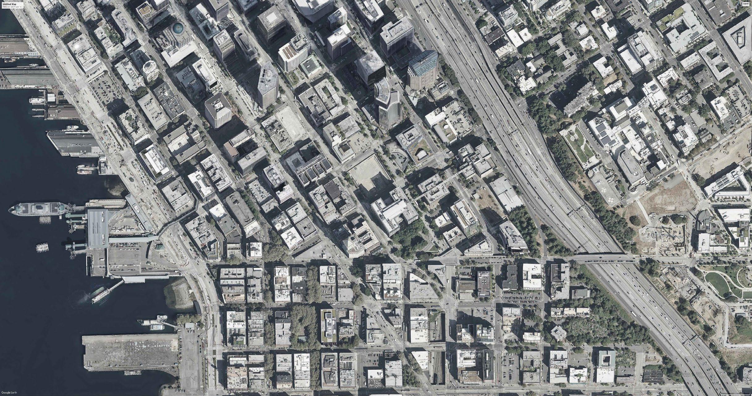
Location: Seattle, WA Study Area: 15 acres
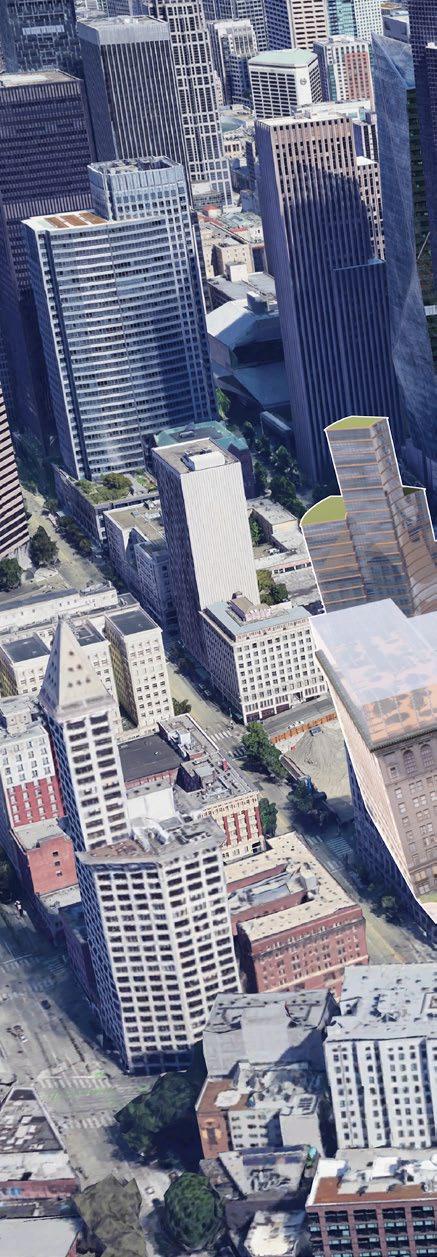
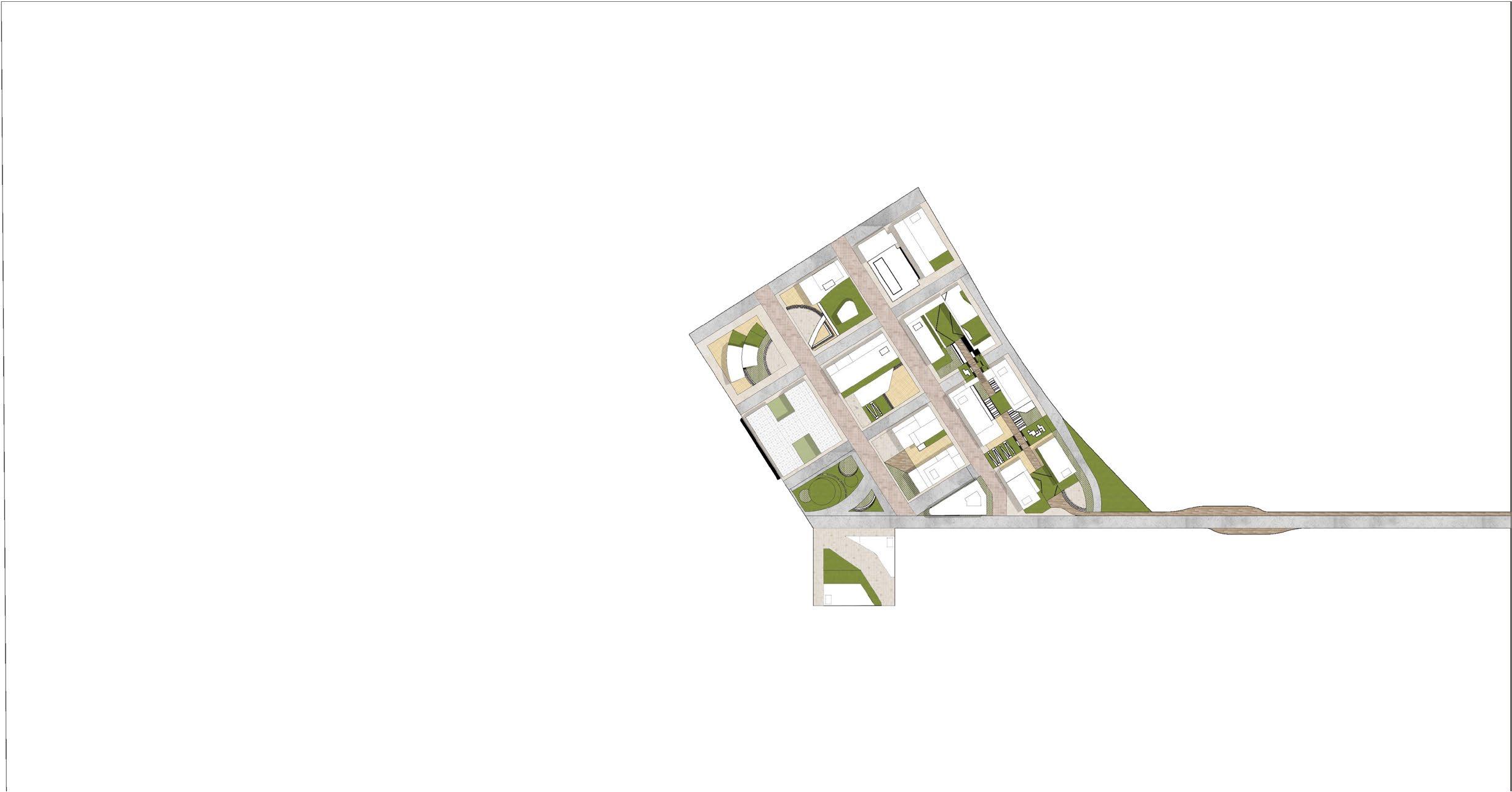
Something that is in-situ is kept in place; its original context is not only preserved but celebrated. in[SEA]tu is a framework for building a just present and resilient future for Pioneer Square by paying homage to the past and celebrating community, leveraging the neighborhood’s rich cultural landscape.
In an effort to REPAIR cultural damage and honor the people who built the city, we aim to REGENERATE Pioneer Square as the beating heart of Seattle and RECONNECT it back to the urban fabric
Role: Conceptual Framework and Programmatic Plan, Master Planning, Site Phasing, Mapping and Graphical Representation

TRANSITIONAL HOUSINGNATIVE-CENTEREDHOUSING COMMUNITYKITCHEN
t
CONNECTIONTOTHEWATERFRONT COMMUNITYGARDENSGREENROOFS
CONNECTION ACROSS I-5
GREENBRIDGE
MULTIMODALTODHUB
CASCADINGGREENWAY
esources totheland newcommunity

LIVE-WORKPERFORMINGARTSCENTER
ARTISTHOUSING MAKERSPACES
Square and collectively build a thriving and equitable future.
A co-working and businesses of King County
NEIGHBORHOOD DELIVERY HUB a ddressharms
o r
RECONNECT REGENERA
Avenue 4 Ar t Space
A Plaza for Ar tists Workshops, Open Exhibits and people’s favoured Protesting Ground
Podium 500
for Weekly Open air movie nights, cultural performances and flash mobs
Evans Square
Right next to the UW School of Public Affairs leading to the food street
YESLER Plaza
The plaza on Terrace Street that leads to Greenway Commons
in (sea) tu innovation labs and flex office hub for local and small County to harbour a culture of Innovation

Greenway AMPHITHEATER
A cozy music venue on the connection between the Greenway and the Yesler Bridge
Jefferson Plaza
A cultural plaza for flea markets, pop up shops and street ar tists
twhahb KOH Square
The TOD Plaza and Open Ar t Gallery
Terrace Street
The most popular destinantion for Weekend Markets and the Annual Block Par ty
Makers Yard
opening into the Native Ar ts Museum
Creative commons in the hear t of Pioneer Square in the Adaptively Reused Prefontane Street

Courthouse Conservatory
A brand new public destination on top of the Courthouse offering stunning views of the Bay and our new development
in[SEA]tu Innovation Labs
To help small and transitioning businesses with the space and resources to grow
To heart dedicated Native
Native Housing and Facility Center
safeguard the rights of the native community in the heart of the city where they belong a facility with dedicated housing, community clinics and free legal cells
Jefferson Plaza
Linking the new underground station the plaza is a people’s favourite, be it for year round events or occassional protests, this is the melting pot of all cultures of expression
Greenway Commons
A series of cascading greens and plazas connecting the new community with an array of public programs through the year

The Yesler Hotel
The adaptively reused Heritage Hotel in the heart of in[SEA]tu with art galleries on the street and Seattle Underground Speakeasies reviving the infamous Arts Scene of Seattle
The Makers Yard and Catalyst
Taking forward the legacy of Tashiro Kaplan artists residences, the Yard and Catalysts help strengthen the new community with art and vocational training to help build skills and opportunities for transitional and re-entry housing above
Housing
Commercial, Retail
Hotel
Plazas
Performing Arts Center
School of Public Affairs
Vocational Training
1
3
4
Square Habitat Beach
Square
Square Preser vation District
Seattle
Square
Jefferson Seattle Fer r y Ter minal
Pioneer
Pioneer
Pioneer
Downtown
Occidental
CherryStreet 4th 3rdAve JamesStreet
City Hall Park
Courthouse Residences in (SEA) tu Innovation Labs
2
King County Performing Arts Center Avenue4 Homes (Apartment Complex)
Avenue4 Artspace
Podium 500
3a
3b
Chinook TOD
twahb-KOH Square and Museum
Jefferson Plaza
Evans Square and 5 The Grand Yesler Hotel
Prefontaine Studios
Makers Yard
Catalyst: The Vocational
4a
4b
4c
6
7
8


Harbour view Medical Center
Yesler
Ter race
Inter national Special Review Distrcit 4thAve 6thAve 5thAve JeffersonStreet TerraceStreet 2 1 3 3a 3b 4 4b 4c 4a 5 7 9 10 12 11 14 15 13 8 6 World Food Gully Hotel Vocational Training School
Yesler Plaza Homes@ the Greenway
Block 2 Homes@ in (SEA) tu Community Co-op
Block 3 Homes@
Greenway Amphitheater
Yesler Lookout
Native Housing 15 James Street Lofts
Yesler
Way
9
10
11
12
13
14
Section A
Avenue 4 Artspace
A plaza for artists, open exhibits and people’s favored protesting ground. The interaction of distinct activities in this plaza makes it a vibrant place with constant on going activities.
Native Housing
Seattle Police Headquarters
Seattle City Hall
Chinook TOD
KING COUNTY PERFORMING ARTS CENTER
RETAIL
NEW PIONEER SQUARE STATION
Section B
Jefferson Plaza
A place for flea markets, pop-up shops and street artists to call their own as a living museum with weekly movie nights for all
Pioneer Conservatory
Courthouse Residences
Avenue 4 Homes
KC Perfroming Arts Center
Evans Square
The podium multiple levels Food Gully, activity and


HOUSING
RETAIL
Public Affairs
City Hall Park
UW School of STUDENT
LUXURY APARTMENTS
LUXURY
APARTMENTS
UW
School of Public Affairs
Square
podium for interaction at levels leading to the World
Gully, a street filled with and cuisines from all over.
of Affairs
APARTMENTS
GREENWAY
Terrace Street
A shared pedestrian corridor from City Hall Park to Yesler Plaza creating a strong connection leading public to Greenway Commons.

894 new affordable housing units
80 transitional housing units
25 re-entry housing units
32 permanent supportive housing units
180 units serving the Native community
Student-oriented housing typologies
Community healthcare and legal clinics in partnership with Chief Seattle Club
Native cultural events and programming at Duwamish Museum and Performing Arts Center

twahb-KOH
MUSEUM
RETAIL F&B GREENWAY
HERITAGE HOTEL
SEATTLE UNDERGROUND ART SPACE
Live/work housing for local artists
Workforce development and upskilling programs
Makerspaces accessible to local artists and artisans
138,000 sqft of retail space reserved for local small businesses
Community Innovation Lab provides educational programs and seed funding for local businesses
Gallery spaces in Underground Artwalk reserved for local and Native artists
Improved pedestrian experience and traffic mitigation on pedestrianized and slow streets
Activation of Yesler Way/5th Ave overpass through Underground speakeasies and Artwalk
Safer inter-light rail concourse with retail and “eyes on the street”
Greenway Commons
FLEXIBLE HOUSING HOUSING
New jobs created in the Neighborhood Ghost kitchen infrastructure for food innovators in the Neighborhood Delivery Hub
Urban gardening co-op spaces in the Conservancy Greenhouse
1,444 apartment units open onto the Greenway
FAMILY PARKING
HOMES FAMILY HOMES
RETAIL
Greenway redirects air circulation to mitigate pollution exposure from I-5
Safe pedestrian connections across I-5 to Harborview Medical Center and Yesler Terrace
Improved ADA accessibility through curb-less streets
in[SEA]tu LABS
The cascading greenway linking the new community with buzzing activity and green connections

I have been working with the community for a long time and in[SEA]tu is a unique platform for members of the Native Community to express their culture through public art and a haven to safe guard their rights and home in the heart of Seattle!
Surviving the pandemic has been hard for my business, but thanks to in[SEA]tu Innovation Lab, it has become so easy for me to rent a floating office that to so close to the downtown! Being right next to the station has also helped boost our visibility and has brought us so many customers - especially on game days.


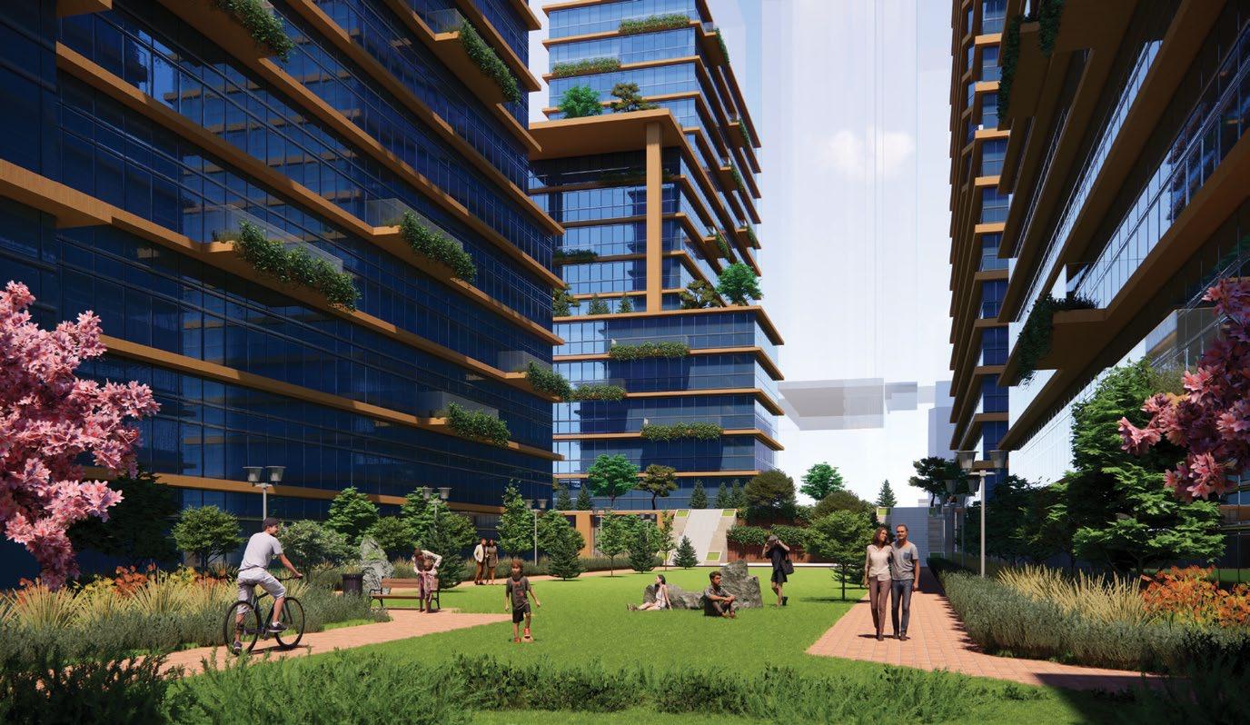
 The shared pedestrian corridor from City Hall Park to Yesler Plaza leading to the Greenway Commons also hosts the Annual Block Party and Street Fairs
Terrace Street
Rendering by Clevan R
Chyenne, 36 NGO Worker
Chris, 34 Small Business Owner
Living on the Greenway has made it so easy for us to commute to work and come back to a community. So many activities at the Plaza keep our weekends booked and movie nights at the Center have now become a new family tradition.

 Kelly, 29 Resident
Dre, 41 Student at the Catalyst

02

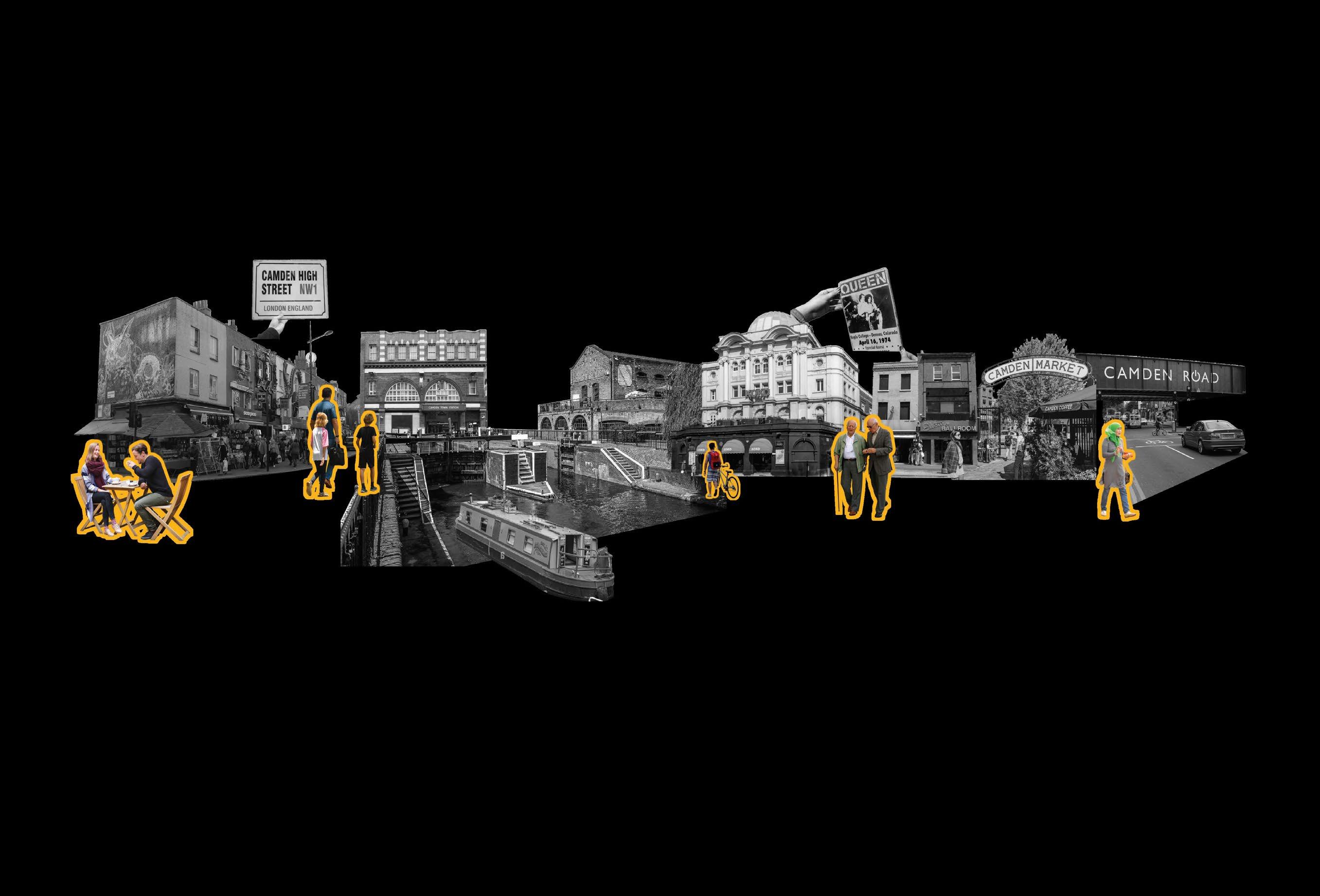

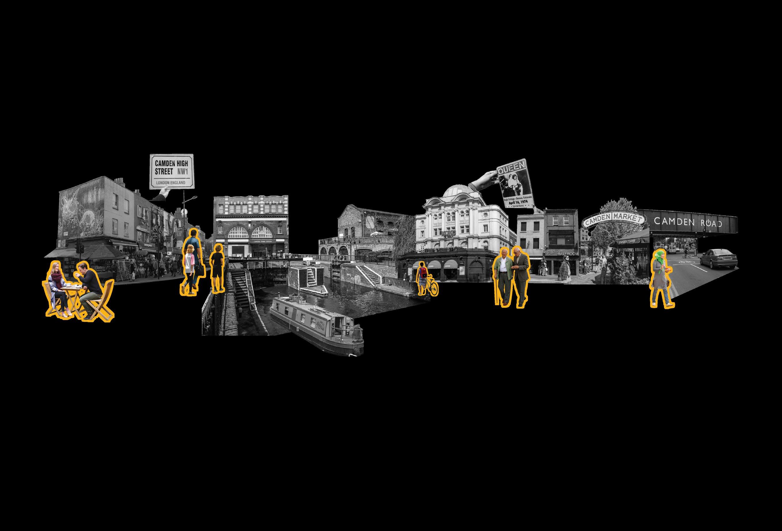
The market has a rich history of music, food and home-made products. I would love to have some of that old world charm back!
Reuse under used spaces for pop ups programs and community amenities as a catalyst for _BUILDING COMMUNITIES
Cars and other vehicles keep my children from going about on their own. My kids are falling sick because of all this smoke.
TRANSIT SYSTEMS
Camden Town and Morningston Station with over 20 different bus lines making Camden one of the better connected neighbourhoods in London
_ECONOMIC CIRCULARITY by decentralizing resources for local businesses in Camden
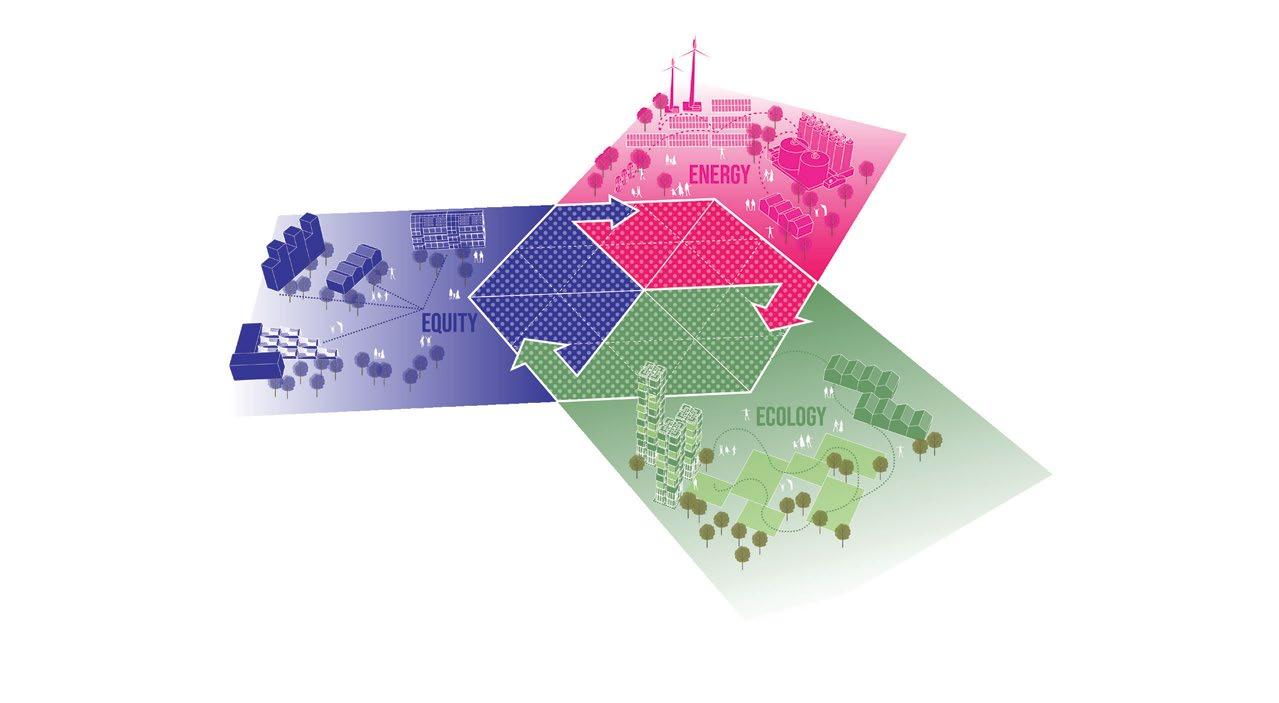
Leverage renewable energy, different housing typlogies and community resources to generate _AFFORDABILITY
Adhering to the Paris agreement, achieving _NET ZERO ENERGY usage goals by 2030 Strengthening the _ECOLOGICAL ARMATURE for a healthier lifestyle: from clean mobility to growing food
TOURISTS
FAMILIES
CAMDEN UNITED LAND TRUST
Old and dilapitated buildings are up for a major overhaul and can be taken over by Camden United and turned into Community oriented programs
These shared bikes aren’t for me, I need some convinient ways to get around, especially when it rains.
PEDESTRIANS
These cars are really dangerous, I wish there was better pedestiran and biking infrastructure for both me and my kids.

The Canal is a wonderful place, would love to see it more active with public spaces along it.
At the end of the day, the Canal is for everyone!
Music venues in Camden are a part of its heritage and have had major concerts and pop culture
MUSICAL HERITAGE
SENIOR DEMOGRAPHIC

Disused rail infrastructure has the potential to provide for much needed public spaces and green connectors. Industrial workers also are a big part of Camden’s New Economy.
INDUSTRIAL HERITAGE


CAMDEN: A NEIGHBOURHOOD FULL OF OPPORTUNITIES REVIVING THE FEELING OF HOME RESILIENT CIRCULAR ECONOMY CATALYSING THE MEANWHILE USED SPACES CLIMATE CONSCIOUS LIFESTYLE EMPOWERED COMMUNITIES PRIORITIZE URBAN HEALTH AND SOCIAL EQUITY
FITNESS ENTHUSIASTS
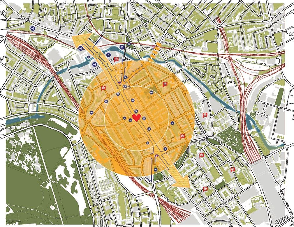
RECLAIMING THE HEART OF CAMDEN
Reviving the high street as the commercial heart of Camden with activities for all its residents making it a pedestrian friendly plaza. Also, provide incentives for local retail and businesses to make the High street the much needed commercial heart of Camden

FUTURE PROOFING THE INDUSTRIAL PAST
Along the leftover rail and industrial infrastructure north of the new King’s Cross Development, we propose the first energy positive neighbourhood of London. A space to harbour the idea of innovation within the dying industry to make it future proof and revive it as a thriving community.
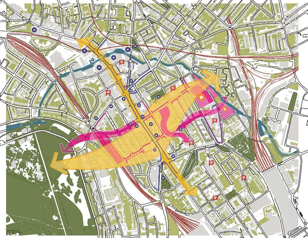
BREAKING THE HARD EDGES
Integrating the residential area with the High Street, new East-West Connections act as parallel streets connecting the High Street to the Regents Canal along the east and Regents Park on the west. To break Canal’s edge, we propose to develop unused parcels as an educational hub leveraging its relationship to the research district.

REIMAGINING MICRO MOBILITY
Introducing the Camden Hopper as a new mode of micro-mobility within the neighborhood. This eco-friendly electric 10 person bus, partnered with the Camden Council and Transportation for London (TfL) will connect major underground stations to key landmarks, educational institutions, innovation and recreation hubs.
BIG MOVES


Promote sense of community Build Affordability Collaboration for Circularity Track and manage trends Promote Compact Development Focus on waste management Systems for healthy living Include and celebrate diversity Camden United Land Trust


THE GREEN LOOP
The green loop around Camden town connects existing neighborhood parks and open spaces to new districts connecting the Regents Park to the new Kings Cross Development.
The loop also connects to Regents Canal on multiple points and uses the Camden Highline as a linear elevated park for the community with spaces for all residents.
Generate Renewable Energy Reutilize Industrial Footprint Improve neighborhoods Manage water systems Connect significant landscapes
Promote Research + Innovation Promote Food Production
Ease of accessibility
Plazas and Gateways as active event spaces

Integrating Cultural hotspots Infill
Adaptively reusing the existing fabric with community oriented programming
Adding more offices near the station as a part of the new TOD Development
Integrating infil projects for housing along the new pedestrian plazas
Adaptively reusing the existing fabric with added density and 24 hr programming
Transforming the Current High Street into a Pedestrian Plaza through road dieting measures
PHASING
housing to build density
Phase 1 2023-2028
Phase 2 2027-2030
Phase 3 2030-2033
New community programs based on the values of education and community engagement
 New Innovation district to bridge the industrial divide
London’s first energy positive district
New neighbourhood leveraging its relationship to the context based on the values of innovation and research
Adaptively reusing the existing warehouse infrastructure into a biogas plant
Laying the solar and wind farms along the elevated rail lines
St. Pancras Gardens
Oakley Square Gardens
BREAKING THE WALL
Access Corridors and Linear Green Connections towards the Canal creating new landmarks
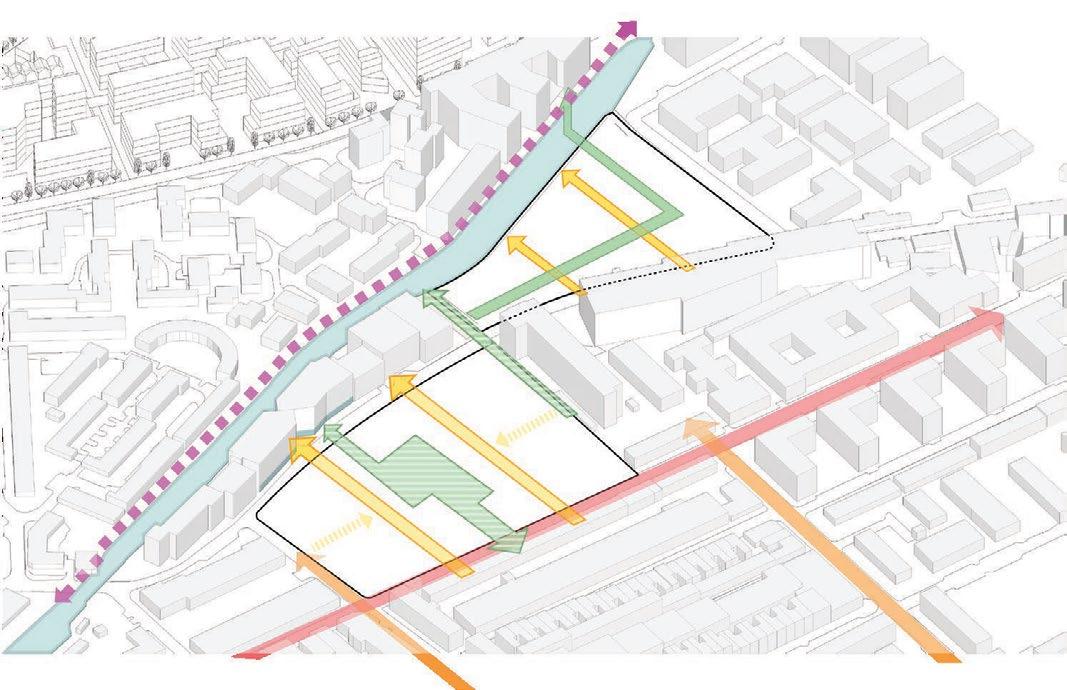
ENGAGING PROGRAMS
To activate the ground floor connections with community oriented programs with education at its core


175 New Apartments
53 Affordable units
60,000 sq.ft of Community Amenities
Manage water systems Build Affordability Promote Research + Innovation Collaboration for Circularity Focus on waste management Include and celebrate diversity Camden United Land Trust Promote Compact Development
Food Hall
School
Vocational Training School
Vocational
Research hub Community Centre Pop up Yard Local Retail 24hr Library
Canalside Co-working
94,000 sq.ft of Farm and Greenhouse Space

140,750 sq.ft of Rentable office space
36,500 sq.ft of Research Units
90,250 sq.ft of Commercial Mixed Use
Reimagining under utilized lots along the Regents Canal to bring the community together with education at its heart by leveraging its relationship with the surrounding educational institutions to set up research cells and incubators. Adding reformative functions like the transitional housing coupled with the vocational school help create affordability. The storm water park acts as a community resource to collect and slow down the speed of water in case of heavy rains. We also use art as a navigator to break the wall to the canal.
Camden Community Food Hall
Coop Transitional Housing
Camden Coop Skill Center
Tender Heart Primary School and Day Care
Camden United Land Trust Research District
Canal Walk
Phase1 of the continuous trail with key highlights along the Regents Canal from the Camden High Street to the new Kings Crosss Development

Activating the Canal’s Edge through campact mixed use developments focussing on local businesses and commercial functions
Research District as a resource for student entrepreneurs and young transitioning professionals
People’s Podium
the green street leading to the canal as a means of bringing life back into the edge with a focus on connecting major landscapes
Culture Gully as flexible open air museums streets leading to the canal
Eyes on the Street
The 24 hr library as a community resource activating Royal College Blvd throughout the day
ZONE 1
Leveraging its connections to the Royal Vet College and Healthcare District, Zone 1 repurposes the demolished lot as a community centered Research Hub for young professionals and transitioning businesses connected to the Institutional community, integrating the values of community engagement, cultural diversity and promoting a healthier lifestyle
ZONE 2
Redeveloping the Parcel Force as a people’s resource giving back to the community centered around education as a catalyst
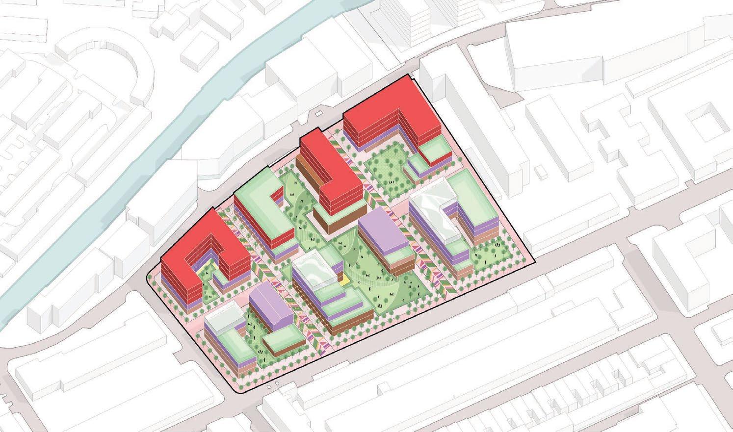
Art Streets
Collector streets as informal hubs of overflowing activity
Community Workshop
a testing ground for the students of the Vocational school and a hub for spontaneous interactions
Housing Typologies
Mixed income typologies including transitional housing for the new community
Transitioning Businesses
Flex rental and co-working spaces for businesses that need temporary formal spaces
Activated storefronts showcasing a plethora of handmade artisnal products, local businesses and F&B establishments promoting a sense of botttom up circularity
SYSTEMS SECTION
Art as a catalyst to guide people through the neighborhood to the canal
Breaking the wall adaptively reusing the ground floors of the canal facing properties to activate the edge, making it more public
Education as a Catalyst Vocational schools as a means of upskilling and empowering the Camden Community

Camden Food Hall
run by the Camden Co-op where you find affordable meals from the locally sourced ingredients and self grown produce.
Camden Commons
a key ecological resource to collect, treat and reuse stormwater during the rains and acts as a neighborhood park when dry
Commercial Mixed Use: 285,000 sq.ft
575 New Apartments
115 Affordable units

and Studios
Waste Treatment
Amenities: 46,000 sq.ft
Pioneer School
Farm and Greenhouse
Space: 220,650 sq.ft
Adjustable PV Panels and Turbines next to the railway lines
Artists Studios and Makerspaces Commercial Office Spaces
Ind + Warehousing: 185,000 sq.ft
New Offices: 100,000 sq.ft
Kids Playground
Camden Co-op
Community Amenities Apartments Townhome Apartments Industries and Warehouses
The focus is to strive for sustainable circularity- not just ecologically but also economically for a synergistic future of the community.
To achieve energy positivity the Innovation district focuses on capturing energy from various sources with urban agriculture, solar capture, wind capture and rain water harvesting as major components.
Camden Community Farms
Grove
Agri Hydroponic Farms
Dogpark
Reflection Garden
Vanguard Eco Hub: Harnessing energy from waste management, to power the hopper and using the manure to grow food on the farm tower
Makerspaces
Camden
Manage Build Promote Collaboration for Circularity Focus Include and celebrate diversity Camden Promote Generate Renewable Energy Reutilize Industrial Footprint Promote Food Production Systems for healthy living
META Kingscross

Solar Roof Tops: 95,500 sqft
Generating ~ 852,406.9 kW of Solar energy per year
Enough to power approx 300 households
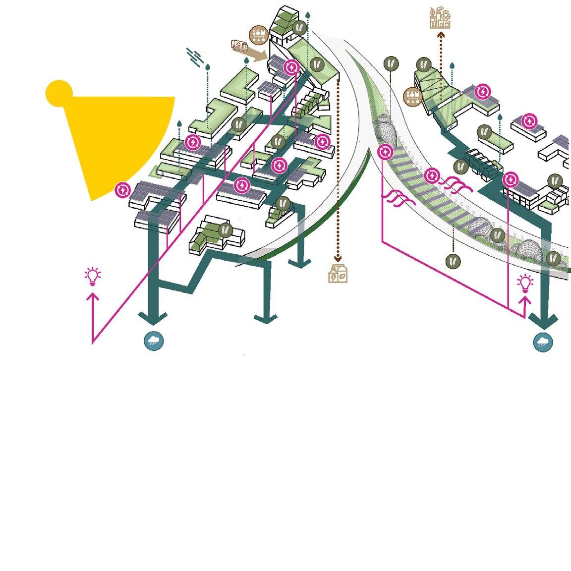
Vanguard Eco Hub
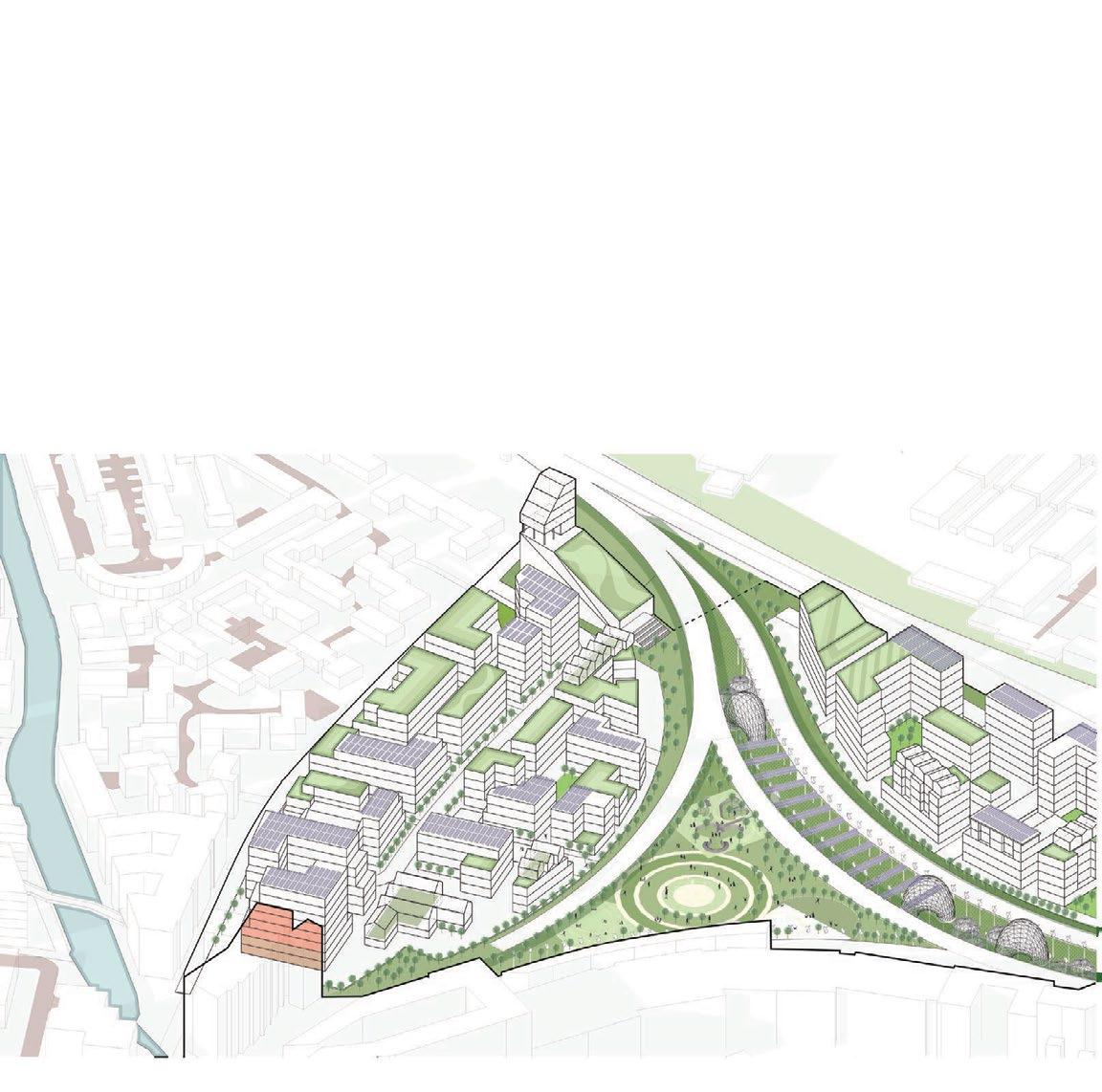
Camden Community Farms
Adjustable PV Panels and Turbines next to the railway lines Agro Hydoponic Towers
Camden Grove
Solar Roof Top Farms
Solar Roof Top Farms
Manage water systems Build Affordability Promote Research + Innovation Focus on waste management Camden United Land Trust Promote Compact Development

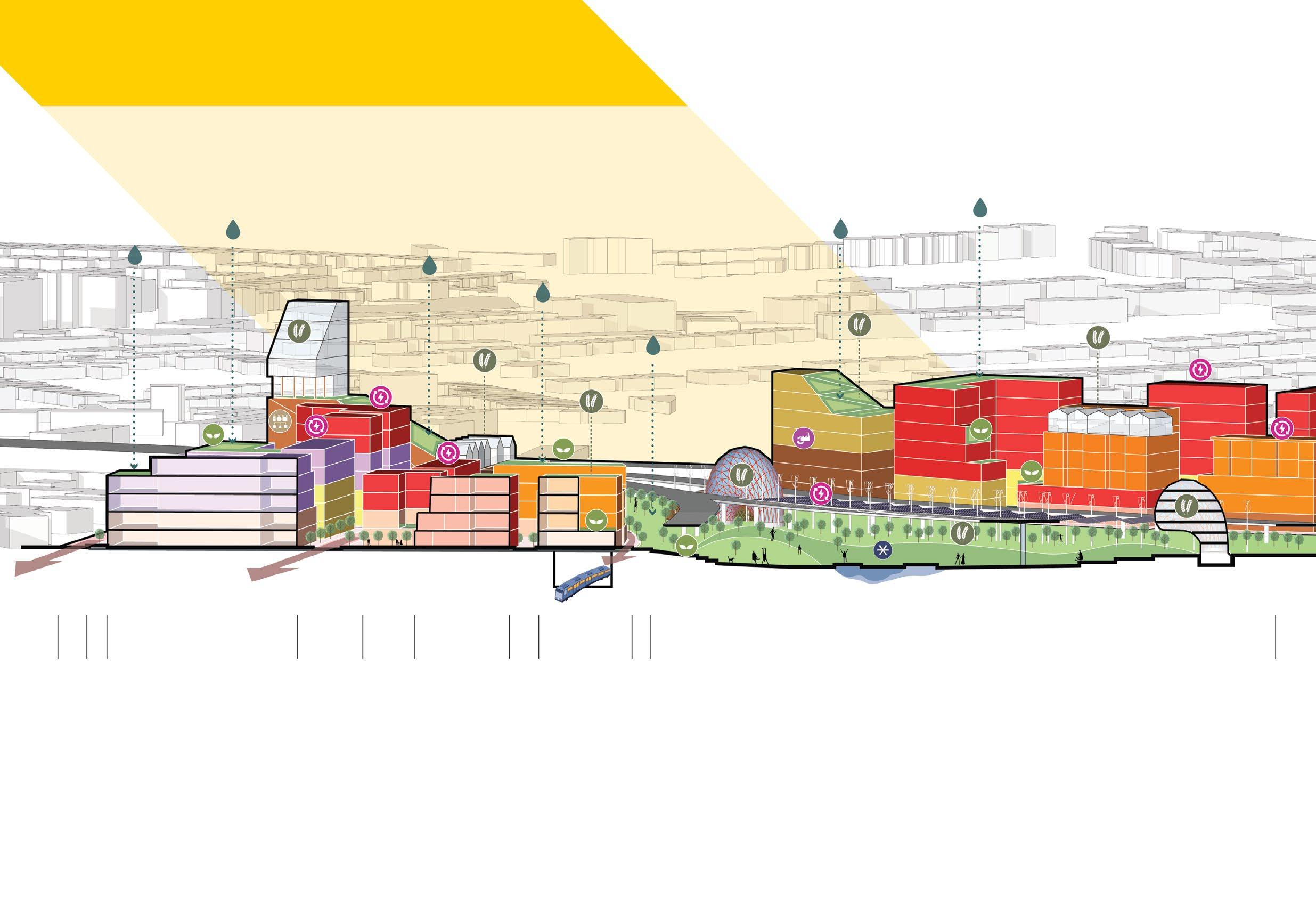
COLLABORATIVE COMMONS
Makerspaces and Workshops promote collaborative work and learning enviroment
VANGUARD ECO HUB
Best in class energy hub managing waste, growing food and generating energy for the hoppers
VIEWS TO THE CAMDEN GROVE STUDIO WORKSHOP MAKERSPACE MAKERSPACE OFFICE APARTMENTS APARTMENTS DAYCARE CENTER COMMUNITY HALL DAILY RETAIL
Building Massing reduces towards the park to provide equitable views to the green commons
TOWN HOMES
UTILIZING VACANT SPACES
Regional park acts as a carbon sequestration zone for the district and a water reserve in case of high rains

URBAN FARMING
Food grown insitu which then goes to high street as a part of High Street Regeneration Project
Artists Studios and Makerspaces
Commercial Office Spaces
Community Amenities
Apartments
Townhome Apartments
Industries and Warehouses
CAMDEN GROVE
CAMDEN COMMUNITY FARMS
02
03
Gateway to the Bay_Gehl San Fransisco
URBAN DESIGN STUDIO
Academic Project, Spring 2023
Instructors: Dean Almy + Gehl Studio
Team: Vatsal S, Sukriti G
Location: Millbrae Station Area, San Francisco
One of the oldest junctions in the Californian Railway corrdior, Millbrae is one of the fastest growing station cities in the Bay Area, yet it is segregated from Tech heart of San Francisco by the lines of transit infrastructure.
Through this studio, we aim to understand how a station can be reimagined to be the heart of a new development that brings in more vibrance, economic opportunities and diversity to the city making Millbrae to the “New Gateway to the Bay”.
Role: Urban Design and Development, Graphics, Strategic Interventions and Research
BART TRACKS
Millbrae/SFO
Millbrae/SFO
Millbrae

Line)
Richmond (RED
Antioch (Yellow Line)
SFO (Purple Line) 46 SAMTRANS CONNECTIONS
major intercity routes RICHMOND
21
DALY
CITY
 SAN FRANCISCO INTERNATIONAL AIRPORT
RICHMOND
FRANCISCO
SAN
OAKLAND
SOUTH SAN FRANCISCO
MILLBRAE
REDWOOD CITY
MENLO PARK
MOUNTAIN VIEW
SANTA CLARA SAN JOSE
PALO ALTO
OAKLAND INTERNATIONAL AIRPORT
SAN JOSE MINETA INTERNATIONAL AIRPORT
 millbrae library
MILLBRAE CITY HALL
BROADWAY STREET COMMERCIAL STREET
VETERANS’ COMMUNITY
MILLBRAE STATION AREA
MILLBRAE TRAIN MUSEUM
MILLBRAE HISTORY WALK
EL CAMINO
BAYSIDE MANOR PARK

the city of millbrae
SF INTERNATIONAL AIRPORT
MILLBRAE AVE
FREEWAY 101
CAMINO REAL
SAN FRANCISCO BAY


Mixed Use Districts
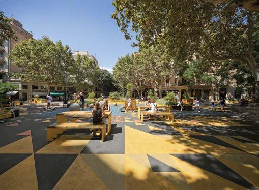
The Station as the main public space bet ween the El Camino and the Bay
Regional and Local Programs connecting the Downtown, El Camino, Airpor t and the Communit y

Humanise the public experi airpor t
Station as a binding elem activities
Creating a heirarchy of uses the central axis with people f
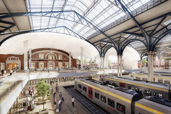
vib r ant R egional Cen t e r sti t ch t he u r ban fabri 0 1 0 2
ence from the ECR to the
ent with a mix of public
throughout the fabric along
irst spaces


Mix of programs to keep the districts active 24X7 around the year
Porous neighborhoods and a net work of shared streets for inclusive and accessible neighborhoods
Democratic spaces for all
abri c c o c r e at e h yb r id c o m muniti e s 0 3 VISION

1. STATION AS THE HEART

Reimagining the Station as an important cultural node of public activity rather than an infrastructural divide
2. CONNECTING THE AXES

Directing more activities into the neighborhood by making key connections to the Downtown and Green Axis
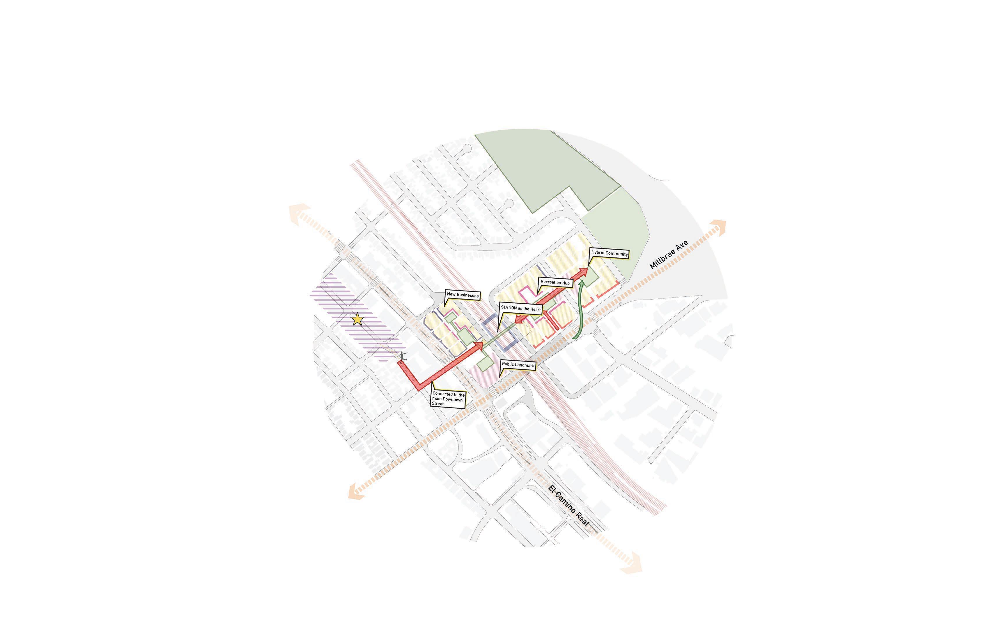
3. BRIDGING COMMUNITIES THROUGH PUBLIC SPACES
Activating key nodes through public activities to bridge the infrastructural divide

ENVISIONING THE NEW NEIGHBORHOOD
BIG MOVES
PROPOSED MASSING GUIDELINES

PROGRAMMATIC DEVELOPMENT


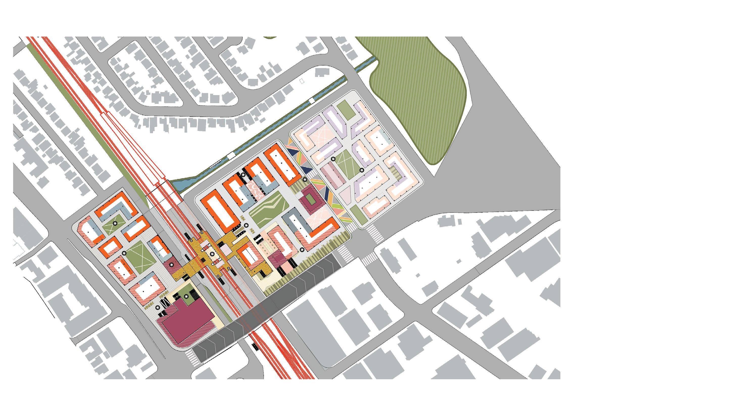


GROUND FLOOR FRAMEWORK PLAN Retail Commercial F&B Event/ Social Space Hospitality Residential Mixed Use 0 75 150 300
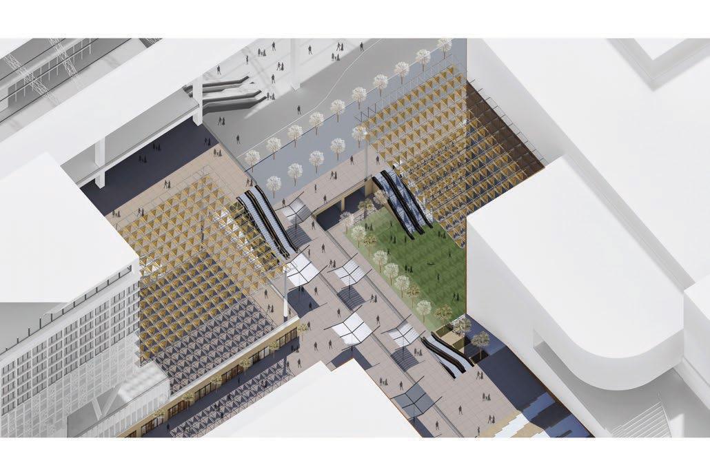


Section
BUS TERMINAL
MUSEUM
CAL TRAIN T
HSR CONCOURSE
HSR TERMINAL
BART TERMINAL
Cultural Plaza along the El Camino
Activity through the Unity Plaza

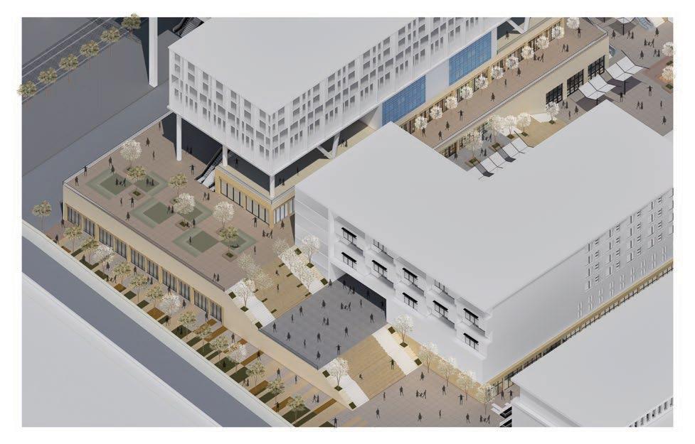
Activated edges along the Millbrae Ave

LIVE WORK NEIGHBORHOOD
LIVE WORK
NEIGHBORHOOD
UNITY PLAZA
COMMUNITY HALL
LIVE WORK NEIGHBORHOOD
LOCAL RETAIL
 Entry Plaza from the El Camino to Millbrae Central
Rendering by Vatsal Shah


Entering Unity Plaza from Millbrae Central
Rendering by Vatsal Shah
04
Envisioning the rapidly developing Charleston metropolitan
Charleston 360
ULI Hines Student Competition 2023
Notable Mention, National Jury ULI Foundation
Team: Clevan R, Despina M, Chaochen F, Bradley A, Sukriti G
Mentors: Efrain E. Velez, Guy Dudley, Ryan McCulloch
Academic Mentors: Dean Almy, Steven Spears
Location: North Charleston, SC Study Area: 89 acres
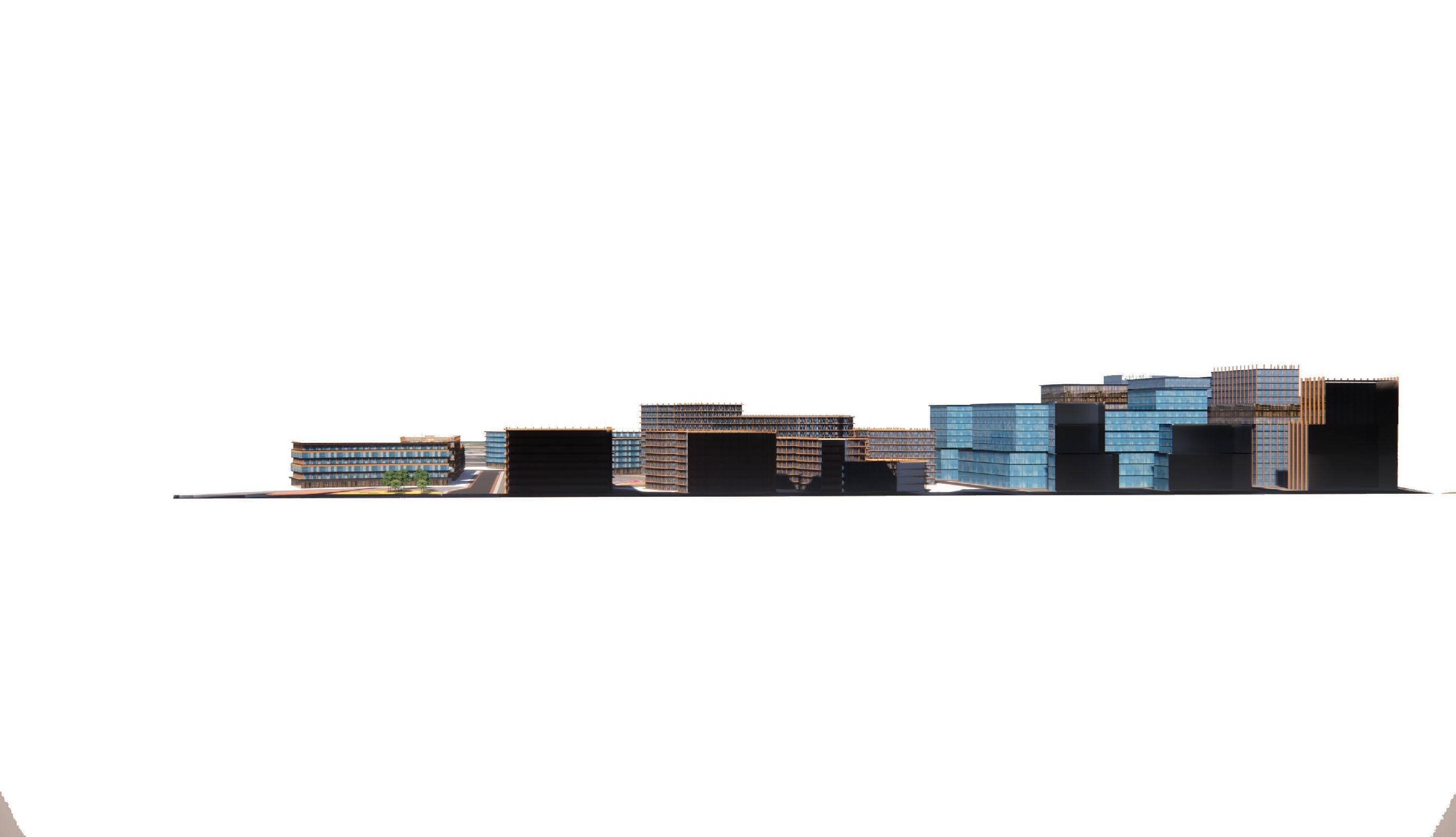
Designed to compliment and support North Charleston's unique economic, social, and environmental fabric, Charleston360 serves as a mixed-use, mixed-income development that celebrates principles of Prosperity, Identity, and Resilience
Given the complexity of the land's history, and the absence of a strong cultural marker to encapsulate the history of North Charleston, Charleston360 features a Cultural Corridor and Art Walk to lead visitors through an illustration of the city’s culture as a live museum in partnership with local artists and communities
Role: Conceptual Framework and Programmatic Plan, Master Planning, Site Phasing, Mapping and Graphical Representation


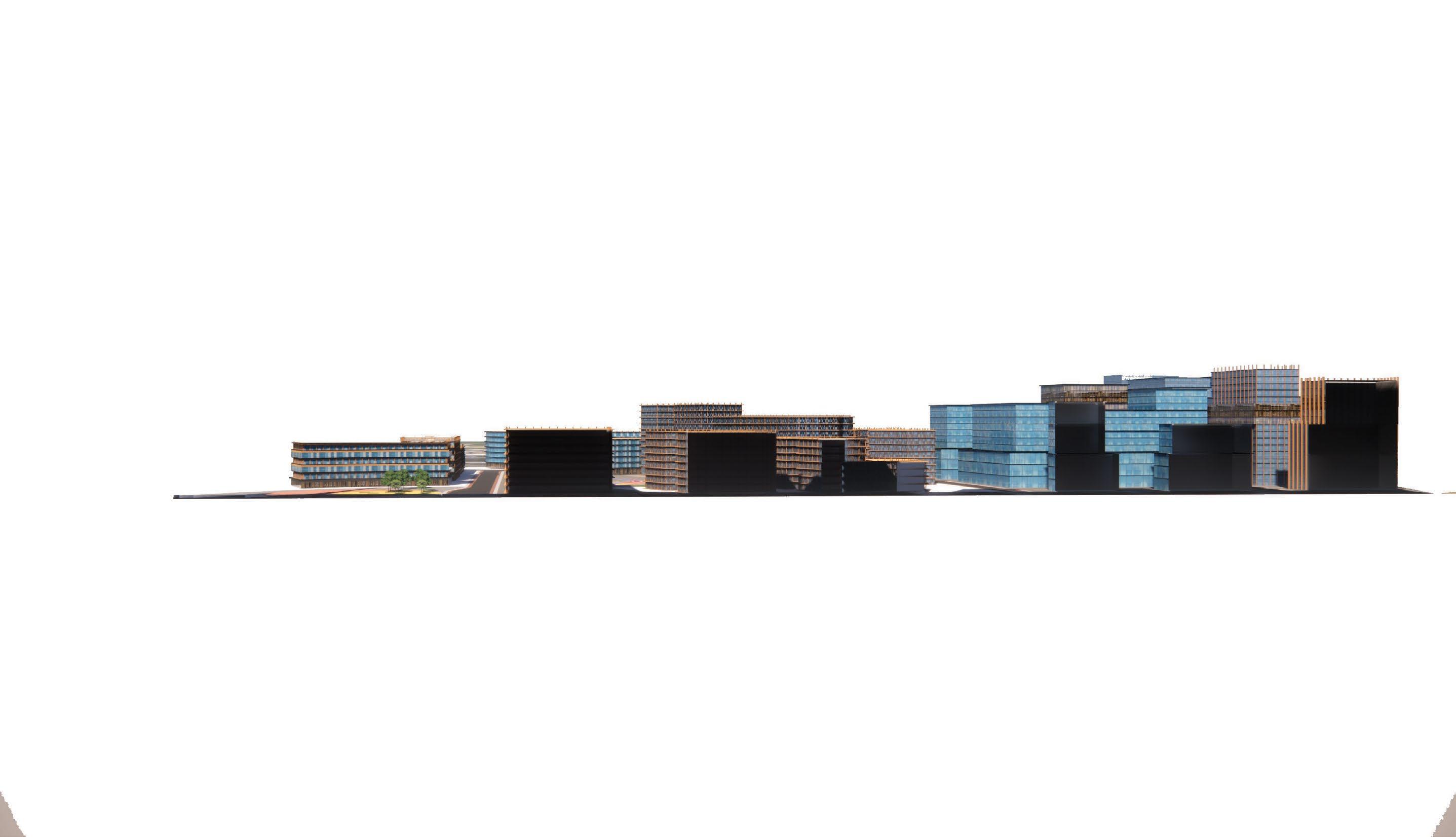
Rendering by Clevan R
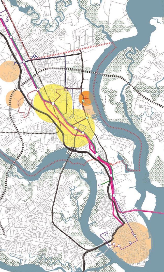
Major Roads
I-78
Existing BRTS Line
Proposed BRTS Line
Existing Bus Stops
Proposed Bus Stops
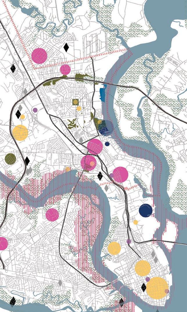
Even though there is limited pedestrian and bus infrastructure across the city, the Proposed BRTS Line, we propose two additional stops connecting to the site.
EXISTING PRIVATE
PARCEL ACQUIRED IN PHASE 2
Most unaffordable neighborhoods
Unaffordable neighborhoods
Borderline neighborhoods
Economic Opportunities
RAIL YARD AS PROPOSED
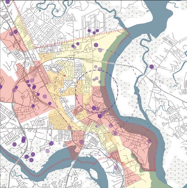
A major context of the site lies in the unaffordable range, with the maximum portion of the population making lesser than the AMI, whereas, there are quite a few zones of economic opportunities.
WIDENING THE NOISETTE BLVD AS THE MAIN STREET FOR CONNECTING TO THE CITY
MAKING PART
PARCELS PART OF VISION PLAN
I NDUSTRIAL DISTRICT DoD
DISTRICT
EXISTING PRIVATE PARCEL ACQUIRED IN PHASE 2
MAKING THE RIVER’S EDGE A PART OF THE PUBLIC LANDSCAPE
ART WALK AS A LIVE THE CULTURE OF LOCAL I NDUSTRIAL
African American Community
Cultural Hotspots
Naval Communities
MAKING THE RIVER’S EDGE A PART OF THE PUBLIC LANDSCAPE
PARCELS AS A
THE PLAN

Art Spots
Universities, Colleges
DoD PARCELS AS A PART OF THE VISION PLAN
Analysing the current cultural fabric, we realised that the nearest Downtown for the city was not even in North Charleston, highlighting the need for a vibrant city center.
RAIL YARD AS PROPOSED
WIDENING THE NOISETTE BLVD AS THE MAIN STREET FOR CONNECTING TO THE CITY
Super Markets
Public Amenities
Hubs
TRANSIT JUNCTION ON NOISETTE BLVD
AVE BN AS A COMMEMORATING NATIVE AMERICAN
RAPID BUS LOOP LINKING THE LOOP IN PH2
AVE BN PEDESTRIAN

There is a major dearth of amenities surrounding the site. These factors indicate the need for public utilities in the affordable bracket to insure the sustainability of mixed income neighborhoods.
TRANSIT HUB CONNECTING TO THE PROPOSED LCRT CORRIDOR
WIDENED BLVD

3 12 P 17 18 3 4 5 15 1 6 19 7 3 3 3 2 3 11 7 7 7 7 19 9 8 8 14 14 20 20 10


SITE PLAN 1 Chadwick Boseman Expo Center 2 Thurgood Marshall Afforable Housing 3 Mixed Use Development 4 Retail 5 Food & Beverage 6 Hotel 7 Offices and Flex Industry 8 Satellite University Campus 9 University Research Hubs 10 Incubator Hubs 11 Maker Spaces 12 Multi-Modal Transportation Hub 13 Outdoor Event Space 14 Resilience Waterfront Park 15 Identity Square 16 Prosperity Plaza 17 Food Hall 18 Urban Farms 19 James Brown Culture District Art Walk 20 High End Luxury Housing 21 Riverfront Park Bridge


FLOODABLE RIVER’S EDGE
as buffer for the broadwalk and the river’s edge as a flood mitigation strategy
IDENTITY SQUARE PLAZA
as an open air event and gathering space between the convention center and food hall


JAMES BROWN CULTURAL DISTRICT
A commemorative open air sourced by local artists and permanent and temporary


 Looking at the Identity Square Plaza through the Art Walk


UNIVERSITY PLAZA
air museum and their exhibits
bordered by the Satellite Campus and Industrial District
INDUSTRIAL PARK
as a hybrid hub for the developing industry transitioning from light manufacturing to innovative technologies and corporate spaces with a mix of Affordable Housing and Live Work Units

Retail
Mixed Use Commecial Offices, Co-Working and Incubator Cells


Parking University Industry and Warehousing

Affordable Housing Market Rate Housing
 James Brown Cultural District
Weekly Farmers’ Market
wellbeing
prosperity
Kids Activity Sunday Community Gardening Week
Housing and Financial Literacy Program
Industry Expo
Open Exercise and Workout Sessions
Vocational Summer Training Programs
Small Business Month
Rotating Community Art Series
Youth Gardening Program
culture

community
MLK Day Parade and Concert
Black History Month Festival
North Charleston Arts Festival
Weekend Flea Markets
Fourth of July Block Party Firefly
Story Telling Series at the Library Open Air
Voter
LOCAL ARTISTS

Vendor Market Park Concerts and Festivals
SMALL BUSINESS OWNERS
Community artists and cultural advocates
Able to participate in rotating art series + Vendor Market, Activities as a contributor in the cultural boulevard public art project.


Utilize Incubation Hubs, offices and mixed commercial spaces Participate and contribute to Industry Expo, and benefit from partnerships with surrounding educational and industrial hubs.


COMMUNITY PARTNERSHIPS
INDUSTRIAL
January February March April May June July August September
Annual


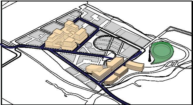


PHASE 1 2024-2025 1 Expo Center 2 Big Box Retail, F&B, Public Amenities, Parking 3 Mixed Use Retail, Hotel, Flex Offices 4 Industrial Park with MR and Affordable Housing 1 2 3 4 5 12 13 14 15 16 17 9 7 PHASE 2 2025-2027 5 Industrial Park, Flex Office Spaces with MR Housing 6 Transit Hub with Commercial Retail and Affordable Housing 7 Art Walk PHASE 3 2028-2030 8 Industrial Park and Offices with MR Housing and Live/Work Units 9 Makers Spaces and Flex Offices with Live/Work and Studio Spaces 10 Luxury Housing with commercial spaces 11 Riverfront Broadwalk Phase 1 12 Mixed Use Commercial + Offices 13 Innovation Industry + Incubators 14 University Satellite Campus + Research Cells 15 Adaptively Reused Industrial Hubs 16 Riverfront Broadwalk Phase 2 17 Luxury Housing with commercial spaces PHASE 4-5 2030-2033 11 10
Movie Nights Registration
Vaccination Clinic
Air
Free
Market
Weekly Farmers’
S/M Industrial Symposium
Financial
Program
Housing and
Literacy
Music Festival
Christmas Market Harvest Festival
Native American History Month
Annual
05
Cascadia Chronicles_Celebrating Lowlands
URBAN DESIGN STUDIO
Academic Project, Fall 2022
Instructors: Dean Almy + Maggie Hansen
Team: Aishwarya P, Elizabeth G, Sukriti G, Whitney C
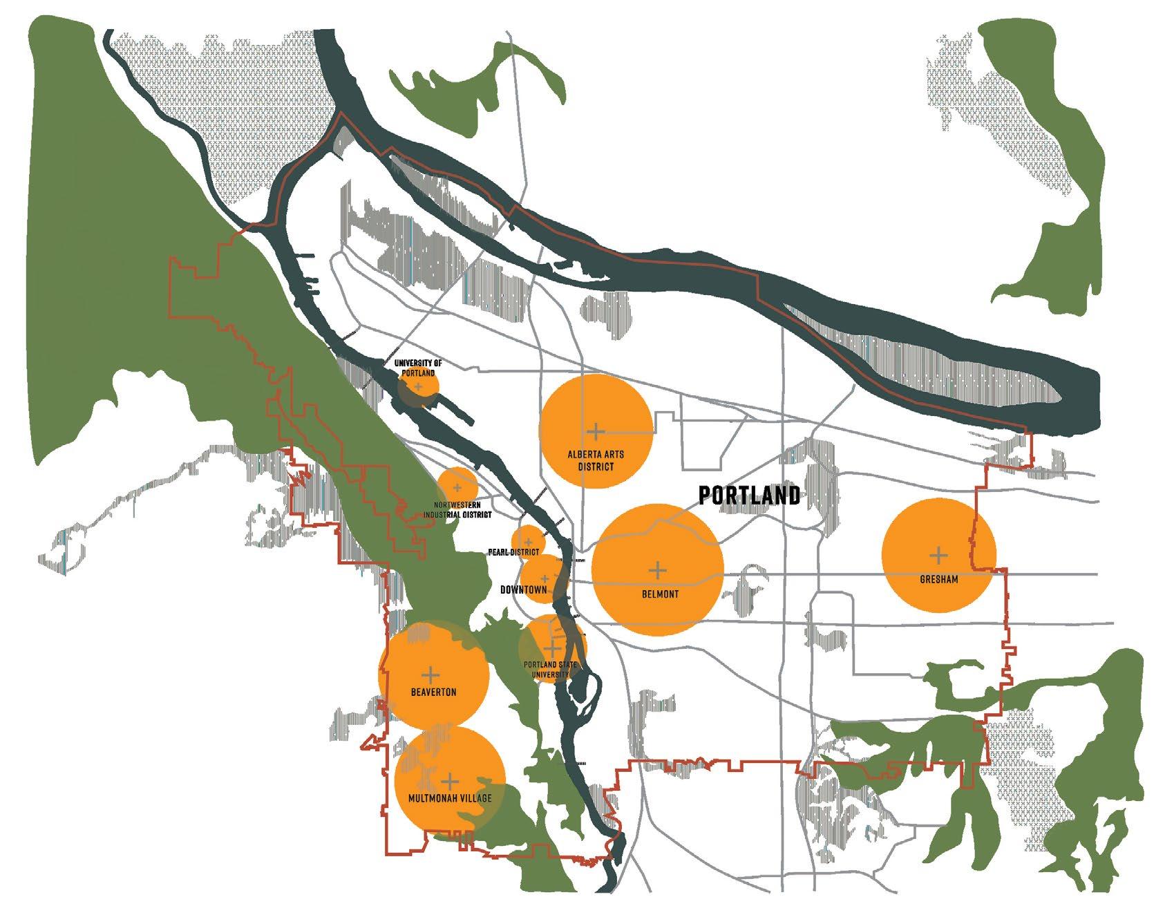
Location: North Western Industrial District, Portland
In an effort to design for climate change and rising sea levels, our project reintroduces woven wetlands throughout the region, which connect the network of public spaces that respond to the challenges of affordability and livability.
Through this organization, we aim to create a new sustainable urbanism that supports Portland’s need for housing and shifting industry while reviving the local ecology.
Role: Urban Design and Mapping, Strategic Interventions, Research and Mobility solutions

1840s
Guild’s
Lake becomes a part of Portland’s urban fabric
1905
Lewis and Clark Exposition hosts the World Fair at Guild’s Lake.


1920s
Exposition
Infill of Guild’s Lake begins with dredged material from the Willamette and hills
1950s Industrial Sanctuary takes over the newly filled land with the switching railyards
1950s Industrial Sanctuary takes over the newly filled land with the switching railyards
1980s
Industrial jobs grew by 37% in the region between 1980 and 2000
2000-Present
The Sanctuary is one of the only few industrial areas within the city’s urban growth boundary.
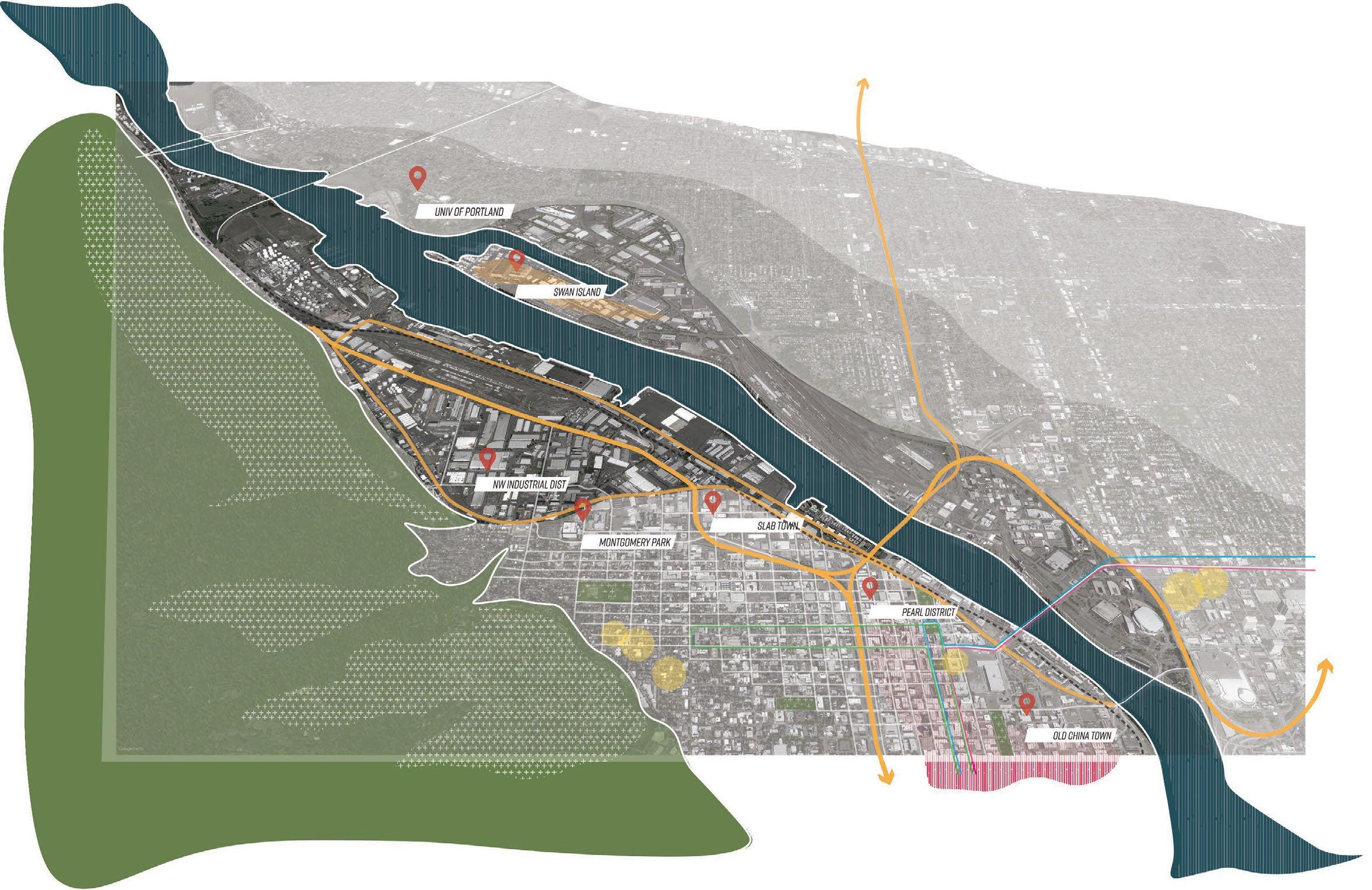
THE NORTHWESTERN INDUSTRIAL DISTRICT, PORTLAND

late 19TH CENTURY Agricultural Processing
MID 19TH CENTURY
Wood and Lumber based Industries
Manufacturing and Wholesale Industries as the Main Contributors to the Ecomony
world war i
Rise of the Steel Industry, Metals, Machinery and Transportation Equipment world war ii Shipbuilding, Reviving the Lumber Industry
late 20tH CENTURY
Electronics and Software Industry taking over
21st century Rise of Retail and IT Industry as the main generators of employment
Bordered by the forest hills on one side and the zone of high income, low density single family homes, the Industrial Sanctuary faces harsh edges to the city which have limited the opportunities of its expansion over time.
However, the district lies in close proximity to cultural and economic hubs like the Pearl District, Slab Town and Downtown and the Swan Island from across the Willamette.
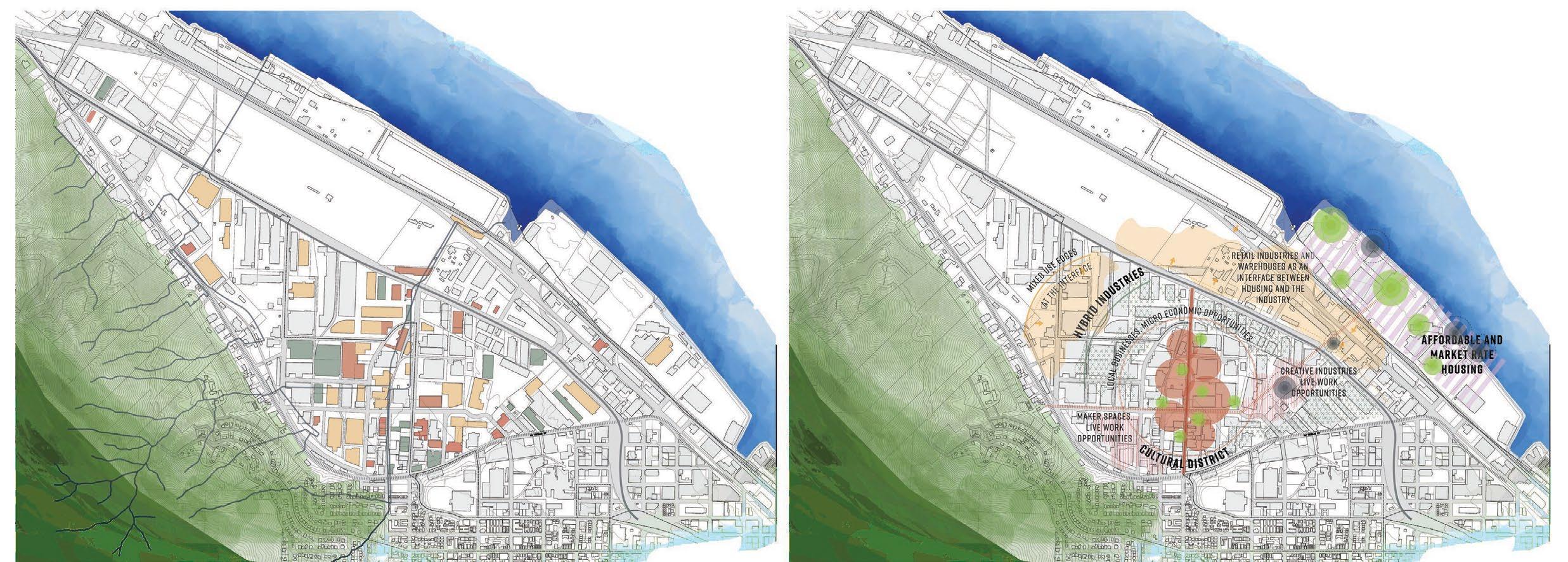
Local Businesses and Cultural Hotspots
Light Industry and Retail Industry
Warehouses and Creative Industries
EXISTING URBAN MORPHOLOGY PROPOSED

CULTURE
The main concept behind our design is to consolidate the scattered businesses and industries throughout the site and bring the zone of local businesses along the central spine. Layering this zone with light and creative industries while providing hybrid typologies for live/work units helps cater to the challenges of social housing throughout the city and discuss the concepts of affordability and safety through our interventions while softening its edge with the city
Building on the challenges of ethically reviving the district, our core values for the vision plan are based on the principles of commemorating and renewing the past of the Sanctuary to make it future proof, while still bringing back the vivid culture of art and innovation in the district to generate more economic opportunities for the local business and catering to the micro economy of the neighborhood.
PROPOSED STRATEGIC LANDUSE PLAN
PAST INDUSTRY E C O L O G Y FUTURE

Reconsolidating the scattered local businesses and creative industries to bring them together forming a central spine of activity along the shared street. Not only does it make a platform for building the local economy of the area, it also brings together a multitude of users throughout the day meandering through the woven public space.


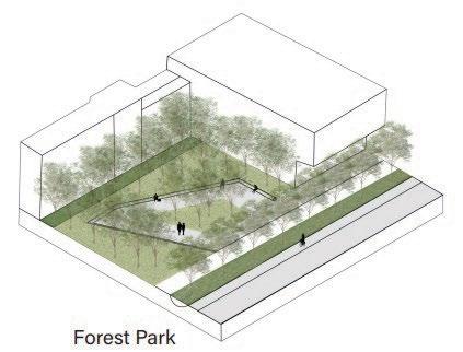


 Stormwater Park Forest Park
CENTRAL SPINE AND ZONE OF LOCAL BUSINESSES

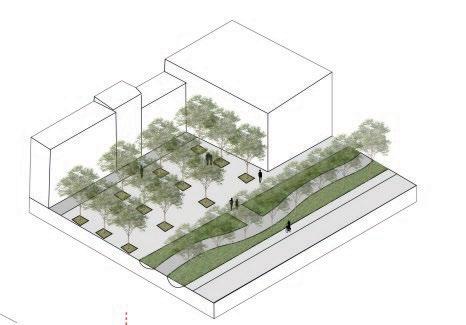


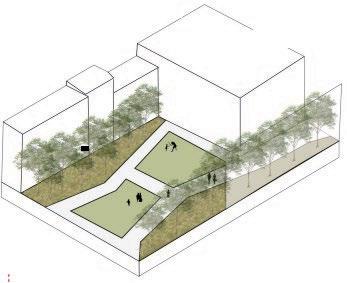 Plazza Park
Kids’ Park
hybrid industry and live/work
To redensify and redevelop the area, a new typology industries with options for live/work units as a response challenges of affordability
The aim of this hybrid district is to provide options for and upcoming industries to adapt to the changing requirements and accommodate flexible options like cells, maker spaces, office spaces and retail industries modulated
The marshland surrounded by the industrial belt is a means water but also integrate the lowlands actively into the year round active public space with varied uses through and creating and intimate, interactive experience through


48’-0” main road 60’-0” building access for services industry + live work district INDUSTRY
APARTMENTS 74 UNITS
STUDIO
APARTMENTS 56 UNITS LOFTS 84 UNITS marsh depression marsh path path prototype
DUPLEX
live/work disrict
typology of hybrid response to the in the area.
the existing changing spatial like incubator that can be modulated with time. means to clean the idea of a the seasons through the site.
wetlands as a connective tissue
Public Platforms connected to the courtyards by a series of wetlands as well as cycle tracks as a link to the bike bridge
living units
A combination of market rate/ affordable units for small families and young professionals above the industry belt by modulating their ground plane
HYBRID INDUSTRIES
Zone of Light Industries with Incubator/ Co-working spaces on the lower floors that open to the courtyards with more intimate, natural experiences as compared to the rear sides that are meant for services


TOTHECENTRALSPINE T K E BR I D G E NWINDUSTRIALSTREET marsh depression
06
srijan: an integrated textile art centre, rajasthan
Undergraduate Thesis 2019
Individual Academic Project, Jan - July 2019
Top 10 Projects of the year
Guide: Prof. Sujay Sengupta
Location: Bagru, Rajasthan, Area: 11.8 acres
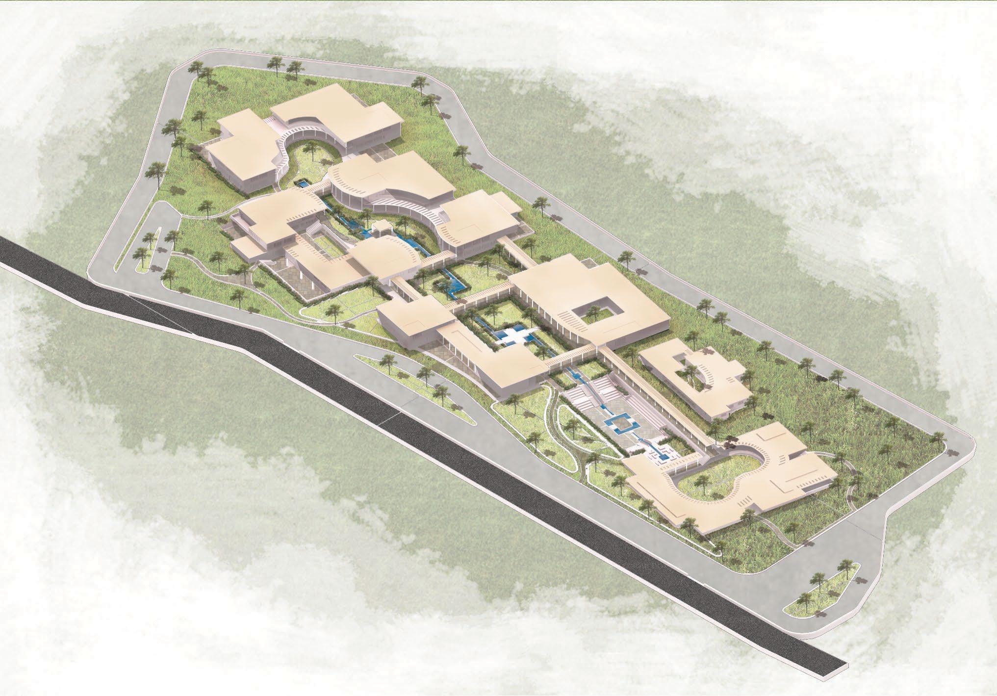
Srijan means to create, and in the contemporary world, it implies experimenting with age old traditions and re-interpreting them in coherence with the upcoming trends, to initiate the ethical re-birth of dying artforms to define a new design trend.
The project aims to help rural artisans to align their traditional skills with the contemporary design trends, to use their precious artform as a potential source of employment and drive the paradigm shift back to the village.
Role: Conceptual Framework Plan, Campus Planning and Design, Conceptual Drawings and Renderings, Programmatic Design

BAGRU
BAGRU
The village of Bagru is located on the Jaipur - Ajmer Highway and lies at a distance of 32km from the Jaipur city. The site had been earmarked for the National Employment Bureau’s Redevelopment proposal but had never been built.
The village Bagru is located on the Jaipur - Ajmer Highway, through the NH-8 and lies at a distance of 32km from the Jaipur city.
The proposal is based for the artisans of the Chhipa Mohalla, which boasts of the Multi generational involvement of the traditional community comprising of Chhipas (Printers), Rangrez (Dyers) and Dhobis (Washermen) and used to be a hub for Fabric printing and hand crafted textiles ever since the Mughal era.
The proposal is based for the artisans of the Chhipa Mohalla, in the village Bagru, which boasts of the Multi generational involvement of the traditional community comprising of Chhipas (Printers), Rangrez (Dyers) and Dhobis (Washermen) and used to be a hub for Fabric printing and hand crafted textiles ever since the Mughal era.
But due to the lack of appreciation and support, the art stands neglected as most of the commercial activity is restricted to the backyards of the residential quarters.
But due to the lack of appreciation and support, the art stands neglected as most of the commercial activity is restricted to the backyards of the residential quarters. And most of the younger generation have moved to neighboring cities for better jobs and apportunities, raising the threat of abandonment for the craft.
The site is located on the periphery of the settlement, along the upcoming RIICO Industrial Area and surrounded by the villages Paldi Parsa and Chirota, but there is no built context as such, the only being a public school and a restaurant.


The site is located on the periphery of the settlement, along the upcoming RIICO Industrial Area and surrounded by the villages Paldi Parsa and Chirota, but there is no built context as such, the only being a public school and a restaurant.
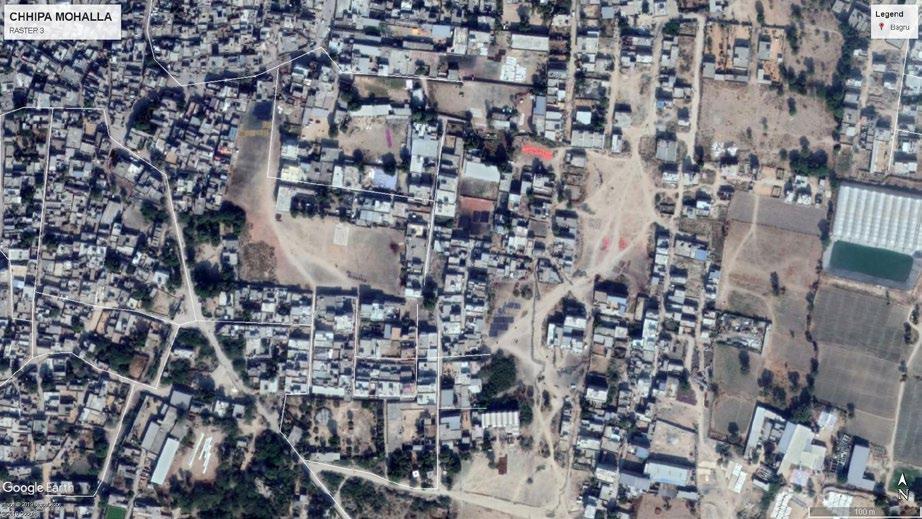
settlement pattern
settlement pattern


density pattern / printing units open / community spaces nodes of activity
density pattern / printing units open / community spaces nodes of activity

Photograph, Village complex, Bagru



This block is the main design centre for the complex closed chain production of , from weaving to sewing with collaborating artisans across different fields of thought.




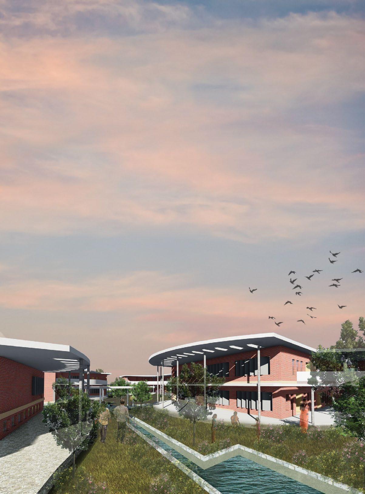

 Illustration, towards the entrance of the Production Block
apparels printing
applique


accessories
printing studio
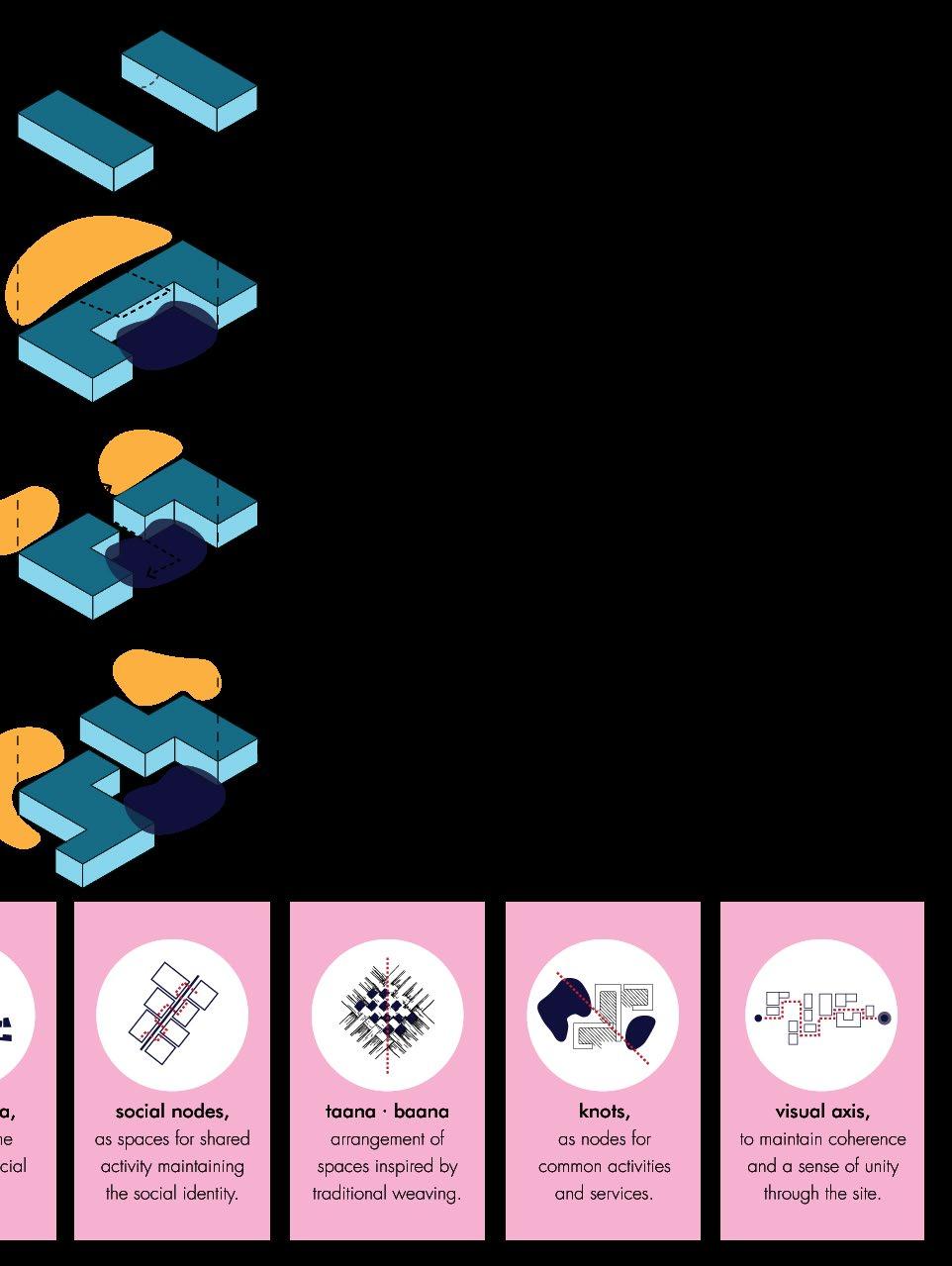
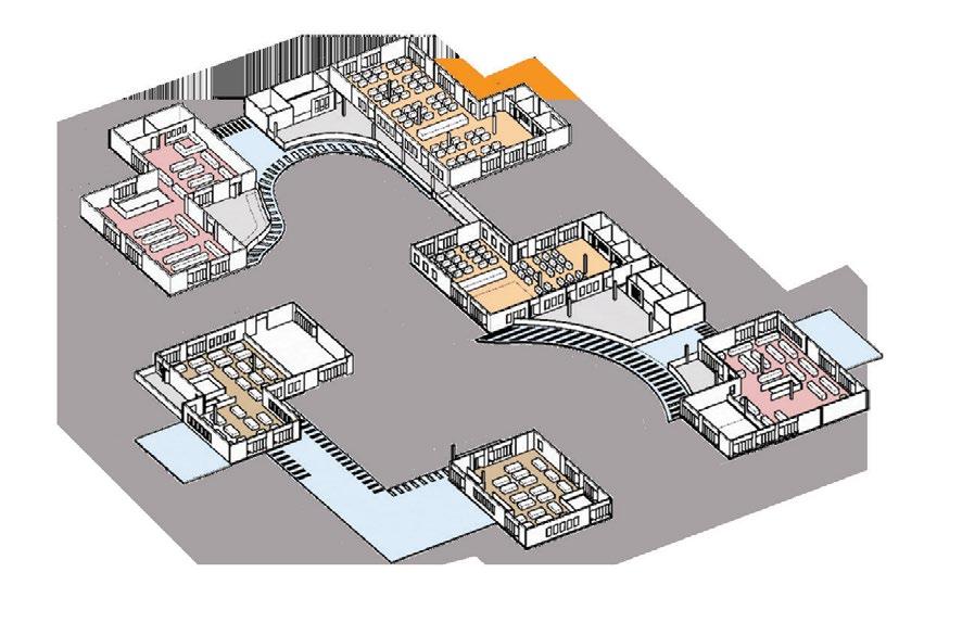
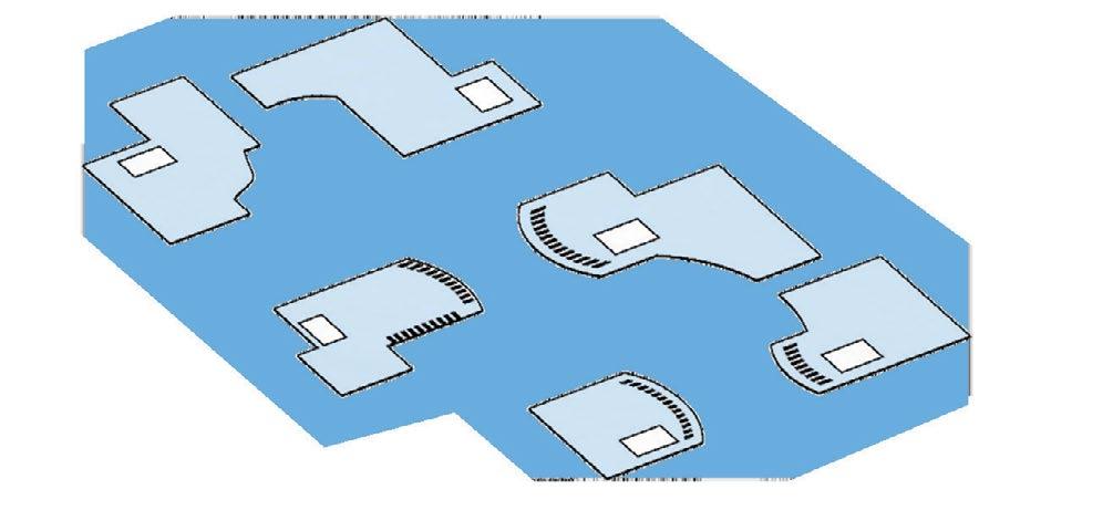
This unit comprises of three facing blocks housing the key functions of weaving, printing and sewing arranged in linear blocks connected through a rhythmic collonade
The Blocks are arranged closely to resonate with the character of the “typical mohalla”, so as to generate a sense of belonging and familiarity
Each floor is complete with their own designated spaces for work as well as design discussions and ample storage. The upper floors are meant for experimental design and training, while the lower floor is meant for “collaborative” production
apparels printing studio
day care centre
sewing centre
applique work studio
printing innovation centre
weavers innovation centre
weavers restoration floor
weaving studios
ACADEMICS BLOCK
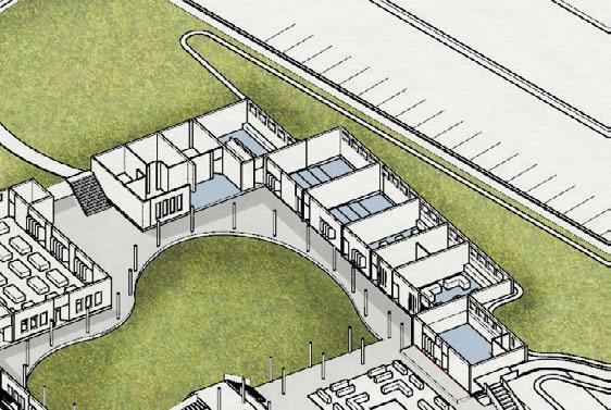
This space is meant to be a shared space among students to understand the technical skills of the craft and learn about the business skills of modern trends to keep pace with the changing global trends.


_skill centre
_conventional training
_interactive learning
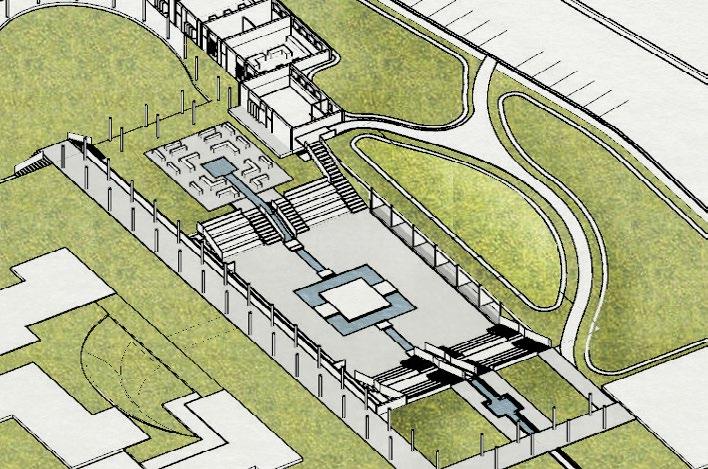
The block is sunken to explore the passive cooling strategies due to thermal mass, making it a flexible, open space.
The Academics block has been linked to the activity area for visitors to act as an interactive space for the students and guests especially during annual symposiums.
sewing studio
amphitheater
activity area
-3.75m
+0.00m
-2.00m
café
weaving and printing studio
research lab lecture rooms faculty area + principal’s office
computer lab


The seemingly linear block opens into an inner courtyard reached through an organic transition space to bring in an element of human chaos among the rigidity, which reflects the basic intent behind the space.
The Academics block is directly accessed by the students through an entrance from the parking, and has a separate route for visitors through the main entrance pavillion, so as to filter privacy

cross section throught the classrooms
An Illustration representing the transitional character of the central courtyard in the Academics Block
07
(re)defining the heritage sector twenty two Academic Project, October 2018
URBAN DESIGN STUDIO INDIA
Instructors: Prof. Parmeet B, Anu S
Team: Ravleen K, Sukriti G, Supreet K
Location: Chandigarh, India
Sector 22 has always been a hub of public activity ever since its conception as a transition sector between the CBDs of sector 35 and 17. The sector stands testimony to the masterstrokes of the creators Corbusier, Pierre Jeanneret, Maxwell Fry and Jane Drew and is still deemed as a significant part of Chandigarh’s heritage network.
Through this studio, we aim to revive the essence of the sector plan as a microcosm of “comprehensible” urban living
Role: Conceptual Vision Plan, Urban Design and Mapping, Market Redevelopment Plan, 2D and 3D drawings


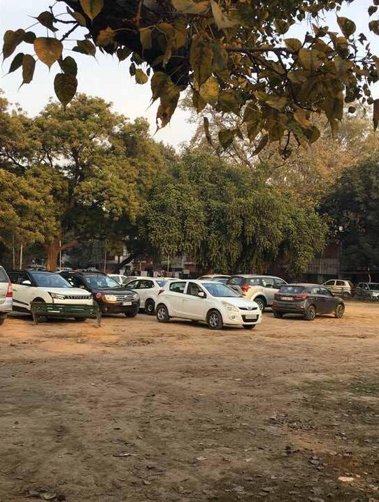
1 Community Clinic
2 Shastri Market (Local Vendor Market)
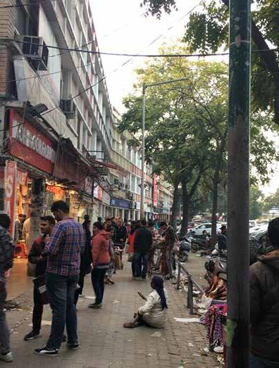
vendor activity with no amenities to cater to the large inflow of people adding to the mess and chaos.
A B C D C D URBAN MORPHOLOGY ACTIVITY PLAN 5 5 8 2 3 4 5
CONFLICT POINTS
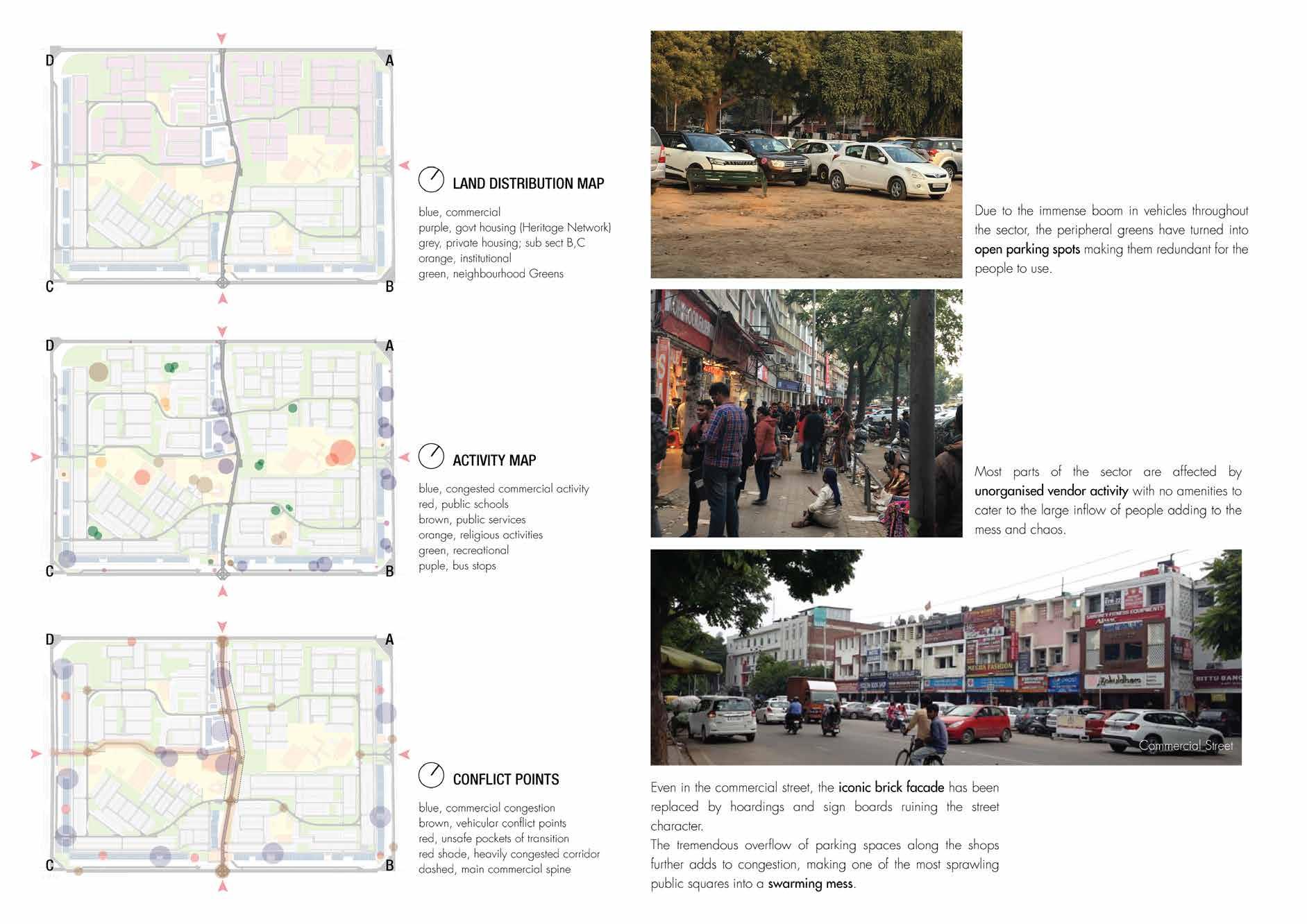
Even in the commercial street, the iconic brick facade has been replaced by hoardings and sign boards ruining the street character.
The tremendous overflow of parking spaces along the shops further adds to congestion, making one of the most sprawling public squares into a swarming mess.
1 6 7


INTENT
To reorganise the neglected greens providing the residents with a recreational haven consisting of inter-linked spaces for different activities throughout the sector. This subsidiary spine is also a means of de congesting the main spine by re-distributing the functional organisation along the lateral edge.
Landscaped gardens
Public School Flea Vendors Food Stalls Pet Clinic Kiran Theater
Fragrance garden
Garden of Senses
Sector 35
Sector
35
Public School Flea Market Parking Food Street Pet Clinic Cycle Track Vending Kiosk Kiran
Vendors’ Mkt Parking Shastri Market Park Buffer Patch
Family Park Shastri Market Parking Public Piazza Vendors’ Mkt Fountain

EXISTING STRUCTURE PLAN
The green patches adjoining the bus stops, behind the schools and main market lie mostly neglected, acting as buffer separators between the sub sector blocks. The area in front of the Shastri market and pet clinic has become a sprawing mess with overflowing vendor activity.

PROPOSED STRUCTURE PLAN
We intend to combine the redundant green patches and design a sector level walkway, connecting the adjoining commercial hubs, sectors 17 and 35 through a transition belt, formalising the structure of the Shastri Market to reorganise the chaotic nature of the complex.
Nehru Park
Sector 17 Sector 17
Buffer Patch
Kiran Theater Nehru Park Kids’ Play Arena
Public School
Public School Tube Well
Tube Well
COMPOSITION
The spine is re-organised to carve out spaces for interaction and relaxation. Starting from the commercial belt along the Dakshin Marg, the primary phase of the sub-spine extends upto the Nehru Park spanning across the sub sectors C and D, covering the Shastri Market belt and the Kiran Theater Plaza, which are the most congested and chaotic parts The sub-spine consists of a series of themed gardens like the garden of senses, fragrance and parks for different age groups with activities for walkers, joggers and families.
The Shastri market is segregated into two levels of spaces based on the activity, the upper layer for the booths and formal shops and the lower plane for the vendors.
A separate area is dedicated for the food vendors and informal hawkers who form a major part of unorganised vendor activity for the sector.The whole strech is linked by a common pedestrian pathway. The Kiran theater plaza looks inwards, creating green niches for vendors and informal activity.
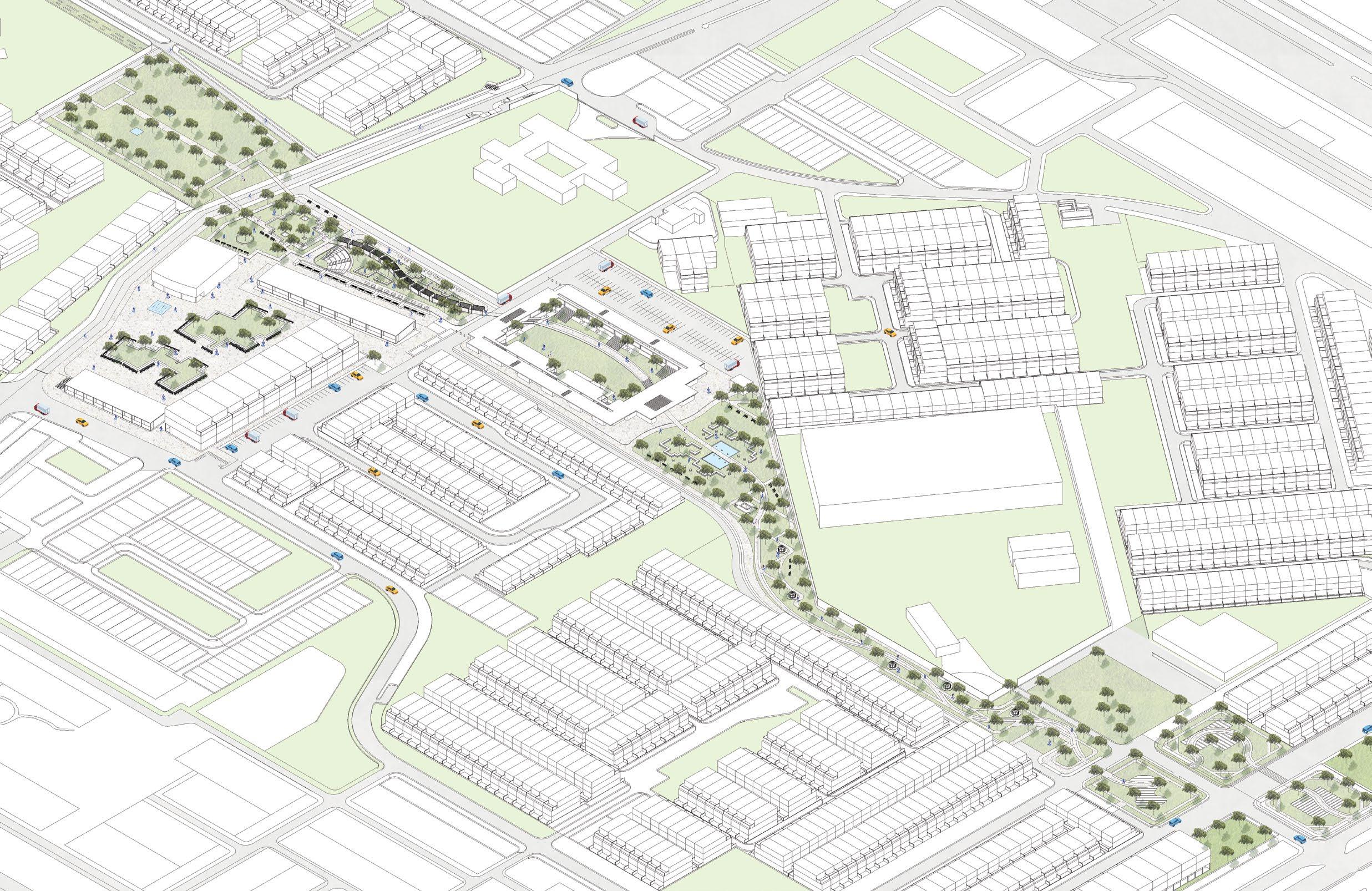 Govt Pet Clinic
Shared Street
Vendors Street
Shastri Market
Food Street
Kiran Theater
Plaza
Nehru Park

Market
Family Park
Fragrance Garden
Garden of Senses
Starting Point
Govt Senior Secondary School


To help in circulation, dedicated cycle tracks and vending units have been installed for people to use at a policy level to make the sector easily accessible. pedestrian culture of the sector, intersperced with social pockets, and make lively, accessible and comfortable haven
08
LOUIS ISADORE KAHN TROPHY
SABALI KUND VAV
All-India Students Competition Entry Group Project, National Winning Entry, January 2017
Team: Sukriti G, Gurkirat S, Karan B, Daman D, Akriti M
Location: Sabarkantha, Gujarat
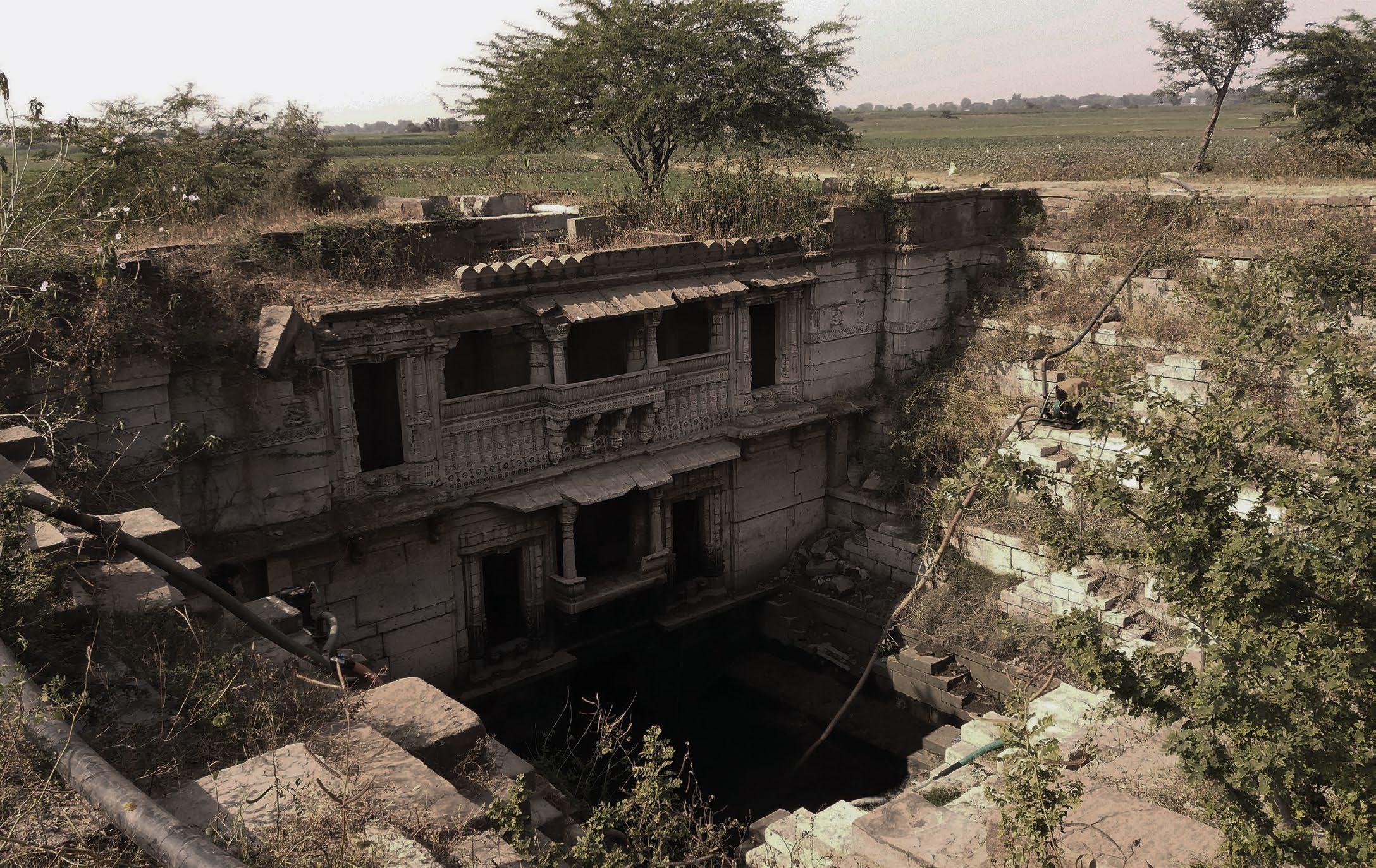
The Louis Isadore Kahn Trophy is an annual trophy organised by the National Association of Students of Architecture in India, that aims to document pre independence structures and cultures that have played an important role in shaping the timeline of their realm.
We chose to document the stepwell at Sabali, a tiny village near Ahmedabad, a one of its kind typology of Hybrid Wells that amalgamated the functionality of a (step)Well along with the sanctitiy of a (step)Pond.
Role: Team Leader, Site Selection, Research and Analysis, Physical Documentation and Mapping, Presentation Drawings


09
experimenting with the iconic Chandigarh aesthtic
the Tapered House
Professional Project, Studio Mohenjodaro
October’19 - July’21
Team: Eshita V, Sukriti G, Tarunpreet Singh B
Location: Sector 35, Chandigarh
Area: 5500 sq.ft, Status: Completed, July 2021
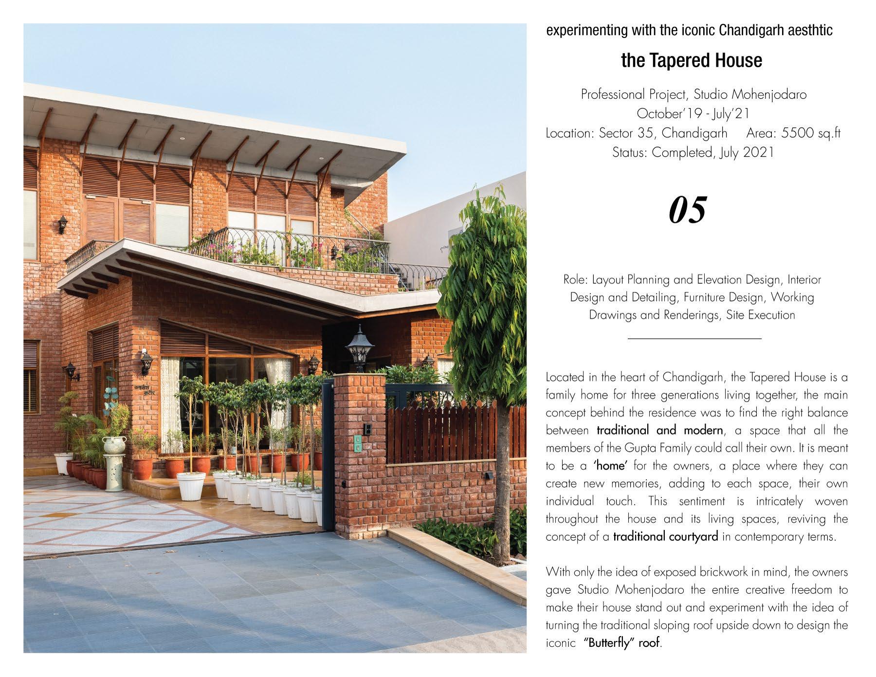
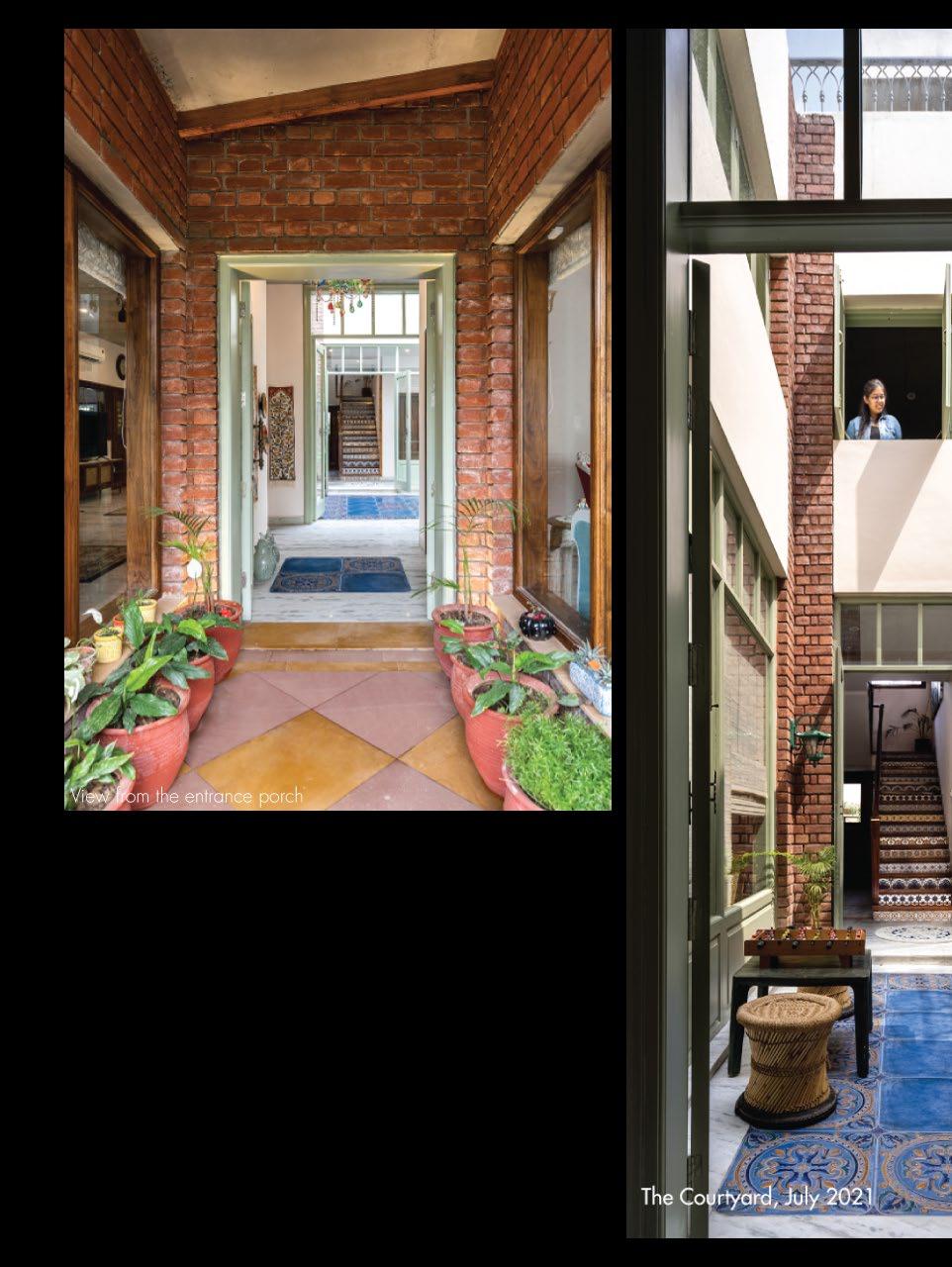
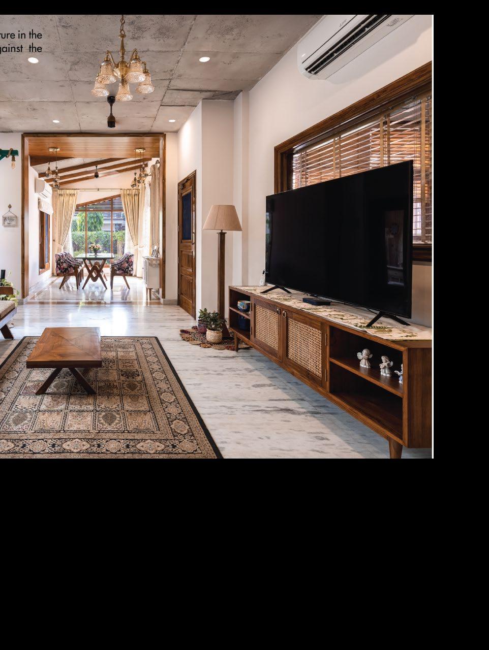
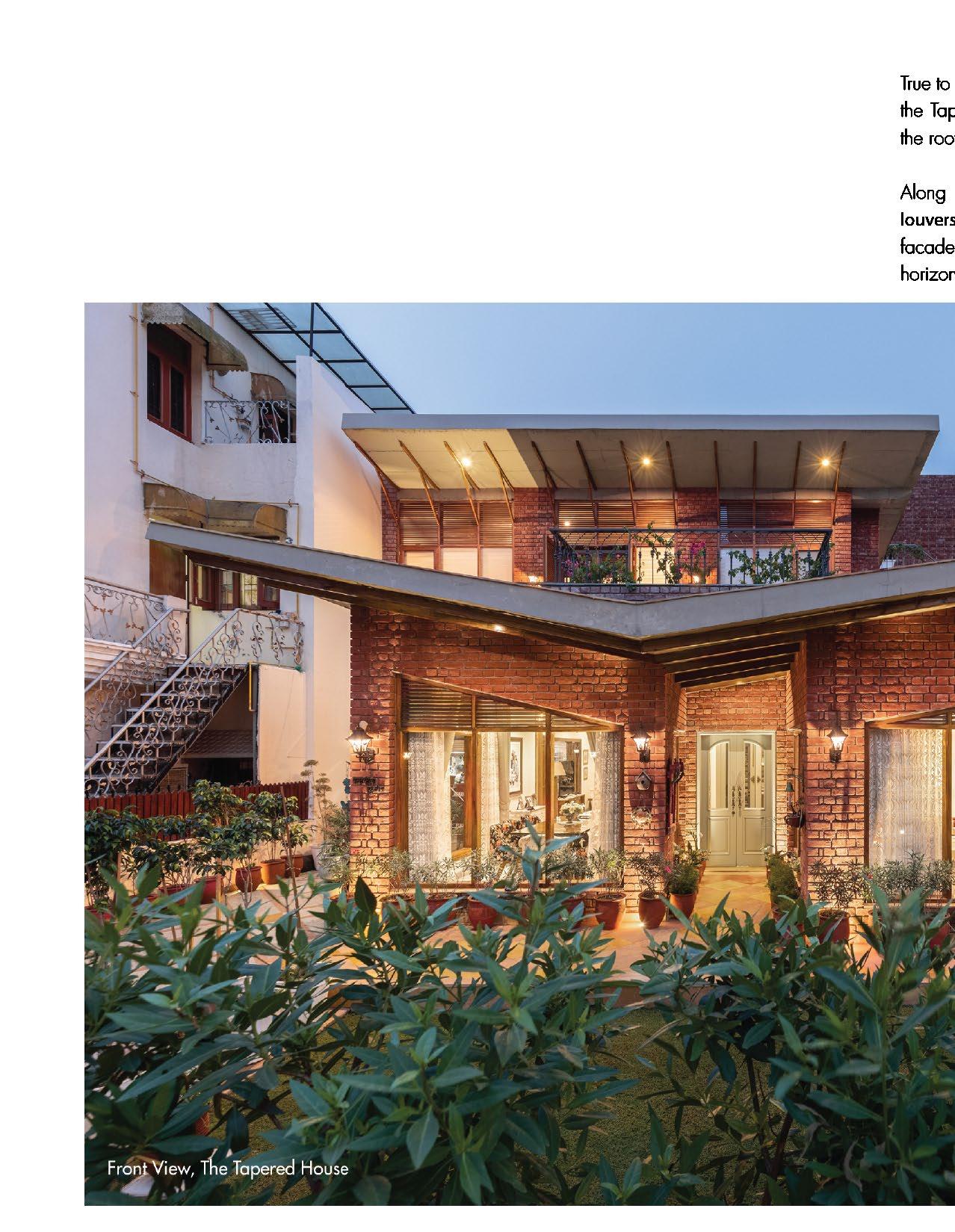
Located in the heart of Chandigarh, the Tapered House demands attention but does so subtly, catching the eye of the passer-by, more by force of its presence, than by loud ostentations.
Designed as a family home for three generations living together, the main concept behind the residence was to find the right balance between traditional and modern, a space that all the members of the Gupta Family could call their own.
Role: Layout Planning and Elevation Design, Interior Design, Furniture Design, Working Drawings and Renderings, Site Coordination and Execution




Sukriti Gandhi
Urban Designer
MS Urban Design’24
The University of Texas in Austin sukriti.gandhi@utexas.edu
+1 737 328 5323
// Education
2022, MS Urban Design, 2022 - 2024
The University of Texas in Austin Current GPA 3.84
2019, Bachelor of Architecture (10 Semesters)
Chandigarh College of Architecture, India First Division with Distinction
2017, Bachelor of Building Sciences (6th Semester)
Chandigarh College of Architecture, India First Division (Part of the main degree)
// Skills
Softwares AutoCAD Adobe Illustrator
SketchUp
Adobe Photoshop
Rhino Adobe InDesign
Revit Microsoft Suite
I am passionate about experimenting with the paradigms of space making and placemaking in the modern, urban context, trying to understand and impact the changing relationship of people and their surroundings
// Practical Experience
Urban Design Intern, Lionheart Places
Austin, TX
UD Presentations and Proposals for the redevelopment of mixed use single family, multi-family and commercial neighbourhoods
Urban Design Intern, Urban Idea Lab Boston, MA
Jan’24 - Ongoing
Analysis and Proposals for transit, roadway and infrastructural projects and public transit improvements in Boston
Graduate Research Assistant, Dean Almy
UT Austin
May’23 - December’23
Fall’23
Spatial and Demographic Analysis and Research with data visualisation for growth opportunities around Austin
Project Architect, The Planners Group Chandigarh, India

Lumion Enscape
ArcGIS (beginner)
Physical Documentation
Model Making
Laser Cutting
// Professional Affiliations
Indian Council of Architecture CA/2020/118664
Green Rating for Integrated Habitat Assessment Council Student Member, GRIHA India (Certification Track)
National Association of Students of Architecture, India
Jul’21 - Aug’22
Conceptual designs, working drawings, on-site coordination for residential, commercial, highrise and institutional projects.
Design Consultant, poojabhagat architects + planners
Jan’22 - Aug’22
Design proposals and 3D visualisations for residential projects based in California
Senior Architect, Studio Mohenjodaro Chandigarh, India
Aug’19 - Jun’21
Design proposals, working drawings and on-site coordination for residential and commercial projects.
Editorial Writer, Re - thinking the Future, Magazine
Jun’21 - Aug’22
Competitions
ULI Hines Urban Design Competition 2023, Jan’23 Design an urban re-development program for a large-scale ex Naval Base in North Charleston
Notable Mention, National Jury ULI Foundation
Panjab Raj Bhawan Competition, Oct’18
A Multi Facility Convention Centre at the Governor of Chandigarh’s Residence
Top 3 selected entries
All India National Design Competition, Mar’16, National Association of Students of Architecture
“The Eye”, a witness to the journey of Dharamshala
Shortlisted Entry for the National Top 17
// Courses and Workshops
Socially Responsible Real Estate Development
May - August 2023,
An online course curated by The Samuel Tak Lee MIT Real Estate Entrepreneurship Lab and edX)
To understand the Environmental and Social impacts of large scale real estate developments on stakeholders through collaborations with various groups to ensure long term sustianabilty and profitability.
Manual Documentation and Drafting Workshop Workshop Mentor
December 2018
Provide a hands-on experience focussing on honing the skills of physically documenting a site and representing it through manual drafting techniques, as compared to the changing measures of the digital era.
Indian Association of Lighting Designers Workshop
February 2017
Organised on the CCA grounds as a measure to design temporary installations across the campus to revive the cultural hotspots through innovative and senstive lighting.
// References
Prof Dean Almy, Program Director
Graduate Advisor for Urban Design, UT SOA
Contact: dja3@utexas.edu
The House 2.0, Mar-Jun’21
An International Architecture Competition looking at the re-defined concept of living post the pandemic.
Louis I. Kahn Trophy, Jan’17
National Association of Students of Architecture
Documenting the cultural heritage of the Forgotten Stepwells of Sabali, Gujarat
Citation 1, Trophy Head and National Winners
Concrete Actions Studio, Nov’15
Re-defining the peripheries of the PEC Campus, with Ar. Mauricio Lizuriaga
Selected Entry
Architectural Imagination
April - June 2020,
A ten module online course curated by the Harvard GSD and edX)
To understand the concept of Architectural imagination and expression in terms of the changing paradigms of global technologies and design vocabularies as an implication of the deepest social and cultural values of the reigning epochs in the timeline of definitive architecture.
Le Corbusier Centre, Installation Workshop
March 2018,
Organised by the Chandigarh Lalit Kala Akademi “Threads of Change”
To celebrate the Life and Works of Pierre Jeanneret.
Installation Workshop at the Open Hand
October 2016
Organised by the Chandigarh Lalit Kala Akademi “le corbeau noir”
Exhibited at the Open Hand Monument and the Chandigarh Carnival 2016.
Don Kindsvatter, Senior Urban Designer Urban Idea Lab
Contact: dkindsvatter@urbanidealab.com
//


 The shared pedestrian corridor from City Hall Park to Yesler Plaza leading to the Greenway Commons also hosts the Annual Block Party and Street Fairs
Terrace Street
Rendering by Clevan R
Chyenne, 36 NGO Worker
Chris, 34 Small Business Owner


 Kelly, 29 Resident
Dre, 41 Student at the Catalyst


 New Innovation district to bridge the industrial divide
London’s first energy positive district
New neighbourhood leveraging its relationship to the context based on the values of innovation and research
Adaptively reusing the existing warehouse infrastructure into a biogas plant
Laying the solar and wind farms along the elevated rail lines
St. Pancras Gardens
Oakley Square Gardens


 millbrae library
MILLBRAE CITY HALL
BROADWAY STREET COMMERCIAL STREET
VETERANS’ COMMUNITY
MILLBRAE STATION AREA
MILLBRAE TRAIN MUSEUM
MILLBRAE HISTORY WALK
EL CAMINO
BAYSIDE MANOR PARK


 Entry Plaza from the El Camino to Millbrae Central
Rendering by Vatsal Shah


 Stormwater Park Forest Park

 Plazza Park
Kids’ Park


 Illustration, towards the entrance of the Production Block
apparels printing
applique


 Govt Pet Clinic
Shared Street
Vendors Street
Shastri Market
Food Street
Kiran Theater
Plaza
Nehru Park


