October 2023
Central Hobart Plan (structure plan)
October 2023
Hobart City Council has endorsed this draft plan for community consultation.
Accessibility:
This document is located on yoursay.hobartcity.com.au where it is also available as a Word, accessible PDF, etc.
On request it can be provided in another accessible format such as enlarged print or audio version. In addition, due to the important information contained in the graphics of the document, please contact us if you would like these to be explained at:
Customer Service Centre
16 Elizabeth Street, Hobart 03 6238 2711 coh@hobartcity.com.au
Disclaimer:
This document is provided for information and for public engagement. While every effort has been made to ensure accuracy and completeness, the City of Hobart does not claim the document to be free of errors or omissions, and disclaims any and all liability for any harm or damage to any person or entity through action or omission based on its contents.
Copyright:
Unless otherwise stated the photos and illustrations in this document have been supplied by the City of Hobart or MGS Architects.
Visit yoursay.hobartcity.com.au
Contents Foreword 1 Central Hobart Plan snapshot 2 Part one: Introduction 4 1.1 The Central Hobart area 6 1.2 The document structure 8 1.3 A vision for Central Hobart 10 1.4 Drivers for change in Central Hobart 12 1.5 Strategic context 14 1.6 Regulatory framework 16 1.7 Central Hobart Plan principles 18 1.8 What we’ve heard so far 20 Part two: City Shaping Framework 22 2.1 Goal one: A captivating and dynamic capital city 24 2.2 Goal two: Public spaces that engage and create joy 30 2.3 Goal three: Sustainable buildings with character 36 2.4 Goal four: Integrated and accessible movement networks 40 2.5 Goal five: An investment ready and innovative city 46 2.6 Central Hobart precincts 56 Part three: Urban Design Framework 78 3.1 Purpose 79 3.2 Vision and principles 80 3.3 Central Hobart’s defining elements 82 3.4 Built form and design 88 3.5 Movement 102 3.6 Public realm 110 Part four: Making it happen 122 4.1 Overview 123 4.2 Proposed actions 124 Part five: Appendix 132 5.1 References 133 5.2 Background documents 134 5.3 Glossary 135

Acknowledgement of Country
In recognition of the deep history and culture of our city, we acknowledge Tasmanian Aboriginal people as the Traditional Custodians of this land. We acknowledge the determination and resilience of the Palawa people who have survived invasion and dispossession and continue to maintain their identity, culture and rights.
We recognise that we have much to learn from Aboriginal people today, who represent the world’s oldest continuing culture. We pay our sincere respects to Elders past and present and to all Aboriginal people living in and around Hobart.
Foreword

Central Hobart is the beating heart of the Island’s capital city. From health care to dinning, from shopping to theatre, from work to play, from learning to living – these bring the city to life.
Hobart has experienced steady population growth over recent years and is expected to increase even further. The city is on the verge of a period of transformation, with new opportunities and new challenges. Charting a course for the future of a city is the most important task of local government. As city managers we want to ensure Central Hobart develops in a way that respects Hobart’s character and but also taps into its creativity and energy.
Several years ago, the community’s passion for their city’s heart was stirred by a proposal for a 120m skyscraper on Davey Street. It raised concern that Hobart didn’t have clear enough planning rules to guide appropriate development into the future. Following a debate about height limits, the Council agreed to develop a Central Hobart Precincts Structure Plan (Central Hobart Plan). Working with the Tasmanian Government, the community and business, this plan will guide how the area should develop sustainably over the next 20 years.
After years of consultation and hundreds of conversations with individuals, community groups, institutions, and government to develop a shared vision for our city centre, I am proud to present the Central Hobart Plan.
The Plan identifies the unique attributes that distinguish Hobart’s centre from other capital cities in Australia such as its human-scale, heritage buildings and the sightlines to kunanyi / Mount Wellington.
It encourages well-designed buildings that respond to our City’s character and proposes maximum building height limits that will help provide clarity and certainty for the community and developers It provides guidance on land uses we’d like to see and the kind of public infrastructure needed to sustain a more vibrant city, with more open space and greenery to ensure the city remains an appealing place to live. The plan also outlines the strategic directions for public and active transport to make a more vibrant city centre still easy to get to and move around.
Creating a forward-thinking strategic plan for a specific part of a city is the first of its kind in Tasmania and a model that the City of Hobart intends to apply to other neighbourhoods to ensure our local communities thrive into the future.
We look forward to continuing to work with the community to make this exciting plan for our Capital City centre come to life in the years to come.
Anna Reynolds Lord Mayor
Central Hobart Plan 1
Central Hobart Plan snapshot
Vision
The Plan identifies and supports Hobart’s Community Vision, identity, goals and aspirations into the future (see section 1.3).
Future skyline
Currently there is no maximum height limit for development in Central Hobart included in the Planning scheme. The Urban Design Framework within the Plan provides certainty about maximum building heights, acknowledges the importance of view lines and heritage, and allows for Hobart’s growth needs. (see section 3.4).
Design excellence
The Urban Design Framework provides clarity for the community and developers regarding the priorities for Central Hobart, supporting the decision making process and enabling best-practice development to deliver built form and public realm, which includes parks, streets and other public areas, outcomes to grow a vibrant, liveable city that responds to the existing character (see part 3).
Greening and resilience
With a changing climate existing open spaces need to be protected and the creation of new open spaces becomes even more important for our local environment. Opportunities for improved waterfront and Hobart Rivulet access, street greening and new urban green spaces are identified in the Urban Design Framework (see section 3.6).
Movement
The Plan provides for streetscape upgrades for better movement, and improved amenity and street vibrancy. It recognises the key connections between a range of public transport modes, addresses more efficient car parking, and aims for greater pedestrian focus in Central Hobart (see section 3.5).
City of Hobart 2
Housing
Housing supply and housing affordability have become critical issues in Hobart. The Plan sets out recommendations regarding the supply of additional dwellings in Central Hobart (see section 2.1). It also identifies the Innovation Precinct as a suitable location for key worker housing (see section 2.6).
Economy
The Plan recognises Central Hobart as the economic centre of the state and contains recommendations for that key role into the future (see section 2.1). The Innovation Precinct, as an area of potential change adjoining the existing CBD, is noted as a desirable location for creative and innovative businesses (see section 2.6).
Placemaking
The Urban Design Framework includes recommendations to improve the amenity of Central Hobart by extending the building frontages that activate the street through increased glazing at ground floor, expanded and easier to apply guidelines to protect the solar access to streets and open spaces. (see section 3.4).
Making it happen
The Plan contains a list of proposed actions and the main mechanisms for delivering them to establish a clear blueprint of how the vision will be delivered (see part 4).
As the heart of the state’s capital, Central Hobart will continue to be a key destination for retail, government services, culture, the arts, and entertainment.
Central Hobart Plan 3
Part one: Introduction
City of Hobart 4
Part one: Introduction
In Part One of the Structure Plan you will find the vision, key drivers of change and a summary of how the plan was developed. The strategic context for the Structure Plan is stepped out and has formed the basis of the principles and will be the framework for the implementation of the Structure Plan. A summary of engagement has also been included and highlights the key findings of what we have heard from the community.
The following sections are included in Part One:
Introducing the Central Hobart area
Document structure and how the plan was formed
A vision for Central Hobart
Drivers for change in Central Hobart
Strategic Context
Regulatory Framework
Structure plan principles
Future planning scheme
What we heard
City shaping goals
The Structure Plan is framed around delivering on 5 key city shaping goals. These goals are referenced through the document and are key to the understanding of the Structure Plan. Part Two of the document details each goal, related strategies and actions for delivering the goals.
Central Hobart City shaping goals:
1.
5.
A captivating and dynamic
Public spaces that engage and
joy
Sustainable buildings with character
Integrated and accessible
capital city 2.
create
3.
4.
movement networks
An
Central Hobart Plan 5
investment ready and innovative city
1.1 The Central Hobart area
Central Hobart is the primary activity centre and the hub of commerce, administration and cultural activity for the southern Tasmanian region and a significant driver of Tasmania’s economy. It is strategically linked to Greater Hobart, particularly through the Elizabeth Street – Main Road corridor, which is identified as the Northern Suburbs Transit Corridor in the Hobart City Deal. It also adjacent to the iconic waterfront and Macquarie Point, a key development area for the State.
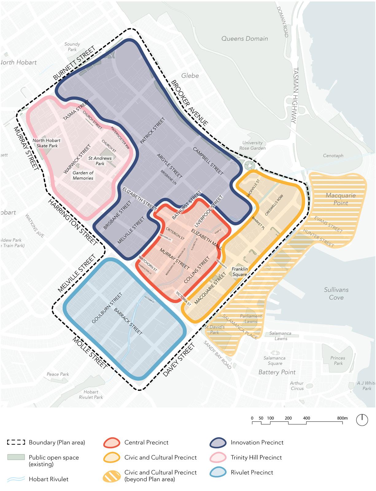
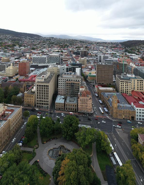
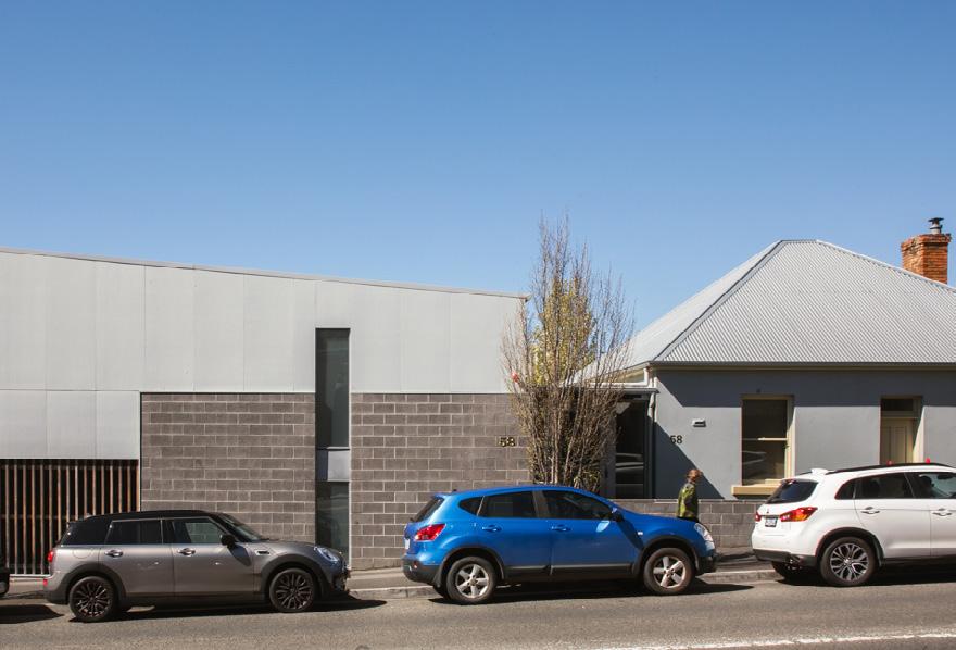
The Central Hobart Plan covers 64 city blocks bounded by Davey Street, Brooker Avenue, Burnett Street, Murray Street, Harrington Street, Melville Street and Molle Street. The Hobart waterfront area has not been included as it has limited capacity for new development, aside from Macquarie Point, which is subject to its own planning process.
Central Hobart can be thought of as a collection of five distinct places, or precincts. Each has its own potential, character and identity arising from topography, land use patterns, proximity to complementary uses, building types and forms, their public realm, including the streets, natural attributes and landmarks.
The Central Precinct is sometimes also referred to as the CBD. The character of the Civic and Cultural Precinct extends into Hobart’s waterfront, beyond the Study Area of the Plan, and will part of future planning and design work.
Some of the precincts are likely to experience significant change in the future, in those cases the Plan provides place-specific objectives and actions.
The Plan identifies areas within walking distance of the CBD that could support increased residential and mixed use development.
The character of the city is highly valued by the community and visitors. The Plan provides guidance and clarity on preferred development heights and built form, based on sound urban design and planning principles, and consideration of valued local character. Importantly, the Plan helps integrate current City of Hobart strategies and policies for the Central Hobart area.
The Plan introduces measures that protect Hobart’s unique character and heritage values, provide additional housing, add more trees and open spaces, and create employment.
As Tasmania’s capital, Hobart has a role in providing an innovative, attractive and liveable destination that retains the city’s sense of place.
Part one: Introduction
City of Hobart 6
Central Hobart Plan 7
Figure 1. Central Hobart area and precincts
1.2 The document structure
The Central Hobart Plan comprises two interrelated parts: The City Shaping Framework and an Urban Design Framework.
The City Shaping Framework
This part sets out the vision for Central Hobart and its precincts. It is organised into five city shaping goals:
1. A captivating and dynamic capital city
2. Public spaces that engage and create joy
3. Sustainable buildings with character
4. Integrated and accessible movement networks
5. An investment-ready and innovative city
The City Shaping Framework describes the intended objectives and actions for each of the five Central Hobart precincts:
Central Precinct
Civic and Cultural Precinct
Innovation Precinct
Trinity Hill Precinct
Rivulet Precinct
The Urban Design Framework
This part provides the built form guidelines that support the Plan. It details the urban design strategy and the resultant built form, amenity and public realm outcomes for the Plan area that will help deliver the overall vision for Central Hobart.
It seeks to deliver on the five city shaping goals through innovative built form, design excellence, an enhanced mobility network and a high-amenity public realm:
1. Built form and design
2. Movement
3. Public realm
Central Hobart Plan (structure plan)
Implementation Plan (next stage)
Part one: Introduction
Shaping Framework City of Hobart 8
Design Framework
City
Urban
How the draft Plan was formed
2018–2019
Planning and baseline analysis
March 2020
Baseline Report released and stage 1 community engagement
February 2020
Project paused due to COVID-19
Early 2021
Additional background studies, considering COVID-19 impacts
Late 2021 through 2022
Discussion Paper released and stage 2 community engagement
Early to mid 2023
Central Hobart Plan draft released and stage 3 community engagement
Late 2023 and beyond
After approval implementation commences
Central Hobart Plan 9
1.3 A vision for Central Hobart
Central Hobart capitalises on its magnificent natural setting and rich cultural and built heritage to mature as a world class, highly liveable and flourishing city showcasing the State’s cultural depth, wisdom, innovation and creative flair.
The draft vision encapsulates where we want Central Hobart to be in 20 years. It identifies the unique attributes and opportunities that distinguish it from the other capital cities in Australia.
It draws on the 2018 Community Vision for the City of Hobart, which explores the unique identity of the city and what is important to hold onto as it grows.
It also draws on the Greater Hobart Plan, a 30 year vision developed between the councils of Glenorchy, Clarence and Kingborough, and Hobart and endorsed by the Tasmanian Government in 2022.
Part one: Introduction
City of Hobart 10
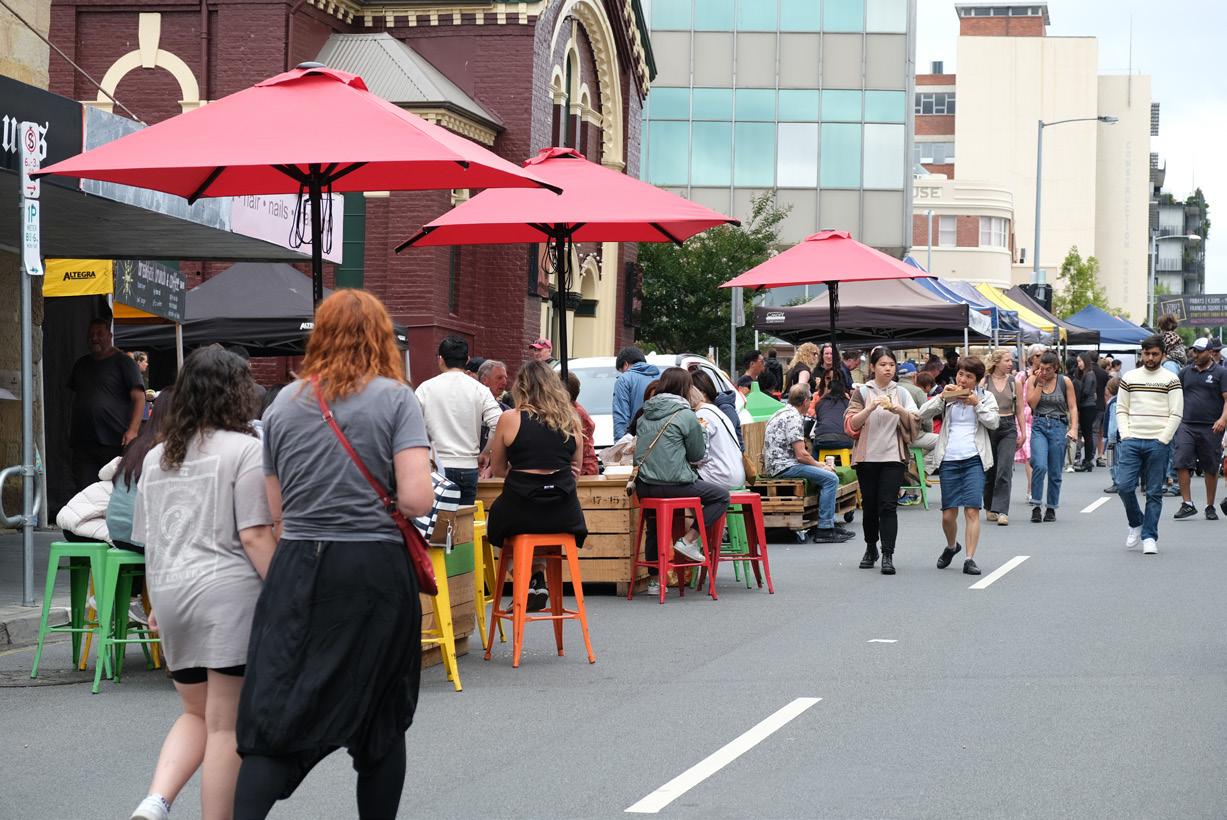
Farmer Gate Market held on Sundays in Bathurst Street
Future story
In 20 years, Hobart is a vibrant hub of activity. It is internationally celebrated for the integration of its distinctive built and natural heritage with new assets that strengthen its role as Tasmania’s innovative cultural, creative, educational and business capital.
It has a mix of medium-rise apartments and other housing options for different needs and incomes. These are intermingled with community spaces, workplaces, shops, galleries, recreation spaces, restaurants and cafes to create an inclusive and exciting place to live.
The knowledge economy in Central Hobart is thriving. A diversity of new spaces has encouraged businesses to start up, grow and evolve; innovation clusters have developed from the vibrancy of workers, creatives, academics and students living and interacting in the city.
The visitor experience is enhanced with excellent wayfinding, playful urban architecture, plenty of events, and great pedestrian links between the many attractions.
Strong support for the arts community has ensured that Hobart continues to attract international attention as a thriving cultural centre. A wide range of creative arts and events are strengthening communities, improving personal wellbeing, and injecting substantial financial returns to the local economy and the state.
A range of high quality community services and facilities are available. They address the needs of the growing and diverse community including those of the young, seniors, families and people with diverse cultural backgrounds.
Central Hobart Plan 11
1.4 Drivers for change in Central Hobart
The opportunities and challenges that are influencing change in Central Hobart have been addressed in the objectives and actions of the Plan. These drivers have been identified through extensive background studies and the phases 1 and 2 of the community engagement process.
Strategic drivers
Capacity to house more people
Central Hobart could accommodate an additional 7,000 residents over the next 20 years.
Strong interest in Hobart
Central Hobart is an increasingly attractive place to live, work and visit.
Housing supply and affordability
Housing stress is becoming more common and housing affordability has decreased.
Hobart’s uniqueness
Maintaining Hobart’s special sense of place, landscape and cultural heritage is an important community expectation. It is also fundamental to continue to attract visitors.
Adapting to climate change
Understanding how the changing climate is impacting the city, mitigate its impacts, and enable the community to prepare and respond.
Transport network solutions
A suite of solutions is needed to reduce the pressure on Hobart’s road transport network.
Infrastructure resilience
Vulnerability to natural and human threats highlights the need for coordinated planning.
Changing technologies
Rapidly changing technology is influencing the way we design and manage our cities.
Opportunity for innovation
The expansion of the Royal Hobart Hospital and the move of some the University of Tasmania’s functions into Central Hobart provides an environment for innovation, as well as opportunities for co-located research and development facilities.
Part one: Introduction
City of Hobart 12
Central Hobart – the next 20 years1
Residential demand
3,650 +7,000* Residents in 2021
Additional residents by 2041 (approximately)
2,280
+3,700*
Additional dwellings by 2041 (approximately)
* The 30 Year Greater Hobart Plan estimates approximately 10,000 new residents by 2050
Top employing industries
35,000 workers
+11,500 Workers snapshot
Additional workers by 2041
Floorspace demand
1.13million m2
Net overseas migration
+
382,000m2 floorspace demand in 2041 of occupied floorspace in 2020
Space at a glance
Gross Regional Product snapshot
The significance of Hobart in the state economy has been increasing steadily for the last 19 years rising from 21% in 2001 to 24% of Tasmania’s GSP in 2021. 1.
$8.3 billion in 2021
Health care and social assistance 14% Public Administration and safety 10% Accommodation and food services 10% Education and training 11% Professional services
2021
19%
Dwellings in
32% Tasmania 54% Greater Hobart
Central Hobart Plan 13
32% of the state’s migrants and 54% of Greater Hobart’s migrants settle in City of Hobart in 2021
348,073m2 Underutilised sites2 288,800m2 Health care 147,000m2 Accommodation + food 86,279m2 Retail 28,440m2 Open space
by
Precincts Plan –
and Employment Study – COVID-19 update, Hill PDA (April 2021)
–
(September 2019)
Informed
Central Hobart
Economic, Demographics
2. Speculate: Expanding City
Underutilised Sites
1.5 Strategic context
There have been many considerations in developing this Plan for Central Hobart, and the broader strategic framework is a critical part this. The Plan must sit within existing state and local government strategies, and in turn influence these in the future.
Local community vision
The City of Hobart’s Community Vision, developed in 2018 with extensive community input, outlines the identity of Hobart and what is important that we hold onto as the city grows.
This Community Vision provides a context for the Central Hobart Plan vision in section 1.3.
Community Vision
Hobart breathes.
Connections between nature, history, culture, businesses and each other are the heart of our city.
We are brave and caring. We resist mediocrity and sameness.
As we grow, we remember what makes this place special.
We walk in the fresh air between all the best things in life.
30 Year Greater Hobart Plan for Growth and Change
The 30 Year Greater Hobart Plan for Growth and Change was jointly endorsed in 2022 by the Tasmanian Government, City of Hobart, Glenorchy City, Clarence City and Kingborough Councils.
The Greater Hobart Plan has identified that there will be strong population growth over the next 30 years. This growth is best placed in the areas with high amenity and with good services, in a way that maintains the key attributes that make these areas liveable and attractive.
Also critical will be the timely upgrading of infrastructure including public transport, open space and community facilities, and ensuring adequate utilities and services to support the growth.
The Greater Hobart Plan finds existing land in the city can accommodate 9,000 additional dwellings over the next 30 years.
2050 Vision for Greater Hobart
We will live in the world’s best small capital city; a city built for people that is connected, friendly and safe.
Greater Hobart is a thriving and inspiring place to live, where we all work together to make a positive contribution to our extraordinary environment.
Part one: Introduction
City of Hobart 14
State and local transport strategy
The Tasmanian Government and City of Hobart are developing a Transport Network Operations Plan - Inner Hobart (TNOP). It will inform decision-making for Hobart’s transport network and associated future land uses.
The TNOP identifies the future ‘movement’ and ‘place’ roles of the city’s streets and notes the key active travel, freight and public transport routes, as well as those that are for lingering, socialising and shopping. This will lead to a balanced movement framework for all users, not just private vehicles. It will also influence the future design and management of these streets, identifying changes that may need to be made over time to improve their movement and place functions.
Background reports/studies
A a number of studies were completed to inform the Central Hobart Plan. These included a land use scenario analysis, public infrastructure financing options, a built form analysis, an economic development analysis, a development feasibility review, and an open space analysis with recommendations.
The Central Hobart Plan was also informed by and will help deliver on the aims of key past work such as the Hobart 2010 Public Spaces and Public Life by Jan Gehl Architects.
The Appendix provides a complete list these studies.
Central Hobart Plan 15

1.6 Regulatory framework
The Plan sits within Tasmania’s legislative land use planning framework, which includes:
• The resource management and planning system of Tasmania is the State’s integrated environmental and planning system, linked by objectives focused on sustainable development.
• Land Use Planning and Approvals Act 1993 (LUPA Act) is the core planning legislation for Tasmania.
• Local Government Act 1993 requires the making of municipal level strategic and annual plans, the most recent being the Capital City Strategic Plan 2019–29.
• Environmental and Pollution Control Act 1993.
• Historic Cultural Heritage Act 1995.
• Greater Hobart Act 2019 provides a framework to support collaborative decision making between the Clarence, Glenorchy, Hobart and Kingborough Councils and the Tasmanian Government.
• The Southern Tasmania Regional Land Use Strategy is the primary strategic planning document for the region, and is a statutory document under the LUPA Act.
Planning schemes are created under the LUPA Act. However, a scheme is not a policy document in its own right, but rather implements adopted policy through regulations controlling the use and development of land. New planning scheme provisions will be a key mechanism that will be used to implement the Plan.
Part one: Introduction City of Hobart 16
Includes actions such as street masterplans, developer contributions plans, capital works programs, etc.
Management & Planning System Land Use Planning & Approvals Act 1993 (LUPA) LUPA Schedule 1 – Objectives Tasmanian Planning Policies Southern Tasmania Regional Land Use Strategy Greater Hobart Act 2019 30 Year Greater Hobart Plan Local Government Act 1993 Community Vision Capital City Strategic Plan 2019–29 Central Hobart Plan (structure plan) Ta smanian Planning Scheme State Planning Provisions Local Provision Schedules Planning Scheme Amendments Central Hobart Implementation Plan
Resource
Central Hobart Plan 17
Figure 2. Regulatory framework
1.7 Central Hobart Plan principles
The Central Hobart Plan is underpinned by the concept of sustainable development as contained in the Resource Management and Planning System and the Southern Tasmanian Regional Land Use Strategy, the planning principles being:
• intergenerational equity
• the precautionary approach
• social equity
• efficiency
• conservation of biodiversity
• community participation.
The Greater Hobart Committee, through the 30 Year Greater Hobart Plan has approved the principles shown in Table 1. These principles expand on those of the Regional Land Use Strategy. The city shaping goals of the Plan must be consistent with the 30 Year Greater Hobart Plan (and the Regional Land Use Strategy). Table 1 shows how these goals align with the 30 Year Greater Hobart Plan principles and objectives.
City shaping goals
1. A captivating and dynamic capital city
2. Public spaces that engage and create joy
3. Sustainable buildings with character
4. Integrated and accessible movement networks
5. An investment ready and innovative city
Part one: Introduction City of Hobart 18
Common/ overarching
Residential Development
Whole of Greater Hobart planning
A compact city
Live locally
Environmental sustainability
Community engagement
Alignment with natural setting
Meeting future housing needs
Urban consolidation
Liveable walkable communities
Respecting local character
Physical infrastructure and service
Economic development
Integration of land use and infrastructure planning
Optimise the efficient use of infrastructure and services
Optimise public accessibility
Identify and attribute true infrastructure costs
Ensure infrastructure services meet future needs
Provide for open space and recreation needs
Employment growth
Activate central and local business hubs
Collaboration
Competitive advantages
A diverse and resilient economy
Central Hobart Plan 19 30 Year Greater Hobart Plan Central Hobart Plan Principles Objectives City shaping goals 1 2 3 4 5
Table 1. The 30 Year Greater Hobart Plan objectives delivered by the Central Hobart Plan
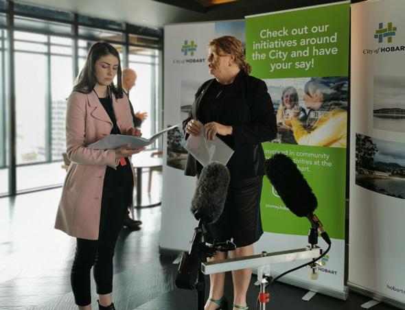
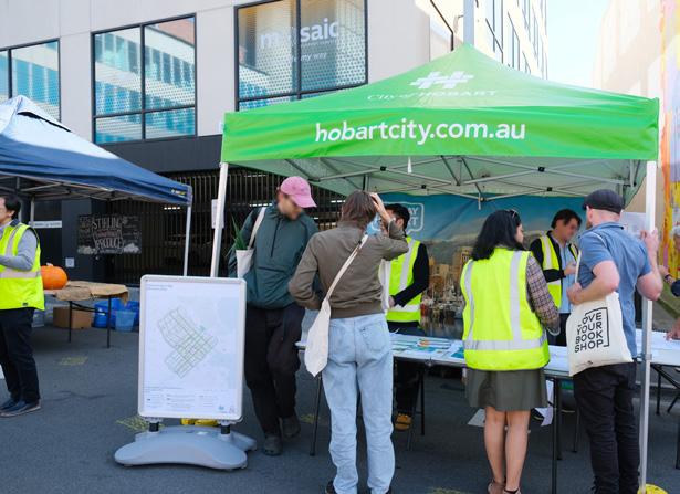
1.8 What we’ve heard so far
The draft Central Hobart Plan, was released in April 2023, was widely commented upon by local residents, business owners and operators, and groups and institutions.
The people of Hobart have told us they value the city’s heritage fabric, human scale, open spaces and open sky. Keeping the compact feel is important and something that sets Hobart apart from other capital cities. This is due to the size of the city, and its backdrop of mountain, bushland and river.
Many submissions provided further detail and input to the goals, strategies and outcomes in the draft Plan. They have also informed the proposed built form controls, and reinforced the desire for more and better open space as well as improved opportunities for walking and cycling. the These have been considered and, where possible, reflected in the final Plan.
What you said:
Key themes snapshot
How we engaged (stage 3):
Key numbers snapshot
60 days for public comments
4,800 visits to Your Say Hobart
220 submisssions in writing
11 engagement activitivies
500 postcards to businesses in the study area
170 registrations for the online discussion panel – city shaping conversation
> 60% constructive and neutral to positive submissions
Central Hobart Plan – draft for stage 3 engagement (April 2023)
What you said Key themes
Part one: Introduction
and innovation Heritage protection
make it happen Improved active travel Control of building heights More green space and street trees Pressure on Hobart’s transport system
Education
Let’s
landscape character and connection to place City of Hobart 20
Protect Hobart’s
What you said: Key themes
1. Retain Hobart’s diversity and identity – in its economy, community and built form.
2. Manage the increased pressure on Hobart’s transport system and the opportunities to improve active travel and integrate all forms of transport.
3. Provide quality and a variety of housing to support all parts of the community.
4. Continue to provide of a range of community services in Central Hobart.
5. Provide clear direction and focus for Central Hobart’s economy
6. Provide additional green spaces and greening.
7. Explore opportunities for daylighting and improving the environment for the Hobart Rivulet
8. Recognise and value connections to place – such as kunanyi / Mount Wellington, the Hobart Rivulet and Hobart’s built heritage and human scale.
9. Improve the design of new development s to provide flexibility, amenity and quality – through built form controls, including height limits, and/or design guidelines.
10. Deliver on the vision and actions contained in the Plan as an important step to ensure our City Centre makes the most of the opportunities for positive change.
Community engagement for the Central Hobart Precincts Plan Discussion Paper (October 2021) and the draft Central Hobart Plan (April 2023) Central Hobart Plan 21
Part two: City Shaping Framework
City of Hobart 22
Part two: City Shaping Framework
Overview
This section of the Central Hobart Plan includes sets out the city shaping goals, objectives and strategies that support the Central Hobart Vision.
The five city shaping goals:
1. A captivating and dynamic capital city
2. Public spaces that engage and create joy
3. Sustainable buildings with character
4. Integrated and accessible movement networks
5. An investment ready and innovative city
Ideas for future directions were proposed in the earlier Discussion Paper. Through feedback received during the Stage 1 and 2 community engagement process, the directions have been consolidated to form objectives under each of the city shaping goals and associated strategies and actions.
Focusing on the goals will enable the City of Hobart to guide growth over the next 20 years, to ensure the city develops in a way that builds on what is already special and valued.
Each goal has associated objectives and strategies to achieve its intent. The responsibility of the proposed actions have been classified as deliver, partner or advocate. A summary of all proposed actions are included in Part 4: Making It Happen.
Goals
Objectives
Strategies
Actions
Implementation
23 Central Hobart Plan
2.1 Goal one: A captivating and dynamic capital city
In 20 years, the function and image of Central Hobart is crucial for Hobart’s role as a capital city. Hobart’s strengths and unique qualities as an Australian capital city, and what sets it apart on the local, national and international stage, need to be reflected and harnessed as it develops and grows.
There are elements of the city that need to be improved or changed to meet future needs as a capital city. Similarly, there are elements that must be retained to protect its primary role in the state, such as being the location of Tasmania’s main hospital, the Antarctic gateway, the seat of government, and all the associated services and functions.
Objective 1: A strong city heart
Central Hobart is where a diverse range of uses, activities, buildings, connections and landscape converge to create a distinctive place. The image that Central Hobart conveys through its appearance, activity, community and economic vibrancy impact the whole of the State.
A strong capital city contains the key government, business, retail, academic, cultural, entertainment and community services that serve the metropolitan area, region and, in many cases, the state. While other parts of Greater Hobart and Tasmania contain some of these types of activities and services, the coordinating functions for most are, and will continue to be, located in the capital. The way in which activities supporting the capital city role are attracted, retained and accommodated is critical.
Strategy 1.1
Prioritise Central Hobart as the primary commercial, cultural, creative, political and administrative centre for Southern Tasmania and the state.
Proposed actions
Advocate, Partner
A.1: Attract and retain key retail, business, cultural, educational, health, community services and community activities.
A.2: Invest in key community and cultural assets that serve the state.
A.3: Encourage, attract and continue to support specialised retail and start-up businesses.
A.4: Encourage a mix of uses that contribute to the night-time economy.
Part Two: City Shaping Framework
24 City of Hobart
Objective 2: A place to live
Generally the more residents in a city the more active, safer, friendlier and interesting it is. It also often results in a more economically diversified and robust city.
The need to accommodate significant population growth throughout the city has been identified in the Greater Hobart Plan. Forecasts indicate that Central Hobart can accommodate up to an additional 7,000 people over the next 20 years.
Importantly Central Hobart can address the need for greater housing diversity in Hobart, through the provision of a variety of housing forms, including apartment and medium density styles, in an area well serviced by public transport, community and cultural facilities, retail and employment opportunities.
Housing affordabilityis to be encouraged so that the City Centre remains a viable option to live for all ages and incomes.
Homelessness and key worker accommodation shortages can be tackled through affordable options and centrally located support services. The City Centre is also the common location for people sleeping rough, so special care should be taken to understand their needs and circumstances.
While tourism accommodation is vital to sustaining the visitor economy, it needs to be balanced with ensuring the local population is adequately housed.
The commons, Hobart
Strategy 2.1
Actively encourage the provision of additional dwellings and a variety of housing types and tenures to meet the projected population demand for Central Hobart.
Proposed actions
Advocate
A.5: Work with landowners to increase residential development opportunities, including the potential for ‘shop-top’ housing.
Deliver
A.6: Develop incentives to encourage residential properties onto the long-term private rental market.
A.7: Develop guidelines that specify the needed types diverse of diverse housing. Include design solutions that will provide sound attenuation where residential uses sit alongside commercial uses, particularly in areas designated for the night-time economy.
A.8: Develop standards for apartments to ensure good living amenity and the maintenance of the city’s natural and cultural character.
Strategy 2.2
Address housing affordability and homelessness in Central Hobart.
Proposed actions
Deliver
A.9: Develop and contribute to a range of affordable housing strategies that provide options for lower cost housing for purchase, long and short-term rentals, and social housing.
A.10: Consider policy in the planning scheme to ensure no net loss of social housing in Central Hobart.
A.11: Investigate mechanisms to provide housing for key workers.
A.12 Consider the needs of people sleeping rough when developing housing policy.
25 Central Hobart Plan
Objective 3: A place to learn and work
Projections estimate a demand for around an additional 382,000m2 of commercial floor space 4 to support business expansion in the next 20 years. In facilitate this, high employment businesses need to be identified and encouraged to locate in Central Hobart.
The Royal Hobart Hospital will bring medical facilities to the area including potential for medical research and innovation activities.
A concentration of students living, studying and working in Central Hobart, and new research and education activity that will develop around the hospital, university, TAFE and any new educational institutions will bring vibrancy and economic benefit.
Workers and residents will have access to improved training and further education; knowledge-intensive uses will increase, clustering around the education precinct.
Strategy 3.1
Facilitate a variety of start-up businesses and innovative industries that provide employment options particularly in the Innovation Precinct.
Proposed actions
Deliver
A.13: Identify key industries and employers, suited to the Central Hobart environment, and develop strategies to attract them.
Advocate
A.14: Encourage new commercial development to have a variety of sizes and types of spaces for small and medium size enterprises, at a variety of price points.
Strategy 3.2
Enable development that provides commercial floor space and generates high employment.
Proposed actions
Advocate
A.15: Support the establishment of business and creative industry incubators, for example through the provision of affordable spaces.
Advocate
A.16: Identify key sites for commercial development and develop guidelines and controls that encourage this form of investment.
Advocate
A.17: Work with UTAS to consider its longterm plans so they benefit Hobart and the wider community.
Part Two: City Shaping Framework
Hobart City Apartment accommodation
26 City of Hobart
Plan – Economic,
and Employment Study – COVID-19 update (April 2021)
4. Central Hobart Precincts
Demographic
Objective 4: A place to visit and explore
Hobart’s reputation as a creative and cultural destination for intrastate, interstate and international visitors has been strengthening over the last decade. Central Hobart provides much of the region’s visitor accommodation. Hobart’s year-round program of festivals is a major attraction, as are the city’s cultural heritage, food and wine, markets, the range and beauty of the parks in and around the city, and its distinctive landscape.
As Hobart’s and Tasmania’s economy relies heavily on tourism, it is vital that the sector is given sufficient support and impetus and is able to withstand disruptors. Recognising, protecting and growing the key elements that attract visitors and diversifying the offer is important. Providing the infrastructure to make the visitor experience as rewarding as possible will generate repeat visits and longer stays.
Hobart’s festival and cultural life has seen a decentralisation of activity away from the traditional focus on Salamanca Place and the waterfront. This offers an opportunity for Central Hobart to have a more prominent role in the city’s festival and cultural life.
Ensuring the city is easy to access and move about, with great open spaces and green street network, and with a range of accommodation options, is important to support the visitor experience.
Strategy 4.1
Diversify, expand and promote the tourism offering based around the key strengths of creative industries, the arts, entertainment and heritage.
Proposed actions Advocate
A.18: Encourage educational institutions to maintain and expand creative educational course options.
A.19 Use heritage buildings to house creative enterprises, and encourage the retention of older buildings suitable for artistic industries and smaller events.
Deliver
A.20: Investigate opportunities for activities and attractions to encourage visitors into Central Hobart.
A.21: Enhance wayfinding, lighting, safety and universal access to, and between, key visitor attractions and areas.
A.22: Encourage a range of dedicated visitor accommodation options throughout Central Hobart.
27 Central Hobart Plan
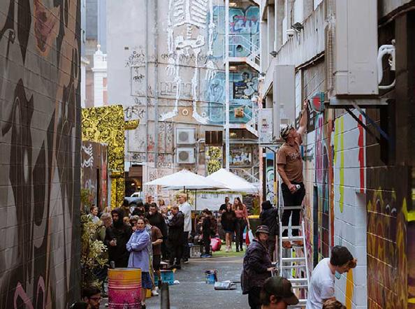
Bidencopes Lane Paint Jam. Photograph: Andrew Wilson
Objective 5: A place of creativity and culture
Hobart has established its reputation as a centre for quality cultural and creative products, activities, events and experiences, and the cultural and creative sector is one of the fastest growing employment sectors in Tasmania.
It is an area where multicultural celebrations and activities contribute to the vibrancy and creativity of our city.
With a significant boost from MONA, Hobart’s cultural festivals and events draw visitors from across Tasmania, interstate and overseas.
The City of Hobart’s Creative Hobart – A Strategy Framework has been building on that strong foundation, supporting, facilitating and establishing conditions for Hobart’s creative industries to flourish.
Central Hobart’s cultural, performing and visual arts venues collectively form a foundation for the broader artistic community, the visitor economy, and help make the city vibrant.
Cultural venues need to be protected from other uses that might curtail their activities due to concerns about noise and/or type of activity. Creating a cultural hub around current venues may generate greater interaction and a critical mass for larger events.
There is a growing need to ensure the local arts community is supported and accommodated through the provision of smaller, accessible and affordable spaces.
Strategy 5.1
Further develop the city’s visual identity by making unique connections between works of art and their environments, offering visitors and residents insights into our distinctive identity.
Proposed actions Advocate
A.23 Support and encourage initiatives to incorporate public art into private and commercial developments.
A.24: Continue to support local artists to activate city spaces and places with temporary and ephemeral art projects.
A.25: Activate streets, car parks and heritage spaces with public art, performances, events and festivals.
Part Two: City Shaping Framework
28 City of Hobart
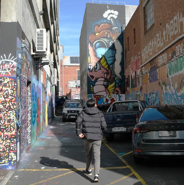
Bidencopes Lane, a site for a previous Hobart Vibrance Festival
Strategy 5.2
Reflect the strong artistic culture of Hobart in everyday activities, streetscapes and the physical environment of Central Hobart.
Proposed actions
Deliver
A.26: Investigate City Hall as a focal point for an arts and cultural hub including a management model that revitalises and activates the site.
Partner
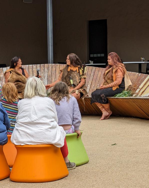
A.27: Work with the Aboriginal community to reflect more of the city’s Aboriginal heritage and culture in activities, events and exhibitions, and as permanent features in the public realm.
A.28: Introduce playful elements in urban design to reflect the creative culture of the city, promoting new experiences and invitations to stay.
A.29: Explore infrastructure opportunities in each precinct for power, rigging, lighting and staging to facilitate use of these spaces for temporary/pop-up activations.

29 Central
Plan
Hobart
Two Islands Sculpture in Franklin Square by Nigel Helyer
In The Hanging Garden
Tasmanian First Nations traditional dances and stories at the Tasmanian Museum and Art Gallery
2.2 Goal two: Public spaces that engage and create joy
In 20 years, the streets of Central Hobart have been further brought to life by placing people at the centre of activity. Well-lit courtyards, street entertainment, quirky laneways and accessible pedestrian routes through the inner city have created a safe and enjoyable environment where people stay longer and visit more often.
Central Hobart’s residents are healthier and happier due to an abundance of trees, parks and links to more open spaces. Walking and cycling trails connect the waterfront to the mountain and all the city’s parks and open spaces.
From vantage points, the views of Central Hobart’s surrounding landscape are protected and celebrated. From bold to playful, the public art around Central Hobart adds delight and meaning, giving a strong sense of place that reflects 40,000 years of human culture and Central Hobart’s multicultural community.
While buildings are an important element, it’s the public spaces in between the buildings that allow us to interact with the city. Safe, inclusive and universally accessible public spaces are crucial in retaining Hobart’s attractive character.
With an expected increase in medium-density housing in Central Hobart, the demand for access to comfortable, green public spaces will only increase.
Central Hobart is fortunate to have space for future development. This provides the opportunity to work with developers to create small pocket parks, activated laneways and courtyards that connect via green streets to our larger open space network. These must be designed well, at a human scale, to be successful.
People are core to a city. They bring the city to life.
Part Two: City Shaping Framework
30 City of Hobart
Activities in Soundy Park, North Hobart
Objective 6: A liveable and resilient city through urban greening
Strategy 6.1
Increase tree planting, green open space and water-sensitive urban design features to future proof the city, and reduce the urban heat island effect and flood risks.
Proposed actions
Deliver
A.30: Develop an Open Space Strategy that increases green infrastructure that integrates natural systems to increase resilience.
A.31: Review innovative funding models to facilitate best-practice planning, design, installation and management of urban greening initiatives.

31 Central Hobart Plan
Seasonal plantings in Elizabeth Street Mall
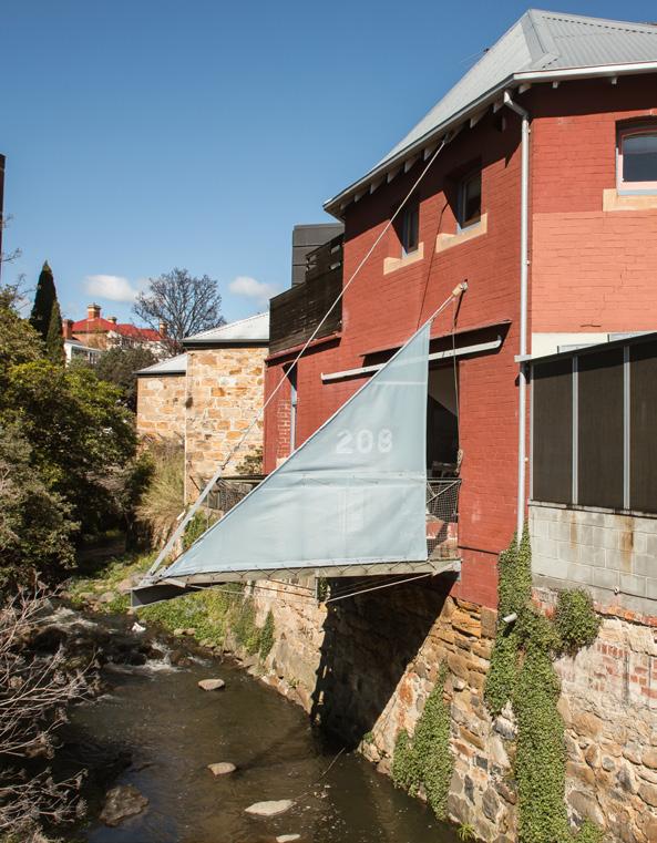
View of Hobart Rivulet towards the city centre
kunanyi / Mount Wellington as a green backdrop for the city
Objective 7: A strong sense of place between the river and the mountain
Strategic 7.1
Maintain and celebrate key view corridors and visual connections to the surrounding landscape and river.
Proposed actions
Deliver, Partner
A.32: Reinforce the importance of protecting key views from the river to the mountain through planning scheme provisions.
A.33: Develop an Active Travel Plan to strengthen the pedestrian and cycling infrastructure along the Rivulet to Macquarie Point.
Strategic 7.2
Provide for a network of open space that meets the needs of residents and visitors to Central Hobart.
Proposed actions
Deliver, Partner
A.34: Develop a city-wide Open Space Strategy that includes the work of the Open Space in Central Hobart Background Discussion Paper.
A.35: Seek opportunities to provide pocket parks and local parks where there are gaps in provision and encourage better use of existing open spaces.
A.36: Coordinate with other agencies to formalise public access to other open spaces, such as school and church grounds.
Strategic 7.3
Develop a network of blue and green infrastructure.
Proposed actions
Deliver
A.37: Develop plans for increasing (and valuing as assets) blue and green infrastructure, working with natural systems to increase resilience.
Part Two: City Shaping Framework
32 City of Hobart

 kunanyi / Mount Wellington with the city in the foreground in the morning sun
Trees in Elizabeth Street Mall
Aerial view of Franklin Square
Photograph: Natasha Mulhall Hobart Rivulet as viewed from Collins Street
kunanyi / Mount Wellington with the city in the foreground in the morning sun
Trees in Elizabeth Street Mall
Aerial view of Franklin Square
Photograph: Natasha Mulhall Hobart Rivulet as viewed from Collins Street
33 Central
Plan
Photograph: Natasha Mulhall
Hobart
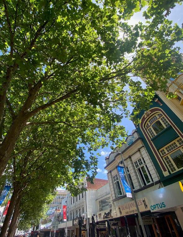
Objective 8: A network of lively, green and active streets to support the walkability and character of Hobart
Streets need to be adaptable to enable different uses at different times of the day, week or year. Wide footpaths, places to rest, shade, shelter and vegetation contribute to the comfort of users and provide access for all.
Mixed uses with a large residential component, small blocks, narrow building frontages, older buildings for character, and a concentration for critical mass help create a pedestrian network that entices people to walk and wander through the city.
The city streets need to be accessible to people of all ages and abilities and feel welcoming to people of all backgrounds.
A city that is safe, welcoming and easy to navigate is one that attracts visitors, residents and business.
There are many aspects to creating a city environment that is both attractive and highly functioning. These include lively, well-designed, weather-protected and easyto-navigate pedestrian ways, efficient and effective transport options, a high-quality built form and places to sit, rest and enjoy.
A safe city needs to be designed with thought for sightlines, lighting, signage and materials.
Strategy 8.1
Revitalise the city’s quieter lanes by encouraging mixed use developments that create opportunities for activation and enhance pedestrian movement.
Proposed actions Advocate
A.38: Endorse the laneway strategy for Central Hobart developed in the Urban Design Framework, which identifies potential future pedestrian links and laneways through the ‘super blocks’ of the city.
A.39: Consider strengthening existing, and encouraging new, developments to provide courtyards, introducing opportunities for spaces that are lively, comfortable and away from traffic and in appropriate locations contribute to the night-time economy by facilitating restaurants, cafes, bars and the like.
A.40: Develop CoH Urban Design Guidelines (LGA wide) for new buildings and streetscape design that includes safe design and universal access principles.
A.41: Engage with migrant communities to understand how their cultures and religions influence the use of public spaces and develop strategies to share their experiences through cultural events that enhance the City of Hobart’s existing and future international relations programs.
Part Two: City Shaping Framework
34 City of Hobart
Strategy 8.2
Create clear and well-designed universally accessible pedestrian routes with incidental green spaces for sitting, information provision and weather protection.
Proposed actions
Partner
A.42: Endorse the Transport Network Operations Plan – Inner Hobart (TNOP) to identify the future functions and staged transition of Hobart’s current and future street network. Noting that the TNOP will be updated as the strategic visions evolve. Refer to related A.67.
35 Central Hobart Plan
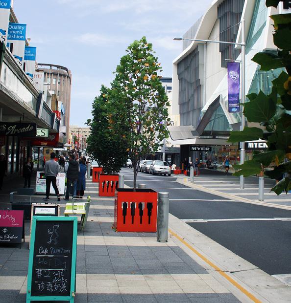
Street greening and seamless pedestrian crossing on Liverpool Street, in front of Myer
Elizabeth Street and Collins Street
2.3 Goal three: Sustainable buildings with character
In 20 years, world-class sustainable, modern architecture stands proudly beside reinvigorated historic buildings, protecting and adding to Hobart’s distinctive character, attractiveness and liveability.
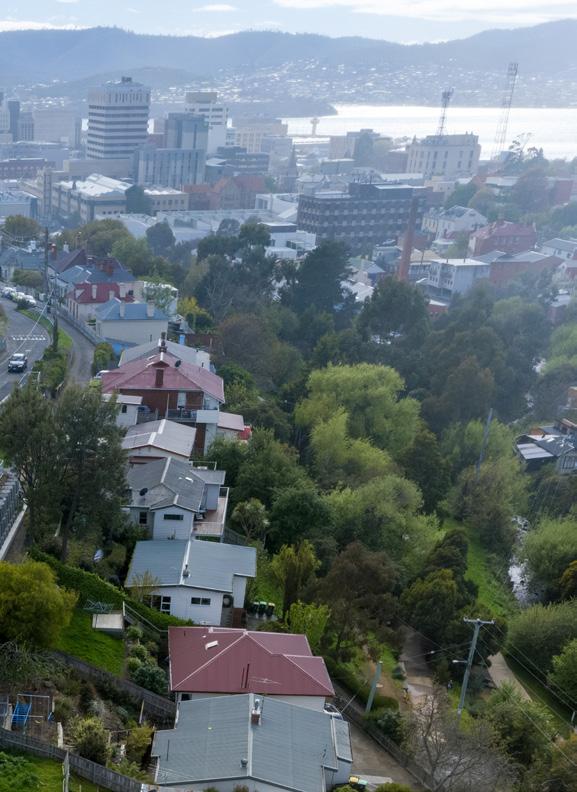
Central Hobart has retained, consolidated and enhanced its character in the ‘urban amphitheatre’, and, focused on the central area basin, the diversity of building form and scale maintains connection to the surrounding landform horizons, especially when viewed from the waterfront and other publicly accessible viewing points.
A range of measures that are producing more sustainable buildings and precincts and exemplary design has been adopted.
Design excellence principles and design review processes are increasingly being embedded in the assessment process for new buildings, and while some processes such as the City of Hobart’s Urban Design Advisory Panel (UDAP) are well established, more guidance is needed.
The position of new development within the ‘urban amphitheatre’ of the topographical setting of the city, and the concept of Hobart being a ‘small c ity in a large landscape’ are t wo important spatial scales that provide a context for the future of Central Hobart.
These concepts have been established from the Building Height Standards Review Project (the ‘Woolley Report’) which advised on appropriate height controls for the Central Hobart and waterfront areas, based on the urban landscape of Hobart and the protection of important view lines.
These influence views and vistas that need to be protected, building height and interrelationships and have been incorporated into the Urban Design Framework (see page 92 onwards) of the Plan.
The impact of buildings is particularly felt at the street level, where the activities occurring inside can contribute energy and interest to the street.
Part Two: City Shaping Framework
36 City of Hobart
The Hedberg, Campbell Street Photograph: Natasha Mulhall
Objective 9: Buildings that excel and excite
Major developments should reflect their specific location and the role of Hobart as Tasmania’s capital city in both quality of architectural expression and materials.
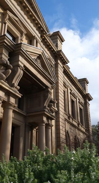
The heritage character and lower-rise scale of the city centre are valued characteristics. Building height, scale and bulk are often contentious issues in a sensitive built environment such as Central Hobart, and clear guidance is needed.
The planning scheme and associated guidelines need to ensure new development responds appropriately to the human scale of Hobart, enhancing the character as the city grows. This will be in addition to the existing local and state heritage sites, heritage precincts and the Place of Archaeological Potential overlay, all of which will still apply.
Strategy 9.1
Respond to surrounding context, human scale and pedestrian experience in building design.
Proposed actions
Deliver
A.43: Progress the planning scheme amendment to introduce the height controls recommended by the Woolley Report to protect key views and vistas.
A.44: Develop and implement detailed Central Hobart Urban Design Guidelines to direct best practice outcomes.
Strategy 9.2
Develop a high expectation of design excellence in Central Hobart.
Proposed actions
Partner
A.45: Create ways to celebrate local exemplar designs illustrating the preferred outcomes.
A.46: Build on the effectiveness and expanding the role of the City of Hobart Urban Design Advisory Panel (UDAP) to assist in developing urban design guidelines.
Goulburn Street Housing Photograph: Natasha Mulhall
37 Central Hobart Plan
Strategy 9.3
Respect heritage and traditional building elements in new buildings while projecting Hobart’s creative and forward-looking edge.
Proposed actions Partner
A.47: Develop CoH Heritage Design Guidelines (LGA wide) further encourage adaptive re-use of buildings to extend the life of heritage buildings and investigate ways to maintain and strengthen historic subdivision patterns, lot sizes and courtyards.
A.48: For strategic development sites, test existing and proposed building controls to ensure economic feasibility, sustainability and liveability outcomes are met. And, if necessary, develop site specific guidelines.
Part Two: City Shaping Framework
38 City of Hobart
The Tasman Hotel, Murray Street
Heritage and new building in Goulburn Street
Photograph: Natasha Mulhall Tasmanian Museum and Art Gallery, heritage building
Objective 10: Environmental excellence
The ‘sustainability’ of a building considers its design in terms of environmental and social contexts, including the durability and life of the building, the energy consumed in producing the building materials, in heating and cooling, and use of other resources in its operation, such as water and chemicals.
While many aspects of sustainable buildings are regulated by the National Construction Code, there is a role for local government in setting the conditions to allow sustainable design to occur.
Built form guidelines that encourage designers to respond to climatic conditions on individual sites, and incentives and measures within a planning scheme, can assist in achieving sustainable outcomes.
Strategy 10.1
Promote and encourage sustainable building design in all new buildings and when retrofitting, including methods of moving to a circular economy and reducing building construction waste.
Proposed actions
Deliver
A.49: Include sustainability requirements in planning scheme provisions where possible, or advocating for changes to building provisions.
A.50: Develop guidelines to demonstrate methods to achieve sustainable buildings in a city centre context and investigate frameworks for sustainable precincts.
Strategy 10.2
Recognise the importance of, and develop a framework for, blue and green infrastructure, water sensitive urban design and urban greening to increase the city’s resilience.
Proposed actions
Advocate, Deliver
A.51: Encourage development to improved access, visibility and celebration of the Hobart Rivulet.
A.52: Develop guidance and policy to encourage the development of green roofs and green walls to achieve the urban canopy coverage of 40% by 2046.
A.53 Develop guidance and policy to encourage zones of deep soil planting in developements to help deliver the urban canopy of 40% by 2046.
A.54: Design Council infrastructure to meet ‘best practice’ sustainable design.
UTAS Student Accommodation Photograph: Natasha Mulhall
39 Central Hobart Plan
2.4 Goal four: Integrated and accessible movement networks
Improvements to public transport, more car sharing, and increased walking and cycling options have reduced the dominance of cars in Central Hobart in 20 years, with far-reaching benefits for citizens and the environment.
Walking, and using micromobility options such as cycling and e-scooters, is easier and more popular because of improved safety, accessibility and other supporting features in Central Hobart’s urban design.
Commuter car parks are located near major arterial routes with regular transport services and better walking and cycling routes bringing commuters into a safer and more amenable central city.
To support the growth in development and use of Central Hobart, movement networks and services will also need to grow. Successful cities use public transport, walking, cycling and micromobility options to move people with a lower space and pollution intensity than can be achieved with private motor vehicles alone.
There are planned improvements for public transport provision in the Greater Hobart region to support trips to and from Central Hobart and this needs to be supported with further improvements for movement in the area for all users.
The envisaged future state for Central Hobart will require changes to where motor vehicles park and how we operate and prioritise some streets for some transport modes.
Such arrangements have been previously outlined in the Tasmanian Government’s Hobart Transport Vision, the City of Hobart’s Transport Strategy, the RACT’s Greater Hobart Mobility Vision and the Hobart City Deal.
Objective 11: More sustainable travel choices to Central Hobart
The Hobart City Deal, has a target of increasing the proportion of regular commute-to-work trips that are by public transport to 10 per cent.
It includes commitments to increase the number and frequency of public transport services from surrounding areas, as well as a range of physical capital works, such as the Kingston to Hobart bus priority measures and the development of a Hobart Transit centre.
The 2021 trial ferry service from Bellerive to the Hobart waterfront attracted significant patronage and has been continued beyond the initial trial period. Additional investment to expand the service reach has also been committed to by governments.
The Northern Suburbs Transit Corridor (NSTC) has been the subject of detailed consideration for activation, redevelopment and public transport service improvements. These actions will provide for additional public transport capacity to provide for trips between Hobart and Glenorchy.
In keeping with the City’s commitments to providing a city for all ages and abilities, and legislative requirements such as the Disability Discrimination Act 1992, public transport services are moving towards being fully accessible for the majority of services.
Part Two: City Shaping Framework
40 City of Hobart
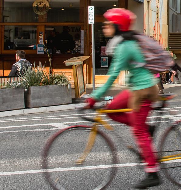
Walking, cycling and micromobility modes of travel provide the lowest overall cost, in terms of space efficiency, pollution and direct expense to the individual users of any transport mode. For most people, every journey begins and ends with a pedestrian journey.
The majority of the City of Hobart population lives within a 4 km radius of the GPO. Where quality facilities have been provided, there is an observably greater proportion of people who use a bicycle, an e-scooter or walk for their journey to the city from their home. However, there are key missing links and suburban areas where no appropriate facilities exist to support people choosing these transport options.
Strategy 11.1
Continue to support the provision of improved walking and micromobility facilities that will support more people to access Central Hobart from proximate Hobart suburban areas.
Proposed actions
Deliver
A.55: Complete and connect the bicycle and micromobility facilities on the key corridors of Argyle Street, Campbell Street and Collins Street.
A.56: Improve pedestrian facilities, greening, and amenities on the key streets identified in the Urban Design Framework
A.57: Identify further micromobility, pedestrian links and improvements that will improve connectivity and attractiveness in Central Hobart.
A.58: Continue to investigate micromobility options beyond the e-scooter trial.
Strategy 11.2
Continue to plan for and support the provision of improved public transport facilities and services that will support more people to access the city from Greater Hobart in ways other than private motor vehicles.
Proposed actions
Partner
A.59: Work with Tasmanian Government to further investigate the feasibility of a central bus transit centre(s) within the and the potential for future upgrades to the existing bus interchange.
A.60: Work with the Tasmanian Government to implement a permanent ferry service on the Derwent River and improve links from the Hobart waterfront to Central Hobart.
A.61: Work with the Tasmanian Government to identify further key bus facility nodes with improved user experience including by way of shade tree planting, shelter for major stops, accessible, well connected, with clear wayfinding, to service land use developments and new service routes associated with the NSTC.
41 Central Hobart Plan
Cycling on Elizabeth Street
Photograph: Natasha Mulhall
Objective 12: Improved amenity for active travel modes in Central Hobart
The workers, shoppers, service seekers, students and visitors along with the new residents in Central Hobart will benefit from improved active travel facilities. In other Australian cities, adoption of these modes has improved city liveability and vibrancy; people stop and talk, experience the delights of window shopping and participate in the local economy.
Overall Central Hobart is quite small. Its longest axis is less than 1500 metres. While there are community members who will require motorised transport for various reasons, there is already of a culture of walking and bike riding in Hobart, for transport and pleasure, and this should continue to be supported.
With the advent of e-bikes, electric mobility scooters and the trial of e-scooters, a wide cross-section of the community benefits from quality facilities if provided.
On key corridors in the city, improving other aspects of street amenity, such as on-street dining, quality street environments, street greening, and trees support active travel and the economy because people want to be in such places.
Strategy 12.1
Continue to plan for and support the provision of improved active travel (walking and micromobility) facilities that will support more people to move around the city using these modes.
Proposed actions
Partner, Deliver
A.62: Continue to support the provision of improved walking, cycling and micromobility facilities that will encourage more people to move around Central Hobart, catering for residential and employment growth mobility demands in the area. Consider All Ages and Abilities standard (AAA) for cycling and micromobility to improve safety.
A.63: Develop street vision plans, with initial priorities being for Elizabeth Street and Collins Street, that are universally accessible and consistent with the Central Hobart Urban Design Framework.
A.64: Undertake a complete audit of the streets and pedestrian crossings in Central Hobart and prioritising accessibility upgrades using the previously undertaken Walkability of the Elizabeth Street/New Town Road Corridor report methodology.5
Part Two: City Shaping Framework
42 City of Hobart 5. City Infrastructure Committee meeting 27 October 2021
Objective 13: Parking cars better
All space in urban areas has value. How we use and develop public and private space has a considerable bearing on the liveability of our community and our ability to create wealth from our interactions and exchanges.
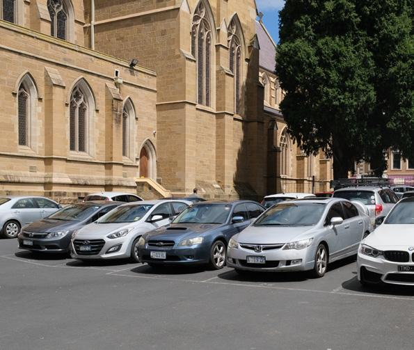
For most of the streets across Hobart, there is capacity to park cars on street and manage that parking with appropriate controls and policies to ensure appropriate access for all and equity of use for this public good. However, some streets will need to see parking relocated to other locations in order to achieve improved public transport, active travel and city activation.
Multi-storey car parking stations and large offstreet car parking facilities exist now across the central area, with most major buildings supporting basement parking facilities.
In the next 20 years, additional off-street parking facilities could be developed to replace on-street car parking and provide reservoirs for car parking that can be equipped with the necessary facilities to become electric vehicle charging and battery storage stations for the Hobart electrical grid.
The future of our vehicle fleet and where we park those vehicles when not in use are changing. We need to start to plan for that future.
Strategy 13.1
Develop a Parking Strategy for Hobart including: an analysis of options for relocating space from laneways to improve the quality for a variety of uses, appropriate pricing strategies, and how to best provide on-street accessible spaces.
Proposed actions Deliver
A.65: Review current publicly accessible offstreet car parking locations and identifying appropriate longer term locations for public short stay and long stay facilities as part of a parking strategy.
A.66: Review the current suburban resident parking schemes in order to support the new parking strategy for Hobart.
43 Central
Plan
Hobart
Parking Spaces Near St. David’s Cathedral
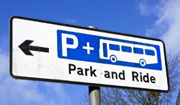
Park and rides around Greater Hobart, DSG
Objective 14: Managing our movement networks
How we manage our transport and movement networks provides tools for achieving our associated goals and objectives for the city.
It is more pleasant as a pedestrian to be around vehicle traffic moving at slower speeds. It is also much safer for people both inside and outside the vehicle. This is the reason in Central Hobart, and around the Hobart waterfront, there is a speed limit of 40 km/h in some locations. In places with high amenity, or the ability to all share the space, the speed limit may be 20 km/h.
Mode priority is also key, for example prioritising a public transport vehicle through dedicated road space or by coordinating traffic signals. A ‘green wave’ can improve travel time reliability and overall travel time savings. For pedestrians, minimising the time spent waiting for the ‘walk’ signal to cross a road can be a way to prioritise pedestrians over car movements.
Managing a network mean in some locations some road users will receive a higher level of service or better conditions than others. This balancing act is undertaken by developing a Transport Network Operations PlanInner Hobart (TNOP), which provides the guidance for making decisions about traffic signal timings, road speeds and, to an extent, space and priority allocation for a road and street network. The first generation TNOP is currently being developed in partnership with the Tasmanian Government.
Strategy 14.1
Provide guidance to the management of transport and mobility in Central Hobart to achieve the Central Hobart Plan objectives.
Proposed actions
Partner, Deliver
A.67: Complete a first generation Transport Network Operations Plan – Inner Hobart (TNOP) in partnership with the Tasmanian Government. Refer to related A.42.
A.68: Develop detailed movement and place 6 mapping for Central Hobart, taking into consideration key pedestrian streets identified by the Central Hobart Urban Design Framework and other key future land use changes.
6. Movement and Place is a methodology to integrate place and mobility considerations as part of the planning, design and operation of a city's roads and streets. For more infomation refer to: https://www. movementandplace.nsw.gov.au/place-and-network/guides/aligningmovement-and-place/what-movement-and-place
Hobart
Part Two: City Shaping Framework
44 City of
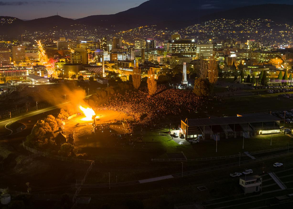
 Aerial view of Hobart’s Cenotaph and Regatta Grounds with a major event (Dark Mofo)
Criterion Laneway Photograph: Natasha Mulhall
Aerial view of Hobart’s Cenotaph and Regatta Grounds with a major event (Dark Mofo)
Criterion Laneway Photograph: Natasha Mulhall
45 Central Hobart Plan
Collins and Liverpool Street are major movement corridors. Photograph: Natasha Mulhall
2.5 Goal five: An investment ready and innovative city
In 20 years, landowners, developers and the local community have a clear understanding of development expectations, and planning approvals are streamlined for preferred development types in particular areas.
An equitable developer contribution system is in place to help pay for community infrastructure, ensuring a vibrant, prosperous and sustainable city. Investment from different levels of government has given private investors confidence and ensured that Central Hobart has the public infrastructure needed to meet the goals of the Plan.
Detailed master planning for specific sites and blocks in Central Hobart has resulted in strategic developments that meet specific community needs and underpin the precincts plan’s success in 2042. Super-fast internet connections and digital technology underpin a wide range of smart initiatives that help Central Hobart to function better, including ways yet to be imagined.
Objective 15: A clear framework for development
The Central Hobart Plan will provide a placespecific understanding of the development needs for the area, when compared to the more generalised zoning standards that are in the current and future planning scheme provisions, which have been developed to suit a variety of development types.
The intent of this place-based approach is to create more certainty about the desired future development outcomes.
There are many triggers in the planning regulatory framework that can be used to encourage or require landowners and developers to address the Central Hobart city shaping goals and objectives. For example, it’s possible to introduce Specific Area Plans to provide clarity about height, setback and required design standards, and to provide more certainty for the community and industry.
Implementing the Plan is likely to require some change to current regulation. This will include changes to planning scheme provisions to ensure that new uses, buildings and works in the precincts are located, designed and constructed in a way that achieves the Central Hobart city shaping goals. Further information is provided in the Urban Design Framework (see page 84).
There may be other implementation requirements such as a Stormwater System Management Plan required under the Urban Drainage Act 2013.
Part Two: City Shaping Framework
46 City of Hobart
Strategy 15.1
Plan for the preferred development forms of Central Hobart and its precincts by creating planning scheme provisions that provide certainty for developers and the community.
Proposed actions
Deliver
A.69: Developing a process to streamline the assessment of planning applications for the preferred development types in each precinct.
Strategy 15.2
Support the development of each precinct to align with the goals and preferred land use outcomes.
Proposed actions
Deliver
A.70: Further test proposed controls in the Urban Design Guidelines to support and guide each precinct and land use outcomes.
47 Central Hobart Plan
The Commons, Hobart
Myer development and adjoining heritage Building, in Liverpool Street
Objective 16: An equitable developer contribution system to help pay for community infrastructure
Development contributions are payments or works (either in kind or in lieu), and facilities or services that developers provide towards infrastructure required to meet future community needs.
While Tasmania does not have a developer contributions framework 7, the practice is well established in most Australian states.
Generally, developer contributions are collected to meet the needs of community generated as a result of the development. These may be at a city, local or neighbourhood scale.
Development contributions are exacted through the planning approvals system and can be grouped into four mutually exclusive categories: user-pays contributions and charges; impact mitigation levies; value capture or value-sharing arrangements; and inclusionary requirements. These can be mandatory, voluntary or shared (refer to digram on the next page).
Development contributions are one method by which public infrastructure can be funded. Separate charges such as rates and levies can provide an equitable means of raising revenues to fund public infrastructure.
As the framework to levy contributions is not readily available within current legislation, the discussion about development contributions is largely at the theoretical stage at present.
Strategy 16.1
Investigate the most appropriate means to introduce development contributions to meet the future infrastructure needs of Central Hobart.
Proposed actions
Advocate
A.71: Exploring opportunities to facilitate the delivery of developer contributions to fund improvements to community infrastructure, including public open space and transport infrastructure.
Consider future planning controls that incorporate community benefits for strategic development sites and areas such as for affordable housing or community infrastructure.
Strategy 16.2
Advocate for legislation that enables the fairest means of collecting and apportioning development contributions.
Proposed actions
Advocate
A.72: Advocating for the introduction of specific Tasmanian guidelines for developer contributions and working with the Local Government Association of Tasmania to advocate for legislation that provides opportunities for a broader range of development contributions, particularly for the public realm.
7. For information on TasWater developer charges visit taswater.com.au/building-and-development/developercharges
Part Two: City Shaping Framework
48 City of Hobart
User pays contributions
Justification
Proponents should contribute towards planning infrastructure in line with projected share of usage
Impact mitigation
Justification
Proponents are responsible for 100% of the cost of making good unanticipated off-site effects, including infrastructure impacts
Examples
Development contribution
Plan levies (Vic)
S94 levies (NSW)
Local Government Infrastructure Plans (Qld)
Examples
Make good conditions on development approvals
Source: Central Hobart Precincts Structure Plan – Development contributions for shared infrastructure, report for City of Hobart, SGS Economics & Planning, October 2021
Value sharing
Determining the best methods and triggers for the application of development contributions is a key element of precinct planning.
Justification
Proponents are required to share part of the uplift in land value brought about by re-zoning or granting of additional height or density
Inclusionary requirements
Justification
Proponents must meet certain development standards on site or pay for these to be satisfied off-site, to meet requirements for cumulative sustainability
Examples
Growth Area infrastructure Charge (Vic)
AmC270 Melbourne Planning Scheme
Voluntary Planning
Agreements –Public benefit for additional density (NSW)
Special Infrastructure Contributions (NSW)
Examples
Parking requirements and cash in lieu schemes
Open space requirements and cash in lieu schemes
Affordable housing requirements (e.g. Ultimo Pyrmont, Green Square)
+ + +
49 Central Hobart Plan
Objective 17: Driving investment through public infrastructure
A key role of the City of Hobart and the Tasmanian Government is investing in Central Hobart to attract appropriate development and investment. This includes investment in the types of public infrastructure that will assist with the delivery of this Plan and provide confidence for private investment.
Improvements to public infrastructure may be delivered in tandem with development and, indeed, may be funded or embellished through development contributions (e.g. public open space, improvements to the urban realm).
Proactive and considered planning for infrastructure maintains or improves the quality of life for the community.
Successful infrastructure planning is a continuous and iterative process and should adapt to the changing circumstances of a community and provide for the transparent expenditure of development contributions and revenue from rates/levies.
Strategy 17.1
Plan for the delivery of infrastructure in Central Hobart.
Proposed actions
Partner
A.73: Prepare a Central Hobart Public Infrastructure Plan that details existing public infrastructure and its capacity to cater for the anticipated growth, and then proceeds to indentify future infrastructure needs, costs and apportionments for all development planned for the area.
Strategy 17.2
Align and coordinate asset renewals with the Tasmanian Government to ensure efficient outcomes.
Proposed actions
Deliver
A.74: Develop a detailed program of works for asset renewals and send to Tasmanian Government agencies to identify project synergies.
Strategy 17.3
Ensure stormwater infrastructure is resilient and able to cope with future rain events.
Proposed actions
Deliver
A.75: Undertake detailed hydraulic modelling and planning in the Central Hobart area to provide the information and strategies to anticipate and plan for likely future rain events and seek appropriate capital funding for upgrades.
Part Two: City Shaping Framework
50 City of Hobart
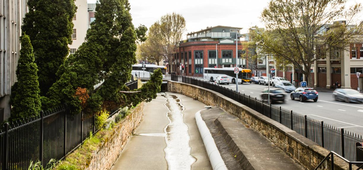
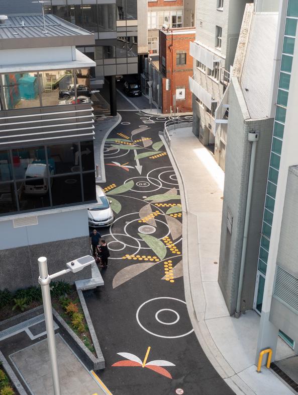
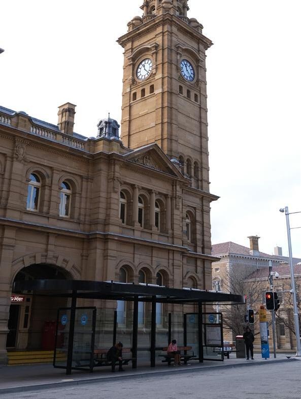 View of Hobart Rivulet along Collins Street
Photograph: Natasha Mulhall
Public art in Kemp Street
View of Hobart Rivulet along Collins Street
Photograph: Natasha Mulhall
Public art in Kemp Street
51 Central
Plan
Hobart Interchange for buses, Elizabeth Street
Hobart
Objective 18: Master planning for strategic development sites
Major under-developed government and university land holdings in the area have been identified as key development sites for future investigation, with the intent that the City will seek discussion with the owners on the future of each site. Council’s land holdings have also been identified.
It is anticipated that some of these key government sites and other sites owned by private landowners may also be suitable for a master planning process.
Key development sites, and the blocks on which they are located, will emerge as crucial to the realisation of the city shaping goals. These sites may be underutilised or vacant; they may be particularly visible and prominent; or they may already be owned by a public authority.
For example, UTAS land holdings are of strategic importance to the city, and the way they are developed will have an impact on the public realm, local businesses, the surrounding streets, and the way the city is used.
Key development sites may also be suitable for the inclusion of affordable housing or public open space.
Strategy 18.1
Work with landowners to achieve coordinated development of key strategic development sites.
Proposed actions
Partner, Deliver
A.76: Further identify key strategic development sites and city blocks that may be suitable for detailed master planning:
• Demonstrate the feasibility of coordinating development of strategic sites
• Engage with landowners to discuss the future of key strategic development sites
• Facilitate or participate in master planning for key strategic development sites.
Part Two: City Shaping Framework
52 City of Hobart
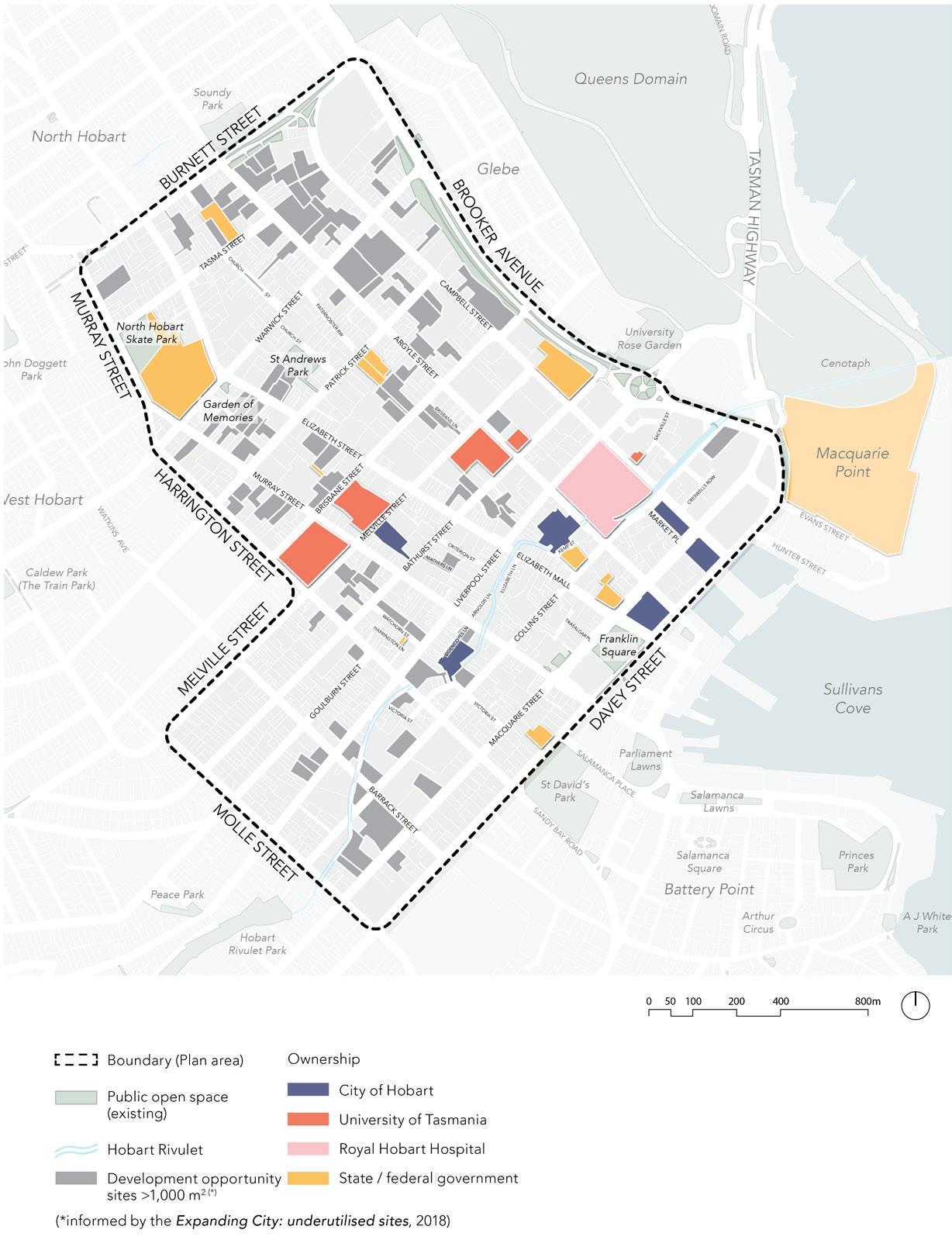
53 Central Hobart Plan
Figure 3. Private, government and university development sites
Objective 19: A smart city that is digital by default
Creating an environment that ensures the city is ready for the next decade and beyond, technologically and physically, is an important component of the Plan.
Connected Hobart, the City of Hobart’s smart city framework, aims to use and apply digital technology and community and organisational collaboration to address a range of urban management challenges.
The Connected Hobart program includes over 60 actions, projects and initiatives under the headings Places, Communities and Safety, Creativity, Transport, Environment, Infrastructure and Government. Some current initiatives are enhancing personal safety and security by expanding security cameras and lighting in the city, Internet of Things (IoT) sensor installation, parking innovations, smart bus shelters, and encouraging innovative transport modes such as self-driving vehicles and micromobility trials.
Work has begun on building the city’s digital twin – a multi-agency information platform that combines data assets owned by the City of Hobart and other stakeholders with a digital replica of the Hobart municipality’s built form, physical assets and infrastructure.
The digital twin provides enormous potential for a publicly owned platform for engagement, tourism, marketing, planning, economic development and other City of Hobart functions aimed at assessing and managing urban assets and networks in the future.
A fast internet connection is a basic requirement of any city, and this needs to be constantly maintained and upgraded to accommodate new technologies and expectations of users. The pandemic has reinforced how much we rely on these communications for everyday life, not just business.
Strategy 19.1
Progress the recommendations of Connected Hobart Smart City Action Plan 8 to maximise the benefits of technology for city functioning and improvements.
Proposed actions
Deliver
A.77: Further develop the city’s digital twin with additional key features including the City of Hobart’s assets, lighting and evening thermal impacts, people movement and parking data, and key environmental layers.
A.78: Align City-led actions in the Connected Hobart Smart City Action Plan with the timelines of the Plan.
Part Two: City Shaping Framework
54 City of Hobart 8. City of Hobart, Connected Hobart Smart City Action Plan
Strategy 19.2
Maintain and upgrade technologies and communications for Central Hobart.
Proposed actions
Deliver
A.79: Develop the City’s ability to provide remote network access and communications by undertaking fibre optic installation works to directly connect the City’s data centre at Town Hall to its larger assets located to the north and surrounding the Central Hobart areas.
A.80: Continue increasing the number of public safety cameras in the Central precinct, and rolling out AI functionality to the City’s Safe City Hub.
A.81: Increase the capacity of the City’s data centre to allow for additional monitoring and data analysis around the city.
A.82: Further develop and strengthen mutual inclusivity with other agencies such as the Department of State Growth, TasNetworks, Tasmania Police, Telstra and surrounding councils via shared access agreements.
A.83: Develop the City’s remote telemetry capabilities by expanding existing LoRa, microwave and other communications protocols.
A.84: Develop the City’s digital wayfinding and digital bus shelter networks to allow the dissemination of cultural, historical, wayfinding and transport information to residents and visitors. These are to work in conjunction with other solutions delivered by the Tasmanian Government.
A.85: Support the roll-out of the 5G mobile network to enable new and improved technological capabilities, while respecting the streetscape and cityscape character of Central Hobart and minimising impacts on existing infrastructure assets.
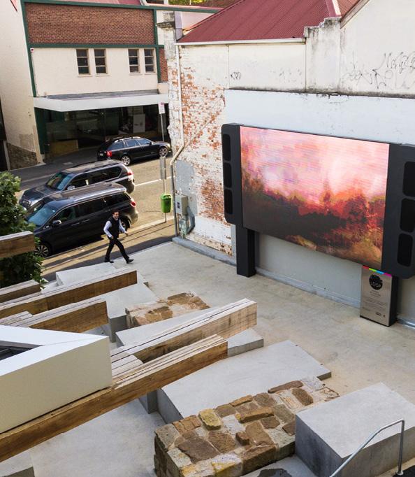
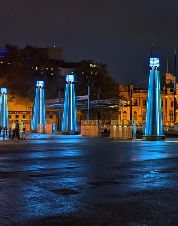 Smart City facilities in UTAS Hobart Apartment
55 Central Hobart Plan
RGB lighting in Mawson’s Place
2.6 Central Hobart precincts
Central Hobart can be thought of as a collection of distinct places or precincts. Some these will see significant change in the future others, where there is a preferred existing character, less so. All have a preferred future character manifesting itself in the land uses, built form and public realm.
Precincts provide an emerging framework for future growth and development according to the potential for each precinct, and helps to develop place-specific policies.
In addition to the Central precinct (sometimes called the CBD), four ‘precincts’ are suggested as areas for potential renewal and revitalisation.
Each has its own potential, character and identity arising from topography, land use patterns, proximity to compatible uses, building type, natural attributes and landmarks.
Some areas are also identified that could support increased residential and mixed use development, within a short walk of the heart of the city.
Central Civic and Cultural Innovation
Trinity Hill
Rivulet
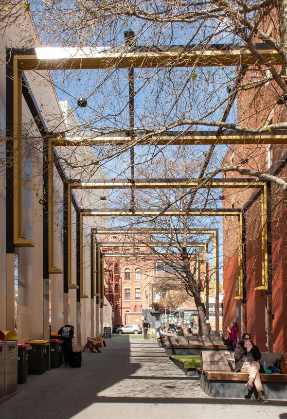
Part Two: City Shaping Framework
Collins Court in winter
56 City of Hobart
Photograph: Natasha Mulhall
57 Central Hobart Plan
Figure 4. Central Hobart area and precincts
Central Precinct
The Central Precinct is the heart of the city, where local residents and visitors come to work, shop, explore and be entertained. It is the principal cultural and business centre of Greater Hobart and Southern Tasmania, containing key public buildings and functions, major retail stores and commercial headquarters.
A large proportion of Hobart’s traditional visitor accommodation, in the form of large purpose-built hotels, is within this precinct. The number of people living in the precinct is likely to continue to increase adding to the vitality and economic strength of the central city.
The Central Precinct has most of the city’s tall buildings and multi-level department stores and much of the city's core retail activity. Character is shaped by grand heritage and civic architecture the buildings such as the GPO and St David’s Cathedral. There is a wealth of two and three-storey heritage architecture throughout the area, as well as taller buildings from more recent decades.
The retail core is bounded by Argyle, Liverpool, Harrington and Collins Streets. Retail also extends north along Elizabeth Street. In recent years three new major hotels have opened, providing a significant increase in accommodation capacity.
This is the area with the highest concentration of foot traffic in the city 9 and includes Elizabeth Mall and an interconnected network of arcades, laneways and squares.
Several of the city arcades are important shopping destinations. Since 2010, when a review by Gehl10 recommended Central Hobart’s network of laneways and streets be made more pedestrian-friendly, many improvements have been made to linkages and the streets, but more are required.
9. Urbis, Central Hobart Precincts Structure Plan Movement Analysis , April 2022
10. Gehl Architects, Hobart 2010 Public Spaces and Public Life
– a city with people in mind: the first stage of Hobart’s inner city development plan, 2010
Hobart
Part Two: City Shaping Framework
58 City of
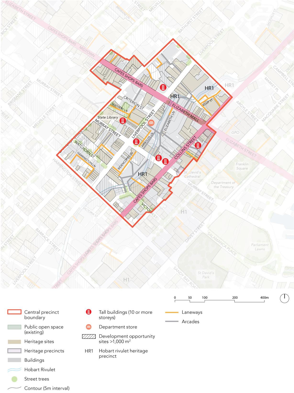
59 Central Hobart Plan
Figure 5. Central Precinct
Central Precinct
Precinct objectives
• Reinforce this precinct’s role as a prime retail and hospitality location and enhance its emerging night-time economy function along parts of Liverpool and Elizabeth Streets.
• Intensify and expand the key retail, hospitality and commercial functions of this Precinct within the City Centre.
• Maintain, improve, and where appropriate expand,11 pedestrian connections through the larger city blocks.
• Reflect the core retail, commercial and pedestrian role of this precinct in the functionality, quality and amenity of streetscapes, greening solutions, built form and movement networks.
• Seek improved public realm amenity through the proposed planning scheme controls for increased active frontages, minimised wind effects and reduced vehicle crossovers.
Precinct key actions Deliver
1. Develop a suite of streetscape improvements that signify the role of the central retail and hospitality core and provide an enhanced pedestrian experience.
2. Require ground floor premises to provide more active frontage along the primary pedestrian routes.
3. Allow for taller buildings as long as these don't create unnacceptable overshadowing impactings affecting pedestrian amenity12 and adjoining building occupants, maintain key identified view lines to surrounding landscapes13 and considers the streetscape and any heritage context.
4. Prepare and implement Elizabeth and Collins Street Vision Plans, with the priority being Elizabeth Street, to improve their movement and place functionality.
5. Prepare and implement CoH Urban Design Guidelines (LGA wide).
6. Prepare and implement CoH Heritage Design Guidelines (LGA wide).
11. Refer to Figure 14 Proposed pedestrian access plan
12. Refer to 3.6.1 Overshadowing
13. Refer to Figure 10. Views and sightlines plan
Part Two: City Shaping Framework
60 City of Hobart
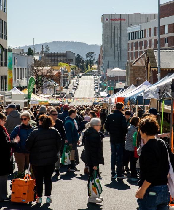
61 Central Hobart Plan
Sunday Farm Gate Market, Bathurst Street. Photograph: Natasha Mulhall
Wayfinding vertical board sign.
Food kiosk in Collins Court. Photograph: Natasha Mulhall
Civic and Cultural Precinct
The Civic and Cultural precinct Hobart’s key civic buildings, such as the City Hall, Town Hall, Franklin Square and the Treasury building. Other notable buildings are cultural institutions, which include the Tasmanian Museum and Art Gallery, the Theatre Royal and the Maritime Museum of Tasmania.
The precinct includes a significant area of residential dwellings in the locality known as Wapping, and tourist accommodation in several large hotels. The blocks bounded by Davey, Liverpool, Campbell and Evans Streets, accommodate performing arts facilities including the Federation Concert Hall, Theatre Royal and the university's new Hedberg creative performing arts centre.
Elizabeth Street is a key corridor from the waterfront through Central Hobart and to North Hobart. Franklin Square is the primary green space in Central Hobart, one of the city’s classical parks and a place for informal relaxation, gatherings and events.
The Elizabeth Street Bus Mall and the stops along the edges of Franklin Square are an important public transport point of arrival and departure, as well as an interchange between different bus routes.
The precinct will continue to reinforce Hobart’s civic and cultural identity, forging strong connections to Hobart as a the cultural capital of Tasmania. It will enhance and extend the night and day life of Sullivans Cove and neighbouring precincts to the north. The precinct will celebrate its living heritage and be inclusive to all.
Because of its strong interrelationship with Sullivans Cove, including new and future developments at Macquarie Point, and the clustering of cultural institutions, such as the Tasmanian Museum of Art Gallery, this precinct will see strong ongoing public investment.
Precinct objectives
• Strengthen the identity of the area by reinforcing its role as the civic and cultural heart of the city.
• Transform pedestrian access from the waterfront area into Central Hobart, and encourage greater pedestrian movement into other neighbouring city precincts.
• Look to the future through the adaptive re-use of heritage buildings and key sites, and the creation of additional cultural and art venues.
• Talk to and be inspired by Tasmanian Aboriginal and other historical events through art, conservation, interpretation and other means.
Part Two: City Shaping Framework
62 City of Hobart
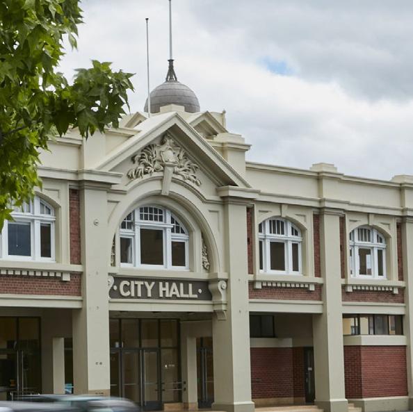
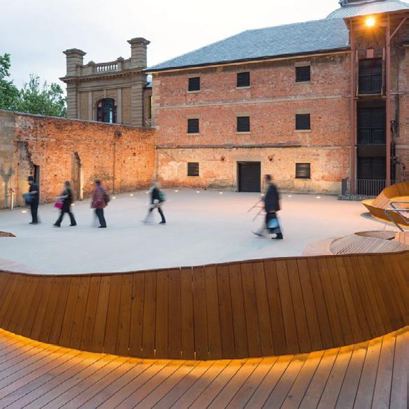
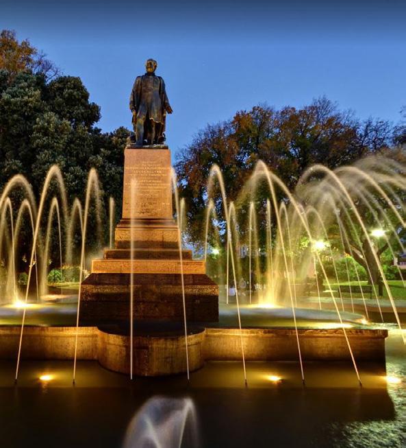
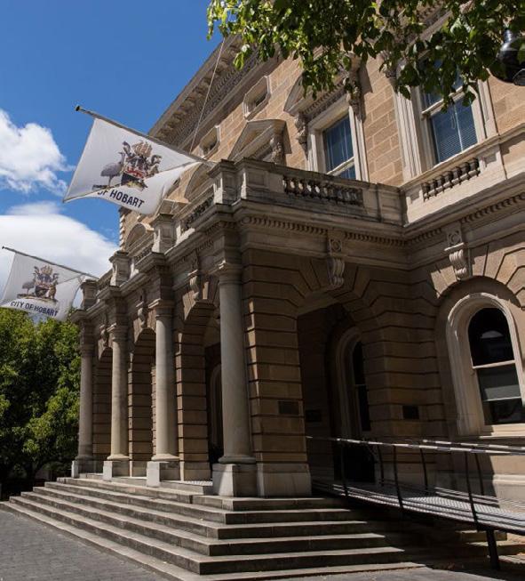 Hobart City Hall, Macquarie Street entrance
63 Central Hobart Plan
Tasmanian Museum and Art Gallery courtyard
Governor Franklin Statue in Franklin Square
Town Hall, Macquarie Street entrance
Civic and Cultural Precinct
Strategic sites
• City Hall (refurbishment and continued use).
• Dunn Place (future opportunities for alternative uses that better reflect its prime waterfront location and adjacency to the Tasmanian Museum and Art Gallery).
• Pedestrian and micromobility travel link connecting Brooke Street and Franklin Square (active travel).
• Connection from lower Collins Street to Macquarie Point (active travel).
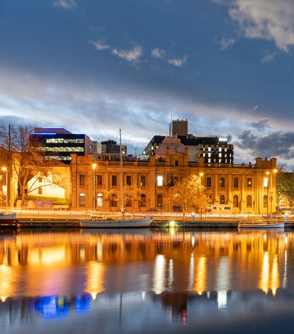
Precinct key actions
Deliver
1. Undertake further design work and seek funding for an active travel link across Davey Street to connect Brooke Street and Franklin Square.
2. Investigate the options for safer and higher amenity pedestrian and micromobility links to Macquarie Point.
3. Develop a program of works to improve the pedestrian experience in the precinct having regard to existing character, accessibility, amenity and safety.
4. Undertake a co-design process to improve the level of amenity around key current and future public transport stops.
5. Investigate how to improve the environment and amenity of the Hobart Rivulet in lower Collins Street.
6. Prepare and implement Elizabeth and Collins Street Vision Plans, with the priority being Elizabeth Street, to improve their movement and place functionality.
7. Prepare and implement CoH Urban Design Guidelines (LGA wide).
8. Prepare and implement CoH Heritage Design Guidelines (LGA wide).
9. Continue the public realm and access improvements for Collins Place.
Part Two: City Shaping Framework
Tasmanian Museum and Art Gallery
64 City of Hobart
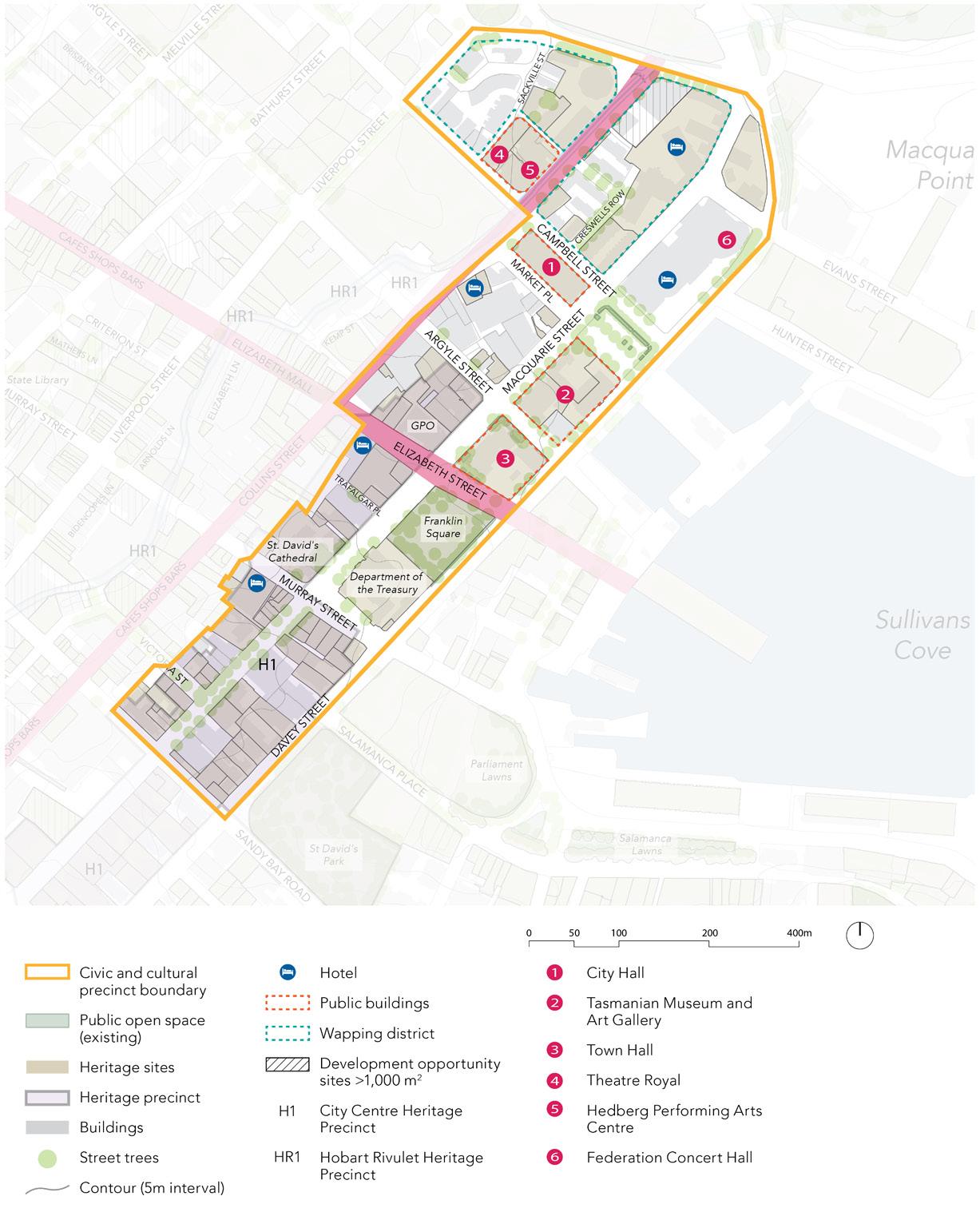
65 Central Hobart Plan
Figure 6. Civic and Cultural Precinct
Innovation Precinct
The Innovation precinct extends across Central Hobart from the Brooker Highway, includes some of the Midtown and extends to the Royal Hobart Hospital. It is currently characterised by a mix of smaller two-storey buildings, larger lot sizes, bulky goods retail, warehouses, and car dealerships.
Many of the sites are considered underutilised given the central city location,14 with opportunities to encourage redevelopment for a mix of innovation, research and development, education, and creative industries.
Retail functions in the area will remain, providing a continued service to the nearby workers and residents. It is proposed that these underutilised sites be locations for innovation clusters given the proximity to the Royal Hobart Hospital and University of Tasmania city campus.
Given its proximity to the City Centre, the hospital, and cultural and education facilities of lower Campbell Street, the precinct is well suited for innovative uses, and compatible living such as key worker housing. Over time, the precint could develop into a diverse, gritty, mixed-use area where some urban living coexists with employment, innovative and creative uses and a mix of heritage and new architecture co-located with UTAS, TAFE and RHH.
The blocks between Harrington and Campbell Streets, in the Brisbane–Melville corridor are an area in transition with recent redevelopment by UTAS. Further change is happening along Campbell Street, southeast of Melville Street, under the RHH and UTAS masterplans.
Council has committed to working closely with UTAS and RHH to ensure future planning of land holdings involve considerable engagement with the community and with Council to ensure a cohesive vision for Hobart.
The precinct includes parts of Midtown, a strip in Elizabeth Street connecting the retail core in the Central Precinct to the active entertainment and dining precinct of North Hobart and is defined by its heritage shopfronts and pedestrian amenity. The dominant land uses in Midtown include office space, residential, retail and education, which are located in buildings designed at a human scale. It is the home of many small and boutique businesses.
As this precinct has the highest proportion of development opportunity sites (see figure 3) and less of a need to respond to the existing character, it is envisaged that an Innovation Precinct Framework Plan will be prepared to guide the evolution of this key change precinct. The Framework will seek to identify the best built form outcomes, including the desirable adjustments to the maximum building heights and setback, and public realm to help deliver on centrally located employment, integrated mixed use development and key worker housing.
14. UTAS Architecture & Design with the City of Hobart (2019) Speculate: Expanding City – Underutilised Sites https://www. hobartcity.com.au/Projects/Speculate-Research-Experienceprojects
Part Two: City Shaping Framework
66 City of Hobart
Precinct objectives
• Encourage redevelopment of underutilised sites for a mix of low to medium size innovation businesses and creative industries.
• Provide for key worker housing to attract staff to the hospital, and emerging innovation and creative uses.
• Encourage the integration of housing and employment when they can provided in a single development site.
• Support the continuation of small and boutique businesses in Midtown.
• Encourage a welcoming and safe streetscape through active frontages on ground floor tenancies along Elizabeth, Murray and Melville Streets.
• Support the provision of active and public transport along key movement networks to better link the precinct with neighbourhoods beyond Central Hobart.
• Encourage the restoration of heritage shopfronts to enhance the character of Midtown.
• Promote the night-time economy emerging in Midtown by implementing planning controls to support businesses and minimise displacement due to amenity impacts.
• Increase tree canopy to improve the amenity.
A growing night-time economy is emerging in Midtown, with restaurants, bars, breweries and cafes emerging along the Elizabeth Street spine.
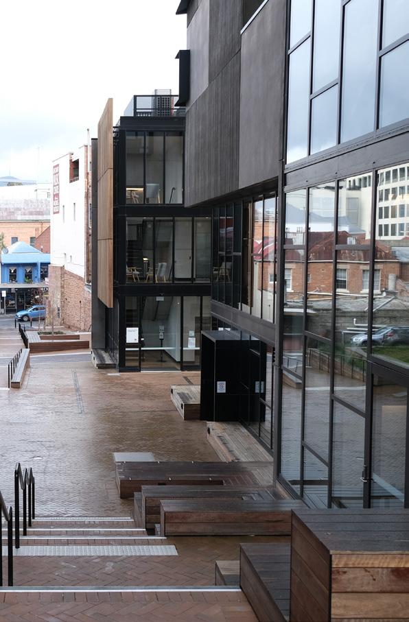
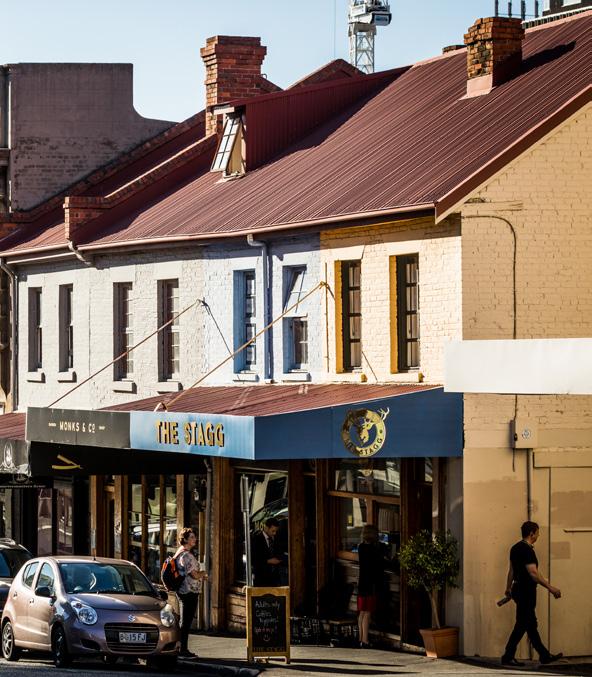 UTAS student accommodation off Melville Street
67 Central
Plan
View of cafe in Elizabeth Street (Midtown)
Hobart
Innovation Precinct
Strategic sites
• State Government sites in Patrick Street
• Royal Hobart Hospital
• University of Tasmania land holdings
Priority streets
• Elizabeth Street, as the most important city spine that connects the waterfront with North Hobart. It also has, or in very close walking distance, a great density and diversity of commercial uses.
• Melville Street, as it may present opportunities for improved active travel and amenity as a result of potential development on key strategic sites.
• Argyle and Campbell Streets, as the two main streets that traverse the Innovation Precinct, which are likely to experience significant change in the next 20 years.
Precinct key actions
Deliver
1. Prepare an Innovation Precinct Framework Plan. It will include analysis of the indicative development capacity of selected blocks and model outcomes that would be achieved from different planning controls and varied building forms, including desired heights and setbacks, and amenity implications.
2. Provide for planning mechanisms to deliver key worker housing.
3. Prepare and implement Vision Plans for Elizabeth, Argyle and Campbell Street, prioritising Elizabeth Street for improved movement and place functionality.
4. Explore the future desired streetscape function and character of Melville Street.
5. Undertake bicycle lane upgrades along Argyle and Campbell Street to help deliver on the Principal Bicycle Network15 to make micromobility use safer.
6. Require ground floor premises to provide an active frontage to the street along primary pedestrian routes to increase passive surveillance and economic vibrancy.
7. Develop streetscape improvements to enhance the pedestrian experience.
8. Prepare and implement CoH Urban Design Guidelines (LGA wide).
9. Prepare and implement CoH Heritage Design Guidelines (LGA wide).
10. Additional open space to meet the needs of workers, in particular north of Patrick Street.16
15. Source: https://www.hobartcity.com.au/City-services/ Transport-and-traffic-management/Sustainable-transportplanning
16. See Figure 38 Strategic Development Sites, page 59
Part Two: City Shaping Framework 68 City of Hobart
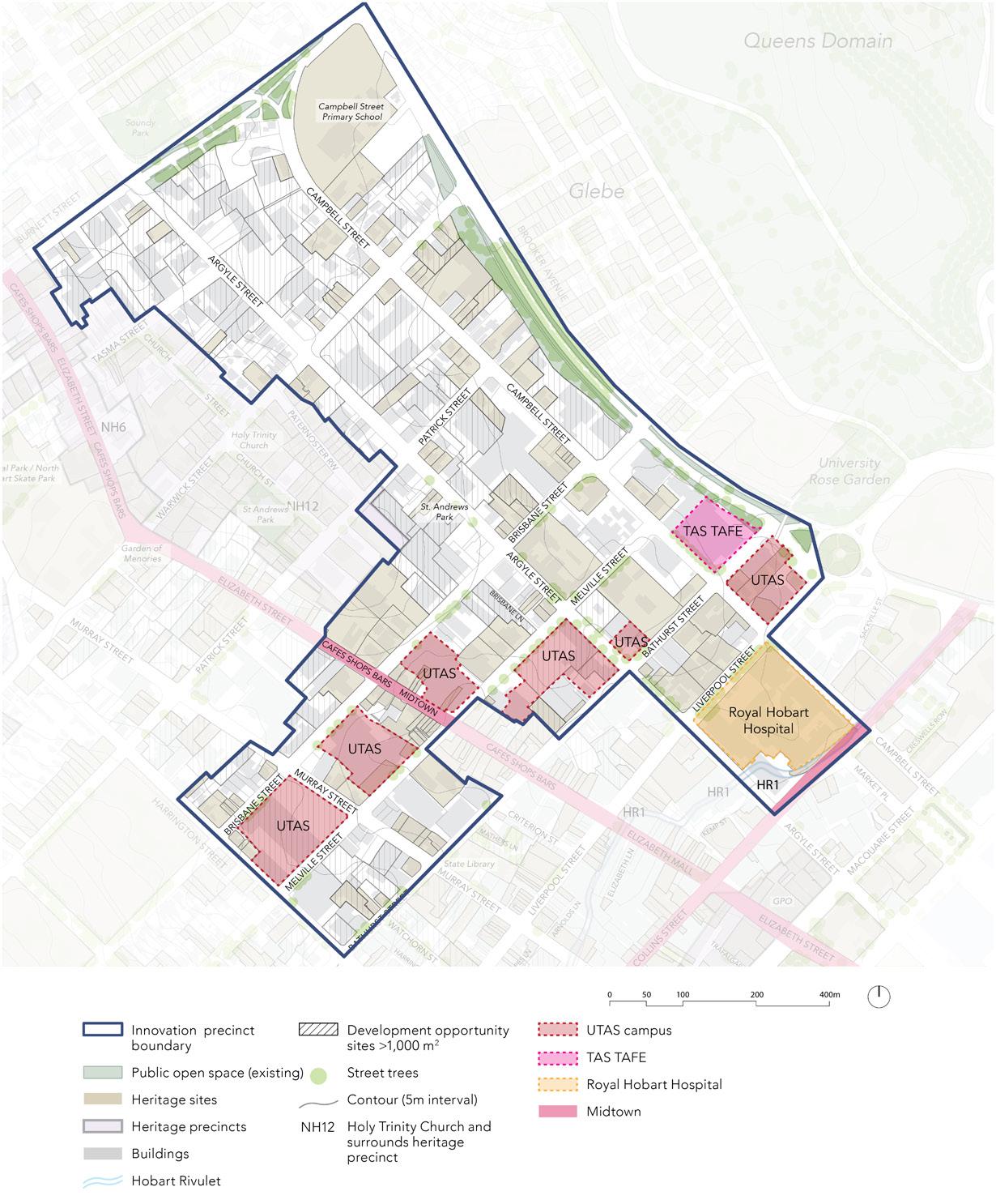
69 Central Hobart Plan
Figure 7. Innovation Precinct
Trinity Hill Precinct
The Trinity Hill precinct is in the northern part of Central Hobart extending along the northern side of Murray Street to the Brooker Highway. It is characterised by a mix of twostorey buildings, larger lot sizes, bulky goods retail, warehouses and car dealerships. The built form density is low for an urban area and many sites are underutilised.
A significant heritage residential area surrounds the old Trinity Church, which is a landmark visible from many parts of the city.
The current land uses in the Trinity Hill Precinct is dominated by retail sales, with wholesale and residential the next most frequent uses. Campbell Street Primary School and a Woolworths supermarket generate daily visits to this precinct.
Given the precinct’s proximity to the commercial and employment centre of Hobart, to the Royal Hobart Hospital, and the cultural and educational facilities of lower Campbell Street, the area is well suited to inner city living.
It is anticipated that potential development sites will gradually transition towards highervalue uses, but a mix of uses will remain, including some light industrial uses. Over time, the area could develop into a diverse, gritty, urban mixed use precinct where urban living coexists with employment, innovative and creative uses and a mix of heritage and new architecture.
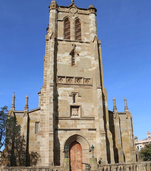
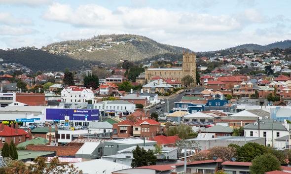
Part Two: City Shaping Framework
70 City of
Hobart
Holy Trinity Greek Orthodox Parish of Hobart
View across Trinity Hill towards West Hobart
Precinct objectives
• Encourage the development of high quality, medium density housing, and, where located along main streets, many with ground floor commercial uses.
• Ensure that educational, retail and hospitality uses are retained.
• Encourage a range of land uses that support the workers and residents of the precinct.
• Support the provision of active and public transport along key movement networks.
• Encourage development to consider the significant and prominent built environment heritage in the heart of the precinct.
• Encourage a welcoming and safe streetscape through active frontages on ground floor tenancies along Elizabeth Street.
 Outdoor dining at the corner of Elizabeth and Burnett Streets
71 Central Hobart Plan
Tree-lined footpath in St Andrews Park
Trinity Hill Precinct
Priority streets
• Elizabeth Street, as the most important city spine that connects the waterfront with North Hobart. It also has, or in very close walking distance, a great density and diversity of commercial uses.
• Warwick Street, as the main street that rises to the Trinity Hill heritage precinct, and then connects to the key areas of change along Argyle and Campbell Streets.
• Argyle and Campbell Streets, as the two main streets that traverse the Innovation Precinct, which is likely to experience significant change in the next 20 years.
Precinct key actions
Deliver
1. Investigate key underutilised sites to better understand their development and public amenity potential.
2. Analyse the indicative development capacity of selected blocks and model outcomes that would be achieved from different planning controls and varied building forms, including heights and setbacks, and the amenity implications.
3. Prepare and implement Vision Plans for Elizabeth, Argyle and Campbell Street, prioritising Elizabeth Street, to improve the movement and place functionality.
4. Explore the future desired streetscape function and character of Warwick Street.
5. Prepare and implement CoH Urban Design Guidelines (LGA wide).
6. Prepare and implement Heritage Design Guidelines (LGA wide).
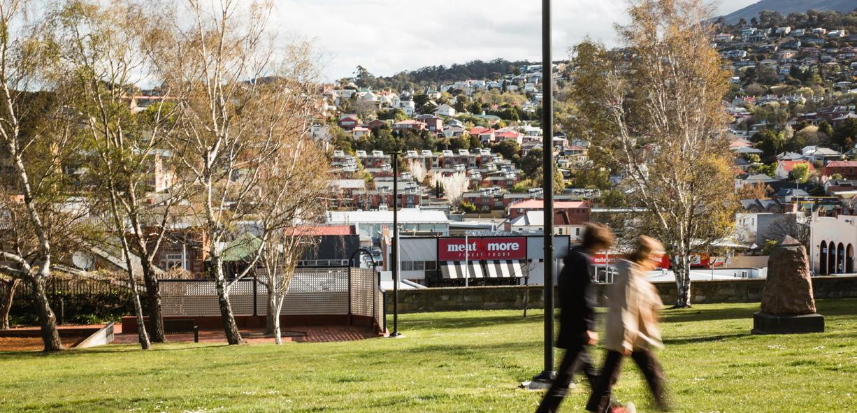
Part Two: City Shaping Framework
72 City of Hobart
St Andrews Park
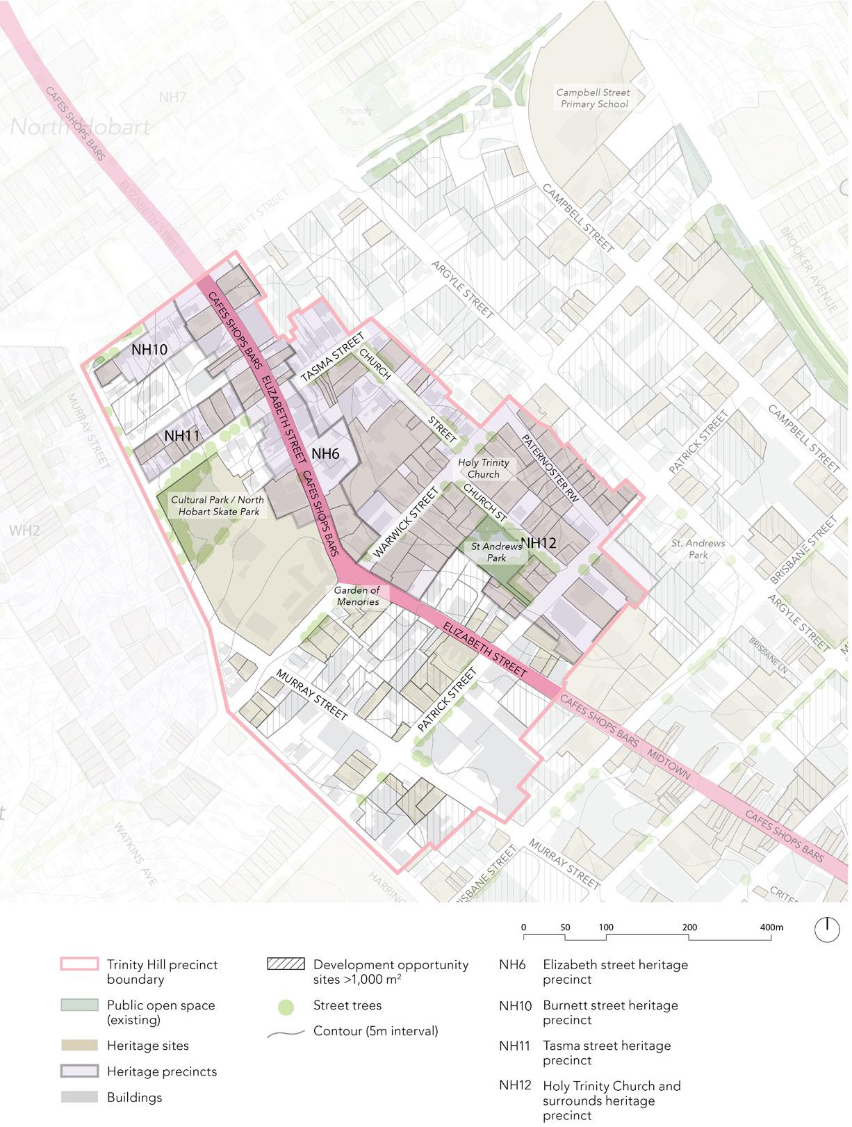
73 Central Hobart Plan
Figure 8. Trinity Hill Precinct
Rivulet Precinct
The Rivulet Precinct is located on the southern fringe of the city centre. This area is characterised by large government office buildings, hotels and general office space. The precinct is a gateway to Hobart's natural landscape, with the Hobart Rivulet forming the green spine that connects the city centre to the mountain.
The Rivulet precinct is a diverse area that includes part of the valley formed by the Hobart Rivulet, sitting to the south of the Central precinct. It is characterised by large government office buildings, hotels and general office space, with several blocks of residential uses that are consistent in form and character with the adjoining suburb of West Hobart.
The Rivulet precinct is dominated by public administration, accommodation and food services, and general office space, with residential the next most frequent land uses. There are some 700 residents in the area now, and approximately 6,000 people work here.
The precinct has a significant proportion of underutilised land with potential for renewal, development and intensification. This area could emerge as a varied, growing urban neighbourhood with increased activity along Collins and Liverpool Streets. Strong links to open space of Hobart Rivulet Park, provide a continuous green link between the city centre and kunanyi / Mount Wellington.
The Hobart Rivulet is central to the precinct and is open to the sky in several locations. There is an opportunity for a more natural and integrated design along the Rivulet and to explore how it connects to the wider city.
As the area grows, pedestrian, cycling and micromobility links should be strengthened, with Collins Street a focus for bike infrastructure and street trees.
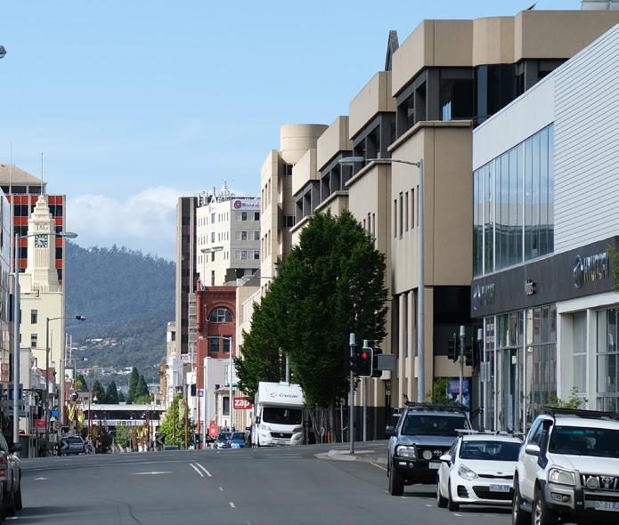
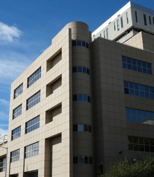
Part Two: City Shaping Framework
74 City of Hobart Streetview of Collins Street Commonwealth Government Office on Collins Street
Precinct objectives
• Encourage the development of high quality, medium density housing, many with ground floor commercial uses.
• Ensure that office and commercial uses are retained.
• Encourage a range of uses that support the workers and residents of the Precinct.
• Support the provision of active and public transport along key movement networks.
• Encourage developers of land near or over the rivulet to setback and create active edges along the rivulet to ‘daylight’ the rivulet as a key feature.
• Encourage welcoming and safe streetscapes through active frontages on ground floor tenancies along Collins Street.
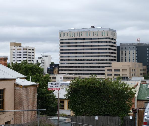
The precinct has a significant proportion of underutilised land with potential for renewal, development and intensification.
75 Central Hobart Plan
View from Goulburn Street towards the office buildings in the precinct
Hobart Rivulet as viewed from Collins Street, between Barrack and Molle Streets
Rivulet Precinct
Priority streets
• Collins Street, as the active travel link between South Hobart, the Central Hobart and, further. It is also an important commercial street.
• Molle Street, as it connects Davey and Macquarie Streets to West Hobart and beyond. However, it presents significant challenges for active travel because of its steepness.
• Macquarie Street, as one of the two main roads, together with Davey Street, that connect Central Hobart to Greater Hobart in terms of private and public transport. It also has notable heritage buildings along its length.
Precinct key actions
Deliver
1. Investigate key underutilised sites to better understand their development and public amenity potential.
2. Analyse the indicative development capacity of selected blocks and model outcomes including amenity implications that would be achieved from different planning controls and varied building forms, including heights and setbacks.
3. Prepare and implement a Vision Plan for Collins Street.
4. Prepare and implement CoH Urban Design Guidelines (LGA wide).
5. Prepare and implement Heritage Design Guidelines (LGA wide).
6. Make active travel improvements along Collins Street.
7. Explore how the Hobart Rivulet could add to the amenity of the precinct by improving its natural environment, stormwater function and access.
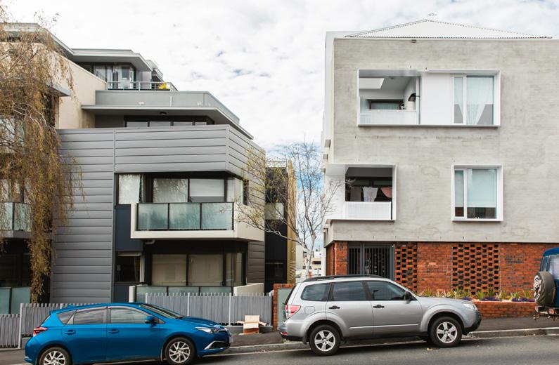
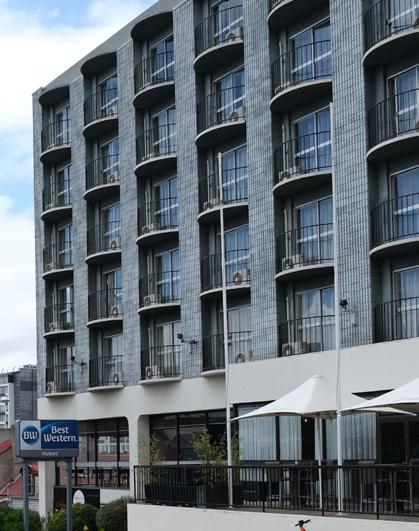
Part Two: City Shaping Framework
76 City of
Hobart
Diverse building mix with varying scale in the Rivulet Precinct, in Goulburn Street and Bathurst Street respectively
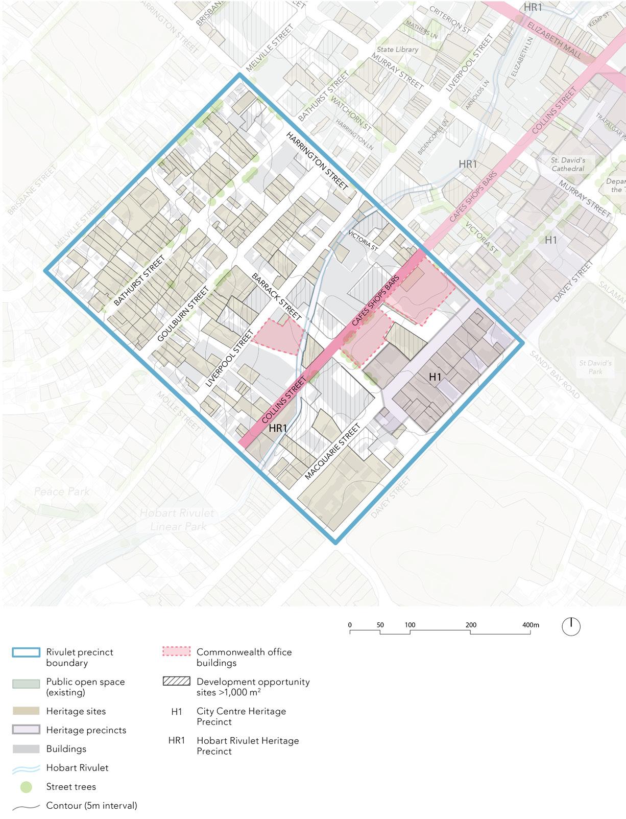
77 Central Hobart Plan
Figure 9. Rivulet Precinct
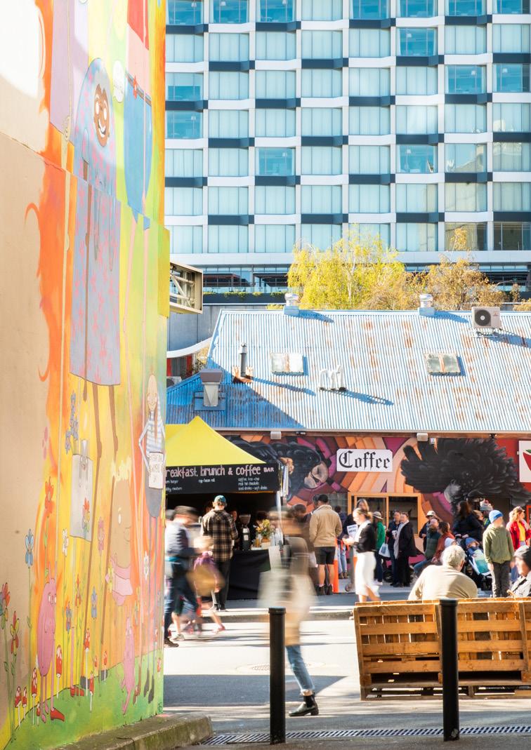
Part three: Urban Design Framework
City of Hobart 78
Part three: Urban Design Framework
3.1 Purpose
The purpose of the Urban Design Framework (UDF) is to support the vision, objectives and strategies of the City Shaping Framework for Central Hobart.
Developed in conjunction with MGS Architects, the framework provides guidance on the future built form of Central Hobart informed by the city’s existing character and identity, economic demands and growth, and recent and emerging investment by government, other institutions and private developers.
The Framework will provide clarity for the community and developers in the priorities for Central Hobart, supporting the decision making process and enabling development to deliver built form and public realm outcomes that will shape Hobart as a vibrant, inclusive, resilient and liveable city.
The City of Hobart Urban Design Advisory Panel will continue to play an important role through the independent review process.
Implementation
The proposed built form controls will be delivered through changes in the Tasmanian Planning Scheme provisions. The improvements to street amenity and the delivery of new open space will be achieved through a combination of developer contributions and public funding.
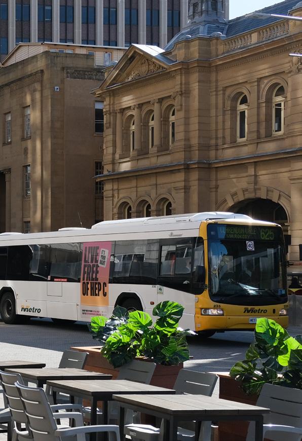
Bus
Buildings of exceptional design quality contribute to the character of the city through mass, form, materials and the design of entries, foyers and active interfaces.
Central Hobart Plan 79
Interchange on Elizabeth Street
3.2 Vision and principles
Vision Overview
As the heart of Tasmania’s capital, Central Hobart will continue to be a key destination for retail, hospitality, government services, and cultural, arts and entertainment experiences.
As the city grows and develops the central cityscape will be maintained, protecting views, significant places, public amenity guiding development that is sensitive to the public realm and city interfaces.
New development is an opportunity for the health, education and other innovation sectors to deliver jobs, enriching the city fabric through high quality design, a complementary mix of uses, improving and creating new laneways, open space, and ground floors that engage with the streetscape.
Encouraging greater mixed land uses will deliver a variety of housing choice in a walkable compact city centre that celebrates its heritage, shaping a vibrant, sustainable and climate resilient centre.
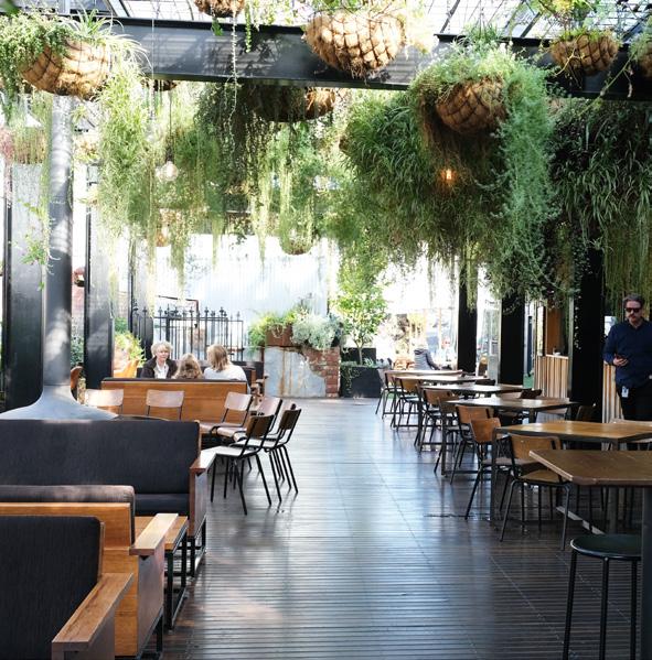
Principles
Built form and design
• Enable innovative, equitable and sustainable development outcomes, including protecting valued existing uses such as the night-time economy.
• Ensure built form is to an appropriate contextual scale, responds to important cityscape views and transitions to lower heights.
• Reinforce the street walls, to better manage setbacks to retain the visual prominence of heritage buildings, and minimise solar and wind impacts.
• Integrate ground floor uses to increase the sense of safety and activation in the public realm.
Delivers on the following City Shaping Goals:
1. A captivating and dynamic capital city
3. Sustainable buildings with character
5. An investment-ready and innovative city
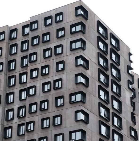
Part three: Urban Design Framework
In The Hanging Garden City of Hobart 80 UTAS student accommodation Hytten Hall
Public realm
• Create a robust public realm network including creating new and improved pedestrian links and open space.
• Protect sunlight amenity and weather protection for the public realm, including streets.
• Increase the street tree canopy and embrace other opportunities for urban greening and connection with nature.
• Expand the public realm interface by identifying opportunities for renewal. For example, improving access to the Hobart Rivulet and conserving environmental qualities.
Delivers on the following City Shaping Goals:
1. A captivating and dynamic capital city
2. Public Spaces that engage and create joy
Movement
• Provide clarity on the proposed Transport Network Operations Plan - Inner Hobart, for pedestrians, cyclists and users of micromobility devices.
• Identify where streetscape upgrades can support better movement, increasing amenity and enhanced street vibrancy.
• Recognise the importance of key public transport nodes and end-of-trip facilities.
• Manage vehicle access and parking, prioritising access locations and consolidating parking for an increasingly pedestrian-focused Central Hobart.
Delivers on the following City Shaping Goals:
1. A captivating and dynamic capital city
4. Integrated and accessible movement networks
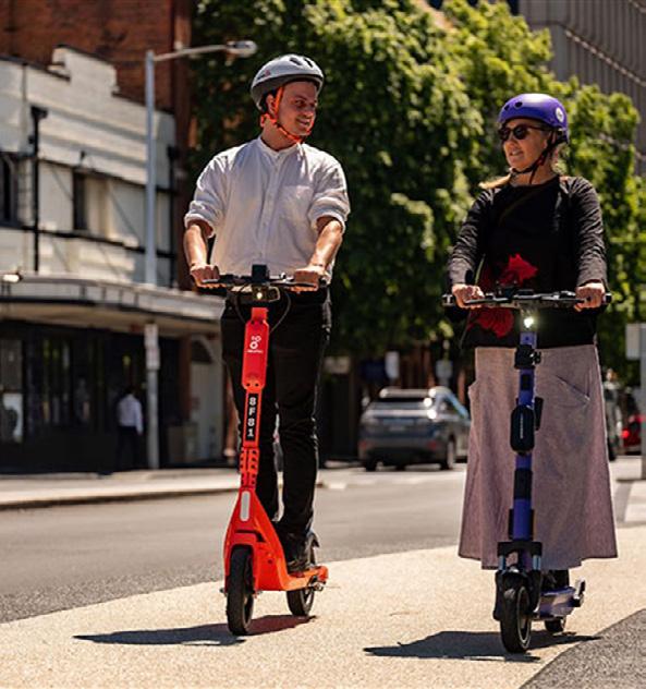
Central
Plan 81
Hobart
Aerial view of the internal courtyard of UTAS student accommodation Hobart Apartments
E-scooters on the Morrison Street shared path
3.3 Central Hobart’s defining elements
Overview
The character and experience of Central Hobart draws from its beautiful natural setting, its Aboriginal history, its built form and land use heritage, fine-grain shopfronts, and networks of streets and laneways.
While some new buildings and public space upgrades have added valuable layers to this rich history, there are examples of some built form that dilute the urban landscape. Further, a sole focus on medium-density residential development could push out some of the uses that would help Hobart thrive into the future.
3.3.1 Aboriginal identity
nipaluna/Hobart was home to the Muwinina people who thrived on country for more than 40 000 years. Today the Palawa people, who survived colinisation and disposession are the recognised custodians of the lands of the Muwinina people who are no longer with us. Palawa people have a strong connection to country, yet this connection to place and expression of Aboriginal culture is not evident in the built form and open space of Central Hobart.

The Urban Design Framework encourages A boriginal engagement and expression as a core need to enhance the city’s character and cultural expression.
3.3.2 Urban structure and heritage
Central Hobart contains many outstanding heritage listed buildings of both State and National importance set on a clear grid street layout. Most notable are the collection of formal sandstone buildings and associated places lining Macquarie and Davey Streets. As well as prominent civic buildings such as the Hobart Town Hall, Treasury Building, General Post Office, St. David’s Cathedral and the Tasmanian Museum and Art Gallery.
Unlike many of Australia's other state capital cities, Hobart has retained many of its older buildings, and importantly, has not experienced substantial amalgamation of its original plot layout. This has limited the number of newer tall buildings and means that the city core has remained largely at a twoand three-storey scale, retaining important vistas to the surrounding landscape and allow older buildings of height, such as churches, to remain prominent.
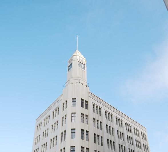
Part three: Urban Design Framework
of
82
City
Hobart
Palawa smoking ceremony at Franklin Square
The T&G Building
This retention of plots and older buildings produces streetscapes with a uniformity of scale, articulation, rhythm, quality materials and fine detailing. Traditional roof forms are a significant feature and Hobart benefits from a clear network of streets and laneways, making it walkable, safe and easy to navigate.
As Central Hobart develops, it is important to ensure the retention and reinforcement of its built heritage, the quality of its built form, the human scale of its streets, its sense of place and its walkability all of which are integral to the City’s identity and character.
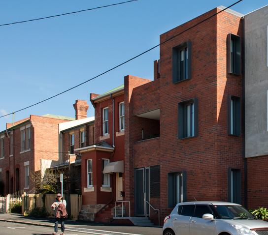
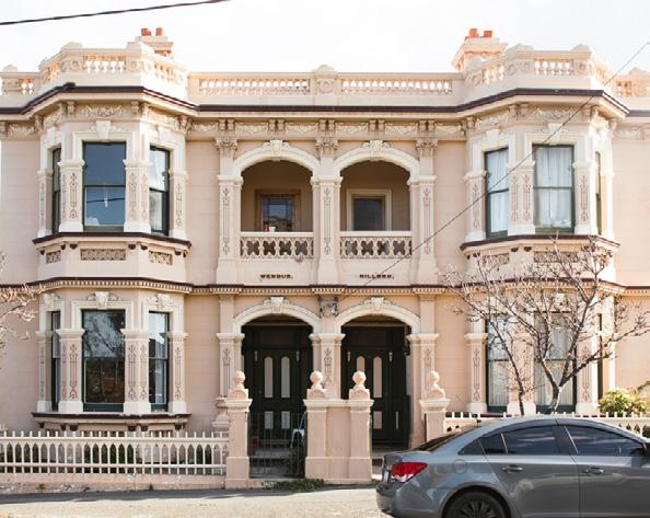
3.3.3 Public realm and movement
Public open space, such as the Sullivans Cove waterfront, Franklin Square, St Davids Park and Queens Domain, are major destinations and form part of Hobart’s identity as a contemporary lifestyle city. Hobart’s gridded network of streets and laneways gives the city great potential for walking and cycling, with public realm upgrades in Sullivans Cove and Liverpool Street providing exemplary open spaces. However, the current provision for public open space in the city centre is relatively limited, noting the extensive bushland setting at the city fringes.
Clear strategies for increasing open space and ensuring streets play a role as ‘social places and spaces’ will be key to the success of a liveable capital city experience. This is particularly pertinent when considering the future densification of Central Hobart.
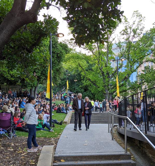
Central
Plan 83
Heritage and new medium density housing on Goulburn Street. Photograph: Natasha Mulhall
Hobart
Wendur and Hillbro, Church Street
Food and live music event, Franklin Square
3.3.4 Built form controls, land use and development
Central Hobart is positioned to grow as new development meets demands for centralised employment and residential opportunities. While some areas and blocks have attracted strong investment, with increasing density or diversifying use, other areas present opportunities for change.
The Building Amenity Envelope in the planning scheme that applies in Central Hobart aims to manage building scale and mass, and, importantly, to protect sunlight amenity within the public realm. As the city grows it will be important to create streetscapes and place's that are comfortable to use all year round.
3.3.5 Existing building heights, street walls and setbacks
Existing buildings in Central Hobart are predominantly taller in the city’s inner core and reduce in scale and bulk as one moves down to the waterfront and up to the residential city fringe. The retail core ranges from taller mid-20th century office towers and car parks (8–14 storeys) to lower scaled shopfronts and heritage fabric (1–4 storeys). Sullivans Cove is a mixture of midscale heritage fabric at its fringes (2–4 storeys) with several higher mid20th century towers that confuse the urban logic of the cove floor. Ensuring density is consolidated in the right locations in the city is key to ensuring the amenity of the city is retained into the future.
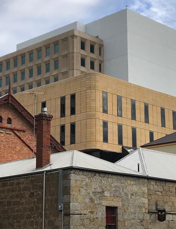
Part three: Urban Design Framework
View of State Library Building from In The Hanging Garden. Photograph: Natasha Mulhall
84
City
of
Hobart
View of buildings at various heights from Davey Street
3.3.6 Design quality
Central Hobart is renowned for its humanscaled heritage fabric, a consolidated mid20th century core, and more recently a series of award-winning buildings, landscapes and open space particularly focused in and around Sullivans Cove.
Buildings in Hobart’s centre need to have high-quality design and visual amenity on their upper levels, they need to be design ‘in the round’, to contribute positively to the broader townscape experience.
Hobart has a history of small-fronted shops and laneways in the city centre, and as the city densifies and becomes more intense in use, genuine activation of the street level is crucial.
3.3.7 Sustainability
Hobart’s unique position at the foothills of the Wellington Range offers expansive green spaces at the city fringes. By contrast, Central Hobart tree canopy is limited and impervious surfaces, such as on-grade parking, are significant.
Emerging challenges due to climate change include the urban heat island effect and flooding, in particular associated with the Hobart Rivulet and impacting areas near the City Hall on lower Collins Street and Market Place.
Improving sustainable transport outcomes is important for a growing city. The City Centre is is the point of arrival and departure, as well as interchange, for the majority of Hobart's bus routes. A new ferry service connects Central Hobart to the eastern shore via Bellerive. Recent improvements to the active travel network include widening footpaths and upgrades to cycling routes.
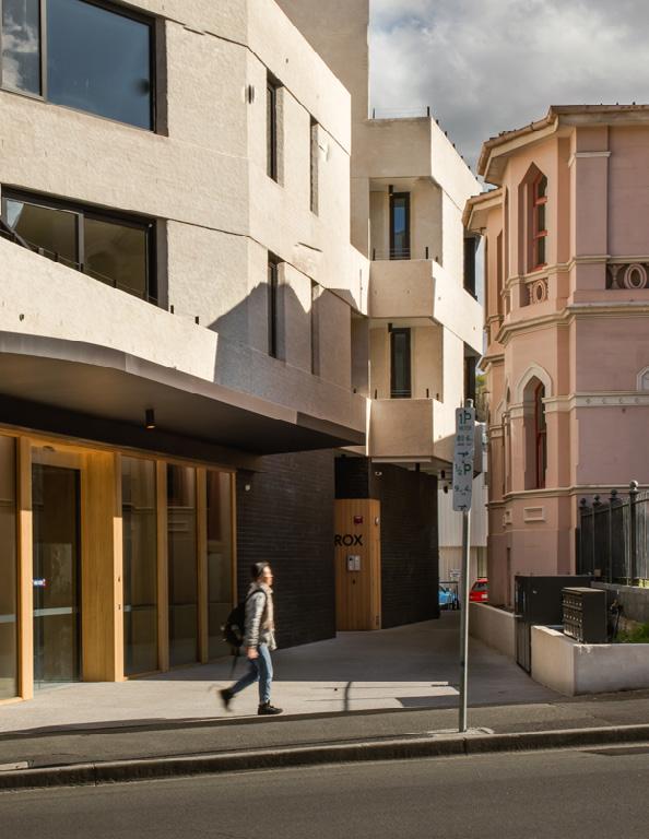
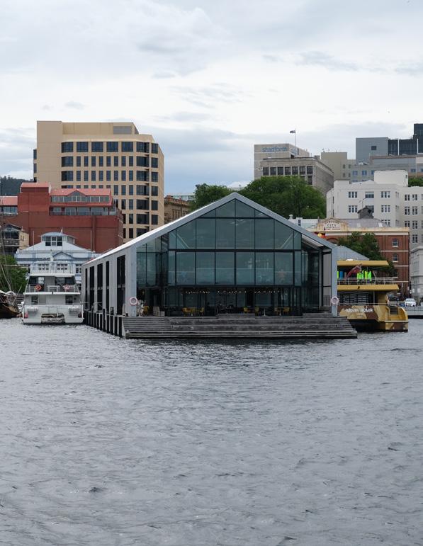 The Rox development on Elizabeth Street and its relationship to the existing on-site heritage building
Central Hobart Plan 85
Brooke Street Pier provides ferry services across the River Derwent
3.3.8 Natural setting and views
Hobart is defined by the dramatic landscape it sits within, in particular kunanyi / Mount Wellington, beneath the expansive Wellington Range.
The urban amphitheatre beneath the mountain is ever present, and visual connections provide the backdrop for a dramatic and unique capital city experience.
Views along the River Derwent, connect the inner city locations deep into the broad southern estuary, contributing to Hobart’s unique identity as a ‘small city in a large landscape at the southern edge of the urbanised world’.17
3.3.9 Views and sightlines
Views to and from Central Hobart bring an immediate sense of place that is cherished by the people of Hobart and its visitors.
The Urban Design Framework supports the ambition to protect the visual connectivity between Central Hobart and it's natural and built heritage landscapes. This helps shape the built form of Central Hobart and its connections to the landform horizon.
Traditional built form landmarks in Central Hobart are the spires of churches and cenotaphs on prominent headlands and elevated hillsides in and around the city centre. Some built form has, over time, diluted some of these visual connections from inner city locations, and robust analysis and testing of views and landform connections is key to ensuring this unique capital city experience is retained into the future.
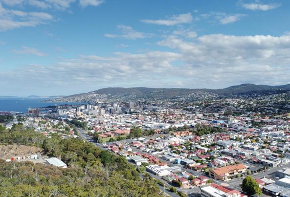
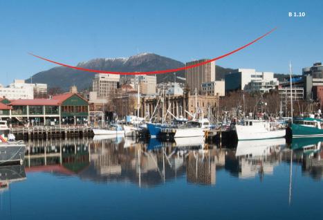
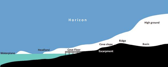
Part three: Urban Design Framework
View of Central Hobart, with the land form horizon of Mount Nelson, from the Queens Domain
Hunter Island to kunanyi / Mount Wellington (Hobart Height Standard Review, 2018)
17. Building Heights Standards Review Project,
City of Hobart 86
The Amphitheatre to the Cove within the Urban Amphitheatre (Hobart Interim Planning Scheme, 2015)
Leigh
Woolley
Report,
2018
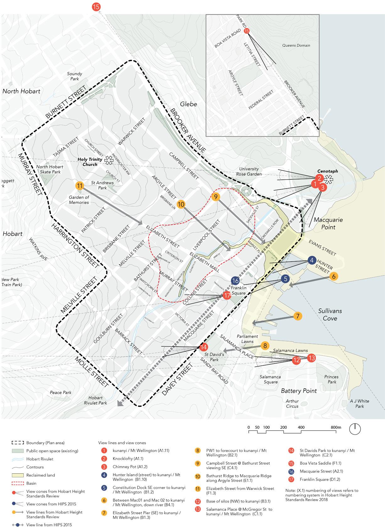
Central Hobart Plan 87
Figure 10. Views and sightlines plan
3.4 Built form and design
3.4.1 Building heights Overview
Building height is a key determinant in the overall scale, form and preferred character of the streets of Central Hobart. Preferred maximum building heights have been established to promote building typologies that support the land use vision while responding to valued landform, sightlines, heritage attributes and streetscapes.
The building height plan represents the maximum allowable heights. Constraints such as lot size inform the appropriate height for each individual lot. Maximum height proposals must demonstrate exceptional design quality and deliver significant public benefit.
Landform and height considerations
The natural topography of Central Hobart influences the way in which building heights are perceived and where it is logical for taller built form to be located without unduly impacting views and amenity.
Development heights should reinforce the layered landform rise from the waterfront or Cove, with greater heights in the ‘basin’ area, and a reduction in scale towards the Queens Domain, the Domain headlands (i.e. the Hobart Cenotaph), Battery Point Headland and the natural rise to the Barracks.
Some newer taller developments have muddied this topographic reading of the townscape, and careful consideration must be taken when assessing where height should occur into the future to protect the character of Central Hobart.
Aligning building heights with amenity controls
Building heights have been proposed to support the protection of key view lines and view cones in order to maintain Central Hobart’s identity as a city within a landscape. This work has been informed by the Building Heights Standards Review Project.18 Establishing surveyed locations and datums for surrounding landscape features will support the planning application process.
The maximums heights are subject to some considered adjustments as part of the planning amendment process, which will be informed by a select block analysis.
Creating a public realm with high levels of amenity is increasingly important to support the city’s growth, particularly in a postpandemic context. The existing built form amenity envelope has been adopted to ensure ongoing protection of sunlight access along Hobart’s southern footpaths.
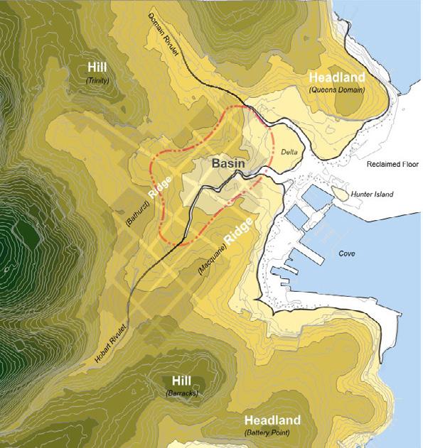
18. Building Height Standards Review Project, report for City of
Part three: Urban Design Framework
City of Hobart 88
The Amphitheatre to the Cove within the Urban Amphitheatre (Hobart Interim Planning Scheme, 2015)
Hobart, Leigh Woolley (June 2018)
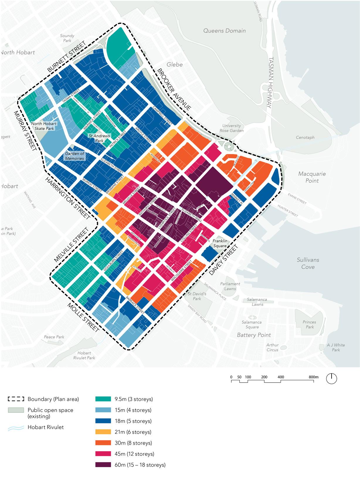
Central Hobart Plan 89
Figure 11. Proposed maximum building heights plan (subject to some refinements and corrections as part of a future public planning amendment process)
Responding to heritage and residential interfaces
Highly valued heritage buildings, streetscapes and precincts create a rich identity in Central Hobart. Building heights prioritise growth and change in areas less constrained by heritage. Building heights transition to adjoining established residential areas to create a logical shift in scale and bulk.
Development capacity and forecast demand
The Framework provides guidance on heights and built form to manage the anticipated growth of both employment and residential gross floor area in Central Hobart. City blocks identified as areas of change will accommodate this growth. New developments can make positive contributions to the city and public realm, including community benefits such as new laneways to support improved pedestrian permeability and site access or new open space. As part of this process, lot consolidation can enable larger or more complex developments to occur and should be considered for overall community benefits.
3.4.2 Street walls
Overview
Street wall height refers to the height of the building at the street edge, with upper levels set further back. Setting back upper levels of buildings ensures there is street wall definition, sunlight amenity can be managed and articulation of the built form reduces building bulk and contributes positively to the character of the city’s townscape and streetscape.
An appropriately scaled street wall at human scale contributes to an inviting and sunlit street with a sense of enclosure, while at the same time offering clear views to the sky.
The proposed street wall height is determined by the proposed maximum building height, so that it provides a transition in street wall height that reflects the total building height.
In areas where heritage buildings contribute significantly to the streetscape character, adjoining street wall heights should match heritage street walls to ensure the heritage elements remain dominant.
In streets where heritage is not the dominant character, maximum street wall heights must meet overshadowing requirements.
• Street wall heights are not defined for
• Streets less than 12m wide, such as laneways
• Rivulet interfaces
• Lots with maximum building heights lower than 15m
• T he Royal Hobart Hospital site
For streets less than 12m wide and Rivulet interfaces, street walls should be at a lower pedestrian-focused scale. Upper level setbacks should allow for sunlight penetration and a sense of opening up towards the sky.
The street wall height along Brooker Avenue, between Brisbane Street and Warwick Street, is set at 15m to provide a transition in height and built form between the intensity of the highway and the city centre.
Part three: Urban Design Framework
City of Hobart 90
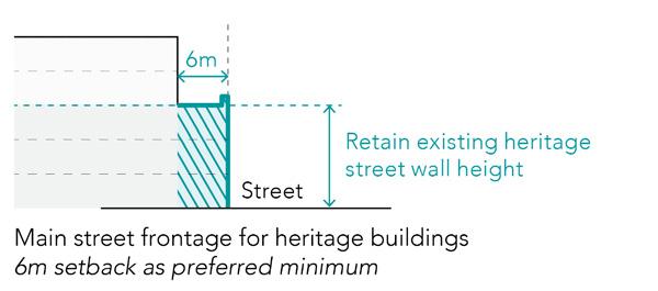
Heritage
To retain the visual distinction and character of heritage buildings within the streetscape, street wall heights should reflect the context, specifically the level of intact heritage streetscapes. New buildings should be designed to reflect the height and width of adjacent heritage buildings or the wider scale of the streetscape including the historic lot pattern.
In intact heritage streetscapes:
• where adjoining heritage is one storey, new street walls up to maximum 1 storey higher
• w here adjoining heritage is two storeys or more, match adjoining heritage parapet height.
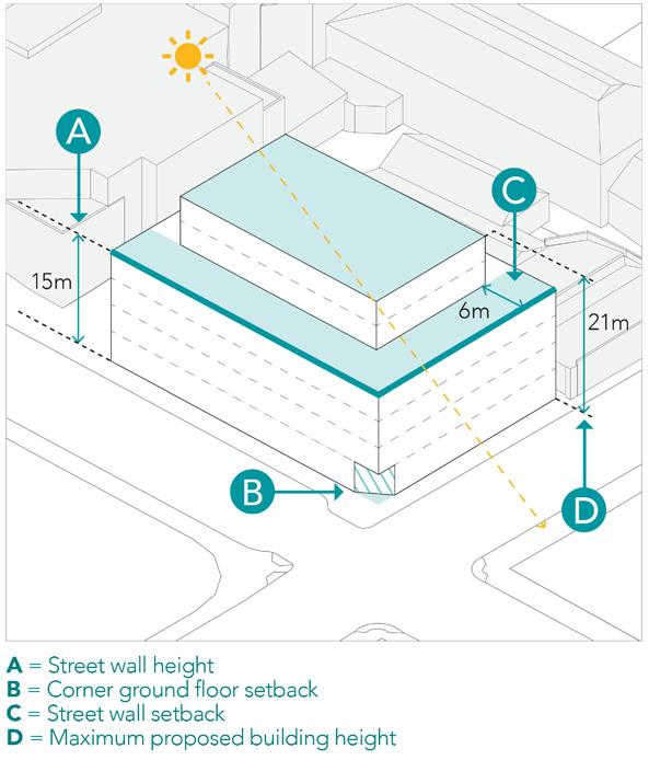
In streetscapes are a mixture of heritage and infill:
• w here adjoining heritage is two storeys or less, new street walls up to a maximum 1 storey higher
• w here adjoining heritage is three storeys or more, match should be compatible with heritage street wall for a preferred minimum of 6m.
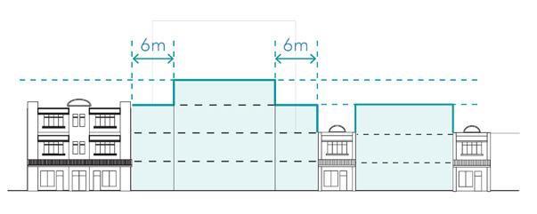
Where streetscapes are a mixture of heritage and infill Note: Heritage built form is indicative only and is not meant to comprehensively reflect the variety of built form heritage in the Hobart
Setback and street wall height requirements for heritage buildings diagram
Diagram showing street wall height, setback and corner treatment. Refer to section 3.6.1 for overshadowing controls
Central Hobart Plan 91
Street corners
Buildings on street corners should be designed to provide emphasis and definition of the street corner.
• ‘Turning the corner’ seeks to address the need to transition down to a lower street wall along the side street where there are two different street wall heights, subject to sunlight amenity assessment. Preferred 6m minimum length of transition zone.
• Design corners at street level, for example through chamfering and/or building setbacks, can create more space and increase visibility, amenity and safety for pedestrians.
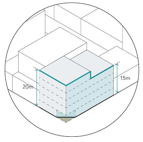
Street corner diagram
Street frontage setback
In principle, buildings should be built to the front boundary to reinforce and define the streetscape except where:
• there is an existing landscaped setback, where the street wall setback should be set in proportion to the landscaped setback.
• placemaking and open space opportunities are identified.
• institutional uses are proposed, where setbacks should respond to amenity and placemaking opportunities.
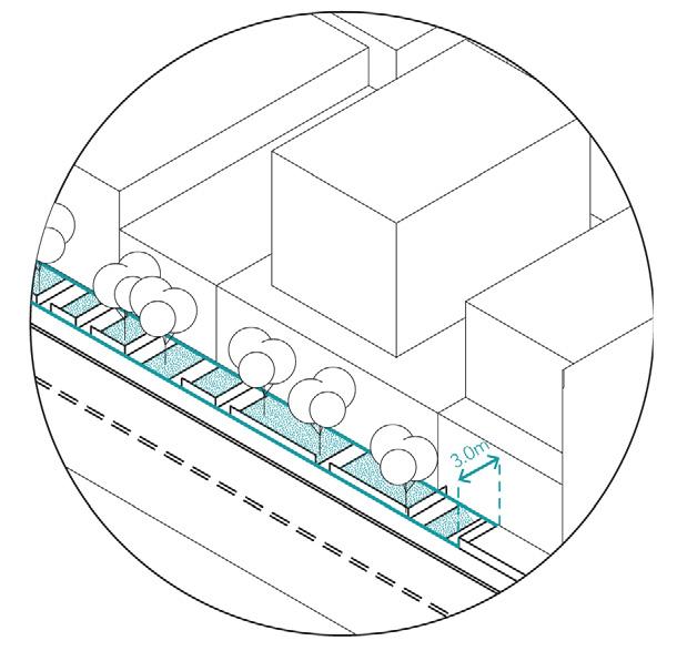
Street frontage setback diagram
Part three: Urban Design Framework
City of Hobart 92
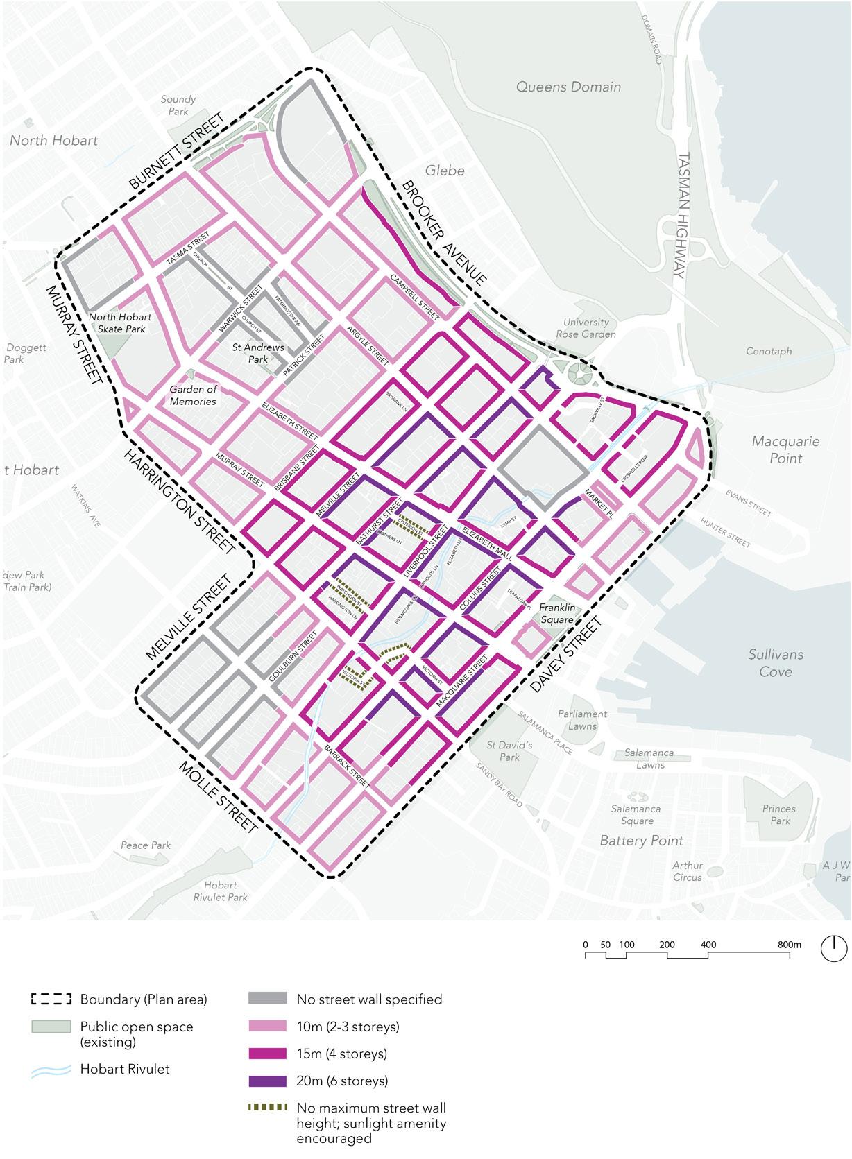
process)
Central Hobart Plan 93
Figure 12. Proposed maximum street wall height plan (subject to some refinements and corrections as part of a future public planning amendment
3.4.3 Setbacks and building separation
Overview
Building setback controls manage how built form within Central Hobart contributes to the streetscape and ensures the desired levels of sunlight and visual amenity are achieved within the streets and other public spaces. Setbacks between buildings create opportunity for views through to the sky and avoid a continuous upper level when viewed from the street.
Side and rear setbacks
Buildings should incorporate side and rear setbacks to provide sufficient distance between buildings to allow equitable access to sunlight and daylight to windows and habitable rooms of existing buildings and to future development on adjoining sites. Side and rear setbacks will provide appropriate levels of privacy at upper levels, minimising the need for screening.
The building separation above the street wall will help lessen the perceived bulk of buildings as perceived from the street.
The sides of buildings will potentially be visible from the street and from adjoining buildings. Consequently, they should integrate elements of architectural interest to positively contribute to the character of the streetscape and townscape of Central Hobart.

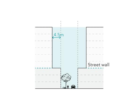
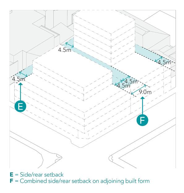
Part three: Urban Design Framework
City of Hobart 94
Side building setback above street wall diagram
Setback above laneways diagram
Diagram showing side and rear setbacks on adjoining building forms
Building Setbacks on laneways and Hobart Rivulet
To improve amenity outcomes for laneways and the Hobart Rivulet such as sunlight/ daylight and creating a sense of opening towards the sky, development is encouraged to create a preferred maximum street wall along the laneway or rivulet with preferred minimum upper level setbacks.
Balconies can project into this setback and, along with windows, should be designed to create a sense of natural surveillance overlooking the rivulet or laneway. Street wall heights along the rivulet should optimise sunlight and daylight onto the rivulet.
Investigate the introduction of a ground floor building setback along the Hobart Rivulet. It will facilitate the long term delivery of a blue and green spine through the city centre and a greater level of public access and enjoyment of the rivulet.
Building separation within a site Development on very large sites (>5000 m2 ) must provide building separation where multiple upper level developments are proposed; to manage privacy, improve amenity outcomes for views and sunlight, and to provide visual breaks between the upper storey form.
Building separation can also be designed around ground level pedestrian access and should comply with the draft Apartments Code to be introduced into the Tasmanian State Planning Provisions.19 19. https://planningreform.tas.gov.au/planning-reforms-andreviews/review-of-the-state-planning-provisions
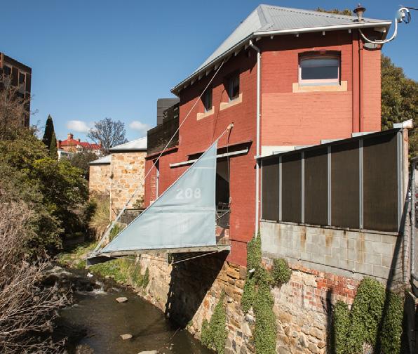
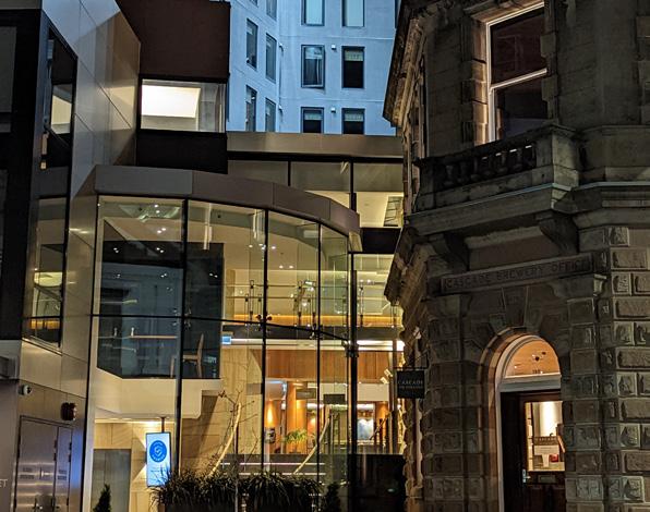
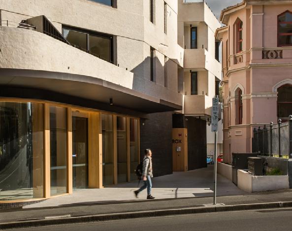 Hobart Rivulet near Collins Street
Photograph: Natasha Mulhall
Hobart Rivulet near Collins Street
Photograph: Natasha Mulhall
Central Hobart Plan 95
RACV Hotel setback from heritage building and street frontage
The Rox – corner of Elizabeth and Brisbane Street. Photograph: Natasha Mulhall
3.4.4 Street activation and interfaces
Overview
Buildings in Central Hobart should be designed with active frontages that contribute to a safe and lively street life. New buildings should respond to the heritage, streetscape and landscape context. Active frontages ensure appropriate levels of transparency creating natural surveillance and a sense of movement, clear entry points and ground floor uses, such as retail and hospitality spaces that enhance street life.
General guidelines
• Provide appropriate levels of clear glazing for specific interface types, (see Table 2) and legible entries to buildings to increase the level of permeability and visibility from the street.
• Avoid the use of vinyl wrap advertising or ensure they are transparent if they are used.
• New development should respect the characteristics and dominant pattern of building frontages in the streetscape.
• Provide sleeved car parking structures (see Figure 102) with active uses to increase street activation and passive surveillance.
• Provide balconies and openable windows within the street wall and orient habitable rooms towards the street and laneway to create interest to occupants and increase passive surveillance of the street.
• Ensure that building indents are set at a depth that remains visible from the street to avoid creating unsafe entrapment spaces.
• T he design of weather-protected spaces should include structures, canopies or awnings that do not encroach into space designated for canopy trees.
Ground floor use
Ground floor uses should logically relate to the type of active frontage to ensure interfaces with the street are not ‘dead’ spaces. In additional to retail, hospitality and services, uses could include spaces aligned with university or education functions such as study or event spaces that could also be accessed by the public.
Table 2. Active frontages
Interface type Requirements (example criteria – indicative only)
Retail and hospitality
Provide structures, canopies or awnings that offer continuous and functional weather protection where retail and hospitality uses are proposed. These should be designed to allow for street canopy trees.
Avoid broad tenancies along the street frontage and sleeve large floorplate tenancies with finegrain tenancies.
Avoid external steps or pronounced level changes at ground level that visually and physically separate the frontage from the street.
Residential Provide direct individual entries to dwellings or home offices at ground level where practical.
Open space
Institutional (e.g. hospital, education)
Provide habitable rooms orientated towards the abutting open space.
Provide direct individual entries to dwellings from open space where practical.
Institutional buildings should, where practicable, create activated facades to increase the degree of visual and physical interaction between people in the street and those within.
Heritage Heritage requirements take precedence over glazing requirements.
Part three: Urban Design Framework
City of Hobart 96
Building services
The design and configuration of building services, including waste and loading, is key to creating high-quality and safe interfaces between the building and streets, laneways and open space. This can be achieved by minimising the amount of space occupied by services at ground level, consolidating, and integrating services within the building and facade design in an unobtrusive manner to maximise active street frontages. This could be achieved by:
• locating services away from primary pedestrian streets.
• consolidating vehicular access for parking and loading.
• distributing separate service elements along the street frontage to reduce the creation of large blank walls.
• integrating externally accessible service elements into the building facade design, including by exposing some service elements and/or reducing the height of cabinets to maximise glazing to ground floor uses.
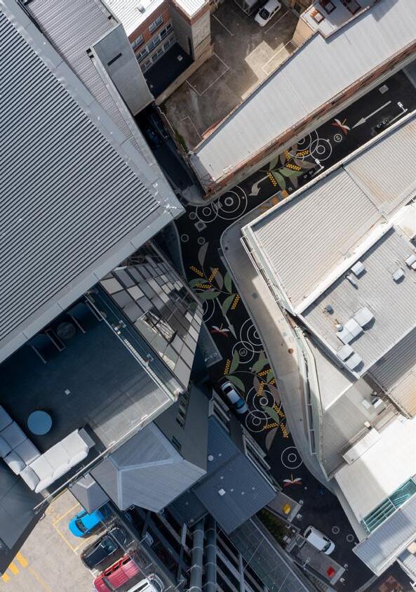
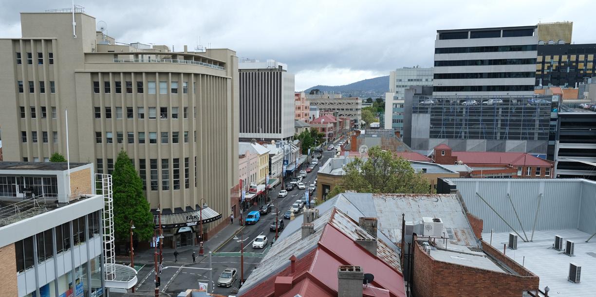
97
Central Hobart Plan
Aerial view of Kemp Street
View along Liverpool Street towards Elizabeth and Argyle Streets
Glazing
The extent of glazing at ground level increases the level of visual engagement and interest between internal uses and pedestrians on the street.
Generally, in the Central precinct and along primary pedestrian streets, a higher level of glazing will ensure that street frontages contribute to the primary retail and hospitality role and appearance of these streets. This is supported by active streets and areas outside the Central Hobart precincts where higher levels of activation are encouraged.
Existing and future laneways may be constrained by their traditional service role and back of house areas; however, the amount of glazing should be maximised when these areas are converted for active uses.
Note: Heritage requirements take precedence over these glazing requirements to protect the integrity of heritage attributes; in these situations, the extent of glazing should be maximised where possible.
Primary
Secondary Active Frontage –Active Street
Active Laneway
Hobart Rivulet
40% void (glazing) to solid
Provide at least 80 per cent clear glazing along the ground level frontage to a height of 2.5 metres, excluding any mandatory utilities and plant equipment, that are not relocatable, and a solid plinth or base.
Encourage openable windows and detailing that engages with the street. Avoid the use of security grilles or mesh and ensure they are transparent where they are used.
Avoid or limit the use of vinyl wrap advertising across ground floor glazing to protect transparency and visibility between ground floor spaces and the street. Where used, transparent materials are preferred.
The integrity of the materials and design of ground floor façades of heritage listed places will take precedence over meeting this requirement.
Provide at least 40 per cent clear glazing along the ground level frontage to a height of 2.5 metres, excluding any solid plinth or base.
The integrity of the materials and design of ground floor façades of heritage listed places will take precedence over meeting this requirement.
Provide and maximise the amount of clear glazing along the ground level frontage to a height of 2.5 metres, excluding any solid plinth or base, where practicable.
Encourage openable windows and detailing that provides for laneway activation.
Encourage overlooking of the rivulet frontage through upper level windows, balconies or terraces.
Encourage building entry along the rivulet frontage that connects to internal spaces that overlook the rivulet.
Part three: Urban Design Framework
City of Hobart 98 Active
type Mandatory requirements Preferred requirements (example criteria – indicative only)
Table 3. Glazing requirements
frontage
Active
–Core Retail
to solid
Frontage
80% void (glazing)
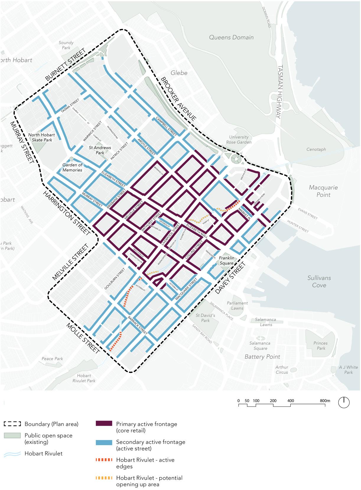
Central Hobart Plan 99
Figure 13. Proposed active frontage plan
3.4.5 Design quality and sustainability
Overview
Hobart is experienced as a city ‘in the round’, viewed from the surrounding hills and headlands, from the top of kunanyi / Mount Wellington to sea level at the Derwent River and estaury. The cityscape of Central Hobart is perceived from all directions and experienced as a ‘city in the landscape’.
Furthermore, the immediate context in which buildings sit is highly influenced by built heritage and streetscape.
Consequently, built form must be designed to protect this experience creating a high-quality urban fabric which is responsive to place and preserves the visual connections to the surrounding landscape and its natural features.
Designing in the ‘round’
• Buildings should be designed as fully resolved three-dimensional forms, with all visible elevations, including side and rear elevation and roofs, designed to be viewed. Materials and finishes must be designed to provide visual interest on all facades and blank walls should be avoided.
• A ny walls with a frontage to a street or public realm should be detailed to provide visual interest.
• W here side elevations are built on the boundary and reasonably anticipated to be completely obscured by future development, they should still be designed with visual interest.
Ground plane
• Ground floor uses should contribute to an active streetscape.
• Ground floor interfaces should maximise the amount of glazing and entries for ground floor tenancies.
• At ground floor and lower levels, active frontages should sleeve any above car parking above ground level to minimise the visual and amenity impacts on the streetscape.
• T he streetscape rhythm and materiality of the street wall should continue down to the ground plane of the building forming part of the built form expression at street level.
Upper-levels
• Setbacks on internal street walls should be used to maintain the familiar human scaled streetscape of Central Hobart and to avoid monolithic structures of uniform bulk above the street wall.
• New awnings must not encroach into space designated for canopy trees.
• U pper storeys above the street wall should differ in architectural expression from the street wall.
• Built form above the street wall must be considered ‘in the round’ and be viewed from all facades.
Part three: Urban Design Framework
City of Hobart 100
Architectural expression – breaking down facade lengths
• New development should reinforce the human-scale streetscape of Hobart, breaking down singular long elevations into a series of facades.
• Wide street frontages should be broken up into smaller, distinct vertical components with indented sections to modulate the building facade and avoid continuous facades that repeat the same form without variation.
Building performance
• Developments should ensure the orientation, design and layout of buildings reduce fossil fuel energy use and makes appropriate use of solar energy.
• Buildings should minimise environmental impacts, including the their carbon footprint, through the selection of building materials, design, and ongoing management.
• Developments should prioritise re-use, adaptation, and extension over demolition and rebuilding.
• Buildings should ensure that dwellings achieve adequate thermal efficiency.
• Development should ensure that waste and recycling facilities are accessible, adequate, and attractive and where possible placed at basement levels. Where possible laneways and rear access should be used over primary city streets.
Minimum floor to floor heights
To ensure that new development allows for the future adaptation of lower levels for different uses over time, buildings should provide a minimum floor to floor height of:
• 4 metres at ground floor
• 3.5 metres at upper levels up to the nominated street wall height
• 3.5 metres at upper levels (non-residential use)
• 3.2 metres at upper levels (residential use)
• 3.2 metres minimum for all floors, where only residential use proposed, and in the Inner Residential Zone.
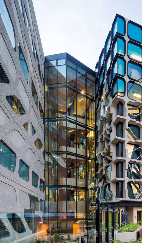
Menzies Institute for Medical Research Central Hobart Plan 101
3.5 Movement
3.5.1 Pedestrian links Overview
Central Hobart is an area with high levels of pedestrian activity. The Urban Design Framework recognises important existing movement corridors including Elizabeth, Collins, Macquarie, and Davey Streets, as well as sections of Liverpool, Murray and Argyle Streets. In addition the Framework maps out where paths need to be planned for, to support greater pedestrian movement as the city grows.
Strategic development sites
On larger strategic sites and in strategic development areas, creating new laneways will support pedestrian movement throughout the city. Mid-block links will complement primary streets and should align with other laneways and thoroughfares, where logical, to create a ‘joined-up’ net work.
Mid-block links should be located to minimise ground-level changes. New pedestrian links should be located to minimise groundlevel changes and include ramps/vertical transportation for universal design outcomes. New laneways should be designed in consultation with the City of Hobart as a community b enefit contribution.
Laneway character and identity
New laneways should be designed to accommodate urban greening such as trees, green walls and landscaped spaces. Along with opportunities for bike parking and seating to foster a sense of place and support nearby ground floor uses, particularly hospitality and retail.
Natural surveillance should be encouraged through the design of openings at ground level and windows and balconies at upper levels (see Section on Street activation and interfaces). Sides of buildings should be designed to reflect the use by pedestrians and consideration given to the sides of upper level materials, transparency, massing and articulation. Upper levels should be set back above the street wall height to create a sense of space and allow for sunlight and daylight penetration (see Section on Street Wall).
Universal accessibility
Pedestrian safety is the primary purpose of footpaths. Council is committed to ensuring universal access for people to move along footpaths. The design of new entrances must ensure any furniture or infrastructure does not obstruct the maintenance of a clear pedestrian path adjacent to the property boundary.
Part three: Urban Design Framework
City of Hobart 102
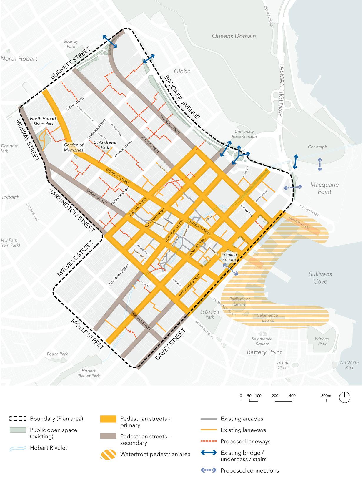
Central Hobart Plan 103
Figure 14. Proposed pedestrian access plan
3.5.2 Micromobility
Cycling network
Creating a clear and integrated cycling network is important for Central Hobart’s sustainability goals and will contribute to managing increased traffic over time. The network needs to connect with the existing onroad and off-road paths to service commuter and recreational cycling and micromobility. Planning for a significant increase in e-scooters has become important to create safe places for local traffic and use of e-scooters by visitors. The use of cycling lanes to be used by scooters will reduce potential conflicts with pedestrians.
Hobart’s existing inner city cycling network is disconnected and unclear. Many streets have no dedicated cycling lanes and those that do, such as Argyle and Campbell Streets, are not continuous and require frequent interactions with vehicular traffic. Increasing the interconnectivity of the cycling network and creating separated cycling lanes will encourage cycling as an alternative to vehicular use and will assist in addressing traffic congestion, sustainability and safety in Central Hobart.
Argyle and Campbell Streets, due to their oneway traffic movement, can work together to provide access from the north into the heart of the city and beyond. Melville and Bathurst Streets stitch the network together and provide a robust street cycling network which connects the broader region with the city centre.
Hobart consists of relatively narrow streets, which vary in width and traffic direction. This requires careful consideration in the design of individual streets and the broader network to ensure cycling is safe, reliable and equitable for all.
Shared slow zones in specific locations will promote pedestrian and cycle priority while still allowing for slow vehicular traffic and onstreet parking and loading.
Separated cycle lanes (All Ages and Abilities or AAA), where appropriate, will promote safe
cycling and micromobility and provide clear cycling priority in the city centre.
To further facilitate cycling bike parking should be integrated into future private and public development, including bike hoops, cages, electronic docks and other similar solutions.
Street network
Hobart’s cycling network needs to connect into directions of movement established by Hobart’s one- and two-way street network. Collins Street will provide two-way cycle movement, connecting the Hobart Rivulet through to Macquarie Point. Elizabeth Street will provide separated and shared solutions and will extend the cycling network into Sullivans Cove, making movement from North Hobart to the Cove more accessible for micromobility options.
Shared zone
In the central blocks of Hobart, a slow traffic shared zone is proposed to assist multiple mode uses of road carriageways. The slow speed zone will support the concentration of commercial and other activity, and the high levels of movement, including pedestrians, cycling and micromobility in the Central Precinct. High quality, pedestrian-focused streets that are safe, attractive and recognise walking and micromobility are central to the future city transport experience of Central Hobart. Special consideration will be given of how these pedestrians-focused streets coexist with public transport, delivery vehicles, etc.
E-scooters
Recent e-scooter hire trials and increased private e-scooter ownership have expanded micromobility modes in Central Hobart in a short period of time. As part of a sustainable transport shift, e-scooters will continue to play a role for residents, workers and visitors in Central Hobart. Planning for a continued increase in e-scooter use is important to ensure rider and pedestrian safety.
Part three: Urban Design Framework
City of Hobart 104
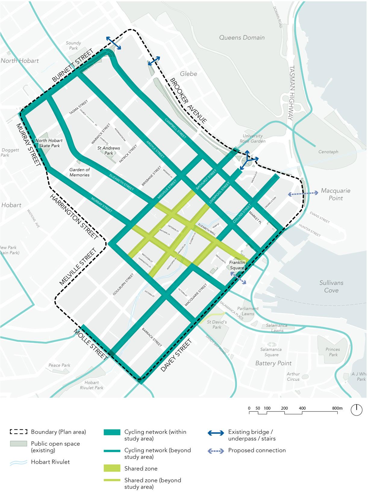
Central Hobart Plan 105
Figure 15. Proposed cycling network plan (informed by the Greater Hobart Commuter Cycling Network Plan 2021)
3.5.3 Vehicle access and parking
The location of vehicle access and parking must support the function and servicing of Central Hobart as a local, regional and state destination, in particular for key services such as the Royal Hobart Hospital. Planning for long term changes in crossover location and consolidated publicly accessible parking hubs will help maintain high levels of access. Private and shared vehicle ownership and use complements the public transport network connecting Central Hobart to the surrounding regions.
Vehicle access
Vehicle entries to car parks should be designed away from primary and secondary pedestrian streets to protect streetscape amenity and pedestrian safety. New entries and crossovers should be designed for pedestrian amenity, including through the design of surfaces and kerbs and visual amenity of entrances and doors. Where possible, crossovers should be removed and relocated to preferred access points.
Laneways
Central Hobart’s street layout provides opportunities to expand the laneway network. Laneways provide access to properties for servicing, deliveries and parking reducing the need for crossovers on main streets. In addition, laneways provide access for pedestrians and can be attractive spaces contributing to the amenity of the public realm.
All laneways should be designed to accommodate vehicles as a shared space with slow movement, incorporating greening and where possible separated pedestrian paths.
Classification
Secondary laneway (or side street)
Street –crossovers not permitted
Street –crossovers strongly discouraged
Street –crossovers discouraged
Street –crossovers allowed
Car parking
Development should provide vehicle access via laneway.
Removal of existing crossovers, no new crossovers. Service and delivery access preferred outside business hours (i.e. 5pm – 8am).
No new vehicular crossovers unless an existing access point is removed. Performance criteria as P2. E6.7.1 of HIPS.
Number of vehicular access points for each frontage must be no more than 1 or the existing number whichever is greater (as A1 of existing) or P1 of existing control (E 6.7.1 of HIPS).
Crossovers are allowed although developments should access via laneways where possible.
• Car parking should be sleeved/wrapped by other uses to ensure active street frontages.
• Car park structures should be designed with visually attractive facades facing laneways. They should provide points where natural surveillance can occur and be designed to mitigate risks of noise, vibrations or emissions impacting nearby sensitive uses.
• Car park structures should be consolidated to minimise the number of access points and provide flexible use to optimise occupation throughout the day and night e.g. publicly available car spaces along with commercial spaces.
Part three: Urban Design Framework
City of Hobart 106
Table 4. Vehicle crossovers
Sleeve car parking with active frontages
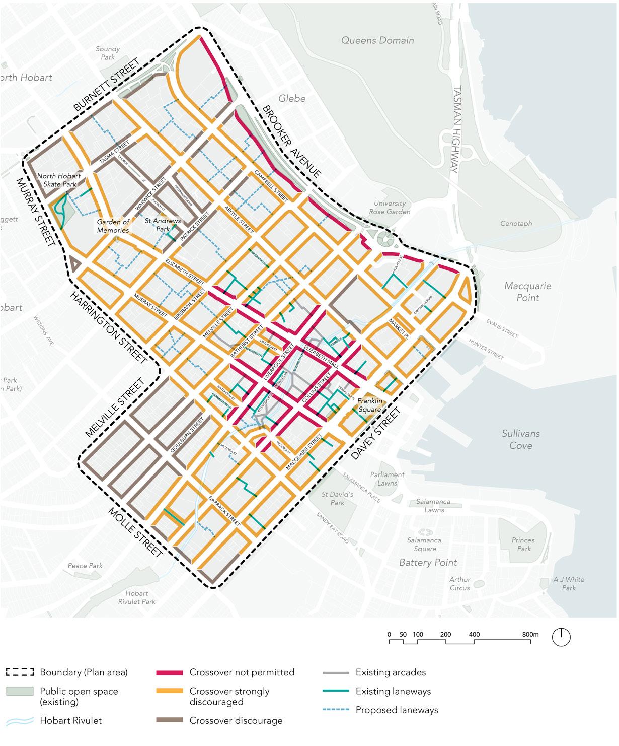
Central Hobart Plan 107
Figure 16. Proposed vehicle access plan
3.5.4 Public transport Overview
The Ubran Design Framework plans for future growth that enhances Hobart’s liveability. Central Hobart will require well-considered, integrated and sustainable transport outcomes to connect residents, workers and visitors to jobs, services, retail and other key cultural and recreational destinations. Public transport is one of the most important considerations in facilitating efficient and equitable access and movement that will support Hobart’s growth socially, economically and environmentally.
Public transport
Central Hobart is a major public transport hub for the south of the state, connecting bus and ferry networks in the region. Strengthening the network in Central Hobart with high quality interchanges and end-of-trip facilities to support increased patrons and service frequency, ensures Hobart will have an increasingly viable alternative to private vehicular transport into the future.
Buses
Buses are the primary form of public transport in Tasmania and Central Hobart. Upgrades could include new or improved bus interchange(s) as well as improving wayfinding, wider footpath to and from, and resting and waiting areas at other key stops in the city centre. Upgrades in technology such as realtime service information will improve the user experience with the potential to contribute to an overall increase in efficiency in road use by buses at key points of congestion. Integrating end-of-trip facilities into transit hubs will support multi-mode trips.
Ferry
A ferry runs between Brooke St Pier and Bellerive Pier. All ferry terminals should have high-quality sheltered waiting spaces and bicycle/scooter storage facilities. Ferries will need to provide for bicycles/scooters on-board.
End-of-trip facilities
High-quality, end-of-trip facilities should be universally accessible, designed for safety and located close to or as part of transit hubs. New and improved facilities will be needed as active and public transport increases. New transport hubs should include best-practice facilities, including storage, restrooms and change areas.
Active travel as the ‘last mile’
Walking, cycling and other forms of micromobility are the final part of any journey. Improving the quality of the active travel experience, in particular walking, will also benefit the adoption of public transport.
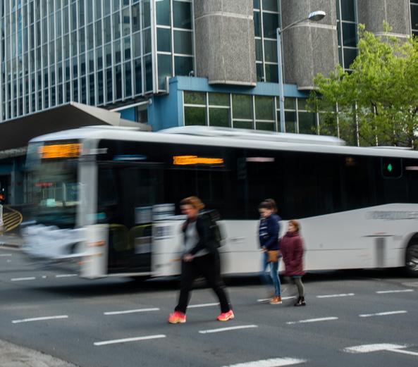
Part three: Urban Design Framework
Collins and Argyle Street int ersection
City of
108
Photograph: Natasha Mulhall
Hobart
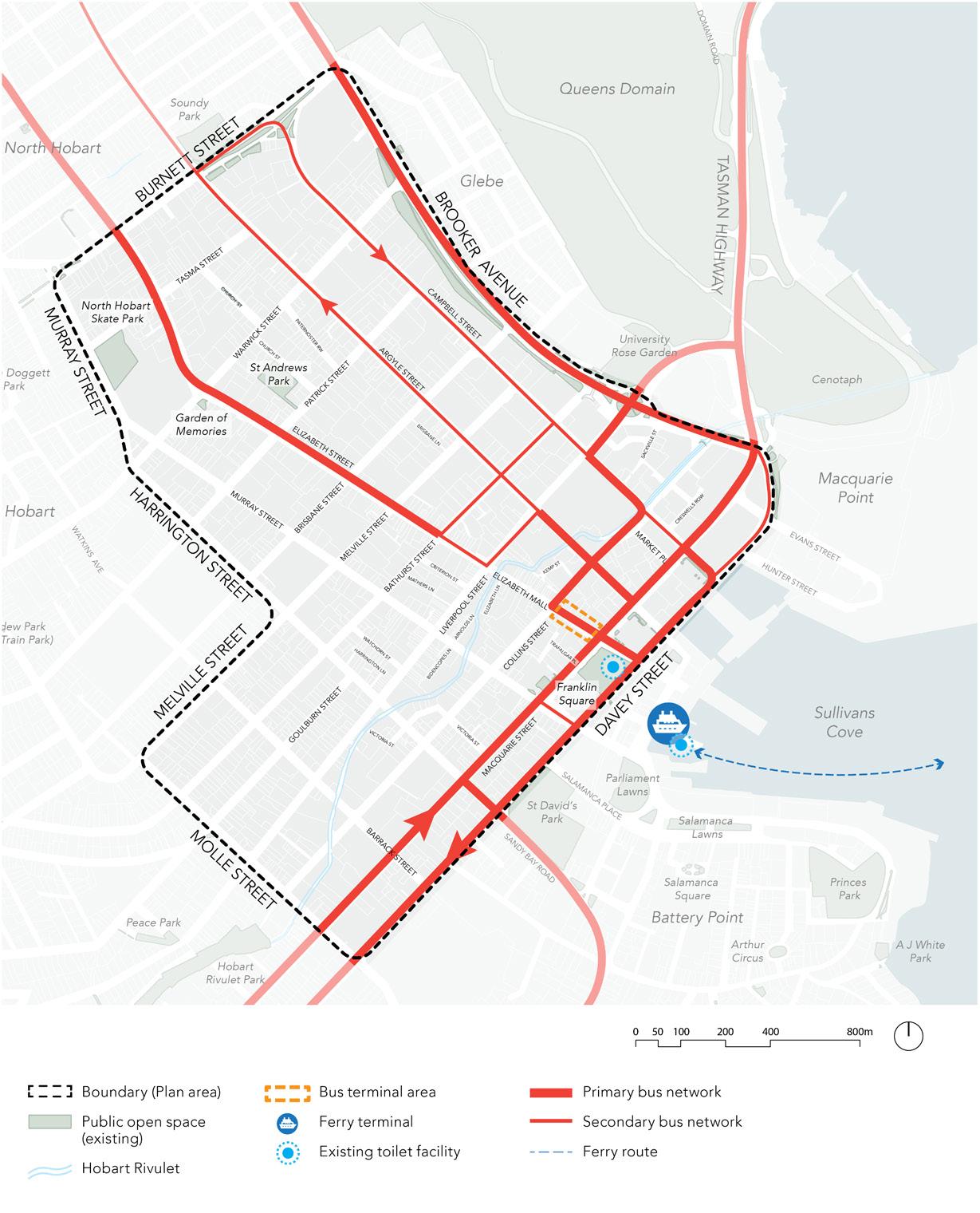
Central Hobart Plan 109
Figure 17. Priority public transport plan (diagrammatic only)
3.6 Public realm
3.6.1 Overshadowing
As Central Hobart’s residential, employment and visitor population grows, the need for high amenity open space will increase.
The current Amenity Building Envelope in the planning scheme applies to the Central Business Zone, which is only part of the Central Hobart precinct area (refer to Figure 2). It has been designed to protect sunlight access and limit overshadowing.
It is proposed that the same solar amenity principles contained in the Amenity Building Envelope are to apply to the whole of the Central Hobart precinct, so developments must demonstrate compliance with overshadowing controls. These controls will be subject to further analysis, as part of the selected block built-form control analysis.
Overshadowing controls – proposed
Open space (excluding urban plazas and streets)
• Existing open space: No additional overshadowing of existing open space between 11am and 2pm at the winter solstice.
• Future open space: Preferred no overshadowing between 11am and 2pm at the winter solstice.
Primary pedestrian streets (see Figure 107)
• Preserve sunlight access between 11am and 2pm at the spring equinox on at least one footpath of the street.
Secondary (narrow) pedestrian streets and laneways
• A setback above street wall height is encouraged to maximise sunlight to narrow streets and laneways (see page 101).
Preferred no overshadowing between 11am and 2pm at the spring equinox.
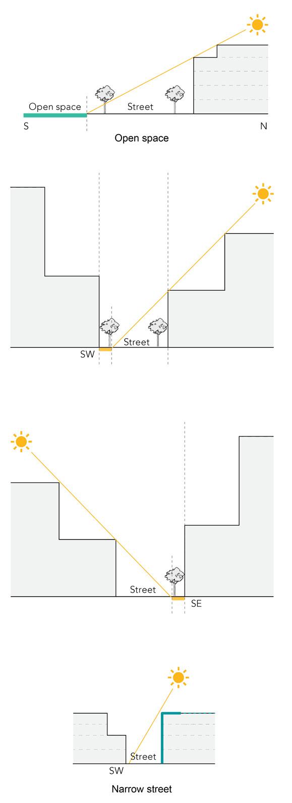
Primary northeast – southwest street
Preserve sunlight between 11am and 2pm at the spring equinox.
Primary northwest – southeast street
Preserve sunlight between 11am and 2pm at the spring equinox.
Overshadowing diagrams
Note: Current controls prevent overshadowing to less than 3 hours between 9am and 5pm on June 21 (winter solstice).
Part three: Urban Design Framework
City of Hobart 110
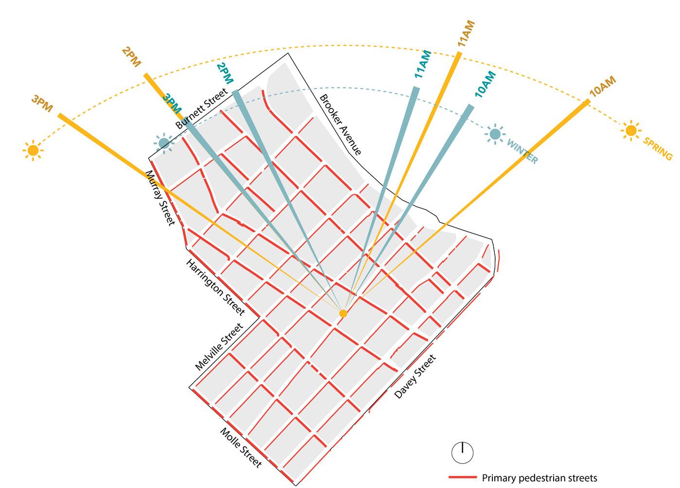
Central Hobart Plan 111
Sun angle plan for winter solstice and spring equinox
3.6.2 Wind effects
Overview
Buildings should be designed to minimise adverse wind effects to ensure safe and comfortable conditions for the streets and other spaces in Central Hobart.
Mandatory requirements for tall buildings
Buildings measuring with heights greater than the required street wall height must comply with the preferred requirements for comfortable wind conditions (Table 5).
Within a distance of half the greatest length of the building, or half the total height of the building measured outwards on the horizontal plane from the ground floor building facade, whichever is greater, the following requirements apply:
• On public land, publicly accessible areas on private land, private open space and communal open space, development in excess of the maximum street wall (see figure 13) height must not cause unsafe wind conditions specified (Table 10).
• On public land and publicly accessible areas on private land, development should achieve comfortable wind conditions specified in the table.
• A permit cannot be granted for buildings and works with a total building height in excess of the maximum street wall (see figure 13) height that would cause unsafe wind conditions in publicly accessible areas within a distance equal to half the longest width of the building above the maximum street wall (see figure 13) height measured from all facades, or half the total height of the building, whichever is greater.
• Wind mitigation elements, such as awnings and screens should be located within the site boundary, unless consistent with the existing urban context or preferred future development of the area.
• Trees and landscaping should not be used to mitigate wind impacts except if in sitting areas, where trees and landscaping may be used to supplement fixed wind mitigation elements.
Table 5.
Wind condition
Unsafe wind conditions
Wind condition
Comfortable wind conditions
Acceptable Solutions
(example criteria – indicative only)
In a wind report prepared by a suitably qualifiedprofessionalthesustained wind gusts do not create unsafe sitting and standing conditions for people.
(e.g. the hourly maximum 3 second gust from any wind direction, considering at least 16 wind directions, with a corresponding probability of exceedance percentage greater than 20 m/s).
Acceptable Solutions
(example criteria – indicative only)
In a wind report prepared by a suitablyqualifiedprofessionalthe hourly mean wind speed from all wind directions combined with a probability of exceedance of 20 per cent does not create uncomfortable siting and standing conditions.
Some examples of metrics are:
• 3 metres/second for sitting areas.
• 4 metres/second for standing areas.
• 5 metres/second for walking areas.
• Hourly mean wind speed is the maximum of:
• The hourly mean wind speed.
• The gust equivalent mean speed.
• 3s gust wind speed divided by 1.85.
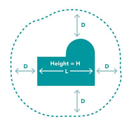
Example wind requirements diagram for assessment within distance D
(source: Melbourne Planning Scheme C311)
Part three: Urban Design Framework
City of Hobart 112
Wind condition
3.6.3 Reverse amenity
There is a need to ensure that existing land uses that are integral to the success of each precinct are not compromised by developments with sensitive new uses such as residential or visitor accommodation.
Embedding reverse amenity in the planning scheme is important to preserve areas of Central Hobart in which local, state or nationally significant services and facilities operate, for example, the Royal Hobart Hospital. Other examples include cultural and live music venues and extended hours activity.
Buildings of the proposed new uses should be designed to address the amenity impacts from, and to, the existing uses. Potential amenity impacts include, noise (including EPA requirements), vibration, light spills, odours, fumes, and other forms of pollution.
Provisions in the planning scheme consider the extent to which the layout and design of new use or development minimises the potential for offsite impacts to affect the amenity of future users of the proposed development, including from noise, vibration, light spills, odours, fumes, and other forms of pollution. New uses and developments must ensure that:
• existing uses are not compromised by a new use or development, and
• a new use or development is designed to address amenity impacts from, and to, existing uses.
There is a need to ensure that existing land uses that are integral to the success of each precinct are not compromised by developments with sensitive new uses.
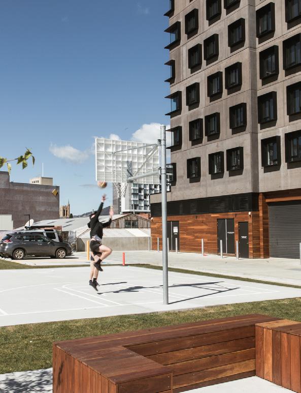
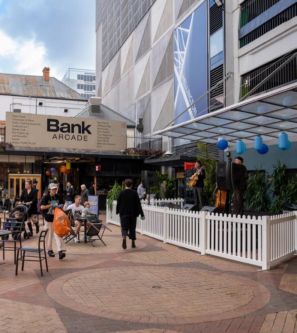
Central Hobart Plan 113
Basketball playground in UTAS student accommodation off Melville Street. Photograph: Natasha Mulhall
Wellington Court activated during an event
3.6.3 Blue and green network
Overview
Cities worldwide are recognising trees and green spaces as critical urban infrastructure, as they provide clean air and shade, and cool the atmosphere during periods of heat. Beyond benefits to human wellbeing, urban greening promotes biodiversity, can reduce pressure on stormwater infrastructure, and aids in carbon capture.
Open space and street trees in the Central Hobart area are limited. With a changing climate, open space needs to be protected and supplemented by the creation of new open spaces, and urban greening throughout the city’s streets needs to be enhanced.
The city is framed by the mountain and river, with the Hobart Rivulet running through it as a ribbon of blue. There are opportunities for improved waterfront and rivulet access and new urban green spaces.
Urban forest
Hobart’s urban forest comprises trees and other vegetation and the soil and water that support it. The Central Hobart area has comparatively low canopy cover and significant gaps in the street tree network. There are isolated areas of high quality, established trees, but many streets are deficient in trees and greening.
Some aspects of street environments, such as awnings, narrow footpaths and underground services, present challenges to street plantings. However, there is a desire in the community to increase trees and other vegetation in the city.
It is now accepted that urban greening can significantly enhance the quality of the pedestrian experience, improving microclimates, decreasing the urban heat island effect, traffic calming, economic activity and enhancing human health, wellbeing and happiness.
Hobart’s Street Tree Strategy (2017) vision, states: ‘Hobart is a city where tree-lined streets are a valued component of our quality of life – achieved through excellence in planning, design, installation and care by the City’s workers and our community'. In 2017 the City of Hobart’s urbanised areas had a tree canopy cover of 16.7 per cent. In adopting the Street Tree Strategy, the City of Hobart has committed to an aspirational target of 40 per cent canopy cover by 2046 in the city’s urbanised areas.
The urban forest will be enhanced over time, including the selection of climate resilient trees and other vegetation for use in streets, laneways and open space. The City continues to map opportunities for tree planting in the Central Hobart area.
Open space
Open space is outdoor areas set aside for the purposes of recreation, relaxation and/ or conservation; they include parks, gardens playing fields and plazas. They can be publicly or privately owned. School and university grounds are considered ancillary open space that can contribute to the community network of public open space.
In Central Hobart, people can enjoy expansive views to the surrounding natural areas including kunanyi / Mount Wellington and Knocklofty Reserve. Some of the larger parks, such as Queens Domain and Hobart Rivulet Park, are within a 10-minute walk of the Central Hobart precincts.
Part three: Urban Design Framework
City of
114
Hobart
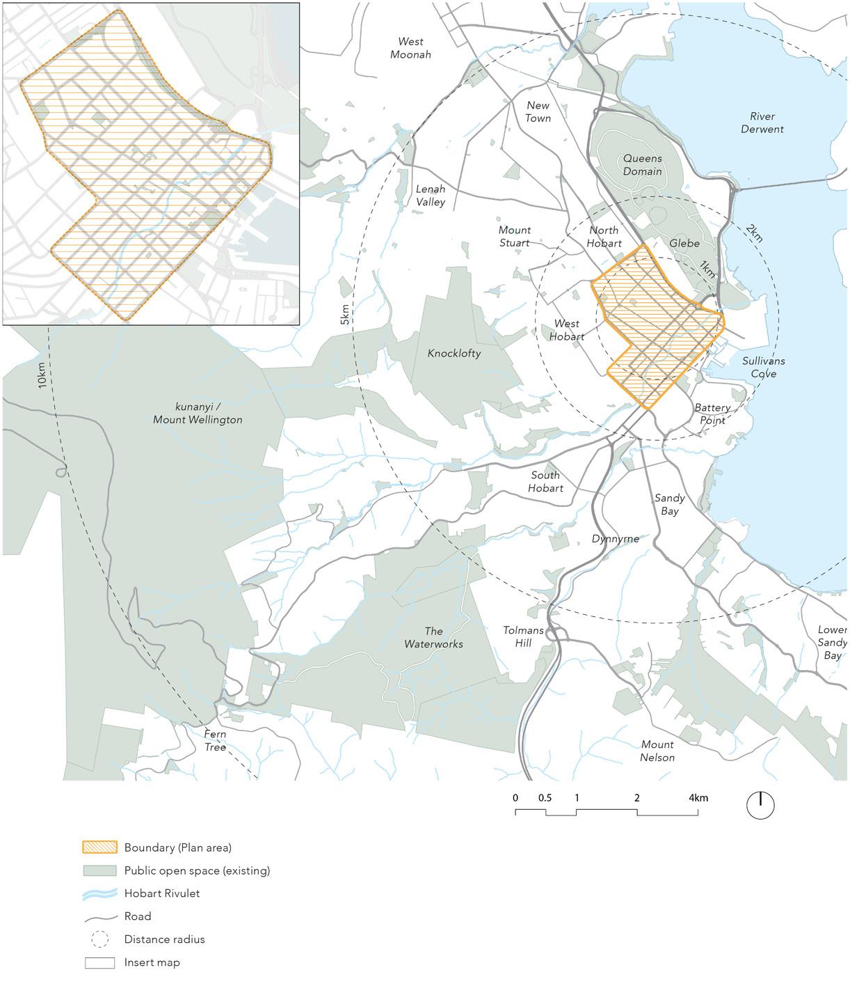
Central Hobart Plan 115
Figure 18. Existing open space map
New open space
Relatively few public open spaces can be reached within easy walking distance of homes and workplaces in parts of Central Hobart, in particular without crossing major roads. (Open Space in Central Hobart: A Background Discussion Paper for the Central Hobart Precincts Structure Plan, 2022).
The emergence of new developments in Central Hobart that offer 'pseudo' open space, such as the Hanging Gardens are bridging this 'gap' in offerings however spaces such as these are for commercial purposes. Purely new open space is needed to meet increasing demand and contribute to urban greening, and the health and wellbeing of the city’s inhabitants.
Open space may be integrated into new projects in the form of plazas, parks or parklets and should be of a high quality design responding to greening, sunlight, orientation and the surrounding built form. New open space should be designed and delivered in future development to provide a community and environmental benefit contribution.
Hobart Rivulet
The Hobart Rivulet offers a great opportunity to engage with the ecosystems, history and culture of the city if it is more strongly present and expressed.
It also provides a potential active travel movement route through some of the most significant places of the city centre.
There needs to be a long term concerted effort in realising the full potential of the rivulet as a great open space. The rivulet flows through the heart of the precinct through underground and open air channels. There are opportunities to 'daylight' some of the underground sections and provide better access and rewild the open sections.
The City should investigate how to progressively achieve ground floor building setbacks along the Hobart Rivulet. These will facilitate the long-term delivery of a blue and green spine through the city centre and a greater level of public access and enjoyment of the rivulet .
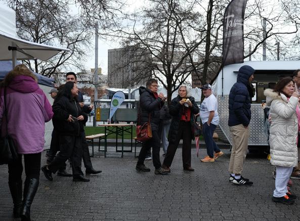
Part three: Urban Design Framework
Salamanca Market food vans
Hobart Rivulet viewed from Harrington Street
116
City of Hobart
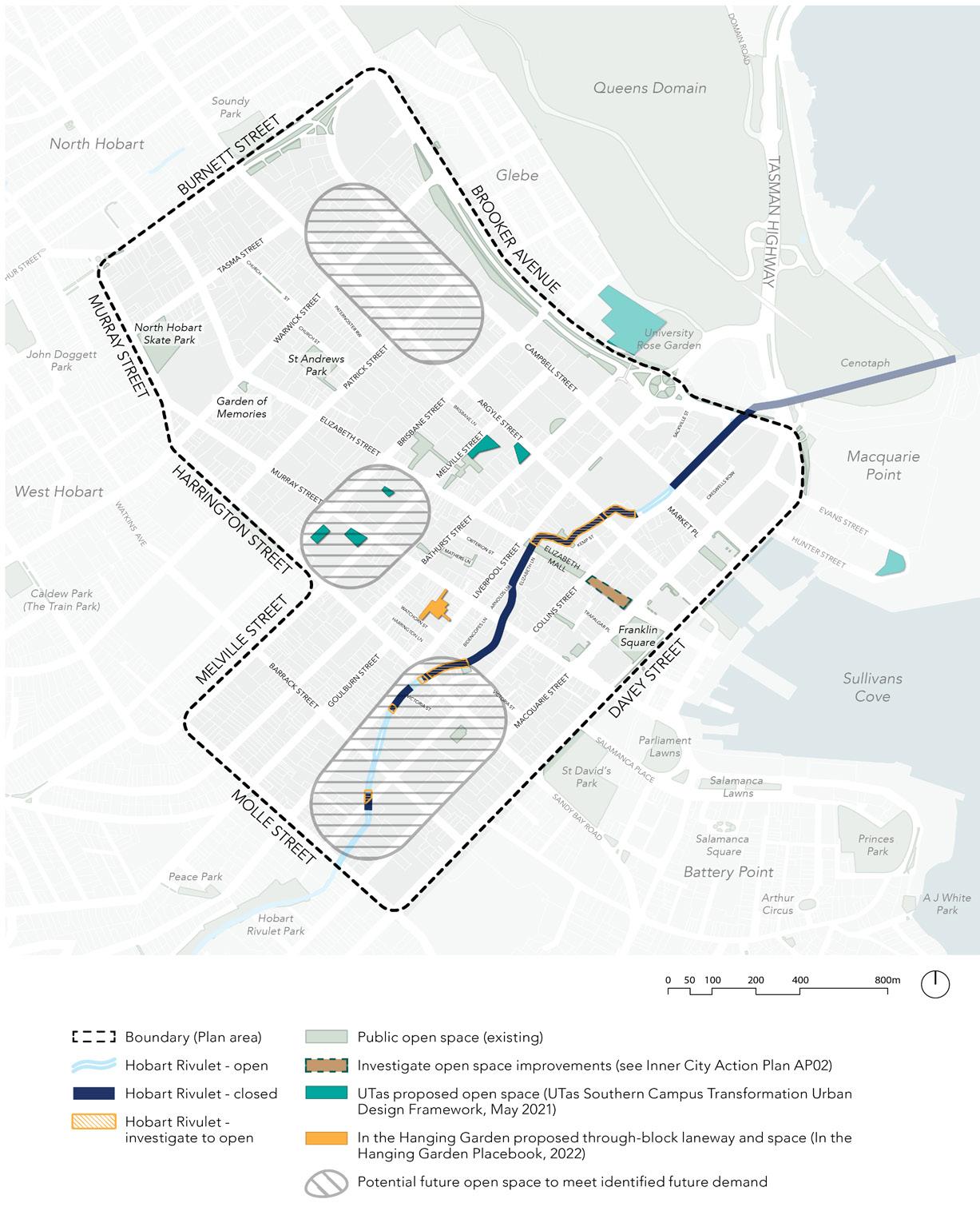
Central Hobart Plan 117
Figure 19. Proposed blue and green network plan
Green streets
A ‘green street’ is a street that has a variety of design elements that give priority to pedestrian and cyclist movement over vehicle use, and are places where people like to spend time such as Salamanca Place. Design elements may include footpath widening, landscaping, and street trees, appropriate furniture and lighting, traffic calming, public art and other pedestrian oriented features with the purpose of:
• Improving pedestrian safety and amenity.
• Where appropriate, planting deciduous trees to improve sunlight in winter and shade in summer.
• Increasing other forms greening in the streetscape.
• Strengthening pedestrian and bicycle connections from surrounding residential areas.
• Providing an inviting landscape.
• Supporting the local economy.
A green street is identified as a logical primary pedestrian and cycling connection to key local destinations such as:
• Transport connections, including bus stops, other routes and shared paths.
• Key retail and commercial businesses.
• Schools and educational facilities.
• Community infrastructure, including childcare or community and health facilities.
• Open space.
A ‘green street’ is a street that has a variety of design elements that give priority to pedestrian and cyclist movement over vehicle use, and are places where people like to spend time.
A green street, as identified on the plans, may or may not currently prioritise pedestrian and/or cyclist movement over vehicle movement. Where it does not, the Urban Design Framework recommends upgrades to reinforce the role of the street as a green street such as footpath widening, canopy trees, seating and landscaping. This will be supported by overshadowing area controls that protect a reasonable level of sunlight access to footpaths. Note that the street walls along streets have been designed to minimise the effects of overshadowing.
The design of the urban elements in green streets needs to carefully consider the functionality and the desired improvement in amenity. For example public lighting and trees should not be considered in isolation to avoid mutual interference.
New development with a frontage to a green street should contribute to urban greening by protecting current street trees and by introducing trees, ground cover, vertical and rooftop vegetation.
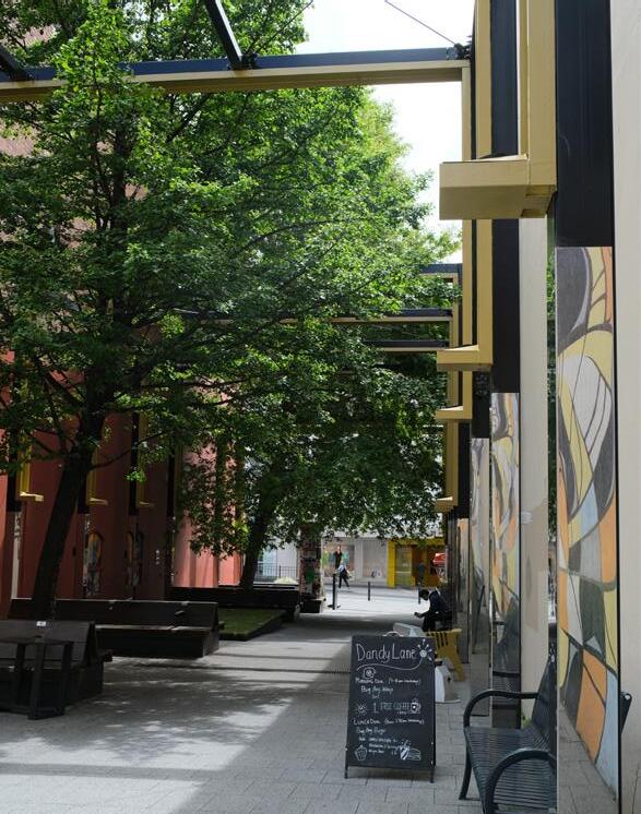
Part three: Urban Design Framework
City of Hobart 118
Tree canopy along the side of Collins Court
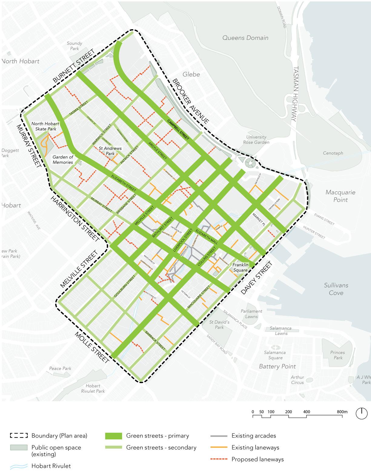
Central Hobart Plan 119
Figure 20. Proposed green streets plan
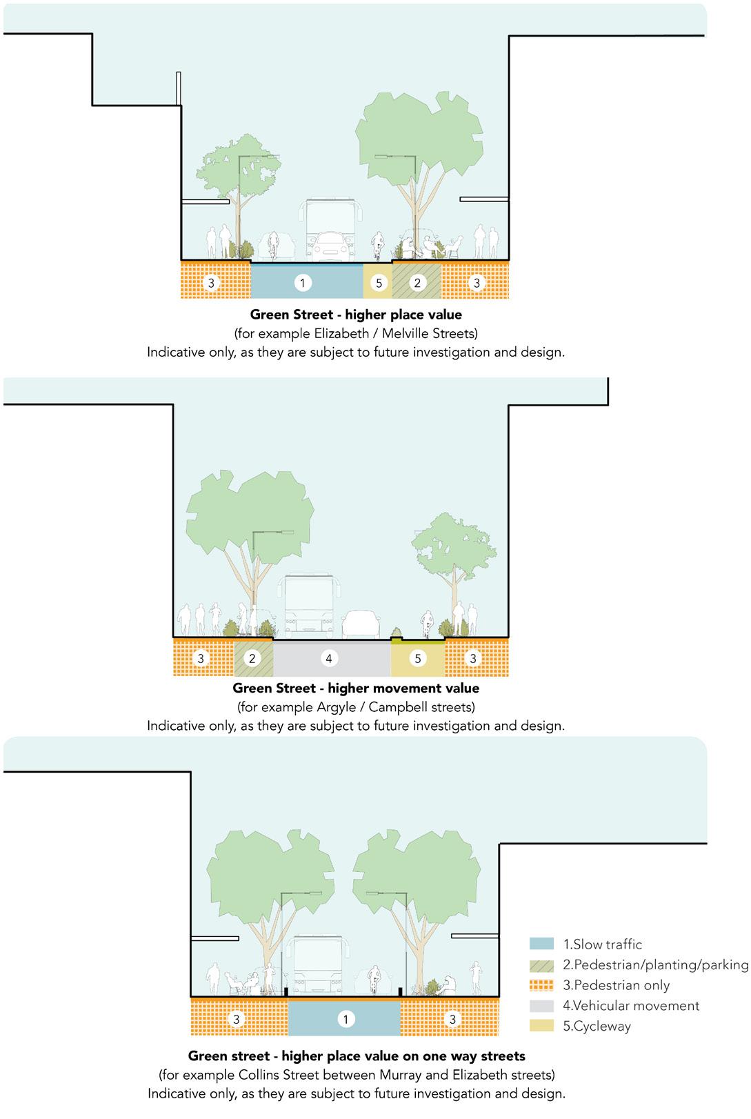
Future potential green street sections – indicative only, subject to future investigation and design.
Part three: Urban Design Framework
City of Hobart 120
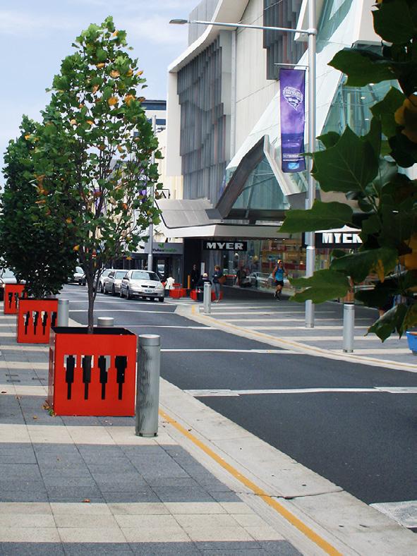
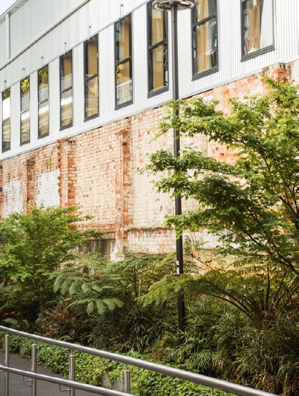
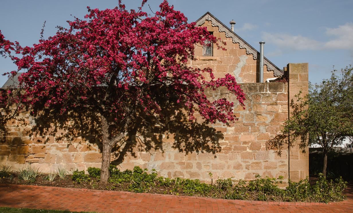
Central Hobart Plan 121
Street tree greening in Liverpool Street
Laneway in UTAS central campus leading to Melville Street
Photograph: Natasha Mulhall Heritage wall and building in St Andrews Park. Photograph: Natasha Mulhall
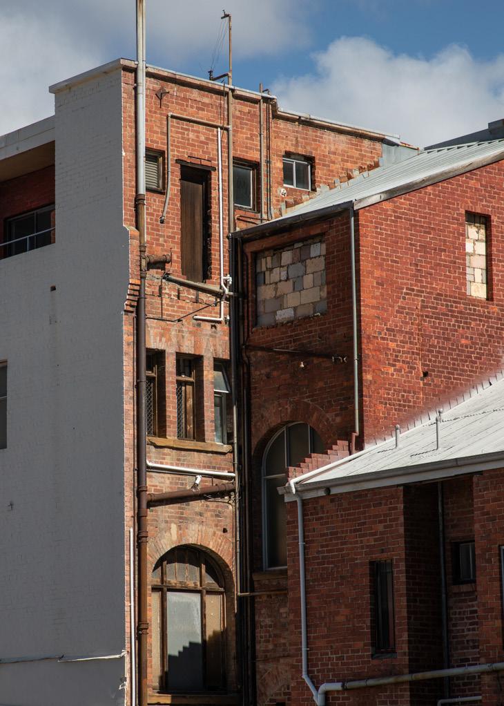
Part four: Making it happen
City of Hobart 122
4.1 Overview
There are several mechanisms that exist to deliver on the goals, strategies and actions included in the Central Hobart Plan. These include planning scheme amendments, CoH capital works, business and property owner investment, and Tasmanian Government policy, strategy and infrastructure programs.
Following endorsement of the draft plan, an implementation program will be developed specifying the actions, timeframes and responsibilities for delivering the Central Hobart Precincts Plan. It will consist of regulatory and non-regulatory actions. Included is a list of proposed actions which will be reviewed and developed further in the implementation program.
The Central Hobart Precincts Plan will be reviewed within the next five to ten years, to ensure it is delivering on its vision and goals and remains accurate and relevant as Central Hobart evolves.
Implementation methods
Deliver
Actions that are marked ‘Deliver’ refer to projects that Council will administer and deliver directly. Each action will require further investigation, community input, planning and financing. Each project will also require an implementation program which will be linked to the Council Plan, Annual Plans and budget process to ensure a whole of Council approach. Funding may come from a variety of sources including government grants and through partnerships with the community and development industry.
Partner
Actions that are marked ‘Partner’ refer to projects that Council will deliver in conjunction with either state agencies, community groups, land owners or the development industry. Funding may come from a variety of sources including government grants and through partnerships with the community and development industry.
Advocate
Actions that are marked ‘Advocate’ involve private land that can deliver public amenity benefits, community services and/or precinct activation. Council will work with land owners, the wider community and development industry to assist in the delivery of these projects.
Timing
Timing is categorised to align with organisational timeframes such as the Capital Works Program and Strategic Plan:
• Short term: 0 – 4 years
• Medium-term: 5 – 10 years
• Long-term: >10 years Timeframes are only provided for guidance and will be further defined as an implementation program is developed for each action.
Mechanisms
There are several complementary mechanisms to implement the Central Hobart Plan. Planning scheme amendments will ensure that the Plan has a statutory role, whereas as CoH capital works, business and property owner investment can act as catalysts for positive change.
Central Hobart Plan 123
4.2 Proposed actions
Support the establishment of business and creative industry incubator spaces, for example, through strategies to provide affordable spaces.
Identify key sites for commercial development and develop guidelines and controls that encourage this form of investment.
WorkwithUTAStoconsideritslong-termplanssotheybenefit Hobart and the wider community. Short Advocate
Part four: Making it happen
City of Hobart 124 Strategy Action Description Timeframe Method Goal 1: A captivating and dynamic capital city Objective 1: A strong city heart 1.1 A.1 Attract and retain key retail, business, cultural, educational, health, community services, and community activities. Ongoing Advocate 1.1 A.2 Invest in key community and cultural assets that serve the state. Ongoing Advocate 1.1 A.3 Encourage, attract and continue to support specialised retail and start-ups. Ongoing Advocate 1.1 A.4 Encourage a mix of uses that contribute to the night-time economy. Ongoing Advocate Objective 2: A place to live 2.1 A.5 Work with landowners to increase residential development opportunities,includingthepotentialfor‘shop-top’housing. Ongoing Advocate 2.1 A.6 Develop incentives to encourage residential properties onto the long term private rental market. Ongoing Advocate 2.1 A.7 Develop guidelines that specify the needed types diverse of diverse housing. Include design solutions that will provide sound attenuation where residential uses sit alongside commercial uses, particularly in areas designated for the night-time economy. Short Deliver 2.1 A.8 Develop standards for apartment developments to ensure high living amenity and maintenance of the City’s natural and cultural character. Short Deliver 2.2 A.9 Develop and contribute to affordable housing strategies that provide options for lower cost housing for purchase, long and short term rentals, and social housing. Short Deliver 2.2 A.10 Consider policy in the planning scheme to ensure no net loss of social housing in the Central Hobart area. Medium Deliver 2.2 A.11 Investigate mechanisms to provide housing for key workers. Medium Deliver 2.2 A.12 Consider the needs of
developing housing policy. Medium Deliver
3:
A.13
Short Deliver
A.14
Short
A.15
people sleeping rough when
Objective
A place to learn and work 3.1
Identify key industries and employers, suited to the Central Hobart environment, and develop strategies to attract them.
3.1
Encourage new commercial development to have a variety of sizes and types of spaces for small and medium size enterprises, at a variety of price points.
Advocate 3.1
A.16
Short Partner 3.2
Short Deliver 3.3 A.17
5.1 A.26
5.2 A.27
5.2 A.28
5.2 A.29
Investigate City Hall as a focal point for an arts and cultural hub. Including a management model that revitalises and activates the site.
Work with the Palawa people to reflect more of the city’s Aboriginal heritage and culture in activities, events and exhibitions, and as permanent features in the public realm.
Introduce playful elements in urban design to reflect the creative culture of the city, promoting new experiences and invitations to 'linger longer'.
Explore infrastructure opportunities in each precinct for power, rigging, lighting and staging to facilitate use of these spaces for temporary/pop-up activations.
Strategy Action Description Timeframe Method Objective 4: A place to visit and explore 4.1 A.18 Encourage educational
expand creative educational course options. Short Advocate 4.1 A.19 Use heritage
Short Advocate 4.1 A.20
Medium Deliver 4.1 A.21 Enhance wayfinding,
Medium Deliver 4.1 A.22 Encourage
Central Hobart. Ongoing Deliver Objective 5: A place of creativity and culture 5.1 A.23 Support and encourage
into private and commercial
Ongoing Deliver 5.1 A.24 Continue to
ephemeral
Ongoing Deliver 5.1 A.25 Activate
Ongoing Deliver
institutions to maintain and
buildings to house creative enterprises, and encourage the retention of older buildings suitable for artistic industries and smaller events.
Investigate further opportunities for activities and attractions to encourage visitors into Central Hobart.
lighting, safety and universal access to, and between, key visitor attractions and areas.
a range of dedicated visitor accommodation options throughout
initiatives to incorporate public art
developments.
support local artists to activate city spaces and places with temporary and
art projects.
streets, car parks and heritage spaces with public art, performances, events and festivals.
Medium Deliver
Ongoing Deliver
Long-term Deliver
Long-term Deliver Central Hobart Plan 125
7.3 A.37
Develop an Open Space Strategy that increases green infrastructure that integrates natural systems to increase resilience.
Review innovative funding models to facilitate best-practice planning, design, installation and management of urban greening initiatives to meet the Council’s goal of an urban canopy coverage of 40% by 2046. Ongoing
an Active Travel Plan to strengthen the pedestrian and cycling infrastructure along the Rivulet to Macquarie Point.
Prepare a city-wide and contemporary Open Space Strategy that includes the work of the Open Space in Central Hobart Background discussion paper.
Seek opportunities to provide pocket parks and local parks where there are gaps in provision and make and encourage better use of existing open space.
Coordinate with other agencies to formalise public access to other open space, such as school and church grounds.
Develop plans for increasing (and valuing as assets) blue infrastructure, working with natural systems to increase resilience. Undertake planning to ensure the stormwater infrastructure is resilient and able to cope with future rain events.
Objective 8: A network of lively, green and active streets to support liveability
8.1 A.38
8.1 A.39
Endorse the Laneway Strategy for Central Hobart developed in the Urban Design Framework, which identifies potential future pedestrian links and laneways through the ‘super blocks’ of the city.
Consider strengthening existing, and encouraging new, developments to provide courtyards. Introducing opportunities for spaces that are lively, comfortable and away from traffic and in appropriate locations to contribute to the night-time economy by facilitating restaurants, cafes, bars etc.
Ongoing Deliver
Short Deliver
Short Deliver
8.1 A.40
8.1 A.41
8.2 A.42
Develop CoH Urban Design Guidelines (LGA wide) for new buildings and streetscape design that includes safe design and universal access principles.
Engage with migrant communities to understand how their cultures and religions influence the use of public spaces and develop strategies to share their experiences through cultural events that enhance the City of Hobart’s existing and future international relations programs.
Endorse the Transport Network Operations Plan - Inner Hobart (TNOP) to identify the future functions and staged transition of Hobart’s current and future street network. Noting that the TNOP will be updated as the strategic visions evolve. Refer to related A.67.
Short Deliver
Short Deliver
Short Deliver
Part four: Making it happen Strategy Action Description Timeframe Method Goal 2: Public
that
Objective 6: A liveable
6.1 A.30
Ongoing Deliver 6.1 A.31
Spaces
engage and create joy
and resilient city through greening
Deliver
7: A strong
and the mountain 7.1 A.32 Reinforce
Ongoing Deliver 7.1 A.33 Develop
Ongoing Partner 7.2 A.34
Deliver
A.35
Objective
sense of place between the river
the importance of protecting key views from the river to the mountain through planning scheme provisions.
Medium
7.2
Advocate Deliver
A.36
Ongoing
7.2
Ongoing Partner
City of Hobart 126
guidance and policy to encourage zones of deep soil planting in developements to help deliver the urban canopy of 40% by 2046.
City of Hobart infrastructure to meet ‘best practice’ sustainable design.
Strategy Action Description Timeframe Method Goal 3: Sustainable buildings with character Objective 9: Buildings that excel and excite 9.1 A.43 Progress
and vistas. Short Deliver 9.1 A.44 Develop and implement CoH Urban Design Guidelines (LGA wide) to direct best practice outcomes. Short Deliver 9.2 A.45 Create
Short Deliver 9.2 A.46 Build on the
Design
Short Deliver 9.3 A.47 Develop CoH
Short Deliver 9.3 A.48 For
Short Deliver Objective 10: Environmental excellence 10.1 A.49 Include
Ongoing Advocate Deliver 10.1 A.50 Develop
Ongoing Deliver 10.2 A.51 Encourage development to
of the Hobart Rivulet. Ongoing Advocate 10.2 A.52 Develop
Medium Advocate Deliver 10.2 A.53 Develop
Medium Advocate Deliver 10.2 A.54 Design
Ongoing Deliver Central Hobart Plan 127
the planning scheme amendment to introduce the height controls recommended by the Woolley Report that protect views
ways to celebrate local exemplar designs illustrating the preferred outcomes such as introducing City of Hobart design excellence awards.
effectiveness and expand the role of the City of Hobart Urban
Advisory Panel (UDAP) to assist in developing design guidelines.
Heritage Design Guidelines (LGA wide) that considers adaptive re-use of buildings to extend the life of heritage buildings, investigating ways to maintain and strengthen historic subdivision patterns, lot sizes and courtyards.
strategic development sites, test existing and proposed building controls to ensure economic feasibility, sustainability and liveability outcomes are met. And, if necessary, develop site specific guidelines.
sustainability requirements in planning scheme provisions where possible, or advocate for changes to building provisions.
guidelines to demonstrate methods to achieve sustainable buildings in the city centre and investigate frameworks for sustainable precincts.
improve access, visibility and celebration
policy and guidance to encourage the development of green roofs and green walls to achieve the urban canopy coverage of 40% by 2046.
experience
by way
tree planting, shelter
major stops, accessible, well connected, with clear wayfinding, to service land use developments and new service routes associated with the NSTC.
Mediumlong Partner
Objective
12: Improved amenity for active travel modes in Central Hobart
12.1 A.62
12.1 A.63
12.1 A.64
Continue to support the provision of improved walking, cycling and micromobility facilities that will support movement of more people around Central Hobart, catering for residential and employment growth mobility demands in the area. Consider All Ages and Abilities standard (AAA) for cycling and micromobility to improve safety.
Develop Street Vision Plans, prioritising Elizabeth Street and Collins Street, that are universally accessible and consistent with the Central Hobart Urban Design Framework.
Undertake an audit of the streets and pedestrian crossings in Central Hobart, prioritising accessibility upgrades using the previously undertaken Walkability of the Elizabeth Street/New Town Road Corridor report methodology.
Objective 13: Better parking management
13.1 A.65
13.1 A.66
Review current publicly-owned accessible off-street car parking locations and identifying appropriate longer term locations for public short stay and long stay facilities.
Review the current suburban resident parking schemes in Central Hobart in order to support the new parking strategy for Hobart.
Medium Deliver
Medium Deliver
Medium Deliver
Medium Deliver
Short Deliver
Part four: Making it happen Strategy Action Description Timeframe Method Goal 4: Integrated and accessible movement networks Objective 11: More people accessing Central Hobart by sustainable travel choices 11.1 A.55 Complete and connect the bicycle and micro-mobility facilities on the key corridors of Argyle Street, Campbell Street and Collins Street. Shortmedium Deliver 11.1 A.56 Improve pedestrian facilities, greening, and amenities on the key streets identified in the Urban Design Framework. Mediumlong Deliver 11.1 A.57 Identify further micromobility, pedestrian links and improvements that will improve connectivity and attractiveness in Central Hobart. Short Deliver 11.1 A.58 Continue to investigate and trial micromobility options beyond the e-scooter trial. Short Deliver 11.2 A.59 Work with Tasmanian Government to further investigate the feasibility of a central bus transit centre(s) and the potential for future upgrades to the existing Franklin Square bus facilities. Mediumlong Partner 11.2 A.60 Work with the Tasmanian Government to implement a permanent extended ferry service on the Derwent River and improve linkages from the Hobart Waterfront to Central Hobart for ferry patrons. Mediumlong Partner 11.2 A.61 Work with the Tasmanian Government to identify further key bus
with
facility nodes
improved user
including
of shade
for
City of Hobart 128
Strategy Action Description
Objective 14: Managing our movement networks
14.1 A.67 Complete a first generation Transport Network Operations Plan - Inner Hobart (TNOP) in partnership with the Tasmanian Government. Refer to related A.42.
14.1 A.68 Develop detailed movement and place mapping for Central Hobart, taking into consideration key pedestrian streets identified by the Central Hobart Urban Design Framework and other key future land use changes.
Goal 5: An investment ready and innovative city
Objective 15: A framework for development
15.1 A.69
Develop a process to streamline the assessment of planning applications for the preferred development types in each precinct.
15.2 A.70 Further test proposed controls in the Urban Design Guidelines to support and guide each precinct and land use outcomes.
Timeframe Method
Short Partner
Short Deliver
Short Deliver
Short Deliver
Objective 16: An equitable developer contribution system to help pay for community infrastructure
16.1 A.71
16.2 A.72
Explore opportunities to facilitate the delivery of developer contributions to fund improvements to community infrastructure, including public open space and transport infrastructure. Consider future planning controls that incorporate community benefits for strategic development sites, such as areas for affordable housing or community infrastructure.
Advocate for the introduction of specific Tasmanian guidelines for developer contributions. Work with the Local Government Association of Tasmania to advocate for legislation that provides opportunities for a broader range of development contributions, particularly for the public realm.
Objective 17: Driving investment through public infrastructure
17.1 A.73 Prepare a Central Hobart Public Infrastructure Plan that details existing public infrastructure and its capacity to cater for anticipated growth. The Plan would identify future infrastructure needs, costs and apportionments for all development planned for the area.
17.2 A.74
17.3 A.75
Develop a detailed program of works for asset renewal and work with Tasmanian Government agencies to identify project synergies.
Undertake detailed hydraulic modelling and planning in the Central Hobart area to provide information and strategies to anticipate and plan for likely future rain events and seek appropriate capital funding for upgrades.
Objective 18: Master planning for strategic development sites
18.1 A.76
Further identify key strategic development sites and city blocks that may be suitable for detailed master planning:
• demonstrating the feasibility of coordinating development of strategic sites
• proactively engaging with landowners to discuss the future of key strategic development sites
• facilitating or participating in master planning for key strategic development sites.
Medium Deliver
Short Advocate
Medium Deliver
Short Deliver
Short Deliver
Medium Deliver Partner
Central Hobart Plan 129
roll-out of the 5G mobile network to enable new and improved technological capabilities, while respecting the streetscape and townscape character of Central Hobart minimising impacts to existing infrastructure assets.
Part four: Making it happen Strategy Action Description Timeframe Method Objective 19: A smart city that is digital by default 19.1 A.77 Develop the city’s digital twin with additional key features including the City of Hobart’s assets, lighting and evening thermal impacts, people movement and parking data, and key environmental layers. Short Deliver 19.1 A.78 Align City-led actions in the Connected Hobart Smart City Action Plan with the timelines of the Plan. Short Deliver 19.2 A.79 Develop the City’s ability to provide remote network access and communications by undertaking fibre optic installation works to directly connect the City’s data centre at Town Hall to its larger assets located across the Central Hobart area. Short Deliver 19.2 A.80 Continue to increase the number of public safety cameras in the Central precinct, and rolling out AI functionality to the City’s Safe City Hub. Short Deliver 19.2 A.81 Increase the capacity of the City’s data centre to allow for additional monitoring and data analysis around the city. Short Deliver 19.2 A.82 Further develop and strengthen mutual inclusivity with other agencies such as the Department of State Growth, TasNetworks, Tasmania Police, Telstra and surrounding councils via shared access agreements. Short Deliver Partner 19.2 A.83 Develop the City’s remote telemetry capabilities by expanding existing LoRa, microwave and other communications protocols. Short Deliver Partner 19.2 A.84 Develop the City’s digital wayfinding and digital bus shelter networks to allow the dissemination of cultural, historical, wayfinding and transport information to residents and visitors Short Deliver Partner 19.2 A.85 Support
Short Deliver Partner City of Hobart 130
the
This page was deliberately left blank
Central Hobart Plan 131
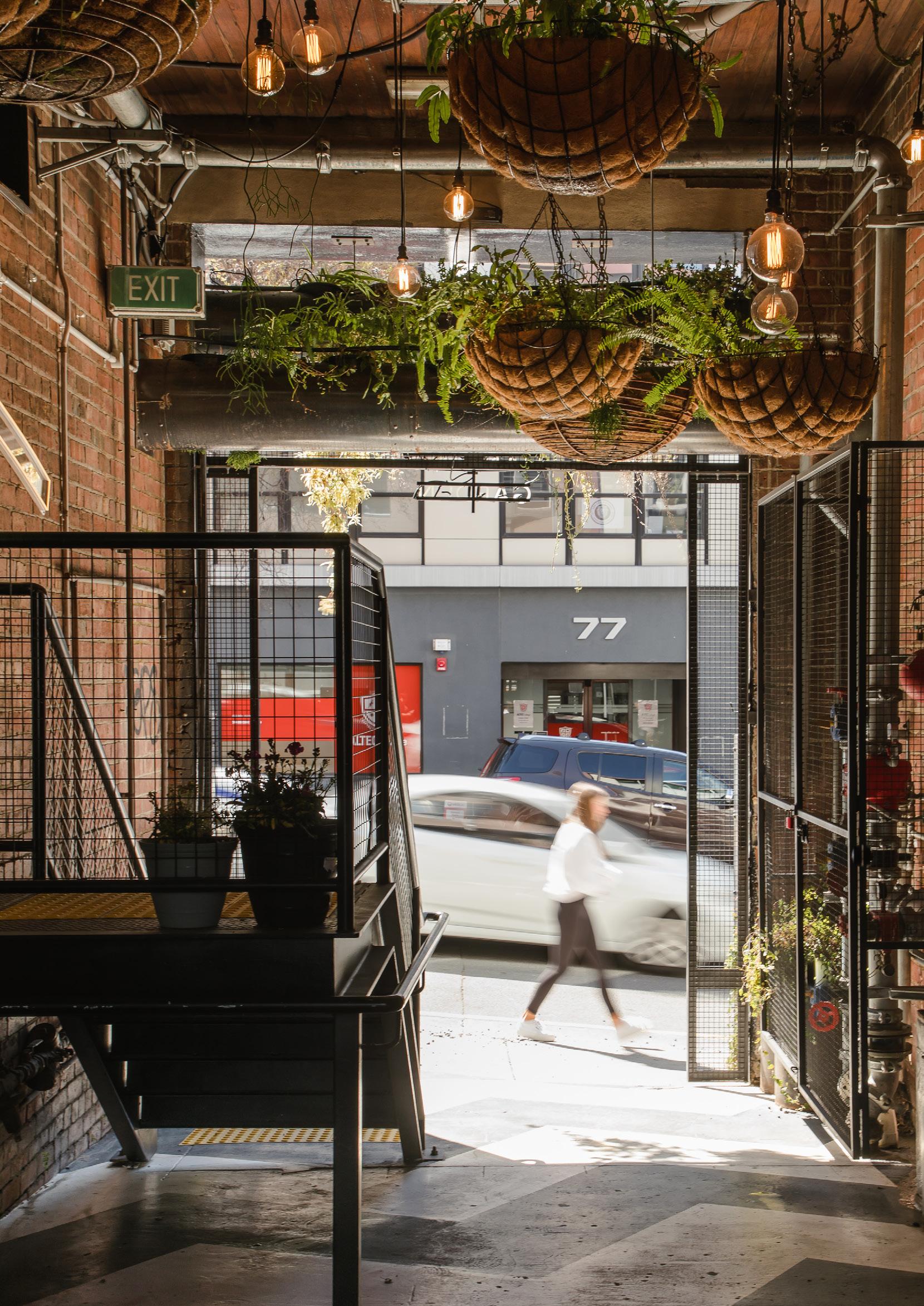
five: Appendix City of Hobart 132
Part
Part five: Appendix
Contributing authors, references and project background documents
Contributing Authors
MGS Architects
Development of the Urban Design Framework contained within the Central Hobart Plan
5.1 References
City of Hobart
City of Hobart
City of Hobart
City of Hobart
City of Hobart
City of Hobart
Gehl Architects
Hi l lPDA
HillPDA
Inkhorn Projects
Leigh Woolley Architect
MGS Architects
SGS Economics & Planning
SGS Economics & Planning
Urbis
UTAS Architecture & Design with the City of Hobart
Capital City Strategic Plan 2019–29 (September 2019)
Central Hobart Precincts Plan – Understanding Central Hobart – Baseline Report (February 2020)
Central Hobart Precincts Plan – Discussion Paper (October 2021)
Open Space in Central Hobart: A Background Discussion Paper for the Central Hobart Precincts Structure Plan, 2022 (February 2023)
Central Hobart Precinct Plan Urban Forest Planning CoH (October 2022)
Walkability of the Elizabeth Street/New Town Road Corridor report methodology (October 2021) (Ref: City Infrastructure Committee meeting 27/10/2021)
Hobart2010PublicSpacesandPublicLife–acitywithpeopleinmind:thefirst stage of Hobart’s inner city development plan (2010)
Central Hobart Precincts Plan – Economic, Demographics and Employment Study (February 2020)
Central Hobart Precincts Plan – Economic, Demographics and Employment Study – COVID-19 update (April 2021)
Greater Hobart Cultural Venues Study (2020)
Building Height Standards Review Project, report for City of Hobart (June 2018)
Developed the draft Urban Design Framework contained within the Central Hobart Plan (November 2022)
Central Hobart Precincts Plan – Development Contributions for shared infrastructure (October 2021)
Central Hobart Precincts Plan – Land Use Scenarios (February 2022)
Central Hobart Precincts Plan – Movement Analysis, Civic and Cultural Study Area (February 2022)
Speculate: Expanding City – Underutilised Sites (September 2019)
Central Hobart Plan 133
5.2 Project background documents
Other background documents
City of Hobart Hobart: A community vision for our island capital, 2018 (July 2018)
City of Hobart Aboriginal Commitment and Action Plan: walking together towards reconciliation (January 2020 – January 2022)
City of Hobart Affordable Housing and Homelessness Commitment (2021–2 023)
City of Hobart A s set Management strategic (various)
City of Hobart Climate Change Strategy 2008–2013 (under review)
City of Hobart Connected Hobart: Smart City Framework 2019–2030 (September 2019)
City of Hobart Community Engagement Framework (2023)
City of Hobart Community Safety Commitment 2021–2023 (2021)
City of Hobart
City of Hobart
Creative Hobart: a strategic framework for Hobart City Council’s cultural programs (2012)
Elizabeth Street Retail Precinct Concept for Consultation, Midtown Streetscape Upgrade Project (draft)
City of Hobart Equal Access Commitment 2021–2023 (2021)
City of Hobart
City of Hobart
City of Hobart
Hobart: A City for All – community inclusion and equity framework (May 2021)
Inner City Action Plan (ICAP): preliminary report to Hobart City Council
LGBTIQ+ commitment 2021–2023 (2021)
City of Hobart Multicultural commitment 2021–2023 (2021)
City of Hobart Positive Ageing Commitment 2021–2023 (2021)
City of Hobart Public Toilet Strategy 2015–2025 (2015)
City of Hobart Public Art Framework 2019 (October 2019)
City of Hobart Social Inclusion Policy (12 October 2020)
City of Hobart Street Tree Strategy (July 2017)
City of Hobart Transport Strategy 2018–2030 (October 2018)
City of Hobart
Inspiring Place
Pty Ltd
Youth Commitment 2021–2023 (2021)
Hobart Recreation Management Plan, prepared for Hobart City Council 2000 (under review)
Part five: Appendix
City of Hobart 134
activation
affordable housing
amenity
blue and green infrastructure
building height controls
cityscape
Place activation is a goal and outcome of placemaking and place management. Active or activated spaces are those that have people passing through, interacting and staying for periods, creating a lively atmosphere, enhancing social cohesion and sense of place.
The standard test for affordable housing is that a household in the lower 40 per cent by income should not pay more than 30 per cent of their gross income on housing, known as the 30/40 rule. In a broader sense, housing is generallyconsideredtobe‘affordable’ifthehouseholdmembersarenot in housing stress after they have paid for their housing, whether renting of buying. Housing is unaffordable for a household when paying their housing cost leaves them in housing stress or living in poverty.
In relation to an area, place or building, amenity means any quality, condition or factor that makes or contributes to making the area, place or building harmonious, pleasant or enjoyable.
Refers towaterways, rain gardens, trees and green spaces, which are natural urban assets that provide ecological and amenity value associated with urban greening and also contribute to stormwater management. When planned together, blue-green infrastructure can achieve multiple objectives.
These are standards under a planning scheme that set the rules for heights of buildings.
Refers to the urban form of the city and the visual quality of its appearance. It includes the urban landscape and visual environment of the city. As a concept, it strives to give order to the form of the city, the pattern of landscape and development of the urban landscape.
CoH City of Hobart (Council)
development contributions
fine grain, fine-grained
green spaces
impervious surfaces
Development contributions are monetary or in-kind contributions taken as part of a planning approval and are used to fund public infrastructure. They are used across many Australian jurisdictions to invest in or co-fund public infrastructure such as stormwater, open space, community facilities, placemaking improvements, public art, social housing, etc.
The detailed network of small-scale spaces where diverse, lower cost, specialised and innovative activities can occur within a city.Fine gain emerges from the activities of the people in the city, supported by mixed uses on small blocks, narrow building frontages, older buildings for character, and a concentration for critical mass.
Land that is partly or completely covered with vegetation such as gardens (including roof gardens), parks and civic spaces. It may be publicly or privately owned.
Hard surfaces that water cannot penetrate. They include roofs and paved areas, such asroads, driveways, cycle or pedestrian pathways, plazas, decks or outdoor display areas for car yards.
Central Hobart Plan 135
5.3 Glossary
'In the Round'
Internet of Things (IoT)
knowledge economy
Refers to when more than the main building elevation/s, likely those facing the street/s, is visible from surrounding vantage points, both public and private. This is particularly noticeable for the building elevations above the street wall, as they can be viewed from the distance. It also points to the need to design all visible elevations so that they positively contribute to the streetscapes and townscape of the City.
New data and information technologies mean that aging city infrastructures can be upgraded or replaced with contemporary solutions that talk to us – and each other – anywhere in the world. Sensors can measure air quality, drones can assess conservation values in bushland, and artificial intelligence can help find and analyse information quickly. Networks of these sensors are called the Internet of Things (IoT).
An economy in which growth depends on the quantity, quality and accessibility of the information available, rather than the means of production. Knowledge-economy jobs require specialist knowledge and skills such as creativity, interpretation and analysis.
Local Provisions Schedules (LPS)
LoRa
micromobility
night-time economy
NSTC
open space
16.
planning scheme
The Local Provisions Schedules indicate how the State Provisions (zones and codes) will apply in each local municipal area.
LoRa (from ‘long range’) is a wireless physical proprietary radio modulation technique derived from Chirp Spread Spectrum (CSS) technology. It encodes information on radio waves using chirp pulses. It is robust against disturbances and can be received across great distances.
The transportation over short distances by lightweight, usually single-person vehicles such as bicycles and scooters.
Economic activity occurring between 6pm and 6am.16
The Northern Suburbs Transit Corridor is a partnership project between the Tasmanian Government, Glenorchy City Council and City of Hobart to provide additional public transport capacity between Hobart and Glenorchy.
The range of public spaces that are open to the sky and provide landscape and/or urban design features that are set aside primarily for rest, recreation, nature conservation, passive outdoor enjoyment and/or public gatherings. It includes sportsgrounds, streetscapes, nature strips, community food gardens, urban plazas, parklets, and overlapping uses of space with schools, public asset providers and other institutions.
Set out policies and requirements for the use, development, protection and conservation of land in the municipality (e.g. City of Hobart). Planning schemes include, among other matters, zones and overlays. Examples of planning schemes are the 2015 Hobart Interim Planning Scheme (HIPS) and the Tasmanian Planning Scheme that will replace it.
Part five: Appendix
City of Hobart 136
Definition from Council of Capital City Lord Mayors, Measuring the night time economy, 2020–21
precinct structure plan
planning scheme provisions
public infrastructure
public realm
Specific Area Plans (SAP)
street wall
streetscape
TNOP
Urban Design Framework
urban forest
urban amphitheatre
urban plaza
water-sensitive urban design
A precinct structure plan (or structure plan) sets out a framework to help manage, influence and facilitate change in an area over a period of time, in a way that aligns with a community’s vision. It guides development, investment and infrastructure, and gives effect to state and local planning policy, integrating land use, built form, transport, open space, streetscapes and infrastructure. It considers the economic, social and environmental context. Recommendations are made for policies, planning scheme controls and projects to bring the vision to life.
These are standards in a planning scheme that set the rules for use and development of land, buildings and other structures such as signs.
Facilities, systems, and structures that are developed, owned, and operated by the government.
The publicly owned places and spaces that belong to and are accessible by everyone.
Provisions under the Tasmanian Planning Scheme that can be applied to a particular area.
Means a wall, or more commonly a building façade, built on a street frontage and forming a continuous or near continuous line with the adjoining buildings.
Means the visual quality of a street depicted by road width, street planting, characteristics and features, public utilities constructed within the road reserve, the setbacks of buildings and structures from the lot boundaries, the quality, scale, bulk and design of buildings and structures fronting the road reserve.
The Transport Network Operations Plan - Inner Hobart is a partnership project between the Tasmanian Government and the City of Hobart is a guide to manage competing priorities on the road network, and to ensure that the operation of the network is aligned with the strategic objectives of the city.
The Central Hobart Plan Urban Design Framework (UDF) provides concrete built form, movement, in particular active travel (i.e. walking and cycling), and public realm guidance for the Plan area.
All of the trees in the city: in bushland, parks, private gardens and street reserves.
Means the setting of Central Hobart including the layered rise of landforms rising from the water plane datum to the landform horizons (see Figure 80).
An open space for public use defined by surrounding buildings or streets.
An approach to urban stormwater management that integrates natural hydrological and ecological systems into urban planning, design and management. Water-sensitive urban design can be implemented at any scale from single projects on individual lots, to interconnected waterway projects at a regional or landscape scale.
wayfinding
The process or activity of determining one’s position and planning and following a route. Urban wayfinding systems are designed to orient people and help them navigate around a city, and typically include a range of devices from physical signage to digital applications.
Central Hobart Plan 137
City of Hobart 138
Notes
Central Hobart Plan 139
Have your say
Online: yoursay.hobartcity.com.au
Phone: 03 6238 2711
In person: organise a meeting with CoH staff
Accessibility
This document is located on yoursay.hobartcity.com.au where it is also available as a Word, accessible PDF, etc.
Please contact the City of Hobart if you need this document in another accessible format such as enlarged print or audio version.
In addition, due to the important information contained in the graphics of the document, please also contact us if you would like these to be explained at:
Customer Service Centre
16 Elizabeth Street, Hobart
t 03 6238 2711
e coh@hobartcity.com.au
Hobart Town Hall,
50 Macquarie Street, Hobart, Tasmania 7000 Australia
t ( 03) 6238 2711
f ( 03) 6238 2186
e coh@hobartcity.com.au
w hobartcity.com.au
