9 minute read
A-Z of the Communes in the Deux-Sèvres


Secondigny (Secondigny-en-Gâtine)
by Sue Burgess
Advertisement
The history of Secondigny goes back to the Middle Ages. In 1068, Jocelyn, the lord of Parthenay, who had created a defensive circle around the Gâtine, decided to build a town at the place called "Castrum Secondignacum". It already had a castle and a chapel dedicated to Saint Pierre built on a hillock surrounded by marshy land. He asked the monks of Bourgueil to build a church with three naves This part of the Gâtine, situated not far from the spring from which the Thouet (Thouve) rises, already had a considerable population. The church, which was probably built on the site of the ancient chapel, collapsed several times as it was built on a castle mound made of soil which was not stable and also because of the ditch that surrounded the mound. In 1200, the lords of Parthenay, with financial support from the English, fortified this new town by surrounding it with a high wall that was 362 metres long, and reinforced with several towers and two high doorways with drawbridges. No lord ever lived there. The roads to Secondigny were often impassable, especially in winter, so the inhabitants lived peacefully for centuries putting the impressive fortifications to very little use. After the Hundred Years War, the area enjoyed a time of tranquility. The landlords were able to strengthen their fiefs and settle on their lands: la Vergne, la Braudière, la Mosnerie, la Caillerie, Montiboeuf and la Petitière were the largest. As land became more valuable, the Grand Etang (Great Pond), 57 hectares which stretched from Prévoireau to Chef du Pont, was drained and dried out in 1579 to make grazing land and fields for the cattle. The parcels of lands were split up over time, due to inheritance, and hedges replaced the ditches around the large fiefdoms and the small parcels of land. It is possible that the « reinette » apple of Parthenay became known as the « clochard » during this period. This word could come from « clos » referring to the enclosures surrounding the fields full of apple trees. In the 18th century, royal taxes and charges became too expensive for the local nobility who gradually moved away. Some lands were just left to grow wild, and the local peasants began to suffer. Some small holders took on a second job in the forest, others took up weaving. During the Revolution, Secondigny found itself on the edge of the Vendée Wars but remained relatively peaceful as the town was of no real interest to either party. After the troubles of 1830, the State decided to construct the road network traced out by Napoleon to open up the Vendée, an area which was difficult to get to. For

Secondigny, the great change started around 1845 with the first requisitions and confiscations of land. The straight lines of the roadways that we know today, from Champdeniers to Angers through Bressuire, and from La Roche-sur-Yon to Parthenay through Secondigny, were built with the help of the army. A great deal of stone was needed for these new roads. Some came from the little local quarries like la Bartière, but a lot came from the old fortifications which were destroyed and as a result disappeared completely. The last remaining stones of the South tower and the western gateway were used to pave the new roads in the town. At the same period the town began to grow and to spread beyond its ancient walls. First of all on the Parthenay side and then on the Bressuire side with the building of market halls, marketplaces and finally the town hall and the first schools. Cherbonneau girls upper school was built in 1888. The building was used as a military hospital during the 1914/18 war, after that it was a primary school and then housed the first years of a secondary school. The building was demolished in 1982. At the end of the 19th century the population of Secondigny reached 2400 leading to the church being extended. The population, which was essentially made up of agricultural workers, dropped in number during the 20th century. The lowest number of inhabitants was recorded in 1999. The number of inhabitants rose again slowly to reach 2000 in 2009. In 1900, the town was buzzing with activity. As well as the extension of the church, the T.D.S (Tramways départementaux des Deux-Sèvres (Deux Sèvres Tramway) line was put into service. The old road of the grand étang was widened for the building of the tram station. The tramway stopped running in 1939. In 1901, the dairy at la Belle Fontaine was built. There were 19 dairy farmers providing milk for it. The dairy closed in 1972. The cemetery which was at the corner of the road to SaintAubin, was moved 500 metres further up the road in 1927 so that it was beyond the last houses. After the 1939/45 war, the country areas around Secondigny started to empty as the people moved nearer to the town and small estates were developed around the town.

Some other important dates: • 1927 electric street lighting arrived in Secondigny. • 1932 construction of the village hall (Salle des Fêtes) with the market hall on the ground floor. • 1950 drinking water was supplied to the town. • 1952 traffic lights were put at the main crossroads. • 1954 the school at Frécul was opened. • 1960 the new market halls were built (removed in 2003). • 1961 saw the first Apple Exhibition. • 1968 the Louis Merle secondary school was inaugurated. • 1976 the Lac des Effres complex was opened. • 1978 the swimming pool was opened. • 2006 the inauguration of the Salle Alauna.
A VOIR / MUST SEE
Saint Eulalie Church
Like in Benet (85), the church is dedicated to Saint Eulalie, a young Spanish martyr who was burned to death in Merida in 303. Saint Eulalie was popular in France in the 11th century at the time of the crusades. From 1975 onwards there was a move to restore the church. The oldest parts of the church are listed, and the church is typical of a lot of those found in the Gâtine – built out of granite with an octagonal bell tower. The Southern Romanesque door, through which you enter the church, is protected by a porchway. The Romanesque nave has three aisles. The columns are decorated with sculptures of leaves. The sculpture of the Virgin and her child, called “NotreDame des Mamans”, the dates from the 17th century and comes from one of the buildings of the abbey at Fontainele-Comte (86). There are a lot of traces of wall paintings, particularly on the North wall, discovered in 1975. These paintings date from the 13th and 14th centuries. The three modern altars date from the 19th and 20th centuries. The stainedglass windows in the apse date from the same period and show the Assumption of Mary and Saint Barthelemy and Saint Blaise. The Stations of the Cross date from 1021.

Forêt domaniale de Secondigny - The State-owned Forest of Secondigny
The forest stretches over about 430 hectares.
The botanical pathway.
A botanical trail is set out in the forest. Leaving from the Maison forestière (old forest keeper’s cottage) it forms a loop of 4,5 km which takes about 2 hours to walk. It shows the main species in the forest, the shrubs and plants in the undergrowth and explains techniques of forestry and the evolution of the forest undergrowth. The trail passes by the highest point of the area which is indicated by boundary markers.
The most beautiful trees.
Before the revolution, the most beautiful trees were used by the royal navy for the masts of their ships. They were transported by carts to Coulon, from where they were taken by canals through the Marais Poitevin to La Rochelle and then by sea to the arsenal of Rochefort. Charcoal burners, loggers, clog makers and lathe splitters (to make fences or barrel staves) exploited, sometimes secretly, the forest that had belonged to the Count of Artois before the revolution. Forêts Domaniales are now the property of the State and are managed by the Office Nationale des Forêts (the National Forestry Commission). Secondigny Forest is made up of three forest massifs. The massifs of Secondigny and la Boucherie are two ancient state properties and in 1962, the forest of Château Bourdin was added.
Bois de l’Aumônerie
Next to the Effres, le bois de l'Aumônerie offers shaded walks. There are three discovery trails which are designed to help you identify the local flora and fauna. • The "botanical trail" (1,700m): learn about botany along this route, which is punctuated by signs indicating the names of the trees and shrubs you may encounter. • The "forest trail" (1,250m): for all those who want to know more about the forest, this circuit describes the
different environments and populations that can be found in the Aumorie wood. • The "children's trail" (800m): suitable for children, this walk is an opportunity to learn, to look at and listen to nature, with the help of a little elf, present on each of the panels.
The washhouses, near the Bois de l'Aumônerie
There are two covered washhouses to be discovered in the town. • The first, rue de la Forêt, was built in the 19th century at the side of a stream that flows into the Thouet. It is particularly interesting from an architectural point of view as it is built with walls of granite rubble and the roof is a lean-to of hollow tiles on wooden posts. It is a washhouse using a system of containment of the water, with a valve allowing the level of the water to be regulated. • The second washhouse, situated rue du Bosquet, was built on the Thouet, a river which used to drive several mills.
Secondigny History and Patrimony Society
This association, created in 1999 by Claude Julliot, brings together people interested in local history who work to decipher ancient documents and photos to try to explain the remains of Secondigny's patrimony – be it real estate, environmental or about society. The work of Claude Julliot and his brother Pierre is available to the public at the media library in Secondigny.
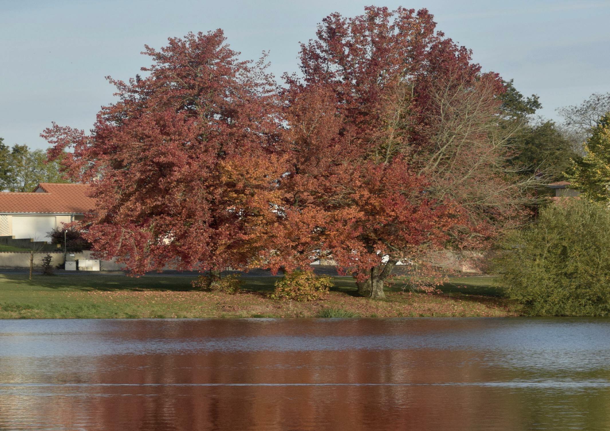
Effres Lake
Effres lake is very popular for leisure activities. A fishing permit card can be obtained at Super U, la Maison de la presse, and at Les Effres campsite. The rules and regulations for fishing are posted at the lake. Swimming is not allowed in the lake.
The Sports area and City stadium
There are structures for children and there is a mini football stadium, a skatepark and a BMX bike track. During the summer many leisure activities are on offer: pedalos, mini-golf, tennis, structures for children, fishing, bowls pitch, campsite and swimming pool.


