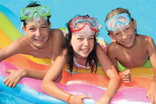
Our Hiking Guide.


TRAILS & OUTDOOR ADVENTURES tourismchilliwack.com # SHARECHILLIWACK POWERED BY


The traditional language of Stó:lō in the Central and Upper Fraser Valley is Halq’eméylem. This guide provides cultural information on a few important place names mainly within the Ts’elxwéyeqw (Ch-ihl-kwy-uhk) Tribal area. Hiking provides a way of respectfully exploring and experiencing S’ólh Téméxw – “Our World” or “Our Land” - an interconnected place of people, nature, geography, and history. There is much to learn and benefit from experiencing the great outdoors and deep Stó:lō connections to the land and resources – cultural landscapes, including the transformations of Xexá:ls “the Transformers,” snoweyelh “laws of the land,” sxexó:mes “gifts of the Creator” – and our rich cultural traditions.

SLESSE PEAK
SELÍSI (SE-LEE-SEE)
Selísi – “fang” – is the Halq’eméylem place name for this fang-shaped mountain peak, a cultural landmark resulting from a transformation by Xexá:ls – “the Transformers.”
This name also applies to the associated creek and a precontact Ts’elxwéyeqw settlement where the creek and Chilliwack River meet. Stó:lō Elders say this word is based on the old Ts’elxwéyeqw language, which was closely related to language of the Nooksack people from nearby Washington State. This name is still carried by some Stó:lō individuals today, connecting them to this powerful place.


SXÓTSAQEL (SKOT-SAKEL)
Sxótsaqel (Skot-sakel) – the Halq’eméylem name for Chilliwack Lake meaning “sacred lake” and a home of S’o:lmexw (S-all-mux-w), potent spiritual beings called “Water Babies.”
Sxótsaqel is the ancestral homeland of the Ts’elxwéyeqw Tribe. Evidence still remains of the ancient houses that extended along the lakeshore. Archaeological research tells us that the people here maintained connections with the indigenous peoples as far away as eastern Oregon. Over thousands of years, the Ts’elxwéyeqw established settlements throughout the Chilliwack Valley, eventually clustering around Vedder Crossing and moving into the lower Chilliwack River and Fraser Valley.
Ts’elxwéyeqw (Ch-ihl-kway-uhk) is the basis for the english place names of Chilliwack and Chilliwack River.
Ts’elxwéyeqw means as far as you can go upstream in a canoe or “slough at the top of the head”; “going into a slough from the river at the top of the head,” referring to the many sloughs at the mouth of the Chilliwack River where it flows out of the valley and leads to the Fraser River.

Lhílheqey, the Halq’eméylem placename for Mount Cheam, is the name of a woman who was turned to stone by the Transformers and given the responsibility to watch over the river and the people, so that no harm comes to them or to the fish that feed them.
Lhílheqey means “glacier,” “to resoak” or “rehydrate something.” The lakes on the mountain were used to rehydrate dried foods such as berries, meat, or fish. This was done during long berry gathering and hunting expeditions on Mount Cheam, an important gathering place of the Stó:lō.

SWÍLHCHA’ (SWEEL-CHA)
Swílhcha’ means “an empty basin that quickly filled with water” or “somebody died.” Cultus, a Chinook jargon word, means “bad” or “used up.”
The power of the lake comes from the stl’áleqems (stl-aa-la-kums) –“supernatural beings” – that inhabit its depths and were a significant part of the training needed to become a Stó:lō Indian Doctor. So many trainees visited the lake that over time that power became used up.
DISTANCE: 20KM, SHORTER OPTIONS AVAILABLE FROM EACH PARKING AREA
This beautiful gravel trail follows the Vedder River on both the North and South sides of the Vedder River Greenway. Explore the whole thing or hop on and off it at the many access points. Maps located on kiosks at parking areas. DIRECTIONS: Parking Areas: Google directions to Vedder Park, Peach Park, Lickman Vedder River Parking Lot, or Browne Creek wetlands.
DISTANCE RETURN: UP TO 5 KM (FLAT)
The Chilliwack Rotary Club provides an Interpretive Centre along with a friendly, flat trail system adjacent to Great Blue Heron’s nesting grounds. Info on-site. Limited trail access for dogs. DIRECTIONS: 5200 Sumas Prairie Rd., Chilliwack, BC.
DISTANCE RETURN: UP TO 2 KM (FLAT)
The Browne Creek Wetlands are located in the Vedder Greenway, on the south side of the Vedder River. The primary feature of the area is the spawning channel network. Two main trails, appropriately named the Kingfisher and the Beaver Trails, flank the rehabilitated spawning channels and allow trail users to observe the natural systems up close. DIRECTIONS: 5205 Browne Rd., Chilliwack, BC.
DISTANCE RETURN: 2.4 KM (FLAT)
This 132 hectare park in Chilliwack features a boat launch, large parking area for trucks and trailers, bike skills park, dog off-leash area, equestrian facilities, and a gatehouse that is staffed in the summer. Parking fees are in effect from the end of June to the end of October. DIRECTIONS: 44955 Cartmell Rd., Chilliwack BC.
DISTANCE RETURN: 18 KM (FLAT)
The Chilliwack section of the ETF winds through beautiful farmland alongside the Fraser River from Island 22 Regional Park to Ferry Island Provincial Park. DIRECTIONS: Parking at Island 22 Regional Park (44955 Cartmell Rd., Chilliwack BC), additionally there is a parking lot at the end of McDonald Rd. and Ballam Rd. adjacent to the Fraser River.
DISTANCE RETURN: 2 KM ELEVATION GAIN: 200 M HIGHEST POINT: 200 M TIME: 1 HOUR
This short forested trail leads you from Chilliwack Lake Rd. to the subdivisions of Promontory, making it a great fitness trail. NOTE: A loop trail ascends Salmon Ridge to a viewpoint overlooking the Chilliwack River Valley. DIRECTIONS: See Heading for “Chilliwack River Valley Area.” 600 metres east of the roundabout at Vedder Rd. and Chilliwack Lake Rd.
7A 7B MOUNT THOM PARK 7A 7B
DISTANCE RETURN: (7A) VIA RYDER LK: HORSE/LOOKOUT LOOP TO SUMMIT: (7B) 1.5 KM (VIA PROMONTORY: THOM CREEK TRAIL 8 KM)
ELEVATION GAIN: SUMMIT LOOP 100M (THOM CREEK 300M) HIGHEST POINT: 484 M TIME: SUMMIT LOOP HOUR (THOM CREEK 3 HOURS)
This trail system offers up two different choices. The “Summit Loop” is wide and well-groomed, leading to an unbelievable view from the top of Mt. Thom. The “Thom Creek” trail is a more ambitious route to the top and back from Promontory.
DIRECTIONS: Google directions to Thom Creek Trailhead (Promontory access) or Mt Thom Park (Ryder Lake access).
8 ELK–THURSTON
DISTANCE RETURN: 8 KM (THURSTON 15 KM) HIGHEST POINT: 1,400 M (THURSTON 1,630M) ELEVATION GAIN: 800 M (THURSTON 1,030 M) TIME: 4 HOURS (THURSTON 7 HOURS)
2WD accessible trailhead with breathtaking views of the Fraser Valley all the way to the ocean. Experience alpine meadows on one of Chilliwack’s most popular hikes. Continue along the ridge to Mount Thurston to enjoy the best alpine traverse in the area. This trail also connects to the Gloria Lookout via Mt. Thurston.
DIRECTIONS: Highway 1 Exit 123 (Prest Rd.) south 4 km to Bailey Rd. roundabout, take 3rd exit and go 1 km turning right and uphill on Elk View Rd. Stay on this road for 8 km (turns into gravel) following the signs to the trailhead.
DIRECTIONS: The following hikes can all be reached by Highway 1 Exit 104 (Yarrow-Cultus) following the signs to Cultus. ALTERNATE: Highway 1 Exit 119A (Sardis-Vedder), south on Vedder Rd. to the Vedder Bridge. Cross the bridge and turn left at the roundabout onto Columbia Valley Hwy.
DISTANCE RETURN: 10 KM HIGHEST POINT: 945 M ELEVATION GAIN: 500 M TIME: 4 HOURS
This trail features boardwalks and climbing aids on rocky scrambles near the summit A viewpoint at 3.5km provides a spectacular view north over the Village of Yarrow and the Fraser Valley. From the summit there are views south towards Mt. Baker and east up the Chilliwack River Valley, over Cultus Lake. DIRECTIONS: At the Cultus Lake Rd./Vedder Mtn. Rd. roundabout take the Cultus Lake exit. Drive 2.2 km, turn right onto Parmenter Rd. Go 600m, turn right onto Vedder Mtn. Forest Service Rd. (FSR). Road is gravel. Go 600m, bear left and drive 3 km. There is parking at this junction, on the shoulder, or continue 750m (accessible high clearance 4WD) to the upper parking area where wood steps on either side of the road lead to the trail.
DISTANCE RETURN: 4 KM ELEVATION GAIN: 120 M TIME: 1.5 HOURS
Seven giant Douglas-firs (some standing, some fallen) await you on this trail. A lovely family-friendly forest walk. DIRECTIONS: See Cultus Lake Area directions above.
Travel 1.3 km from the park entrance to Spring Bay picnic area on your right and park. Crossing the road, go uphill to your right, turn left into Clear Creek Campground, and left at the sign for the trail. Turn left 25m further to hike to the giant tree. From there you can turn around or continue to Entrance Bay Campground. ALTERNATE: Trail can be accessed from Entrance Bay Campground (steeper). Park at Day Use Area, cross main road to campground and keep right. Trail starts just past Site #7.
DISTANCE RETURN: KM ELEVATION GAIN: 90 M HIGHEST POINT: 180 M TIME: 45 MINS
This 800year-old tree is the oldest and largest in the Park. DIRECTIONS: See Cultus Lake Area directions. Travel 2 km from the Park Entrance. Just past the Delta Grove Campground, watch for the sign and roadside parking on your left.
12 TEAPOT HILL
DISTANCE RETURN: 5 KM ELEVATION GAIN: 280 M HIGHEST POINT: 360 M TIME: 2 HOURS
Most popular hike in the Park. There are interpretive signs and great views of Cultus Lake. DIRECTIONS: See Cultus Lake Area directions. Follow signs to Cultus Lake Provincial Park. Travel 2.3 km through the park to the sign and parking area for Teapot trail on your left.
DIRECTIONS: The following hikes are all accessed via Chilliwack Lake Rd. From Highway 1 Exit 119A (Sardis-Vedder) travel south 5.4 km on Vedder Rd. until you reach the roundabout before the Vedder Bridge, do not cross. Turn left onto Chilliwack Lake Rd. and set your odometer to “0”. There is no cell service. Like, none.
13 CHILLIWACK RIVER HATCHERY
DISTANCE RETURN: KM LOOP (FLAT) TIME: 20 - 30 MINS
DISTANCE RETURN: 11 KM ELEVATION GAIN: 1,435 M HIGHEST POINT: 1,880 M TIME: 8 HOURS
This trail is steep, gaining 1,000m in only 1.7 kilometers. The views from the ridge are breathtaking, and the trail continues to Williams Peak which is a technical scramble for more experienced adventurers. DIRECTIONS: See Chilliwack River Valley directions.
At 32 km look for signage on your left before a sharp left curve in the road. Park here.
The trail is evident on your left after passing through a small section of recently logged area. A cluster of orange markers on a tree indicates you have reached the ridge. Turn right and gain another 450 m in 4 km to the open meadows at the base of Williams Peak. (The peak itself requires rock scrambling experience and equipment). Or turn left and be lead 5 km along the ridge to Ford Mtn (see #13).
DISTANCE RETURN: 8 KM ELEVATION GAIN: 460 M HIGHEST POINT: 1,100 M TIME: 3 HOURS
From the trailhead, you will descend toward Nesakwatch Creek in the valley below. When you reach the creek, head upstream to find a bridge crossing. The trail winds up through forest, before intersecting an old logging road. Follow this until you reach a memorial plaque commemorating TCA Flight #810, which crashed on December 9, 1956 into Mt.Slesse killing all 62 aboard. The trail continues past the plaque and and steepens, leaving the logging road before switchbacking through brush to the propeller cairn monument and stunning views of the surrounding peaks and hanging glaciers. DIRECTIONS: See Chilliwack River Valley Area directions. At 31 km you will see the second entrance to the Riverside Recreation Site. Turn right, and reset odometer to “0” again. A bridge immediately crosses the Chilliwack River and you are on the Chilliwack South Forest Service Rd. In 400 m turn right onto Nesakwatch Creek FSR and drive for 5.6km to park at pullout before washout. This road sees seasonal rain washouts; however, you can usually drive to within 1-2 km of the trailhead. You will need a minimum of a high clearance 2-WD vehicle to get up the road. NOTE: Due to washouts, please check current FSR road conditions on backcountrybc.ca.
18 RADIUM LAKE
DISTANCE RETURN: 15 KM ELEVATION GAIN: 910 M HIGHEST POINT: 1,460 M TIME: 6 HOURS
This trail follows the begining of the Chilliwack River then turns up into the alpine. Hike to the lake, or for more experienced hikers, you may aim to reach the saddle between Mts. Webb and MacDonald. DIRECTIONS: See Chilliwack River Valley Area directions. Drive 42 km to Chilliwack Lake Provincial Park and turn right at the Gatehouse. Park in the Day Use parking lot and walk back towards the sani-dump, turning left and passing the info board on your way down the campground road to the TC Trail Radium Lake sign. This will take you to the footbridge over the Chilliwack River where you cross, turn right and follow the TC Trail downstream for 1 km. Watch for the Radium Lake sign post on the left. NOTE: Due to snowpack, trail is best June – October.
19 LINDEMAN–GREENDROP LAKES
DISTANCE RETURN: 3.4 KM (GREENDROP 10.4 KM) ELEVATION GAIN: 215 M (GREENDROP 365 M) HIGHEST POINT: 825 M (GREENDROP 1,010 M) TIME: 3 HOURS (GREENDROP 6 HOURS)
This trail is family friendly. Due to the beauty of the lake, this trail can be quite crowded on summer weekends. BC Parks recently upgraded some portions of the trail and installed a new urine-diversion toilet and building. After reaching Lindeman Lake the trail follows its western shore to the far end, crossing some talus (rock) slopes along the way. Continue beyond the lake to Greendrop. DIRECTIONS: See Chilliwack River Valley Area directions. At 40 km you will see the parking lot on the left hand side of the road. Signage at the trailhead.
22 BABY MUNDAY
DISTANCE RETURN: 10.5KM ELEVATION GAIN: 1,407M HIGHEST POINT: 2,250M TIME: 7 HOURS
Baby Mundy Peak consists of 10.5 km of trail, the route will take just under 7 hours to complete – round trip. This route is a hiker’s dream, rarely interacting with other explorers this trail truly allows you to be one with nature. The trail requires a 4WD vehicle due to harsh road conditions. Though you can still access this unique trail without a 4WD. DIRECTIONS : See Chilliwack River Valley Area directions. Drive 28 km towards Chilliwack Lake, just past Chilliwack Lake bridge turn left onto Foley Creek FSR. After 2km turn right at the T-junction after Foley Creek Bridge and continue to Airplane Creek FSR. Travel along this FSR for about 3km. Trailhead will be on your right.
23 CHEAM LAKE
DISTANCE RETURN: UP TO 2 KM FLAT TIME: 30 MINS
Flat trails in and around these wetlands make it easy for all to enjoy. Boardwalks, two viewing platforms and trails and allows you to view sensitive habitat with an abundance of wildlife species, including 184 different bird species. Bikes and dogs are not permitted. Maps and info on site. DIRECTIONS: 53480 Elgey Rd., Rosedale, BC.
24 BRIDAL VEIL FALLS
DISTANCE RETURN: 2 KM TIME: 30 MINS
A short trail through old growth forest to the 6th highest waterfall in Canada. DIRECTIONS: Highway 1 Exit 135 (Agassiz- Harrison). Do not cross over highway. Go straight on access parallel road 1 km to commercial area. Follow Bridal Falls Provincial Park signage on your right, just before the gas station. Features inlcude: parking and a picnic area.
25 COMMUNITY FOREST
PI TXEL: 1.5KM, CHOLQTHET: 4KM, CANYON LOOP: 4KM, BROKEN TREE: 5KM HIGHEST POINT: 500M (BROKEN TREE LOOP)
ELEVATION GAIN: PI TXEL, 67M: CHOLQTHET, 122M: CANYON LOOP, 60M: BROKEN TREE, 160M
TIME: PI TXEL, 30 MIN, CHOLQTHET, CANYON LOOP 1.5 HOURS: 1 HOUR: BROKEN TREE, 1.5 HOURS
Chilliwack Community Forest is a multi-use trail system. This trail consists of several loops “Pi txel” (Peet-hyul) a beginner level trail loop, Cholqthet a moderate trail loop, the Canyon Loop, as well as a small loop at the top referred to as “Broken Tree.” The shorter trail features interpretive signage and resting benches at scenic view points and is less than 5% average grade, great for families and kids. This is also the access for the Gloria Lookout trail as well as the top of Thaletel, described in Lexw Qwò:m Park. DIRECTIONS: 51642 Allan Rd., Chilliwack, BC. More information available on trailforks.com.
DISTANCE RETURN: 12 KM HIGHEST POINT: 1450 M
ELEVATION GAIN: 1500M TIME: 4-6 HOURS
EASY DIFFICULT WALKING
MODERATE VERY DIFFICULT DIFFICULT
This Salmonid Enhancement Program (SEP) site has been operational since 1981, and is located alongside one of B.C.’s premier salmon rivers. A beautiful setting for this self-guided tour with info available on site. Open daily 8 am – 3:30 pm.
20 FLORA LAKE
DIRECTIONS:
See Chilliwack River Valley Area directions. At 20 km, cross the wooden bridge over Slesse Creek and park in the parking area on your left after the hatchery sign.
14 PIERCE LAKE/MOUNT MACFARLANE
DISTANCE RETURN: 16 KM
MT. MAC: 21 KM
ELEVATION GAIN: 1,040 M (MT. MAC: 1,760 M) HIGHEST POINT: 1,375 M (MT. MAC: 2,100 M)
TIME: 7 HOURS MT. MAC: 10 HOURS
This trail leads to two alpine lakes, Lower and Upper Pierce, and one of the spectacular views in the area or those that choose to continue to the summit of Mt. MacFarlane. Caution : Mt. MacFarlane is a long haul with strenuous and challenging terrain A good overnighter. The grade is gentle to start, but eventually steepens to a consistent uphill. Be sure to keep an eye out for trail markers, especially at logging road crossings. Some route finding is involved beyond the lower lake. DIRECTIONS:
See Chilliwack River Valley Area directions. At 22 km the Pierce Lake Parking Lot is on the right hand side of the road.
15 FORD MOUNTAIN 4x4
DISTANCE RETURN: 14.6 KM (WITH 4X4 ONLY 6 KM/3HOUR HIKING) ELEVATION GAIN: 1,005 M HIGHEST POINT: 1,410 M TIME: 5 HOURS
A forested trail leads to a panoramic view from an old Forest Service fire lookout. Optional: continue 5 km along Williams Ridge towards Williams Peak (see #14). DIRECTIONS: See Chilliwack River Valley Area directions. At 28.4 km watch for Ford Mountain Forest Service Rd. and trail signpost on the left. 4x4’s can travel 4 kms of rough, steep road. 2WD can make it about 2 km. Before the metal gate (at 4 km), park and walk the 300 m to the trailhead via the old road on your left.
DISTANCE RETURN: 14 KM ELEVATION GAIN: 1,585 M (TO RIDGE) HIGHEST POINT: 1,770 M TIME: 8 HOURS
The views of Sxótsaqel Chilliwack Lake from Flora Ridge are truly breathtaking. The trail climbs 1,585 m to the ridge and this is the destination for most hikers, it then drops 345 m down to the lake. Flora Lake is usually is only visited by those linking the whole Lindeman, Greendrop, Flora Lake loop (20km, 10 hrs). This loop is only suitable for those who are very fit, experienced and well prepared. An overnight trip would be best if you are doing the loop. DIRECTIONS: See Chilliwack River Valley Area directions. At 40 km you will see the parking lot on the left side of the road. Signage at the trailhead.
21
DISTANCE RETURN: 9.5 KM HIGHEST POINT: 2,112 M ELEVATION GAIN: 665 M TIME: 4 HOURS
Mt. Cheam offers spectacular 360 degree views . The entire trail is in the sub-alpine. Despite the difficult access, this trail is quite popular in the summer months. CAUTION: There are sheer drops near the top. DIRECTIONS: Do not attempt without a high clearance 4x4 and an experienced backroad driver. See Chilliwack River Valley Area directions. At 28 km turn left on Foley Creek Forest Service Rd. “0” odometer again and drive 2 km, cross bridge over Foley Creek, turn left at T-Junction. 2 km further cross Chipmunk Creek Bridge, take next right uphill (passing gravel pit on your left) on Chipmunk Creek Forest Service Rd. This is a rough road with many cross ditches, moderate grade for 7 km. Keep right after crossing Chipmunk Creek. The road is rougher and steeper for the final 4 km to the parking area.
This trail leads to a vista over Chilliwack after climbing through the Douglas Fir and Cedar forests. Ranked as a difficult trail it is certainly a workout. The trail tops out on a ridge at a T-junction. Go right to the lookout. Go left and connect all the way to Mt. Thurston and Elk Mountain. DIRECTIONS: Park at the trailhead of the Chilliwack Community Forest – 51642 Allan Rd., Chilliwack, BC. From the parking lot, follow signs to the top of the Cholqthet trail. Continue following signs to the Gloria Lookout.
27 LEXW QWÒ:M PARK/
DISTANCE RETURN: LEXW QWÒ:M (EASY) 400M LOOP / THALETEL (MODERATE) 2.5KM HIGHEST POINT: 385 M
ELEVATION GAIN: 300 M TIME: 1.5 HOURS
The name Lexw Qwò:m (Luwh-KWOM) is the traditional name for the area and means “always lots of moss” in Halq’eméylem, the language of the Sto:lo Coast Salish People. Day use trails within the park incorporate the old water intake structures as trail bridges and visitors will also be able to read historical information about how the intakes were used by Elk Creek Waterworks. Designed for mountain bikers, hikers, and dog walkers, the park features two main trails, one 400m loop trail that connects the two old water intakes, and a second a 3km mixed-use trail known as Thaletel (THA la tell) Thaletel is the Halkomelem name for the wild ginger which grows along the trail. Pronounced “THA la tell” it literally means “like a heart.” DIRECTIONS: Park at 51930 Hack Brown Road, Chilliwack, BC.
4x4
4WD REQUIRED & HIGH CLEARANCE
MOUNTAIN BIKING CAMPGROUNDS