
7 minute read
Hiking


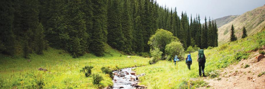
Mileage is roundtrip, with levels based on family access. All trails are more heavily used on weekends.
Advertisement
Order books direct at TheStormKing.com
or pick up a copy at:
• Geared for Games • Word After Word • Alice’s Mountain Market Bookshop located at Squaw Valley • Gratitude Gifts • Donner Memorial State Park • Mind Play Group presentations · In-home talks
(530) 546-5612 · mark@TheStormKing.com
HOME IMPROVEMENT
Call (530) 546-5995, ext. 110, to be included in Home Improvement.
SIDESHOW BOB’S Window Cleaning
Since 2000
Residential & Commercial (530) 581-2343 CA & NV Licensed & Insured
- Since 2000 Rooster to Cricket Maintenance
• Landscaping • Painting/Staining • Snow Removal • Window Cleaning 530.412.1105
Advertise in MARKETPLACE
Color 1 col x 2” $60 | 2 col x 2” $100
All ads included in free digital edition.
Serving the Truckee/ Tahoe Area
New Construction Custom Homes Additions & Remodels

775-302-0232 | parraconstructionllc.com Lic # CA: 974622/ NV: 0086046A

SV Snow Removal d We only work in Squaw Valley d 12 years experience d Local references d We use shovels & snow blowers Call Bob at (530) 412-2703
Tree Trimming & Removal • Brush Chipping Yard Clean-Up • Defensible Space Wood Splitting & Stacking • Stump Grinder • Crane Work Licensed & Insured Juan Estrada • 530-546-8493 • 530-412-2220

FOLLOW US ONLINE
NO. 1 FOR OUTDOORS & RECREATION, FAMILY FUN, LIVE MUSIC, EVENTS, ENTERTAINMENT, ARTS, FOOD & WINE DELIVERING THE FUN SINCE 1982
E-newsletter: subscribe at TheTahoeWeekly.com facebook.com/TheTahoeWeekly @TheTahoeWeekly @TheTahoeWeekly
TheTahoeWeekly.com issuu.com/TheTahoeWeekly
Visit TheTahoeWeekly.com for more Hiking Trails to enjoy.
TAHOE RIM TRAIL
Moderate
The Tahoe Rim Trail is a 164.8-mile loop trail that encircles Lake Tahoe. The trail is open to hikers and equestrians, and mountain bikers in some sections. It is generally moderate in diffi culty, with a 10 percent average grade and elevations ranging from 6,300 to 10,333’. Visit tahoerimtrail.org for maps, guided hikes & descriptions.
LAKE TAHOE
EAST SHORE
MARLETTE LAKE Moderate | 9 miles RT
Walk along the dirt path through the picnic area and follow signs to Marlette Lake. Mostly sun exposed. Great wildfl owers in early summer. Start at Spooner Lake State Park.
SECRET HARBOR & CHIMNEY BEACH Easy | 3 miles RT
Follow the trail to Chimney Beach trail and follow the trail to the end and over a group of boulders to reach the sandy beaches of Secret Harbor (the wooden steps off the trail lead to the nude beach at Secret Cove). Off Hwy. 28.
SKUNK HARBOR Moderate | 2.8 miles RT
This interesting hike ends at a beautiful cove lined with boulders and a luxurious sandy beach on the edge of Lake Tahoe with some of the warmest waters around the lake. Visitors can look inside the historic party house owned by George and Caroline Newhall in the 1920s along beach. Park north of gate; do not block gate off Hwy. 28.
SPOONER LAKE Easy | 1.8 miles RT
Spooner Lake is a great, easy hike for any season with interpretive displays. At Spooner Lake State Park.
NORTH SHORE
PICNIC ROCK Moderate | 3.6 miles RT
Just off the Tahoe Rim Trail, the expansive view from the top provides a panorama of both Lake Tahoe and the Martis Valley. A single track winds up, offering a gradual climb with no technical challenges, until reaching Picnic Rock, an old volcanic rock. Off Hwy. 267.
STATELINE LOOKOUT Easy | .5 miles RT
This short hike offers superb views of Lake Tahoe. A short, self-guided nature trail explains the history of the North Shore. Hwy. 28 in Crystal Bay.
SOUTH SHORE
LOWER & UPPER ECHO LAKES Easy | 2.4-4.8 miles RT
Lower and Upper Echo Lakes is a little-known paradise perched atop Echo Summit, 5 miles west of Meyers on Hwy. 50. The trailhead begins next to the dam. Once you reach Upper Echo Lake, 2.4 miles from the start, you’ll see a kiosk at a dock for a water taxi. You can take a taxi back or return the way you came, or continue into Desolation Wilderness. The ride is a relaxing 20-minute tour through the channels connecting the two lakes. Taxi, cash only. (530) 659-7207.
WEST SHORE
CASCADE FALLS Moderate | 1.4 miles RT
This boulder-strewn hike takes hikers to the waterfall descending from Desolation Wilderness into Cascade Lake. The falls are raging in the spring and are often a trickle by late summer. Near the end of the trail, walk up a large, fl at boulder to the top of a hill where the trail can become confusing. Look for wooden posts marking the trail. Trailhead at Bayview Campground off Hwy. 89. Not recommended for small children or small dogs.
EAGLE ROCK Moderate | 1 mile RT
Quick hike to the top of a volcanic outcropping offers panoramic views of the area off Hwy. 89 south of Tahoe City.
EAGLE FALLS & LAKE Easy-Moderate | .1-3 miles RT
Great views of Lake Tahoe & Emerald Bay. Falls 5-minute walk from parking lot. Steady ascent to Eagle Lake not recommended for young children. West end of picnic area across from Emerald Bay, Hwy. 89.
EMERALD BAY & VIKINGSHOLM CASTLE Moderate | 2.5 miles+ RT | No dogs
Steep descent to Vikingsholm Castle. Can continue to Eagle & Emerald Points around the bay for easy hikes. Connects to Rubicon Trail (see below). Park on either side of rocky overlook in Emerald Bay on Hwy. 89. ADA access (530) 525-9529.
GRANITE LAKE Moderate | 2.2 miles RT
A small alpine lake situated on the cusp of Desolation Wilderness, the hike is a popular entrance for hikers and equestrians to the back country and a spectacular trek towering over the pristine waters of Emerald Bay. Steady ascent of 850’ in less than 1 mile. Trailhead at Bayview Campground off Hwy. 89.
PAGE MEADOWS Easy-Moderate | 4-6 miles RT
The hike to Page Meadows is a local favorite because of its easy access and beautiful scenery through forests to an expanse of several meadows. You can start the hike to Page Meadows from 64 Acres off Hwy. 89 along the Tahoe Rim Trail for a longer hike or from Ward Creek Boulevard off Hwy. 89.
RUBICON TRAIL & LIGHTHOUSE Easy-Moderate | .5-9 miles | No dogs
Hike starts at Calawee Cove at D.L. Bliss State Park or Emerald Bay. Trail follows cliffs and coves along Lake Tahoe, nesting ospreys and eagles, short side trail to Rubicon Lighthouse, which is easy to access with small children.
Park closees Oct. 31.
BALANCING ROCK Easy | .5 miles | No dogs
A short, self-guided nature trail featuring Balancing Rock, an overlying rock of 130 tones balanced on a rock. At D.L. Bliss State Park.
SUGAR PINE POINT STATE PARK Easy | 1.5 miles RT
The nature trail loops through the forest past an array of wildfl owers and through several sections of dense slash bleached nearly white from years of sun exposure. There are great spots to relax on the beach below Ehrman Mansion.
ALPINE MEADOWS
FIVE LAKES Strenuous | 5 miles RT
Five Lakes is a great hike inside Granite Chief Wilderness, with the fi rst 1 mile+ a steady ascent with great views of Alpine Meadows. Trailhead 1.8 miles up Alpine Meadows Road from Hwy. 89 across from Deer Park Drive. Dogs prohibited May 15-July 15.
OLYMPIC VALLEY
SHIRLEY CANYON & SHIRLEY LAKE Easy-Strenuous | .5-5 miles RT
This hike follows a creek as it passes by waterfalls and spectacular granite boulders along Shirley Creek. Park at the end of Squaw Peak Road. The fi rst section that follows the creek is great for kids. As you climb, the trail may sometimes be hard to distinguish, so keep the creek on your right going up and on your left going down. Can continue a strenuous climb to High Camp and take the Aerial Tram to the valley (schedule at squawalpine.com). Tram closed.
SQUAW & EMIGRANT PEAKS Moderate | 3.4-4.4 miles RT
Ride the Aerial Tram to High Camp, elev. 8,200’, and choose from a variety of trails (maps from Guest Services or squawalpine.com). Climb to the weathered buttresses atop Squaw Peak, visit the historic Watson Monument at Emigrant Peak or meander through the meadows covered with wildfl owers, and enjoy the panoramic views afforded from Squaw’s spacious upper mountain. Tram ticket required. Hikes in the meadows good for small children.
Tram closed.
TRUCKEE
GLACIER MEADOW LOOP Easy | .5 miles RT
Short, self-guided nature loop with signs that explain how glacial action carved and polished the surface landscape. Take Interstate 80 W from Truckee to the Castle Peak/Boreal Ridge Road exit.
MARTIS CREEK WILDLIFE AREA Easy | 4 miles RT
Loop through Martis Creek meadow for a walk along the creek. Off Hwy. 267.


