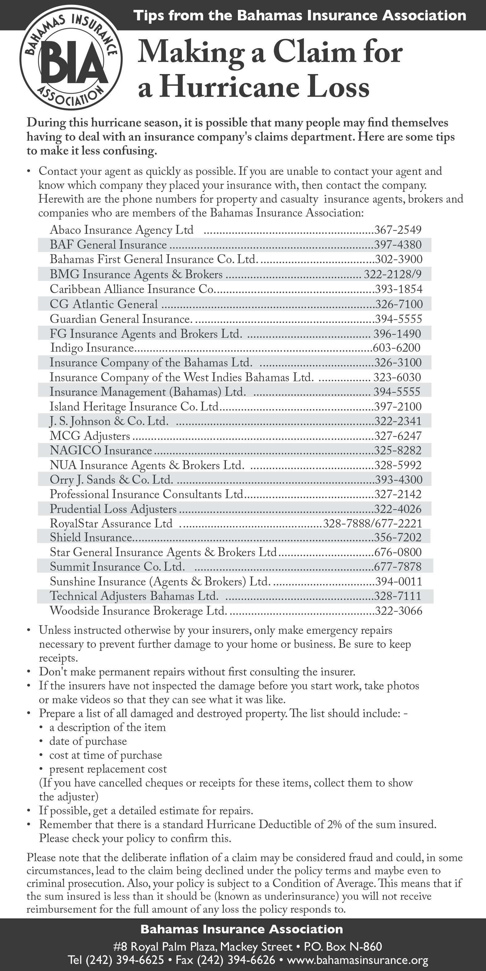
By RASHAD ROLLE Tribune News Editor
FOR years, the National Emergency Management Agency (NEMA) and its head, Captain Stephen Russell, were the face of hurricane preparedness and recovery efforts in The Bahamas.
That changed with the passage of the Disaster Risk Management Act and its formation of the Disaster Risk Management Authority.
The DRM is a merger of NEMA and the Disaster Reconstruction Authority.
The new agency allows officials to work faster and “cut through a lot of the tape”, said Alex Storr, the chairman of the DRM Authority.
For example, under NEMA, workers’ travel abroad approval went through a government ministry, a potentially lengthy process.
The DRM, with its board, has shortened that time considerably.
“The DRA only focused on reconstruction and
rebuilding after the hurricane,” Mr Storr added.
“The new agency now focuses on preparation, mitigation and immediate recovery.”
He said the new law facilitates a greater focus on capacity building so the best and most capable people are involved in preparing the country for disasters. Currently, 60 people are employed at the authority, which has incorporated NEMA’s infrastructure.
Captain Stephen Russell, the long-time head of NEMA, is now working within the Ministry of Disaster Risk Management and is a senior advisor to the DRM, which received a $2.5m budget for the upcoming fiscal year.
At a press conference launching the DRM authority, Minister of State in te Office of the Prime Minister with responsibility for Disaster Preparedness and Management Leon Lundy said: “Our vision is clear: to have a country where every citizen and resident feels secure in the face of a storm. The government, along with our dedicated agencies, has been working relentlessly to enhance our disaster preparedness and response capabilities.”
“The formation of the DRM Authority represents a pivotal change in our approach. By merging NEMA and the [DRM Authority], we have created a unified entity focused on preparing for, mitigating, and responding to disasters with unparalleled precision and efficiency. This consolidation ensures a comprehensive and cohesive framework for disaster risk management, embracing innovation to fortify our resilience.”
In addition to Mr Storr, the DRM is led by managing director Aarone Sargent.
Mr Storr said procuring new disaster software is the authority’s priority. That technology, he said, would streamline communication with stakeholders.
He said the authority is also feverish about ensuring that each island has a purpose-built shelter. Only two islands — Abaco and Andros — have such shelters.
The DRM was created after an Inter-American Development Bank (IDB) study found that the country had limited legal, institutional and budgetary conditions for implementing effective public policies in disaster risk management.

The law mandates that the government approve a national disaster risk management policy that addresses disaster risk issues.
The authority must establish an emergency operations centre as the headquarters for activities undertaken in response to a disaster.
The authority must also maintain a Disaster Prevention Fund for risk analysis,
reduction, and preparedness activities. In addition, a Disaster Emergency Fund should be used to respond to disasters and help the country rehabilitate. In 2022, the International Federation of Red Cross and Red Crescent Societies reviewed the country’s legal and policy frameworks for disaster recovery after Hurricane Dorian.
It concluded that prior to Hurricane Dorian, the framework to properly recover from a large-scale disaster was either “nonexistent or inadequate.” In particular, experts found that the disaster disproportionately

CENTRAL ABACO
Central Abaco Primary School
Friendship Tabernacle
Guana Cay Primary School
Man-O-War Primary School
Hope Town Primary School
Murphy Town Community Centre
NORTH ABACO
Amy Roberts Primary Pre-School
Faithwalk Church of God, Community Centre
Grand Cay All Age School Pre-school Block
SOUTH ABACO
Crossing Rocks Primary School
Moore’s Island School
Sandy Point Community Centre
Dundas Town
Dundas Town
Guana Cay
Man-O-War Cay
Hope Town
Murphy Town
Green Turtle Cay
Cooper’s Town
Grand Cay
Crossing Rocks
Moore’s Island
Earnest Dean Highway
Soul Seeking Ministry Moore’s Island
ACKLINS
Joshua Kingdom Ministries Pine field
ANDROS, CENTRAL DISTRICT
Bowen Sound Pentecostal Church Bowen Sound
Church of God Cargill Creek
Mt. Ethel Baptist Love Hill
ANDROS SOUTH DISTRICT & MANGROVE CAY
Rev. Euthurl Rodgers Primary School Deep Creek
Friendship Baptist Church
Cleora McKenzie Pre-school
Mount Olive Baptist Church
Burnt Rock Primary School
Mangrove Cay High School
ANDROS, NORTH DISTRICT
Bluff
Long Bay Cays
Smith’s Hill
Burnt Rock
Swains, Mangrove Cay
B. A. Newton Primary School Red Bays
BAMSI Training Centre
Nicholls Town Primary & Clara Evans Primary Schools
BERRY ISLANDS, GREAT HARBOUR CAY
Church of God of Prophecy
Berry Islands Community Centre
BIMINI
BARC Community
Nicholl’s Town
Great Harbour Cay
Bullocks Harbour
Gateway Gymnasium Bailey Town
Louise McDonald High School (4 class rooms) Alice Town
Urban Renewal (Special Needs Shelter)
CAT ISLAND
St. Mark’s Anglican Church
Zion Baptist Church
Seaview Seventh Day Adventist Church
Holy Redeemer Catholic Church
Mt. Sinai Baptist Church
Lovely Zion Baptist Church
CROOKED ISLAND & LONG CAY
All Saints Anglican Church, Priest Residence
Alice Town
Port Howe
McQueens
Wilson Bay
New Bight
Douds
The Bluff
Church Grove, Crooked Island (Colonel Hill and Church Grove Residents)
Church of God of Prophecy
Cripple Hill, Crooked Island (Landrail Point, Richmond, Moss Town and Cripple Hill Residents)
Landrail Point Community Centre
Landrail Point (60 persons seated)
ELEUTHERA CENTRAL DISTRICT
Wesley Methodist Church Hall
Church of The Nazarene
The Salvation Army
Emily G. Petty Primary School
George E. Johnson Memorial Centre
Bahamas Methodist Habitat Camp Symonette
Bahamas Methodist Habitat
ELEUTHERA NORTH DISTRICT
Charles Wesley Methodist Church
Mission Church of God
Palmetto Point
Palmetto Point
Palmetto Point
Governor’s Harbour
Hatchet Bay
Cistern
Cistern
Bogue
Bogue The Current Community Centre
The Haitian Baptist People Church
Zion Methodist Church
New Jerusalem Church Blackwood
ELEUTHERA, SOUTH DISTRICT
Church of God of Prophecy
Tarpum Bay
Deep Creek Primary School Deep Creek
Castle
Green Castle Primary School
Rock Sound Primary School Rock Sound
Wemyss Bight Primary School
ELEUTHERA, HARBOUR ISLAND
Harbour Island
SINCE 1953, Atlantic tropical storms had been named from lists originated by the National Hurricane Centre in the US. They are now maintained and updated through a strict procedure by an international committee of the World Meteorological Organisation (WMO). According to the centre’s website, www.nhc. noaa. gov, the lists are used in rotation and recycled every six years, so the 2016 list was used again in 2022.
The only time that there is a change in the list is if a storm is so deadly or costly that the future use of its name on a different storm would be inappropriate for reasons of sensitivity.
If that happens, then at an annual meeting by the WMO committee the offending name is removed from the list and another name is selected to replace it. Several names have been retired since the lists were created.
If a storm forms in the off-season, it will take the next name in the list based on the current calendar date.
For example, if a tropical cyclone formed on December 28, it would take the name from the previous season’s list of names. If a storm formed in February, it would be named from the subsequent season’s list of names.
In the event that more than 21 named tropical cyclones occur in the Atlantic Basin in a season, additional storms will take names from the Greek alphabet.
There is an exception to the retirement rule. Before 1979, when the first permanent six-year storm name list began, some storm names were simply not
used anymore. For example, in 1966, ‘Fern’ was substituted for ‘Frieda’ and no reason was cited.
There are, however, a great number of destructive storms not included on this list because they occurred before the hurricane naming convention was established in 1950.
For several hundred years many hurricanes in the West Indies were named after the particular saint’s day on which the hurricane occurred.
The Hurricane Centre website reports that Ivan R Tannehill described in his book ‘Hurricanes’ the major tropical storms of recorded history and mentions many hurricanes named after saints.
There was ‘Hurricane Santa Ana’ which struck Puerto Rico with exceptional violence on July 26, 1825, and ‘San Felipe’ (the rst) and ‘San Felipe’ (the second) which hit Puerto Rico on September 13 in both 1876 and 1928.
The website explains that Tannehill also tells of Clement Wragge, an Australian meteorologist who began giving women’s names to tropical storms before the end of the 19th century.
An early example of the use of a woman’s name for a storm was in the novel ‘Storm’ by George R Stewart, published by Random House in 1941.
During World War II the practice apparently became widespread in weather map discussions among forecasters, especially Army and Navy meteorologists who plotted the movements of storms over the wide expanses of the Pacific Ocean.
In 1953, the United States abandoned a
two-year-old plan to name storms by a phonetic alphabet (Able, Baker, Charlie) when a new, international phonetic alphabet was in- troduced. That year, the United States began using female names for storms.
The practice of naming hurricanes solely after women came to an end in 1978 when men’s and women’s names were included in the Eastern North Pacific storm lists.
In 1979, male and female names were included in lists for the Atlantic and Gulf of Mexico.
The Hurricane Centre website explains the reasons for even having a naming convention: “Experience shows that the use of short, distinctive names in written as well as spoken communications is quicker and less subject to error than the older, more cumbersome latitudelongitude identification methods.
“These advantages are especially important in exchanging detailed storm information between hundreds of widely scattered stations, coastal bases, and ships at sea.
“The use of easily remembered names greatly reduces confusion when two or more tropical storms occur at the same time. For example, one hurricane can be moving slowly westward in the Gulf of Mexico, while at exactly the same time another hurricane can be moving rapidly northward along the Atlantic coast.
“In the past, confusion and false rumours have arisen when storm advisories broadcast from radio stations were mistaken for warnings concerning an entirely different storm located hundreds of miles away.
Wemyss Bight
• WATER - one gallon per person
• FOOD - basically non-perishable items such as canned goods
• CLOTHING AND BEDDING
• PERSONAL ITEMS
• FIRST-AID SUPPLIES and MEDICATIONS
• IMPORTANT
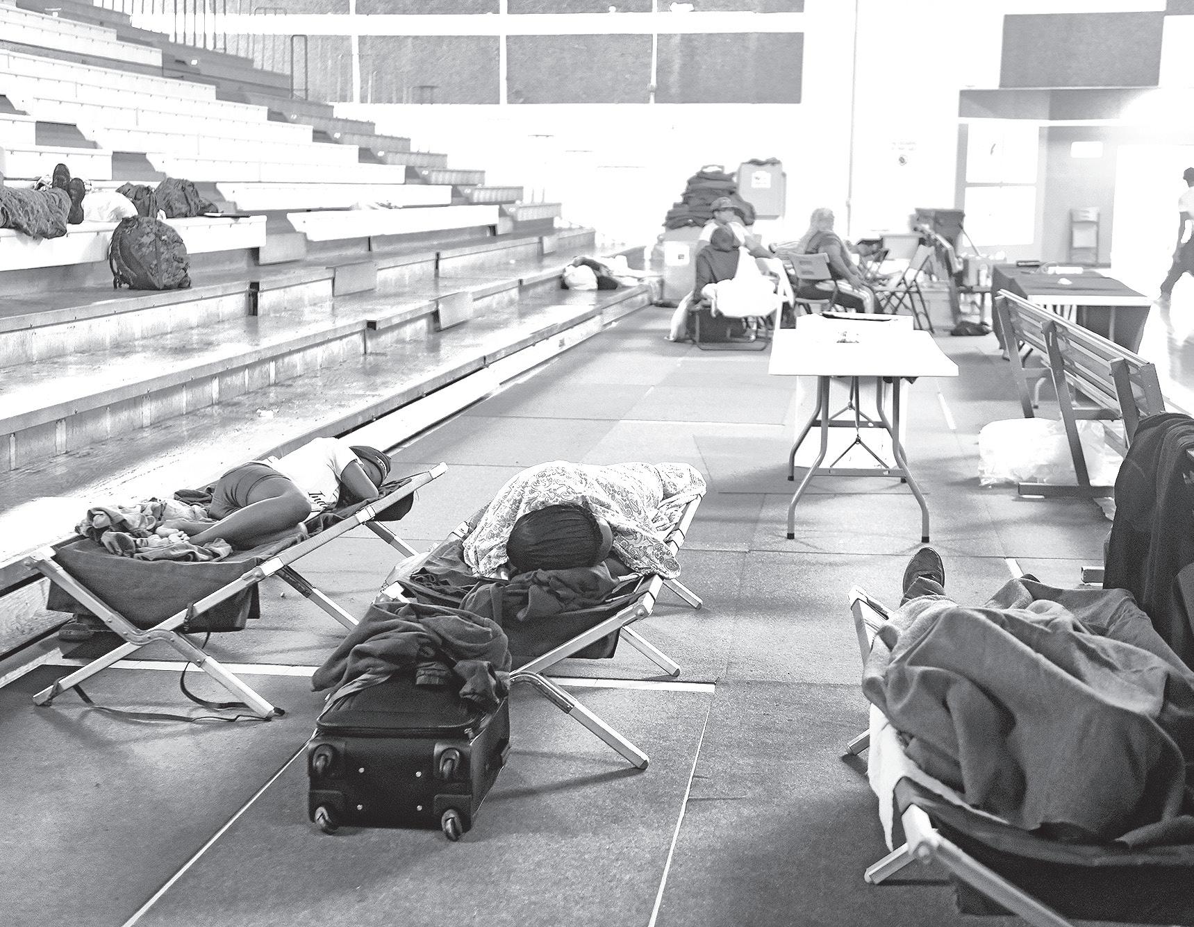
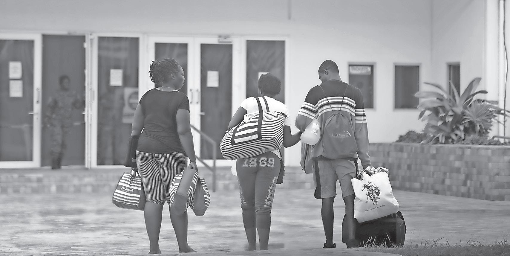
SCHOOLS, church halls or other solidly constructed buildings that provide a large, safe environment are the common sites of hurricane shelters, which should be considered a last resort if relatives or friends are not available when a storm hits. Shelters for each Atlantic
hurricane season are inspected and designated by the National Emergency Management Agency (NEMA). A team comprising NEMA personnel, the Fire Branch of the Royal Bahamas Police Force, Environmental Health Services, the Bahamas Red
Cross and the Department of Social Services inspected buildings on New Providence and throughout the Family Islands before releasing the official list for the season. Shelters tend to lack many comforts such as bedding, pillows and food so residents should bring their
own supplies in the event they have to evacuate their homes. In such cases, residents should be prepared to live
with strangers in close quarters for the duration of the storm, or up to three days. No pets are allowed in shelters - owners are encouraged to make prior arrangements with veterinary clinics or other such facilities.
COGOP Community at Heart
(Reserved for use of aftermath) Universal Household of Faith
(Reserved for use of aftermath) Flame of Fire
(Reserved for use of aftermath)
Maurice Moore Primary School
First Holiness Church of God
(Reserved for Youth of aftermath)
Miracle Bible Fellowship
(Reserved for aftermath)
Sir Jack Haywood Junior High School
INAGUA
New Life Seventh-Day Adventist Church
St. Phillips Anglican Community Centre
Zion Baptist Church
LONG ISLAND
Assemblies of God
Community Centre
Highway Church of God
Holy Cross Anglican Church
Holy Family Anglican Church
Salem Baptist Church
St. John’s Anglican Church
Seymour’s Gospel Chapel
MAYAGUANA
St. James Native Baptist Church
Betsy Bay Community Centre
Mayaguana Comprehensive K- School
NEW PROVIDENCE
Agape Full Gospel Baptist Church
Berea Seventh-Day Adventist Church
Canon Neil E. Roach Hall, Holy Cross Anglican Church
Church of God Convention Centre (for use by SRC)
Epworth Hall, Ebenezer Methodist Church
(for use by Homeless and People with Physical Disabilities)
Grants Town Seventh-Day Adventist Church
Hillview Seventh-Day Adventist Church
Maranatha Seventh-Day Adventist Church
New Bethlehem Baptist Church
New Dimensions Ministries
New Providence Community Centre
Pilgrim Baptist Temple
St. Barnabas Anglican Church
Torcross Rd. &
Sandcombe Drive
Young Husband Avenue
Eleuthera Drive, Hawksbill
Settlers Way
Matthew Town
Matthew Town
Matthew Town
Salt Pond
Clarence Town
Doctors Creek
Hamiltons
Mortimers
Millers
Buckleys
Seymour’s
Abraham’s Bay
Betsy Bay
Pirate’s Well
Kennedy Subdivision
Baillou Hill Road South
Highbury Park
Joe Farrington Road
Shirley Street
Wellington Street
Tonique Williams Darling HWY
Prince Charles Drive
Independence Drive
Joe Farrington Road
Blake Road
St. James Road
Wulff Road and Baillou Road
Rev. Dr. O. A. Pratt Educational Building, Augusta and Meeting Streets
St. John’s Native Baptist Church
Samuel and Cornella Williams Community Centre,
The Salvation Army
Living Waters Kingdom Ministries Warren Street
The Anglican Church of the Epiphany Prince Charles Drive
The Salvation Army Mackey Street
SAN SALVADOR AND RUM CAY
Fellowship in Christ Church
Cockburn Town
Gerace Research Center United Estates Settlement
Idell Jones Community Hall
St. James Native Baptist Church
St. John’s Native Baptist Church
St Peters Native Baptist Church
Rum Cay All Age School
Cockburn Town
North Victoria Hill
United Estates
Long Bay
Rum Cay
Please note that this list is subject to change; where
By LYNAIRE MUNNINGS Tribune Staff Reporter lmunnings@tribunemedia.net
FORMER deputy direc-
tor of the Department of Meteorology Basil Dean is predicting a “slightly above average” 2023 hurricane season, with as many as six hurricanes forming, of which two are projected to be major storms.
Recently, Colorado State University released its 2023 Atlantic region hurricane season forecast, predicting 13 named storms, six hurricanes, and two major hurricanes ranging as category three or higher.
However, these forecasts are said to be “slightly below” the typical season average of 14 named storms, seven hurricanes, and three major hurricanes.
In an interview with The Tribune, Mr Dean said this season’s predicted formation is based on two environmental factors, which leaves room for uncertainties.
“Looking at the factors that dictate the frequency of development would be the ENSO (El Nino Southern Oscillation), which is currently in a neutral phase, and that is moving from what we call the La Nina,” he said.
“The La Nina tends to favour more tropical storm development, so we are moving away from that phase and expect to transition into what we call the El Nino phase by late summer or certainly by fall. The question, however, is how quickly is it going to get to that point. Now we do not know that, so that leaves
some uncertainties as to what kind of season we’re really going to have.
“Another factor that we also look at is the sea surface temperatures in the Eastern and Central Atlantic Ocean. The Sea Surface temperatures are above normal, so even if for example, it does not transition to the El Nino phase which favours less activity, we still can have a fairly active hurricane season because of the warm sea surface temperatures, which is also another ingredient hurricanes need for development.
“So, at the end of the day, it really all boils down to the El Nino, how quickly it reaches that point, so that remains some uncertainties because we really don’t know. But personally, I would tend to lean more towards an average season
perhaps just slightly above average.”
CNN reported that traditionally the El Nino inhibits hurricane activity, whereas La Niña or ENSO neutral conditions create a more favourable environment for tropical storm development.
The Climate Prediction Centre issued an El Nino Watch on Thursday which indicates a 62 percent chance of El Nino developing during the months of May and July.
Mr Dean urged residents to take advantage of this dry season to prepare in anticipation of any possible dangerous and destructive storms that could affect the county.
The 2023 hurricane season runs from June 1 to November 30.
By EARYEL BOWLEG Tribune Staff Reporter ebowleg@tribunemedia.net
DISASTER Risk Management
Authority managing director
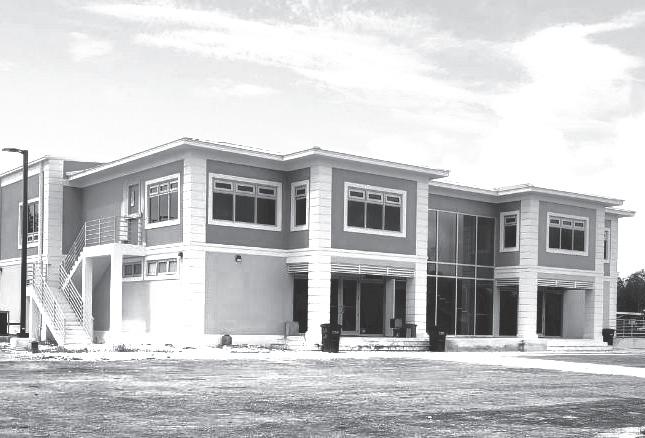
Aarone Sargent said the government is seeking to build at least five hurricane shelters that could withstand category five storms over the next two years.
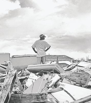
Hurricane Dorian highlighted the insufficiency of such facilities as schools, which are usually used as shelters, and prompted officials to say they would construct hurricane-resistant shelters on each island.
This year’s hurricane season is projected to be the most active in years, with the National Oceanic and Atmospheric Administration projecting 17 to 25 storms, eight to 13 hurricanes, and four to seven major hurricanes.
Speaking in May, Mr Sargent said officials are working with regional partners and the United Kingdom to get funding for “purpose-built shelters”.
He noted that the construction of a shelter in Central Pines, Abaco, is moving “full speed ahead.” The building would be able to withstand category-five storms with winds up to 200 miles per hour. It will be complete by the end of this year, but will be usable this summer in an emergency.
Officials are also set to open a similar building in South Andros.
Officials said 144 hurricane shelters would be available this hurricane season, and shelter inspections were complete as of May 30.
Alex Storr, chairman of the DRM authority, said the country is ready to handle a strong storm.
“The infrastructure is in place,” he said. “I can’t say we are ready for a Hurricane Dorian-type storm because nobody could be, but we are ready to tackle whatever comes our way. You can be confident in that.”
The DRM Authority results from a merger between the National Emergency
The plan to develop a predictive system to improve the ability to prepare for and respond to severe weather systems was highlighted at a recent climate talk. Trevor Basden, senior vice president and director of Meteorology at the Bahamas Aviation, Climate and Severe Weather Network (BACSWN) provided an overview of the evolving nature of hurricanes and tropical storms affecting The Bahamas at the Bahamian American Association of the Washington, DC and MidAtlantic Region’s (BAAWMAR) Community Conversation on Facebook.
For his part, Mr Basden emphasised the increasing intensity and frequency of these storms and the urgent need for advanced predictive models to mitigate their impact. He underscored that The Bahamas is particularly vulnerable, ranking high in the Atlantic basin for major hurricanes, especially impacting areas like Abaco and Grand Bahama. This vulnerability necessitates innovative approaches to forecasting and preparedness.

Management Agency (NEMA) and the Disaster Reconstruction Authority (DRA).
Economic Affairs Minister
Michael Halkitis noted last week that the government has a loan from the Inter-American Development Bank (IDB) to help post-storms.
Mr Sargent said the law allows the government to send funds to
One of the key initiatives Mr Basden discussed was BACSWN’s plan to develop a predictive system to improve the ability to prepare for and respond to severe weather systems. This system aims to enhance the accuracy of storm tracking and intensity predictions, crucial for timely and effective disaster management.
Mr Basden also addressed the critical role of visualisations in communicating weather forecasts to the public. He advocated for using more engaging and understandable 3D visualisations to help residents of vulnerable areas better comprehend potential impacts, which is crucial for effective evacuation and preparation strategies. He pointed to BACSWN’s partnerships with the National Center for Atmospheric Research (NCAR) and the National Oceanic and Atmospheric Administration (NOAA), aimed at bringing the latest advancements in meteorological science to The Bahamas. These partnerships will also provide scholarships and training opportunities to Bahamians interested in the field, he said. Mr Basden said: “We have already reached out to the National Center for Atmospheric Research, and also NOAA, the National Oceanic and Atmospheric Administration. So we really have gotten together with these organizations, and they’re are showing great support with
the DRM Authority for preventative and post-disaster measures. The funds would help the authority prepare and procure relief items and provide aid after a hurricane.
He said officials wanted the funds established by the end of June.
our idea of the visualisations to the extent that we would wish to offer at least 50 scholarships to deserving of Bahamians, who would be interested in meteorology and climate... we are willing to assist and provoke and encourage Bahamians.” Mr Basden emphasised the importance of preparedness and resilience in the face of increasing climate challenges. He underscored the need for continuous innovation, collaboration, and education to build a more resilient nation capable of withstanding the growing threats of climate change.
The live talk on “The Climate Crisis: Managing Risk, Recovery, and Resilience”, was moderated by Dr Khandra Sears, chair of BAAWMAR and also featured other experts, including Ms Barrise Griffin, Mr Charles Hamilton, Ms Shacara Lightbourne, Mr Giovanni Moss, and Mr Aarone Sargent, who provided a comprehensive overview of the multifaceted approach needed to address the climate crisis. The discussions underscored the collective effort required from local communities, government agencies, and international partners to effectively manage and mitigate the risks associated with climate change.

By CARA HUNT Tribune Features Writer
STORMS are scary enough for adults who know full the devastation Mother Nature can wreck during hurricane season, but for the littlest members of the family it can be even more of a traumatic experience.
Hurricanes are loud and dark - two things that little children are naturally afraid of and so even in the mildest of storms it can be rough to get them through calmly.
Tribune parents recently shared the tips they employ to help their kids get through a storm.
“For me, it’s important that my kids are aware of the fact that this is a serious matter, not that you want to frighten them, but at the same time you want to prepare them. So we let them know ok if something happens we will have to leave the house quickly so when we say things you have to listen, but at the same time you let them be a part of securing the house, that helps them feel safe like ok we have the shutters and we have sandbags and we are prepared,” said Trent, a dad of an 11 and and eight-year-old.
For Crystal, who has younger kids, her focus is keeping them entertained through the storm as a way to keep them distracted.
“It’s scary, so the first thing I do is make sure they have their favorite snacks on hand, even as an adult when you stressed you want comfort food, so we have candy and lil treats.”
She also makes sure that she has activities that don’t require electricity.
“I think it’s a great idea to maybe have a family book, you can read together, maybe some art supplies, colouring books, a few new toys. So that when they get restless, you can pull something out at different intervals.
“Also, we let them stay with us in our room so they don’t get extra scared. And then of course we try to have extra charges and download movies and shows etc.”
She added: “During a hurricane when they are bored, that is when they really focus on it dark, oh the wind so loud I scared, so you have to distract them as much as possible.
‘If they do get scared, it’s important to help them deal with the fear.
“It is a scary situation, let them know that it is ok to be scared. Don’t let them listen to all the weather reports, but give them an idea of what is going on in an age appropriate way. Allow them to speak about
what they are afraid of and then see if there is a way you can address it together.
“Please don’t lie to your children that everything will be ok, because we have seen recently that it may not be, instead stress that we are together and Mommy and Daddy are doing everything to keep you safe.”
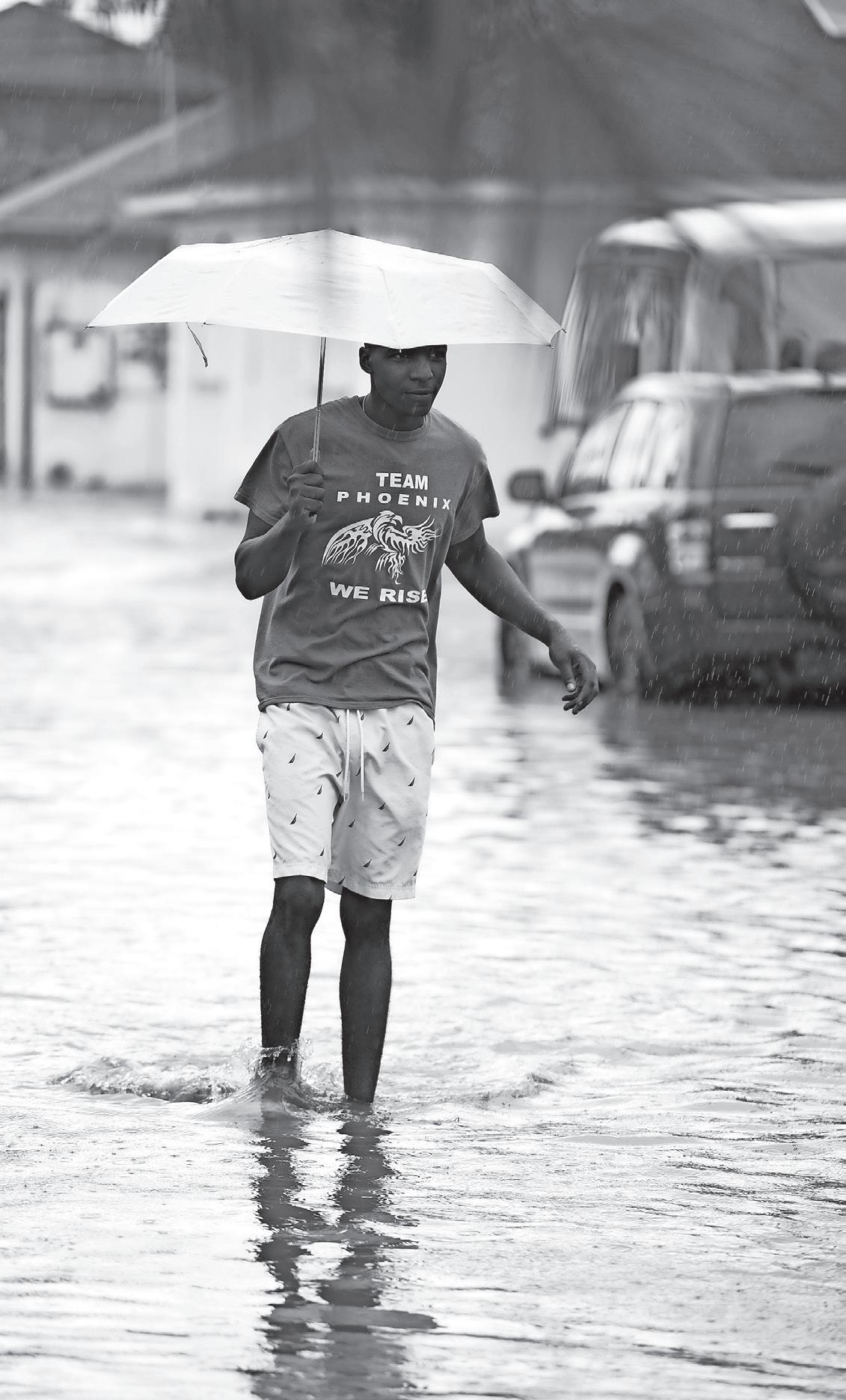
THE most important thing you can do as the hurricane season approaches is to get yourself, your family and your home prepared.
Hurricanes typically form from June 1 to November 30. While there’s no avoiding it, it’s not diffiult or costly to stock up on basic essential items that will help you weather any potential storms.
When preparing for a hurricane, it is important to not only be aware of critical information about the storm itself, but also to know about the different kinds of supplies you should have on hand. Gaining an adequate amount of supplies for your household in advance will save you the frustration of hitting the stores right before the rough winds and rains emerge. Your investment in emergency supplies could save you money, or even a life if storms become severe. Here are the top 10 items to keep on hand to last the duration of the storm.
1WATER: YOU SHOULD HAVE ENOUGH WATER ON HAND TO USE FOR BOTH DRINKING AND WASHING. ICE SHOULD ALSO BE STORED IN A FREEZER OR COOLER.
2NONPERISHABLE ITEMS: KEEP AN ADEQUATE SUPPLY OF CANNED GOODS AND OTHER NONPERISHABLE ITEMS IN THE EVENT THAT YOU AREN’T ABLE
TO RELY ON YOUR REFRIGERATOR. YOU SHOULD ALSO ENSURE THAT YOU HAVE A MANUAL CAN OPENER ON HAND.
3CASH: BANKS AND ATMS MAY NOT BE OPEN OR AVAILABLE FOR EXTENDED PERIODS. ENSURE THAT YOU HAVE CASH AVAILABLE TO PAY FOR EMERGENCY ITEMS DURING THE STORM.
4FIRST AID KIT: MANY DRUG STORES SELL THIS EMERGENCY
ITEM. IF YOU’RE PUTTING ONE TOGETHER ON YOUR OWN, CONSIDER INCLUDING BANDAGES, PAIN MEDICATION, COTTON BALLS, GAUZE ROLLS, ANTIBIOTIC OINTMENT, CLEANSING WIPES AND ANTI-INCH LOTION OR CREAM.
5FLASHLIGHTS, CANDLES AND MATCHES: IN THE EVENT THAT YOU LOSE POWER, KEEP FLASHLIGHTS, CANDLES AND MATCHES AVAILABLE IN YOUR HOME.
6RADIO (BATTERYOPERATED): IN ORDER TO KEEP UP WITH NEWS AND ALERTS,ENSURE THAT YOU HAVE A BATTERY-OPERATED RADIO ON HAND AND EXTRA PACKS OF BATTERIES.
7PHONE CHARGER: ENSURE THAT YOU KEEP YOUR CELLPHONE FULLY CHARGED. CONSIDER INVESTING IN A PORTABLE CHARGER IN THE EVENT OF A POWER FAILURE.
8MEDICATION: MAKE SURE THAT YOU HAVE A SUFFICIENT SUPPLY OF ANY PRESCRIBED MEDICINE, PAIN KILLERS OR VITAMINS.
9HYGIENIC SUPPLIES: ENSURE THAT YOU HAVE A SUFFICIENT SUPPLY OF TOILETRIES ON HAND.
10GAS AND OIL: FILL YOUR CAR TANKS AND HAVE AN EXTRA SUPPLY

By TOM HARTLEY British High Commissioner to The Bahamas
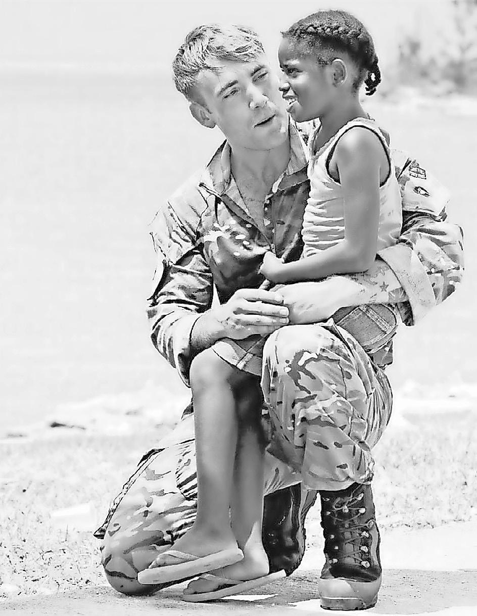
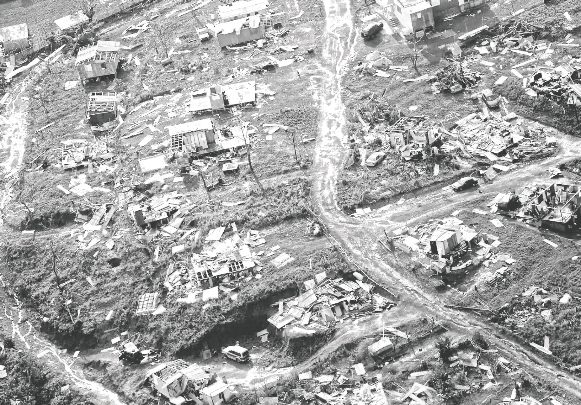
FIVE years ago, Hurricane Dorian hit The Bahamas with 200mph winds and a tidal surge that, over two days, killed hundreds and destroyed thousands of lives. There is little to celebrate about those September days in 2019: but the people of Grand Bahama and Abaco have shown incredible resilience on the days during and since.
Whenever I visit Freeport or Marsh Harbour, I have always stopped at the memorials at the Jack Hayward Bridge or Memorial Gardens, and remembered the people who tragically lost their lives; I am always struck by the stories of the RDBF officers and locals who accompany me, many of whom were first responders.

It is hard not to be crushed under the weight of sorrow they still carry. I am incredibly aware that many Bahamians are still rebuilding their lives the best they can, and the islands themselves are still healing: the pine forests along the Grand Bahama Highway,
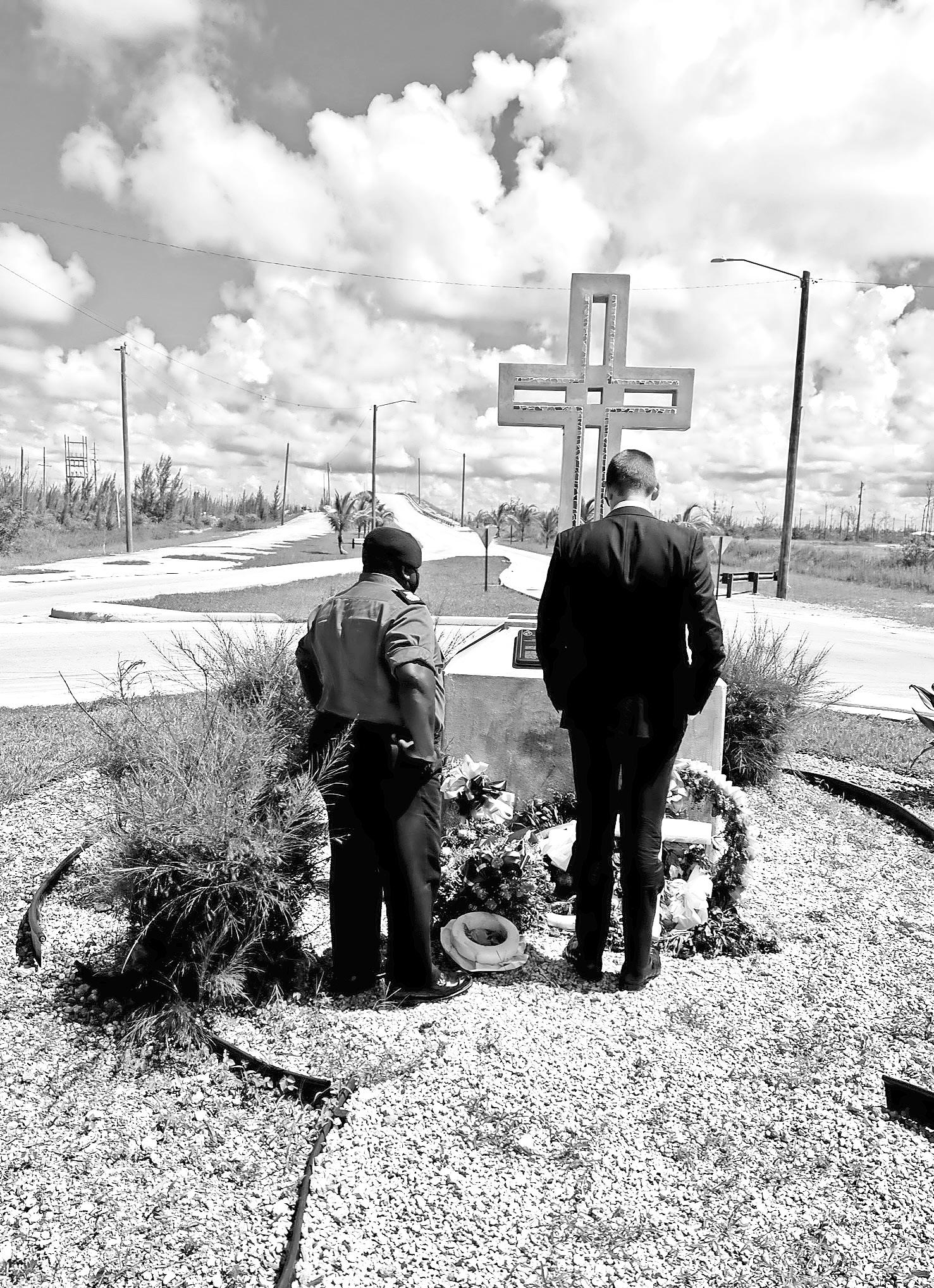
stand as Mother Nature’s own memorial to those dark days.
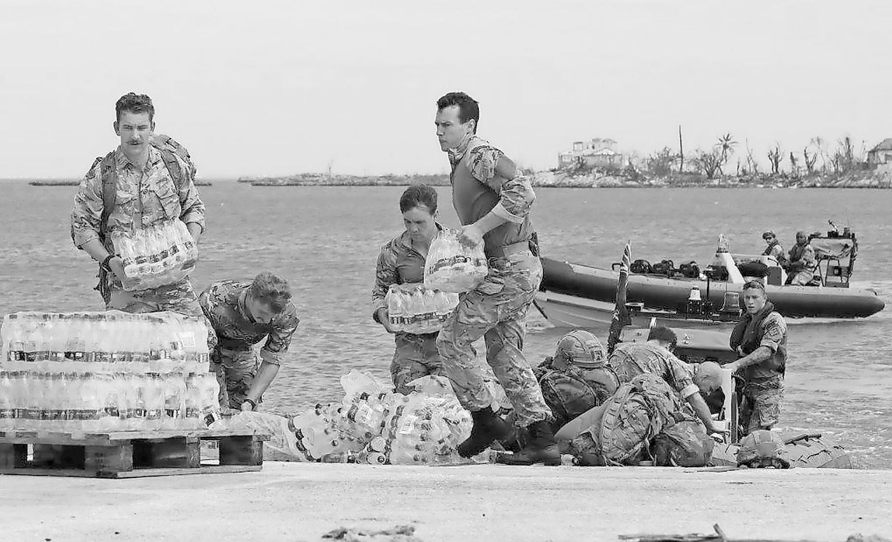
For our small part, I am proud that the Royal Navy was the first international responder in 2019. Our ship RFA Mounts Bay was the first on the ground in Great Abaco – under direction of The Bahamas – and her helicopters, her engineers, and her crew flew in life saving water supplies in the hours that followed the storm. My predecessor, Sarah Dickson OBE, had re-opened
the British High Commission just two weeks prior, after its much-too-long closure, and led a team of humanitarian responders and military advisors and worked alongside the many, many Britons living in The Bahamas who volunteered to support the 116 international organisations that responded. We tried to help in every way we could.
Hurricane season 2024 As a UK government, this year we plan to deploy another Royal Navy ship into the Caribbean ready
for this hurricane season; it will conduct counterdrug operations when it is calm, and be ready to respond if hurricanes hit either the British Overseas Territories (such as Turks & Caicos) or the wider Caribbean: the ship’s engineers and its desalinisation capacity can provide life saving response, the Royal Marines and Royal Engineers aboard can provide incredible manpower, and the ship itself provides
By JORGE GONZÁLEZ-CRUZ
University at Albany, State University of New York
PREPARING for Atlantic hurricane season is always a priority in the Caribbean, especially when forecasts project high numbers of storms, as they do for 2024. The region’s most devastating storm in recent years, Hurricane Maria, struck in September 2017 and inflicted unprecedented destruction on Puerto Rico, Dominica, St Croix and other islands.
Maria killed more than 3,000 people and caused about US$96 billion in damage. It devastated Puerto Rico’s electric power system, leaving 1.5 million customers in the dark for up to 328 days – the longest blackout in US history. These outages had cascading impacts on other infrastructure, such as water and communications systems.
Today, the Caribbean region is experiencing new climate-related challenges. Prolonged extreme heat and humid days are increasing because of the accelerated warming of ocean waters.
In response to these increasingly frequent and extreme weather events, I teamed up with a dozen other researchers in 2023 to form the Caribbean Climate Adaptation Network. Our goal is to connect scientists with communities and government agencies in the US Virgin Islands and Puerto Rico and to provide scientific information that can help them prepare for and respond to these emerging climate extremes.
I am a coastal-urban climatologist and a Puerto Rico native. Launching this network has been extremely important personally for me. I hope it will solidify our current partnerships for longer-term collaboration among leading academic researchers, vulnerable communities, government agencies and utility companies in the islands and serve as a platform to reach the entire Caribbean.
Our mission is to develop new ways of representing the coastal-urban environment as a unified system – one that places people at the center and integrates human-made systems, such as buildings and infrastructure, with natural systems, such as the atmosphere, ecosystems and oceans. All of these elements face the challenge of a changing climate. We want to support vulnerable communities by providing research that can make them more resilient against climate change and to bring them to the table so that we can create better solutions together.
LEARNING FROM PUERTO RICO’S RECOVERY
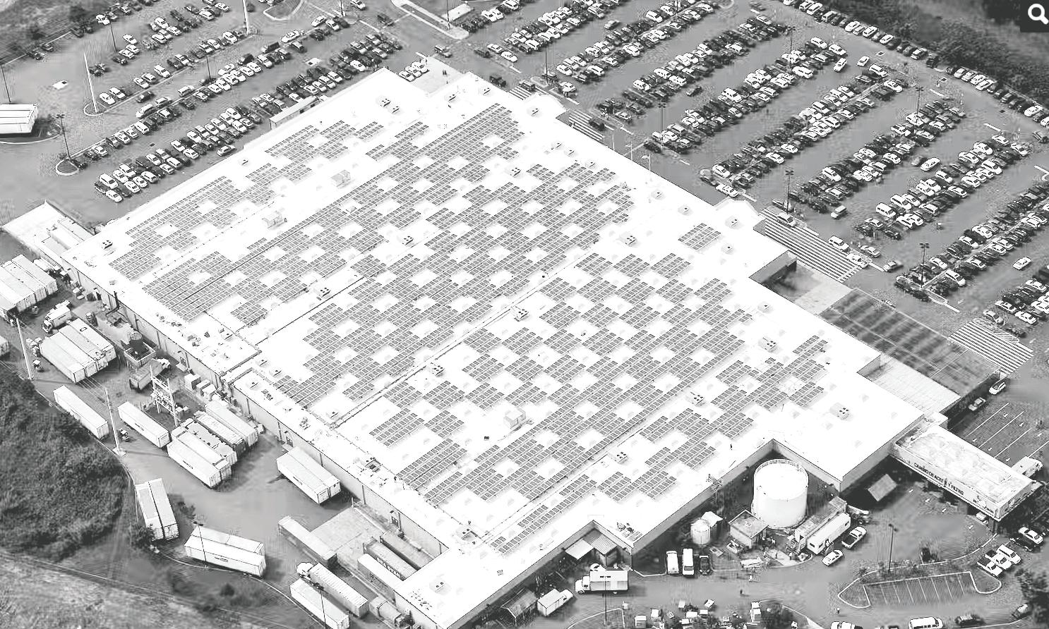
Puerto Rico has made its power grid more resilient in the years since Maria struck, but challenges remain. Over one million customers on the island have experienced intermittent outages since the Hurricane. In September 2022, Hurricane Fiona – a much weaker Category 1 storm – made landfall in Puerto Rico and caused an island-wide blackout.
Puerto Rico’s power system is fragile mainly because its infrastructure is
aging and the island is naturally exposed to recurrent extreme events fueled by global warming. Nonetheless, local utilities have made significant progress in hardening a very complex power system at all points, from generation to distribution. Solar power generation – particularly small-scale rooftop installations that can power individual homes and businesses during grid outages –is playing a major role in making the system more resilient.
In 2023, I led a group of researchers in reconstructing the impacts of Hurricane Maria on Puerto Rico. We used a combination of geophysical models, engineering models of the power and water grids, reviews of damage reports and socioeconomic information to show how proposed hurricane preparedness strategies would affect low-income communities.
We learned that the most effective strategy to protect all community members was to harden the transmission system to handle impacts from Hurricane Maria-like events in the future. This will likely require new transmission towers capable of withstanding extremely high winds and soil saturation. It also could include limiting exposure through measures such as burying power lines. We did not research the costs of these solutions, but presumably they would be steep.
We’ve since joined again to reconstruct
other major past weather events in Puerto Rico and gather new data, with a focus on resilient power infrastructure and adapting to a changing climate. For this work, we’re installing unique sensors on electricity transmission towers and wires, while observing the natural conditions around these transmission assets. These devices continuously measure mechanical stresses on the towers and the transmission lines’ capacity to manage power loads under varied weather and demand conditions, including extreme weather events.
By reconstructing past storms, collecting new data on the health of Puerto Rico’s infrastructure and using machine learning algorithms, we plan to develop new predictive modeling frameworks that can anticipate risks of disruption to the electric transmission system during extreme weather events.
INFORMING REGIONAL ACTION
In recent years, our research group has used satellite observations to detect that Caribbean sea surface temperatures are increasing by nearly 0.9 degrees Fahrenheit (0.5 Celsius) per decade –some of the fastest ocean warming on Earth. This trend has direct implications for the risk of frequent and intense hurricanes.
It also affects ambient temperatures on land, including driving extreme heat
conditions. In summer 2023, the city of San Juan experienced a prolonged heat wave, with heat indices above 100 F (38 C). This level is considered unhealthy for most people. Heat advisories and record-breaking temperatures forced government officials to scramble to protect students. Public schools took the unprecedented step of canceling classes across the island. This event showed the importance of monitoring Caribbean ocean conditions and anticipating their effects on people, infrastructure and ecosystems.
My colleagues in the Caribbean Climate Adaptation Network and I believe that our findings will be transferable to other Caribbean communities. Our work also can inform coastal areas in the continental US where critical infrastructure is heavily exposed and storms often hit the most vulnerable people hardest.
We hope that our work with communities will lead to broader education and new actionable science that can guide climate adaptation decisions and investments that reduce risks. Specifically, we aim to produce strategies for making island infrastructure far more resilient and adaptable, as well as safeguards to protect communities and maintain a sense of normality in a hotter climate.
• Originally published on www.theconversation.com
PET owners are responsible for disaster planning for their animals so, if you plan to evacuate in the event of an approaching storm, plan for your pet as well. Take your Pet Survival Kit if you go to friends, relatives or a hotel.
Shelters cannot accept pets. If you plan to go to public shelter, make other
For more information, call the Bahamas Humane Society at 323-5138.
• Proper ID collar and rabies tag/licence
• Carrier or cage, leash
• Ample food supply
• Water/food bowls
medication(s) and specific care instructions
• Newspaper, cat litter, scoop, plastic trash bags for handling waste
• Proper ID on all belongings
• Make sure your pets have had all their shots within the past 12 months.