PORTFOLIO
Tomás Quaglia
Master of Architecture in Urban Design | Harvard GSD
Selected Works 2016 - 2023
Urban Design | Ecology | Architecture | Research
This portfolio exhibits my recent work in architecture and urban design, both academic and professional. Ranging from a large, territorial scale to a small, unit scale, these projects address the issues of borders within cities, urban regeneration and resilience, focusing on the potential of neglected and undervalued elements of the city.
The majority of the world’s population lives in cities. A decade ago, the urban global population exceeded 50 percent, and is currently in continuous expansion. It is therefore necessary to formulate answers to this rapid growth.
Connecting Borders 01 Urban River Restoration towards an Integrated City urban design architecture Homeostasis Flux & Transition 03 02 The Role of Iceland in the Global Energy Transition Waterfront Development in South Boston Knot Charleston 06 ULI Hines Competiton Mixed Use Development In Between Natural Layers Urban Water Intelligence 07 05 Almaviva Park Proposal Office of Urban Resilience (ORU) Catalog of Solutions Creative Warehouse 08 Recovery of a Railway Infrastructure ecology & climate House for the Compact City Scenic Mist Climate Action in Latin America 09 10 04 Sustainable Housing Prototype Brazilian Pavilion EXPO 2020 IDB Publication for the C40 Cities Meeting 4 16 22 32 36 30 40 44 48 26
description
Connecting Borders
Urban River Restoration towards an Integrated City
2017 - 2019
Thesis Project
Suquía River, Córdoba, Argentina
In collaboration with Emilia Darricades - Ana Isaía
Agustín
Berzero - Adolfo Mondéjar
For many years, rivers were a source of transportation and power that defined the foundation of cities. But, as cities became industrialized, urban rivers suffered important alterations in their biophysical structure, which became more evident in industrial and post-industrial periods. In many cases, they turned into polluted banks, they were deflected, covered, buried underground and forgotten. Urban rivers are essential for the foundation of cities and have several characteristics that make them one of the most important means of change and transformation.
River recovery projects proved to be a fundamental tool for a complete urban renovation, while stimulating functional and integrated community spaces. Urban rivers should be restored considering their natural condition and memory with a water sensitive approach. This way, cities can recover urban green spaces, reduce the risk of flooding and increase biodiversity.
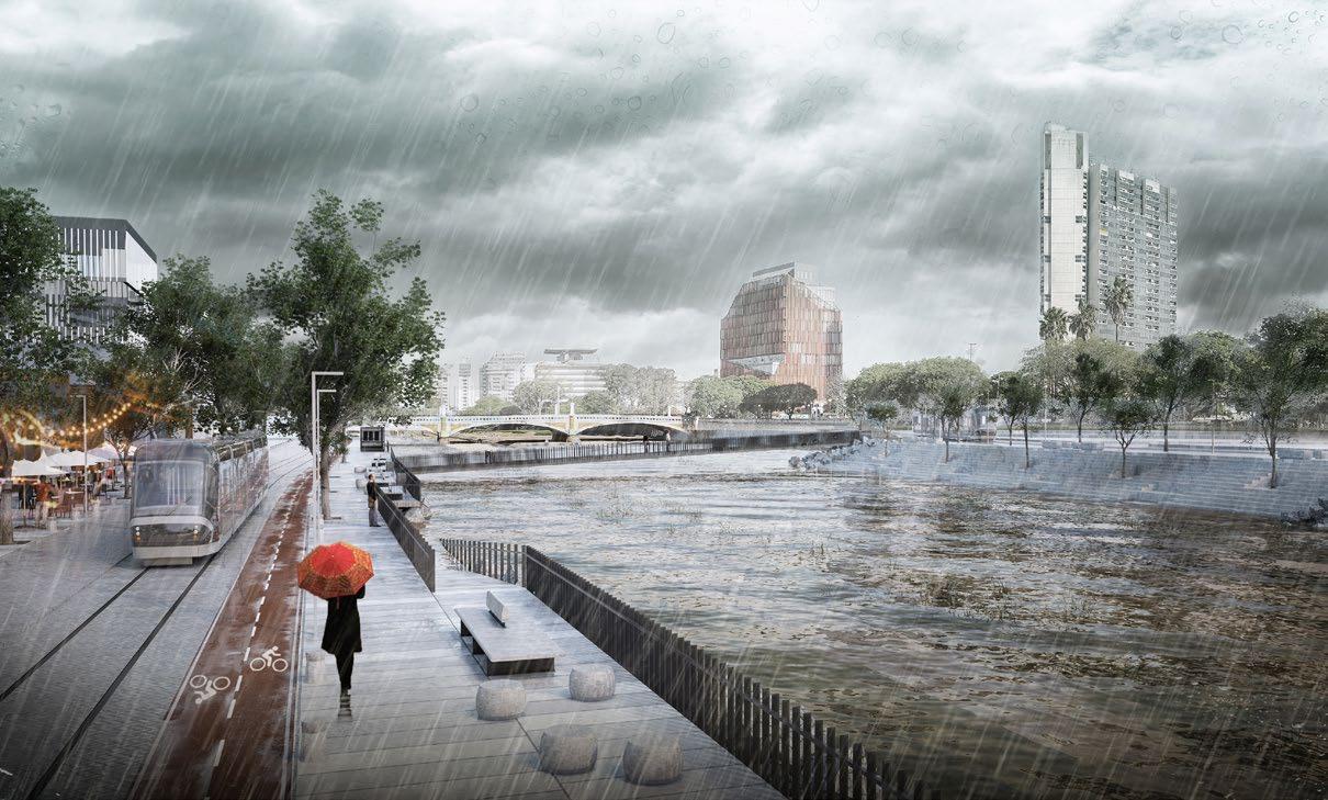
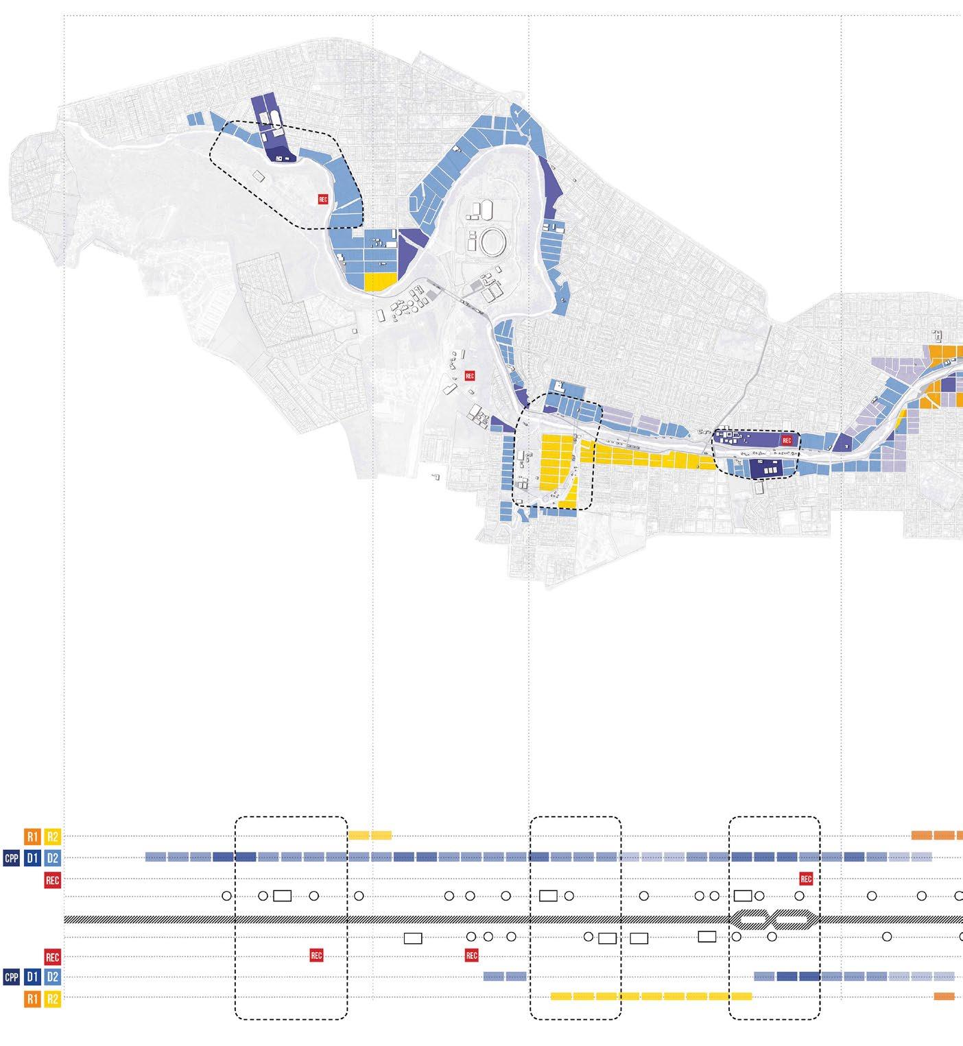
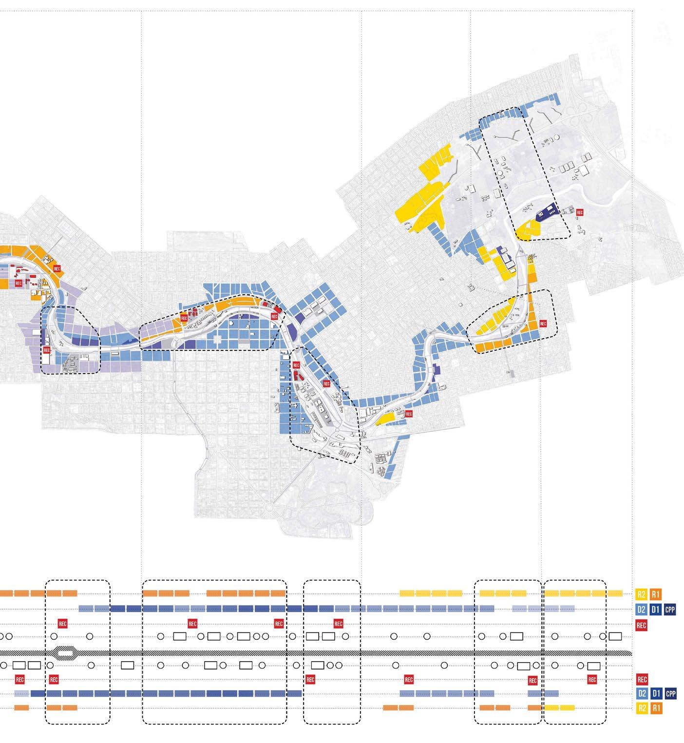
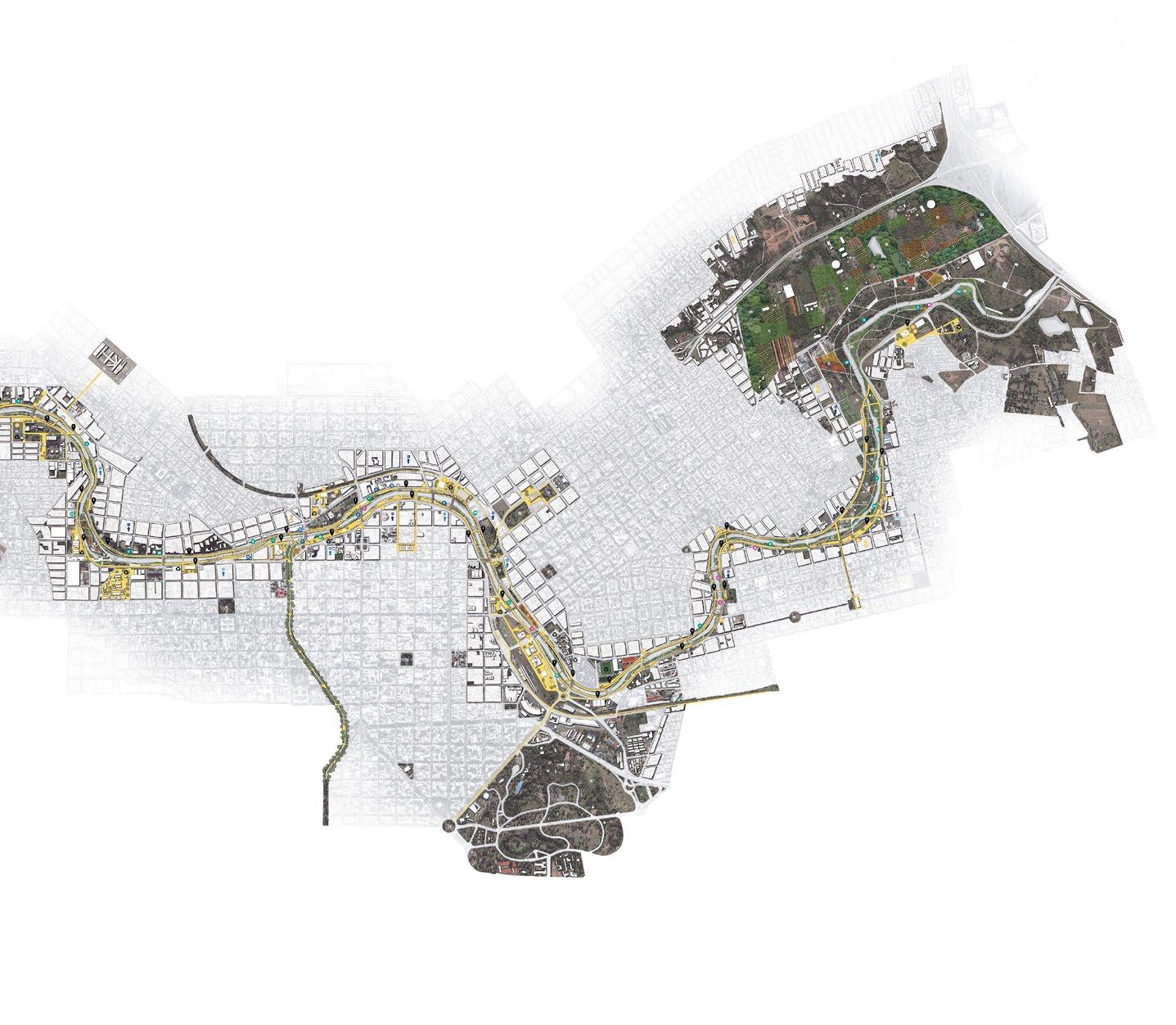
In Córdoba, Suquía River has a great potential; it crosses the city from West to East having a direct impact on a large part of the urban population (58% live less than one mile away from the water course). Under this position, we proceeded to identify the needs and characteristics of the different areas located on both sides of the river in order to define the possible activities and infrastructures of each sector. The Suquía River is a border in the heart of the city. Our goal is to regenerate that missing piece towards an integrated city of Córdoba.
Distinguished Project, International Biennale of Architecture of Argentina, 2018.
Honorable Mention, Degree Final Project Competition: Rethinking Architecture.
Honorable Mention, Tamayouz Excellence Award: International Graduation Projects.
year type site team 4 01
tutors
awards

5
Proposed: Storm Proposed: Typical
suquía river /
Integrates Urban Ecosystems
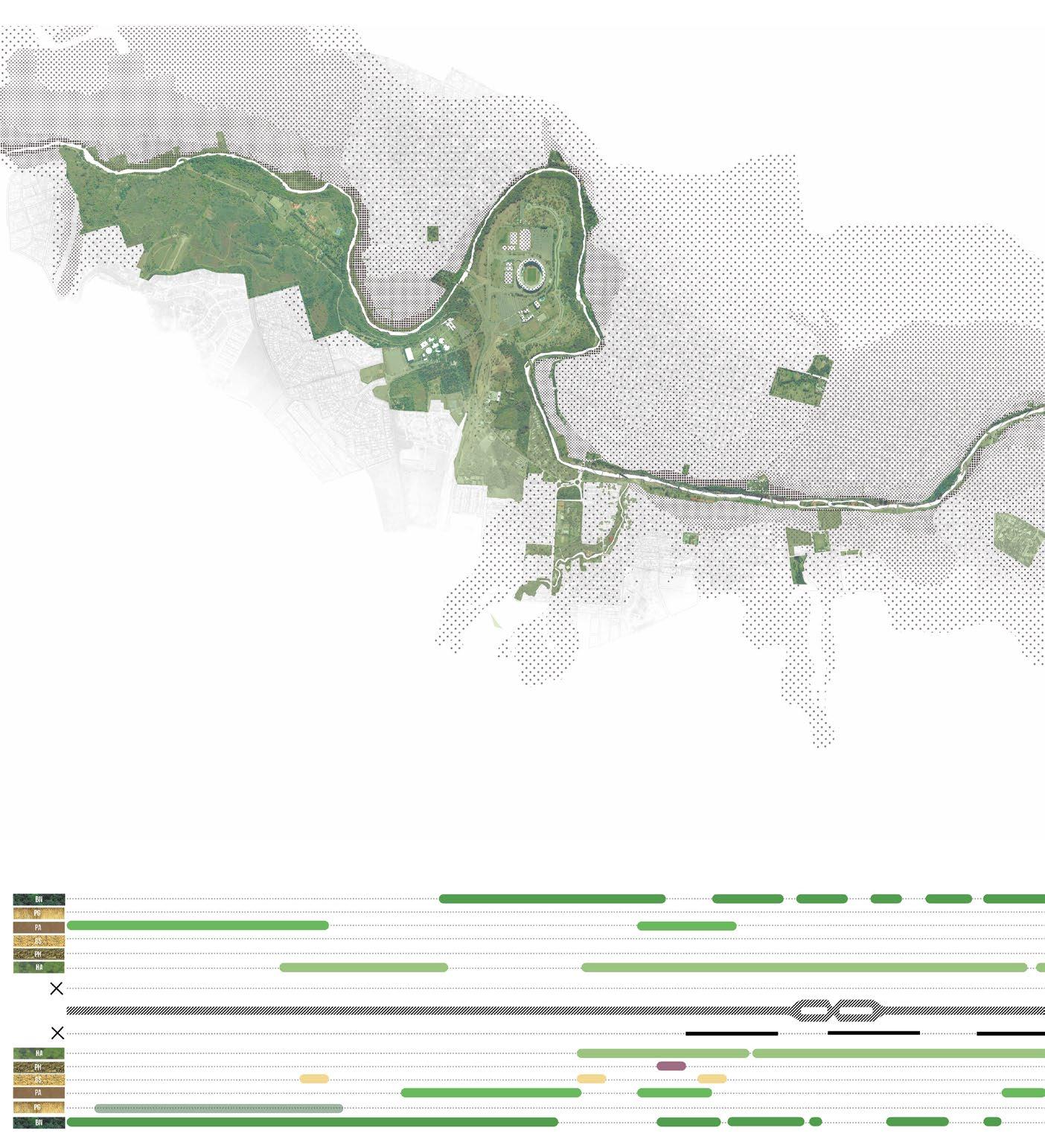
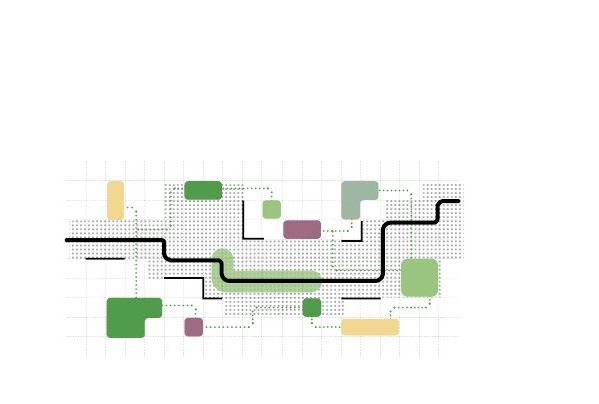
Green areas of Córdoba are usually disconnected, and not linked to the network of public spaces, making them inaccessible to citizens. Suquía River is an axis with the potential to integrate all these spaces and reduce pollution, create environmental awareness, preserve native species and generate different cultural, learning and observation scenarios.
Suquía River
Native Forest
Grass / Pasture
Parks
Sensorial
Urban farming
Wetlands
Resilence / Floods
Resilence / Floods
Wetlands
Urban farming
Sensorial
Parks
Grass / Pasture
Native Forest
6
STRATEGY 1
Integration of urban green spaces Recovery of vegetation and biodiversity

Connecting the ecological network of green spaces throughout the city. This area represent more than 9m2 for every citizen, as suggested by the WHO.
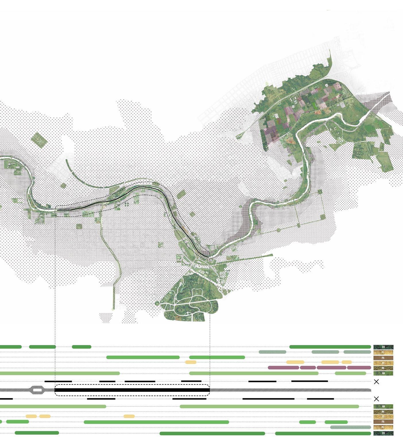
Definition of multiple land uses and vegetation for a diverse ecological system.
Recovery the river to its natural condition, removing concrete canals, which extend for 3 miles.
Development of multiple tools to control floods and other risks. Devices to Resist, Delay, Store, Discharge.
7 1.1 1.2 1.3 1.4
River re-naturalization Urban resilience to floods
re-naturalization
Suquía River
Promotes Urban Development
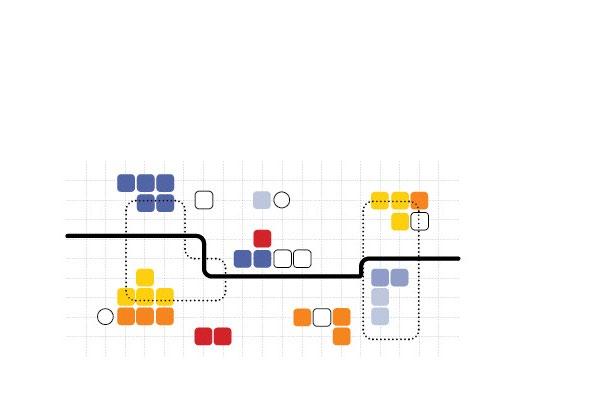
The recovery and renovation of the Suquía River means that proprieties values in surrounding areas will rise. It also generates interest in private investors to develop projects around the river, and causes a renewal of the nearby urban fabric, often degraded.
Renovation
Density
Infrastuctures
Institutions
Institutions
Infrastuctures
Densifty
Renovation
8 suquía river / STRATEGY 2
PHASE 3 - 3.6 miles PHASE 2 - 38 miles PHASE 1 - 2.8 miles
PHASE
Suquía River

9 Suquía River PHASE 4 - 2.4 miles PHASE 5 - 2.3 miles PHASE 6 - 2.3 miles PHASE 7 - 2.2 miles
suquía river /
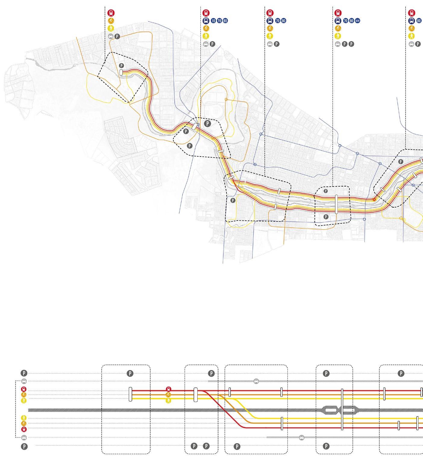
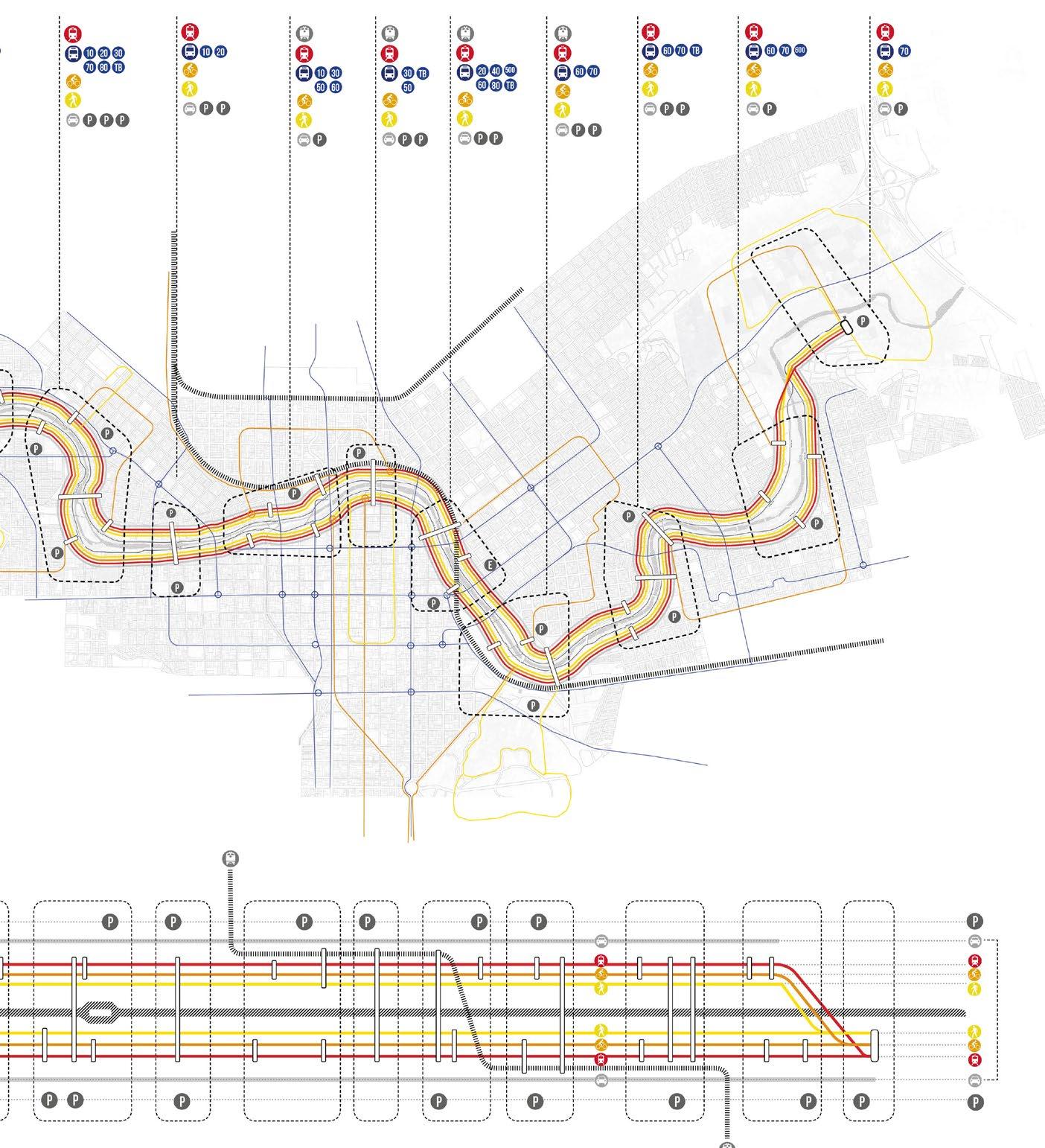
Supports Sustainable Mobility
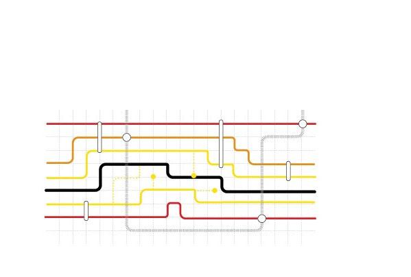
Suquía River crosses the city from West to East, through the highest urban growth areas. That represents a great opportunity for the development of a sustainable mobility axis articulated with the existing transport systems.
10
STRATEGY 3
Suquía River Sustainable Moiblity System Parking Cars Light Train Light Train Cars Parking

11 Sustainable
Moiblity System Suquía River
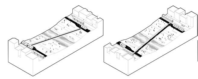
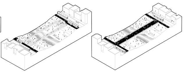
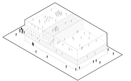
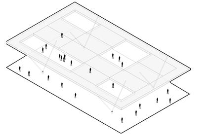
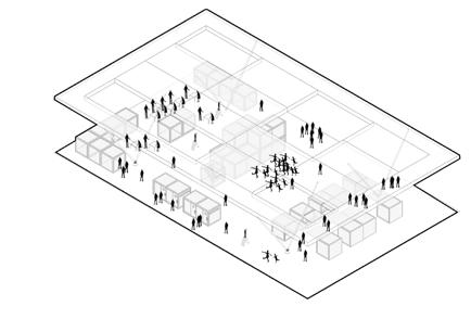
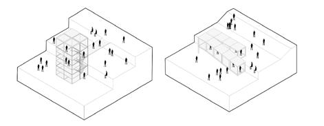
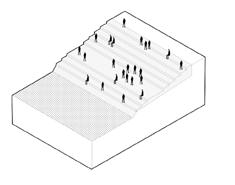
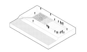
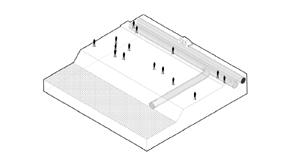

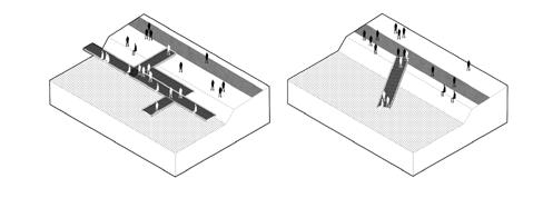
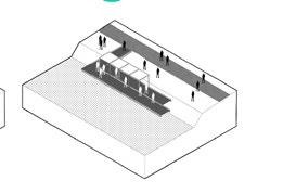
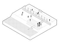

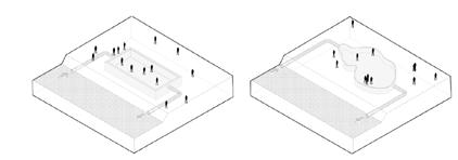
12 TOOLKIT Connect Pedestrian bridge Bicycle bridge Platform bridge Renovated bridge 01 Use Hybrid-use building Flexible roof Market 08 Reach Clean Tower Filter pond Cleaning drain Urban stairs Ramp 02 03 Live Move Rental WC Info Train stop Storage Dock Covered dock Balcony dock 04 05 Resist Store Flood court Reservoir tank Flood square Wall flood barrier Building flood barrier Natural flood barrier 06 07
CONCEPT
Borders are spaces for interaction
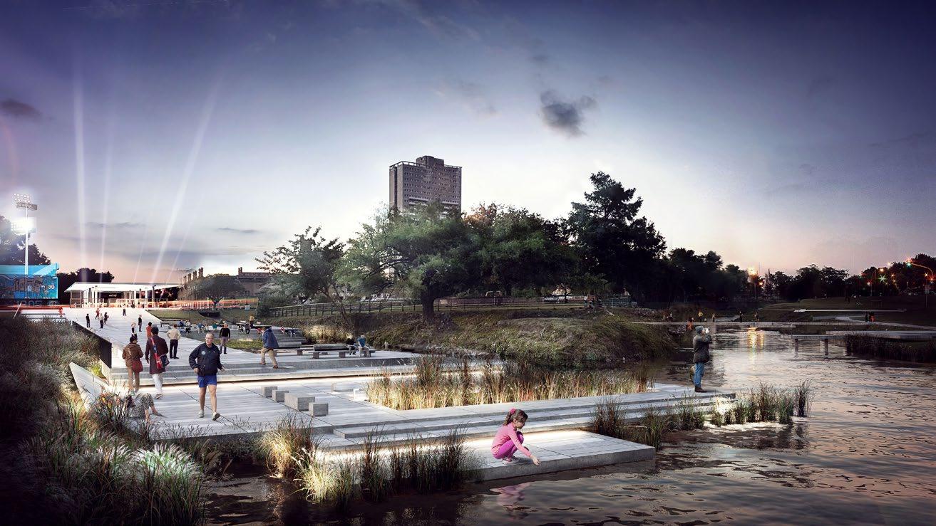
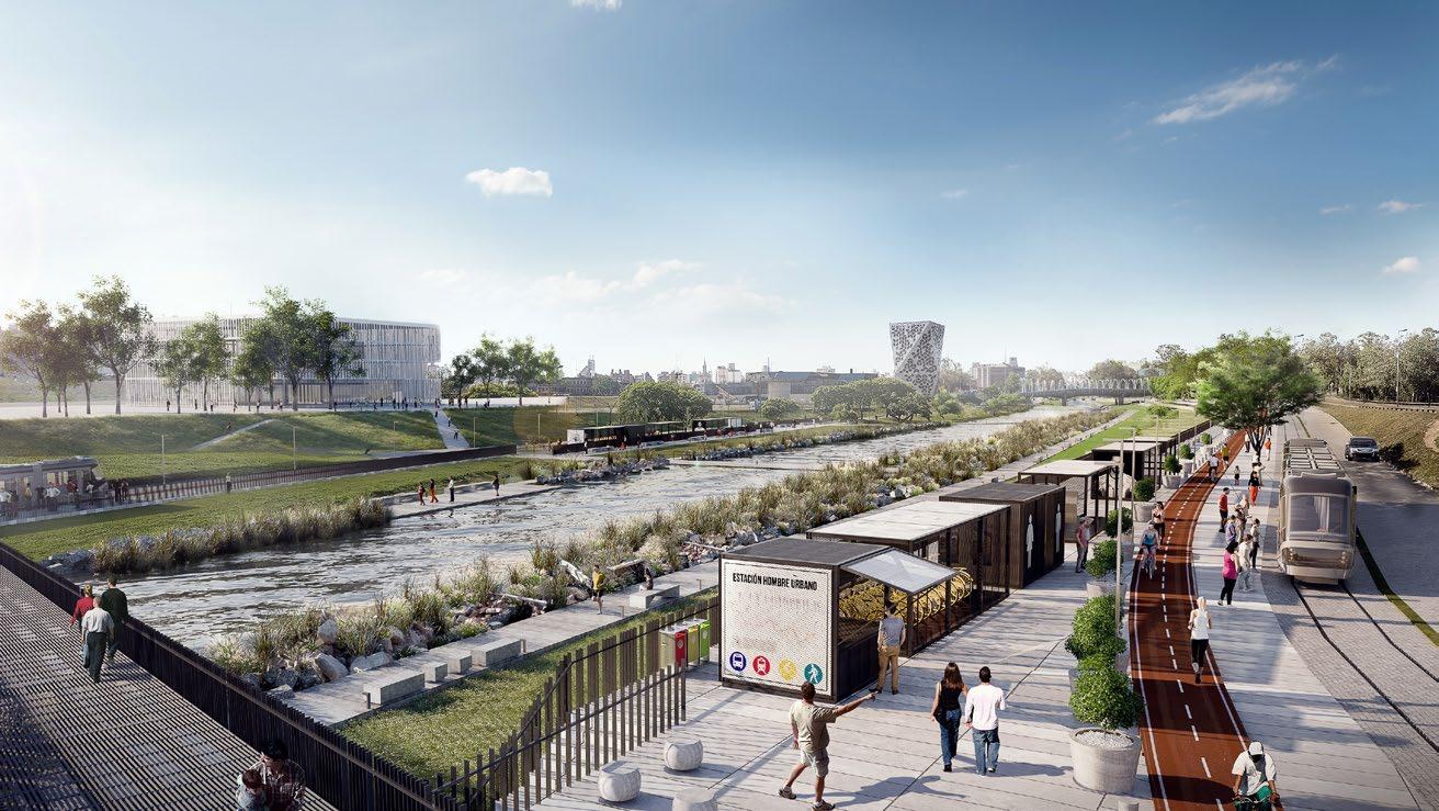
Usually, in urban design the focus is the center of cities, neglecting the borders. Borders, in nature, are areas of an habitat where organisms become more interactive, due to the encounter of different species or physical conditions. The border contains more energy than the inside. Taking advantage of this in the design of cities is crucial to create spaces for interaction that encourage the integration of the urban population.
Upper way: New sustainable mobility system
Lower path: Reaching the water and public space
13
Large, Medium, Small


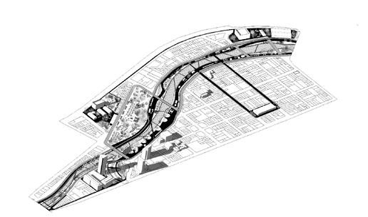
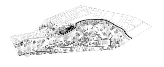
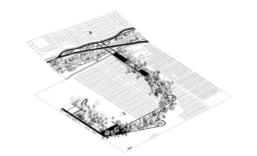
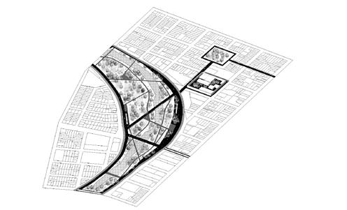
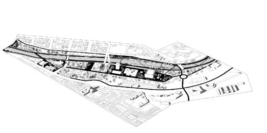
The plan is developed through three different scales. [Large]: Territorial study of the entire river across 18 miles. [Medium]: “Priority Projects”, areas where solutions are needed more urgently, with the potential of being major projects of the system. [Small]: “Tool Box”, which contains a series of devices that solve particular issues and that respond to actions such as use, connect, reach, store, clean and resist.

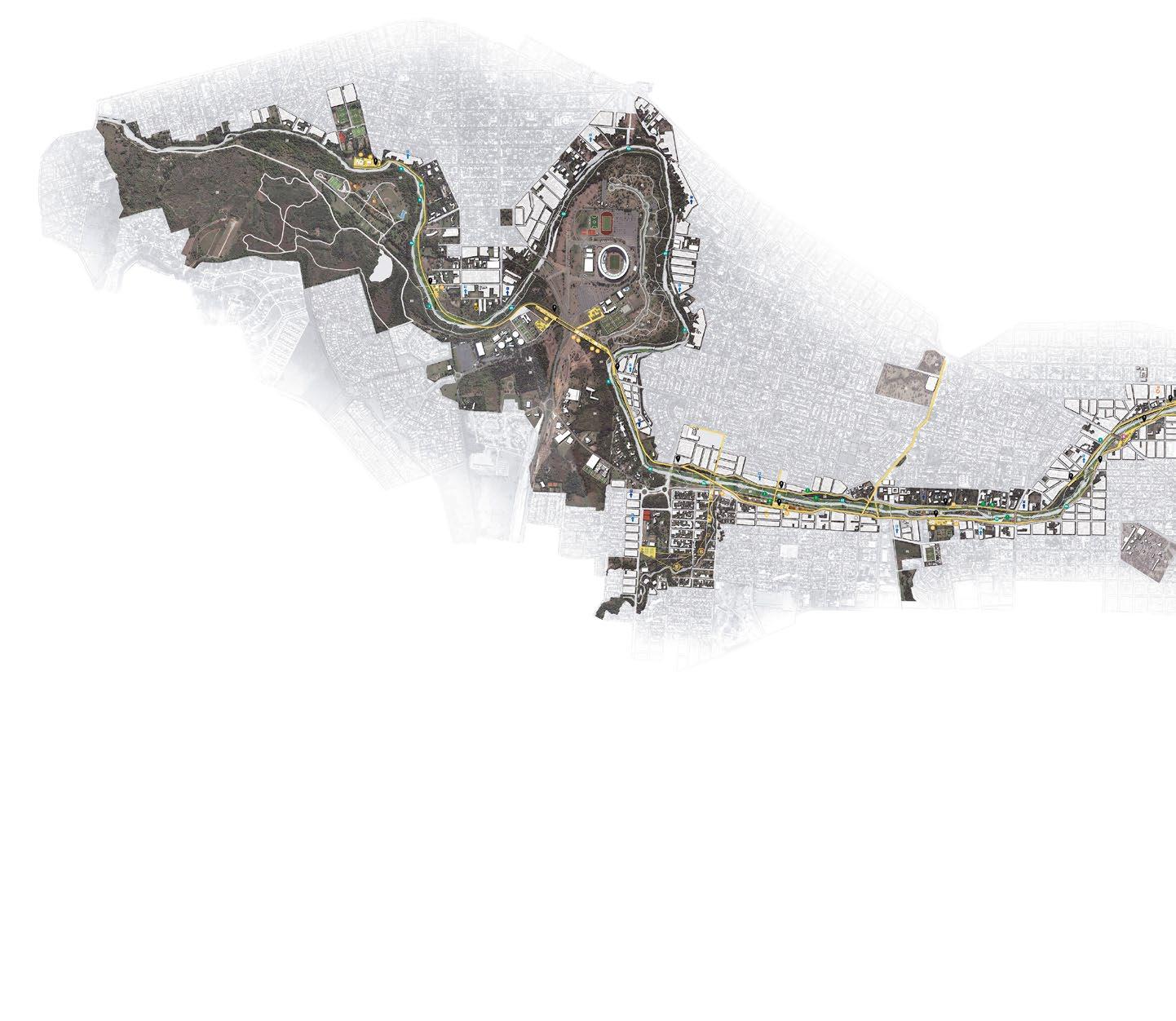
14 MASTERPLAN
P2
3.2 miles 2.4 miles 7k new pop. 5k new pop. 41 ha 63 ha
P4 Downtown 8.8 miles 14k new pop. 36 ha
Infiernillo Canal
P1 San Martín Natural Reserve


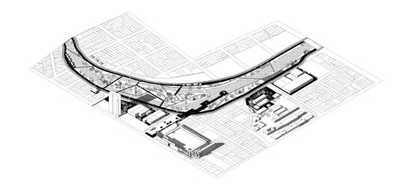

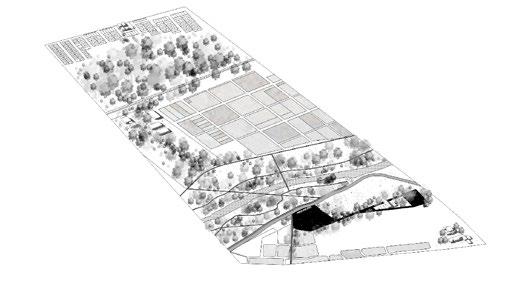

15
Alberdi San Vicente 5.8 miles 4.5 miles 9k new pop. 3k new pop. 65 ha 18 ha P5 P7 Civic Center East Natural Reserve 6.2 miles 6.3 miles 13k new pop. 2k new pop. 10 ha 86 ha
P3 P6
Flux & Transition
Waterfront Development in South Boston
2021
Academic Work - Harvard GSD
Boston, MA
in collaboration with Zhihan Wang
tutors Stephen Gray, Rahul Mehrotra
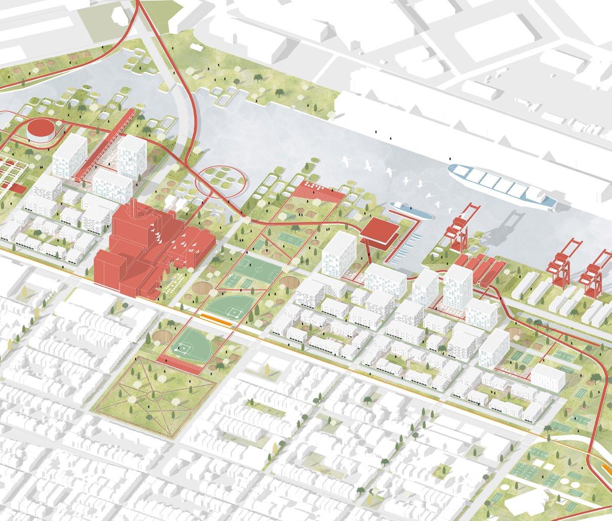
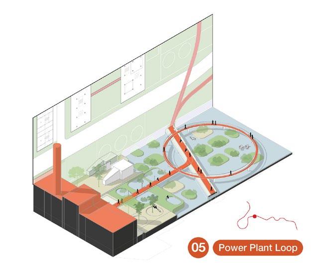
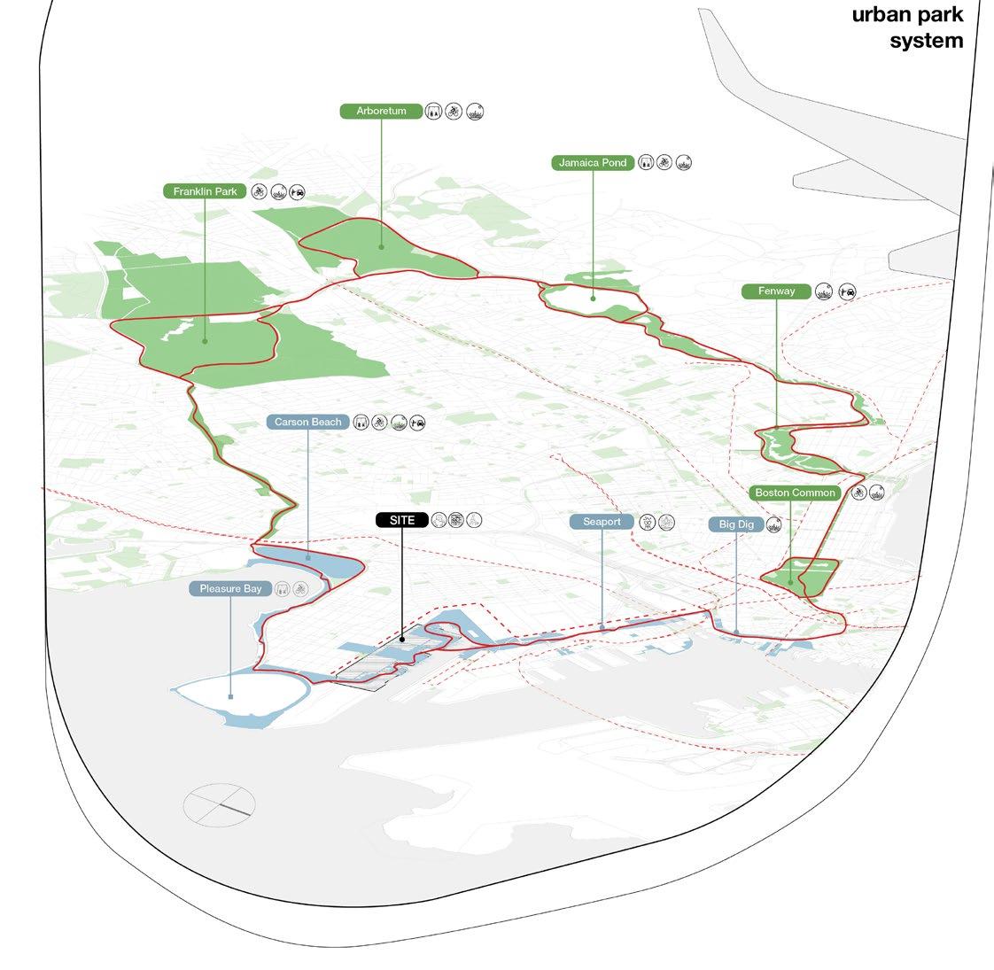
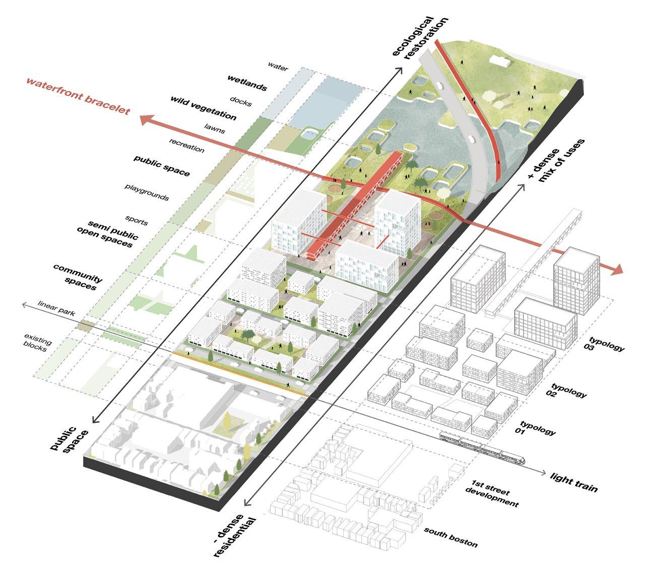
Flux & Transition understands the site’s potential to complete the Emerald Necklace by proposing a “Waterfront Bracelet” of continuous open spaces and public programs. The urban fabric is designed to have a gradual transition from South Boston, with a low residential density, and Seaport, with a rising density and mixed use configuration, gradually growing in density, diversity of programs, accessibility and ecological function of open spaces.
Our proposal is based on transitions. From South Boston to Seaport, from land to water, from port and industrial use to residential neighborhoods. First, the transition from South Boston to Seaport. In order to have a gradual transition from South Boston, with a low residential density, and Seaport, with a rising density and mixed use configuration, the new housing units gradually grow in density and diversity of programs. . The open space axis, on the left, goes from public space in the south to ecological restoration closer to the water. In the urban fabric axis, on the right, we propose a gradient from neighborhood to urban program and density.
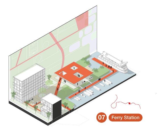
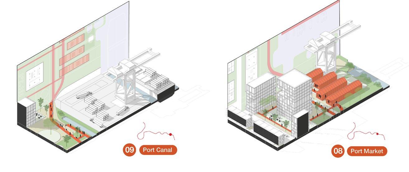
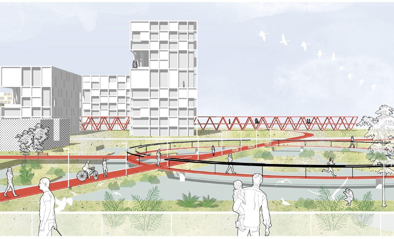
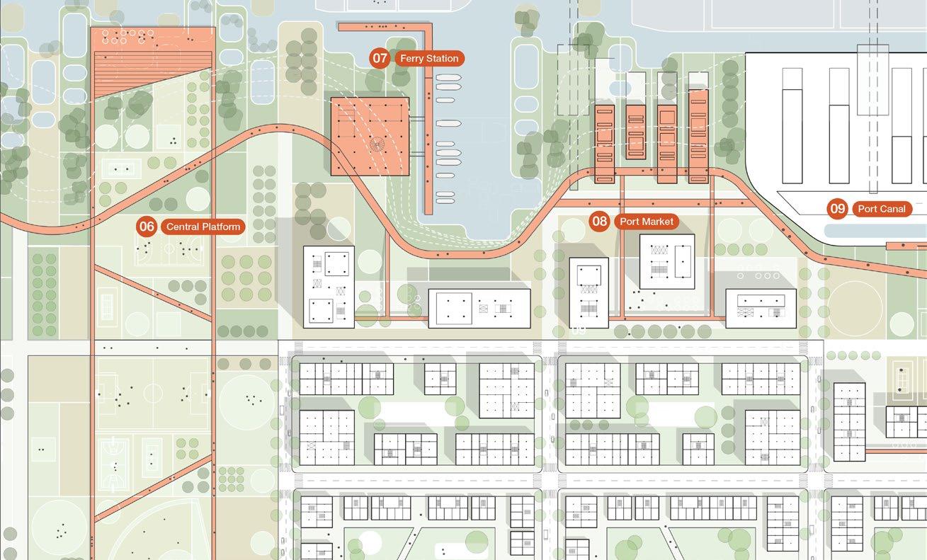
These strategies are intersected by a new axis on the first street, including a light train system for a fast connection to downtown, and it is also intersected by the new waterfront pathway, which we call the waterfront bracelet. Throughout the waterfront, the bracelet considers the post industrial identity of the site, with some remaining structures like electrical grids and cranes, and combines them with new programs, like markets, playgrounds and stations.
year type site team description 16 02
17

18 SECTOR AXOS
SITE PLAN

19
20 URBAN PARK SYSTEM Power Plant Loop View
21
Sector Plan
URBAN - WATERFRONT TRANSITION
Knot Charleston
ULI Hines Competiton Mixed Use Development
2023
Competition - WINNER
North Charleston, SC
with Youngsoo Yang, Emily Johansen, Ben Parker, Rachaya W.
General design, Axonometric, Diagrams, User Profiles
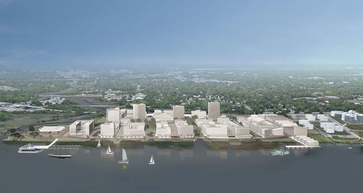
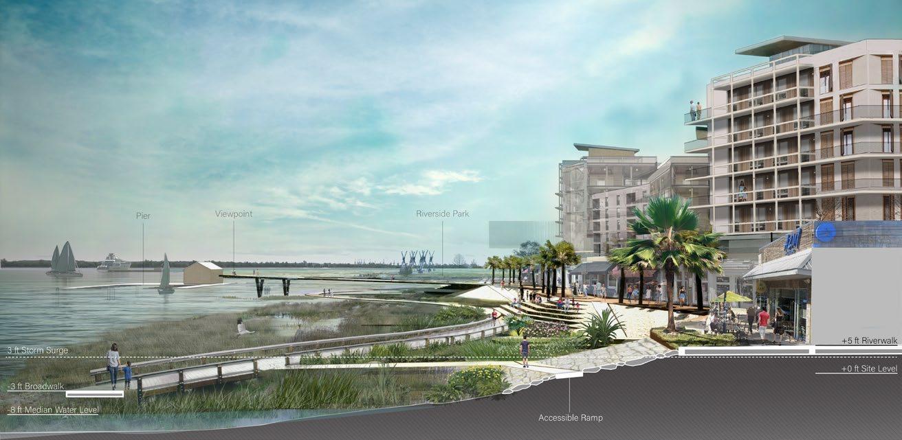
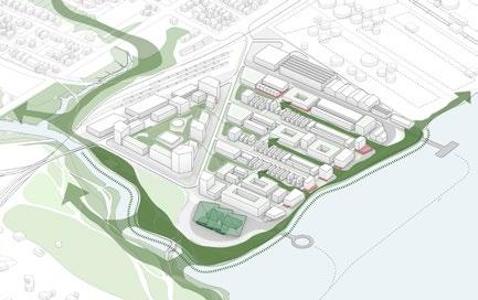
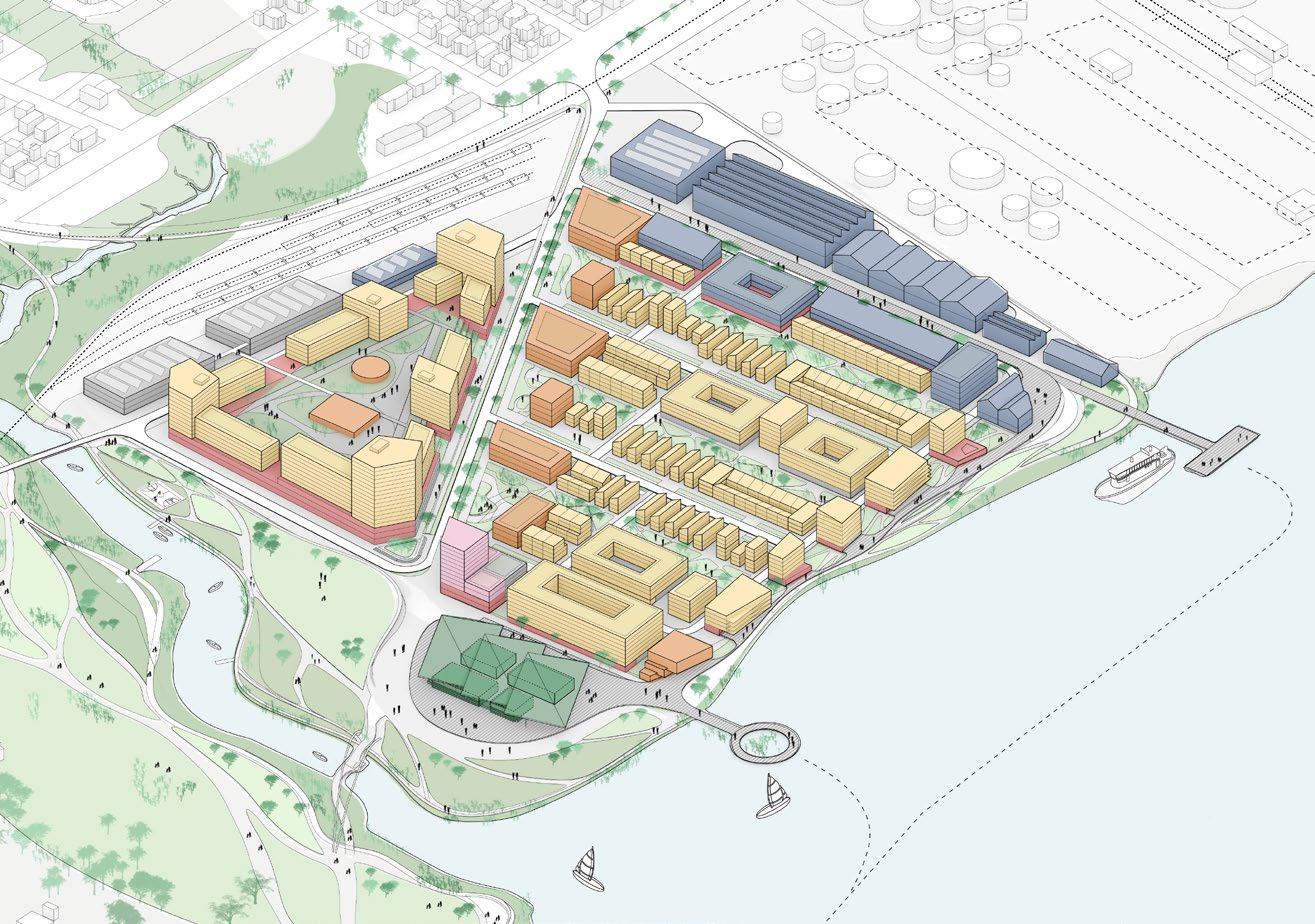
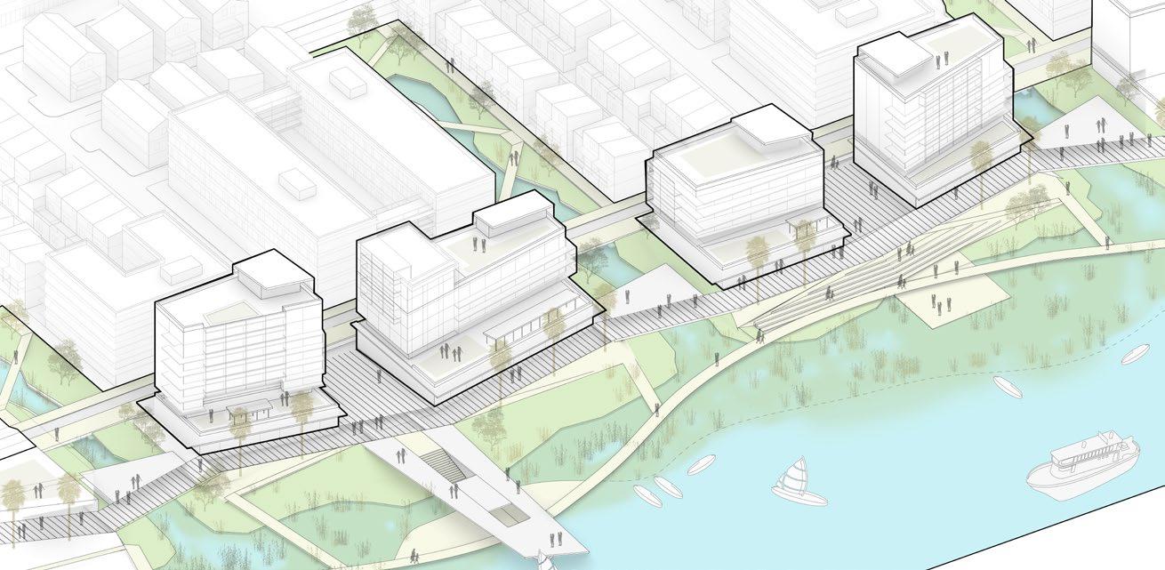
For the past 100 years, the western shore of the Cooper River has been a military and industrial center, lined with working docks and the Naval Shipyard. In the next 100 years, shifting economies and emerging technologies will continue to change the nature of work, transportation, and energy. North Charleston should be ready to capitalize on the opportunity to turn these 7 miles of waterfront into vibrant, dense, mixed-use urban development & parkland that beautifies the city, preserves the character of existing neighborhoods, and creates homes & jobs. This will be North Charleston’s new downtown, its postcard waterfront, the thriving heart of a thriving city
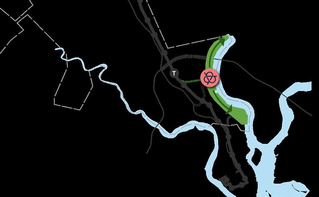
Knot Charleston will become a new community hub for North Charleston, where neighbors from different parts of the city can get together to take advantage of the community benefits and amenities on the site. The site is also located in the city’s former industrial axis. The Knot mantains that identity while incorporating mixed uses and diverse programs, tied together through a food loop that connects existing and future establishments. Finally, in the urcentain future due to climate change, the site has a key role in ensuring a resilient ruban development of North Charleston. The Knot integrates the ecological corridors and incorpores them into the mixed use development.
The Knot is a new vision for complete living in North Charleston, tied together by food. Drawing on the highest aspirations of LEED, WELL, and the Living Community Challenge, this mixed-used project synthesizes these certifications with the city’s unique context to create a well-connected, affordable, and enriching place to live for generations.
year type site team role
22 03
description
awards Winner - Urban Land Institute (ULI) Hines Competition 2023
23
The Knot aerial view from the Cooper River
Regional Vision
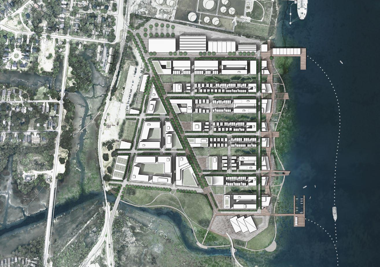

24 SITE PLAN
Industry Market Retail Parking
WHARF GREEN FINGERS EXPANDED PUBLIC WATERFRONT
Housing
MAKER’S
Section A
Riverwalk Section
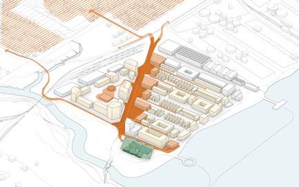
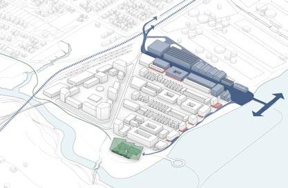
25 FUTURE DEVELOPMENT FUTURE DEVELOPMENT BIKE PATH RAPIDLOWCOUNTRYTO TRANSIT NOISETTEPARK RAILROADTERMINAL RIVERFRONT PARK NOISETTE MARKET NOISETTECREEK WATER TAXI TO CHARLESTON LEGEND Housing Community Industry Market Retail Hotel Parking MAKER’S WHARF the RIVERWALK LIVE OAK AVENUE DESIGN CONCEPT Community Economy Resilience Riverwalk Axon
Climate Action in Latin America
IDB Publication for the C40 Cities Summit
2022
Research - Publication for the Inter American Development Bank
C40 World Mayors Summit 2022 in Buenos Aires, Argentina
Felipe Vera (PM) Rolando Girodengo, Tanushri Dalmiya, Aimen Fatima Publication Layout, Research, Tables, Diagrams
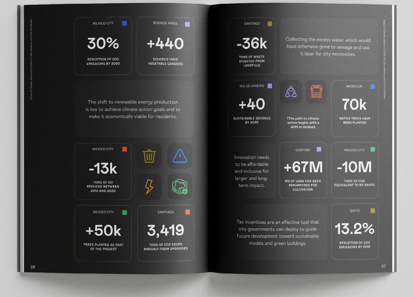
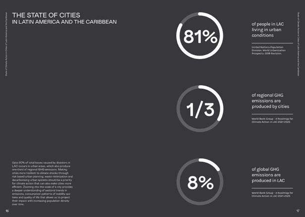
Latin America and the Caribbean is the second most urbanized region in the world, with 81% of the population living in urban areas1. This high urbanization rate has led to an increased demand for transportation, higher production of waste, and overconsumption of fossil fuels for energy purposes that include electricity generation, building construction, and industrial processes. LAC contributes to less than 10% of the global greenhouse emissions that predominantly stem from agriculture, land-use and forestry sectors - which together account for almost fifty percent of emissions across the region - while cities produce one-third of regional emissions2. In turn, LAC is among the regions most challenged by climate change, being exposed to climatic shocks such as floods, storms, and heatwaves hitting particularly the most vulnerable groups3. The approach to combating the climate crisis has largely involved mitigation efforts, calling for attention to adaptation strategies.
This report constitutes a first effort in providing an overview of the current sectoral greenhouse gas emissions generated by the region, the main climate challenges and the capacity of cities to lead transformative climate action. It builds on from the climate action plans of cities with most available information and evaluates their country’s Nationally Determined Contributions (NDCs), bringing an interesting approach to turn the global goals of the Paris Agreement into implementable actions at all scales.
year type site team role description 26 04

27
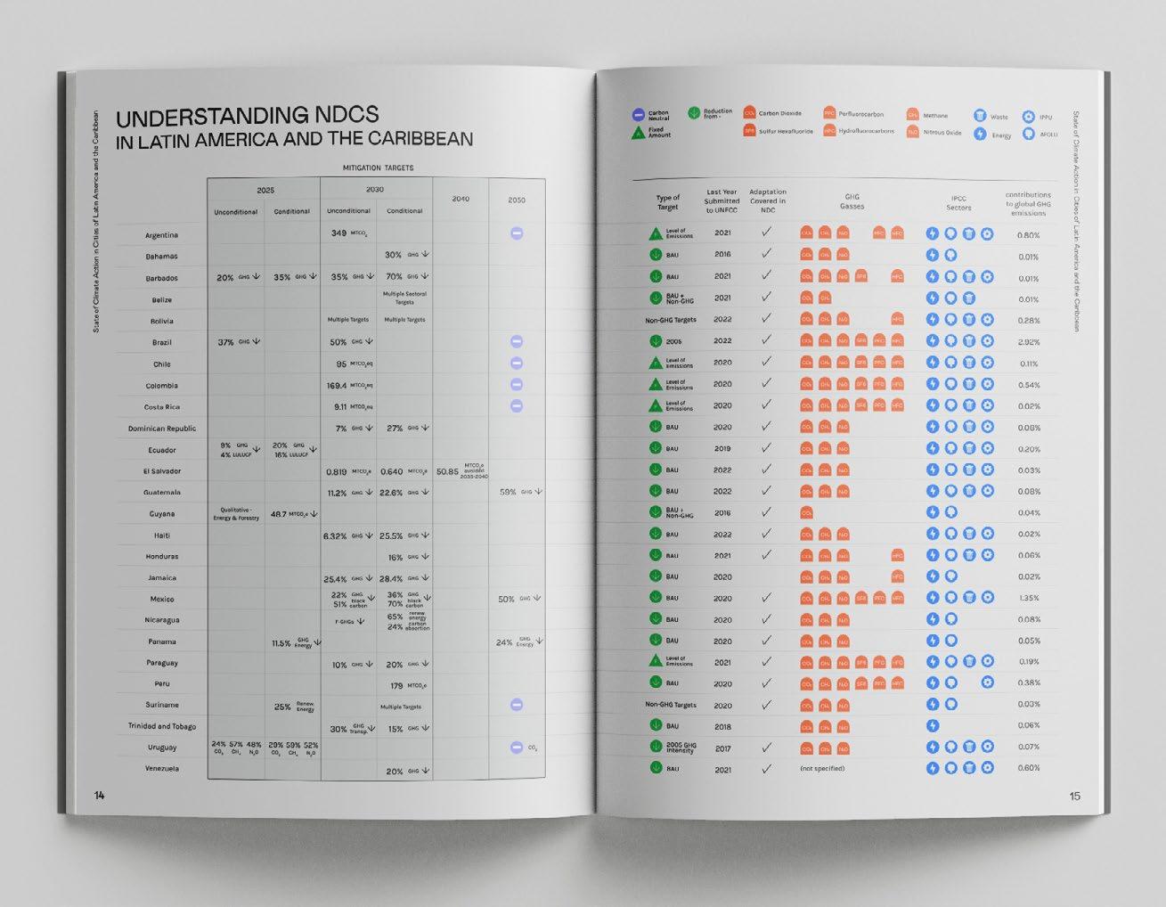
Summary of results and strategies of selected case studies
28
Comparison of NDCs and mitigation strategies of all countries in Latin America
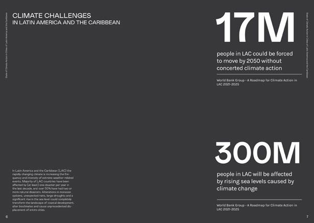
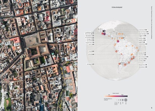
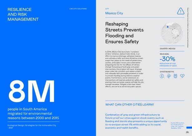
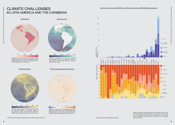
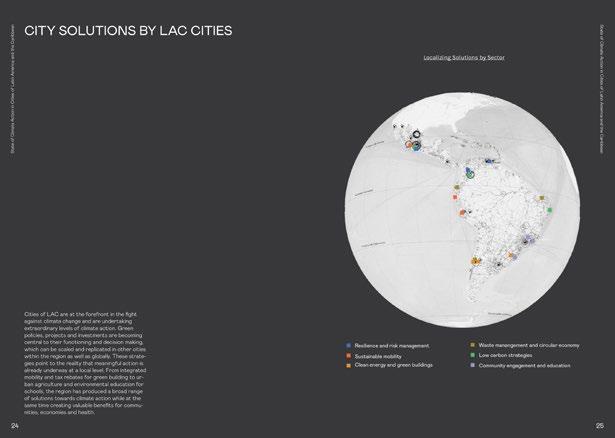
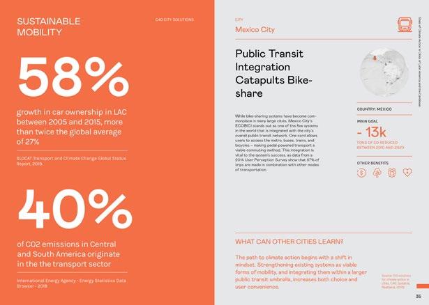
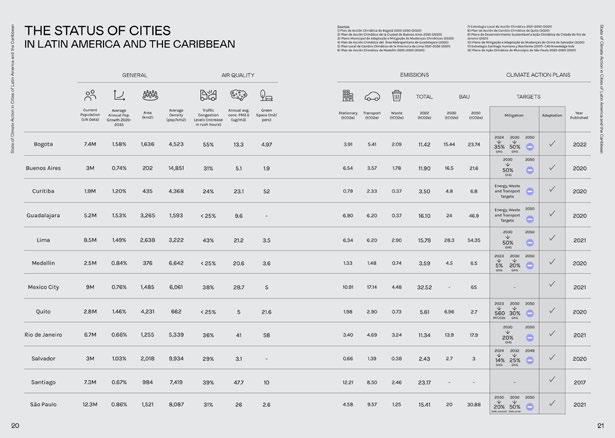
29 Climate Indicators, Case Studies, Comparison of climate action plans of Latin Amercian countries and cities
Urban Water Intelligence
Office of Urban Resilience (ORU) Catalog of Solutions
2022
Research - Open Access Website
Mexico and LATAM
Supervised by Adriana Chavez, Elena Tudela and Victor Rico (ORU)
Research, Website Design, Mapping, Content Development
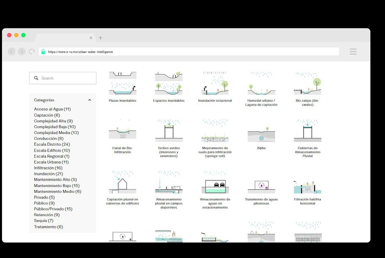
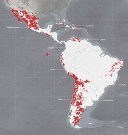
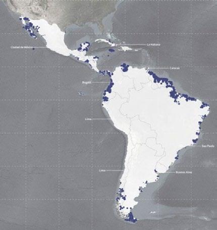
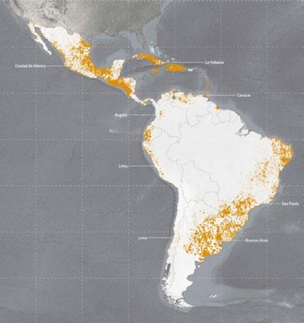
In Latin America, the global urbanization process occurs at an accelerated rate: more than 80% of the population lives in cities. The urban development of this region usually occurs without considering the environment and natural resources, which brings consequences to its population.This problem is considerably increased by the effects of global climate change. Floods, droughts and problems of access to water are multiplying exponentially throughout the region. Despite only producing 5% of CO2 emissions globally and having the second lowest pollution per capita, Latin America is one of the most affected regions with extreme weather and natural catastrophes.
Water is the most affected resource in this process. Cities were founded around rivers, lakes and oceans, since water is essential for their operation. The climatic imbalance and the inefficient management of urban water cause water resources to become a risk. The intelligent management of water in cities is essential to reduce the imminent risks that climate change causes in the region and to guarantee comprehensive access to water for the entire population.
The water crisis in the region is growing exponentially and generates the need to urgently seek solutions. The current model of water management in the cities of the region is not enough to counteract the consequences of climate change. It is necessary to develop new strategies and solutions for urban design.
website https://www.o-ru.mx/urban-water-intelligence
year type site team role description 30 05
31
Water Stress Flooding Drought
Homeostasis
The Role of Iceland in the Global Energy Transition
2022
Studio Project
Iceland
Rolando Girodengo - Sarah Page - Pam Setpakdee
General design, Diagrams, Regional Plans, Presentation
In the midst of a global climate and energy crisis, we have to collectively move forward to reduce our overall consumption and transition to renewable energy sources. With the development of local circularity practices and leading use of clean energy, Iceland serves as a leader in building models of practice and innovation.
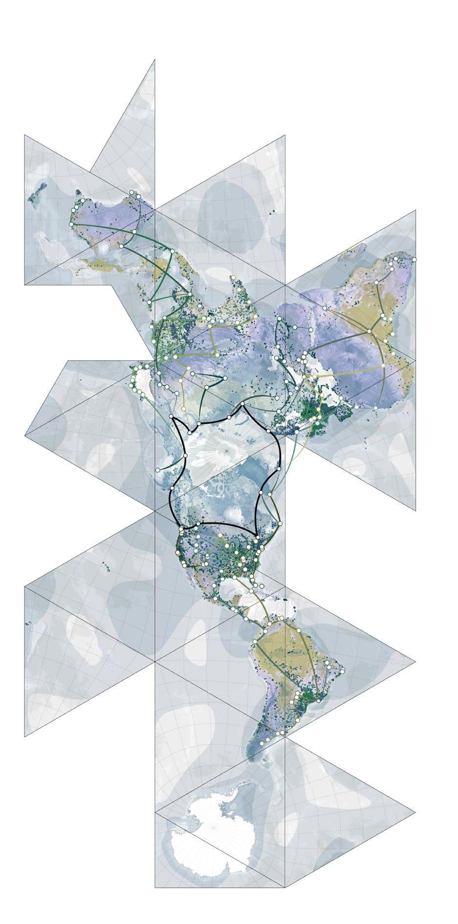
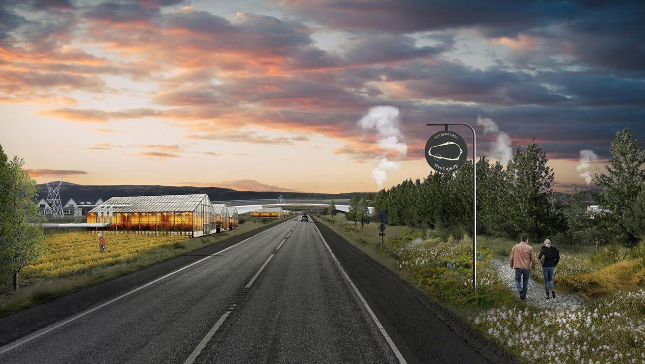
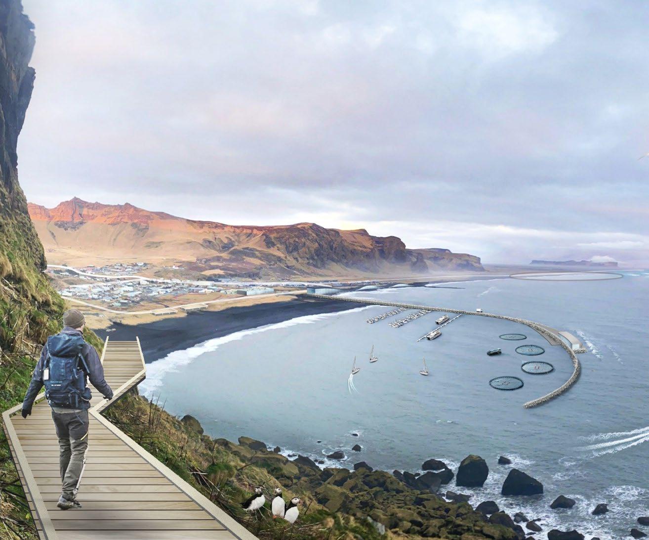
The Energy Circle Plan works to further ongoing efforts by reimagining the relationship between spaces of human habitation and energy production to create a regenerative relationship with natural systems. This effort is accomplished through a multi-scalar approach to circularity. At the local level, energy production is developed through microgrids and tied to local economies, creating closed loops of circularity.
Regionally, the system is able to mitigate changes in energy production in order to satisfy temporal energy demands and respond to local limitations. At a national scale, the project functions as a link between existingregional economies and tourist attractions, diversifying Iceland’s potential.
The project frames Iceland’s role globally to act as an innovator in connecting scales of circularity that can be deployed elsewhere in the world.
year type site team role description 32 06
33 Global Renewable Energy Exchange
34 Ocean Energy Geothermal Energy
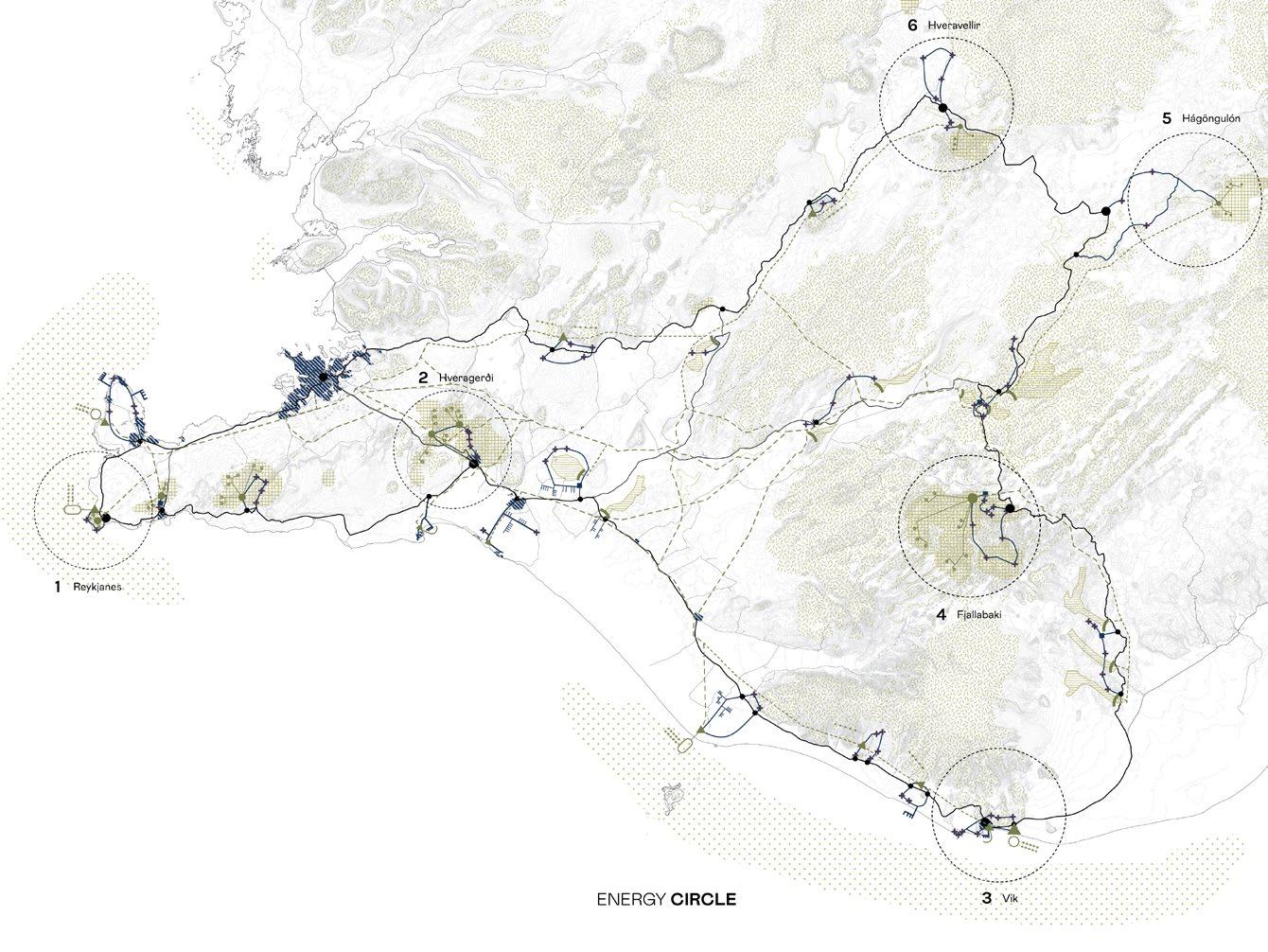
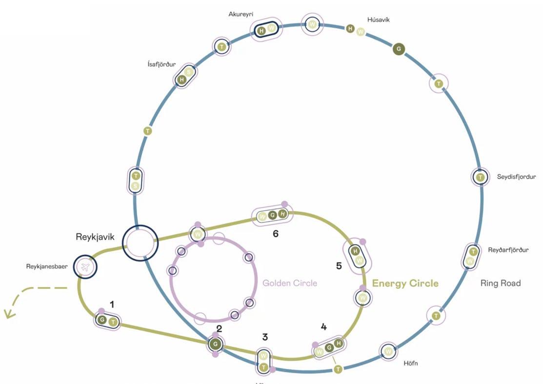

35 REGIONAL PLAN National Diagram - Energy Circle + Golden Circle + Ring Road Energy Circle Plan
In Between Natural Layers
Almaviva Park Proposal
2020
International Design Competition - Honorable Mention Villavicencio, Colombia
Soledad Patiño, Stefano Romagnoli, Lautaro Do Campo, Taller de Arquitectos,
General Design, Landscape Units Research, Technical Drawing, Presentation
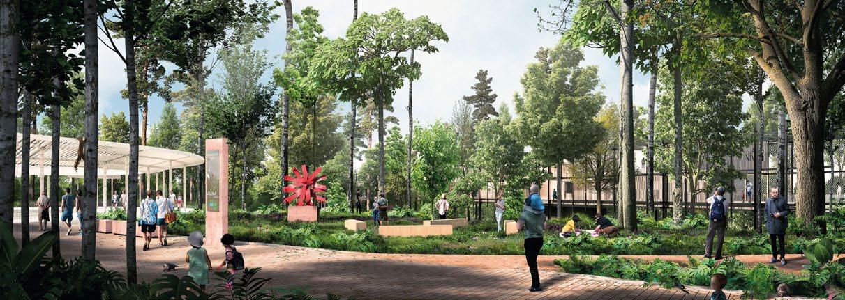
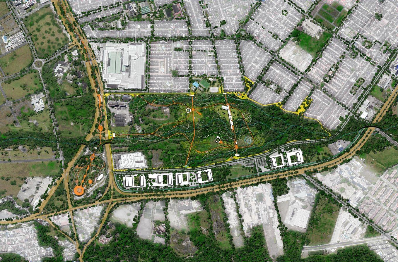
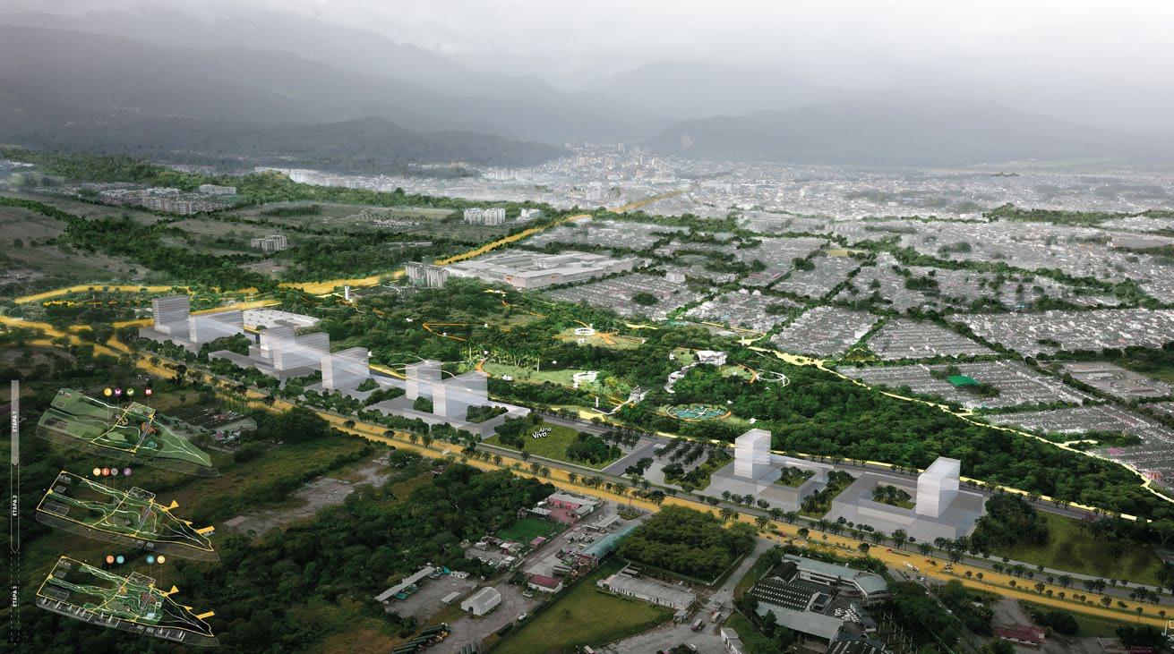
Almaviva Park understands the context and history of the territory in which it is inserted, and is configured as a new structuring element of the city and regional park, which values the natural and cultural heritage of Villavicencio as the capital of the plains and the foothills . The Park is constituted as a key piece in the urban conformation of the public, ecological and recreational identity of the city.
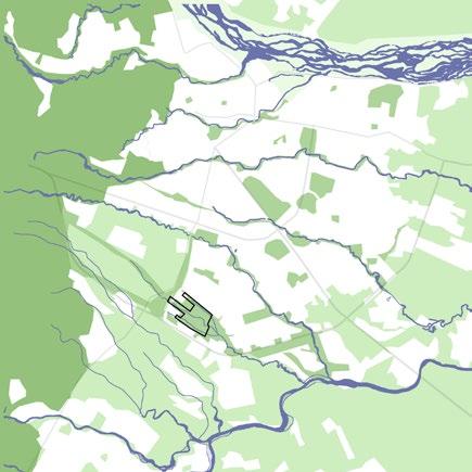
This is achieved through three strategies: [Suture] Connecting and completing the biological network ensuring continuity and connecting with metropolitan ecological system. [Diversify] Restoring and improving biodiversity in existing while promoting new cultural and recreational activities for the community. [Enhance] Making water streams and rainforests accessible to the city, considering its symbolic and social location in the metropolitan region.
The buildings are separated from the ground to avoid interrupting ecological processes. These interventions are designed to guide visitors through the diverse natural layers located at Almaviva Park.
year type site team role description 36 07
Emergent Layer
Canopy Layer Understory Layer

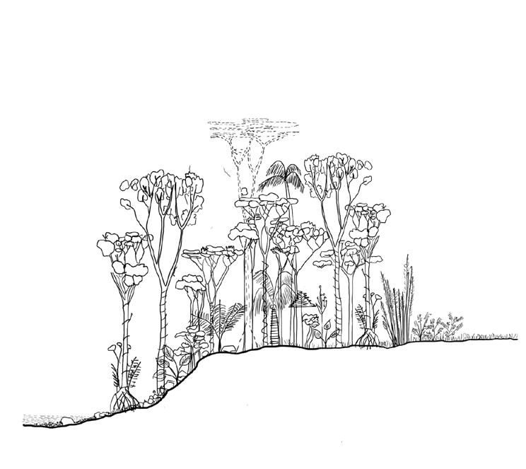
Layer

37 Estrato herbáceo Estrato suelo Estrato Emergente Estrato Dosel Estrato Sotobosque
Ground
Shrub Layer
Pedestrian and Bike Paths
Museum



CAÑO ARROCITO PARQUE LOS FUNDADORES CENTRO COMERCIAL VIVA AVENIDA 40 AVENIDA40 CALLE AFECTACIONVIALV4 ANFITEATRO MIRADOR MARIPOSARIO UP5 AFECTACION VIAL CARRERA37 UP2 AGROURBANO UP1 SELVATICO DE MIRADOR TEATRINO LOWER PLAINS Ocoa River Almaviva Park RESTORE Ecological network 1 Rainforests Bio. Connectors Rural Streams Rivers Commercial Cultural Services Sports INTEGRATE Public space and institutions 2 SÍNTESIS Sector Public Space Vertical Connectors Urban Borders AlmaViva Park STRENGHTEN Mobility System 3 Regional Roads New Pedestrian and Bicycle Paths Urban Roads Bus Station 40 40 65 65 65 SITE ANALYSIS PLAN Section A Section B Palmetum Stream Stream Stream Membrane Parking Membrane Stream Stream Productive Soil Stream Membrane Urban Fabric Wetland Membrane Sports Rainforest Lowland Meadow Top View Integrate Restore Strenghten 2 1 3 Public space and Institutions Ecological Network Mobility system


39 Productive Soil 3 Palmetum 4 Wetland 5 Insects Hummimbirds Sheeps Cows Goats Horses Parrots Monkeys Turtles Chigüiro Amphibians Turtles Fish Chigüiro PedestrianBike Path CulturalMuseum Contemplation Food Public Events Auditorium Open Space EcologicalPreservation Contemplation Phytoremediation PedestrianBike Path PedestrianBike Path GR GR HG PA PA AR AR AR JF MU AC 500m 750m 1000m 1250m 1500m 250m FOOTHILLS LOWER PLAINS PARAMOS West Andes Ocoa River RESTORE Ecological network 1 Rainforests Bio. Connectors Rural Almaviva Park LANDSCAPE UNITS CONTEXT Masterplan Bird Eye View Productive Palmetum Wetland Regional Section 1 2 3 A park in the Foothills
description
Creative Warehouse
Recovery of a Railway Infrastructure
Mendoza, Argentina
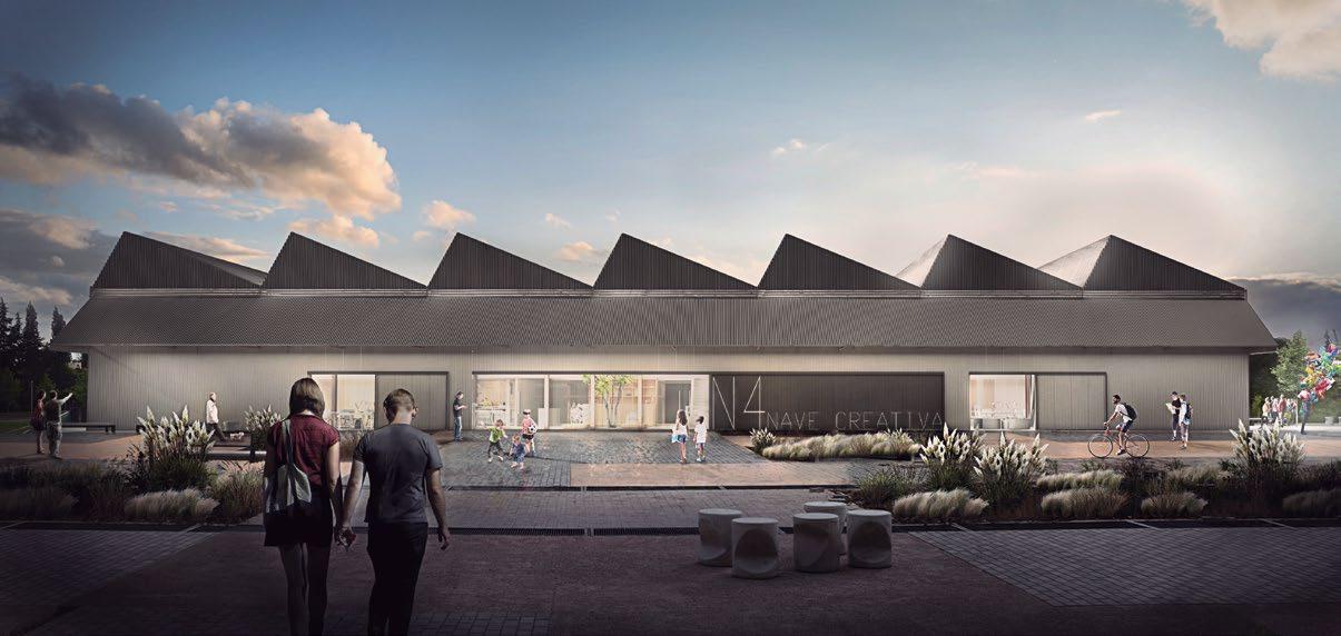
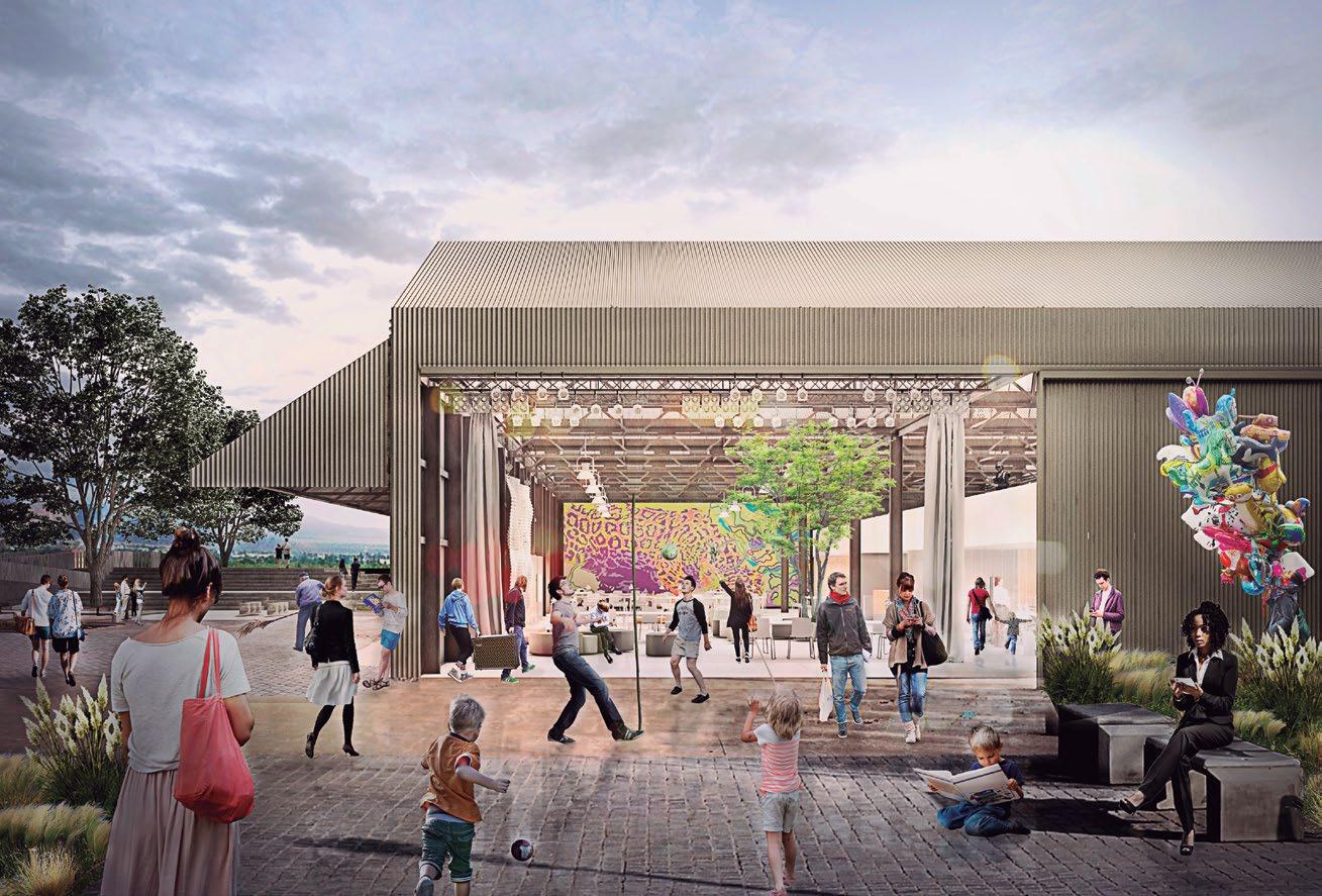
As railway systems declined in Argentina, many venues and building were abandoned in key locations within cities. In Mendoza, a large railway land close to the city center was recovered for public use. Four different warehouses, used to repair trains are now part of a cultural venue of Mendoza’s University. One of this buildings is being transformed into a “Creative Warehouse”, a center for research, art and innovation.
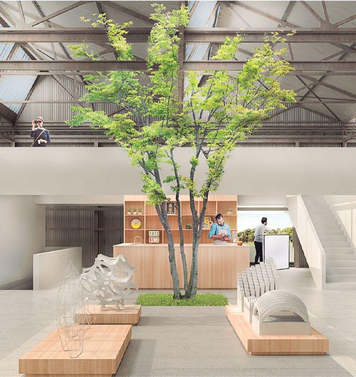
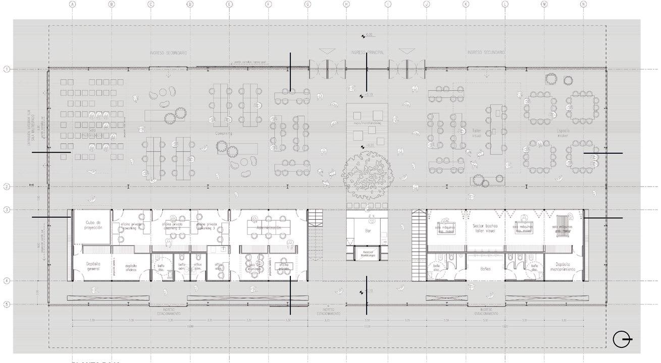
The proposal looks for a balance between heritage importance and identity of the old building and the incorporation of a new element in the interior, which is necessary to enable a new program ,encouraging innovation and collaborative work. The interior is divided in two long spaces, according to the original layout for train refurbishment. A compact block, both introspective and permeable, is located in one of this spaces, containing all the activities that require a greater level of control and acoustic, climatic, security and privacy protection.
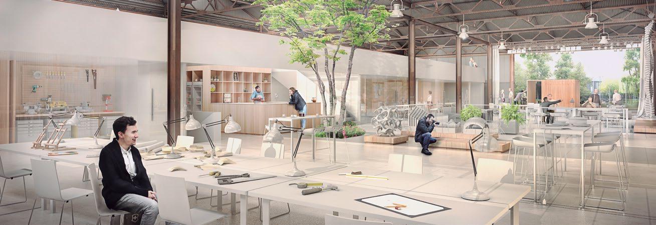
The second space becomes a free ground floor plan, a large multipurpose space to integrate a wide range of activities and presentations. Its flexibility makes possible a meeting and exchange environment, both creative and social to democratize the access to digital manufacturing and new technologies. Most of the interior space remains empty, a void that enhances an existing tree in the center of the proposal, where the main access is located. In this void, a “technical cloud” suspends from a continuous rail with lighting and sound systems, curtains, platforms and elevators to support the multiple layouts of the ground floor.
year type site team role 40 08 2018 National Design Competition - FIRST PRIZE General Design, Technical Drawing, Presentation
Emilia Darricades - Ana Isaía - Seizen Uehara - Francisco Astrain - Santiago Páez
awards
Distinguished Project, International Biennale of Architecture of Argentina, 2018
41
Front facade view
Existing tree

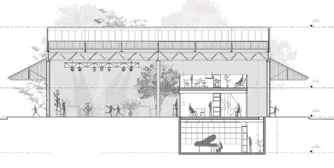

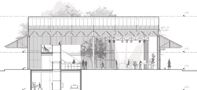
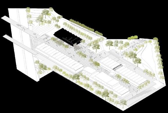
42 PLAN CONTEXT Ground Floor Plan Sections
West
East South
Access and Open Space
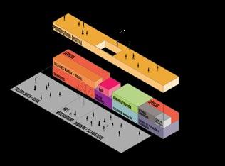
Continuous expansion in the west and south facades, service access in the east
Circulation
Service corridors in the east facade and central elevator
Technical Cloud Program
Suspended infrastructure to support multiple layouts
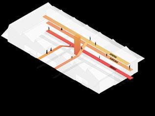
Compact block with private activities and services for the continuous flexible space
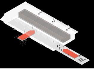
Ground floor flexible program
Souther facade, open for continuous expansion
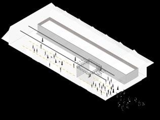
43
LAYERS
awards
Sustainable Housing Prototype House for the Compact City
2018
National Design Competition - FIRST PRIZE
Córdoba Argentina
In collaboration with Agustín Berzero - Valeria Jarós - Emilia Darricades
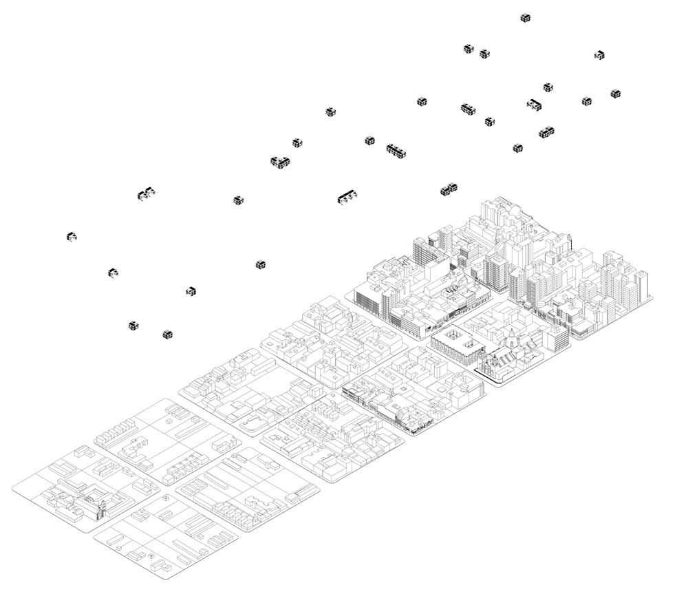
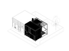
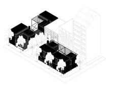
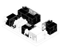
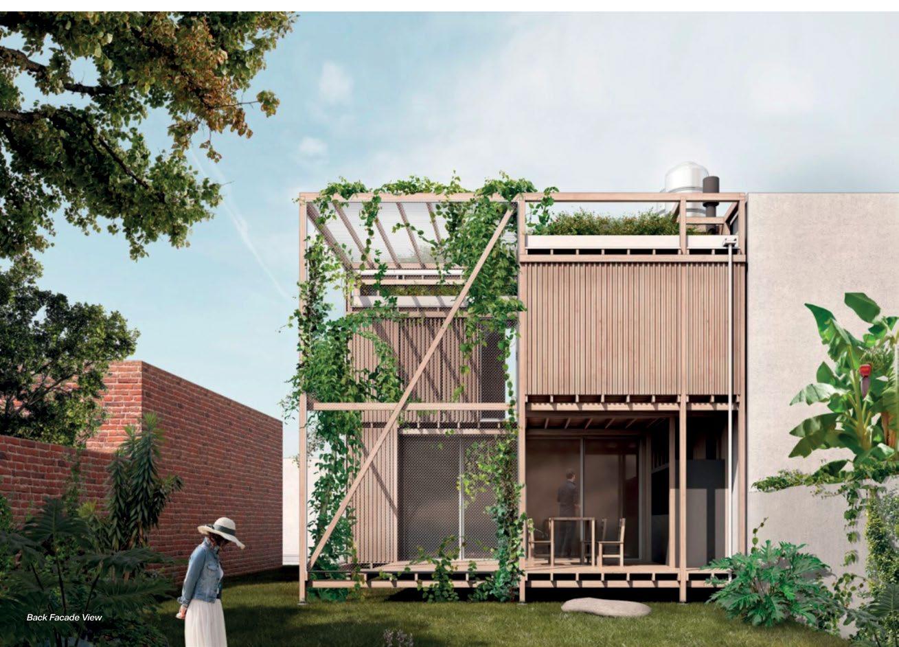
To achieve a sustainable urban development it is necessary to promote a dense and compact urban fabric. The main problem for the development of single-family homes is the scarcity and high cost of land. Therefore, it is essential to reduce land use through compact constructions. The proposal is committed to the consolidation and regeneration of the existing urban fabric, achieving more appropriate urban density. This way, it takes advantage of the proximity to urban centers with its opportunities, achieving a better quality of life.
A housing prototype must be based on achieving a more sustainable urban development, since every architectural proposal designs the city. The contemporary inhabitant is essentially urban; it is not a typical user or family, it rather requires an flexible and changing habitat that adapts to different needs over time. The housing prototype must adapt to multiple users and requirements, support different locations and must be able to grow and change.
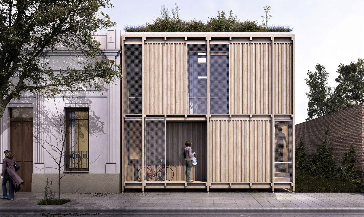
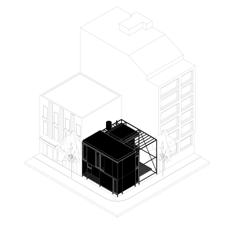
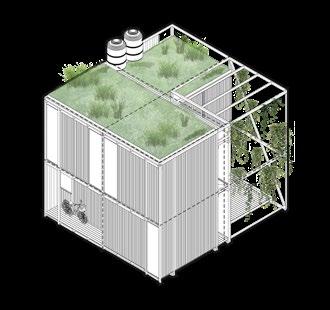
Our proposal is a prototype systematized in modules, with the possibility of internal growth. This means, it understands the need for growth by providing the structural module to contain it. The layout allows a high degree of adaptability and occupies a small area, enabling both its capacity to adapt to different lots and its wide range of possible units. A housing proposal is presented, but it is actually a reflection about a modular system that allows the development of economic housing with spatial and material quality, contributing to sustainable urban development.
Holcim Foundation Sustainability Award, Acknowledgement Prize Latin America
Distinguished Project, International Biennale of Architecture of Argentina, 2018
year type site team role 44 09 description General Design, Diagrams, Presentation
Housing Infill for a Sustainable City
45
CENTRAL URBAN RURBAN SUBURBAN
Front facade view, urban location





46 Stage 1 4x16m2 / 64m2 Stage 2 5x16m2 / 80m2 Central Suburban Infill - Cen2 Clustering 3 Growth 1 Adaptability Infill - Suburban ESTAR / COMEDOR INGRESO VACIO GALERIA COCINA BAÑO Y6 Y5 Y4 Y3 Y1 Y2 Proy. Estructura Proy. Estructura Proy. Estructura Proy. Estructura X1 X3 X4 X2 X5 3.00 3.00 8.20 3.00 0.90 4.10 1.10 9.10 B C0 B C0 A C0 A C0 Y6 Y5 Y4 Y3 Y1 Y2 3.00 0.90 4.10 1.10 9.10 DORMITORIO 1 DORMITORIO 2 BAÑO VACIO Y6 Y5 Y4 Y3 Y1 Y2 Proy. Estructura Proy. Estructura Proy. Estructura X1 X3 X4 X2 X5 3.00 3.00 8.20 3.00 0.90 4.10 1.10 9.10 B C0 B C0 A C0 A C0 B C0 FUTURO CRECIMIENTO VACIO +0.60 +3.65 GALERIA ESPACIO SEMICUBIERTO COCINA ESPACIO SEMICUBIERTO Estructura de madera Carpintería aluminio Y6 Y5 Y4 Y3 Y1 Y2 4.10 0.90 4.10 9.10 B C0 1.10 1.10 1.10 1.10 COCINA Y6 Proy. Estructura X1 X3 X4 X2 X5 3.00 3.00 8.20 B C0 A C0 A C0 DORMITORIO 1 DORMITORIO 2 DORMITORIO 3 BAÑO VACIO Y6 Y5 Y4 Y3 Y1 Y2 X1 X3 X4 X2 X5 4.10 3.00 8.20 3.00 0.90 4.10 1.10 9.10 +6.50 DORMITORIO 2 BAÑO VACIO Y3 Y1 Y2 Proy. Estructura Proy. Estructura Proy. Estructura X1 X3 X4 X2 X5 3.00 3.00 8.20 0.90 4.10 9.10 B C0 B C0 A C0 A C0 B C0 A C0 A C0 B C0 FUTURO CRECIMIENTO VACIO +3.65 +3.65 GALERIA ESPACIO SEMICUBIERTO COCINA ESPACIO SEMICUBIERTO DORMITORIO 1 PASO ESPACIO SEMICUBIERTO Tabla de madera virpitá 1" X 4" Estructura de madera Revestimiento exterior Tabla de madera virpitá Estructura de madera Carpintería aluminio Alambre tejido colector solar panel solar panel solar Y6 Y5 Y4 Y3 Y1 Y2 X1 X3 X4 X2 X5 4.10 4.10 8.20 4.10 0.90 4.10 9.10 7.70 +6.50 CUBIERTA VERDE B C0 A C0 A C0 B C0 1.10 1.10 1.10 1.10 1.10 ESTAR / COMEDOR INGRESO VACIO GALERIA COCINA BAÑO Y6 Y5 Y4 Y3 Y1 Y2 Proy. Estructura Proy. Estructura Proy. Estructura Proy. Estructura X1 X3 X4 X2 X5 3.00 3.00 8.20 3.00 0.90 4.10 1.10 9.10 B C0 B C0 A C0 A C0 DORMITORIO 1 DORMITORIO 3 VACIO Y6 Y5 Y4 Y3 Y1 Y2 X1 X3 X4 X2 X5 4.10 3.00 8.20 3.00 0.90 4.10 1.10 9.10 +6.50 DORMITORIO 1 DORMITORIO 2 BAÑO VACIO Y6 Y5 Y4 Y3 Y1 Y2 Proy. Estructura Proy. Estructura Proy. Estructura X1 X3 X4 X2 X5 3.00 3.00 8.20 3.00 0.90 4.10 1.10 9.10 B C0 B C0 A C0 A C0 B C0 A C0 A C0 B FUTURO CRECIMIENTO VACIO +0.60 +3.65 GALERIA ESPACIO SEMICUBIERTO COCINA ESPACIO SEMICUBIERTO ESPACIO SEMICUBIERTO colector solar panel solar panel solar Y6 Y5 Y4 Y3 Y1 Y2 X1 X3 X4 X2 X5 4.10 4.10 8.20 4.10 0.90 4.10 9.10 7.70 +6.50 CUBIERTA VERDE B C0 A C0 A C0 B C0 1.10 1.10 1.10 1.10 1.10 DORMITORIO 1 DORMITORIO 2 DORMITORIO 3 BAÑO VACIO Y6 Y5 Y4 Y3 Y1 Y2 X1 X3 X4 X2 X5 4.10 3.00 8.20 3.00 0.90 4.10 1.10 9.10 BAÑO X4 X5 B C0 B C0 A C0 A C0 B C0 +3.65 ESPACIO SEMICUBIERTO DORMITORIO 1 Carpintería aluminio Tanque de Agua capacidad 1200lts. Soporte de estructura vegetal Alambre tejido Revestimiento exterior Tabla de madera virpitá 1" X 4" Estructura de madera Estructura de madera Tanque de Agua capacidad 1200lts. Revestimiento exterior Tabla de madera virpitá 1" X 4" Estructura de madera Estructura de madera Carpintería aluminio Tanque de Agua capacidad 1200lts. Revestimiento exterior Tabla de madera virpitá 1" X 4" Estructura de madera Estructura de madera Carpintería aluminio Soporte de estructura vegetal Alambre tejido Carpintería aluminio Tanque de Agua capacidad 1200lts. Tabla de madera virpitá 1" X 4" Estructura de madera Y6 Y5 A C0 1.10 1.10 PLAN Ground Floor Plan First Floor Plan - Phase 1 First Floor Plan - Phase 2 Roof Floor Plan N W E S 03 04 05 06 07 08 Summer Winter 02 01 01 02 03 04 05 06 07 08 Rainwater harvesting Green roof Solar collector Cross ventilation Vertical garden Ground elevation Multiple layer walls Reduced glass facades SUSTAINABILITY
& PROGRAM

47 CUBIERTA VERDE Y6 Y5 Y4 Y3 Y1 Y2 ESTAR- COMEDOR GALERÍA FUTURA AMPLIACIÓN DORMITORIOS CUBIERTA VERDE
Modular System Small catalog of wooden components with simple structural joints 01 01 01 04 04 07 07 07 02 02 05 05 08 08 03 06 06 09 09 1 x 4 wood wall Future Expansion Green Roof Bedroom Green Roof Patio Dining / Living Insulation Concrete foundation Aluminium window Green roof 4 x 4 wood column Vertical garden Water tank, 1200 lts 3 x 5 wood structure
STRUCTURE
awards
Scenic Mist
2018 - 2020
International Design Competition - FIRST PRIZE [Built in 2020]
Dubai, UAE
MMBB Arquitetos [Sao Paulo] - Ben Avid
General Design, Concept Diagrams, Renderings, Presentation
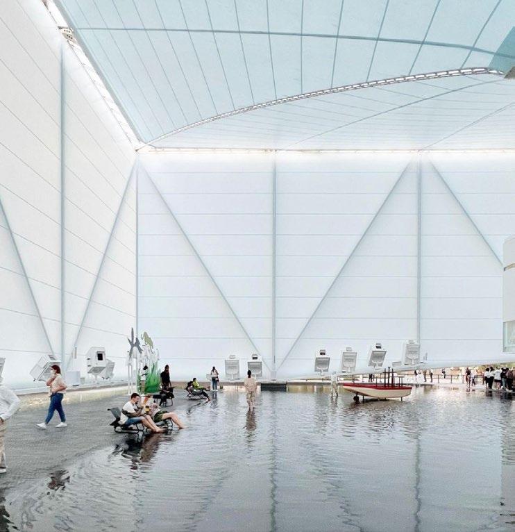
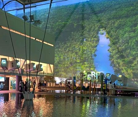
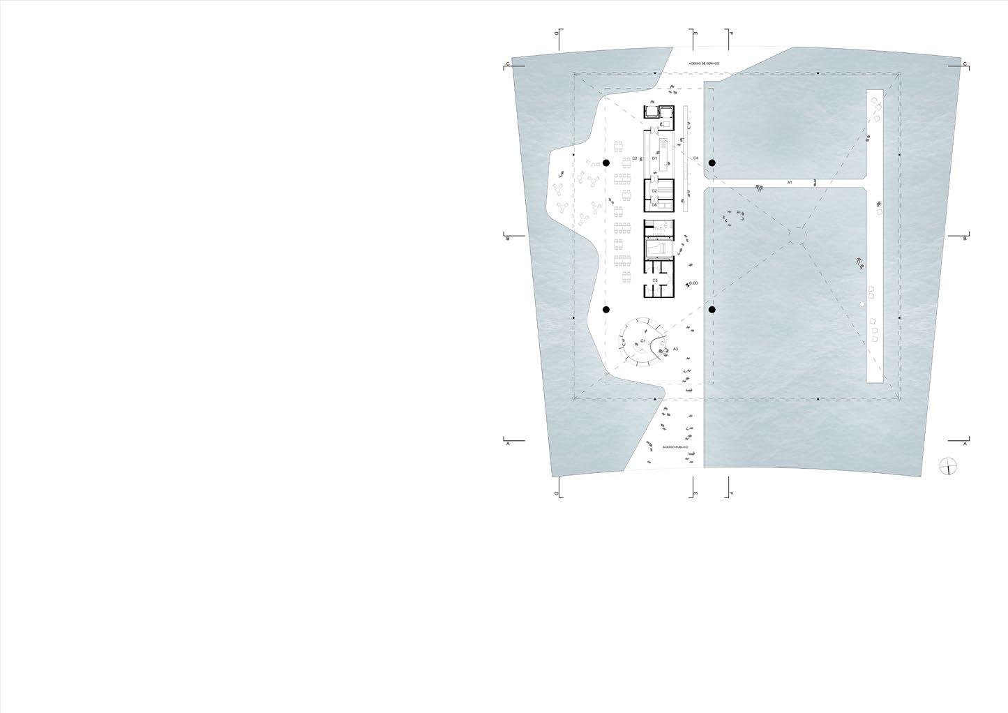
The pavilion presents the Brazilian waters, rivers and mangroves. It choses water a central topic for discussion. Water means fertility of life and is the most important natural resource for sustainability worldwide. The whole lot is flooded with a slim layer of water in a continuous topography.
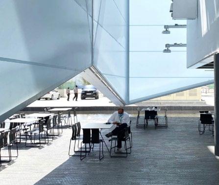
With a steel tensile structure and light white fabric, it creates a screen able to receive projections, creating an immersive atmosphere of variable images, sounds, smells and temperature. It is a place for animations and interaction place with a distinct scenic character. At the same time, it is a visualization and experimentation scenario of nature and cultures, both in the past and in the future.
The exposition and service program is contained in a steel block suspended over the water square. In the main exposition area, a long window gives the visitor a new perspective of the pavilion and the projections. Under this block, a restaurant and a shop take place in a pavement platform with 360 degree views to the pavilion. The focus is to preserve and promote nature and sustainability through technology.
Archdaily Building of the Year 2023, Commercial Architecture
year type site team role description 48 10
Brazilian Pavilion EXPO 2020
49 Restaurant
Water Square Ground Floor Plan Suspended Block Tensile Structure
Amazonia Projections Water Square
Architect & Urban Designer Tomás Quaglia Cambridge, MA tomasquaglia@gmail.com +1 617 417 7548


