Purpose and Process | Study Area | Plan Alignment | Community Engagement
District Analysis
Historic Churches and Neighborhoods | Natural Systems | Pathways and Roadways | Land Use and Zoning | Airport Considerations | Market Analysis
Strategic Direction
Guiding Themes | Design Considerations | Connectivity Improvements | Future Land Use Map
Focus Areas
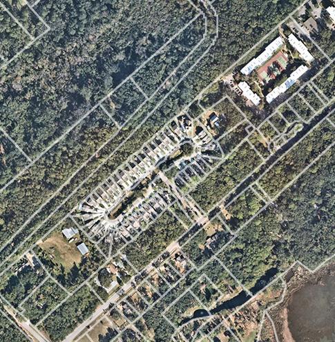
Focus Areas | Mid-Island Tract | District Center | Historic Neighborhoods
Implementation
Town of Hilton Head Island Council
01 INTRODUCTION
Plan Purpose
The Town of Hilton Head Island is taking a bold and forward-looking step in developing a holistic vision for the Mid-Island District (District) that combines park design with community planning. Taking its direction from and building upon the recommendations of the Parks and Recreation Master Plan, the Our Plan Comprehensive Plan, and the Gullah Geechee Culture Preservation Project Report, the Town has recognized the opportunity to leverage community investment in public spaces and infrastructure improvements to energize adjacent private redevelopment and reinvestment in existing Historic Neighborhoods.
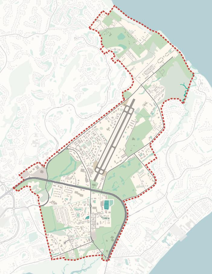
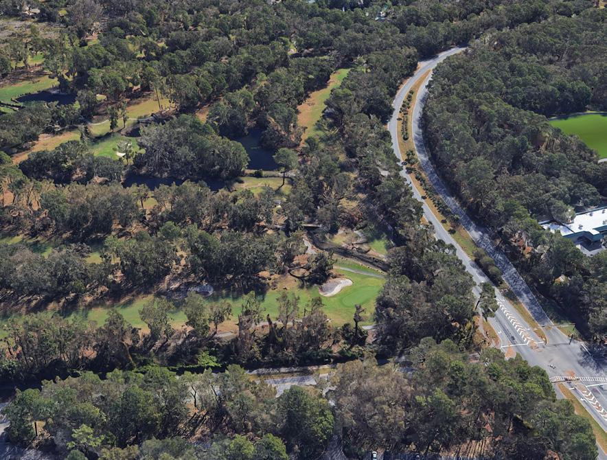
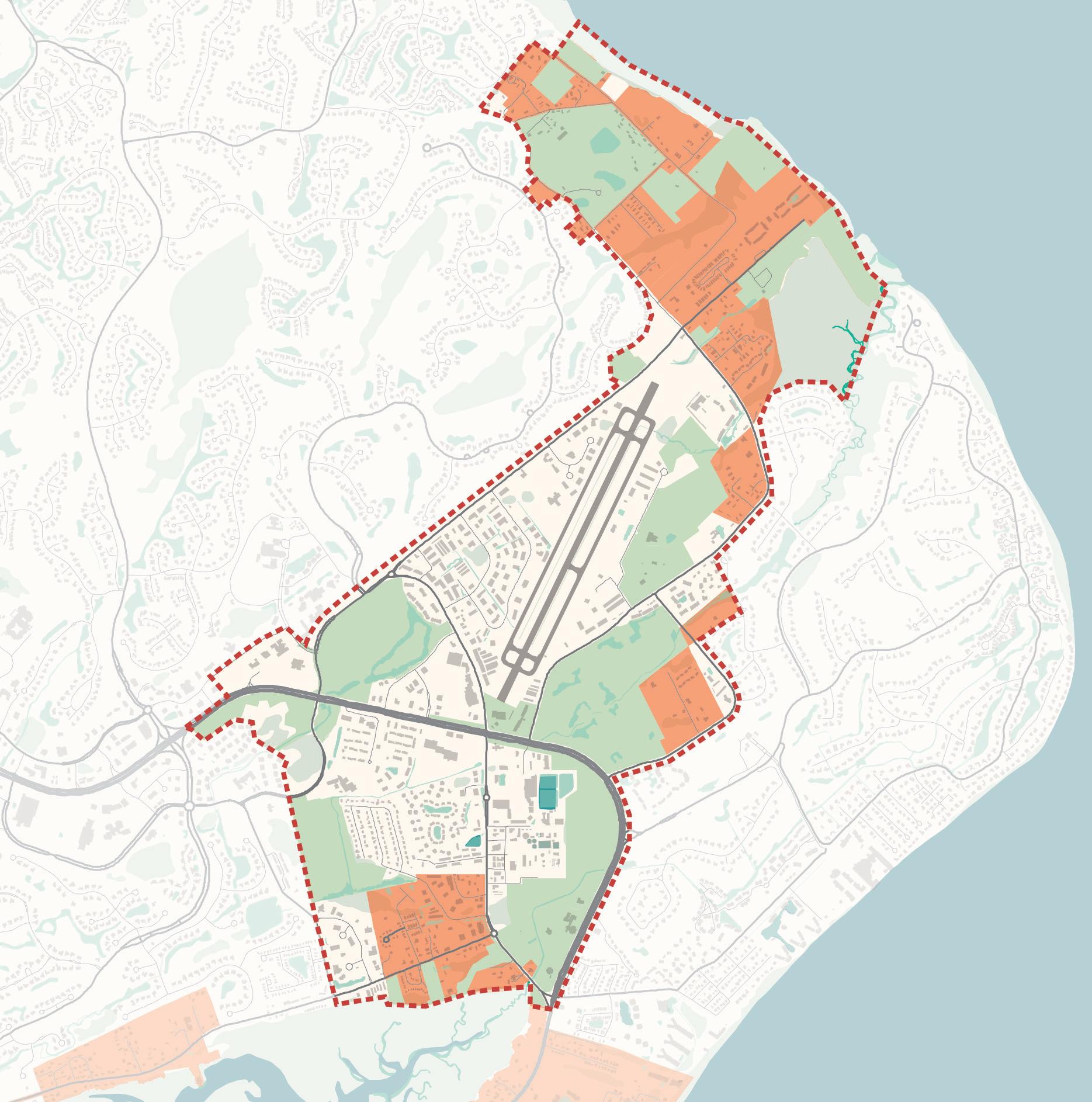
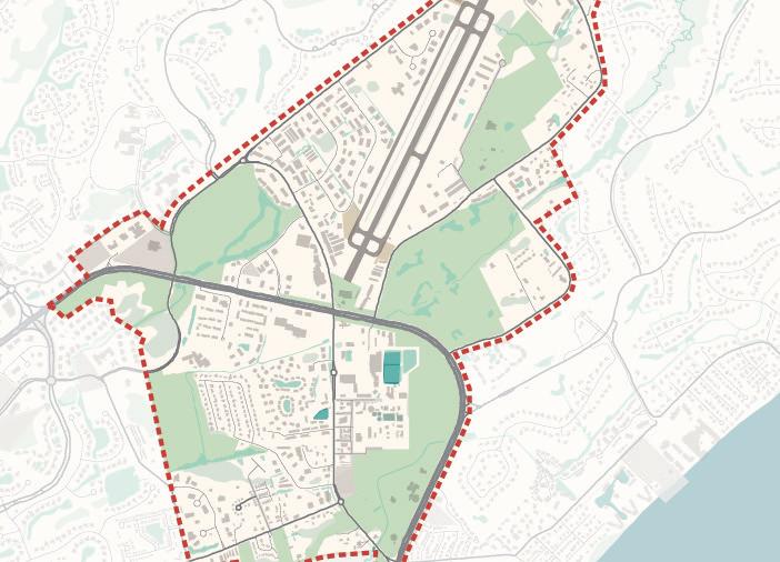
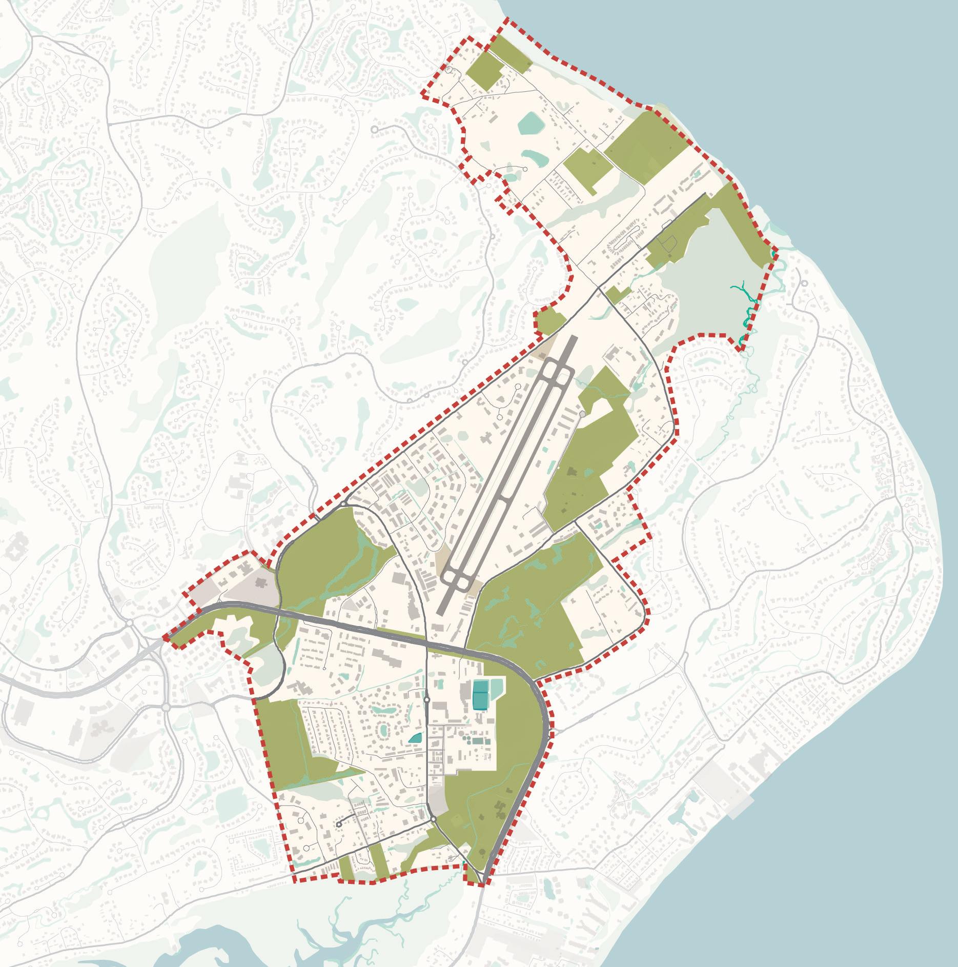
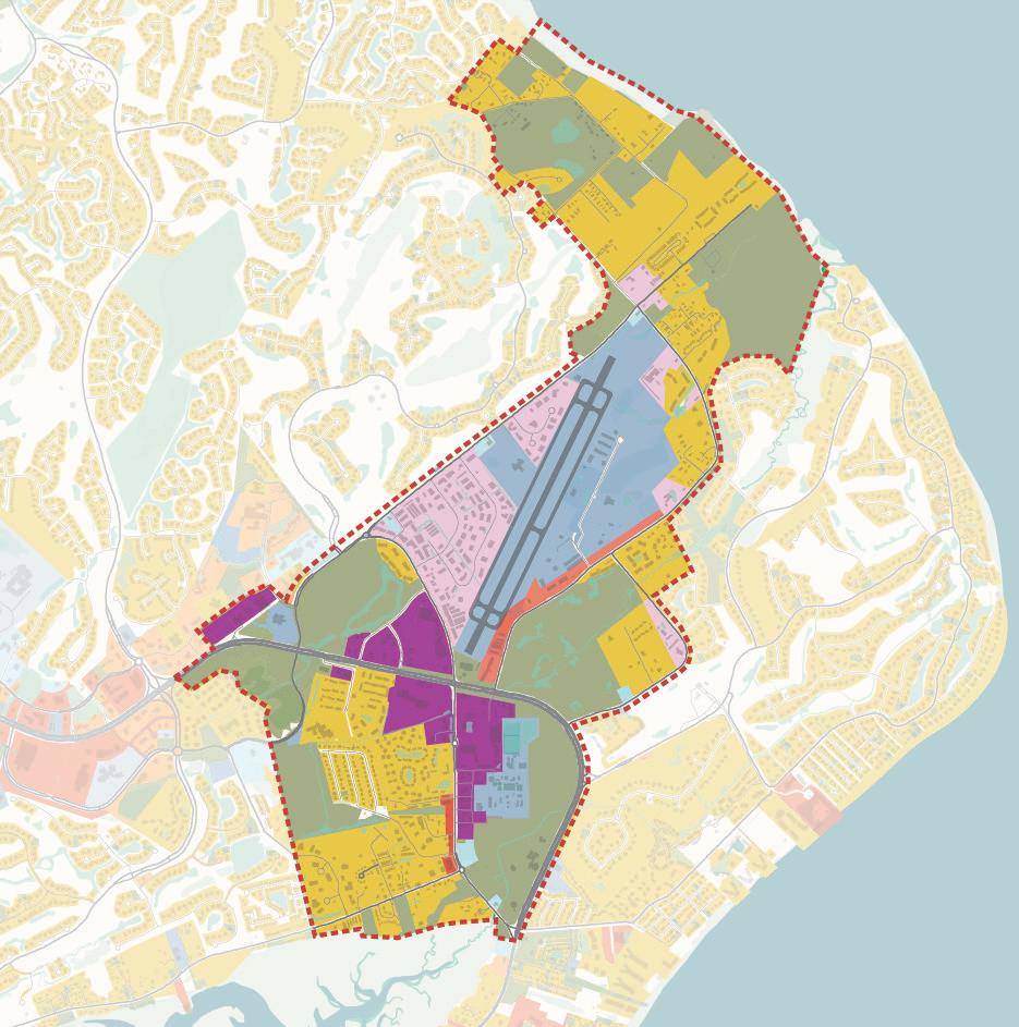
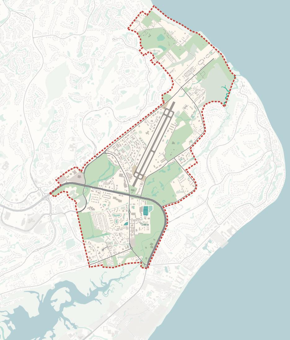
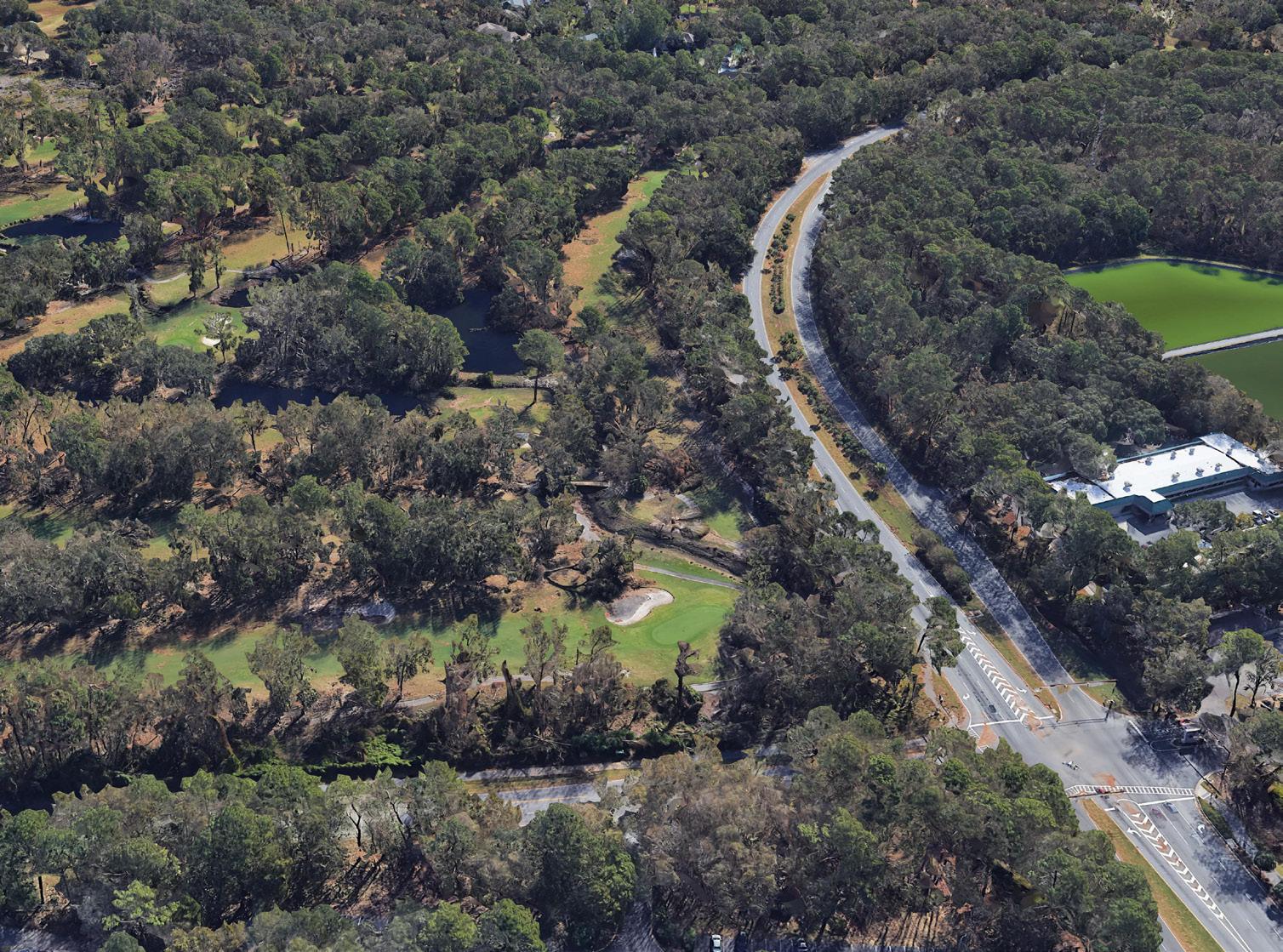
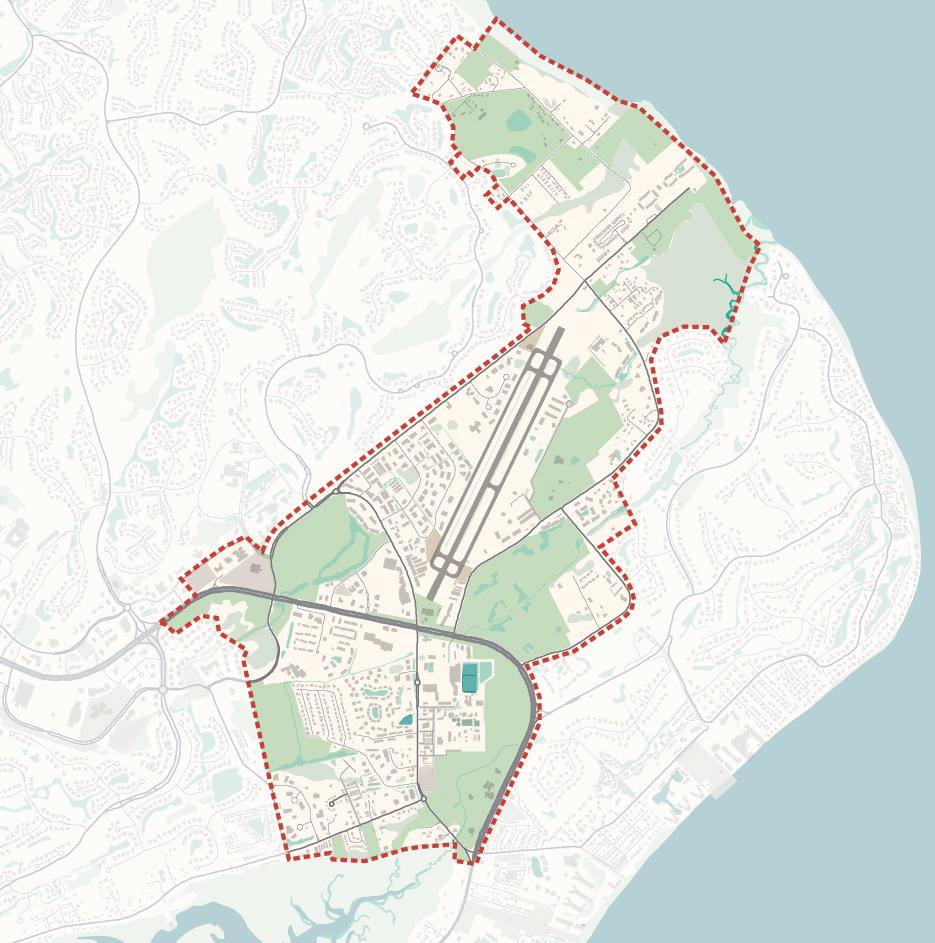
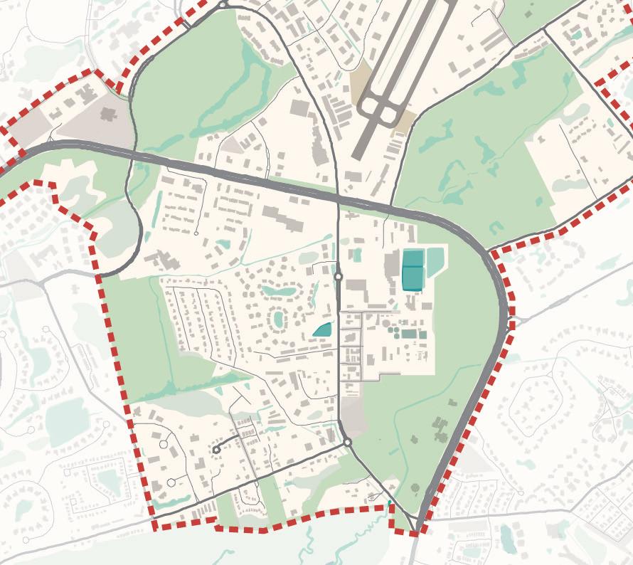
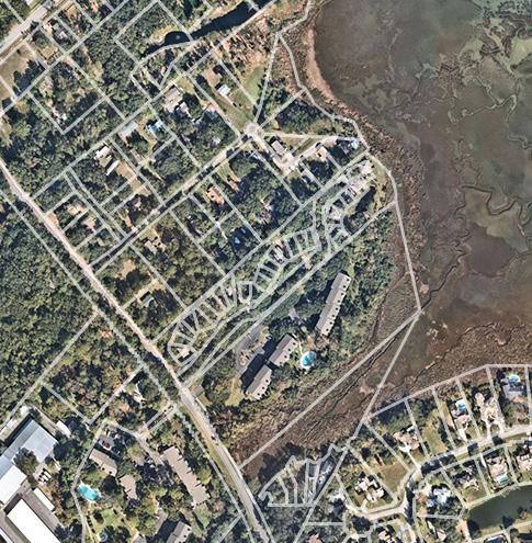
The study area for the Mid-Island District Plan extends from Marshland/ Broad Creek on the south, to Beach City Road/Baygall on the north/ northwest, to Union Cemetery Road/Dillon Road/the Atlantic Ocean on the east/northeast. The future of the Town-owned Mid-Island Tract is the impetus of this community planning process. This critical site is at the center of not only the District, but also the Island. It represents an opportunity to bring the District and all of Hilton Head Island together around the new park and community gathering space. Occupying a portion of the former Planter’s Row Golf Course, the Mid-Island Tract is ideal park space that can be transformed and connected to the system of green spaces, preserves, trails, neighborhoods and commercial development that surrounds it. Stretching to the south along the Town-owned Ashmore Tract, there is an opportunity to connect the Mid-Island District to the rest of the Island through the existing and ever-improving system of parks and trails that make Hilton Head Island special.
The Mid-Island District Plan builds on planned public investment by exploring both the redevelopment potential of existing commercial and retail areas and the revitalization opportunities within the Historic Neighborhoods.
PLAN PROCESS
Beginning in July of 2021, a multi-disciplinary planning team began to explore the reuse of the Mid-Island Tract and to consider the revitalization potential of the Mid-Island District as a whole. Working in close collaboration with Town Staff and Town Council, the planning team conducted initial community outreach and existing conditions analysis in the Fall of 2021. This understanding of community issues and priorities supported a series of Town Council Workshops through the Winter, Spring and Summer of 2022 that tested ideas, recommendations and plan concepts that have culminated in this vision for the future of the Mid-Island District.
This document details the formative stages of the planning process, beginning with plan alignment and background and a summary of community engagement results. The District Analysis section reviews the existing physical conditions, natural systems, regulatory environment, and economic opportunities within the Mid-Island District. Taken together, the community input and planning analysis helped to form the Strategic Direction for the future of the Mid-Island District. These informed the approach to the conceptual design for the Mid-Island Tract, the proposed character of streets, development and neighborhoods, and the recommended Future Land Use Map. With these building blocks in place, this plan highlights three Focus Areas of a new park on the Mid-Island Tract, the mixed-use redevelopment of the Mid-Island District Center, and the residential and neighborhood commercial potential of the five Historic Neighborhoods within the Mid-Island District. This community-led plan is action-oriented with clear priorities and next steps detailed in the Implementation section at the end of the document.
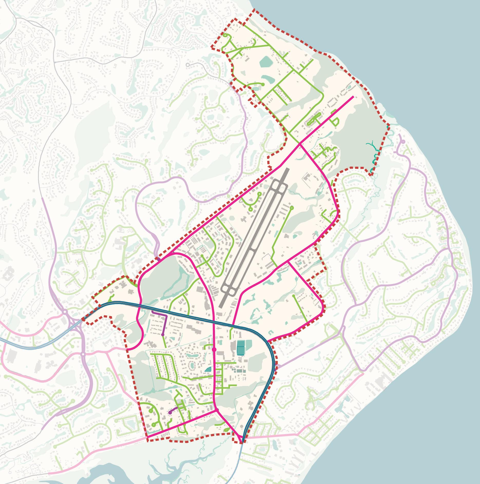
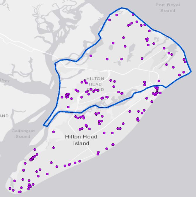
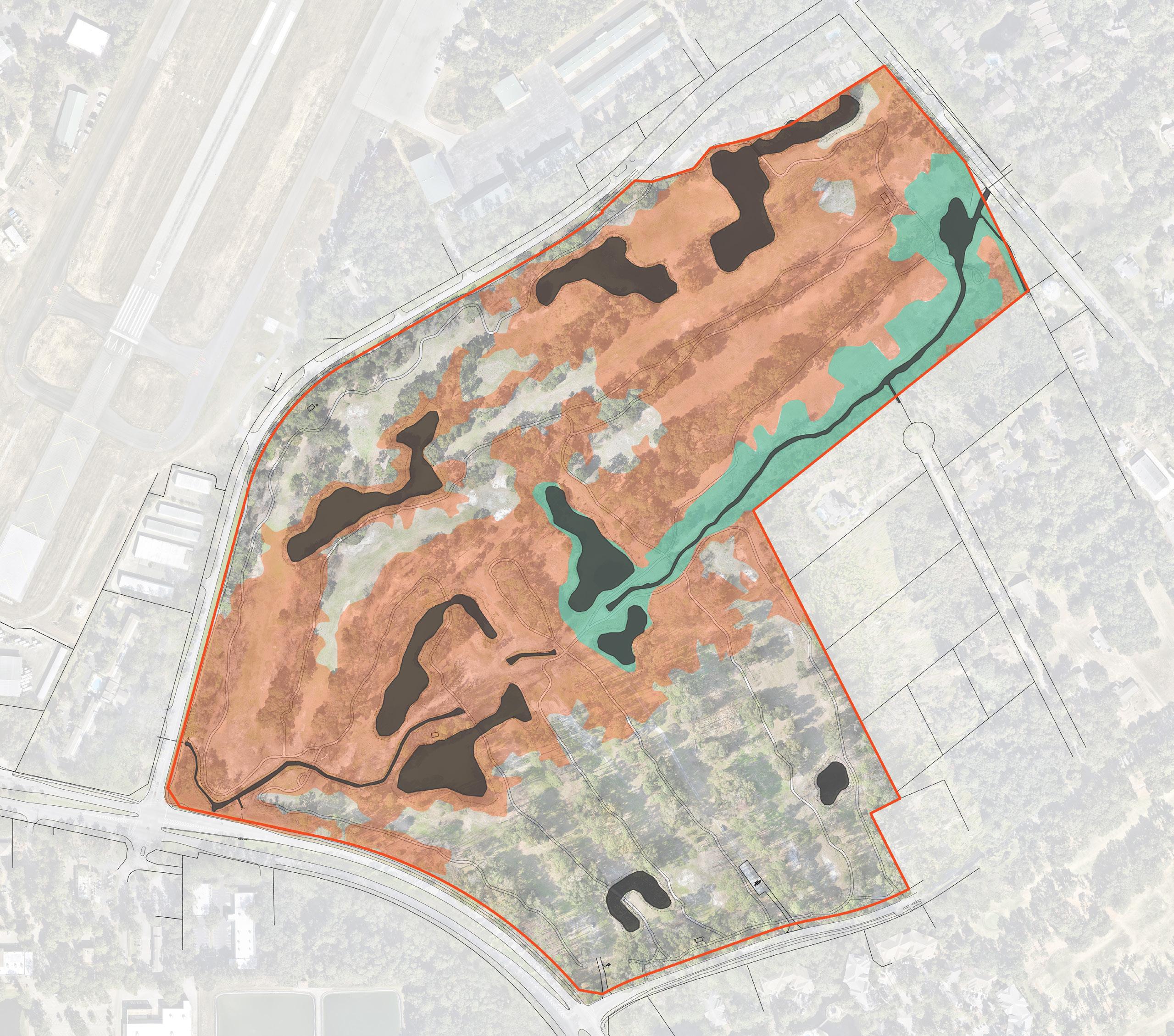
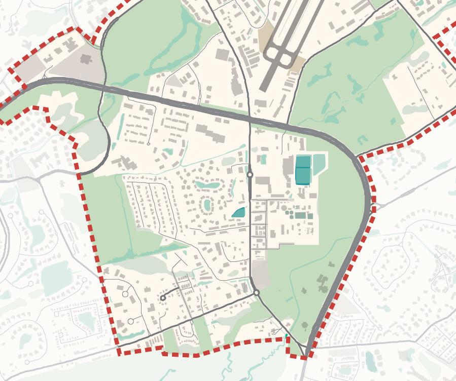
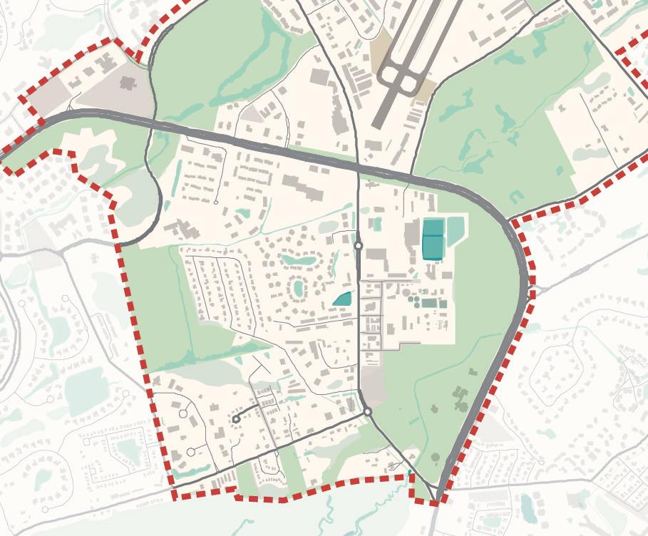
Study Area
District Boundary
Wetlands
Lagoons
Protected
Town-Owned Properties
County-Owned Properties
Plan Alignment
Beginning with the principles laid out by Charles Fraser that set the standard for the character of the Island, the Town of Hilton Head Island has had a strong culture of planning. The Mid-Island District Plan builds on numerous recent community plans that guided this work. Three plans in particular provided insights and direction and they are detailed below. Our Plan
As the 2020 to 2040 Comprehensive Plan for the Town of Hilton Head Island, Our Plan is foundational for the Island’s growth and development. It provides a baseline of existing conditions and outlines goals, strategies, and tactics for the future of the Town and Island community. This document is crafted as a dynamic and informational guide that reflects integral components of the Island community fabric. It also serves as a tool for the Town and community leaders to strengthen and preserve the Island culture, image, character, and unique sense of place.
The Town’s Our Future community engagement initiative developed the Vision for Our Plan. Reinventing Sustainability... Again! is the community’s preferred future for Hilton Head Island for the next 20 years.
“… identify and assist in the preservation of the Gullah Geechee culture for the purpose of detecting and resolving issues specific to its community, including, without limitation, heirs’ property, taxes and land use, economic and sustainability issues for an improved quality of life, and through on-going educational programs, workshops and seminars.” Accordingly, there are three primary purposes for this project:
Create a broad strategy for Gullah Geechee cultural preservation, to include resource preservation and enhancement, interpretation, and heritage tourism.
Identify potential revisions to the Land Management Ordinance (LMO) and other land use and development related policies to better accommodate the use and development of Gullah lands.
Identify tools for addressing the heirs’ property issues, which greatly limit what Gullah land owners can do with their land because of a lack of title to their property and related legal hurdles.
Parks and Recreation Master Plan
The Parks and Recreation Master Plan reviewed current park conditions and classifications to set a baseline of services and needs on the Island. The plan outlines opportunities for both park improvements and new parks to continue to build a system of park spaces and trails that ensure that residents and visitors alike have access to best-in-class parks and open spaces. This plan recommends a program of potential park uses and activities for existing parks (Chaplin Community Park and Crossing Park) and new park spaces (the Mid-Island Tract). This Mid-Island District Plan builds from this base understanding of community needs.
Community Engagement
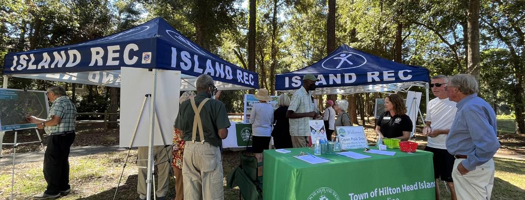
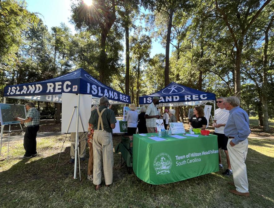
Working in collaboration with Town Staff, the planning team conducted a variety of community events, meetings, and activities to enable a large cross-section of the community to participate in the planning of the Mid-Island District. This included broad-based stakeholder meetings, Open Park Days, multiple neighborhood outreach meetings and Town Council Workshops, and a Community Survey.
More than 100 stakeholders were engaged in the planning of the Mid-Island District through group and individual meetings. Held at the outset of the planning process these discussions helped to shape District recommendations and concepts.
Open Park Days
Held over two days in August and September of 2021, more than 225 people attended Open Park Days to visit the Mid-Island Tract, interacted with Town staff and the planning team, and provided needed input on the future of the Mid-Island District and potential public and private improvements.
Outreach Meetings
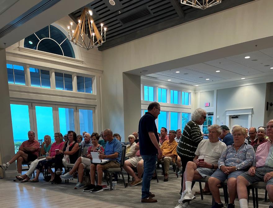
Town staff and the planning team conducted numerous additional outreach meetings to engage each of the Historic Neighborhoods, Port Royal, the Gullah Geechee Land & Cultural Preservation Task Force, and regulatory agencies. These meetings were scheduled to both receive initial input and direction and to share recommendations before completing the final plan.
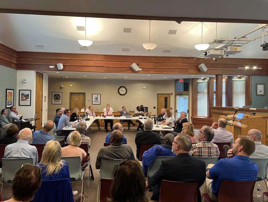
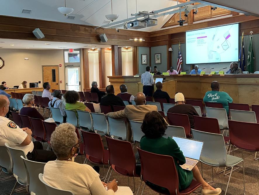
Town Council Workshops
The planning team conducted four Town Council Workshops to understand initial needs and opportunities, review to community input and existing conditions analysis, and iteratively shape MidIsland Tract and District recommendations and concepts. In addition to providing valuable feedback from councilmembers, these meetings also allowed for public comment and community interaction.
More than 1,000 residents participated in an online and inperson survey about the needs, opportunities and future of the Mid-Island District. The majority of survey respondents were daily or weekly visitors to the Mid-Island District. Most of the respondents shop, live or dine in the District as their primary activity. Other reasons respondents spent time in the District include using essential services, going to the airport, using the trail systems and going to work. Respondents also wrote in several common activities including visiting parks and nature, exercise, and bird watching.
When asked what uses or amenities were missing in the Mid-Island District, the majority of respondents selected park space. Given the focus of the District planning on the MidIsland Tract, it is not surprising that the community is interested in protecting natural areas and investing in park space. However, there were also several other common answers that indicate the community sees a need to transform and invest in the District overall. These needs include walkable streets, additional dining and shopping, space for community events, and workforce housing. Respondents also shared their concerns and issues as part of the survey. These responses can be categorized into comments about the Tract and the District as a whole.
What best describes how you spend time in the MidIsland Initiative Area? Select all that apply.
What uses or amenities are missing in the Mid-Island Initiative Area? (n = 1,000)
Open Park Day
Town Council Workshop
Port Royal Community
Gullah Geechee Task Force
Community Survey
Related to the potential of a park on the Mid-Island Tract, the results showed that most would like a park that is natural and is focused on environmental protection. Most would prefer a passive park, but there are a handful of active uses that some would like to be accommodated in a future park. As it pertains to the District, responses provided additional detail focused around traffic, walkability, and safety. Answers also showed that many are concerned about the neglected commercial shopping centers in the core of the district and the need for affordable and workforce housing. Additional concerns include the need for any redevelopment to remain true to the Island’s character and identity.
What other concerns or issues should we be aware of as we plan for the Mid-Island Initiative Area? (n = 563)
Engagement Themes
The survey responses, along with stakeholder interviews and existing conditions analysis helped to shape plan recommendations and concepts. Taken together, these results and discussions show an understanding of the greater community need and opportunity to create a new community park space in the District. There is also a strong sense of the opportunity to have this public investment in park space help to reshape the identity and use of both the commercial areas and the residential areas in the District and directly adjacent to the Mid-Island Tract.
District
• Preserve and protect existing open spaces, creating an interconnected and green District.
• Create a walkable district that seamlessly integrates existing development and neighborhoods.
• Improve connectivity and safety and making it easier to cross William Hilton Parkway.
• Address the condition of existing commercial shopping areas in the Mid-Island District by considering a mix of uses and potential repositioning opportunities that balance the need for housing, commercial, office and airport supporting uses.
• Address the land use and zoning recommendations from the Gullah Geechee Culture and Preservation Project Report to calibrate District recommendations with the needs of the Historic Neighborhoods.
• Create a distinct District identity that provides an overall aesthetic appearance and fits the character of the surrounding neighborhoods.
Mid-Island Tract
• Transform the Mid-Island District into a hub of activity for the entire Town of Hilton Head Island, using the Mid-Island Tract as a catalyst.
• Connect the Mid-Island Tract to other green spaces, parks, and trails.
• Enhance the natural features of the Mid-Island Tract and provide nature observation opportunities.
• Embrace the Gullah history and culture of the site and the island by providing needed community gathering space adjacent to the potential future St. James Baptist Church site.
• Encourage entrepreneurial and cultural understanding in the park by providing space for an open-air market, heritage gardens, and gathering space.
• Ensure that a park on the Mid-Island Tract serves the entire community, residents and visitors alike.
• Consider implementation phasing and broader ongoing maintenance and operations costs in the design of the park, public space and civic infrastructure.
02 DISTRICT ANALYSIS
DISTRICT ANALYSIS
To complement community engagement and plan alignment findings, the planning team conducted an analysis of existing conditions within the Mid-Island District. This analysis considers the following:
• History and Culture: Identify and understand the areas of historic and cultural importance in the District.
• Existing Natural Systems: Map the waterways, open space, preserves, park space and tree cover in the District.
• Existing Multi-Use Paths and Roadway Network: Understand the existing character and function of streets and multi-use paths in the District.
• Existing Zoning and Land Use: Understand the issues around existing land use and zoning that the plan should address.
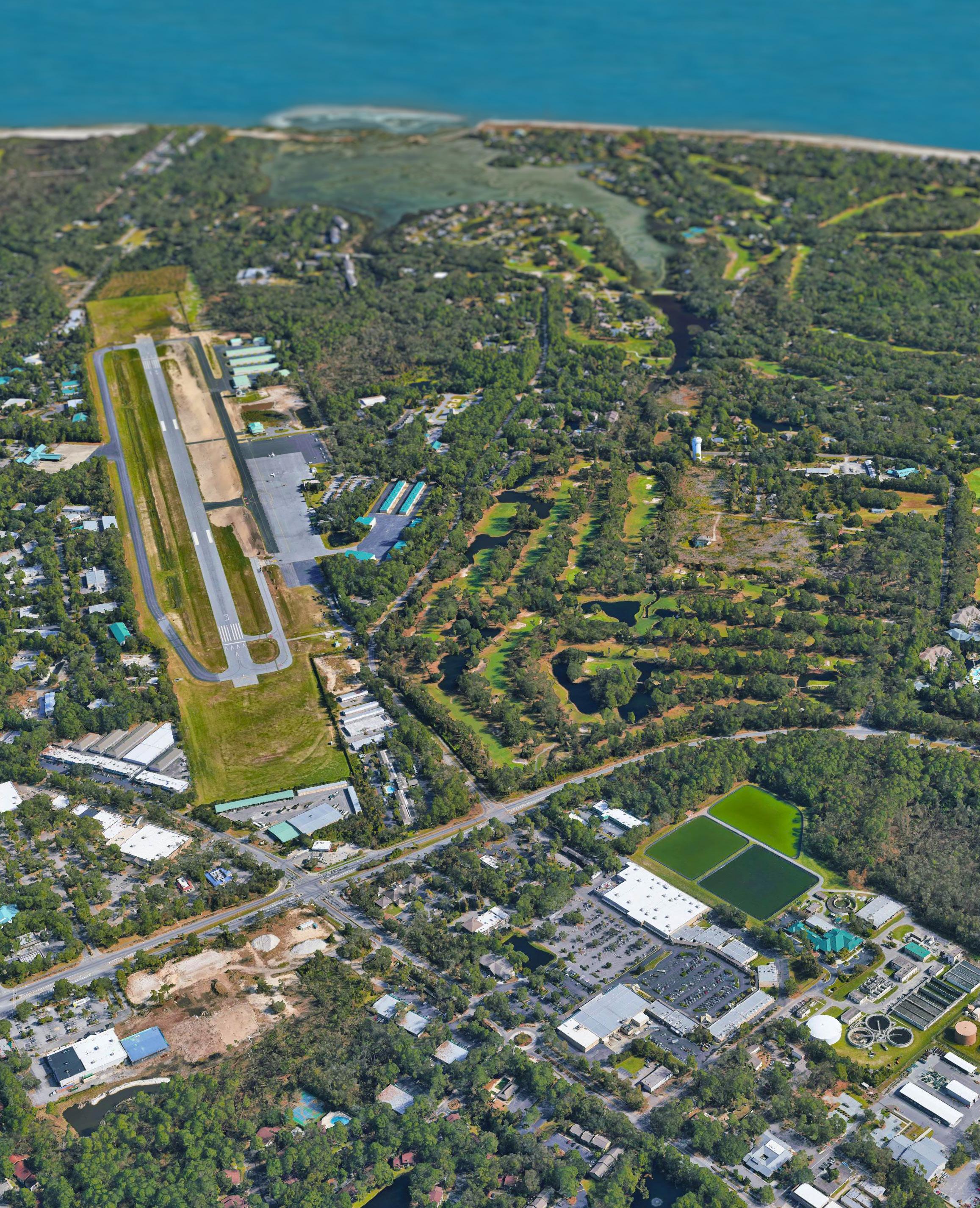
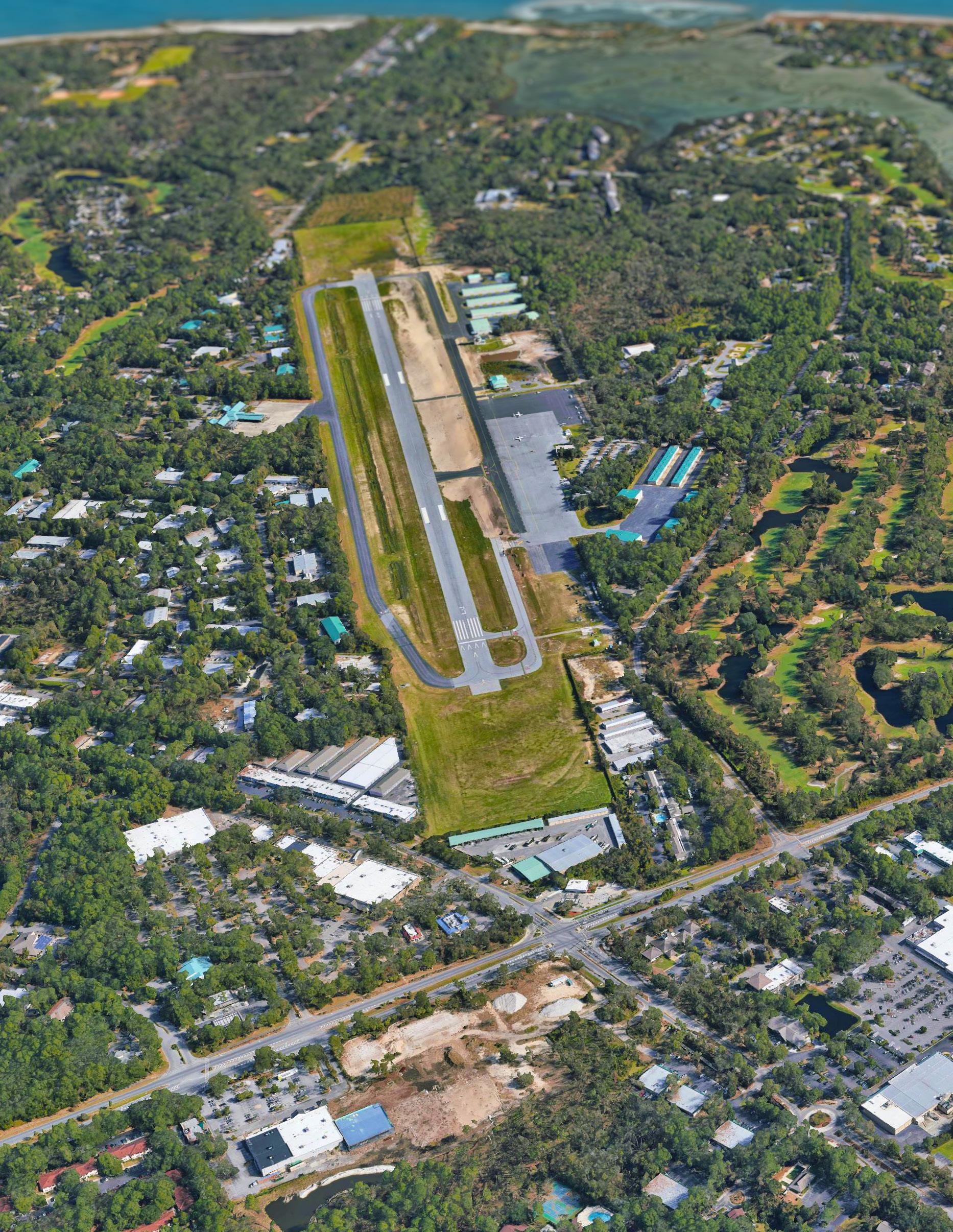
• Airport Considerations: Identify and understand FAA and other regulatory requirements associated with the airport and potential impacts on land uses and development.
• Economic and Market Conditions: Collect information on existing economic and market conditions to determine demand for development and opportunities for revitalization.
This section reviews the findings and understanding for each of these important topics. This analysis forms a basis for planninglevel decision making as the Town considers moving forward with implementing plan recommendations, infrastructure improvements, and investment in public spaces and amenities.
Mid-Island Tract
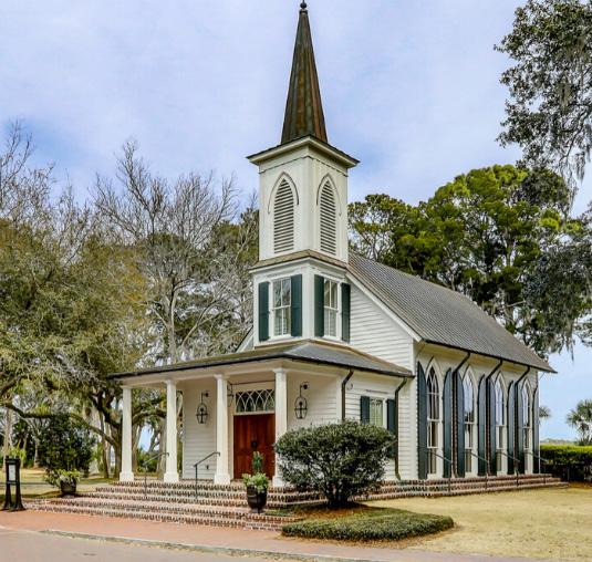
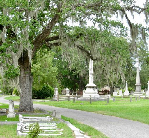
Historic Churches & Neighborhoods
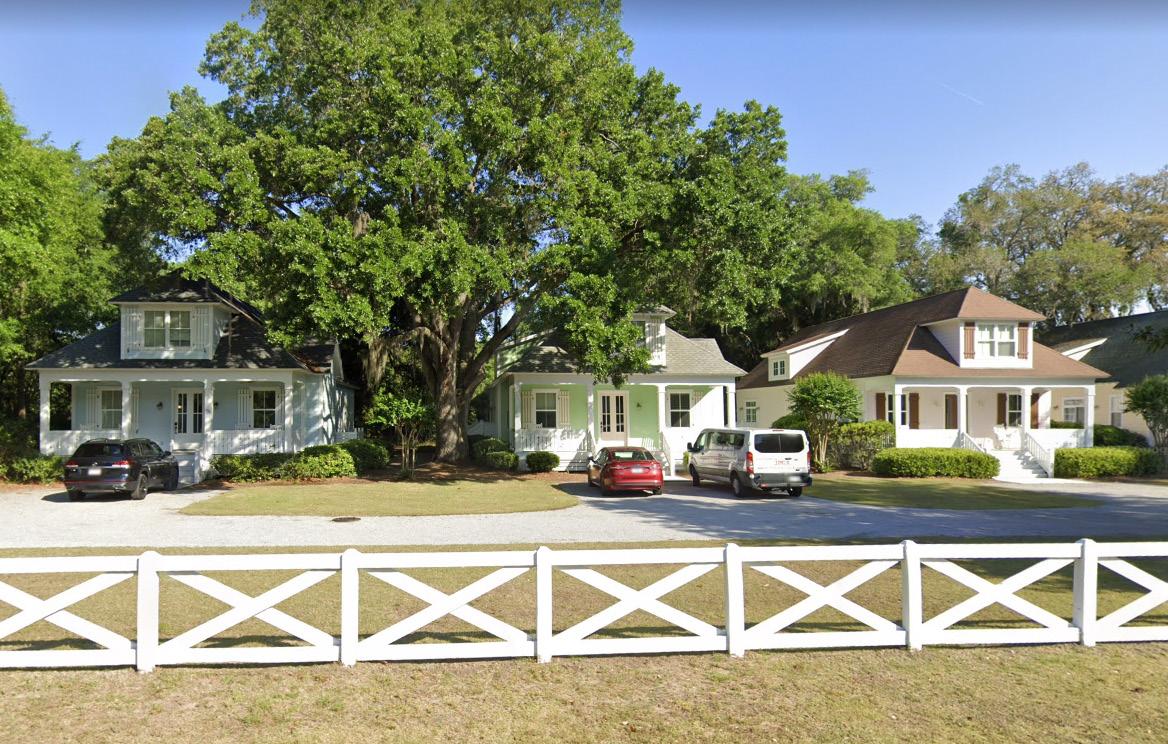
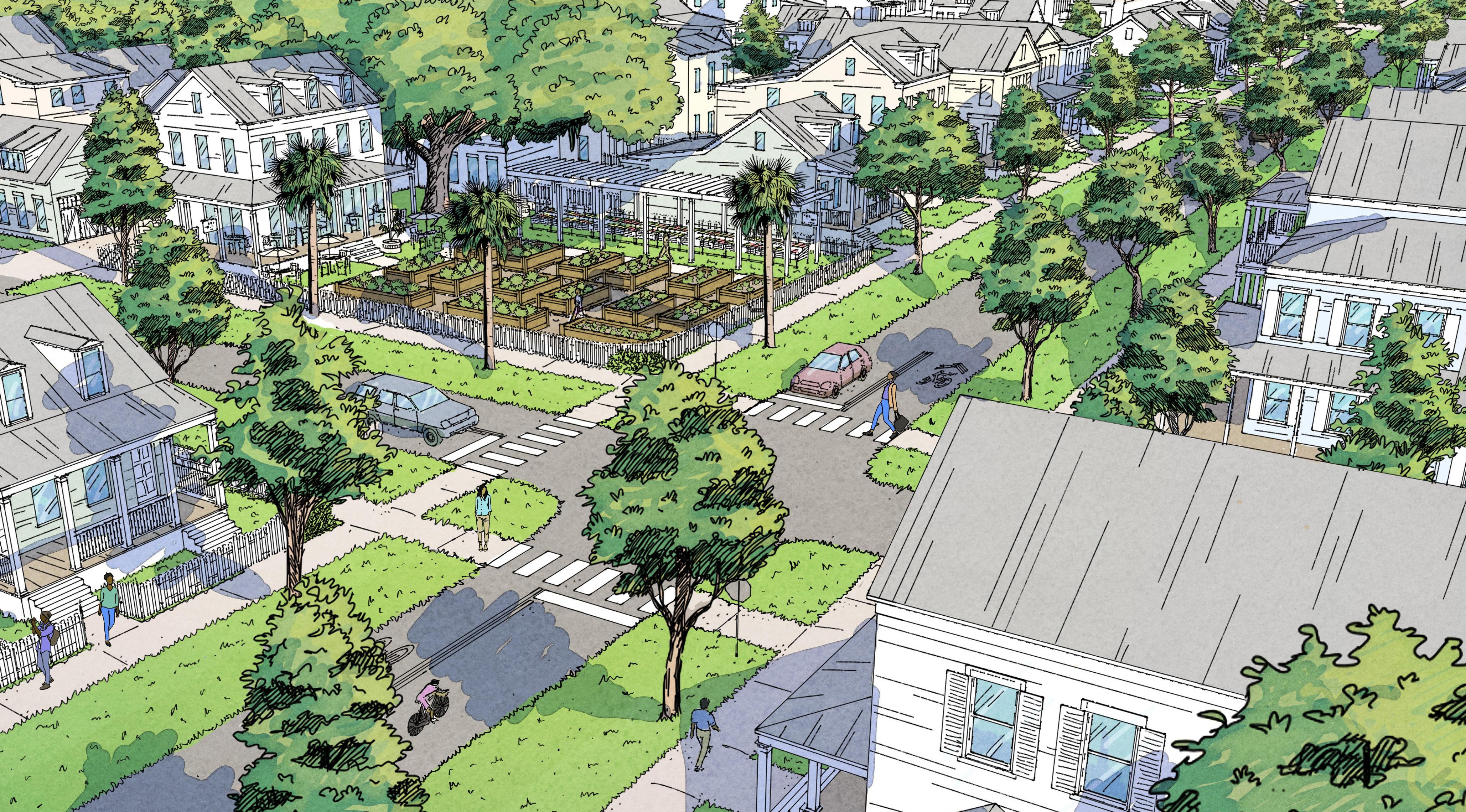
There are five Historic Neighborhoods in the Mid-Island District that are home to native islanders and other residents. Formed in the late 1860s, these Gullah Geechee neighborhoods each have their own unique characteristics and are defined by places of worship and community historic sites. In the Mid-Island District this includes First African Baptist Church, Queen Chapel AME Church, St. James Baptist Church, Historic Mitchelville Freedom Park, the Cherry Hill School, Fort Howell, Drayton Cemetery, and Union Cemetery. The continued self-sufficiency and economic sustainability of these historic communities are an important aspect of this planning work.
Existing Natural Systems
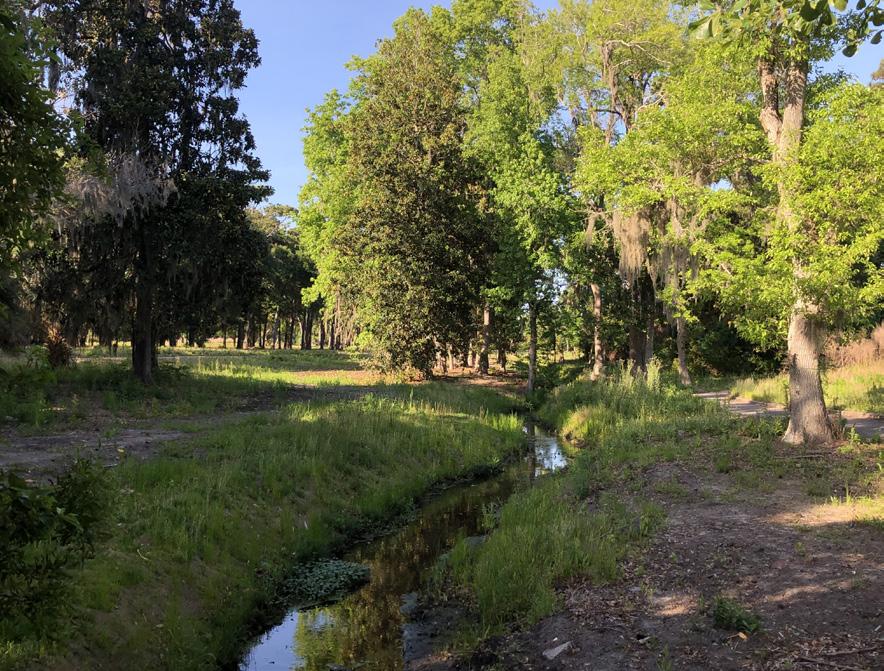
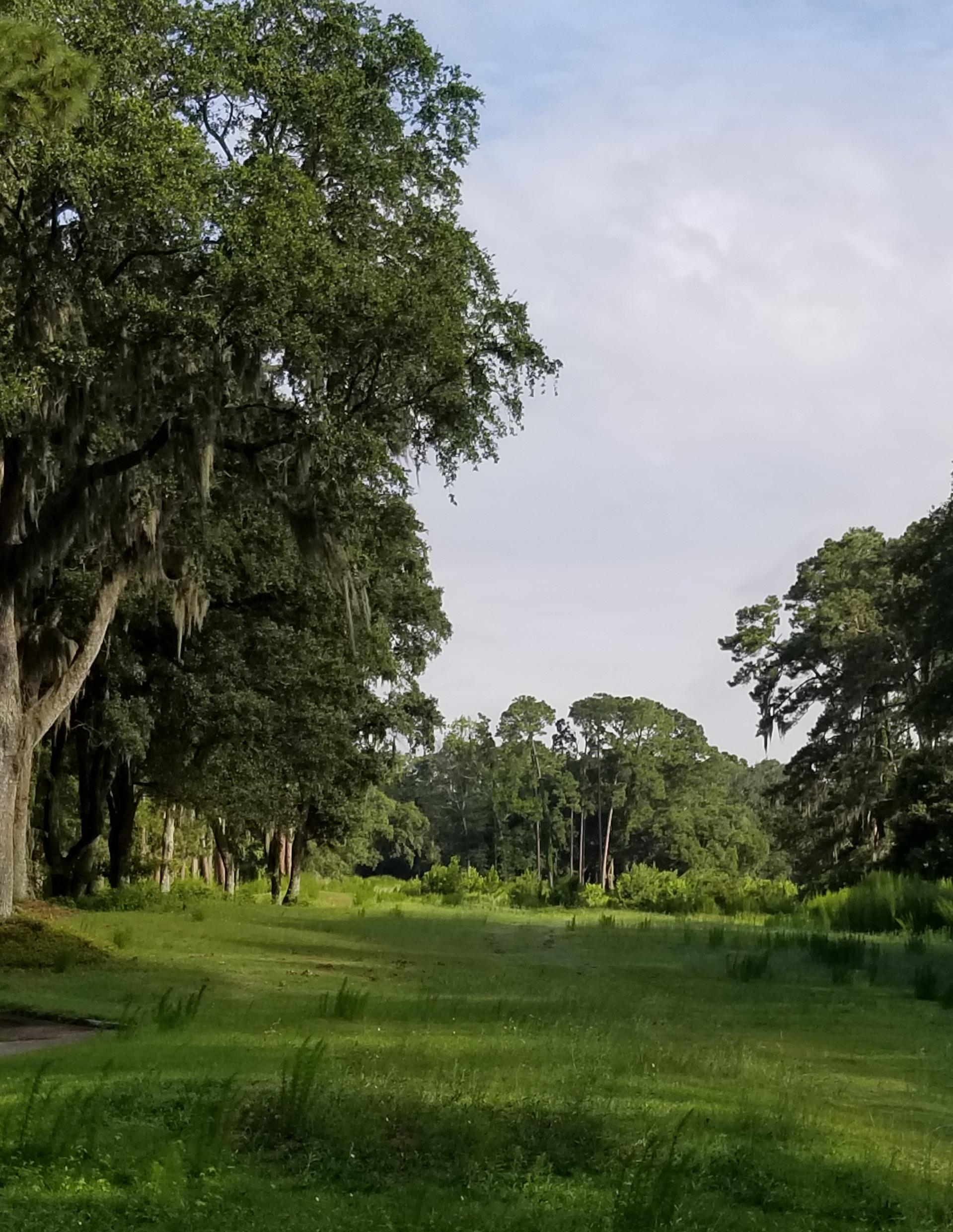
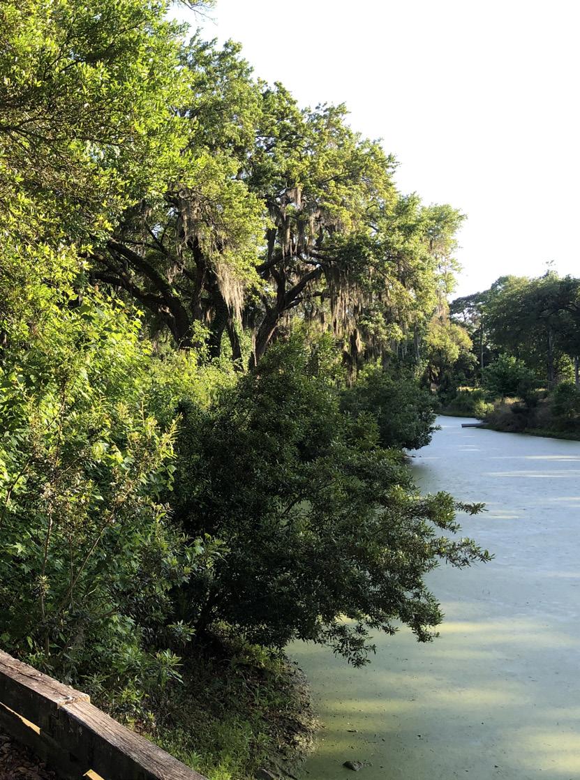
The Mid-Island District is typified by large swaths of open space, nature preserves, parks and tree cover that form an important green network that provides resiliency and sustainability to the area. These natural areas and wetland filter stormwater into surrounding creeks and drainage areas and enable stormwater infiltration and groundwater recharge. These areas also provide important habitat to wildlife. Finally, this green network of natural spaces forms the backbone of island character that should be supported and enhanced.
Existing 500-Year Flood
Because of the connectivity of Coggin Creek to the inlet, much of the Mid-Island Tract falls within the 500year designation. With any changes to this area it is most likely that the 500-year limits would be changed so attention should be paid to design considerations that provide adaptive capacity to the area to prevent flooding on adjacent properties as it does today.
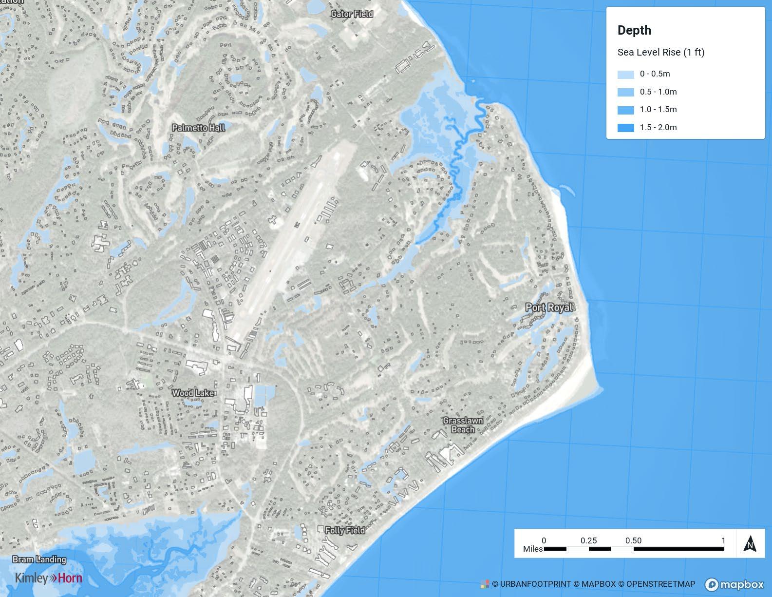
Sea Level Rise
Sea level along the U.S. coastline is projected to rise, on average, 10 - 12 inches over the next 30 years (2020 - 2050), which will be as much as the rise measured over the last 100 years (1920 - 2020). Sea level rise will vary regionally along U.S. coasts because of changes in both land and ocean height. Sea level rise will create a profound shift in coastal flooding over the next 30 years by causing tide and storm surge heights to increase and reach further inland. By 2050, “moderate” (typically damaging) flooding is expected to occur, on average, more than 10 times as often as it does today and can be intensified by local factors.
Hilton Head as a barrier island, and more importantly the northern end of the island adjacent to the mouth of the Broad River in Port Royal Sound, is move susceptible to sea level rise in combination with erosion and increased inland runoff levels.
With the projected 1 ft of sea level rise modeled, most of the Mid-Island Tract is not influenced by this increase. However, with additional upstream flooding, erosion and sedimentation, the property over the 30-year horizon could become more susceptible to these conditions.
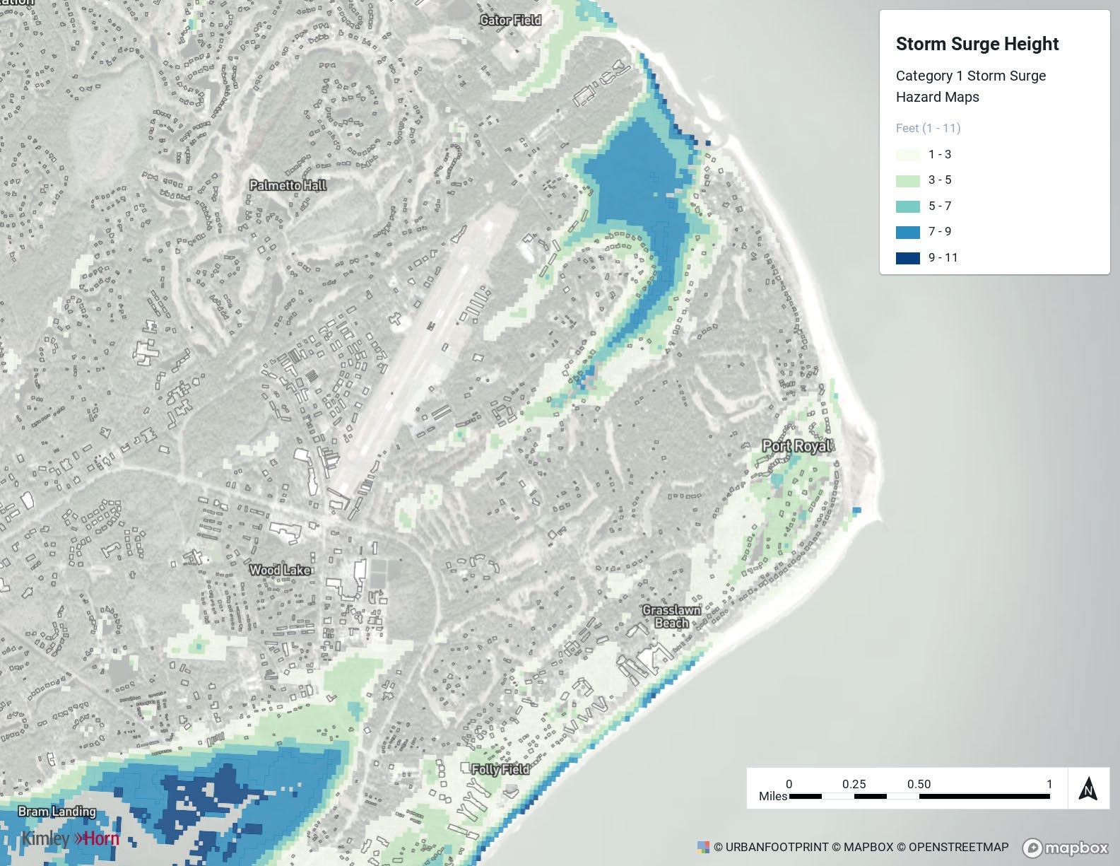
Category 1
Category 1 storm will have minimum inundation from storm surge in the District.
Inundations follows the natural water course path coming from Coggin Creek.
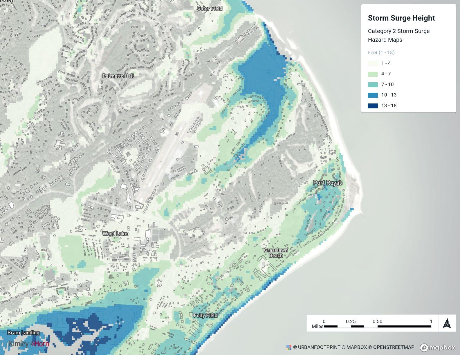
Category 2
Category 2 storm will have complete water inundation on the Mid-Island Tract from storm surge.
Inundation is maximum around 9 feet following Coggin Creek through the property.
Majority of property will have a maximum of 4 feet inundation.
Category 3
Category 3 storm will have complete water inundation from storm surge on the Tract and much of the District.
Inundation is maximum around 13 feet following Coggin Creek through the Tract.
Majority of Tract will have a maximum of 9 feet inundation.
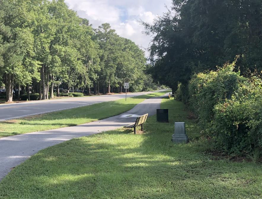
Existing Multi-Use Paths
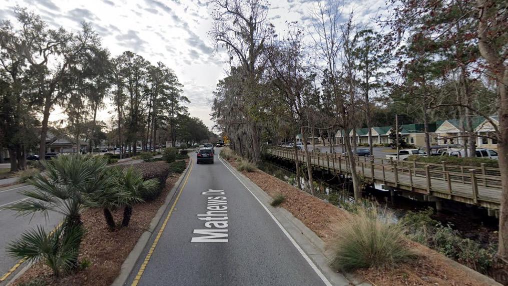
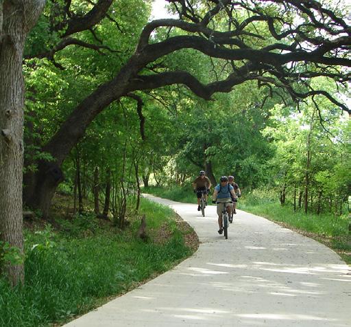
The Mid-Island District is connected by a series of multi-use paths that run along major roadways and provide linkages to existing community assets and destinations and the rest of Hilton Head Island. There are no major gaps in the path network, but there is an opportunity to improve service by adding pathways on both sides of busy corridors, especially William Hilton Parkway and Mathews Drive. As improvements are planned to the Mid-Island Tract, the Ashmore Tract and other nearby developments, attention should be paid to adding connections and access.
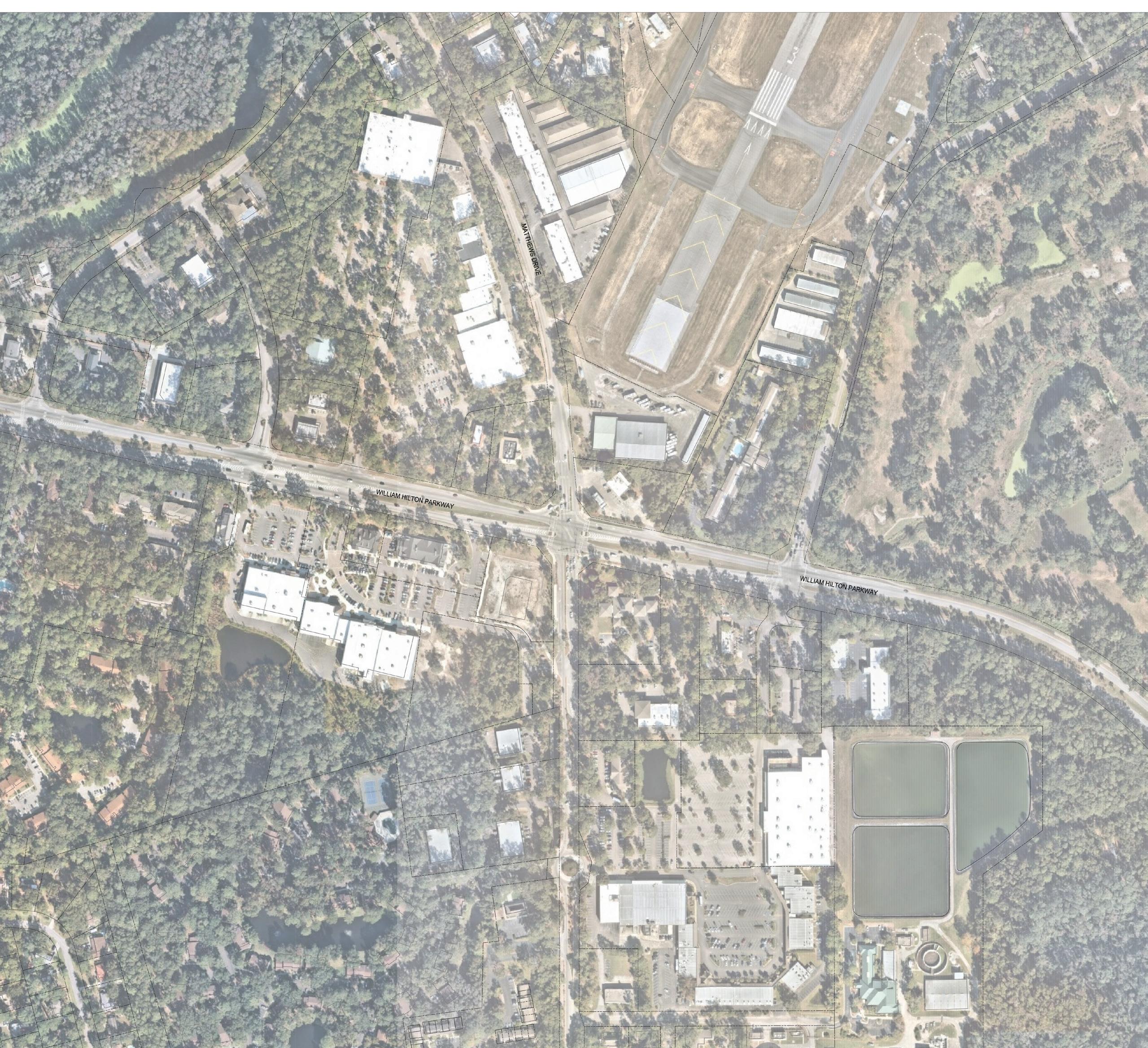
Existing Roadways
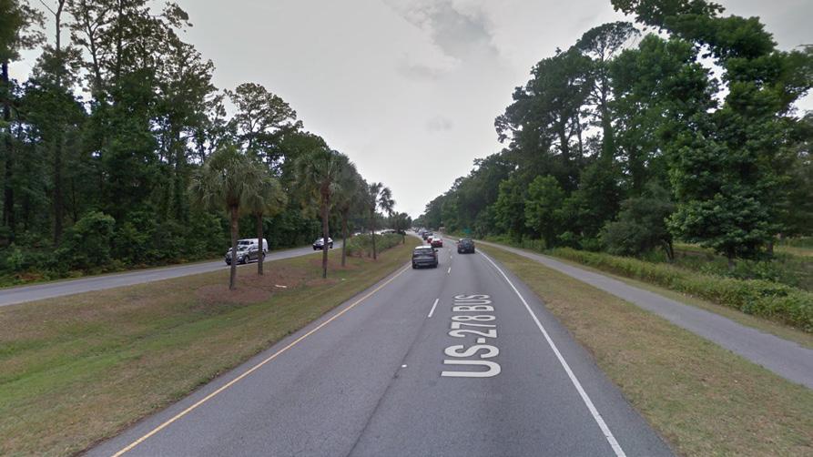
William Hilton Parkway bisects the Mid-Island District and connects it to the rest of Hilton Head Island. As a wide, highspeed roadway, it also acts as a barrier between the northern and southern portions of the District. There are several minor arterials in the District, including Union Cemetery Road, Dillon Road, Beach City Road and Mathews Drive. These mostly two lane roads provide access to neighborhoods and destinations but lack consistent streetscape treatments that could make them more walkable and bikeable. Throughout the District, attention needs to be paid to safe crossings where these minor and major arterials intersect. At the core of the district, around the Mid-Island Tract, the level of service (LOS) for William Hilton Parkway and both signalized intersections at Mathews Drive and Dillon Road operate
LOS
or better and the unsignalized intersection at Union Cemetery Road
Use
MS - Main Street
MV - Mitchelville
PD-1 - Planned Dev.
PR- Parks & Rec.
RM-12-Moderate-High Density
RM-8-Moderate Density
RM-4-Low-Moderate Density
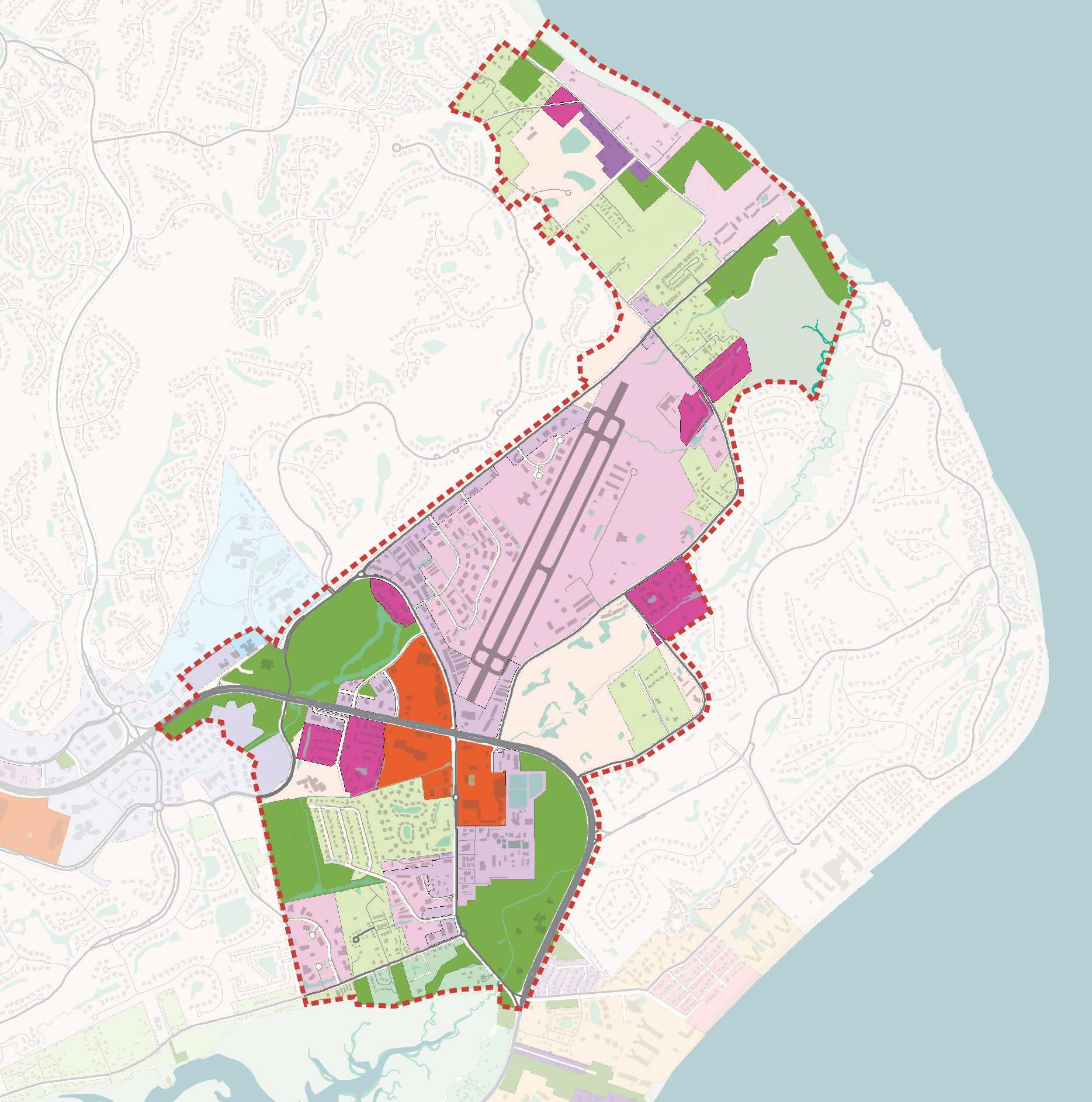
Existing Zoning
Existing zoning in the Mid-Island District is predominantly in residential, commercial, light industrial and parks and recreation categories. Residential and parks and recreation zoning categories – with some pockets of light industrial –typify the edges of the District, while the shopping centers and the airport represent light industrial, light commercial and community commercial uses in the center of the District. While there are some pockets of denser residential allowed, most of the District is RM-4 which allows for anywhere from 4 to 8 dwelling units an acre depending on parcel size.
District Boundary
Retail/Service/Sales
Office
Light
Utilities
Government Facilities
Airport
Institution
Multi-Family Residential
Single-Family Residential
Cemetery
Park-Passive Recreation
Open Space/Undeveloped
Existing Land Use
There are 14 different land use categories within the Mid-Island District. Uses along William Hilton Parkway, Mathews Drive, and portions of Dillon Road represent the primary retail/service/sales and office uses in the District. The area directly west of the airport is a mix of retail/service/sales, light industrial, and vehicle services uses, as is the area along Marshland Road though it has some residential uses mixed in. Baygall and Grassland are largely comprised of residential and park/open space uses, while Mitchelville and Big Hill have a number of other uses mixed in. Looking ahead, the Future Land Use Map for the District could be simplified to reflect community desired uses and development patterns.
William
District Boundary
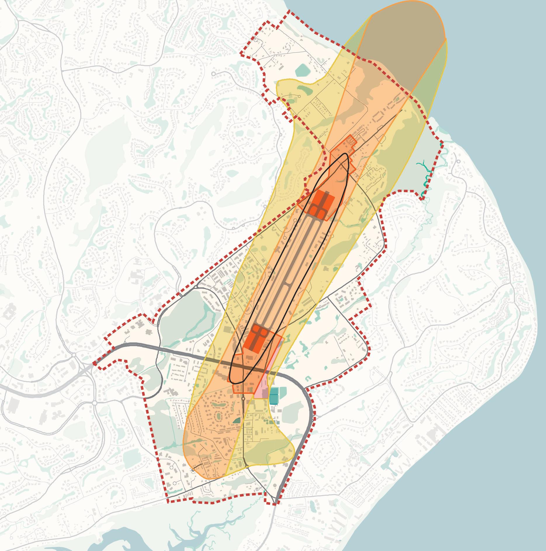
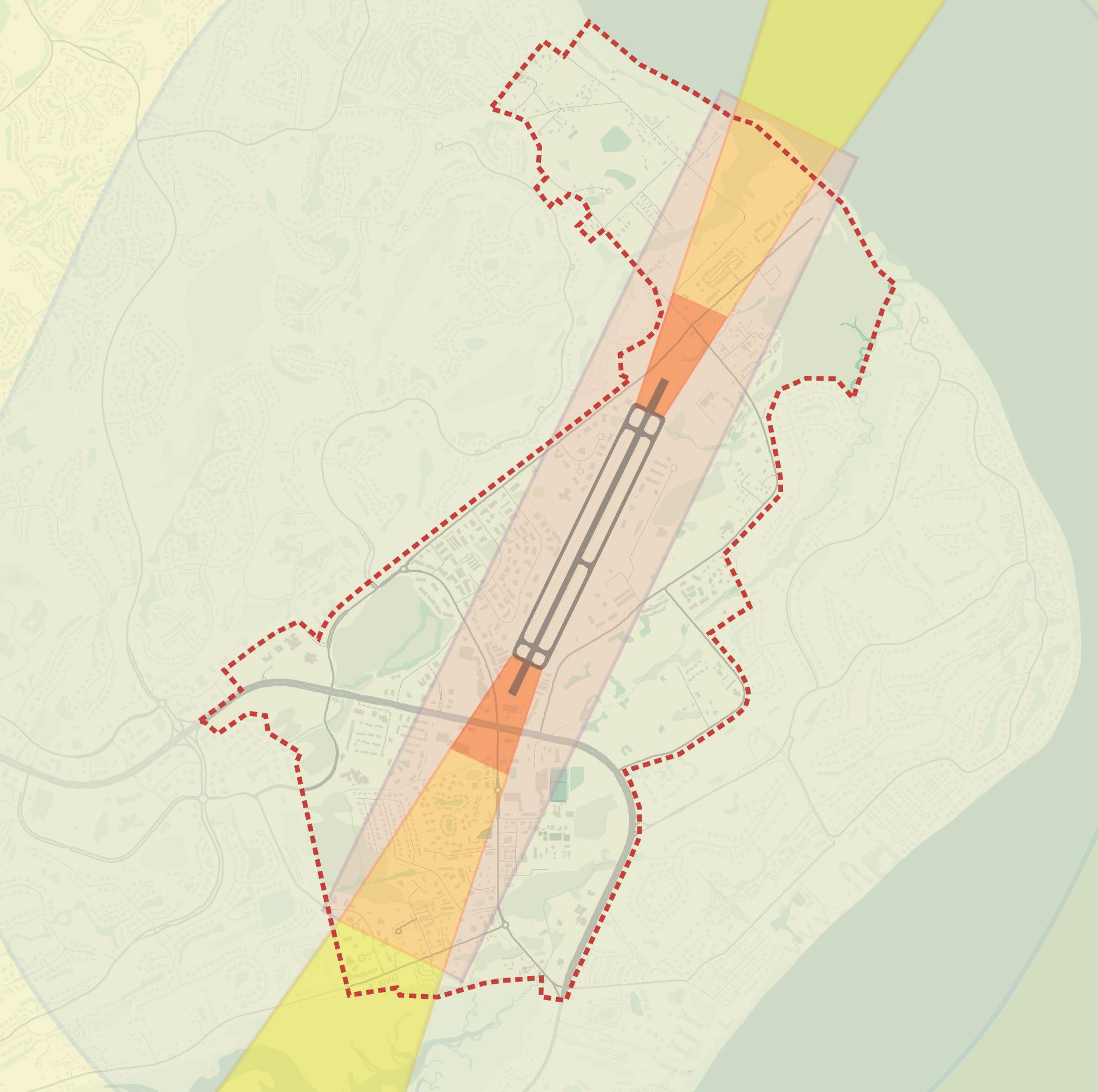
LDN65 Noise Contour
65 decibels average over a 24 hour period. This is equivalent to laughter or a conversation. Residential development is prohibited.
LDN60 Noise Contour
Noise mitigation measures are encouraged for all proposed residential development. No use can create electrical interference with navigational signals or radio communication.
Approach Area
From the sides: 250 feet from the airport primary surface area the height limit increases at a rate of 1 foot per 7 linear feet to a maximum of 75 feet in height.
From ends: height increases upward at a rate of 1 foot per 34 linear feet. Outer Hazard Outer Hazard Inner Runway Hazard
Prohibited Uses: Uses designed to serve children or those with low effective mobility (day care, hospitals, nursing homes, etc.)
Prohibited uses and height restrictions No Structures / Buildings. All uses other than airport runway related are prohibited.
Noise Contours
The Town of Hilton Head Island uses the Noise Contours from the Hilton Head Island Airport to guide develop near the airport and runway. In certain areas like the Inner Runway Hazard all uses not related to the airport are prohibited. Whereas, other zones like the Outer Hazard, Approach Area and LDN60 Noise Contour have prohibited uses and height restrictions.
District Boundary
Zone A - Runway Protection Zone
Zone B1- Airport Inner Approach and Transitional Zone
D - Airport Vicinity Zone Zone C - Airport Inner Approach and Transitional Zone Zone B2 - Airport Outer Approach Zone
E - Airport Vicinity Zone
FAA Hazard Zones
The Hilton Head Island Airport also has FAA Hazard Zones that have their own guidelines for development and height restrictions. The standards are guided by the zones shown in the graphic above and follow the airplane approach and flight zones. These zones helped guide the development patterns and height recommendations set forth in this document.
MARKET ANALYSIS
Demographics
As of the 2020 United States Census, Hilton Head Island hosted a total of 37,661 residents on a permanent, full-time basis. Population growth since 2010 has been modest across the Island, adding less than 600 people over the last ten years. Historically, growth on the Island has been constrained by an established land use pattern, with new residential development largely consisting of smaller-scale infill projects. The northern half of the Island, including the Mid-Island District, contains approximately 62.4% of the total population. It’s also important to note that Hilton Head Island has a large population of second homeowners, as well as an influx of seasonal workers and visitors, that keeps the population count in daily fluctuation.
While growth of permanent residents on Hilton Head Island has been modest, the larger Hilton Head Island-Bluffton metro area has experienced rapid increases in population in the last several decades. Neighboring Bluffton has consistently been one of South Carolina’s fastest growing communities. The growth of the larger region is no doubt influential for Hilton Head Island’s local economy.
Residents of Hilton Head Island are comparatively older than the surrounding region, which tends to attract more families. The northern side of Hilton Head Island (HHI North) is comparatively younger than the south. The median age of northern island residents is 52.7, compared to 61.2 in the south, and 38.4 for the region. Hilton Head Island’s attraction as a retirement and aging-in-place destination has resulted in strong growth in older age groupings, resulting in a notable increase in median age over time. Approximately 14% of population in HHI North are children.
Median household incomes are highest in the southern half of Hilton Head Island; however, both areas on the Island are higher than the County and the region. The largest concentration of households in HHI North earn more than $86,000 annually.
POPULATION FORECAST, HILTON HEAD NORTH, 2021
The tourism and service support industries have historically been the primary economic driers for Hilton Head Island. The community’s Our Plan (2020-2040 Comprehensive Plan) notes a goal of diversifying the economy to attract different professions and age groups to the Island in the future. In total, Hilton Head Island had an estimated 33,620 jobs in 2020, representing 13.6% of the regional total. Hosting many larger-scale shopping destinations and resorts, the southern portion of the Island contains a slightly larger share of the total (52.9%). The norther portion of the Island hosts approximately 15,830 jobs.
The largest employment sectors align with the tourism economy, with Trade & Transportation, including retail services, and Leisure and Hospitality representing nearly half of the total. Other notable employment industries include Professional Services (16.2% of the total), Construction, (12.4%), and Education and Healthcare (10.5%). It should be noted that since 1990, visitors to the Island have increased by more than 65%, driving continued demand for retail, service, and hospitality jobs. More than 2.6 million people travel to Hilton Head Island each year; these jobs will be an important local economic driver in the shortand long-term.
When comparing the northern and southern portions of Hilton Head Island, the northern portion’s largest industry is Education and Healthcare, comprising 40.0% of all jobs. The southern portion of the Island is more heavily influenced by Leisure and Hospitality jobs at 52.3% of the total.
Commuting Trends
As of 2019, more than 14,820 people commuted onto Hilton Head Island for employment, more than twice the number of employed residents that traveled off (6,399). In addition, 8,419 employed residents live and work on the Island. The demands of the local tourism economy and service industry requiring a large workforce is evident; however, housing affordability and a higher cost of living have had a notable impact on commuting for these employees.
The most common locations of work for employed Hilton Head Island residents are:
• Hilton Head Island (58.6%)
• Bluffton (4.0%)
• Burton CDP (3.2%)
• Savannah (2.0%)
• North Charleston (1.6%)
With a high percentage of employed residents living and working on the Island nearly two-thirds have commutes of less than ten miles.
Commuting In and Out of the Island
14,820
6,399
8,419
Mid-Island Tract
Mid-Island Tract
Housing Considerations
Housing units in the northern portion of Hilton Head have a median age of 1990, slightly older than the median for Beaufort County. The value is notably higher, approaching $500,000 per unit. Consistent with trends across the County, the share of vacant housing units is elevated due to seasonal residents that do not live full time on the Island. However, it should be noted that the vacancy rate of HHI North is approximately one-half than HHI South. Although the distribution of housing units by type generally mimics the County, HHI North has a higher share of multifamily, driven by condominium developments on or near the beaches.
Nearly two-thirds of all home-ownership units in the northern portion of the Island are valued at greater than $400,000. Rental rates are at or above $2.00 per square foot for professionally managed communities. Aquatera, another third market-rate multifamily community is nearing completion. There are currently no units available at either community. Based on the average wage for workers in Beaufort County of $44,435 annually, price points that could support sustainable housing costs would be $1,250-$1,300 per month, well below the median prices for most ownership or rental available (based on 30% monthly income).
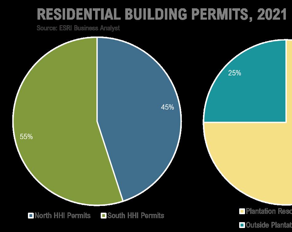
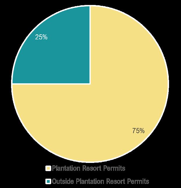
Through November of 2021, there have been 498 permits pulled to construct new residential units on the Island. Approximately 72.0% of the new residence permits were pulled on the northside of the Island. The northside share is bolstered by a 260unit multifamily project at 55 Gardner. A further analysis was prepared for permits pulled within the plantation resort neighborhoods, which captured approximately one-third of the total. The plantation resort permits were pulled for pre-platted, entitled lots, versus the 66.4% that represent newly platted projects or infill opportunities.
Residential
Building Permits
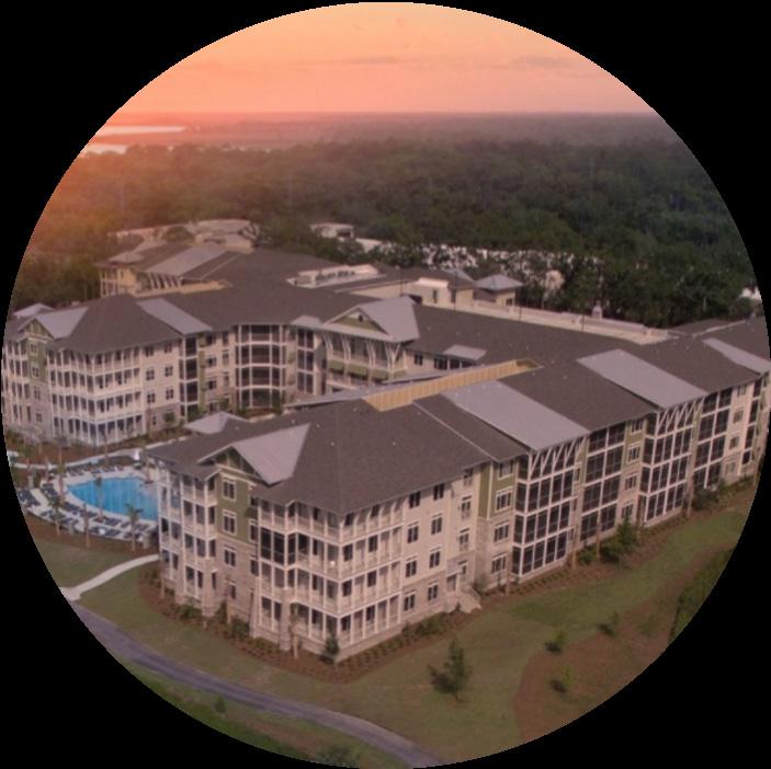
Water Walk at Shelter Cove Towne Centre
Built in 2017
240 one-, two-, and three-bedroom units
Avg. Rent: $3,523/month
$2.25 per SF
Occupancy: 100%
Marsh Point Apartments
Built in 1990
140 one- and two-bedroom units
Avg. Rent: $1,746/month, $1.94 per SF
Occupancy: 100%
Hilton Head North
Hilton Head South
Initial Demand Analysis
Population and job forecasts were prepared based on transportation analysis zone data prepared by the Lowcountry Council of Governments. It also incorporates the most recently released US Census baseline information available. Population growth in the northern part of the Island is expected to follow recent trends, reflecting modest increases over the next 20 years. However, the Hilton Head Island-Bluffton region is expected to continue to be an attractor of strong growth over the coming decades. Hilton Head Island’s ability to identify catalytic infill opportunities could result in a higher capture of regional growth. Based on Woods & Poole Economics, a third-party socioeconomic forecasting company, the Hilton Head Island-Bluffton region could reach nearly 360,000 residents by 2060, an increase of 59.3%.
Similarly, job growth is projected to be modest across Hilton Head Island over the next 20 years. The northern portion of the Island is forecasted to increase from an estimated 15,830 jobs in 2020 to 16,535 jobs in 2040, resulting in 4.5% growth over 20 years.
Based on conservative population and job forecasts for the northern portion of Hilton Head Island, the area around Mid-Island could see an increase of 1,500-1,700 residential units, 160,000 to 180,000 square feet of retail space, 55,000 to 75,000 square feet of office space, and 100 to 250 hotel rooms. Of these sectors, office remains the most influx due to the economic dynamics of the local economy and the macro-level influences that continue following the COVID-19 pandemic. Momentum in other sectors will likely be the initial catalysts, followed by office development. Modest demand for industrial space, between 40,000 and 60,000, could be generated in the northern portion of the Island. This would be focused near the Hilton Head Island Airport, which is owned and operated by Beaufort County. Future plans for the Airport include renovations to the commercial terminal and parking areas to accommodate the increase in use. These modifications would accommodate the increased traffic for both commercial and private terminals. Industrial demand would largely be focused on smaller footprint users that are seeking a location on the Island to be close to a customer base, including repairs, service, and maintenance facilities.
REAL ESTATE DEMAND CONSIDERATIONS
Housing
Products:
Neighborhood-Serving
Demand Timeframe Mid- term
Market Considerations
• Population growth has been modest; available land will continue to be the limiting factor
• Increase housing options to support a wider range of age and income cohorts
• Adds rooftops to support commercial
• Increased housing that is attainable to a widevariety of incomes could result in a reduction of commuting, especially in a tourism economy
Market Considerations
• Retail in a state of flux
• New development will seek premier locations
• Important component of mixed- use projects
• Role for services beyond traditional retail
REAL ESTATE DEMAND CONSIDERATIONS
REAL ESTATE DEMAND CONSIDERATIONS
REAL ESTATE DEMAND CONSIDERATIONS
Office Product:
• Capitalize on nearby parks and open space to draw in customers
Considerations
• Continued recovery from pandemic
• Smaller- scale neighborhood- services targeting Island residents as customers
• Will seek amenitized locations
• Smaller medical offices and urgent care clinics to address increases in seniors and tourists
•
Hilton Head Island North: 20-Year Demand (2021-2041)
The area immediately surrounding the Mid-Island District offers clear opportunities that could drive future development and redevelopment potential. Each of the opportunities, whether existing like the surrounding full-time, permanent residents and established neighborhoods, Hilton Head Island Airport, or a job base supporting the node of light industrial space, or future possibilities focusing on development/ redevelopment along Business 278 (William Hilton Parkway) suggest clear momentum on the northern portion of the Island. Increased recreation amenities in this dynamic area will further the opportunities to create a uniquely livable area on Hilton Head Island.
CREEK
Aviation restrictions could impact the types, heights, and intensities of real estate development depending on proximity and air travel patterns.
Existing node of light industrial uses supports job creation and serves residents, businesses and airport. Workers could drive demand for retail services.
Established neighborhoods like Port Royal Plantation are less transient than elsewhere on the Island. A higher share of families require services and recreation amenities.
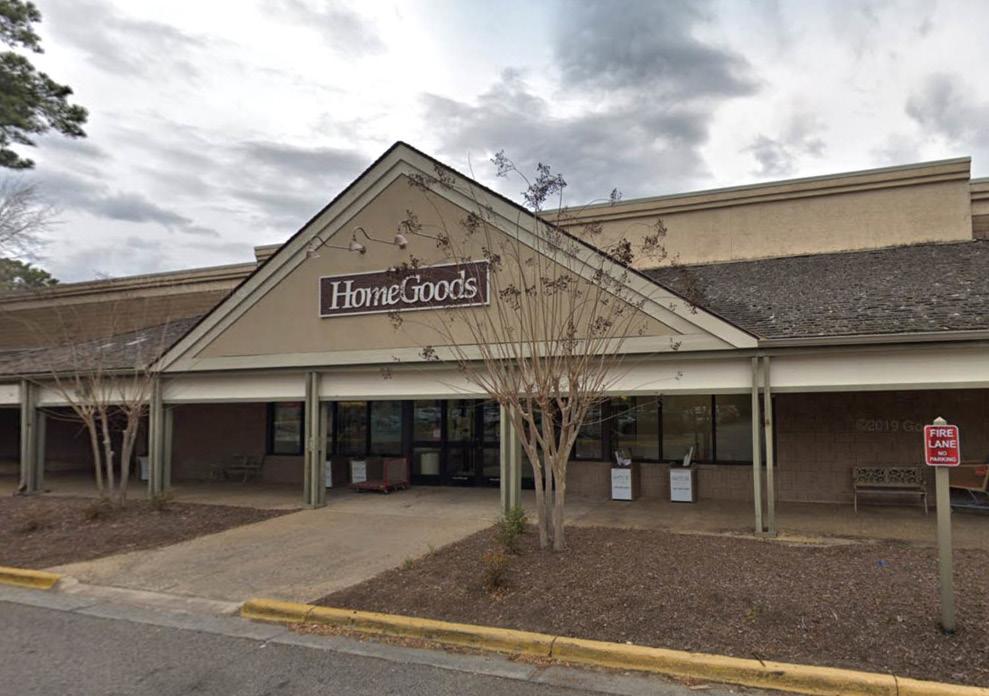
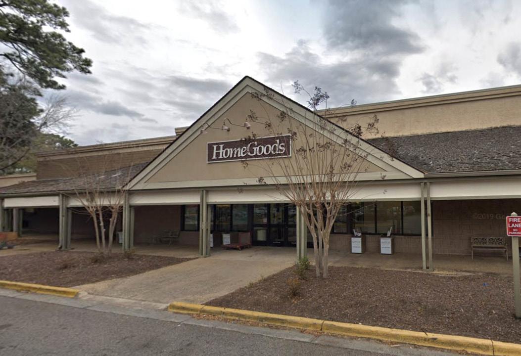
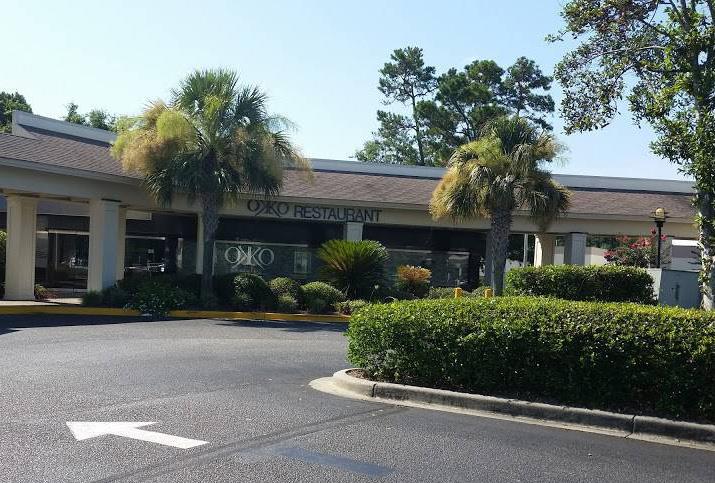
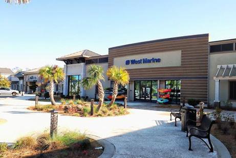
Nearby shopping centers vary in age and performance. Sea Turtle Marketplace has experienced recent revitalization but has additional areas for infill. Port Royal Plaza has a vacant anchor space and could be ripe for reinvestment. Northridge Plaza has seen some recent investment in parking lots and landscaping, but has an opportunity become a more active place in the Mid-Island.
Park amenities could represent an important catalyst to attract development.
ISLAND AIRPORT COGGIN
Hilton Head Island Airport
Existing Industrial
Established Neighborhoods
Nearby Retail/Infill Opportunity
Northridge Plaza Airport Area
03 STRATEGIC DIRECTION
GUIDING THEMES
Community engagement and existing conditions analysis helped the planning team, Town Staff and Town Council to develop three themes to guide future planning and redevelopment in the Mid-Island District.
1. Protect and Enhance: The plan must honor people and place by protecting and enhancing the neighborhoods, the culture and history, the natural environment, the preserves and parks, and the parkway character of Mid-Island District and Hilton Head Island by investing in a best-in-class park, creating community and cultural gathering space, and enabling economic opportunity.
2. Connect: The plan must connect people, open spaces, neighborhoods, and community hubs through a network of multi-use paths, complete streets, and transit.
3. Evolve: The plan must reconsider future land use in the District to allow for a mix of uses, residential infill and neighborhood commercial uses.
This section sets the stage for public and private investment in the Mid-Island District by reviewing design considerations, street characteristics and connections, and future land use. This strategic direction directly informs the development of three Focus Areas that will be detailed in the next section of the plan.
PROTECT + ENHANCE
• PEOPLE
• NEIGHBORHOODS
• CULTURE AND HISTORY
• NATURAL ENVIRONMENT
• PRESERVES & PARKS
• PARKWAY CHARACTER
CONNECT
• PEOPLE
• OPEN SPACES
• NEIGHBORHOODS
• COMMUNITY DESTINATIONS
EVOLVE
• FUTURE LAND USE
• MIXED USE
• RESIDENTIAL INFILL
• NEIGHBORHOOD COMMERCIAL
• REDEVELOPMENT STANDARDS
Protect the Green Network
The Mid-Island District is defined by its green network of parks, preserves, and waterways, marshes, and wetlands. The plan will protect and enhance these natural and park spaces by investing in a new park at the Mid-Island Tract and Ashmore Tract and connecting them to other parks, preserves and open spaces in the District and the rest of Hilton Head Island.
DESIGN CONSIDERATIONS
The following Design Considerations should inform the public and private investment in the Mid-Island District, whether it is redevelopment of a shopping center, the design of a park, a street or roadway improvement or infill residential in an existing neighborhood.
Green … Not Grey
Street trees and landscaping provide many natural, physical, and psychological benefits. They help shape the street and add shade in the summer, add character, increase property value, remove pollutants from the air and soil while generating oxygen, and decrease the amount of stormwater runoff.
Close and Cozy … Not Spread Out
Streets and public spaces should function as an outdoor room, surrounding its occupants in a space that is welcoming and usable. A 1:3 ratio for building height to street width is often cited as the ideal minimum for a sense of enclosure. As a general rule, the tighter the ratio, the stronger the sense of place.
Complete, Varied … Not Single Use
Great neighborhoods have a fine-grained mix of land uses and housing types. This condition enables residents to dwell, work, socialize, exercise, shop, and find some daily needs and services within walking distance. A mix of housing provides options for people with diverse lifestyles and incomes to live in the same neighborhood; residents have the choice to move within their community as their housing needs change over time.
Connected … Not Isolated
Healthy communities are well connected in many ways. Having an interconnected web of streets is the most basic and effective form of bringing a neighborhood together. An interconnected network of streets helps to alleviate traffic by providing many options to get from point A to point B. The need for connectivity extends to all mobility facilities such as connected sidewalks, trails, bike lanes, and transit networks.
Walkable … Not Auto-Focused
The overall size of a neighborhood should be suitable for walking. Most people will walk approximately one-quarter mile before turning back or opting to drive. Neighborhoods of many shapes and sizes can satisfy the quarter-mile radius test. Larger planned communities can establish several distinct neighborhoods, being sure to place different neighborhood centers with some mix of use or community destinations one-half mile apart or less.
Artful, Memorable ... Not Generic
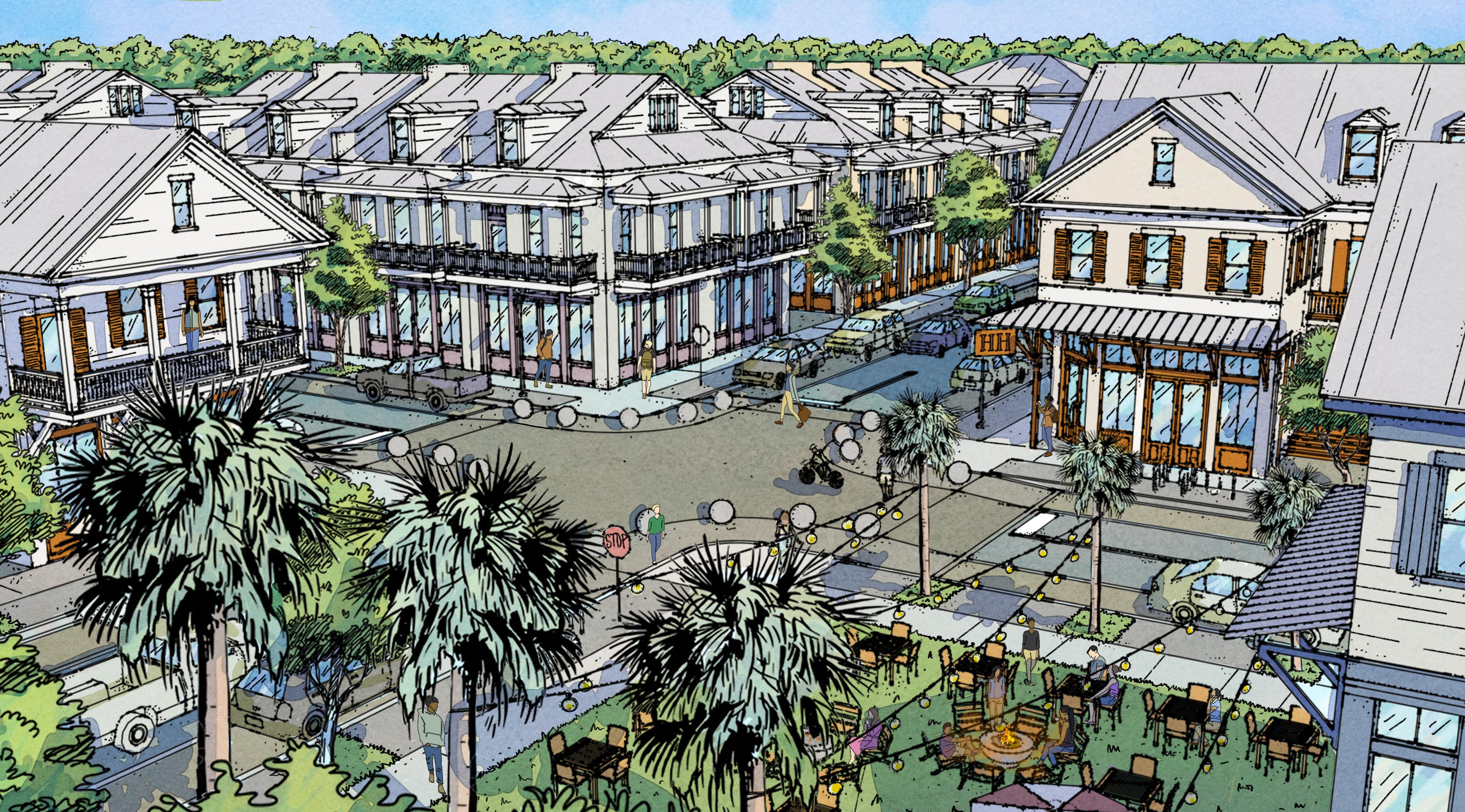
Artful and memorable settlements emphasize the distinctly local features of a place, embracing unique factors such as local shops or businesses, historic features, distinctive native landscaping, local artists, or regional architecture. The best streets and public spaces are the “postcard views” of the Town, high-quality gathering spaces that celebrate local culture.
Close
The Design Considerations are not new ideas; they’re based on a study of new and historic settlements. Taking inspiration from loved and valued streets and neighborhoods in peer communities demonstrates how design can improve quality of life; precedents show how to encourage healthier more active lifestyles, include more chances for interacting with neighbors and growing community, and how to respect and live closer to nature. These are all important goals that can be addressed by designing our built environment better.
There are several local examples of historic small towns of the Lowcountry included in the precedents. These local examples exhibit how to work with geography, climate, and local building materials. Looking closely a common pattern emerges: smaller blocks, narrower, connected streets, a mix of uses and building types – features that are all part of successful walkable places.
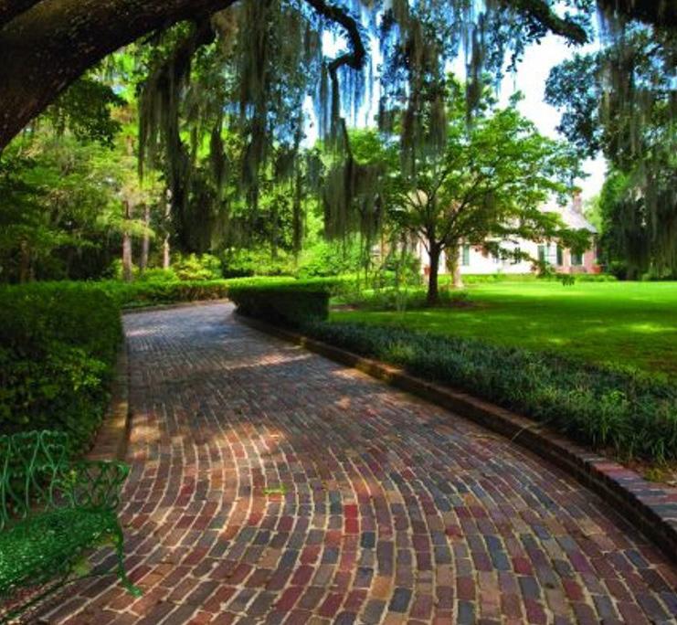
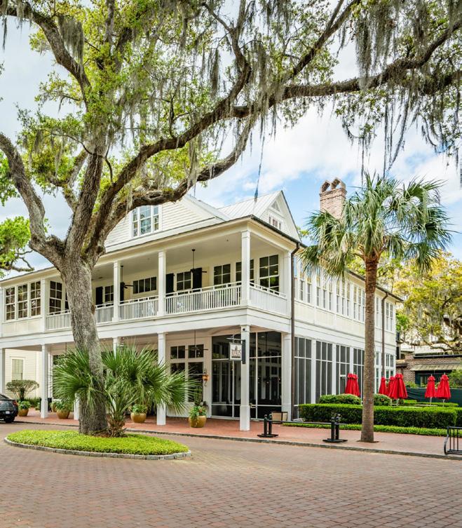
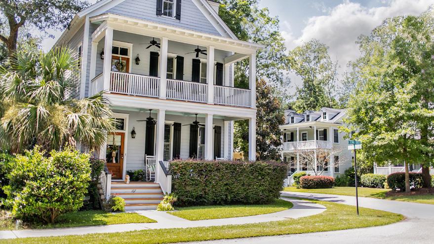
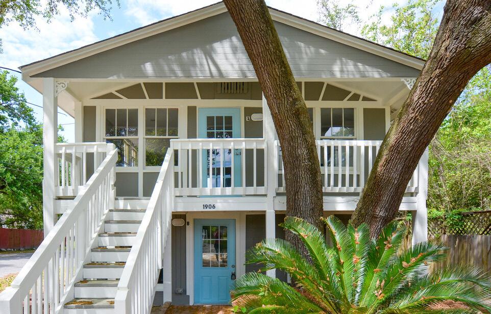
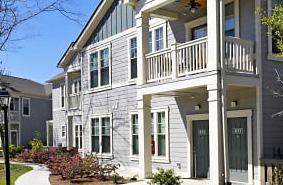
Palmetto Bluff
Palmetto Bluff is an example of new compact walkable neighborhoods designed in harmony with the environment, protecting sensitive environments, trees and habitats while accommodating people and bringing value to the community. The use of Lowcountry vernacular architecture allows the development to fit in seamlessly and feel like it is part of the historic landscape. A variety of building types and park spaces create new wellloved residential areas and neighborhood centers.
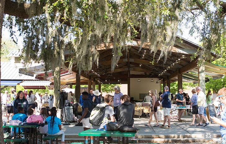
Haile Village Center is a mixeduse, walkable neighborhood center that is a gathering hub for the community, providing attractive spaces for events, festivals, and farmers markets. Haile Village Center shows how a neighborhood center can fit with the existing historic character of an area; neighborhood centers don’t have to be generic strip malls surrounded by parking, but rather can include local architecture, public spaces and building types and fit along a connected street network to support multiple modes of transportation.
Seaside
Seaside demonstrates it is possible to maintain an attractive walkable town amidst the pressures of large numbers of visitors. Designing for people over cars allows more people to be in a space, and more people to visit shops and support the local economy. Instead of large fields of parking, the town provides ample on-street parking and a few strategically located lots, along with highly walkable and bikeable streets, to accommodate visitors without detracting from sense of place. Human-scaled architectural is a time-tested way to create places people love. Seaside mixes formal classically inspired architecture with a relaxed beach town atmosphere to create its own unique sense of place.
I’On
I’On applies the Design Considerations in a Lowcountry setting. This new traditional neighborhood combines walkable neighborhood design with regional historic precedents. I’On turned needed stormwater infrastructure into attractive amenities that add value to the surrounding neighborhoods, using connected waterways to create a truly unique neighborhood. The neighborhood includes small mixed-use areas where driving is not required to achieve daily needs. Learning from historic Charleston, buildings are placed close to the street to define the public realm, creating a comfortable walking environment.
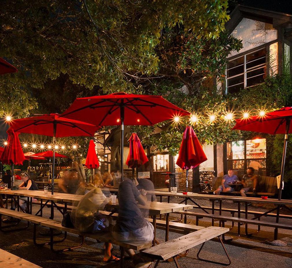
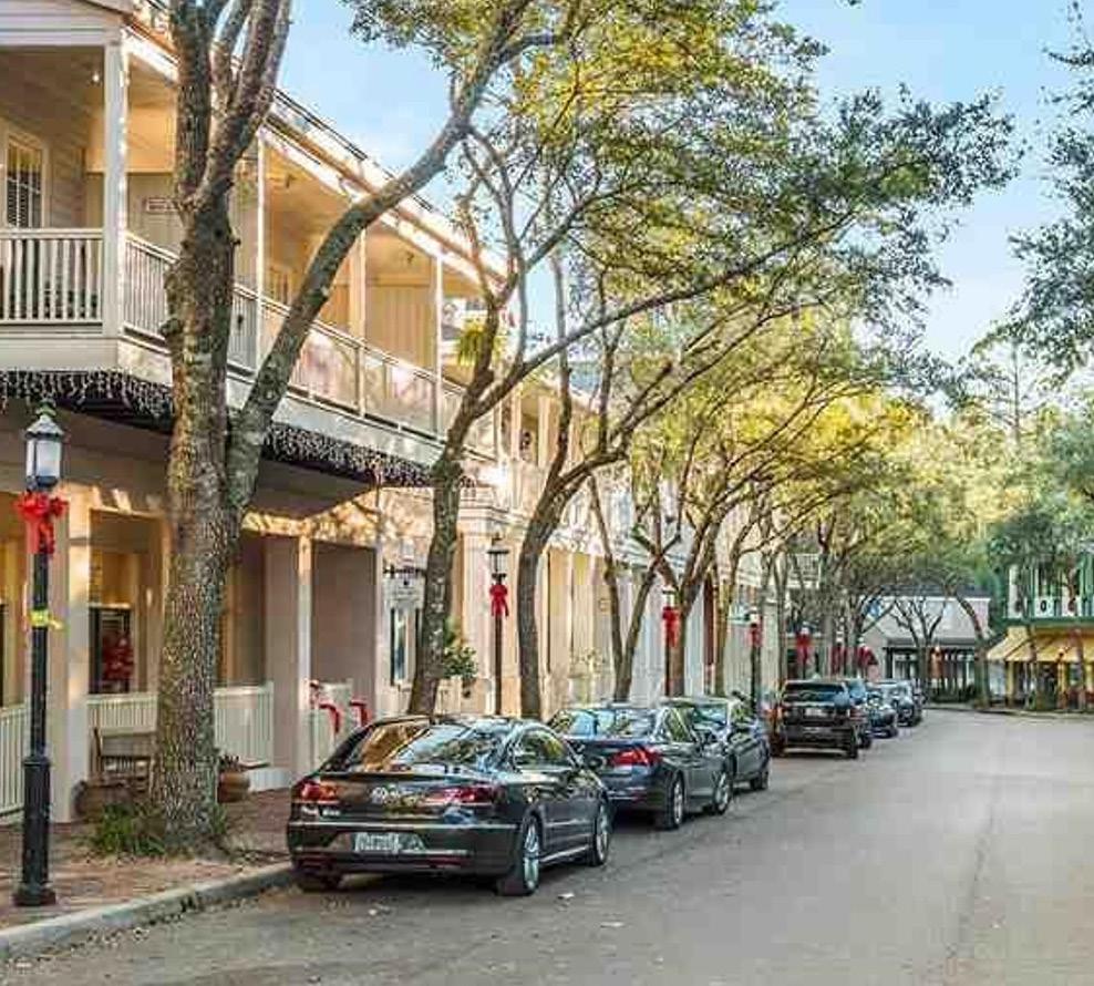
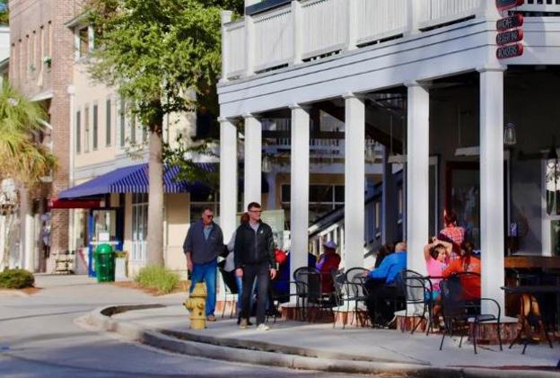
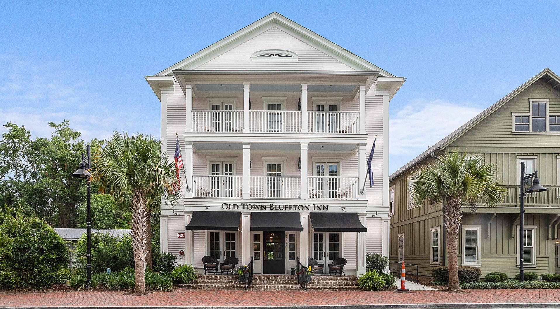
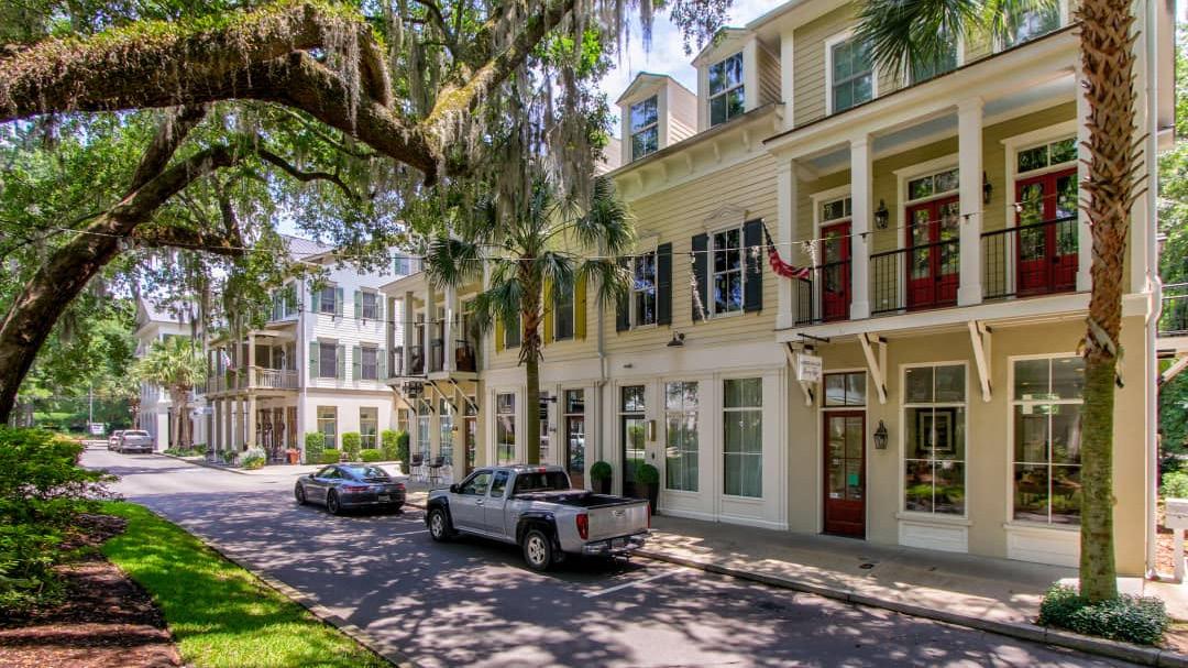
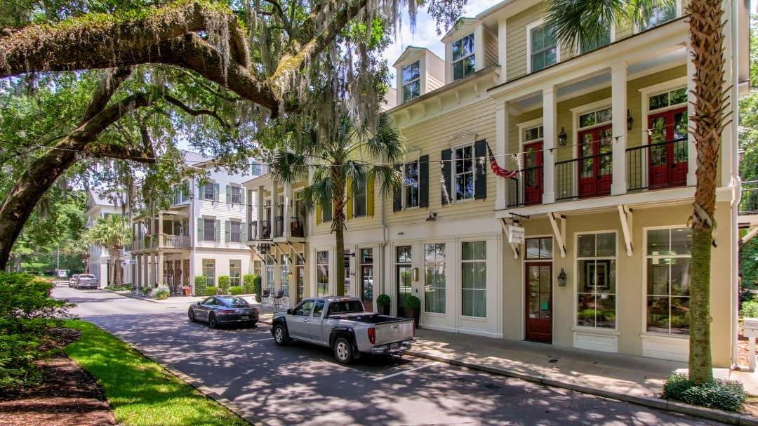
Old Town Bluffton
Old Town Bluffton exhibits some of the best walkable urbanism in the country, showcasing all of the Design Considerations. Its memorable streets embrace local character with local businesses and distinctive architecture, a mix of uses and building types, and building facades and signature trees defining high-quality public spaces and community parks.
Haile Village Center
Old Town Bluffton,
Street Character
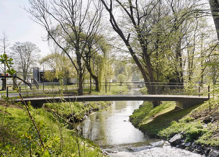
Building on the functional classification of roadways in the District, this plan establishes the design characteristics and advocates for connections and additions to the multi-use path network. The result is a connected network of people-focused streets and multi-use paths that allows residents and visitors to traverse the District safely. This will require investment in additional multi-use paths, intersection improvements to allow for safer pedestrian crossings, and new internal roadways to commercial development sites to provide pedestrian scaled connections.
Connect the District
The Mid-Island District Plan calls for multi-use paths on both sides of Marshland Road, William
and Mathews Drive to allow for greater safety and connectivity. These multi-use paths should be augmented by internal pathway networks in existing preserves and parks. Doing so will create a system of walking and bicycling infrastructure that links the Mid-Island District to new and existing public spaces.
As the backbone of the Island and the one road that every resident and visitor must use, it is exceedingly important to ensure that William Hilton Parkway is equally attractive and accessible. Building off of the existing pathway network and expanding bicycle access is a critical component of the larger island-wide effort to improve bicycle infrastructure.
Mathews Drive is a critical piece of the larger street network and one that must connect different parts of the Mid-Island District aesthetically and modally. A continuous bicycle and pedestrian path is just as important here as the travel lanes to ensure a well connected neighborhood grid. By encouraging new development to front Mathews Drive with new buildings placed closer to the road with parking behind them, Mathews Drive has the ability to become a central part of the new District Center and not just a way to get to the new District Center.
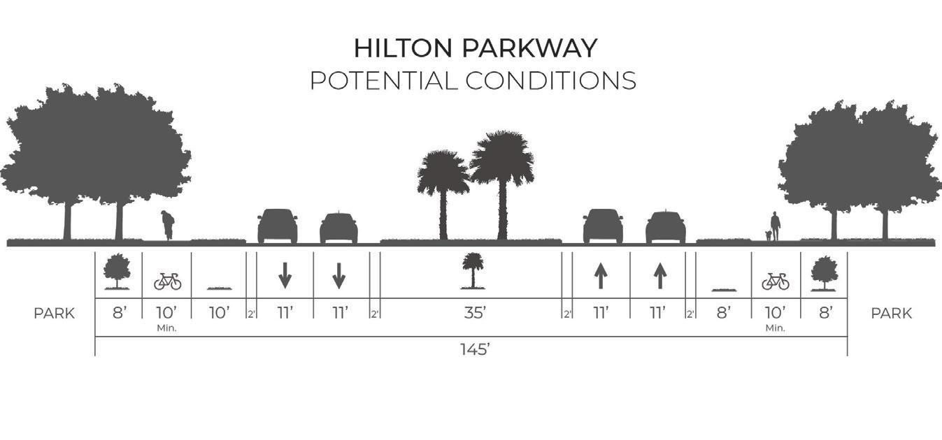
There is a unique opportunity do something where William Hilton Parkway runs adjacent to the Mid-Island Tract. Something that will create a noticeable change in the landscape and something to communicate to road users that they have arrived at the new heart of the Mid-Island District. By putting the “park” back into parkway, quite literally, we can create a separate experience from the usual William Hilton Parkway roadside views of well landscaped parking lots. Widening the parkway median, like what is done with the great Parkways of the country from Chicago to the Blue Ridge Parkway, significantly allows for the Parkway to have a feel of becoming part of the new park, not just bisecting it.
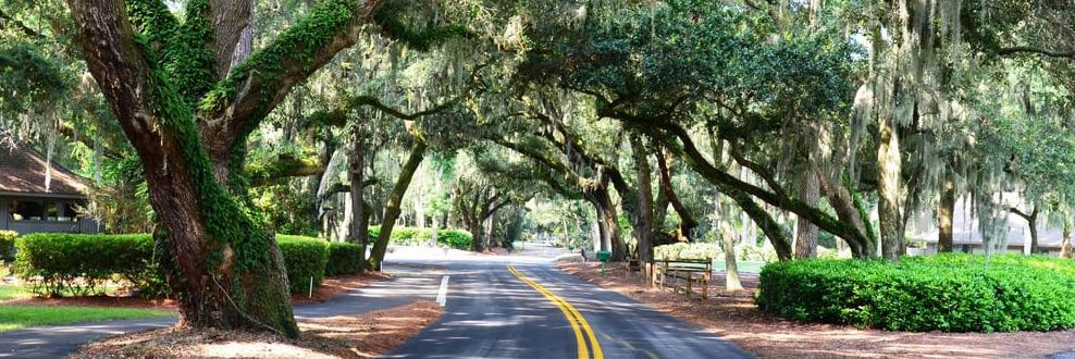
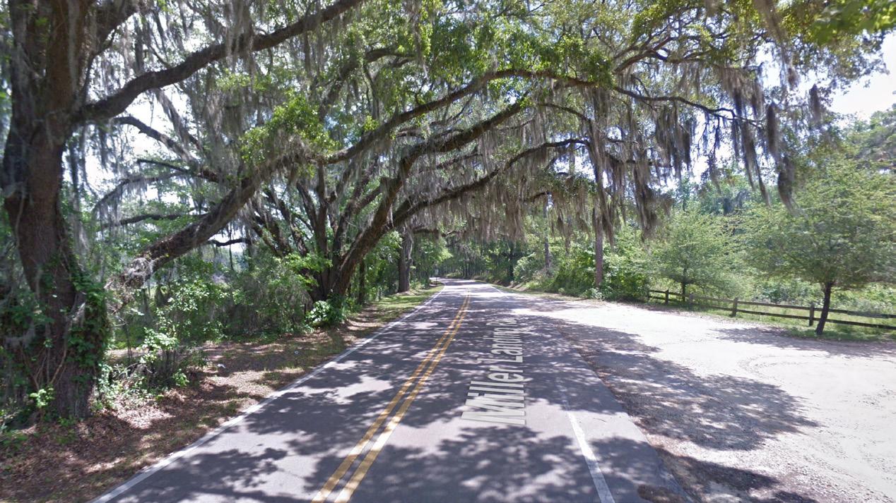
Streets on Hilton Head Island like Dillon Road and Union Cemetery Road are great examples of the classic meandering coastal lowland rural canopy road. Photographers love the picturesque Spanish moss covered oak limbs, cyclists are drawn to the uninterrupted shade and lower speed traffic, and the roads are popular for those out for a Sunday drive looking for the smooth curves framed by waves of greenery that only a canopy road can provide. These characteristics should be preserved as much as possible in any future Mid-Island District streetscape improvements. When opportunities for improvement are available, whether that is to tie the separated multi-use path into the trail network of future park
improvements or to add occasional on-street parking on Dillon Road to improve park access, it should be done in a way that minimizes impacts to existing trees along the right of way.
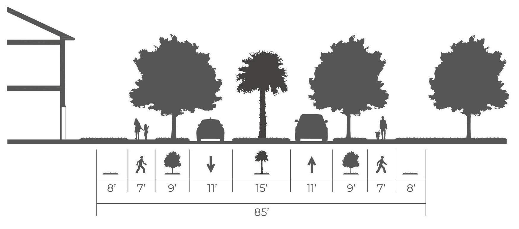
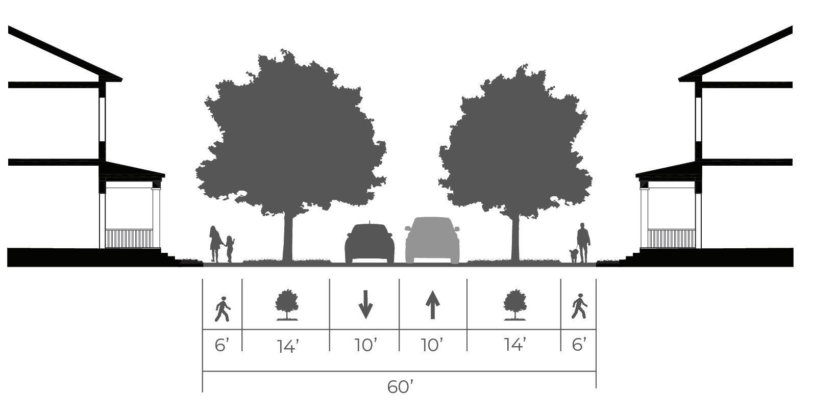
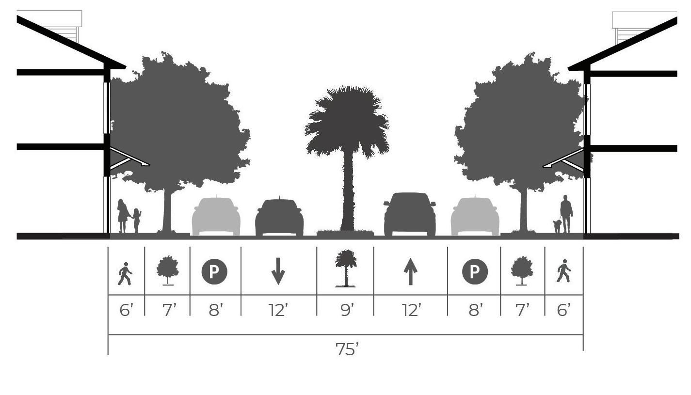
William Hilton Parkway
Mathews Drive
Dillon Road
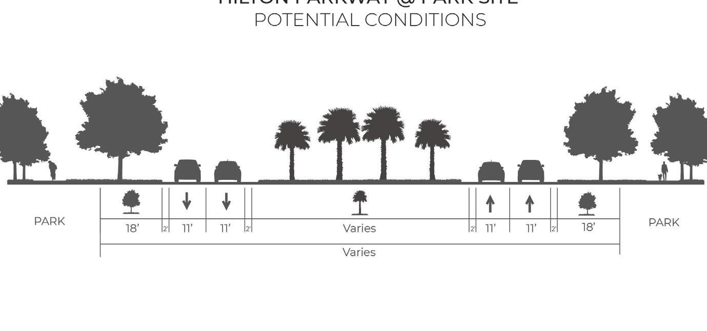
William Hilton Parkway at MidIsland Tract
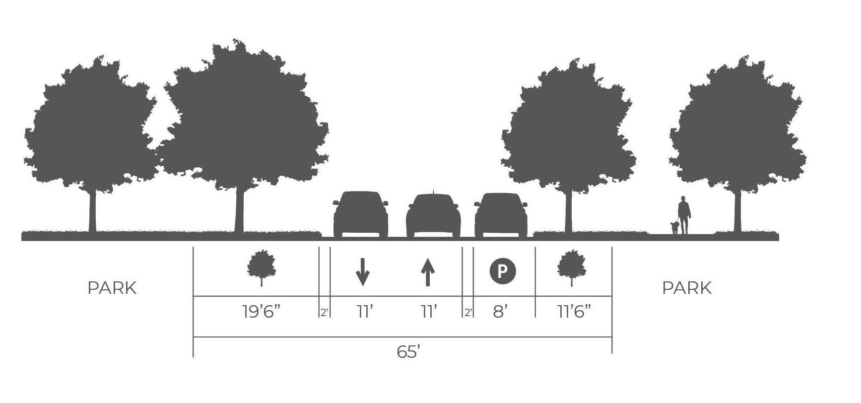
District Center Street
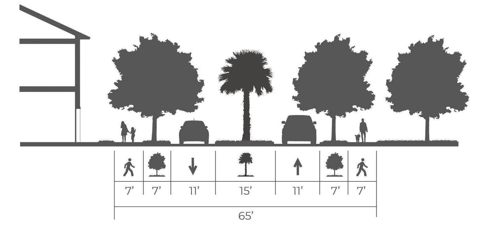
It can be argued that District Center streets are the most important components of a well-designed community. Streets with wide, shaded sidewalks, on street parking, narrow lanes, all framed by neighborhood scale residential, or mixed use buildings are the ingredients of any successful main street or neighborhood center. By applying these timeless techniques to new street design, it is possible to get a great neighborhood center up and running quickly. Without good District Center street design however, it is harder to achieve that common goal.
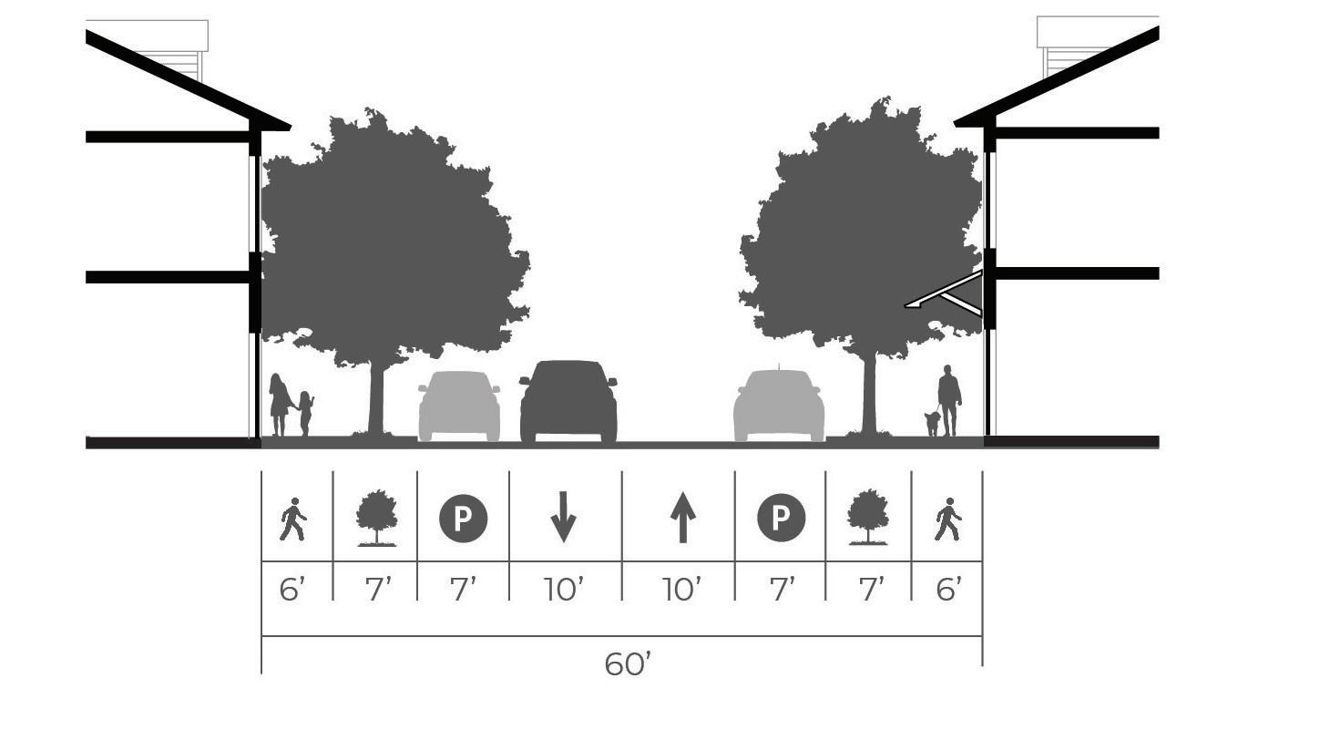
Neighborhood Residential Street
Not every street should have the whole complete streets package. Sometimes a quiet neighborhood street is preferred to one with all the bells and whistles of the more prominent roads in a community. That is where your typical neighborhood street comes in, often with swales instead of curbs, sometimes trees from adjacent front yards provide shade instead of a more urban allée of street trees, etc. The street can even be low-speed and low-volume enough to not warrant the need for conventional sidewalks in some cases.
District Center Avenue
Designing a new District Center avenue with wide medians, sidewalks, and ample on street parking is a wonderful opportunity to create an identifiable central corridor to new development. This could be the District Center main street or it can strategically provide stormwater retention and additional parking if desired. The flexibility of avenues are their hidden strength and if designed well can serve as the exclamation point for a well designed District Center street network.
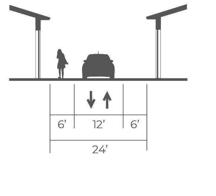
Alley
The workhorses of good urbanism, alleys are the unsung heroes of well-functioning neighborhoods. This is where your garbage is collected, where you can access even more parking, where the power lines go, all the necessary but less attractive elements of walkable neighborhood living need a place to live, and alleys provide that service. Alleys can also provide a secondary low-speed, low-volume grid for pedestrians and cyclists. They even make it easier to have more narrow lots and therefore provide more housing by creating a means of accessing a property from the rear so a front yard driveway, and curb cut, isn’t necessary.
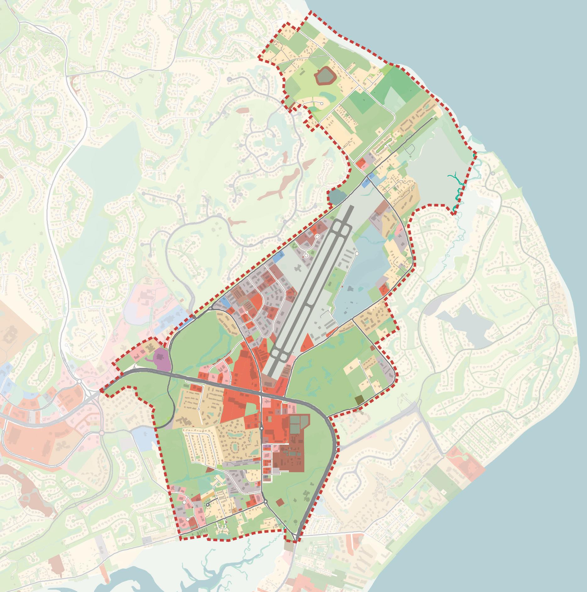
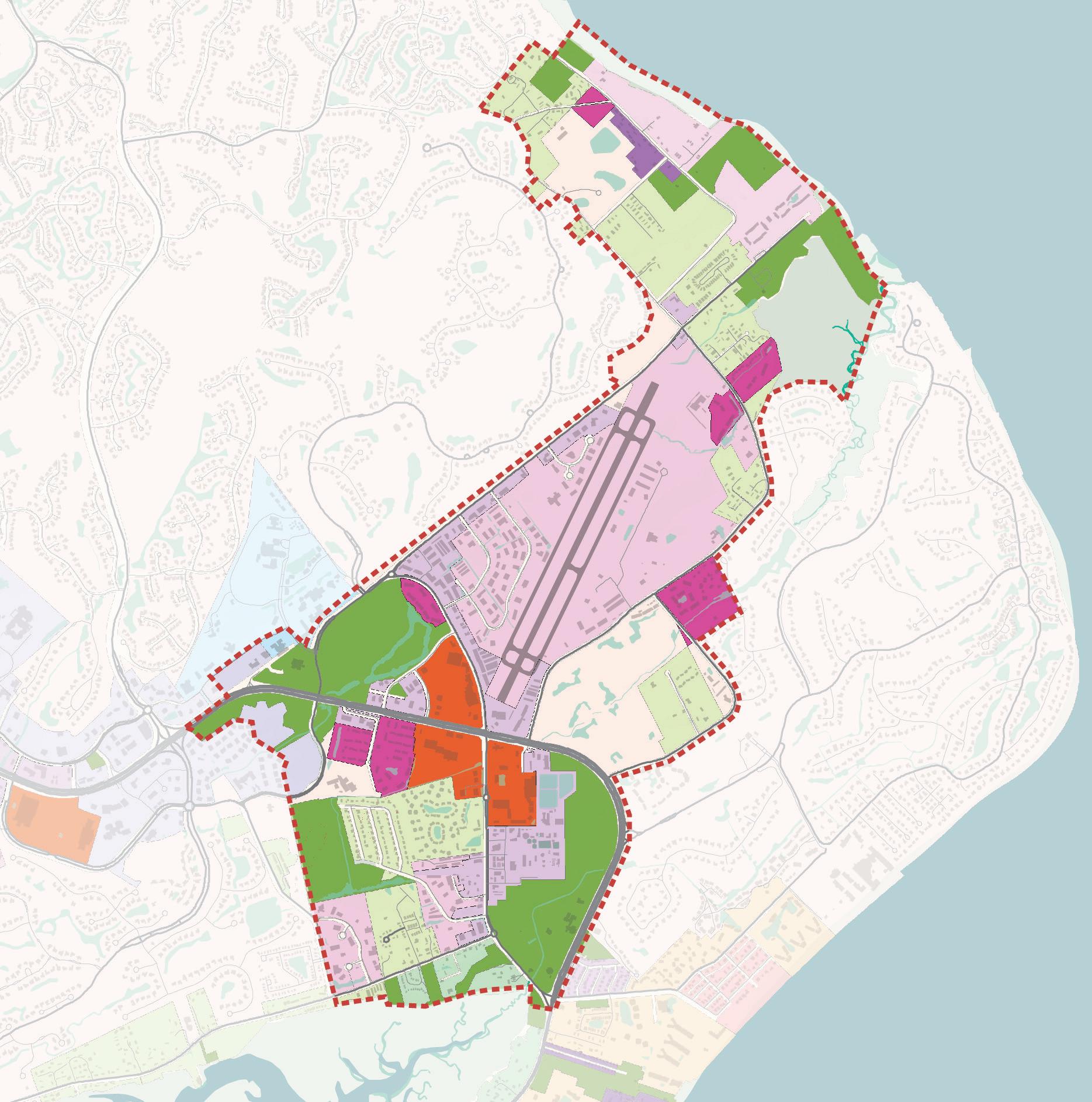
FUTURE LAND USE
To shape the evolution of the Mid-Island District, the planning team worked with Town Staff and Town Council to consider changes to land uses in the District. Four primary objectives drove the proposed Future Land Use Map.
Simplify and consolidate: The current Land Use Map has 14 categories and does not provide needed guidance to shape the future of the District. Consolidating the categories to seven defines the uses desired by the community and provides clear direction to property owners and developers on both expectations and opportunities.
Allow for a mix of uses: As the existing commercial shopping centers redevelop over time, they will likely evolve to be more of a mix of retail, restaurant, commercial, residential, office and public spaces as opposed to being single-use developments. This new mixed-use category delivers on the live-workplay environment supported by the community and represents an opportunity to add needed housing. The development community also favors this style of redevelopment that offers a range of experiences and creates a more walkable, engaging environment.
Define and protect open space: The proposed land use plan creates one Park/Open Space category that includes the Mid-Island Tract, the Ashmore Tract and the Northridge Tract, Barker Field, Historic Mitchelville Freedom Park, but also all of the interstitial green spaces, wetlands, and marshes that connect or run between them.
Enable greater density and neighborhood commercial uses: To address the need to reexamine uses and allowed density in the Historic Neighborhoods (per recommendations in the Gullah Geechee Culture Preservation Report), the future land use map increases the base residential density and enables neighborhood commercial uses to expand economic opportunity.
Existing Land Use
District Boundary
Mixed-Use
Residential/Neighborhood Commercial
Retail/Service/Lodging
Religious Institution/Cemetery
Government Facilities/Utilities
Commercial/Services
Park/Open Space
Future Land Use Map
The Future Land Use Map concentrates mixed-use development in the center of the District, and along William Hilton Parkway and on Mathews Drive. The residential uses are collapsed into one category that allows for neighborhood commercial uses. The area around Hilton Head Island Airport is set aside for needed commercial/services uses. Existing retail, services, and lodging uses remain along Mathews Drive and Dillon Road. Park and open space uses define the edges of the District and ensure the availability and protection of parks and open spaces.
Mixed-Use
The mixed-use category encourages a mix of uses such as retail, restaurants, apartment flats, townhomes, office, institutional and allocation of open space to promote a green network. This mix of uses will create an area that can support local businesses, variety of housing types and context sensitive architecture. Walkability will be promoted through shared parking areas and pedestrian scaled streets and amenities.
Uses Retail, Restaurants, Apartment Flats, Townhomes, Office, Institutional, Open Space
Residential Density 12-18 dwelling units per acre
Height 1-3 story height max, adherence to airport height restrictions by area (consistent with Shelter Cove, Harbour Town); 45 feet
Parking Shared structured parking and surface lots
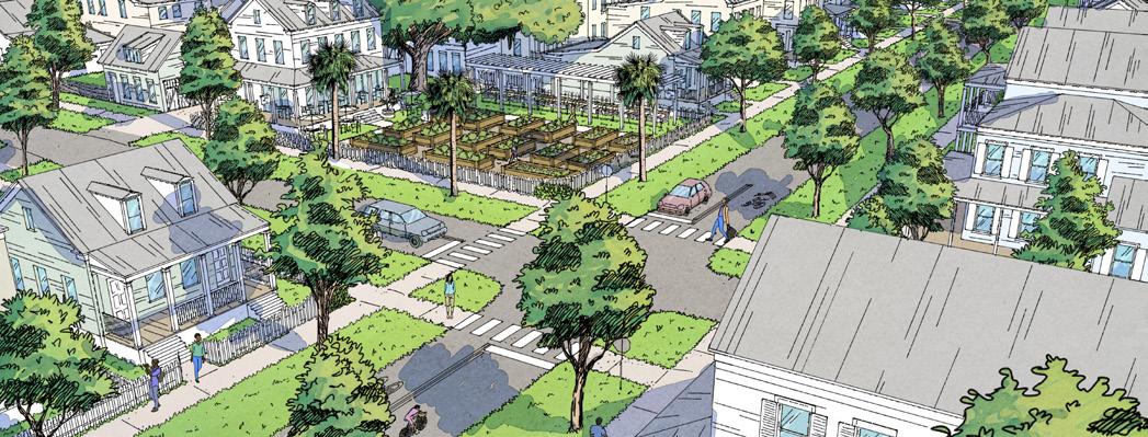
Residential/Neighborhood Commercial
The residential / neighborhood Commercial category introduces small scale commercial and home business opportunities to residential areas in key locations. Residential will be limited to 6-8 dwelling units per acre with a mix of singlefamily, apartments, townhomes, and two-family. Encourage context sensitive architecture that matches the architecture seen in development in the Lowcountry like Palmetto Bluff, Shelter Cove, and Harbour Town.
Uses Single-Family, Apartments, Townhomes, Two-Family, Neighborhood Commercial and Home Business Opportunities
Residential Density 6-8 dwelling units /acre
Height 1-2 stories; 35 feet
Parking TBD
Retail/Service/Lodging
This land use category will allow retail, service and lodging. Context sensitive development is encouraged by keeping the height at 45 feet maximum.
Commercial/Services
Commercial/services are uses that support the airport and light industrial uses.
Uses Retail, Services, Lodging
Density Determined by design and performance standards
Height 1-3 stories; 45 feet
Parking TBD
Uses Commercial Support Services, Car Rental, Office, Warehouse, Light Manufacturing
Density
Determined by design and performance standards
Height 1-3 stories; 45 feet
Parking TBD
Religious Institution/Cemetery
Religious institutions on Hilton Head Island are a cultural significant use. In areas with this land use designation office, institutional and open space uses are allowed while maintaining the Island character and providing context sensitive architecture.
Uses Office, Institutional, Open Space
Density N/A
Height 1-3 story; 45 feet
Parking TBD
Government Facilities/Utilities
Government facilities and utilities will allow uses like office, industrial, light industrial, utilities, airport and open space. These uses will support the Town of Hilton Head Island and encourage consolidating governmental facilities.
Park/Open Space
Park and open space is important on Hilton Head Island as it is known for its natural beauty. Areas that are designated park and open space will be protected and preserved to maintain existing natural resources or create passive and active recreational spaces.
Uses Office, Industrial, Light Industrial, Utilities, Open Space, Airport
Density N/A
Height 1-3 stories; 45 feet
Parking TBD
Uses Parks, Passive Recreation, Active Recreation, Preservation
Density N/A
Height 1-3 stories; 45 feet
Parking TBD
FOCUS AREAS
FOCUS AREAS
There are three primary focus areas in the Mid-Island District that represent public and private investment in park space, mixed-use development and more sustainable neighborhoods. These focus areas address community needs and concerns identified through the engagement process, align with market conditions and opportunities, and follow through on the strategic direction outlined in the previous section. The following three focus areas are explored in this section:
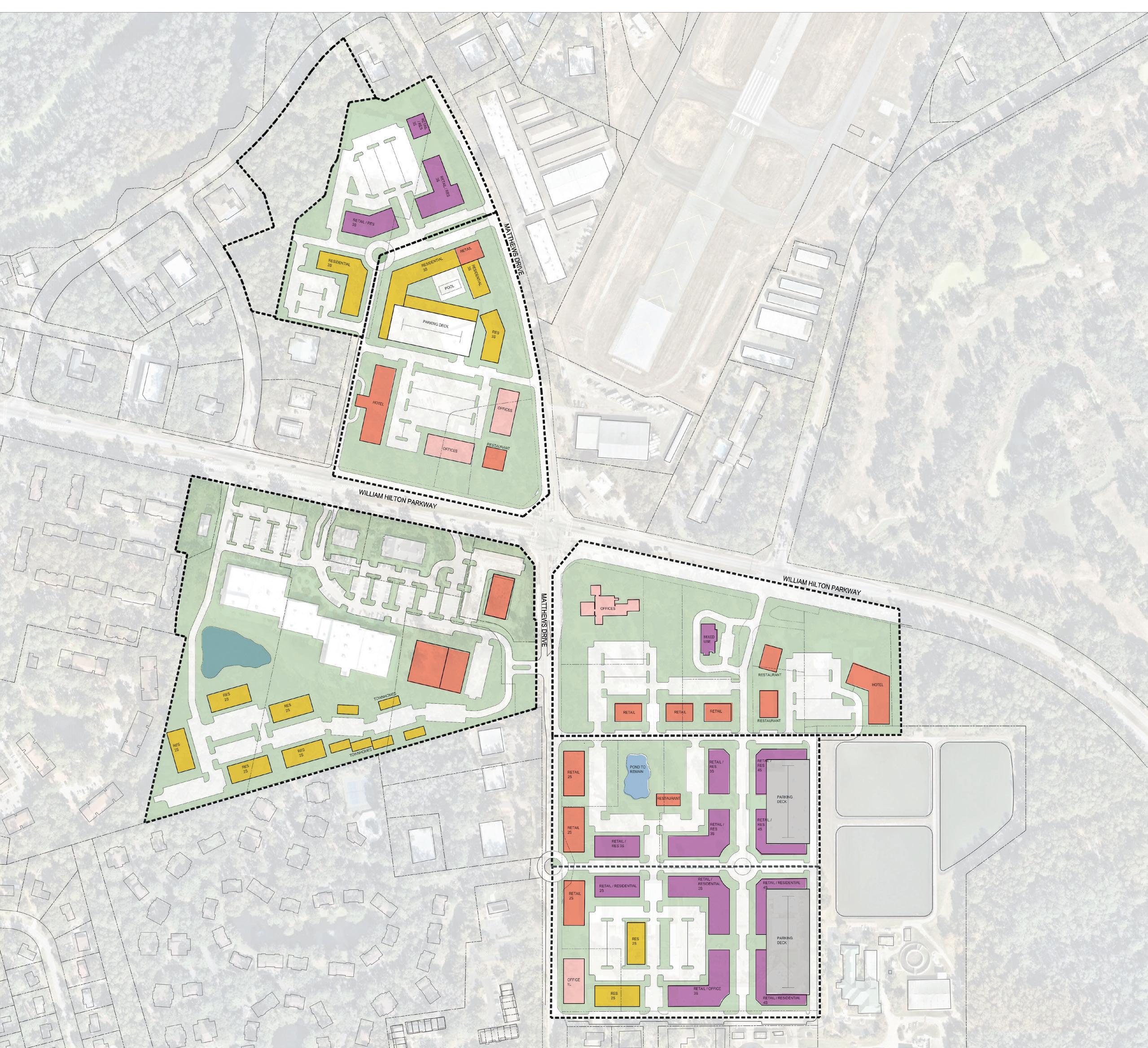
1. Mid-Island Tract – A new public park will be built by the Town of Hilton Head Island on the Mid-Island Tract. This focus area outlines the existing site and context and reviews the proposed park program and improvements. This park will redefine the Mid-Island District, protect and restore natural areas, and provide needed community and cultural gathering space.
2. District Center – The Mid-Island District lacks a true center of activity. Building on the public investment in park space, the District Center focus area considers mixed-used redevelopment at the core of the Mid-Island, reimagining the existing single use retail shopping centers as dynamic places to live, work, and play. This vision for the District Center will help leverage public investment in park and street improvements into private development to enhance the economic vitality of the Mid-Island District and the north half of the island.
3. Historic Neighborhoods – To implement the recommendations in the Gullah Geechee Culture Preservation Project Report, the Mid-Island District Plan proposes enabling more consistent and compatible density and neighborhood commercial uses in the Historic Neighborhoods. Doing so will allow for greater economic prosperity and sustainable for Historic Neighborhood communities.
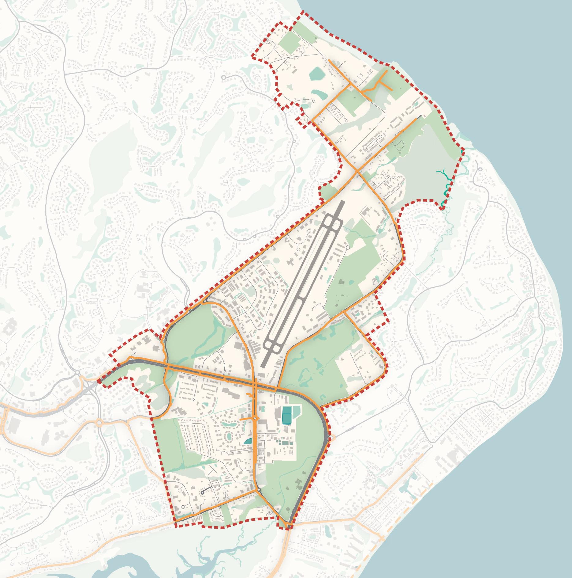
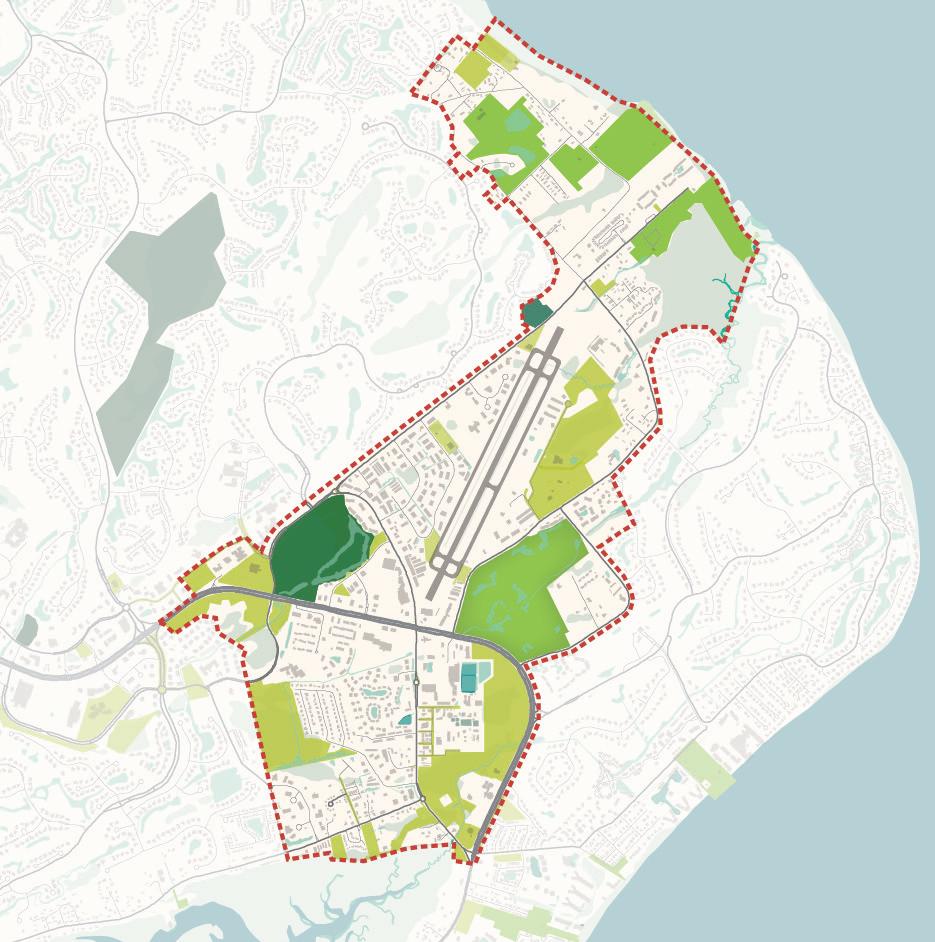
Focus Areas
District Boundary
Mid-Island Tract
District Center
Historic Neighborhoods
Open Space
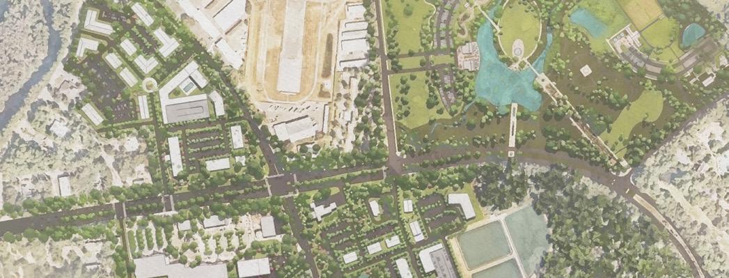
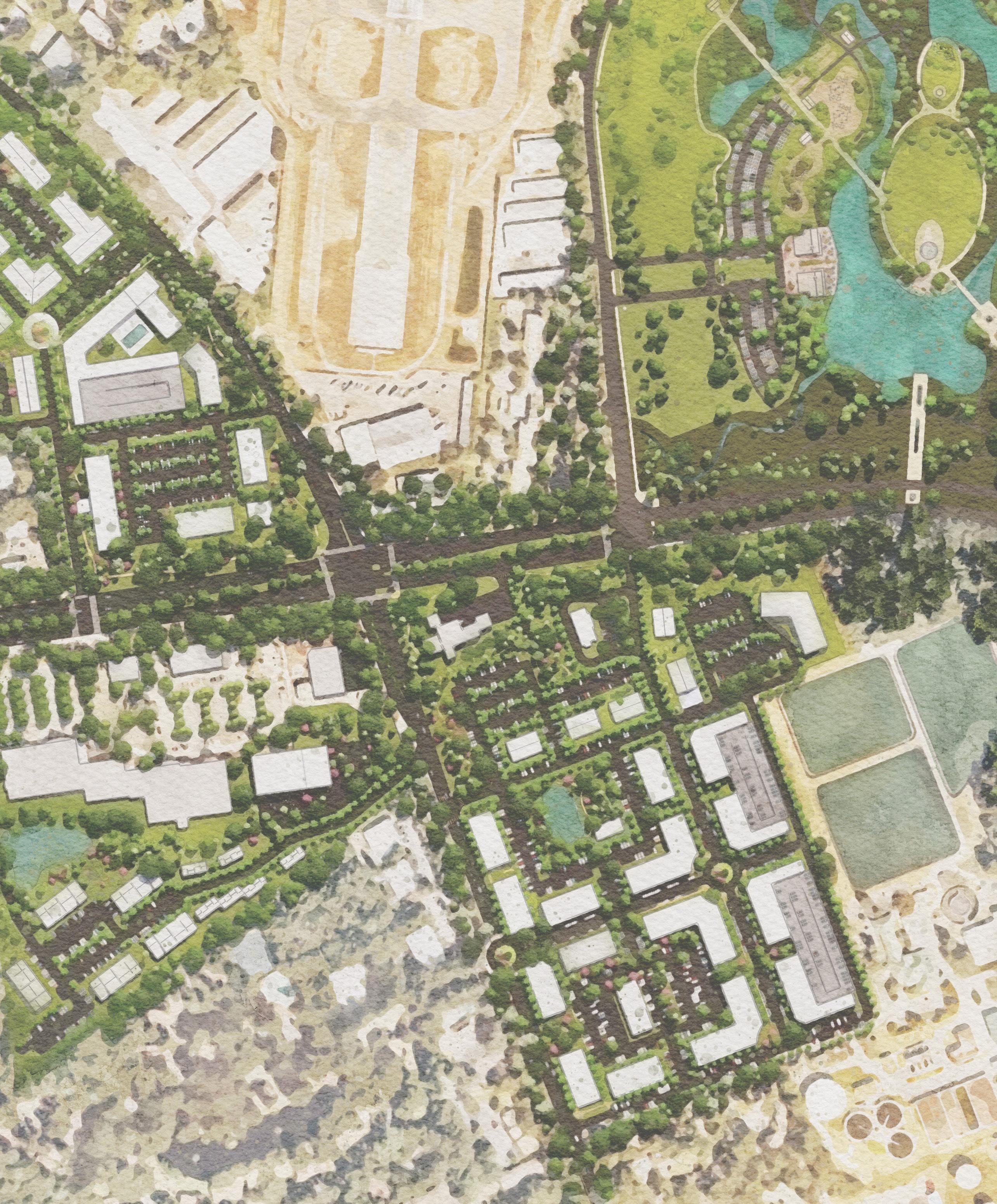
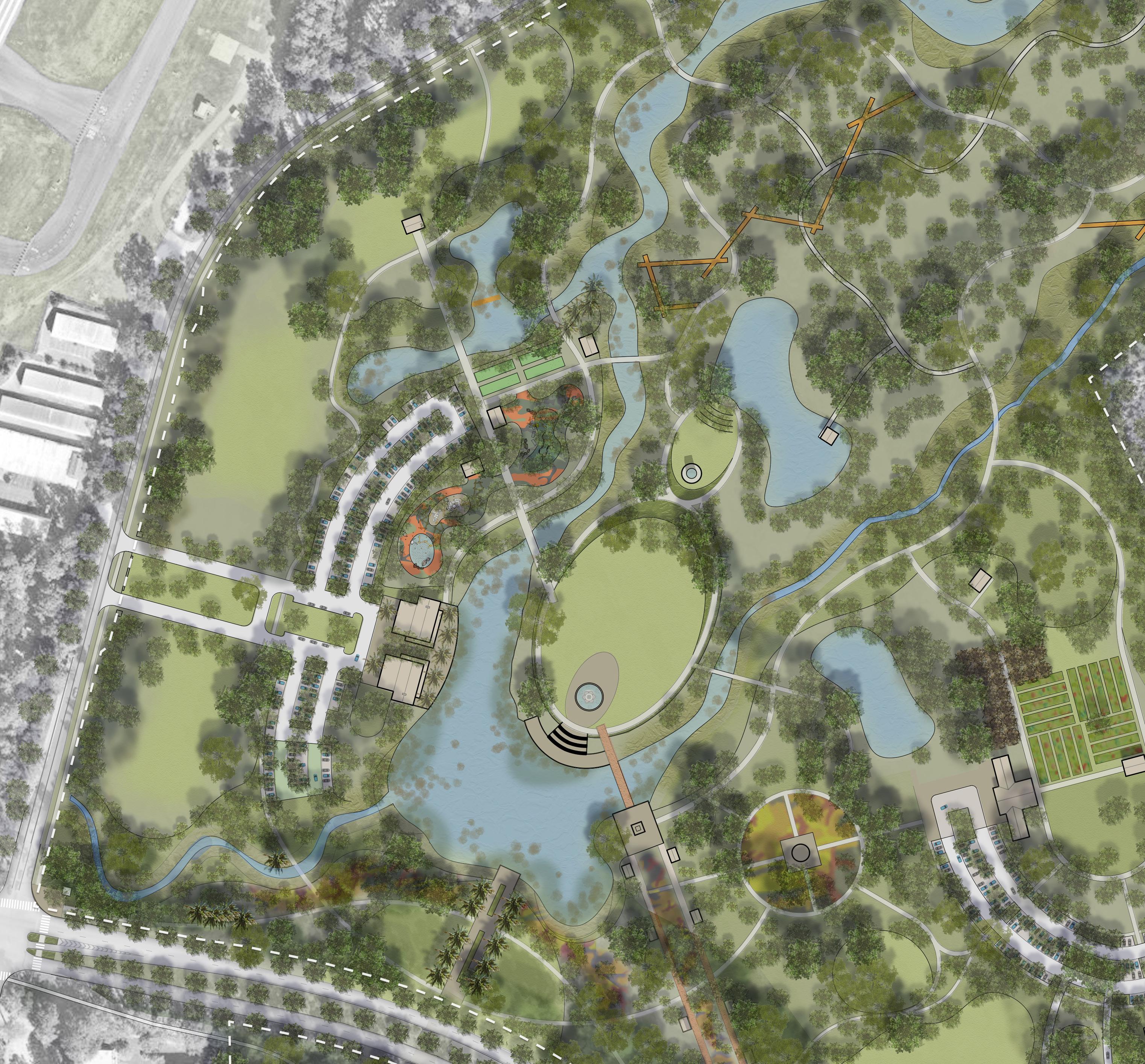
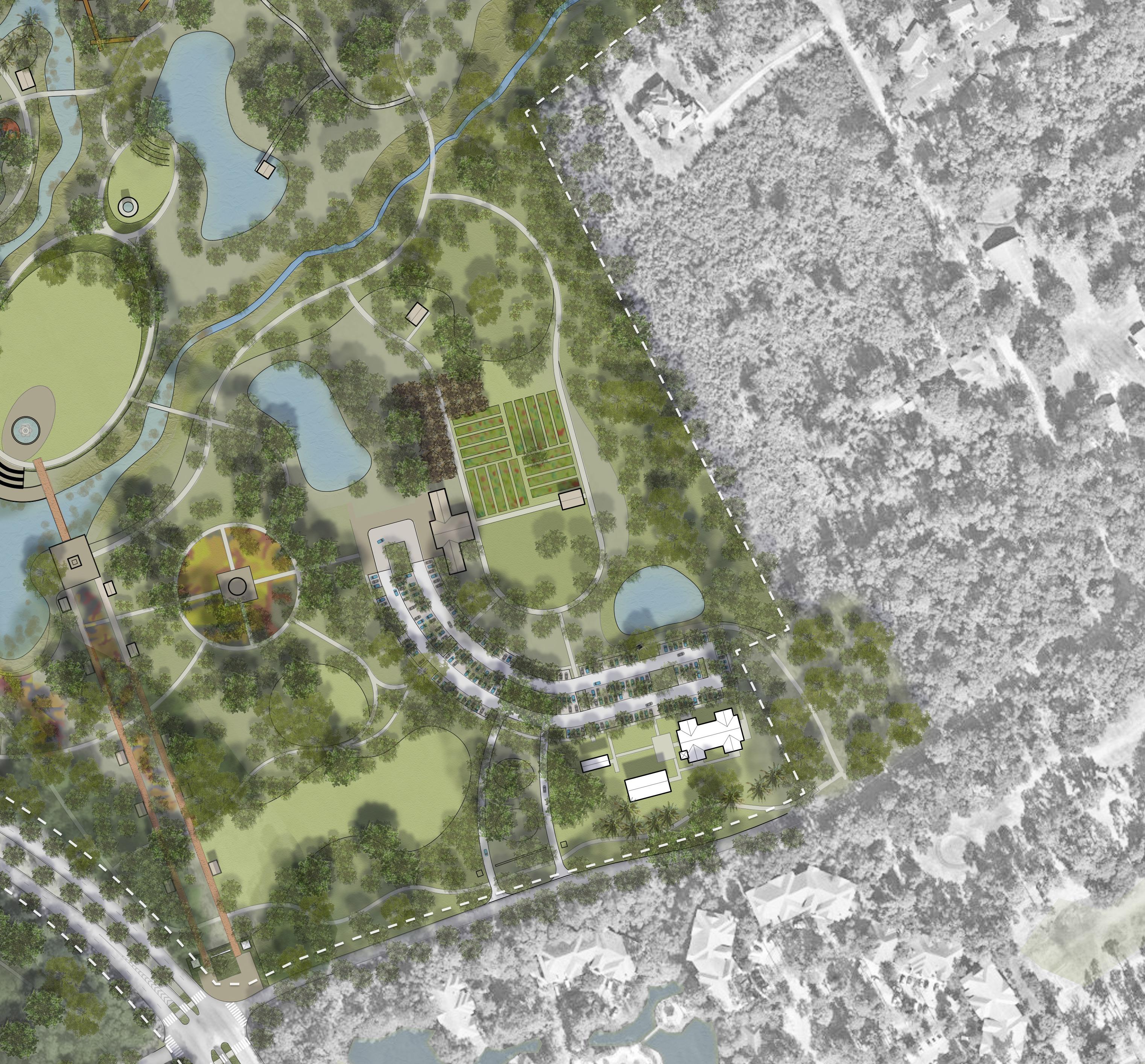
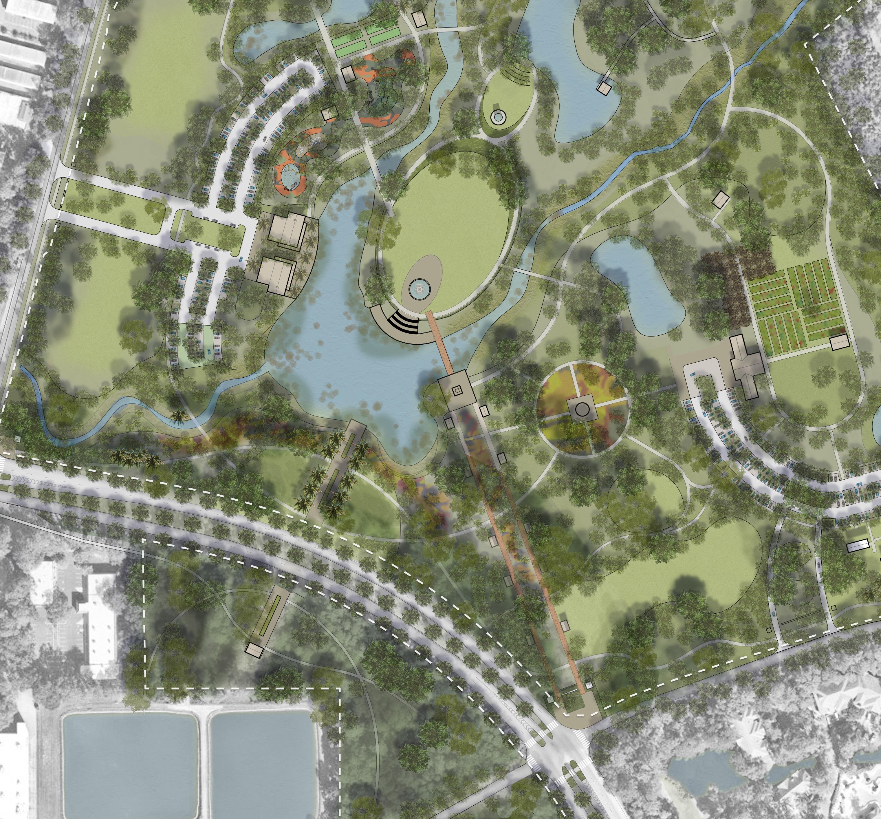
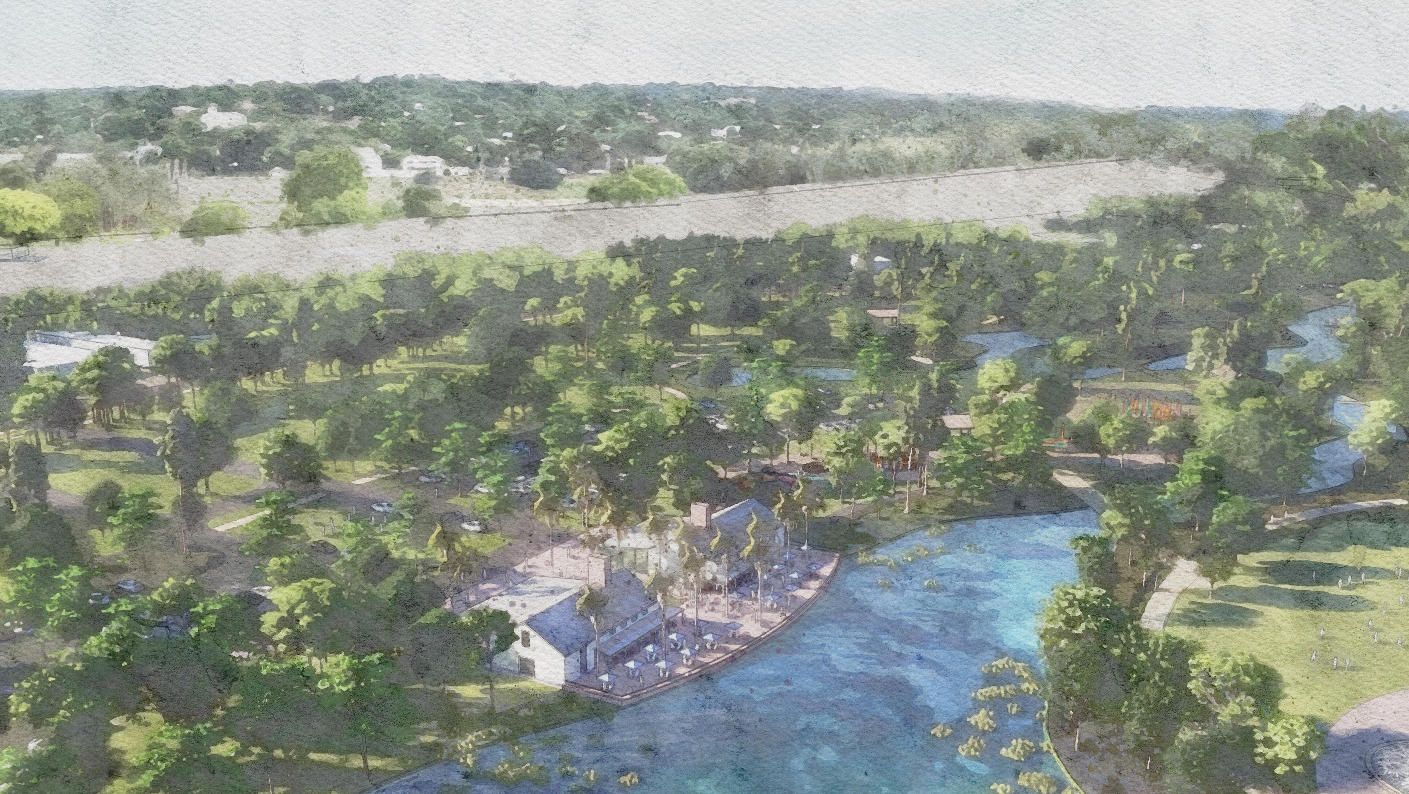
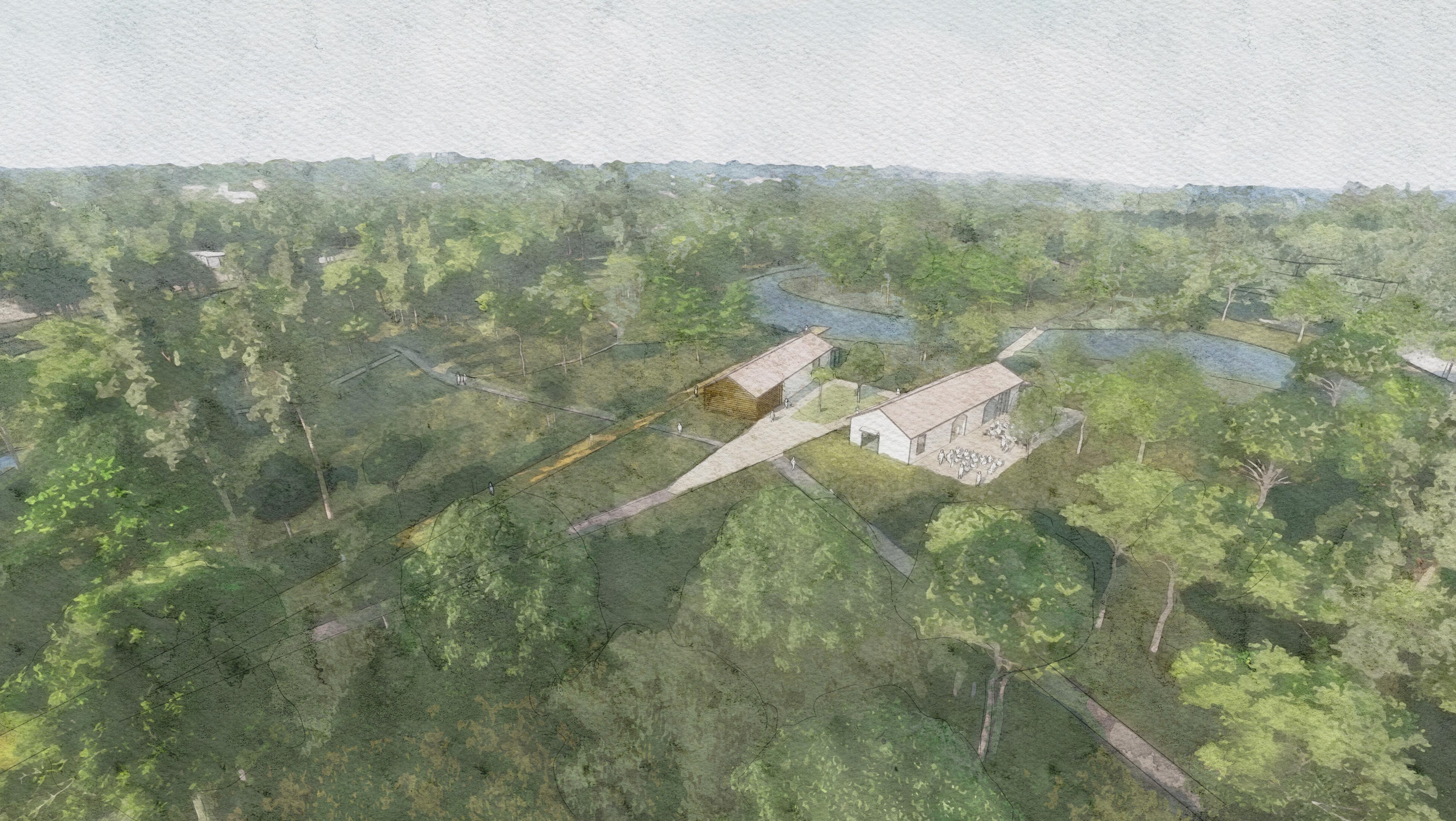
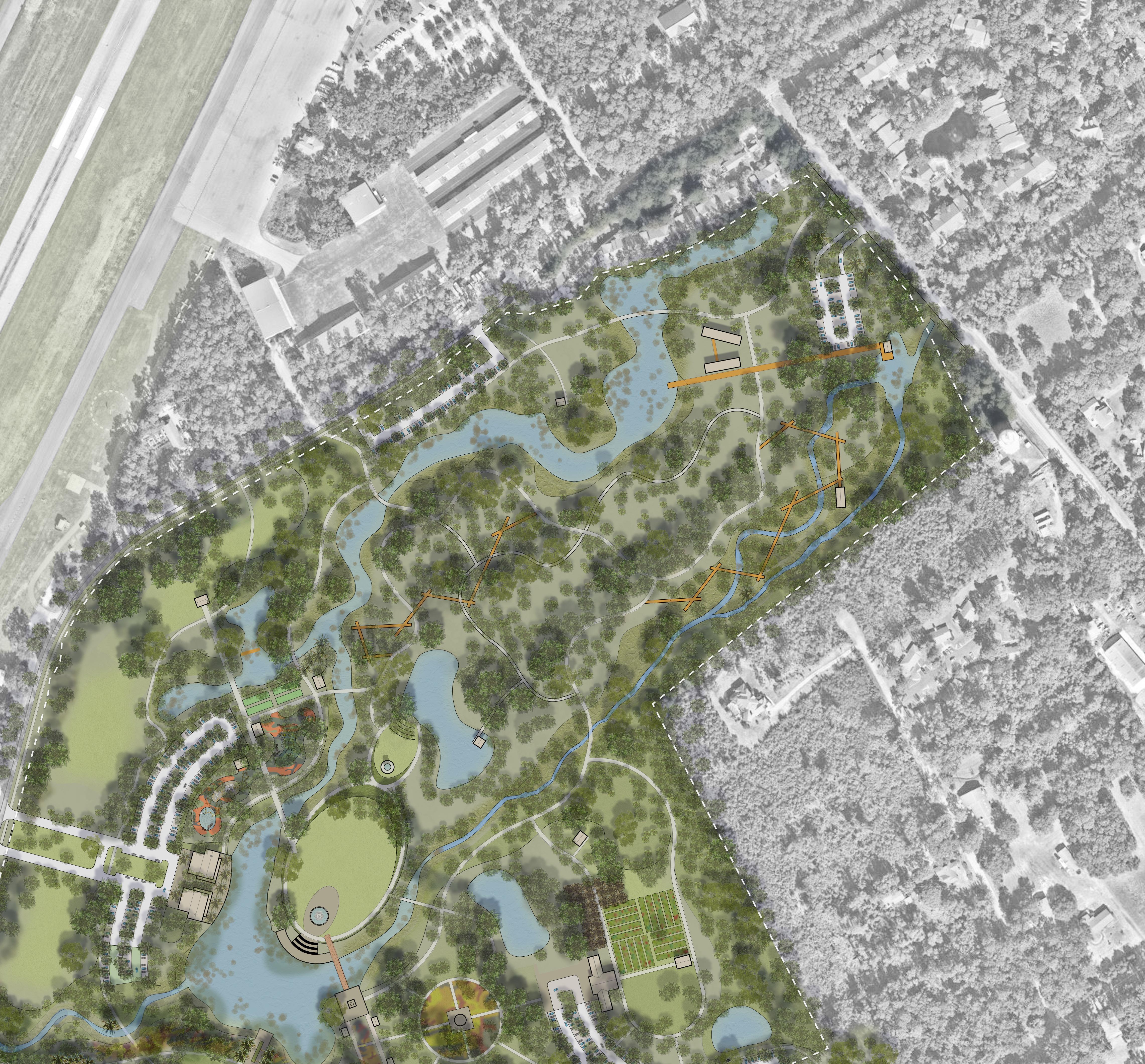
MID-ISLAND TRACT
Concept Plan Design Context
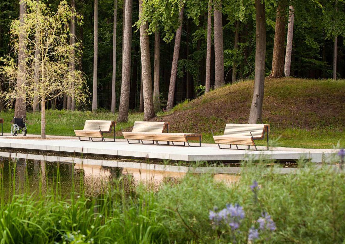
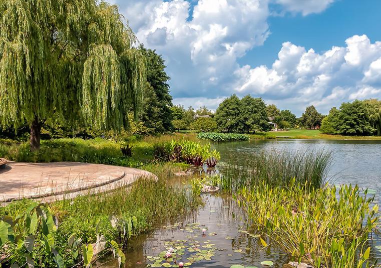
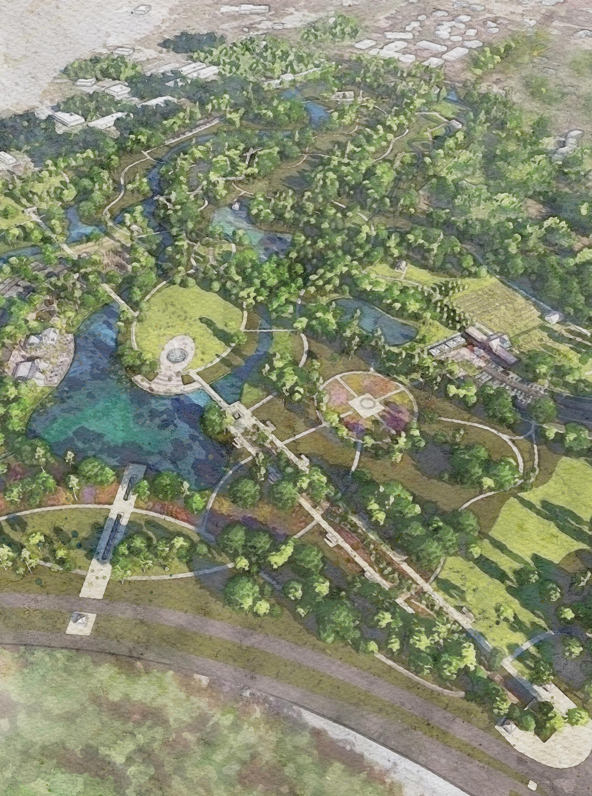
The Mid-Island Tract is prominently located along William Hilton Parkway and adjacent to the airport and commercial areas to the west, residential neighborhood to the north and east, and Public green space to the south. The site is a portion of the former Planter’s Row Golf Course with features such as fairways, water bodies, sand traps and cart paths still in tact. The site will be restored and enhanced by interconnecting water bodies, improving both water quality via natural flushing and improving drainage for adjacent sites. The site will be rehabilitated to host a variety of ecosystems, diminishing the previous site manipulation when the golf course was created.
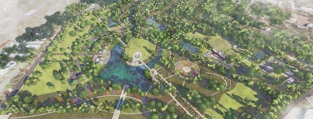
Building upon the physical site improvements, the park program is carefully curated to ensure each element is complimentary and creates synergy within the natural site. Over half of the site is programmed as natural passive use, allowing many opportunities to explore the ecological beauty of the site. Program elements are divided into areas of related use including: The Heart of the Tract, Island Heritage, Cultivated Landscapes, Active Play, and the Eco-Park. These varied program areas work together to create a Best-in-Class Park for Hilton Head Island. Recommendations and Next Steps
Following the adoption of the District Plan and the Concept Plan for the Mid-Island Tract, the Town should define Phase 1 project scope, budget, funding sources, and schedule for design and construction. In addition to Schematic Design for the entire park site, this would involve additional site investigation, design, construction documentation and bidding documents for Phase 1 improvements.
Connecting Open Space
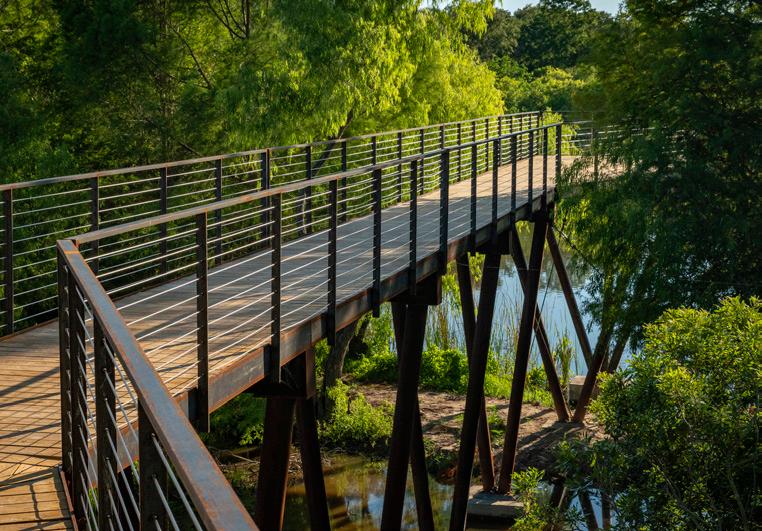
Providing pathway connections from Mid-Island Tract to nearby green spaces is critical to creating an interconnected network and builds toward the Greater Island Greenway. This network is dependent on comfortable, convenient connections consisting of various trail types and allowing otherwise separate sites to function as one large park network, ultimately increasing the function and usage of each site. The open spaces are activated by the connecting pathway network, and inversely, pathway users are provided relief from the adjacent roadway system.
Visual Connectivity
The Mid-Island Tract is located directly across William Hilton Parkway from the Ashmore Tract, another Town-owned parcel dedicated for green space. These two properties offer a unique opportunity to create a gateway moment for the Parkway. Providing views into these sites and a consistent edge treatment allows for visual engagement for vehicles as they pass through an interconnected park rather than merely passing by a park. Linking these two spaces makes each green space more functional and also allows for better pedestrian connectivity.
Natural Systems
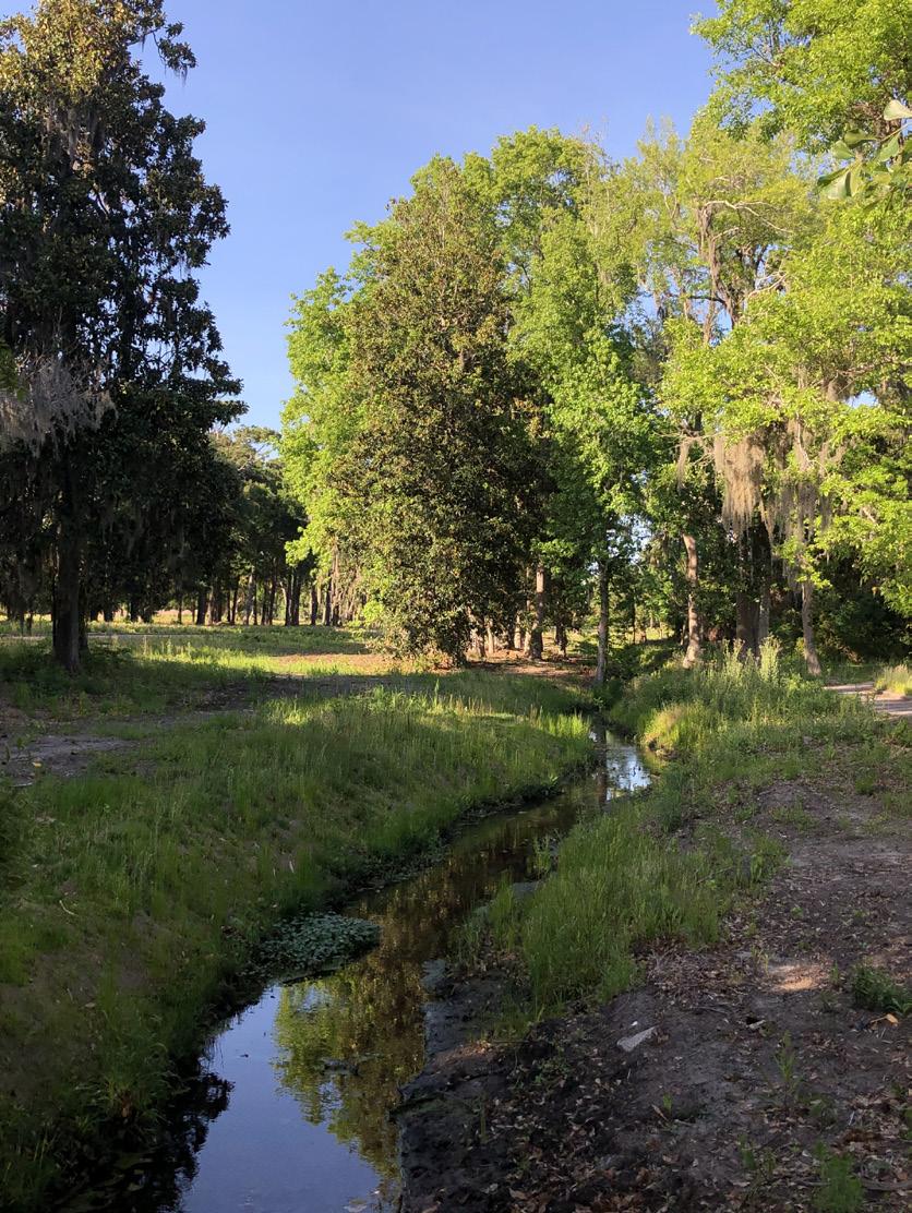
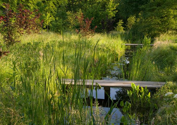
The manipulated golf course landscape that exists today is not the natural healthy ecosystem it has the potential to be. Existing lagoons are isolated, therefore they do not benefit from natural flushing during rain events. Natural movement of water reduces buildup of carbon dioxide and reduces the algae growth which is prevalent today. The drainage ditch that crosses the site was originally the terminus of Coggin Creek, but was manipulated during golf course construction, disregarding its ecological function. Shallowing the banks and meandering the centerline of the drainage ditch allows for a varied ecosystem that is more akin to a natural state with an expanded floodplain. Expansion of the floodplain and slowing of stormwater discharge will allow for increased groundwater recharge. Adapatability to storm surges, sea level rise, and resiliency against other natural impacts is the basis for expanding and restoring natural systems on the site.
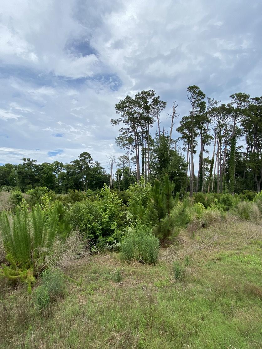
A variety of tree species exist on the site, some native and some non-natives, were planted during golf course construction. The existing fairways provide an opportunity for naturalization through successional growth and by supplementing existing desirable species with native plantings. New plantings will be selected specifically to support native wildlife including the only Red-Headed Woodpecker nesting colony on the Island as reported by the Audubon Society.
PARKWAY THROUGH A PARK
Provide views into the parks to allow for visual engagement for vehicles passing through a park rather than passing by a park.
Isolated Lagoon
Successional Growth Coggin Creek
Hydrology & Flooding
Site Analysis
Analysis conducted for the Mid-Island Tract consisted of hydrography and hydrology, storm surge expectations, 100 yr. and 500 yr. flood elevations, stormwater detention, salt water intrusion, tree cover, topography and viewsheds, and flora / fauna. This analysis informed the siting of program and facilities to maintain the character of the site and improve the resiliency over time.
Balancing ecological needs with program potential is critical as we build upon the great work from the Town’s 2020 Parks and Recreation Master Plan. The proposed program considers Stakeholder feedback and expresses the unique natural qualities of the Mid-Island and Ashmore Tracts. Program was evaluated for suitability for inclusion on the site and sometimes allocated to other parks within the Town system such as Chaplin and Crossings Park if program elements or activities were not compatible with the Mid-Island site. For example, active sports such as court games, league play, extreme sports, etc were shifted to other parks to minimize impacts to the natural system and aesthetic of the Mid-Island Tract.
The balancing of program elements allows for a significant portion of the site to be dedicated to ecological restoration and provides space for natural buffers between program elements. These buffer areas allow for distinct spaces within the park separated by trees, native vegetation, and water bodies providing the user a variety of experiences.
Additional Considerations
While considering the potential options for the Mid-Island Tract it is imperative that the adjacent site conditions be explored. This includes examining the adjacent roadway sections, Hilton Head Public Service District improvements, pedestrian crossings, vehicular improvements, and the adjacent Ashmore Tract. The Mid-Island and Ashmore tracts may also have the opportunity to create wetlands for a workforce housing mitigation bank.
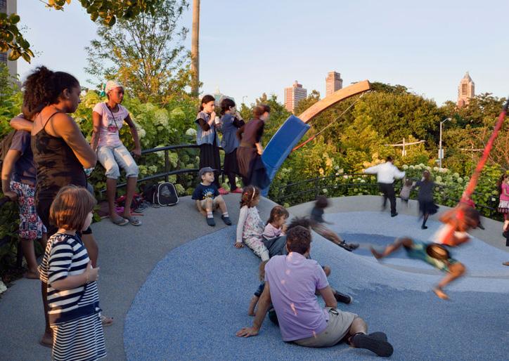
Amended program from Parks & Recreation Community engagement
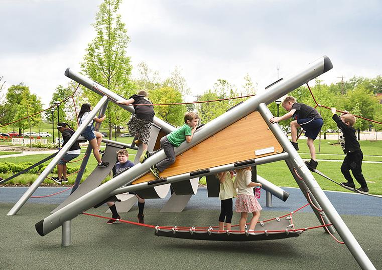
• Multi-Use Trails
• Playground
• Overlooks
• Picnic Pavilions
• Great Lawn
• Nature Preserve / Conservation Area
• Nature Trails
• Concours D’elegance Parking
• Bike Parking
• Multi-Use Recreation Lawn
• 18-Hole Disc Golf/ Foot Golf
• Multi-Use Trails
Recommended expanded program from stakeholder feedback and site opportunities
• Eco-Center
• Enhanced Pedestrian Crossing at William Hilton Pkwy
• (Bridge Crossing Optional)
• Observation Decks
• Stormwater Management / Storage
• St. James Baptist Church
• Extension of Greater Island Greenway
• Event Grove
• Community Cultural Gardens
• Cultivated Landscapes
• Martin Luther King Jr. Memorial
• Interactive Water Feature
• Open Air Market
• Boardwalk
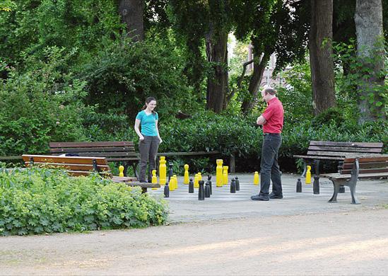
• Chess
• Sculptural Fountain
• Multi-Use Community Space
• Bocce
• Natural Play
• Canopy Walk
• Dog Park
MID-ISLAND TRACT
ASHMORE TRACT
ASHMORE TRACT
MID-ISLAND TRACT
PARK AREAS
THE HEART OF THE TRACT ACTIVE PLAY
WILLIAM HILTON PARKWAY
UNION CEMETERY ROAD UNION CEMETERYROAD
DILLON ROAD
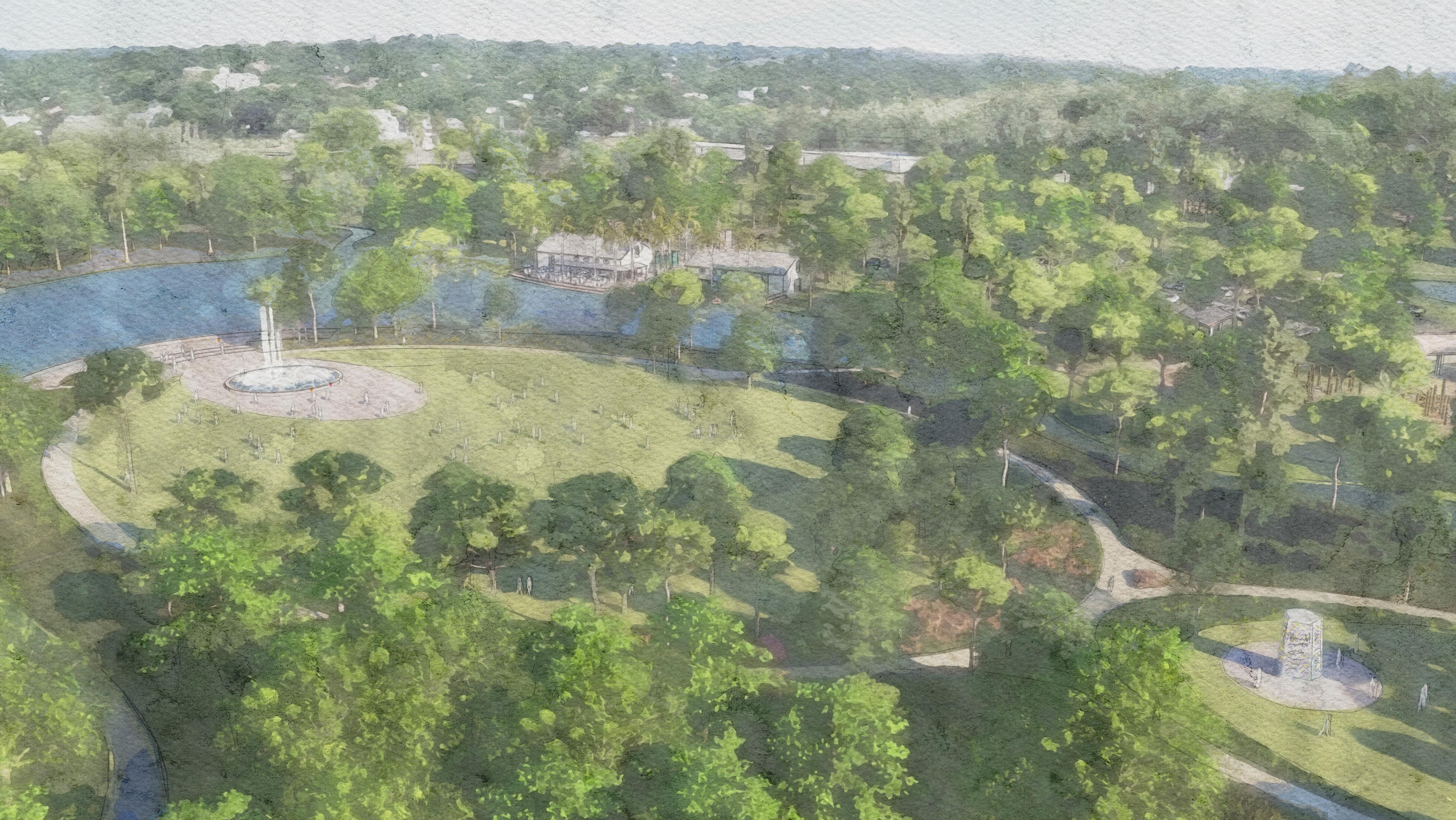
The Heart of the Tract
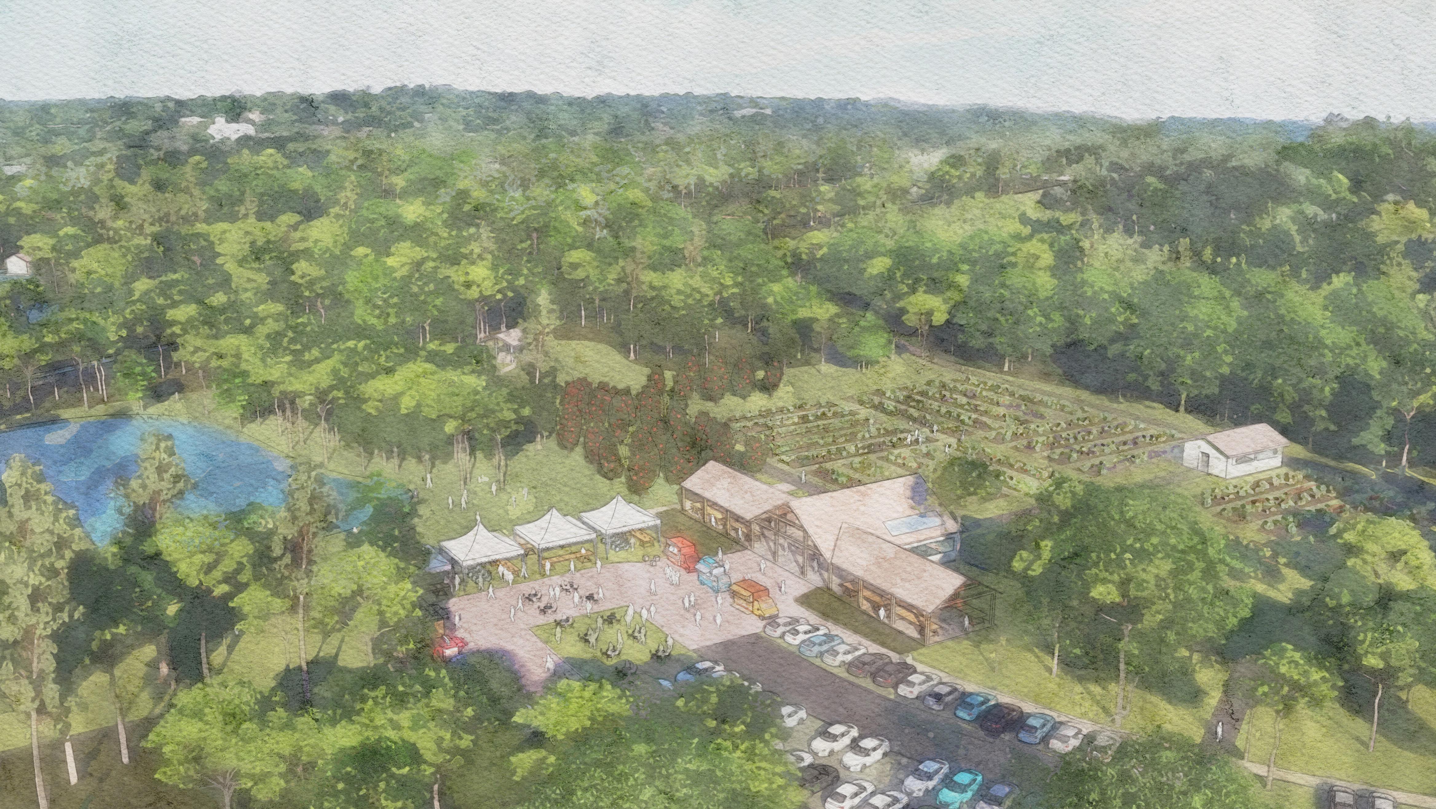
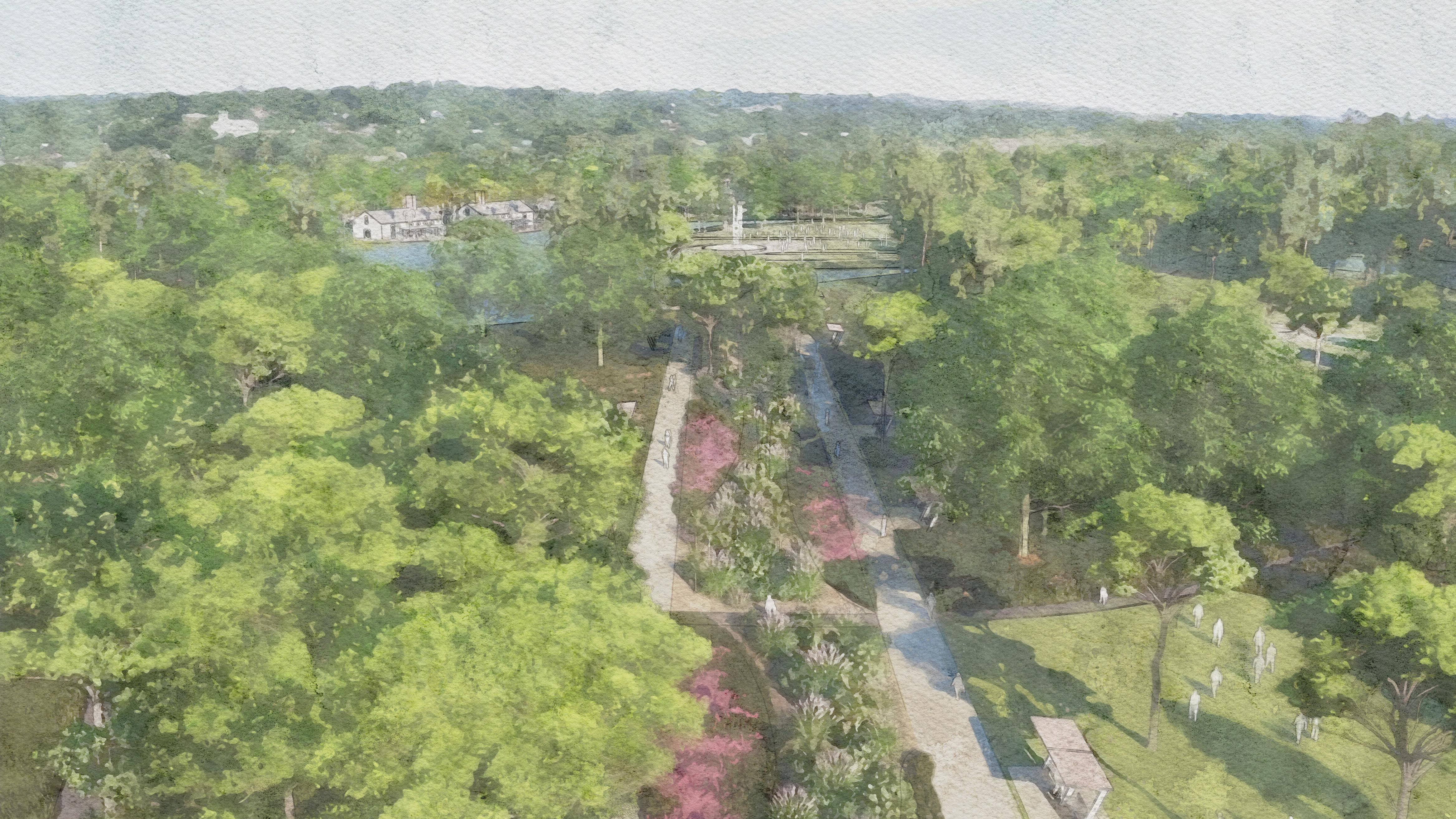
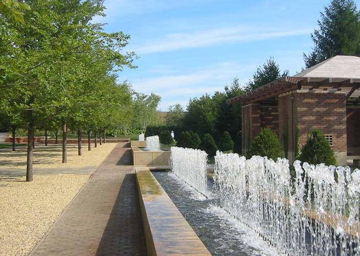
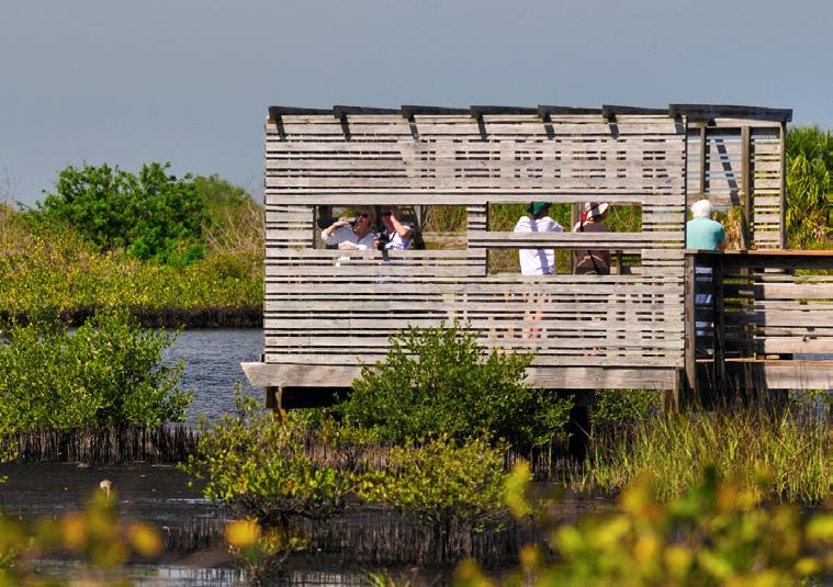
The Heart of the Tract is the main hub of activity for the Mid-Island site. It is anchored by a multi-use community facility that overlooks the interconnected lagoon system with views to the Great Lawn. The lawn area provides a space for events or gatherings and provides a backdrop for signature site elements such as a sculptural fountain, Martin Luther King Jr. Memorial, and an event grove for small performances. The Great Lawn serves as the central programing space with multiple connections to adjacent program areas.
While many users will access the tract from this ceremonial entrance off of Dillon Road or connect to this area through the park’s interior pathway system, The Heart of the Tract will also provide filtered, yet scenic views from William Hilton Parkway for vehicles driving through Mid-Island and Ashmore Tracts.
Program Components
Sculptural Fountain
Great Lawn
Luther King Jr. Memorial
Sculptural Fountain [Traditional] Event Grove Water’s Edge
Sculptural Fountain [Art] Great Lawn The Basin
Sculptural Fountain [Water] Great Lawn Pedestrian Bridge
Pedestrian Bridge
The Basin
Water’s Edge
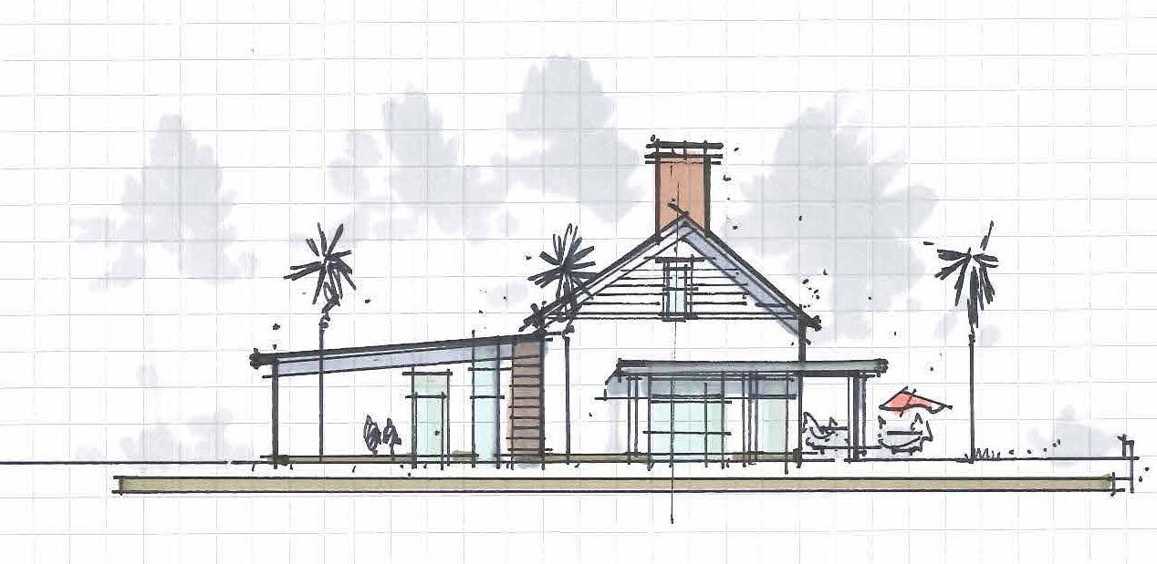
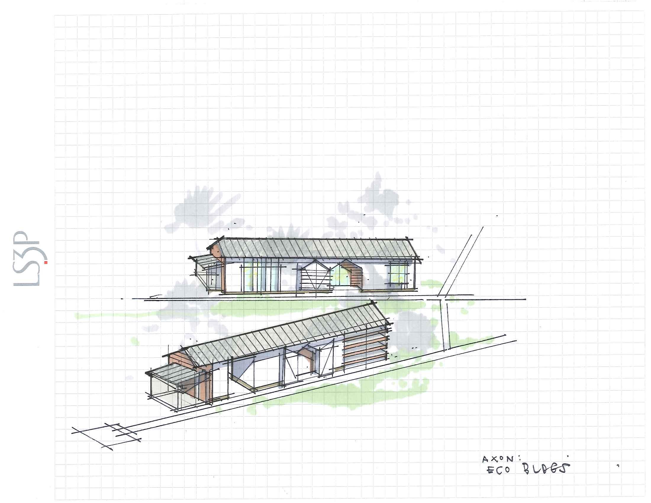
Multi-Use Community Facility
ISLAND HERITAGE
Island Heritage
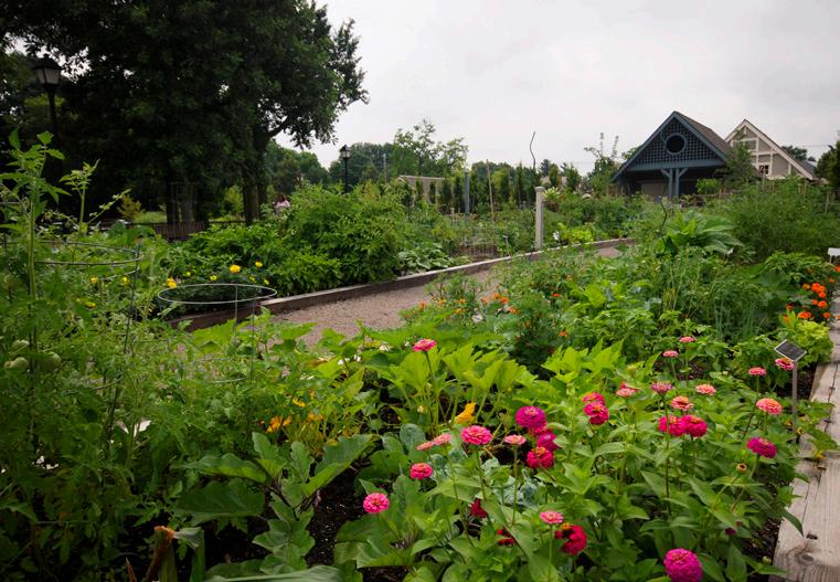
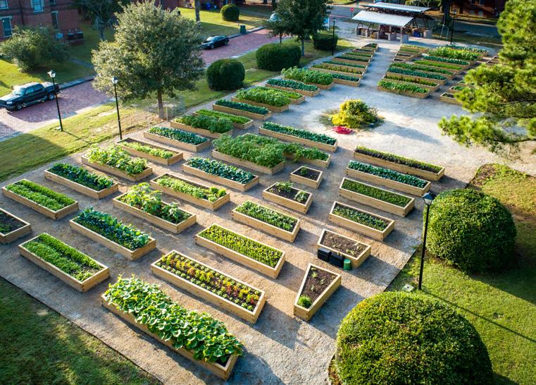
Hilton Head Island has a diverse history and heritage including Native Americans, Gullah Geechee, European settlers and modern-day developers amongst others. The Island Heritage program area, while not duplicating features at other parks and facilities on the Island, provides an opportunity to tell the story of those historic periods of island settlement, including architecture, crafts, traditions, and agrarian foods. This area of the park, located near Grassland neighborhood, historic Union Cemetery, and the new site of the St. James Church, includes a community demonstration garden for showcasing the fruits and vegetables that were historically grown on the island. The garden will also provide an opportunity to supply these agricultural products to other island communities.
In addition to the demonstration gardens, a multi-use community space will anchor the program area and serve as an open air market for showcasing artists, crafters, and wear. In addition to providing a high-quality location to display locally produced merchandise, the community space can function as an outdoor meeting space or a covered pavilion.
GRASSLAND
Sculptural Fountain [Traditional] Event Grove Water’s Edge
Sculptural Fountain [Traditional] Event Grove
Multi-Use Community Facility
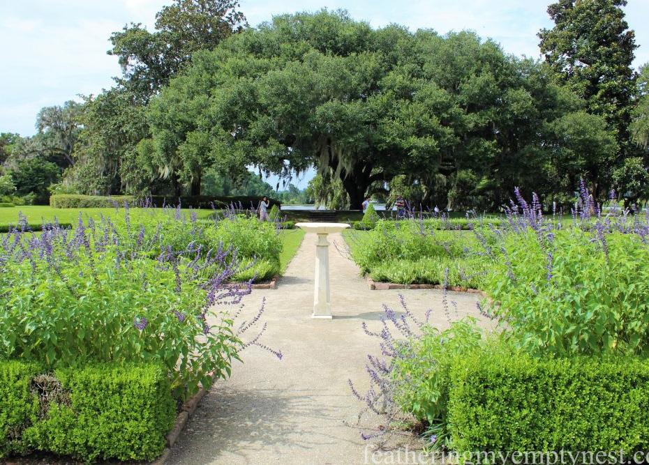
Cultivated Landscapes
The Cultivated Landscapes provide a counterpoint to the natural and informal restored landscape of the Tract with an ornamental and intentionally curated appearance. The Monet Garden, the most highly manicured, will feature clipped hedges and colorful blooms. Such a formal garden is to become a place for respite and contemplation. The Alameda will have a moderate level of formality with swinging benches along a tree lined garden walk, meant for strolling, seating, and interaction with other visitors. The Lowcountry botanical gardens will feature native plants and have a natural aesthetic. The centerpiece of the Lowcountry botanical gardens will include a promenade with central water feature, boosting the connection between William Hilton Parkway and the interior of the park. The southern portion of the program area will also accommodate staging for the Concours D’Elegance event through usage of the parking areas and open lawn for overflow parking.
WILLIAM HILTON PARKWAY
Riparian Gardens Water Gardens
Lowcountry Botanical Gardens
The Alameda The Promenade Monet Garden
Monet Garden Riparian Gardens Lowcountry Botanical Gardens
Active play is provided through a variety of program elements building on the synergy of the Heart of the Park. Users can cool off in an interactive water feature or run though the nature playground that is themed on aspects of the natural environment and compliments the adjacent Eco-Park portion of the park. Bocce courts and chess tables are available for casual matches or teaching opportunities. Utilizing existing fairways along Dillon Road, two open lawn areas can be used for pick up games, gatherings, and other informal uses.
These open lawns are also allow for clear views into the Heart of the Park from one of the major vehicular entries into the park to naturally orient the visitor to parking, community multi-use facilities, and play areas. They are also available as overflow parking for major in-park events and festivals.
DILLON ROAD
ECO-PARK
Eco-Park
The site contains a number of diverse habitats, freshwater ecosystems, and other natural environments rare to Hilton Head Island. The Eco-Park preserves and enhances these unique environments, offering a place for the public to spot important migrating bird species, learn about the natural history of a barrier island, and connect with nature.
The Eco-Park features a series of boardwalks, observation areas, and a canopy walk to provide multiple vantage points for observing and interacting with the natural features of the site. The Eco-Center provides educational opportunities for all ages while providing preservation/conservation areas to increase biodiversity and restore the natural ecosystem.
Program Components
The Ashmore Tract is low-lying and prone to flooding with considerable wetlands, so it is limited in potential uses. However, the fragmented quality of the site provides a unique opportunity for a dynamic disc golf course on higher ground beneath mature canopy trees. Incorporating the natural features of the site into the design of the course will be critical to retaining the natural features that exist today. It also may be possible to create wetlands for a workforce housing mitigation bank on the Ashmore Tract. Balancing program, vehicular access, parking, and pedestrian connectivity with the PSD expansion are also key considerations for the site.
1. Park Road
2. 18-Hole Championship-style Disc Golf
3. Pavilion / Comfort Facilities
4. PSD Provided Improvements
Ashmore Tract
PARK VISION
WILLIAM HILTON PARKWAY
DILLON ROAD
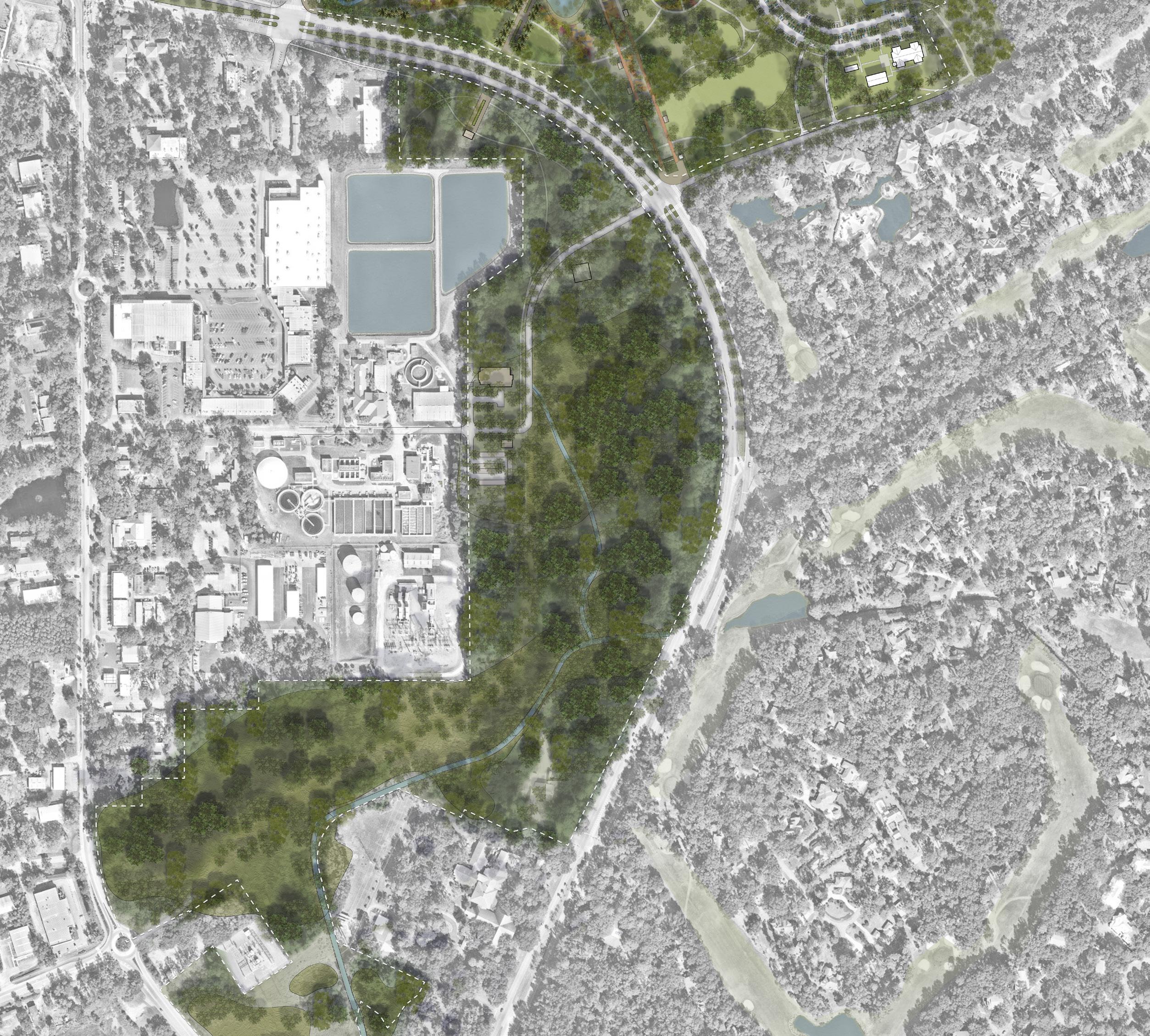
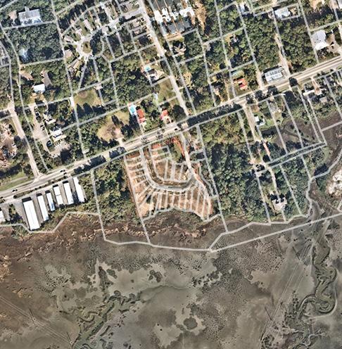
DISTRICT CENTER
The District Center focuses on the three commercial shopping areas at the core of the Mid-Island District. While Sea Turtle Marketplace, Northridge Plaza, and Port Royal Plaza are all relatively functional shopping centers today, they follow an outdated development pattern that focuses on auto-oriented, single-use retail uses that have a lack of public space and vitality. All three centers have significant large vacant buildings and lots and are centered around acres of surface parking lots. Community concerns about these older shopping centers in the Mid-Island District along with the desire for additional residential, updated shopping and dining experiences, and a more walkable, pedestrian-oriented character lead to the planning team exploring a mixed-use District Center that is seamlessly connected to existing neighborhoods, existing park spaces, and the new park at the Mid-Island Tract. The recommendations for the District Center were driven by the following community goals:
• Preserve and protect existing open spaces, creating an interconnected and green District.
• Integrate history and culture and expand economic opportunity.
• Create a walkable District that seamlessly integrates existing development and neighborhoods.
• Improve connectivity and safety and making it easier to cross William Hilton Parkway.
• Address the condition of existing commercial shopping areas in the MidIsland District by considering a mix of uses and potential repositioning opportunities that balance the need for housing, commercial, and office uses.
• Create a distinct District identity that provides an overall aesthetic appearance and fits the character of the surrounding neighborhoods.
• Transform the District Center into a hub of activity for the entire Town of Hilton Head, using the Mid-Island Tract as a catalyst.
District Center Components and Uses
The creation of a compact, walkable center for the Mid-Island District starts with a commitment to a mix of uses and the insertion of a system of pedestrian oriented streets. Uses must be mixed both vertically and horizontally with active ground floors. Parking must be integrated into the development, through the use of internal garages and on-street parking. Any surface parking should be located behind buildings. This allows for a continuous streetscape that is oriented toward pedestrians and prioritizes sidewalks, bike connections, and transit access. In addition to investment in memorable architecture, attention must also be paid to the quality of public spaces that invite community gathering and anchor the District.
The following District Center uses and design considerations are recommended:
1. A mix of uses that includes retail, restaurants, apartment flats, townhomes, office, institutional and open spaces.
2. A residential density of 12-18 dwelling units per acre to create more housing units and options (depending on product type).
3. 3-story maximum height to keep with the character of the Island.
4. Establish shared structured parking and place surface lots behind buildings to encourage walkability.
5. Establish a landscaped green edge along William Hilton Parkway.
Multi-Use Path
Internal Path
Connections
District Center Existing Conditions
The three shopping centers along William Hilton Parkway represent an opportunity to transform the core of the Mid-Island District. Northridge Plaza has made recent improvements in parking and landscaping, but the outdated development pattern persists. Port Royal Plaza has begun to invest in smaller storefronts and restaurant uses to break up the larger retail floorplates for individual businesses. Sea Turtle Marketplace, while the newest, has significant vacancies in existing buildings and lots.
District Center Uses and Capacity
To test the capacity of these sites, the planning team looked at how a market-supported mix of uses and a new development form could create new District Center. Each of the three plazas could be redeveloped in phases to allow for existing successful retailers to occupy new buildings and for needed parking to be constructed to enable pedestrian oriented streets that are fronted with buildings instead of surface lots. New residential is located in mixed-use buildings and in stand-alone buildings. Community gathering and green spaces are integrated throughout the new development and a green landscape is established along William Hilton Parkway.
Market Feasibility
Recognizing the importance of a plan that carefully considers true market potential in the District Center, the Town of Hilton Head Island sought additional detail on the market feasibility of redevelopment along William Hilton Parkway, focusing on the Northridge Plaza, Port Royal Plaza, and Sea Turtle Marketplace shopping centers. The market feasibility results build upon work previously prepared for the Mid-Island District, providing a greater level of detail to assess the short- and long-term development opportunities. Ultimately, the District Center provides a unique opportunity for Hilton Head Island to create a successful mixed-use node that promotes a live, work, play environment with proximity to a prominent recreation destination.
With a focus on a mixed-use environment, multifamily residential, retail, and office real estate sectors were assessed for future viability to be incorporated into redevelopment efforts in the District Center. Key real estate market findings are as follows:
• Multifamily residential represents a clear and immediate demand opportunity for the District Center. The addition of new rooftops is critical in the success of future nonresidential land uses and presents an opportunity for more of Hilton Head Island’s population to live with pedestrian accessibility to a unique recreation asset. There is only one existing modern multifamily community on Hilton Head Island, with a second about to deliver near the District Center. Extremely low historic vacancy rates have led to elevated lease rates with strong year-over-year growth. Aquatera, which is expected to begin unit occupancy later this year, has quoted rents averaging $2.55 per square foot, a threshold that can typically support structured parking and/or vertical integration.
• Retail uses serve not only residents but also the robust tourism economy on Hilton Head Island. Approximately two-thirds of the retail inventory was completed prior to 1990. Occupancy of Island retail space has historically been high, typically measuring 95% or greater. Sea Turtle Marketplace is a focus area within the District Center and represents one of the newer retail centers on the Island, completed in 2018. Occupancy at the center was impacted by the closure of a junior anchor, which adds to the nearly 54,000 square feet of available space. In-line suites at Sea Turtle Marketplace have quoted lease rates of $23.00 per square foot.
• Office space on Hilton Head Island has been one of the softer real estate sectors. In fact, less than 10,000 square feet has been completed on the Island since 2010. With limited new product being introduced to the market, vacancy rates have remained lower than 5% in the last several years. Lease rates on the Island average less than $20 per square foot, however newer buildings are estimated closer to $25 per square foot.
Multifamily Residential
Northridge Plaza, Port Royal Plaza, and Sea Turtle Marketplace represent key opportunities to attract investment through infill opportunities that can be phased over time to retain successful existing tenants. The inclusion of multifamily residential not only addresses immediate need on Hilton Head Island for rental options but can also be leveraged to build additional demand for retail and office uses in the future. All three focus areas offer opportunities for infill residential projects, either on undeveloped portions of the property or by strategically converting surface parking lots to development pads through shared parking strategies. Market-rate projects will be the easiest to bring to market, but inclusion of affordable units would be beneficial to meet stated housing goals for Hilton Head Island.
Retail & Office
Non-residential development, including retail and office uses, likely have more varied timelines for redevelopment. Well-located retailers have proven successful across the Island, served by the robust tourism industry. The District Center offers a new opportunity for a live, work, play environment that equally serves locals and tourists. In the short-term, continued leasing at Sea Turtle Marketplace will provide new confidence for retailers on the northern portion of the Island. Retail rents in the immediate area could require shortterm incentives to reach levels that are adequate for most vertically integrated mixed-use projects. Office development will be more limited in the short-term, however, a modern, mixed-use district would be attractive for professional office tenants and their employees. COVID’s impact on the modern work environment, including the ability to work remotely, may ultimately have a positive effect on Hilton Head Island as a desirable economic development destination.
Redevelopment Considerations
Redevelopment of these key existing shopping centers will likely require public intervention. This could represent comprehensive redevelopment of a site or integration of uses by reducing surface parking provision. Given the fact that suburban development patterns tend to be primarily single-use parcels, their layouts can be resistant to incremental change. The key design challenge of reimagining suburban retail centers is integration, both internally and externally, over time and over multiple parcels. Overcoming suburban fragmentation requires innovative adaptations to zoning and subdivision regulations. The creative use of public investment in key development opportunities, either through the creation of additional value in special taxing districts or through public-private partnerships, can help overcome this challenge. Public-private partnerships at a variety of scales are often required to collectively take on the challenges of retrofitting a suburban setting.
Multifamily residential represents a clear and immediate demand opportunity for the District Center
Traffic Impacts
Both a park at the Mid-Island Tract and new trips generated by the District Center are not expected to have significant impacts on the typical daily traffic in the area or alter the existing Level of Service. The following is a summary of the planning-level review of the proposed development concepts in the Mid-Island Tract and District Center areas with regard to vehicular and pedestrian traffic impacts. These initial recommendations are not intended to replace the need for further detailed capacity and traffic impact analyses for the proposed developments. It is recommended that further study be undertaken before implementing any of these concepts beyond the planning stage.
Potential improvements for both the Mid-Island Tract and District Center include:
• Realigned crosswalks and crosswalk improvements at the intersection of Dillon Road at William Hilton Parkway to reduce pedestrian crossing distance and improve safety.
• Mid-block crossing and a median refuge island for pedestrians at Union Cemetery Road and William Hilton Parkway.
• Signalization of the intersection at either Northridge Drive or the adjacent median opening, including pedestrian signals and crosswalks across William Hilton Parkway (signal would be subject to approval by SCDOT, and warrant analysis should be conducted). Consolidate vehicular and pedestrian access to the new signal by removing access at the adjacent median opening or restricting it to right-in, right-out only.
• Tightened turning radii on the side street approaches at the Northridge Drive intersection, to reduce the crossing distance for pedestrians and to reduce speeds of vehicles turning across the crosswalks.
• Improved crosswalks for the access points to the District Center redevelopment along Mathews Drive.
• Improvements at the intersection of William Hilton Parkway at Dillon Road to benefit access for the redevelopment at Port Royal Plaza.
• Signal timing adjustments to allow for protected left-turn movements on the north and south approaches at William Hilton Parkway and Dillon Drive to improve the safety and capacity of these movements at the intersection to benefit access for the redevelopment of Port Royal Plaza.
Intersection Improvements
Smaller Intersection Improvements
Improved Crosswalks
William Hilton Pkwy
DISTRICT CENTER
Connecting the District
The District Center can be developed in a way that encourages connections across William Hilton Parkway to bridge parts of the District north to south. Within these existing shopping centers like Northridge Plaza, Port Royal and Sea Turtle Marketplace a new network of streets can create smaller block sizes that support walkability on safe and active streets. A mix of uses can support a variety of active storefronts that attract more visitors and retain local business.
WILLIAM HILTON PARKWAY
SEA TURTLE MARKETPLACE
NORTHRIDGE PLAZA
MATHEWS DRIVE
MID-ISLAND TRACT
PORT ROYAL PLAZA
DILLON ROAD
DISTRICT CENTER
Redevelopment Character
New development in the area has the opportunity to be done in a way that creates a walkable District Center. A special place that the community takes pride in and comes together to meet and intermingle with neighbors celebrating special occasions or just taking advantage of a pleasant evening stroll with friends. This will be where residents bring visiting friends and family to show off their community, a place that is quintessentially Hilton Head Island with local businesses and high-quality cozy public spaces that bring people together.
This area is defined by an interconnected network of walkable, shaded canopy streets. A mix of restaurants, shops, and homes, all decorated with artful and memorable sights throughout. While people visit for the beach, they stay for the warm and welcoming coastal lifestyle.
By identifying opportunities for sprawl retrofit in areas centered around the intersection of Mathews Drive and William Hilton Parkway and the surrounding shopping plazas by organizing parking more efficiently, and strategically placing infill development, a new District Center can really make an impact and chart a new course for the Mid-Island area.
HISTORIC NEIGHBORHOODS
The Gullah Geechee Culture Preservation Project Report recommended changes to the Town’s Land Management Ordinance (LMO) to provide more development opportunities for Gullah landowners. This would involve relaxing certain development standards, expanding permitted land uses and increasing development densities.
In the five Historic Neighborhoods in the Mid-Island District, the Gullah Geechee Culture Preservation Project Report recommendations focused on the areas that are zoned RM-4. As currently written, the code allows a range of 4 to 8 dwelling units an acre depending on whether it is a 1, 3 or 5 acre site. Coupled with existing setback, buffering and open space requirements, this constricts the ability of landowners to develop their property. The report also noted that commercial services such as bed and breakfasts, convenience stores, open air sales be allowed.
The Gullah Geechee Culture Preservation Project Report recommended a Historic Gullah Neighborhoods Conservation Overlay District to address these issues. To allow for greater regulatory clarity, the planning team recommends that these overlay goals be accomplished through an update to the base zoning and the creation of design standards.
Building from the Gullah Geechee Culture Preservation Project Report, the recommendations for the Historic Neighborhoods were driven by the following community goals:
• Advance and celebrate the history and culture of the Native Islanders
• Enable Historic Neighborhoods to be economically sustainable
• Provide for additional uses including neighborhood commercial and home business opportunities
• Meet the increasing need for housing, including affordable and workforce options, on the island
• Allow existing property owners the flexibility to optimize the use of their property
Historic Neighborhoods
In the Mid-Island District, Historic Neighborhoods include Baygall, Mitchelville, Big Hill, Grassland, and Marshland.
Existing Land Use in Historic Neighborhoods
The land uses in the Historic Neighborhoods are predominantly a mix of different scale of residential and park and open space. Marshland and Mitchelville have the greatest variety of uses including retail/services/sales, light industrial, institution and office uses.
Historic Neighborhoods Boundaries
District Boundary
IL- Light Industrial
LC - Light Commercial
MF- Marshfront Mixed Use
MV - Mitchelville
PD-1 - Planned Dev.
PR- Parks & Rec.
RM-12-Moderate-High Density
RM-8-Moderate Density
RM-4-Low-Moderate Density
Existing Zoning in Historic Neighborhoods
Zoning in the Historic Neighborhoods reflects the Land Use to a degree, with most of the zoning representing different residential categories and a variety of densities. Most of the residential zoning is RM-4, but there are areas of RM-12 in Grassland and Mitchelville, RM-8 and RM-12 in Baygall, and Marshfront Mixed Use in Marshland.
Existing Residential Development
To guide the recommendation on residential density, the planning team reviewed recent development within the Mid-Island District. In each example of residential development the existing zoning category, allowed density, and resulting development density is identified. All of these examples fall between 5 and 6 dwelling units an acre.
Mitchelville
Historic Neighborhood Uses and Recommendations
Based on the direction from the Gullah Geechee Culture Preservation Project Report, the planning team, Town Staff, Town Council, The Gullah Geechee Task Force, and the community discussed recommended changes to the base zoning for the Historic Neighborhoods in the Mid-Island District. These changes address allowing for density, making adjustments to development standards, allowing for economic opportunity and a mix of uses, and encouraging walkable neighborhood scale and character.
The following Historic Neighborhood uses and design considerations are recommended:
• Adopt consistent, uniform density standards and development patterns
• Allow for consistent densities in the RM-4 districts (6 to 8 DU/AC) regardless of parcel size
• Calibrate setback and buffering (internal) and open space requirements to allow for infill development
• Allow for neighborhood commercial and home business opportunities
• Use mix on a site should be 75% residential and up to 25% neighborhood commercial
Following the adoption of a Future Land Use Map, the Town of Hilton Head should continue to work with the Historic Neighborhoods on the updated zoning code and design standards.
Neighborhood Commercial
Neighborhood Commercial
Modular Homes
Modular Homes
Two Family
Townhomes
Garden Apartments
Single Family
RESIDENTIAL CHARACTER
Historic Neighborhoods
The Historic Neighborhoods of Hilton Head Island are critical components of any future planning efforts in the area. It is important to ensure that residents are able to continue to enjoy close-knit neighborhoods with controlled growth so as to protect the lifestyle of existing residents. The legacy neighborhoods of Hilton Head Island are what give a sense of place to the area through the many distinct cultural traditions that residents carry into the future.
Its important to create a planning framework that celebrates these neighborhoods and ensures that residents will continue to chart their own course. One way to do that is to identify current regulatory hurdles to traditional community building and allowing residents to create neighborhoods the way they historically did, with a variety of small-scale residential building types arranged so as to promote healthy relationships with the land and neighbors.
In historic neighborhood areas gentle density with certain missing middle housing types provides increased options for more accessible home ownership opportunities. Neighborhood scale food access is provided through community gardens. Residents enjoy their private yards, gardens, and shared neighborhood spaces. Occasional interactions with other community members is common. Building types are typically limited to single detached houses, townhomes, duplexes, and corner stores. Land uses are typically limited to residential with occasional neighborhood-scale small commercial uses.
05
IMPLEMENTATION
STRATEGIC ACTIONS
A Roadmap for Implementation
Implementation of the Mid-Island District Plan is guided by a set of six Strategic Actions that will enable the Town of Hilton Head Island to take a methodical approach to transforming the District. These six Strategic Actions represent the key steps that the Town must take to implement the District Plan and follow through on the community’s vision. This will require leadership from the Town of Hilton Head Island, cooperation of key property owners, continued collaboration with community members and residents, and the formation of partnerships with the development community and other allied organizations.
01
Adopt a Future Land Use Map
This work begins by adopting a Future Land Use Map that will set the stage for updating the zoning code and creating standards.
Implement Park Development on the Mid-Island Tract
Concurrent with step one, the Town should begin implementation of Phase 1 of park development on the Mid-Island Tract. Upon adoption of the MidIsland Tract Concept Plan, the Town should engage the consultant team to prepare Schematic Design and Development documents of the entire park and conduct further site investigations, design, construction documentation and bidding documents for the first phase.
Adopt a policy framework
To support ongoing Island-wide planning efforts and initiatives, the Town should next create policies and strategies to address infill development, mixed-income housing, housing types, energy efficiency, transit and mobility, and sustainability within the District.
04 02 05 03
Update the Zoning Code and Map
Following the adoption of the Future Land Use Map and the policy framework, the Town should update the Zoning Code and Map and create standards that will result in a compact, walkable and vibrant district. The zoning code update and creation of standards will be instrumental in guiding infill development in Historic Neighborhoods and the redevelopment of the commercial shopping centers in the Mid-Island District to create a dynamic, mixed-use District Center.
Leverage planned public investments
In addition to making investments in a park on the Mid-Island Tract, the Town should—concurrent with park design—plan for additional improvements and investments in public space, corridors, alternative transportation and infrastructure to facilitate the development of the District and the reinvestment in Historic Neighborhoods.
06
Establish the organizational and financial tools to guide implementation
In order to incentivize the redevelopment and reinvestment required in the Mid-Island District, the Town of Hilton Head will also need to explore the organizational and financial tools to acquire needed funding, create public-private partnerships, and streamline the regulatory process. The Town’s recent establishment of the Gullah-Geechee Historic Neighborhoods Community Development Corporation should be extended to the Historic Neighborhoods in the Mid-Island District to aid in implementation. The model of a Community Development Corporation could also be considered as an organizational structure that could be formed to focus purely on the District Center as well.
These six Strategic Actions and the tactics for each are detailed in the following matrix that identifies a timeframe, potential partners that could be helpful in or required for implementation, and reference pages from this plan. The timeframe includes immediate term tactics (0-1 year), short term tactics (1-3 years), medium term tactics (3-5 years), long term tactics (5+ years), and continuous tactics as represented at below:
0-1 year
1-3 years
3-5 years
5+ years
Continuous
This matrix and its tactics should be revisited continually removing ones that have been completed and adding new ones as the need arises. Using this tool, the Town can begin the important work of implementation.
Mid-Island District Wide Strategic Actions
Following adoption of the District Plan and the Mid-Island Tract Concept Plan, the Town should:
Strategic Actions
1. Adopt a Future Land Use Map
2. Implement park development on the Mid-Island Tract.
a. Town to define Phase 1 project scope, budget, funding sources and schedule for design and construction.
Engage consultant team to further site investigations, design, construction documentation and bidding documents.
- Commission and secure archaeological investigation of the park site.
b.
- Commission and secure preliminary geotechnical investigation/report.
- Commission consultant team to prepare Schematic Design and Development level document of the entire park site (including all phases of development) to refine, validate and increase the accuracy of park layout as depicted by the approved Concept Plan.
c. Prepare detailed estimate of probable construction costs, final Phase 1 development scope, budget and schedule.
d. Prepare complete set of biddable Construction Documents including technical specifications for Phase 1 development.
e. Bid, award and commence Phase 1 construction.
f. Develop scope for the next phase of park development.
3. Adopt a policy framework to support ongoing Island-wide planning efforts and initiatives.
a. Town to align Mid-Island District recommendations with the Workforce Housing Framework, the Gullah Geechee Culture Preservation Report, and other ongoing planning.
b. Create a district infill development strategy to target properties for redevelopment including incentives.
c. Develop a small home/cottage series of pre-approved plans.
d. Institute programs to promote mixed-income housing within the district.
e. Provide full spectrum of housing types catering to changing demographics over time.
f. Promote energy efficient modular construction.
g. Strengthen environmental sustainability and stormwater resiliency.
h. Promote sustainable practices through the use of community gardens.
Mid-Island District Wide Strategic Actions
Following adoption of the District Plan and the Mid-Island Tract Concept Plan, the Town should:
Strategic Actions Time frame Potential Partners Page #(s)
4. Update Zoning Code and Map to implement the Future Land Use Map and create standards that will result in a compact, walkable and vibrant district.
a. Town to engage consultant to conduct zoning code assessment to inform implementation of Mid-Island District recommendations.
Update Zoning Code to allow for Mixed-Use Development within the District Center that encourages redevelopment and infill development that meets Island Character. The following uses and design considerations are recommended:
- A mix of uses that includes retail, restaurants, apartment flats, townhomes, office, institutional and open spaces.
- Density is recommended at 12-18 dwelling units per acre to create more housing units and options (depending on product type).
- To keep with the character of the Island 3 story maximum is recommended.
- To encourage walkability establish shared structured parking and place surface lots behind buildings.
- Establish a landscaped green edge along William Hilton Parkway.
Update Zoning Code to allow for Historic Neighborhood density calibration and allowance of neighborhood commercial use. Adopt consistent, uniform density standards, development patterns, and neighborhood commercial uses within the Historic Neighborhoods including the following:
52-57, 98, 116
116
c.
110
County
Housing Trust Fund 96, 103, 110
Green Building Council SC 119
Lowcountry Stormwater Partners 42, 119
Lowcountry Stormwater Partners 42, 119
- Adopt consistent, uniform density standards and development patterns.
- Allow for consistent densities in the RM-4 districts (6 to 8 DU/AC) regardless of parcel size.
- Calibrate setback and buffering (internal) and open space requirements to allow for infill development.
- Allow for neighborhood commercial and home business opportunities.
- Use mix on a site should be 75% residential and up to 25% neighborhood commercial.
5. Leverage planned public investments in public spaces, corridor improvements, and alternative transportation, and infrastructure to facilitate the development of the district.
a. Town and consultant team to align District recommendations with the outcomes from the Corridors Project and other plans/projects to inform priority infrastructure and public improvements.
Mid-Island District Wide Strategic Actions
Following adoption of the District Plan and the Mid-Island Tract Concept Plan, the Town should:
Strategic Actions
b. Lead efforts to mitigate airport impact on St. James Church.
c. Study needed transit and mobility improvements to improve equitable and non-motorized access.
d. Implement the recommended street sections for the District that includes on-street parking, sidewalks and street trees. Start with the roadways directly adjacent to the park (Dillon Road, Union Cemetery Road and William Hilton Parkway) to align with park construction.
e. Implement the recommended intersection safety improvements, crosswalks and trail connections. Phase improvements to align with park construction.
f. Develop an access management plan.
g. Develop a public parking strategy for the District.
h. Provide park development (Historic Mitchelville Freedom Park, Barker Field and Extension, etc.) and expand the pathway network throughout the District.
i. Commit to needed infrastructure upgrades to include water, sewer, stormwater, streets (paving dirt roads and adding new internal streets), broadband, etc. to support and facilitate infill development in the District.
j. Coordinate with Beaufort County Airport on operations and impacts on the District.
6. Establish the organizational and financial tools to guide implementation.
a. Form a Town-led Working Group to assess and determine the implementation tools required for the Mid-Island District
b. Explore creation of a TIF district.
c. Align and coordinate with CIP and Town funding sources.
d. Extend the focus of the Gullah-Geechee Historic Neighborhoods Community Development Corporation to address the needs of the Historic Neighborhoods in the District.
e. Consider the creation of a Community Development Corporation for the District Center.
f. Explore public private partnerships to advance redevelopment infill opportunities.
g. Refine development review process to streamline and expedite permitting.
h. Enact a land acquisition program to assemble parcels to facilitate plan implementation.