4 minute read
DETECTING DROUGHT


DROUGHT DETECTIVES
DR. JOHN CHRISTY GETS $600,000 TO CREATE A MORE ACCURATE ANALYSIS OF SOIL MOISTURE
Advertisement
Better drought depiction, agricultural assessments and information about flood potential are the goals of a two-year, $600,000 grant to create a more accurate analysis of soil moisture that has been awarded to UAH’s interim College of Science dean by the National Oceanic and Atmospheric Administration (NOAA).
The interim dean, Dr. John Christy, is a distinguished professor of atmospheric science and director of UAH’s Earth System Science Center (ESSC). He’s also the Alabama state climatologist and the grant’s principal investigator.
“We will deploy state-of-the-art sensors at our 16 Alabama climate stations, along with other types of sensors for cross-validation, that will aid in producing consistent measurement values because these various sensors are used throughout the nation,” Dr. Christy says. “To fill in the area surrounding the point measurements, we will develop and improve remote sensing soil moisture products using satellites and drones.”
The system under development would especially aid farmers seeking federal assistance payments, as the region is prone to flash droughts that can decimate pastures and crops over a wide-ranging, spotty area.
“We had a serious flash drought in September 2019 that devastated pastures in Alabama, Georgia and north Florida that supported our livestock industry,” Dr. Christy says.
“The typical metrics for determining stress for federal assistance payments relied on tools that did not capture this event, so many livestock producers were not eligible for assistance,” he says. “This work will provide not only high resolution but a more accurate depiction of the stresses that such crops experience and thus be used as an additional indicator of agricultural losses.”
Dr. Christy’s team is Dr. Walter Ellenburg, ESSC research engineer; Dr. Vikalp Mishra, ESSC research associate; Dr. Udaysankar Nair, associate professor of atmospheric and Earth science; Dr. John Mecikalski, professor and chair of the Department of Atmospheric and Earth Science; Dr. Christopher Hain, research scientist, Short-term Prediction Research & Transition Center (SPoRT), Earth Science Branch, NASA Marshall Space Flight Center; and Cameron Handyside, ESSC research engineer.
Currently, much of federal drought assistance for farmers is based on U.S. Drought Monitor status, says Handyside.
“The problem with the Drought Monitor is that it is a conglomeration of many factors that go into a general drought condition,” Handyside says. While it’s a good indicator of general drought, the Drought Monitor does not always reflect agricultural drought, he says.
“Spot droughts are one of the biggest challenges facing farmers in Alabama. Alabama can go from flood to drought in seven days and often the Drought Monitor is slow to respond.”
Much of the Drought Monitor data is reported at the county level, yet conditions can vary widely across a county.
“We see cases where a farmer in northern Madison County is doing great, plenty of rain and so on, while farmers in the southern part of the county have not seen a drop of rain in weeks,” says Handyside. “We believe that agricultural drought is driven mostly by soil moisture and that a high-resolution map of recent and current soil moisture is a better indicator of crop stress that leads to agricultural drought.”
Soil moisture monitors installed under the grant at the climate stations and at North Alabama sites used by Baron Services will have an accuracy of ± 1%. Each station will record soil moisture at three depths – 5 cm, 20 cm and 50 cm – for direct comparison with the standard measurements at the NOAA and U.S. Department of Agriculture (USDA) Natural Resources Conservation Services reference sites. Soil samples will also be collected and analyzed from each site.
Where available, stations will use electric power and internet service, but otherwise stations will be designed to be independent of power or internet, using cell service and solar to power internal batteries.
The sensor network will be used to develop, test and regionally calibrate remote-sensed and model products. One goal is to evaluate low- to moderate-cost sensors to determine reliability and how well the data returned compares to more expensive sensors used by USDA and NOAA.
“Alabama soils and weather make the state much different than conditions in the Midwest or Plains states, where so much of the soil moisture research is conducted,” Handyside says. “The remote-sensed and model data from satellites, drones and crop models are intended to fill in the gaps between the sensor stations and create a more complete picture of current soil moisture conditions in Alabama.”
As well as the Alabama research, the overall NOAA funding incorporates separate but cooperative projects in Georgia and Florida.
“As part of the Alabama project, we are working to develop an online repository that will allow access to sensor data and maps,” Handyside says. The Alabama research will be made available to the National Soil Moisture Network’s effort to standardize soil moisture data.
“We hope to work with the USDA National Agricultural Statistics Service office in Alabama, since they are responsible for publishing crop progress reports,” Handyside says. “We have had success working with them in the past to provide data to help them develop a clear picture of conditions during the growing season.”
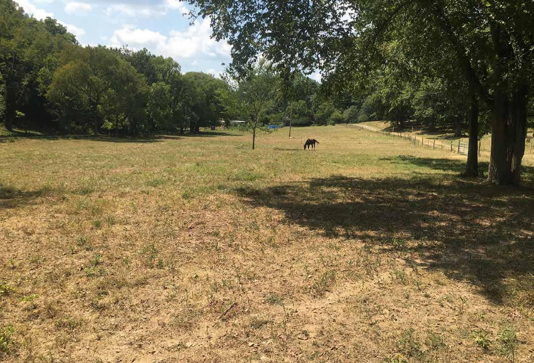
Spot droughts are one of the biggest frustrations for farmers, who may miss out on federal assistance payments. Photo courtesy Laura Warner