
3 minute read
Introduction


The city of Sari with more than 300,000 residents is located in the north of Iran, surrounded by Caspian Sea on the north, and Alborz mountains and Caspian forests on the south which makes the region a national tourist attraction as seen in figure 32.The diverse nature and Mediterranean climate has made the city a national tourist attraction. Sari is the capital city of northern province Mazandaran and it is governed by three main municipalities. All three mayors are appointed by the city council and city council members are elected by the citizens. The fieldwork site is a public green space and its adjacent streets in the center of a residential neighborhood in east of Sari and encompasses an area of 20,000 square meters. The neighborhood is bounded by “Tajan” river on its east side and “Darab” boulevard on its south side. Municipality of district one is in charge of this neighborhood. The public green space has an area of 4563 square meters and was constructed in 2002 by the municipality.
Figure 32: The fieldwork site, (Source: Google Earth, edited by author)
Advertisement
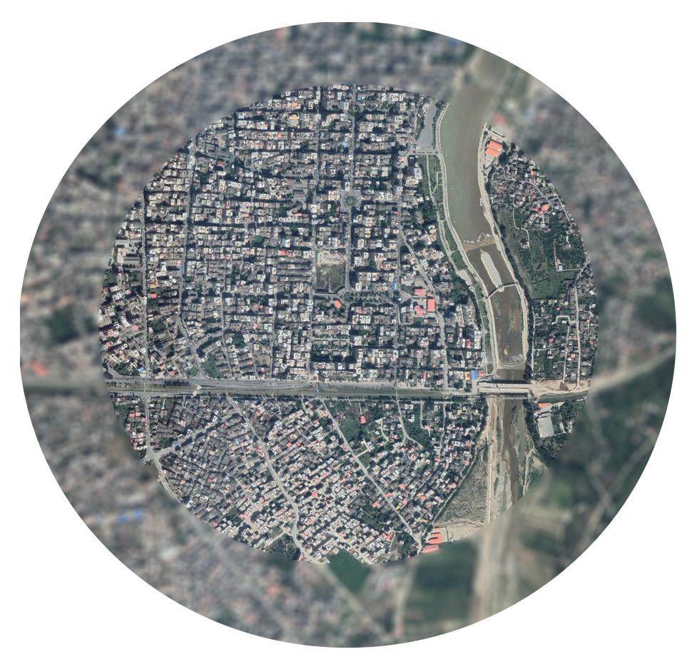
Figure 35: Sari city with neighbourhood (Source. Google Earth)

Figure 33: Map of Iran

Figure 36: Study site (Source. Google Earth)
The rationale behind the selected area
This residential neighborhood has developed within recent years and its central public green space has the potential to attract more population, while a large brownfield in the neighborhood has decreased the livelihood of this area by causing people to feel unsafe. In addition, the variation in land uses and activities in the area makes it more interesting to study.
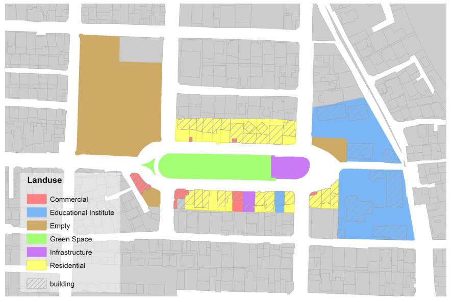
Figure 37: Land use map Land use
The landuse map (Figure 37) was generated based on fieldwork observations. Other than residential and commercial landuses, and infrastructure services, there are vacant lots in the area. The large empty lot is expected to be a shopping mall based on real estate agencies in the neighborhood.
The history
Archaeologists have found evidence of human habitat in the area of Sari city that belongs to Mesolithic era (Ramezani, 2013). Although, the exact date of founding of the city is not clear. The first municipality of Sari was established in 1919. (Sari Master plan, 2015)
The Study area is located in a not well-reputed district of the city. The infamy is rooted in the history of that place which used to contain a prison (Figure 38) in the vicinity of the city. As the city expanded, the prison which was located inside the boundaries was razed to the ground about eight years ago (Figure 39).
Based on an interview with an old resident of the area, she does not care about labeling her neighborhood as “Zendan” that literally means “Prison Neighborhood”. In fact, none of the residents use the new official name of the neighborhood. She believes after all new constructions in the surrounding area housing price has increased and titling the district as prison does not evoke any degrading feelings due to the rise in property prices. Although, the identity of this area is intertwined with the history of the neighborhood.

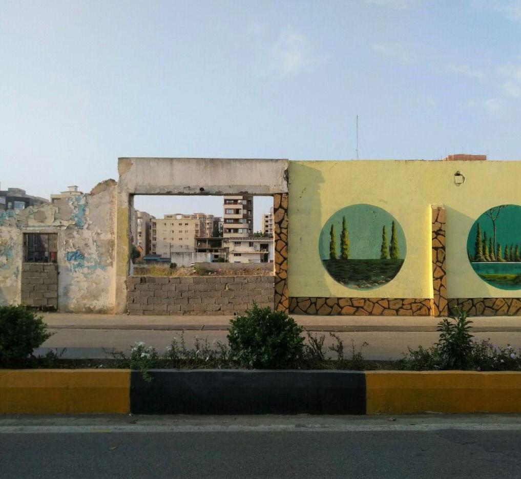
Figure 38: The prison, 2011 (source: ISNA news agency website) Figure 39: The vacant block. (Source: Author)


