3 minute read
In This Issue
Geographical boundaries are important in defining who we are. Human beings occupy the planet Earth with its natural land masses of continents, subcontinents, and islands. But we also live in nations, states, counties, cities, and towns. While we are residents of the North American continent, most readers of the Utah Historical Quarterly are also citizens of one of twenty-nine counties that are found within the state of Utah—one of the fifty states that constitute the United States of America. Our birthplaces are Salt Lake City, Grouse Creek, Torrey, Taylorsville, Magna, Monticello, and hundreds of other locales that are defined by political and geographical boundaries. How such political boundaries are formed and aspects of the human experience within defined geographical boundaries are the historical processes examined in this issue.
Our first article, reveals the political intrigues, machinations ,and negotiations that occurred during the last half of the nineteenth century leaving Utah with its present boundaries. Cut, split, and severed during six boundary-altering procedures, the Utah Territory was reduced in size from the enormous 225,000-square-mile territory of 1850 to its present size of 85,000 square miles. These reductions occurred on all but Utah’s southern boundary as parts of present-day Nevada, Idaho, Wyoming, and Colorado were once a part of the Utah Territory. This boundary setting process reveals much about the complexities of creating and organizing territories in nineteenth century America.

MerinSmith’s orchard at the base of the cliffs in Capitol Reef National Park, Fruita, Utah.
A.L. INGLESBY COLLECTION, UTAH STATE HISTORICAL SOCIETY
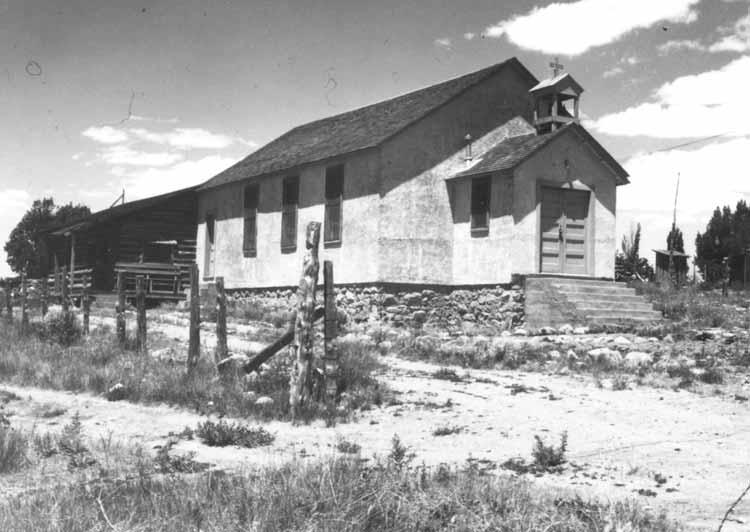
The Mormon endeavor to establish and foster a religious identity within the boundaries of what is now Utah is well known. However, not as well known are the attempts by other religious groups to build and maintain their institutions. The struggle to establish Roman Catholicism in sparsely settled southeastern Utah, discussed in our second article, is an inspiring story of dedication and commitment that should be remembered.
Our third article takes us from southeastern Utah to Grouse Creek in the northwest corner of the state for a look at the community experience of that Mormon agricultural area. A treasure of oral histories collected twenty-five to thirty years ago provide the foundation for this article, allowing a rich story of a cherished ,but lost, community life to unfold. The article also examines the issues of memory and reality—basic questions students of the past must address.

GROUSE CREEK CULTRUAL SURVEY COLLECTION, UTAH STATE HISTORICAL SOCIETY
The Tanner house and store outbuilding, Grouse Creek, Utah.
As we conclude this 2003 spring issue, we go back to another spring seventy-nine years ago to climb aboard a horse-drawn mail wagon to ride with a father and his two small sons on the adventure of a lifetime. Our nostalgic trip begins in the Wayne County town of Torrey and takes us east past towering Chimney Rock and on to Fruita, now headquarters for Capitol Reef National Park. Here we cross the Fremont River and head south along Capitol Reef before turning eastward through a narrow slot between the high cliffs of Capitol Gorge and journey on to the town of Notom before descending the dangerous Blue Dugway to reach our destination at Caineville. This is a trip you will not soon forget.


