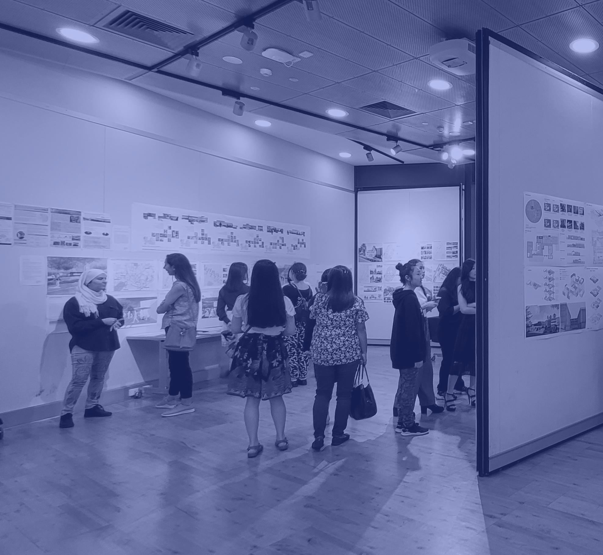
46 minute read
Architecture/Landscape Architecture


& LANDSCAPE ARCHITECTURE

ARLA2001 DESIGN STUDIO Unit and Studio coordinator: Santiago R. Pérez ‘Community Learning Centre’ JASON ZHANG
This project is based on the rapidly changing economic, health-related, and environmental context of the twenty-first-century city. We must find new ways of engaging innovation in learning, beyond the old stereotypes of the lecture hall or classroom. How can we re-imagine the ‘Spaces of Learning’ within this changing context?
The site is located next to Mitchell Freeway. The building is surrounded by trees to avoid blocking the unattractive view towards the Mitchell Freeway.
When you approach the building, the entry will bring to you two different spaces: the left-hand side is performance space, and the right-hand side is an art gallery and art studio space. The swing door inside the performance space allows the inside space to connect with the outdoor space. When you go to the first floor which is the adult and teenage library area, the big opening at the front and side allow people to see the front view of the park and to communicate with the art gallery downstairs. There are bridges connecting the library and performance space. The second floor is a pottery space and a children’s library and playground. The small incision in the outer pottery space is so that when the children stand there, they can see different views and surprises from each small cut out. They also allow natural ventilation to come inside. The connection bridge continues to the second floor. When you’re in one space and you can see what’s going on in another space, maybe that will lead you to be interested in another space. The connection bridge links different spaces together allowing them to exist easily and communicate with each other.
Image: View from children’s library to clay workshop.
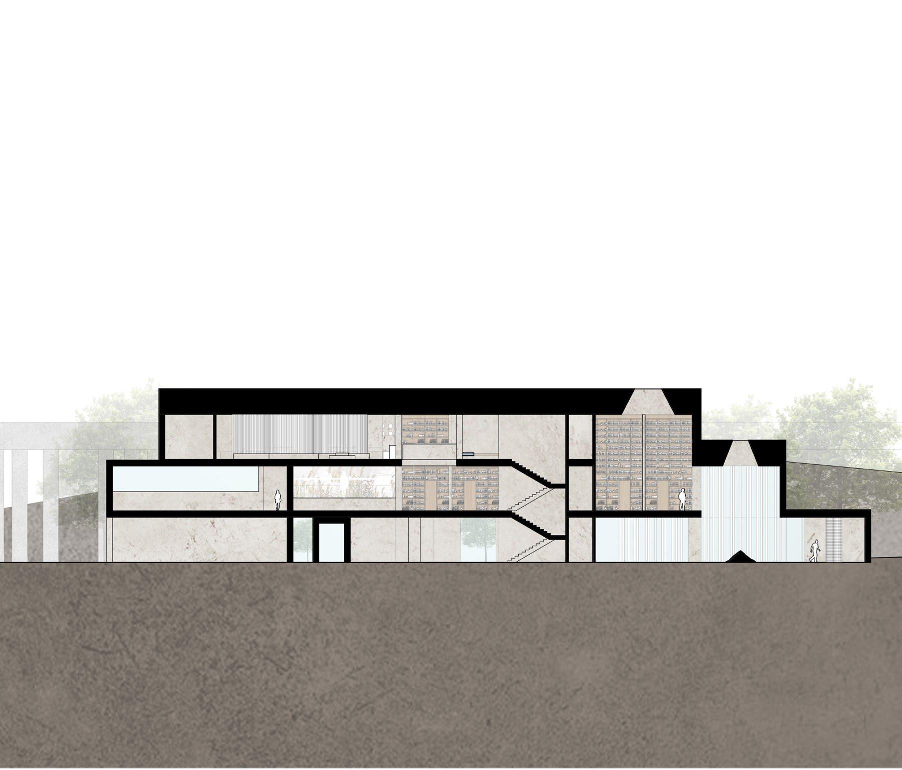

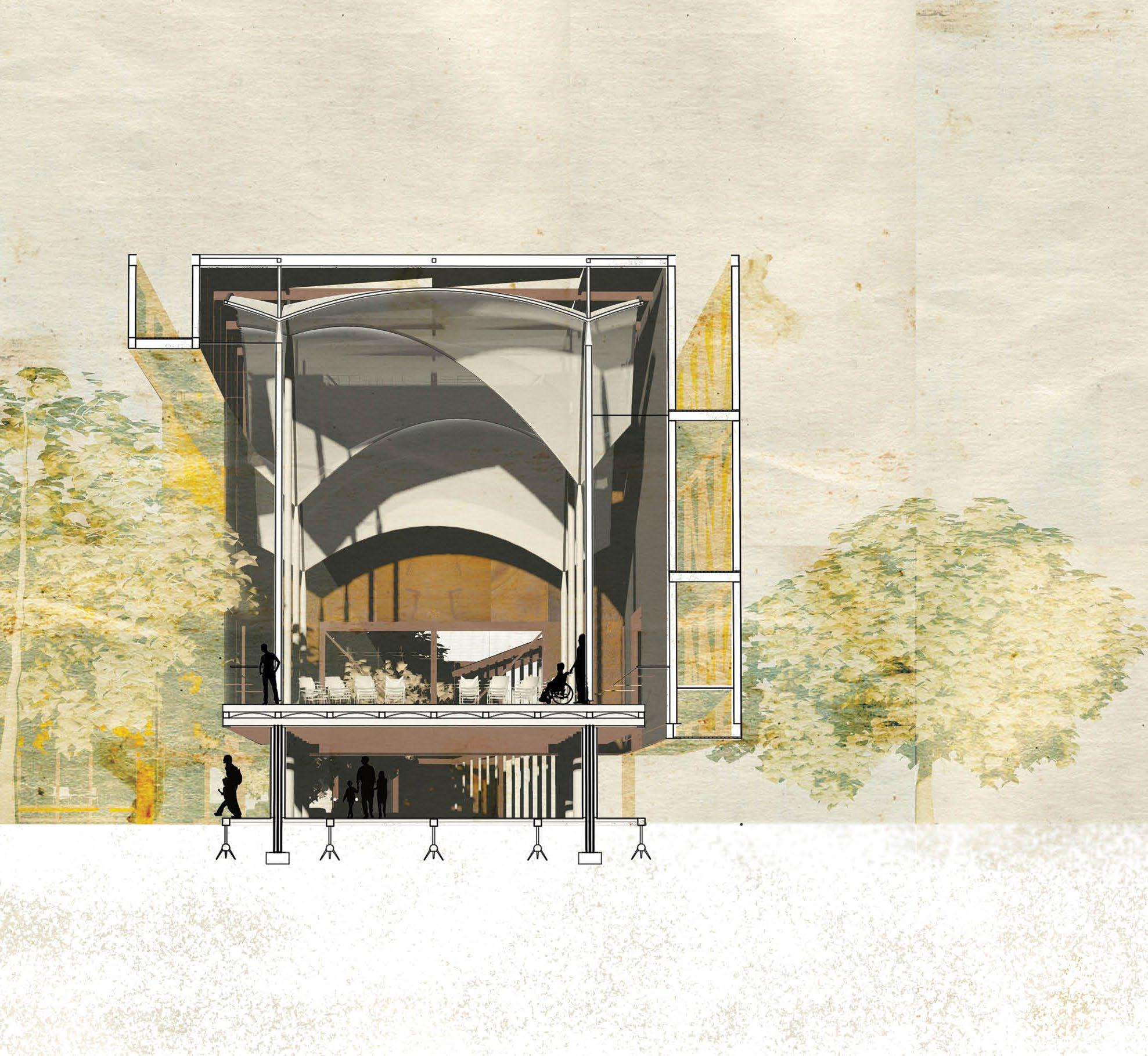
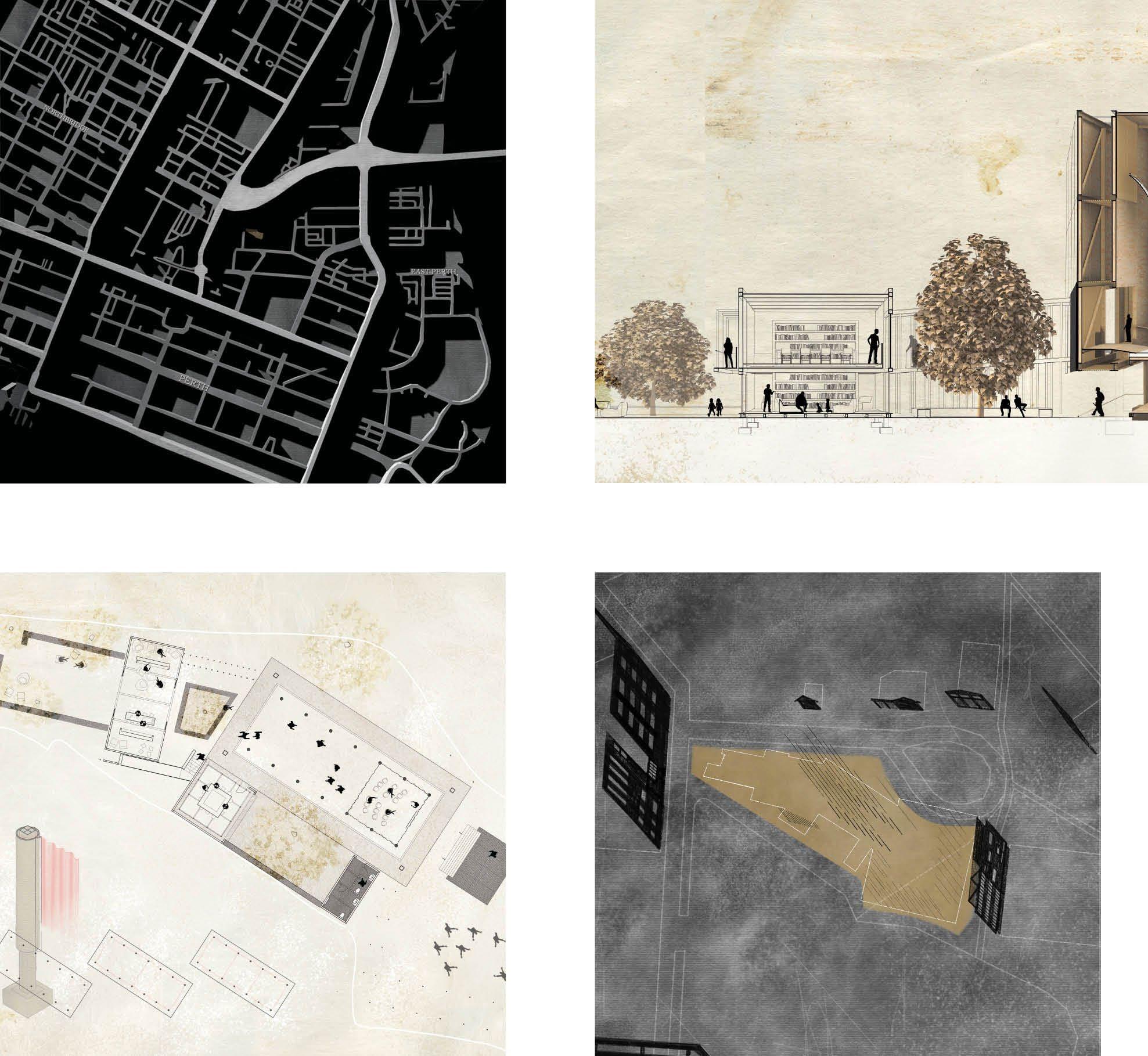
ARLA2001 DESIGN STUDIO Unit coordinator: Santiago R. Pérez Studio coordinator: Sally Farrah ‘Drawing in, drawing out’ SARAH WONG
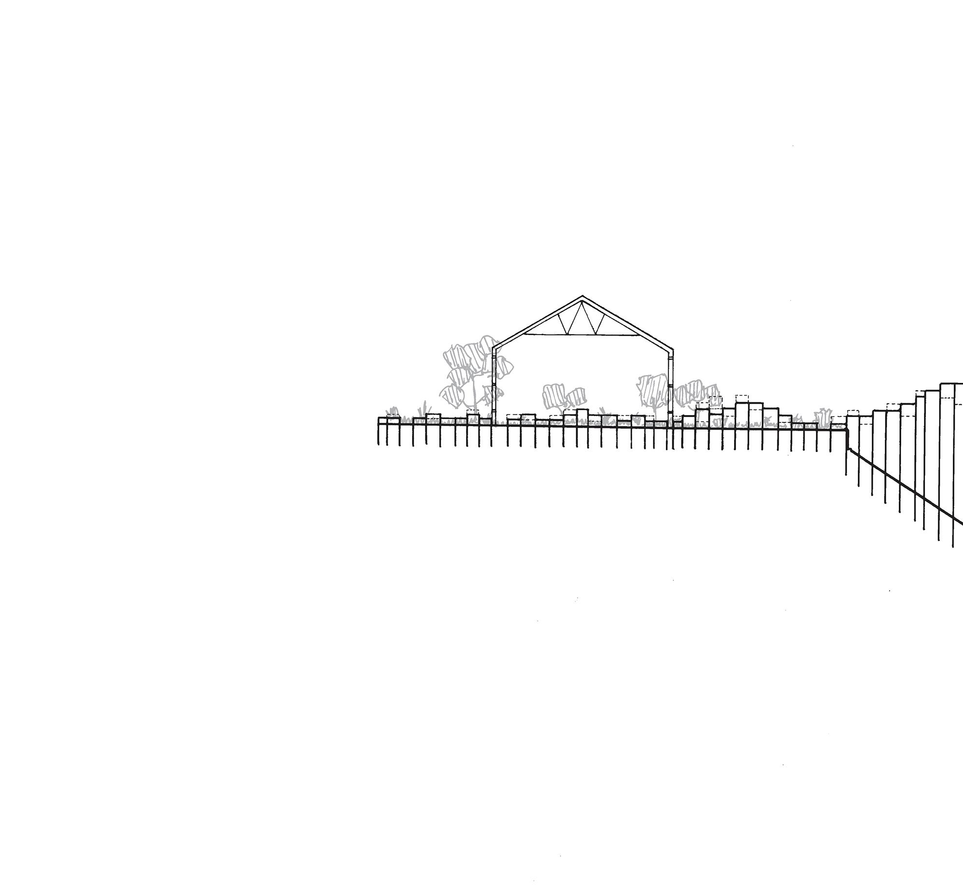
“Architecture is one, always the same in time and space... there is no such thing as new architecture or old architecture, insofar as there is no historical contrast between living and building in the present and what they meant in the past.” – Giorgio Grassi, Architecture, Dead Language (1980) Grassi’s ideal of a timeless architecture – understanding buildings as ever-present objects, and people’s needs and way of life as unchanging – was influential throughout the design process. The challenge of evoking permanence, while considering the transience of East Perth’s neighbouring buildings, and the necessity for an open-air COVID-conscious learning centre limited to lightweight construction, was proposed through both tangible and intangible means.
Three offset grids were identified through mapping the roads and surrounds of East Perth, with the project embedding itself into the permanence of these grids, through orientation and the structural grid. Pre-existing site conditions – including trees, desire lines, and the informal outdoor space of the St. Bartholomew’s House residents – were drawn, understood, and accommodated, improving the unique conditions of the site.
The Great Hall, which Grassi believed a quintessential element of a public project, allows for flexibility so the structure may absorb various usages and meanings over time. Its vaulted ceiling harks back to medieval cathedrals for the open-air learning space, while adjacent stoas for circulation allude to classical forms, strengthening the designs claim on the present by grounding itself to its predecessors. Oxidised steel comprises most of the structure and communicates architecture’s temporality through its visual deterioration.
The proposal encourages a weaving together of the area’s differing demographics, with the ground level radially open, and accessible ramps used throughout. Ample ventilation and diffuse lighting make the building COVID-safe and comfortable, where visual and aural permeability between different spaces connects users, enabling passive and spontaneous interactions.
Image: Perspective section of the Great Hall.


The ART FARM design approach begins with the intersection of paths where the varying aspects of our Ashfield Flat site converge. The native wetlands, the plateau overlooking site, and the steep yet vegetated hill leading up to suburban areas all meet at this intersection. The proposed environmental technology school uses these differing ‘zones’ of site to emphasize different modes of learning. Informal exploration learning is encouraged at the wetlands where children can encounter native flora and fauna, whereas formal, more rigorous, learning would occur on the plateau where students would have access to research equipment and facilities. A hybrid of the two would occur in between with an emphasis on play and activity with minimal architectural intervention. The school also proposes vast rehabilitation of the site with native vegetation, resulting in built forms being lightweight in order to have minimal impact on the ground. Ultimately, the school is a place where students are encouraged to engage with the landscape and to learn from place, cultivating children to engage, explore, and experiment.
Image: Wetland section and detail isometric.


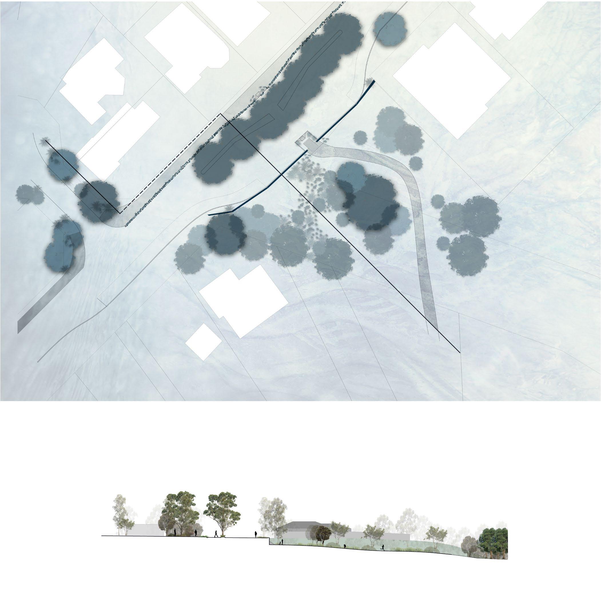
The Ashfield Flats Immersion Learning Centre responds to the risk imposed by humans to our natural environment: the long rammed earth retaining wall symbolises the furthest point of the urban condition. Ashfield is a suburb facing increasing development in the next decade, and the immersion school, with its strong wall, is a statement of an urban boundary. The lightweight timber structure, which stems from the wall, suggests a transitional space, between human and wetland environments. The indoor and deck spaces, are elevated on smalls stilts to allow vegetation to grow underneath, and are mostly open to the elements. Thin timber slat walls, which blend the indoor and out, aim to desegregate the built and the natural. Vertical timber slats, which form a roof over indoor learning spaces, imitate the filtered light through the canopy of the fringing woodland on site. Entering from the existing path to the east, people find a welcome space of tables and planters, situated under large eucalyptus trees. A performance space evolves from the topography of the site, with recycled timber seating. The nursery sits to the west of the revegetated drain. The design aims to actively educate visitors on the propagation of natives and sustainable agricultural practices, and bring together a community that will reap the benefits of the nursery and seed collection program. The organisation is aided by day excursions from WA schools, who leave with an understanding of these practices, a connection to the site through engaging in its revegetation, and historical understanding of pre-colonisation vegetation and conditions.
Image: Site plan.


The Breathing Suburb links the suburb of Ashfield from the rail to the Ashfield flats through a manipulation of hardscape and vegetation. The grounding experience of Ashfield saw a lack of connection between the community and ecological history of the biodiverse site that is Ashfield. The Ashfield Flats, on the banks of the Derbarl Yerrigan (Swan River), are an important aspect of site - both socially and environmentally. In its present condition, this landscape is significantly disconnected from Ashfield’s suburban grid, offering a significant opportunity for ecological expansion into the residential area.
The Breathing Suburb provides a link throughout Ashfield through connecting, water, people and ecology by using locally found materials and vegetation with through the design is both permeable and impermeable landscape elements. This scheme explores conceptual understandings of natural gradients and aspects of permeability, exploring the loss of past natural flooding and expansion events of the Derbarl Yerrigan into the wider Ashfield area as a key element of design.
Image: Master concept plan.

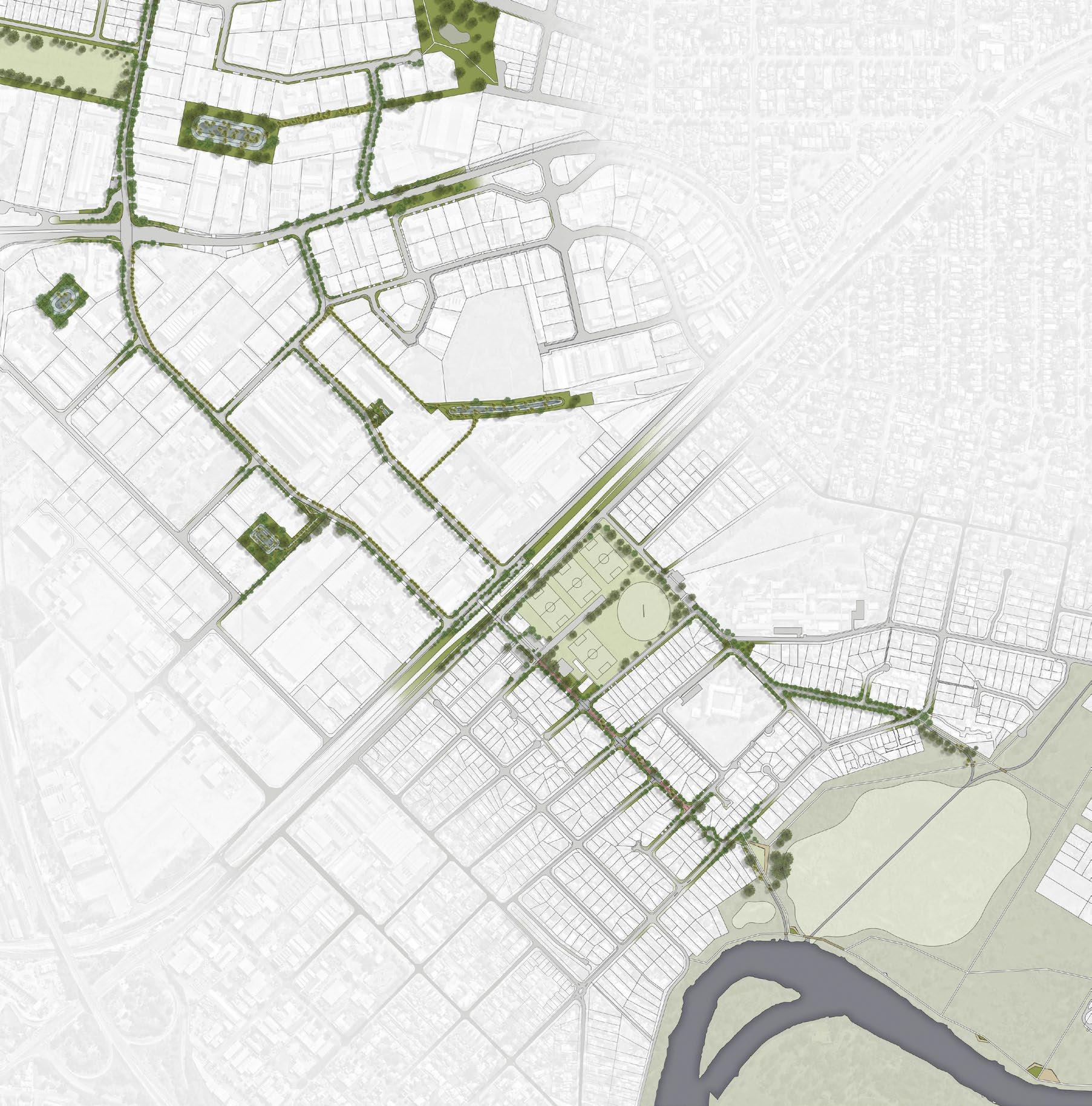
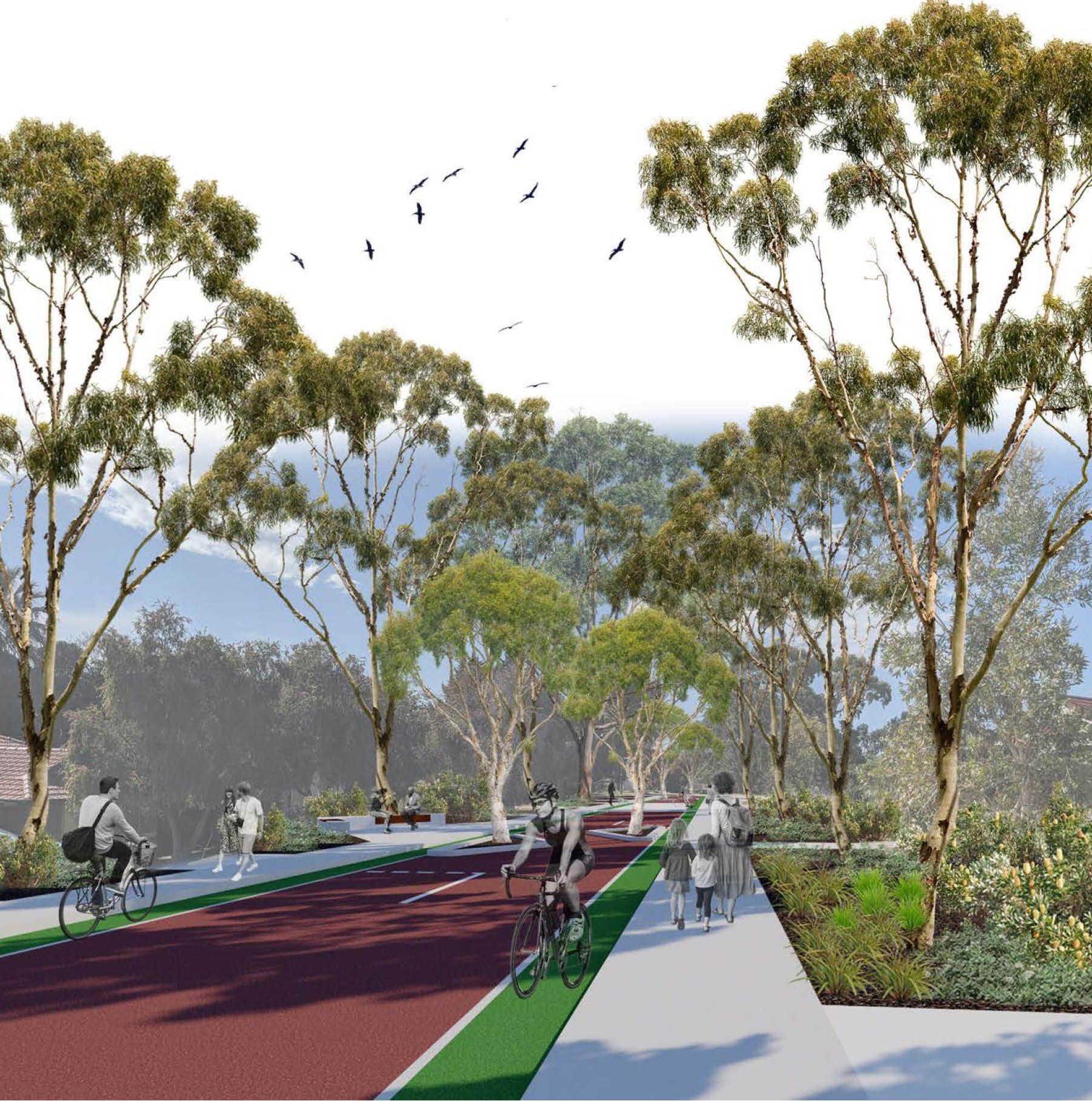
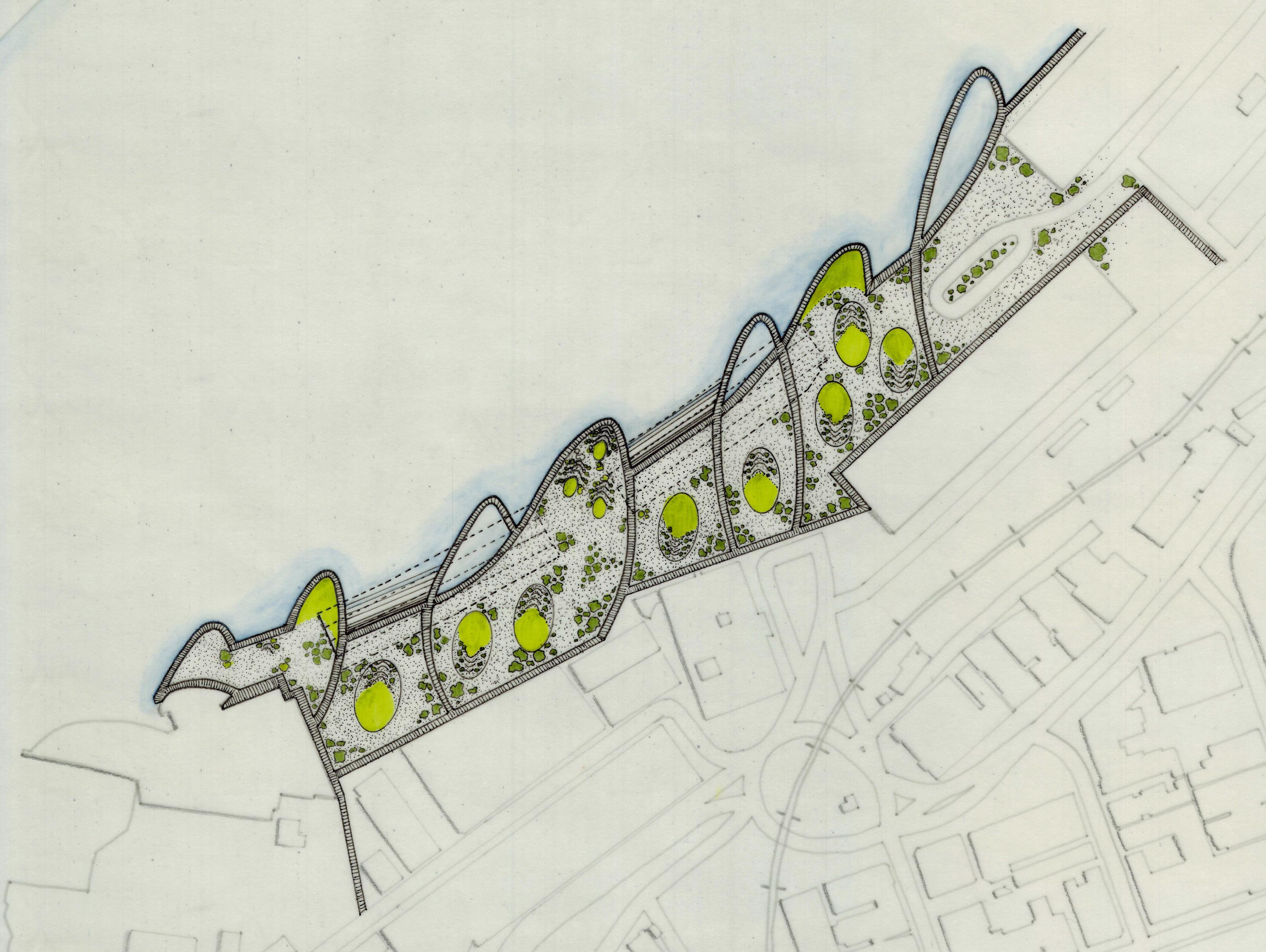
Ashfield Green Corridor connects remnant vegetation and green space throughout Ashfield and surrounding suburbs to provide a cohesive link for both human and non-human residents of this riverside area. The scheme aims to recover and reinterpret a cohesive natural link for endemic flora and fauna – a link that has been lost due to the development of industrial and residential areas – while also creating a safe and usable pedestrian and cycle link for residents and visitors. The scheme is specifically targeted at improving community health and wellbeing, while also improving ecological outcomes for the area.
Image: Ashfield Green Corridor, section.

ARLA1000 DESIGN STUDIO – GROUNDINGS Unit and Studio coordinator: Emily Van Eyk Teaching Assistant: Joe Winfield ‘Stories to Tell’ HAMISH LYFORD
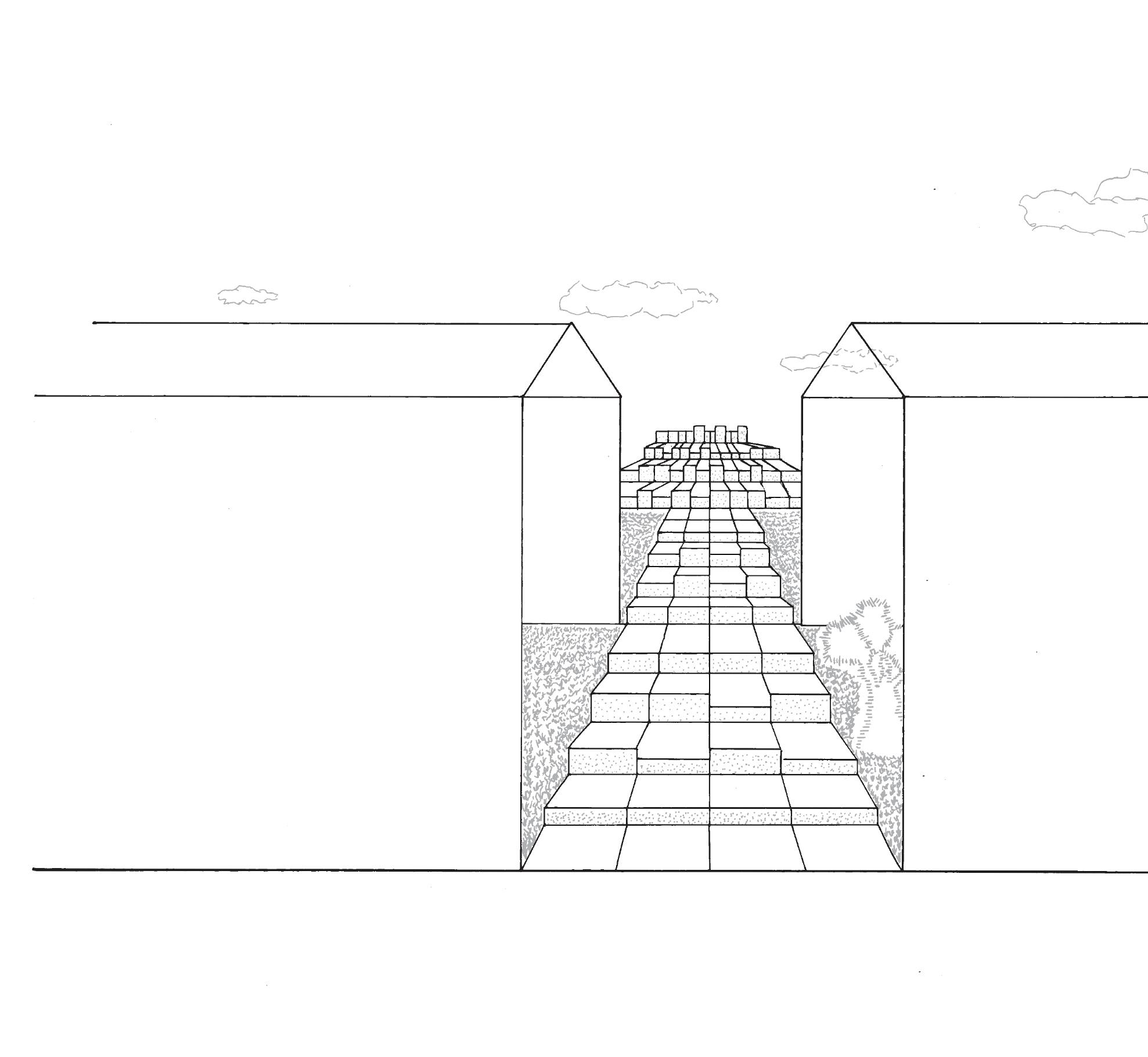
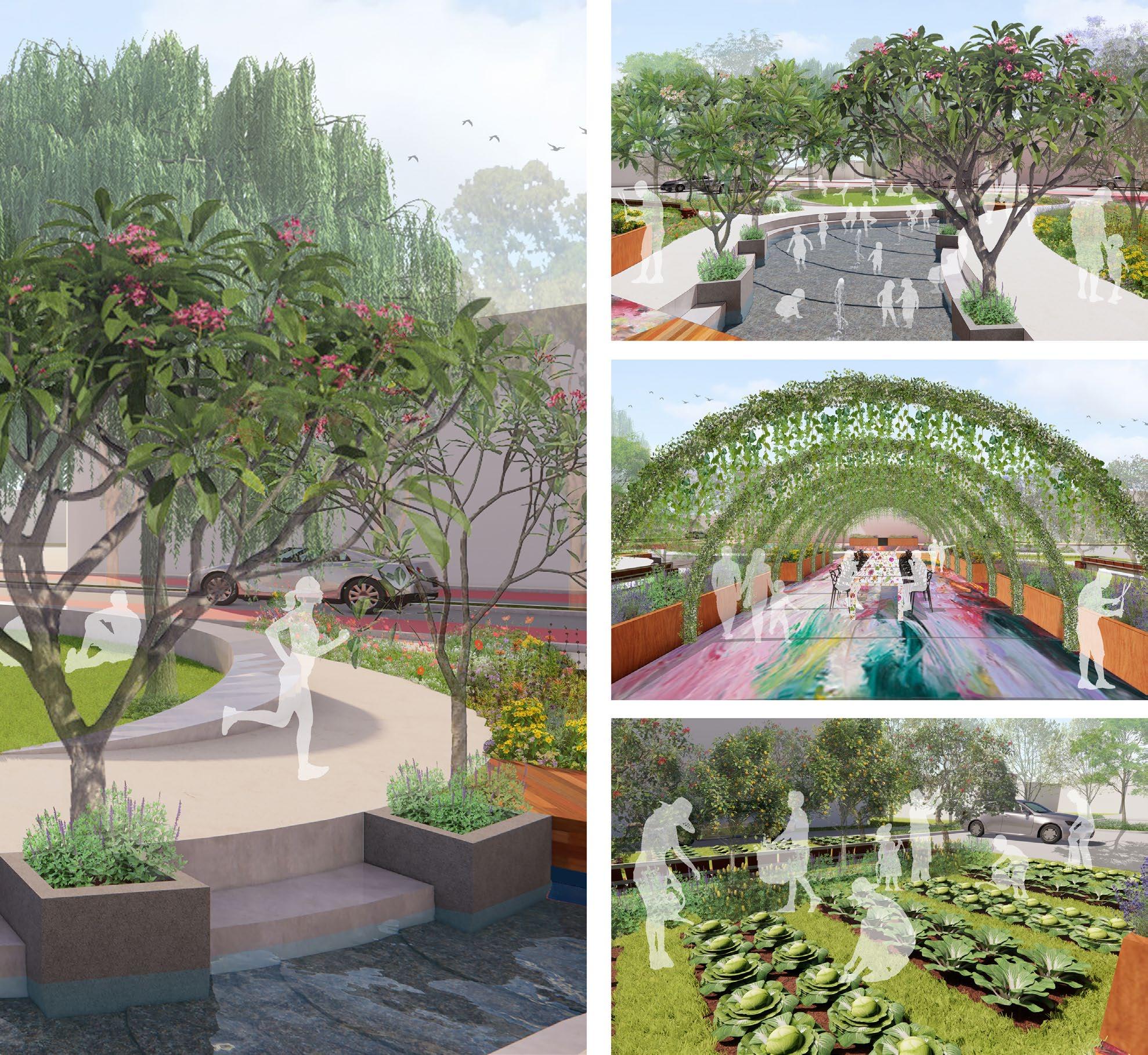
Backyard Construction is a theorised installation located in the Port City of Fremantle. Nestled inside and in front of Fremantle’s renowned ‘A Shed’, my design aims to celebrate the area’s long and illustrious history as a shipping port. As well as introducing natural elements previously inhabiting the area before European industrialisation, my aim was to combine raw and organic textures including, limestone and native plants to produce an area that is both an inviting and accessible space for locals and visitors to congregate, relax and share stories.
Largely inspired by Carlo Scarpa’s Monument to the Partisan Woman, the main section of my design uses large 1 x 1m2 limestone plinths in an array at varying heights. These plinths are used to produce an amphitheatre-like setting, in which visitors are able to sit in a variety of positions to facilitate both intimate conversations as well as discourse within a group setting.
The second part of my design focuses on the ‘A Shed’ itself. I have chosen to repurpose the shed by introducing native plant life within the building and by replacing the shed’s roof with transparent polycarbonate sheeting I have created a greenhouse-like environment. This again provides an environment that serves as a comfortable and inviting place to meander and relax. It was very important to me that the shed remain as part of my design in order to pay homage to the history of the Fremantle wharf.
Image: Site perspective.

ARLA1000 DESIGN STUDIO – GROUNDINGS Unit coordinator: Emily Van Eyk Studio coordinator: Frances Silberstein
KEALI PYVIS
In its current form, Victoria Quay is a wasteland of concrete and asphalt, a space to pass through but not to stay. The purpose of this project was to reimagine the site to allow a space for the stories of the site to be told. Specifically, the design brief challenged us to offer a response to the climate, a connection to the water and provide a gathering space encouraging people to engage with the site.
My design was heavily influenced by the dune morphology of the natural coastal plains that once commanded the coastline. Starting at the remnants of the limestone bridge once used by the custodians of the land, the undulating boardwalk’s path is dictated by the parabolic formations of the windswept dunes.
As the path winds away from the coastline and back again it offers visitors a higher perspective on the site, before once again sloping down to the waters of the Derbarl Yerrigan (Swan River). Within the parabolas bordered by the boardwalk are wide terraced steps that invite you to step off the path and explore the site organically, take a rest, have a picnic, or congregate. The terraced steps are bordered by native dune plants that soften the landscape and cocoon you into the protection of the dune’s oasis. The boardwalk also winds through the existing A and B Sheds on the site where wide terraced steps seem to continue into the river itself, offering yet another space to connect to the natural elements of the site.
Image: Site plan.
LANDSCAPE ARCHITECTURE


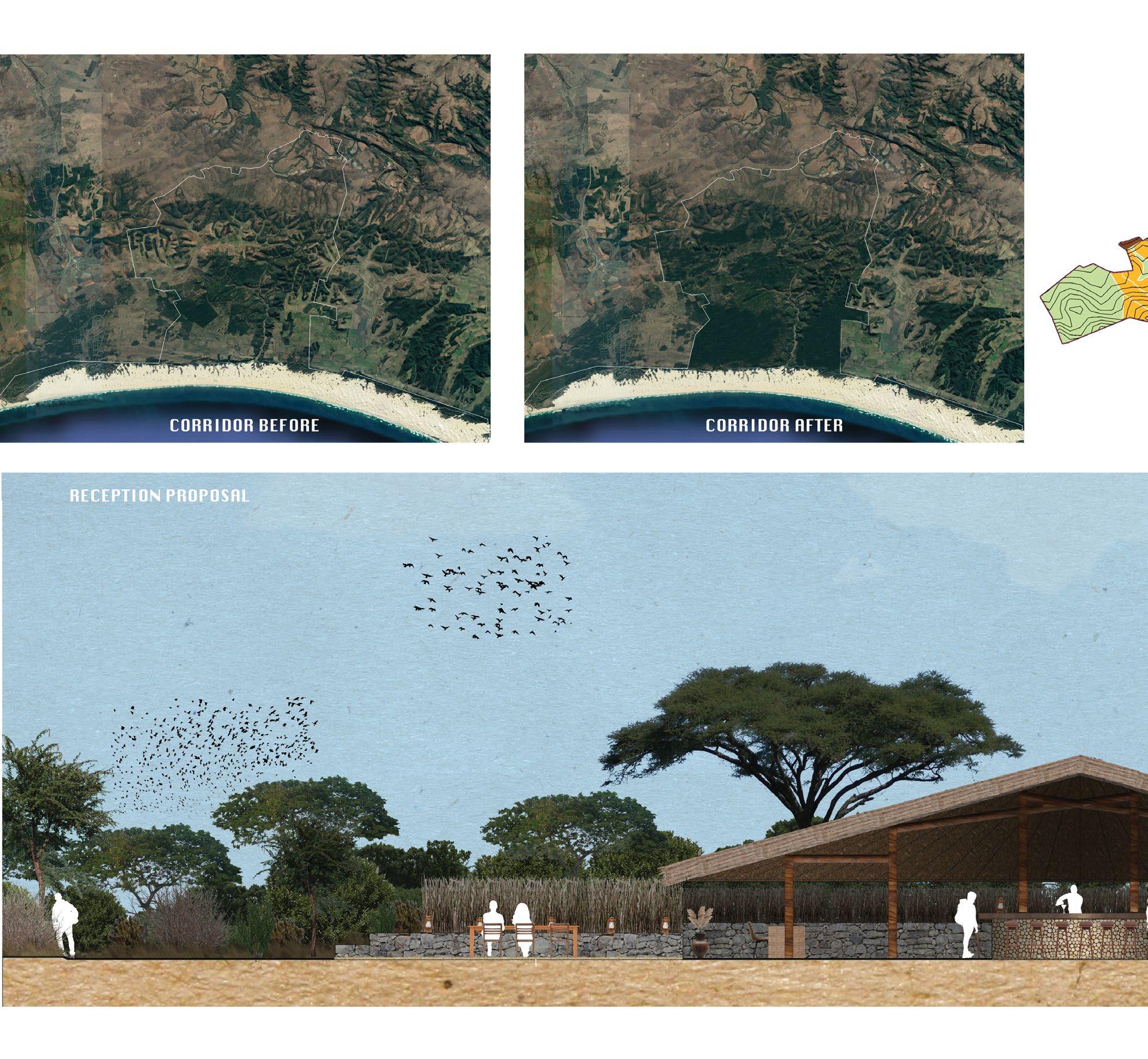
Under the Stars challenges the traditional role of landscape architecture and conservation planning in South Africa through a holistic approach that involves three scales of design and focuses on the connection of conservation land, improving localised socioeconomics, optimising guest interaction with the landscape and decreasing poaching of all species.
The Eastern Cape of South Africa sits in a win-win position as conservation land is currently valued at four times the price of farmland. By converting existing farms to conservation landscapes, landowners will economically benefit from increased land value and tourism and nature will benefit due to the large-scale expansion of conservation land.
The large-scale proposal focuses on the development of phase one (out of five) for the Addo to Great River conservation landscape, the largest conservation corridor proposal in the Eastern Cape of South Africa and the second largest in South Africa. Phase one includes a land acquisition proposal of over 50 properties and calculates the direct tangible benefit of converting farmland to conservation. Benefits included the increase of carbon sequestration of 157,590,000 gigatons, the increase in microclimate rainfall of around 35%, the increase in land value from AU$451 to AU$2,135 and a decrease in poaching through strategic planning.
The medium scale proposal looks at developing a community-owned and run bush lodge that seeks to bring guests closer to the traditional African culture while the community profits directly as part of the ownership scheme. The bush lodge is constructed through modern interpretations of traditional African construction techniques such as rammed earth and thatching. The accommodation and landscape pull guests out of their comfort zone and seeks to increase guests’ environmental stewardship through landscape connection. Due to the nature of ownership, the proposal also maintains all existing infrastructure and proposes cost-effective techniques to upskill workers and reduce costs.
The smaller-scale design looks at the use of bush craft and African ingenuity to create a unique water capture methodology to supply the guests with suitable amounts of water for drinking and other amenities. The smaller scale also looks at the movement of guests through the site and mimics the movement of game through the bushveld.
In whole, the three scales of design aim to be a proof of method for the Amakhala game reserve and the wilderness foundation as momentum swings in favour of conservation over farming.
Image: The Hut. An essential part of the of the design was to bring the outdoors in and provide a seamless experience of nature.

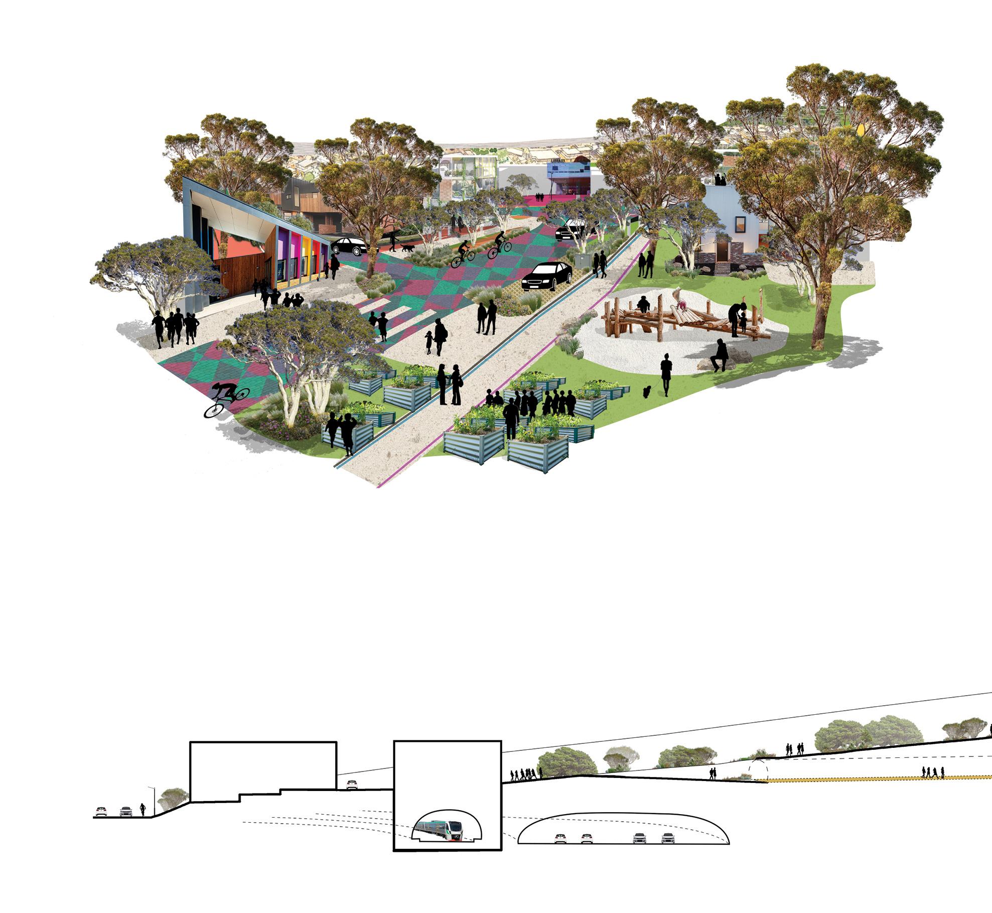
‘Living: beside the ridge, before the sea’
This study was guided by three research questions: What are the processes of place attachment and cognitive affordance? Why should these processes inform urban design? And how can these processes inform urban design?
Changes in urban design form and modes of living are embraced or rejected by residents based on experiences, learnt norms and ascriptions of value to urban landscapes. Designers can influence the development of these norms and values via careful affective design.
When people experience place attachment, they align their values according to this positive experience. Equally, if landscapes provide many opportunities for learning, feeling and interacting, residents are encouraged to form diverse perceptions of ‘normal’. Together these factors influence what people value, what is deemed desirable and, therefore, economically attractive. If designers work with the goal of broadening residents’ values, they curate a diversity of future viable design options.
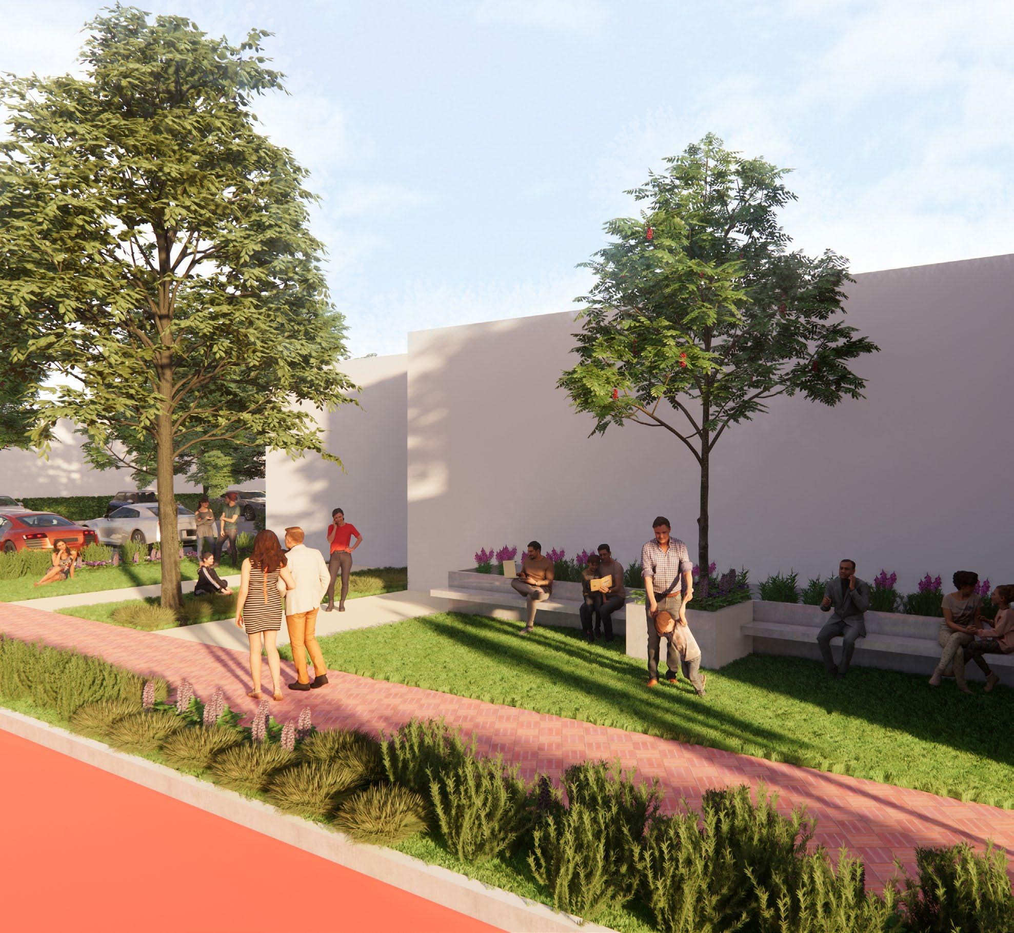
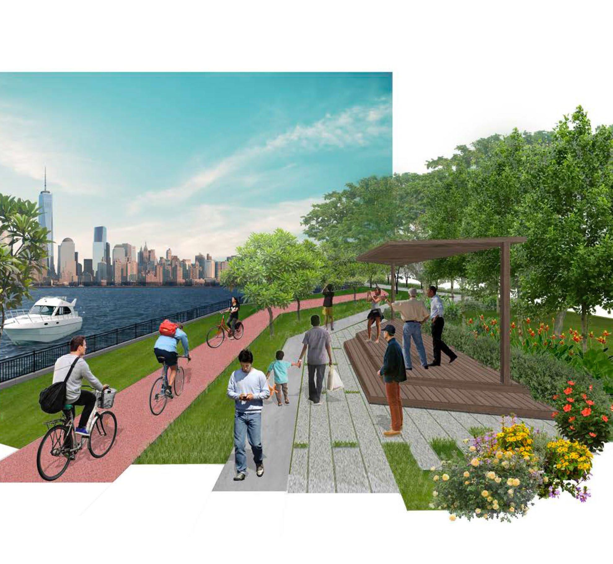
The design for the City of Cockburn site is intended to prioritise this goal. In this design, people are encouraged to determine their own uses for the public space, allowing personal (and possibly shared) recognition of place to emerge. There is a purposeful emphasis on providing a lot of public – and particularly green – underdetermined space. Commercial, residential, learning and civic facilities are not separated, and multiple modes of movement ensure people are offered many opportunities for intended and unintended interactions.
This design recognises that people can make sense of urban landscape complexity – particularly as pedestrians – and are capable of forming their own landscape understandings and preferences. Homogeneity of the suburbs is not needed for clarity and resident satisfaction. The design offers a richness of urban landscape experience via ascriptions of value placed on urban and ecosystems features (exposing water flow, highlighting terrain and topographic variability, and providing diversity in the built form).
Image: Design study site.


Development and expansionism have always come hand in hand with the times. The increasing urban sprawl seems to be unending as our demand for more land grows. Habitat fragmentation and its effects threaten the survival of our natural landscape’s ecological identity. In the first part of this dissertation, I will be presenting the collection of current theories and concepts to better understand the long-term implications of continuing this path. The effects of fragmentation on habitats are more easily understood when analysed into its components.
Patches, edges and mosaics are the fundamental units in landscape ecology and are applicable in understanding this topic. It is also important to understand how habitats respond to changes in its surroundings.
Gathering this data will allow this research into investigating the responses available to us in the form of landscape architecture.
Landscape Architecture is a relatively new branch that combines science with art and architecture. This field of study has fortuitously surfaced as society has matured enough to be self-aware of its effect on the environment. We have generally mapped out the butterfly effect of even the smallest change in an ecosystem, thus the emphasis being placed on specific potential issues such as habitat fragmentation is a rational consideration.
Habitat fragmentation’s inevitable occurrence as urban development continues will need a measured response. This will require a proper consideration that will involve the environmental sciences with the intent of designing interfaces with human and urban infrastructure.
The saying “what once was is now gone,” rings true in this case as the countless generations of plant and wildlife will forever be changed. It is a fragmentation of the habitat as well as an irreversible fragmentation of its genetic ecological past.
Habitat fragmentation is an issue that breeds further problems if it is left to resolve itself. It is a byproduct of our need to expand in the most cost-effective manner. What becomes ‘unseen’ to the public is the effects it has down the line. It becomes an afterthought and thing to ‘fix’ instead of something we as the genesis of this problem, need to prepare for. We only see bird species being placed on the endangered list or the ‘greenifying’ of verges irrespective of plant selection. Our methods in developing areas must evolve or we risk losing a lot more.

Image: (Above left) Large patch and internal interaction. (Below left) Small patches and jumping interactions. (Above right) Regular edge. (Below right) Irregular edge.
LACH5504 INDEPENDENT DISSERTATION PART 2 Unit coordinator: Dr Maria Ignatieva Supervisors: Dr Maria Ignatieva & Christopher Vernon KAT STEWART
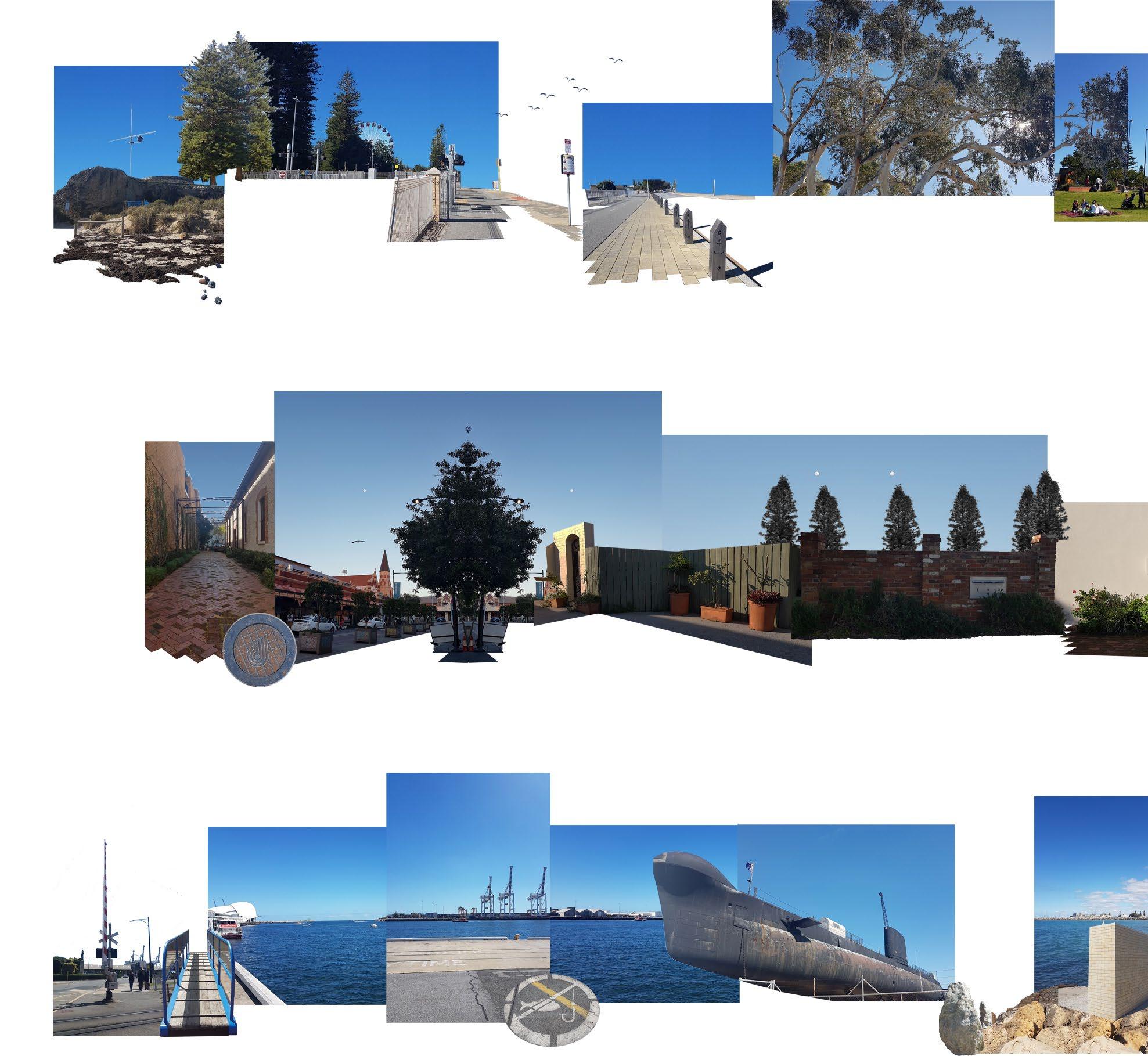
This dissertation project considered the multisensory experience of walking and its relevance to landscape architecture. It highlighted the importance of physical engagement with the landscape by landscape architects during research and the design process. The first part of the dissertation supported this view with a detailed literature review of cultural theories and current research papers that focus on direct engagement with the landscape through walking and visual representation of experience in landscape architecture. The paper argued that the role of landscape architects is not only to design new landscapes for people to participate in, but to facilitate people’s perception, awareness, appreciation, and value of landscapes that already exist. One of the core objects of the dissertation was to develop and test an alternative design methodology using walking as method for multisensory experience and data collection. It also explored visual representations as design outcomes in the form of visual walk diaries, walking knowledge and a design narrative. The thesis of this dissertation was that landscape architects can curate the multisensory experience of walking into design narratives to facilitate perception, awareness, and appreciation of existing landscapes. Walking was used as a tool to traverse, perceive, and sequence experiences in Fremantle, Western Australia. This dissertation found that participation in the design methodology facilitated a change in the researcher’s own perception and value of Fremantle as an existing landscape. The dissertation concludes by proposing that the design methodology developed could be adopted as a tool by landscape architects to communicate and facilitate changes in perception, connection and value from experience with clients, project teams and community groups. It also reinforces the argument for the role of the landscape architect not only to design new physical landscapes, but to communicate the value of existing ones.
Image: Visual representations of the walker’s perspective of three walks in Fremantle. A collage of each walk contributed to the final design narrative.


‘Breakout Room’
The scenario focused on post-pandemic life and how an increased number of workers have adapted to the working from home (WFH) lifestyle. The aim was to develop the Beaufort Street precinct into a place where WFH can benefit a diverse range of workers and encourage the idea of work-life balance. The reduction of traffic volume and encouraging residents to cycle also played a major role in developing the precinct into a more pedestrian-orientated environment.
This was done by exploring four different levels where level one was already activated, with workers working in their own home. Level two, the residential area, looked at encouraging neighbours to interact and utilise the new shared spaces (i.e. community garden, outdoor working stations, active activities) on their street. Level three, Beaufort Street, was designed to be a place to gather at a larger scale with different hybrid working stations available (i.e. café, plaza, carparks, open office environment). This was also an area where workers go to seek necessary tools (i.e. printers, stationery) and other essentials ( i.e. gym, grocery). Finally, level four looked at the connection between the two parks (Hyde Park and Forrest Park) to the rest of the precinct and how flexible working can be applied.
Image: First Intervention Phase 4.

Climate change has and will be a major challenge for everything and everyone if nothing is done to mitigate the dire consequences of it. It has resulted in an increase in surface temperature in Beaufort Street. This design aims to alleviate the negative impacts of climate change by targeting three main areas: heat, water and food.
Firstly, vegetation has been shown to significantly reduce temperatures. This is done by simultaneously absorbing sunlight and shading hard surfaces, thus reducing the amount of heat that is absorbed and radiated. The plot of area that can potentially be revegetated includes small areas such as building setbacks and sidewalks. The presence of greenery has been shown to attract higher number of potential customers. Secondly, groundwater stores have been gravely affected by climate change. An ideal solution would be to recycle storm and grey water, to water the vegetation in the area. This creates a positive feedback loop.
Lastly, good literacy has been an epidemic of gargantuan proportions in the young. 1 in 5 children have absolutely no idea where their food comes from. Childhood obesity has been on the rise as well. Childhood obesity has a significant correlation to obesity in adulthood. Obesity is a leading cause in many degenerative diseases. A prospective proposal would be to include a community garden. Residents who reside in the vicinity would sow and nurture fruits and vegetables of the season. This provides opportunities for children in the area to learn more about the origin of food. Community gardens also provide a strong sense of belonging.
Image: Revegetating setback buildings of Beaufort Street.

LACH4421 AUSTRALIAN LANDSCAPES Unit coordinator: Christopher Vernon BLAKE STODDART
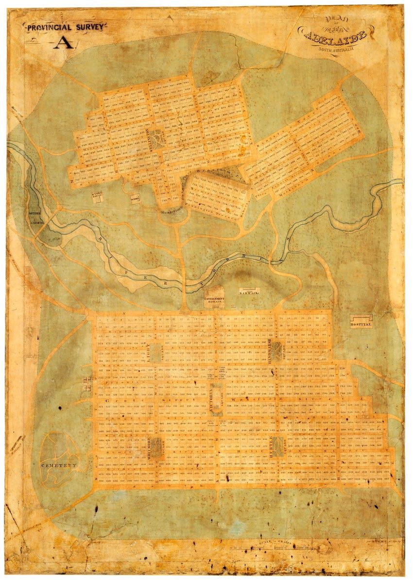
The 1837 Adelaide Plan (Plan), including Adelaide Park Lands, is regarded as a significant turning point in Australian settlement and a master achievement in city planning. The settlement is the first Australian urban centre to be designed as a place for free settlers, rather than a colonial military or penal outpost. In 2008, the honourable Minister for the Environment Heritage and Arts, Peter Garrett MP announced the National Heritage listing of ‘Adelaide Park Lands and City Layout’ noting the ‘influential urban design of Adelaide – Australia’s first planned city… recognises the 1837 Adelaide Park Lands and City layout as technical masterworks which went on to influence the planning of other towns in Australia and overseas’ (Garrett & Ellis 2007).
Drivers for a New Colony in Australia
In 1833 the British government determined the need for a third colony in Australia to be situated between the first two colonies, Sydney and Perth. The need for a third colony was born largely from the poor management of the settlement of Western Australia compromised by a reliance on convict labour, poor administrative practice, and restrictive military presence (Bunker, 2008; Proudfoot, 2010).
As a result a systematic approach to urban layout was developed, largely by Edward Gibbon Wakefield of the Colonial Office (LlewellynSmith, 2013). Wakefield, based in England, was familiar with colonial settlements in New Zealand and Australia, living in both during his childhood and early adulthood. He had observed the process of colonisation in both countries and felt personally frustrated with the slow and inefficient approach (Bunker, 2008). He believed many of the social issues of England could be addressed by decentralising and reducing overpopulation (Llewellyn-Smith, 2013). The Colonial Office was attracted to his ideals, which he developed into a planning scheme known as the Wakefield Scheme.
The scheme recognised that immigration should focus on craftsman, labourers and artisans over convicts and unskilled workforce. These free settlers with specialised skills would be critical to the development of a new South Australian colony and were favourable to the unskilled, penal labour of the first two colonies (Llewellyn-Smith, 2013). The scheme also developed a standardised approach to laying out the developing cities of prospective colonies across the empire (Bunker, 2008).
The Adelaide Plan 1837
The Plan was finalised in March of 1837 by Colonel William Light, first Surveyor General of South Australia with support from his Deputy, George Kingston. With the decision to settle South Australia only being finalised in 1836, Light had limited time to survey South Australia and lay out the capital, with significant pressure from the Colonial Office in England for free settlers to start arriving in 1837 (Bunker, 2008).
After much consideration, Light made the decision to place Adelaide City on the plains between the Port river, Holdfast Bay and Mount Lofty. This received criticism that the site for the city should be located in a coastal position such as Port Adelaide or Port Lincoln (Llewellyn-Smith, 2013). Light determined the correct position for Adelaide City, avoiding the sandy coastal soils in favour of the fertile lands nearer the Adelaide hills (Proudfoot, 2010). However, the British government was keen
to avoid the mistakes made in settling Western Australia and eventually agreed (Proudfoot, 2010).
The plan shows the systematic grid layout of Adelaide, often referred to as the ‘Square mile’ (Anderson, 2020). The city is separated into a north and south section, bifurcated by the Torrens River. The orientation of the North and South cities responds to the topography of the Torrens River valleys. Within the city structure, Light provides for six (in some later drawings sometimes five) squares (one in the north, five in the south). Each of the squares were proposed to support the public life of the various districts within the city. The Plan also indicates the green swathe surrounding the city, known, and loved by contemporary South Australians as the Park Lands.
Surprising International Interest
The Adelaide City Plan gained critical international attention in the 1890’s as an example of the potential of the Green City movement. Notably, Ebenezer Howard, theorist, and advocate of the Garden City movement, used the Adelaide Plan to support his own theories as an example of how a Garden City might function. His seminal text, the “Garden Cities of To-Morrow” from 1898 makes specific reference to the city, including a sketch plan for the city (Bunker, 1990).
It is easy to see how the structured city surrounded by the green swathe of the Park Land was sympathetic to Howards ideology, particularly with the green belt playing a critical role for the colonies agricultural and husbandry function (Jones, 1998). For example, the Park Lands played a significant role in providing space to for government horses and sheep rearing (Robinson and Liu, 2015).
Howard’s assumptions about the development of Adelaide led him to falsely use the city as a case study to support his argument for the Garden City Movement (Repps, date unknown; Bunker, 2008). He erroneously concluded that Adelaide City north of the Torrens (and surrounding Park Land) developed later than the southern part of the city in response to increased population (Repps, date unknown). As a result, Howard suggests Adelaide is an example of how cities could grow organically, separated by green agricultural spaces (Repps, date unknown). In actuality, the two city areas had been planned that way from the beginning, invalidating the claim.
While Howard’s interest in Adelaide is well documented and well known, the city plan also caught the interest of influential architect and urban designer Le Corbusier. A little-known sketch diagram of Adelaide in 1950 by Le Corbusier indicates the designer had some knowledge of the South Australian capital and had some interest in its urban design principles (Moulis, 2012). His interest appears to be the result of a chance meeting between Le Corbusier and a lecturer at the University of Adelaide, Professor Hugh Trumble who was on secondment in the Americas.
The drawing is signed by Le Corbusier dated 17 September 1950 in Bodega, Colombia, notable in timing for being just five months before he developed his plan for Chandigarh (Moulis, 2012). The diagrammatic Plan includes the southern art of the city, its grid structure and internal parks, the surrounding Park Lands with notes on environmental influences outside of the city zone like the Adelaide Hills, Industrial zones and port. The drawing implies that Trumble and Le Corbusier spent some time together drawing the diagrammatic plan of Adelaide, with Le Corbusier noting it as a collaborative drawing between the two.
Moulis (2012) Speculates that it is unsurprising Le Corbusier was drawn to the layout of Adelaide. The colonial grid system established in Adelaide would naturally appeal to Le Corbusier’s modernist sensibility. Moulis suggests Le Corbusier may
already have been somewhat aware of Adelaide, likely being familiar with Howard’s work in the late 19th century. Some evidence for this may be that Le Corbusier ignores the North portion of the city in his drawings, perhaps erroneously assuming it to be a later addition to the city.
When drawn, Le Corbusier had already developed plans for a theoretical modernist city but had not had an opportunity to test these ideas in practice (Moulis, 2012). By the time Le Corbusier returned home from Columbia, he had received a letter from the Indian embassy inviting him into the competition for Chandigarh. Le Corbusier’s design for Chandigarh shares many high-level similarities with Adelaide including, the grid lay out, the park encircling the city, and the relationship of the gridded city to its mountainous backdrop. It may not be possible to determine any direct correlation between the plans, but it does demonstrate the continuity of Le Corbusier’s belief in particular features or elements that are important to good city design
References
Anderson, Margaret. “Light’s Plan of Adelaide 1837.” History Trust of South Australia. Accessed 1 September 2020. https://adelaidia.history.sa.gov.au/panoramas/lights-plan-ofadelaide-1837. Bunker, Raymond. “Why and How Did Adelaide Come About?” Planning Perspectives. 23 (2): 233-240. 2008. DOI: 10.1080/02665430801906455. Bunker, Raymond. “Urban Design in a Metropolitan Setting: A Case Study of Adelaide.” Town Planning Review. 61 (1): 2140. 1990. DOI: 10.3828/tpr.61.1.6v4n661p02575k17. Garrett, P. & K. Ellis (2008) National Heritage Listing for Adelaide Park Lands. Joint media release, 7 November 2008. https://search-informit-org.ezproxy.library.uwa.edu.au/ documentSummary;res=TVNEWS;dn=TES20084400716 Jones, David. “Designing the Adelaide Parklands in the 1880s: The Proposals of John Ednie Brown.” Studies in the History of Gardens and Designed Landscapes. 18 (4): 287-299. 1998. DOI: 10.1080/14601176.1998.10435553. Llewellyn-Smith Michael, “1 – The Background to the Founding of Adelaide and South Australia in 1836.” In Behind the
Scenes: The Politics of Planning Adelaide. 39-66. Adelaide: South Australia. The University of Adelaide Press. 2013. https://www.cambridge.org/core/books/behind-the-scenes/ background-to-the-founding-of-adelaide-and-south-australiain-1836/7B9E12ECB4DBEA60E13A9F673D126075. Llewellyn-Smith Michael, “2 – The Development of the City and State from 1840 until 1950 and the City/State Relationship During this Period.” In Behind the Scenes:
The Politics of Planning Adelaide. 39-66. Adelaide: South Australia. The University of Adelaide Press. 2013. https:// www.cambridge.org/core/books/behind-the-scenes/ development-of-the-city-and-state-from-1840-until1950-and-the-citystate-relationship-during-this-period/ FDFAA2F3E22E87998F83C2F5C5578D6A. Moulis, Antony. “An Exemplar for Modernism: Le Corbusier’s Adelaide Drawing, Urbanism and the Chandigarh Plan.” The Journal of Architecture. 17 (6) 871-887. 2012. DOI: 10.1080/13602365.2012.746043. Proudfoot, Helen. “Fraternal Twins? Hoddle’s Melbourne and Light’s Adelaide.” Australian Planner. 35 (2): 75-80. 2010. DOI: 10.1080/07293682.1998.9657819. Reps, John. “Garden Cities of To-Morrow”. Cornell University, New York. http://urbanplanning.library.cornell.edu/DOCS/ howard.htm. Robinson, Guy and Zhiling Liu. “Greening and “Un-Greening Adelaide, South Australia.” AIMS Environmental Science. 2 (3): 511-532. 2015. DOI: 10.3934/environsci.2015.3.51.
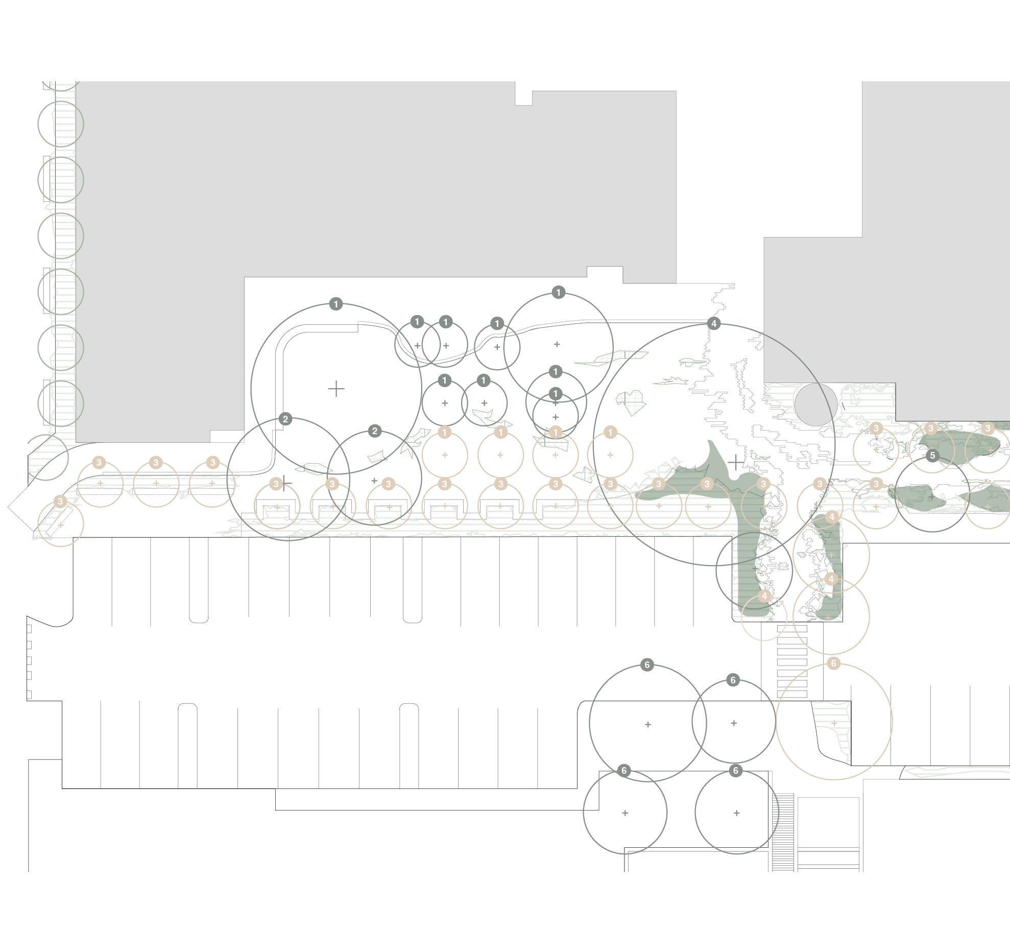
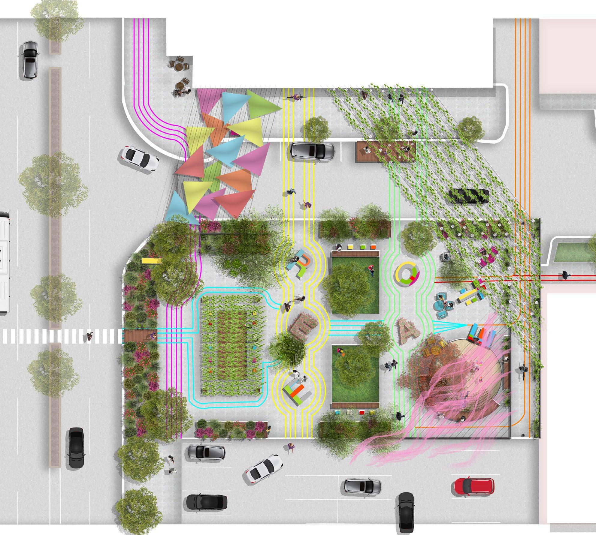
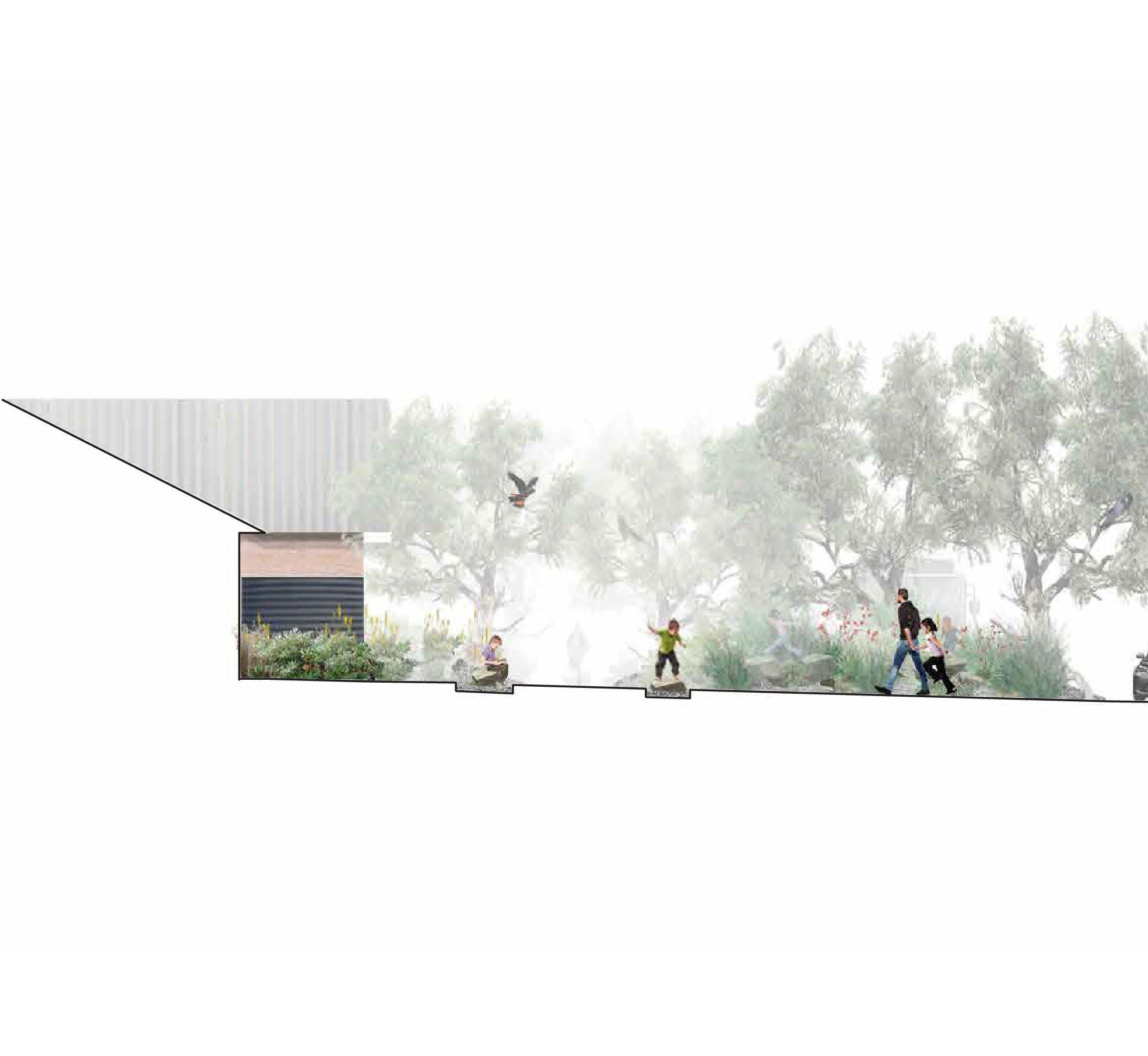
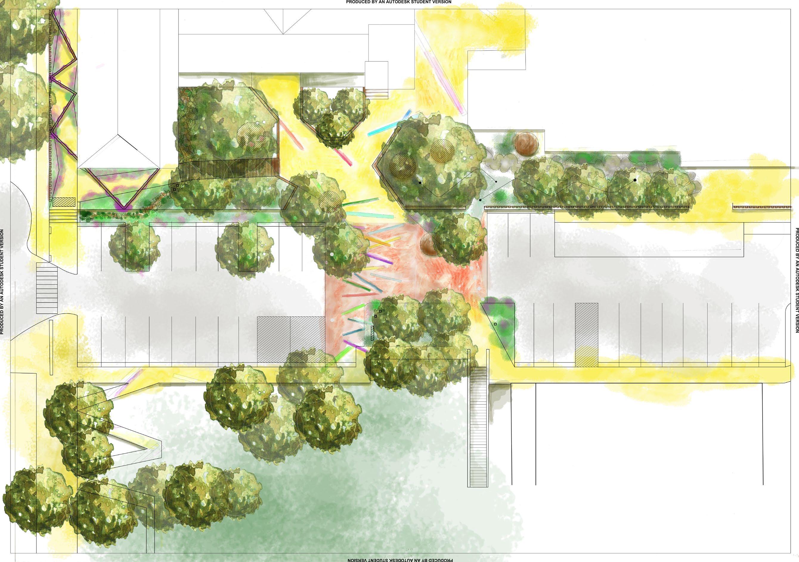
The response to site aims to release the site bound by its unnecessary edges to promote versatility and permeability through the site. Creating, not just a space for the school but, for the surrounding community. The proposal studies the school’s boundary limits, looking to redefine North Perth Primary’s visual cues to the edge and to create connections to the outer community. The project looks at the dispersal of the west edge, creating a permeable public edge with the park adjacent to the library, while the southern connection seeks to strengthen the relationship between the southern courtyard, the art class and Goonderup.
The existing landscape of the school is centralised around an accidentallyformed grove via the planting of the Tipuana benth in close proximity making them grow up rather than out. This informed the adding of an extra row of Tipuanas exasperating the formality of the open gravelled space.
Informed by the dominating Corymbia ficifolia in the courtyard, a thick row of dwarf Corymbia ficifolia has been added. This further accentuates the formality of the space as well as being the first threshold or edge of the school. Its small height adds a potential to be climbed and its red flowers pair with the school’s heritage red brick aesthetic.
The Third Grove mimics the plants in its area to form a canopy connection across the adverse edge of the car park to the well-loved play-space of Goonderup oval.
Image: Soft works.

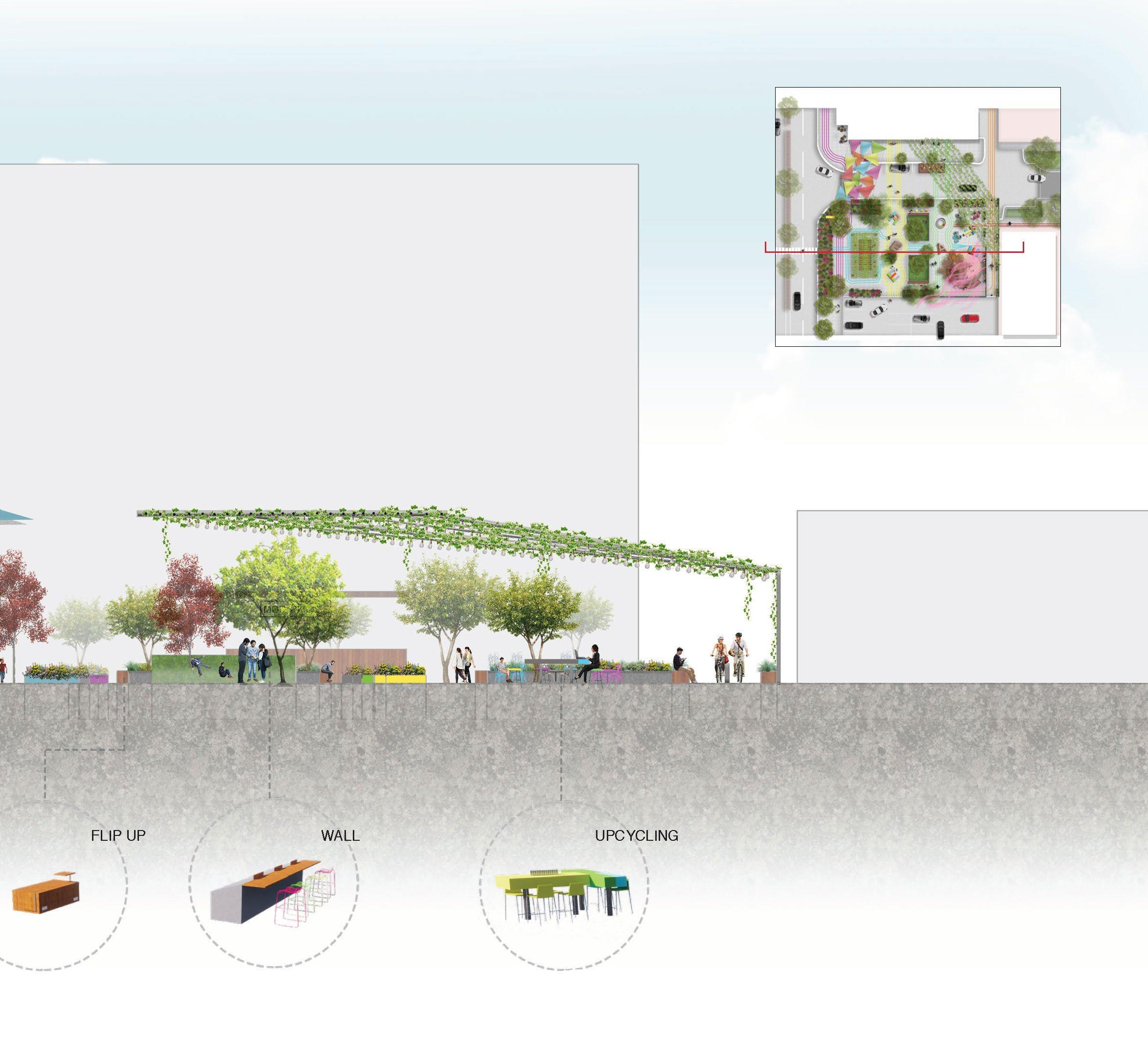
The brief requisites were to design and transform the campus into a space that embraced diverse teaching and learning within a more natural environment.
Further focus on school access, a connection to the school oval, circulation both pedestrian and vehicular, views, urban heat offset, and improved plant ecology were to be explored and resolved.
As a registered Indigenous site of significance, ‘Goonderup’, the cultural and historical acknowledgement of site was paramount for instilling a ‘sense of place’.
Through design principles Movement, Memory and Play this acknowledgement was further explored through a modern interpretation of ‘mark making’ - a physical, visual, and oral narrative. Derivative of Indigenous ‘Song lines’, they revolve around memory connecting nature, sky, spirit and earth, of our first nation people, their history and culture.
Mark making transverse between horizontal aspects of painted strips on the ground plane, to vertical structural accents, arbours and wayfinding poles that lead you to the western quad and the school oval ‘Goonderup’. Subtle level changes in the landscape improve access and circulation with soft and hard scaping addressing the physical, sensory and ephemeral journey through site.
The reconfigured western quad articulates the benefits of unstructured play through nature and the built environment, a vehicle for improving strong cognitive, consequential skill building attributes that help build resilience and foster inclusivity. Opposite, under the shady canopy of existing trees, is an opportunity for a quieter solitude with timber carousel seats for groups of two or more.
Lead the way, this journey through site.
Run your hands through native grass and follow the painted markers down to the oval, to gather and play.
In a time before, where goat tracks would take you on the best path ... where lines in the sand would tell a story, paint a picture of where you had been and where you were going.
Image: Masterplan North Perth Primary School.

LACH2050 PLANTS AND LANDSCAPE SYSTEMS Unit and Studio coordinator: Christina Nicholson PATRICK ONG
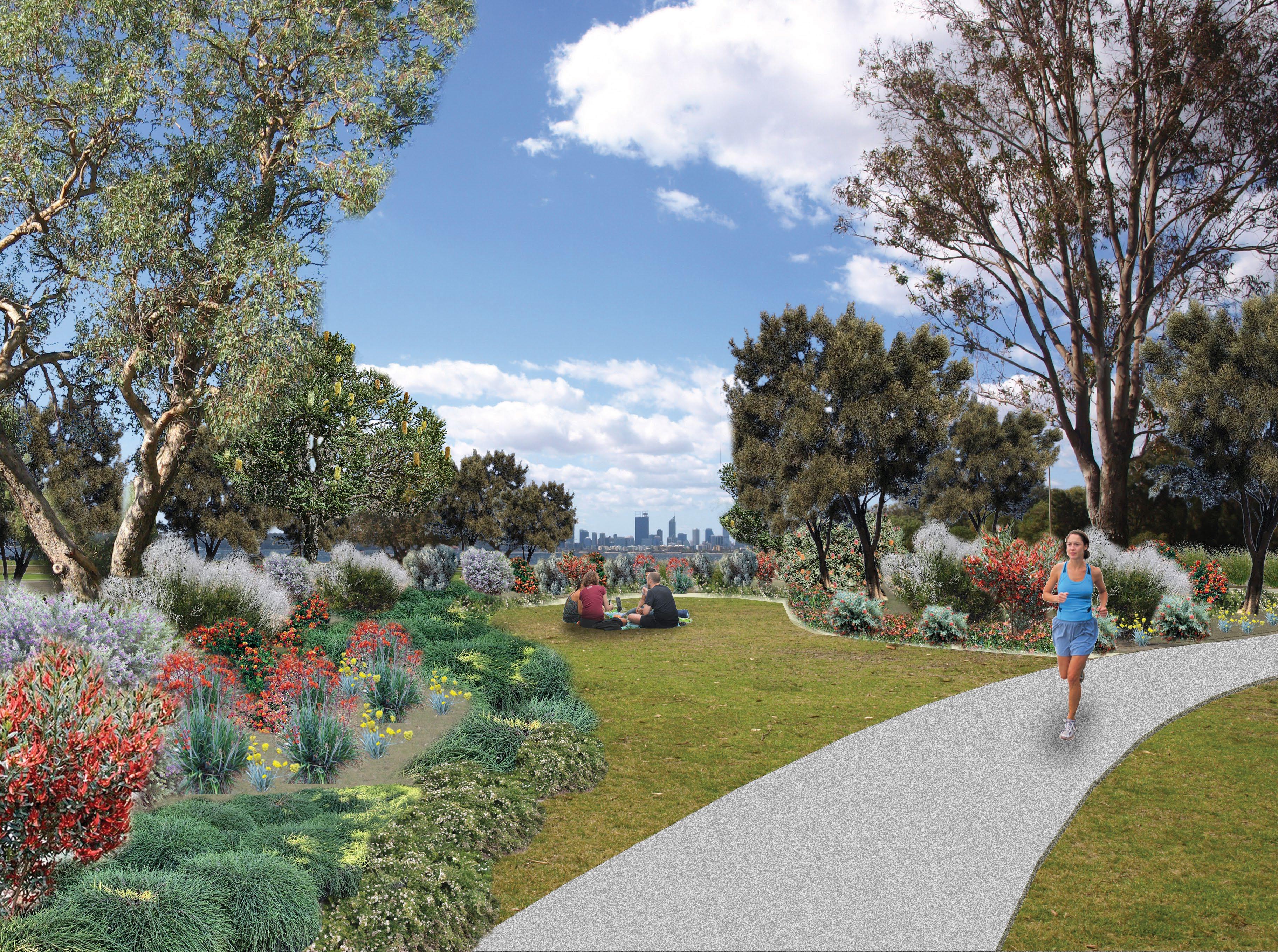
Jeff Joseph Reserve sits on reclaimed land along the shores of Applecross on the Derbarl Yerrigan/Swan River and is currently a large expanse of underutilised lawned area offering little protection against the elements and with few amenities provided. The planting upgrade proposal builds on the existing revegetation efforts occurring along a section of the bay, further increasing the ecological biodiversity for the region whilst at the same time creating inviting spaces and opportunities to gather in groups of various sizes. An area dedicated for nature play area is also positioned close to the foreshore, allowing for a chance to explore and interact with the nearby estuarine environment.
The planting palette celebrates the diversity and distinctiveness of local endemic species that would have been abundant prior to European intervention, reclaiming and reinforcing the sense of place that the reserve is located in, geographically and ecologically. Plants of various textures and colours in foliage, in combination with colourful flowers uniquely distinct from the rest of the world, were selected to invite a new perspective and appreciation of local endemic species, not only for their resilience against climate change, but also to invite speculation and discussion on what a park or reserve can be in Perth, in a cultural context of a contemporary suburban setting within a world biodiversity hotspot that Perth is uniquely positioned in.
Image: Nature play area.

URBAN DESIGN


This research aimed to establish future plan that is sustainable and resilience to flood as the impact of climate change and land subsidence for Penjaringan district in Jakarta.
The journey started with understanding Jakarta’s context, its problem, its communities and future prediction. The case of Jakarta shows great social and environmental challenges when dealing with water management. Then, a comprehensive literature review on facing climate change and flood risk was undertaken. In response to sea level rise, adaptation measures can help reduce vulnerability and lead to city’s resilience. However, in some cases where the existing system incapable of mitigating future risks, transformational adaptation which goes beyond incremental adaptation is needed.
Jakarta’s flooding problem calls for transformational solutions to become sustainable and resilience. This research changed focus from designing adaptation plan for existing city to transforming the city for a long-term period. The 3 key processes are mitigation, adaptation and transformation. Taking UN sustainable development goals as a framework, the concept is treating the existing city as a resource. Recycling the old city to be the new Jakarta. The process towards transformation needs to sacrifice the existing city, demolish existing buildings, and turn waste into sustainable buildings and city that reduce the impact of climate change and land subsidence. This research shows hope for Jakarta to stay.
The scenarios in this research are one of the possible outcomes on transforming the city to be sustainable and resilience. The key outcome will be how government apply this concept and principles to Jakarta. To transform a city, it needs the collaboration of experts from different fields. Therefore, there are areas from this research that requires further studies for it to be achieved, such as recycling industry, future food industries, and future transportation.
While this research has established transformation plan for Jakarta in facing flood risk, it is hoped that this research will lead the government or stakeholder to take further action in this matter and the communities to understand the urgency on dealing with climate change and protect our environment.
Image: Floating Park.

How can we improve the design of suburbs for people with dementia so that they can continue to use them in order to enhance their quality of life?
When I started this dissertation unit, I was interested in mental health and the urban environment. I delved into the topic of dementia as I was inspired by two people who currently suffer from it. The first person is my grandmother who is 75 years old, has mild dementia, and lives alone in my hometown in Malaysia. Every Saturday morning, I would drive to my grandmother’s house and take her to the local market nearby to buy breakfast and groceries for the following week. I never leave my grandmother to roam around the market alone because I had lost her before for half an hour and it was a terrifying experience. Despite her dementia, my grandmother insistently claims that she is physically and mentally capable of doing everything on her own and she never asks for help.
The second person is my partner’s mother. She has onset dementia and is starting to have short term memory loss. Whenever she visits Perth, my partner and I will take her for walks to the local park and the shopping centre, and again we must always accompany her wherever she goes when outdoors because we fear that she might lose her way. As an urban designer, I want to help people with cognitive challenges like my grandmother and my partner’s mother, to live independently for as long as possible and be able to walk around the neighbourhood safely. Therefore, I embarked on this research journey to
Nearly 70% of Australians with dementia live at home, and one-third of1 them live alone despite experiencing difficulties caused by physical and cognitive impairments.
Image: Legible Neighbourhoods cover.
Legible Neighbourhoods
Alicia Chan
Illustration by Drew Shannon

create ‘Legible Neighbourhoods’ that will improve the design of suburbs for people with dementia, and generally anyone who has trouble navigating their way around spaces.
The aim of this research is to investigate how to create neighbourhoods that enable people with dementia greater access to the public realm and actively participate in their local neighbourhood. This raised the following objectives: 1. To investigate the needs of people with dementia in their neighbourhoods, which contribute to a better quality of life. 2. To identify design factors that influences the experience of people with dementia in the outdoor environment. 3. To evaluate the nature and quality of the outdoor environment in Perth’s local neighbourhoods. 4. To make policy recommendations to Western Australia’s existing neighbourhood design policy based on dementia-friendly design.
This research topic sparked from a personal interest on mental health, specifically dementia, due to intimate relationships with two family members afflicted with mild dementia and the anxiety felt when accompanying them to public spaces. During the initial stages of understanding dementia, it was evident that many people with dementia continue to live in their homes because they feel more comfortable in a familiar context. However, due to their diminishing capabilities in their cognitive and physical functions, they tend to isolate themselves within the confines of their homes leading to a reduced quality of life. This led to the research question: ‘How can we improve the design of suburbs for people with dementia so that they can continue to use them in order to enhance their quality of life?’
Prior to the literature review and analyses, three research parameters were established. Firstly, people with dementia and seniors are the main focus user groups, but the research will attempt to relate to a broader range of age groups and capabilities. Secondly, the scope of this research is restricted to mild and moderate dementia as these stages indicate that institutionalisation is not yet required, and people can still stay in their homes and go outdoors. The third parameter is this research understands the importance of including people with dementia in the process but due to the limited time, data derived from existing research will suffice. This means that there is an opportunity to involve people with dementia to improve this research in the future.
A comprehensive literature review was undertaken to understand people with dementia and their relationship with the neighbourhood. From the review, neighbourhoods can support a good quality of life by offering stability in a familiar environment, provide opportunities for physical exercise, social interactions, and everyday citizenship, and retain their freedom and independence. However, as people with dementia go through mental and physical changes due to the condition and old age, their experiences in the outdoor environment change as well. The barriers and design strategies of neighbourhood design revolve around the design of streets and built form, land use, wayfinding elements, and environmental stimuli. These findings were further reinforced by findings from the case studies, which also enlightened on the design process and measure to ensure the success outcome of these projects.
Two neighbourhoods – Myaree and Tapping – in Perth metropolitan region were then selected with the aim to flesh out issues with the existing neighbourhood design based on the information from the literature review. The analysis consisted of a neighbourhood-scale mapping of the street
network, land use and public amenities, and a site walk of three different routes. It was clear that Perth’s neighbourhoods are not designed to accommodate people with dementia and seniors, in general. Main issues identified were poor street design, low connectivity and accessibility to local facilities and amenities, and lack of wayfinding tools in the environment.
Initially, the goal of this research was to design an improved or idealised version of the neighbourhoods that is more inclusive to people with dementia. This shifted mid-way through the research to a focus to the Liveable Neighbourhoods policy review, which will serve more importance in delivering recommended design guidelines that will improve the legibility and accessibility of neighbourhoods. This policy review makes specific recommendations for four design elements – community design, movement network, public parkland, and activity centres and employment. This research envisions that future neighbourhood design will be taken to the next level and start looking at spaces from a dementia perspective.
Endnotes
1. Alzheimer’s Australia NSW, Living Alone With Dementia (2013), https://www.dementia.org.au/sites/default/ files/20131011-NSW-PUB-LivingAlone_ServiceGuide.pdf.
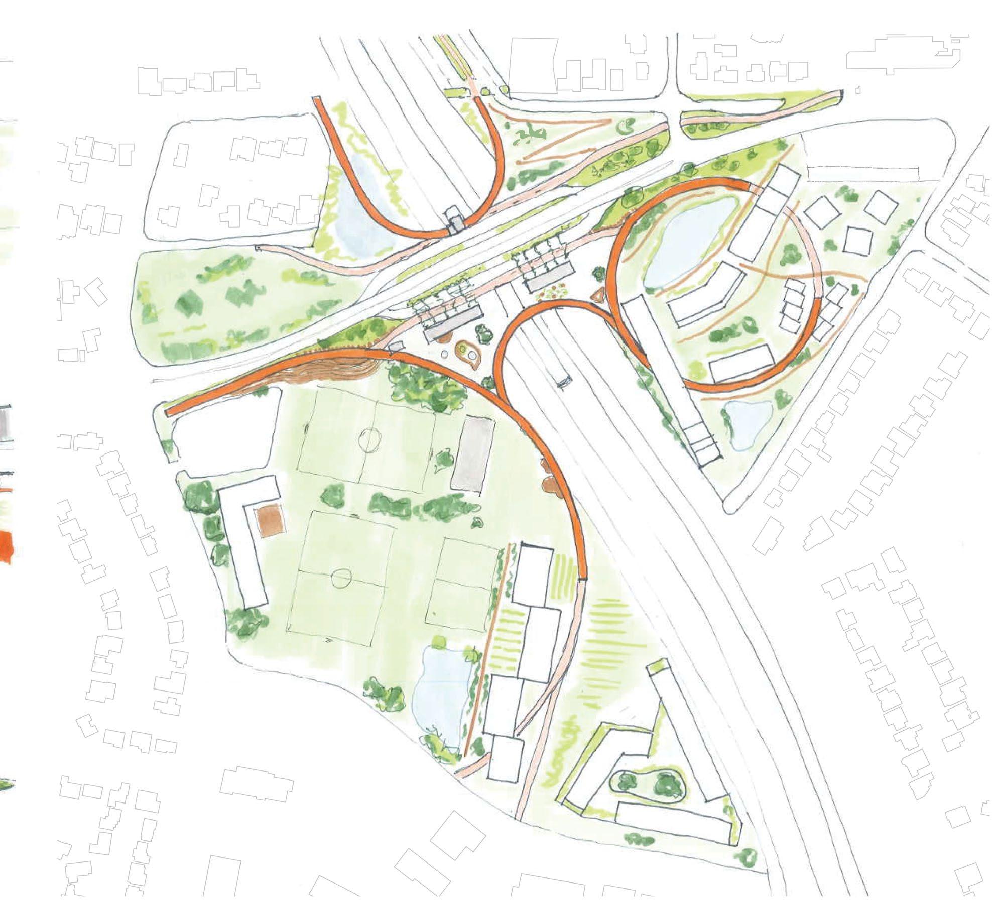
The ascending fingers of the market trail reach deep into the surroundings of the new Morley train station hub to draw in the disparate parts of the urban fabric to come together in an integrated civic experience. Architecture, landscape, infrastructure and transport culminate in a new active community space. The market trail finds value in the existing light industrial history, the natural ecology present in the wetlands, and the highly participated sports and community clubs. The development re-interprets these disparate elements and prioritises their presence as integral to the site and area. The urban market promenade, leading from all directions to the elevated plaza, presents a platform for displaying and sharing the goods and services crafted and produced within the vicinity to the wider community, encouraging engaging participation and pride through self-sufficiency as a means of boosting quality of life.
The Morley station development adheres and builds upon the vibrantly diverse local character, acknowledging the importance of easily accessible workplaces and a successful public transit network that prioritises the human over the vehicle. The various built forms proposed abide by a found concept of being able to live - work - recreate in one place.
Image: Section and axonometric of the Wetlands Precinct of the Morley Train Station development.
Morley Park seeks to capitalise on a once-in-a-generation opportunity for urban renewal, made possible by a new railway line. The extant site condition is consistent with Perth middle-ring suburbia – dominated by private vehicular infrastructure, single residential development, and a shopping centre, which belies a neighbourhood with a strong urban structure.
The response to this site is three-fold: 1. Mobility: The implementation of a rapid transit service, secondary to the heavy passenger rail, provides a direct link to the Morley strategic activity centre and beyond, providing a speed-competitive solution to the transit desert of middle-ring suburban Perth, and linking suburban activity centres. 2. Activity: The implementation of an inclusionary zoning model lowers the bar for entry for business owners by allowing and incentivising mixed-use development, live-work spaces, ancillary commercial units, and small-scale commercial, retail and hospitality. This aligns with the rapid transit link and creates an activity corridor between the railway station and the existing activity centre. 3. Liveability: Provide housing diversity through medium-density single residential, missing-middle housing, and high density living, where the organisational structure of the urban realm is the site’s landscape elements, rather than vehicular thoroughfares.
Finally, the station building itself becomes a landmark for the region: a habitable infrastructural element which is central to the identity of the place and a nexus point for the re-connection of four quadrants, previously torn apart by the physical and psychological barriers of Tonkin Highway and the Broun Avenue bridge. The canopy collects and distributes the life of Morley Park, which will be a connected, active, 15-minute neighbourhood where housing diversity, employment opportunities and regional mobility support an active lifestyle engaged with nature, providing an active green link to Perth’s north-east.

Image: Morley Park perspective.


LAND USE MAP