4 minute read
Precision systems technology


Adoption of precision systems technology AgTech is predicted to be a $100 billion industry in Australia by 2030.
3 THE project sought to engage producers and commercial providers in order to develop underlying spatial management approaches and evidence of crop variability.
Advertisement
AgTech (agricultural technology) is a rapidly developing sector. Predicted to be a $100 billion industry in Australia by 2030, this sector is a vital element in meeting demands for future food and agricultural production.
AgTech covers a group of digital technologies that provide data, information and tools to agricultural producers. It assists with more informed and timely management decisions and ultimately improves productivity and sustainability.
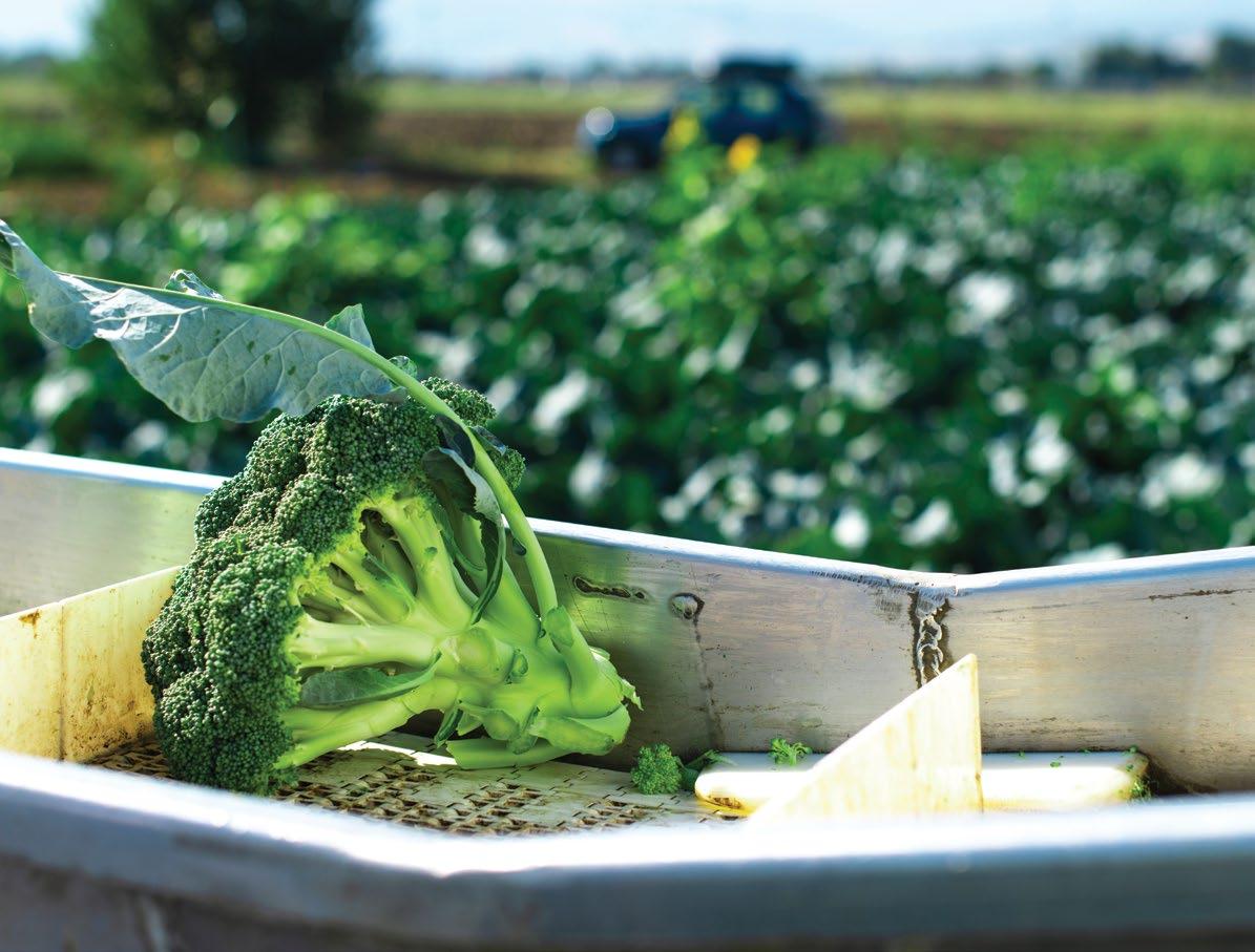
PA uses AgTech to collect detailed field and crop data, mainly using sensing technologies combined with geo-referencing. Adopting precision agriculture technologies could improve your vegetable production and profitability for a variety of crops. Worldwide, agricultural management and production is likely to be increasingly associated with AgTech areas such as Internet of Things (IoT), SMART technologies, drones, robotics and automation. With precision spatial technologies underpinning these AgTech areas, the Australian vegetable industry will need to increase adoption to remain competitive and viable. Recently, Hort Innovation released the findings of its project, ‘Adoption of precision systems technology for vegetable production’, which generated significant evidence for precision agriculture (PA) implementation in vegetable systems. Given the relatively low adoption and knowledge base of precision agriculture in vegetable production systems, the project sought to engage producers and commercial providers in order to develop underlying spatial management approaches and evidence of crop variability.
This involved establishment of key grower-led case study sites across Australia for increased adoption of a broad range of PA technology and approaches. The project significantly increased knowledge and awareness of how PA approaches can be applied to vegetable system using a broad suite of communication products including 12 case studies, eight factsheets, four ‘YouTube’ style videos, two webinars and 15 industry magazine articles. It also connected over 900 vegetable industry representatives with the latest application of PA approaches in vegetable systems through 23 face-toface extension activities. The project achieved the development of accurate and reliable yield prediction capabilities from remotely sensed satellite imagery in carrots and sweet corn across the country. Overall accuracy of the forecasted yield was 82 per cent (Tasmania) and 91 per cent (Western Australia) and ranged from 74 to 99 per cent accuracy.
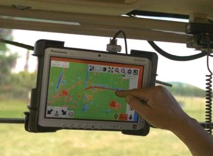
The project facilitated increased • There is a ready cohort of growers adoption through a collaborative across Australia that are primed for approach to implement a range PA adoption with support through of PA technologies and practices future investment. across a range of vegetable • Building capacity in PA service productions systems. providers and regional support These include: crop sensing imagery, yield forecasting from remotely sensed crop imagery, yield and profit/loss mapping, a range of soil mapping technologies, variable rate application, networks would help address current limitations in this area that have been identified as a key barrier for PA adoption in vegetables across the country. precision drainage technologies and various drone applications. Commercially available PA technologies which you can Over 90 per cent of grower implement in vegetable crops co-operators indicated Soil mapping continued use of PA approaches Soil sensing technologies can be used implemented through the to measure how soil characteristics project, with 72 per cent expanding to other precision technologies. vary across a field or farm. Use soil mapping to identify soil type, pH variability and salinity/nutrient constraints. Technologies All project co-operators indicated that involvement Soil sensing technologies include: • Electromagnetic soil in the project accelerated PA adoption, some by more than two years. Key learnings from can be used to measure how soil characteristics vary across a field or farm. • • mapping (EM38) Soil pH mapping (e.g. Veris ® technologies) Mapping of soil and the project include Spatial variability in vegetable production systems is sufficient to have significant impacts on crop • physical characteristics (e.g. Soil Information Systems TM ) Gamma radiometric analysis productivity and profitability and • Grid sampling and analysis. warrant precision approaches to manage this and PA technology and Crop-sensing imagery and analytics management options were successfully Crop variability maps are used to implemented. direct field sampling locations (ground • PA adoption in vegetables needs to be targeted at addressing particular truthing) to identify causes of field variability and to direct crop scouting. issues rather than focused on Use crop-sensing imagery to identify technologies alone. crop variability using:
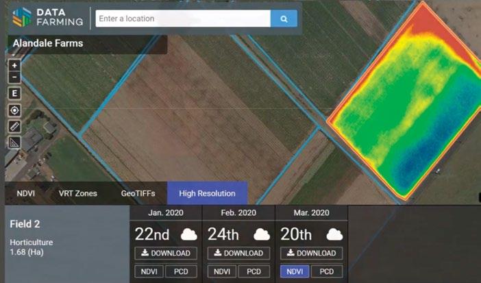
• Low- and high-resolution satellite imagery • Drone-captured imagery. Increasing options in online platforms provide growers access to freely available low-resolution satellite crop sensing imagery, with higher resolutions available at a cost.
Applying drone imagery to vegetable systems The type of drone imagery is dependent on the sensor used. Drone imagery of vegetable crops are predominantly: • Multispectral (to assess crop vigour through vegetation indices) • RGB (digital images). Commercial crop imagery analytics can generate a range of crop vegetation indices from multispectral reflectance data, develop 3-dimensional crop models or automate plant counts from drone RGB imagery in brassicas, lettuce and other hand-harvested crops.
Variable rate application technology Use technology for variable rate applications of soil amendments (e.g. lime/gypsum) and fertilisers to amend variable soil pH and nutrient distribution.
Drainage modelling for land planning Accurate elevation data forms the basis for precision drainage modelling. Precision drainage technologies can be used for land planning to optimise surface water flow, for example, TerraCutta TM is a GPS-enabled in-cab software package for land forming operations (e.g. levelling) and iGrade TM which automates movement of the landplane (grading and plane generation).
Yield mapping and monitoring Use harvester-based yield mapping for machine-harvested crops such as carrots, potatoes and sweet potatoes.
MORE INFORMATION
For more information visit: www.business.


