11 minute read
Soil mapping


Soil mapping for farm development and infrastructure
Capel Farms, Western Australia
Advertisement
BY RACHEL LANCASTER 1 AND JULIE O’HALLORAN 2 1 ENVIRONMENTAL AND AGRICULTURAL TESTING 2 QUEENSLAND DEPARTMENT OF AGRICULTURE AND FISHERIES
PERTH
CAPEL
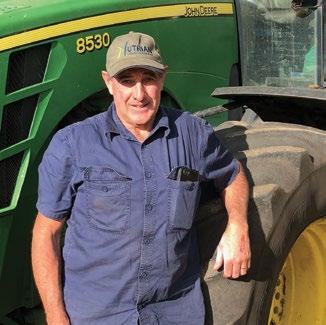
Grower Capel Farms (pictured is David Blakers, co-owner) Location Capel, Western Australia
Enterprises Broccolini, English spinach, kale and chard Soil Sandy surface with silty clay soil at depth
Topography Flat
Average 860mm
annual rainfall
Precision EM38 soil mapping, drone technologies crop sensing imagery
implemented Key outcomes
• Soil mapping is useful for determining soil variability across a farm, allowing different soil type areas to be treated as separate production zones. • Soil mapping helps to inform decisions about drainage options on farm. • NDVI imagery should be used on crops that have a low weed burden as excessive weeds can cause an incorrect estimation of crop biomass. • A difference in crop vigour can be determined using NDVI imagery, however detailed assessment of the imagery and field sampling is required soon after capture to provide early information for crop management decisions.
Background
Precision agriculture techniques on Capel Farms had not previously been used. David Blakers, from Capel Farms was interested in using precision agriculture techniques to investigate soil properties on a new area of land being developed for vegetable production. The new development area of land was sand mined about 20 years previously and had been rehabilitated after mining to allow farming to recommence. Grazing was the predominant land use after rehabilitation. “The EM imagery was really useful for whole farm planning for future cropping.” — David Blakers
The surface soil in the area is mainly sand, however the mining operations had left some silty clay layers from deep in the soil profile on the soil surface. These silty clay areas did not mix well into the surrounding sandy soil and set very hard when dry. Identification and removal of the clay areas was required prior to vegetable production on the new farm. In existing vegetable cropping areas, assessing variability in soils and crop growth was of interest, to see if improvements in the existing cropping area could be made.
Activities
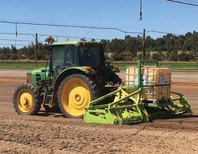
Electromagnetic (EM38), elevation and radiometric soil mapping data was collected to identify and understand variability in soil characteristics across both the new development area and current cropping area (see Figure 1). The soil mapping activity was carried out at 14m swaths. After processing this data the resulting maps were used to locate sample points within each zone (based on both ECa and radiometric data). Soil samples were collected at each of these sample points to a depth of 60cm and analysed for soil texture, electrical conductivity, soil pH and nutrients (see Figure 2). Drone imagery was also captured across two commercial broccolini crops. This imagery included crop sensing for NDVI, a measure of crop biomass/vigour (see Figure 3).
New development soil mapping
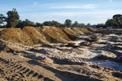
Ground-truthing of the soil maps indicated the EM38 data had accurately identified the location of clay areas, providing a guide for their removal (see Figure 4).
FIGURE 1. EM38 SOIL MAPPING.

FIGURE 2. LEFT: SOIL TYPE AREAS IDENTIFIED FROM EM38 SOIL MAPPING. DARK BLUE AREAS INDICATE HIGHER EC AND CONTAINED CLAY, RED AREAS WERE LOWER EC AND WERE PREDOMINANTLY SAND. RIGHT: SOIL CORES SHOWING SOIL CORES FROM GROUND-TRUTHING.
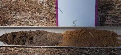
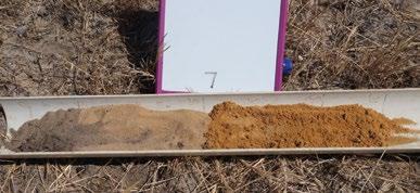

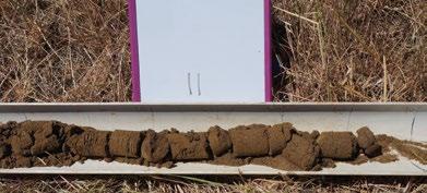
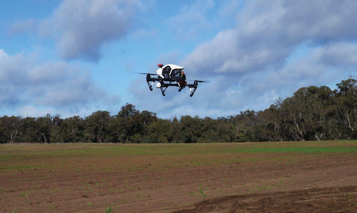
FIGURE 4. CLAY REMOVED FROM FUTURE VEGETABLE CROP AREA AFTER LOCATION USING EM38 SOIL ANALYSIS.

The dark blue colour on the maps Elevation and depression data was indicates a substantial amount of clay also used to determine the potential in that location, with the lighter colour flow of surface water (Figure 5), areas indicating less clay was present. which assisted with decisions for the During removal operations, it was found that although the location of installation of drainage lines in the new development areas. the clay areas was accurately Soil mapping of cropped identified, the depth of the clay layer was not accurately determined. The clay layers were stratified through the soil profile to varying depths, The ability to harvest plants earlier is a significant finding. areas The EM38, elevation and radiometric mapping layers were also used to understand soil type differences in the cropped which may have caused areas and formed the basis a false indication of the for modelling drainage across quantity of clay present in an the farm. This data was used to area. However, the depth of clay to map the location of a new drain across be removed was not considered to be a cropping areas that are occasionally major concern as it was the spread of excessively wet for vegetable the clay across the entire paddock that production, providing better drainage of was important to locate. existing centre pivots (see Figure 6).
FIGURE 5. ACCUMULATED WATER FLOWS (LEFT) AND BREACH FLOW PATHS (RIGHT) MODELLED FROM ELEVATION DATA IN THE NEW DEVELOPMENT AREA. ACCUMULATED FLOW IS THE DIRECTION THE WATER COULD POTENTIALLY FLOW IF THE SOIL PROFILE IS AT FIELD CAPACITY. THE ACCUMULATED FLOW IS MODELLED BASED ON THE ELEVATION AND DEPRESSION DATA CAPTURED DURING THE EM38 MAPPING.
“The ability to harvest plants earlier is a significant finding with potential cost savings as less inputs such as water, fertiliser and pest control may be required.” — David Blakers.
Drone imagery
Of the two broccolini crops where drone imagery was taken, only one had usable data. In one field the high weed burden confounded the crop vigour data as the image analysis for NDVI does not distinguish between weeds and crop. The second broccolini crop, which had a very low weed burden, provided imagery where it was possible to use NDVI to distinguish between areas of high and low crop vigour (see Figure 7). In this case: • The crop yield between the high and low areas was similar although there was a difference in the time to harvest. • The high area had a greater percentage (over 60 per cent) of the crop ready for harvest in the first six days of the harvest period compared with just 25 per cent for the low crop vigour area. • The low area had the majority (over 70 per cent) of the crop ready for harvest from days 8–13 of the harvest period, with only 35 per cent of the harvest in the high crop vigour areas remaining at 8–13 days.
Cost benefit analysis
EM38 soil mapping costs were $40/ha. Soil sampling and analysis was additional and included soil texture, electrical conductivity, soil pH and exchangeable cations. This mapping proved extremely valuable for both clay removal on new development areas and understanding soil type differences in existing vegetable production areas.

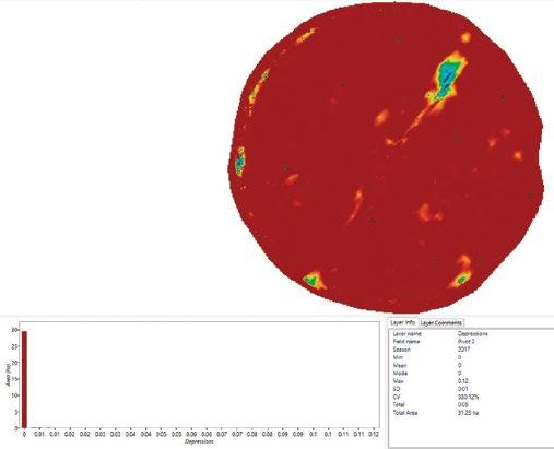


FIGURE 6. USING ELEVATION DATA CAPTURED WITH EM38 SOIL MAPPING (TOP LEFT) COMBINED WITH DEPRESSION DATA (TOP RIGHT) AND LANDSCAPE CHANGE (THE DIFFERENCES BETWEEN ELEVATION AND DEPRESSION LAYERS) (BOTTOM LEFT) HAS ALLOWED CAPEL FARMS TO IDENTIFY LOCATIONS TO INSTALL FARM DRAINS (BOTTOM RIGHT).
PERCENT HARVESTED (%)
80.0 70.0 60.0 50.0 40.0 30.0 20.0 10.0 0.0
1–6 days Low (average) High (average) HARVEST DAY
8–13 days
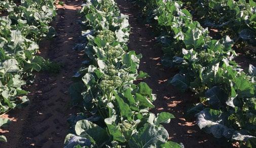
FIGURE 7. HAND HARVEST MATURITY DATA FROM HIGH AND LOW BIOMASS AREAS (LEFT) AND THE HARVEST SAMPLE AREA IN THE HIGH BIOMASS ZONE IDENTIFIED USING NDVI IMAGERY.
Drone crop sensing imagery was captured over two existing centre pivots. The costs for this imagery were $500 for drone imagery capture, $300 for associated data processing, and $550 for travel. Travel costs would vary with location, and data capture and processing costs are dependent on the area of crop to be mapped.
Challenges and considerations with crop sensing using drones
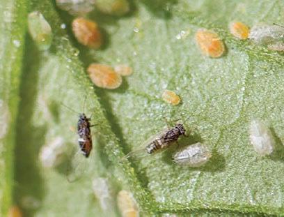
While crop sensing imagery can provide an indication of how crop health and vigour varies it is not without some challenges. These include: • Differentiation of weeds from crops to provide an accurate estimation of crop biomass. It is important when using NDVI imagery to consider the weed burden in the crop and if this is likely to cause false results for biomass determination. Timing of crop sensing operations is critical. Too late in the crop and crop biomass may be too high so that NDVI ‘saturates’ and the variability is not evident in the bulk of the biomass. Similarly, too early in a crop and the plants may be too small to properly sense or complete different image analyses.
ACKNOWLEDGEMENTS
DAF acknowledges the assistance and contribution of the participating landholder, David Blakers, in undertaking this case study.
DISCLAIMER
The information contained herein is subject to change without notice. The Queensland Government shall not be liable for technical or other errors or omissions contained herein. The reader/user accepts all risks and responsibility for losses, damages, costs and other consequences resulting directly or indirectly from using this information. Mention of a particular product or brand name does not imply endorsement in preference to other products that are capable of offering similar performance or service. Costs presented in this document were accurate as of October 2019. These will change over time and between data processing service providers.

This project has been funded by Hort Innovation using the vegetable research and development levy and funds from the Australian Government. For more information on the fund and strategic levy investment visit horticulture.com.au

Sustainable agriculture for a sustainable future
IN THE SUMMER of 1982, a research scientist took a well-earned holiday in the sunny Caribbean. While touring the local sights with his wife, he visited an abandoned rum distillery on a tiny tropical island.
Quietly wandering through the old buildings, he was struck by the ghostly, eerie silence. In a climate where the incessant buzz of insect life droned 24 hours a day, the sudden quiet was deafening. Intrigued, he took some soil samples and transported them back to the United States for testing. What he and his team discovered was a unique soil bacterium that produces active metabolites (spinosyns) that gave excellent control of certain insect pests. Years of development and exhaustive testing followed, culminating in the release of Entrust ® Organic, a product characterised by its efficacy equivalent to synthetic insecticides, but with the safety and environmental profile of a biological. Entrust ® Organic received regulatory approval by the Australian Pesticides and Veterinary Medicines Authority (APVMA) in July 2020, and will be available this October.
Naturally derived, highly effective and fast-acting, Entrust Organic has long been anticipated by the Australian agricultural market. Its organic certification, favourable environmental profile and selectivity to key beneficial insects make it ideally suited to many Integrated Pest Management (IPM) systems. Entrust Organic belongs to a unique insecticide group known as the ‘Spinosyns’. A group 5 insecticide for resistance management, shared only by one other product, Success ® Neo.
The introduction of Entrust Organic offers organic growers a new resistance management tool for the selective control of some of Australia’s most damaging pests. As with all insecticides, it is beholden on users to rotate between different chemical Modes of Action (MoA) in accordance with label directions to prevent the onset of resistance. The broad label covers more than 80 registered crops, including a wide range of fruit and vegetables, making it extremely versatile for farmers with mixed enterprises. Entrust Organic offers growers effective control of several damaging Lepidoptera species including Diamondback moth, Heliothis, Cluster caterpillar, Light brown apple moth and many other caterpillar pests including loopers. It also controls Western flower thrip, leaf miner and Cherry slugs (Diptera). The recent arrival of Fall Army Worm (FAW) in Northern Australia earlier this year presented significant challenges for organic producers. Subsequently, the APVMA approved an emergency use permit (PER89870) for the use of Entrust Organic which is welcome news for growers struggling to control FAW. Corteva Agriscience Marketing manager Nick Koch said: “Biological products are often associated with lower levels of performance compared to that of synthetic insecticides.” Contrary to belief, this could not be further from the truth when assessing the performance of Entrust Organic. “Growers will be delighted with the speed of control and activity across multiple life stages”. “It’s hard to imagine a product that is so effective at controlling pests being environmentally sustainable, but this is certainly the case,” said Mr Koch. “Organic and conventional producers of fruit and vegetables now have a pest control option that ticks all the boxes. They can rest assured knowing that their crop protection choices will provide them with a sustainable future for this generation into the next.”
MORE INFORMATION
Entrust ® Organic will be available in limited supply from October. To register your interest, visit entrust-organic.corteva.com. au or call Corteva Agriscience toll free on 1800 700 096.
TIME TOOL


produc your tion