
The project has been implemented to strengthen Latvian Estonian cross border cooperation to ensure a harmonized approach to the management of groundwater resources and the assessment of the status of groundwater bodies in the cross border area, thus ensuring the long term sustainable management and protection of the main drinking water resource groundwater Spring dataset Habitats guide
WaterAct project
Sustainable cooperation Public spring monitoring Field visits
Currently, the project is in its final phase, and the project team shares the most significant results.
2nd Newsletter SEPTEMBER 2022
Harmonized approach to the management of groundwater resources
Since summer 2020, strong cooperation has continued between the Estonian and Latvian organizations involved in the preparation of River Basin Management Plans to improve the efficiency of joint groundwater resources management in the transboundary area within the Interreg Estonia Latvia program project “Joint actions for more efficient management of common groundwater resources” (WaterAct).
Monitoring and data exchange


Coherent and sustainable cooperation
2
It was discovered that due to differences and quality in available data and their sources in both countries and the specificities of national legislation, harmonization was not always possible, and further cooperation in the future will be needed between both countries. Still, the WaterAct project is a good start and an example of ensuring coherent and sustainable cooperation to ensure joint management of transboundary groundwater resources in Estonia and Latvia.
Joint training on using "R" statistical language was organized by the University of Latvia and led by Didzis Elferts in August 2021. The training aimed to integrate R into daily tasks among project partners. The workshop covered several topics, including data handling and manipulation, visualization, basic statistical tests, and dynamic document preparation. For many participants, this was the first coding attempt in R, and the conclusion is everything can be accomplished, but it takes time to learn. To manage transboundary groundwater resources and assess their status in transboundary Gauja/Koiva and Salaca/Salatsi river basins, extensive work was carried out to develop harmonized assessment principles, which initially included the exchange and comparison of methodologies and assessment approaches already used in Estonia and Latvia, as well as an analysis of the requirements of the European water policy and best implementation practices in other EU countries. Project partners also attended the EGU General Assembly 2021 to gather and share even more experiences to broaden their horizons and gain more knowledge. As a result, harmonized principles were developed for chemical and quantitative status assessment of the transboundary groundwater bodies (GWBs), including harmonization of related methodologies.
In the Gauja/Koiva and Salaca/Salatsi river basins, transboundary groundwater bodies (GWBs) were delineated, where joint activities should be carried out for monitoring, data exchange, and chemical and quantitative status assessment. The initial characterization of the common GWBs and assessing their overall status according to harmonized principles showed that the identified GWBs are in good quantitative and chemical status. It should also be noted that transboundary GWBs are not currently exposed to intense anthropogenic pressures. To further ensure the consistent protection of groundwater in the Estonian Latvian transboundary area, the first joint coordination in the monitoring field took place between the countries. Based on the collected information on the existing principles of groundwater monitoring in each country, a strategy was developed for the implementation of transboundary groundwater monitoring and the annual exchange of monitoring data and joint data analysis Attention was paid not only to groundwater but also to ecosystems dependent on it and the integration of their monitoring into the groundwater monitoring program It is important to ensure the protection of these ecosystems and provide data on the ecological status of ecosystems and thus indicate the overall status of GWBs
Strategy for the implementation of transboundary groundwater monitoring and data exchange
Assessment of common groundwater resources in Gauja-Koiva and Salaca-Salatsi river basins
3
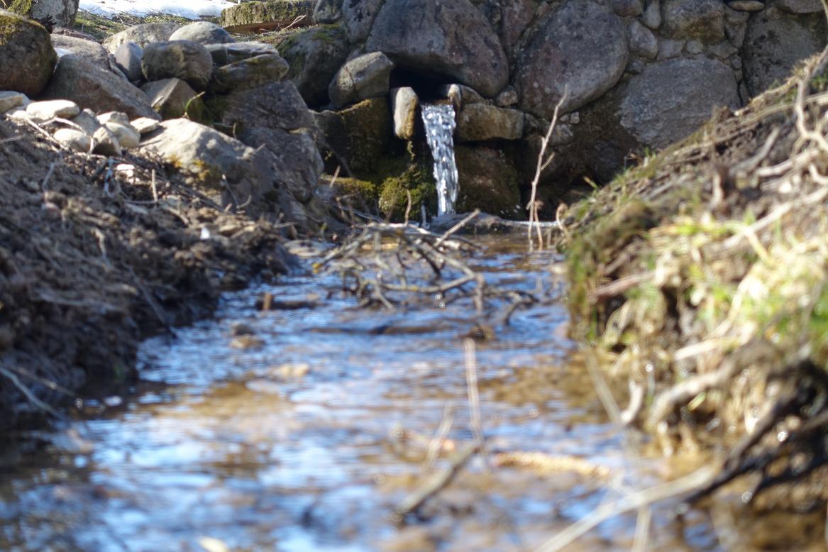
The compiled dataset will be analyzed to characterize and classify the sampled springs and monitoring wells in the transboundary area and determine which transboundary aquifer systems they are associated with. It would make it possible to select the springs that would be most representative for transboundary groundwater body monitoring. Springs can be significantly more cost effective in monitoring groundwater bodies than wells, as they describe the average groundwater quality over a much larger area. Watersheds have been calculated for selected springs in the Estonian-Latvian transboundary area. A watershed or catchment is an area from which all precipitation flows to a single spring They are necessary to understand how geological settings (rock types) and human activities (land use, pressures) within the watershed can affect the chemical composition of a spring. Moreover, a conceptual understanding of a spring is crucial to assess if a spring can represent a specific transboundary aquifer and be included in a transboundary monitoring network. Combining calculated watersheds and data from spring water chemistry allows the selection of new springs for monitoring.
Spring dataset
4 In three sampling campaigns, researchers from TU, LU, and GSE collected 89 water samples from 58 springs and five monitoring wells in the transboundary area of Estonia and Latvia. The water samples were complemented by external hydrochemistry data from previous studies in the transboundary region by Koit et al. (2021) and Kalvans et al (2021), various national databases, and groundwater monitoring programs of Estonia and Latvia (Latvian hydrogeological database WELLS, 2021; Estonian Nature Information System, 2021; Environmental Monitoring Information System, 2021), resulting in a database comprising a total of 409 observations. The final dataset includes field parameters (pH, SEC, ORP, water temperature, DO); major ions (Na+, NH4-, K+, Mg2+, Ca2+, Cl-, NO2NO3 , SO42 ); log pCO2, SIcalcite, SIdolomite; dissolved carbon (DOC and DIC); organic matter (CODMn); macronutrients (Ntot and Ptot); stable isotopes (δ18O, δ2H and d excess); trace elements (Al, As, B, B, Ba, Be, Ca, Cd, Co, Cr, Cu, Fe, K, Li, Mg, Mn, Mo, Na, Ni, P, Pb, S, Sb, Se, Si, Sr, Ti, Tl, V, Zn).
Experts from all scientific institutions represented in the project have shared their experience and knowledge of groundwater dependent ecosystems, their classification, identification, threats, chemical and physical properties, vegetation, and ecosystem services in the habitat guide "Groundwater dependent ecosystems: conceptual understanding, threats and mitigation possibilities" (Priede, Strazdiņa (ed ), 2022)
5
The handbook is arranged in 8 chapters with a detailed explanation of the given topics, which are richly illustrated with diagrams, photos, and tables both the original results of the project experts' research and adapted from external resources. The information will be useful to practitioners working in ecosystem restoration and research and to managers responsible for monitoring and conservation of the GDTE and the GAAE The habitats guide is in English and available on the project partner websites (LEGMC, NCA, LU, TU) and the ResearchGate project profile. Handbook authors: A. Babre, J. Bikše, D. Borozdins, J. Demidko, O. Koit, E. Lode, K. Ojamae, K. Popovs, A. Priede, L. Strazdiņa, J. Terasmaa, L Urtāne, M Vainu, K Valters, L Vizule Kahovska. Drawings and design are made by Z. Rubene (NCA).
Photo: Agnese Priede, Nature Conservation Agency
A guide for habitat experts


The manual covers all the important topics and helps users start monitoring step by step For example, it covers topics such as how to find and recognize springs, how to describe and photograph them, and detailed instructions on why and how to make different measurements water temperature, pH, conductivity, etc. Everyone can easily start because all new information has high value even just some pictures and short descriptions already confirm that spring is still existing. All descriptions and images will give the possibility to evaluate the possible changes in the future. Researchers will have data on groundwater bodies that otherwise may go unmonitored
6
For testing, a volunteer spring monitoring project team worked out a web based map application (allikad.info and avoti.info), where the general public can see all known springs and participate in their research All submitted data is publicly available, but one must register to submit new observations. The website has 208 registered users who have submitted over 1000 new observations and over 2600 spring photos and added to the database over 800 new springs in Estonia and Latvia! Some schools have been joined from the Estonian side, and already, one school's research on spring monitoring has been successfully defended. At Tallinn University, seven bachelor's and master's level theses are conducted related to spring monitoring. Project partners prepared useful materials to help volunteers join and start spring monitoring. The spring monitoring manual for volunteers (Terasmaa et al , 2021) is available in English, Latvian, and Estonian.
Public spring monitoring


7
To share knowledge, discuss the properties of the springs and find out the vegetation characteristic of the alkaline bog and mineral rich spring habitats, the experts were invited to join the project team during a field visit to Vidzeme, Eastern Latvia. The field seminar took place in the Natura 2000 site, in the Microreserve “Bānūžu Zelta avots” (Banuzu Golden spring). The seminar was held on April 28, 2022. A total of 26 people from both Estonia and Latvia participated Project experts hydrogeologists J. Bikše (University of Latvia), J. Terasmaa, and M. Vainu (Tallinn University, Estonia) explained the spring formation processes, measured water chemistry, and its discharge rate. Also, a project application for voluntary spring monitoring avoti info was presented. In turn, the bryologist and ecologist L. Strazdiņa (Nature Conservation Agency, Latvia) showed the most common spring bryophytes in spring habitats, including rare and protected species in Latvia, such as Paludella squarrosa, Helodium blandowii, Mesoptychia rutheana and Breidleria pratensis. The issues of spring habitat degradation were discussed.
Field visit in Vidzeme


LATVIA Latvian Environment, Geology and Meteorology Centre (lead partner) University of Latvia, Faculty of Geography and Earth Sciences Nature Conservation Agency Vidzeme Planning Region The newsletter is prepared within the Interreg Estonia - Latvia 2014 2020 cross border cooperation programme project “Joint actions for more efficient management of common groundwater resources" (WaterAct) (Nr. Est Lat 155). It aims to promote sustainable management of shared groundwater resources in a transboundary area. ESTONIA Ministry of the Environment Tallinn University, Institute of Ecology Geological Survey of Estonia Estonian Environment Agency This newsletter reflects the views of the author The managing authority of the programme is not liable for how this information may be used Project partnership bit.ly/estlat-WaterAct bit.ly/WaterAct-Researchgate
