
70 minute read
FITNESS


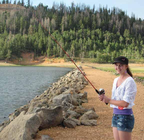
It's Time to Get Outside gThrive!
by Ashley Centers
Advertisement
Hello, again, lovely readers. This edition is all about the great outdoors and nature, and I love it so much because it’s such an easy topic to talk about. Those of us who live here know how blessed we are to live in such a beautiful locale where outdoor recreation abounds yearround. When other savvy adventurers come to visit, they very quickly discover for themselves not only the beauty but the myriad of recreational opportunities!
While many of us do sate our desire for recreation through- out the year, and though we have our favorite things to do recreationally, this year I would like to issue a challenge to all of us to try some new things. Let’s challenge ourselves to go new places, see new sights, and overall, to just expand our horizons concerning what our outdoor recreation and fitness can look like. Lots of us hike, and it’s a beautiful way to spend a day in nature, but do you find that you spend a lot of time on the same trails? Challenge yourself this year to explore a few new ones! Do you ATV on your days off but feel like you know the Beaver Dam Wash like the back of your hand? Maybe take a ride in the opposite direction and explore a new, untraveled road for yourself! There are plenty of desert and mountain roads to explore that you’ve probably never even seen or heard of. So go grab a map, program the GPS, and get going!
Some of us already enjoy golf as our outdoor recreation, but did you know that there are nearly 100 golf courses within an hour and a half drive of Mesquite? Maybe you could challenge yourself to make a day of it and choose one new course to play on during one of your golf days.
Make it even more fun and recruit your buddies for a travel golf day to that course. Breakfast somewhere near the new course, play your heart out at your scheduled tee time, and then enjoy dinner at the clubhouse or a local restaurant you’ve wanted to try. Make it a full day of adventure together!
I know you’re reading this, saying, isn’t she the fitness writer? What does any of this have to do with fitness, and why does it matter?
Let’s start with this: did you know that on average, you can burn 300–500 calories an hour playing golf? Or that ATVing can burn 300 or more calories per hour, depending on your body and the terrain you’re riding in? Did you also know that the active core engagement you achieve during an average-length ATV ride equates to more total-core muscle work than a full 30-minute ab workout?
What about this—while hiking is excellent for a full-body workout, the active cognitive challenges presented while hiking can actually increase cognitive function, decreasing the risk of diseases like dementia/Alzheimer’s. Hiking can also help us to maintain brain volume (which starts to drop dramatically after age 40), and it increases neuroplasticity (our brain's ability to learn, retain new skills, and process information). So yeah, that’s why it matters.
It matters that we do the things we enjoy and that we continue to expand on them and to challenge ourselves because these things do directly relate to our mental and physical fitness.
Just being outside in the sun alone can increase mood, increase vitamin D, help us to sleep better, strengthen our bones, and lower blood pressure—among a million other little things! So why not use those nearly 300 days of sunshine a year that we get (in combination with the fun things we already love) to take our fitness to the next level!
This year, let’s challenge ourselves to grow and expand our fun and fitness by trying new ways to enjoy the things we already love outside. And let’s be mindful of how it all works together to make us thrive! So let’s get out there and get at it!V

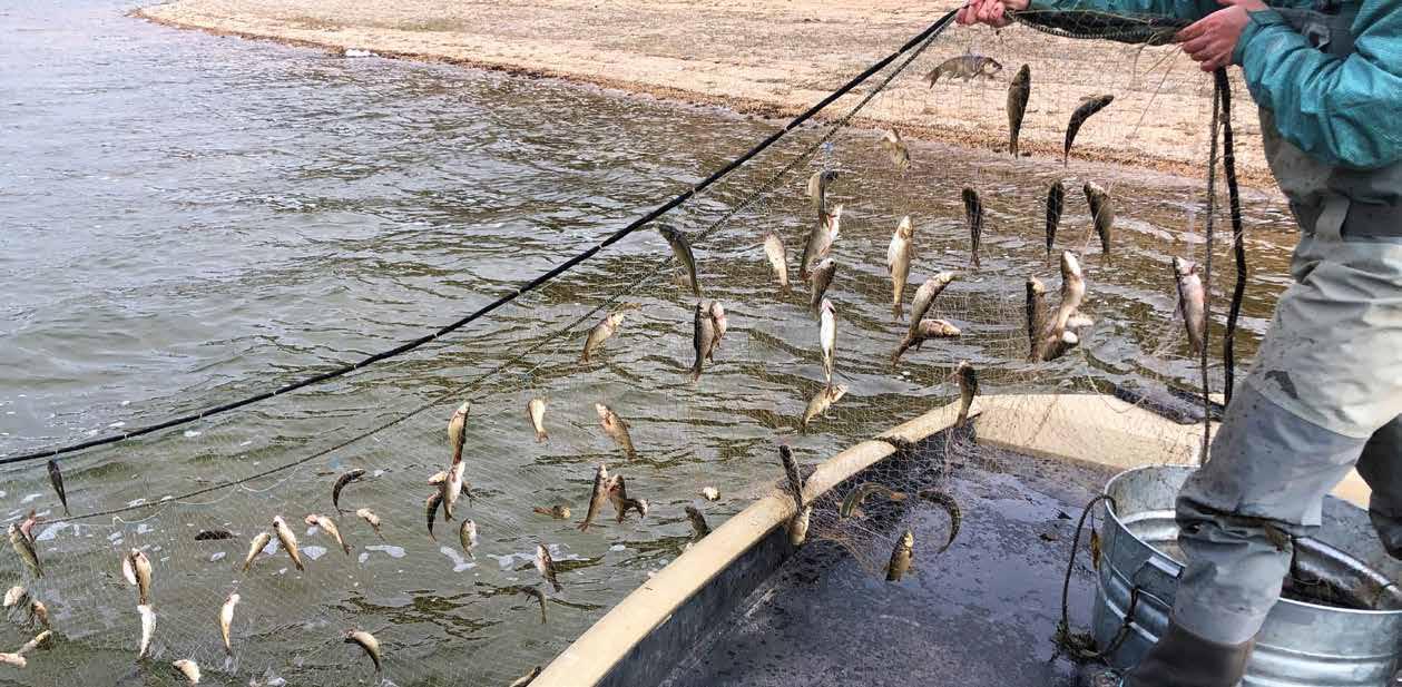
Visit Navajo Lake For Some Hot Rainbow Trout Fishing This Summer
by Faith Heaton Jolley Utah Division of Wildlife Resources Public Information Officer Photos Courtesty of Utah Division of Wildlife Resources
With warmer weather comes hot summer fishing. And if you are looking for a great place to cast a line in southern Utah, look no further than Navajo Lake.
Located on Cedar Mountain along State Route 14, Navajo Lake is a scenic mountain lake that is easy to access while still offering that secluded feeling. The lake is roughly 26 miles east of Cedar City and three hours from Las Vegas, making it a popular fishing spot for southern Utah locals and Nevada residents alike. Recently, Utah chubs were overrunning Navajo Lake and made up over 90% of the fish in the waterbody. As a result, they were outcompeting the trout (rainbow, brook, splake, and tiger) that are stocked there. In an effort to restore the trout fishery at Navajo Lake—and rid the waterbody of its overwhelming Utah chub population—the Utah Division of Wildlife Resources did a rotenone treatment last October when the lake levels were low.
Rotenone is a natural substance that comes from the roots of a tropical plant in the bean family. It’s a respiratory toxin to fish but isn’t dangerous to people, pets, or other wildlife, especially considering the extremely low quantities that


biologists use to treat and reset lakes. Rotenone treatments have proven to be an effective management tool when water- bodies are overrun by certain fish species. DWR biologists feel that the treatments were successful in reducing the Utah chub population to a level that is manageable and can be kept in check going forward by stocking predator species such as splake, tiger, and cutthroat trout.
The DWR plans to stock 15,000 10-inch rainbow trout in the lake this spring after the ice melts. There are also plans to stock splake, tiger, and cutthroat trout—though the quantities will be smaller—at a later date. “Trout is the preferred species to fish for at this lake, which is why we are working to restore Navajo Lake as a top-quality trout fishery,” DWR Southern Region Aquatics Manager Richard Hepworth said. “This year will offer some of the best rainbow trout fishing at Navajo Lake in a long time. We are really excited about the opportunities for anglers this summer.”
Navajo Lake offers great shore fishing, though there is also a small boat ramp where anglers can launch kayaks, canoes, and other small watercraft. There are also three lodging options available at the lake—Navajo Lake Campground, Spruces Campground, and Navajo Lake Lodge—for those wanting to
venture on a longer fishing trip.
Fishing Tips
Rainbow trout are best to target when the weather and water aren’t too hot. You can have success using PowerBait or a worm on a hook suspended about 18 inches below a bobber. The daily catch limit for rainbow trout is four fish. The daily catch limit for splake, brook trout, and tiger trout is a combined total of four fish, and only one may exceed 22 inches long. Make sure to read the 2022 Utah Fishing Guidebook for other rules and regulations. Anyone 12 years old or older is required to have a Utah fishing license.V

CAN MY DOG INHERIT MY ESTATE?
by Jeff McKenna
In most states, animals are allowed to be the beneficiaries of a special trust that is created to take care of them. These are often referred to as “pet trusts.” Your pet would not technically “inherit” your estate, but your pet may receive the benefit of a pet trust for as long as your pet is alive. (Being the beneficiary of a trust is not the same as inheriting an estate.)
How does a pet trust work? You (the trustor) give your pet enough money or other property through a trusted person or bank (the trustee) who is under a duty to make arrangements for the proper care of your pet according to your instructions. The trustee will deliver the pet to your designated caregiver and then use the property you transferred to the pet trust to pay for your pet’s expenses throughout the pet’s lifetime.
Pet trusts provide pet owners with the ability to have tremendous control over their pet’s care. For example, you may specify the following: who manages the property (the trustee), who the pet’s caregiver is to be, what type of expenses relating to the pet that the trustee will pay, the type of care the animal will receive, what happens if the named caregiver can no longer care for the animal, the disposal of the pet after the pet dies, and the eventual recipient of the assets in the pet trust, if any, after the death of the pet.
Recently, the Utah legislature enacted legislation authorizing pet trusts within Utah. Many of my clients have taken advantage of these provisions and have planning in place to take care of their pets upon their passing.
If you would like a free copy of a guide for pet owners entitled “Frequently Asked Questions About ‘Pet Trusts,’” you can call our office, and we will be happy to mail you, as a public service, our list of important pet trust issues to consider.V
Jeffery J. McKenna is a local attorney serving clients in Utah, Nevada, and Arizona. He is a shareholder at the law firm of Barney McKenna and Olmstead. He is a founding member and former president of the Southern Utah Estate Planning Council. If you have questions regarding this article, or if you have a topic you wish to have addressed in this column, you can call at (435) 628-1711 or email jeff@bmo.law.
Looking for a Spirited Time?
Visit Nearby Ghost Towns

by Elisa Eames
Nothing intrigues seekers of adventure quite like the idea of a ghost town. To think that in the stead of a bustling and prosperous settlement there now stand only shadows and remnants inspires both fascination and a certain disquiet. Here are a few noteworthy ghostly offerings in southern Utah and Nevada.
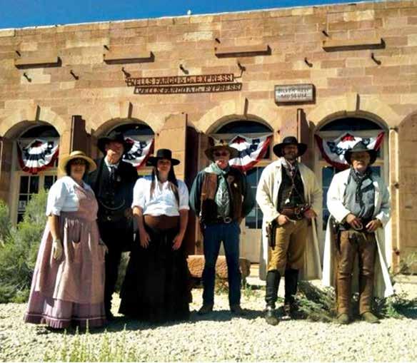
Silver Reef, Utah
Whoever heard of silver in sandstone? This is what geologists in 1866 asked when a prospector found a vein of silver in a sandstone formation approximately 15 miles northeast of St. George. When the claim was confirmed, however, the ensuing silver rush was inevitable, and the town of Silver Reef eventually housed the largest population in southern Utah. By 1879, it had 2,000 residents, an impressively large and varied business district, a horse race track, its own brass band, a brewery, and a Catholic church. It even had its very
own Chinatown. Sadly, a fire destroyed a significant portion of the business district in 1879, though residents rebuilt much of it.
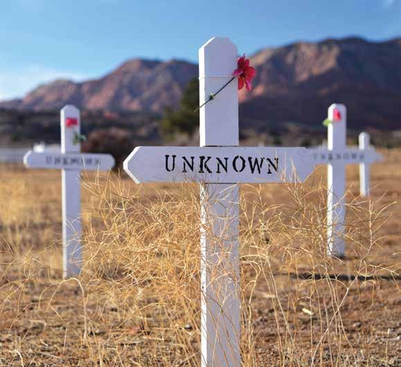
Unfortunately, with a surging population, there were bound to be conflicts. In 1880, a disgruntled miner stabbed and killed the foreman of the Silver Reef Mine for firing him (ironically, because of his violent disposition). Enraged town residents threatened to lynch the miner, and shortly after his arrest, he was moved to custody in St. George for his own protection. However, a lynch mob followed the police escort to St. George, where they overpowered the sheriff and attempted to hang the miner on a telegraph pole. When the pole broke, they hanged him on a nearby cottonwood tree (thoroughly shocking St. George residents). As a result of the frequent violence, Silver Reef was also home to two cemeteries, one Catholic and one Protestant.
A few years later, the world’s silver market plummeted, and by 1884, most of the mines were closed or in disuse—the exodus of

the town’s residents had already begun. Today, the grounds of the town are open to visitors free of charge. A walking trail leads through the old Main Street. When exploring the grounds, please be mindful of nearby residences. There is also a museum, in front of which can be found self-guided tour maps. The museum itself is located in a registered historic building, entrance to which is $3 per person, $10 for a family of five, or $2 a person for ten or more people. Admission includes a docent-led tour of the museum. Unfortunately, the popular mine tour is closed as of the publication of this article due to a lack of volunteers, but please visit their YouTube channel, Silver Reef Museum and Ghost Town. There you can find history videos, including the aforementioned murdered mine foreman, a virtual 3D mine tour, and virtual tours of the museum and grounds.
In addition to exploring the ghost town, guests can also go hiking, visit Red Cliffs State Park, or view nearby dinosaur footprints. From northbound I-15, take exit 22 for UT-228 North towards Leeds (the exit is about 13 miles from St. George). The exit road will curve to the right a bit, and in less than a mile, turn left onto UT-228/South Main Street. Follow this road for a mile and a half, and then turn left onto Silver Reef Road. In a little over a mile, turn left again to stay on Silver Reef Road. Then, in less than half a mile, turn right onto Wells Fargo Road. The museum and adjacent grounds are located at 1903 Wells Fargo Road, Leeds, Utah, 84746, and can be reached at (435) 879-2254. For more information about attractions at or near Silver Reef, visit their website, www.SilverReefUtah.org.


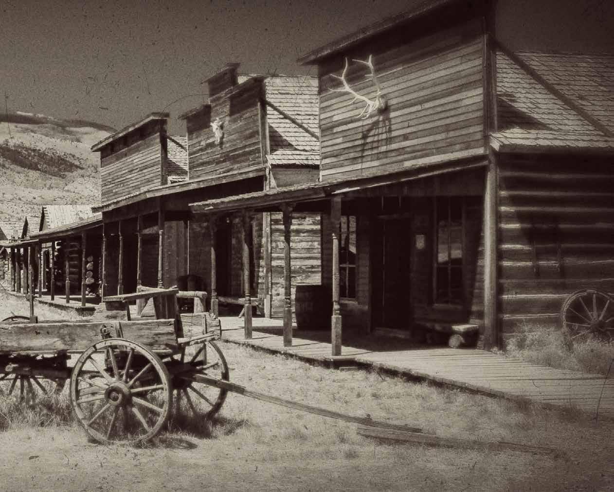
Nelson, Nevada
Next up is Nelson, Nevada, which is southeast of Las Vegas in Eldorado Canyon, an area named by the Spaniards who first discovered gold there in 1775. Gold and silver were discovered again in 1859—considered the first major gold discovery in the state—and the rush began in 1861. The town was named for Charles Nelson, a leader who was killed in 1897 by a Native American renegade. Many of the mines, which were active from about 1858 to 1945, were created by Civil War deserters from both sides who made their way to Nelson in hopes that they could remain hidden in such a remote location.
Not to be outdone by Silver Reef, Nelson’s history of violence is just as notorious. Abandoned by the Spaniards, the Techatticup Mine was one of the first mines to open within the canyon in the 1800s and quickly gained an ominous reputation. Ownership and labor disputes occasioned such frequent and ruthless murders as to be considered ordinary and commonplace. But despite this, the area yielded millions of dollars worth of gold, silver, copper, and lead in what would be one of the biggest mining booms in the history of Nevada.

Today, visitors can tour the Techatticup Mine and see the actual veins within the quartz where gold and silver were found. There are also a number of old buildings to see as well as an impressive collection of rusty vintage vehicles and what many consider to be the main attraction of the area—the iconic plane that Kevin Costner’s character blew up in the 2001 film, 3000 Miles to Graceland. Nelson has provided various settings for a number of films over the years and has seen its share of Hollywood visitors. The mangled plane was later repositioned by the property owners to appear as if it had crashed into the landscape and has been a tourist attraction ever since.
Mine tours last about 70 minutes, cover about one-quarter of a mile of level terrain, and take place daily at 9 a.m., noon, and 2 p.m. (if there are at least four adults). Reservations are required, and admission is $15 for ages over 13, $10 for ages 5–12, and free for those five and under. For reservations or more information, call (702) 291-0026 or visit www.eldoradocanyonminetours.com.
From southbound I-15, take exit 42 in Las Vegas and merge onto I-515 South/US-93 South/US-95 South toward Phoenix. In about 15 miles, continue onto I-11 South/US-93 South/US-95 South, and proceed for about nine more miles. Take exit 14, and in about two-thirds of a mile, merge onto US-95 South toward Searchlight. After 8.5 miles, turn left onto NV-165 East. Follow this road for about 13 miles and turn left into the ghost town around mile marker 13. Look for an old Texaco station. When you arrive, please check in at the store. The ghost town is two miles past the current town of Nelson and is located at 16880 State Highway 165, Nelson, Nevada. It is NOT located in Searchlight, which is further down US-95. NV-165 is narrow and winding. Make sure to have plenty of gas to get out there and back!
*Owners tip: You will need to use Google Maps to find us. If you try to use GPS, you will get lost!


Goodsprings, Nevada
Finally, Goodsprings, Nevada, which is southwest of Las Vegas, is just a hop away from Nelson. This mining town was established after the discovery of the Keystone Mine in 1902 and was named for Joseph Good, a local cattleman. Other mining areas may have produced more wealth, but the fame of Goodsprings lay in its uncommon array of different metals, including gold, silver, lead, copper, and zinc.
Most of the first buildings in Goodsprings were built circa 1910 and 1911, including the historic schoolhouse. The town also had a post office, general store, newspaper, and of course, several saloons. In 1913, the famous Pioneer Saloon was erected and is still in operation today as the oldest bar in Nevada.
Pioneer Saloon was also the site of several infamous happenings and is even said by some to be haunted. Many claim that three bullet holes found in an inside wall are evidence of the 1915 murder of a man caught cheating during a game of poker. The man’s ghost is said to be one of many that still frequent the establishment.
In 1942, actor Clark Gable waited for days at the Pioneer Saloon for news of his wife’s fate after her plane crashed 11 miles outside of Goodsprings. The wood still bears the alleged cigarette burns made by Gable when he fell asleep at the famous Brunswick bar. Tragically, the search party did not return with good news; his wife, actress Carole Lombard, had been killed in the crash.
Though it was home to eight hundred people during World War I, the boom in Goodsprings began to slow after World War II. In 2010, the town was featured in the popular video game, Fallout: New Vegas. Today, visitors can stop in at the saloon to grab a map of the old buildings, including miner cabins and the schoolhouse. And while you’re there, sample their well-known Ghost Burger and their assortment of drinks as you chat up the local bartender for the best tips on seeing the town. On July 8, 2022, the saloon is also hosting a Fallout: New Vegas event, which anyone is welcome to attend. Visit pioneersaloonnv.com for event/general information.
To reach the Pioneer Saloon as well as the ghost town, from southbound I-15, take exit 12, which is about 33 miles from the Las Vegas Strip, and merge onto NV-161 West/ Goodsprings Road. (Exit 12 is also the exit for Jean.) From here, it’s almost a straight, seven-mile shot along NV-161/ Goodsprings Road to the saloon, which is located at 310 Goodsprings Road, Goodsprings, Nevada, and can be reached at (702) 874-9362.V


by Christine Ward
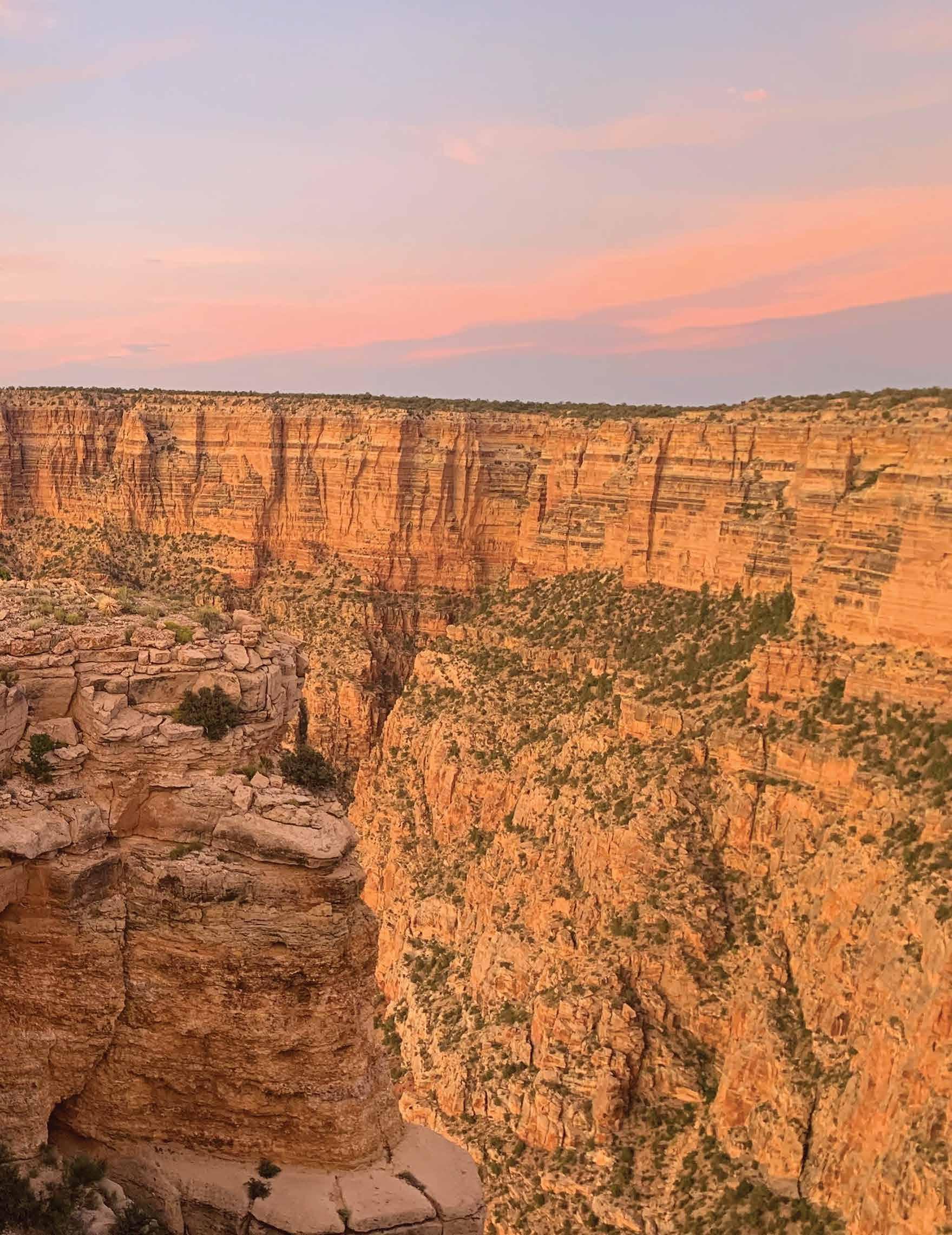
Avisit to the Grand Canyon is a once-in-a-lifetime experience for many people, but it's easy to get confused with all the different options available. This includes the first major choice: Do I want to go to Grand Canyon West Rim, the Grand Canyon National Park South Rim, or the Grand Canyon National Park North Rim? There are three main areas of the Grand Canyon, and it’s important to know before you head off on your journey which area you want to visit, because getting from one “area” to another entails hundreds of miles of driving. The three main areas are the South Rim, the North Rim, and the West Rim. The South Rim and the North Rim are both parts of Grand Canyon National Park. The West Rim is owned and operated by the Hualapai Nation.
The West Rim of the Grand Canyon, as part of the Hualapai Nation, offers great viewpoints and visitor services. The Skywalk is located at Grand Canyon West and has become the main attraction at the Grand Canyon West Rim. The closest area to Las Vegas, the West Rim offers helicopter and airplane tours, as well as ground tours, a zipline, and whitewater rafting.
The North Rim of the Grand Canyon is part of Grand Canyon National Park. The differences between the South Rim and the North Rim are vast: the North Rim receives one-tenth of the visitors that the South Rim receives, it is 1,000 feet higher in altitude, and it is only open seasonally, generally from mid-May through mid-October. The North Rim is known for less crowded conditions, plants and animals not supported on the drier South Rim, and a more “laid back, less commercialized” Grand Canyon experience. Airplane, helicopter, ATV, and ground tours are available.
The South Rim of the Grand Canyon is also part of Grand Canyon National Park. Many people consider the South Rim to be the “real” Grand Canyon, and more people visit the South Rim than any other


location. It has almost two dozen different viewpoints, many of which include views of the Colorado River. The South Rim viewpoints are the most recognized and publicized of any locations, are featured in movies and TV shows, and are prominently on social media. Activities there also include airplane, helicopter, and ground tours as well as skydiving, bike rentals, and ATV rentals.
Buck Wild Grand Canyon Hummer Tours provides ground tours at the South Rim of the Grand Canyon National Park. While anybody can drive themselves* to any of the almost two dozen viewpoints on the South Rim, the many benefits of a guided tour include: 1) a guide to drive and park for you, leaving you free to enjoy the scenery stress-free; 2) a guide to take you to the best viewpoints so you don’t have to research and find them on your own; 3) and of course, a guide to provide you

with a lot of history and information about the Grand Canyon and the surrounding area.
Buck Wild Grand Canyon Hummer Tours began operating in May 2018, and we have enjoyed sharing the Grand Canyon with many visitors from numerous states and countries since then. Many people choose to participate in a Hummer tour and then visit the park in their own vehicle after the tour. The guide provides them with great tips for what viewpoints to see on their own, including advice on the best times to visit, where to park, and how long they should plan for each stop.
Buck Wild Hummer Tours are all scheduled for two hours and visit three to four viewpoints during that time, providing guests with a great overview and introduction to the South Rim. We offer several daily departures, including a sunset tour, and private tours are also available. Each hummer can seat up to 13 passengers in comfort with our front-facing, stadium-style seating, which offers great views from every seat. Vehicles are former military Humvees customized to provide the best touring vehicle experience anywhere.V
For more information, please visit our website: www.BuckWildHummerTours.com.
*The viewpoints along Hermit’s Rest Road, also known as “the Red Route,” are accessible only by the free shuttle bus from March 1 to November 30 annually. During December, January, and February, private vehicles are allowed on Hermit’s Rest Road.
Long Live Your Outdoor Furniture
Choosing & Caring For Outdoor Fabrics
by Helen Houston Creamer

Whew! During the sizzling months in Mesquite and southern Utah, spending time outdoors for many consists of dashing out to the driveway to pick up the newspaper. Come June, we anxiously await the cooler temperatures and our ability to spend more time outdoors. But while we live in air-conditioned comfort, the fierce desert sun, wind, and blowing sand wreak havoc on our outdoor furniture. Before we can be cradled in the comfort of cushioned seating, dine al fresco, or have cool drinks by the pool, our outdoor furniture needs some tender loving care. There is no denying it—great outdoor furniture makes outdoor living that much more pleasurable. Buying and keeping outdoor fabrics looking good is easy if you know the basics. Consider these tips:
Know what you are buying. Invest in fabrics made for the outdoors that are water repellent and UV and stainresistant down to the actual fibers used to weave them. Recognizable names such as Sunbrella and Sun N Shade are made to endure the wrath of Mother Nature.

Keep fabrics clean. Simply brushing off the dirt before it becomes embedded (I use a leaf blower) and wiping up spills as they occur will add years to your outdoor cushions. When more cleaning is needed, use a solution of one-fourth cup of mild soap per gallon of lukewarm water. Use a sponge, soft-bristle brush, or cloth to apply it, and then allow it to soak into the fabric. Then rinse off all soap residue, and allow the fabric to air dry. Upholstery shampoo or cleaning solutions manufactured specifically for outdoor fabrics can be used as alternatives.


Use natural solutions on resistant stains. For oil stains such as suntan lotion, rub in cornstarch or baby powder, allow the powder to soak up the stain, let dry, and then flake it off. Or use a paste made from fresh lemon juice and salt: rub it on the stain, allow it to soak in, then rinse with clean water. Try a solution of eight ounces of bleach and two ounces of mild soap per gallon of water on resistant stains.
Don’t bring cushions in every night. Constantly bringing cushions back and forth detracts from the enjoyment of your outdoor living space and is unnecessary for cushions made from true performance fabrics. But do bring them in if extreme weather is coming. This will help prevent dirt build-up and mildew.
Let them bask in the sun! Performance fabrics are lightfast to a degree. They can be UV protected for between 500 and 1,500 hours of direct sunlight. However, rotating and turning the pillows and cushions around periodically will prevent any uneven fading that may occur.
Clean before storing. Storing cushions indoors will prevent dirt build-up and increase longevity. Make sure the cushions are thoroughly cleaned and dry before storing someplace where they will not get wet or dirty.


What are the characteristics, types, and care of/for outdoor rugs? When we talk about outdoor rugs, we are not talking about the typical artificial grass mats, but designs and colors that will add a touch of the modern to our terrace or garden. Outdoor rugs are special because they are prepared to withstand weather such as rain or cold as well as ultraviolet rays. Generally, the material used is polypropylene fiber and is impermeable and resistant to the elements.
Durable and easy to clean, a polypropylene rug is a great addition to your patio setting, adding style and sophistication to any outdoor area. When it comes to rug cleaning, it may be as simple as vacuuming or passing the suction hose above it, while others may need a more complex cleaning. If the rug is particularly dirty, then you need to give it a thorough cleaning. Take a water hose, wet the rug, and then pour or spray soap or rug cleaner on the entire area. Use a scrub brush to work in the soap, and then rinse off with the hose. Leave the rug on a flat surface, making sure to turn it over occasionally so it dries evenly, or just hang it on a clothesline. Make sure to use a rug pad. A rug pad is a type of material that people place under their rugs to keep them in place, protect their floors, and extend the life of their rugs. There are different types of rug pads from which you can choose, and each has its own advantages and disadvantages. While many people use these indoors, they could also work well on outdoor rugs, as they prevent dirt from reaching the fibers from underneath while also preventing wear from uneven boards and flooring.
Enjoy the season! Minor due diligence is all it takes to keep outdoor rugs, cushions, and pillows vibrant for seasons to come.V
Helen Houston Creamer is the owner of Staging Spaces & Redesign. For questions or design service inquiries please contact Helen by phone at (702) 346-0246 or send an email to helen@stagingspaces.biz.

True
by Frank Golden
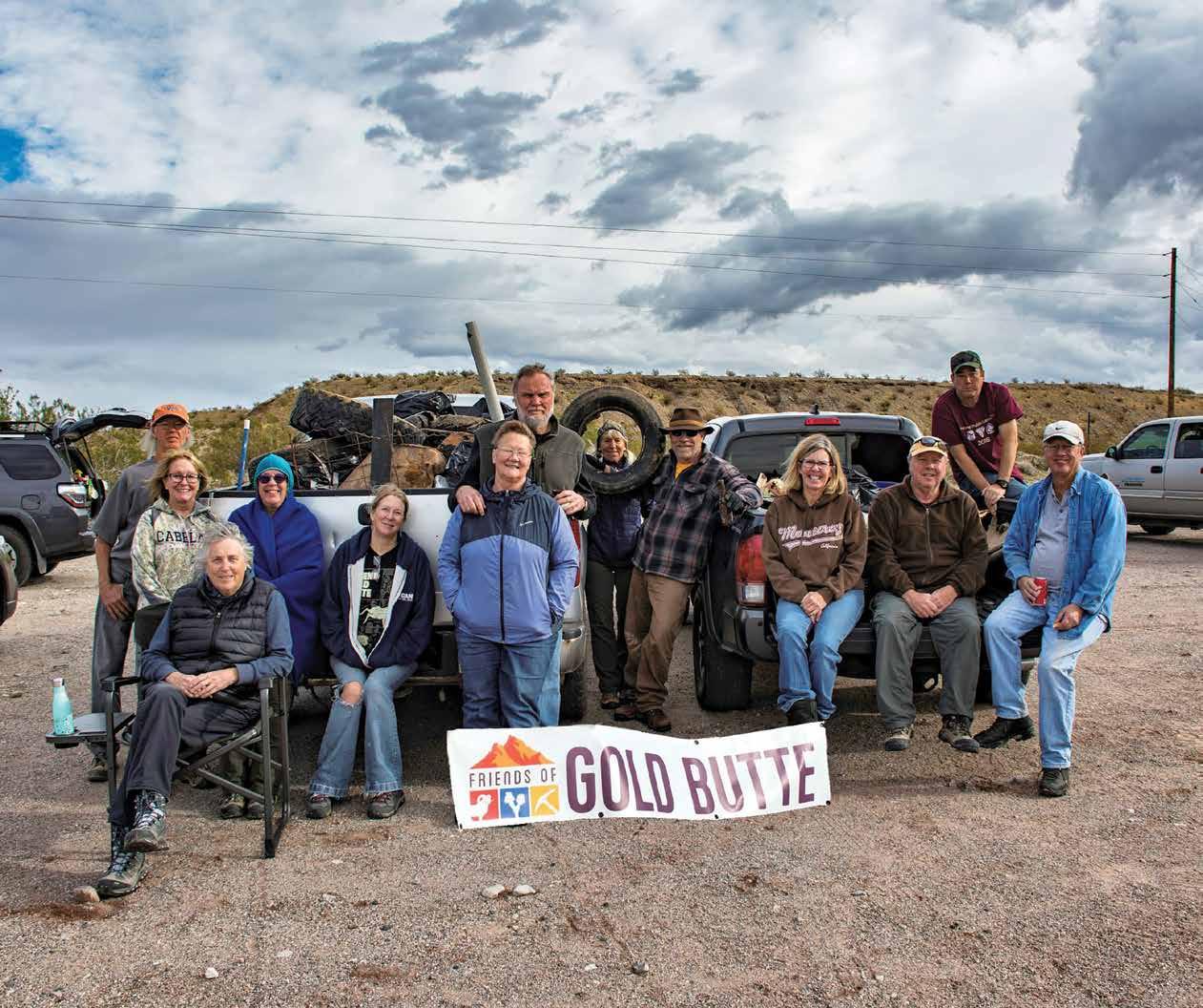
Margaret Mead said, “Never underestimate the power of a small group of committed people to change the world. In fact, it is the only thing that ever has.” This statement exemplifies the Friends of Gold Butte (FoGB). It may not have changed the entire world, but it's efforts certainly changed a special corner of our back yard. Its members, the volunteers, benefactors, supporters, and the staff continue to enrich the communities in the Virgin Valley.
The FoGB started as and remains a grassroots organization of concerned citizens whose goal is to protect the area between Lake Mead and the Arizona boundary. The area contains unspoiled beauty, pristine natural habitats, and important cultural and historic sites. All of it was threatened by commercial interests, development, and by extension, restricted access. As a result of the countless hours donated by an army of supporters, the area became a national monument on December 28, 2016, during the final days of the Obama administration. With the stroke of a pen, nearly 300,000 acres of land were saved so that our children and their children can continue to experience the special magic that Gold Butte offers.
FoGB's mission today is to promote the responsible enjoyment of Gold Butte National Monument (GBNM) through education, stewardship, advocacy, and preservation of natural and cultural resources. The vision is to maintain a vibrant and healthy landscape where the land, wildlife, cultural resources, and solitude are preserved and accessible for the enjoyment of current and future generations.
A common misconception is that the FoGB is in charge of the management of GBNM or that the FoGB makes decisions regarding the activities at the monument. The truth is that GBNM is under the control of the Bureau of Land Management
(BLM), a subunit of the Department of the Interior. As with much of Nevada's public lands, the BLM is charged with maintaining and overseeing the utilization of the land through its various programs and mandates. When Gold Butte attained monument status, the BLM was charged with continuing its management, although under different sets of rules and with a focus towards perpetual conservation and access by the public.
The BLM and FoGB have created a mutually beneficial working relationship over the years. But it is the BLM that has the authority and responsibility to administer the various programs. In some cases, the BLM will approach the FoGB with a request to provide manpower for specific tasks. In some instances, FoGB will identify a problem and alert the BLM. And in many cases the simple solution is to gather a group of volunteers to fix it. For example, littering is a problem in GBNM as it is in many places. For the BLM to undergo the bidding process of contracting a company to pick up the trash could take months. FoGB offers to pick up the trash, and permission is given. The end result is that the trash is picked up quickly at no cost to the government.
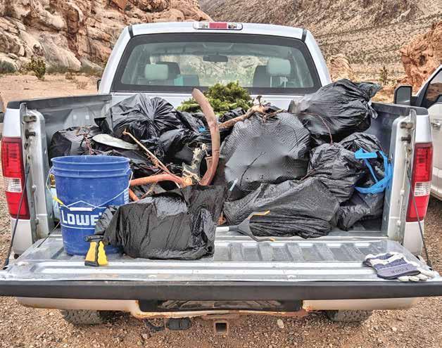
Speaking of picking up trash, FoGB hosts monthly trash pick-ups as part of their commitment to good stewardship. Gold Butte Road is the main target of the clean-ups, as it accumulates the most trash. A sad testimony of our society is that a large portion of the trash is beer cans/bottles. Other common items include debris from damaged vehicles, plastic bags, and food wrappers. The most unexpected item I've found was a child's bicycle thrown about 15 feet into the bushes. Items that are more than 50 years old are considered historic artifacts and left in place until it can be documented and cataloged by archeologists prior to its removal. Since 2017, the FoGB has collected over 4,000 pounds of trash!
Another noteworthy project was patching potholes on Gold Butte Road. In the spring of 2019, the BLM and Clark County purchased and delivered 200 tons of cold patch asphalt, and volunteers shoveled it out of the truck and filled hundreds of potholes. FoGB members comprised over 75% of the ground crew. While we are on the subject of roads, FoGB volunteers have also worked to repair gravel roads that were washed out from flash floods and have installed numerous road signs at key intersections.
A related project involves the blocking of illegal incursion. Again, there is a misconception that the FoGB arbitrarily closes roads. First, the FoGB does not have the authority to close anything. Second, It is the BLM's decision and responsibility to close areas that require rehabilitation due to damage. One example is the western end of Mud Wash Road where a natural spring flows through a wash. The historic mining road goes around and above the spring on a bluff. However, many people choose to drive through the spring, causing erosion and long-term damage to the fragile habitat. The BLM requested volunteers to help install barriers to prevent the illegal entry by motorized vehicles. FoGB provided some of the manpower. At the time of the writing of this article, the barriers had been vandalized and the illegal incursions and destruction had resumed.


Graffiti removal is another project that FoGB volunteers participate in from time to time. Spray paint removal requires an environment friendly solvent and vigorous scrubbing with a brush. After one such project, my arm felt like it was going to fall out of its socket the next day.
There is an obscure program called “Seeds of Success." This program involves the collection of seeds from specific native plants. They are then planted at special farms to create an even larger quantity of seeds. These seeds are then used for reseeding damaged areas to promote its recovery. In our area, this is vital to minimize soil loss due to erosion and to replenish food sources for the native animals. Strict rules are followed to limit the amount of seeds that are collected in an area to minimize the impact on the animals living there.
Probably the best known and recognized activities offered by the FoGB are its educational outreach programs. These include guided hikes, driving tours, classes and demonstrations, and the monthly guest speaker presentations. All of our events are provided free of charge, and you can sign up through the website: www.meetup.com/Friends-of-Gold-Butte.
One of the most popular activities is guided hiking. FoGB provides experienced volunteer hike leaders to guide groups of 10-12 people on specific hikes throughout GBNM. These events allow people, especially those who are new to the Mojave Desert, a way to experience GBNM with a greater degree of safety and confidence. Each hike is announced on Meetup.com with a description of the hike and its level of difficulty. They vary in distance but are generally between 3 to 8 miles round trip. Some of the easier hikes include the Falling Man, Twenty-one Goats,


Little Finland, Whitney Wash, the Mud Wash Narrows, and the DoodleBug Arch.
The more difficult hikes lead the adventurous at heart to the tops of Little Virgin Peak, Bitter Ridge, and Gold Butte Peak, to name a few. When I lead groups, I like to stop every so often to rest and discuss the wildlife and the geology of the area. Larger group tours for organizations are also available with prior coordination. These outings can be tailored to the specific interest of the group's members.
Driving tours allow for members to cover longer distances for viewing specific interests. A popular driving tour is the Spring Flowers Drive. The leader of this tour takes the attendees to various locations in the monument where wildflowers may be found. Another tour starts at Lime Kiln Canyon. It climbs over the Virgin Mountains, then travels east to Whitney Pocket, and then loops back to Mesquite. In previous years, carpooling was encouraged. Perhaps it will be again once COVID-19 is no longer a threat.
FoGB provides classes and demonstrations on various topics including how to use a compass, how to use trekking poles, soil biocrust, and wilderness preparedness. Some classes are held in a classroom setting, while others are given in the field. During the cooler months, FoGB hosts guest speaker presentations. The speakers are noted leaders in their fields and bring a wealth of knowledge not only to inform but also, in many cases, to entertain. Topics vary from astronomy to zoology and everything in between. One of my favorite presentations was on snakes and reptiles where a live Gila monster took center stage. Another was on the milkweed plant and its relationship with monarch butterflies. In previous years, the presentations were held at the Mesquite Community Theater. Since the pandemic, the presentations have been conducted online via zoom.
The sheer number of activities that FoGB conducts would not be possible without the generous donations and contributions by ordinary citizens. It has been a little over five years since Gold Butte attained monument status and the protections it affords. But the work towards conserving and improving conditions at GBNM is never ending. There are ongoing issues and new challenges, just as there are new opportunities and hope. I, for one, am very proud of FoGB's endeavors and accomplishments. I'd like to think Margaret Mead would be too.V
Frank Golden is a retired colonel in the United States Army and lives in Mesquite with his wife, Tina. They spend their time volunteering for various organizations and enjoy exploring Gold Butte.


by Keith Buchhalter
Afew years ago, during a power outage (rare in our area), my neighbor called me and said, "It must be nice to work for the power company; you are the only one with power in our block!" I chuckled and replied, "My power is out too; I brought inside my solar landscaping lights." Think about it—this is a great benefit of solar landscaping lights. In this ViewOn outdoor edition, I want to share other benefits of solar landscaping lights.
Solar landscape lighting is cost-effective and enhances our gardens and walkways. It has a lot of advantages, including no monthly electricity cost, low maintenance, and—essential in my book—easy installation (I am not very good with tools). Let's talk about these advantages.
Installation Modern solar landscape lights are wireless, and they come with everything necessary to run the light contained within the unit. Installation is easy; it only requires sticking the attached spike into the ground. However, some units can be mounted on walls or posts. It is important to keep in mind that, for optimal performance, you should place them in an area that gets adequate sunlight to charge the battery.
No Electrical Connection Needed Solar landscape lights are powered by the sun; you do not need additional wiring or an electrical connection. Not only is this convenient when it comes to installation, but it also makes landscape lighting possible in far corners of the yard where electrical wiring isn't readily available. Even a guy like me can install them. Cost A significant advantage of using solar lighting outdoors is that they cost nothing to operate. Because solar lights don't require electricity for power, this can save you money in the long term. The initial cost for a quality solar landscape fixture can be high, but this is typically recouped over time as you pay nothing in energy costs to run the lights.
Convenience Solar power is free energy, and as long as solar landscape lights can charge in direct sunlight, they'll work problemfree. They are also a no-hassle feature, automatically turning on at dusk and off again at dawn.
Maintenance Solar landscape lighting needs little maintenance. LED solar bulbs have a service life of up to 20,000 hours, and because the systems are self-contained, they need only a quick wipe periodically to clean away moisture, dirt, or debris.
Long-Term Savings Potential Solar-powered landscape lighting won't affect your monthly utility bill. Solar landscape lighting can last three to four years before you need to change batteries and even longer before you need to replace the LED bulbs. This offers a great return on investment.V
We hope you find this article helpful. Remember, we regularly post energy-saving tips on social media. Like us on Facebook, and don't forget to follow us on Instagram and Twitter @opd5.
The Wild and Scenic Virgin River

by Karen L. Monsen
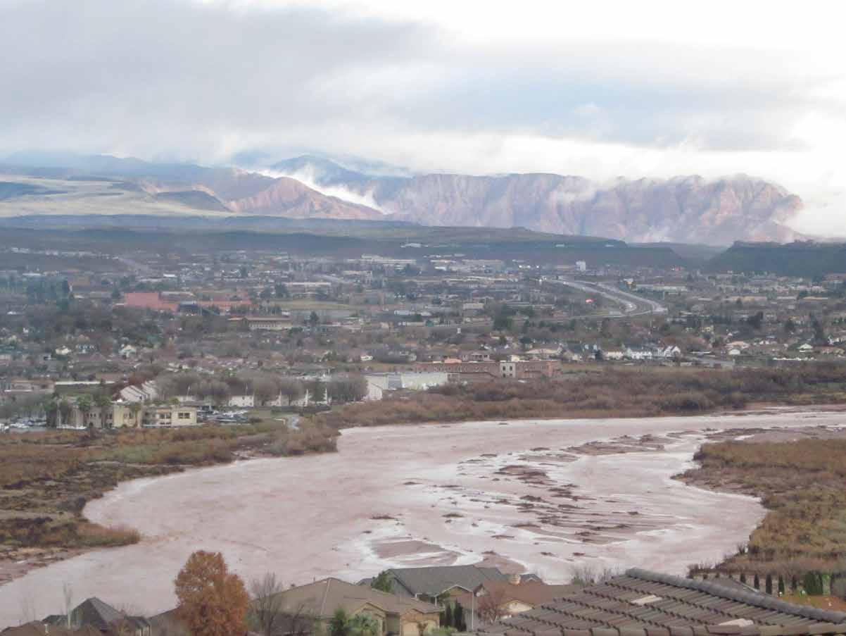
The Virgin River is wild, scenic, and untamable. Most of its 162 miles are in Washington County, Utah, beginning north of Zion National Park and flowing through Zion Narrows. The river drops an average of 70 feet per mile—10 times steeper than the Colorado River—and moves through the Grand Canyon, carving the Virgin River Gorge in Arizona, and then joins the Colorado River at Lake Mead in Nevada. The river’s story is one of contrast: too much or too little water, dams, diversion channels, hydroelectric generation, floods forcing the abandonment of towns, scenic views, overdevelopment, and parcels of preserved riparian habitats. Turbulent History The Washington County Historical Society (wchsutah.org) has archived extraordinary challenges faced by farmers in areas where annual rainfall was barely eight to 10 inches. Virgin River irrigation diversion channels required constant clearing and frequently failed. In his book, Red Rock Recollections, Volume I: Fascinating Stories of Utah's Dixie, Reuben Wadsworth, a pioneer descendant and local historian, recounts the river washing out irrigation dams sometimes two or three times in a single year. Floods were devastating in 1862, 1889, 1909, 1938, 1961, 1966, 1989, and recently, in 2005 and 2010.

Virgin River High Water 2017 at LaVerkin-Hurricane Bridge | Photo Credit Karen L Monsen
Grafton Ghost Town The Grafton Heritage Partnership Project at graftonheritage. org records the 1862 Great Washout that destroyed Grafton, Fort Harmony, and Santa Clara. In the words of a former resident, “Houses in old Grafton came floating down with furniture, clothing, and other property of the inhabitants, some of which was hauled out of the water, including three barrels of molasses.” Nearby, Nathan Tenney’s wife was swept away in a wagon box while giving birth to the daughter she named Marvelous Flood Tenney. In 1909, Virgin City, Grafton, and Rockville residents again witnessed farm implements, milk cows, two stacks of hay, fourteen hives of bees, chickens, melons, squashes, and other valuables carried downstream. By 1944, the last family left Grafton—rendering it a ghost town.
Diversions and Hydroelectricity Diversion dams were built to feed canals like those that powered the 1929 La Verkin hydroelectric plant. Today, the plant’s ruins attest to the reality of these early river projects. Of La Verkin’s hydro-plant, Wadsworth writes, “It was the
Abandoned LaVerkin Hydroelectric Plant on Virgin River | Photo Credit Karen L Monsen

largest plant in the network of four hydroelectric plants within Washington County.” Providing all the electricity for Hurricane, La Verkin, and four neighboring towns, it was noisy, prone to leaks, plagued by flow fluctuations, sand abrasion, silt obstructions, and power surges, and it literally destroyed itself when revolutions exceeded a specific range. It closed in 1983.
The remains of a river pump station exist today near Bloomington Country Club Golf Course where Dan Heaton’s carrot farm formerly stood. Built in 1965 and abandoned in 1982, the pump drew water from the Virgin to irrigate fields and later, to water the golf course until the river level dropped and the streambed moved, making it unusable.
Virgin River Gorge and Mesquite The destruction caused by the Virgin River is not limited to Utah. On the less-developed floodplain in Arizona and Nevada, two houses in Littlefield were flooded in 1989. One was destroyed while surrounding fields were buried and eroded, livestock was drowned, and canals and irrigation systems serving Mesquite were inundated and demolished.
surged through Mesquite, destroying a golf community. The Las Vegas Review-Journal reported on December 21, 2010, that near Littlefield and Beaver Dam Wash, “one house toppled into the wash and floated downstream about 200 yards, where it crashed into some trees, spun away, and sank in the churning flow.”
YouTube videos filmed in September of 2014 capture torrents rushing through the Virgin River Gorge, creating spectacular waterfalls, stranding hundreds, and destroying I-15 between Mesquite and Las Vegas. Floods that were assumed to occur every 100 years happened in 2005 and 2010. Living along the Virgin River remains challenging today.
Wild and Scenic Life along the Virgin has been difficult for plants, animals, and humans. In 2009, congress designated portions of the Virgin River and its tributaries as part of the National Wild and Scenic Rivers System. Elaine York, the West Desert Regional Director for The Nature Conservancy (TNC, www.nature.org/utah), clarifies that “Wild and Scenic” designations are for specific areas not along the mainstem of the Virgin River. TNC is a global non-profit dedicated to protecting and caring for nature and finding balanced approaches for meeting human water needs while preserving the river itself. It has worked with the Virgin River Program (VRP, virginriverprogram.org/the-virgin-river/), Washington County Water Conservancy District, Utah agencies such as the Utah Division of Wildlife Resources (UDWR), municipalities, and federal authorities. Through collaborative efforts, they secured funding to improve Hurricane’s water delivery system and Washington City’s return flow canal, making them more efficient while improving river flows.
The Virgin River is home to plants and animals that have adapted to survive a variety of conditions, including floods, high silt, low flows, and high water temperatures. Christian Edwards, a wildlife biologist for UDWR and a biology and ornithology adjunct instructor for Dixie State University, monitors the Virgin River riparian habitat. He reports that aquatic diversity, including native fish species, and water flows are currently stable despite severe droughts. Edwards acknowledges, “Habitat loss via human growth and development is the primary factor to species becoming threatened or endangered.”
Roads, bridges, and houses are replacing portions of riparian habitat and are negatively affecting southwestern willow flycatcher numbers, which average only 10 breeding pairs in the St. George area. Additionally, lower water levels due to human use result in higher summer river temperatures that have moved
woundfin and chub populations to endangered levels. Edwards asserts, “Biodiversity, or a variety of life, is critical for any ecosystem. Aquatic insects, animals, plants, and the water itself all rely on each other. All species play a role, and sometimes we don’t know their impact until they are gone. So it’s important that we do our best to help them survive. If we lose these species, we lose a little bit of ourselves.”

Sheep Bridge Nature Preserve Caring for the Virgin requires protecting natural areas. Important habitats are being spared from development near the town of Virgin where the river drops into a deep, dramatic canyon and is spanned by a narrow bridge over which sheep have crossed in order to be counted. The 419-acre parcel purchased by TNC includes two miles of critical river habitat, two hiking trails with signage, and a small segment of the JEM/ Hurricane Rim bike trail that enables people to experience the area’s natural beauty. After a three-year negotiation, prior landowners and TNC are equally pleased that this beautiful property will be dedicated as the Sheep Bridge Nature Preserve in summer 2022.
TNC has achieved amazing progress along the Virgin River by working collaboratively with many partners to improve water flows, restore riparian areas, meet human water needs, and ensure that there’s enough water in the right places at the right time for fish to survive and thrive. Elaine York cautions, “River work is never done!” Being good land stewards, according to Christian Edwards, means that we must “learn to appreciate the value of nature and the resources it provides.” He encourages everyone to “find ways to do your part in keeping the Virgin River healthy and happy.”V
Virgin River at Sheep Bridge | Photo Credit Stuart Ruckman


by Bryan Richards
It all started some twenty years ago as a future dream— a vision of something created to offer sanctuary and healing to those in need. Becki Richards had been working as a manager of a resort located in St. George, Utah. Up to this point in her life, she had never thought much about herself working in the massage industry as a therapist or how making that decision would change the course of her life. But while working at the resort, she became acquainted with the massage therapists there and developed an interest in the massage industry, deciding to proceed with her own massage therapist training.
Because of this, she was taken to Utah County where she completed massage therapy school, passed her exams, became licensed, and went to work as a massage therapist. During the following 20-plus years, she created her own business as a budding therapist, taught massage therapy where she was employed for 14 of those years, and also worked as the director of the massage program. Through the years, she has not only grown into an accomplished massage therapist but has also been able to hone other skills and talents, becoming very intuitive and sensitive to others and their emotions and feelings. She has helped many to create more productive and worthwhile thought patterns and lifestyles.
In December of 2020, she was married to Bryan Richards, and shortly thereafter, on a quick trip to southern Utah and Nevada, they both felt the strong urge and pull to relocate here. So, after giving up what was a successful, almost 18-year-old business with established clientele, Becki and Bryan moved to Mesquite, Nevada, where they currently reside.
As mentioned above, with Becki, there had always been the desire and vision to create something special. The two spoke about it, dreamed, and planned for it, and in February of 2022, their plans came to fruition, yet their vision has only begun to unfold. Crystal Palms Healing Sanctuary
was created, formed, and put together through much research, planning, and traveling to many places. They tested all kinds of different machines and modalities in order to eventually choose and offer what they believe are not only exceptional alternative modalities, each with its own different healing properties, but also modalities that are a perfect fit for providing help and healing to those who visit the Sanctuary.
Aside from the custom massages that are offered, there are also services and treatments that have never been seen in the southern Utah/Mesquite area. Modalities offered include:

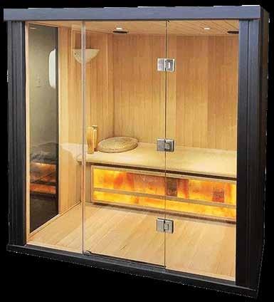
· A Cocoon Infrared Pod that uses heat and infrared light to offer relief to muscles, tissues, and joints for those suffering from arthritis, rheumatoid arthritis, chronic fatigue syndrome, and fibromyalgia, just to name a few.
· Air Compression Recovery, where air is inflated into sleeves that are put on your legs in order to develop circulating pressure/improve blood circulation and help speed up recovery. This is great for those who suffer from neuropathy, leg and foot swelling, varicose veins, and more.
· Halotherapy or Salt Therapy,
where tiny, pharmaceutical-grade Himalayan salt particles are diffused into the air to improve breathing and other respiratory issues like asthma, COPD, bronchitis, and sinusitis. Also, the salt is great for relieving the discomfort of eczema, psoriasis, etc.
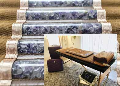
· Infrared Crystal Vibroacoustic
Therapy, which uses a combination of fabrics and amethyst stones to generate infrared rays that are then transferred to the body as heat. This is combined with their Vibroacoustic system that includes a low-frequency generator, allowing the frequencies to penetrate deeper into the tissues and joints. Thus, this treatment reduces stress, relieves muscle pain, and helps with migraines, anxiety, and depression. It has also been proven to help reverse dementia and Alzheimer’s symptoms.
· Craniosacral Therapy, which relieves compression in the head, neck, and back. Current research suggests that the use of Craniosacral Therapy has been successful in the treatment of PTSD, helping to relieve symptoms with amazing results. It is also perfect for migraines, headaches, IBS, scoliosis, fibromyalgia, anxiety, depression, and more.
· Emotional Clearing Therapy, which is for those who may be harboring negative or painful emotions that hamper their quality of life. Working with a therapist, you can identify those trapped negative emotions and release them in a comfortable therapeutic environment. This also releases the toxic pain that is preventing you from living the life you deserve.
Crystal Palms Healing Sanctuary is a one-of-a-kind wellness center offering these unique proven therapies. The goal is to not only help all individuals achieve the full benefits of each treatment session as they pursue their wellness paths but to ensure that they receive the highest quality of service and will yearn to return time and time again.
Their mantra is “Crystal Palms Healing Sanctuary is where the mind and body meet the soul.” Their desire is that as you enter the sanctuary, you feel the peace and tranquility present there. Becki and Bryan are so grateful to the Mesquite community for embracing them and allowing them to spend every day visiting with good people in order to help them rid themselves of some of their aches and pains. They feel blessed for this opportunity and are proud to call Mesquite home now.
Although the Healing Sanctuary is now open and operating, it is only the start of what Becki and Bryan desire to one day offer and achieve for those seeking the betterment of their lives. Crystal Palms Healing Sanctuary is just a stepping stone for what the two have planned for the next 3–5 years. Stay tuned for what is to come. Their promise to you is that you will not be disappointed.V

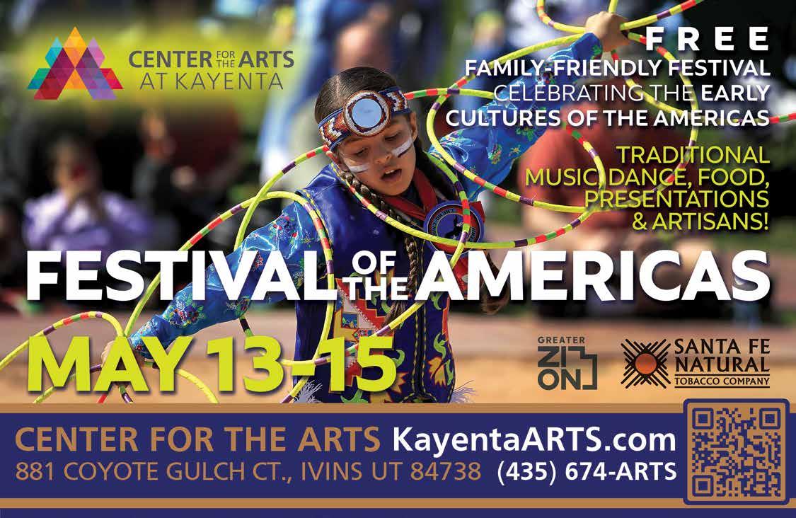
Celebrate Native American Culture
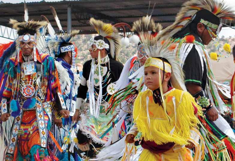
by Michelle Sundberg
Festival of the Americas is a FREE, three-day family-friendly multicultural outdoor festival. It showcases and celebrates the cultures of the first peoples of the Americas. Attendees will enjoy live music, dancing, fine art, native artisan booths, demonstrations, drum circles, unique costumes, and more! Much of this year’s festival will focus on Native American art and culture and will take place in the outdoor setting of Kayenta Art Village and Center for the Arts at Kayenta. The area was once the ancestral home of the Paiute Indians and showcases the stunning natural beauty of Kayenta.
The opening ceremony for the Festival of the Americas will be Friday morning, May 13th, at 7:30 a.m. with a blessing of the grounds. Saturday evening will feature a special ticketed performance by the Adrian Hall Trio: Music from Native America at 7:30 p.m. inside the Center for the Arts at Kayenta. Tickets for this evening event are $15 and are available online at www.KayentaArts.com.
Rob Goodman, president of the KAF Board of Directors, explains, “The Festival of the Americas promotes collaboration between diverse cultural groups in the region. We plan on more than 40 artisans presenting their work and engaging with visitors about the connection of their own work to their cultural heritage. In addition, the festival will create a celebratory community hub for the understanding and appreciation of the history and cultural fabric of our shared ancient American story and the land we now live on.”
The earliest habitation of Native Americans in Utah dates back 10,000 to 12,000 years. Amid the backdrops of Ivins City and the ancient red rock landscape, these exquisite and advanced cultures have been preserved through music, dance, fine art, storytelling, and sacred customs.
Surrounded by the warmth of the Kayenta community, attendees will dive deeper into their respective understanding of Native American cultures and customs.
The three-day festival will feature an array of cultural art forms and customs (painting, pottery, weaving, silversmithing, storytelling, dance, drumming, and flute). In addition, the
at Festival of the Americas
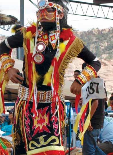
weekend event will feature traditional drumming circles, friendship dances, native food, and demonstrations.
Goodman further states, “KAF is committed to offering visitors and residents an outdoor arts festival program that provides a safe, healthy experience for people of all ages. This event will draw together distinct tribal communities for the greater good of preserving and sharing these ancient cultures with local residents and visitors to the region.”V
DATE: May 13, 14, 15, 2022 Friday and Saturday: 9 a.m.–6 p.m. Sunday: 9 a.m.–4 p.m.
COST: FREE ($15 for Adrian Hall Trio Saturday performance in CFAK theater) For more information, please visit www.KayentaArts.com.
If you are interested in participating as a food vendor, artisan, or sponsor, please contact Todd Prince at Kayenta.Arts@gmail. com, or call (435) 590-0036 for more information.
Kayenta Arts Foundation is a 501(c)(3) nonprofit organization whose mission is to develop and create an environment where diverse artistic endeavors can flourish. The Center for the Arts at Kayenta (CFAK) is the actual place where people in the greater southern Utah area come to learn, express, appreciate, and celebrate art in all forms.


The History of Nevada Aviation Arrows
Along the Los Angeles–Salt Lake City Air Route, 1925–1938
by Steven H. Heath
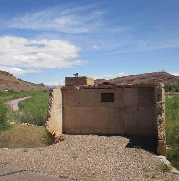
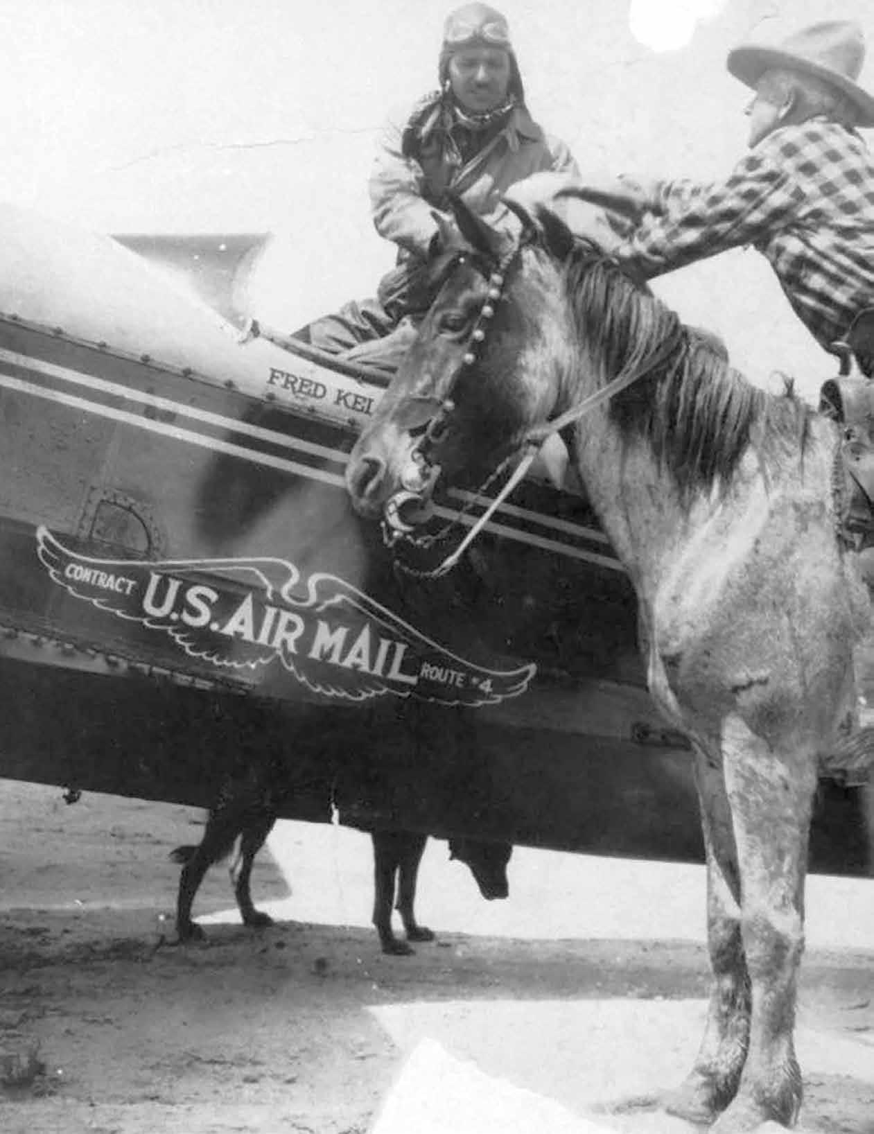
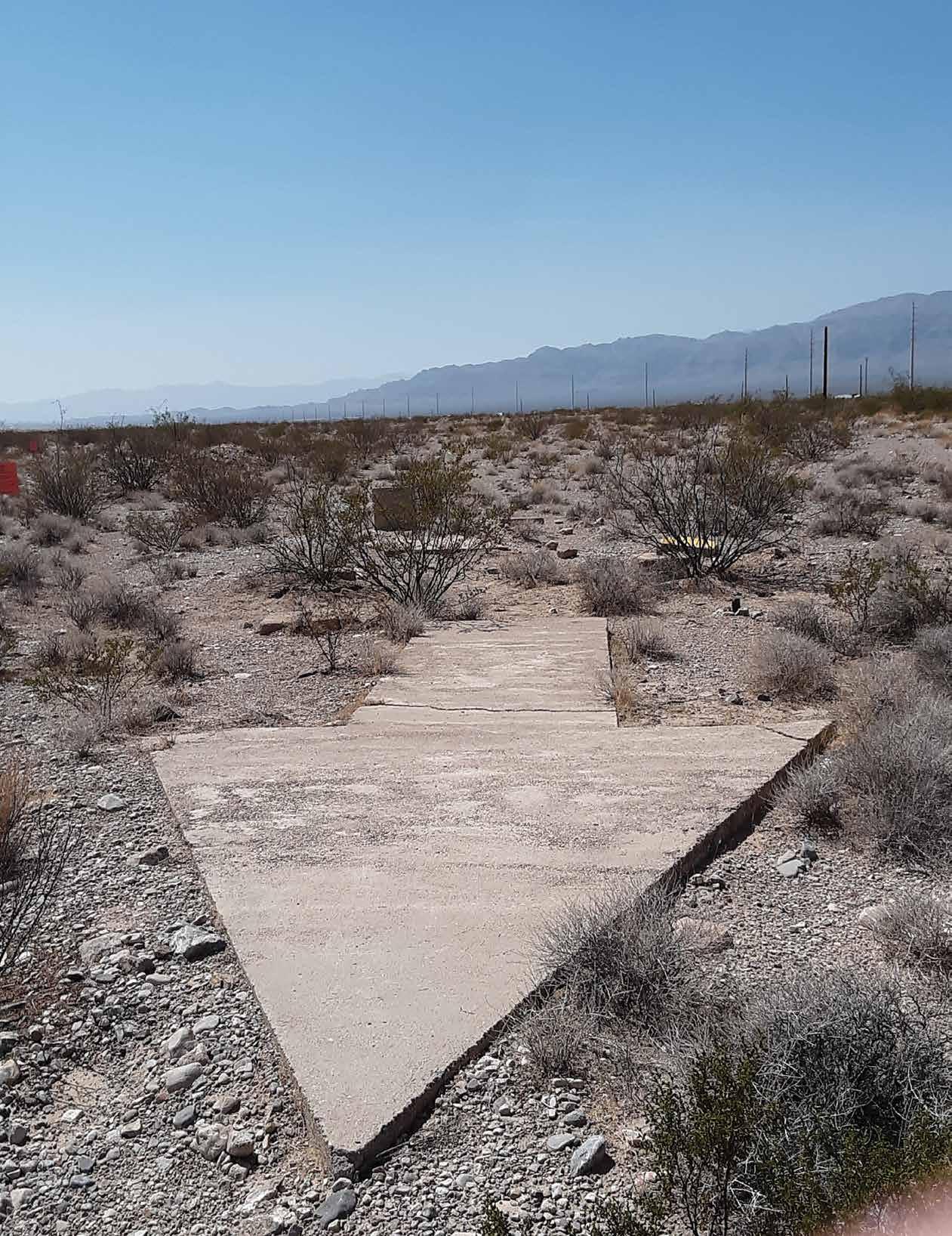
One of the most interesting days of my life came on January 28, 2016. I was invited to ride along with my jeep-owner neighbors to visit some scenic sites north of St. George, Utah. Our first stop was on top of the western side of the Harrisburg Anticline, which is on the east side of I-15 and less than five miles from my home. There, we had a great view of Zion National Park to the east, the Pine Valley Mountains to the west, and below us, an awesome view of Quail Creek Reservoir and the water purification facilities for the St. George area. But the biggest surprise that day was at my feet, a fifty-five-foot-long concrete arrow. I had never seen one before or been aware of such structures. I was told at the time that the arrows were used by pilots in the 1920s and 1930s to direct them along the correct path in the days before radio and radar. I was also told that there are several other aviation arrows in the region.
When I returned home, I did a Google search for aviation arrows and learned that there are at least seven arrows in southern Utah and Nevada that are close to home and that there are actually hundreds of arrows on different air routes across the United States. I also found that one of the principal air routes was between Los Angeles and Salt Lake City and that regular airmail began on the route in April 1926. With later study, I found that along the LA-SLC route, there are thirteen aviation arrows that still exist: three in California, four in Nevada, four in southern Utah, and two in northern Utah (Aviation Arrows Across America, https:// www.dreamsmithphotos.com/arrow/). I also learned that these pioneering air routes actually followed major railroad paths between American cities and that the pilots used the rail lines, much like painted lines on modern highways, for a guide between cities. But there were places where railroad lines would begin to wander due to physical constraints and

places where there were no railroad lines to follow. The result was the construction of arrows to guide planes during the day and, eventually, beacon lights to guide them at night. Since there were no straight railroad lines between Glendale, Nevada, and Cedar City, Utah, the construction of aviation arrows and beacons was essential for airplane pilots in the period from 1925 to 1938.
Within four months of seeing my first aviation arrow in January of 2016, I drove to three more in southern Utah and to two on the Mormon Mesa in Nevada. It turns out that all eight of the arrows in Nevada and southern Utah lie along Interstate-15 and can easily be reached. I have enjoyed visiting all eight arrows many times in the past six years. I will describe the location of the four Nevada arrows and other significant aviation history sites on an I-15 drive from Mesquite to Primm.
Aviation Arrow #32—Mesquite to Las Vegas To reach the first two aviation arrows and other Nevada aviation sites, start south on I-15 at Mesquite. Just past milepost 111, I-15 climbs to the top of the Mormon Mesa. Exit right into the truck stop immediately after you get onto the mesa. Locate the cattle guard on the north side of the parking area. Immediately after crossing the cattle guard, turn right onto a very rough road. Unfortunately, the first of the four arrows should probably not be accessed in an ordinary touring car due to the rough road, but the road does improve in less than 0.2 miles. Stay left on this road past two right forks during the next 0.5 miles. Past the second fork, drive 1.1 miles north to Aviation Arrow #32. The odometer on my truck indicated

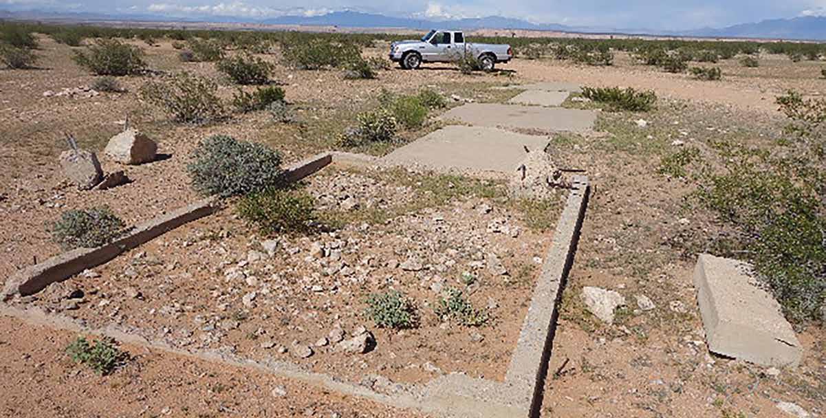
that it was 1.9 miles from the parking area to the arrow. This impressive arrow is located at 36.7968° N 114.2465° W. The southwest rectangle, a 14 by 10-foot area of the arrow, was the location of a beacon generator station. The cement area of the arrow covers 275 square feet and would have required at least 10 cubic yards of cement to create. The arrow is pointing in the N 65° E direction towards a low spot of Utah Hill. It takes about fifteen minutes to return to I-15.
Aviation Arrow #31—Mormon Mesa South As you drive south, you encounter an emergency landing field for the LA–SLC route on the southeast side of I-15 at exit 100. The 1931–1938 Airway Bulletin says it is located seven miles northeast of Glendale. The landing field covered 160 acres and was 3,500 feet long and 2,000 feet wide with a beacon tower in the northeast corner. The brief reports also indicate that a directional arrow labeled “29B LA-SLC” was located on the southeast corner of the field. The field had no servicing facilities and may have been used only a few times, but it was functional for eight years (Airway Bulletin No. 1, 1931-1938, #295, 703, 893, 1,095, 1,347, 1,580). An examination of the region on GoogleMaps shows a possible runway at 36.7226° N 114.4374° W but shows no remains of an arrow or beacon tower.
Just past milepost 94, exit right at another truck stop (at the access area) to a set of modern beacon towers. On the south end of the parking area is a gate. Pass through the gate and turn left onto a partially paved road (Beacon Hill Road) that follows I-15. Stay right on the road, which gives access to 22 different antennae and relay stations in the area.
You will come to Aviation Arrow #31, LA-SLC, on the downhill side of the road about one mile from the parking lot. This arrow is a little smaller than the one you just visited, and the generator shed rectangle is missing on the south end of the arrow. It is located at 36.6853° N 114.5176° W. The south end of the arrow points in the direction of the Union Pacific Railroad line that is south of Glendale, and the north end of the arrow points towards the emergency airfield and Aviation Arrow #32. “A pilot would approach the tail of the arrow on a compass heading of 48° (NE) and then exit the arrow on a compass reading of 68° (E-NE)” (Aviation Arrows Across America, 31 LASLC Mormon Mesa). This arrow has recently been painted a light orange color, but in the 1920s and 1930s, aviation arrows were painted bright yellow.
Beacon Tower near Moapa Indian Reservation After your visit, return to I-15 and head south towards Las Vegas. Near milepost 75, you will encounter the railroad on the right side of the interstate just before the Valley of Fire exit. Right before the exit near milepost 79 are the remains of a major beacon tower from the 1920–1939 period. It is located on the south side of I-15 at 36.5408° N 114.7103° W on a hill next to the freeway, but a section of it also lies on the Moapa Indian Reservation. The beacon tower remains can easily be seen on GoogleMaps, but one needs permission to visit the site. The beacon was extremely important for pilots in the 1920s and 1930s since it signaled a major departure from using railroad paths to using concrete arrows and beacons to navigate instead. There were at least 20 beacon towers, or “blinkers,” between Apex (milepost 59) and New Harmony, Utah (Airway Bulletin No.1, September, 1931, p. 34). One of them was near the Nevada/Arizona border at Mesquite. In some cases, modern-day communication towers were placed at sites where these early towers were.
Anderson Airfield, Las Vegas If you take exit 57 on Las Vegas Boulevard (Highway 604), you pass by the entrance to Nellis Air Force Base. From 1929 to 1942, it was called “Alamo Field” and served as the main airport for the city of Las Vegas. In 1942, Las Vegas built the Harry Reid International Airport (formerly McCarran), and it has served as
the Las Vegas Airport for 80 years. When you are not rushed, visit the Howard W. Cannon Aviation Museum in the airport. It is located on one of the entrance levels for Terminal 1. This site has a nice section devoted to the early aviation history of Las Vegas and its first airport.
The first minor airport in Las Vegas was opened on December 21, 1925, by the Rockwell brothers, Leon and Earl. The airfield was located in downtown Las Vegas and was referred to as the Anderson Airfield. The western boundary of the airfield was present-day Paradise Road, and the northern boundary was Sahara Avenue. It probably included most of Section 10, Township 20 South, Range 61 East in the heart of presentday Las Vegas and extended to Maryland Parkway to the east South Las Vegas Aviation Arrow There are two aviation arrows south of Anderson Field. The first is in Sloan at 35.9533° N 115.1793° W. The arrow sits on a 225-foot-high rough hill between I-15 and Las Vegas Boulevard South. It can be reached by taking exit 27 from I-15 and then driving east on St. Rose to Las Vegas Boulevard South. Turning south on the Boulevard, continue south to Larson Lane, turn right, and drive to the power line and power poles. Park your vehicle and walk to the first power pole to the south. Then climb up the steep hill to its top and walk south along the ridge until you arrive at the arrow.
From the aviation arrow, one has a great view of I-15, which is only 1,000 feet to the west. The tail of the arrow comes from the direction of the railroad, which is further to the south at about N 30° E, and the arrowhead points almost directly north to Anderson Field. The change of direction here was needed because the railroad began to wander to the west before it entered Las Vegas from the south. I would wear gloves if you climb to the arrow, but if you choose not to make the climb, take a look on GoogleMaps. The arrow is partially damaged, as it is nearly 100 years old now.
Aviation Arrow #21—Jean, Nevada (shown left) The last arrow is located just south of Jean, Nevada, on Las Vegas Boulevard South. It can be reached by taking exit 12 from I-15, but I would suggest traveling south on the Boulevard and then stopping at the colorful piled-rock exhibits at Seven Magic Mountains and at the Nevada “Last Spike” historic sign. Near the sign’s location, the last spike of the San Pedro, Los Angeles, and Salt Lake Railroad was driven on January 30, 1905. It was the last transcontinental line to southern California and provided the path that pioneer aviators would follow 20 years later and for nearly two decades. It is located just east of the highway before the road crosses the railroad. Its GPS coordinates are 35.8238° N 115.2875° W, and the historic sign is just over a mile south of Seven Magic Mountains.
At Jean, travel south past the Jean Airport that now serves as a recreation center for sky jumpers. Prior to this development, the airport was managed by the United States Air Force in the 1940s. Before that, it was designated as Site 21 on the LA–SL Airway.
The L-shaped airfield there had two landing strips, one 2,640 feet long and one 2,500, both of which were 400 feet wide with beacons and approach lights, though the airfield itself had no servicing facilities (Ibid., p. 89). Just past milepost 3 on the unmaintained oiled road, we can drive to the remains of the arrow. It is located at 35.7402° N 115.3523° W, about 150 feet off the road to the southeast. Only the pointed part of the aviation arrow remains, but an examination of its surroundings indicates that at one time, it was a more complete arrow. Why portions of the arrow have been removed is not known, but the “No Trespassing” signs may provide clues if one wants to investigate. This aviation arrow was established to bring planes back to the railroads that headed east from an area north of Yermo, California, to Kelso, California, and then north to the arrow here. The air route that followed I-15 saved 30 to 40 miles of air flight.
Protecting Aviation History If Nevada wants to safeguard the history of aviation in its state along the LA-SL route, all of its aviation arrows need to be preserved. Hopefully, some group will take up the cause and save them for future generations. An energetic individual can visit all the aviation arrows from Mesquite to the Nevada/ California border in one day, but you may want to make visits to a few of these historic places at a time and over an extended period of time. I hope you enjoy visiting these relics of American aviation history—for me, it has been a remarkable experience.V
Go Take a Hike

But Be Prepared!
by Anita Delelles
It’s a great time of year to go hiking with your dog. The weather is warming up, and the desert comes alive with color in the spring. We’ve outlined some simple practices to make this time safe and enjoyable for you both.
A Good Harness
Ever feel like you’re being dragged around instead of walking your dog? Or that your dog is walking you? It’s a common problem, but it’s one that has a very easy fix. A good no-pull harness will make all the difference.
Contrary to popular belief, a dog that pulls on the leash while being walked does not want to be pack leader, top dog, alpha, or dominant over his human. There is a much simpler explanation: dogs get excited going on walks! They love to be outside, and the walk is both physically and mentally stimulating. It’s the most exciting part of their day, so the desire to push ahead is very strong. A leash, though vital for safety, can also be frustrating for a dog because being “tied” to a person essentially stops a dog’s ability to act naturally. That being said, all dogs can learn how to walk on the leash in a positive way without being jerked, yanked, choked, or shocked so that walks can be enjoyable for everyone.
A chest-led harness takes pressure off of a dog’s sensitive neck area by distributing the pressure more evenly around the body. When the leash is attached to a ring located on the chest strap and your dog pulls, the harness will turn his body around rather than allowing him to go forward. Avoid the use of choke or prong collars, as these devices cause pain and significant physical damage to your dog’s neck.
A Water Container
Hydration for your dog is essential, especially in warm weather. Always take along fresh water for you both. Plan ahead—even a short walk may turn into an emergency situation if the unforeseen happens. Water can be a lifesaver. Some owners train their dogs to drink as they pour from a bottle. A lightweight, collapsible dish also works well and is easy to carry.
Protective Dog Booties
There are a variety of doggy boots available, and they make a lot of sense. They offer basic protection from sharp rocks, thorns, and broken glass. Since we wear shoes, it’s easy to forget how hot the pavement can get. And hot sand is no fun to walk across for your trailblazing buddy. Your dog may hop around comically at first but will soon get used to wearing boots and would thank you if he could.
A Dog Towel
It’s a great idea to carry a dedicated “hiker towel” to wipe off muddy or dusty paws and fur after your hike. Keep it in your car to wipe off your seats and to keep the carpet clean as well.
A Cooling Collar
All dogs struggle to dissipate heat since they don’t have sweat glands under their skin. Panting and sweating through their paw pads are the only ways to cool themselves. But it’s often not effective enough in the really hot afternoon sun. Cooling collars or bandanas can help prevent heatstroke. This soak-and-wrap accessory is worth every added ounce when the temps start to climb. Be conservative—rest and drink often, and watch your dog for signs of overheating. If your pup keeps lying down in shady spots, he is sending you a message.
A First Aid Kit
A veterinarian won’t be handy when you’re on the trail, so a doggie first aid kit (and the knowledge to use it) is a smart backpack item. Be sure to add to your kit any special medicines your vet has prescribed in case of an emergency. Kits typically include gauze, elastic bandages, a splinter-picker for paws (if you see your dog in distress), antihistamines, antiseptic wipes, and eyewash.
A Water-Testing Kit
Dogs are susceptible to most of the same waterborne pathogens as humans. Water-testing kits are available to test water before swimming and especially before drinking from a lake or stream.
So go ahead, get outside and enjoy the spring scenery with your dog while being well prepared. With a bit of planning ahead, you will have fun and keep your adventure from becoming a misadventure.V
WOOF! Wellness Center and Training Academy offers a Loose Leash Walking Class, specifically designed for making dog walking more enjoyable. The six-week class ends with a guided walk through Snow Canyon Park. Visit woofcenter. com for more information.


by Haylee Benglan
Hello, everyone! I’m Haylee! I’m the founder of BeBrave Supply Company and BeBrave Athletics, located in Mesquite, Nevada. BeBrave was born in 2017 during the most rock bottom of times.
Going through a divorce as a young mother with a baby girl, I was living day to day in a motel in Mesquite and was faced with the decision of where I was heading next. I chose to take life head-on and to BE BRAVE with every step I took.
With the little savings I had, I invested in 100 pieces of apparel. With every piece that I sold out of my trunk, I was $20 closer to building a life for my baby and myself. There were so many trials and tribulations along the way, and BRAVERY is what got me through those hard times. Thus, our name: BeBrave. I am now building a beautiful life for my daughter because of how BRAVE I choose to be every single day with every single step. Trust me when I say that no matter what you are going through, bravery is the most powerful attribute that will get you to that light at the end of the tunnel. When you put on a piece of BeBrave apparel, my hope is that you will become closer to your bravest self each and every time.
When my apparel company helped me into a steady life, I decided to put my athletics background to work. I stopped by the local rec center, inquired about a space to coach power tumbling, and shortly afterward, started BeBrave Athletics.
kept coaching each week and grew more and more. We soon outgrew the karate room we were coaching in and moved to a bigger space that the city had offered to us.
In 2018, the BeBrave Athletics competition team was born. SUTA (Southern Utah Tumbling Association) is made up of 10 different clubs around southern Utah and Nevada. We compete in trampoline events and power tumbling from October to May. Our team quickly grew, and Paige Woods also became part of our BeBrave staff and is now 50% owner of our corporation.
At BeBrave, our goal is to promote bravery, kindness, leadership, and self-confidence. Power tumbling and trampoline are great foundations for any sport or for the future of any athlete. Over the past five years, we have grown to over 250 athletes.
We've recently moved to a new location at 473 West Mesquite Boulevard to accommodate our growing BeBrave community! Our grand opening brought so many faces, and the nostalgic stories from those who have been here since before we moved into the building (it was formerly El Rancho Market) were great to hear! The excitement we have for this new venture is indescribable! Paige and I coach athletes from age three to 16.
BeBrave Athletics hosted our annual state meet at our new location on April 23. As president of SUTA, I was excited to bring this event to our new space and to the community!
BeBrave has changed so many young athletes' lives by giving them an outlet to express themselves physically and a way to explore talents that they never would have been able to explore otherwise. Shannon Drollinger, a BeBrave parent, says, "I am a lot newer here, but just to put in my two cents, I am still learning what Mesquite has to offer our family. I got very lucky to have found BeBrave. My little girl has been obsessed with getting into gymnastics forever. The ladies are so kind and truly care about every child that enters their gym. They've been here making a real difference in our kids' lives!”
BeBrave will also be offering birthday party packages on the weekends and can even provide a place to hold your special events such as baby showers, anniversaries, and, in the future, field trips for local schools.
BeBrave is not just a gym—it's a lifestyle! We believe every human has so many ways that they can be brave, and this is just the beginning!V

Owners Haylee Benglan (left) and Paige Woods (right)
Our hours are every weeknight from 4 p.m.–9 p.m. No kids? No problem! We also have a boutique for youth and adults alike! We would love for you to stop by and check out our apparel, which offers casual and comfortable style along with great gifts for your friends and family! Check out our website, www.bebraveathletics.com.

