Sea level is the altitude where the ocean meets the atmosphere. It is often short for Mean sea level (MSL), an average level of the surface of one or more of Earth's bodies of water from which heights such as elevation may be measured. Acommon and relatively straightforward mean sea-level standard is instead the midpoint between a mean low and mean high tide at a particular location.

CASE STUDY-1
MASSBOMMEL NETHERLANDS
CASE STUDY-2
CASE STUDY-3
Map of the Earth with a long-term 6-metre (20 ft.) sea level rise represented in red (Uniform distribution, actual sea level rise will vary regionally).

EFFECTS:
Current and future sea level rise is set to have a number of impacts, particularly on coastal systems. Such impacts include increased coastal erosion, higher storm-surge flooding, inhibition of primary production processes, more extensive coastal inundation, changes in surface water quality and groundwater characteristics, increased loss of property and coastal habitats, increased flood risk and potential loss of life, loss of non-monetary cultural resources and values, impacts on agriculture and aquaculture through decline in soil and water quality, Loss of tourism, recreation, and transportation functions.
EFFECT OF SEALEVEL RISE ON INDIA:

Rise in sea temperature and sea level leads to loss of marine ecosystems and biodiversity, salination, erosion and flooding and also increases occurrence and intensity of storms along entire shoreline. Climate Change impacts are already observed in submergence of coastal lands in the Sundarbans, loss of wetlands and of coral reefs by bleaching, and an estimated sea level rise of 1.061.75 mm/year. Low end scenarios estimate sea levels inAsia will be at least 40 cm higher by 2100. The IPCC calculates that it would expose 13–94 million people to flooding, with about 60% of this total in South Asia.Asea level rise of 100 cm would inundate 5,763 cubic km of India's landmass.

THE FOUNDATION
CONSTRUCTION:
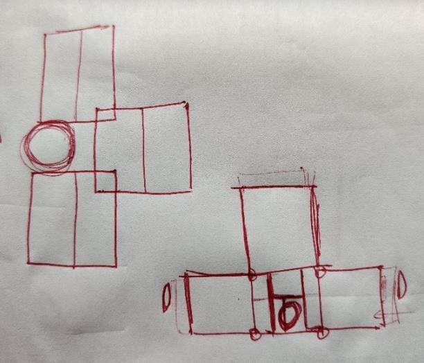
Amphibious structure dock and mooring pole
COMPARITION CRITERIA
CASE STUDY-1
CASE STUDY-2
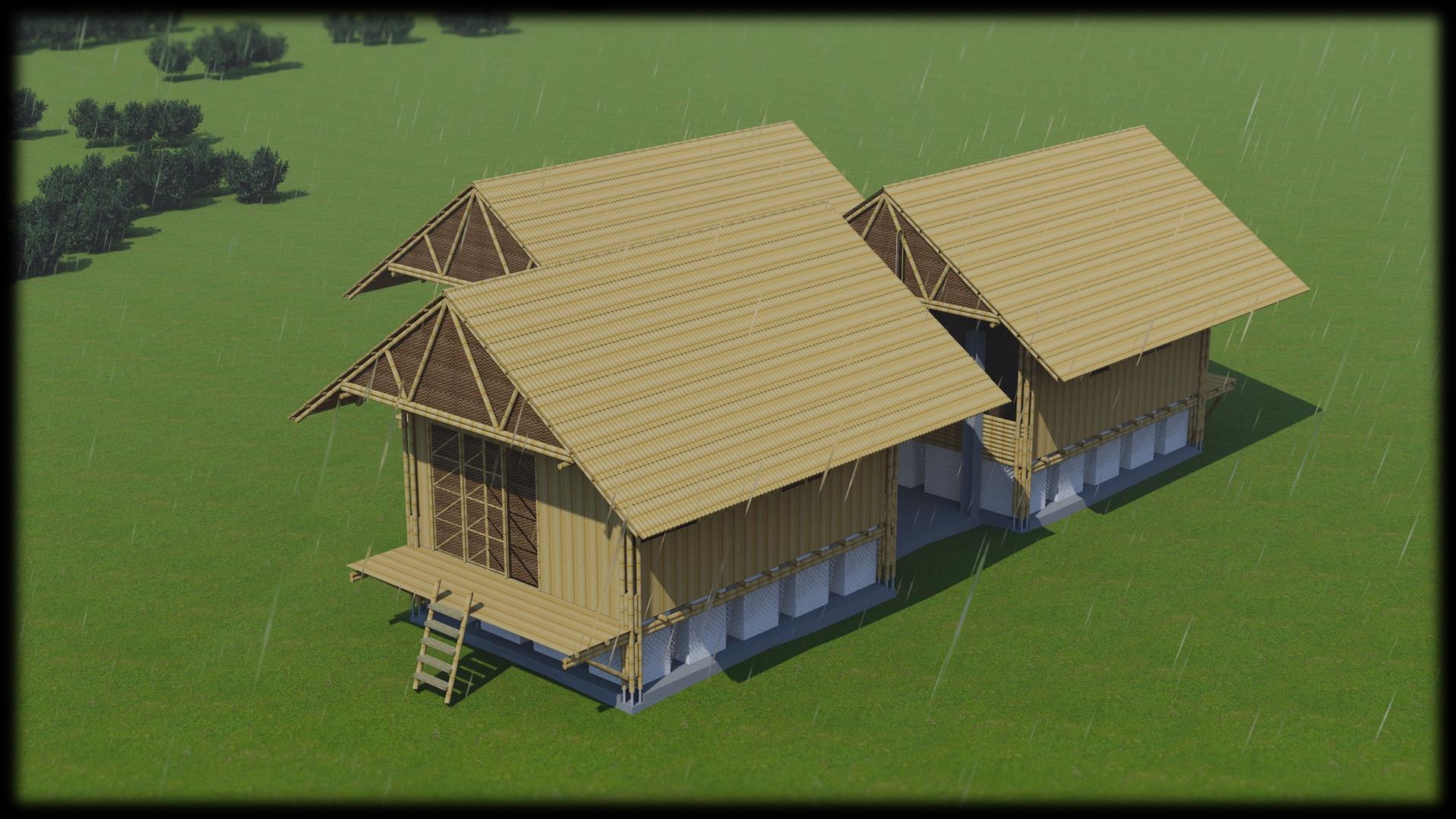
CASE STUDY -3
NAME Massbommel Lift house Blooming bamboo house
LOCATION Netherlands Bangladesh Vietnam

BUILDING TYPE Amphibious and floating houses Amphibious house Flood proof house

BUILDING STYLE Modern architecture Vernacular architecture Vernacular architecture

FOUNDATION TYPE Amphibious foundation using steel and timber hull for floating mechanism which is rested on six concrete foundation pile


Amphibious foundation using a hollow ferro cement structure and a bamboo frame filled with empty used water bottles for floating mechanism

MATERIALS USED Steel for columns and framework, prefabricated timber structure for walls and floors, The roof was made up of steel and wood and then covered with PVC roofing in site
SERVICES Flexible pipelines are used for all the services from the house onto the land surface

Brick and reinforced concrete is used for service spine, bamboo is used for columns, walls, doors, windows and roof

Built compost storage for sanitation, solar power for electricity, built biogas plant for cooking gas, rain water harvesting and storage system for water
Flood proof house with steel anchoring for strong foundation

Steel is used for anchoring and bamboo is used for the remaining structure
Built rain water tank, clean water tank and waste water tank underground in the site

16091AA030

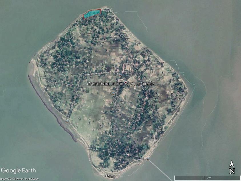
GHORAMARA ISLAND IN THE YEAR 2020

TOTAL GEOGRAPHICAL AREA: 923 acres [3735248 m2]
TOPOGRAPHY LEVELS

CLIMATE ANALYSIS:
• The months January, February, November and December have a nice average temperature.
• On average, the temperatures are always high.
• On average, the warmest month is May.
• On average, the coolest month is January.
• The average annual maximum temperature is: 31.0° Celsius (87.8° Fahrenheit)
• The average annual minimum temperature is: 22.0° Celsius (71.6° Fahrenheit)
• On average, April is the sunniest.
• On average, July has the lowest amount of sunshine.
• On average, July has the hottest water temperature.
• On average, January has the coldest water temperature.
• A lot of rain (rainy season) falls in the months: May, June, July, August, September and October.
• Kolkata has dry periods in January and December.
• On average, July is the wettest month.
• On average, January is the driest month.
• The average amount of annual precipitation is: 999.9 mm (39.37 in)
• Most rainy days are in June, July, August and September.
• Kolkata has dry periods in January, November and December.
• On average, August is the rainiest.
• On average, January has the least rainy days.
• The average annual amount of rainy days is: 122.0 days
• On average, July is the most humid.
• On average, March is the least humid month.
• The average annual percentage of humidity is: 71.0%
GHORAMARA ISLAND IN THE YEAR 2011

TOTAL GEOGRAPHICAL AREA: 2553 acres [10333300 m2]
Site location: On the north side of the island
Site area: 5 acres [20234 m2]

Site perimeter: 670 metres
Regional context: Rural
Number of existing houses in the site: 10
Number of farm lands in the site: 0
Risk of flooding: very high
Physical characteristics:
1. Site is in the opposite direction of the flow of Hooghly river
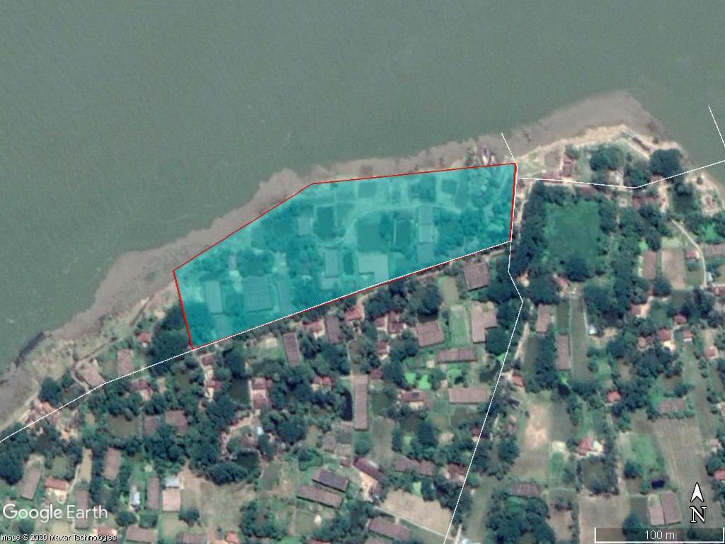

2. More prone to soil erosion due to sea level rise


3. Prone to migration of the people living on the site
4. There are existing houses on the site
5. Site is in a rural area and the primary occupation of the people is agriculture and secondary occupation is fishing
OVERALL-ANALYSIS:
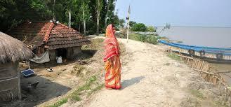
1. People who could afford for migration from Ghoramara island migrated and the people who couldn’t stayed back. So the poverty level is very high, hence the structure should be cost efficient.
2. The culture followed by the people is purely traditional Indian culture, hence the spaces in the dwelling should be designed in the accordance.

3. As the people here migrated in large quantities, there is a chance for people to return back to their native place. So this should be taken under consideration for the number of dwellings.
4. As the place is an island, locally available materials should be used for the construction and lightweight materials should be used for importing from other places for cost efficiency. For example, EPS, bamboo etc.
5. There is no provision of basic services like electricity, sanitation, cooking gas etc.; hence the structure should be made self-sustainable for a better living.
6. The wind direction is mostly from north and south side of the site overall the year.
7. As there is a lot of soil erosion going on the island and effects on the foundation of the building, safety precautions should be taken to prevent the soil erosion effecting the foundation, like

Retaining Barriers

French Drains

HOOGHLY RIVER
BOAT PARKING


GHORAMARA ISLAND
SOLAR-WIND HYBRID SYSTEM


WATER STORAGE TANK WITH SOLAR ROOFING
TRIPLET UNIT
DWELLINGS
• WATER STORAGE AND SUPPLY TANK IS PLACED ON THE HIGHEST CONTOUR LEVEL ON THE SITE FOR EASY SUPPLY OF WATER TO THE DWELLINGS.
• THERE IS A FISHING BOAT PARKING AREA NEAR THE SITE ON THE NORTH-EAST SIDE OF THE SITE. HENCE THE DWELLINGS OF FISHERMEN ARE PLACED ON THE NORTH EAST SIDE OF THE SITE WHICH IS EASILY ACCESSIBLE FOR THE FISHERMEN TO THEIR BOATS
• DWELLINGS FOR THE FARMERS AND OTHERS ARE PLACED ON THE SITE WHERE THERE IS AN EVEN TOPOGRAPHY LEVEL


• SOLAR-WIND HYBRID POWER GENERATION SYSTEM IS PLACED IN BETWEEN 2 TYPES OF DWELLINGS AND ALL THE SERVICES ARE PLACED AT ONE PLACE FOR EASE IN ACCESSIBILTY FOR SERVICE REPAIRS etc. AND EASY DISTRIBUTION OF WATER AND ELECTRICITY TO THE DWELLINGS


EXISTING HOUSES-10

WITH AN INCREASE IN 85% OF THE PRESENT POPULATION (CONSIDERING THE REMIGRATION) TOTAL NUMBER OF HOUSES TO BE CONSTRUCTED WILL BE 19 HOUSES
POPULATION DENSITY = PRESENT POPULATION / LAND AREA


ESTIMATING 60 PEOPLE ON THE SITE FOR 10 HOUSES, DENSITY WOULD BE 12 PEOPLE PER ACRE.
WITH AN INCREASE BY 85% ,THE POPULATION DENSITY WOULD BECOME 22 PEOPLE PER ACRE
NUMBER OF HOUSES FOR FARMERS – 15
NUMBER OF HOUSES FOR FISHERMEN - 6