
Can the 15-minute walking city save intensification hubs in and beyond the COVID-19 pandemic


The COVID 19 pandemic challenges many facets of urban intensification plans. Public health measures and fears of contagion rapidly depleted economic, social and transit activity in high density, transit oriented development (TOD) hubs in places such as downtowns and centres. Simultaneously, there has been renewed interest, visions and designs for sustainable cities with ample public spaces where safe walking and cycling can flourish. We explore how adapting to pedestrian oriented development (POD) envisioned as the 15 minute city, could serve as an alternative model throughout successive waves of the virus and beyond. Supportive of public health, sustainable mobility, intensification and transit recovery goals in the near term, such adaptation reinforces commitment and growth management directions in regions like Waterloo, Canada heavily invested in TOD.
 Neluka Leanage and Pierre Filion
School of Planning | University of Waterloo August 31, 2020
Image: City of Kitchener
Neluka Leanage and Pierre Filion
School of Planning | University of Waterloo August 31, 2020
Image: City of Kitchener
7. Adapting intensification model with POD in Waterloo Region’s Central Transit Corridor.................28
8. Conclusion 29
Acknowledgements.....................................................................................................................................31
References 31 Appendix A 41
Symposium presentation, 18 August 2020.............................................................................................41
List of Figures
Figure 1: Central Transit Corridor, Waterloo Region 5
Figure 2: Perry’s Neighbourhood Unit 9
Figure 3: Radburn model 10
Figure 4: Schematic diagram of the Chinese 15 minute neighbourhood 13
Figure 5: Time area requirements by mode 17
Figure 6: Designing to move people: The capacity of a single 10 foot lane (or equivalent width) by mode at peak conditions with normal operations
17
Figure 7: Winter design ideas for a community park, City of Fort St. John, British Columbia 25
Figure 8: TOD and POD walking zones around Uptown Waterloo’s Urban Growth Centre 27
Figure 9: Key differences between transit and pedestrian oriented development 28
Leanage and Filion: Can the 15 minute walking city save intensification hubs in and beyond the COVID 19 pandemic? 2
1. Introduction
COVID 19 is leading to renewed interest, visions and designs for sustainable cities with ample public spaces where safe walking and cycling can flourish. Advocates call for reclaiming the streets for people, pedestrians and cyclists over the car as a resilient way forward for cities and healthy living (Ewing, J., 2020; Schwedhelm et al, 2020), as confidence in public transit could take years to bounce back. There are signs that some cities like Milan, Paris and New York are considering making permanent, temporary space accommodations to pandemic related rising pedestrian flows and the need for distancing (Laker, 2020). Promoting active transportation has added benefits to quality of life, the environment, road safety and health.
There is a strong possibility that avoidance of public transit due to fear of contagion will result in increased reliance on solo driving, undoing decades of policy objectives, trends and dynamics of urban intensification oriented to public transit and compact, efficient, high density form across Canada. One possible response to this problem would be to offer appealing active transportation options (Bliss and Kasky, 2020) and focus development around walking and cycling spatial temporal patterns, sometimes referred to as the 15 minute city inspired by Jacobs’ vision and related to Perry’s Neighbourhood Unit. In this paper, we review the novel coronavirus implications to intensification hubs based on high density, compact transit oriented development (TOD) generating a vibrant public realm in places like downtowns, commercial and employment centres, and station and stop areas. We compare pedestrian oriented development (POD) with TOD and propose that the 15 minute city model supports pandemic related transit recovery, can deliver high density in an adapted urban form, mitigates anticipated automobile congestion, reinforces long range growth management objectives and aligns with other policy objectives that may have been difficult to implement earlier yet feasible due to COVID. Lastly, we explore how the 15 minute city could be translated in Waterloo Region to salvage intensification hub plans in the near term, throughout waves of the virus and beyond. We perceive PODs as an alternative way of meeting TOD intensification objectives, of providing an animated pedestrian environment capable of increasing the appeal of nearby density.
We situate this work in the Canadian pandemic and growth planning contexts. First, the evolving understanding of coronavirus risks and government interventions has meant that the duration of initial lockdowns were grossly underestimated in weeks to what has become months Since the early 2020 coronavirus, swift, unprecedented government actions have been taken to save lives, reduce the spread of the virus and “flatten the curve,” declaring states of emergency and mandating changes to everyday individual, business and community behaviours. Initially, expectations were that such interventions would be temporary and adequate to mitigate and prevent the contagion’s spread After six months, it appears that to achieve either of these objectives, ongoing, flexible non pharmaceutical interventions may be needed over the next twelve months to respond to outbreaks, future pandemic waves and until an effective vaccine becomes available to the masses (Berkeley Jr., 2020). Whereas herd immunity was thought to hold great protective promise, opinions on the virus shift regularly and include a trajectory in which it will persist in our communities and circulate like the common cold i.e., something we must learn to live with to opinions that it’s too early to tell (CBC News, 2020b). As the science of COVID 19 and its transmission emerges, uncertainty remains and cautionary opening experiments indicate different outcomes and implications for all sectors of society in cities and communities of all sizes.
Leanage and Filion: Can the 15 minute walking city save intensification hubs in and beyond the COVID 19 pandemic? 3
Second, this pandemic presents critical challenges to planning and calls into question earlier assumptions and visions about cities, mobility and human behaviour. Are smart growth strategies based on compact intensification, transit oriented development and an engaging public realm still relevant? Across Canada, many regional and local municipalities are engaged in updating and redeveloping their long range official plans in the year 2020, ensuring community and future needs are reflected in land use and transportation plans until the next 20 year horizon. For the past twenty years, smart growth has been the major framework for official plans in Canadian cities: limiting sprawl by mixing land uses, transportation modes, jobs and residences more intensely and to build compact, transit oriented communities enriched with amenities and public spaces with high quality design (Ontario, 2019 [2006]; Greater Vancouver Regional District, 2011; Hamilton City Council, 2006; Region of Waterloo, 2003; City of Kitchener, 2019).
This is true of Waterloo Region, Canada, located approximately 100km west of Toronto, which serves to focus our exploration of COVID 19 impacts and adaptations. Waterloo is ideal to examine as a rapidly growing North American knowledge tech region, with a population over half a million, that has invested heavily in TOD intensification with the completion of a 19 kilometre, 19 stop light rail transit system in 2019 and a forthcoming stage 2 that would finish connecting three mid sized cities and downtowns.
1.1Organization of paper
We begin with a discussion of transit oriented development (TOD) intensification strategies and the impacts of COVID 19 in Section 2 and Section 3 that leads to our proposal for an alternative density approach in Section 4 of using a pedestrian oriented development (POD) model to salvage TOD hubs. We highlight the benefits of POD in addressing COVID 19 now and its wide benefits to cities beyond the pandemic in Section 5. In Section 6 we compare TOD and POD to illustrate their similarities and feature main differences with key adaptations we recommend in Section 7. Our conclusion is presented in Section 8.
2. COVID-19 Implications on TOD Hubs
2.1. From urban dispersion to urban recentralization
One of the main manifestations of the late 1990s smart growth movement has been the adoption in metropolitan scale plans of urban recentralization strategies focused on new or expanded public transit systems. These strategies are still very much a feature of local and regional plans and urban form policies (Filion, Kramer and Sands, 2016). The Urban Growth Centres policy of the Greater Golden Horseshoe Growth Plan falls in this category (Ontario, 2019: 16 17). Recentralization strategies represent a reaction to seven decades of dispersed urbanization, characterized by low density, rigid functional specialization and near total reliance on the automobile. Their proposals are indeed at the antipodes of dispersion: expansion or creation of multifunctional high density centres well connected to new or existing rail public transit or bus rapid transit. Ideally, these centres include office employment, retailing, hospitality and high density housing, as well as a walking friendly environment with stimulating ground level facades and large pedestrian flows and public transit reliance (Hess et al, 1999). They reproduce at different scales the dynamics of successful large city downtowns, with rich walking based synergy effects beneficial to their different categories of activities.
Leanage and Filion: Can the 15 minute walking city save intensification hubs in and beyond the COVID 19 pandemic? 4
2.2. Density and public transit as key to intensification
Key to the recentralization planning model is the connection between density and public transit. One indeed begets the other. High density fosters a market for public transit while transit creates accessibility peaks that are conducive to the clustering of density (Ewing and Cervero, 2010). By contrast, areas that rely on the automobile present more diffused accessibility patterns and, therefore, do not lend themselves to the development of high density multifunctional centres (Filion, Bunting and Warriner, 1999).
Waterloo Region exhibits commitment to a TOD approach. From its first 1976 regional plan onwards it has adopted a Central Transit Corridor policy combining public transit improvements with urban intensification, most notably in downtown areas. The planning and realization of its ION light rail system and the Growth Plan’s Urban Growth Centres (UGCs) have created an accessibility and regulatory environment promoting intensification (Region of Waterloo, 2015: 20 24). Density is accommodated within the UGCs, which correspond broadly to the three downtown areas, and at other locations along the ION. Over the last years, with the construction of multiple residential towers within the central transit corridor and the arrival of new, mostly information technology oriented, workplaces in the downtowns, urban intensification policies have been highly successful.
Figure 1: Central Transit Corridor, Waterloo Region


Leanage and Filion: Can the 15 minute walking city save intensification hubs in and beyond the COVID 19 pandemic? 5
 Uptown Waterloo UGC
Kitchener UGC
Uptown Waterloo UGC
Kitchener UGC
2.1.1.Intensification aims
Recentralization strategies aim to achieve a range of objectives. They are obviously driven by environmental considerations such as reduced energy consumption, air pollution and greenhouse gas emissions, and a containment of urban sprawl and the associated loss of rural and natural land. They are also motivated by economic and financial objectives. It is costly to provide the services and horizontal infrastructures required by sprawling low density urban areas. In a similar vein, traffic congestion resulting from near generalized reliance on the car is responsible for important losses in productivity (Ewing and Hamidi, 2017). Finally, one cannot overlook the health and quality of life advantages of an environment that promotes walking and cycling and offers easy accessibility to close by daily activities (Badland and Schofield, 2005). Most conducive to the meeting of these objectives is the concentration of different high density functions within centres rather than dispersing residential density without connection to ancillary land uses and public transit (Filion, McSpurren and Appleby, 2006). The concentrated density model is better adapted to coordination with public transit infrastructures and more suited to the creation of pedestrian hospitable environments. These advantages along with the diversity of close by land uses incentivize residents to trade residential space for high density living.
2.1.2.Challenges
implementing intensification
It has proven difficult to implement the full vision of the ideal high density multifunctional centre, as evidenced by gaps in most of these centres. Such gaps are visible in Growth Plan Urban Growth Centres and in centres elsewhere (Filion et al, 2018). A major challenge has been to attract employment due to competition from cheaper car oriented locales. Similar difficulties confront retailing. A scarcity of street level store facades makes it difficult to animate pedestrian environments. Mainstream retailing has long vacated street oriented locations for mall locations. More recently, all retailing has confronted competition from big box stores and online shopping. Another impediment to the implementation of the ideal vision of centres is the large amount of space dedicated to the car, especially in the form of wide arterials and surface parking. All these obstacles affect the multifunctionality of centres as well as their ability to provide a stimulating and animated urban environment.
3. The impacts of COVID 19 on transit and intensification areas
3.1. Uncertainty
The COVID 19 pandemic is impacting multiple facets of urban intensification strategies. These effects are due to both the reality of COVID contagion and, perhaps above all, perceptions of how the contagion spreads and of its effects. The pandemic is a moving target as we learn more about it as it progresses and scientific research advances. For example, some of the first hot spots (New York and Montreal in North America) were large high density cities, which led to the conclusion that density was a major vector for contagion. But it soon became obvious that contagion did not concentrate in the highest density sectors of these metropolitan regions and that later phases of the pandemic affected low density as much as high density areas. It became apparent that international travel and the vulnerability of the service class explained the early distribution of the pandemic (Hamidi, Sabouri and Ewing, 2020).
3.2.
Avoidance of indoors and transit
But there are factors related to the pandemic that do have a direct impact on the perception of urban density, its future appeal and possibilities of planning for intensification. They call for new ways of
Leanage and Filion: Can the 15 minute walking city save intensification hubs in and beyond the COVID 19 pandemic? 6
making a case for and of delivering intensification. Some of these factors are grounded in evolving epidemiologic evidence, others emanate from the public’s reactions and behaviour adjustments, and finally there are those that are based on perceptions of contagion risks. With increasing evidence of aerosol transmission of the coronavirus there appear to be sound scientific reasons to avoid large concentrations of people in closed indoor spaces such as bars, lecture halls, theatres, offices, public transit and airplanes, even when distancing and mask wearing are practiced (Brosseau, 2020). Accordingly, while the pandemic is active there is little expectation that public transit ridership will rise to pre COVID levels and that large contingents of office workers will stop working from home.
3.3. Work from home patterns
In fact, changes in office work patterns may be permanent, which will have a major impact on public transit use especially in large metropolitan regions where downtown with its office towers constitutes the main transit market. Such transformations can trigger a chain effect percolating through the activity ecology of downtowns and other centres. A July 2020 New York Times article featured a Midtown office building where the number of employees has fallen from 7,500 to 500 in the post lockdown period. The article showed how with the absence of office workers, the close by subway station was used by only fifteen percent of its normal passenger flow and virtually all nearby stores and services were closed (Wilson, 2020).
3.4.
Brick and mortar retail suffer
Apart from less public transit use and fewer office workers, there is another COVID related impact on high density multifunctional centres. Retailing has been severely affected by the prevalence of online shopping during the lockdown and post lockdown periods (CBC News, 2020a). As in the case of homework, we may be in the presence of a permanent behavioural shift. The loss of retailing (in all but the largest multifunctional centres is not a new phenomenon due to the predilection for shopping malls and big box stores) robs centres from a key means to fill ground level facades and thereby to foster a stimulating pedestrian environment. The danger is that the joint effects of less reliance on public transit, the persistence of homework among office employees and less brick and mortar retailing will trigger a downward spiral in high density multifunctional centres. The hospitality scene of these centres will be depleted by the falling number of people working and shopping there, while their appeal to residents will suffer. With such a scaled back public realm, there will be less incentive to trade off living space for an animated walking environment with access to diversified close by activities.
3.5.
Issues with earlier intensification formulas
The danger is that the challenge of prevailing intensification formulas by the pandemic and its consequences will create a context that is favourable to advocates of low density, car oriented urban developments. The concentration of activities in the home and reliance on the car seem indeed to be, at first glance, better adapted to the COVID pandemic. In order to prevent a return to an all out dispersed form of development, with its adverse environmental, economic, financial, quality of life and health consequences, the onus is on planners to come up with forms of intensification that can address present pandemic circumstances and their future consequences.
Leanage and Filion: Can the 15 minute walking city save intensification hubs in and beyond the COVID 19 pandemic? 7
4. Towards an Alternative Density Hub Model
4.1. Reconsider activity scale: neighbourhood
Although it is difficult at this stage to paint a full portrayal of the consequences of the pandemic on urban trends, current information allows us to speculate on a shift in urban activity scales. As downtown areas decline, one can expect a growing focus on the neighbourhood scale. With more people working from home and avoiding public transit, hospitality and personal service, culture and entertainment consumption that used to take place downtown is likely to increasingly happen at the neighbourhood level.
4.2. Catalysts for change in Waterloo Region’s intensification hubs
On the one hand, Waterloo Region may be less affected than large metropolitan regions by this urban rescaling because proportionately, it has smaller downtown employment concentrations within its diversified manufacturing, insurance, technology, and food and beverage sectors, lower transit ridership, and retailing has for the most part long left for the suburbs. On the other hand, the urban cores of Waterloo and Kitchener connected by a new light rail system, are home to one of the fastest growing tech industries in the world and the second highest startup density after Silicon Valley (Compass, 2015). By 2016, the Region had Canada’s largest concentration cluster in information technology (Institute of Competitiveness and Prosperity, 2016) and tech companies like Shopify and Communitech’s start up community had been increasingly occupying and expanding their downtown commercial spaces, hiring hundreds of tech workers across Waterloo Region (Reinhart, 2017). These tech workers often desire urban lifestyles, amenities and transit, suited to higher density downtown living Shopify, like other prominent technology companies such as Google, have announced permanently moving significant shares of their Waterloo workforce to home in what has been termed, a post office period (Bickis, 2020). The timing of work from home and layoffs could not be worse for Waterloo Region’s downtowns that had until recently, been recovering from decades of decline. With light rail ridership and developer incentives having stimulated the building of large numbers of high density residential condominiums in the urban centres to be occupied in the coming months and years, a new survey reports that one third of Canadians do not want to live in urban centres and want more living space (Foran, 2020). A dual, impending setback would be that both commercial and residential tenants and owners vacate intensification hubs.
The challenge for Waterloo Region is to further advance recent residential intensification achievements, especially along the ION line, and thereby keep jobs and people downtown while avoiding a return to near total dispersion oriented development.
Drawing on present conversations on how cities can adapt to the pandemic and post pandemic periods we propose an approach that compensates for the decline in the capacity of public transit patronage, office work and brick and mortar retailing to catalyze density, by focusing on the neighbourhood scale to foster intensification. Moderate to high density residential development would provide the conditions for a multifunctional pedestrian conducive pedestrian realm while this realm would create an inviting environment for additional residential intensification. People living in such intensified areas would be able to carry out most of their daily journeys within an easily walkable perimeter (Handy and Clifton, 2001).
Leanage and Filion: Can the 15 minute walking city save intensification hubs in and beyond the COVID 19 pandemic? 8
4.3. Neighbourhood models
We review three models relevant to walkable neighbourhood focused organization of urban activities: Perry’s Neighbourhood Unit, Jane Jacobs’ vibrant neighbourhood and the 15 minute city. A motivating question is whether a pedestrian oriented neighbourhood model is a viable alternative to TOD intensification hubs.
4.3.1 Neighbourhood Unit
Clarence Perry’s Neighbourhood Unit (1929), has been a longstanding planning and design model prescribing a neighbourhood vision through spatial arranging of land uses, traffic and key components needed to build a family oriented residential community. In its ideal 160 acre site, the design had at its centre, public institutions such as a primary school and a community centre,and was bounded by shopping clustered along arterials and at junctions accessible on foot by neighbourhood dwellers within 400m walking distances (Figure 2). Vehicular traffic was to be routed along arterials around the prescribed low density housing to create a pedestrian based public realm intended to match the slow movement of walking, and address safety and livability from rising vehicular traffic and noise (Perry, 1929). An allocation of ten percent (10%) recreation and park space was to be added in small areas throughout the neighbourhood and larger park spaces at its edges.
Figure 2: Perry’s Neighbourhood Unit
Leanage and Filion: Can the 15 minute walking city save intensification hubs in and beyond the COVID 19 pandemic? 9

We contrast Perry’s model primarily focused on planning at the neighbourhood scale and the walkable relationship of homes and activities to community functions, with the Radburn model, inspired by the Garden City movement and developed around the same period by Stein and Wright. The Radburn model sought to balance nature and development with a neighbourhood design relating to smaller groupings of homes sharing small streets or lanes around ample greenspace, that combined to create blocks and superblocks bounded by more greenspace and faster highways the origin of the segregated suburban subdivision (Figure 3) Although the Neighbourhood Unit and the Radburn model both wanted to protect residents from outside traffic through physical design, and were based on a population supporting an elementary school, the Radburn model was predicated on a scale suited to driving, whereas Perry’s concept matched daily walking rhythms and conveniently located amenities accessed on foot (Patricios, 2002).

Figure 3: Radburn model (in Birch, 1980)
4.2.1.Jane Jacobs’ vibrant neighbourhood
One of the most familiar and lasting neighbourhood inspiration comes from Jane Jacobs and her observations about what makes places work. Using her own neighbourhood of Greenwich Village to measure the impact of different planning approaches, Jacobs contended that a combination of factors are needed to create bustling main streets, pedestrian friendly environments and social interaction (1961). These included higher residential density than those proposed in the Garden City suburbs (not necessarily high rise), a compact, mix of uses in close walking proximity usually with short blocks, continuous sidewalks and stimulating facades all scaled to people and walking rhythms rather than to the automobile. Together, these generated the safe, lively streets with spontaneous conversations and mixing of different kinds of people and businesses activities. Opposed to suburban plans that separated uses and people, Jacobs promoted the idea that vibrant, walkable neighbourhoods would develop organically if allowed by planning.
Leanage and Filion: Can the 15 minute walking city save intensification hubs in and beyond the COVID 19 pandemic? 10
Her vision of dynamic, walkable communities went on to inspire planners and researchers for decades (Filion et al., 2007) including those promoting New Urbanism, infill, downtown revitalization, transit oriented planning as well as the works of Gehl, Smart Growth America, Congress for New Urbanism and WalkScoreTM (Jacobs, 1961 and 2006; Filion et al., 2004; Gehl, 1996; Boer, 2007; Owens, 1993; Congress for New Urbanism, 2020; Duany et al., 2011; Speck, 2013).
Congress for New Urbanism, 2020
The physical conditions identified by Jacobs have been well investigated for their ability to stimulate walking and as foundations of healthy, walkable neighbourhoods. In various formulations, with land use mix being one of the strongest variables, density, connectedness or short blocks, and sufficient concentration of buildings and design, have been shown to produce walking and other active modes of transportation across an array of times and contexts in North America and internationally (Christianson et al., 2016; Frank et al., 2006; Badland and Shoefield, 2005; Ewing and Handy, 2009; Lee and Seon, 2015; Wasfi et al., 2016). Furthermore, walking and multifunctionality create synergies benefitting economies by generating a reinforcing cycle that attracts more people, business, and activities like shopping, walking and cycling (Arancibia et al, 2019; Filion et al, 2018).

It is no surprise that significant public and private sector coordination of investments into compact, transit and pedestrian oriented, mixed use and high density development are central to reconfiguring urban sprawl and managing growth in order to reduce dependence on the automobile, improve reliance on sustainable modes of transportation and foster high quality of life in complete communities.
4.3.3.The
15 minute city
Another recent neighbourhood model inspired by Jane Jacobs’ approach, is the 15 minute walking city, proposed by Carlos Moreno for Paris (Moreno, 2019). His model consists of making sure that from any residential location in Paris it is possible to access a wide array of activities within fifteen minutes on foot, including: work, shopping, restaurants, entertainment, culture, education, health care, libraries
Leanage and Filion: Can the 15 minute walking city save intensification hubs in and beyond the COVID 19 pandemic? 11
and sport facilities. The 15 minute walking city was adopted in early 2020 by Anne Hidalgo, the Mayor of Paris, as one of the main platforms for her re election (Paris en commun, 2020). Timing was little short of providential for this proposal. Soon after it was aired, France came under lockdown and since then a large share of the public has become hesitant to use public transit, substantially increasing reliance on walking. Moreno described the 15 minute city as providing an urban hyper proximity to high quality social living linking the two essential components of urban life: space and time and as a means of recovering from the novel coronavirus (Sisson, 2020).
Like in the case of the previous neighbourhood models, the foundation of the 15 minute city is coordinating and configuring everyday activities accessible on foot. It also emphasizes high quality place based strategies and designs that accommodate slower movements and non movement i.e., stopping, standing and sitting.
In China, the 15 minute neighbourhood or life circle as it is sometimes referred to, has been growing in popularity since 2016, as a government model providing walkable access to essential public services, increasing walking rates, improving health in general and addressing inequity (Weng et al., 2019; Zhou, 2019). The Chinese 15 minute walking model also attempts to redistribute public services by need instead of equally and uniformly as was done traditionally (Zhou, 2019). The concept shown in Figure 4, like Perry’s Neighbourhood Unit, locates public institutions, early learning and small parks within a 5 minute walk. A fresh food market and elderly care are also found within the shortest walking distance. Other important land uses and services such as sports and public health facilities are located within 10 and 15 minute walking distances. The residential density in the Chinese model fits with their urban populations and growth, and although such densities are atypical in most North American cities, they demonstrate that walkable neighbourhoods can be planned for and attain high density. Evidently such a solution must be adapted to different density levels: Manhattan is nearly 26,000 people/km2, downtown Toronto is over 8,000 people/km2 and Kitchener and Waterloo are between 1,500 and 1,700 people/km2 (Wikipedia, 2020).
In Zhou’s study (2019) comparing twelve (12) communities varying in size, density, demographics and rural to urban character, residents in higher density inner cities and newly developing cities adopting the 15 minute life cycle program were better able to reach public facilities on foot. The lower density urban rural fringe and outer city residents were less able to meet their needs on foot and essential public facilities were more challenging to integrate in these communities. Overall, interviewees mentioned that their average walking time was over 20 minutes to reach larger public destinations, and many felt them to be too far. In both Weng et al. and Zhou’s research (2019), older people had more trouble accessing public services on foot and were more sensitive to time, indicating that services for this demographic need to be laid out closer to 5 minute walk distances and that smaller public facilities could be added in closer proximity. Findings also showed that other facilities not provided were in high demand, e.g. childcare and elder learning, suggesting that neighbourhood level surveys could aid in shaping the urban design of amenities and their proximities.
Figure 4: Schematic diagram of the Chinese 15 minute neighbourhood (Weng et al., 2019)
Leanage and Filion: Can the 15 minute walking city save intensification hubs in and beyond the COVID 19 pandemic? 12
5. Reconciling intensification objectives and COVID-19 with the 15minute city
The novel coronavirus has created uncertainty in what had been clear municipal and regional planning visions and widely shared demographic and development scenarios and forecasts. What we believed in February and March 2020 differs from what we understand today. While our learning has been steep and sacrifices large over the past six months, some uncertainty still remains about aerosol transmission indoors and outdoors as well as the severity of successive waves in northern climates with looming cold and flu seasons (Dancer et al., 2020; Lewis, 2020) Significant mitigation and re opening experimentation across countries and cities has been underway and monitored in order to interpret the trajectories of non pharmaceutical interventions and how best to reconfigure our lives. For long term endeavours such as planning and development that rely on evidence for decision making, involve coordinating multiple actors at different levels within slow moving institutions, uncertainty poses particular challenges.
The proposal to adapt TOD to a pedestrian based neighbourhood model represents a compromise in the face of uncertainty. It maintains municipal, regional and provincial visions and objectives while adapting to and anticipating changes appearing to become long term shifts with deep psychological and recessionary impacts and ripple effects, the recovery of which may take years. It directly addresses COVID 19 and meets intensification objectives sought by many municipalities.
In the next section, we describe six mutually beneficial aims: pandemic and overall health, equity and accessibility, sustainable modes of transportation, transit recovery, and intensification

5.1. The 15 minute walking city and pandemic health
At the heart of the 15 minute city is walking outdoors which in most North American contexts offers 24/7 access to fresh air with lower risk of viral transmission compared with the enclosed settings of
Leanage and Filion: Can the 15 minute walking city save intensification hubs in and beyond the COVID 19 pandemic? 13
buildings, transit vehicles, stations and shelters. It is thought that indoor environments, ventilation systems pose higher risk due to differences in aerosol and droplet dilution and dissipation and more touch points (Mayo Clinic, 2020; Levenson et al., 2020). With severe travel restrictions in place in the vast majority of cities, the air quality improved with fewer automobile trips.
As a commuting mode of transportation, walking can provide complete or partial mobility to essential workers, shift workers, vulnerable people or those in low income and non driving groups This is especially important when transit service is reduced due to COVID 19 staff availability and when transit routes and times have been adapted to low ridership (Grand River Transit, 2020; Aguillar 2020). Providing alternatives to transit has the benefit of lowering the risk of viral transmission from passengers to transit operators, common concerns for drivers and their unions (Barthel, 2020; Moore, 2020; Roberts, 2020).
Moreover, many essential workforces have declined due to COVID 19 illnesses, job absences due to fear of virus exposure and surges in home caregiving responsibilities, exacerbating time pressures on those still working. Ensuring proximity between home and work with needed amenities can reduce viral exposure to essential workers already facing higher burden of risk through their jobs. In a 15 minute community, travel times are shortened for everyone but especially for essential workers. Freeing up time outside of work can aid in stress reduction during these challenging times for new self care and home care demands faced by everyone.
By the last week of March 2020, upwards of 40% of non essential workers had worked from home since pandemic emergency measures were initiated (Statistics Canada, 2020a) Without access to gyms and recreational programming, for apartment and condominium dwellers and those in shared or crowded households with limited personal interior space, outdoor recreation using neighbourhood public infrastructure like sidewalks, cycling lanes and trails provided much needed and allowable exercise and mental relief (Bozikovic, 2020; City of Kitchener, 2020; Davies et al., 2020)
5.2. Health benefits of the 15 minute walking city
There are well documented health and health care benefits of investing in walking and cycling, and walkable communities. Studies demonstrate that shifting short car trips to walking and cycling increases physical activity, reduces exposure to pollution and reduces traffic fatalities leading to lower morbidity, disability and health care costs (Kriit et al., 2019; Macmillan, 2011; Mizdrak et al., 2019). Built environments with mixed land uses, residential density and compact urban form generate more walking and cycling trips and are associated with lower rates of chronic illnesses like obesity and heart disease, and more happiness (Frank et al., 2004 and 2006; Eriksson et al., 2012; Morris and Guerra, 2015; Montgomery, 2013). When such communities provide easy access to greenspace, stress reduction and social connections are improved in self reports and objective physiological tests (Beyer et al., 2014; Ibes et al., 2018; Thompson et al., 2012). Walkable and well designed neighbourhoods provide mental stimulation as well with aging related cognitive preventive benefits (Watts et al., 2015; Cassarino and Setti, 2016).
“You want to design a transportation system and lay out your cities so that there’s less vulnerability should something like this happen again…We’d have to think past a contagious epidemic and make cities more conducive to biking and walking. It could have an incredible impact on chronic disease.” Larry Frank (in Tchir, 2020)
Leanage and Filion: Can the 15 minute walking city save intensification hubs in and beyond the COVID 19 pandemic? 14
5.3. Equity and accessibility improvement in the 15 minute city
Co locating activities generates multifunctionality, offering critical socioeconomic programs and services that strongly influence the health of urban dwellers and make communities more equitable and inclusive. Non drivers such as the elderly, people with disabilities, young people and lower income residents can access health and social services, jobs, food, entertainment, education and training, and public spaces using a growing set of mobility options. Whether by foot, (e )bike, wheelchair, mobility cart or transit, long automobile commutes, large upfront investment and on going automobile maintenance (estimated to be CAD $9,500 per year in 2013 according to CAA), are avoided.
Designing cities at the pedestrian scale fosters more accessibility and equity to people with disabilities and materially poor populations. The cost of transit per year in Waterloo Region is over CAD $1,000 while the cost of a used, working bicycle and new helmet is roughly CAD $250 or 25% of transit and 2.5% of car ownership. Through the lens of walking, different kinds of barriers to vulnerable people can be identified and addressed through principles of universal design.
5.4. Sustainable modes of transportation are ideal in the 15 minute city and during a pandemic
5.4.1.Supports pandemic travel and recreation, and modal shifts
With many employees working from home, not using transit or driving significant distances, surges in walking, cycling, scooters, mopeds and skateboards have been documented for utilitarian trips and recreation (Davies et al., 2020; Goetsch and Peralta Quiros, 2020; Hu, 2020; Statistics Canada, 2020b). Workers who once went to gyms at or nearby the office, are choosing outdoor physical activities like biking for cardio workouts. Across many North American cities and especially smaller and mid sized cities, transit ridership will take time to recover with fears of contagion and challenges of tracing it to transit (Fass et al., 2013; Maogui et al., 2020; Troko et al., 2011) At the height of the pandemic, smartphone apps revealed major drops in driving trips and increases in walking and cycling (Google, 2020; Apple, 2020; TomTom, 2020). To maintain physical distancing, residents in dense urban areas spilled off sidewalks into city streets (Beresford, 2020; Ewing, 2020) clearly exposing the inadequate capacity of non motorized infrastructure and potential risks of collisions. Bicycle purchases increased to such an extent that combined with production delays, created long waiting periods for new purchases (Ewing, L., 2020; Goldbaum, 2020) though for those with access to bike , scooter and moped ride sharing options, they could replace even longer distance transit trips (Krueger, 2020).
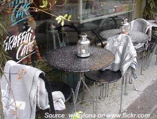
Across Waterloo Region, pedestrian and cycling safety provisions have been installed. Although some complaints have been made (D'Amato, 2020), motorists have adjusted to fewer lanes and people are returning to commercial hubs to access outdoor patios and outdoor shopping.
Leanage and Filion: Can the 15 minute walking city save intensification hubs in and beyond the COVID 19 pandemic? 15
With amenities and services within walkable distances, the 15 minute city reduces the need for automobile ownership and trips as it can often take longer to drive, park and access services than simply to walk or cycle door to door. The inconvenience and cost of driving and parking favours active travel and transit, perhaps more than other factors according to Chatman (2006). At larger scales, collectively this would decrease automobile reliance and road congestion. Making non motorized travel physically possible by way of shortening distances and travel times to amenities, and economically appealing to employers, households and individuals even for some trips, would offer benefits. This is critically important given the high cost of road expansion as Waterloo Region grows.
5.4.2.Improves urban capacity and efficiencies

Building, operating and maintaining roads is expensive for municipalities and require a significant amount of land and ongoing expenditures that could be used more efficiently (NACTO, 2013 and 2016) to generate higher value land uses like housing to meet community needs. A growing body of research demonstrates that expanding lanes induces vehicle miles traveled, i.e. demand that leads to more congestion and delays (Cervero, 2002 and 2016; Litman and Colman, 2001; Noland, 2001). Various studies show that comparatively, walking and cycling require the least amount of land per day and like transit, move the greatest number of people within a given amount of space (Bruun, 1992 ; Dimitrou, 1993; Kauffman, 2001; Meyer and Goimez Ibanez, 1983; NACTO, 2016).

If automobile use were to continue as it has in the past to meet the growth of urban populations, municipalities would need to expand hundreds of kilometres and spend billions in road infrastructure. In about 10 years, Waterloo Region is expected to gain 200,000 more people. If automobile use were to follow its growth trajectory, the road network would “need to expand by at least 500 additional lane kilometres of traffic by 2031, at a cost of $1.4 to $1.5 billion” (Region of Waterloo, 2011, p.1).
Leanage and Filion: Can the 15 minute walking city save intensification hubs in and beyond the COVID 19 pandemic? 16
Uptown Waterloo patio, Source: Pierre Filion Source: Neluka LeanageFigure 5: Time area requirements by mode (Litman, 2020, p.11 based on Bruun and Vuchic analysis, 1995)
Mode Average Speed Standing Area Moving Area Travel Area Parking Area Total Area Miles/Hr Ft 2 Ft 2 Ft 2 Minutes/Mile Ft 2 Minutes/Mile Ft 2 Minutes/Mile
Walking 3 10 30 400 400 Cycling 10 20 100 400 960 1,360
Bus Transit 15 20 20 53 53
Solo Driving (Arterial) 20 100 300 600 2,400 3,000
Solo Driving (Highway) 60 200 3,000 2,000 1,600 3,600
In their Transit Street Design Guide, the National Association of City Transportation Officials, NACTO, present a more inclusive method of gauging road capacity and performance. By measuring the throughput of people and accounting for the social, cultural, and economic activities served by transit, walking, and bicycling, it becomes clear that transit, walking and cycling substantially increase capacity of many types of roads that can aid in shifting modes and reducing road expansion (2016)

Figure 6: Designing to move people: The capacity of a single 10 foot lane (or equivalent width) by mode at peak conditions with normal operations (NACTO, 2016)
Leanage and Filion: Can the 15 minute walking city save intensification hubs in and beyond the COVID 19 pandemic? 17
5.4.3.Improves
road safety for everyone
By planning and designing for sustainable modes of transportation, the needs of the most vulnerable road users, i.e. people with impairments, pedestrians, cyclists, children and elders are evaluated. In addition to implementing accessibility, and separated walking and cycling facilities, many traffic calming interventions such as narrowing lane widths and reducing speed limits to 30km/hour translate into road safety improvements for everyone including motorists (Marshall and Garrick, 2011) On going revisions to road engineering level of service (LOS) standards to evaluate and increase servicing for non motorized users help to ensure the performance of road systems address non motorized users (Asadi Shekari et al., 2013; Dipanjan, et al., 2020) Modelled after Swedish safe systems principles, Vision Zero addresses mobility and, on another hand, re balances the priority and functions of streets from automobile flow to making safe places for people.
5.5. The 15 minute city supports transit recovery
5.5.1.Types of mobility responses to COVID
In some cities, particularly smaller ones, transit may take years to recover from COVID 19 until several changes occur: travel restrictions are lifted, agency staff and service levels return, telework and telelearning drops, there is public confidence in transit health and safety protocols to prevent transmission, and a vaccine is effective. These changes operate at different scales and with different actors holding a range of knowledge and perceptions making them complex and gradual. In the meantime, alternative means of travel are imperative for front line workers, transit reliant demographics, accessing essential services and family caregiving. Alternatives for non essential workers and social trips are needed next. There are four primary travel responses with the absence or fear of transit: reduce/stop transit use, use an automobile (owned, rented, shared/taxi), use non motorized modes of transportation (on foot, bicycle, scooter, etc.) and remove need for travel beyond short distances. Further, these responses could be permanent, temporary or combined affecting transit’s short and long term trajectory.
5.5.2.Worst case: automobile rebound
The worst scenario for cities managing their growth with transit oriented intensification is permanent deviation away from transit and replacement of transit trips with a personally owned automobile. In large North American metropoles where ridership was high before the coronavirus, return to transit is showing signs of recovery (TransLink, 2020; Passifiume, 2020). For smaller, dispersed or transit emergent cities already registering high automobile modal share, expensive road costs and population growth, losing riders once amenable to transit to the automobile would create yet another significant hurdle. Research on transit service disruptions show mode choice can be affected immediately causing spikes in traffic congestion from pick ups and drop offs (Blumstein and Miller, 1983) and longer term, permanent shifts to other modes of travel can occur with multiple days of non service (New Zealand Ministry of Transportation, 2013).
During the coronavirus lockdown, avoidance of public transit was strong, demand for parking was expected to rise due to more driving (Elstein, 2020) and micromobility alternatives were commonly sought (New York Times, 2020a). Edmunds (2020) described “an unprecedent, historical shift” whereby used vehicle prices rose considerably. In a July 2020 consumer survey, after lockdowns were lifted, the intent to buy an automobile was returning, consumers planned to use private cars for more intercity
Leanage and Filion: Can the 15 minute walking city save intensification hubs in and beyond the COVID 19 pandemic? 18
travel and to “connect with the outside world in a safe way, such as for drive in movie theaters” (Furcher et al.). The sooner service and perception gaps left by transit can be filled with sustainable modes of transportation, the automobile’s return can be lessened.

5.5.3.Best case: temporary AT substitutions and complementary long term
The best case would be temporary reduction in transit use substituted with active transportation until in person work resumes. Since transit entails walking or cycling at its beginning or end, these three modes of travel are part of the same travel continuum requiring coordination and enabling fluid exchange along the complete journey. Pedestrians routinely extend walking distances to reach major destinations, higher order transit, for pleasure, exercise and for multi purpose journeys (Morency et al., 2011; Hanson, 1980). Switching to transit in colder and wetter periods is commonplace for many Toronto cyclists (Nahal and Mitra, 2018) and so is the avoidance of peak times (Singleton and Clifton, 2014).
Similarly, transit and active transportation can form a symbiotic relationship in a pandemic. With countless North American cities reporting dramatic declines in transit alongside growth in walking and cycling after COVID 19 lockdown interventions (Apple, 2020; CBC, 2020; Google, 2020; Schwedhelm, 2020; Transit, 2020), cities have added new supportive facilities including restriction to automobiles (Beresford, 2020; Geary, 2020; Javed, 2020; O’Sullivan, 2020).

With service disruptions, walking and cycling could replace a former transit trip entirely or partially, e.g. cycling for the same journey or walking further to catch a primary transit departure avoiding the feeder connection. Or people could stay within their neighbourhood until transit service and in person work resumes avoiding any distance travelling. Substitutability depends on factors such as the presence of walking and cycling infrastructure, a pedestrian friendly built environment, the propensity to drive, weather and demographics such as age (Piatkowski et al., 2015; Saelens et al., 2003). Other research describes synergies between non motorized modes and transit use when planned as complementary and interchangeable (Krizek and Stonebraker, 2010; Nam et al., 2018; Singleton and Clifton, 2014).
Leanage and Filion: Can the 15 minute walking city save intensification hubs in and beyond the COVID 19 pandemic? 19
Uptown Waterloo, Source: Pierre Filion Waterloo, Source: Pierre Filion Uptown Waterloo, Source: Pierre FilionIn an environment that is planned properly, active transportation can be associated with post pandemic public transit recovery. While walking is made the dominant mode for an increased local concentration of activities within an intensified environment, it can feed into public transit for longer journeys. Likewise, cycling can interface with transit for long journeys. The danger we face in present pandemic circumstances is that former transit users may shift to the automobile. When this happens, it will be difficult to bring them back to public transit. If instead they rely on walking and cycling, the return to transit will be easier.
5.6. Intensification in the 15 minute walking city
To make TOD or POD work requires intensification of people and activities Maintaining intensification objectives at a 15 minute walking neighbourhood scale entails prioritizing a few key interventions such as mixed use and alternate forms of density, safe active transportation infrastructure (described above) and neighbourhood public realm animation with attention to winter designs, practices and programming
5.6.1. Mixed use and different forms of density
Major commercial and employment land uses are typically zoned in central business districts or suburban shopping and employment parks. In TODs, a mix of commercial, employment and residential land uses in sufficient number and combination are zoned to maximize transit ridership potential and deliver higher numbers of employees and residents to use amenities, as outlined in Ontario’s smart growth strategy by jobs and people per hectare Ontario 2017 [2006]). Waterloo Region planned to concentrate 68,000 residents and 110,000 jobs within 600 meters of rapid transit stations by 2031. Without adding more and alternative forms of density and mixed activities to neighbourhoods, achieving the 15 minute walking city will be a challenge.
With the coronavirus, many firms rapidly adapted to working from home conditions and found that productivity was just as high without expensive central locations and having to retrofit workspaces under uncertain viral transmission conditions. As a result, major firms in the financial and tech sectors shifted to telework permanently and gave up costly downtown office spaces. Concurrently, all levels of education shifted to online delivery into homes and student rooms. Should telework and telelearning remain at high or even moderate enough levels there will be an immediate double impact with long term implications. The growing importance of working, studying and recreating from home generates vacant commercial space in intensification areas and employment parks.
5.6.1.1.
Adding uses and density in and around lower density neighbourhoods
With reductions in transit services and riders, ever increasing online shopping and greater telework and tele learning, neighbourhoods and homes have become central to supplying and consuming knowledge, amenities, services and programs. Once the domain of family life, homes and neighbourhoods need to adapt.
While density and diversity of activities are planned to increase within 5 to 10 minute walking areas around transit hubs and stops in intensification hubs, the 15 minute city catchment area is stretched across a larger spatial scale in order to satisfy both transit and local neighbourhood destination walking. This means increasing density of present day lower density residential neighbourhoods. Zoning would need adjustment in order to add density at the edge of such neighbourhoods, along neighbourhood
Leanage and Filion: Can the 15 minute walking city save intensification hubs in and beyond the COVID 19 pandemic? 20
main streets and atop strip plazas that were once zoned for small retail and local business, medical and health offices, and restaurants.
To deliver density comparable to that of TODs, PODs do not need to rely exclusively on presently popular clusters of podium style high rise buildings for office and residential. Rather, they can intensify and mix different forms of residential density and a sufficient number of amenities. Residential density could be integrated into neighbourhoods by way of low to mid rise buildings, stacked townhouses and row housing referred to collectively as the missing middle. Used throughout Scandinavian countries, mid rise residential buildings can deliver high residential density that is also well suited to walking.

The design of residential buildings would also need altering whether in new developments or retrofitting existing buildings. To accommodate more people working and learning from home, residential units would need reconfiguration for home office space with separate or new types of ventilation systems. New forms of live work buildings and co working spaces can also increase density of people and jobs while maintaining physical distance and supporting work locally in neighbourhoods.
Teleworkers and tele earners will need access to local amenities within walkable distances in the 15 minute city. To accommodate physical distancing, local indoor amenities could be formatted as small, flexible spaces for indoor/outdoor activities such as pop up take out food establishments, food trucks, brick and mortar retail supporting online shopping and pickup, patios, small maker spaces. Cities providing secure, public Wi Fi would enable opportunities for working and learning outside.
Leanage and Filion: Can the 15 minute walking city save intensification hubs in and beyond the COVID 19 pandemic? 21
High density Swedish mid rise example, Source: Lindbäcks Group AB5.6.1.2. Shifting uses and formats in intensification areas
TODs must adapt to vacant employment and commercial spaces. Current commercial zoning may not allow residential uses or may be quite restrictive as to the types of activities permitted. With uncertainty around aerosol transmission and contribution of commercial grade ventilation systems in transmission, flexibility in occupancy levels and uses is needed. One consideration could be to allow larger sized residential use units inside commercial buildings and redesign such spaces with flexibility and creativity so that they can be reformatted later to commercial and employment spaces. With incentives, there is potential to integrate inclusionary housing that under normal circumstances would be less appealing to commercial owners. Other types of activities that add or keep people in intensification areas could include new types of smaller learning spaces across age groups, as well as creative spaces for artists, innovators and entrepreneurs.
Residents in high rise condominiums in intensification areas chose trading off interior physical space in order to live close to urban centres, jobs, amenities, culture and entertainment. COVID 19 reveals that without such jobs and amenities, the appeal of these developments is reduced. Meanwhile, rural realtors posted high sales to urban dwellers opting to give up their homes and apartments in favour of cottages or year round dwellings outside of cities (Goldfinger, 2020). Without the need to access employment by transit and reduced hospitality, entertainment and shopping amenities, they seek alternatives to urban living. The provision of walking, cycling and other public realm facilities and programming are critically needed to bring back quality of life in dense urban areas.

5.6.2.Public realm animation
Pedestrians naturally animate the public realm by the very nature of being outdoor, walking, standing, stopping and talking People tend to attract other people and even with COVID 19 physical distancing and fears of contagion from other people, our social nature is difficult to overcome. Public health protocols have limited gatherings in March 2020 to up to five people in the same household and family,
Leanage and Filion: Can the 15 minute walking city save intensification hubs in and beyond the COVID 19 pandemic?then later as infection rates declined in Waterloo Region and Ontario by June 2020, up to 10 people in social bubbles and up to 50 people gathering outdoors with physical distancing. Collectively, as we learn the benefits of masks in preventing transmission, mandatory mask by laws in indoor public spaces provide some comfort. In outdoor public spaces, though not required, some people wear masks for protection and physical distancing practices are still required.
With walking as the basis of the 15 minute city, the goal is for people to meet their daily needs using active travel modes. But pedestrians need to be attracted to the public realm and pedestrian activities must be generated i.e., they don’t happen magically. On the one hand, encouraging more people to use public spaces may be counter intuitive during a viral pandemic and may generate public health concerns if people were not to comply with or not able to respect physical distancing and gathering limits in the public realm. On the other hand, as northern countries grow colder as summer ends, the tendency for people to shift activities indoors could fuel contagion, as the risks of viral transmission is known to be greater indoors where droplets can concentrate and linger longer (Levenson, 2020), the tendency for people to shift activities indoors could prove to be much worse. With uncertainty surrounding aerosol transmission and indoor ventilation systems, promoting outdoor activities with gathering limits can continue to offer safer spaces than indoors.
5.6.2.1. Generating pedestrian activity Generating walking and pedestrian activities requires addressing four dimensions according to Filion et al. (2018): multifunctionality based in a diversity of land uses, pedestrian friendly built environment conditions, temporal factors (e.g., hours of operation), and clustering rather than dispersion of activities. Together, these motivate people to walk to and stay engaged in the public realm, animate spaces with their presence and involve themselves in various activities such as shopping, eating at restaurants, and so on throughout the day and night.
Neighbourhoods around TODs (and along Waterloo’s Central Transit Corridor) can be ideal locations to animate the public realm because residents already have a place based connection, perhaps an affinity with neighbours and spend considerable time in their homes and neighbourhoods especially due to COVID 19. Challenges with animating the public realm to generate pedestrian activity are different in lower density neighbourhoods than in transit oriented hubs. TODs have or will have higher residential density allowing to deliver sufficient numbers of people to animate their public realm. They have also been designed for multifunctionality resulting in a mix of nearby amenities accessible within short walking distances and times. Stimulating street level retail and hospitality can however be difficult to maintain even in TODs. This is especially the case given the economic consequences of COVID 19. Lower density neighbourhoods surrounding TODs are largely single use residential places with a smattering of local businesses along main streets: convenience stores, pharmacies and a few restaurants catering to locals. In these locations, there is insufficient population density to naturally animate spaces hence the need to increase residential density and diversify land uses across the 15 minute walking zone.
5.6.2.2. Hyper local 24/7 and winter city orientation
Another key means to animate the public realm and generate pedestrian activity is to offer programming and activities throughout the day and night. With more people in their neighbourhoods, engaging them after working hours and on weekends does not require any travel. All that is needed is a short stroll to local activities and events. There is a significant opportunity to provide hyper local activities to strengthen sense of social belonging during particularly isolating pandemic times. Where
Leanage and Filion: Can the 15 minute walking city save intensification hubs in and beyond the COVID 19 pandemic? 23
many downtowns have struggled to attract people in the evening hours and weekends, the 15 minute neighbourhood has a built in local population.
When weather is sunny and temperate, walking and recreating outdoors is pleasant. Summer programming is commonplace across municipalities featuring outdoor markets, entertainment like music and arts festivals, and fitness. All these activities do well to animate the public realm. The appeal of outdoor learning camps due to fear of COVID 19 is an example of an adaptation to the pandemic that animates public space. Some parents have registered their children this autumn for outdoor, experiential learning over in person, indoor classroom settings (Engel, 2020).
Colder temperatures, rain and snow, unless mitigated, will make walking and spending time outside difficult, except for winter sports enthusiasts. It is common for pedestrians and cyclists to switch to transit when the weather is hot or cold can be a major barrier to active travel and recreation for adults and children (Ahlport, et al., 2008; Nahal and Mitra, 2018; Lee et al., 2013; Winters et al., 2011; Iwińska et al., 2018).
With the cold and flu season arriving in the next two months, promoting outdoor activities could act as a protective and preventive response to warding off the seasonal illnesses as well as COVID 19. Lessons from parts of Canada and Scandinavia show us that winter cities and designs work by shifting attitudes, behaviours, designs, practices and being creative with programming in which municipalities have a strong role to play.
There are many examples of successful winter city designs and practices already in use. Some municipalities assume responsibility of and prioritize snow and ice clearing on sidewalks and cycling facilities, as well as promote year round active and safe routes to school. Communities that embrace winter cities create winter programming, offer public realm and street level food, art and recreational activities (e.g., snow sculptures, outdoor hockey), make tobogganing hills safe and do not plow trails to enable neighbourhood cross country skiing and snow shoeing. Municipalities could also allow and incent winter patios for neighbourhood restaurants and cafés with shelters, blankets and heaters
Figure 7: Winter design ideas for a community park, City of Fort St. John, British Columbia
Leanage and Filion: Can the 15 minute walking city save intensification hubs in and beyond the COVID 19 pandemic? 25

6. Comparing TOD and POD
There are many similarities and symbioses between transit and pedestrian oriented development as well as important differences. Both stimulate sustainable, efficient land use transportation interactions supportive of intensification and growth management, climate change mitigation, healthy urban lifestyles, congestion relief, equity and safer roads. In many respects, TOD and POD are complementary.
6.1. Transit-pedestrian interfaces and complementarity
While transit depends on pedestrians, the reverse is not true; transit requires a pedestrian interface to coordinate transfer between modes throughout the journey. On their own, pedestrians are in control of their movement, time and direction, unencumbered by transit frequencies, routes and exchanges. The two share related catchment areas however there is more willingness to walk longer to other destinations than transit stops, thereby expanding the pedestrian oriented developable area. Transit does indeed carry more people over longer distances more quickly to connect to local, intercity, inter regional and international hubs as well as to deliver pedestrians at the micro scale. The pedestrian scale operates locally and comparatively, at a microcosm, distributing foot traffic to animate the public realm and connect patrons to amenities
Under present and future COVID 19 transit scenarios, TOD and POD are complementary: walking and cycling fill gaps temporarily and safely until transit, ridership, staffing and servicing resume to pre COVID levels. Especially in cities outside major metropolitan areas, promoting walking and cycling could set up conditions for future transit ridership preventing the adoption of automobile reliance as an alternative to transit during the pandemic.
6.2. Scale
Transit oriented development is commonly based around 5 to 10 minute walks to reach stations and stops. Local transit facilitates longer travel distances to local hubs, across the city and connections to intercity and regional travel.
In PODs, although the walking times and distances are extended to 15 minutes and up to 30 minutes, the physical effort required to walk, limits coverage to 3km for most people. With adequate supply of facilities such as benches and shade, and overhead umbrellas or stoas, pedestrians can rest as needed.
6.3. Mixed use and residential density
Transit oriented, intensification is zoned for high density commercial, residential and employment land use mix to build multifunctional centres intended to attract business, residents and visitors, and a buzz of street level activity. In pedestrian oriented neighbourhoods, the predominant use is residential with retail limited variety stores, pizza joints, pharmacies and dry cleaning intended to service locals. Higher densities are achievable in POD by increasing residential density and fostering creativity and flexibility to accommodate different types and forms of commercial uses
Leanage and Filion: Can the 15 minute walking city save intensification hubs in and beyond the COVID 19 pandemic? 26
500m


TOD POD
6.4. Costs and coordination
2000m/30 min 1000m/15 min 800m/10 min
Transit oriented development and POD provide more affordable mobility options, including cycling, compared to autocentric land use patterns that make mobility without a car difficult. Both are aligned with existing Ontario municipal, regional and provincial growth management, intensification and accessibility objectives, and current political direction. However, investment, planning, coordination, implementation horizons differ dramatically. Transit infrastructure requires coordinating multiple levels of government approvals to obtain substantial financing and proceed with long term construction. Sidewalk infrastructure is required in development approvals, repaired and replaced through annual capital budgets. For cycling facilities, costs are relatively small compared to transit and roads, and approvals can take place as quickly or slowly as politically feasible as we’ve seen during COVID 19 lockdowns across North America
6.5. Delivery time, disruption and operations
Another important distinction is that to achieve TOD and generate population and building density, fixed light and heavy rail or underground systems are needed, which during construction, disrupt nearby business, residents and traffic over years. Walking and cycling infrastructure can be permanent or temporary with little construction and disruption to business and residents, and minimal traffic disruption that can dissipate over time. Staffing, maintenance and passenger information systems needed to run transit networks are other operation and management costs not required in the case of pedestrian and cycling networks.
Leanage and Filion: Can the 15 minute walking city save intensification hubs in and beyond the COVID 19 pandemic? 27
 Figure 8: TOD and POD walking zones around Uptown Waterloo’s Urban Growth Centre
6.6. Indoors and outdoors
Pedestrian oriented developments rely on walking outdoors in which pedestrians are engaged primarily in the public realm, providing a safer environment from viral transmission. For TODs, there is both indoor and outdoor activity: stations and vehicles are indoors where physical distancing can be challenging and contain high contact touch points and ventilation systems for air conditioning and heating. Transit shelters come in various forms, some more open than others to provide air flow but usually have touch points. Both TODs and PODs can be multi seasonal however, PODs need climate supports and design to protect from poor weather or mitigate the conditions e.g., wind and rain.
6.7. 24/7hour cycle
TODs can suffer from lack of activity found in traditional downtowns of small to mid size cities. Transit services catering to the daytime worker often reduce services after peak hours making trips home in the evening and nighttime a challenge. Even on weekends, transit service can be reduced. It is one reason people choose to drive In PODs and especially with COVID 19, more people reside and work in their home neighbourhoods. This makes them available to 24/7 hyperlocal activities, creating opportunities for engagement in the public realm.
Figure 9: Key differences between transit and pedestrian oriented development
400m+ ranges, 5 60 minutes
< 3km, 5 30 minutes Regional, intercity, local hubs Neighbourhood, local hubs $$$$$$ $
Long planning installation ridership horizon Quick planning installation shift horizon Front line, operations and management staff Limited staff, no front line High density Moderate + high density Commercial residential employment mix Creative commercial flexible residential mix Mostly daytime, expanding night time activities 24/7 hyperlocal activities Indoor activities + public realm
Multi season, outdoor activities in public realm
7. Adapting intensification model with POD in Waterloo Region’s Central Transit Corridor
Of course, Waterloo Region is not Paris or a Chinese megacity where the 15 minute city concept has achieved the most prominence. Paris posts an extremely high residential density in all its neighbourhoods so in this city the 15 minute walking strategy relies primarily on a redistribution of non residential land uses. The other side of this strategy in such a dense city is the allocation of more space to pedestrians. In Waterloo Region, it would be a matter of creating at once an ecosystem of activities catering to nearby residents within a stimulating pedestrian environment, on the one hand, and high density housing, on the other. These two sides of the strategy would be mutually reinforcing. Whereas until now the major attractor for density in Waterloo Region was the presence of the LRT, thus leading to TODs, in the present case, it would be an activity rich pedestrian environment. Such density hubs
Leanage and Filion: Can the 15 minute walking city save intensification hubs in and beyond the COVID 19 pandemic? 28
could then be referred to as PODs, pedestrian oriented developments. POD residents would be willing to trade off some personal living space so as to be able to live much of their life close to home and rely on walking for most of their journeys.
For Waterloo Region to adapt its TOD intensification model to POD in its Central Transit Corridor and surrounding neighbourhoods, we recommend focusing on four key actions: flex TOD, animate the public realm, prioritize walking and cycling and track changes. These are appended as a copy of our symposium presentation (Appendix A).
8. Conclusion
The conclusion synthesizes the main arguments of the white paper. In brief, the paper has proposed a 15 minute city walking environment (referred to here as POD, pedestrian oriented development) as an alternative to TODs as a way to catalyze and justify urban intensification.
The pandemic has severely hampered public transit due to apprehension about being in enclosed spaces with strangers, the shift to working from home and online education. It follows that in present times, public transit does not foster anything like the accessibility advantages it procured before the pandemic. There is a risk that in the post pandemic period if current home based work and education trends persist, less people will use public transit, which will result in service cuts and reduced transit impact on urban development.
Over the last decades, TODs have been a (if not the) prominent model of urban intensification. One reason for the popularity of this formula is that by providing accessible, quality public transit conducive to high density development, people sacrificing some personal living space for density in such developments generate ridership for that public transit. Hence a mutually beneficial relationship between quality public transit and high density development.
Density does not work well on its own, especially when it is scattered rather than clustered. In scattered configurations it is difficult for density to materialize the advantages like high accessibility locations, nearby urban amenities and a stimulating walking environment. Hence the popularity of TODs and the different scales at which they take form, from large downtown areas to regional sub centres and small medium density residential developments.
With the COVID 19 pandemic induced steep decline in ridership, public transit is presently unable to play its TOD catalyst role and cannot, as in the past, be used as the lynchpin of intensification strategies. Does this situation challenge intensification strategies? Will it translate into an inevitable shift to low density dispersed forms of development? The white paper has proposed an alternative to the prominent role public transit has played over the last decades in urban intensification strategies. Indeed, TOD advanced a different way to link density to urban advantages, so as to make density more attractive and justify urban intensification. Our alternative, a form of pedestrian oriented development inspired by the 15 minute city model is considered now across the world as an urban development model. The 15 minute city involves bringing daily activities within residential areas in order to increase walking and cycling and thereby reduce reliance on other modes. Walking and cycling can play a strong role in lessening the pandemic induced diversion from public transit to car use. If reliance on the car increases and the pandemic provides another type of induced demand for car travel, it becomes more difficult to allocate additional space to pedestrians to encourage safe distance walking while distancing in order to lessen dependence on the car. The same reasoning applies to the accommodation of cyclists.
Leanage and Filion: Can the 15 minute walking city save intensification hubs in and beyond the COVID 19 pandemic? 29
We believe that this model is not only a passing adaptation to the pandemic. It also has the potential to provide a new enduring way of intensifying, managing growth and providing many planning objectives such as health, sustainability, active travel, safety, accessibility, efficiency, and quality of life. As a POD, the 15 minute city can indeed provide a rich, animated walking environment that attracts high density development and puts people out of doors, in the public realm and in streets, that in turn support businesses and their recovery. A greater reliance on active transportation in the neighbourhood means less time spent travelling in cars and transit, and opportunities for community building
A vital and timely rationale for the POD model is that with targeted public health and municipal practices and programming to promote fall and winter activities, residents may be able to reduce their indoor exposure to the coronavirus by spending more time outside. The social, physical and mental health benefits of outdoor winter activity during future stressful wave(s) of COVID 19 would build personal, household and community resilience. The emphasis this model places on walking means greater attention is needed to activate both people and the environment. New ways, especially winter city thinking, must be applied to make the outdoors safe, welcoming and comfortable even when it is cold or wet. In Section 5.6, Hyper local 24/7 and winter city orientation, we identify examples from snow clearing to winter cafés. Sidewalk Labs proposed means of increasing the time people can comfortably be outdoors by 30% for the Toronto waterfront site through the use of, for example, building raincoats and infrastructure heating systems.
As part of an urban rescaling process, if a significant redistribution of activities were pulled out of large metropolitan downtowns to the edges of the 15 minute city without corresponding commercial adaptions and retrofits in the core that we begin to explore in Section 5.6, Intensification in the 15 minute walking city, these downtowns could suffer. The loss of workers in large downtowns and their patronage to its retailing, hospitality and entertainment activities need consideration. In smaller metropolitan regions, like Waterloo, we expect less impact due to smaller downtown workforces and the spatial arrangement of the 15 minute city neighbourhood to correspond better with TOD hubs
We anticipate obstacles to implementing the POD model. First, large manufacturing or specialized workplaces or large format shopping are not suited to the 15 minute walking neighbourhood scale. Second, with growth in online shopping and home delivery, some brick and mortar businesses converted to webstores and may not return so new models of store pick up and different types of stores will be needed ensuring well designed facades Third, in lower density places like Waterloo Region, POD initiatives must be bi directional. They must at once generate the density required to enable the presence of activities in intensified neighbourhoods and provide an activity scene and animated pedestrian environment with the potential of making POD high density living attractive. Lastly, confrontations to implementing safe, active transportation infrastructure are likely as change during already uncertain times may raise criticisms.
It is worth engaging in efforts to overcome these obstacles, for PODs can satisfy short term pandemic challenges while compensating for the weaknesses in TOD by stimulating and building a local activity. The 15 minute city and TOD should be viewed as complementary by enhancing each other’s features and thereby together providing stronger incentives for intensification. The emphasis can be on public transit or the walking environment according to the circumstances. The point made in the white paper is that the pandemic situation calls for a recalibration of intensification strategies in favour of the POD, rather than TOD model. Since PODs are more flexible than TODs, cost effective as they do not require the level of infrastructure to support quality public transit and still provide accessibility and efficiencies
Leanage and Filion: Can the 15 minute walking city save intensification hubs in and beyond the COVID 19 pandemic? 30
to large numbers of people. We focused on PODs along Waterloo Region’s Central Transit Corridor however, they could also used to retrofit suburban neighbourhoods.
Acknowledgements
The authors would like to thank the Region of Waterloo and the Faculty of Environment at the University of Waterloo for rapidly organizing cross disciplinary researchers and a symposium to examine the implications of COVID 19 on planning. Symposium participants also prompted researchers with questions that aided the analysis. Funding support was provided by the Region of Waterloo and the Faculty of Environment.
References
Ahlport, K. N., Linnan, L., Vaughn, A., Evenson, K. R., & Ward, D. S. (2008). Barriers to and facilitators of walking and bicycling to school: formative results from the non motorized travel study. Health Education & Behavior, 35(2), 221 244.
Aguillar, B. (2020, March 14). Metrolinx reducing GO Transit service due to low ridership amid COVID 19 pandemic. Retrieved from https://toronto.ctvnews.ca/metrolinx reducing go transit service due to low ridership amid covid 19 pandemic 1.4852951
Apple. (2020). Mobility trends. Retrieved on May 11, 2020 at https://www.apple.com/covid19/mobility
Badland, H., & Schofield, G. (2005). “Transport, urban design, and physical activity: an evidence based update”, Transportation Research Part D: Transport and Environment 10: 177 196.
Barthel, M. (2020, April 21). 'They're Scared, But They're Out There': Transportation Workers Are Still Clocking In As Coronavirus Spreads. Retrieved from https://wamu.org/story/20/03/18/theyre scared but theyre out there transportation workers are still clocking in as coronavirus spreads/ Beresford, C. (2020, March 31). Making Room for Social Distancing, Some City Streets Go Car Free. https://www.caranddriver.com/news/a31994797/social distancing city streets ban cars/ Bergum, C. and Beaubien, L. (2009). Smart growth and winter city design. City of St. Albert. http://wintercities.com/Resources/articles/Smart%20Growth%20and%20winter%20city%20design.pdf
Berkeley Jr. (2020, July 24). Dr. Fauci says coronavirus vaccine likely won't be 'widely' available until several months into 2021. Retrieved July 25, 2020, from https://www.cnbc.com/2020/07/24/dr fauci says coronavirus vaccine likely wont be widely available until months into 2021.html
Beyer, K. M., Kaltenbach, A., Szabo, A., Bogar, S., Nieto, F. J., & Malecki, K. M. (2014). Exposure to neighborhood green space and mental health: evidence from the survey of the health of Wisconsin. International journal of environmental research and public health, 11(3), 3453 3472.
Bickis, I. (2020, May 21). Shopify announces post office model, most staff to permanently work from home. Retrieved August 29, 2020, from https://www.cp24.com/news/shopify announces post office model most staff to permanently work from home 1.4948678
Leanage and Filion: Can the 15 minute walking city save intensification hubs in and beyond the COVID 19 pandemic? 31
Birch, E. L. (1980). Radburn and the american planning movement the persistence of an idea. Retrieved from https://repository.upenn.edu/cgi/viewcontent.cgi?article=1030&context=cplan_papers
Blumstein, A., & Miller, H. D. (1983). Making do: The effects of a mass transit strike on travel behavior.
Boer, R., Zheng, Y., Overton, A., Ridgeway, G.K., Cohen, D.A. (2007). Neighbourhood design and walking trips in ten US metropolitan areas. American Journal of Preventive Medicine, 32(4), 298 304, doi: 10.1016/j.amepre.2006.12.012. Transportation, 11(4), 361 382.
Bozikovic, A. (2020, April 02). City dwellers need room to breathe on the streets. Why is that so hard in Toronto? Retrieved from https://www.theglobeandmail.com/canada/toronto/article city dwellers need room to breathe on the streets why is that so hard/ Brosseau, L. (2020) Commentary: COVID 19 transmission message should be based on science. Minneapolis, MN: Center for Infectious Disease Research, University of Minnesota. https://www.tandfonline.com/doi/full/10.1080/01944363.2020.1777891
Bruun, E. C. (1992). Calculation and evaluation of the time area parameter for different transportation modes.
Bruun, E. C., & Vuchic, V. R. (1995). Time area concept: Development, meaning, and applications. Transportation Research Record, (1499).
CAA. (2013, February 15). Retrieved from https://www.caa.ca/caa provides real picture of annual driving costs/ Cassarino, M., & Setti, A. (2016). Complexity as key to designing cognitive friendly environments for older people. Frontiers in psychology, 7, 1329.
CBC News (2020a) “Business: Online shopping has doubled during the pandemic, Statistics Canada says”, CBC, July 24. https://www.cbc.ca/news/business/online shopping covid 19 1.566181
CBC News. (2020b, April 02). Will COVID 19 become a seasonal disease like the flu? It's too early to tell, experts say. Retrieved July 2, 2020, from https://www.cbc.ca/news/health/covid19 seasonal 1.5516685
Cervero, R. (2002). Built environments and mode choice: toward a normative framework. Transportation Research Part D: Transport and Environment, 7(4), 265 284.
Cervero, R. (2003). Road expansion, urban growth, and induced travel: A path analysis. Journal of the American Planning Association, 69(2), 145 163. Retrieved from https://escholarship.org/content/qt05x370hr/qt05x370hr.pdf
Cervero, R. (2006). Alternative approaches to modeling the travel demand impacts of smart growth. Journal of the American Planning Association, 72(3), 285 295.
Cervero, R. (2002). Induced travel demand: Research design, empirical evidence, and normative policies. Journal of Planning Literature, 17(1), 3 20. Retrieved from https://stuff.mit.edu/afs/athena/course/11/11.951/OldFiles/oldstuff/albacete/Course%20Reader/Trans portation/High Speed%20Tranist%20Literature%20Review/Cervero%202002.pdf
Leanage and Filion: Can the 15 minute walking city save intensification hubs in and beyond the COVID 19 pandemic? 32
Chatman, D. (2006). Transit oriented development and household travel: a study of California cities. Los Angeles: Institute of Transportation Studies, School of Public Affairs, University of California, Los Angeles. Retrieved from: https://www.researchgate.net/profile/Daniel_Chatman/publication/228391163_Transit oriented_Development_and_Household_Travel_A_Study_of_California_Cities/links/02e7e52616373408 15000000.pdf
Cervero, R. (2002), “Induced Travel Demand: Research Design,Empirical Evidence, and Normative Policies,” Journal of Planning Literature, Vol. 17, No.1, pp. 4 19.
City of Kitchener. (n.d.) Bike Kitchener. Retrieved from https://www.kitchener.ca/en/getting around/bike kitchener.aspx#
D’Amato, L. (2020, July 10). Those temporary bike lanes are not giving value for money. Retrieved from https://www.therecord.com/news/waterloo region/2020/07/10/those temporary bike lanes are not giving value for money.html
Dancer, S. J., Tang, J. W., Marr, L. C., Miller, S., Morawska, L., & Jimenez, J. L. (2020). Putting a balance on the aerosolization debate around SARS CoV 2. The Journal of hospital infection, 105(3), 569 570. https://doi.org/10.1016/j.jhin.2020.05.014
Davies, N., Cornes, C. and Sheriff, G. (2020, May 12). How major cities are trying to keep people walking and cycling. Retrieved from https://theconversation.com/how major cities are trying to keep people walking and cycling 137909
Dipanjan Nag, Arkopal Kishore Goswami, Ankit Gupta & Joy Sen (2020) Assessing urban sidewalk networks based on three constructs: a synthesis of pedestrian level of service literature, Transport Reviews, 40:2, 204 240, DOI: 10.1080/01441647.2019.1703841
Duany,A., Speck, J., Lydon, M. and E. Goffman. (2011) The Smart Growth Manual, Sustainability: Science, Practice and Policy, 7:2, 89 90, DOI: 10.1080/15487733.2011.11908078
Edmunds. (2020). Used vehicle prices are on the rise during the coronavirus pandemic. Retrieved from https://www.edmunds.com/industry/press/used vehicle prices are on the rise during the coronavirus pandemic according to edmunds.html
Elstein, A. (2020, May 7). COVID 19 could be a lifeline for garages if commuters ditch mass transit. Retrieved from https://www.crainsnewyork.com/transportation/covid 19 could be lifeline garages if commuters ditch mass transit
Engel, E. (2020, August 31). Forest school expands with influx of parents pursuing outdoor education for kids. Retrieved from https://www.collingwoodtoday.ca/local news/forest school expands with influx of parents pursuing outdoor education for kids 2676967
Eriksson, U., Arvidsson, D., Gebel, K., Ohlsson, H., & Sundquist, K. (2012). Walkability parameters, active transportation and objective physical activity: moderating and mediating effects of motor vehicle ownership in a cross sectional study. International Journal of Behavioral Nutrition and Physical Activity, 9(1), 123.
Leanage and Filion: Can the 15 minute walking city save intensification hubs in and beyond the COVID 19 pandemic? 33
Ewing, J. (2020, April 18). Growing calls to re open parks, expand streets to pedestrians amid COVID 19. https://www.ctvnews.ca/health/coronavirus/growing calls to re open parks expand streets to pedestrians amid covid 19 1.4901999
Ewing, L. (2020, May 23). Bike shop owners worry about supply as business booms amid COVID 19. Retrieved from https://globalnews.ca/news/6978435/coronavirus bike shop owners supply/
Ewing, R. and R. Cervero (2010) “Travel and the built environment: A meta analysis”, Journal of the American Planning Association 76: 265 294.
Ewing, R. and S. Hamidi (2017) Costs of Sprawl. New York: Routledge.
Ewing, R. and S. Handy. (2009). Measuring the unmeasurable: Urban design qualities related to walkability. Journal of Urban design, 14(1), 65 84.
Filion, P., Hoernig, H., Bunting, T., & Sands, G. (2004). The successful few: Healthy downtowns of small metropolitan regions. Journal of the American Planning Association, 70(3), 328 343.
Filion, P., T.E. Bunting and K. Warriner. (1999) “The Entrenchment of Urban Dispersion: Residential Location Patterns and Preferences in the Dispersed City”, Urban Studies 36, 1317 1347.
Filion, P., A. Kramer and G. Sands. (2016) “Recentralization as an Alternative to Urban Dispersion: Transformative Planning in a Neoliberal Context” International Journal of Urban and Regional Research 40: 658 678.
Filion, P., N. Leanage, M. Oviedo and S. Leger (2018) Achieving walkability in Urban Growth Centres: Final report to the Places to Grow Implementation Fund. Toronto: Government of Ontario, Growth Secretariat.
Filion, P., K. McSpurren and B. Appleby. (2006) “Wasted Density? The Impact of Toronto’s Residential Density Distribution Policies on Transit Use and Walking”, Environment and Planning A 38, 1367 1392.
Filion, P., Shipley, R., & Te, Z. (2007). Works Planners Read: Findings from a Canadian Survey. Canadian Journal of Urban Research, 16(1), 59 91. Retrieved August 22, 2020, from http://www.jstor.org/stable/26192545
Faass, J., Greenberg, M., & Lowrie, K. W. (2013). Defending a moving target: H1N1 preparedness training for the transit industry. Health promotion practice, 14(1), 24 29.
Flanagan, R. (2020, August 02). Can I catch COVID 19 on a train? New study explains which seats are riskiest. Retrieved from https://www.ctvnews.ca/health/coronavirus/can i catch covid 19 on a train new study explains which seats are riskiest 1.5048895
Frank, L. D., Andresen, M. A., & Schmid, T. L. (2004). Obesity relationships with community design, physical activity, and time spent in cars. American journal of preventive medicine, 27(2), 87 96.
Frank, L. D., Sallis, J. F., Conway, T. L., Chapman, J. E., Saelens, B. E., & Bachman, W. (2006). Many pathways from land use to health: associations between neighborhood walkability and active transportation, body mass index, and air quality. Journal of the American planning Association, 72(1), 75 87.
Leanage and Filion: Can the 15 minute walking city save intensification hubs in and beyond the COVID 19 pandemic? 34
Furcher, T., Grühn, B., Huber, I., & Tschiesner, A. (2020). How Consumers’ Behavior in Car Buying and Mobility is Changing amid COVID 19. Retrieved from https://www.mckinsey.com/business functions/marketing and sales/our insights/how consumers behavior in car buying and mobility changes amid covid 19
Geary, A. (2020, May 3). Why these advocates hope COVID 19 could lead to a more walkable, bikeable Winnipeg. CBC. https://www.cbc.ca/news/canada/manitoba/winnipeg pedestrian cyclist covid 19 1.5553283
Gehl, J. (1996). trans J. Koch. Life Between Buildings: Using Public Space. Copenhagen: Arkitektens Forlag.
Goetsch, H. and Peralta Quiros, T. (2020, August 07). COVID 19 creates new momentum for cycling and walking. We can't let it go to waste! Retrieved from https://blogs.worldbank.org/transport/covid 19 creates new momentum cycling and walking we cant let it go waste
Goldbaum, C. (2020, May 18). Thinking of Buying a Bike? Get Ready for a Very Long Wait. Retrieved from https://www.nytimes.com/2020/05/18/nyregion/bike shortage coronavirus.html
Goldfinger, D. (2020, May 28). 'Space is the new luxury': Could the coronavirus prompt an urban exodus in Ontario? Retrieved from https://globalnews.ca/news/6970856/ontario urban exodus coronavirus/
Google (2020, May 2). COVID 19 Community Mobility Report. Retrieved on May 11, 2020 at https://www.gstatic.com/covid19/mobility/2020 05 02_CA_Mobility_Report_en.pdf
Grand River Transit. (2020, 3 April). COVID 19 Transit service changes. Retrieved from https://www.grt.ca/Modules/News/index.aspx?feedId=bbee2b8e 91b6 4696 8c3d 481dbf28de8e,24b9d7cd 762a 4496 ad74 4e816cb9adc8,d23e5a74 6488 4978 9740 594267f59ea8,38cb3425 641c 49a2 a83b f03081ea8431,31820c97 a4b0 4704 ab8b 7c088247077a,69a9e0f5 98d5 4bcc 8f1e 5537cb4c997b&newsId=6f0a7b3f 3f78 4c8d b911 574e45524c5e
Hamidi, S., S. Sabouri and R. Ewing. (2020) “Does density aggravate the COVID 19 pandemic”, Journal of the American Planning Association https://www.tandfonline.com/doi/full/10.1080/01944363.2020.1777891
Handy, S.L. and K.L. Clifton. (2001) “Local shopping as a strategy for reducing automobile travel”, Transportation 28: 317 346.
Hanson, S. The importance of the multi purpose journey to work in urban travel behavior. Transportation 9, 229 248 (1980). https://doi.org/10.1007/BF00153866
Hess, P.M., A. Vernez Moudon, M.C. Snyder and K. Stanilov (1999) “Site design and pedestrian travel”, Transportation Research Record 1674: 9 19.
Hu, Winnie. (2020, March 14). A Surge in Biking to Avoid Crowded Trains in N.Y.C. The New York Times. https://www.nytimes.com/2020/03/14/nyregion/coronavirus nyc bike commute.html
Leanage and Filion: Can the 15 minute walking city save intensification hubs in and beyond the COVID 19 pandemic? 35
Ibes, D., Hirama, I., & Schuyler, C. (2018). Greenspace ecotherapy interventions: The stress reduction potential of green micro breaks integrating nature connection and mind body skills. Ecopsychology, 10(3), 137 150.
Institute for Competitiveness and Prosperity. (2016). Clusters in Ontario: Creating an ecosystem for prosperity. Retrieved from https://www.competeprosper.ca/uploads/WP26_clusters_rev.pdf
Iwińska, K., Blicharska, M., Pierotti, L., Tainio, M., & de Nazelle, A. (2018). Cycling in Warsaw, Poland Perceived enablers and barriers according to cyclists and non cyclists. Transportation research part A: policy and practice, 113, 291 301.
Jacobs, J. (1961). 1 961, The Death and Life of Great American Cities. New York: Vintage. Javed, N. (2020, April 22). Brampton does what Toronto won’t do: closes road lanes to make space for pedestrians. https://www.thestar.com/news/gta/2020/04/22/brampton does what toronto wont do closes road lanes to make space for pedestrians.html
Keefe, K. (2020, April 21). As 1918 shows, railroads have been through this before. Retrieved from https://www.railwayage.com/passenger/intercity/as 1918 shows railroads have been through this before/
Kriit, H. K., Williams, J. S., Lindholm, L., Forsberg, B., & Sommar, J. N. (2019). Health economic assessment of a scenario to promote bicycling as active transport in Stockholm, Sweden. BMJ open, 9(9), e030466. Retrieved from https://bmjopen.bmj.com/content/bmjopen/9/9/e030466.full.pdf
Krizek, K. J., & Stonebraker, E. W. (2010). Bicycling and Transit: A Marriage Unrealized. Transportation Research Record, 2144(1), 161 167. https://doi.org/10.3141/2144 18
Krueger, A. (2020, July 17). Citi Bikes, Scooters, Skateboards: Anything but the Subway. Retrieved from https://www.nytimes.com/2020/07/17/nyregion/coronavirus subways spread nyc.html
Lee, C., Ory, M. G., Yoon, J., & Forjuoh, S. N. (2013). Neighborhood walking among overweight and obese adults: age variations in barriers and motivators. Journal of community health, 38(1), 12 22.
Levenson, M., Parker pope, T., & Gorman, J. (2020, May 15). What We Know About Your Chances of Catching the Virus Outdoors. Retrieved from https://www.nytimes.com/2020/05/15/us/coronavirus what to do outside.html
Lewis, D. (2020, July 08). Mounting evidence suggests coronavirus is airborne but health advice has not caught up. Retrieved July 14, 2020, from https://www.nature.com/articles/d41586 020 02058 1
Litman, T. (2020). Generated traffic and induced travel: Implications for transport planning. Victoria Transport Policy Institute. Retrieved from https://www.vtpi.org/gentraf.pdf
Litman, T and S. Colman. (2001). Generated traffic: Implications for transport planning. ITE Journal, 71(4), 38 47.
Maogui Hu, Hui Lin, Jinfeng Wang, Chengdong Xu, Andrew J Tatem, Bin Meng, Xin Zhang, Yifeng Liu, Pengda Wang, Guizhen Wu, Haiyong Xie, Shengjie Lai, The risk of COVID 19 transmission in train passengers: an epidemiological and modelling study, Clinical Infectious Diseases, , ciaa1057, https://doi.org/10.1093/cid/ciaa1057
Leanage and Filion: Can the 15 minute walking city save intensification hubs in and beyond the COVID 19 pandemic? 36
Marshall, W. E., & Garrick, N. W. (2011). Research Article: Evidence on Why Bike Friendly Cities Are Safer for All Road Users. Environmental Practice, 13(1), 16 27. doi:10.1017/s1466046610000566
Mayo Clinic. (2020, August 05). Stay safe, have fun during the COVID 19 pandemic. Retrieved from https://www.mayoclinic.org/diseases conditions/coronavirus/in depth/safe activities during covid19/art 20489385
Mizdrak, A., Blakely, T., Cleghorn, C. L., & Cobiac, L. J. (2019). Potential of active transport to improve health, reduce healthcare costs, and reduce greenhouse gas emissions: A modelling study. PloS one, 14(7), e0219316. Retrieved from https://journals.plos.org/plosone/article?id=10.1371/journal.pone.0219316
Montgomery, C. (2013). Happy city: Transforming our lives through urban design. Macmillan. Moore, O. (2020, March 12). Toronto's transit unions demand better health precautions as coronavirus spreads. Retrieved from https://www.theglobeandmail.com/canada/toronto/article torontos transit unions demand better health precautions as/
Morency, P., Plante, C., Dubé, A. S., Goudreau, S., Morency, C., Bourbonnais, P. L., ... & Bhowmik, T. (2020). The potential impacts of urban and transit planning scenarios for 2031 on car use and active transportation in a metropolitan area. International journal of environmental research and public health, 17(14), 5061.
Morency, C., Paez, A., Roorda, M. J., Mercado, R., & Farber, S. (2011). Distance traveled in three Canadian cities: Spatial analysis from the perspective of vulnerable population segments. Journal of Transport Geography, 19(1), 39 50.
Moreno, C. (2019) The 15 Minutes City: For a new chrono urbanism. http://www.moreno web.net/the 15 minutes city for a new chrono urbanism pr carlos moreno/ Morris, E.A., Guerra, E. Mood and mode: does how we travel affect how we feel?. Transportation 42, 25 43 (2015). https://doi.org/10.1007/s11116 014 9521 x
NACTO (National Association of City Transportation Officials). (2013). Urban street design guide. Island Press.
NACTO (National Association of City Transportation Officials). (2016). Transit Street Design Guide. Island Press.
Nahal, Tamara & Mitra, Raktim. (2018). Facilitators and barriers to winter cycling: Case study of a downtown university in Toronto, Canada. Journal of Transport & Health. 10. 10.1016/j.jth.2018.05.012.
Nam, D., Yang, D., An, S., Yu, J. G., Jayakrishnan, R., & Masoud, N. (2018). Designing a Transit Feeder System using Multiple Sustainable Modes: Peer to Peer (P2P) Ridesharing, Bike Sharing, and Walking. Transportation Research Record, 2672(8), 754 763. https://doi.org/10.1177/0361198118799031
Noland, R. (2001), “Relationships Between Highway Capacity and Induced Vehicle Travel,” Transportation Research A, Vol. 35, No. 1, January 2001, pp. 47 72.
New Zealand Ministry of Transportation. (2013). The transport impacts of the 20 June 2013 storm: The effects of closing the Hutt Valley rail line between Petone and Wellington for multiple day. Retrieved
Leanage and Filion: Can the 15 minute walking city save intensification hubs in and beyond the COVID 19 pandemic? 37
from https://www.transport.govt.nz/assets/Uploads/News/Documents/027d376695/Transport impacts in Wellington storm June 2013.pdf
Ontario (Government of, Ministry of Municipal Affairs and Housing) (2019) A Place to Grow: Growth Plan for the Greater Golden Horseshoe. Toronto: Queen’s Printer for Ontario. https://files.ontario.ca/mmah greater golden horseshoe place to grow english 15may2019.pdf
O’Sullivan, F. (2020, April 22). Europe’s Cities Are Making Less Room for Cars After Coronavirus. CityLab. https://www.citylab.com/transportation/2020/04/coronavirus reopen cities public transit car free bike milan/610360/
Ozbil, A., Peponis, J. & Stone, B. Understanding the link between street connectivity, land use and pedestrian flows. Urban Des Int 16, 125 141 (2011). https://doi org.proxy.lib.uwaterloo.ca/10.1057/udi.2011.2
Paris en commun (2020) Ville du 1/4h. https://annehidalgo2020.com/thematique/ville du 1 4h/ Patricios, N. N. (2002). Urban design principles of the original neighbourhood concepts. Urban morphology, 6(1), 21 36.
Piatkowski, D. P., Krizek, K. J., & Handy, S. L. (2015). Accounting for the short term substitution effects of walking and cycling in sustainable transportation. Travel behaviour and society, 2(1), 32 41.
Passifiume, B. (2020, July 12). TTC ridership slowly recovering from COVID 19. Retrieved from https://torontosun.com/news/local news/ttc ridership slowly recovering from covid 19
Perry, C. A. (1929). the Neighborhood unit a scheme of arrangement for the family life community, regional survey of New York and its environments. Neighborhood and Community Planning, Committee of Regional Plan of New York and Its Environs, 8, 30.
Reinhart, A. (2017, October 19). Shopify to triple Waterloo workforce in major expansion. Retrieved from https://news.communitech.ca/shopify to triple waterloo workforce in major expansion/
Region of Waterloo. (2011). Rapid transit: The facts about rapid transit in Waterloo Region. Retrieved from https://rapidtransit.regionofwaterloo.ca/en/multimedialibrary/resources/2011 facts_about_rapid_transit.pdf
Roberts, P. (2020, March 05). Not everyone can stay home: Seattle area bus drivers, clerks and others fear exposure to coronavirus. Retrieved from https://www.seattletimes.com/business/local business/bus drivers clerks and other workers who interact with the public fear exposure to coronavirus/
Saelens, B. E., Sallis, J. F., & Frank, L. D. (2003). Environmental correlates of walking and cycling: findings from the transportation, urban design, and planning literatures. Annals of behavioral medicine, 25(2), 80 91.
Schwedhelm, A., Wei, L., Harms, L. and C. Adriazola Steil. (2020, April 17). Biking Provides a Critical Lifeline During the Coronavirus Crisis. World Resources Institute. https://www.wri.org/blog/2020/04/coronavirus biking critical in cities
Leanage and Filion: Can the 15 minute walking city save intensification hubs in and beyond the COVID 19 pandemic? 38
Singleton, P. A., & Clifton, K. J. (2014). Exploring synergy in bicycle and transit use: Empirical evidence at two scales. Transportation research record, 2417(1), 92 102.
Sisson, P. (2020, July 25). How the ‘15 Minute City’ could help post pandemic recovery Retrieved from https://www.bloomberg.com/news/articles/2020 07 15/mayors tout the 15 minute city as covid recovery
Speck, J. (2013). Walkable city: How downtown can save America, one step at a time. macmillan. Statistics Canada. (2020a, July 14). Canadian Perspectives Survey Series 1: COVID 19 and working from home, 2020. Retrieved from https://www150.statcan.gc.ca/n1/daily quotidien/200417/dq200417a eng.htm
Statistics Canada. (2020b, August 10). More commuters now walk or bike to work than take public transit. Retrieved from https://www150.statcan.gc.ca/n1/daily quotidien/200810/dq200810a eng.htm
Sung, H., Lee, S., & Cheon, S. (2015). Operationalizing Jane Jacobs’s Urban Design Theory: Empirical Verification from the Great City of Seoul, Korea. Journal of Planning Education and Research, 35(2), 117 130. https://doi.org/10.1177/0739456X14568021
Tchir, J. (2020, March 25). Coronavirus is reshaping the way we get around cities. The Globe and Mail. https://www.theglobeandmail.com/drive/mobility/article coronavirus is reshaping the way we get around cities/ TomTom. (2020). Kitchener Waterloo traffic report: Traffic index. Retrieved from https://www.tomtom.com/en_gb/traffic index/kitchener waterloo traffic/ TransLink. (2020, June 10). TransLink ridership begins recovery. Retrieved from https://www.translink.ca/About Us/Media/2020/June/TransLink ridership begins recovery.aspx
Troko, J., Myles, P., Gibson, J., Hashim, A., Enstone, J., Kingdon, S., ... & Van Tam, J. N. (2011). Is public transport a risk factor for acute respiratory infection? BMC infectious diseases, 11(1), 1 6, https://doi.org/10.1186/1471 2334 11 16
Wasfi, R. A., Dasgupta, K., Eluru, N., & Ross, N. A. (2016). Exposure to walkable neighbourhoods in urban areas increases utilitarian walking: Longitudinal study of Canadians. Journal of Transport & Health, 3(4), 440 447. doi:10.1016/j.jth.2015.08.001
Watts, A., Ferdous, F., Diaz Moore, K., & Burns, J. M. (2015). Neighborhood integration and connectivity predict cognitive performance and decline. Gerontology and Geriatric Medicine, 1, 2333721415599141. Weng, Min et al. “The 15 Minute Walkable Neighborhoods: Measurement, Social Inequalities and Implications for Building Healthy Communities in Urban China.” Journal of transport & health 13 (2019): 259 273. Web.
Whyte, W. Hollingsworth. (1980). The social life of small urban spaces. Washington, D.C.: Conservation Foundation. Retrieved on August 22, 2020 at: https://babel.hathitrust.org/cgi/pt?id=mdp.39015010988429&view=image&seq=7
Wilson, M. (2020) “The virus turns Midtown into a ghost town, causing an economic crisis”, New York Times, July 26. https://www.nytimes.com/2020/07/26/nyregion/nyc coronavirus time life
Leanage and Filion: Can the 15 minute walking city save intensification hubs in and beyond the COVID 19 pandemic? 39
building.html?surface=most popular&fellback=false&req_id=882870661&algo=top_conversion&imp_id=926074319&action=click&m odule=Most%20Popular&pgtype=Homepage
Winters, M., Davidson, G., Kao, D., & Teschke, K. (2011). Motivators and deterrents of bicycling: comparing influences on decisions to ride. Transportation, 38(1), 153 168.
Zohreh Asadi Shekari, Mehdi Moeinaddini & Muhammad Zaly Shah (2013) Non motorised Level of Service: Addressing Challenges in Pedestrian and Bicycle Level of Service, Transport Reviews, 33:2, 166 194, DOI: 10.1080/01441647.2013.775613
ZHOU, D. (2019). EXAMINATION OF THE 15 MINUTE LIFE CYCLE PROGRAM OF A CHINESE MEGA CITY: CASE STUDY OF GUANGZHOU. WIT Transactions on Ecology and the Environment, 238, 97 106. Retrieved from https://www.witpress.com/Secure/elibrary/papers/SC19/SC19009FU1.pdf
Leanage and Filion: Can the 15 minute walking city save intensification hubs in and beyond the COVID 19 pandemic? 40
Appendix A
Symposium presentation, 18 August 2020
Leanage and Filion: Can the 15 minute walking city save intensification hubs in and beyond the COVID 19 pandemic? 41

 Leanage and Filion: Can the 15 minute walking city save intensification hubs in and beyond the COVID 19 pandemic?

 Leanage and Filion: Can the 15 minute walking city save intensification hubs in and beyond the COVID 19 pandemic?

 Leanage and Filion: Can the 15 minute walking city save intensification hubs in and beyond the COVID 19 pandemic?
