
LANDSCAPE ARCHITECTURE
PORTFOLIO
Selected works from 2020 to 2023
SILIN WANG
ABOUT ME
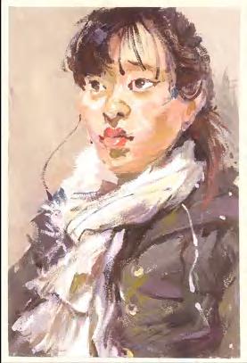
Silin Wang (she/her)

swang20@risd.edu
Hey! As an artist and a beginning landscape architect, I have always regarded landscape architecture as my favorite and always believe that it can change the whole world as a great cause.
Language
English
Chinese (Mandarin & Cantonese)
Education Background
Xi’an Academy of Fine Arts
Bachelor of Environmental Design
Rhode Island School of Design
Master of Landscape Architecture
Skills
AutoCAD | ArcGIS | Rhino | SketchUp
Lumion | Photoshop | Illustrator
Indesign | After Effects | Premiere Pro
Twine | Microsoft Office
Oil Painting | Watercolor | Sketch
Gouache and propylene
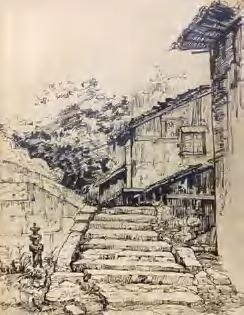
Pen-and-ink Drawings
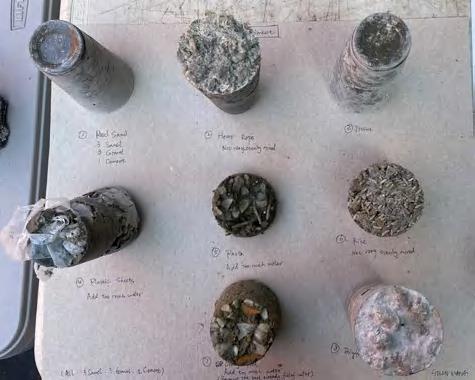
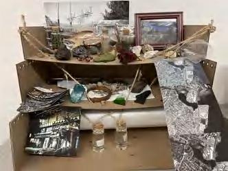
Material Test
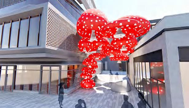
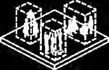
Public Art Installation
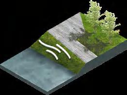
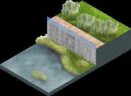
OTHER WORKS 00 BETTER WITH AGE Emotional Healthy Block of The Elderly 01 OTHER WORKS 00 CONTENTS AQUATIC OASIS Ecological Renewal of Historic Industrial Land Revitalization of Shenzhen Yanzi Lake wetland park 02 03 BURST OF INSPIRATION Sustainable Urban Drainage Systems (SUDS) Retrofit of Xi'an Academy of Fine Arts Square 04 GROW WITH CITY A Large Resilient Installation of The Ancient Wall in Xi 'an City 05 02 ECOLOGY 03 EDUCATION 04 INSTALLATION 01 COMMUNITY & URBAN DESIGN 05 ECOLOGY teamwork 2023.1 teamwork 2022.6 individual work 2020.2 individual work 2020.1 individual work 2020.10
Sea Wall Model & Representation
Paintings
Film Photography
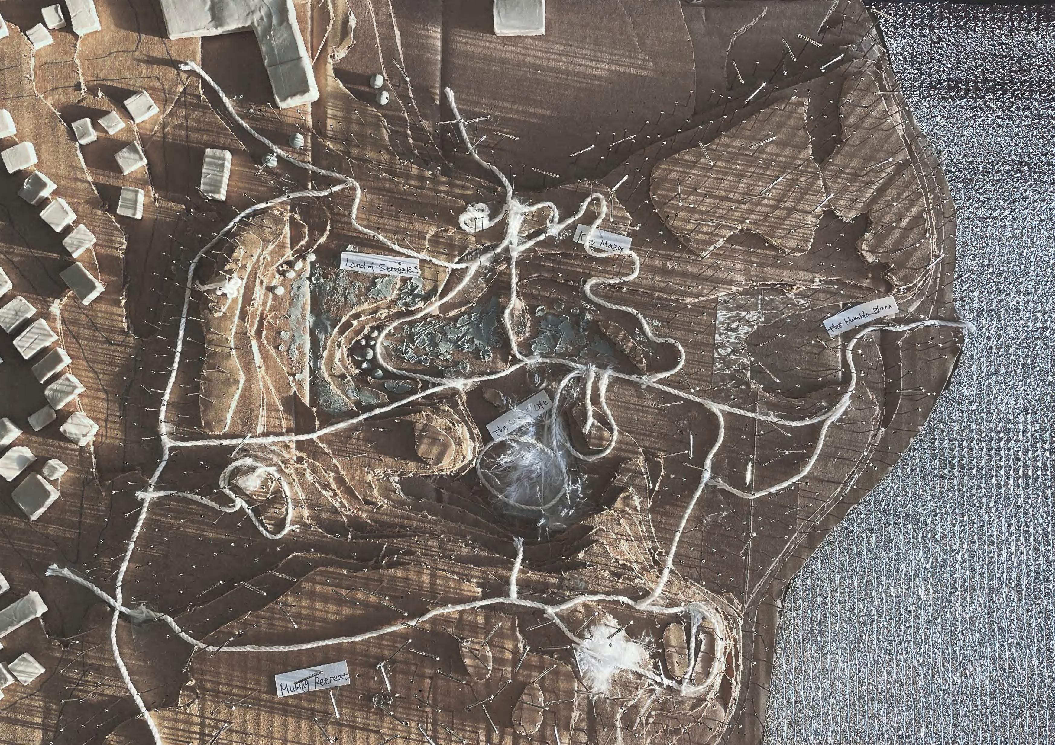
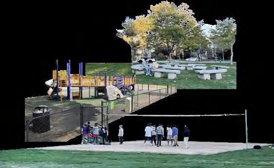
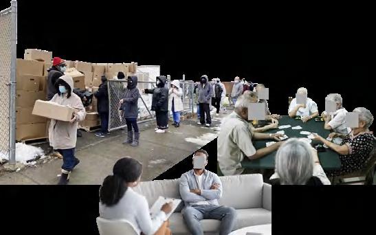
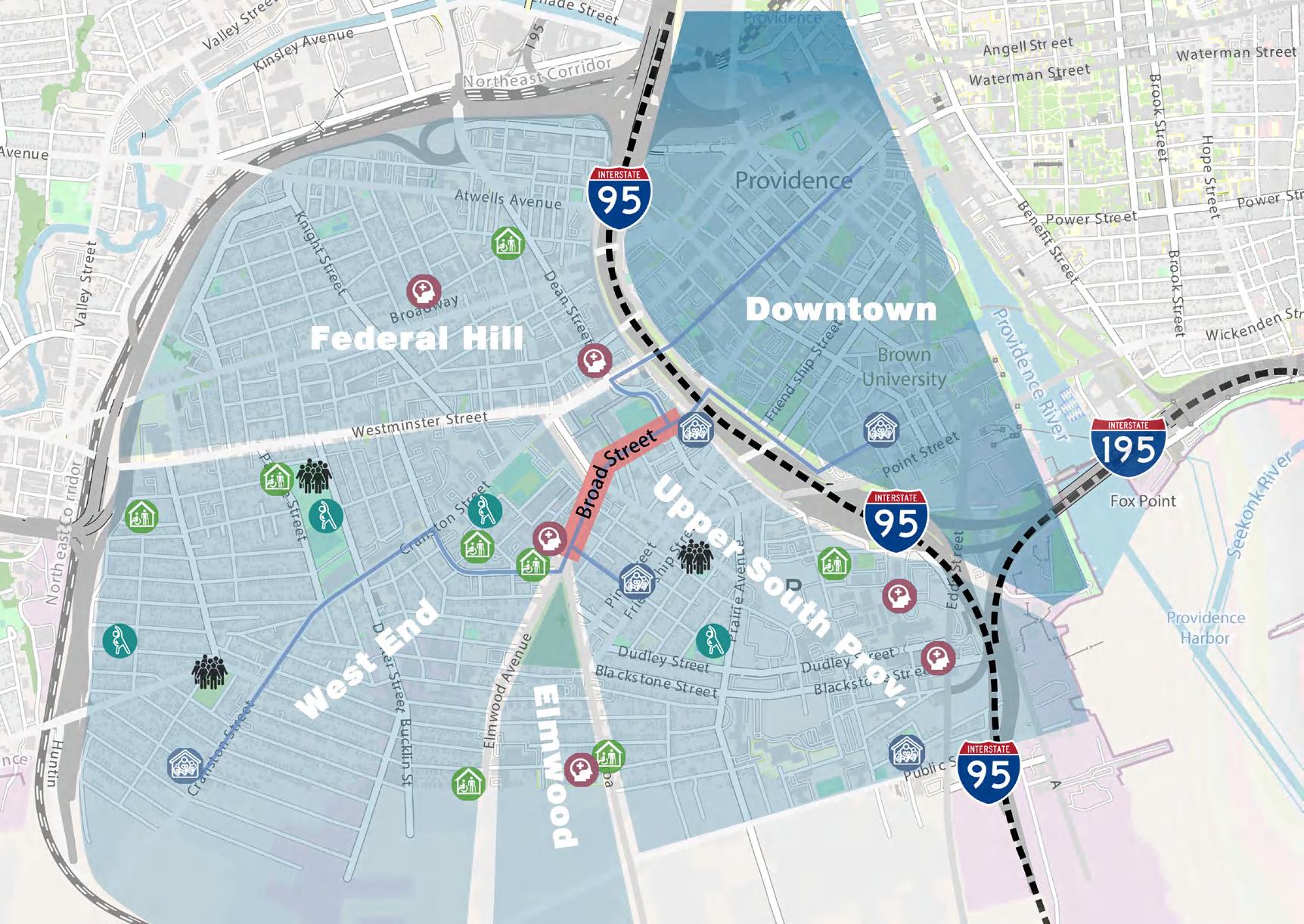
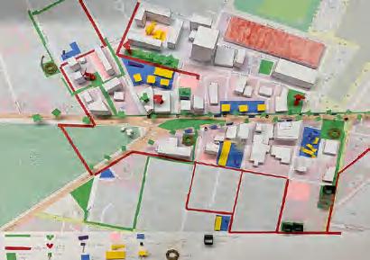
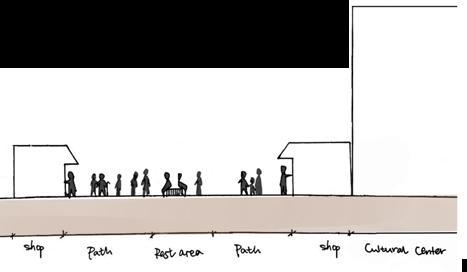
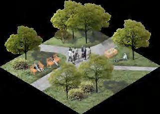
It's a team project named the Emotional Health Block (team members: Silin Wang, Shixuan Zhou, Yufan Xu, Yumeng Dai), which aim to improve mental health of residents and adapt to future urban development in the decaying Providence West neighborhood. I'm in charge of the part that focuses on providing a variety of social and exercise space for the elderly in the nearby nursing home, as well as to cope with the future aging trend.
HOMELESS SHELTER MENTAL COUNSELING PUBLIC EXERCISE SPACE NURSING HOME HOMELESS PEOPLE ROUTE HIGHWAY SITE

NEED Low-income groups, homeless

IN
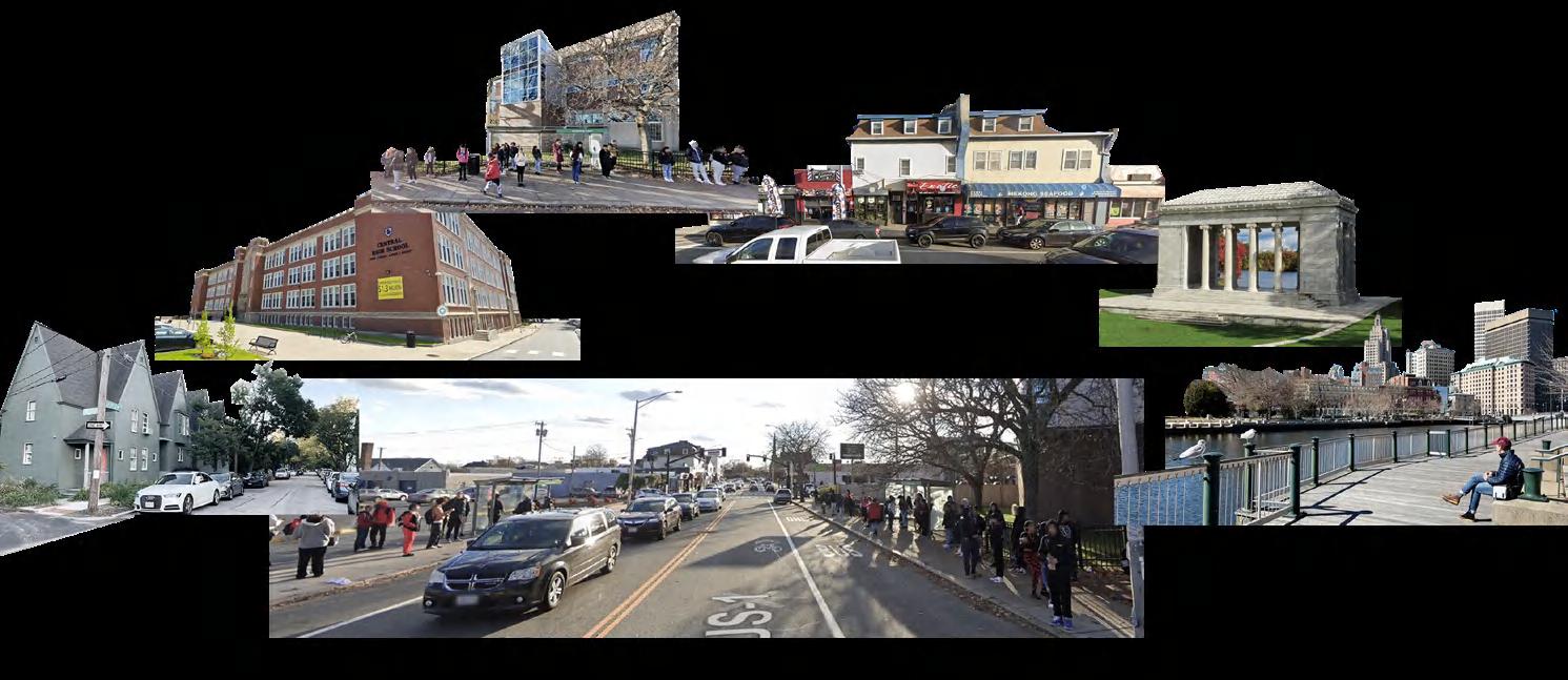
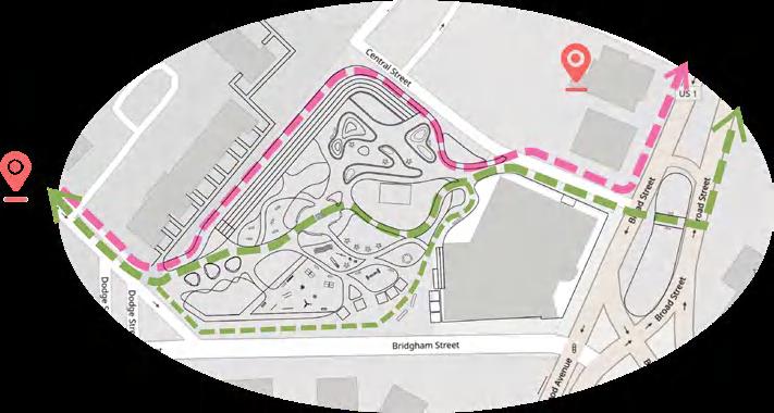
WHY FOCUS ON BROAD ST. ?
Many small businesses along Broad Street
As the fast route from downtown to Roger Williams Park, Zoo, Natural History Museum, and Southside Cultural Center.
As


BETTER WITH AGE Emotional Healthy Block of The Elderly 01 Physical space, culture, economic isolation Lack of attracted site. Drive too fast Commercial decline Unsafe street
the fast route from downtown to
>5,000 elementary, middle, and high school students at schools along Broad St densely populated residential and commercial areas of the southwest.
the
23% of households in Broad Street area do not have a car. 40% of people in Broad Street area walk, ride the bus, bike, or carpool to work.
As a dense population area, more than 30000 people live within 1/3 mile of Broad St (<10 min. walk).
people Race and Ethnicity White Hispanic Black Asian Mixed Other Precentage of the total population 12.2% The area is characterized by multi-racial and multi-cultural POTENTIAL 55.1% 19.0% 10.1% 1.4% 2.2% Existing Private/unafforable Sports Resources
private playgrounds
children's playground
Ways to Prevent and Treat Mental Illness social assistance private party psychotherapy sitting and chatting exercise nursing Existing Socializing Ways
COMMUNITY ANALYSIS
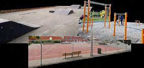
Existing Public Exercise Space
limited
Existing
Model Large differences in income and canopy ownership among Providence communities. The site has high population density, low income and lack of greening
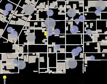
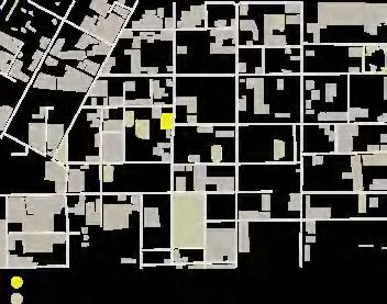
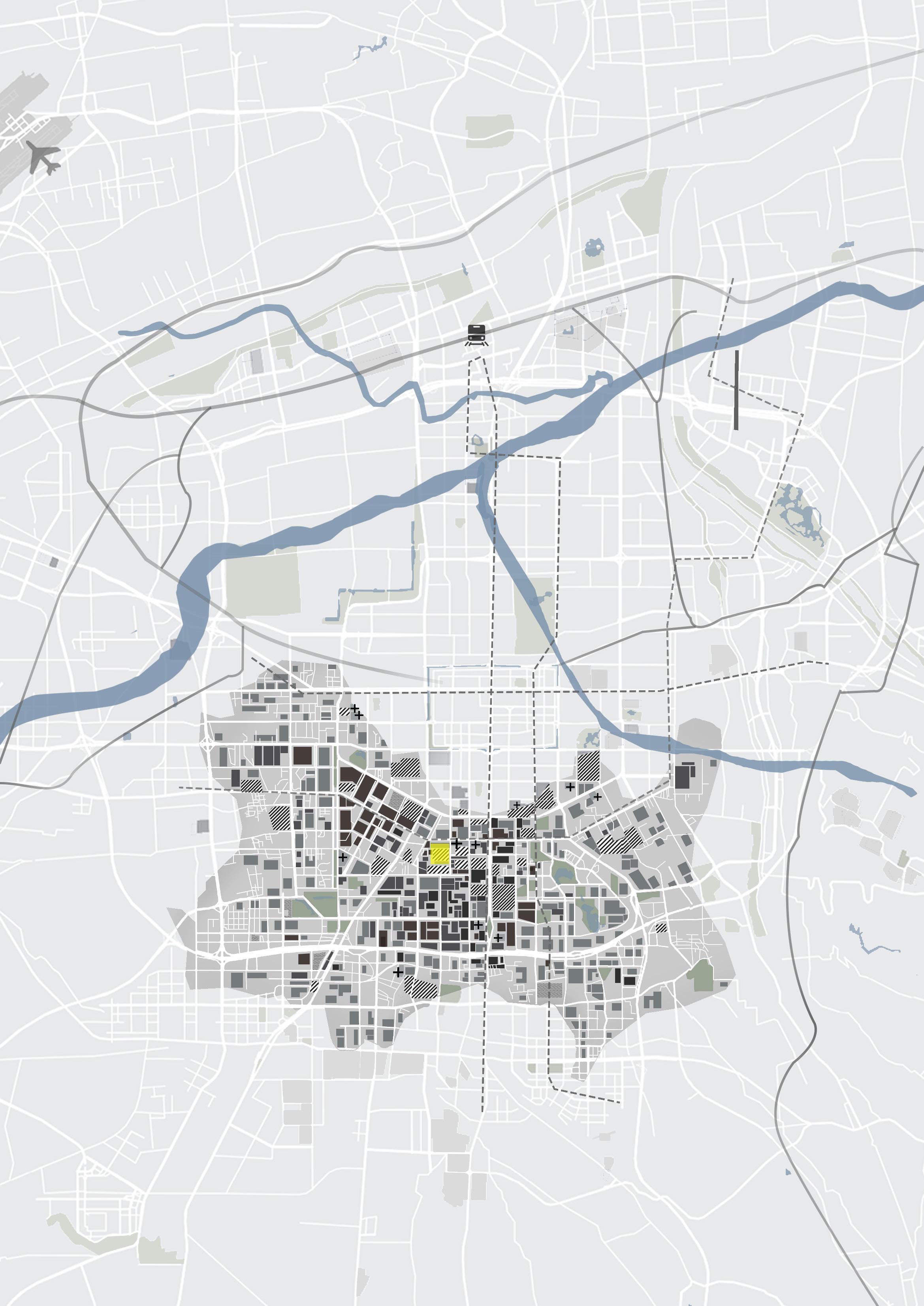
SITE AND BACKGROUND
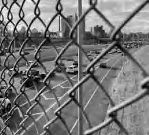
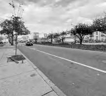
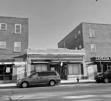
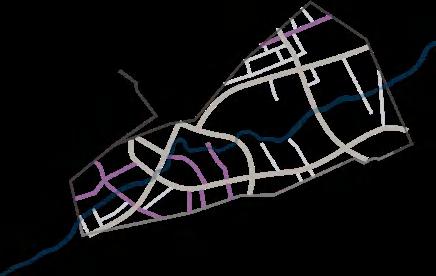
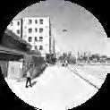
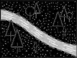
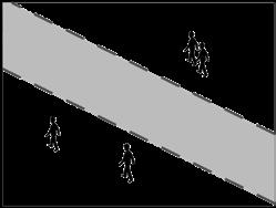
West of Providence, RI, the area that had become a slowly decaying, impoverished inner-city neighborhood as the city weakened and the middle class left in the 1930s. Interstate 95, built in 1958, separated western neighborhoods from downtown and east, affecting the original thriving social space and changing the character of the area forever.
FRAMEWORK OF EMOTIONAL HEALTH BLOCK

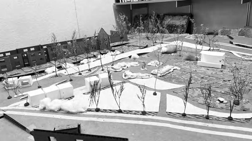
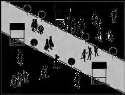
We decided to transform Board Street and the surrounding neighborhood into a pedestrian-friendly neighborhood with a variety of functional zones to help improve mental health. And encourage visitors to use the site as a destination, not just a quick pass.
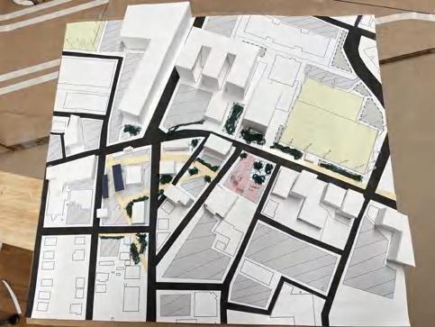
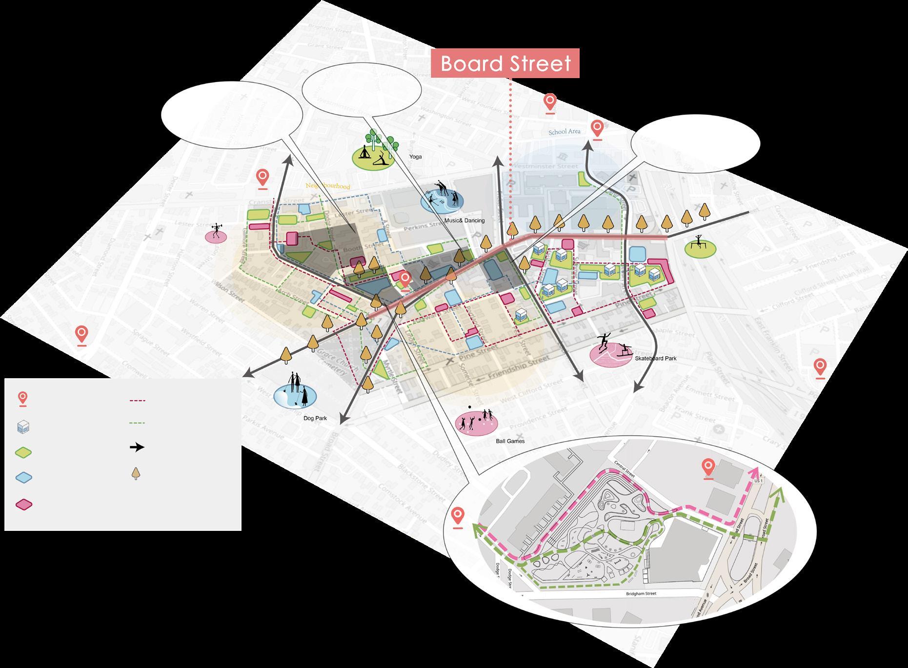
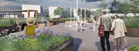
DESIGN OF EMOTIONAL HEALTH BLOCK OF THE ELDERLY

STRATEGIES
Here are some ways to improve the elderly's mental health

STUDY MODEL
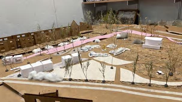
PRINCIPLE


POTENTIAL

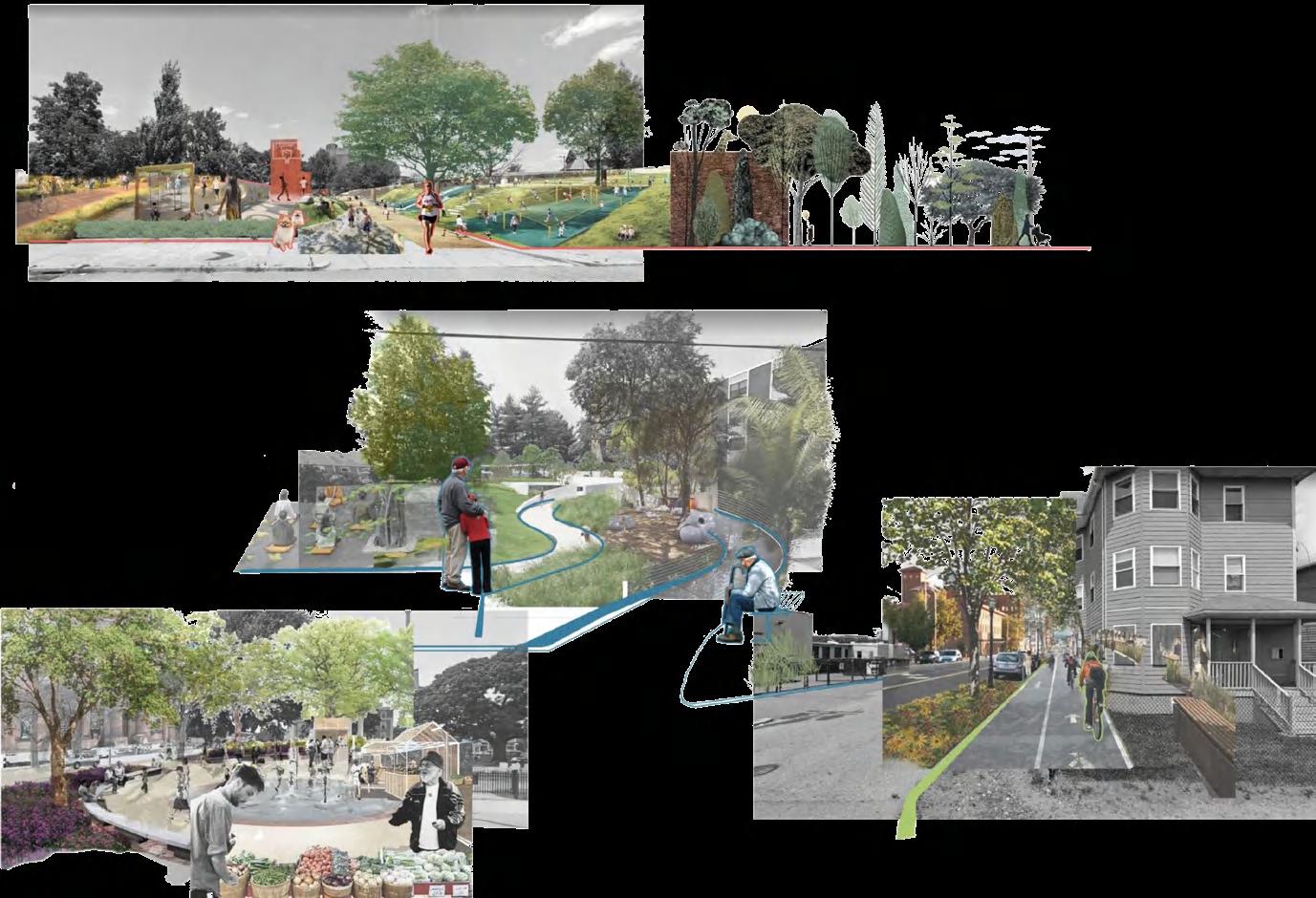
SENSE HEALING FOR THE ELDERLY HORTICULTURE THERAPY FOR THE RESIDENTS
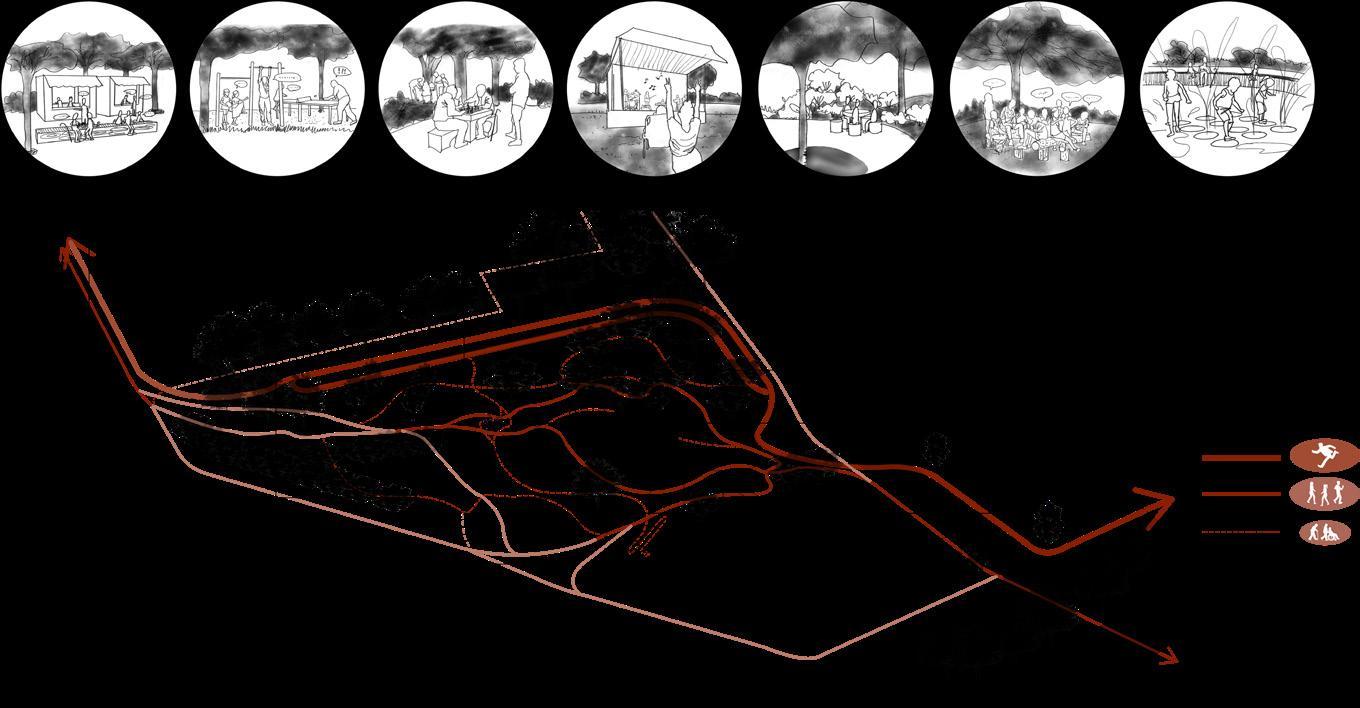
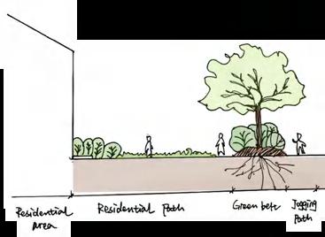
HEALING FOR RESIDENTS Existing mental health center Temporary healing shelter Healing Zone Jogging Path Walking Path Connection Corridor Greenway Social Zone Sport Zone SOCIAL HEALING FOR THE ELDERLY Residential Area Residential Area Center for Rehabilitation and Nursing Health HouseHistoricalOfficeConcepts TrinityUnitedChurchMethodist Southside Cultural Center of RI Hi! Hi! NATURAL SANCTUARY SENSORY HEALING COMMUNITY BETTER WITH AGE
SOCIAL
SOCIAL SPACE GREEN CONNECTION EXERCISE SPACE
HEALING GARDEN
SOCIALIZATION
SITE Rapid Weekend Market Exercise with Groups Lawn Music Festival Company and Rest Story Telling Paddle Play Chess Low Intermediate Route Speed
IN THE
study model VOLUNTEERING HOBBIES SOCIALIZATION MIND GAMES EXERCISE
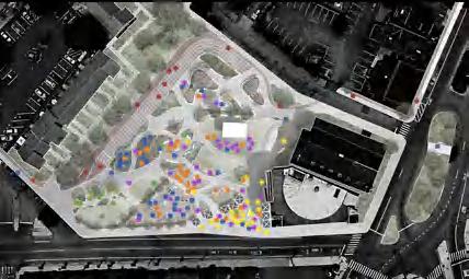
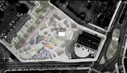


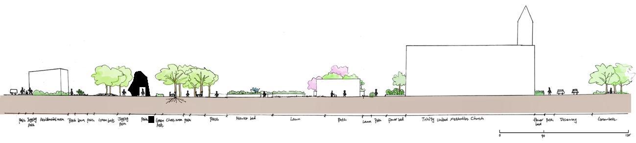
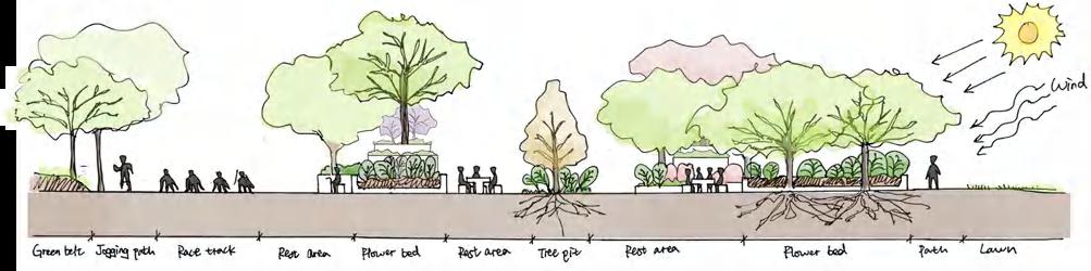
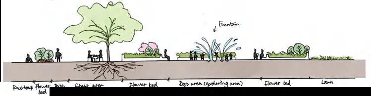
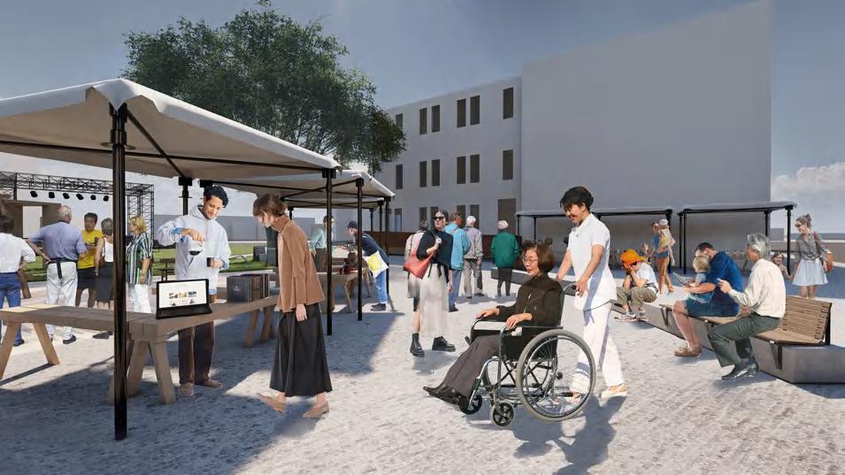
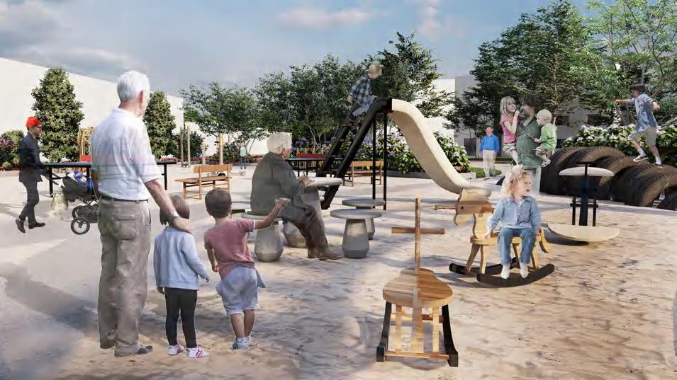
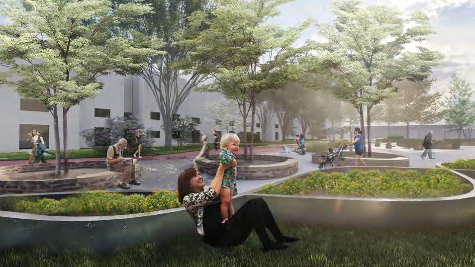
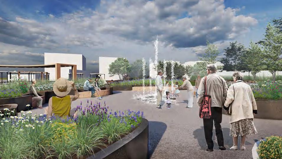
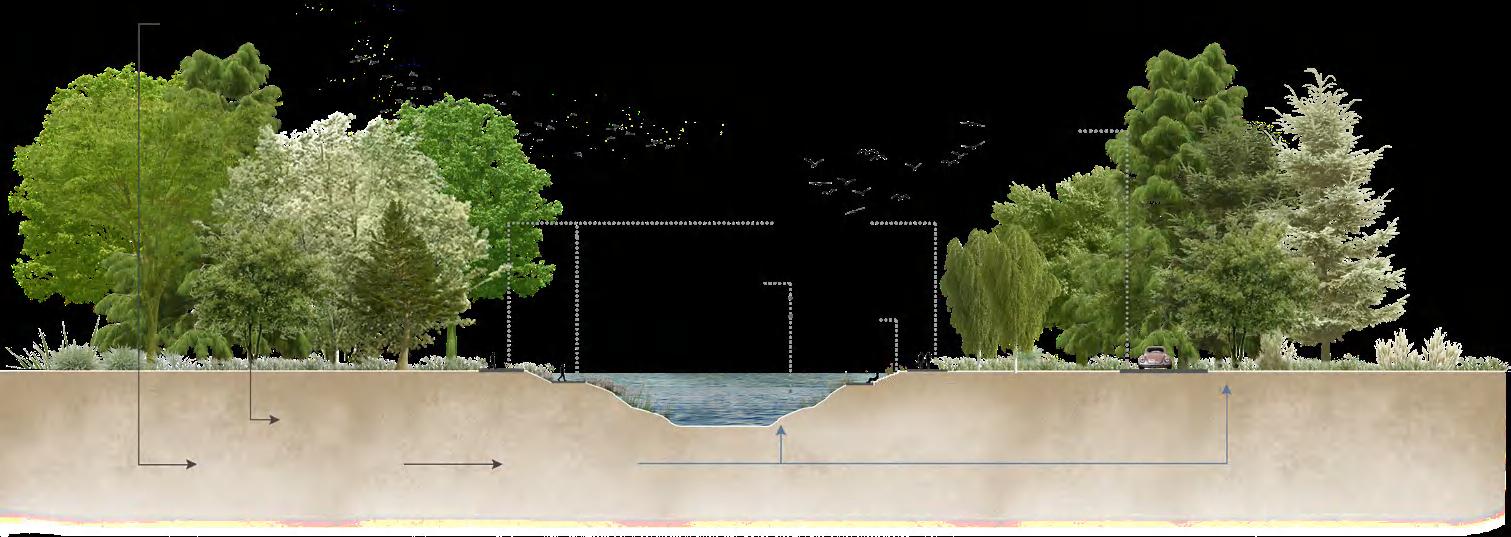
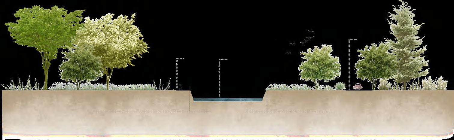
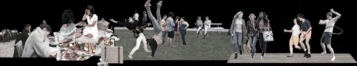
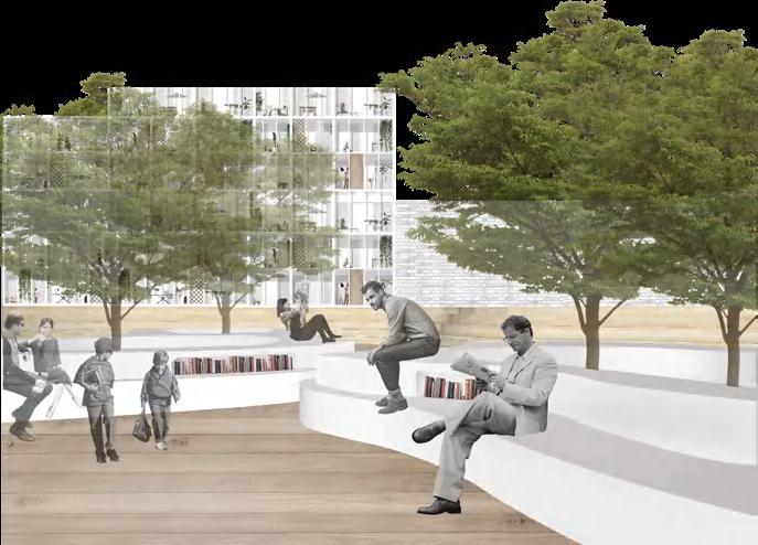
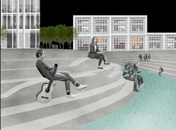
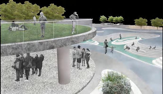
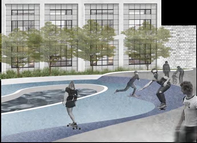
SITE OCCUPANCY The elderly Children Jogger Residents People come for lunch Volunteers of church and cultural center WORKDAY WEEKEND ① ② ③ ④ ⑤ ⑥ ⑦ ⑧ ⑨ ⑩ ① weekend market ⑥ public rest place ② story place ⑦ chess table ③ platform ⑧ fountain garden ④ children park ⑨ private rest place ⑤ exercise park ⑩ jogging path & track church cultural center community community historical house PLAN N a b e c d SECTION section a section b section c section e section d ① weekend market ④ children park ⑥ public rest place ⑧ fountain garden PERSPECTIVE
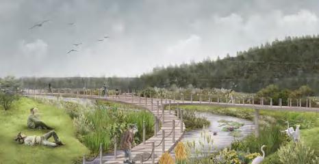
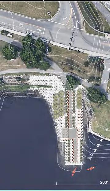
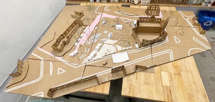
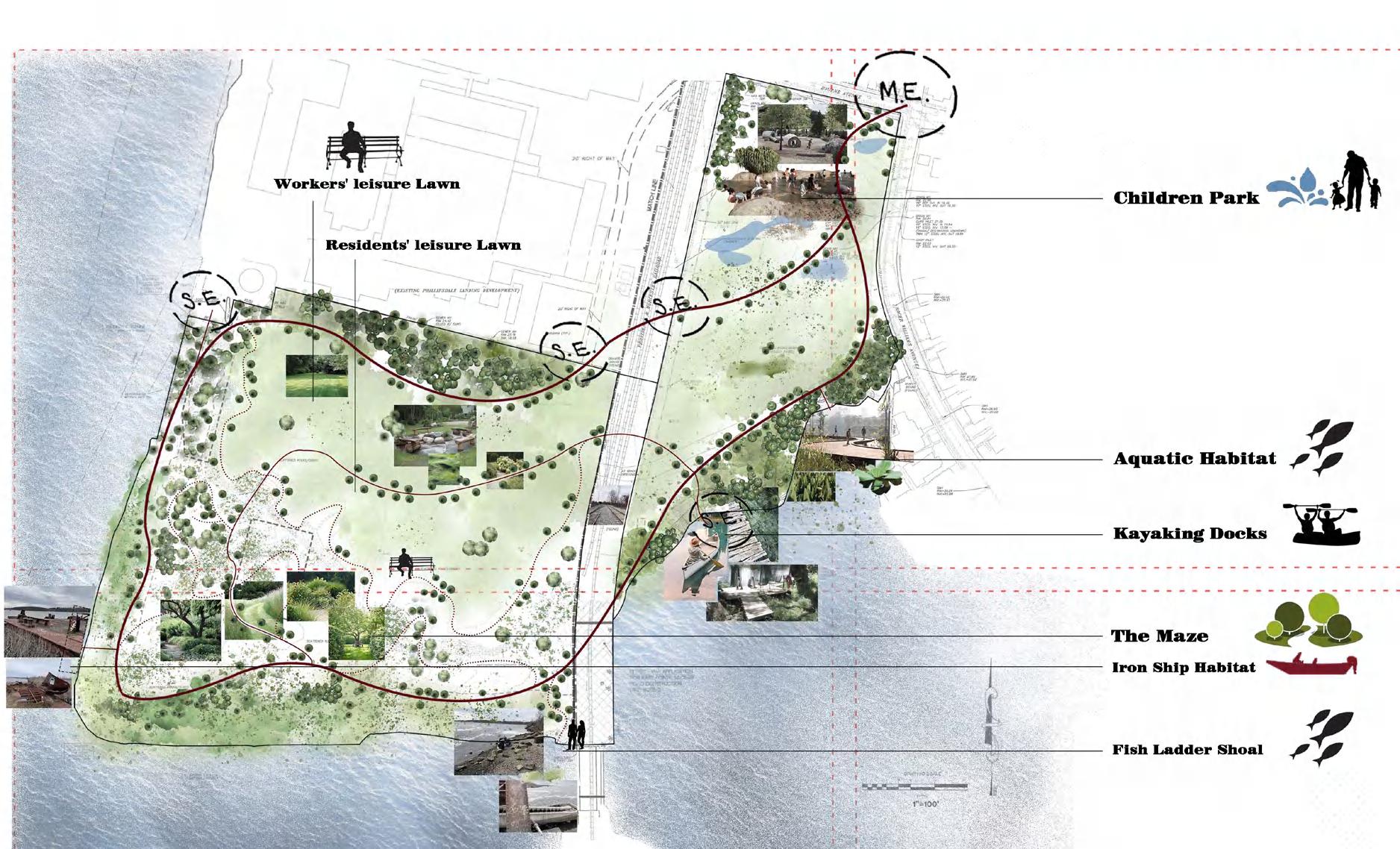
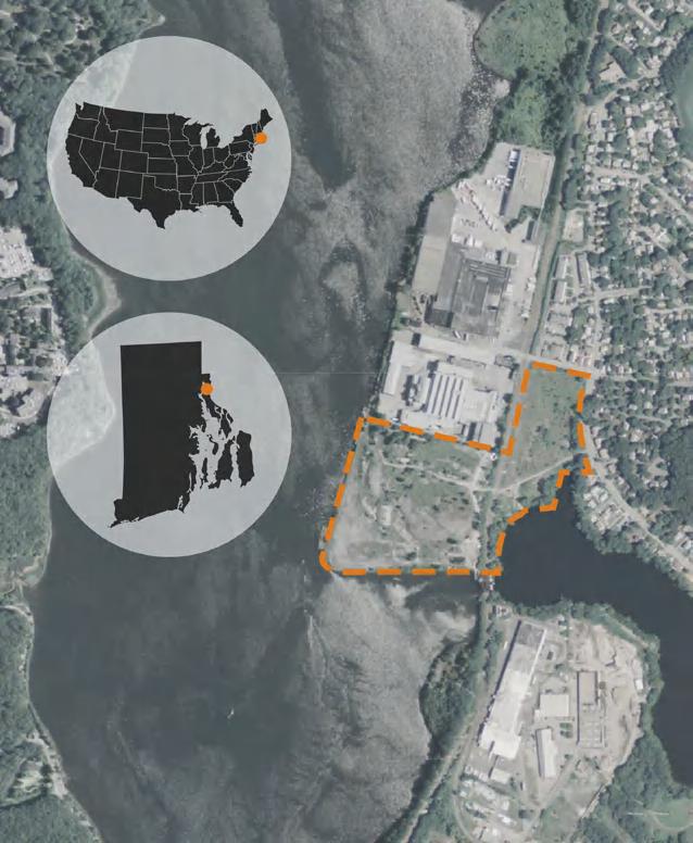
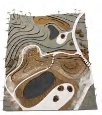
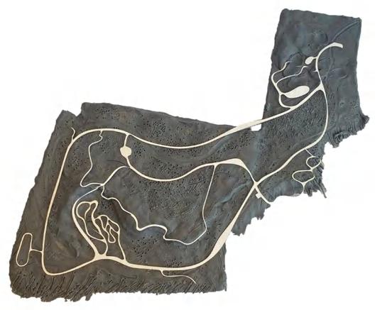
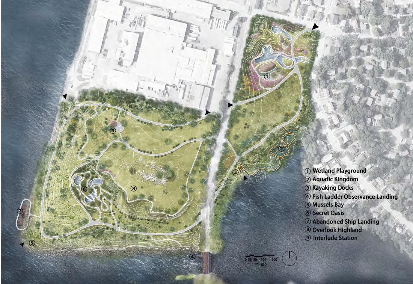
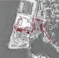
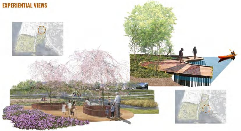
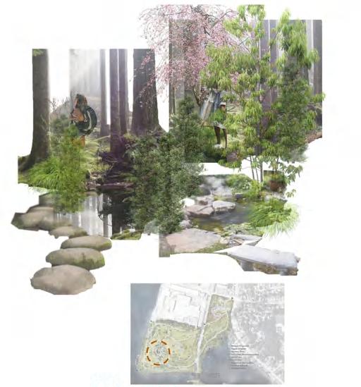
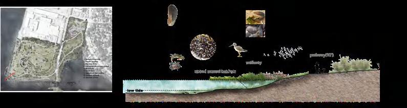
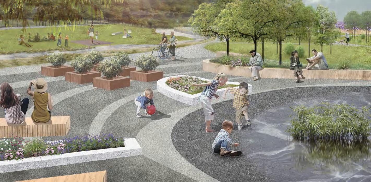
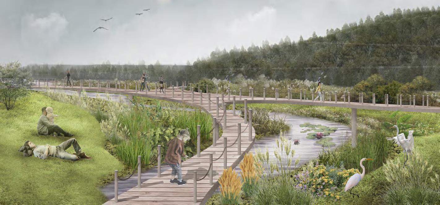
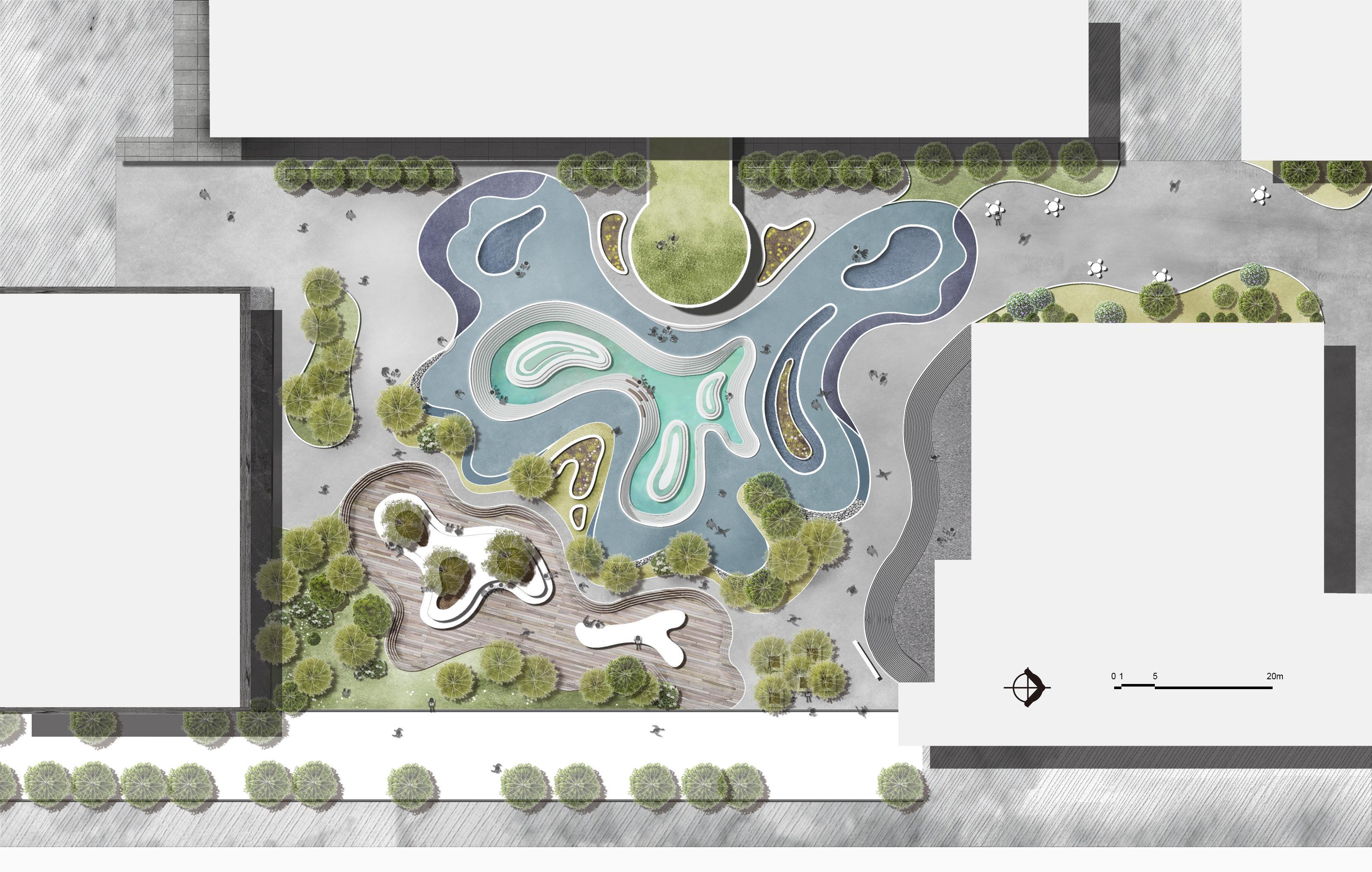
Aquatic Oasis is a wetland education park designed to emphasize the site’s ecology and provide accessible, interactive green spaces. With this design, we were able to transform an abandoned industrial area in East Providence to feature an ecosystem of many aquatic habitats, as well as a variety of recreational experiences.
teamwork members:
LOCATION&HISTORY
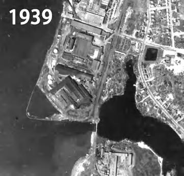
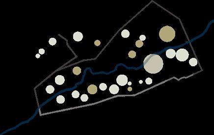
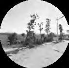
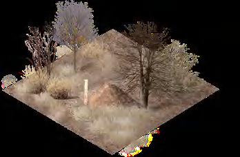
The site is a small mill village containing land and water, including 3 industrial sites and a mill pond, a dam, a railroad bridge, 75 workers’ houses , 30 other houses, 3 former stores, a church, and a former school. The district encompasses the largest concentration of surviving historic resources built within Phillipsdale during its period of significance (1883-1958) primarily by three manufacturers: Richmond Paper Company, American Electrical Works, and Glenlyon
STUDY PROCESS
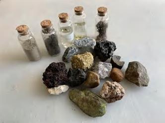
Cabinet study of pollutants in soil layer.
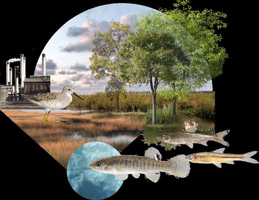
As a long-term industrial zone, soil and water are polluted by a variety of metal slag, mineral, cinder and other substances, and the original salt marsh landform is eroded.
Relationship related to environmental system of the site
FRAMEWORK SKETCHES
FRAMEWORK PLAN
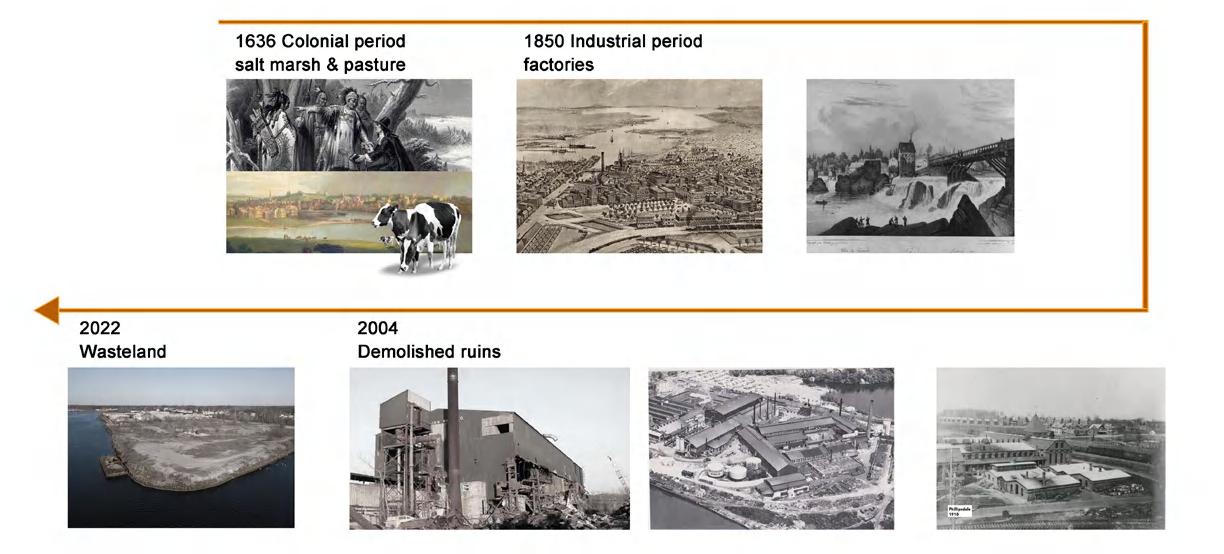
1636 Colonial period salt marsh & pasture 2004 Demolished ruins 2022 Wasteland 1850 Industrial period factories
02
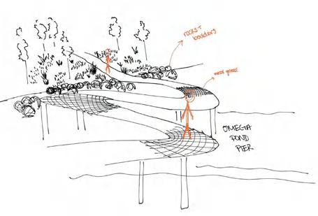
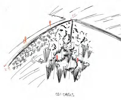
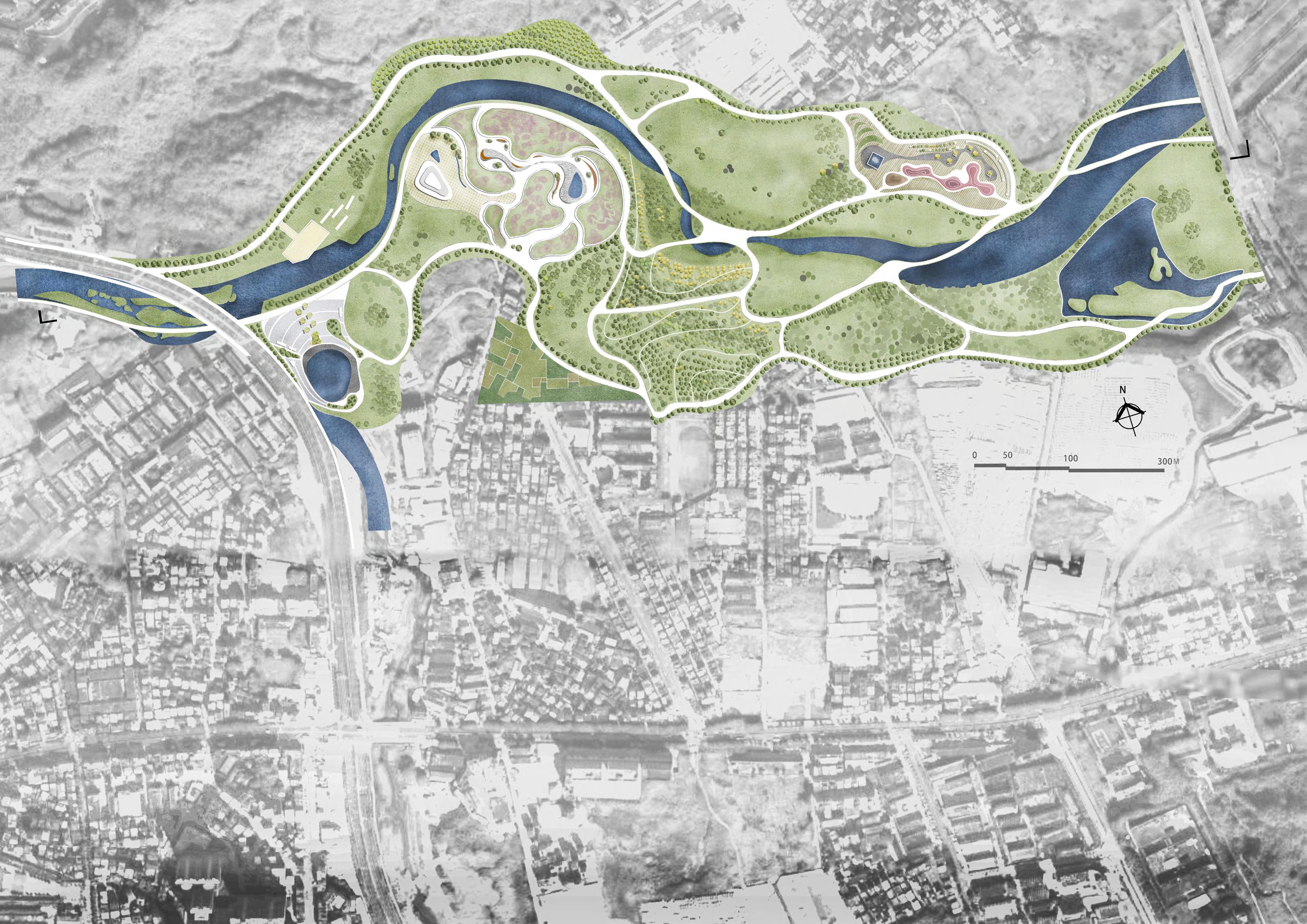
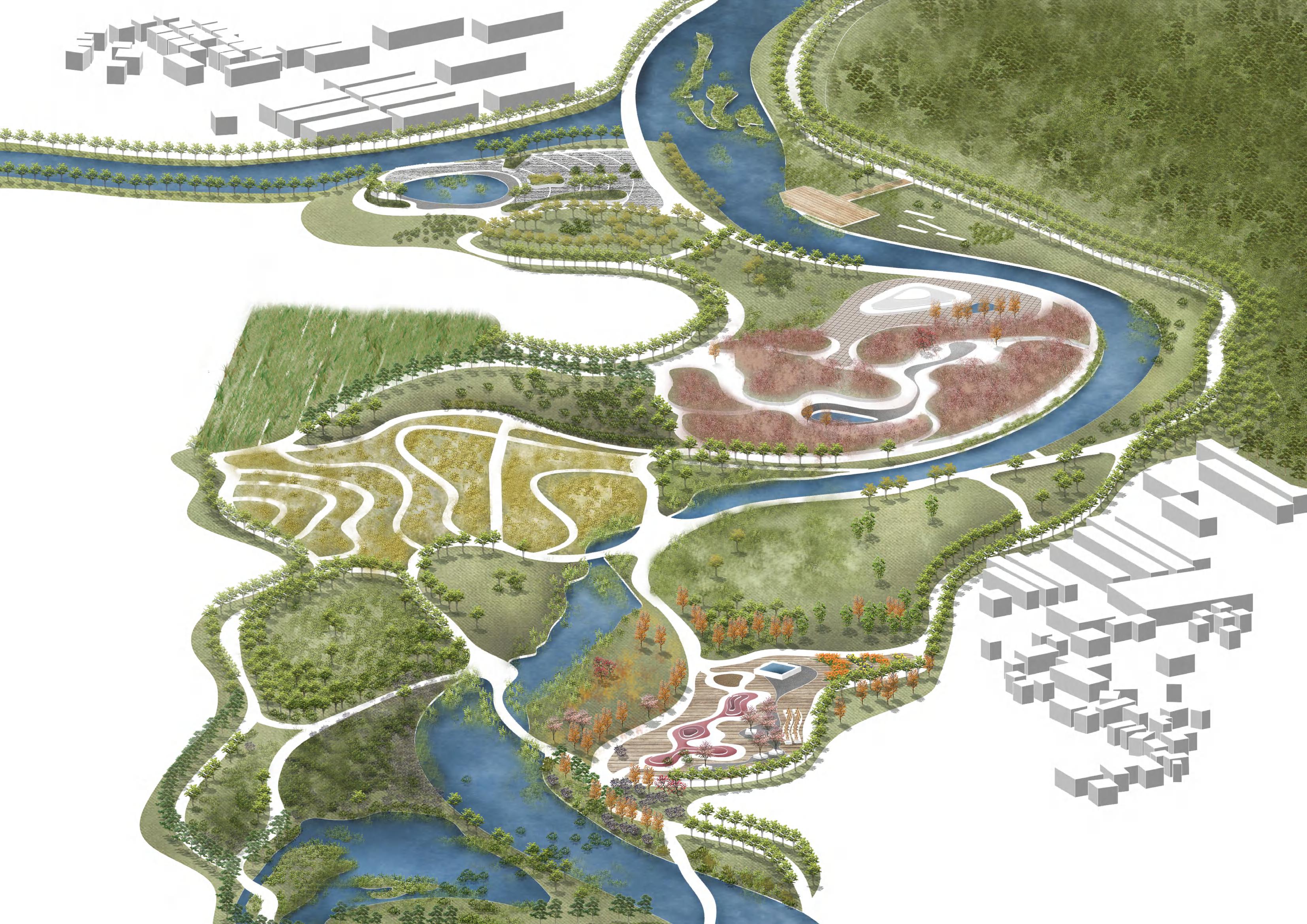
AQUATIC OASIS Ecological Renewal of Historic Industrial Land
Silin Wang & Naomi Canino
Bleacheries.
Phillipsdale Historic District
Seekonk River
Omega Pond
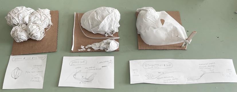
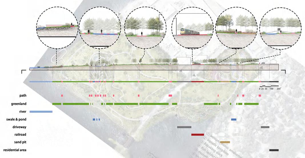
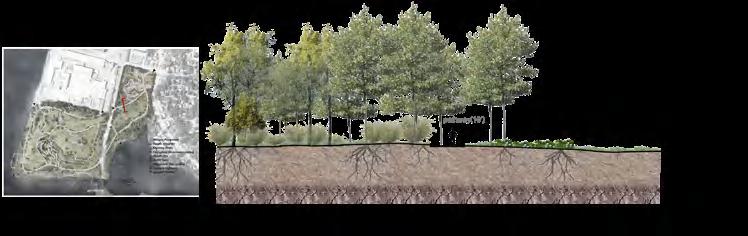
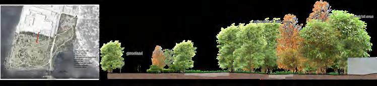
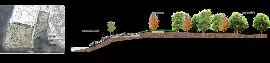
From left to right are plants, root and soil tension, water flow shaping the land, and land occupation with water levels changing during seasons.
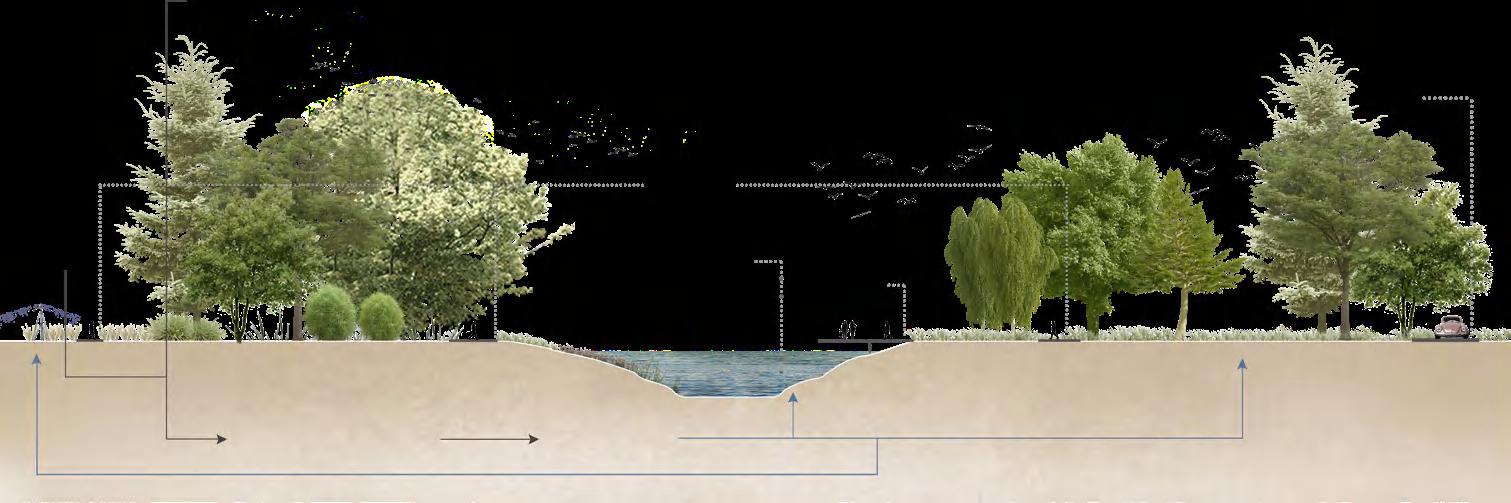
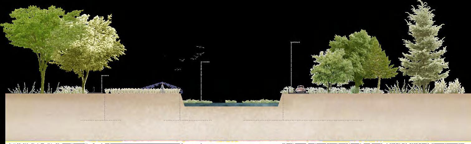
SECTIONS

THE ARCHITECTURAL FORM ON THE BORDER (OPPORTUNITIES)

STUDY MODEL
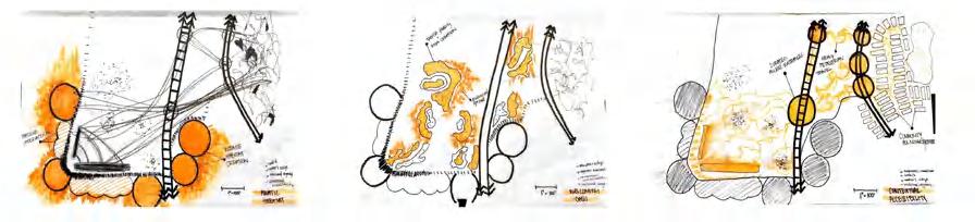
PARTI DIAGRAM AND PLAN
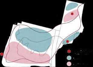
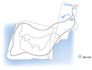
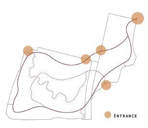
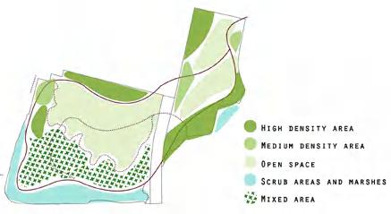
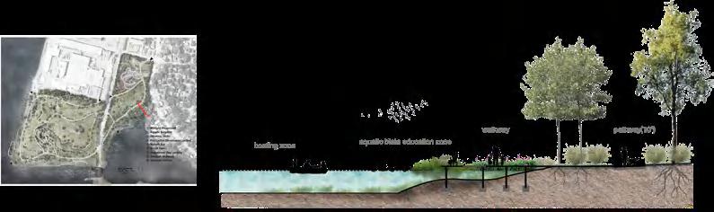
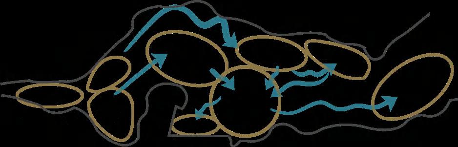
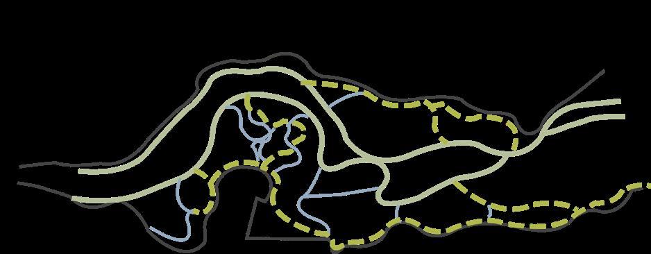
Based on topography, soil pollution levels and habitat conditions, we designed various vegetation and animal habitats to restore healthy estuaries and land ecology. A loop is provided to encourage employees and residents to enter the site to explore and rest.
PRINCIPLE
Accesibility
Improve the ecological transition from land to water and enhance the accessibility of surrounding areas to the water.

Oasis
Create different spatial experiences with vegetation, ponds and other landscape materials.
Industrial Legacy
Preserve industrial memory and special facilities.

PERSPECTIVE
Education
Provide wetland ecological education opportunities and obtain funding to maintain the site.
Aquatic Habitat
Provide wetland ecological education opportunities and obtain funding to maintain the site.
community factories and track warehouse
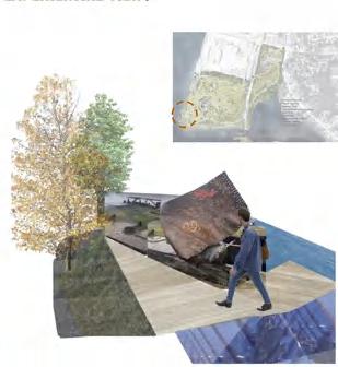
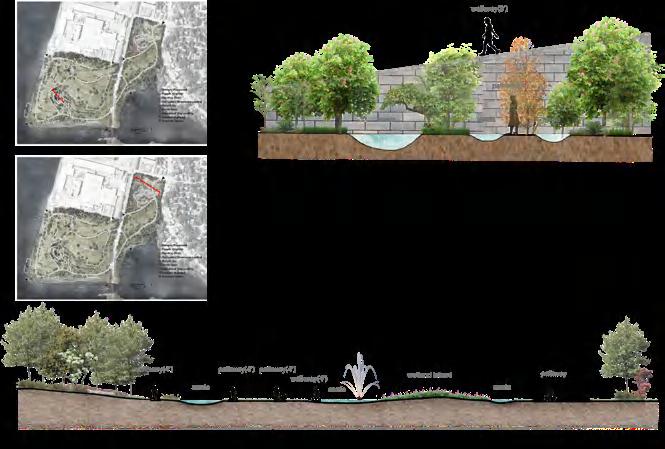
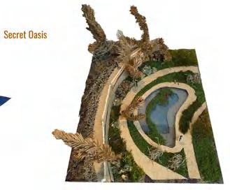
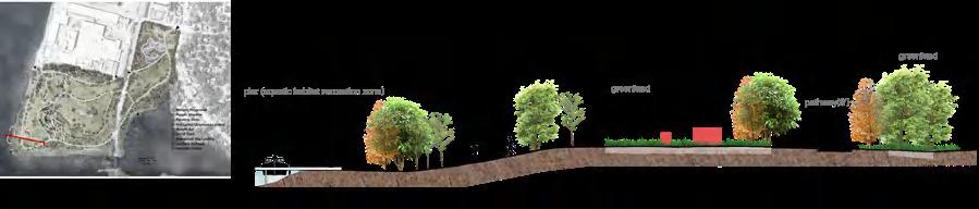
Fish Ladder Observance Landing Industrial legacy Abandoned Ship Landing Aquatic Habitats Kayaking Docks Mussels Bay Transitions from Built Environments Entertainment Secret Garden Wetland Playground SECRET OASIS KAYAKING DOCKS WETLAND PLAYGROUND ABANDONED SHIP LANDING
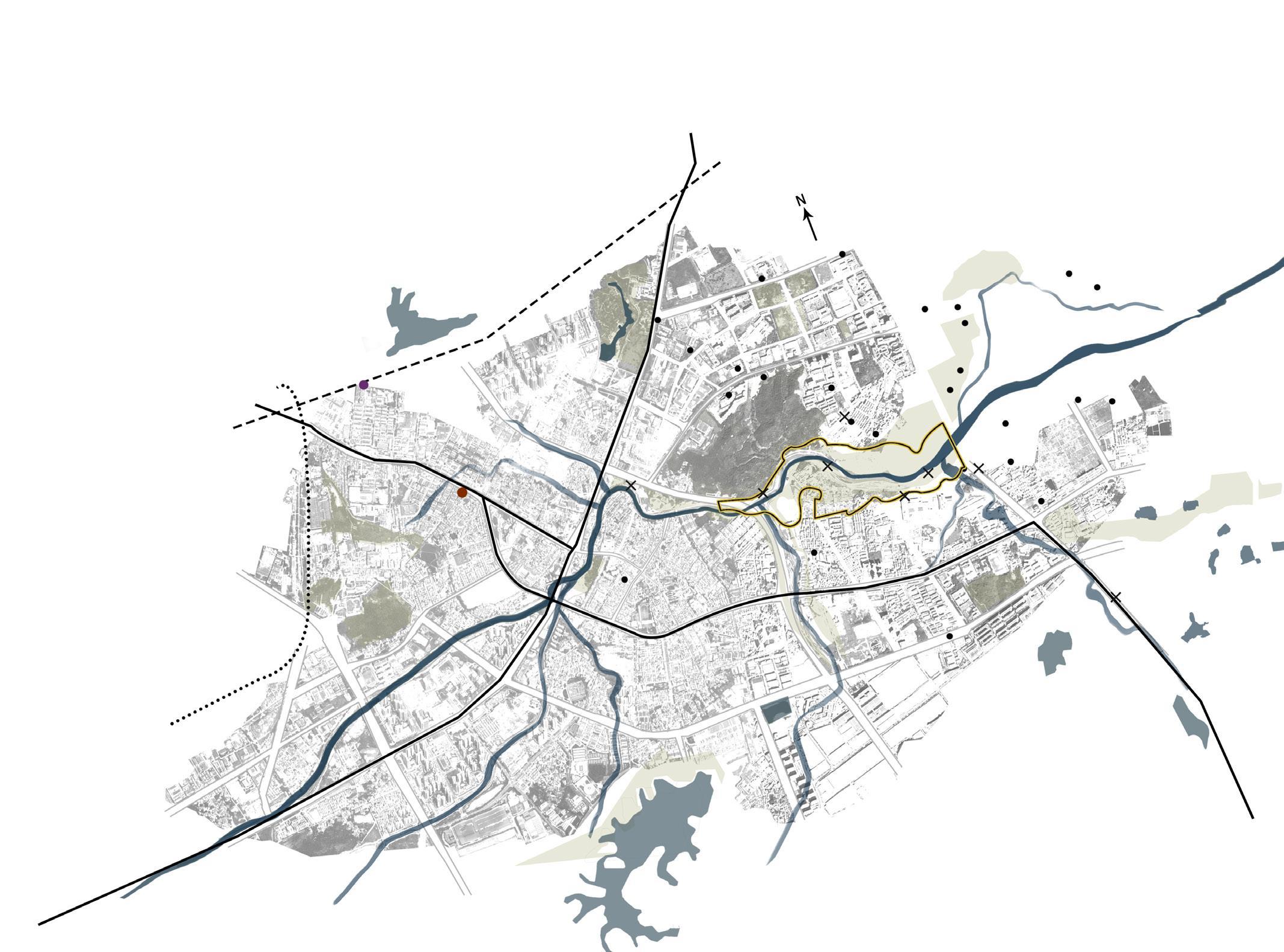
REVITALIZATION OF SHENZHEN YANZI LAKE WETLAND PARK
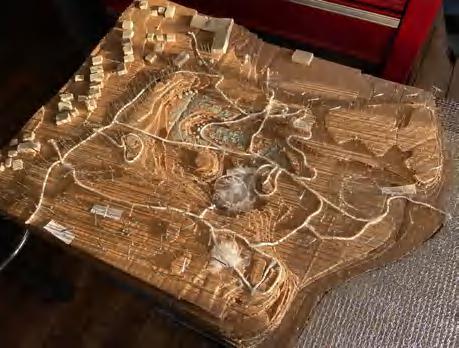
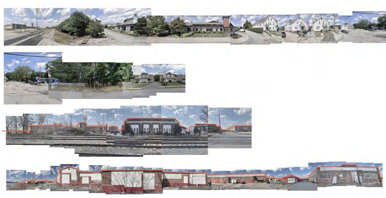
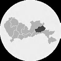
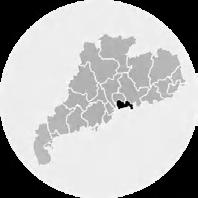
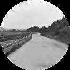
Site is located in the center of the large industrial zone in Pingshan District, Shenzhen, with a design area of about 2 square kilometers near more than a dozen industrial parks, large tracts of farmland, and dense residential areas. Pingshan River, which is the firstlevel tributary of the Danshui River, crosses this area. However, due to the discharge of industrial, agricultural, and domestic sewage, the self-purification capacity of the rigid channel is low, and the biodiversity is destroyed by contaminant.

The


A reduction in the quality of plants.
USER ANALYSIS
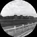
Hard Banks destroy the natural form of rivers.
SITE ANALYSIS
pass walk rest chat exercise

The project features a variety of techniques for restoring altered riverbanks, restoring vegetation, and restoring watershed ecology with natural self-cleaning INDUSTRIAL
pass walk rest chat farming
Daytime Schedule of user


pass rest babysit exercise walk the dog chat picnic
Worker White-collar Farmer Inhabitant Tourist pass walk rest chat weekend weekday
photograph walk rest chat
 hardness of the river leads to the decrease of vegetation along the river.
Weakened water storage has dried up river beds.
The transition zone of vegetation from xerophyte to water body is destroyed.
The plant system was replaced by artificial roads.
hardness of the river leads to the decrease of vegetation along the river.
Weakened water storage has dried up river beds.
The transition zone of vegetation from xerophyte to water body is destroyed.
The plant system was replaced by artificial roads.
Bus station Motor station Railway station National highway Expressway Subway route
03
AGRICULTURE URBANIZATION Terrain Analysis School Exhibition Center Arterial Road Secondary Road Alley Hospital Traffic Analysis Facilities Analysis


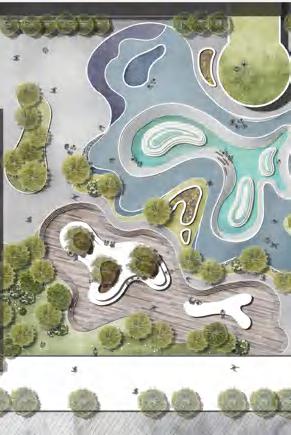
Route ecological floating island water platform garden active area lakeside leisure area lawn terraced fields experimental field leisure square Jungle Open Forest Grassland Cropland Bush Arterial Road Secondary Road Alley Traffic Analysis Vegetation Analysis Function Analysis MASTER PLAN SECTION
1 ecological floating island
2 leisure square
3 hydrophilic platform

4 garden
5 test field
6 terraced fields
7 children’s playground
8 lake
1 3 4 5 6 7 8 2
N Function of
AERIAL VIEW Ecological Protection Landscape Agriculture Physical Exercise Tour Civic Education Children's Entertainment Local Culture
linkage
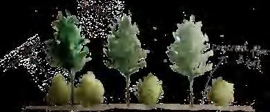
PLANT ANALYSIS

Upcoming and existing plants are well adapted to the climate and conditions of the site and absorb pollutants from soil and water

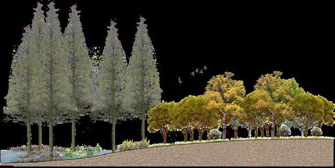
Spring JANUARY FEBRUARY MARCH APRIL MAY JUNE JULY AUGUST SEPTEMBER OCTOBER NOVEMBER DECEMBER Summer Autumn Winter crown diameter:500cm height:1500cm crown diameter:400cm height:1000cm crown diameter:300cm height:3000cm crown diameter:150cm height:200cm crown diameter:250cm height:500cm
Ceiba speciosa Cinnamomun camphcra
Ervatamia divaricata
Terminalia
Pond
crown diameter:250cm height:2500cm crown diameter:300cm height:400cm crown diameter:40cm height:50cm height:70cm height:70cm height:150cm height:150cm height:200cm height:100cm
Cassia surattensis Alstonia scholaris Bermuda grass Frangipani Xanthostemon chrysanthus pittosporum Iris pseudacorus
neotaliala Capuron
Cypress
Cattail Pampasgrass Hornwort Lotus Phragmites Miscanthus Elaeocarpus hainanensis Oliver
Pontederia cordata L.
crown diameter:100cm height:500cm crown diameter:3cm height:300cm crown diameter:150cm height:350cm height:5cm height:150cm height:150cm
Callistemon rigidus R. Br. Cyperus alternifolius
METHODS OF RIVERBANK RECONSTRUCTION

Leisure
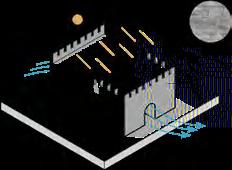
walk way river space some part of the river went dry some part of it is stagnant water landscape space landscape space roadway water level floor season clean season rainfall absorded water collected tank river irrigation water purifier (pumping device) walk way ladder roadway water level walk way water level roadway river space farmland space landscape space landscape space some part of the river is stagnant water most of it are covered with mud and weeds rainfall water collected tank agricultural effluent walk way water level bridge roadway irrigation irrigation water purifier river (pumping device) ① BEFORE ② BEFORE ① AFTER ② AFTER River bank to water level > 4M 4M > River bank to water level > 1M 1M > River bank to water level
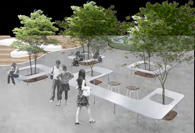
Waterfront
Square PERSPECTIVE
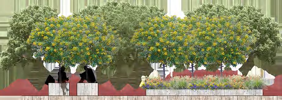
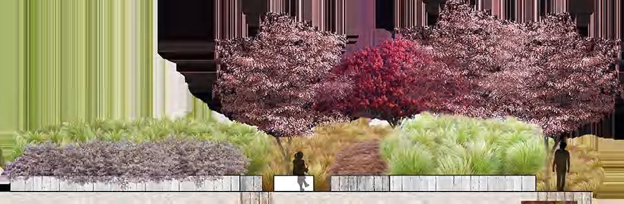
BURST OF INSPIRATION
Sustainable Urban Drainage Systems (SUDS)
Retrofit of Xi'an Academy of Fine Arts Square
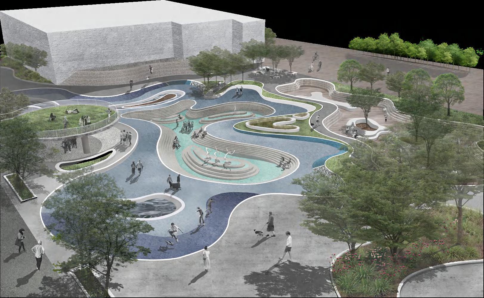
SITE ANALYSIS

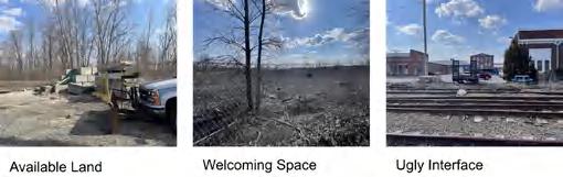
Xi’an Academy of Fine Arts Square locates in the south of Yanta District, Xi’an, close to several large hospitals and residential areas. The block densely populates with buildings and people. The square, which was built in 1999 and covered an area of about 6000 square meters, is the only way for people to enter the campus, visit exhibitions, attend classes, and use the library.
Due to the low greening rate in the neighborhood, many citizens will enter the campus for a walk. However, in recent years, there has been a surge in rainfall, often resulting in heavy ponding and making it difficult for people to get around. Also, the square cannot meet the living needs of the students, and the square without aesthetics cannot reflect the artistic atmosphere of the college.
BASE ANALYSIS

Campus square changes of four phases


The square was formerly a wasteland with many graves.
After being razed to the ground, workers planted grass and trees at this place. This area becomes a crossing space.
After the vegetation grew, seats and beverage stalls were set up here, and the number of people staying increased.
Seats and drink stalls were removed, concrete floors replaced green Spaces, and the area became a parking lot with no one to stay.
CURRENT PROBLEMS
There is no resting place under the trees, which makes it difficult to stay, so space utilization is low.


The site has been exposed to the sun for a long time.
The whole square has almost become a parking lot. Teachers, students, motorcycles, cars, and trucks are all mixed, so it is very noisy and unsafe.
On rainy days, rainwater is difficult to seep, resulting in serious ponding problems.
The trees are too dense, darkening the underside.
Greenland River and lake Subway Railway Railway station Airport Else Hospital Public buildings Residential Commercial School Industrial park Bus station Scope of design Scope of design Parklands Flooded spot Metro station Scope of design Line 3 Line1 Traffic Analysis 225.1mm 553.9mm 331.8mm 420.9mm 840.7mm 736.1mm 513.3mm 242.3mm 44.9mm 40.3mm Parkland Analysis Flooding Area Analysis Dec-Mar Oct-Mar peS-rpA pAyaM-r nuJ luJA u gN o v
Have breakfast and go to class Go to the library Have a class Have a class Group discussion, research, do homework Review Take the test Graduation exhibition Have a class Have dinner and join a club Join a club Go shopping Exercise Have lunch and take a nap Have lunch and take a nap
Themaximum amount of precipitationthecitycan hold at t h i s s gat e 46.7mm 63.4mm
USER ACTIVITY ANALYSIS School Day Weekend Beginning of term The end of term
03


4 7 5 3 1 Large sculpture Large sculpture Medium-sized sculpture Small sculpture The product model Small craft 9 9 6 5 5 8 8 8 4 3 1 2 7 1 9 2 3 4 5 6 7 8 Public
Lawn
Exhibition
Active
Lunch
MASTER PLAN NODE ANALYSIS 2 1 1 2
entrance Inner entrance
Reading area
area
region
area Roof garden Waterspace
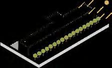
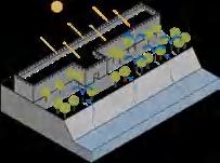
SUSTAINABLE URBAN DRAINAGE SYSTEM SECTION
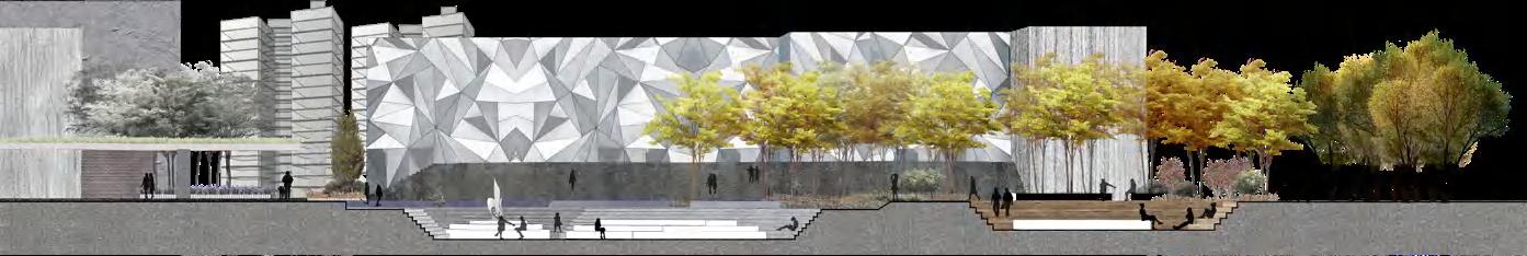
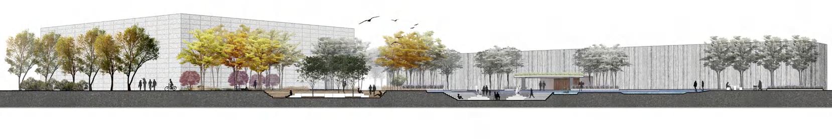
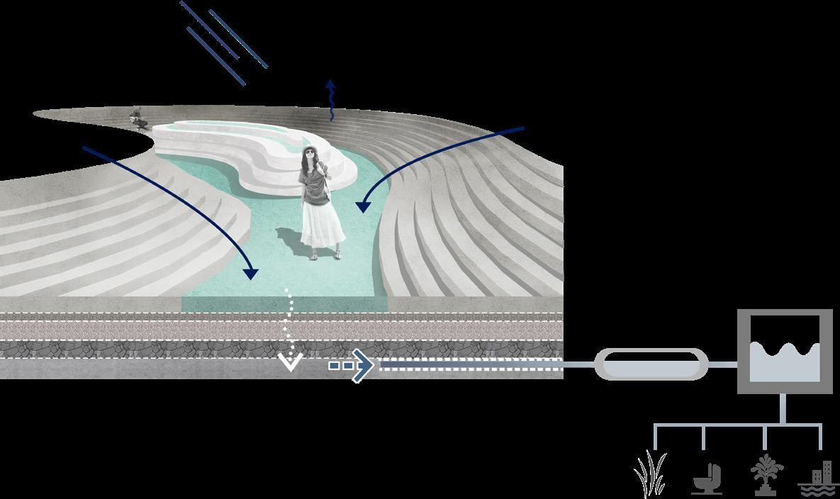
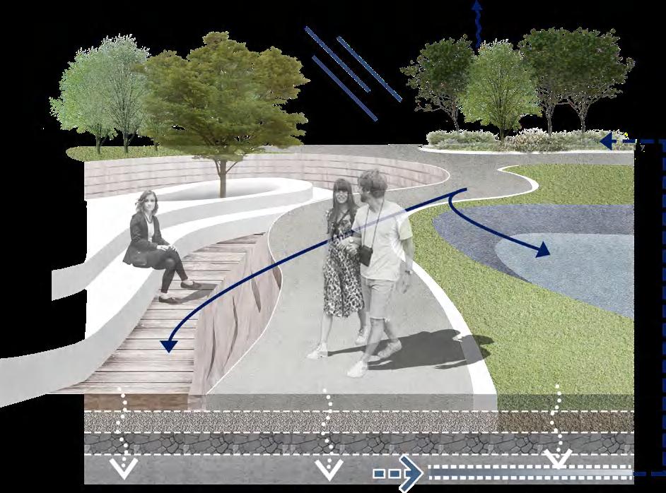


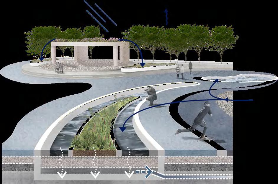


How do they work?

evaporation evaporation evaporation green roof tree pits rain garden porous paving swale ① silver sand ① little stone ① silver sand ② little stone ③ broken stone hardcore ④ concrete ② broken stone hardcore ③ concrete ② little stone ② little stone ④ concrete ③ broken stone hardcore gabion bioretention areas dry basin lawn porous paving dry basin
collect tank tree pits
purifier
AERIAL VIEW
section1-1
section2-2
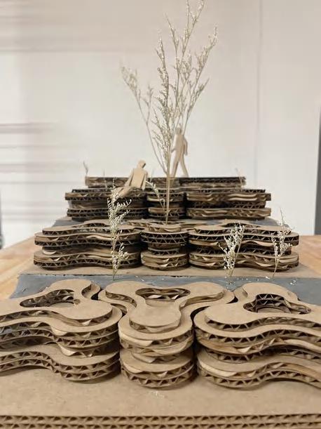
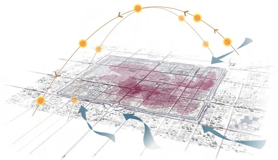
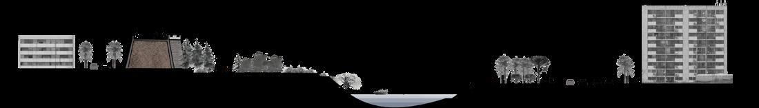
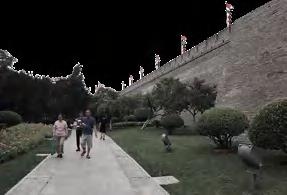
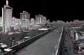
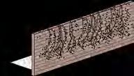
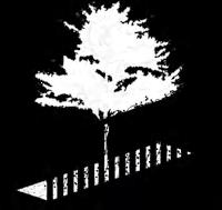
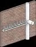
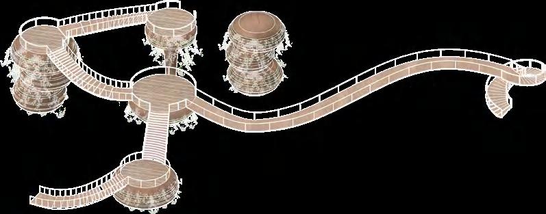
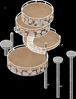
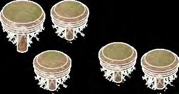
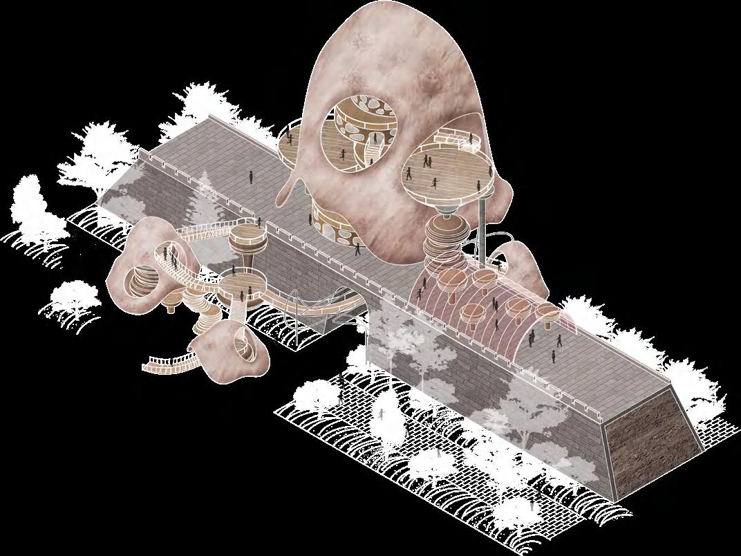
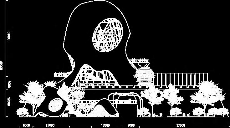
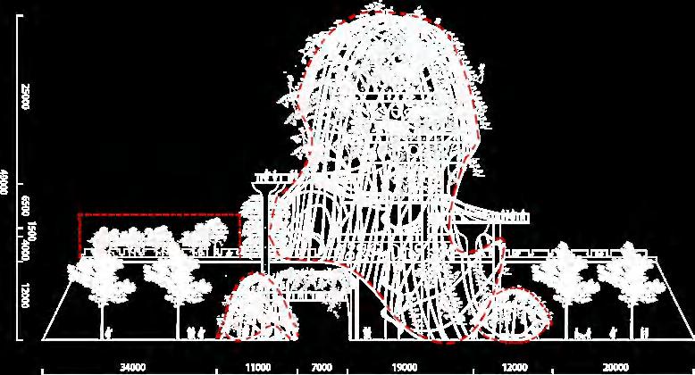
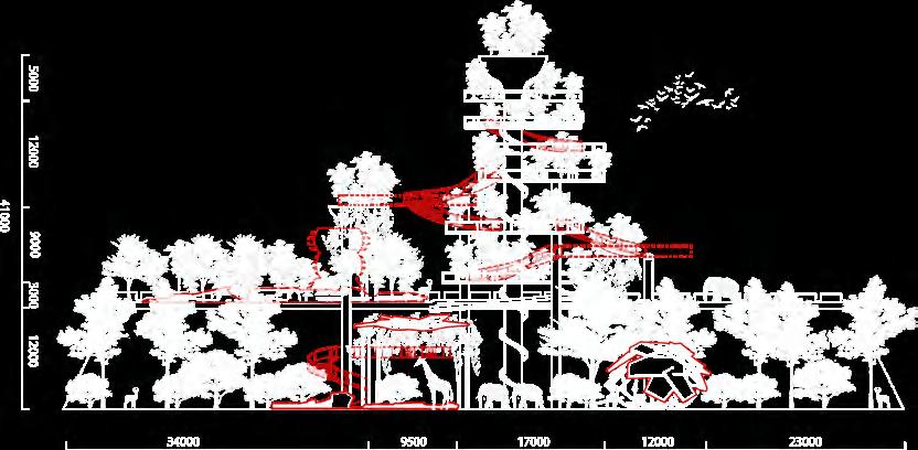
A Large Resilient Installation of The Ancient Wall in Xi 'an City


The Xi'an City Wall has been protecting the city for more than 1,000 years. With the progress of the times, in recent years, the tall and heavy city walls have restricted the communication between the inside and outside of the city, resulting in obvious differences in the living environment and economy.
Outside the city wall, the economy is developed and the environment is comfortable, while inside the city wall, the economy is backward, the city is crowded, and the facilities are dilapidated.


WHAT IS


QUALITY OF BUILDINGS QUALITY OF LIVING FACILITIES
BOUNDARY
Boundary of Entity ROAD ACTIVITY SPACE TYPE RIVER WALL Virtual Boundary new city zone new city zone the city wall old city zone
THE
IN XI 'AN CITY?
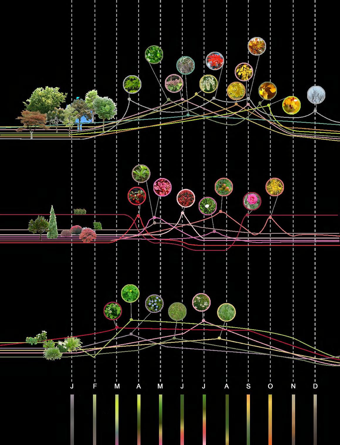
Acer palmatum Thunb firethorn-mature period white clover-flowering phase creeping oxalisflowering phase Veronica persica-flowering phase Bermuda grass zephyranthes candida-flowering phase Radix Ophiopogonis Berberis thunbergii var. atropurpurea Chenaultfirethorn-mature period France Holly photinia serrulata Sabina chinensis pomegranate-mature period Chinese rose-flowering phase pomegranate-leaf fall period goldenrain-flowering phase Chinese scholartree-flowering phase horse chestnut-leaf fall period catalpa-leaf fall period Acer palmatum Thunb-mature period goldenrain-leaf fall period cotonier-leaf fall period Acer palmatum Thunb-withering period Acer palmatum Thunb-mature period catalpa-flowering phase privet-mature period PLANT ANALYSIS OF NEARBY Trees Shrub Ground covers HISTORY OF BOUNDARY Political impact Population mobility Disjunctive space Contact space The city wall was built to protect the city. Peasant uprisings and wars caused the people to flee into the city. Frequent wars caused food shortages, and people outside the city fled into the city. The business model changed. The city government moved away, and the city declined. With the establishment of the municipal government here, the number of residents has increased and the economy and culture have prospered. Tang Dynasty Ming Dynasty The Republic of China Now Period of Transition SECTION AT PRESENT ROAD ALLEY PARK MOAT GREEN BELT ROAD THE BORDER 5 10 20m 9PM 6PM 12PM 9AM 6AM GATE PARK PEDESTRIANS WALKWAY OF INNER WALL MICROCLIMATE ANALYSIS Specific heat capacity of black brick 1.24KJ/(kg·C°) THE BORDER 04 GROW WITH CITY
WHY DO WE NEED TO IMPROVE THE BOUNDARY?


In recent years, the tall and heavy city walls have restricted the communication between the inside and outside of the city, resulting in obvious differences in the living environment and economy.
The living environment inside the city
HOW TO IMPROVE THE BOUNDARY?
Transform the essence of the boundary.
The living environment outside the city
Increase activity and weaken the sense of boundary.


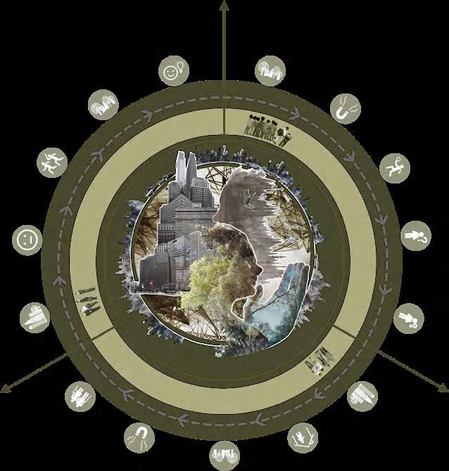
Due to the neglect of preserving the natural environment in urban construction and the great pressure of citizens' daily routine, citizens are generally suffering from nature-deficit disorde.

Besides,as the landscape of the city is very monotonous, the perception of residents is reduced, which is harmful to health.


Types of landscape configuration inside the city

Bridge connection.
Buildings are too close together, and people feel oppressed.
Break the wall.
Away from nature, the cognitive sense of life is reduced, leading to numbness.

Lack of perception

Lack of stimulation, loss of creativity.

Increase of negative emotions


The outdoors is not attractive and people are reluctant to go out.
Use plants to soften the edges of the boundary.


As part of the boundary, humans and animals often interact with them.
 The buildings within the city walls are noticeably lower and shabby than those outside.
Modern architecture and beautiful surroundings. Complete living and entertainment facilities.
Modernization of business model. Greening in good condition. The streets are wide and bright.
Living facilities are scarce and rudimentary. Greening is poor. The streets are narrow and dark.
The business model is backward, selling traditional goods.
The buildings within the city walls are noticeably lower and shabby than those outside.
Modern architecture and beautiful surroundings. Complete living and entertainment facilities.
Modernization of business model. Greening in good condition. The streets are wide and bright.
Living facilities are scarce and rudimentary. Greening is poor. The streets are narrow and dark.
The business model is backward, selling traditional goods.
A d u l ts — — RelievethePressure —sredlE laicoS tcatnoC Children— —Ed u c a t oi n SPIRIT FITNESS IQ BENEFITS OF FOREST EDUCATION hT e ic t epacsy P e o p l e s p e r cep tua l a bilities Increaseof Landscapescheduling Perceptua sys em Landscape schedulng Childrenare Observethe plant Th i nk i n g a n d hC i l nerd s golytilaci epacsyticehT ottnawtndidsredlE epacsdnaL udehcs gn tuoogsredlE sredlE era i s tonom suono a e o u t o f ba lance negative emotion andupdating s activated and updating attractedtoit andits changes E x p o r n g sesaercni si suonotonom ylenoltlefdnatuoog dna adpu gn tiotdetcartta ezilaicosdna
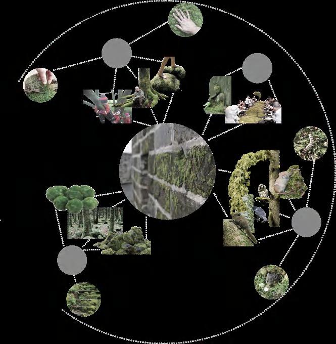
ANALYSIS OF FOREST EDUCATION WHY STUDY AND USE MOSSES?N CITY? As part of the boundary Soft Decorate Moss provides shelter Moss as food Moss holds water, absorbs pollutants, and breaks down rocks to form soil It is loved by the Chinese people FOOD & SHELTER CULTURE FAMILIARITY ECOSYSTEM Therearemany worms in the moss! Isthemosson thewallsoslippery? I'mgoingtopick themossandplantitathome! Themossisso beautiful,Iwant totakemorepics.
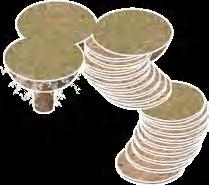
MOSS PLANTING EXPERIMENT 1day smooth smooth rough rough porose porose Beech Cork Wood 2weeks 1month 2months smooth rough porose Flower mud Non-woven fabrics+Flower mud
PROCESS OF DEGRADATION


In the process of gradually turning into a forest, moss can degrade the construction waste produced in urban construction well.


PROCESS OF GROWTH
INSPIRATION
rainforest system
crown


branches¶sitic vines


building&stairs
shrub


viewing platforms
rottenwood


rainshed
ANALYSIS OF COMPONENT PARTS

Scaffolding
The Shell (Degradation after 3 years) (Degradation after 10 years)


(Degradation after 100-200 years) Building
Viewing Platforms
(Degradation after 50 years)
Elevator Shaft

(Degradation after 100-200 years)
Pergola
(Degradation after 200 years)
Viewing Platforms & Corridor
(Degradation after 50 years)
fungus root corridor
vegetation towers
Vegetation Towers

(Degradation after 20 years)
Rainshed
(Degradation after 3 years)

Rainshed


(Degradation after 200 years)
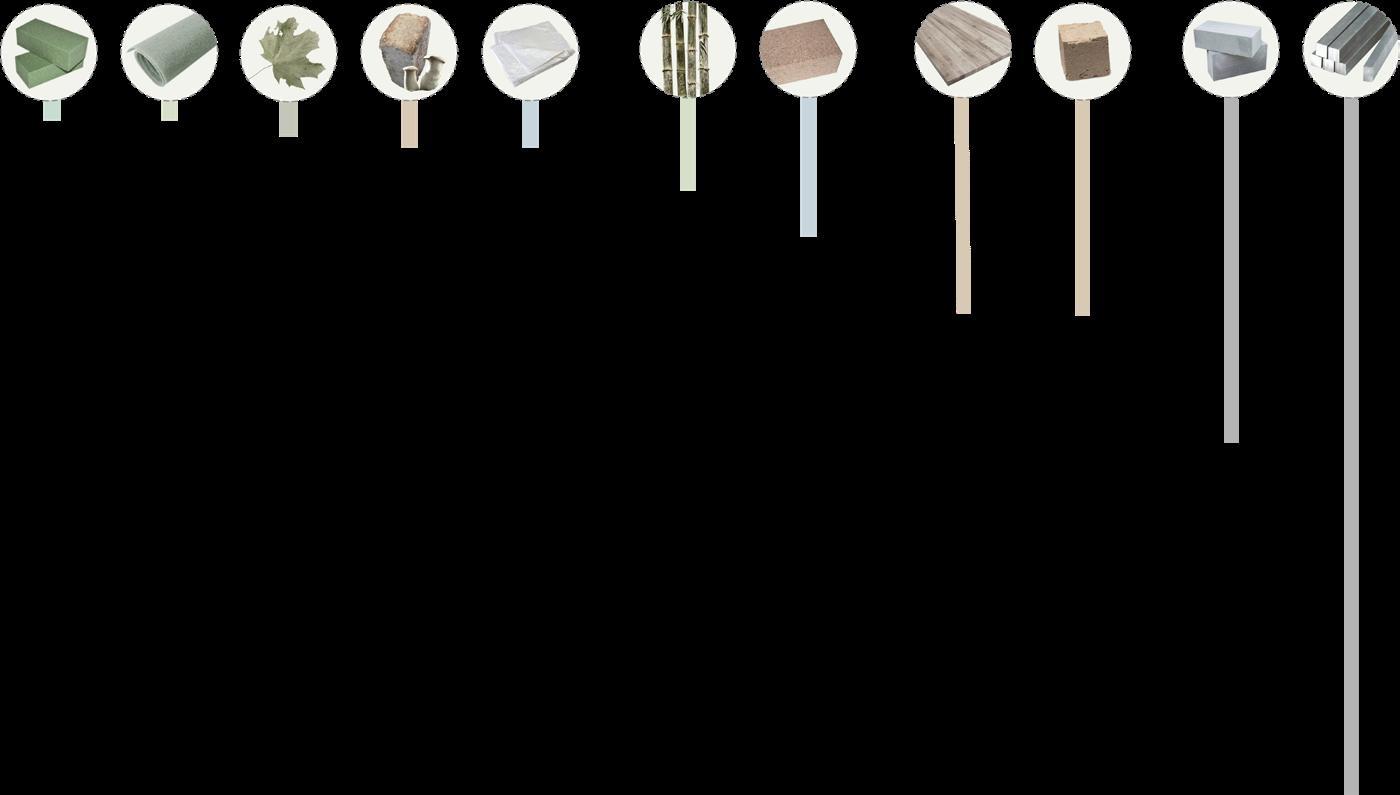
3 Weeks 3 Weeks 5 Months 3 Years 3 Years 10 Years 20 Years 50 Years 50 Years 100 Years 200 Years Flower Mud Non-woven Fabrics Dry Plant Mushroom Mycelium Bioplastics Bamboo Cork Wood Beech Material Finite Concrete Steel
shell
SECTION&PLAN


PERSPECTIVE SECTION

PERSPECTIVE
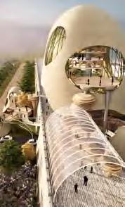
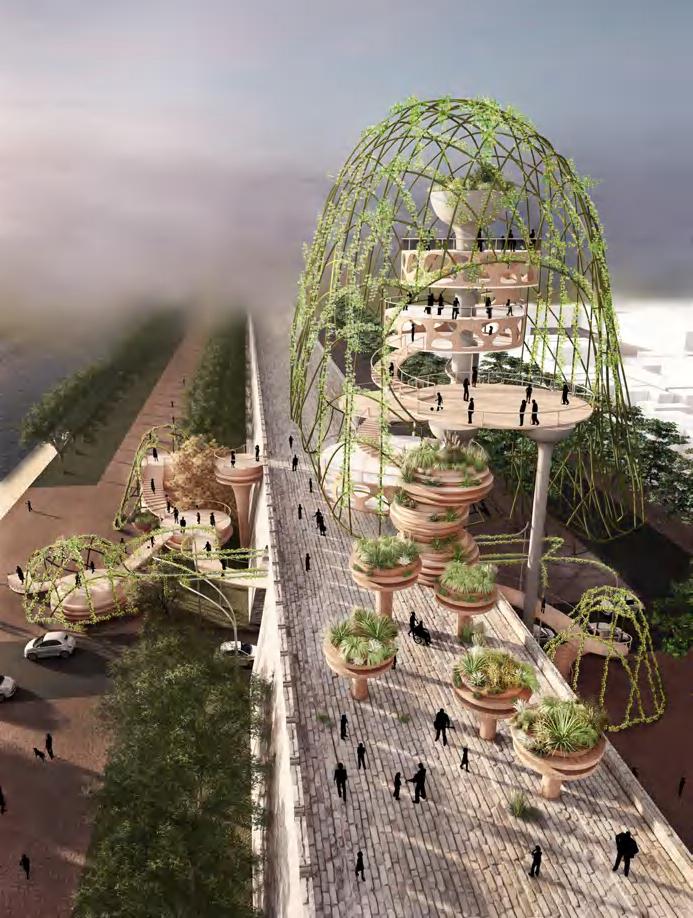
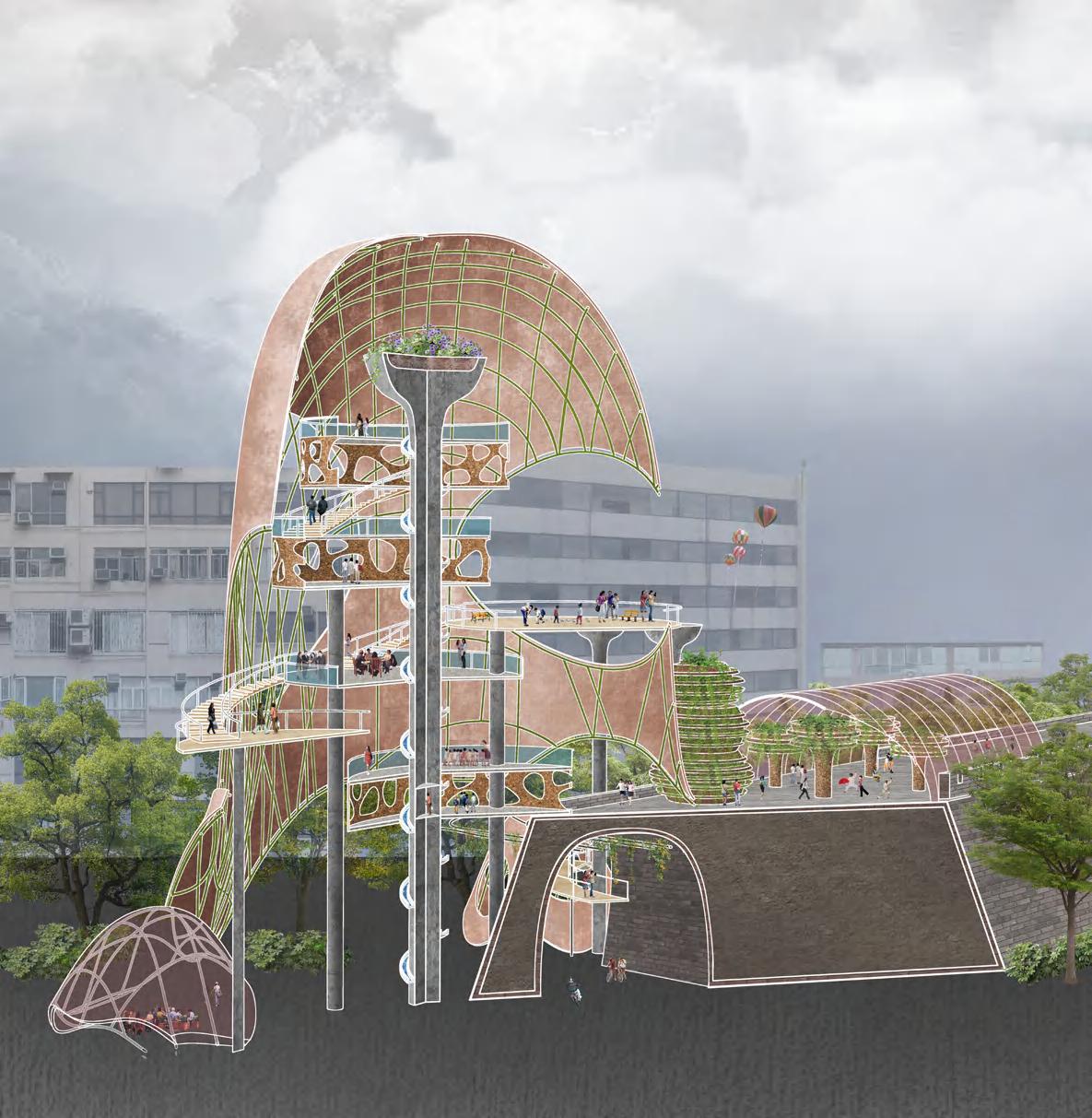
It becomes a new landmark of the city and serves as an exhibition centre, attracting citizens and promoting communication
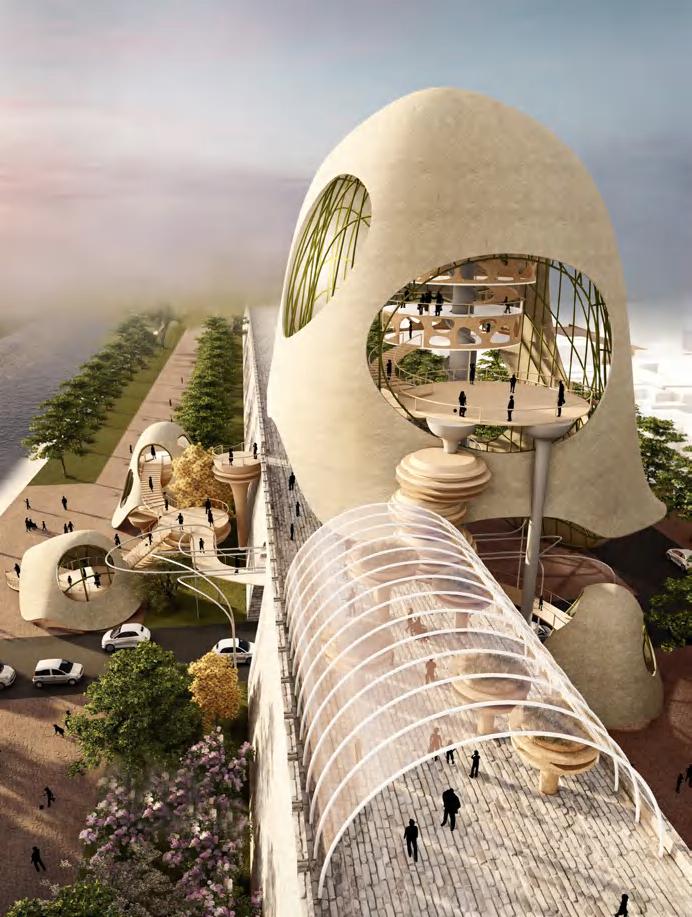
It will be an urban complex where citizens will come to take part in various activities and schools will set up nature classes 2023
It will become an urban garden.Vehicular space will be raised, and ground space will be reserved for pedestrians 2070
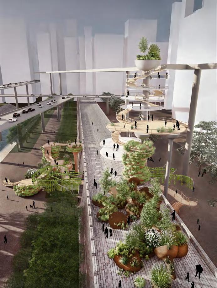

It will become a habitat for animals. People will live above the city and use vehicles that can fly. The ground space will be returned to animals.Man and nature will coexist harmoniously in the city
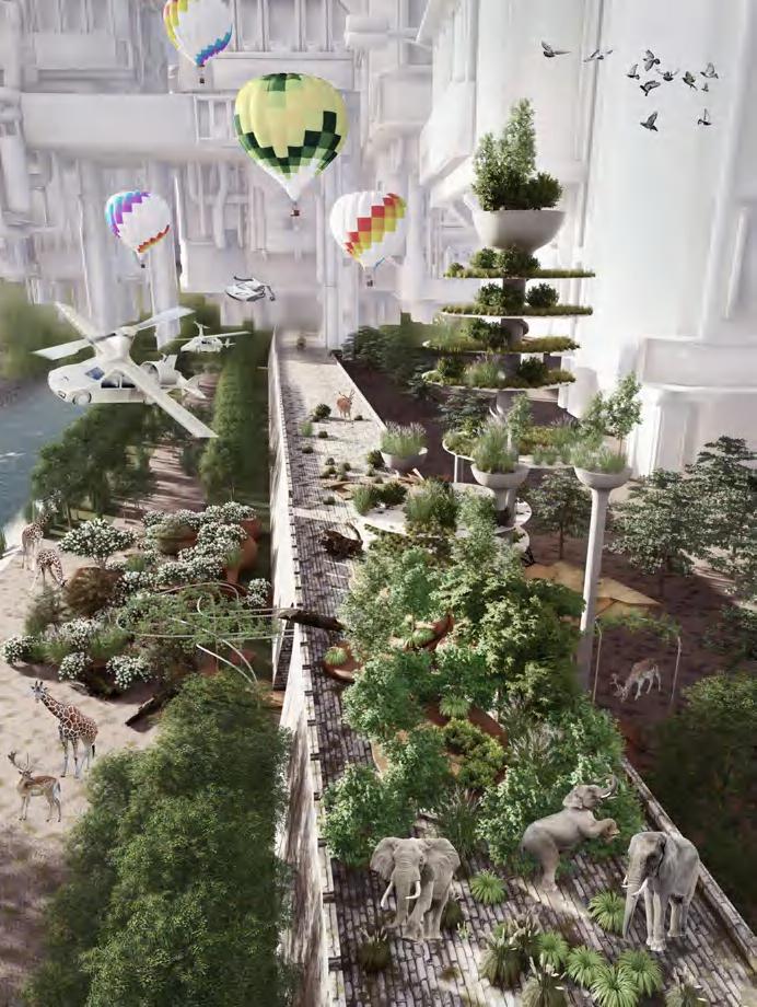
The structure weakens the urban boundary, providing assistance for human and animal activities and plant growth in a short time.
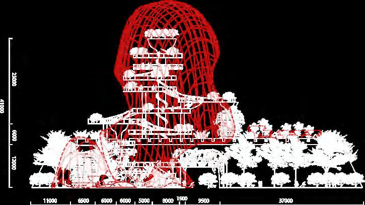

It will change gradually over time, leaving concrete and steel, the more permanent building materials that we use now, more as monuments than as buildings in many cases.
After many years, the monument will also disintegrate and disappear, completely engulfed by plants and eventually turned into soil.
Elevator Shaft Irrigation System Activity Theatre Viewing Platform Exhibition Center Air Passage Reception Center
Phase 1:Exhibition Center(outside view of the wall) Phase 3:Urban Garden(outside
) Phase 2
Leisure
Phase 4:Animal Habitat(inside view of the wall) viewing exhibition catering theater viewing viewing viewing exhibition public class garden garden cave shelter hanging garden pedestrian rest area Before the degradation After the degradation Unit:mm
view of the wall
:
Complex(inside view of the wall)
2020
2120
…………………………