TABLE OF CONTENTS
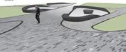
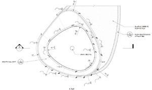
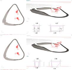
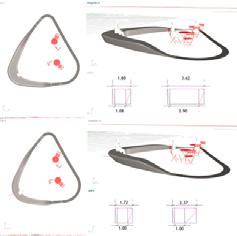
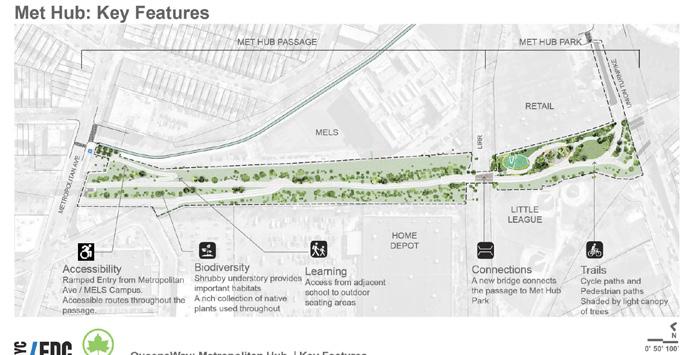
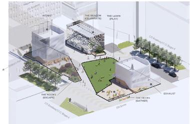
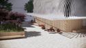
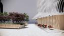
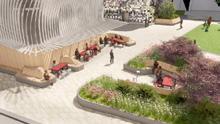
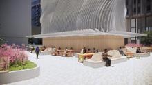
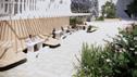
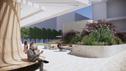
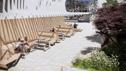
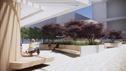
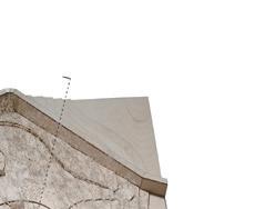
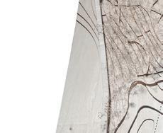
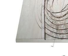
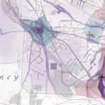
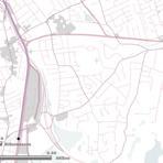
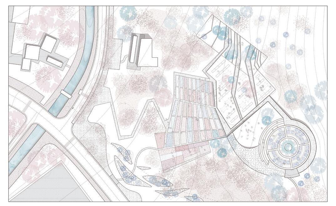
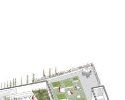
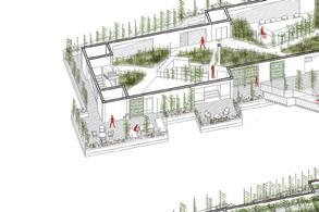
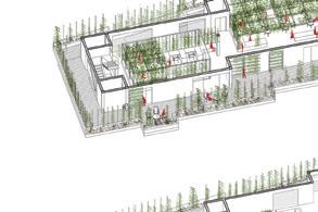
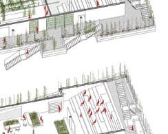
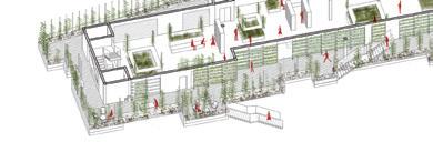
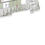
Life Science Campus Enhancement
Type Life Science; Built Work
Team 1 principal; 3 Landscape architects; 3 landscape designers
Time line Mar 2020 - Aug 2021
Project Status DD-CD
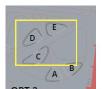
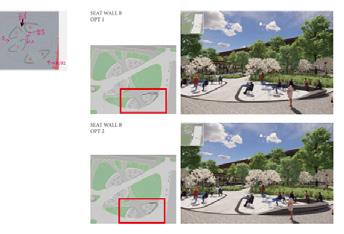
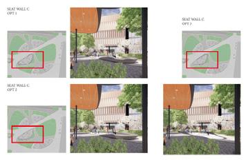
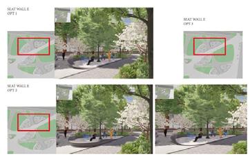
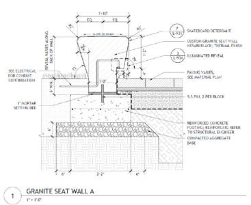
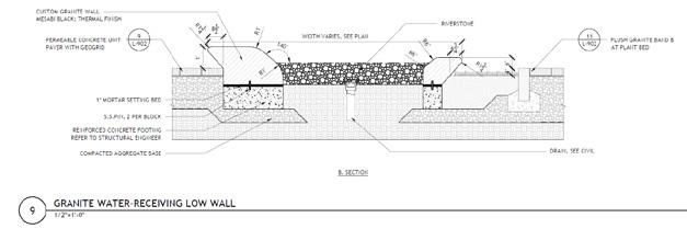
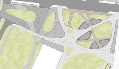
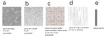
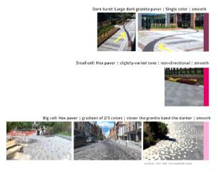
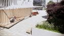
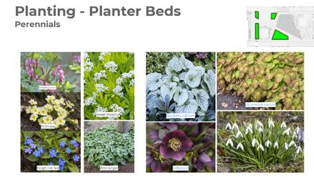
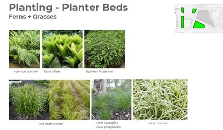
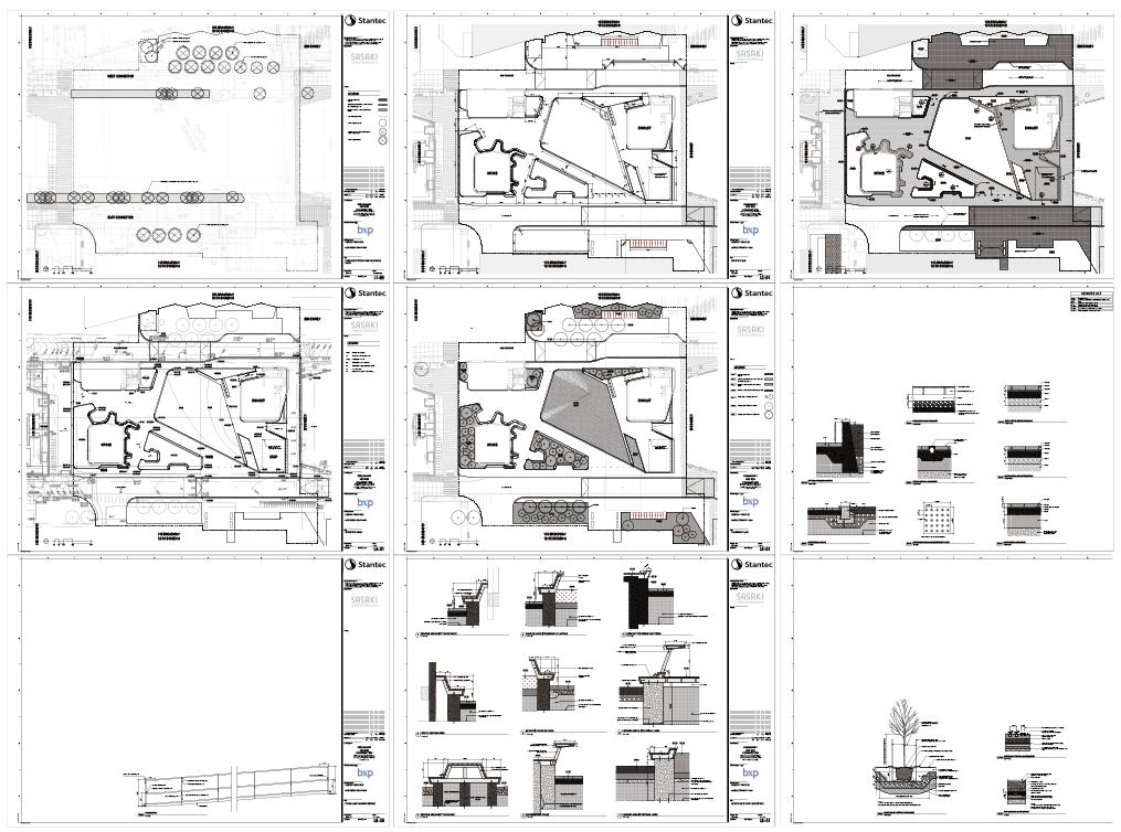
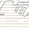
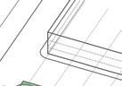
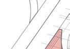
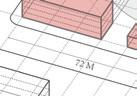
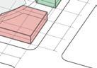
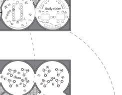
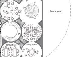
My Role collaborated closely with a larger team and owned a few smaller design exercises. In this sample chose the campus heart area as an example, to show my work methods for the seat wall study, paving pattern, materiality, and planting. In this project also worked closely with project landscape architect to draft the construction documents, specifically, materials plan and paving details.
A. Professional Work Samples
B. Academic Works


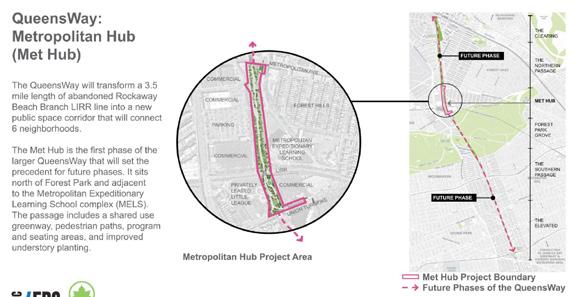
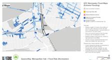
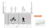
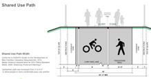
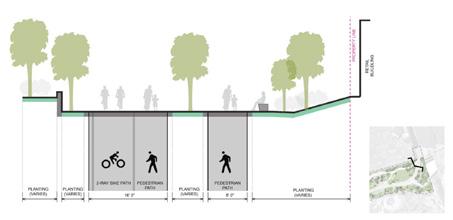
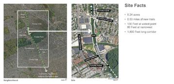
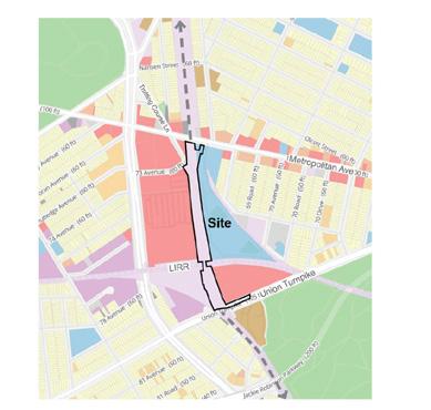
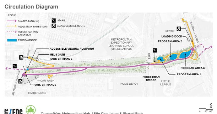
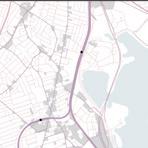
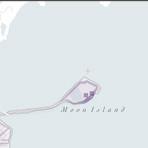
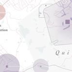
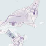
Linear Park in New York City
Type Park; Built Work
Team 1 principal; 1 landscape architect; 2 landscape designers
Time line Mar 2023 - Dec 2023
Project Status Construction Documentation
My Role & takeaways worked closely with the team to study design updates and prepare presentations for agencies to review. Since the project was on hold and entered construction stage a few years after DD, there has been a lot of newly changed/discovered site conditions and coordinations to make. At this project, we also faced a competitor’s proposal for the arrangement of the site (aka Queenslink, which is to build a subway). In this project, learned perspectives and coordinations from first hand.


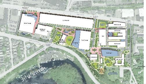
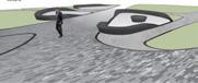
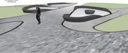
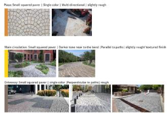
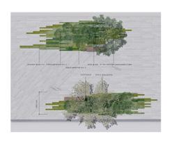
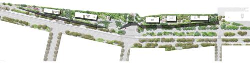
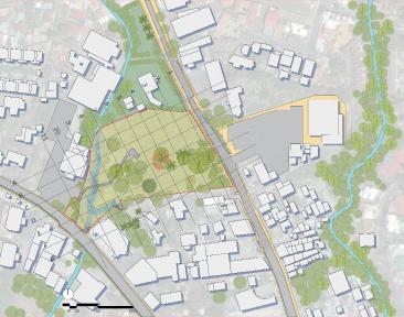
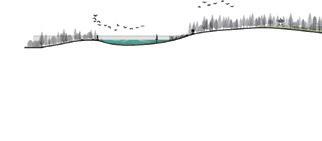
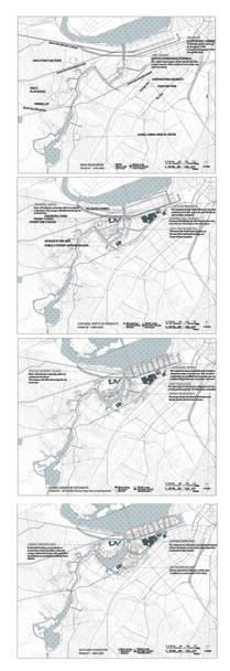
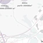
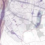
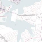
Urban Plaza, Parks and Streetscape
Type Office; Transportation; Life Science; Built Work; Redevelopment; Streetscape
Team 1 principal; 2 Landscape architects; 2 landscape designers
Time line Nov 2022 - Jan 2024
Project Status Concept/SD/DD/Construction
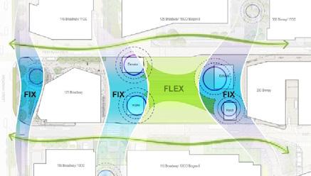
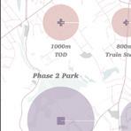
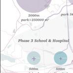
My Role & Takeaway In this project, was deeply involved in these sub projects: “Kendall Square Plaza Redesign”, “300 Binney Street”, and “E-W connector”. also worked on concept for “galaxy park”, and construction documents for “Alta Streetscape”.


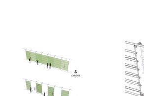
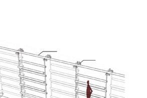
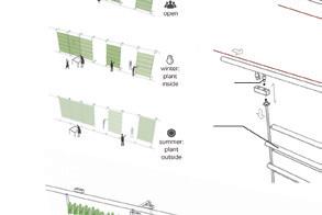
Office Along Railway - Competition
Type Office; vertical landscape
Team 1 principal; 1 landscape designer
Time line Jan - Feb 2021
Project Status Competition
My Role & takeaway As the landscape designer, collaborated closely with the principal and moved fast to finish the submission less than a month. The quick yet deep study in “geography-function-form” gave me an opportunity to extract the meanings from non-visual elements and put them into spatial forms, and how to use patterns to enhance those meanings.
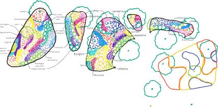
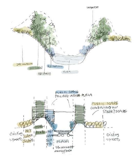
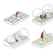
Our proposal for the Sprava zeleznic Headquarters is a celebration of the natural wonders of the Czech Republic, defined by wide valleys with a dense network of rivers, lakes, dense forests, hills and ridges. Drawing inspiration from the beautiful forms and drama of Bohemian Switzerland, the architecture emerges from a diverse botanical wilderness of native Prague plantings.
The movement is fluid in all directions, as necessitated by the flow of visitors to both the Sprava zeleznic Headquarters and the Transportation Terminal. We model the public streetscape on the idea of the shared greenspace between pedestrian, tram and bus.

Bohemian Landscape Spirit
Borrowed scenery is a strategy to bring a familiar and fantastical nature to the city and to give people a chance to experience the wonders of their country. More importantly it is a direct connection to the health and well-being associated with urban biodiversity which produces ecological services such as cleaner air and reduced carbon.
The garden is shaped by movement. Inspired by the perception of a passing landscape while traveling on a train, the gardens are an abstract pattern of linear gardens. The gardens and paving layouts shift according to the programs and neighborhood context.

Mixed Use Development in Canada
Type Mixed use development design and research
Team 1 principal landscape architect; 2 landscape designers; 2 architects
Time line Nov 2020 - Jan 2021
Project Status Concept and Research
My Role As the landscape designer, collaborated closely with the team to do research for local ecology and geography, and quickly came up with concept and ideas by hand sketches. learned a lot about how to get inspired by the locality and ecology, and how that could benefit a high-density mixed-use development.


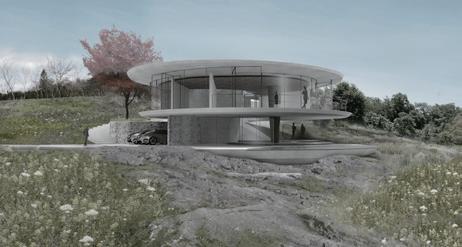
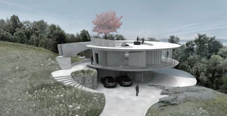
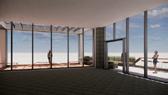
Private House in Hudson Valley
Type Private Residence and landscape
Team 1 principal; 1 landscape designer; 2 architects
Time line Oct - Dec 2021
Project Status Concept
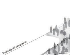
My Role & Takeaway As the landscape designer, collaborated closely with the principal and architects, developed the project from concept to SD. studied the local geography, created a storyboard, designed the materiality and planting palette, and considered typical details and edge conditions carefully for the nuances.
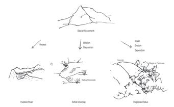
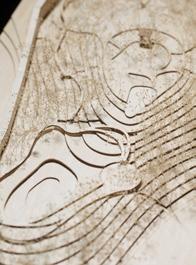
Key Site Elements that tell the story
The Hudson river and the vegetated rocky talus share the same formation: glaciation - erosion of the advancing glaciers and deposition of the sediments when they melt away. This shared geological origin reveals the intercon-
of the site elements, telling a story of the place..


Appendix


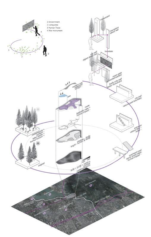
DEATH TO LIFE
Nanjing, Jiangsu, China
Personal Work 2017 Fall
Dedicated to those who sacrificed for the city’s freedom during Nanjing Defense War, 1937.
was born in Nanjing, a beautiful city that had gone through a lot of pain. During the World War II, Nanjing was invaded by Japanese militarism. Soldiers died to protect their homes and one of the battleground was a small hill near the city wall. When found the location 80 years later after the war, it was forgotten field with trees thriving wildly. Nothing was special, nothing really left. Then the night came and was stunned by thousands of fireflies magically twinkling in the bush. At that moment, it was like those soldiers came back as fireflies. These beautiful creatures die soon after showing up, yet the next year, they can be seen again. To a certain extent, Fireflies never die. With this thought in my mind, the dark-blue sky, the bright full moon, the distant city wall and the fireflies got meanings and immediately started to call out the memory of the 1937 war. The whole place was activated by just one element. This resonance between human and nature, emotion and landscape had touched the deepest part inside of my heart. Glory souls never end, and they are always beautiful.

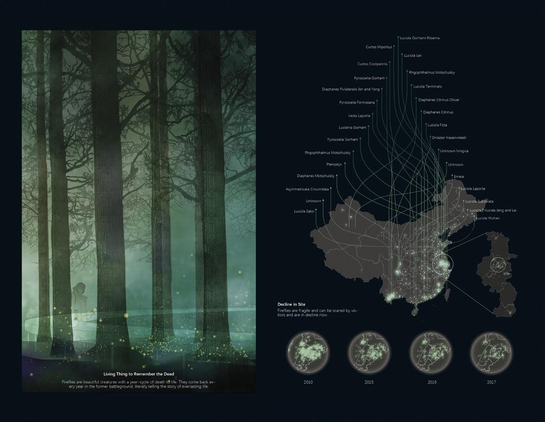
Shelter for Firefly and History
The site is reshaped to be more suitable for fireflies. Human impact is limited. The “everlasting life” - fireflies freely fly in front of the City Wall which was the witness to the war. The scene calls for the memory of history.


Plant For Firefly
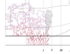
According to fireflies' life cycle, arrange plants with fallen leaves and suitable height to help fireflies survive.


Rotted leaves and grass thicken soil, provide food and shelter for larvae and pupae.
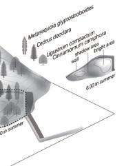
13m
Metasequoia glyptostroboides Cedrus deodara
lowest branches
Pittosporum tobira
Viburnum macrocephalum Fort. Ficus pumila Linn.
Lycoris radiata var. radiata
Setaria viridis
Jasminum nudiflorum Lindl.
Fallen leaves hide the newborn eggs, and protect larvae from cold.
Plants reach perfect height, which can cover fireflies when flying and courting, avoiding being explosed to predator.

Phytolacca acinosa Roxb Phytolacca acinosa Roxb 4m
top branches 1m


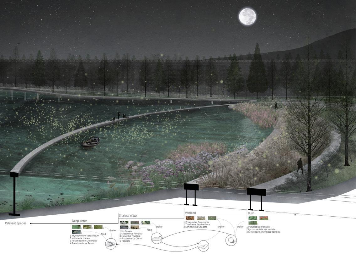
Firefly, City Wall, War
Through the gate, it is the framed scenery of the distant City Wall and reachable fireflies. City Wall is the witness of the war and stayed still for so many years, while fireflies die and reborn again and again.


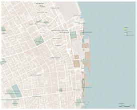
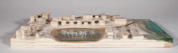
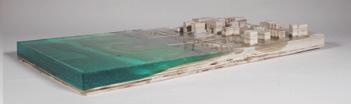
AQUA FLUXES
Redefine Boston Shoreline and A New Public Realm Boston, MA
GSD1211 Core III Studio Group Work 2018 Fall
Role: Research, Mapping, Analysis, Sections, Plans, Axons, Geomorphology Experiments, Models (Digital and Physical)
Graphics Revised Individually in this Portfolio
Instructor: Sergio Lopez-Pineiro
Collabrators: Yoni Carnice, Yun-ting Tsai, Xijia Zhang
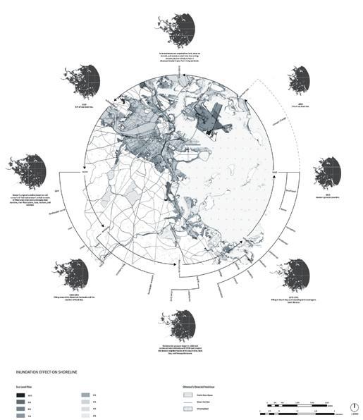
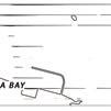
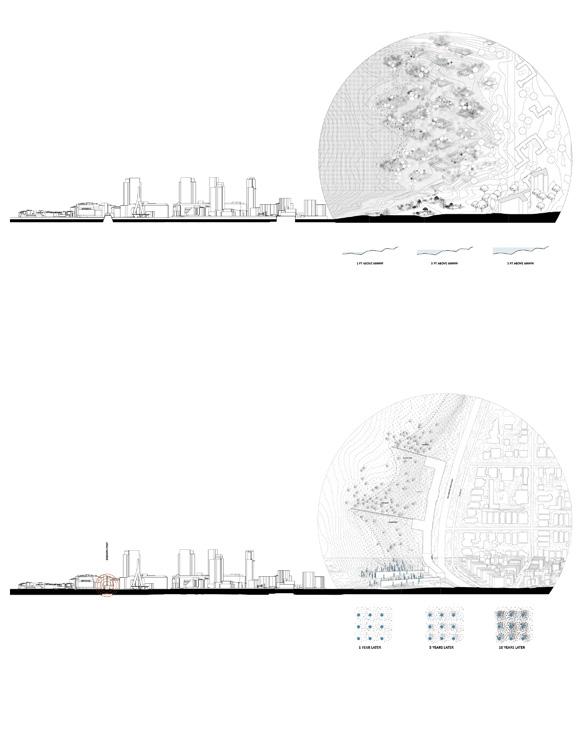
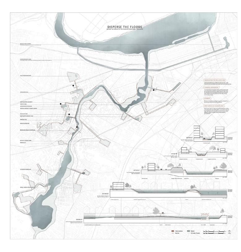
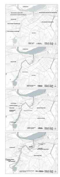
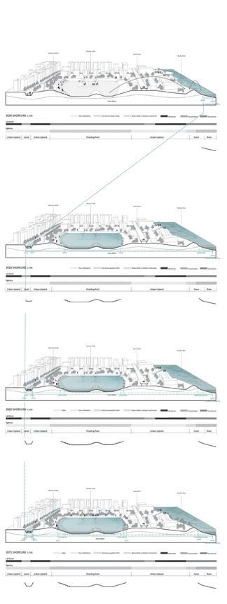
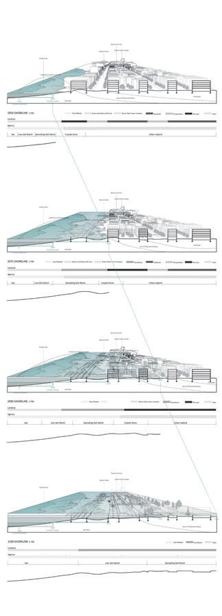
This project has studied the historic land forming and future projection of water dynamics in Boston harbor. Land and water have been constantly exchanging, and every time of the change has created new public space on shoreline. In the past, land reclamation created Back Bay, which was originally water and salt marsh. In the future, Back Bay will be reclaimed by water again due to sea level rise. By recognizing this complicity and temporality in landscape, we redefined shoreline as an ambiguous interface which has been and will be continuously dynamic, and tried to catch several ephemeral moments in this dynamics, meanwhile, prepare for the transition in ecological conditions. In terms of public realm. We look at the flooding situation based on FEMA sea level rise projection, and see how public realms will be eliminated or invented. The future is split into two stages, 2018-2075 and 2075-2100. The main issues are periodic flooding and sea level rise inundation, respectively. Choosing Muddy River as a case, we develop two main strategies, and use a series of changing process to show how the strategies cover the climatic challenges.


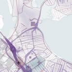
WHITE OUT
Networked Infrastructure for Snow Energy Utilization and Community Redesign Boston, MA
GSD1112 Core IV Studio Group Work 2019 Spring Role: Research, Mapping, Analysis, Prototype, Models, Rendering Graphics Are Revised Individually in this Portfolio
Nominated for GSD Platform 12
Instructor: Danielle Choi
Collabrators: Jingyun Li, Zhaodi Wang
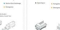
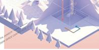
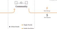
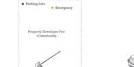
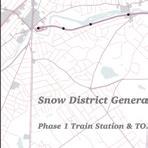
The project challenges the current management of snow, harvest snow as a resource, and reorients the city around snow in Quincy. The rearrangement of city form based on energy supply, as long as the imagination for networked multi-functional infrastructure system (which can be used to process more materials, such as leaves), also inspire the picture of a near-future city. One day of extreme snowfall can cause $265 million of management fee for Quincy. However, according to our calculation, the energy contained in the 12-inch-thick snow on the roof of a single-family house could roughly supply this family for 20 days, and save $90,000 for an urban district like Quincy. The project proposes two main techniques to realize this transformation: Deep ice well for storage, and heat-exchange facility to generate electricity. The facilities are based on MBTA train tracks and yards. In the following phases, parking lots, parks, schools and hospitals in Quincy will join to complete the system. By generating a new demand-support system for the local community, the system is not only for energy reuse, but also for social equity reimbursement.


SNOW FACILITY CAPACITY


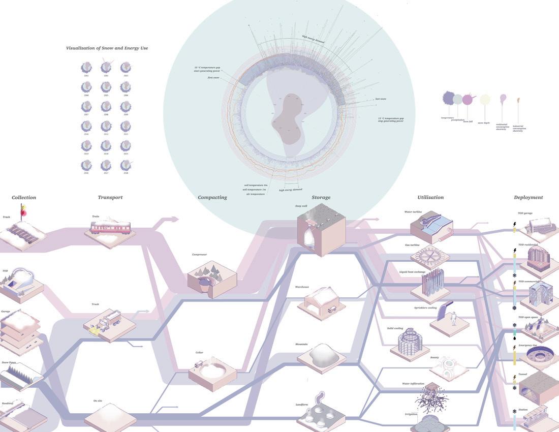


Deep Ice Well
Compared with simply piling up snow in empty space and waiting for it to melt, the deep ice well is utilized to store snow at the undeground space. This new facility uses space more efficiently and transforms snow as resource. The cold water melted from snow will be pumped into the heat exchanger to provide cooling energy for buildings; the warm water will be sent back to the ice well and speed up the melting process. The ice well could be placed beneath playground, an open space, parking lot.


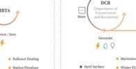


Snow Mound + Snow Fence
Utilizing the temperature difference in winter to change the state of nitrogen from liquid to gas, the gas travels above and drives the gas turbine on the top, in which way generates power and transfers back to the community or parks through urban electricity grid. The electricity could be used to power fireplaces and navigation lighting system in the parks.


04
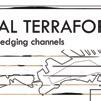
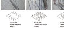
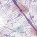
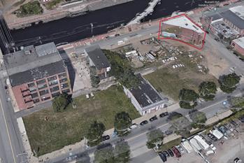
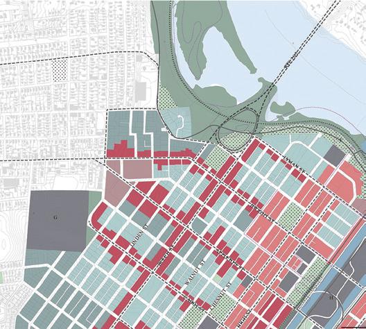
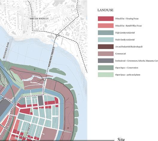
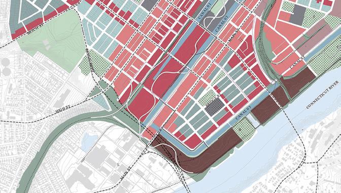
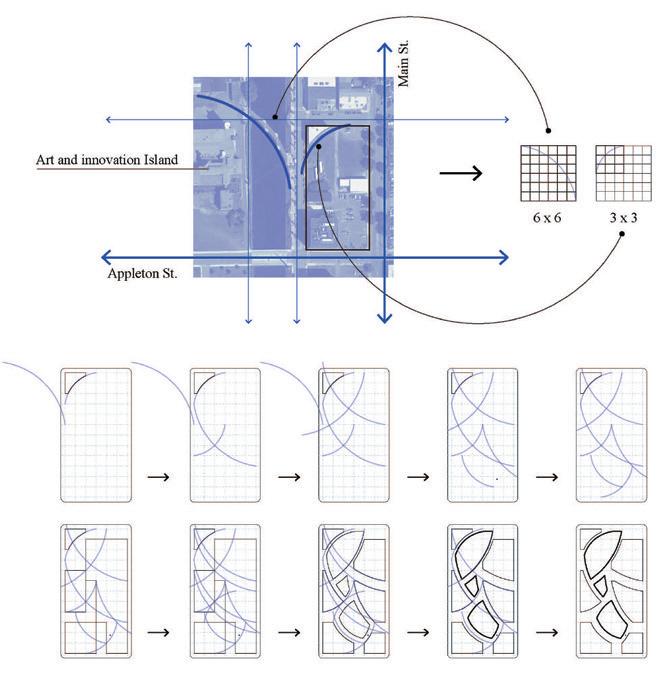
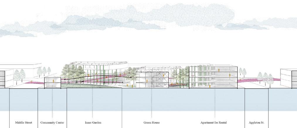
BREAKING THE GRID
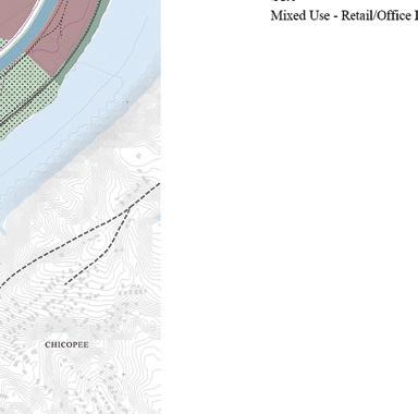
Holyoke, Massachusetts
GSD1410 Option Studio Individual Work 2020 Spring
Instructor: Martha Schwarz, Paola Sturla, Edith Katz
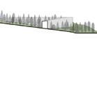
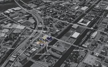
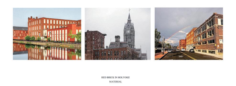
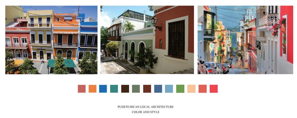
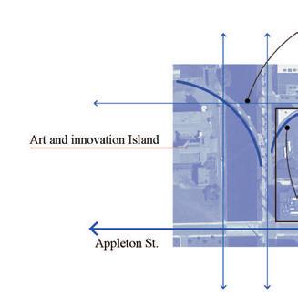
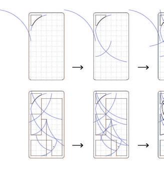
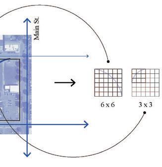
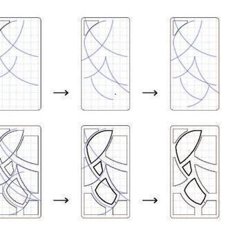
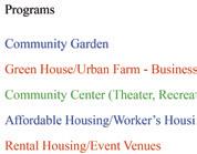
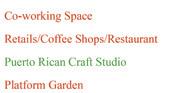
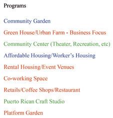
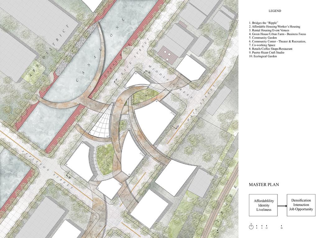
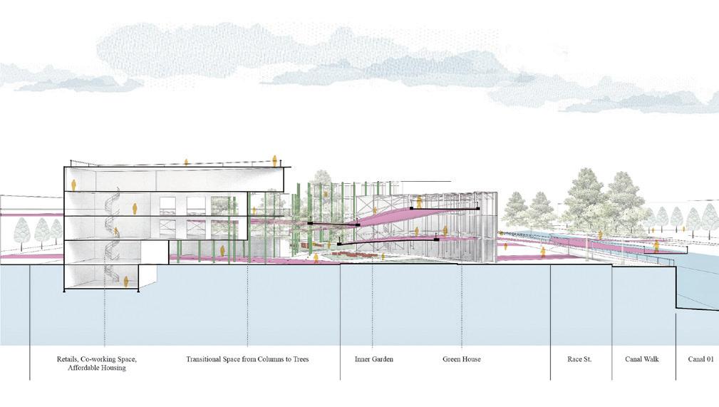
Inspired by an odd-shaped building founded in the corner of the site, see this disturber as ripple breaking the still water of the space, and bringing liveliness to the idle city life. The generation logic of the entire site is based on this small building’s shape, which extends outside and have impacts on the neighborhood or even the city. This story aims to inspire the Puerto Rican climate migrants who have sojourned here as minorities: A tiny kernel could become so strong to survive and thrive. Observing the Puerto Rican culture, the vivid color is built into the red-bricks, outdoor activities are celebrated, cultural and traditional programs are inserted. These create a public space advocate for Puerto Ricans in the Western Massachusetts. Moreover, located at the intersection of Appleton St. and Main St., the site has preeminent connectivity that could be frequently seen, visited, and used, not to mention also the beautiful view of the Canal One. It could be an a spot that people drive to visit or a landmark on Appleton St. that extends all the way to the City Gateway, as memory for the diversity.
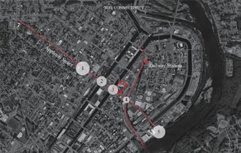
Site Connectivity


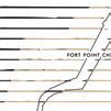
SOCIAL OPERATIVE INFRASTRUCTURE
Water Infrastructure Enhancing Regional Food Security and Social Equity Santiago, Chile
GSD1404 Option Studio Individual Work 2019 Fall
Instructor: Tomás Folch, Eugenio Simonetti
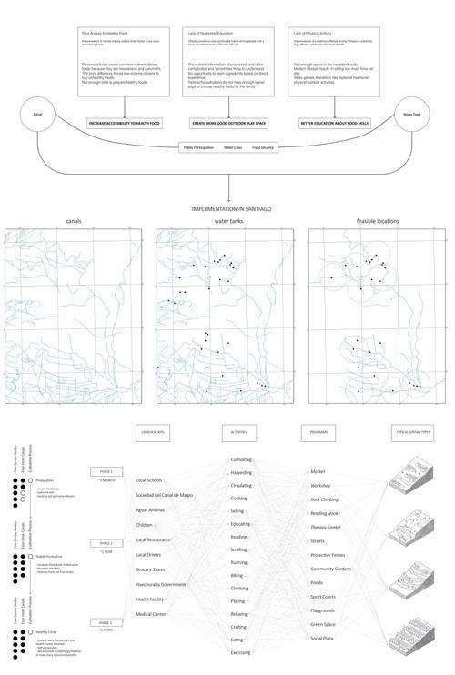
This project reimagined operative water infrastructure (canal+tank) in Santiago to enhance food security and social equity, especially for children in low-income communities who had high obesity rate. High obesity rate among children has been trending and serious problem in Santiago. Between 1993 and 2010, the obesity among children increased from 12.1% to 23.4%. Changes in lifestyle towards unhealthy dietary and lack of physical activities due to progressive industrialization and urbanization have been associated with obesity. Moreover, the low-income communities in Santiago were especially vulnerable to this situation due to poor access to fresh vegetable and fruits and lack of food education. Taking La Pincoya as the specific site, the system of the canal and the water tanks were integrated to the community to secure local food production, water supply, and public realm. The water model could be further applied to communities who share the same conditions and face similar problems.

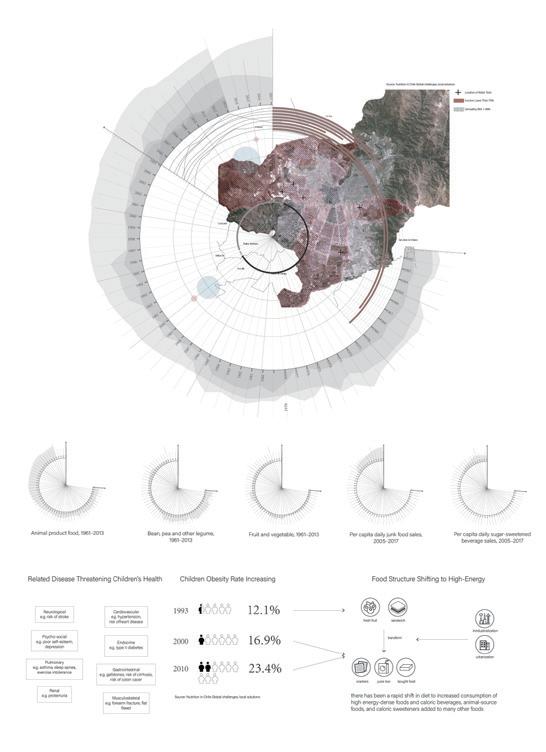
Between 1987 and 2000, the prevalence of undernourished pregnant women decreased from 26.0% to 14.1%; While obesity among them increased from 12.9% to 32.7%. Progressive industrialization urbanization has occurred in Chile during the second half of the 20th century. This has been associated with changes in lifestyle towards unhealthy dietary and physical activity patterns. In many developing countries like Chile, there has been rapid shift in diet to increased consumption of high energy-dense foods and caloric beverages, animal-source foods, and caloric sweeteners added to many other foods. Between 1980 and 1998, the average daily per capita calorie consumption increased from 2.667 kcal per 11.159 (21% fat) to 2.844 kcal per 11.899 (28% fat).


Master Planning
Five Nodes
As the defined spots for the region, the five nodes will be constructed first (within stage 1), and radiate out to inspire the remaining undefined area on the belt. The defined zones are safe, clear, children-friendly.
The Belt Like a belt, The unused land alongside the mountainside and the canal is undefined at first. With further developmental needs raising, it will gradually evolve accordingly. This project proposes a manual of prototypes as a guidance of its future development.
Four Canals
Shaping like fish spine, the four canals are adapted from main streets to provide irrigation water for the public. Complying to the topography, water from the canal is spontaneously introduced to the neighboorhood and drains to the inner green space. Alongside the canals, with more street trees and access to water, a safer, greener, more fun zone will be created, activating the surrounding blocks.
Food Market
electricity plant
Planting Terrace natural drainage flow natural drainage flow
rain garden
Amphitheater
Rooftop Garden
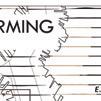
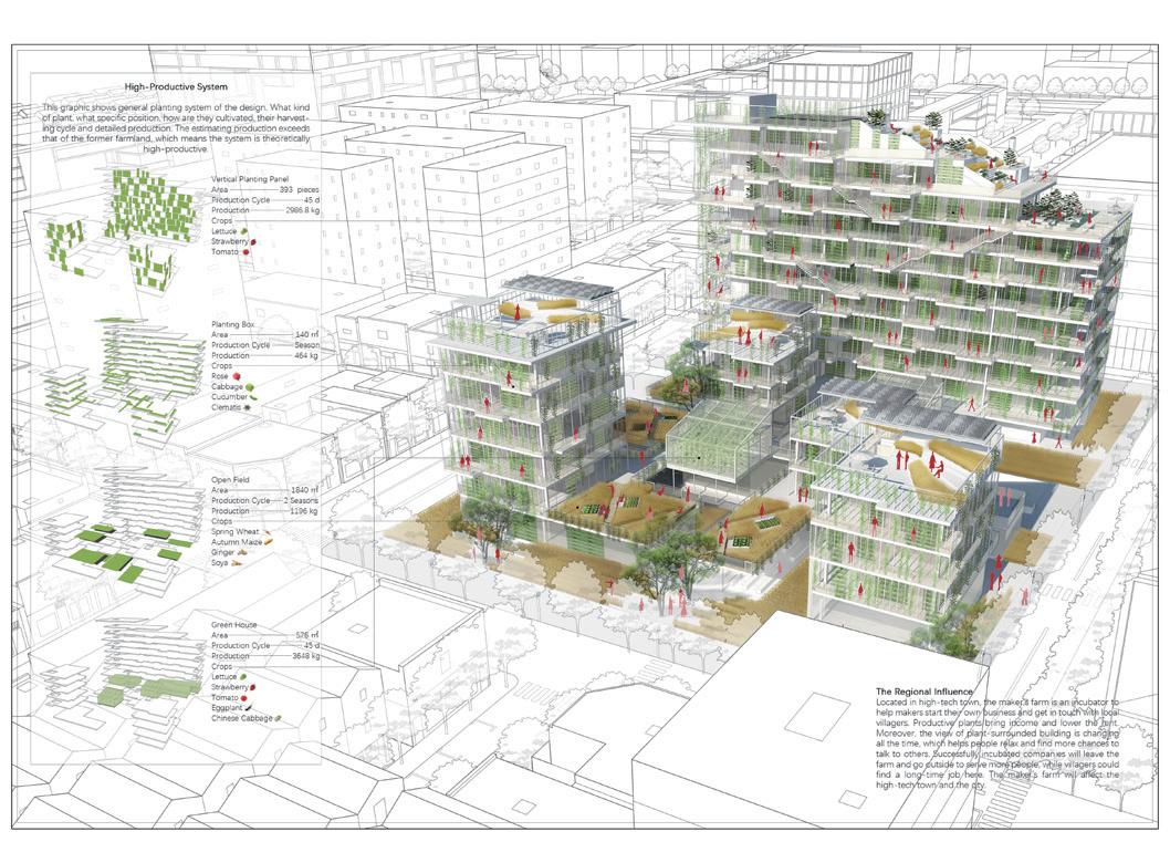
A BUILDING TO CULTIVATE
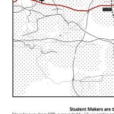
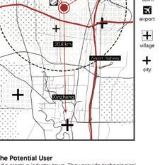
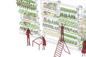
Maker Space Equipped with Vertical Planting Zhengzhou, China Competition Group Work 2016 Spring
2nd Prize in Vertical Farming International College Architectural Design Competition
Collabrators: Yujing Xie, Yinyu Lyu
All graphics in this portfolio are individual works
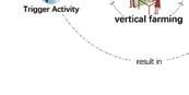
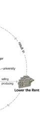
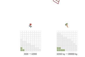
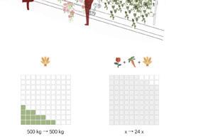
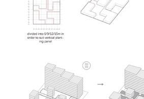
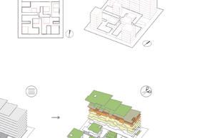
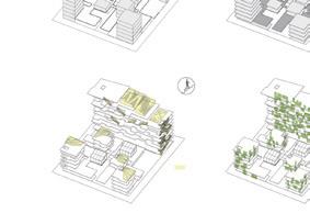
Every year, huge amount of farmland is relinquished for buildings due to the urban expansion. Shopping malls, apartments and office buildings can provide more profits than cultivating crops. Traditional planting cannot provide enough production, resulting in its value further decline. Farmland need to be saved. In this case, 4269㎡ farmland was about to be changed into an office building determined by the government and developers. Adopting the technology of vertical farming, production can be substantially improved and the memory of farming can be saved. Moreover, a complex combining plants and human together could better serve our target user - student makers. Because plant as a productive medium can lower their rent and trigger activities for their business. Villagers and collage faculty nearby could also find their interests in the complex. Plant, the medium, is functioning as a bond between man and man, and man and nature


Central Node: Food Market
As a plaza with a water tank on site, the plaza uses drinking water from the water tank to supply the activities at the food market, while water from the canal will be used for irrigation. Vegetables, fruits, and medical herbs are planted at the terraced field and managed by the local contractor or individual resident/family. Located at the top of the semi-buried water tank, garden provides plants and educational facilities that they can play with and learn from. Fresh ingredients from the field will be harvested and delivered to the community downwards or sold at the flat plaza next to it. Stormwater from the top of the mountain drains through a rain garden that slows down the velocity of the flow, decreasing the potential damage from flooding. The food market node also serves as the starting point or the destination of the local school activity program route. Student participants can ear, drink, rest, and play sports here before or after the marching at the belt. The plaza is also a social node for common daily use. At weekends and special holidays, flee markets can be seen on the flat plaza and terrace.
Water Tank


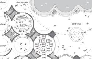


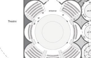


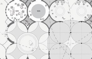


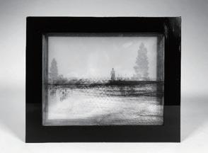
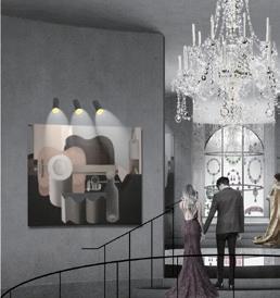
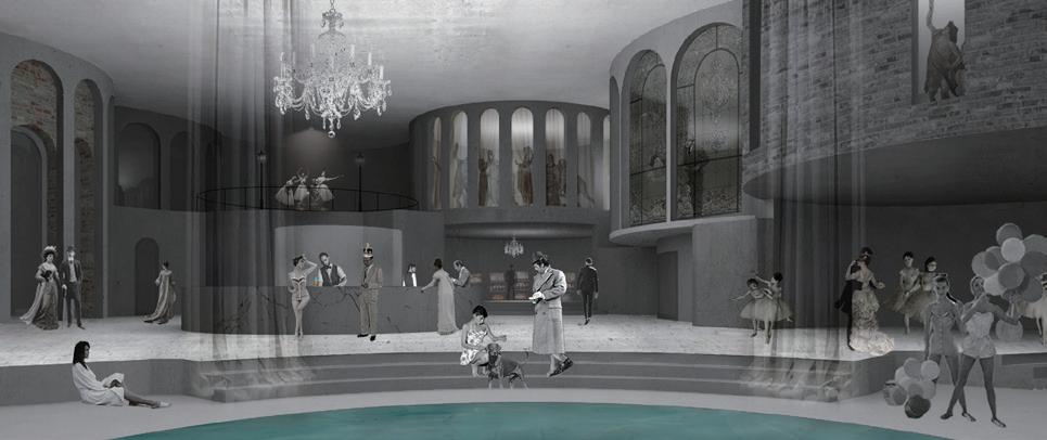
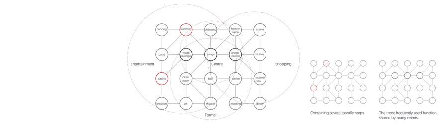
noticed this gorgeous lady at the ball. She was playing some unknown but beautiful ditties. She went to the casino after the ball was over.


followed her for curiosity, only saw her disappearing at the entrance of the art museum.
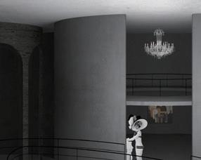
The jewellery’s was like a beacon that everyone headed for. However, saw her standing still, staring at a painting. Guernica, was so surprised, that was also my favorite work.

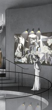
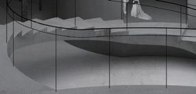
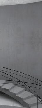
lost her. However, while wandering in the art hallway, accidentally peeked at the swimming pool downstairs. She was looking up at me too.
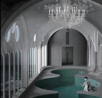

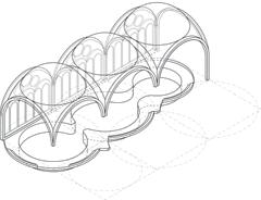
Higgins came downstairs, and finally met Eliza.
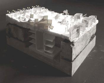
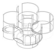
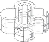
GSD 2241 2018 Fall
Instructors: Craig Douglas, Rosalea
Open House
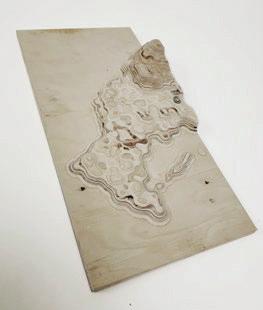
Material: Plywood, Cement Fabrication: Laser Cutting & Casting & CNC Milling