9 minute read
Priority Areas and Drivers
Flooding has the potential to negatively affect people and communities. By considering both the vulnerability of communities and the opportunities for land management interventions, actions can be targeted to have a positive impact on communities most at risk. Flooding is one of a number of natural hazards which can cause harm to people, the environment and the economy. The primary driver for targeting this catchment is flooding. However, there are other priority areas and drivers which will be affected by NFM and can determine the most appropriate type of NFM for the catchment. These are mapped in the following pages.
Priority Areas and Drivers
Flooding
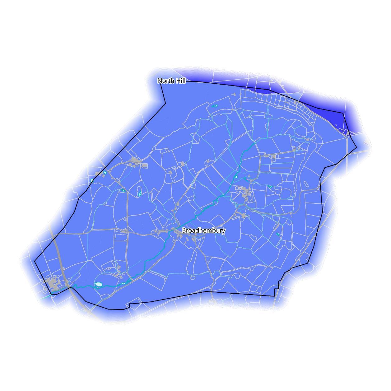
The Neighbourhood Flood Vulnerability Index (NFVI) characterises vulnerability as communities likely to experience losses in wellbeing during flood events. This is based on their susceptibility, preparedness, responsiveness, and ability to recover, all without significant support from emergency services. Nearly all of the catchment is classed as “Relatively Low” in the NFVI, meaning the community are slightly less vulnerable to losses in wellbeing from a flood event than the UK average. At the north boundary, on the plateau, the NFVI rises to “Average”, meaning the communities here are as vulnerable as the UK average from flood losses.

Priority Areas and Drivers
Flooding
The Social Flood Risk Index (SFRI) is a geographic measure of flood disadvantage. It identifies communities who are both exposed to flood risk by living on a flood plain and who are more vulnerable to the effects of flooding, due to factors such as health, preparedness and the availability of community support. Higher numbers of people living in a flood plain coinciding with high social vulnerability result in higher index values. The map highlights neighbourhoods identified as at risk of fluvial flooding higher than the national average. Please note that this is based on flood
risk from rivers and the sea, so coastal areas may not be affected by changes in land management upstream.
At present, the northern border of the catchment is classed as “Low” in the SFRI for river and coastal flooding, though this doesn’t increase in future projected scenarios of 2 and 4 degree temperature increases by the 2050s. The rest of the catchment is classed as “exposed” but the NFVI remains below the UK mean in all scenarios.


Priority Areas and Drivers
Flooding
When considering flooding, it is necessary to investigate records of previous flood events and combine this with modelled scenarios of what could happen, particularly in the face of the uncertainty of climate change affecting weather patterns. The River Tale has previously flooded in October 2008 where channel capacity was exceeded with no raised defences. There are 12 buildings falling within the recorded flood outlines. There are currently no flood defences in the catchment.
The EA’s modelled fluvial Flood Zone 2 dataset show areas predicted to flood from rivers in a storm event so severe it is likely to occur only once every 1000 years. This is also known as a 0.1% Annual Exceedance Probability. Flood Zone 2 was used to identify buildings potentially at flood risk as shown previously on page 8. This extends most of the way up the catchment and into Broadhembury.
The EA’s Risk of Flooding from Surface Water (RoFSW) dataset shows the extent of flooding caused by rainwater flowing across the ground towards the nearest water course in a 1 in 1000 year storm event. This overlaps frequently with Flood Zone 2, but also shows depressions in the ground where surface water will accumulate. This covers the whole length of the River Tale and much of the length of all the tributaries, including multiple field boundaries and lanes. There are also linear flooded areas within multiple fields. There is a particularly large area south of Broadhembury spreading across the land.

Priority Areas and Drivers
Flooding
The modelled flood risk shows higher risk in the village of Broadhembury and in the downstream Colliton industrial estate which matches anecdotal evidence during the survey.
Some road verges were reinforced with concrete gullies or drains which indicates the road network often experiences rapid surface water run-off and may exacerbate flooding. This was reinforced by some unsealed roads or tracks in the upper catchment areas showed signs of rapid run-off pathways and erosion.
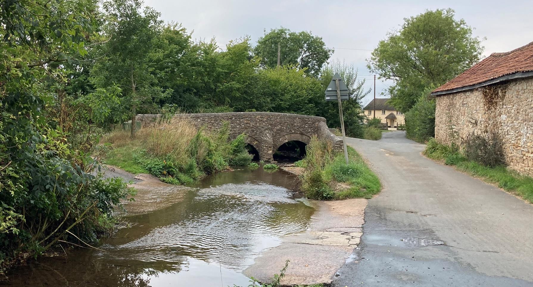
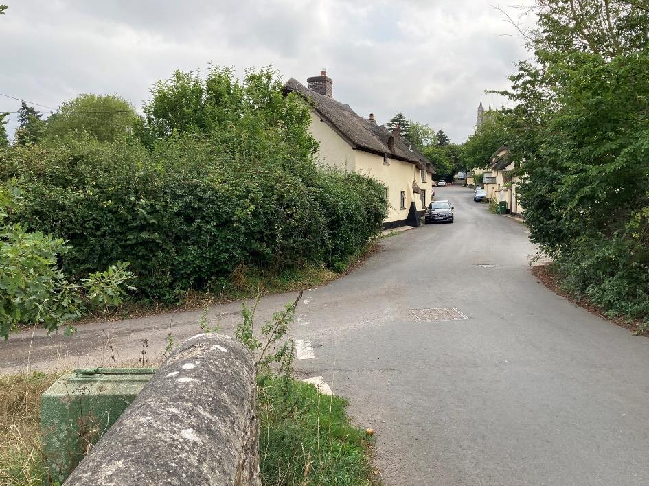
The village appears to experience flooding due to the bridge infrastructure being a pinch-point (pictured top right) which is particularly vulnerable should it become blocked or partially blocked. The river runs directly adjacent to the road in the village and the banks have been significantly reinforced with large blockstone in places.

Priority Areas and Drivers
Flooding
Community Stakeholder groups are important frontline people who help prepare and respond to local flooding.
The Broadhembury Parish Council has a published emergency plan for residents with advice and guidance. Flooding is one emergency stated and confirms flooding can be a problem in the surveyed microcatchment as well as downstream, “Parts of Broadhembury, Kerswell, Luton and Colliton are liable to flood after prolonged rainfall or sudden downpours which can lead to ‘flash floods’. The majority of this flooding is due to the inability of road drains to deal with the capacity of water, though in some cases the problems are exacerbated by run-off from fields. In some instances the rivers and brooks do not have sufficient capacity to accommodate increased volumes of water.”
The community has an ongoing interest in the wider catchment as part of its concerns about flooding.
The Blackdown Hills AONB Nature Recovery Plan also has mention of nature recovery in the upper catchment being used to help alleviate flooding.

Priority Areas and Drivers
Water Quality
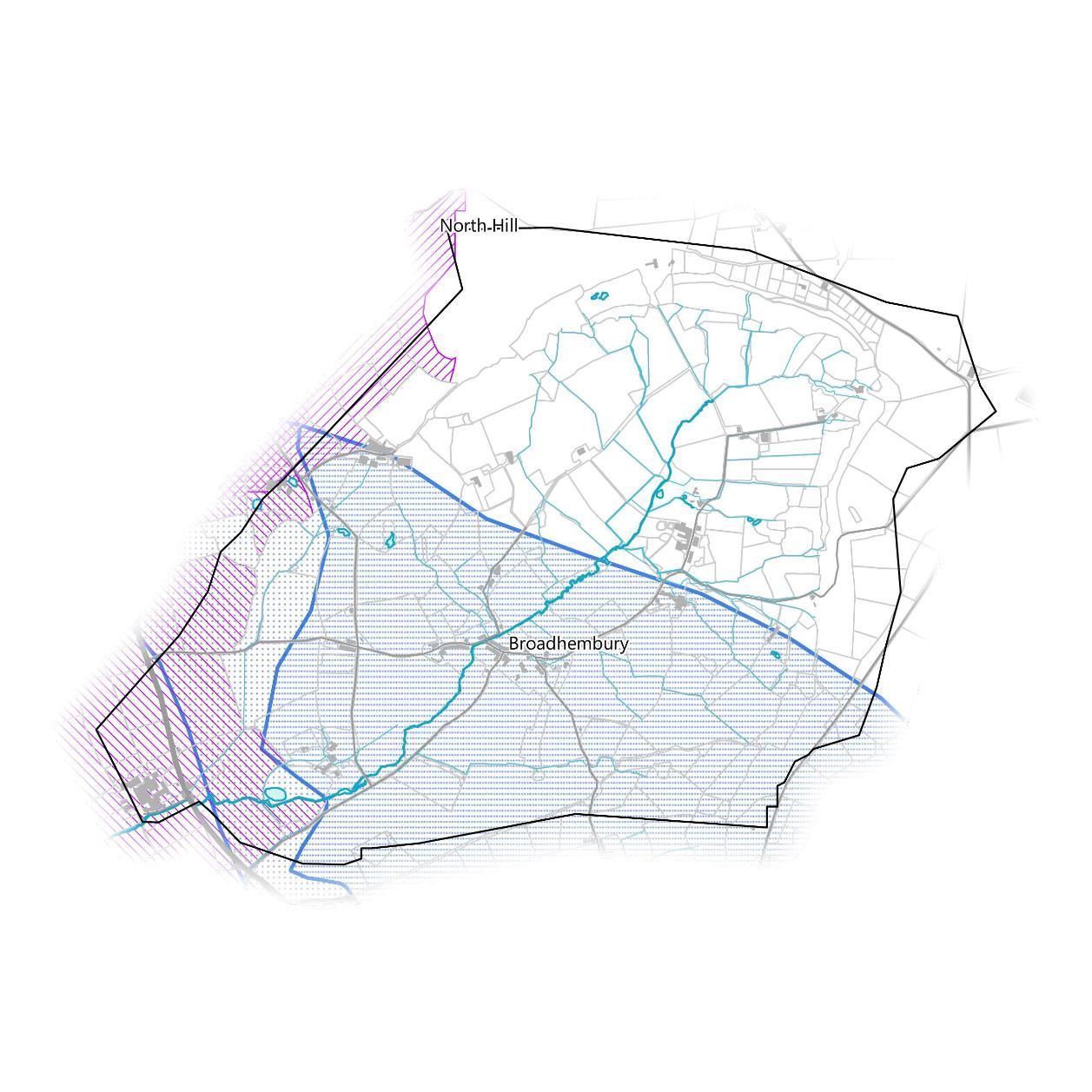
Clean and plentiful water is vital for a huge variety of our activities, and for supporting healthy ecosystems. Good water quality supports an efficient water supply, healthy natural habitats and cultural ecosystem services. A plentiful water supply is important for drinking water and household use, irrigation, industrial use and for maintaining habitats. Water quality is a key underpinning for the Water Framework Directive. The catchment falls within Nitrate Vulnerable Zones (NVZ) for surface and ground water. These are found on the west boundary of the catchment, surface water in the northwest and ground water in the southwest, also covering the base of the catchment. However, the southwestern half of the catchment overlaps with a Ground Water Source Protection Zone III – Total Catchment which is defined as the total area needed to support the abstraction or discharge from the protected groundwater source. For more information on water quality go to slide 26.
Priority Areas and Drivers
Water Quantity and Drought Risk
The amount of water available for abstraction is an indicator of how much drinking water is available for people. The catchment sits within an area not currently available for licensed water abstraction (left map) but is bordered to the north and west by areas where water is available for licensed abstraction. This area also falls just within the catchment boundary on top of the plateau. In the context of NFM, it is also necessary to consider water availability for plants and wildlife. Drought can cause vegetation to die back, leaving bare soil exposed and more vulnerable to erosion and runoff when it eventually rains. The Vegetation Health Index (VHI) uses satellite data to combine temperature and vegetation condition to characterise vegetation health. Areas are scored between 0 and 1 with lower values indicating low drought risk to plant health and higher values indicating higher risk. The catchment is scored relatively high at 0.612 on the VHI (right map), indicating relatively high risk to plant life from drought stress. The southwestern border of the catchment is scored slightly lower at 0.396, indicating slightly below average risk.


Priority Areas and Drivers
Designated Sites
Designated habitat sites, from small local nature reserves all the way up to large national parks, need to be protected for the wealth of benefits they provide to people and the environment, including already providing some degree of NFM. A site being designated can be an indicator of habitat health.
The majority of the catchment (northeast of the A373) falls within the Black Down Hills Area of Outstanding Natural Beauty. Aside from this, there are no other designated sites for habitats present.

Priority Areas and Drivers
Air Quality
Clean air is important for people’s health and for healthy ecosystems. Air quality is the term used to describe the levels of pollution in the air. When air quality is poor, pollutants in the air may be hazardous to people, particularly those with lung or heart conditions. In the past, the main air pollution problem was smoke and sulphur dioxide from fossil fuels such as coal. Now, the major threat to clean air is from traffic emissions. Petrol and diesel motor vehicles emit a variety of pollutants, principally carbon monoxide (CO), oxides of nitrogen (NOx), volatile organic compounds (VOCs) and particulate matter (PMx). A growing body of research suggested that smaller particles, in particular PM less than 2.5μm in diameter (PM2.5), is a metric for air pollution which is closely associated with the adverse health effects of poor air quality. Therefore, this section will use data relating to PM2.5 where relevant. Improvements to the soil and surrounding environment have the potential to also deliver improvements to air quality through natural filtering processes. The micro-catchment has relatively low concentrations of air particulate matter from emissions with some small areas showing slightly higher concentrations, such as the region in the west, just east of the A373. This measures at 7.09PM2.5, while the lowest recorded measurement of 6.63PM2.5 is in the northeast of the catchment.

Priority Areas and Drivers
Tourism and Recreation
Areas and features important for tourism and recreation may also be at flood risk and it is necessary to protect them for a healthy society and environment.
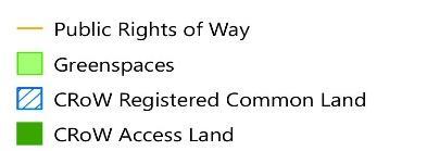
There are two greenspaces in the catchment, both in Broadhembury. They are comprised of a churchyard for St Andrews Church, and a children’s play space. There is an area of Countryside and Rights of Way (CRoW) Access Land and CRoW Registered Common Land at the northern boundary of the catchment.
A Public Right of Way (PRoW) runs along the edge of the plateau in the north of the catchment. Several shorter paths are found west of the river Tale and run into Broadhembury.

