2 minute read
Why this Catchment?
Over view
Why this Catchment?
The micro-catchment was selected in the GIS modelling step because it contains a large number of properties at Ford Mill and elsewhere
in the catchment that are potentially at flood risk. The map below shows which buildings overlap with the EA’s modelled “Flood Zone 2” area, specifically areas at risk of flooding from rivers, as identified during the micro-catchment mapping process.
There are 5 buildings potentially at risk out of 36 in the catchment, approximately 11% of them. The catchment’s size of 4.66km2 gives an area of 0.93km2 per building at risk.
The water framework directive (WFD) status in the wider Lower Batherm catchment is Moderate.
If property owners are willing to work with land owners and vice versa, then small-scale NFM measures upstream in the catchment have the potential to benefit a large number of properties and improve water quality.

Micro-catchment Over view
Topography
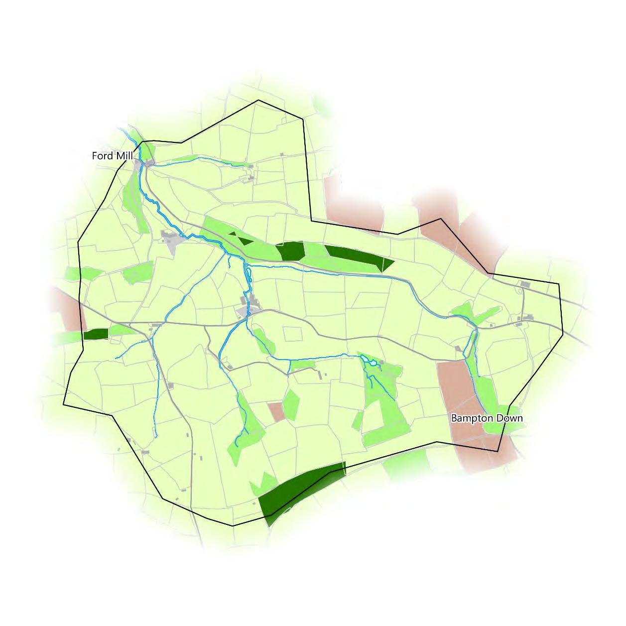
The micro-catchment covers the rural area between Ford Mill and Bampton Down. The micro-catchment forms the watershed for an unnamed watercourse that this report will refer to as the Bampton Stream and its tributaries, that flows northwest through Ford Mill. The total river length present in the catchment is approximately 9.7km. Overall, the micro-catchment falls within the Bampton County Parish and is administered by Bampton Town Council, The map on the right shows the steepness of slopes. The catchment exhibits a long valley fed into by several smaller valleys that the Bampton Stream and its tributaries run along the bottom of. The main valley and the catchment outlet in the northwest are particularly steep-sided.


Micro-catchment Over view
Land Cover
The way the land is used has significant impacts on flood management. Land use has been mapped here using the Centre for Ecology and Hydrology’s (CEH) Land Cover Map 2019. This is a model derived from satellite imagery at 25m resolution. The land use here is primarily improved grassland, accounting for 77% of the catchment. Patches of broadleaved and coniferous woodland are spread throughout the catchment, accounting for another 17%. There are a few fields of arable and horticultural land in the northeast and southeast at Bampton Down that cover another 5%. It should be noted that this land cover map model is not a perfect representation of land use as it simplifies UK land cover into very broad classes.

Micro-catchment Over view
Land Cover
Land use observed during the catchment walkover mostly matched the land use mapped here using the Centre for Ecology and Hydrology’s (CEH) Land Cover Map 2019.
The catchment is dominated by pasture with a few pockets of wooded land.
This catchment is very steep sided, and this was noticeable on a lot of the pastured slopes where ‘mini-terracing’ was occurring through natural slumping of the slope displaying small lines across the slope.
The catchment appeared to be mainly farming for beef and sheep production.
There are a number of disused quarries in and around the catchment and Bampton.

Upper catchment looking west down the main Bampton Stream channel.


