22 minute read
DIRECTORY OF TOWNS


OUR SMALL TOWNS ARE THE HEART OF THE REGION. NOW THAT YOU’VE READ ABOUT ALL THERE IS TO SEE AND DO OUT HERE IN SOUTHEAST MONTANA, IT’S TIME TO DRILL DOWN AND REALLY FIGURE OUT WHERE TO BEGIN.
This section gives a brief description of each community in Southeast Montana. Big or small, every town has something to offer—just take the time to stop and look. Consider this your guidebook for the practicalities in Southeast Montana. Communities are listed here alphabetically. As always, there’s more information at southeastmontana.com.
ACTON Acton is 16 miles northwest of Billings. Its population numbers less than 100 people, but this is cattle country, and the little town and post office serve many people in outlying ranches. Acton began as a station on the Great Northern Railroad. Hang out with the locals at 3 North Bar & Grill. southeastmontana.com/community/acton
ALZADA Alzada began as little more than a saloon in 1877. It was located strategically along cattle trails and serviced the thirsty cowboys looking for a break from their long, hard days on the prairie. Mr. M. Stone, who also owned a store and was the town’s first postmaster, built the local saloon. Today Alzada is much as it was then, a great place to stop for gas, a snack or a drink.
southeastmontana.com/community/alzada
OUT HERE
SMALL-TOWN WELCOMES
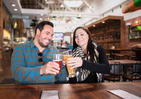
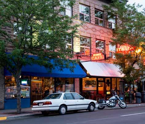
Come here as a stranger and return home as a friend. The folks in our towns excel at warm welcomes—all you have to do is say hello. Belly up to century-old bars and eat the local specialties for a taste of the real Montana.
Photos – Top: Cruising down Highway 7 near Baker, Donnie Sexton; Bottom Left: Über Brew in Billings, Visit Montana; Bottom Right: Downtown Billings, Montana Office of Tourism and Business Development
Bucking Horse Sale in Miles City, Montana Office of Tourism and Business Development

ASHLAND Ashland is on the Tongue River at the mouth of Otter Creek. The post office was established under this name in 1886. Ashland is division headquarters for the Custer Gallatin National Forest, and it is possible that the name comes from the abundance of ash trees. The town is a trade center for a group of cattle ranchers and for American Indians from the Northern Cheyenne Reservation. The St. Labre Mission and Cheyenne Indian Museum, the St. Labre Indian School and the Ashland Labor Day Powwow are of special interest in the Ashland area.
southeastmontana.com/community/ashland
BAKER Baker first boomed when the Milwaukee Railroad came across Montana in the 1900s. It received its name from A.G. Baker, the construction engineer for the main railroad line. Today, the town is experiencing an energy boom, and the many shops and restaurants buzz with activity. Medicine Rocks State Park lies 25 miles south of Baker and offers unique camping and hiking opportunities. Baker offers a variety of year-round activities, including fishing, boating and water-skiing at Baker Lake; hunting for deer, antelope, pheasant and wild turkeys; and snowmobiling and cross-country skiing. Events in Fallon County include a Classic Car Show, Fallon County Fair, Fall Festival, Bump and Run Races and Motocross Races, just to name a few. Baker also boasts the O’Fallon County Museum and Prairie Rose Antique Car Museum. 406.778.2266, bakermt.com
BALLANTINE Ballantine was founded in 1907 in conjunction with the Huntley Irrigation Project just east of Billings. As the Irrigation Project thrived and the sagebrush prairie began to give way to various crops, the area’s population slowly grew. A post office was opened in Ballantine to serve the growing number of homesteaders in the area.
huntleyproject.net
BILLINGS Billings is “Montana’s Trailhead” and largest city. Many visitors to Southeast Montana enter the state via Billings Logan International Airport, and Billings makes a perfect basecamp for your excursions into Southeast Montana. If you want to experience big-city dining, lodging and shopping, all with the small-town friendliness you’d expect in a visit to Montana, Billings is your place. It’s also home to the state’s only Walkable Brewery District. Call/text 406.245.4111 , visitbillings.com
BROADUS Broadus lies along the scenic and historic Warrior Trail near the junction of the Powder and Little Powder rivers. It was named for the Broaddus family, settlers on the Powder River. Broadus is known today for its cattle, oil and outstanding school system. It’s also a great place for history buffs. The Reynolds Battlefield is just a short drive from town. Visitors can also stop by the Powder River Historical Museum and Mac’s Museum to admire the general store, the original county jail and more. The Powder River Taxidermy and Tannery Museum features wildlife mounts, antique guns and local art.
406.436.2778, prchamberofcomm.com
BROADVIEW Broadview was established around 1908 when the Great Northern Railway’s Billings and Northern branch line was built. Broadview was incorporated in 1917. In 1934, almost half the town burned in a devastating fire.
southeastmontana.com/community/broadview
BUSBY Busby, on the Northern Cheyenne Indian Reservation, is named for Sheridan Busby, a homesteader who came to the area in 1895 and established the first post office here in 1904. Trader W.P. Moncure erected the Two Moon Monument at Busby in 1936. In 1993, the remains of 10 men, five women and two children who died about 116 years earlier during the Indian Wars were buried in a circle near the Two Moon Monument on U.S. Highway 212 after they were retrieved from various museums across the country. southeastmontana.com/
community/busby
COLSTRIP Colstrip was founded in 1924 when the Northern Pacific Railroad started mining coal nearby to fuel its steam locomotives. Once the railroads switched from coal to diesel fuel, however, the mine closed, and Colstrip was left nearly abandoned. When the Montana Power Company purchased the mine as well as the town site of Colstrip, they reopened it and just a few years later construction on the Colstrip Power Plant began. Today, Colstrip is a quiet, closely knit community with more than 2,000 citizens and 22 parks. On the edge of town is the picturesque Castle Rock Lake, which is surrounded by bike paths and picnic areas. cityofcolstrip.com
CROW AGENCY Crow Agency is the headquarters of the Crow Indian Tribe and is close to the Bighorn Canyon National Recreation Area and Little Bighorn Battlefield National Monument. Crow Agency becomes the “Teepee Capital of the World” in mid-August during the Crow Fair celebration, when American Indians from across the country come to participate in the festivities. Little Big Horn College, located in the center of Crow Agency, is a great example of modern American Indian architecture. The newly finished Health and Wellness Center incorporated state-of-the-art green technology in its construction. The town also features Veterans Memorial Park. crow-nsn.gov
CUSTER Custer was named for Lt. Col. George Armstrong Custer, who was killed in 1876 at the famous Battle of Little Bighorn. Custer was a freight station for traders bringing supplies to the Crow Indian Reservation. Custer is a friendly town along the Yellowstone River where visitors can enjoy agate hunting. Floating the river allows agate hunters to search the many sand and gravel bars along the shore as well as the gravel islands. Fishing is another popular pastime. Nearby, at the junction of the Bighorn and Yellowstone rivers, is the site of Fort Manuel Lisa, the first building in Montana built by white men. The Manuel Lisa fishing access is about 4.5 miles east of Custer.
southeastmontana.com/community/custer
EKALAKA Ekalaka is named for Ijkalaka, the Oglala Sioux niece of Chief Red Cloud and the bride of David Russell, who opened a store and saloon here in 1885. Though small, the community has two motels, a campground with hookups, several restaurants, service station and two city parks. Camp Needmore, a refurbished CCC Camp, lies just outside Ekalaka in the wooded hills. The two large barracks with kitchen and camper hookups can be rented for just a few dollars a day. Medicine Rocks State Park is just 10 miles north of Ekalaka. Ekalaka is also home to the Carter County Museum, Montana’s first county museum.
southeastmontana.com/community/ekalaka
FALLON Fallon is between Miles City and Glendive. It was a station on the Northern Pacific Railway and is one of the oldest towns along the Yellowstone River. The town was named for Benjamin O’Fallon, an Army officer and nephew of William Clark of the Lewis and Clark Expedition. Fallon is now in the middle of rich grain fields near the junction of the Yellowstone River and O’Fallon Creek. southeastmontana.com/community/fallon
FORSYTH With the abundant growth of cottonwood in the area, steamers often stopped here to refuel their engines. Forsyth was established in 1880 and earned its post office in 1882 when the Northern Pacific Railway arrived. The opulent buildings located along Main Street reflect the wealth of Forsyth’s early years. It’s a great place to stop for a bite to eat. Be sure to see the Rosebud County Courthouse and the Rosebud County Museum, both located along Forsyth’s Main Street. forsythmt.com
TOP 5 REASONS TO VISIT MONTANA’S YELLOWSTONE COUNTRY THIS WINTER

North of Yellowstone, winter is wide open. Choose your own snow venture at three of Montana’s four largest ski areas, in the rugged backcountry or on never-ending Nordic trails, and lodge in the best small towns the West has to offer.
BIG SKY RESORT. JEFF ENGERBRETSON
THREE SKI RESORTS WITH EPIC MONTANA POWDER: Big Sky Resort, Bridger Bowl and Red Lodge Mountain offer up some of the biggest skiing in America without big-mountain crowds and prices, and local vibes prevail in the ski towns they call home.
BRIDGER BOWL. PAT CLAYTON
GATEWAY TO YELLOWSTONE NATIONAL PARK’S WINTER WONDERLAND: Drive through the wildlife-laden Lamar Valley from Gardiner, Montana (the only park entrance open to vehicles year-round) to the friendly outpost of Cooke City, or snowmobile/snowshoe in from West Yellowstone.
YELLOWSTONE’S HYDROTHERMAL FEATURES IN WINTER.
400+ INCHES OF ANNUAL SNOWFALL AND WORLD-CLASS WINTER RECREATION: Massive snow means massive fun snowmobiling, Nordic skiing, ice climbing frozen waterfalls, dog sledding, and taking enchanting sleigh rides, all followed by soothing hot springs and crackling fires.
SNOWMOBILING IN WEST YELLOWSTONE. DAN ARMSTRONG
SMALL-TOWN ADVENTURE + WESTERN HOSPITALITY: Discover the heart and soul of Montana in Yellowstone’s captivating mountain communities where lodging, eateries, breweries and distilleries lay out the warmest welcome mats around.
LONE MOUNTAIN RANCH. AUDREY HALL
PREMIER WILDLIFE WATCHING: The quiet of winter brings out for Montana’s majestic wildlife. Watch Yellowstone Country’s iconic bison, elk, moose, mountain goats, bighorn sheep, pronghorn antelope and gray wolves in their pristine winter habitat.
BISON IN YELLOWSTONE NATIONAL PARK. DONNIE SEXTON
FORT SMITH Fort C. F. Smith was established on August 12, 1866, to protect immigrants traveling on the Bozeman Trail from attacks. The Bozeman Trail crossed the Bighorn River 400 yards from the fort. The nearby Bighorn Lake extends approximately 71 miles through Wyoming and Montana, 55 miles of which are held within spectacular Bighorn Canyon National Recreation Area. There is a visitor center in Fort Smith. The Bighorn River below the Afterbay Dam and Campground is a world-class trout fishing area and numerous fishing outfitters are located in the area.
southeastmontana.com/community/fort-smith
GARRYOWEN Garryowen was named by Buffalo Bill Cody in 1896 for the Burlington-Quincy Railroad. Garryowen was the name of the marching song of the old 7th Cavalry. Myles Keogh, one of Custer’s officers, brought the tune and the words from Ireland. The Custer Battlefield Museum is located here on the former site of Sitting Bull’s camp, where some of the first shots of the Battle of Little Bighorn were fired. The museum includes the Tomb of the Unknown Soldier and is where the burying the hatchet ceremony took place.
custermuseum.org

GLENDIVE Glendive is tucked between the badlands and the Yellowstone River on I-94 and is a major hub for energy and agricultural activities in eastern Montana. Museums in Glendive include the Makoshika Dinosaur Museum, Glendive Dinosaur Museum and Frontier Gateway Museum, which together house an incredible collection of paleontological artifacts and pieces of regional history. Makoshika State Park is also near Glendive. A selfguided walking tour of Glendive’s downtown historic district leads past many buildings listed in the National Register of Historic Places and the historic Bell Street Bridge. Guide brochures are available at the Glendive Chamber of Commerce.
406.377.5601, glendivechamber.com
HARDIN Hardin was named for Samuel H. Hardin, a cattleman who leased tracts of land on the Crow Reservation to range his cattle. The local industry includes farming and ranching, surface coal mining and recreational endeavors. Today, Hardin sits just outside the borders of the Crow Reservation and has several accommodations for visitors including motels, campgrounds, restaurants and shops. Area attractions include the Big Horn County Museum, Little Bighorn Battlefield and Custer National Cemetery as well as the Yellowtail Dam, Bighorn River and Tongue River Reservoir for fishing and water recreation. Each June, Hardin celebrates Little Bighorn Days with a rodeo, parade, street dance, arts and crafts fair, plus other events. Hardin is also home to two farmers markets in the downtown area, featuring locally-grown food and talented local artists.
hardinmtchamber.com

HUNTLEY Huntley was named for S.S. Huntley, a pioneer stockman. The area was part of the Crow Indian Reservation from 1874 to 1904, when the government purchased the 35,000 acres, stretching across 27 miles from Huntley east to the Little Bull Mountains. The name Huntley is short for Huntley Irrigation Project, which was the second U.S. Bureau of Reclamation irrigation project. Huntley Project is a valley of lush crops and is actually made up of four small communities: Huntley, Worden, Ballantine and Pompeys Pillar. The Huntley Project Museum of Irrigated Agriculture is located on the site of the early-day town called Osborn. The museum features a collection of more than 5,000 artifacts related to irrigated agriculture on the Montana prairie.
huntleyproject.net
OUT HERE
ZOOMONTANA
In Billings you’ll find Montana’s only zoo. With over 50 species of animals—all found along the 45th parallel across the globe—you’ll see the likes of Amur tigers, grizzly bears, river otters, bison, wolverines, bald eagles and much more.

HYSHAM Hysham, the county seat of Treasure County, is an agricultural community consisting of farms and cattle ranches. In 1906, the Crow Nation Reservation boundaries were redrawn, and the area was opened to settlement. Hysham was created as a result of ranching supplies being delivered by the railroad and was incorporated in 1916. The Treasure County ’89ers Museum preserves local history with displays and exhibits. Located across the street from the museum is the 1931 Yucca Theatre, which is listed on the National Register of Historic Places. Local sculptor Bob Schulze created statues of William Clark, Sacagawea with Pomp, and various animals that can be found at the Yucca and other town locations. hysham.org
INGOMAR In the early days, Ingomar and Sumatra were the chief trading towns for the homesteaders in western Garfield County. Ingomar has several of its original historic buildings still intact. The original frame school building, the Jersey Lilly Bar and Café—internationally known for its beans and steaks—and the Bookman Store were all placed on the National Registry of Historic Buildings. The Historic Jersey Lilly Campground provides a meeting place for locals and visitors with good food and a place to hang your hat, hitch your RV or pitch your tent, and catch a night’s rest.
southeastmontana.com/community/ingomar
ISMAY Ismay began as a Milwaukee station on O’Fallon Creek. It was on the old stage line that ran from Fort Lincoln at Bismarck to Fort Keogh, which is now Miles City. In May 1993, a radio station in Kansas City, Missouri, contacted the town of Ismay with a special request, asking whether the town would consider changing its name to Joe, Montana, for the duration of the football season. The radio station promoter felt that this was a great way to honor NFL quarterback Joe Montana, who had recently signed with the Kansas City Chiefs. Ismay, population 22, agreed. In celebration, the town organized a ranch rodeo, a parade and a night show for July 3. The events drew more than 2,000 spectators.
southeastmontana.com/community/ismay
LAME DEER Lame Deer is between Broadus and Hardin on Deer Creek and is the tribal and government agency headquarters of the Northern Cheyenne Tribe. It was named for Lame Deer, an Indian chief. Dull Knife and the Northern Cheyenne returned to Lame Deer following their long march home after being held in Oklahoma. Attractions here include the Chief Dull Knife Cultural Center, the Jesse Mullin Picture Museum, the Arts and Crafts Center and the Charging Horse Casino. Lame Deer also hosts the 4th of July Powwow.
cheyennenation.com
LAUREL North of Laurel is where the battle between the Nez Perce Indians, led by Chief Joseph, and the U.S. Cavalry, led by Col. Samuel Sturgis, took place. The Chief Joseph Monument on the outskirts of Laurel rests where the famous Nez Perce passed while leading his people toward Canada in 1877. Of local historical significance is Riverside Park, located south of the Yellowstone River bridge, which was the site of a prisoner of war camp during World War II. The prisoners built the structures located in the park.
406.628.8105, laurelmontana.org
LAVINA Working for T.C. Power & Bro., Walter Burke selected Lavina as a stagecoach stop in 1882. It lies at the crossing of the Musselshell River, between Fort Benton and Billings. Audaciously, Burke named the station after a former girlfriend rather than his wife. In 1903, it took 12 hours to travel by stagecoach from Billings, so Lavina was an important stop on the stage line. The town did not experience significant growth until the arrival of the Milwaukee Railroad in 1907. The Musselshell River is noted for its catfish and trout. Hunting and fishing licenses can be purchased at the Lavina Bar. Stop and fish in some of the lakes and streams or hunt the wildlife in the area.
co.golden-valley.mt.us/html/lavina.html
LODGE GRASS Lodge Grass, which is on the Little Bighorn River and the Crow Indian Reservation, is the trading center for ranchers whose herds graze the rich, grass-covered uplands where buffalo used to range. In the early days, the Crow made their summer hunting camps here. The town was named for Lodge Grass Creek, which empties nearby into the Little Bighorn River. The Indians called the stream “Greasy Grass” because the grass was so nourishing that it made their animals fat. The words for “grease” and “lodge” are so similar in the Crow language that an interpreter mistakenly translated the phrase as “Lodge Grass.” southeastmontana.com/community/
lodge-grass
MELSTONE Melstone began as a Milwaukee Railroad station and was named for Melvin Stone, an Associated Press reporter who was aboard the train with the railroad’s president, his daughter and a friend, all of whom were naming towns along the line. Dryland farmers followed the railroad, but the surrounding acres proved too dry, and now they are dotted with producing oil wells.
southeastmontana.com/community/melstone
MILES CITY Miles City was, and sometimes still is, the real frontier. It was at the epicenter of Wild West history and has been immortalized by authors and historic characters alike. The city grew up around Fort Keogh, whose commanding officer was Col. Nelson A. Miles. Miles City was named for him. As the cattle industry became more important, it was fitting that the Montana Stockgrowers Association was formed here in 1884. After the coming of the railroad, Miles City became, and still is, a leading cattle market. The town’s main attractions are the Range Riders Museum, the WaterWorks Art Museum and the annual Bucking Horse Sale event.
406.234.2890, milescitychamber.com

OUT HERE
THE KEMPTON HOTEL
Not much can compete with service and hospitality that’s been around for more than 100 years. The Kempton Hotel in Terry is the longest continually operating hotel in Montana—it opened on June 15, 1902.


Frontier Gateway Museum
Indoor Pool and Hot Tub • Fitness Center Complimentary Hot Breakfast Guest Laundry Refrigerator/Microwave in all Guest Rooms
Holiday Inn Express-Glendive
1919 Merrill Avenue • Glendive, MT 59330 (406) 377-3300
Pierre Wibaux Museum 112 E Orgain Ave. Wibaux, Montana 406-796-9969
FREE ADMISSION
201 State St. Glendive, MT • 406.377.8168 Open Memorial Day to Labor Day

POMPEYS PILLAR Pompeys Pillar is on the banks of the Yellowstone River. The town is named for the nearby sandstone pillar, which is today Pompeys Pillar National Monument. After visiting the national monument and climbing to the top of the pillar, be sure to stop by the town for lunch or to find some shade and air conditioning. huntleyproject.net
PRYOR Pryor, south of Billings, takes its name from the creek and the mountains, which were named by Lewis and Clark for Sgt. Nathaniel Pryor, a member of the expedition. Pryor is on the Crow Indian Reservation and is the site of the Chief Plenty Coups State Park. Plenty Coups, the last of the great Crow war chiefs, died in 1933 at the age of 84 and represented the Indian Nations at the dedication of the Tomb of the Unknown Soldier in Washington, D.C. His short speech on war and peace is regarded as a masterpiece of oratory.
southeastmontana.com/community/pryor
RICHEY Richey is between Sidney and Circle, and was named for the first postmaster, Clyde Richey. The station served as a terminus for the Great Northern Railroad when it arrived in 1916. The Shell Oil Company discovered oil nearby on July 13, 1951, in Williston Basin. By the end of that year, oil companies had leased more than 60 million Montana acres. As a lively, small and friendly town, Richey has a variety of businesses to serve visitors. It hosts the annual Richey Rodeo, which takes place on the third Sunday in July, as well as a vintage Car Run every year on the first Saturday in June. The Richey Historical Museum features more than 7,000 items, including a Model A mail car, blacksmith shop, pioneer kitchen, school and church memorabilia, newspaper files and period clothing.
richeymt.com
ROUNDUP Roundup is located along the banks of the Musselshell River in an area surrounded by hills. It was so named because ranchers found the valley near the Musselshell River a natural place to “round up” their cattle every fall. One of the many attractions in the area is the Musselshell Valley Historical Museum, which houses a coal tunnel, complete with a wooden car, carbide lamps, lunch pails, maps and photos. The Bull Mountains, south of Roundup, offer beautiful roadside geology and pine trees. Elk have been known to travel through these mountains en route to or from the Little Snowy Mountains to the west. The Musselshell River, noted for fine trout and catfish, also offers plentiful spots for relaxing picnics along its lazy banks.
406.323.2822, roundupchamber.org
ROSEBUD Rosebud, a name inspired by the wild roses that grow profusely in Montana, is the name of the town, county and river. The region was originally explored and used by the fur traders. Rosebud Creek was popular with the beaver trappers. On July 28, 1806, William Clark and company passed this area. rosebudmontana.com
RYEGATE Ryegate is located between sandstone cliffs and the Musselshell River on Highway 12 and is the county seat for Golden Valley County. Ryegate is the location where the Nez Perce people, under the leadership of Chief Joseph, crossed the Musselshell River on September 17, 1877. They had left their Idaho homeland in a valiant but futile effort to reach Canada. Today, Ryegate is a farming and ranching community. This area is one of the most productive areas in central Montana for waterfowl. The Hailstone National Wildlife Refuge includes a large alkaline lake and surrounding habitat for waterfowl, shorebirds, pronghorns and prairie dogs.
co.golden-valley.mt.us/html/ryegate.html
ST. XAVIER St. Xavier is on the Crow Indian Reservation along the Bighorn River. In 1887, Fr. Prando, a Jesuit missionary, and two companions founded a mission here and named it St. Xavier. The church is still in use. The mission’s school, affiliated with the St. Labre Mission School, also continues to operate, but is now called the Pretty Eagle School, after a famous Crow chief. The St. Xavier area is a patchwork of fields of malting barley, alfalfa and sugar beets that are irrigated by the Bighorn River.
southeastmontana.com/community/st-xavier
TERRY The town of Terry is named for Gen. Alfred H. Terry, who commanded an 1876 expedition in connection with Custer’s campaign against the Plains Indians. The town’s main attraction is the Prairie County Museum and Evelyn Cameron Gallery. The museum displays early settler artifacts, and the gallery showcases the incredible photographs taken by Evelyn Cameron in the late 1800s. Terry also sits on the edge of the Terry Badlands. The Calypso Trail, an old bootlegging road, allows high-clearance, all-wheel drive vehicles to explore this beautiful area. The town features the Kempton Hotel, known to be the haunt of friendly spirits and the oldest continuously operating hotel in Montana. There are also many restaurants and gift shops, including Prairie Unique, where Made in Montana gifts can be purchased.
406.635.5895, visitterrymontana.com
VOLBORG Located between Broadus and Miles City, Volborg is more ranching community than town. Pumpkin Creek originally attracted stockmen to the area of vast, unfenced and unclaimed ranges on both sides. Today the post office and small store are where locals gather, including 2017 & 2019 Professional Bull Rider Champion Jess Lockwood, who grew up in the area.
southeastmontana.com/community/volborg
WIBAUX Wibaux owes its existence to the railroad’s 1880s arrival. During the days of open-range cattle ranching, it was one of the largest shipping points on the Northern Pacific Railway. During homesteading days, its population grew rapidly. The town is named for Pierre Wibaux, a flamboyant French cattleman who built an empire for himself in eastern Montana. Before it became Wibaux in 1895, it was called Mingusville, a raucous town where cowboys were known to make greenhorns dance to their bullets. Legend has it that even Teddy Roosevelt, who would eventually become president, was forced to defend himself when a drunk cowboy tried to bully him for wearing glasses.
southeastmontana.com/community/wibaux
WORDEN Worden was named for Sen. Joseph Dixon’s wife, whose maiden name was Worden, and possibly for her father as well, who was a prominent Montanan. The land surrounding Worden has been richly productive ever since the Huntley Irrigation Project brought water to it. Just east of Worden is Pompeys Pillar, a rock outcropping that rises 200 feet above the Yellowstone River. huntleyproject.net
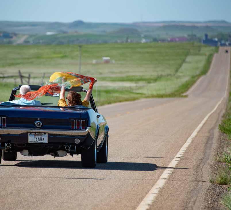
Photos – Above Left: An RV driving down I-94, Donnie Sexton; Below: Horses in Southeast Montana, Donnie Sexton


