7 minute read
Chasing fire


A team of scientists drove across Brazil to understand how fire, agriculture, and deforestation interact in three forest ecosystems
Sarah Ruiz, Science Writer
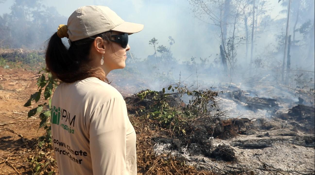
In August, amidst the fire season, a team of scientists from Woodwell Climate Research Center and the Amazon Environmental Research Institute (IPAM) embarked on a trip to Mato Grosso, Brazil to follow state military firefighters as they battled blazes across three different biomes—the Cerrado, Pantanal, and Amazon. Fires can take many forms in Brazil, some ignited accidentally and some intentionally. Some biomes have evolved with fire disturbance, while others would never see a fire if not for human encroachment. Regardless, out of control fires can pose a danger to human health and livelihoods, biodiversity, and carbon stocks. Brazil’s firefighters must use every tool at their disposal to protect people and forests. Satellite data is one such tool that can help with fire detection and research into fire impacts or trends, but it’s not always accessible in a useful form for firefighters. Dr. Manoela Machado, a Postdoctoral Research at Woodwell, organized the joint expedition to gather information on regional firefighting strategies, and how science and data might better support fire brigades. “We’re trying to be the bridge between these very important ends, the satellite detection of active fires and the people fighting fires on the ground,” Machado says. What they found over 10 days of chasing smoke signals, walking across hot coals, negotiating passage across private lands, and dousing flames, was that fighting fires requires grit and strategy, and that suppressing flames before they burn out of control— preventing them before they ignite where possible—is the only way to prevent serious damage. The Cerrado
The Cerrado, also known as the Brazilian savanna, is a vast wooded grassland that has evolved in conjunction with wildfire. In the wet season, the region is extremely productive, building up biomass in the form of grasses, shrubs, and other plants that become flammable as the dry season moves in. Fires typically stay low to the ground, burning through built up fuels, and allowing fire-adapted species to sprout back up just days after a disturbance.
The team began their journey in the Cerrado at Chapada dos Guimarães, where firefighters were already hard at work trying to tame a fire that was spreading from property to property. It was moving fast and had been hard for the group to locate as they drove around the area, following satellite signals— as well as literal smoke signals— to get their heading. By the time the team arrived, the day was cooling off, which gave the firefighters an edge over the flames. In the Cerrado, firefighting is like an intense game of chess played out over the landscape, with elements including hills, wind direction, dry creek beds, roads, and downed trees forming the pieces. “They’re interpreting the landscape and interpreting the wind so they know which direction the fire is spreading,” Dr. Machado said of the firefighters in Chapada dos Guimarães. “As the night was approaching they were working in a dry river, blowing off the leaves and creating a natural firebreak. Then as the heat diminished, they were monitoring to make sure the firebreak worked.”
Although fire in the Cerrado is a natural phenomenon, it is usually sparked by lightning storms much closer to the rainy season. In the middle of the dry season, this fire represents a shift away from the biome’s natural regime. Humans are influencing fire regimes both by increasing burn frequency, and by excluding fire completely, which builds up fuel and causes a catastrophic fire when it eventually ignites. Both conditions can be dangerous to the environment as well as critical infrastructure. The fire in Chapada dos Guimarães had melted irrigation hoses to a nearby orchard and came dangerously close to power lines. Fires spread fast in the dry season and can incur high costs for residents of the region without the quick, strategic thinking of the firefighters. “Speed and efficiency of firefighters in detecting and reaching an occurrence of fire is crucial,” Dr. Machado said. “That’s the part we’re working closely with them and satellite data providers to improve.”
The Pantanal
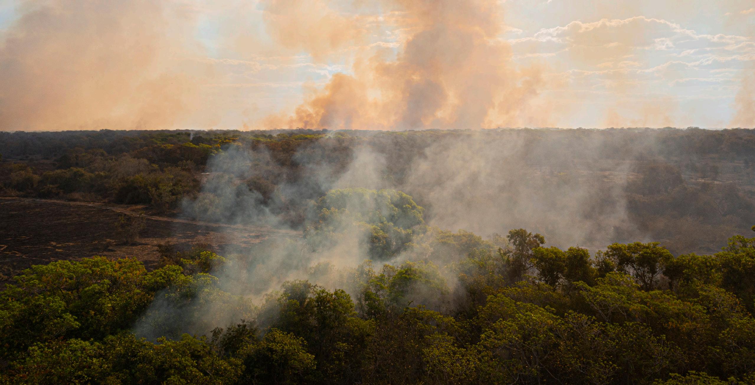
The team’s second destination was the Transpantaneira Road which cuts through the Pantanal wetlands— the world’s largest tropical wetland. The landscape is a mosaic of grassland and marsh dotted with islands of forest. From December to March, the region floods with nutrient-rich sediments. Even in the dry season, the water usually doesn’t completely recede. There are occasional natural fires here. Native grasses grow tall and wild in the rainy season and, together with planted pastures, become fuel during the dry season. When that fuel builds up over seasons and the region experiences a prolonged drought, the fires that spark can be massively destructive. Pantanal fires are made additionally challenging because of the variety of fuels available, and the existence of peat soil which can burn and spread beneath the surface of the ground. The group from Woodwell and IPAM arrived in the Pantanal just in time for this year’s first major fire. Ignited from a backfiring tractor, the flames spread rapidly across dry grass. When they reached patches of forest, they shot all the way up to the crown of the trees, where the wind fanned embers out across the landscape. The Pantanal experienced a record-breaking year of fires in 2020, and residents and firefighters were worried about seeing history repeat. Here, firefighting also requires working strategically with the landscape to hem in the flames, but the brigade was largely unable to fight the fire directly because of its size and intensity. “A 15 foot flame is impossible to fight using any techniques on the ground,” Dr. Machado said.
Instead, they had to monitor the fire’s path and shape the landscape to remove fuel and slow it down. Dr. Machado grabbed a heavy 20 liter backpack of water herself, and helped in spraying down scorched earth to cool it enough to walk over—an important step called “rescaldo,” done post-combat to make sure flames won’t re-ignite. Being close to such intense flames made clear the destructive force of fire to the team. “You could hear the forest screaming from the green leaves,” Dr. Machado said. “It sounded like a broken instrument.” IPAM communications analyst Bibiana Garrido recalls watching animals flee the heat and smoke.
“We saw a lot of birds and small insects trying to run. The first day we went to a family farm that was burning and as we stood on the ashes, little animals started walking up our legs trying to get away from the heat.”

The Amazon
“This is the place after hope dies,” Dr. Rattis said after watching fires burn unopposed through the Amazon rainforest. The team had driven north from the Pantanal to Apiacás and the frontier of deforestation in the Amazon.
Here in the rainforest, fires are never natural and almost always set intentionally. Fire is a step in the transition process from forest to agricultural land and is often used by land-grabbers. At its edges, where trees run up against farms and pastureland, the Amazon is degraded and drier. Land grabbers will set fires in the understory to weaken it further to facilitate conversion. After valuable timber is removed, that area is burned again to clear the land for agriculture. Burning set to clear existing pasture can also sometimes escape into standing rainforest, exacerbating the damage. The flames here are not the multi-story fires of the Pantanal; the greater danger comes from the people, who actively try to scare fire brigades out of the area. Though land grabbing is illegal, the law is rarely enforced here. The fires were set on purpose, and the culprit made no attempts to hide his actions— even driving up to the fire brigade in an ostentatious yellow truck. “It’s so serious that firefighters cannot work to kill the fires in some areas,” Dr. Rattis said. “It’s too dangerous.” In some cases, firefighters only feel safe combating the flames when there is enough media attention on the area to create public outcry. Without that, the firefighters said, they wouldn’t have enough support to oppose the hostile— often armed— land grabbers. The most effective way to fight fires in the Amazon is to prevent them by removing the pressure to deforest in the first place. Strategies like providing financial incentives and technical support to landowners that don’t deforest, detection and rapid response to deforestation using satellite imagery, and establishing new protected areas have been proven effective at reducing deforestation and could be scaled across the region. Improved enforcement of existing laws too, could go a long way to getting fire under control. Agencies like the Brazilian Institute of Environment and Natural Resources (IBAMA), the Chico Mendez Institute for Biodiversity Conservation (ICMBio) and military firefighting brigades are largely underfunded in the current administration.
Without strong policies that aim to get out ahead of deforestation, Dr. Machado says reacting to fires as they happen simply won’t be enough. “The problem with the Amazon fire crisis is not fire detection, it’s not how fast brigades can allocate the teams, it’s not the equipment they have in the trucks, it’s the deforestation process. As long as we have the deforestation process, we are going to have deforestation fires.”