PORTFOLIO
YANG YI'CHEN
 2020-2022 Selected Works China University of Mining and Technology Application for MLA Landscape Architecture at the Bartlett, University College London


CONTENTS
PROJECT 04 - PRODUCTIVE FARMLAND NETWORK Bring Agricultural Landscape back to Urban Campus
PROJECT 03 - SHELTER UNDER BUDDHA Refugee Camp & Memorial Hall Design for Bamyan Buddha
PROJECT 02 - TETRIS VILLIAGE Integration of African Residents in Chinese Urban Villiage
PROJECT 01 - REVIVING TAI O Transformation & Preservation of Hong Kong Fishing Villiage
TAI


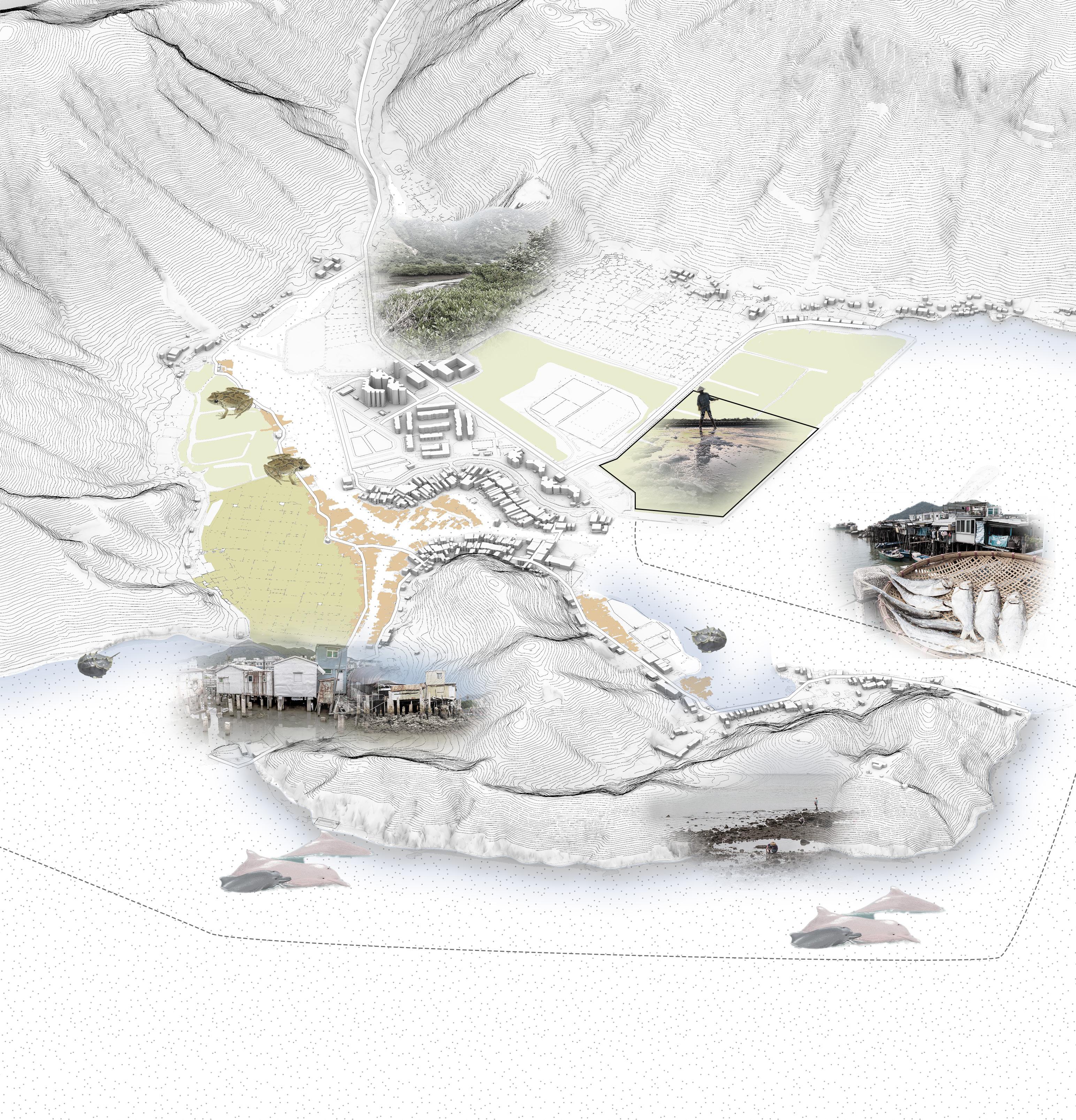
Tai O Mapping


field in the past, which was the symbol of Tai O's prosperity. The site is adjacent to the public pier, close to the Tai O village and market, with convenient personnel and close contact with the village.
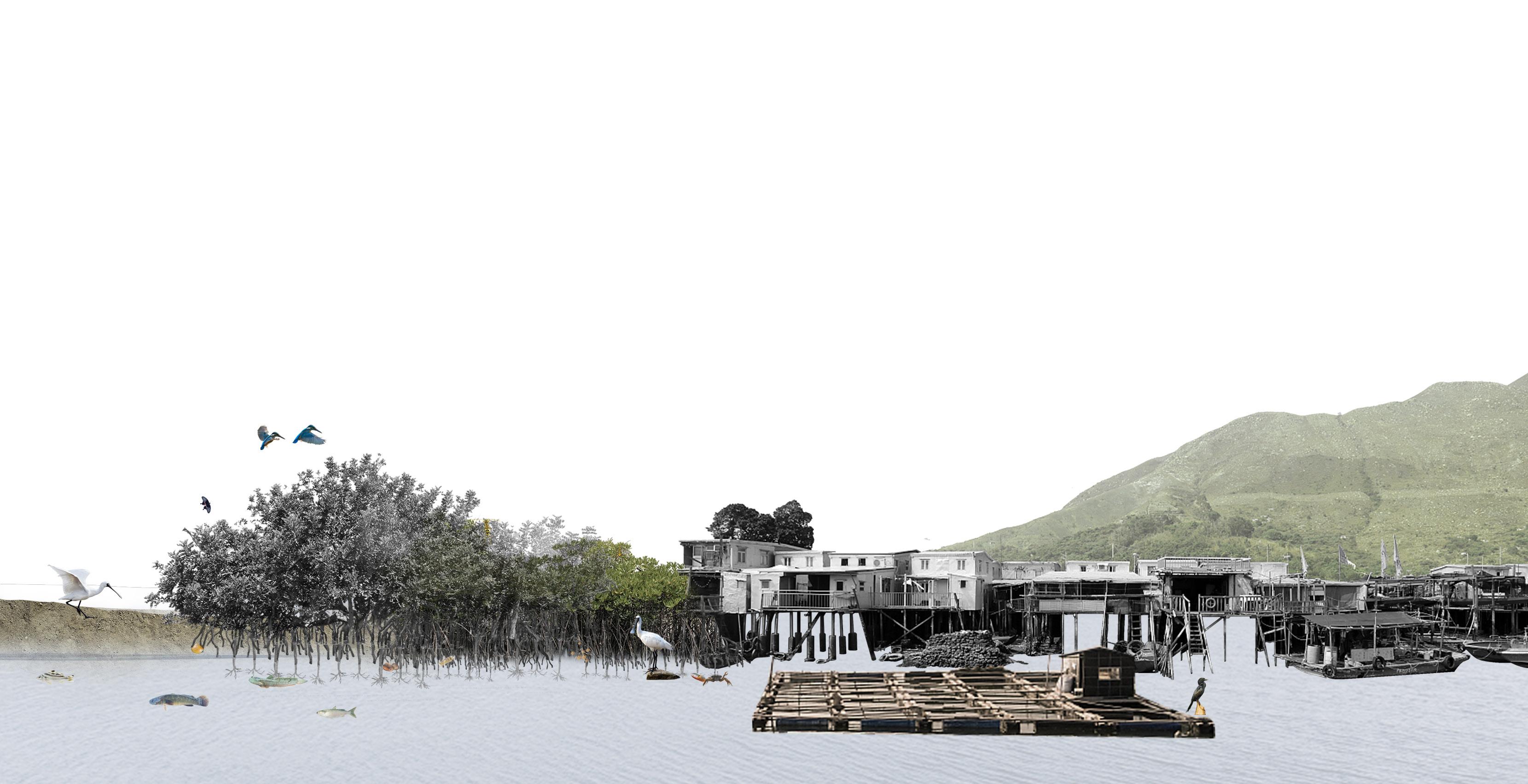
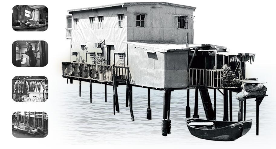
Tai O is known as "Hong Kong's last traditional fishing village". The Tankas are considered to be the only aborigines in Hong Kong. Tankas' way of living on the water makes Tai O's unique landscape of Stilt houses (Pang Uk), residences that were built right over the waterway.
Tai O reached its peak for the salt and fishing industry in the 1960s and gradually declined with the loss of traditional industry and the depletion of fishery resources. Tai O has taken tourism as its main industry in recent years. It is vulnerable in the context of environmental degradation and economic depression.
We proposed to transform the village through the concept of the "Blue Carbon Trading System". With the conservation and restoration of the coastal and marine ecosystems of Tai O and the introduction of oceanic farming and ocean-related high-tech industries, the village would prosper again and have the stability for a sustainable future.


Historical Timeline
In eighteenth century, salt industry began to flourish in Tai O. Some of the salt produced was smuggled from Tai O to Macau, Hong Kong and the Pearl River Delta.
Settlers first arrived at Tai O in the late Ming Dynasty. The Tankas originally lived in fishing boats, and are believed to be the only aboriginal people in Hong Kong.
The Tai O salt industry reached its peak in the 1940s and declined under foreign competition.


The British called Tai O "Tanka Villiage" when they arrived in Hong Kong. In 1902, the government set up Tai O Police Station.
As the industry declined, Tai O lost its economic status. A large number of residents migrated to the urban area for work.
Background
LAND TYPES PUBLIC FACILITIES Bus Terminal Stilt Houses Public Pier Market Abandoned salt field Natural Coastline Mangrove Forest Indo-Pacific humpback dolphin Romer's Tree Frog Seagrass Meadow Horseshoe Crab Wetlands Site
Fu Shan
Tai O Promenade
Cheung Shan Mt.
DailyService toTungChung , TuenMun HolidayService toCentral,HungHom to Lantau Island (S.),
The site is a mangrove replanting area located in the core area of Tai O. This area used to be a salt
Pearl River Estuary Lantau Hong Kong New Territories Kowloon Hong Kong Tai O Tai O Hong Kong SAR Hom Hum Central Tuen Mun Tung Chung Mui Wo Airport Hong Kong SAR Guangdong Prov. Guangzhou Shenzhen Macao 1600 1963 Salt Pans Salt Pans - Abandoned Tai O Salt Field 1920-1950 Mangrove Plating Area
Source: Environmental Protection Department, The
1984 1991 2005 2020 1700 1800 1900 2000
Sze Shan Mt.
Tung Chung, Mui Wo
the construction of the Tai O road destroyed the sluice systems, resulting in the remaining salt pans being abandoned
Government of Hong Kong In 2004, the abandoned salt pans were repurposed as a mangrove planting area.
fishery
PROBLEM PROBLEM 2 PROBLEM 3 PROBLEM 4 PROBLEM 5 Current mangrove planting areas are scattered and fail to form an ecosystem. Abandoned salt pans fail to be reused to achieve economic benefits. The existing industrial structure in the village is single and fragile. The village of Tai O is in depression and declining with low regional income. The existing ecosystem in the coastline is fragile to the pollution in Pearl River Estuary.
Transformation & Preservation
Fishing
TUTOR:
The resident population of Tai O has remained at around 2,000 in recent years, with tourism as its supporting industry. In the late 1950s, the
resources near Tai O were rapidly depleted. Tai O's fishery declined dramatically.
PROTECTED SPECIES PROJECT 01 - REVIVING TAI O
of Hong Kong
Villiage ACADEMIC / INDIVIDUAL APRIL 2022 - JULY 2022
TONG XIAOXIAO
Students
O, HONG KONG S.A.R, P.R CHINA An alternative version of this project, which was a two-person GROUP PROJECT, has won FIRST PRIZE WINNER of 2022 YUANYE AWARDS International Competition for
HONORABLE MENTION of 2022 China Habitat Design Academic Year Award All presented contents are individual work.
FIRST PRIZE WINNER HONORABLE MENTION

Proposed Users LOCAL RESIDENTS FISHERMAN BUSSINESSMAN FREELANCE WORKERS STUDENTS SIGHTSEEING TOURISTS NATURE-LOVERS RESEARCHERS SCIENTISTS VENDOR REASHEARCH WORKERS VISITORS Blue carbon is the carbon stored in coastal and marine ecosystems. 83% of the global carbon cycle is circulated through the ocean. Coastal habitats cover less than 2% of the total ocean area while accounting for approximately half of the total carbon sequestered in ocean sediments. The Blue Carbon Initiative focuses on mangroves, salt marshes, and seagrasses. Seagress EXTRA CARBON EMMISION QUOTA REVITALIZATION TAI O WITH BLUE CARBON GOVERNMENT INVESTMENT POLLUTION ENTERPRISES CARBON EMMISION EXCEED LIMIT BLUE CARBON ECOSYSTEM REGIONAL CARBON EXCHANGE CENTER BLUE CARBON ECONOMY CYCLE AQUACULTURE PRODUCTION LOCAL ARCHITECTURE FORM UTILIZATION CULTURAL PROGRAM INCREASED BIO-DIVERSITY REDUCED CO2 IN AIR ECO-TOURISM RESIDENTS INCOME BLUE CARBON INDUSTRY Carbon sequestration into soil Carbon sequestration into shells MANGROVES SALT MASHE SEAGRESS OCEAN-FARMING TOURISM AQUACULTURE PRODUCTION PROCESSING SCIENTIFIC RESEARCH 1 1 2 3 2 3 4 INDUSTRAIL FACILITY Strategies CO2 CO2 CO2 CO2 CO2 CO2uptake through Photosynthesis CO2consumption through growing shellfish CO2 LOCAL ARCHITECTURE FORM STUDY ECO-INFRASTRUCTURE ENVIRONMENT CULTURE CONSERVATION CARBON EXCHANGE MAIN HUB FRONT HUB WASHROOM SAMPAN PONTIANAK WOOD STAINLESS STEEL CONCRET
Forms of Ecological Revetment


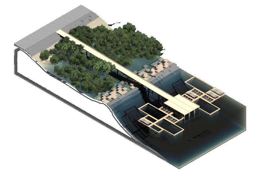
Fishes, Shellfish, and Seaweed farms were arranged interlaced to form extensive and strong biocirculations. Crabs and Mangroves Forest also form mutual benefits for their growth.
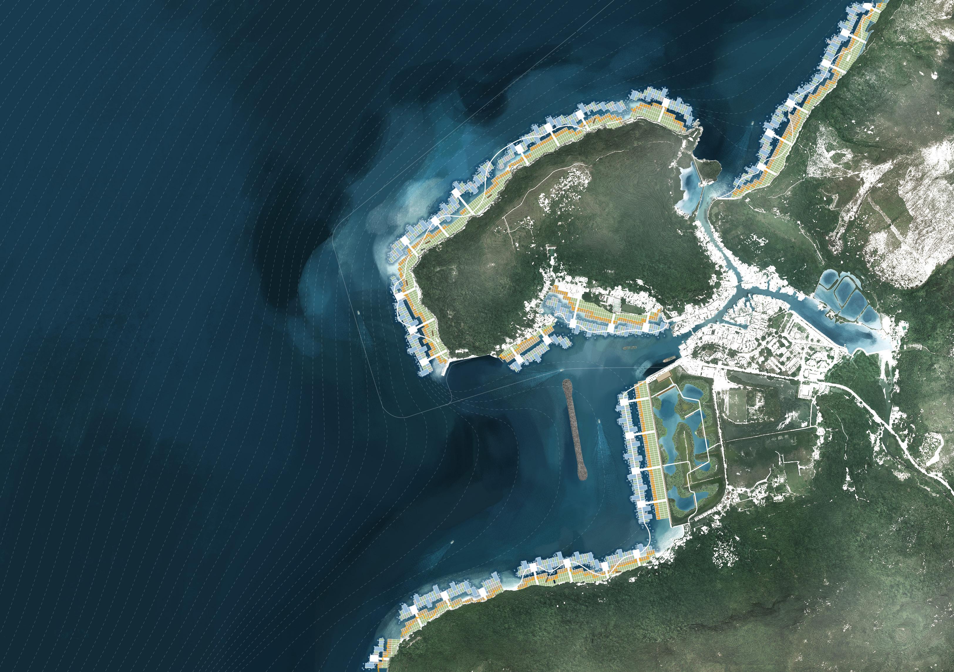
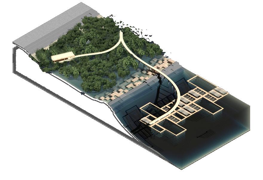
Artificial Reefs help improve biodiversity by attracting fishes and shellfish to gather. Artificial Reefs also forms embankment that separates the ocean and shallow salt marshes.
Mangroves Conservation Areas would be the core of the Bule Carbon Cycle, with only observatories and observation Trails set up for science studies and carbon monitoring.
 Marine Farm
Artificial Embankment
Planned Mangroves Salt
Seaweed Farms Fish Farms Artificial Fish-Reef Crab Traps Mussels
Mangroves Conservation Area
Master Plan
Mashes
Farms ECOLOGICAL SHORE MARINE-FARMING
The project proposed to transform the coastline around Tai O with core elements of forming the Bule Carbon Cycle: Mangroves, Salt Mashes, and Marine Farms. Additional ecological facilities were applied to further stimulate ecological circulations, maximizing the ecological benefits provided by the project.
Artificial Reefs Artificial Reefs Artificial Reefs
N
Crab Traps Crab Traps Mangroves & Salt Mash Conservation Area Observation Trails Observatory Landscape Trail Resting Pavilion Fish Cages Shellfish Cages Seaweed Farms Distribution Platform
50m 100m


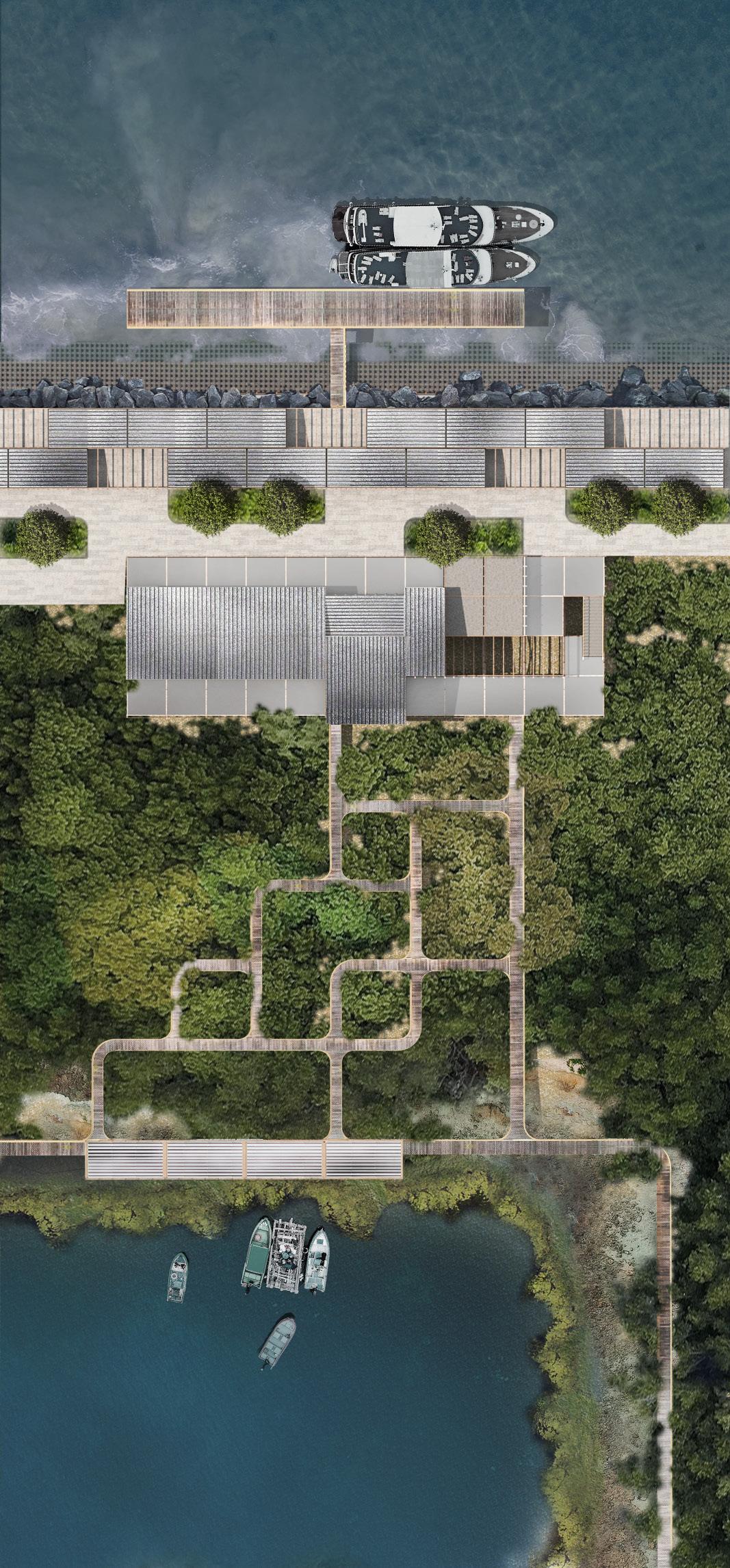
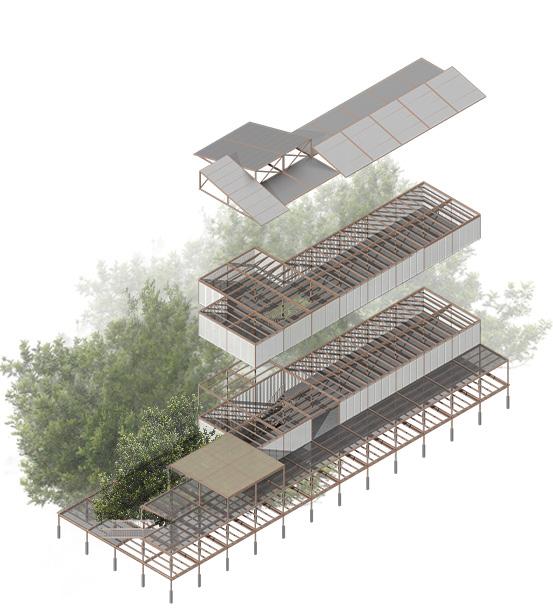
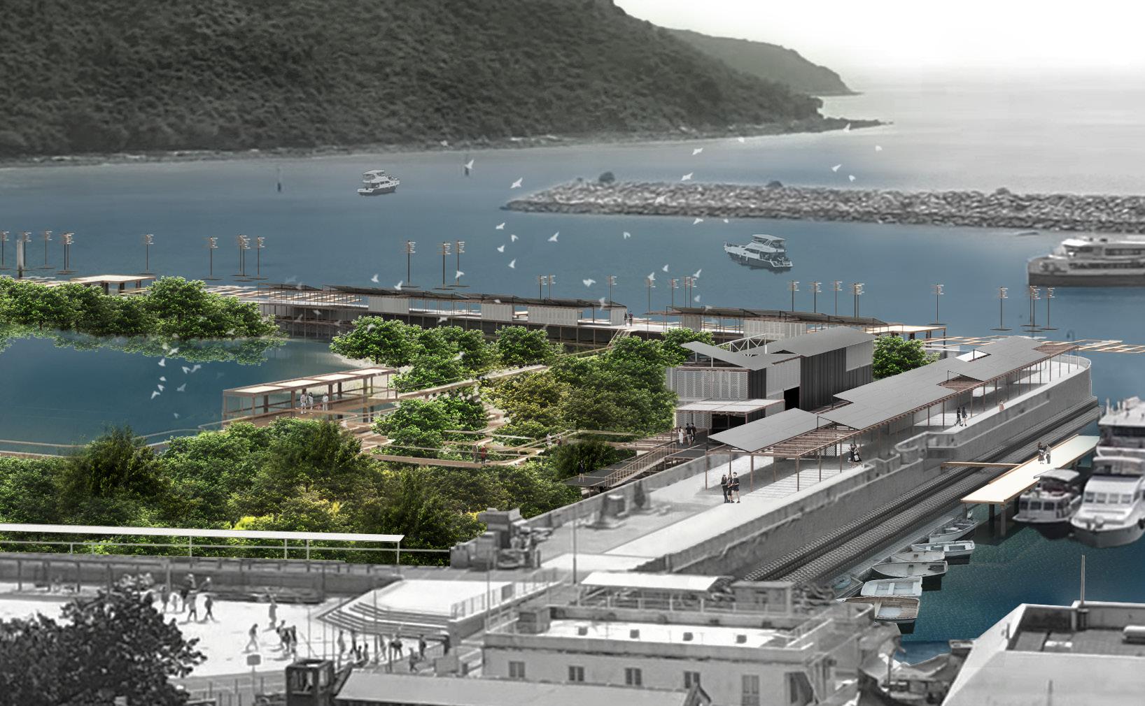
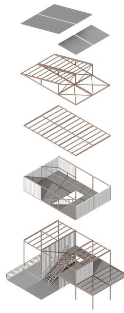
Tourist Center Construction Details Public Pier Promenade Tourist Center Entrance Mangroves Paths Resting Pavilion Base Body Roof Architecture Structure Base Pontianak Wood Structure Marine Lime Wall Panels Wooden Columns Wooden Structure Metal Roof Anticorrosion Marine Concrete Pontianak Wood Pillars Wooden Columns Wooden Floors Railings Trestle Structure Trestle Pavilion 8m ±0m +0.4m -0.5m +0.8m 1.3m Tourist Center & Public Pier Detail Plan


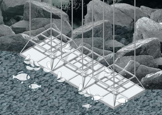


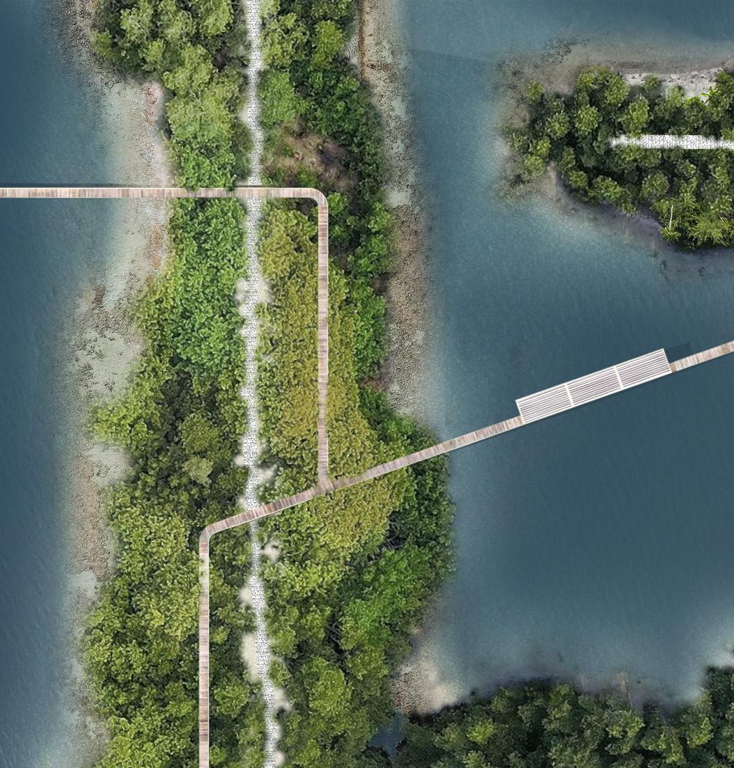

Crab Traps Mangroves Observatory Artificial Shellfish Reefs Artificial Fish Reefs Artificial Algal Turfs Mangroves & Crap Mutualism Aquicultural Production Species Conservation Landscape Trails Resting Pavilion Crab Traps Trails Distribution Platform Fish Farm Seaweed Farm Mussel Farm Artificial Algal Turfs Observatory Observation Trails Fields Ridge Crab Traps 2m 2m 2m 8m 2m 2m 1m Artificial Reefs Distribution Platform Artificial Shellfish Reefs Artificial Fish Reefs Artificial Algal Turfs Section of Ecological Shore Seawall Shore ±0m ±2.2m +5m Ecological Shore Marine Farm Detail Plan Mangroves Conservation Area Detail Plan
ACADEMIC

Background
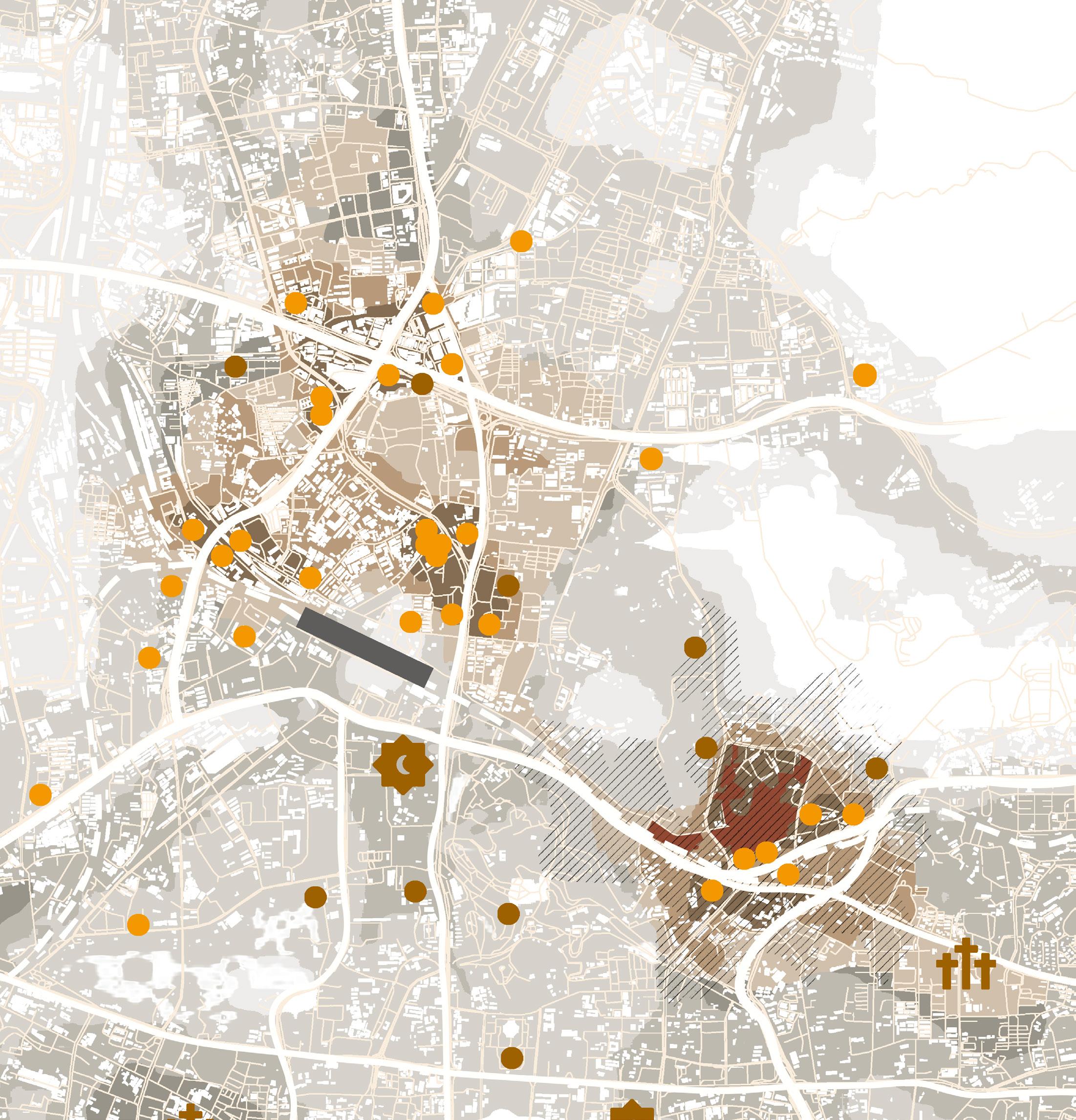
Since the 1990s, African businessmen came to Guangzhou, hoping to make a fortune through trade. International trade connected the city with their home country but failed to earn them the respect that they deserve.
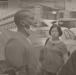
In recent years, with the spread of extreme nationalism and xenophobia in Chinese society, the conflict between African residents and local residents intensified. During the COVID-19 outbreak in 2020, African residents clashed with the local police force.
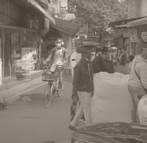
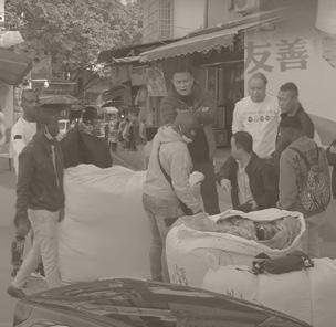

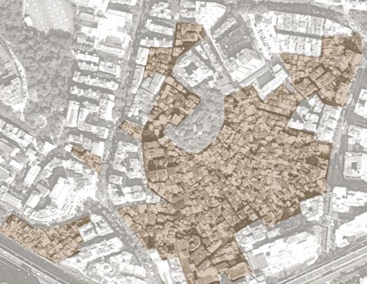
This project aims to explore the common culture between African communities and local communities. Deng'Feng Village is an urban village in Xiaobei, where African communities and local communities reside together. This project's purpose is to set cultural spaces inside the village that allows residents to communicate, revealing our vision of a society that is of kindness, understanding, and harmony.
Historical Timeline
Thirteen Hongs of Canton was thriving for international trade.

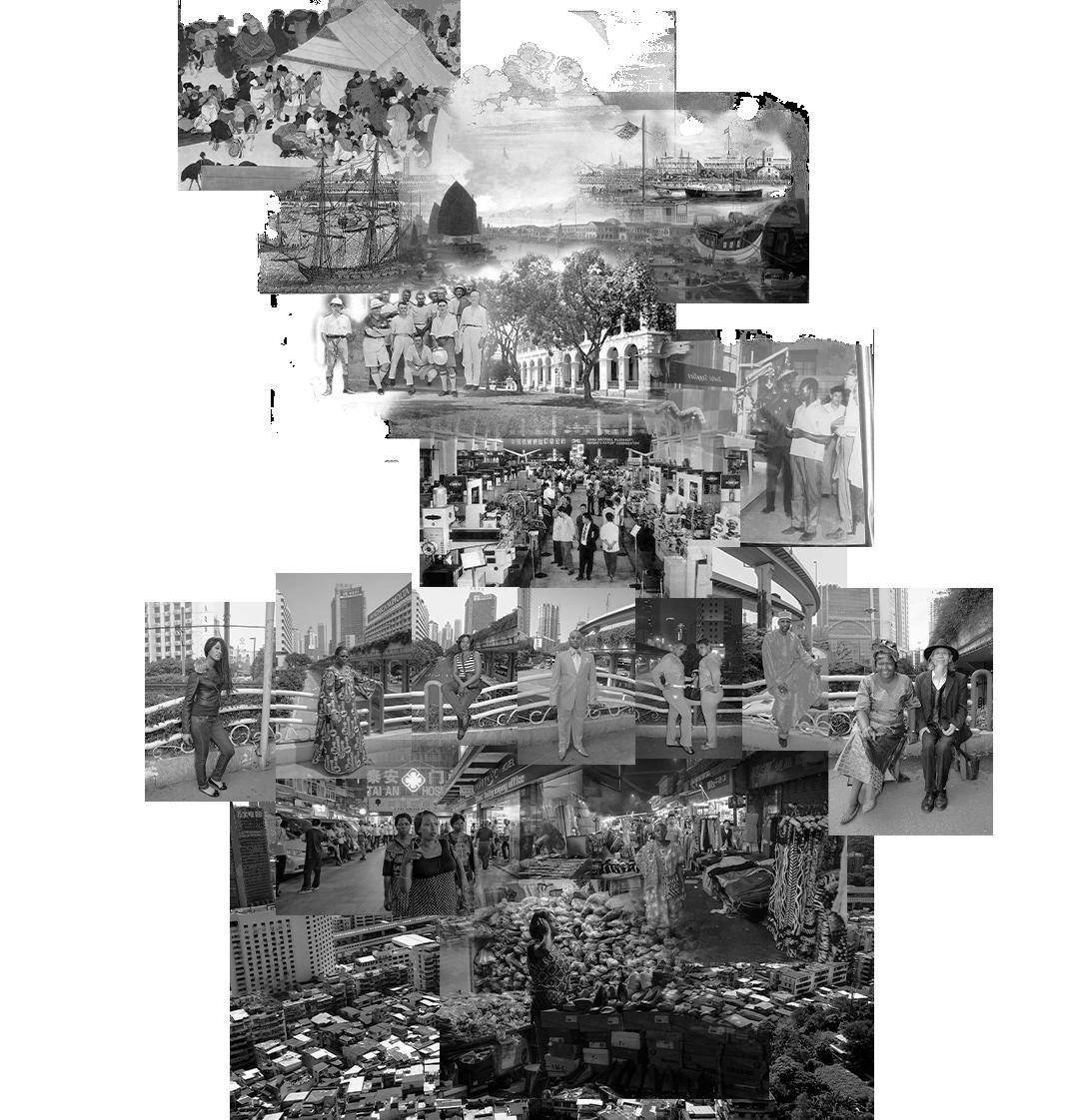
In 1861, Shameen became the leased territory of Britain and France, where foreign residents, corporations, and embassies would gather for decades.
The N


COVID-19 outbreak
put cross-border trade in a bind. The rise of nationalism
Low High Density of African Residents Density of Foreign Residents International Trade Center Church Cultural Facilies Mosque 500m LEGEND Data Analysis of African Residents in Guangzhou Islam Arabic Others University Illiterate Senior High Junior High English French Hausa Amharic Individual traders Employees Co-workers Families Friends None Unemployed Students Christianity Catholic 30~40 40~50 20~30 >50 >10 >20 1~2 6~10 5~10 10~20 2~5 3~5 0 0 <20 Age Identity Main Languages Number of Local Friends Frequency of Contacts with Locals /m Religious Faith Acompany by Education Level PROBLEM PROBLEM 2 PROBLEM 3 PROBLEM 4 PROBLEM 5 Current cultural facilities and public spaces could not meet the demands of African residents. African residents and local residents estrange from each other. African residents lack local employment opportunities and fail to truly integrate into the economic life of the community. Local residents worry that foreign cultures will limit the survival space of local cultures. The closedness of the urban village buildings intensified the intergroup isolation. Regional Mapping
Guangzhou Old Downtown Site
Baiyun
Tianhe
ZhujiangRiver
Yuexiu
Liwan
XIAOBEI HISTORIC FOREIGN RESIDENT AREA OldTown SITE DENG'FENG XIAO'BEI YUE'XIU HILL TAO'JIN HUAN'SHI CENTRAL SAN'YUAN LI Railway Station RingExpressway Airport Expressway AirportExpressway InnerRing InnerRing 15min Walk 15minWalk 15minWalk 15minWalk Canton-KowloonRailway GBA Intercity Railway Beijing-Guangzhou Railway InnerRing Ring Expressway Ring Expressway During Tang Dynasty, foreign businessmen first appeared in Guangzhou on large scale. In 741 AD, a piece of land was set aside outside the city for foreigners to reside.
SANYUANLI
Canton Fair brought foreign visitors to the socialist state once a year. Long-time foreign residents were rare until China open in the 1980s. With Asia financial crisis hitting neighboring economies severely and China joining WTO in 2001, African businessmen poured into Guangzhou from Hong Kong and Southeast Asia.
has
and
China
tensions
Tang & Song Era Qing
The number of Africans residing in Guangzhou continues to rise, and they live near the trade market in Sanyuanli-Xiaobei Area. Due to imperfect policies and regulations, African residents living illegally have become a prominent problem in Guangzhou municipal administration. Era Late 20C After 1997 21C 2020
xenophobia in
intensified
between local residents and African communities. The situation for African businessmen in Guangzhou is getting tougher.
& the Republican
PROJECT 02 - TETRIS VILLIAGE
Integration of African Residents in Chinese Urban Villiage
/ INDIVIDUAL MARCH 2022 - MAY 2022 TUTOR: LIU ZHENYU DENGFENG VILLIAGE, GUANGZHOU, GUANGDONG PROV., P.R.CHINA

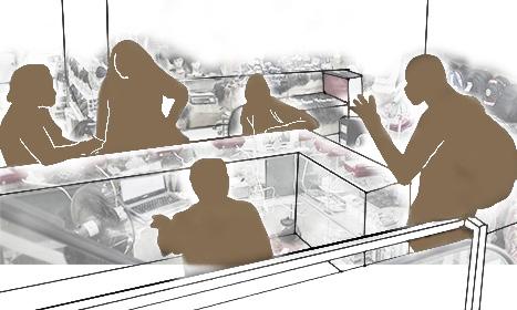


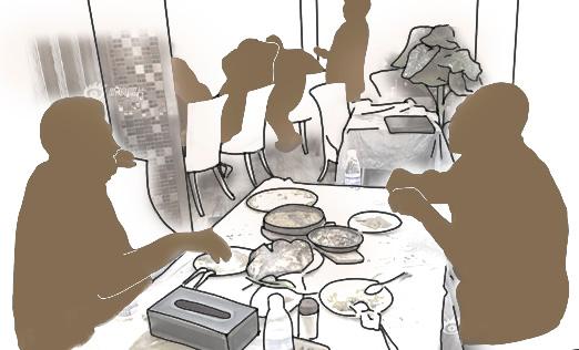
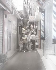
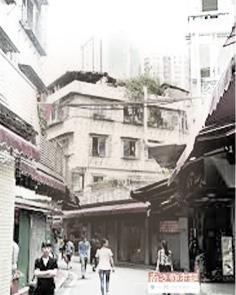
Site Analysis Formation Self-built Housing Forming Process Analysis Making Street Arts Making African Cusine Playing Religious Music Community Gathering & Chatting 1 1 2 2 3 3 4 4 4 3 2 4
urban village
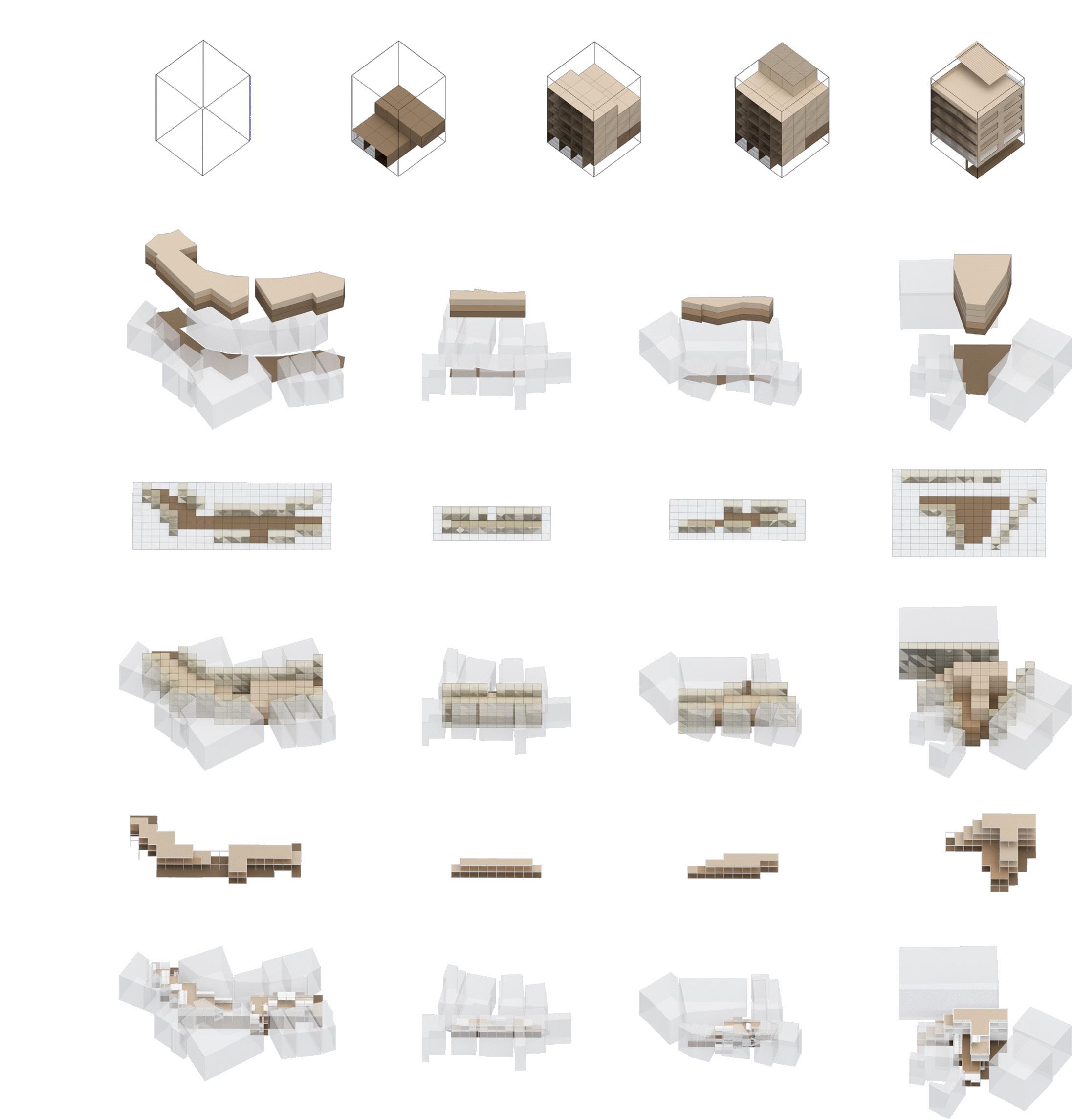
CURRENT SITUATION STEP 2 STEP 1 SPACE 1 SPACE 2 SPACE 3 SPACE 4 STEP 3 STEP 4 STEP 5 The Tetrominos Functions Placement Maxmium Construction Space Open Spaces Type A Type B Streets Community Space Cultural Gallary Cultural Gallary Rooftop Markets Households Commercial Space Placement Housing Space Placement Residents Utilization on Rooftop Typical Self-built Building The Tetris Spaces Formation Details Refinement VILLIAGE BUILDINGS OPEN SPACES TYPICAL VILLIAGE BULIDING LANDUSE MAP Villiage-Owned Land State-Owned Land Trade Center Trade Centers Minor Roads Homesteds Point of Interests Hill Villiage-owned Enterprises Self-built Housing Urban Areas Roadway Type C Type D
The site is located in an
within a metropolis. Separating from the carefully planned urban area, the spontaneous growth in space and simple site elements constitute its unique landscape. “One Line Sky". the landscape on narrow streets between "Handshake Building" in the village, that buildings were constructed near each other closely, but are enclosed, resulting in the separation of residents.


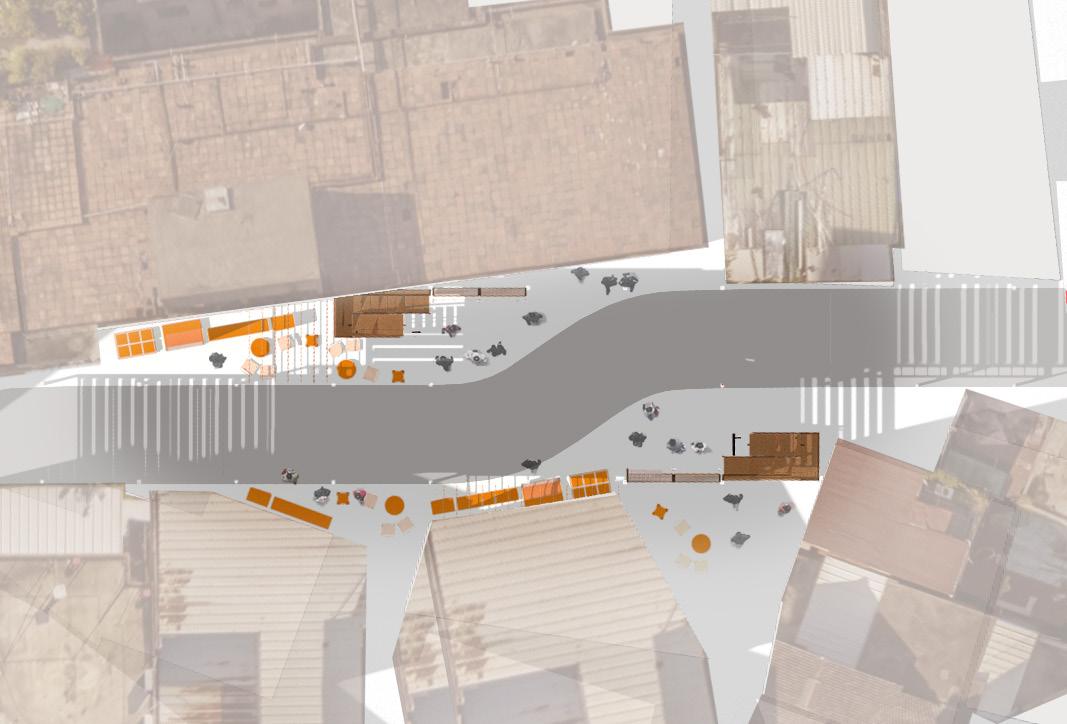

Elevation - Streets, Cultural Gallary & Rooftop Markets Plan - Rooftop Markets Rooftop Markets Booths Booths Booths Booths Booths Benches Benches Benches Stairs Stairs +3m +6m ±0m Stairs N Plan - Streets Streets Booths Booths Booths Stairs Stairs Roadway N 5m 3m

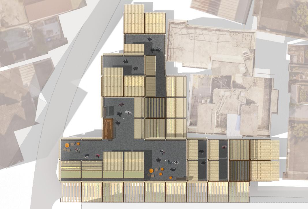


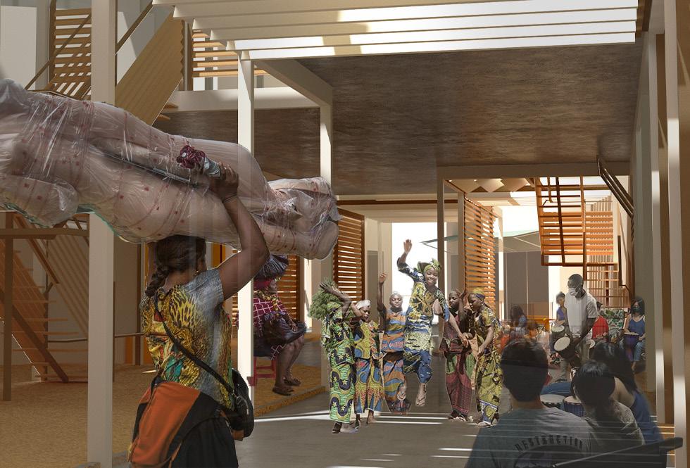
Elevation - Households & Community Space Plan - Households & Community Space Households & Community Space Booths Balcony Balcony Balcony Stairs N N Plan - Cultural Gallery Cultural Gallery Benches Benches Benches Benches Resting Space Resting Space Stairs Stairs +12m +15m ±9m 3m 3m
PROJECT
03

-
SHELTER UNDER BUDDHA Refugee Camp & Memorial Hall Design for Bamyan Buddha

ACADEMIC / INDIVIDUAL
DECEMBER 2021 - FEBRUARY 2022
TUTOR:
LIN DEJUN
BAMYAN,
Background
Destroied Buddhas
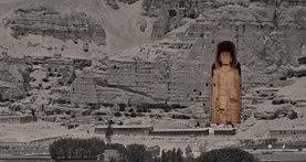
Bamyan was a thriving center for religions and cultures as an intersection on the ancient Silk Road. Stood in the valley since the 6th century, The Buddhas of Bamyan themselves were symbols of integration between cultures and religions, until they were dynamited by the Taliban in 2001. A deliberate act of destruction, motivated by an extremist ideology that aimed to destroy culture, identity, and history, the loss of the Buddhas revealed how the destruction of heritage could be used as a weapon against local populations and those who hold a different belief.
Oppressed Hazara People
Shia mosque - Kandahar 15/10/2021 08/10/2021 08/05/2021 21/11/2020 24/10/2020 12/05/2020
AFGHANISTAN Data Resource: Major Anti-Hazara Attacks since 2020
Shia mosque - Kunduz Sayed al-Shuhada School - Kabul Bamyan
 AFGHANISTAN
SILK ROAD COUNTRIES
BUDDHIST INFLUENCE AREAS c.500CE
HAZARA RESIDENT AREAS
ATTACKS
Suicide
Massive
Massive
Massive
TYPE
Attack Suicide Attack
Attack
Attack
Attack Suicide Attack IS-KP IS-KP IS-KP IS-KP IS-KP IS-KP 63 63 63 63 63 63 83 83 83 83 83 83
CLAIMED BY PLACE DATE DEATH INJURIES The
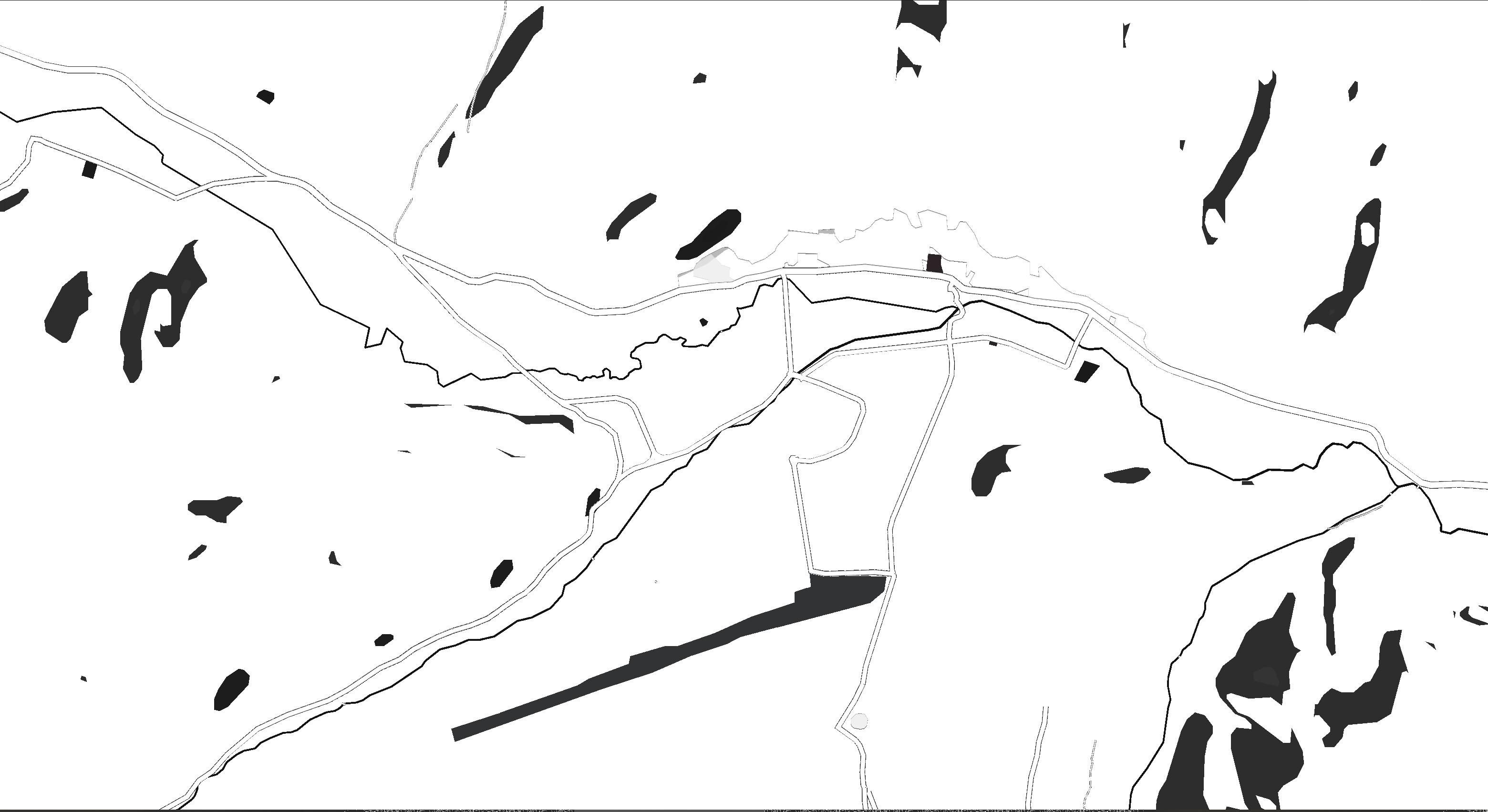
Central Bamyan Valley
Kowsar Education Center - Kabul Dasht-e Barchi - Kabul
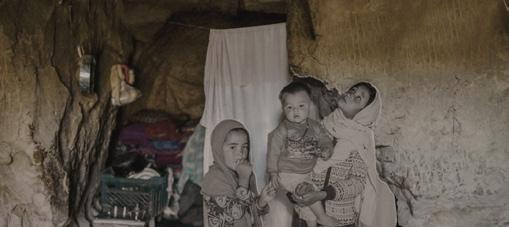
Hazaras are considered to be one of the most vulnerable groups in Afghanistan. Hazaras suffered severe oppression and ethnic genocide. Bamyan is the center of the region of Hazarajat, where Hazaras mainly settled.
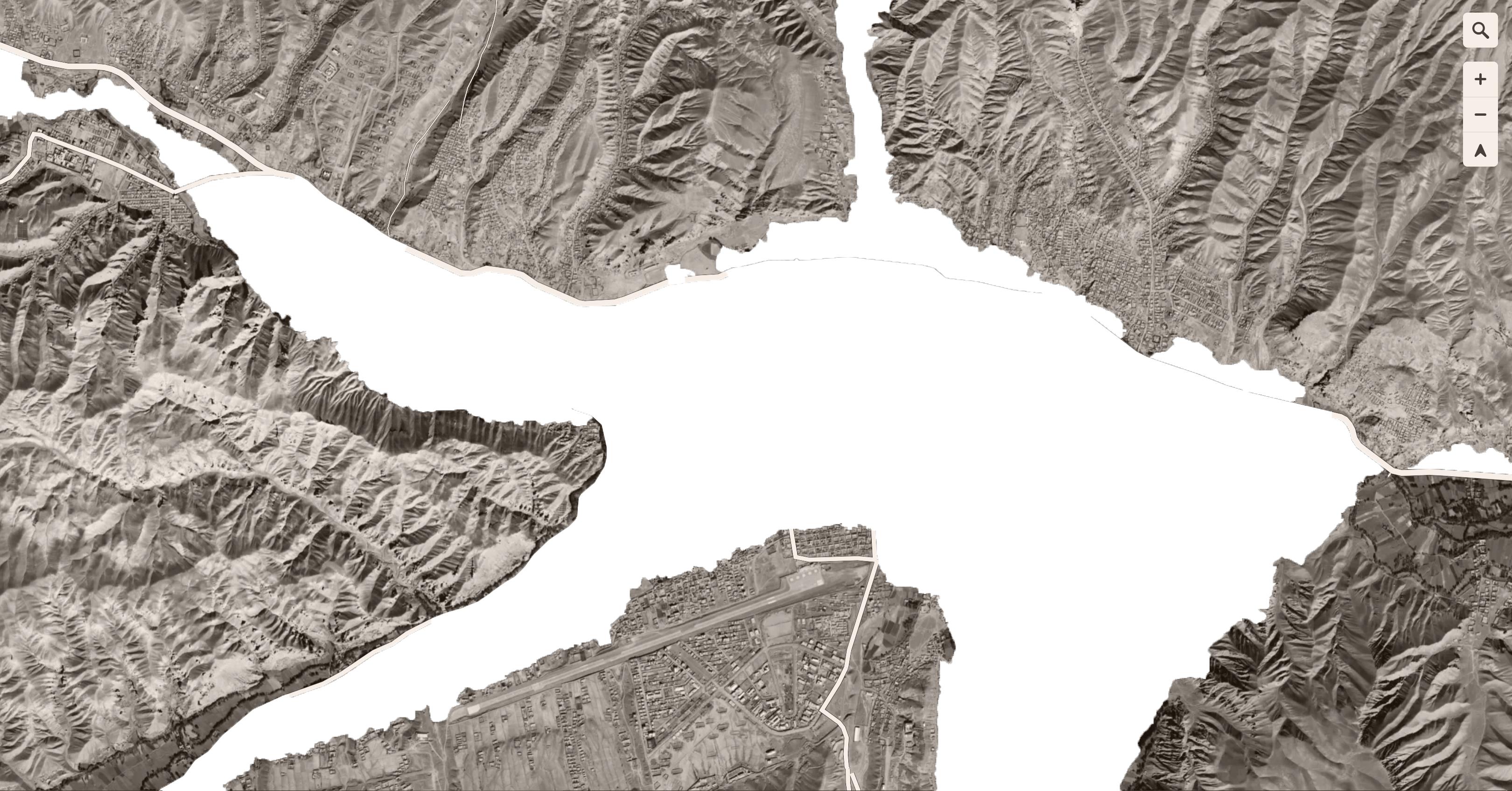
BUUDDHAS CLIFF HISTORICAL GHOLGHOLA CITY BAMYAN BUDDHAS SITE BAMYAN CULTURAL CENTER OLD BAZZAR MARKET to KABUL to BAND-E-AMIR NATIONAL PARK AIRPORT TRADITONAL SETTLEMENT UNESCO WORLD HERITAGE REVISED WORLD HERITAGE PROTECTION ZONE BOUNDERY SETTLEMENT CLUSTERS PUBLIC FACILITIES REGULATED DEVELOPMENT ZONE BUILD HERITAGE & TRADITIONAL SETTLEMENTS HISTORIC NATURAL & AGRICULTURAL SETTING HISTORIC & ARCHAEOLOGICAL SITES N
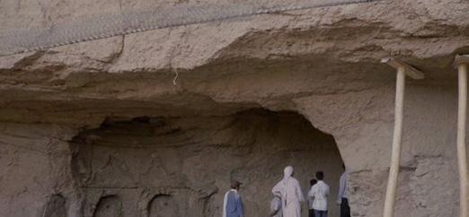
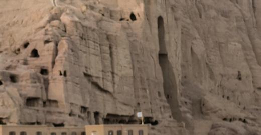
ACIENT CAVES ACIENT CAVES TERRIORST ATTACKS INFORMAL SETTLEMENT IN CAVES
WEST BAMYAN BUDDHA (DESTROIED)
FREQUENT WARS SINCE 1940s
Afghanistan
had suffered constant chaos and wars since the 1940s, as invaders and local powers keep comes and goes. In 2021, the Taliban took control of the country for the second time, raising concerns that the ultra-extremist Islamic group would reimpose their inhuman laws on the country.
Afghanistan is
the most threatened countries
estimated more than 5,000 civilians
last
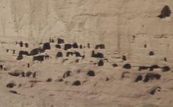
The 6th-century monks dug out numerous caves in the Bamyan valley. These caves are now home to around 700 Hazara ethnic families who have no land and can't afford conventional housing.
The Buddhas of Bamyan were listed as UNESCO world heritage. The Taliban dynamited the Buddhas of Bamyan in 2001 despite opposition from local residents and international society.
one of
by terrorist attacks in the world, with an
died in attacks during the
decade.
Site Conditions Analysis
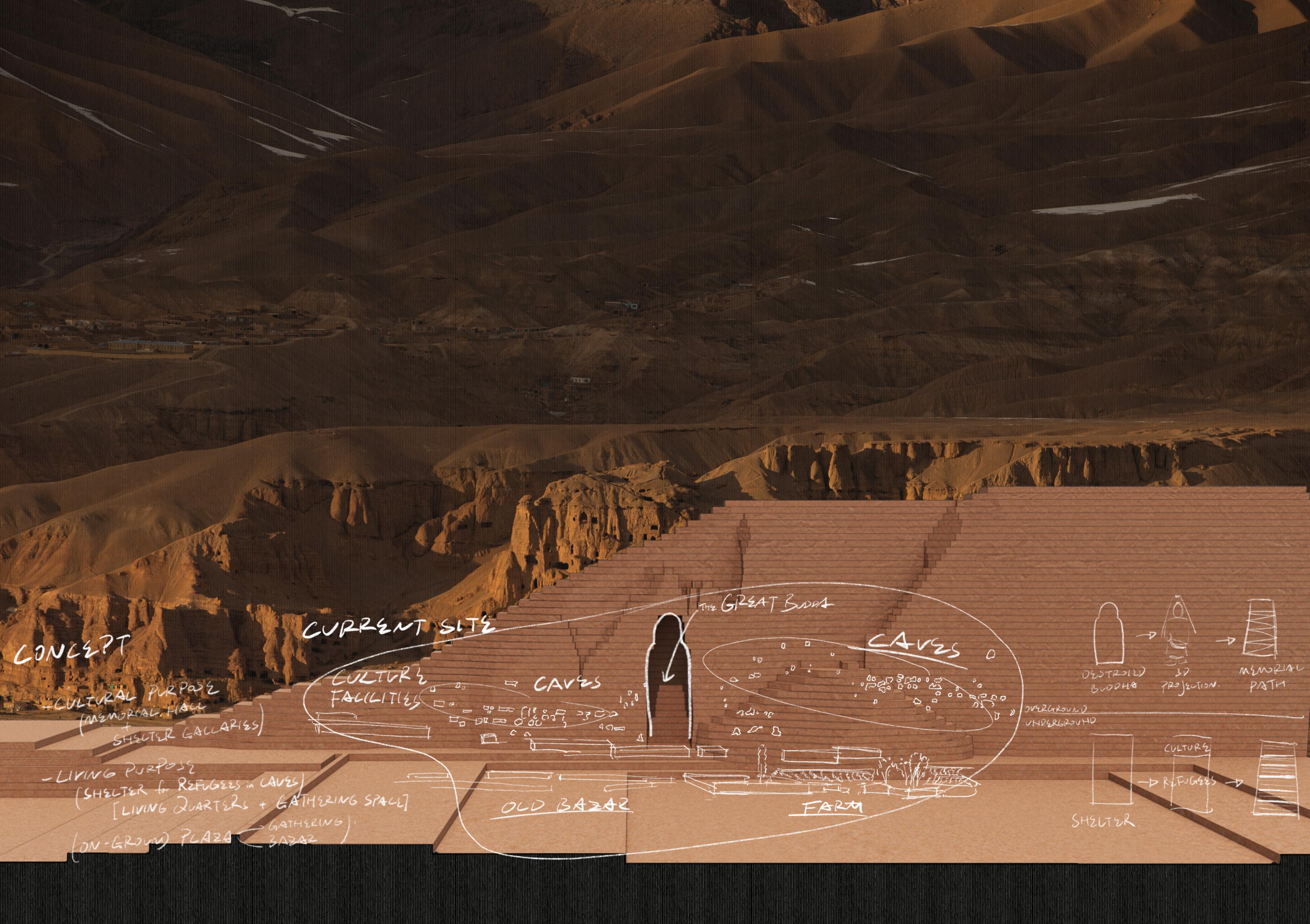


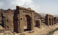
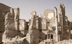
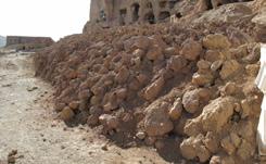


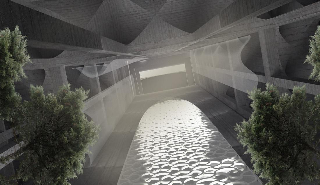
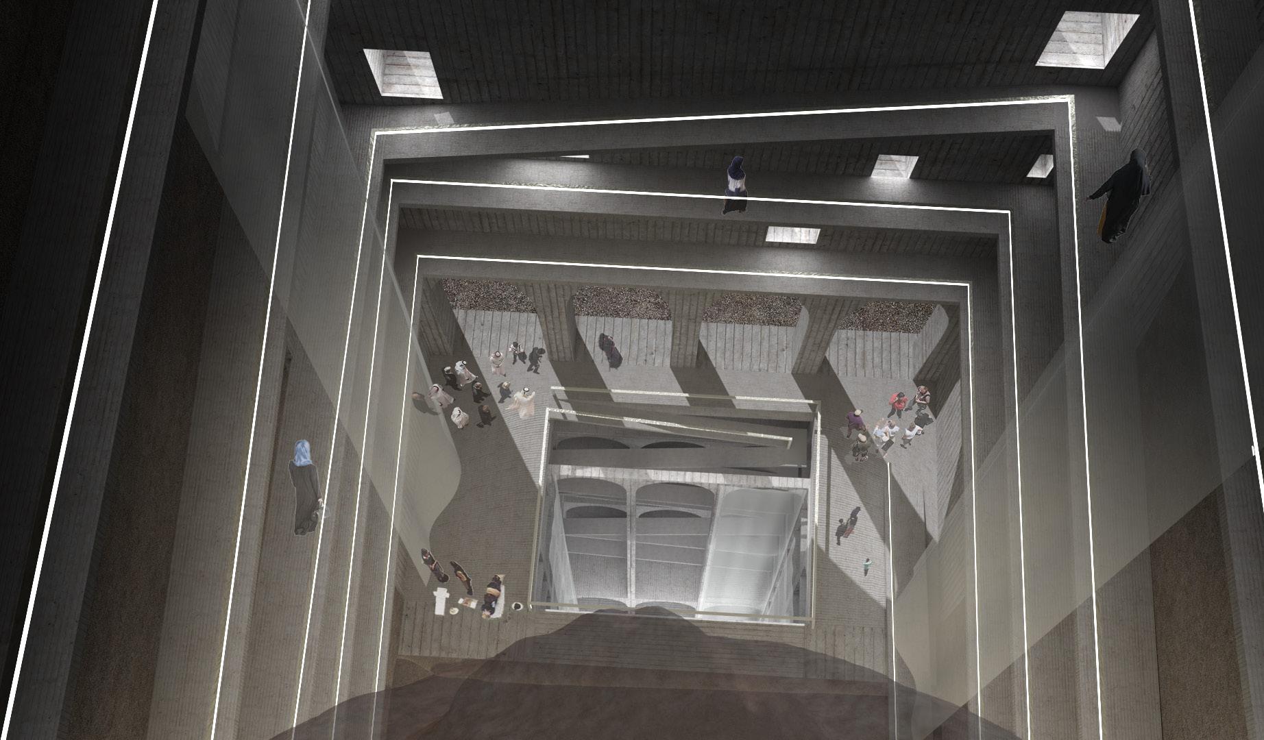
Concept Local Building Elements Generation Memorial Hall for Destoried Buddha Awokening Heaven Shelter for Culture Relics Human's World Refugee Camp Root of Faith The Pond & The Prayers Hall Pilgrimage Ascending Viewing Path Reborn Buddha of Light Overground 3 2 1 Underground Sheltered Refugee Camp for Local Hazara Refugees Traditional Windcatcher HOT AIR Floor Decks around Wind Tunnel Slopes for Connecting overall Structure Intergrate with Local Architecture Forms Intergrate with Local Field Prototype Multiple Elements Caves Old Bazzar Residential Area Facade Step 5 Step 4 Step 3 Step 2 Step 1 Living Quarters Entrance Decoration Slope Slope
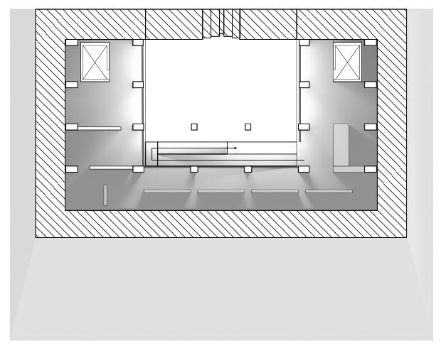
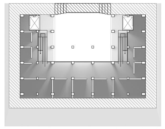


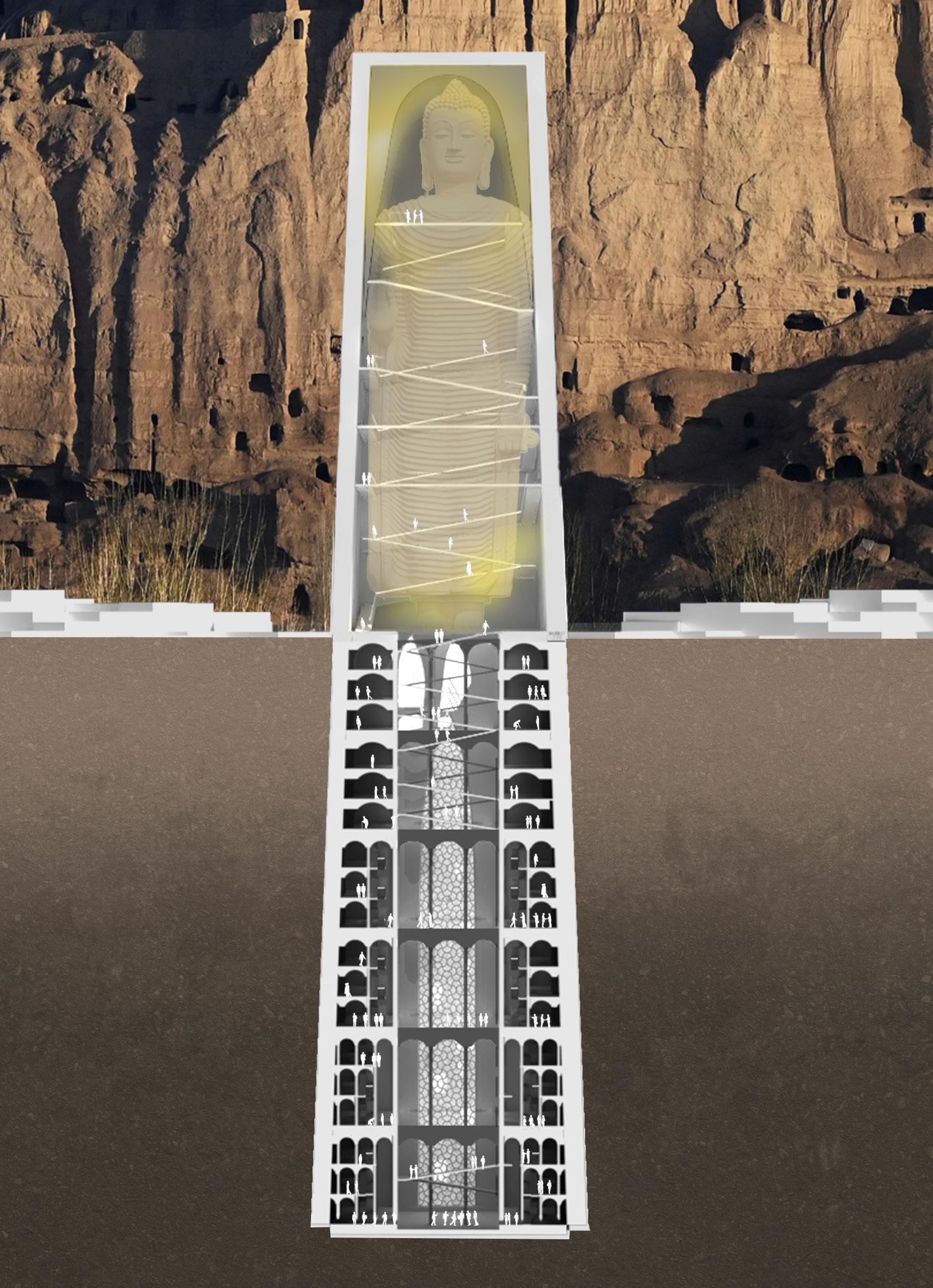

CULTURE CENTER REFUGE CAMP THE PRAYERS HALL MEMORIAL HALL Pilgrimaging Platform Pilgrimaging Paths the Main Hall Buddha of LIght Exhibition Hall Relics Shelter Living Quarters Living Quarters Living Quarters Ablution Place Offices & Research Rooms Bunker & Mechanical Storey Bunker & Mechanical Storey Bunker & Mechanical Storey Bunker & Mechanical Storey the Pond & Prayer Hall ±0m +10m +20m +30m +40m +50m +60m -10m -20m -30m -40m -50m -60m Exhibition Hall Ablution Pool Ventilate Tunnel Ventilate Tunnel Ventilate Tunnel Bunker Shield Gallary Lift Lift Lift Lift Main Prayers Hall Pulpit Storge Rooms Storge Rooms Prist Room Recycle Facilities Lounge Washrooms Prayers Rooms Holybook Area Water Tank Reception Showroom Lounge Corridor Public Space Public Space Bunker & Mechanical Storey Ventilate Tunnel Living Quarters The Prayers Hall Buddha Cliff A77 National Road to Shahidan to Kabul Fields to Bamyan City Master Plan Floor Plans Section N



Main Hall Atrium
Living Quarters
The Prayers Hall Bunker Shield Gallary Storge Rooms Tank & Recycle Facilities Reception Showroom Public Space Rooms
Section - Exhibition Hall
Section - Living Quarters Section - Bunker
&

environment and how a new

can be created through the
landscapes into our


identity within the
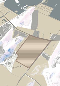
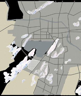
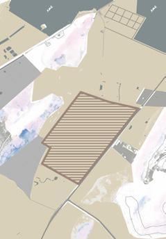
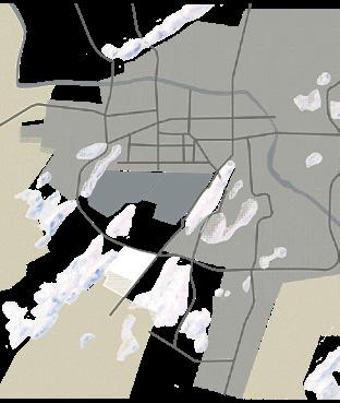
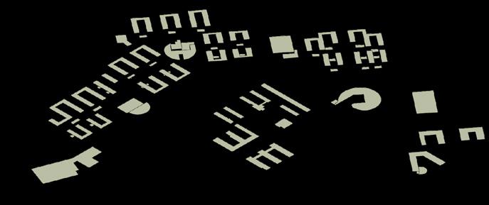
facilities are places where education & connections with the local community come together, therefore making them decent sites for the experiment. Here the mapping enlisted all educational facilities & markets in central Xuzhou, demonstrating the potential possibilities of bringing in a productive landscape inside schools & building connections between schools with local markets.
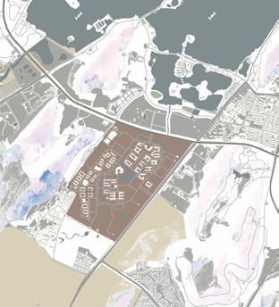
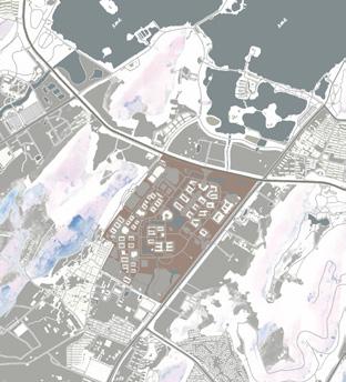

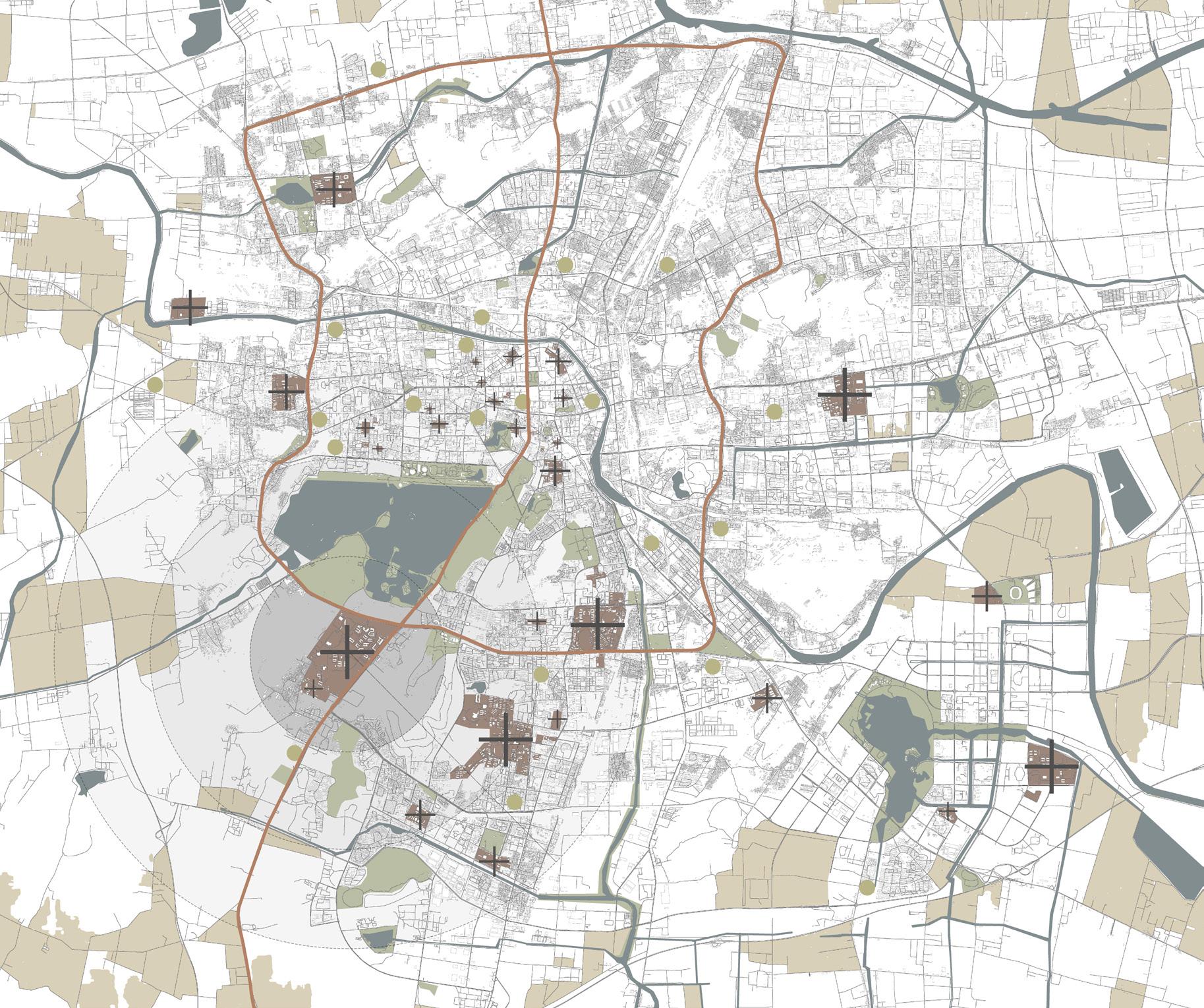
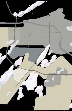
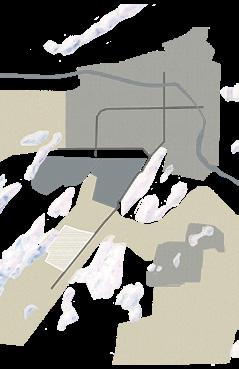
1975 1980 1993 1984 2004 2020 Areas near the site are undeveloped with mainly natural landscapes and sporadic farmlands. SITE Industrial Area Downtown Residential Areas Acient Yellow River Yunlong Lake Neighboring areas are reclaimed as farmlands on large scale. The edge of urbanization reaches the area with basic infrastructures being built. The 3Rd Ring Road of Xuzhou Metropolitan was constructed, urbanizing the surrounding areas. The Municipal Government decided that the site would be used to build the new campus of the university. The site and its surrounding areas have been fully urbanized with no trace of farmlands can be found. 1860 133 2000 2005 2010 2015 Reconstruction Expension Construstion of New Center 2020 Regional Central City 1983 2003 2020 Wheat Wheat Wheat Wheat Wheat Rice Rice Rice Rice Rice Maize Maize Maize Maize Maize Soybean Soybean Soybean Soybean Soybean Potato Potato Potato Potato Potato 2104 197 2KM 3Rd Ring Road 3Rd Ring Road This project demonstrates the possibilities of
agricultural
1992 2007 Historical Timeline Farmlands Green Spaces Educational Facilities Markets N 4KM 6KM New Downtown Population (millions) Farmlands Areas (km²) Urban Area Farmlands Urban Expansion in Xuzhou Farmland, Population & Crops Trend of Xuzhou from 1995 -Central Xuzhou Mapping- Urban Area Urban Area Urban Area Urban Area Farmlands Farmlands Farmlands Site Site Site Site Urban Area Urban Area Urban Area Site Site Site Site Site Site PROJECT 04 - PRODUCTIVE FARMLAND NETWORK Bring Agricultural Landscape back to Urban Campus
SEPTEMBER 2021 - NOVEMBER 2021 TUTOR: LIU ZHENYU CUMT CAMPUS, XUZHOU, JIANGSU PROV., P.R.CHINA
bringing
landscape
productive
urbanized
cultural
region
process. Educational
ACADEMIC / INDIVIDUAL


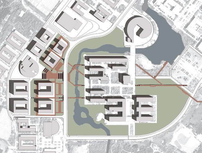
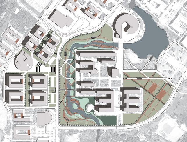


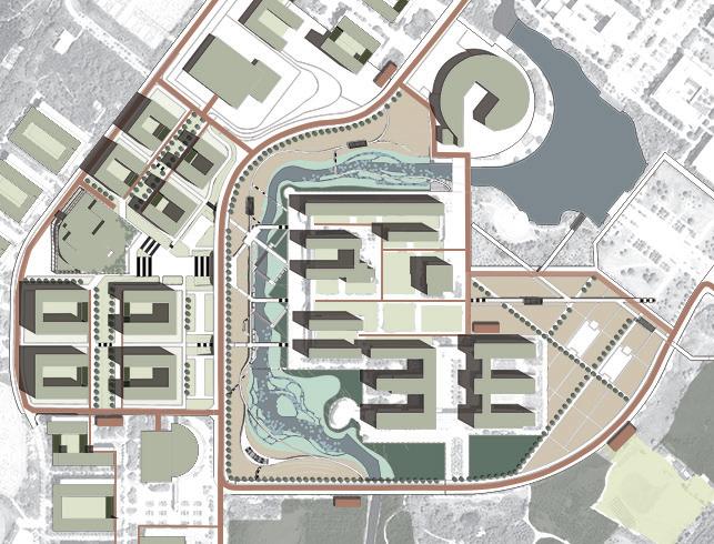
Nelumbo nuci era Nymphaeaceae Iris Thalia dealbata Pontederia cordata Sagittaria montevidensis Crepe myrtle Armenian plum Prunus persica Prunus mume MIDARBOR DAY NEW YEAR S PART Y GRADUATION SEASON ORIEN TAT ON SEASON AUTUMN S PART Y NATIONAL DAY CELEBRATION HARVEST CONCERT CAMPUS MARATHON SUMMER CONCERT SCHOOL ANN VERSARIES FLEA MARKET Prunus serru ata Salix Magnolia grandiflora Jasminum nudiflorum Iris tectorum Loropetalum chinense Rosa multiflora Photinia × raseri Chimonanthus praecox Rhododendron Oryza sativa Triticum NELUMBO NUC FERA Ginkgo biloba Acer buergerianum SOLUTION 1 SOLUTION 2 SOLUTION 3 SOLUTION 4 SOLUTION 5 SOLUTION 6 Circulation of Vehicles and Pedestrians Intersects Large Pedestrian Volum Causing Traffic Pressure Across Stream Difference in Elevation of Site Insufficient Planting Resulting in Soil Erosion Regional Context Vanished Existing Constructions Affected Ecological Environment Adversely PHASE 1 0-1 yrs COMPLETED CIRCULATION Circulation formed by newly constructed bridges and pedestrian space solves the most urgent issue in the field. LEISURE SPACE Leisure spaces are created as the field was further divided into wetland, woodland, shrubland & planned productive land. PRODUCTIVE LAND Planting pioneer crops on planned productive land as other plants grow on wetland, woodland & shrubland. DIVERSE SPACIAL DEVELOPMENT A self-reliant ecosystem is forming in the field as more plants are being planted and pioneer plants keep growing. AGRICULTURAL DISTRIBUTION SYSTEM Crops and other agricultural products are capable to provide for the campus canteen through the agricultural distribution system. PHASE 2 1-3 yrs PHASE 3 : 3-5 yrs PHASE 4 : 5-10 yrs PHASE 5 10-20 yrs JAN APR JUL OCT Wetland NELUMBO NUCIFERA Woodland Scrubland Cropland MAIN STRUCTER FLOATING ISLANDS FLOATING ISLANDS VIEWING FOOTPATHS VIEWING FOOTPATHS FARM PATHS VIEWING PLATFORMS GREEN ROOFS GREEN ROOFS GREEN ROOFS CROPLANDS CROPLANDS ORCHARD FIELDS INTERSPACE GARDENS INTERSPACE GARDENS AGRICULTURAL DISTRIBUTION STATIONS GREEN ROOFS PLANT FACADE Overall Strategies Phasing Development CHALLENGE 1 CHALLENGE 2 CHALLENGE 3 CHALLENGE 4 CHALLENGE 5 CHALLENGE 6 Multi-Layering Circulation Pedestrains Flows Branches Terraced Fields + Level Management Biodiversity + Wetland System Productive Framland + Campus Landscape Eco + Sustainable Constructions Seasonall Planting & Activities
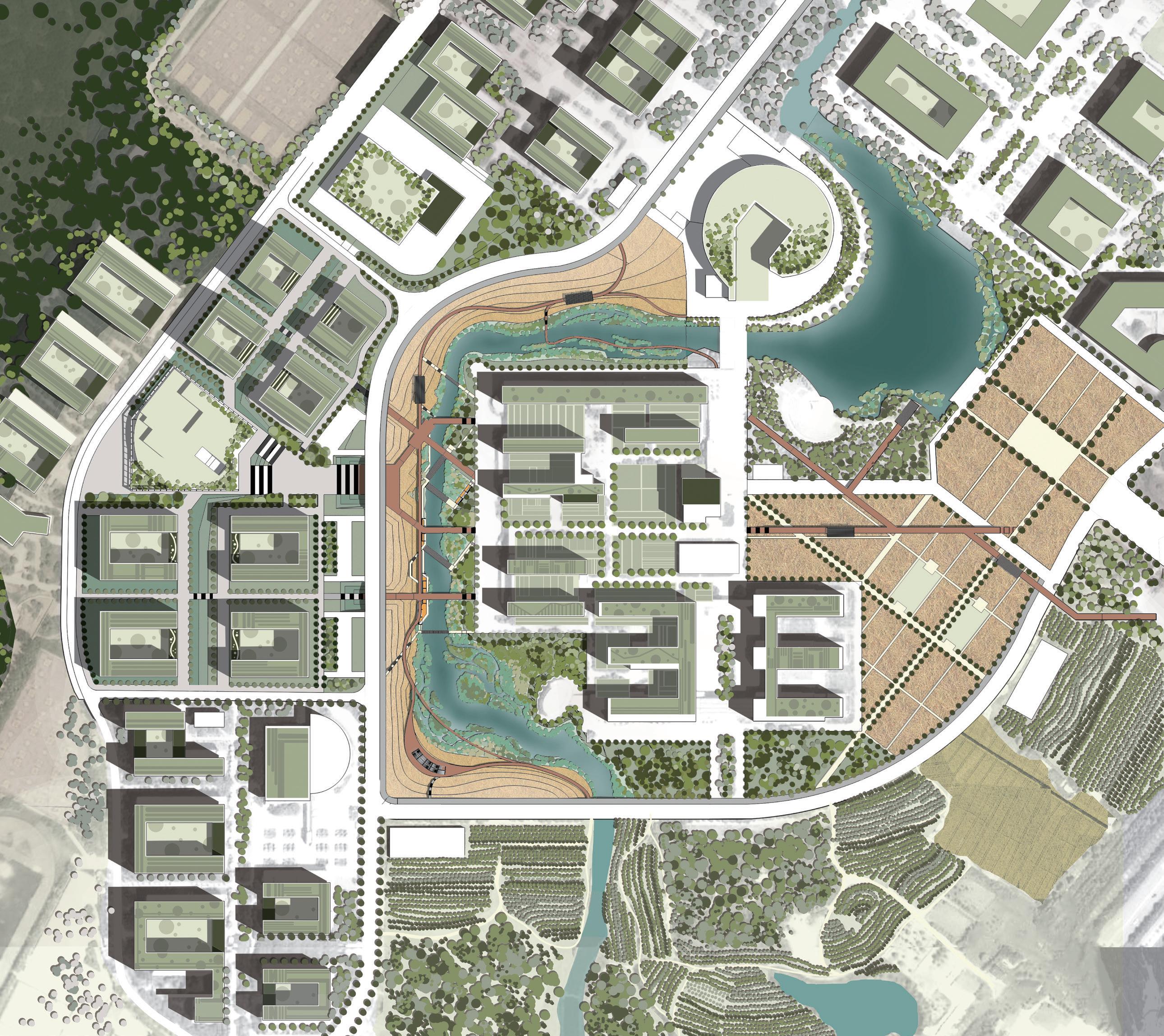

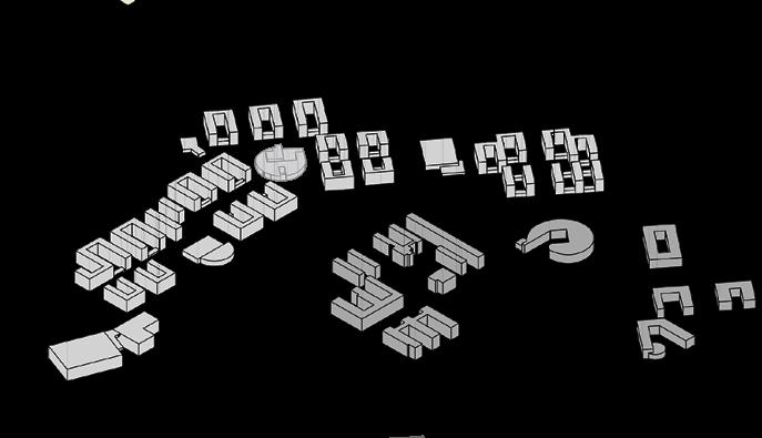

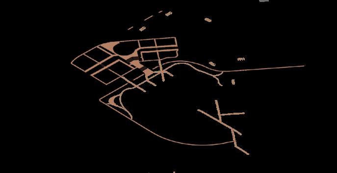


Teaching Area Teaching Area Living Area Living Area Living Area Sports Field Living Area to E. Gate ▶ to S. Gate▼ SECTION A SECTION B SECTION C Dormitory LEGEND Parking Field Underground Passage Scooters Parking Field Canteen Library Green Roof Productive Garden Public Square Streambank Footpath Viewing Bridge Wetland Footpath Pavilion Waterborne River Crossing Terrace Field Floating Islands River Islet Orchard Field Flower Field Wetland Paddy Field Fram Paths River Crossing Bridge 1 1 1 1 1 1 1 1 1 1 1 1 1 1 1 1 1 1 2 2 2 2 3 3 4 4 5 5 5 6 6 6 7 7 7 7 7 8 8 8 8 8 8 9 9 9 9 9 9 9 9 9 9 9 10 10 10 11 11 11 11 11 12 12 12 12 12 12 12 13 13 14 14 14 14 14 15 15 15 15 15 15 15 15 15 15 16 16 16 16 16 17 17 17 17 17 18 18 18 19 19 19 19 19 21 21 21 21 21 21 23 23 23 23 23 23 24 24 20 20 20 20 20 20 20 20 20 22 22 Master Plan Explosive View The site is located on the campus of the China University of Mining & Technology, in the city of Xuzhou, as the city is undergoing a massive transformation from a resource-dependent (mainly Mining, obviously) city to a green city that fits a sustainable future. The site is mainly dived by a creek into two separate parts, Living Area to the West, and Teaching Area to the East. Such an arrangement resulted in massive crowds traveling between the areas during peak hours. Multiple creek crossings are designed to arrange the crowds. The difference in height reaches a maximum of 6 meters between two creekbanks, which had long suffered from erosion due to steep slopes. Terraced Fields are introduced on the creekbank as a method to solve the issue. Green Roofs and vertical greening are introduced in the design to further create an eco-sustainable campus. Large experimental fields, as well as rather small gardens, are set to bring productive landscapes to campus. Streambank Footpath Farmlands Farmlands Woodland Wetland Pedestrains Space River Crossing Viewing Bridges Viewing Platforms Pavilions Sidewalks Sidewalks Waterborne River Crossing Farm Tracks & Viewing Platforms Agricultural Distribution System Green Roofs Courtyards Roadway Function Pavements Minor Paths Landuse Living Areas Teaching Areas Greenland 50m N
Campus Market Rice Paddies & Farmlands







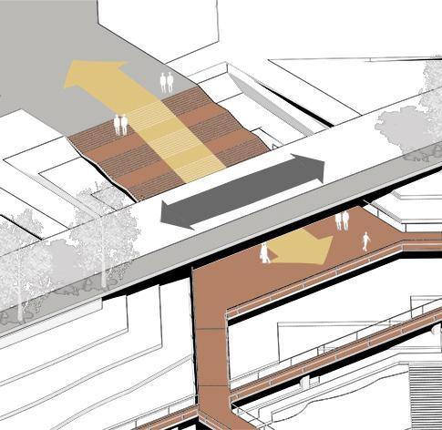
Trail Field Trail Viewing Platform Viewing Platform Viewing Bridges Field Road Canteen Vertical Greening Pedestrain Walks Market Booth Vehicle Roads Intersection Public
Field Field Floating Islands Floating Islands River Islet Wetland Main Road Wetlands
Square
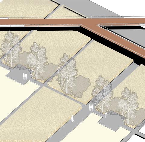
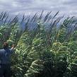
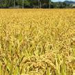
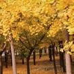
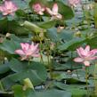
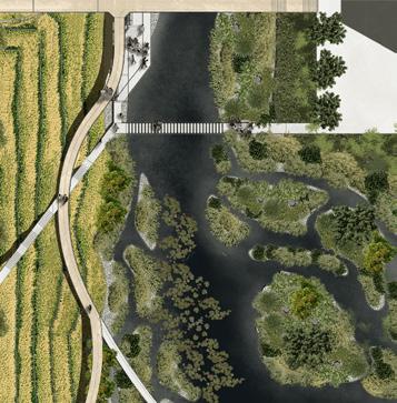
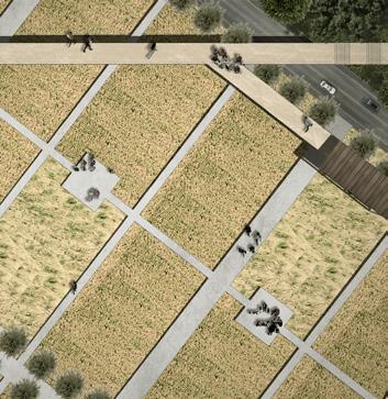
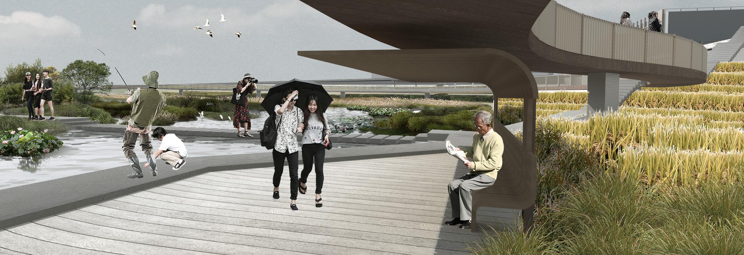
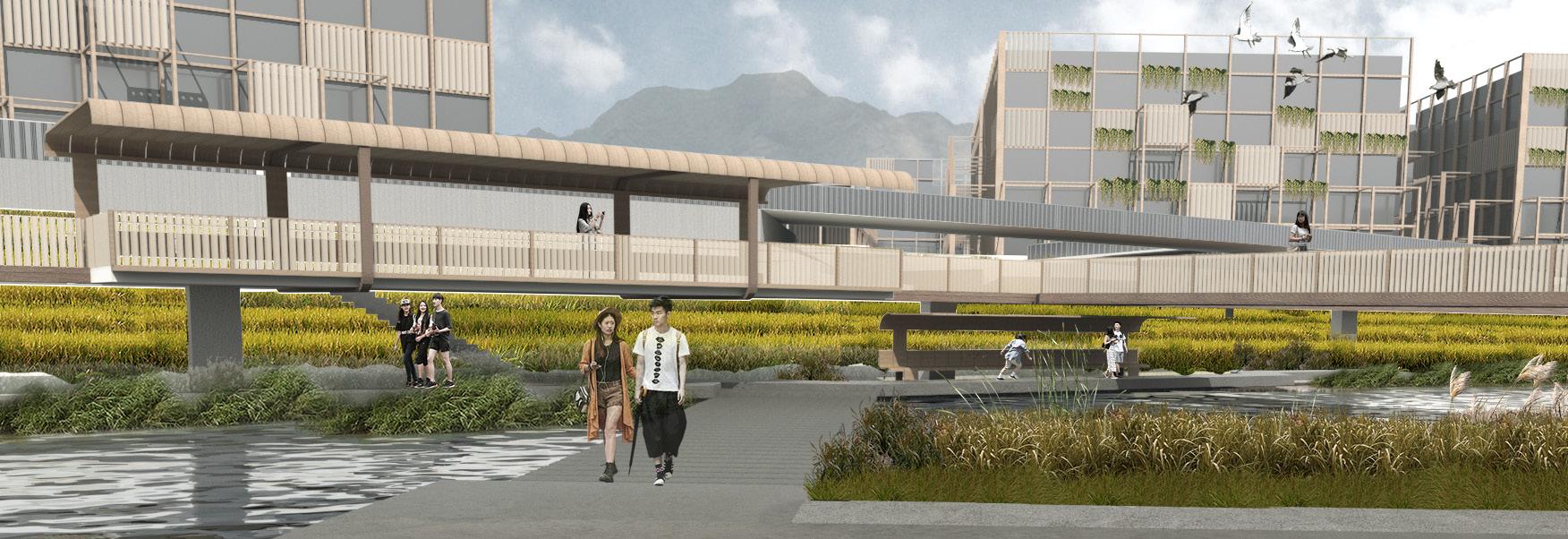
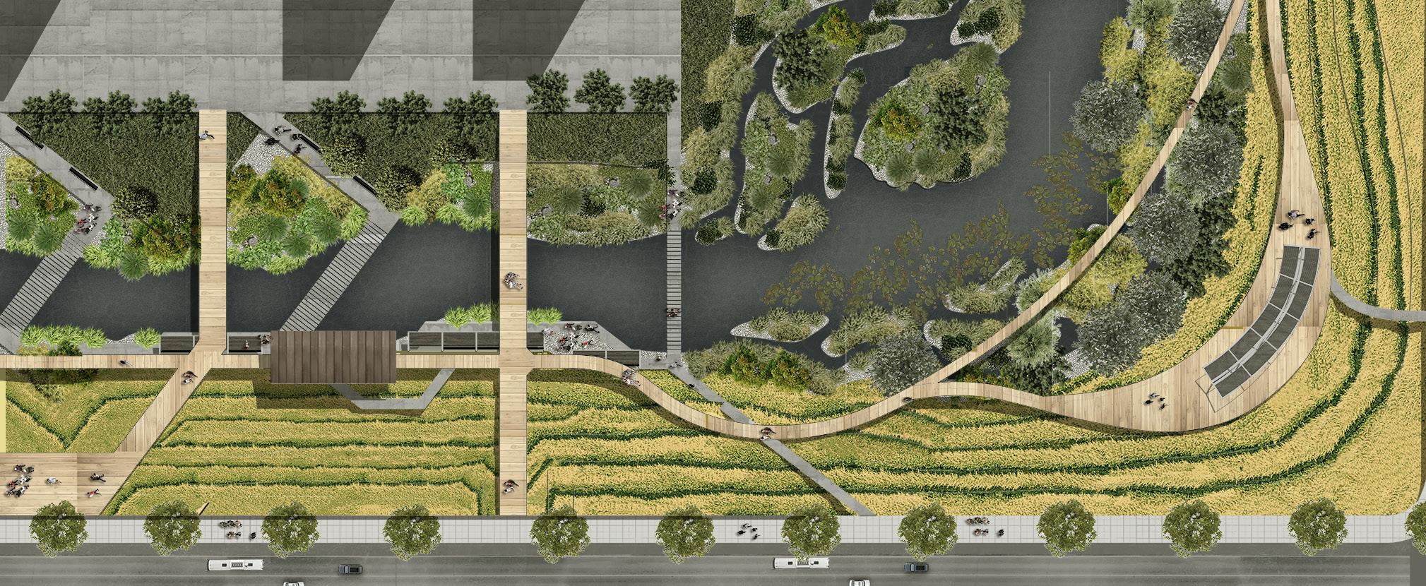
The design makes use the lawn on the east of teaching area to set up an experimental field area, echoing the theme of design to explore the reproduction of agricultural landscapes in urbanized public areas such as campuses. Viewing trails are set above the rice paddy to connect two sides, while there is also viewing platforms that overlooks field. The square carries massive flows of people during peak hours. The design depresses pedestrian walks under main roads at the cross, avoiding conflicts between the flow of people and the flow of vehicles. At the same time, the design also established an enveloping structure on the outside of the canteen building to make its overall shape more consistent with the site as a whole, while also providing more spaces for vertical greening. The river has a larger width at the southern end of the site and runs around the island in the middle of the river. This area is largely ignored under current consideration. This design connects two banks of the river with the island in the center of the lake ecologically through the ecoartificial floating islands, creating a complete wetland space.
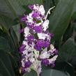
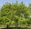
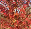
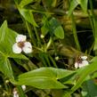
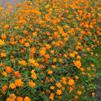
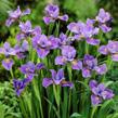
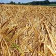
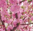
Oryzoideae Nymphaeaceae Prunus Serrulata Triticum Arundo donax Prunus persica Brassica rapa Iris Prunus mume Cosmos sulphureus Thalia dealbata Magnolia grandiflora Malus pumila Sagittaria sagittifolia Acer buergerianum Pterocarya stenoptera Productive Wetland
8m 8m 8m
Nelumbo nucifera Ginkgo biloba



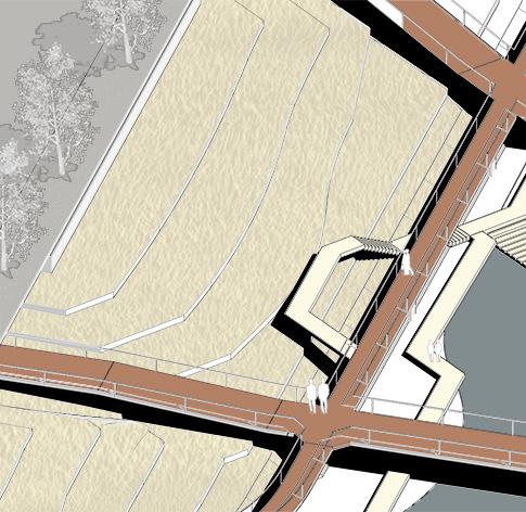
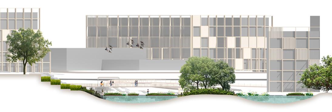
 The design uses terraces to handle the sixmeter height difference between the main road and the stream. The productive landscape is therefore integrated into the site naturally, meanwhile decreasing soil erosion on the slope. Elevated viewing trails and trails by water provide observation from different angles and heights respectively.
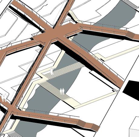
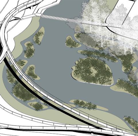
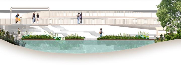
The design uses floating Islands to create spaces for wetland plants above the once-neglected creek way, connecting both sides of the creek to form a more integral wetland ecosystem, therefore improving the overall eco-environment of the creek.
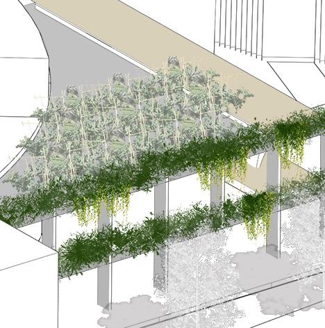
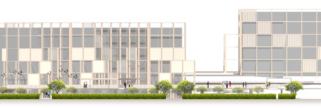
Existed buildings are modified with vertical facades in a grid of pillars that envelop the building itself, with a capacity of carrying living greenery. The structure also provides grids and platforms that could be used as small gardens for productive plants.
10m N Detail Plan
Riverbank
Pavilion Pavilion Viewing Bridges
Streambank Footpaths
Pavilion
Bridge Waterborn Path
Terrace Field
Terrace Field
Pavalion
Terraced Fields
Floating Islands
Vertical Greening Green Pavilion
 2020-2022 Selected Works China University of Mining and Technology Application for MLA Landscape Architecture at the Bartlett, University College London


 Marine Farm
Artificial Embankment


 AFGHANISTAN
SILK ROAD COUNTRIES
BUDDHIST INFLUENCE AREAS c.500CE
HAZARA RESIDENT AREAS


