PORTFOLIO
yan.gong.20@ucl.ac.uk BARTLETT SCHOOL OF ARCHITECTURE | MLA POSTGRADUATE 2020-2022 July 2022 YAN GONG

Ephemeral adaptive littoral zone as outdoor performance space

Activate underutilized urban spaces using the concept of on/off script
A city park transformed from a city island
Regeneration of a huge and ancient water conservancy project in China
year of completion: 08.2022
Tutor: Cannon Ivers, Alexandru Malaescu
Type: Individual

The studio project focuses on the foreshore of the River Thames to build an outdoor Museum/performance space and leisure area changing with the tide. The waterfront of the River Thames has many unplanned areas, which are also buried with the long historical relics of the River Thames. The project attempts to tap the potential of the foreshore and reproduce the history of the Thames in the form of combination with the current situation. While shaping the space changing with the tide, the project also needs to solve the problem of site erosion and how to build a better small water system in the foreshore.
Low density fresh water
High density salt water


When the beach opened a newspaper reported ‘When it was opened a few weeks ago they expect ed that 500 children a day would visit it. But there were 5,000 a day from the beginning, and consider ably more since the summer holidays started.’ It was estimated that between 1934 and 1939 over half a million people used the beach.


Carefree scenes on forgotten stretch of sand which lay right in the middle of London 88 years ago
The famous Windmill Theatre girls work hard, but they also found time to play between shows. London’s own beach by the Thames at Tower Bridge was close enough to the thea tre for them to change into swimsuits and enjoy a brief breather with hun dreds of Londoners who are enjoying a spell of early summer.
King George V decreed that the beach was to be used by the chil dren of London and that they should be given ‘free access forever’. This stunning shot shows it was still a pop ular spot in 1952.


Source: https://www.dailymail.co.uk/news/ article-5983699/When-life-beach-Amazing-pic tures-carefree-scenes-forgotten-sand-middleLondon.html
The black and white photographs showcase a for gotten time in history when London had its very own beach. Children do what children do best - find some thing to play with - while the woman looks up, maybe keeping an eye on the weather.


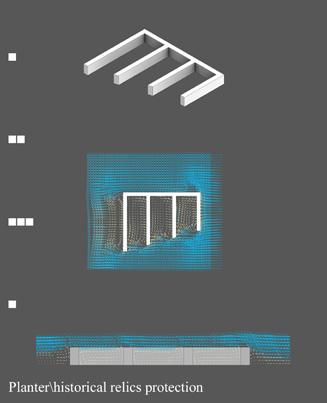


The project studies the existing anti-erosion measures of the river bank, and continuously test them to solve the erosion problem and form a space. At the same time, the corresponding historical sites will be protected through the establishment of structures. Different forms of structures affect the ground form and water flow form, forming a new landform of the foreshore.The project studies how the waterfront generates reasonable landscape and space under the action of tide, and consider the role of dynamic and static intervention in ecological problems.


Select the main division
Generate spaces according to Voronoi diagrams, distributing the size proportionally among the various spaces
the main division
Generate spaces according to Voronoi diagrams, distributing the size proportionally among the various spaces

Simulates the flow of water through, generating rounded corners to buffer the flow of water
Simulates the flow of water through, generating rounded corners to buffer the flow of water


Select some functional zones and roads, and the shape has been generated
Select some functional zones and roads, and the shape has been generated
Diagram:
Diagram:
Diagram: Building a


Plan

The area is centred on curved ground interventions, and various plant forms with different heights and habits are designed. The placement of the interventions facilitates the formation of sediments to grow plants.

The area is dominated by variable plant landscapes, with floating and fixed planting areas for various plants. The planting area on the ground is mainly attached to the growth near the intervention.


This area is a key protection area for historical relics. The setting of interventions can effectively protect the relics and provide more opportunities for plant growth.


The area is designed with a framework for people to search for historical relics, and two large public platforms are set up, which can rise and fall with the tide.


The area is designed with bridges and swimming pools in the centre, so as to achieve the effect of extending Greenwich Park


In this area, the old large pier was remodeled, and the connection between the shore and the pier was opened up. Place a rocky tide pool in a cooler place under the pier to provide an environment for aquatic life.


Year of completion: 06.2021

Tutor: Sandra Youkhana, Katie Kasabalis
Type: Individual
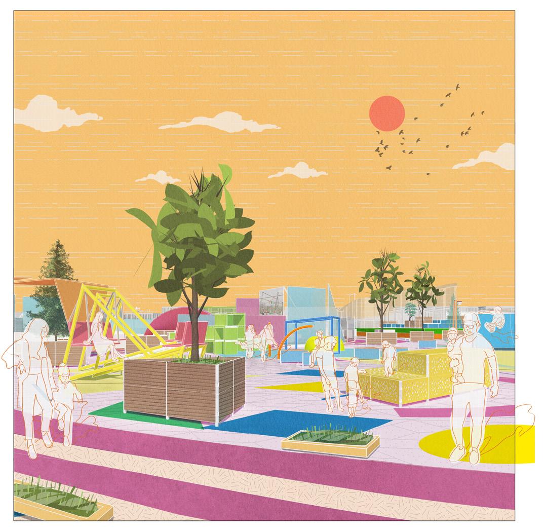
PROJECT DESCRIPTION: This project aims to activate underutilized urban spaces for the surrounding community using the concept of on and off script spaces.
DESIGN PROPOSAL: Design a set of facilities suitable for urban small and medium space, with the least intervention to achieve better results. Brings all of design elements together in underutilized spaces through the lea valley.

This mapping analyzed how much scattered space are there around the site. Black dots represent the areas that are unused, and blue line texture represent the sites that block people’s use of space, for example like parking lots and material accumulation places. All these elements together, you can choose the most potential external activity space. The following design is mainly aimed at these areas.


Underutilized areas
Lower Lea Valley

Places that the motor vehicles might be concentrated are been analyzed, in the yellow part of the figure. The depth of color indicates density, which will affect the use of surrounding space. The more dense the traffic flow is, the less pedestrians there are. At the same time, open and not remote path, there will be more pedestrians, in the drawing is the blue part.

Sites that block people’s use of space
Motor vehicle density
Pedestrian density
Key design areas
Moving route of people
Construction land red: business district or shop blue: residence
Four different colors and patterns represent different functional areas, but this does not mean that their functions must be fixed, but give people some suggestions to make urban space more orderly, and at the same time increase interest, encourage people to create and explore.
Pedestrian route guidance identification Table and chair placement and small space identification
Open public activity space
Natural scenic area
Green space identification Medium and large scale activity space identification
Activity space of small residential area

Waterfront activity areas and bridges

Optimized commercial pedestrian area

Temporary interventions (patterns)

More permanent interventions
Temporary interventions (patterns)

More permanent interventions
More permanent interventions


More permanent interventions


Toolkit test of different materials
Toolkit test of different materials


This area is a comprehensive summer activity place. All kinds of activity facilities are distributed around the site, and people can use them at will. The soundproof panel at the back prevents people from being disturbed by outdoor movies.

The area is a place for winter parties. At the same time, the structure originally used for tree pool is used to place heaters, which ensures the feasibility of outdoor activities in winter. Most of the plants are evergreen.
This is an area near the entrance. The site is designed with luminous ground interactive devices and a grass slope to attract more people here. Some areas are equipped with sunshades for people to enjoy the shade at the back.

In winter, small hothouses are set up for people to watch plants in different seasons. Originally for a whole grass slope into scattered snow heaps. People can have snowball fights and make snowmen here.


 Fig: Bare Greenwich foreshore after erosion (2021) Souce: Author's own photo