What makes me different? I have a passion for design and I am committed to learning innovative and advanced design concepts and applying these theories to my works.
After studying environmental design in Anhui University for four years, I have good professional quality and software ability.During my internship in the design institute, I gained practical experience. The abilities above will be fully reflected in my portfolio which make me a qualified candidate for this programme.
All in all,I am eager to apply for this programme.I firmly believe that the advanced design concept of this programme can be a solid theory and experience for me to become an outstanding urban designer in China in the future, and contribute China’s urban construction.
01
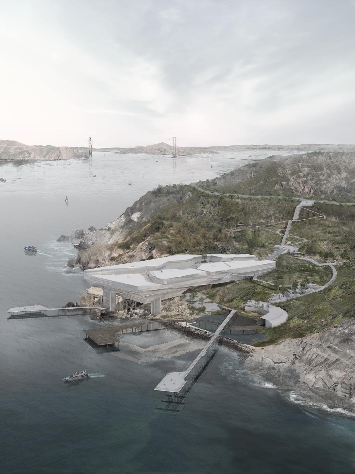
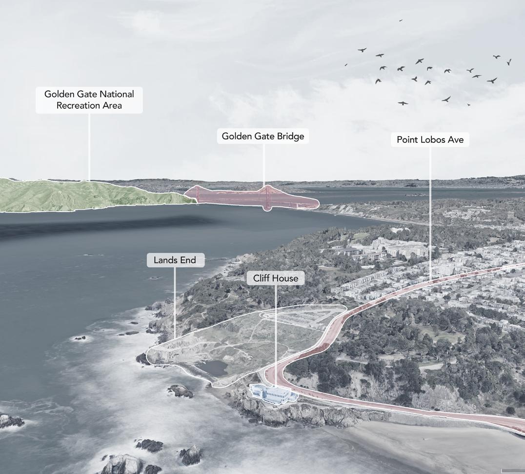
CONVERSING WITH THE AGES
Memorial Landscape Architecture
Project Type:Individual Work
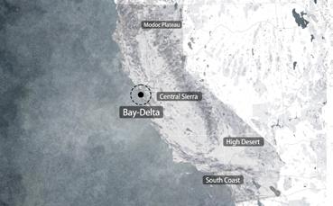
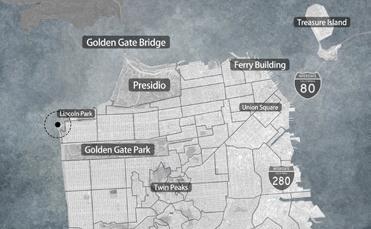
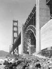
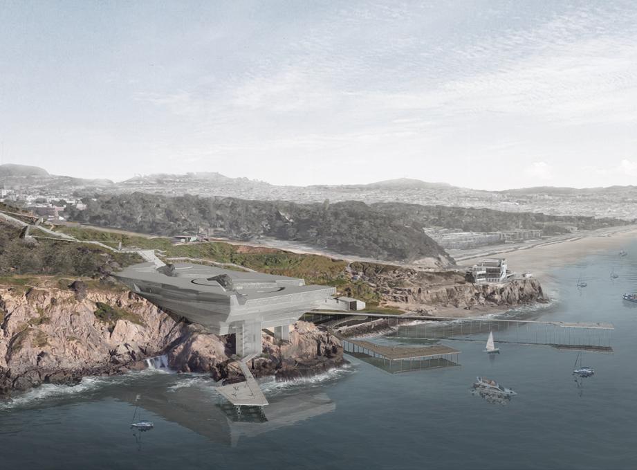
Location: San Francisco, California, US
Planning Area: 10 Hectares
Category: Workshop Work
Instuctor:Boris Yu
Date:2024.10-2024.12
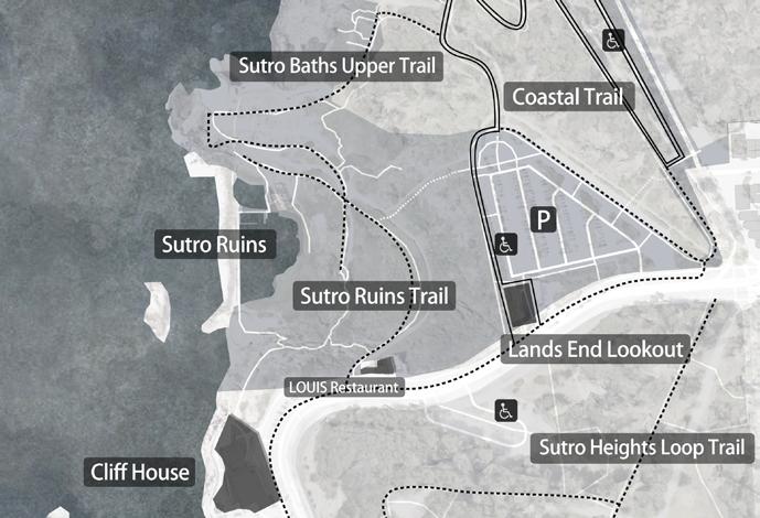
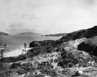
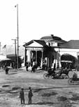
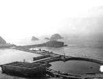
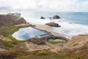
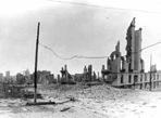
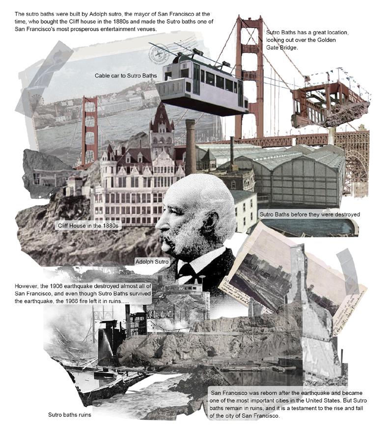
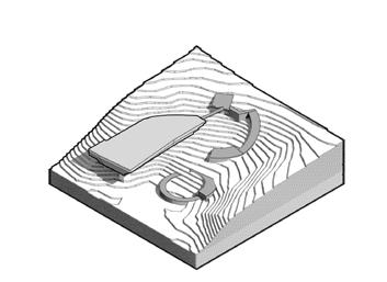
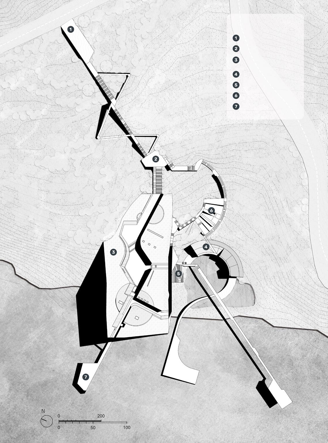
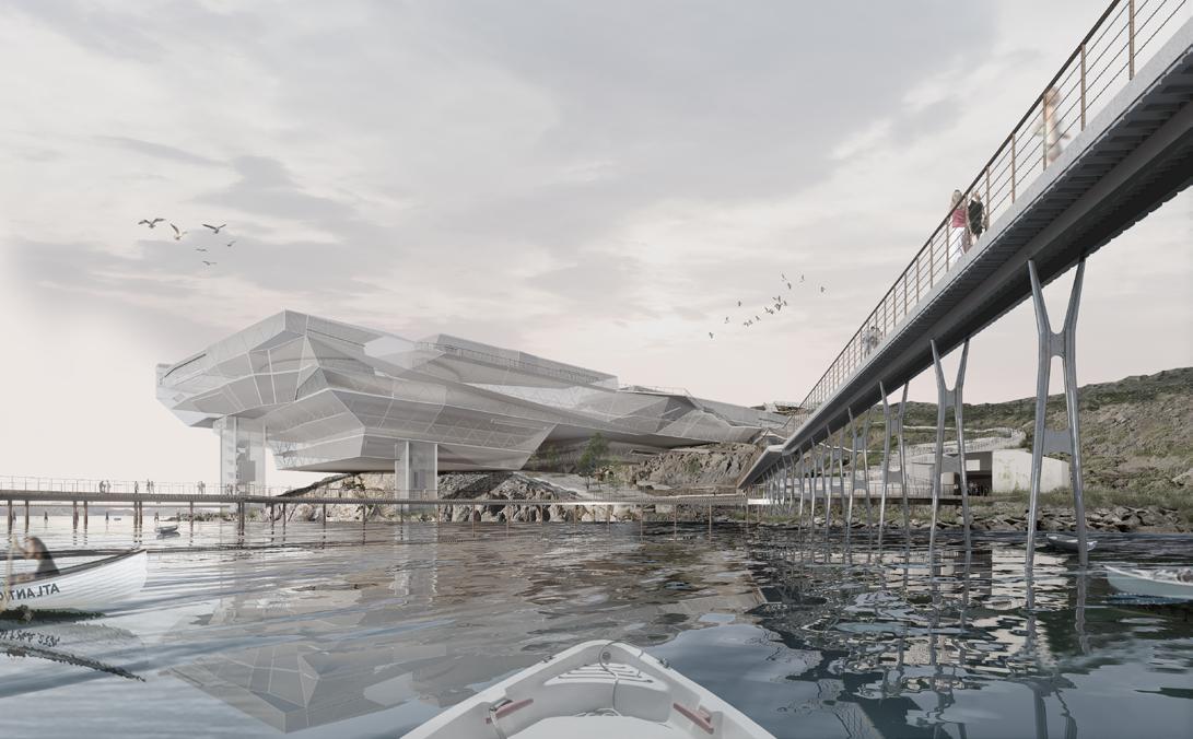
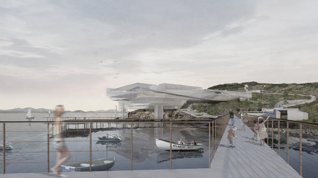
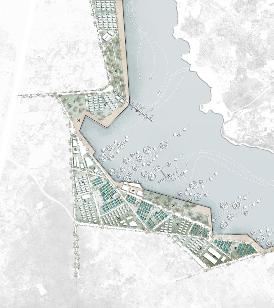
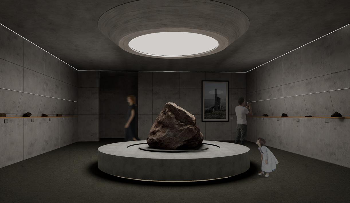
Set along the rugged coast of San Francisco, the Sutro Baths not only witnesses the urban changes of San Francisco, but also the best embodiment of the spirit of social and public welfare in the last century....,To commemorate the transformation of San Francisco and the prosperity of Sutro Baths before it burned down, the Sutro Baths Memorial Project stands as a beacon of architectural ingenuity and historical preservation. This ambitious initiative seeks to breathe new life into the ruins of the iconic Sutro Baths by meticulously sculpting the landscape to harmonize with cutting-edge design elements while honoring the site’s storied past. The project employs advanced grading techniques to seamlessly integrate the memorial into the existing contours of the coastal terrain, ensuring that each architectural intervention enhances the site’s natural beauty and historical context.
Evolving Landscapes - The Synchronized Histories of Sutro Baths and San Francisco
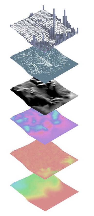
Analysis
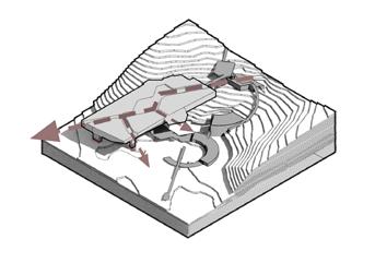
This diagram strategy outlines the evolution of the design plan for the Sutro Baths, blending historical context with environmental considerations to enhance site functionality. Each stage, from foundational geometry to the final layout, is crafted to respect the site’s rich legacy while optimizing visitor interaction and landscape integration.
Initial Geometric Foundation
Incorporating natural and historical contours of Sutro Baths into the basic design layout, setting the stage for detailed development.
Strategic Design Segmentation
Utilizing cutting techniques to delineate distinct areas within the Sutro Baths site, optimizing space for varied uses while respecting historical landmarks.
Pedestrian Flow Lines
Designing intuitive routes that guide visitor movement through the Baths, enhancing accessibility and interaction with key environmental and historical features.
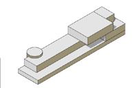
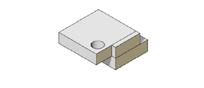
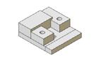
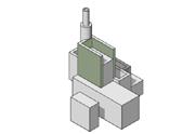
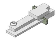
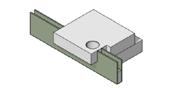
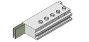
Volumetric Study Model
Platform Generation
Establishing viewing and activity platforms that offer expansive views of the surrounding landscape, integrating the rugged beauty of the site with functional public spaces.
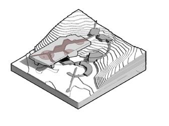
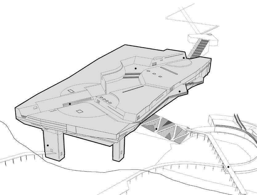
Presented here are volumetric study models for the proposed Sutro Baths Memorial in San Francisco. These models perform a roughness analysis to meticulously craft the integration of architectural elements within the preserved ruins, enhancing the memorial’s narrative while respecting the site's natural and historical essence.
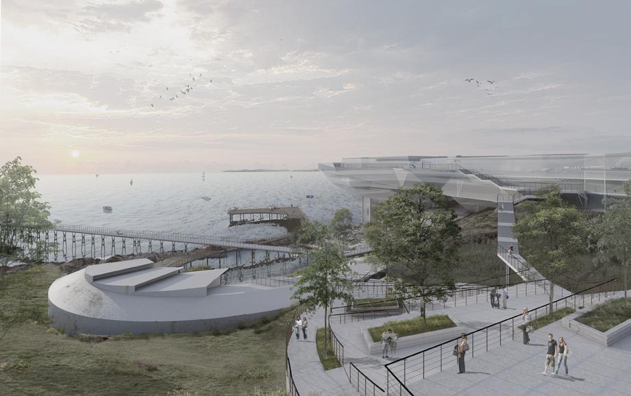
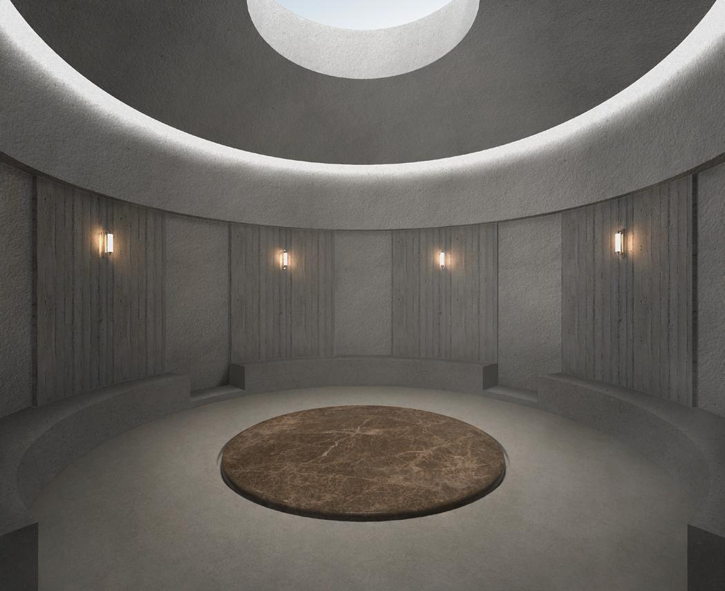
Offshore platform elevator & stairs SSG AL Heart Rock viewing platform Sutro Baths Memorial Hall entrance
Sutro Ruins viewing platform
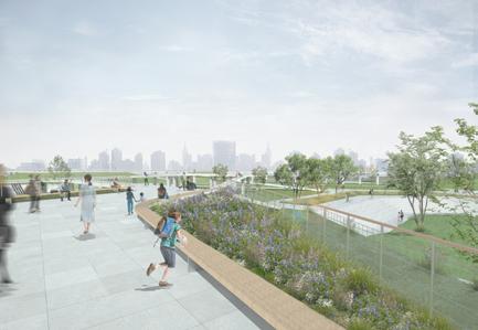
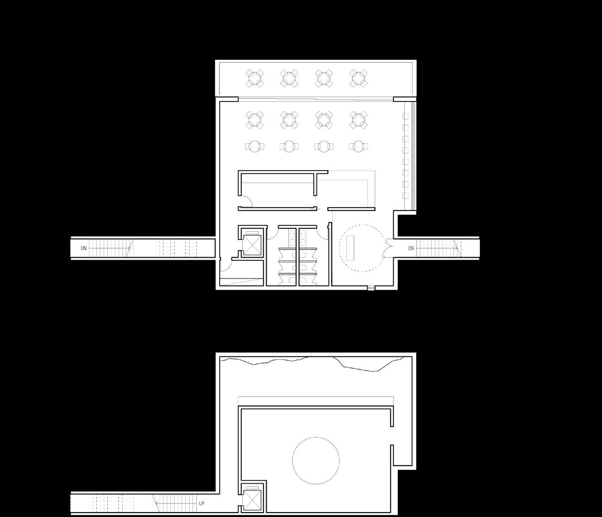
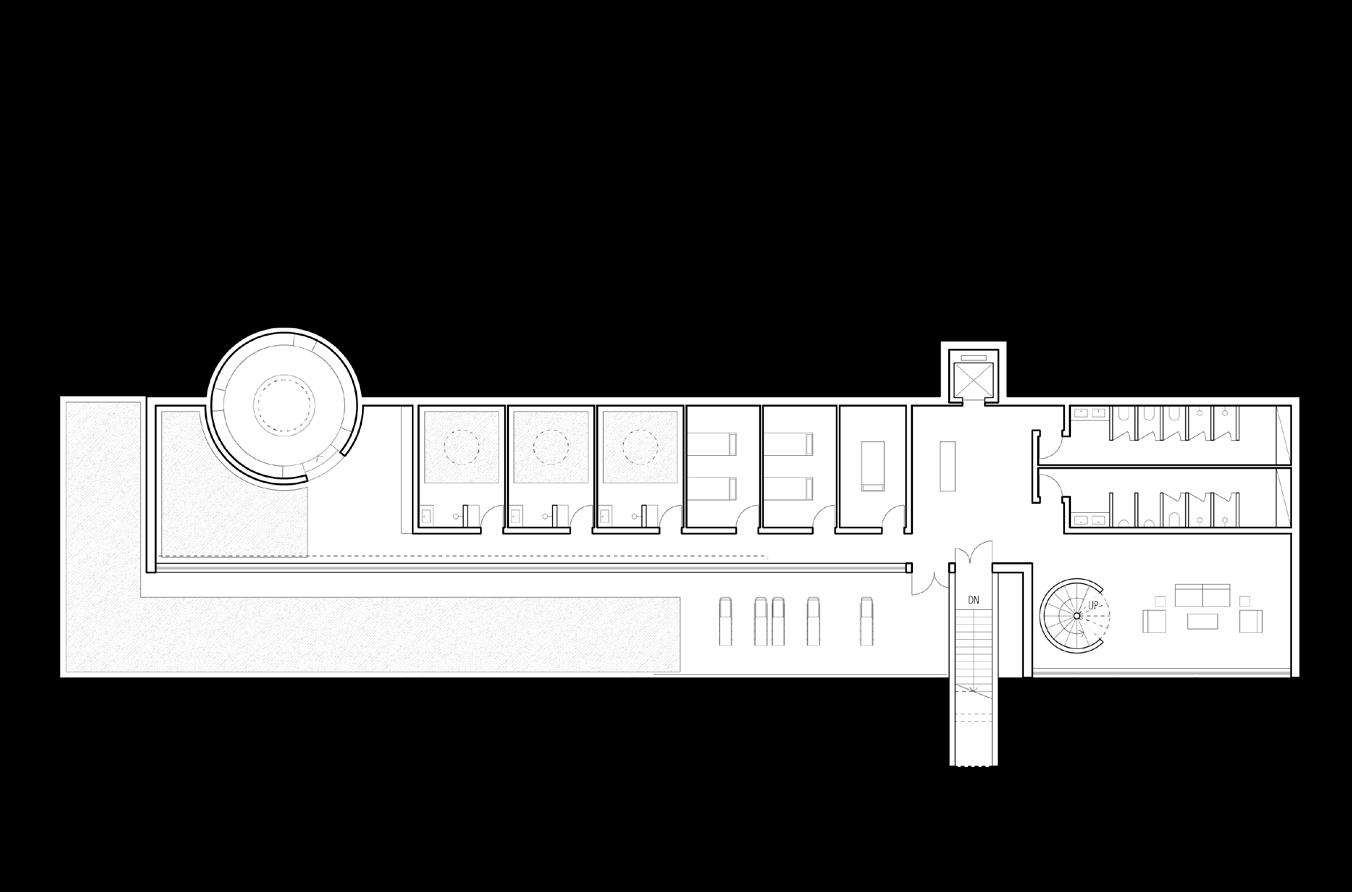
Memorial Hall main entrance serves as the primary access point connecting the El Cwamino del Mar Parking Lot to the memorial. This entrance is designed to provide a direct pathway leading up to the multi-purpose rooftop, facilitating easy navigation and accessibility for all visitors.
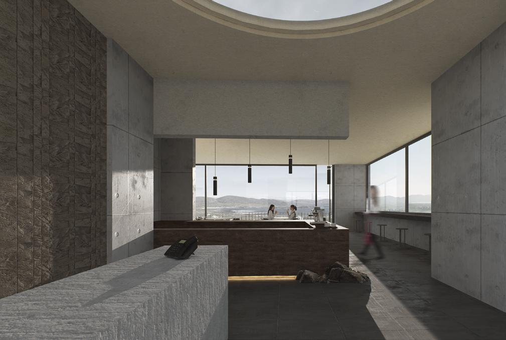
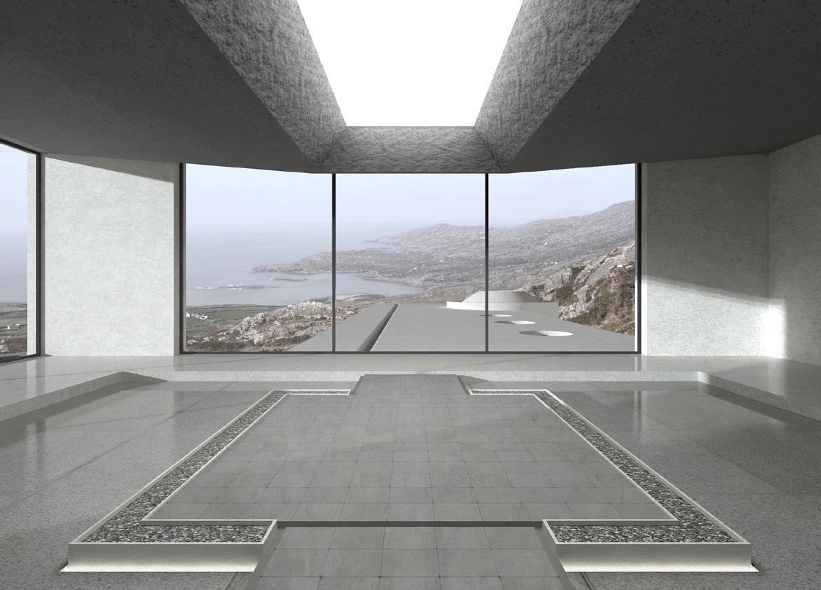
Situated atop the Memorial Hall, the multi-purpose rooftop offers a versatile space for events and gatherings, boasting panoramic views of the surrounding area. This area is engineered to host a variety of activities, from cultural performances to public meetings, enhancing the communal use of the memorial.
Sutro Ruins Viewing Platform is strategically positioned to offer visitors unobstructed views of the historic Sutro Baths ruins. This vantage point allows for a deep appreciation of the site's historical significance and architectural remnants, encouraging reflection and discovery.
SSG All Heart Rock Viewing Platform
Located near the iconic All Heart Rock, this viewing platform provides a special spot for visitors to enjoy scenic vistas of the coastline and the famous rock formation. It is an ideal place for photography and sightseeing, capturing the natural beauty of the San Francisco shoreline.
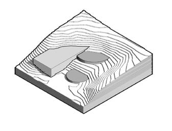
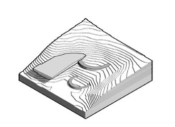
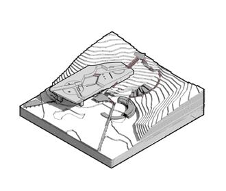
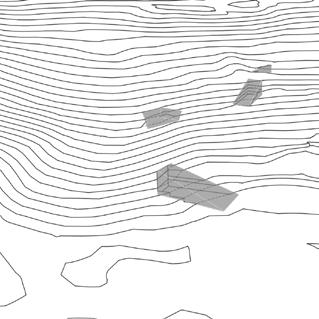
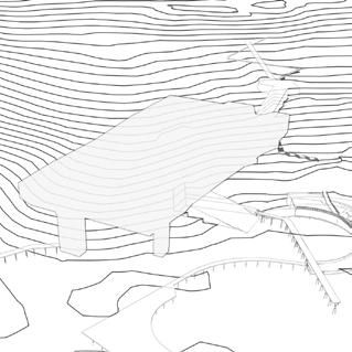
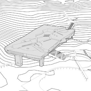
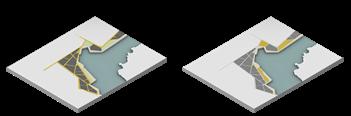
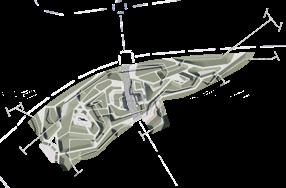
Grading Evolution - Sculpting the Terrain for Sutro Baths Memorial
This sequence of axonometric diagrams captures the complex grading process undertaken to sculpt the terrain for the Sutro Baths Memorial, ensuring a seamless integration of the new structures with the site's challenging topography. Each drawiWng represents a critical phase in manipulating the landscape to accommodate both the architectural vision and the existing natural environment.
Cutting the Site
This initial phase involves making a deep incision into the hill, laying the groundwork for embedding the project within the natural landscape. This strategic cut minimizes the impact on the surrounding terrain while preparing the site for the main structural development.
Confirming Building Placement and Pathway Integration
This phase of the project solidifies the positions of key architectural elements and their connection via an intricate network of pathways, ensuring seamless integration into the existing landscape. The diagram meticulously outlines how each building is strategically placed to take advantage of the site’s natural topography and views.
Integrated Site Development
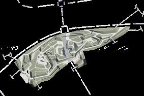
The final overview of the project showcases a complete integration of architecture, pathways, and terrain, illustrating how each element has been meticulously designed to harmonize with the landscape. This axonometric view provides a comprehensive depiction of the entire memorial site, emphasizing the seamless flow between built structures and the natural environment.
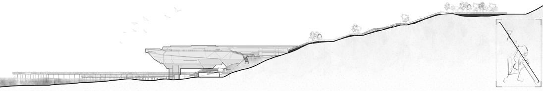
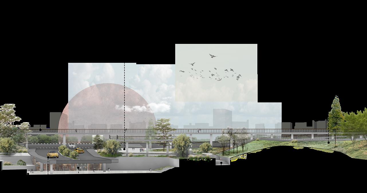
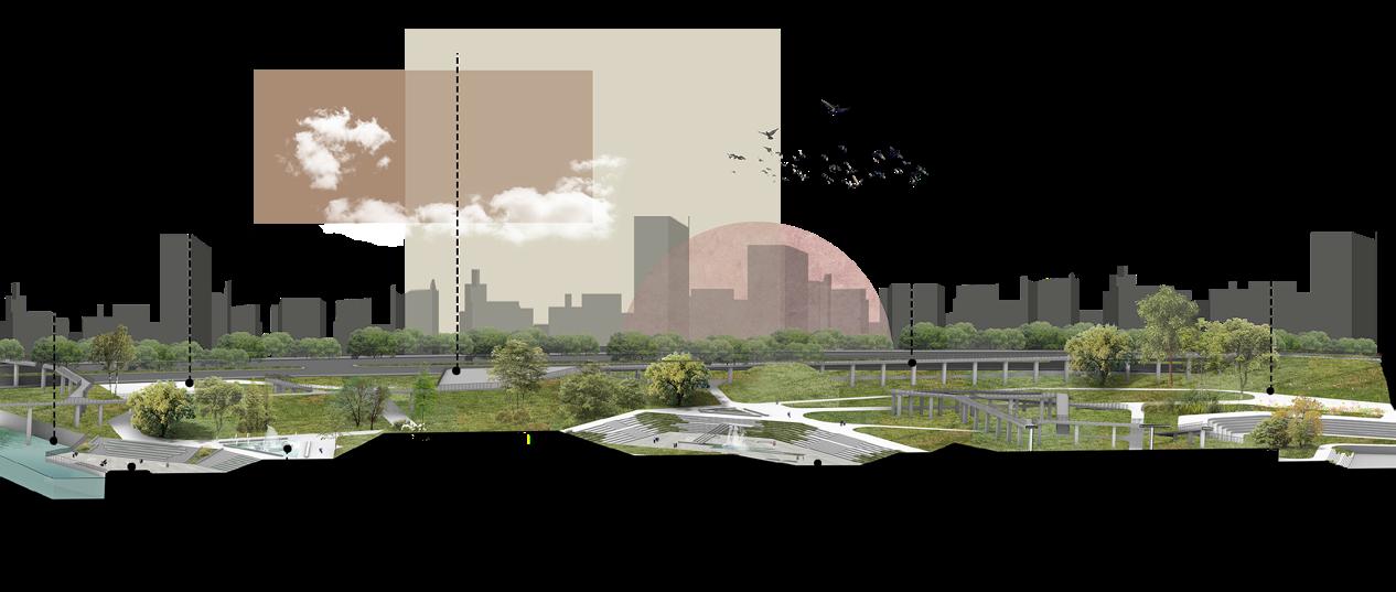
Site Section--Longest Axis
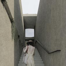
This site section represents the primary and longest axis of our design, stretching over 1600 feet from the entrance to the marine viewing platform. Carefully aligned with the unique topography of the original site, this axis was chosen to minimize cut and fill, respecting the natural landscape while providing a logical and accessible pathway through the site.
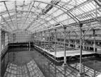
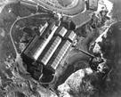
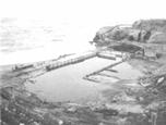
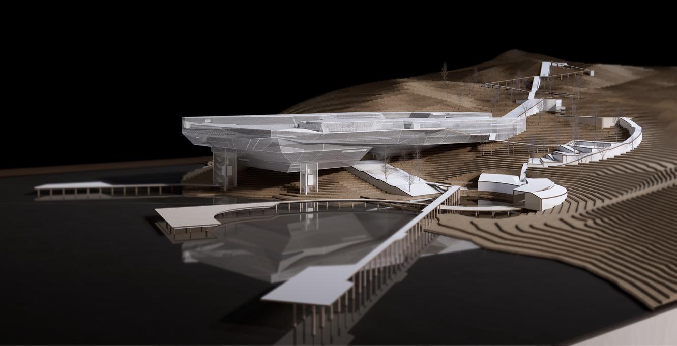
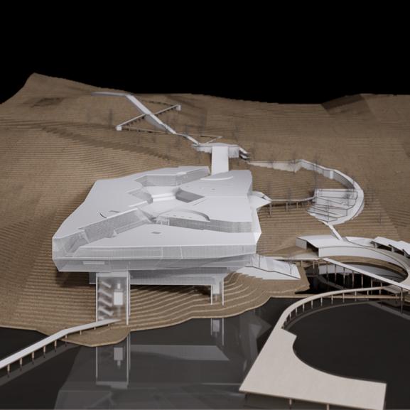
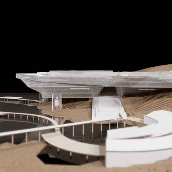
Physical Model
This physical model of the Sutro Baths Memorial illustrates the detailed integration of architectural structures with the natural landscape using various modeling techniques. The landscape is constructed from laser-cut kraft paper(1/16in) to replicate the site's topography, while the water elements are represented with black acrylic. Architectural details are produced using 3D printing, with facades in mesh aluminum, and other structural elements in resin and white plastic. Steps, pathways, and viewing platforms are crafted from white cardstock and plywood, providing a clear view of the design's functionality and visitor flow. Wooden dowels are used as support columns to stabilize the structure within the model.
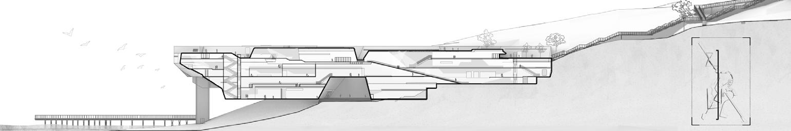
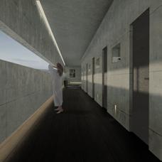
This sectional drawing unveils the intricate architectural design of the Sutro Baths Memorial, showcasing a multi-level structure that descends into the landscape, culminating in a stunning rooftop vista. The memorial's design is a testament to modern architectural practices, integrating four interior levels. The rooftop serves as the crown of the structure, offering unobstructed views of the Pacific Ocean and creating a space where history and horizon meet. This design not only respects the site’s historical essence but also enhances visitor engagement through its innovative use of space and perspective.
Model Dimensions: 162 x 122 x 61 (cm) Light:
Studio lighting
Photographic Focal Length: 35mm
Main Materials Used: kraft paper, black acrylic, clear acrylic, resin, plywood, white plastic, white cardstock, wooden dowels
Memorial Building Section- A Multi-Level Exploration
02
THE REBIRTH OF MANGROVES
Ecological Landscape&Community Planning
Project Type:Individual Work
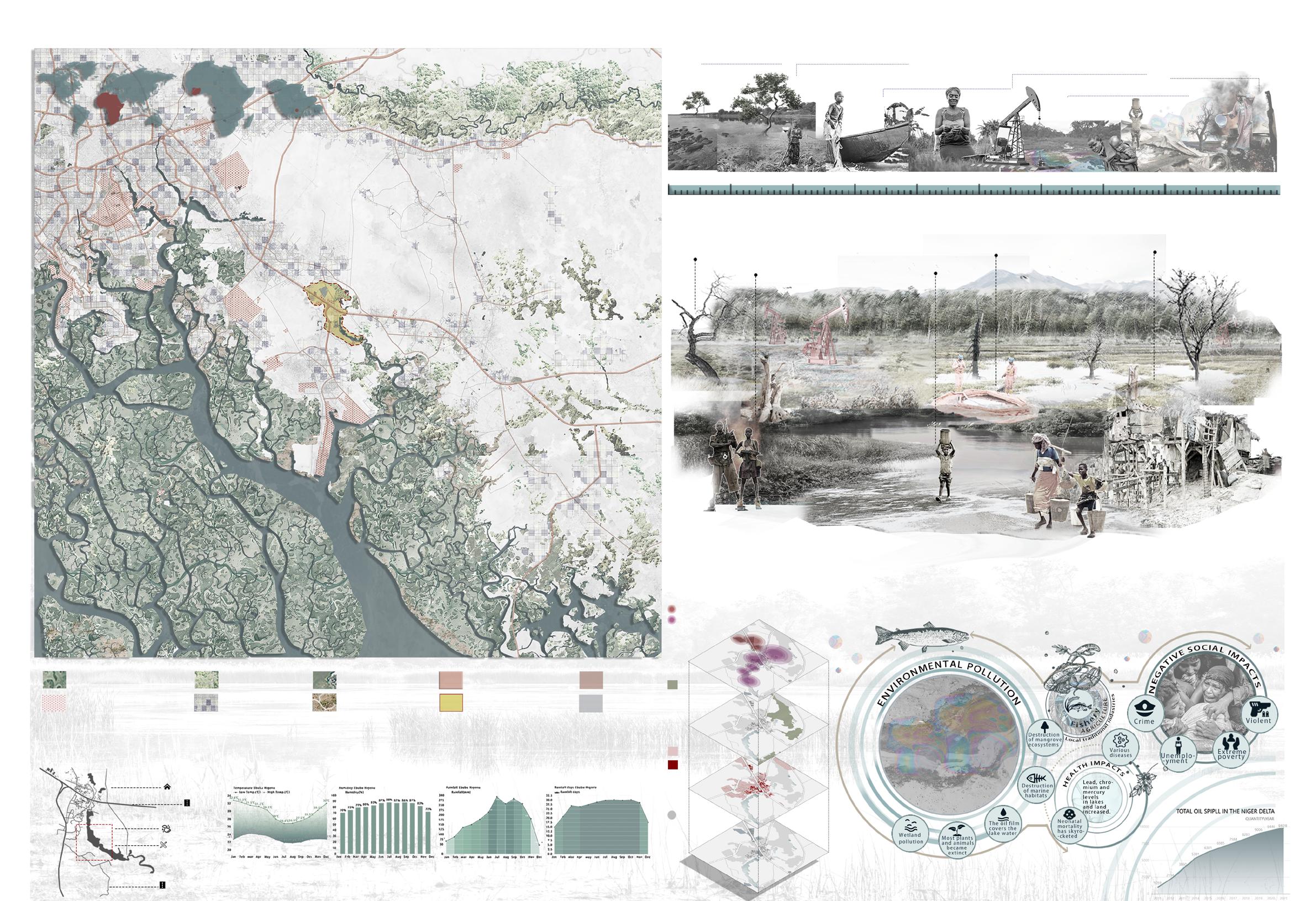
Location: Niger River Delta, Nigeria, Africa
Planning Area: 30 Hectares
Category: Competition
Instuctor:Yuanyuan Su
Date:2024.03-2024.06
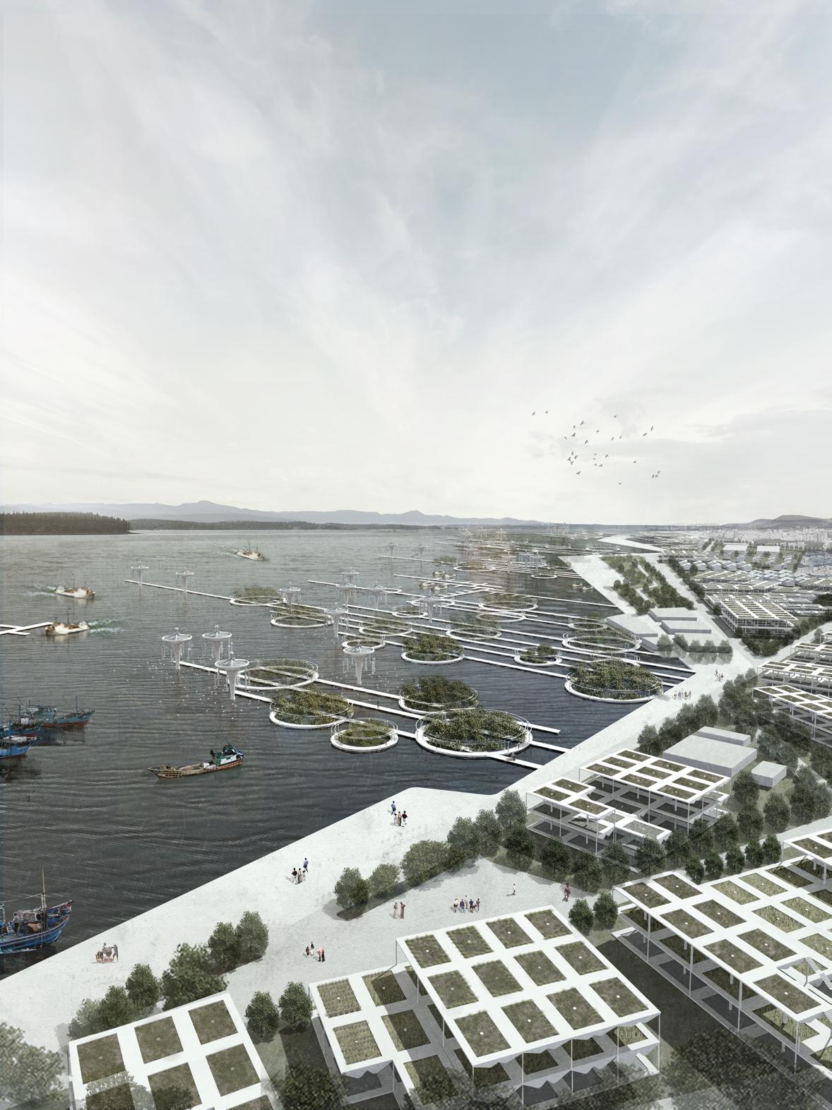
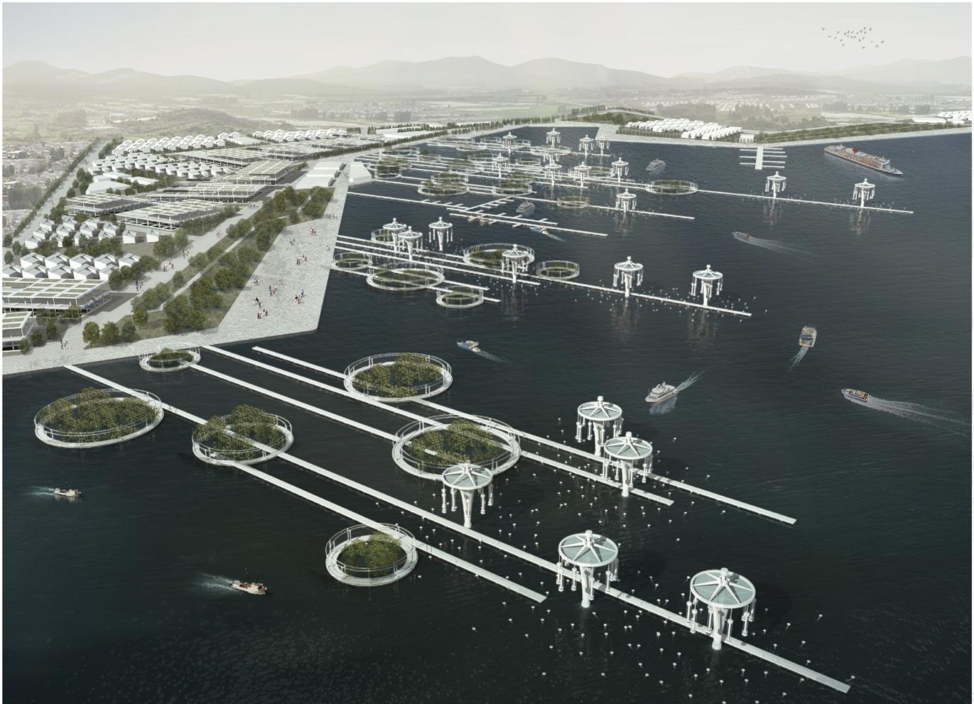
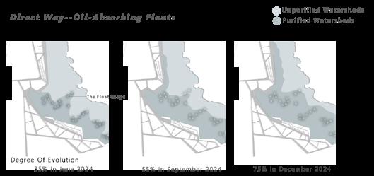
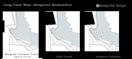
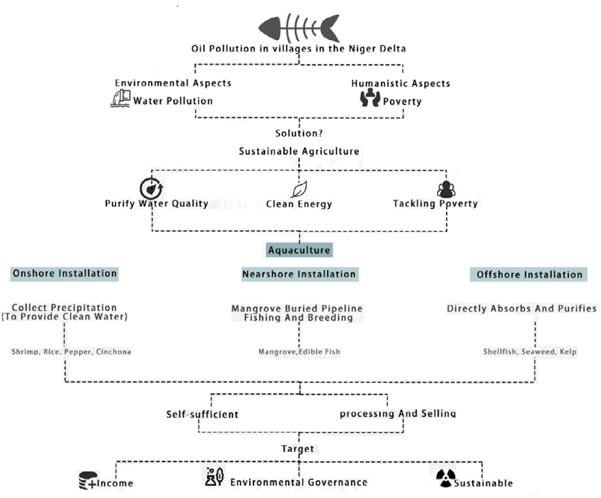
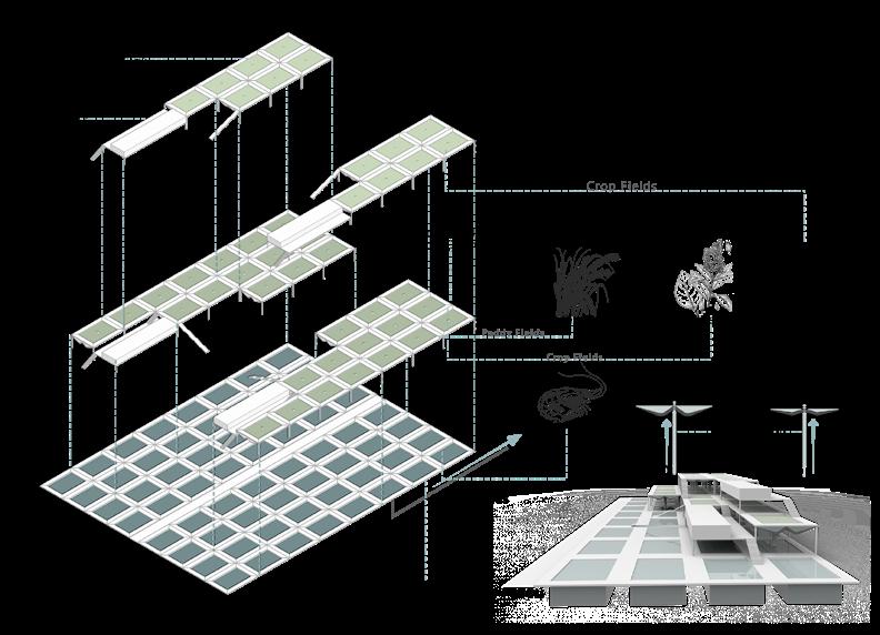
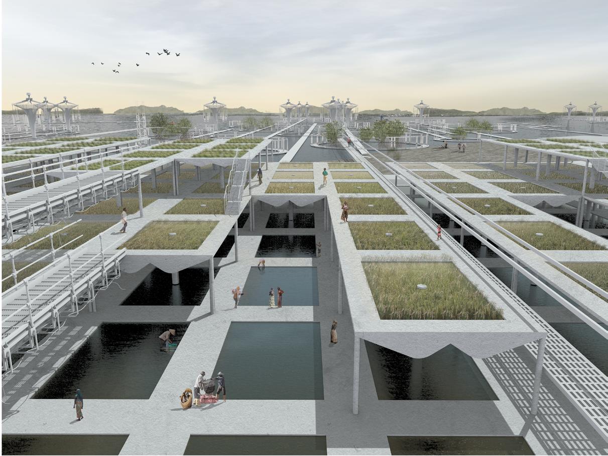
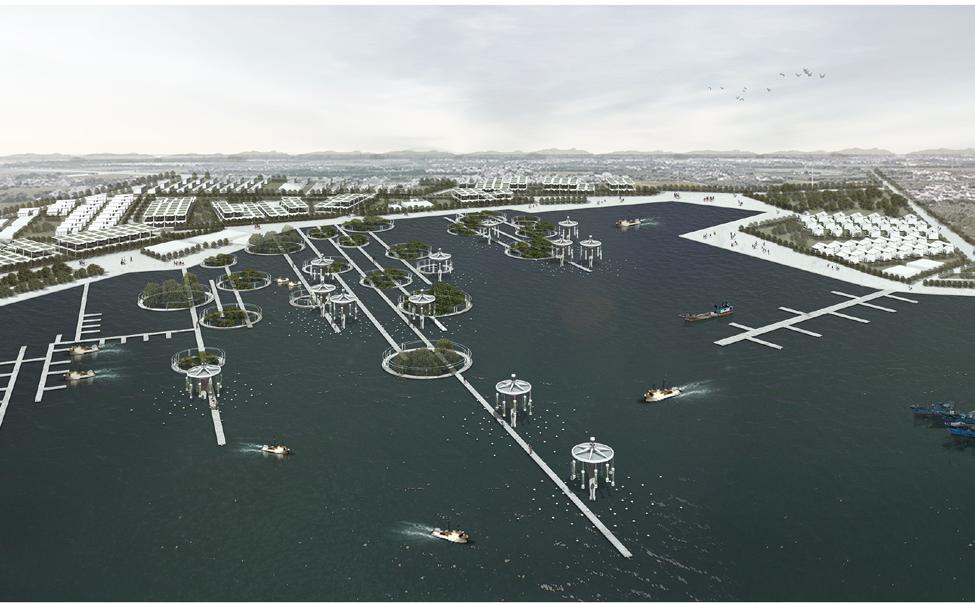
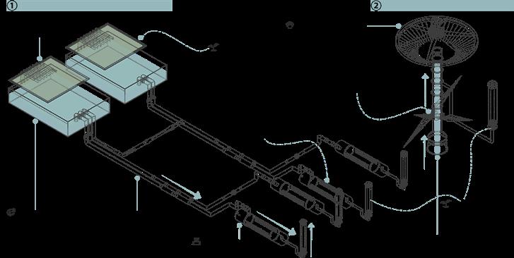
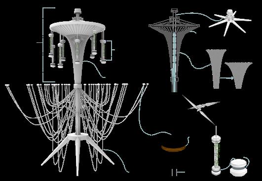
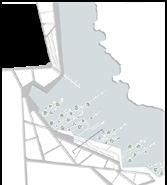
The project is located in the Niger Delta region of Africa, once home to one of the largest mangrove ecosystems in the world. However, illegal oil extraction has brought unprecedented disaster to the Niger Delta. Mangroves wither, water is seriously polluted, soil heavy metals exceed the standard, unemployment, social unrest, low status of women... .. In order to solve the oil pollution problem and save the mangroves, developed a sustainable agriculture plan for the site. Mangrove buried pipeline fisheries and mixed fish and vegetable farming can solve oil pollution and form a sustainable ecosystem, bringing considerable benefits to the village. I re-planned the layout of the village, and set up modern fishing and agricultural processing plants in the village, which solved the employment problem and provided jobs for local women, greatly improved the social status of local women, brought economic benefits to the region, and achieved stable social development.
The polluted river water is purified by the plant and transported to algae culture pipes and shellfish culture ponds under the action of tidal energy for the purpose of sustainable agriculture.
shows the
of
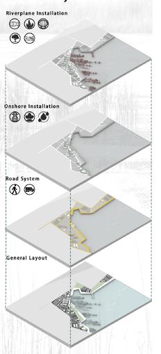
Aquaculture is a form of sustainable agriculture. In the project, onshore installation, nearshore installation, and offshore installation are set up, all of which adopt the mode of aquaculture.
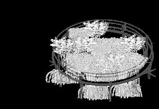
This is a nearshore Installation. The goal was to restore mangroves, so I designed the mangrove biosphere. In order to make the local agriculture sustainable, adopted the mangrove fishing method to maintain the ecology.
sustainable agricultural installation. In order to connect the three devices, designed underground
Mangroves
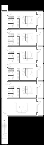
BONDS OF HAPPINESS
Elevated Park Design 03
Project Type:Individual Work
Location: Pudong New Area,Shanghai,China
Planning Area: 12 Hectares
Category: Academic Work
Instuctor:Chao Sun
Date:2023.12-2024.02
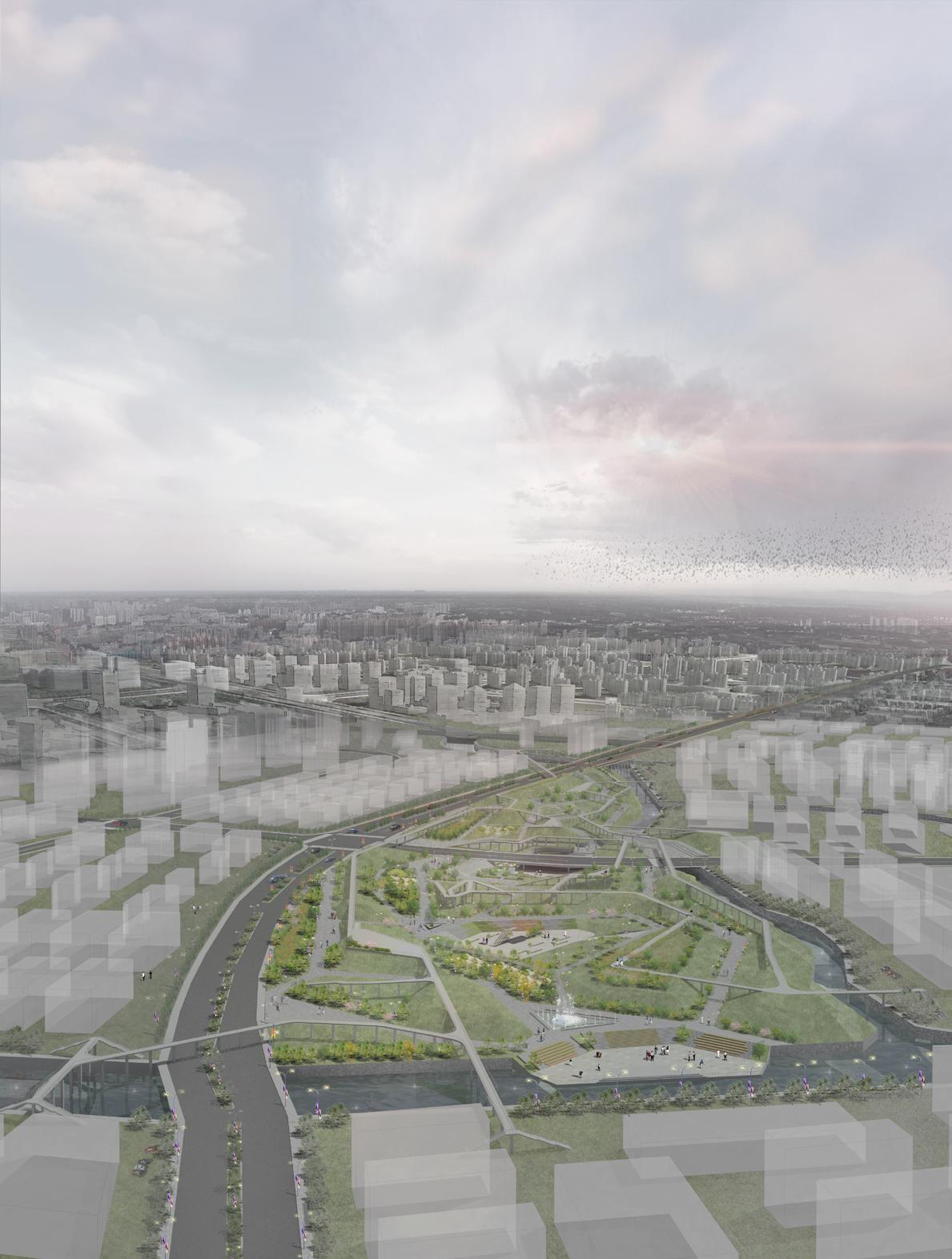
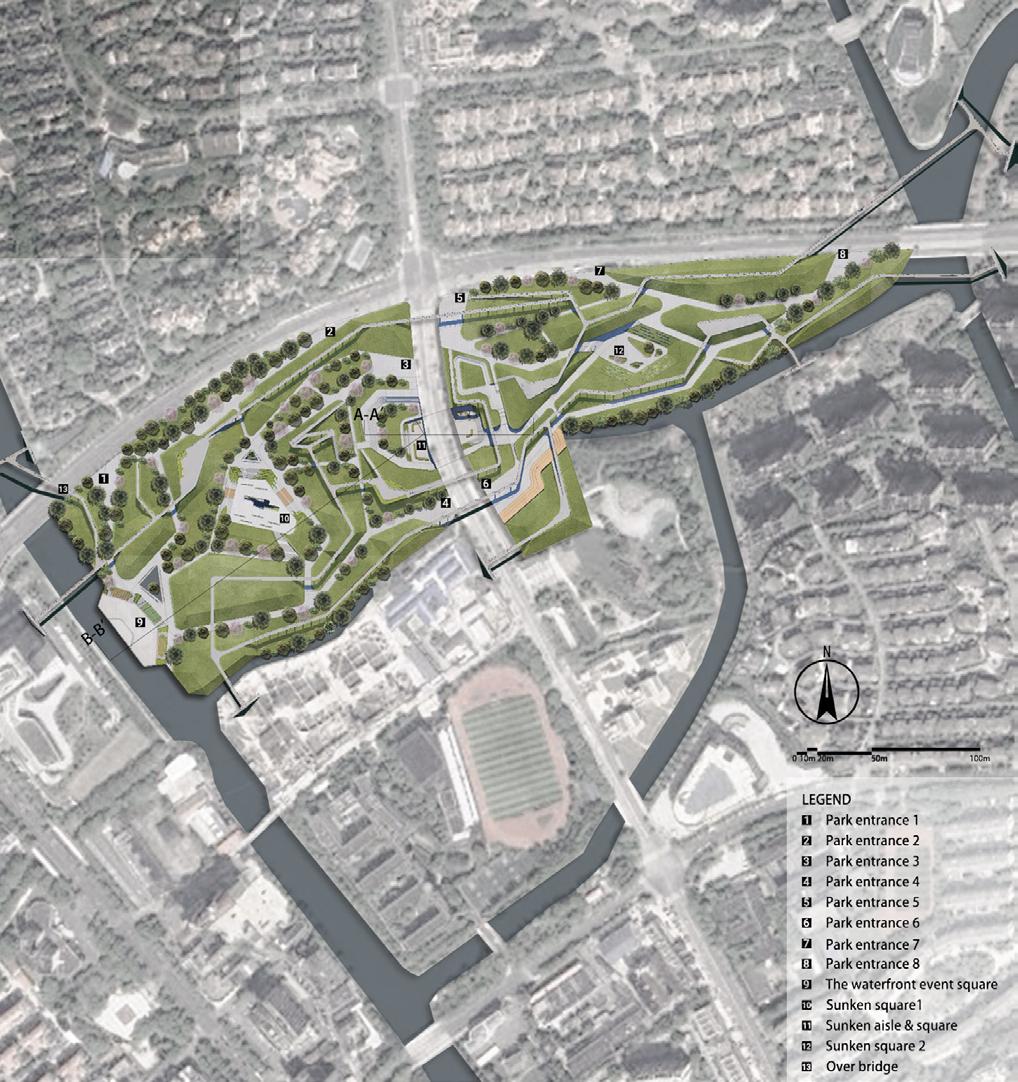
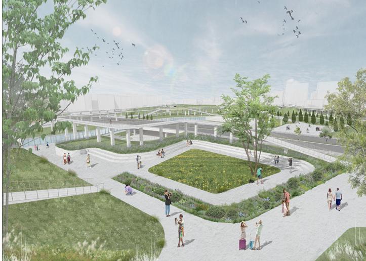
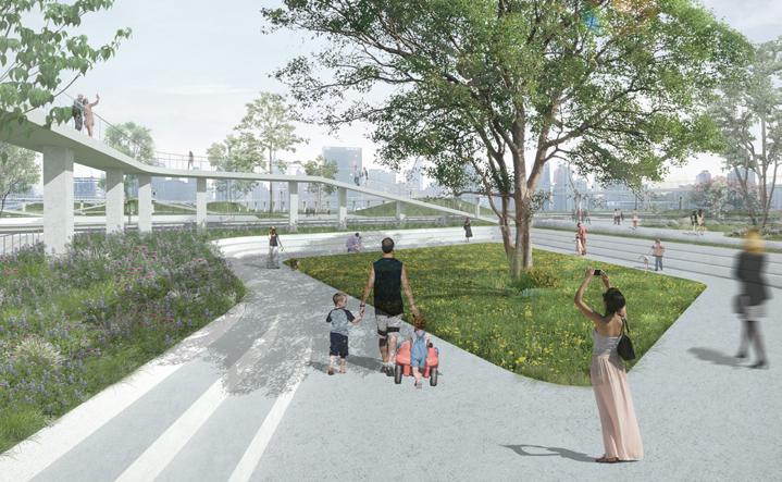
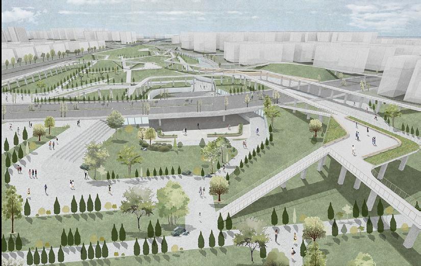
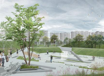
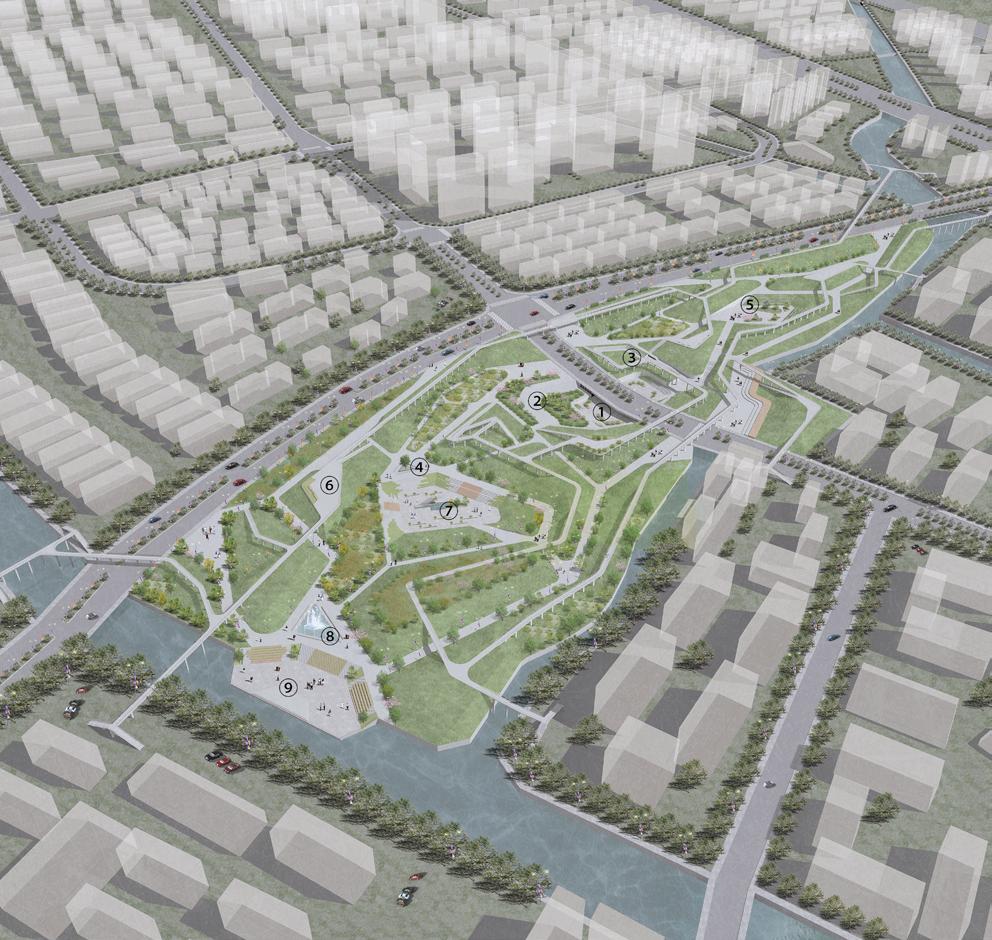
The site is located in the Pudong New Area of Shanghai, The project planned a 12-hectare park on the site. During the design process, took into consideration that many surrounding communities were cut off by the road, so I designed a bridge and several park entrances, which connected each community like a bond and promoted the communication and interaction of residents. In addition, the design of the underground square cleverly opens up the area that was once isolated by the road, greatly easing the traffic pressure and bringing convenience to the surrounding residents. In order to reflect the spirit of social public welfare and the spirit of equality for all, I designed a number of barrile-free ramps in the site, so that the disabled can equally participate in public activities, rather than isolating the vulnerable groups, which is the best interpretation of the bond of happiness.
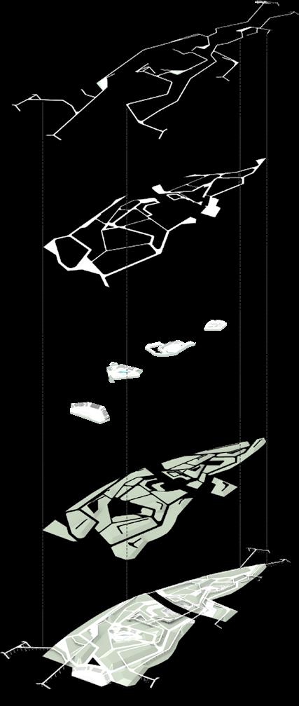
Mapping Master Plan
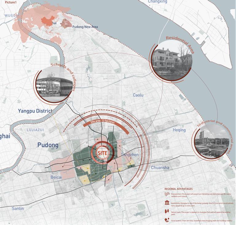
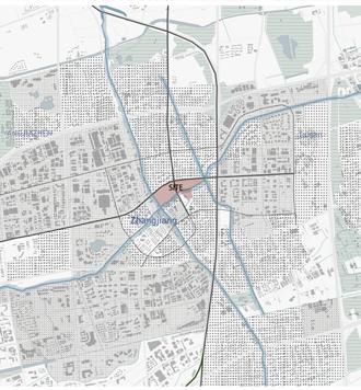
The site is located in Pudong New Area,Shanghai,China.
The site is strategically located,with villas on the north side,Zhangjiang Experimental Middle School of East Nomal University on the south side,Zhonghuan Road on the east side,and “window of the future”of Zhangjiang Science Future City on the west side.Pudong New Area as China’s economic development demonsration district,Zhangjiang Science City has the title of “China’s Silicon Valley”.
Site History
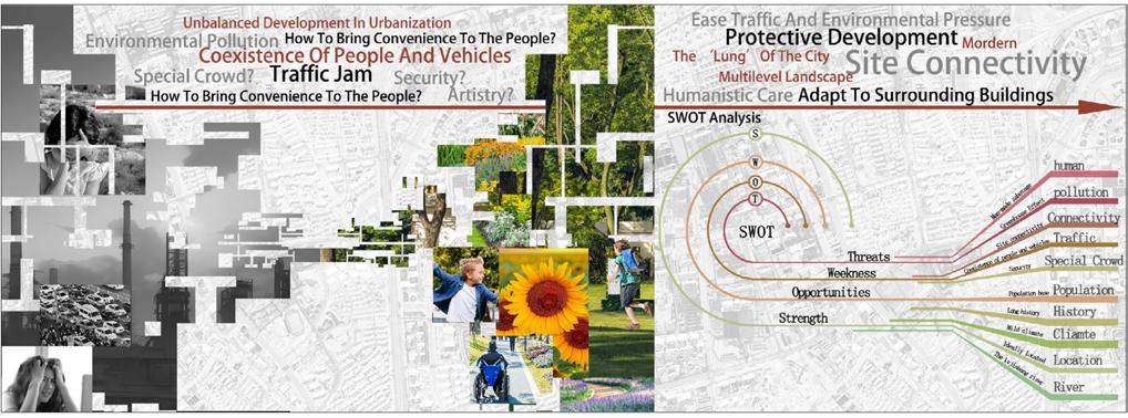
The design site is located in Pudong New Area, Shanghai, China. This design scheme is mainly to solve the environmental and social problems caused by the unbalanced development in the process of urbanization. The design concept is three-dimensional park, the overall shape has artistic beauty, rich functions, and humanistic care. Add a vibrant modern park to the city.
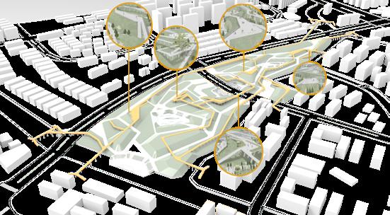
After investigation, because there are many factories and companies around, the park has a large flow of people during commuting hours.
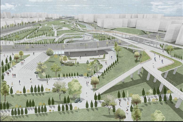
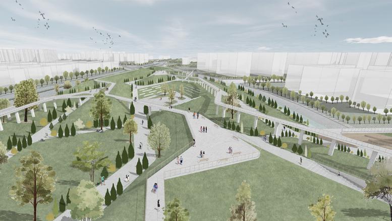
The park is very rich in levels. I have roughly divided them into five levels based on their functionality and type of company. The multi-dimensional park can meet the needs of the surrounding residents and become a link to the neighborhood.
There are many factories, enterprises, residential areas and universities around the site. Therefore, a variety of functions should be considered in the design of the site to meet the needs of different users. Not only that, the traffic around the site is busy, but there are many people, so the site should also have the function of relieving traffic pressure.
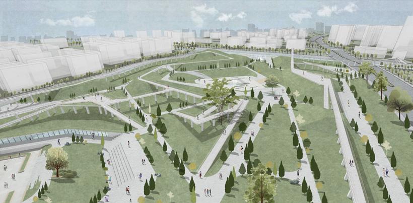
Overbidge
Level2 takes the form of bridges. At each entrance, a two-way staircase is installed. Level2's setting allows the surrounding area, which is divided by the river, to be connected to the site. In addition, there are a total of five nodes in level2, where pedestrians can rest and enjoy the view.
Road Planning
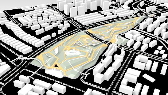
Analyzing the surrounding building types, crowd density, traffic conditions and various factors, a total of 7 entrances and an underpass were set up on the site. Multiple entrances and exits allow people around to enter and exit the park quickly and easily.
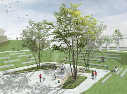
In order to promote the spirit of social public welfare and equality for all. I designed a number of barrier-free ramps in the site, so that vulnerable groups can enter the park and play smoothly, rather than being isolated outside. Not only that, when I designed the green space, designed the grass into a grassy slope shape, and the viewing platform can be perfectly mounted on the grassy slope to form an interesting space.
The site was cut in two by the road. It brings inconvenience to the traffic. To solve this problem, and better plan the space. I opened up the road under the design of the underground passage, and the underground passage at the same time has the function of the bottom shop and the underground park. Make the space types rich and colorful.
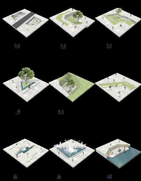
Section A-A'
Pedestrian Passageway
The aerial view nicely illustrates the theme of happiness bonds. Overpasses, underpasses and park paths connect multiple communities; Green Spaces mitigate air pollution from nearby factories; The design of the barrier-free ramp allows more disadvantaged groups to participate in public activities equally, which is the best embodiment of the bond of happiness.
Sections show a variety of different Spaces. Among them, the waterfront square is located by the river, which can echo the surrounding venues. In order to increase the functional diversity and interest of the venue, I designed a performance stage in the waterfront square, which can hold various activities. In addition, the site is designed with a number of barrier-free ramps, so that people with disabilities can equally participate in public activities.
This Project was a collaborative effort.Qijun Mainly focused on site analysis,modeling and outdoor renderings,while Ruiqing mainly focused on massing design,spatial planning and interior design.
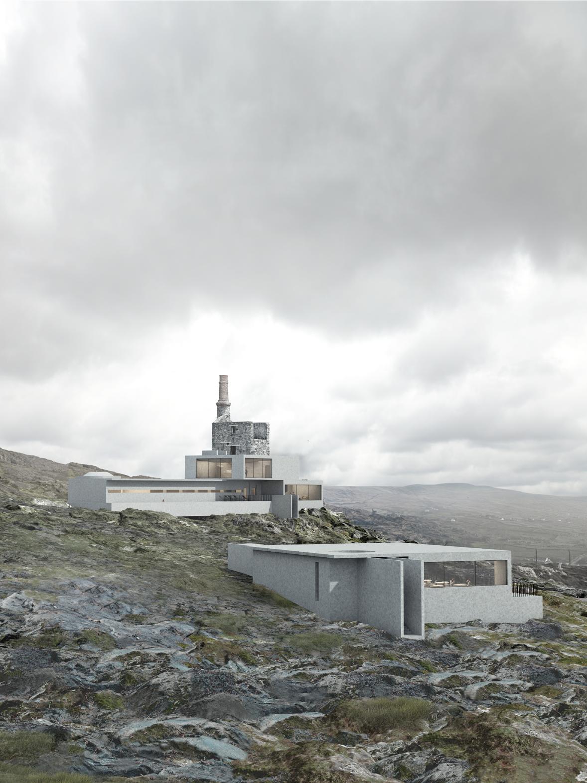
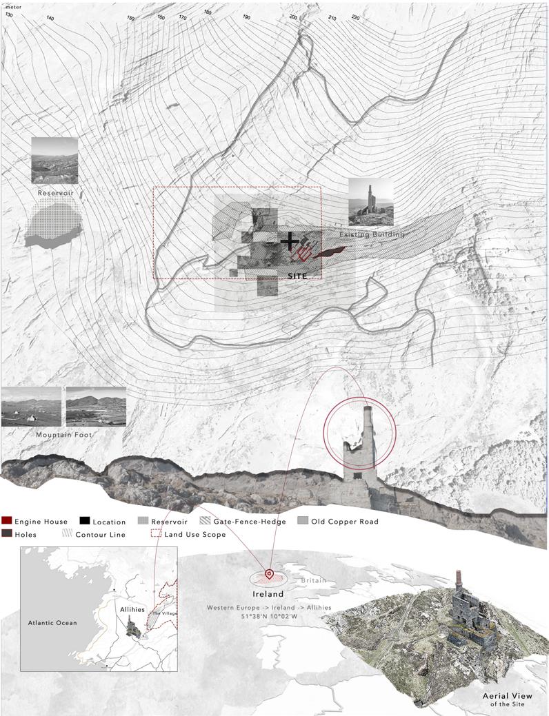
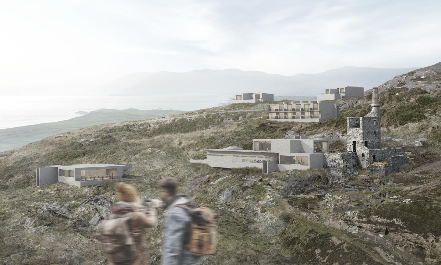
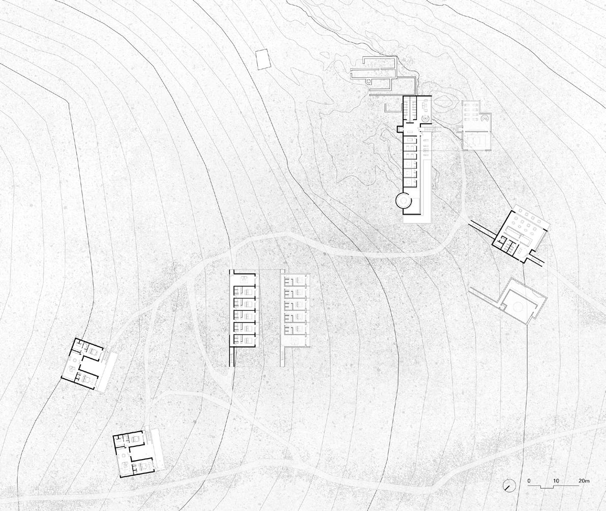
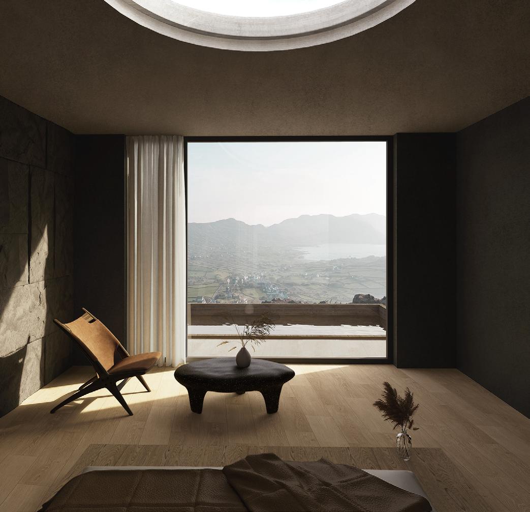
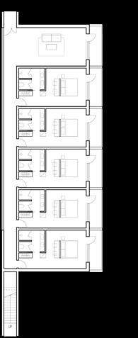
The project is located in the Copper Mountains of the Allihies town Ireland, in a green wilderness overlooking the North Atlantic Ocean. The ruins of the original copper mine tower on the site still retain traces of the mine's industrial era, and the traces of the huge mechanical structure are faintly visible on the broken stone walls. The land is steeped in history and spirituality, as if every rock whispers of the mine's past. In this context, our design goal was to respect and preserve the history and heritage of the original tower building, while transforming the site into a retreat space. The space will include a visitor center, museum, spa area, meditation and yoga studios, swimming pools, and lodging facilities to provide visitors with a place to heal the soul. The design is inspired by the styling features of the original building, the history of the mine, and the process of mining, from which we extract inspiration and skillfully integrate it into the design, so as to create a pure architecture and space, providing visitors with a place to release stress, calm nature and history, and enjoy inner peace.
Site History
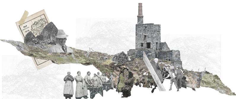
This is the Ireland of miners, men and women of brave heart that used to mine from the heart of the island the minerals feeding the furious 19th-century industry. This is a story of silent heroism, ordinary people, an extraordinary ordinariness attested by majestic ruins that are no less fascinating than the stark castles and mysterious abbeys depicting the best-known face of Romantic Ireland.
·1812
Copper mining started when John Puxley, a local landlord, identified the large quartz promontory at Dooneen as copper bearing from its bright Malachite staining.
·1813
The Mountain Mine copper vein was discovered. It started as an open cast mine, following the copper bearing quartz vein, as can be seen in the huge gaping holes in front. Women and children took a big part in this laborious and painstaking process, the evidence of which can be seen in the resulting rubble around the site here.
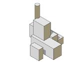
Existing Condition
Massing Iteration
·1884
At the end of the 19th century, copper resources were newly developed in Africa, the Americas and Australia. The fall in global copper prices led to the closure of mining operations in Allihies. There has been mass migration in the region, and many miners have found their way to newly developed mining centers in the United States and Canada. Since then, the Allihies copper mine has been abandoned.
·1927 - 1962
·1812 - 1912
297,000 tonnes of ore were transported from the mines in Allihies to the smelter in Swansea, Wales. The Company's drilling area spans the townland of Allihies, and the adjacent townlands of Cloan and Kealoge.
During this period, people mined copper ore again, but it all ended in failure due to economic losses, natural factors, etc
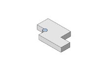
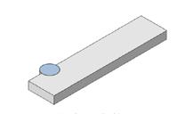
We prioritized generating design concepts through the observation and understanding of the site’s historical architecture and terrain, aiming to reshape the
in a
We
and reassembled elements of the existing Engine House, extracting two basic forms: the rectangle and the