
PORTFOLIO | SHIJIA YANG
SHIJIA YANG
LANDSCAPE DESIGNER
500 Crawford St. Apt 547 | Houston, Texas, 77002
979-402-9175 | syangdevdesign@gmail.com
Education
Experience
Texas A&M University | Master of Landscape Architecture 08/2018 - 05/2021
Harrisburg University of Science and Technology | Master of Computer Information Sciences 09/2022 - 08/2024
Stantec Inc. | Houston, Texas, 12/2021 - Current Landscape Designer
MP Studio Landscape Architecture, LLC. | Santonio, Texas, 06/2020-12/2020 Landscape Designer Intern
Texas A&M University | College Station, Texas, 05/2019-12/2020 Research Assistant
Texas A&M University | Florence & Venice, Italy, 06/2019-07/2019 Research Assistant
Texas A&M University | College Station, Texas, 04/2019-04/2021
TAMU ASLA Chapter Career Fair Co Chair & Chair
Awards & Publications
Publication | 07/2021
Journal of Urban Forestry and Urban Greening: Native Plant Establishment on A Custom Modular Living Wall System in A Humid Subtropical Climate.
Awards | 08/2020 & 01/2021
Elizabeth & Edmund Rodiek MLA Scholarship
Patent | 07/2016
The utility model patent of “a hydroponic plant partition planting device” (CN205584981U)
Skills
Project Management, Construction Administration, Mircrosoft Office, Bluebeam Revu
AutoCAD, Land F/X, SketchUp, Lumion, D5 Render
Photoshop, Illustrator, Indesign
ArcMap, Google Earth Pro Generative AI, Python(Programming Language)
12
Urban Design
El Paso Deck Park
Location: El Paso, TX
36
18
Mixed-Use Redevelopment
City of Pleasanton Downtown Redevelopment
Location: Pleasanton, TX
42
Urban Planning
Repurposing A Deindustrialized Cityscape
Location: Johnstown, PA
Urban Design
Redevelopment of Downtown Bryan
Location: Bryan, TX
24
Natural Park Design
Spirit Reach Contemplative Path Design
Location: San Antonio, TX
Community Park Design
Heers Park
Location: Las Vagas, NV
Shopping Mall Renovation
28
Round Rock Premium Outlets
Location: Round Rock, TX
School Renovation
32
Manor ISD Elementary School Renovation
Location: Manor, TX
EL PASO DECK PARK
Type: Urban Design
Location: El Paso, TX
Area: 8.5 acres
Time: 2023.06 - 2024.07
Phase: Schematic Design
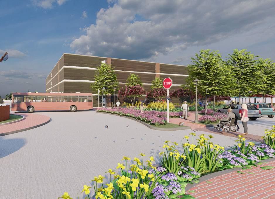
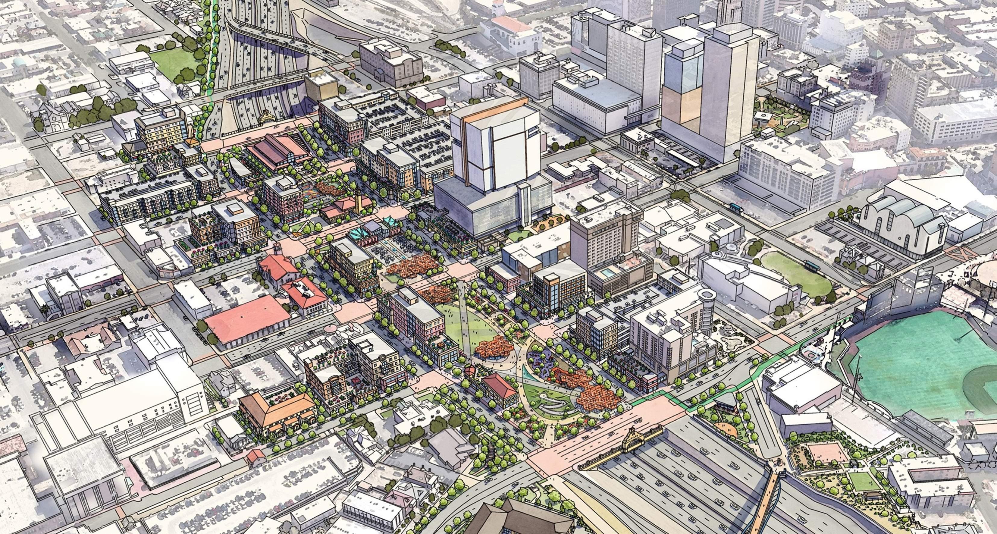
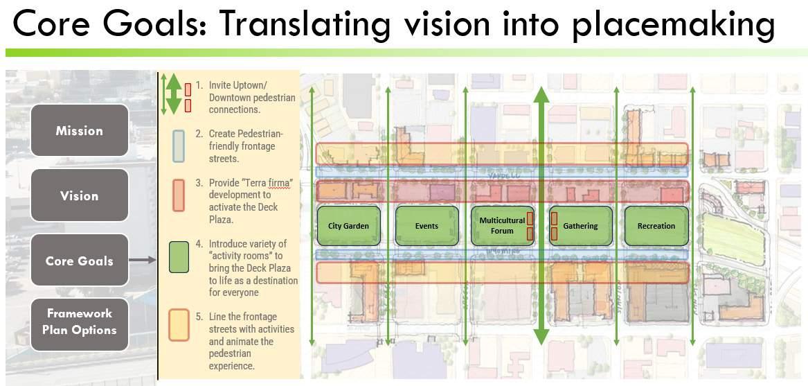
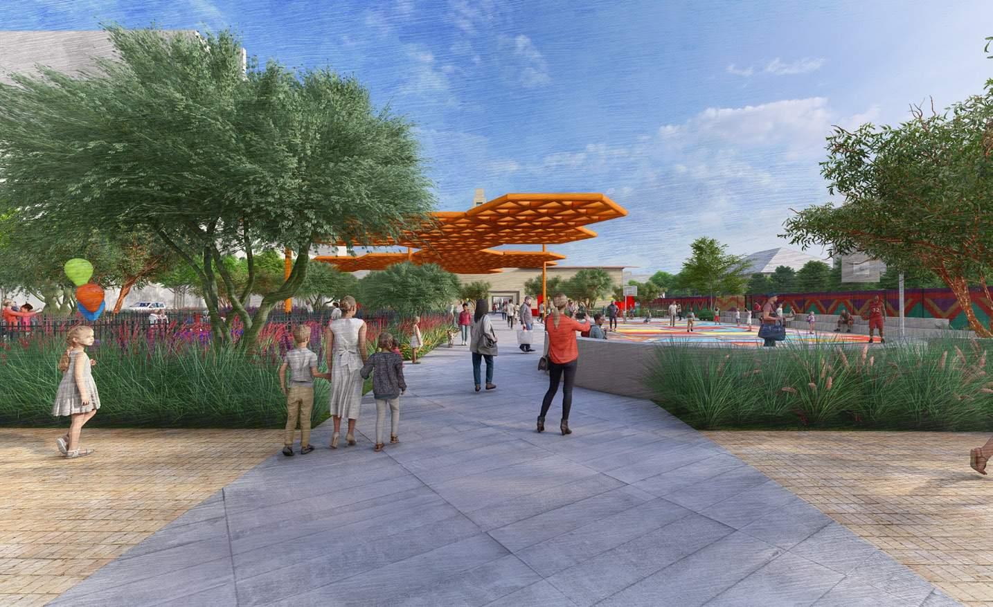
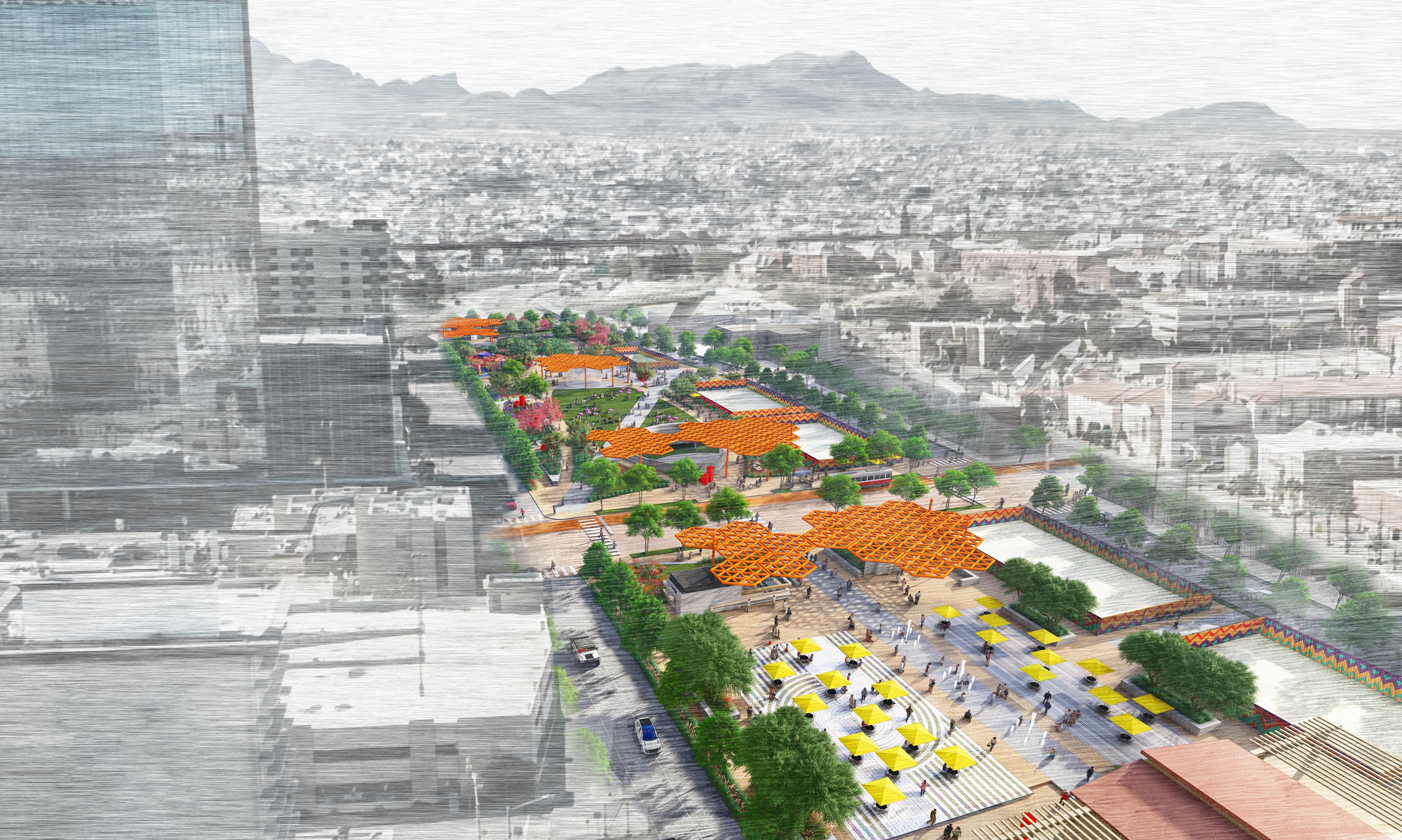
The El Paso Deck Park presents an unprecedented opportunity to create a unique space that reflects El Paso’s rich heritage and vibrant living culture, while reconnecting adjacent neighborhoods to enhance livability, economic opportunity, and a shared sense of community in this binational region. This feasibility study explores the construction of a deck plaza over Interstate 10, with the vision of creating a compelling destination that enriches the lives of all El Pasoans. The goal is to revitalize downtown El Paso by focusing on placemaking, programming, and the addition of park amenities and architecture, thereby solidifying it as the heart of the city.
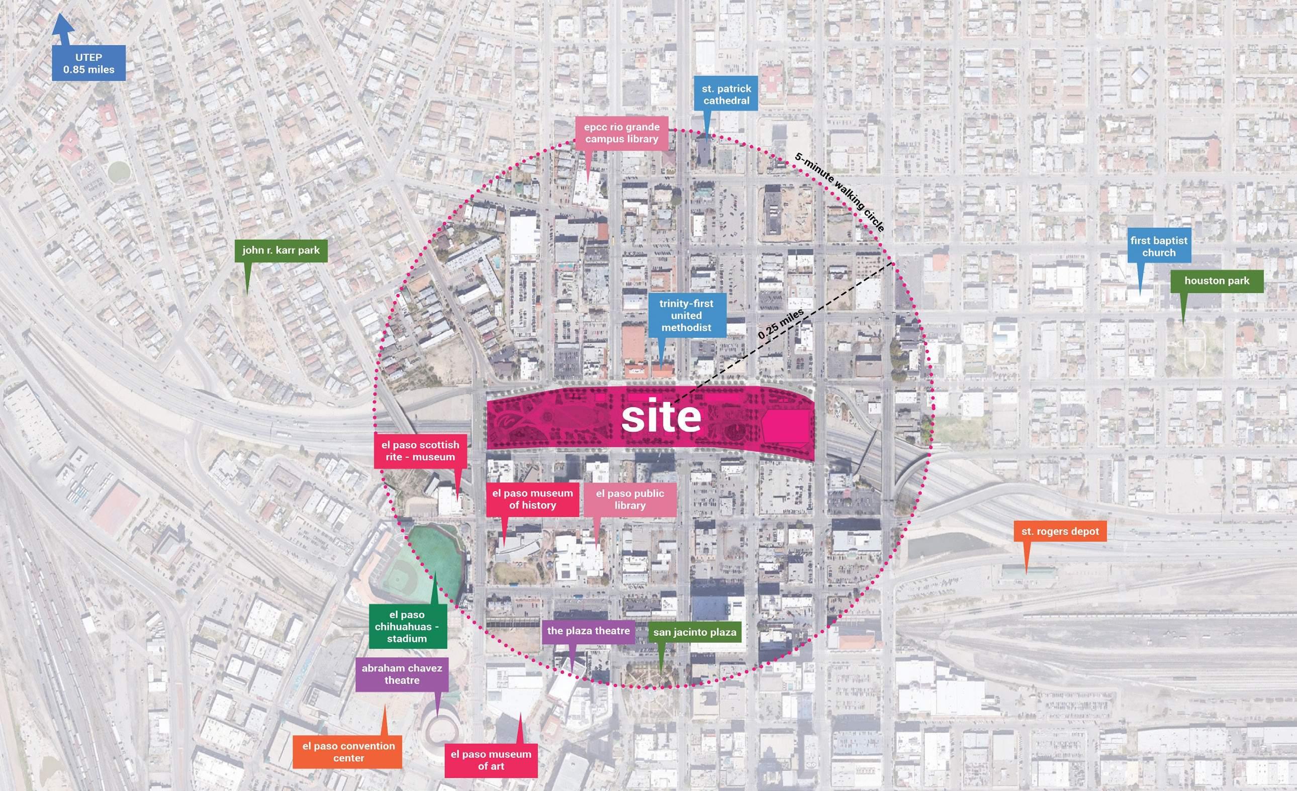

5 Minute Walk Diagram
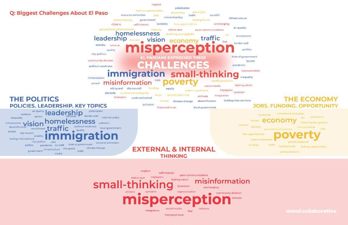
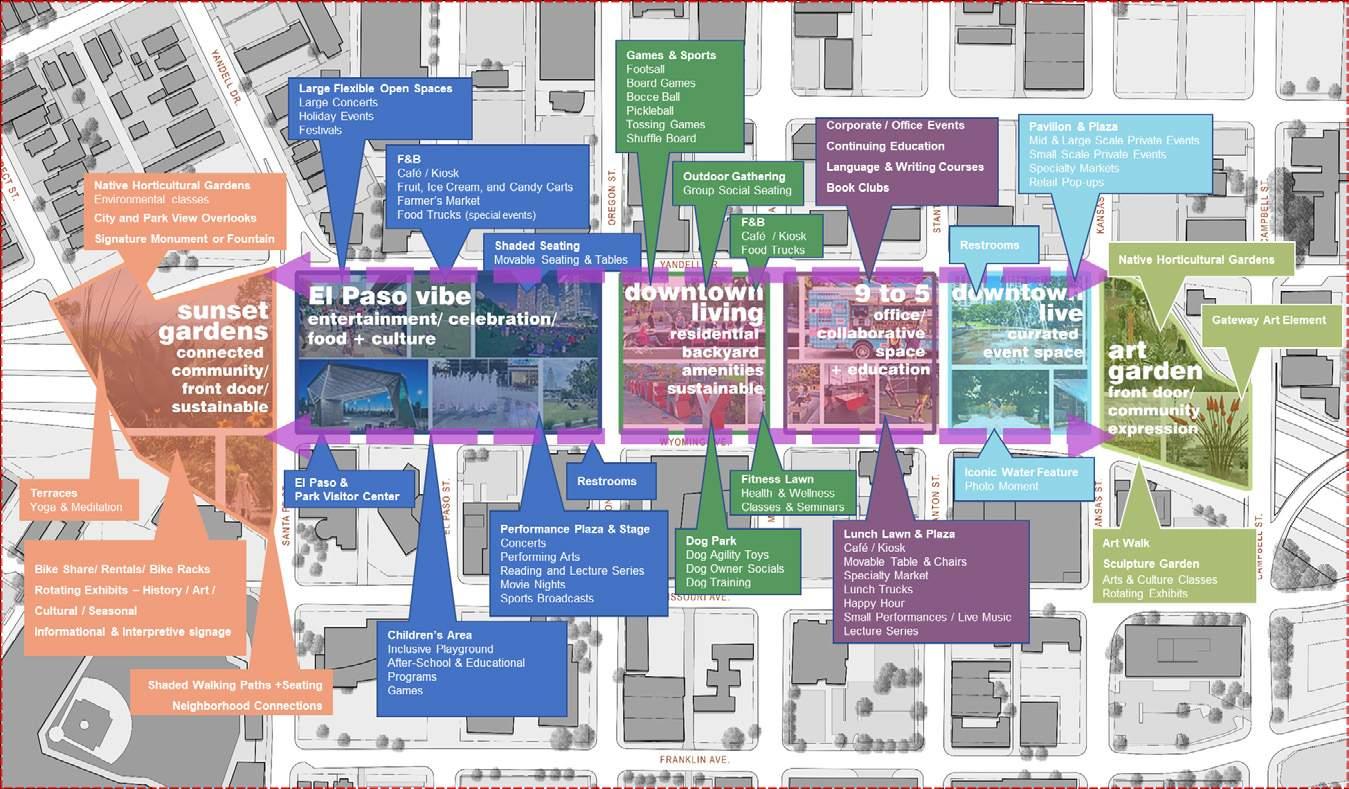
Site Challenges & Programming
Placemaking Diagram

Key Features:
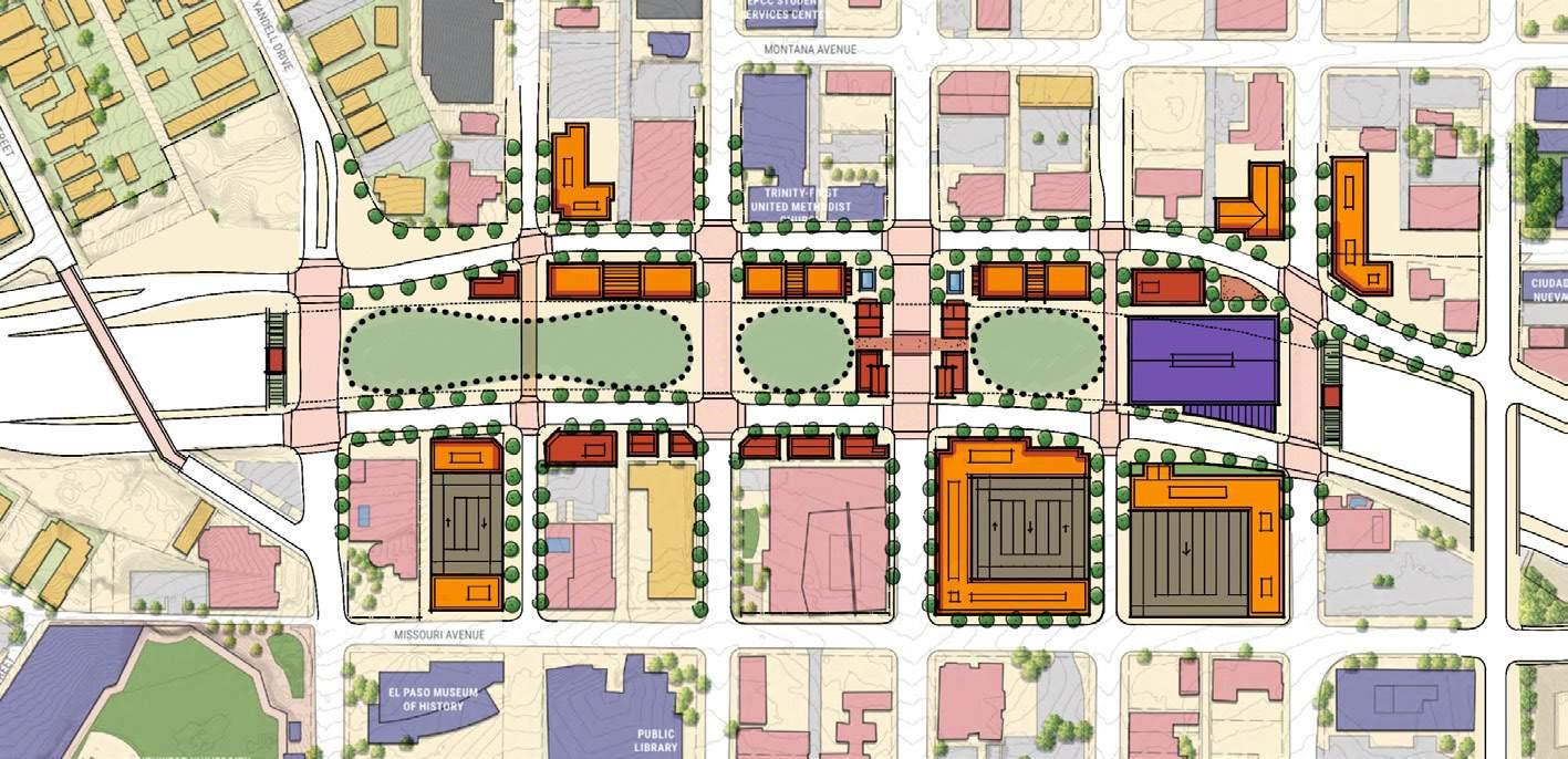
1. Bridge at Mesa to include low-scale shops/restaurants lining the street and framing the deck plazas, providing activation, shade, and space containment.
2. New development along the north edge activates the plaza spaces and provides much-needed housing and commercial space.
3. Liner buildings along Wyoming to help hold the deck edge.
4. Shaded recreation to serve the local/regional residents and provide additional active programming.
Framework Diagram

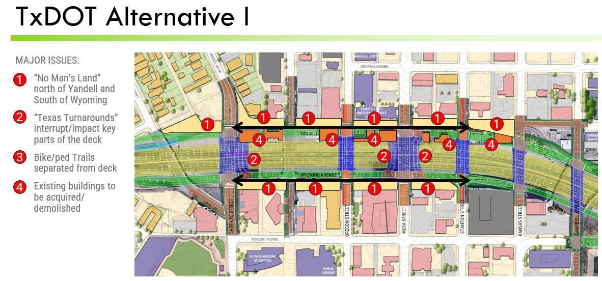
Major Issues


Programming Diagram
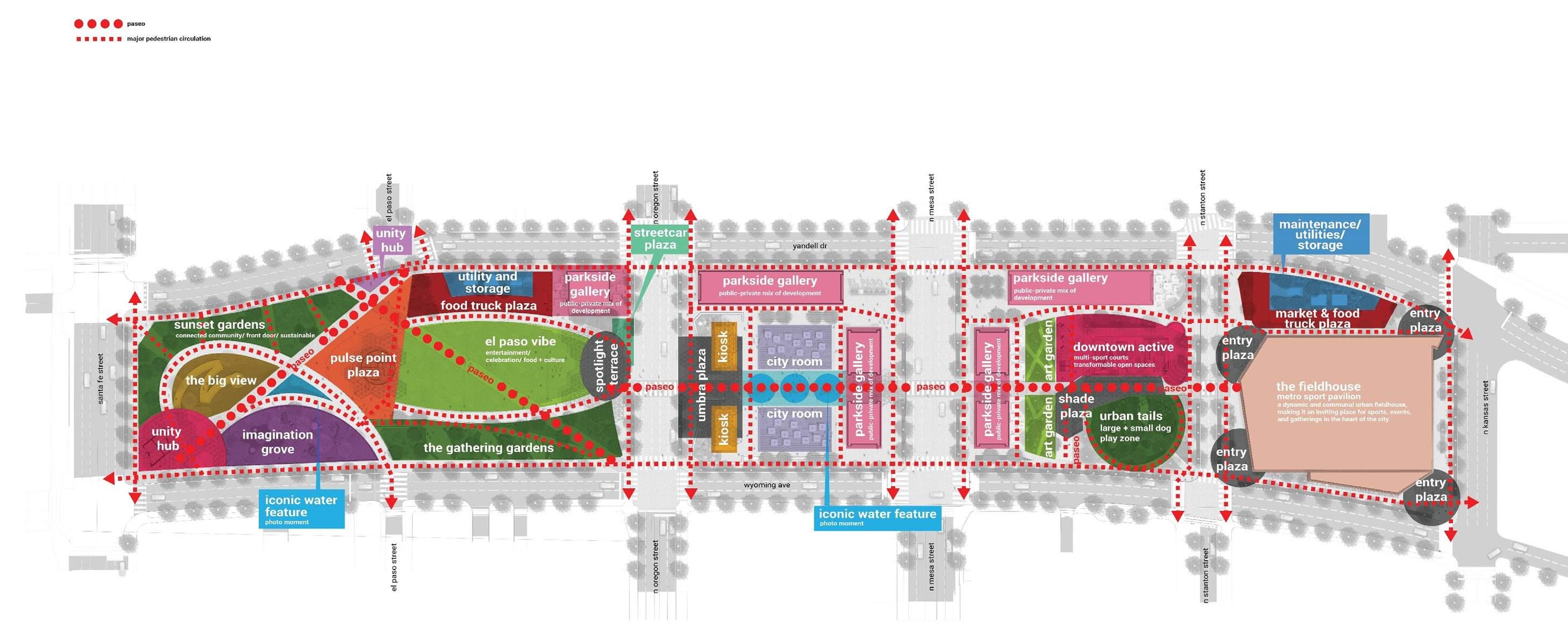
The El Paso Deck Park Master Plan envisions the transformation of a space above Interstate 10 into a dynamic and culturally rich destination that honors El Paso’s unique heritage. This project aims to reconnect surrounding neighborhoods, fostering a stronger sense of community while enhancing economic opportunities and livability in this binational region. By revitalizing downtown El Paso, the master plan focuses on placemaking and programming, with the addition of diverse park amenities and architecture. The park will be divided into four distinct areas: a city garden with event space, a multicultural forum, a backyard games plaza, and a shaded recreation area. Together, these elements will activate the space, introducing mixed-use features that will solidify the park as the vibrant heart of the city.

CITY GARDEN + EVENT SPACE MULTI-CULTURAL FORUM BACK YARD GAMES SHADED RECREATION
PARK PLAZA DEVELOPMENT CHARACTER ZONES
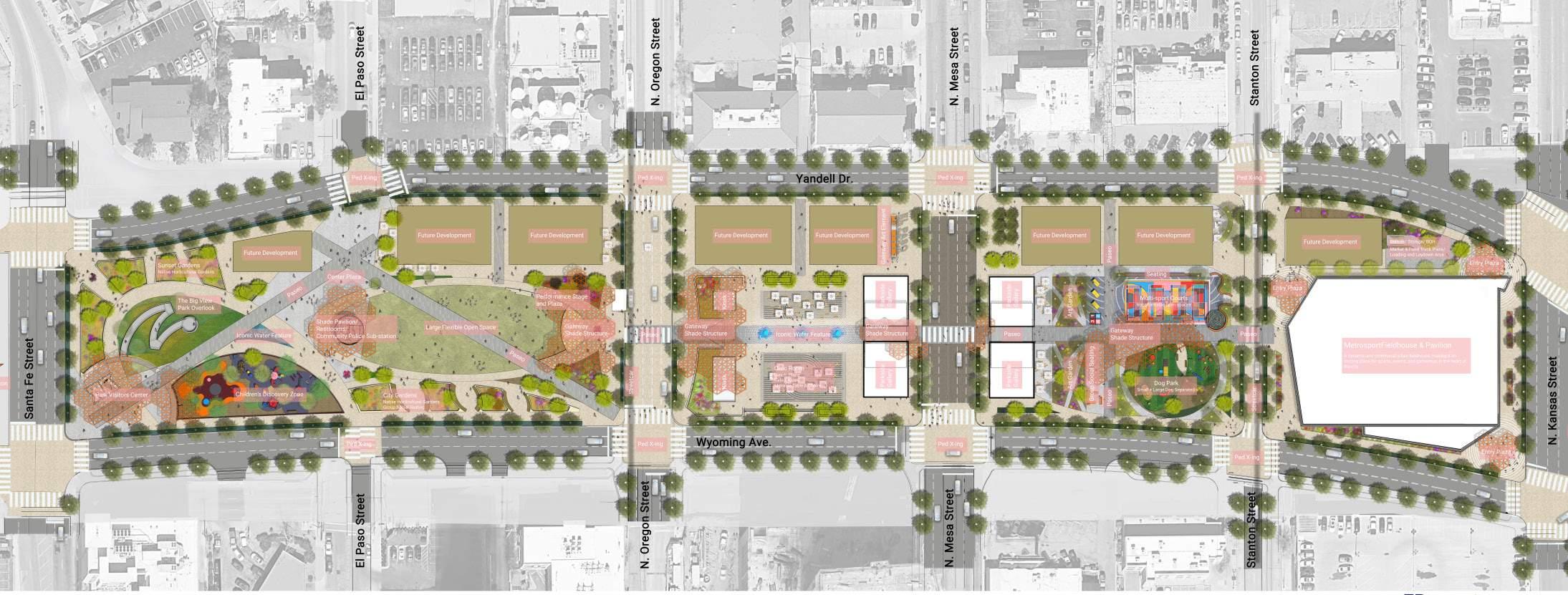
Schematic Design Analysis



Schematic Design Development Diagram
Schematic Plan Pedestrian Circulation Diagram
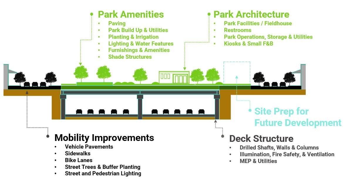
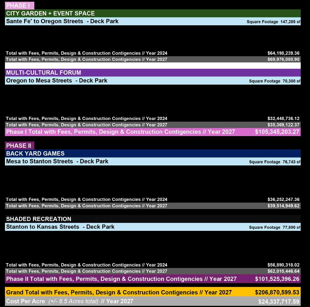
Cost Inputs
El Paso Deck Plaza:
Size: 8.5 acres
$24.3M/ acre (2027)
Klyde Warren Park: Opened: 2012
Construction cost: $110M
Size: 5.2 acres
$21.15M/ acre (2012)
$26.07M/ acre (est. 2027)
Frankie Pace Park: Opened: 2023
Construction cost: $32M
Size: approx. 3 Acres
$10.66M/ acre (2022)
$11.56M/ acre (est. 2027)
Central 70 Cover Park: Opened: 2022
Construction cost: $125M
Size: 4 acres
$31.25M/ acre (2020)
$34.56M/ acre (est. 2027)
Southern Gateway Park:
Under Construction est. opening 2026
Construction cost: est. $112M
Size: 2.8 acres (phase I)
$40M/ acre
Margaret T. Hance Park: Opened: April 1992
Size: 32 acres
Construction cost: $100M (1992)
$237.56M (est. 2027)
$7.42M/ acre (est. 2027)

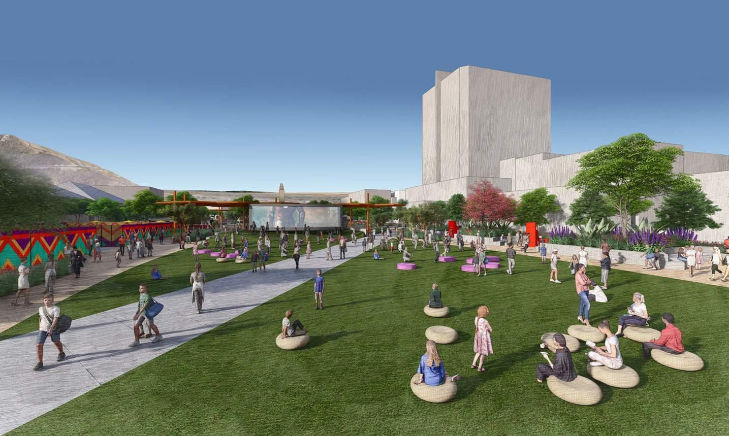
Perspective Views
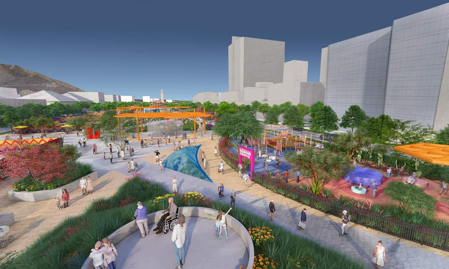
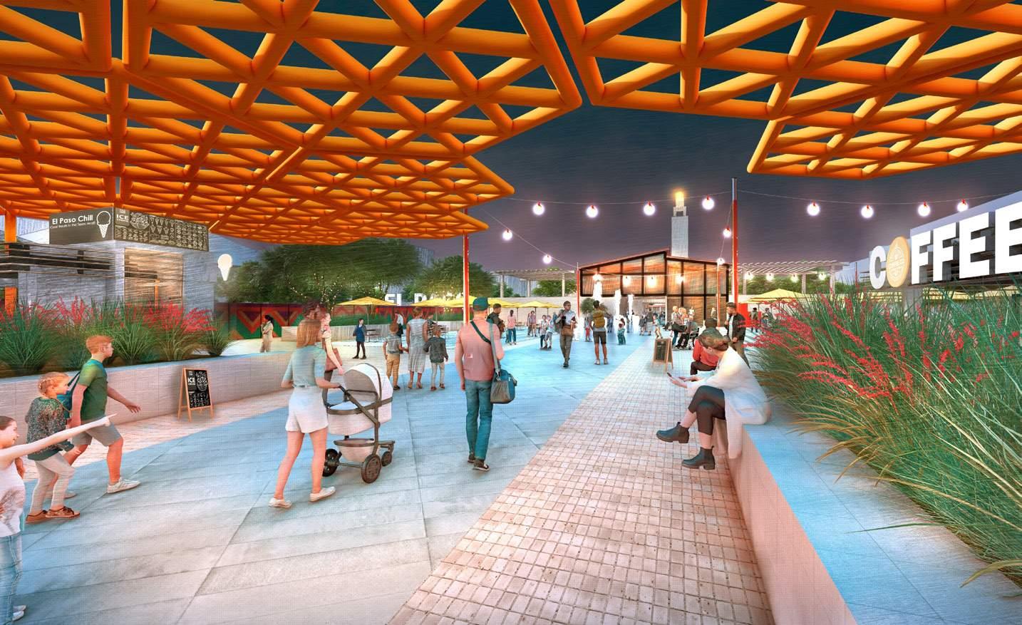

View at Park Overlook
View at Great Lawn
CITY OF PLEASANTON DOWNTOWN REDEVELOPMENT
Type: Mixed-Use Redevelopment
Location: Pleasanton, TX
Area: 18 acres
Time: 2024.01 - 2024.04
Phase: Schematic Design
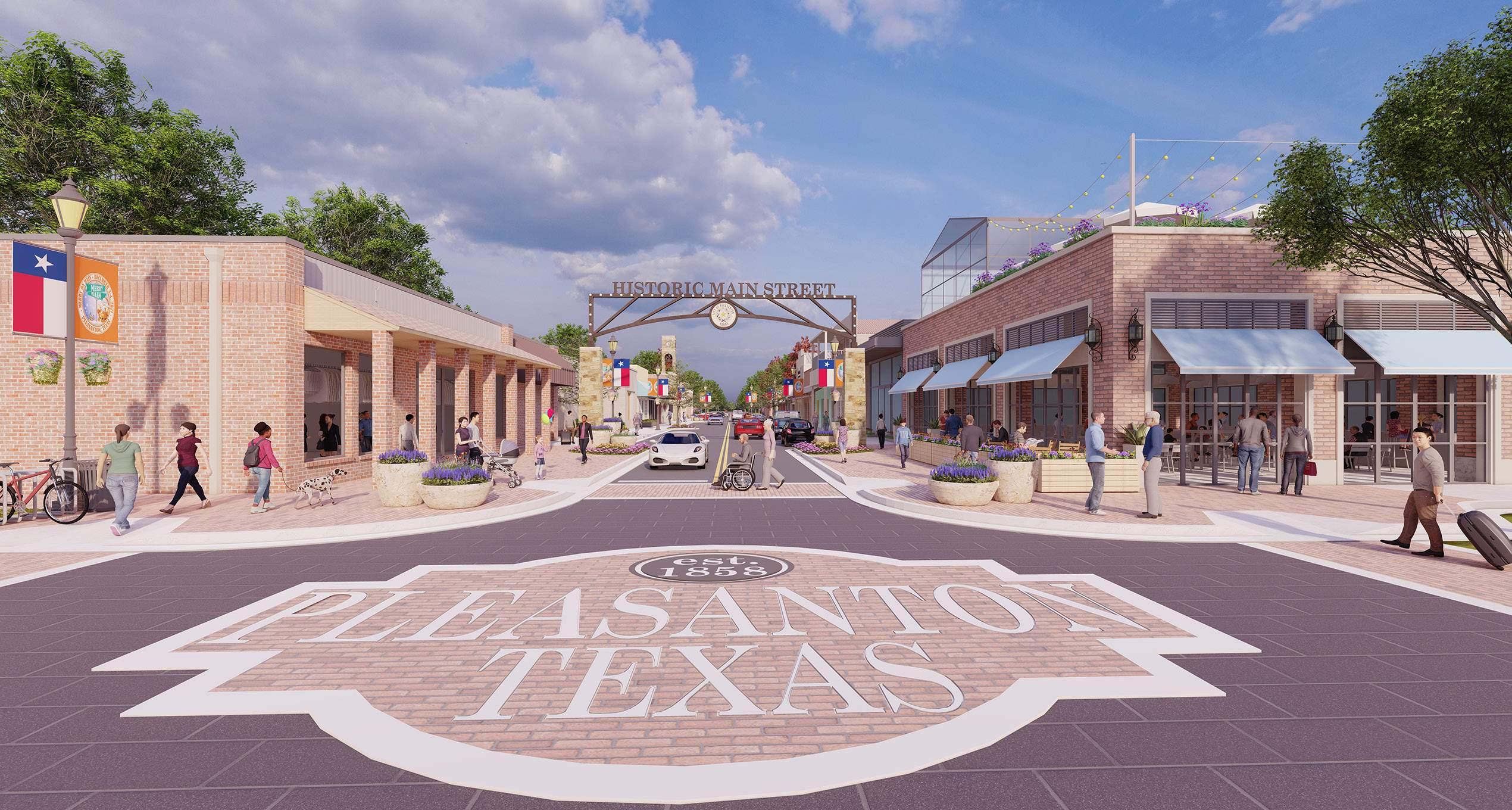
The landscape architecture design for the Pleasanton Mixed-Use Development aims to enhance livability, identity, and connectivity while respecting the site’s natural and cultural context. The design vision is to create a diverse and dynamic landscape offering a variety of experiences and amenities for residents, visitors, and neighbors.
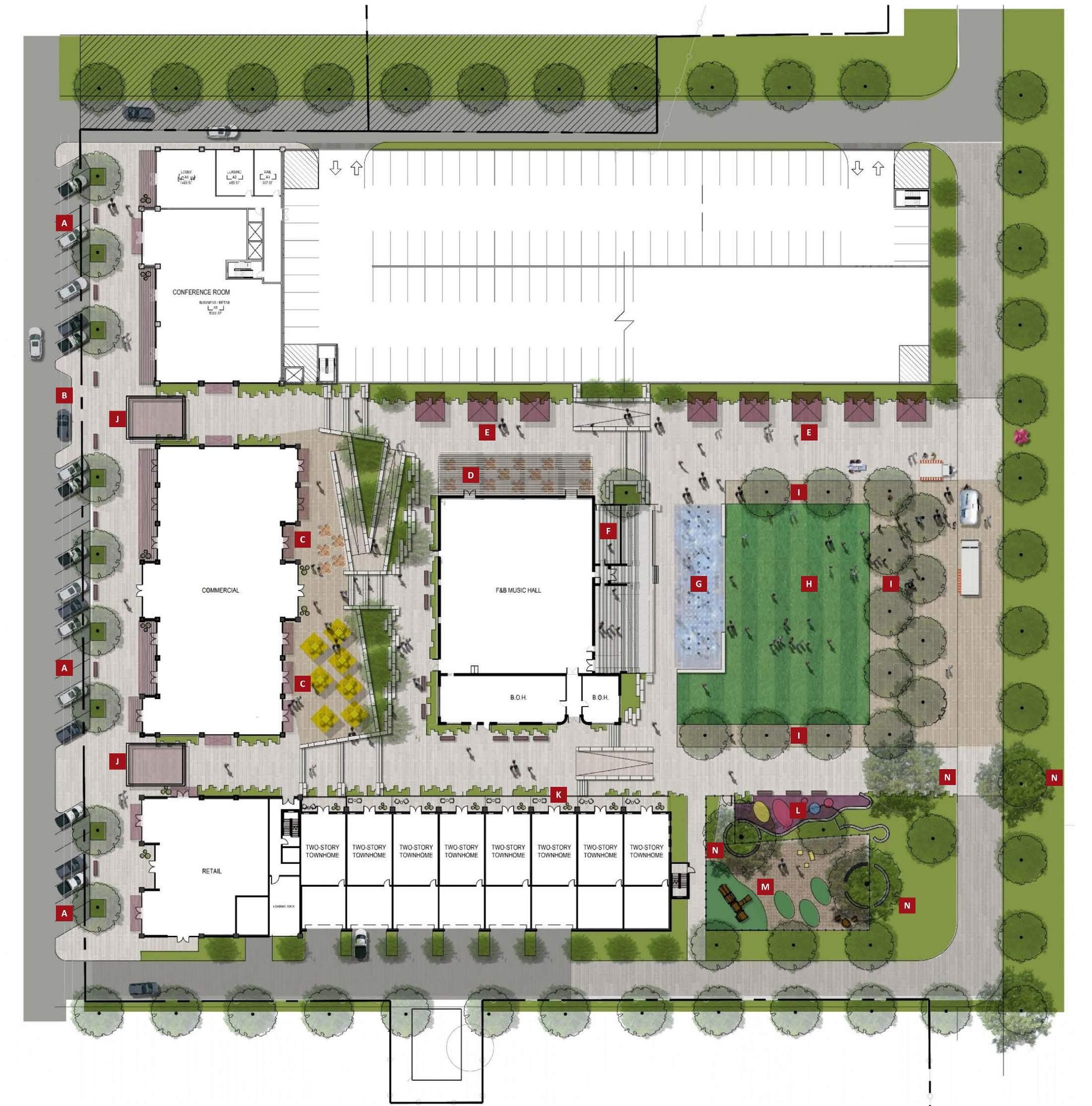
The design program includes a central plaza, outdoor market space, tree preservation and mitigation, a deck pool, street parking, and a garage. These elements work together to create a memorable identity, support a range of activities, ensure strong connectivity, and foster a comfortable and attractive microclimate.
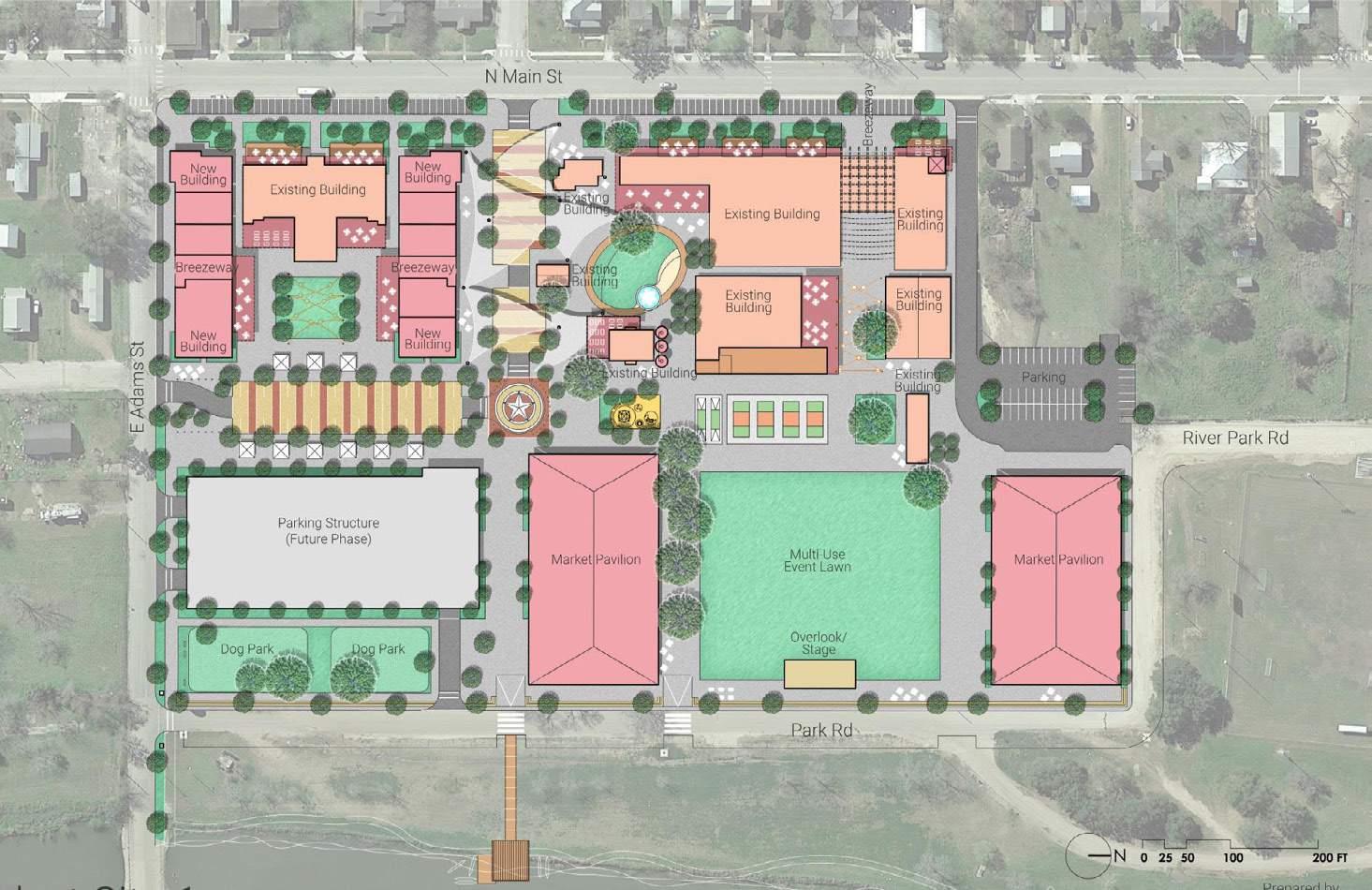
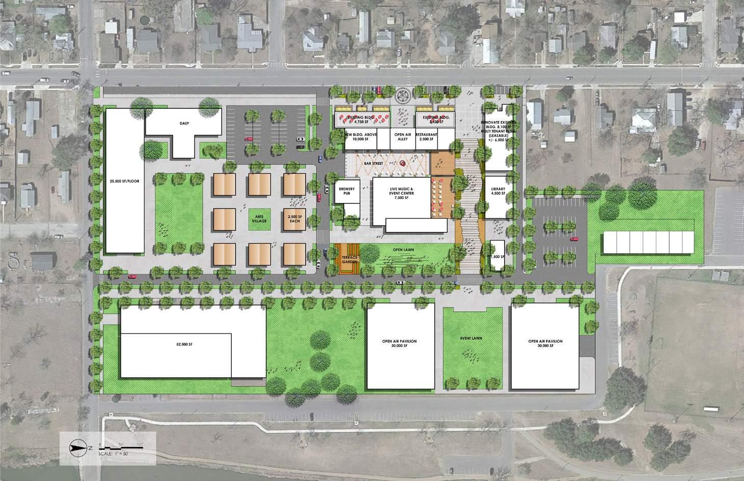
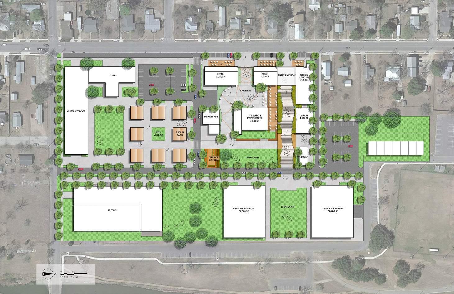
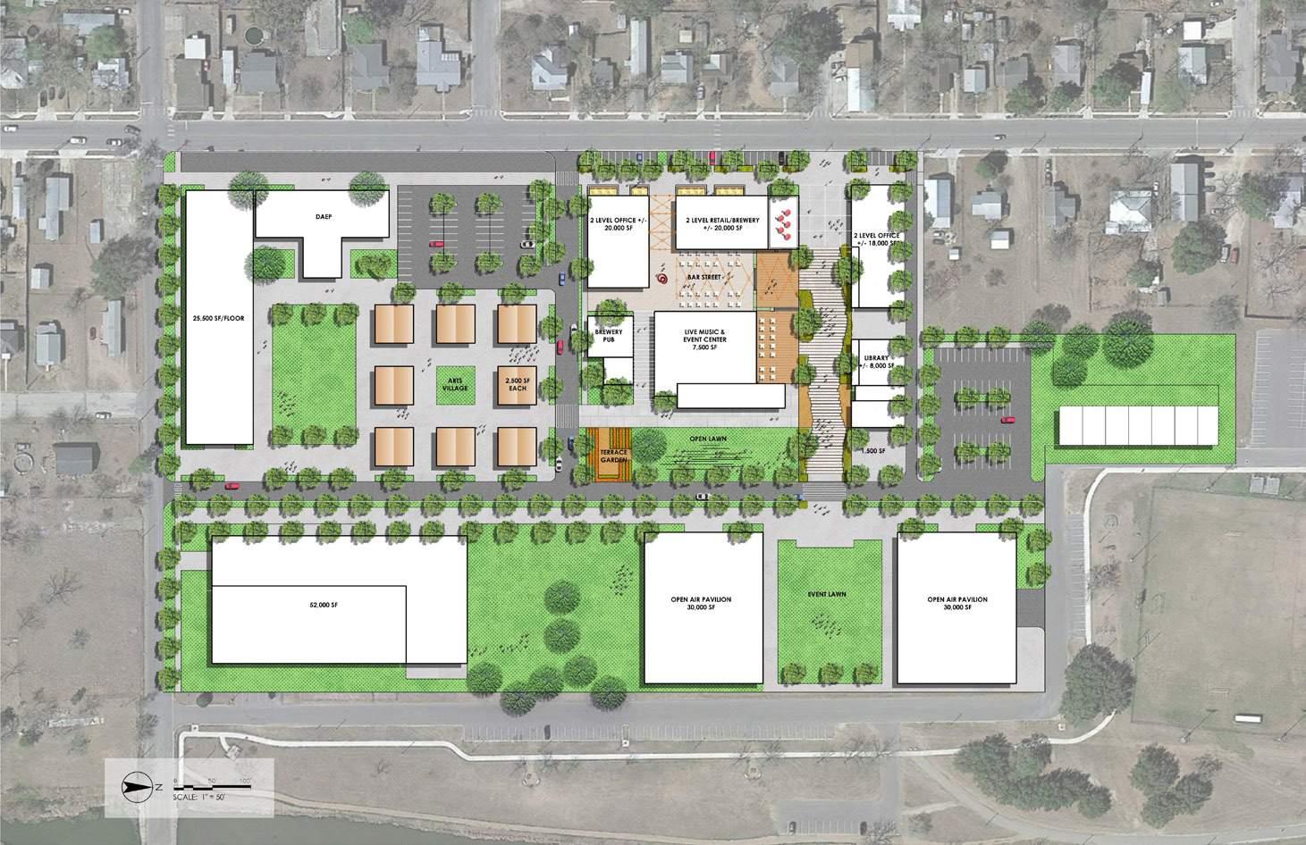
Site Plan Rendering
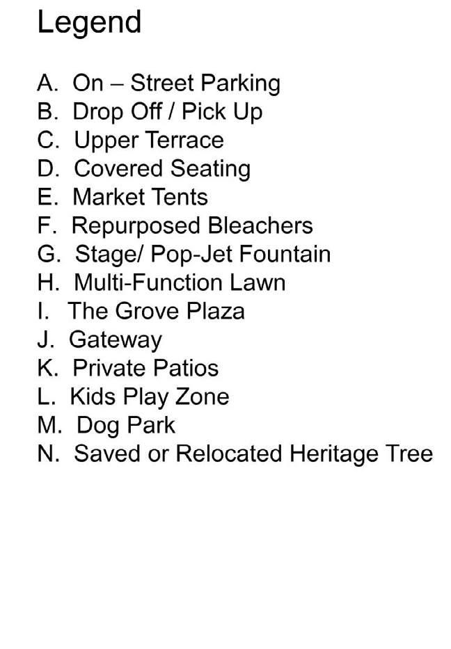
The design aims to create strong and coherent connectivity by linking the site to the surrounding context and providing clear and safe circulation and access. The mixed-use nature of the project and the diversity of users and functions offer high potential for social interaction and economic activity. By incorporating local history, culture, and art, and introducing unique and recognizable features and landmarks. The mixed-use nature of the project and the diversity of users and functions offer high potential for social interaction and economic activity.
Section Renderings
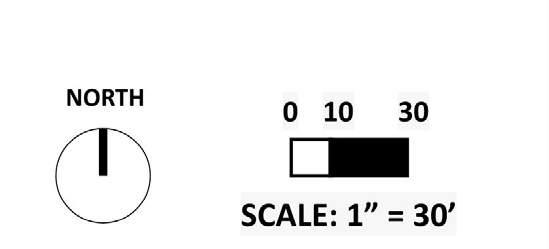
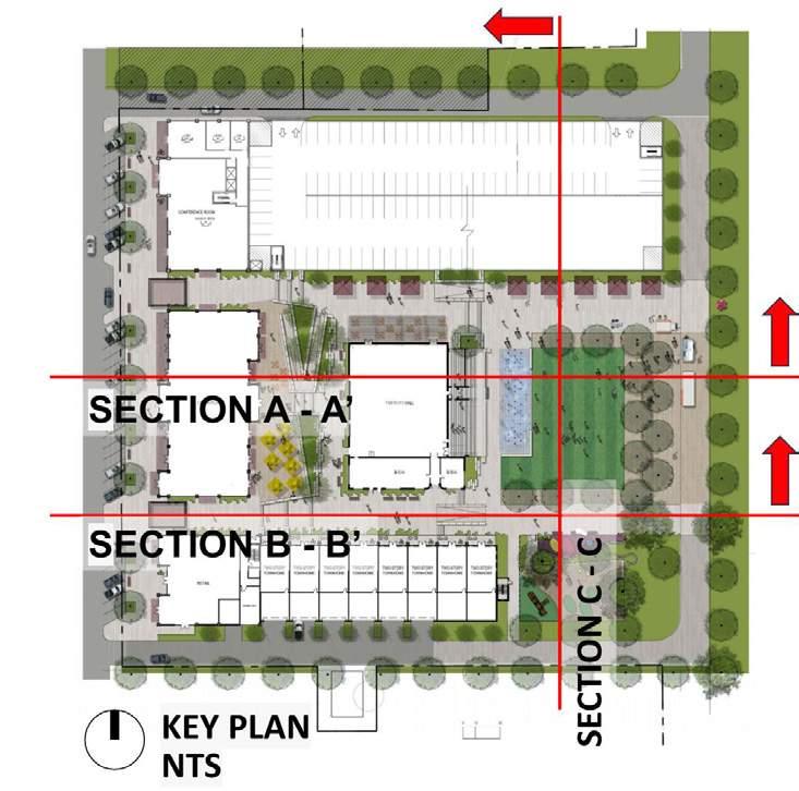
The sections illustrate the seamless integration of the existing memorial gym building and bleachers with the proposed commercial retail spaces, residential buildings, and open space activities. They also effectively highlight the transition across an approximate 10-foot elevation difference. Additionally, the sections demonstrate clear circulation, high visibility, and accessibility, incorporating preserved heritage trees and proposed landscaping. This design creates a cohesive and accessible environment that enhances functionality and aesthetics while offering a range of outdoor interactive activities.
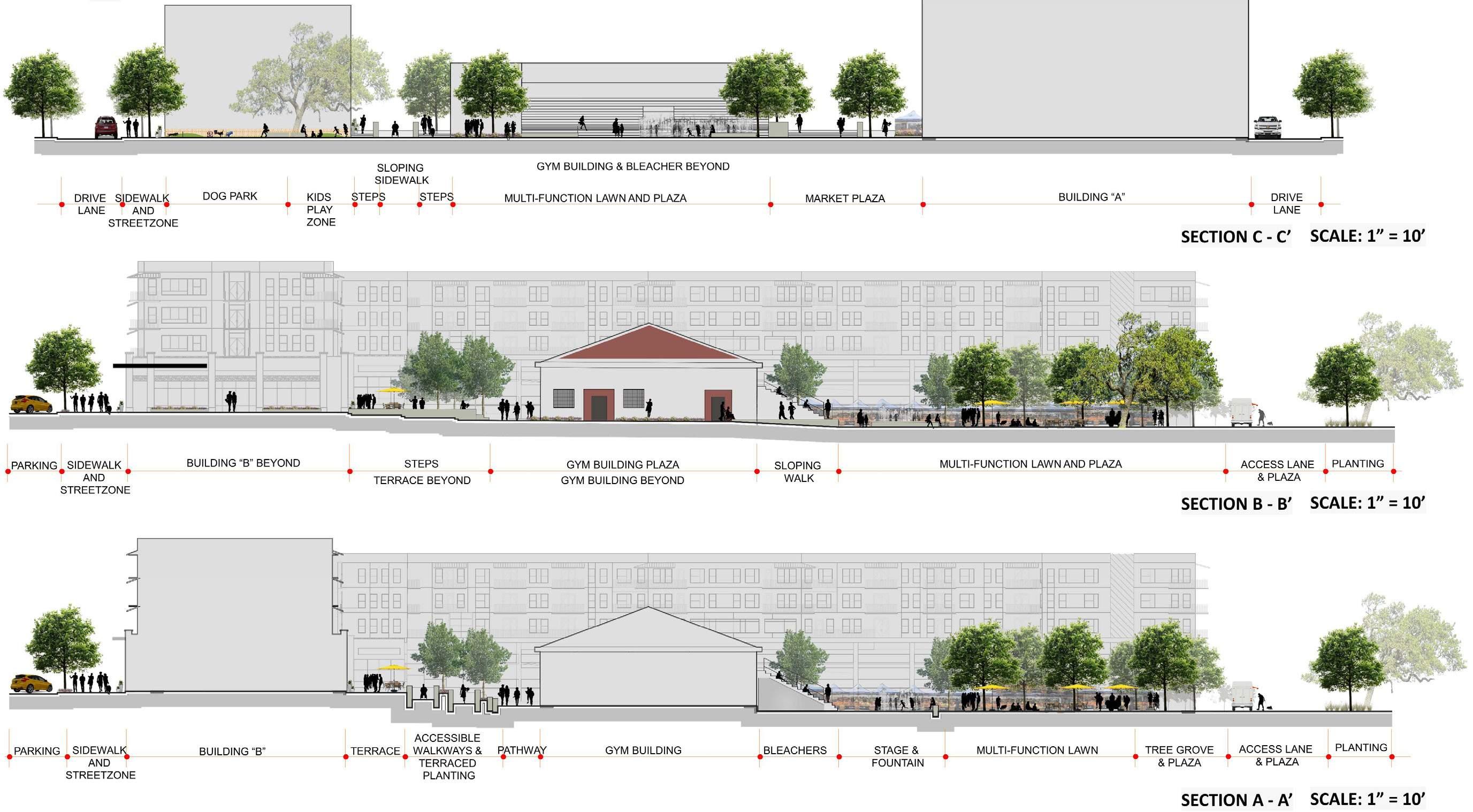
Terrace Plan & Section Renderings
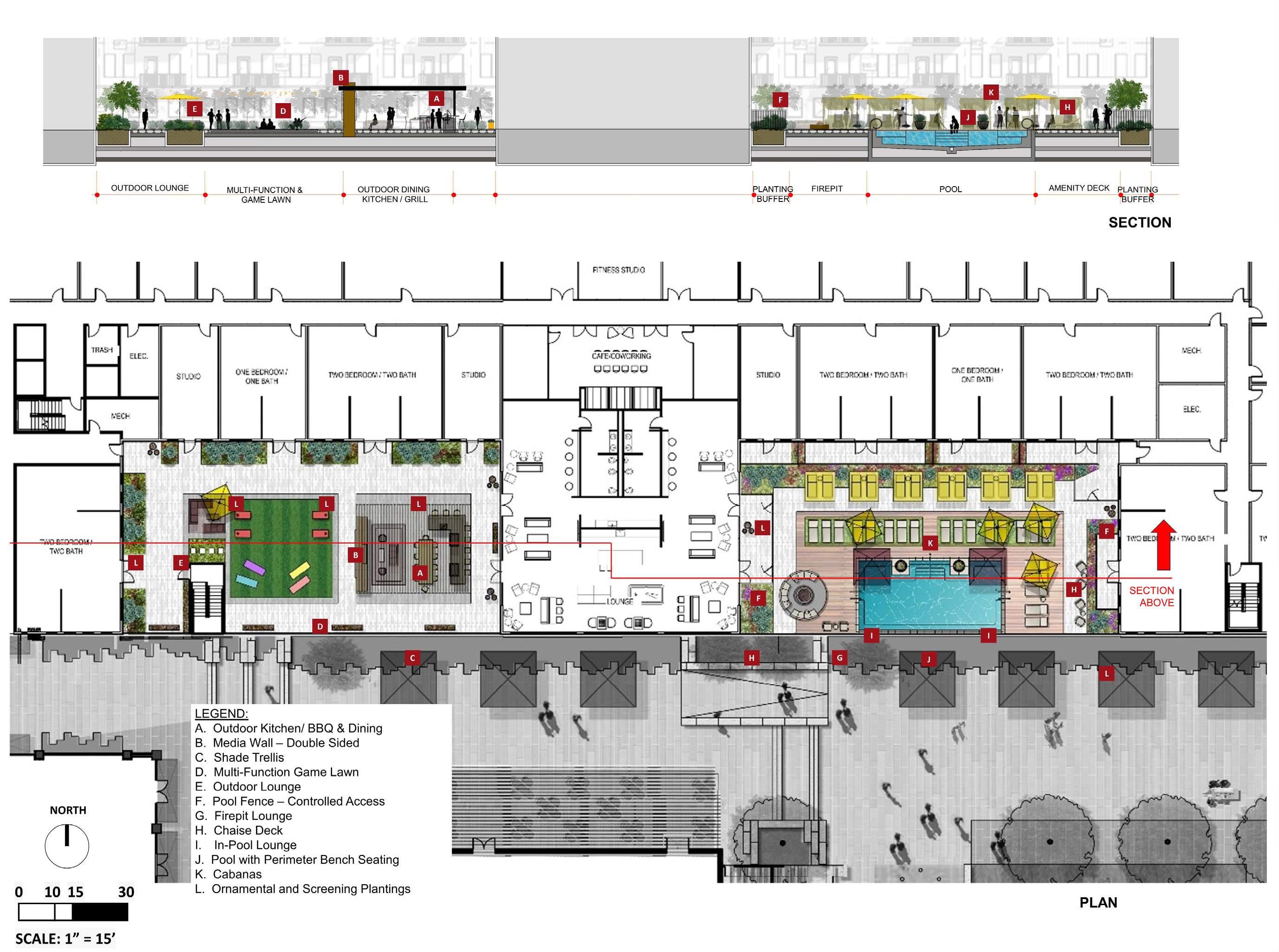
Section Renderings
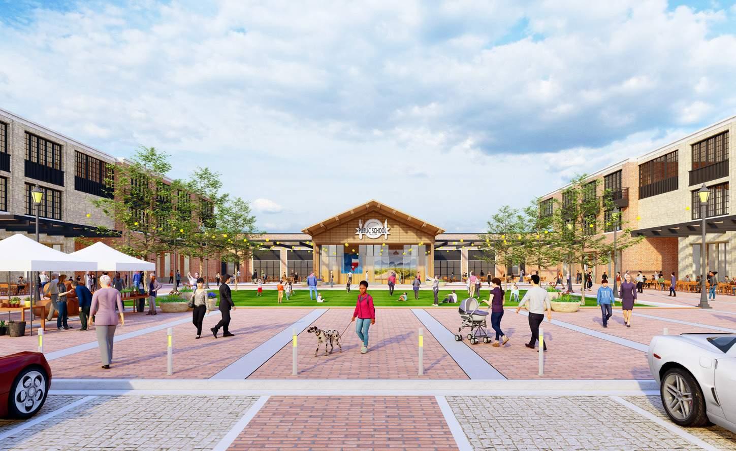
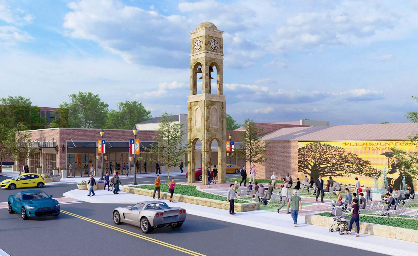
Program: SketchUp, Lumion
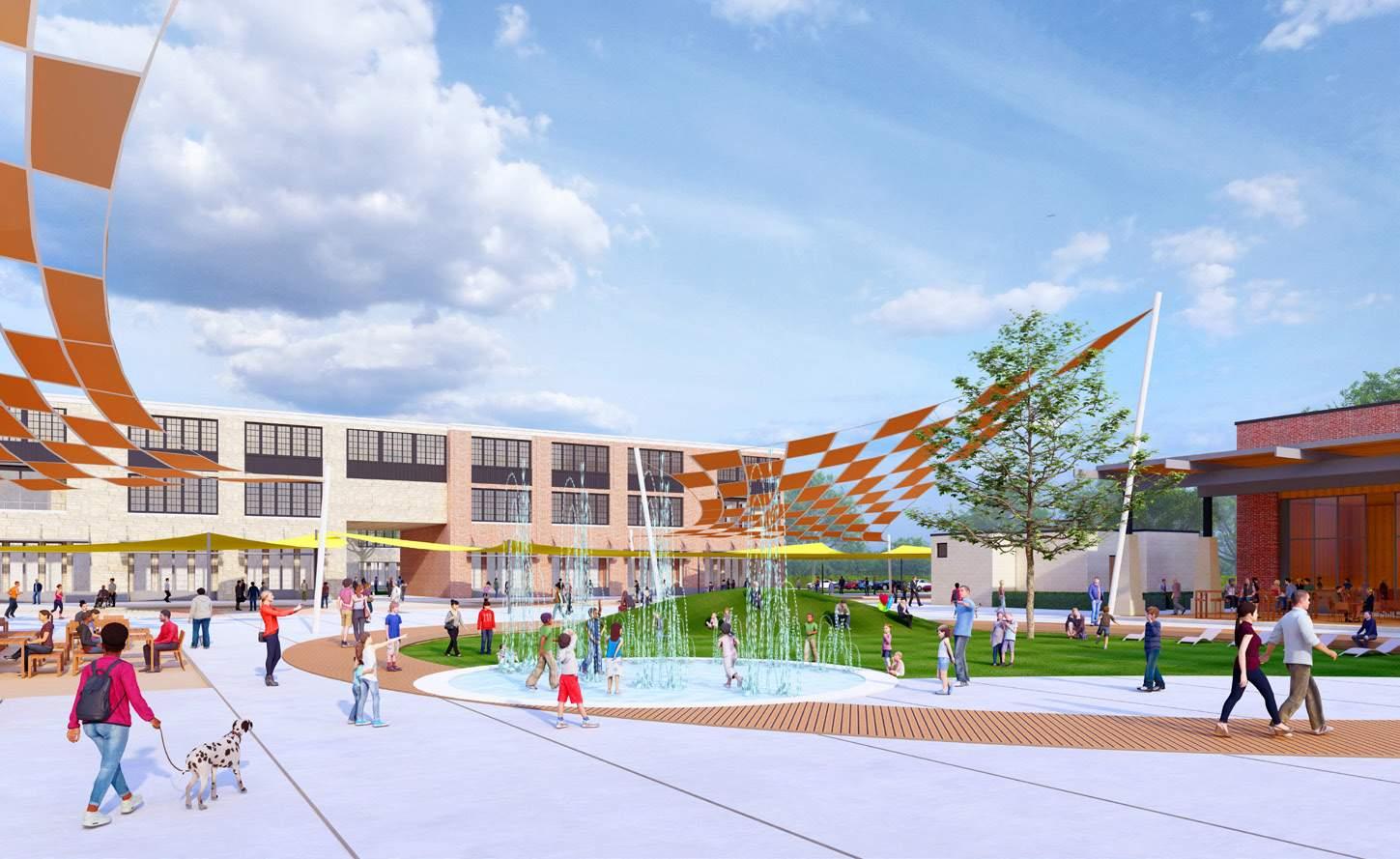
View at Pop Jet Fountain
View at Market Square
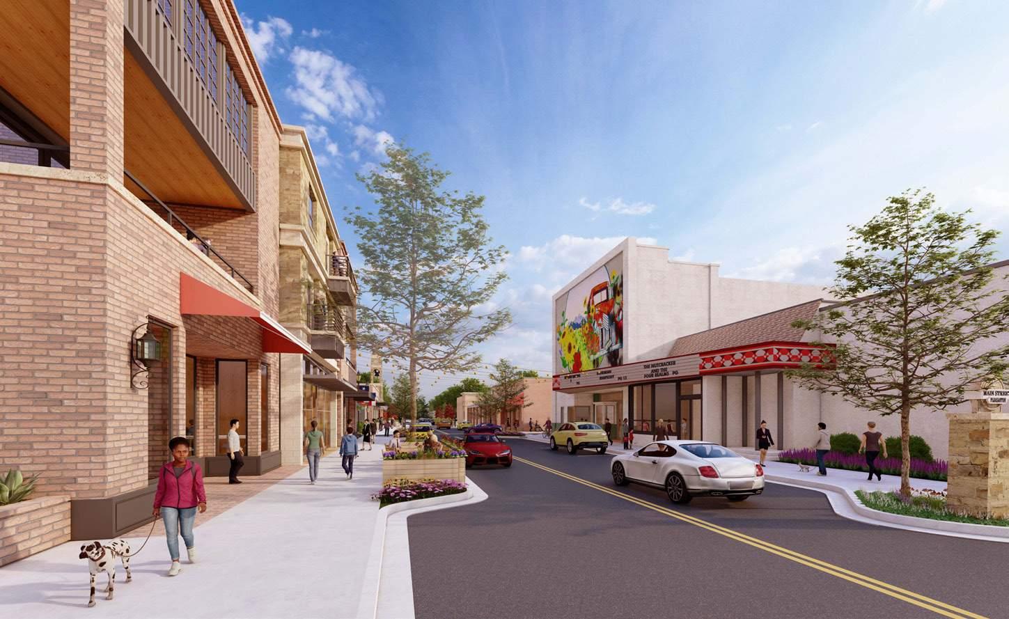
View at Main Street
View at City Tower
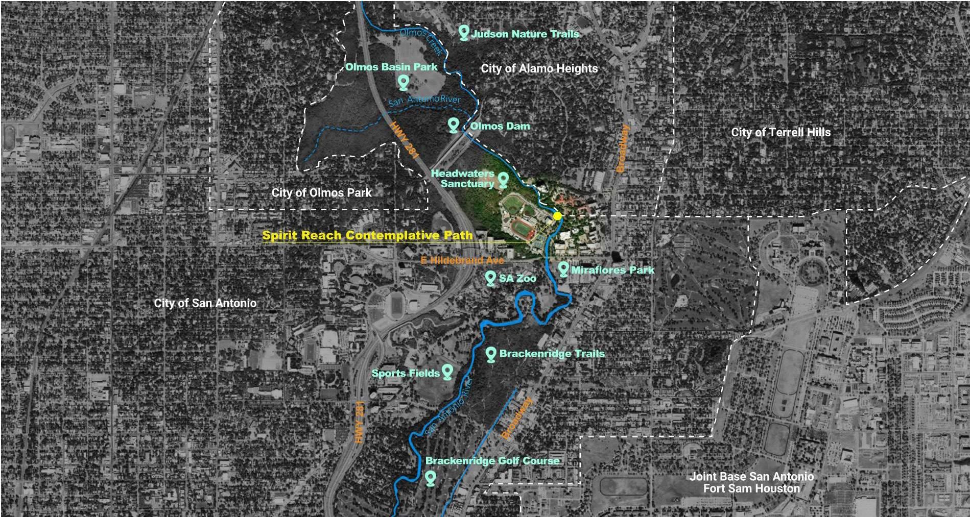
SPIRIT REACH CONTEMPLATIVE PATH DESIGN
Type: Natural Park Design
Location: San Anotonio, Texas
Project Expense: 2 Million
Phase: Schematic Design
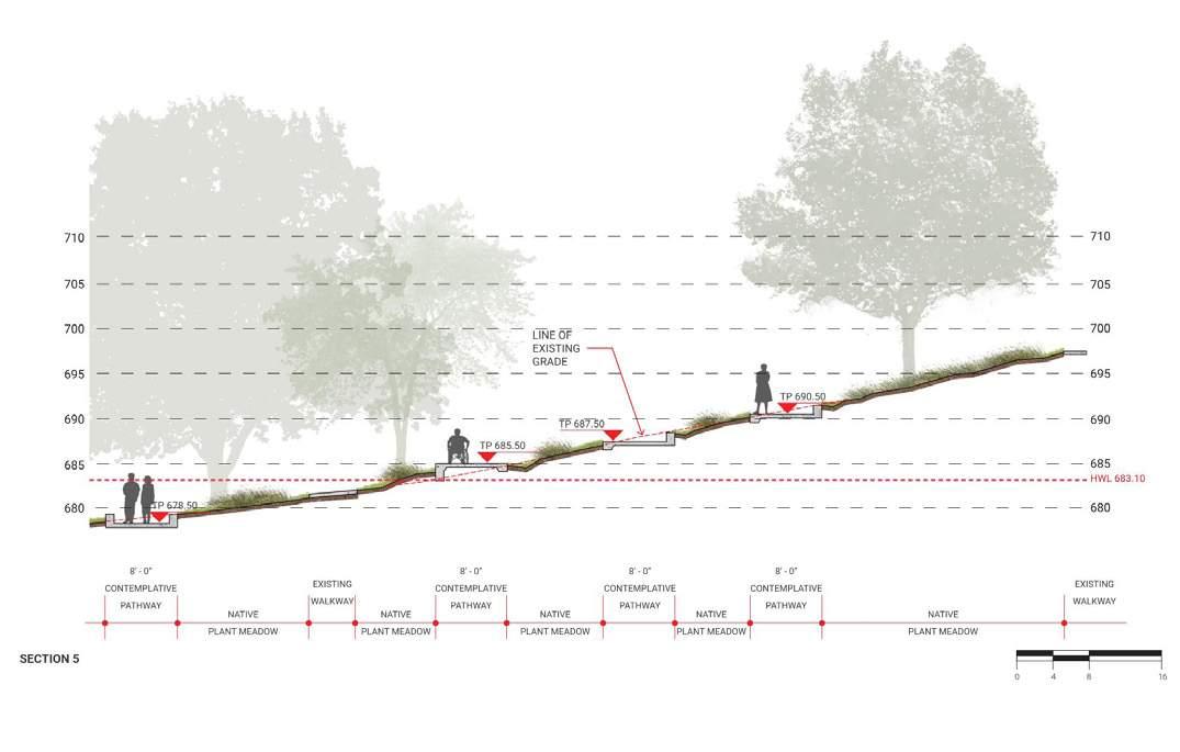
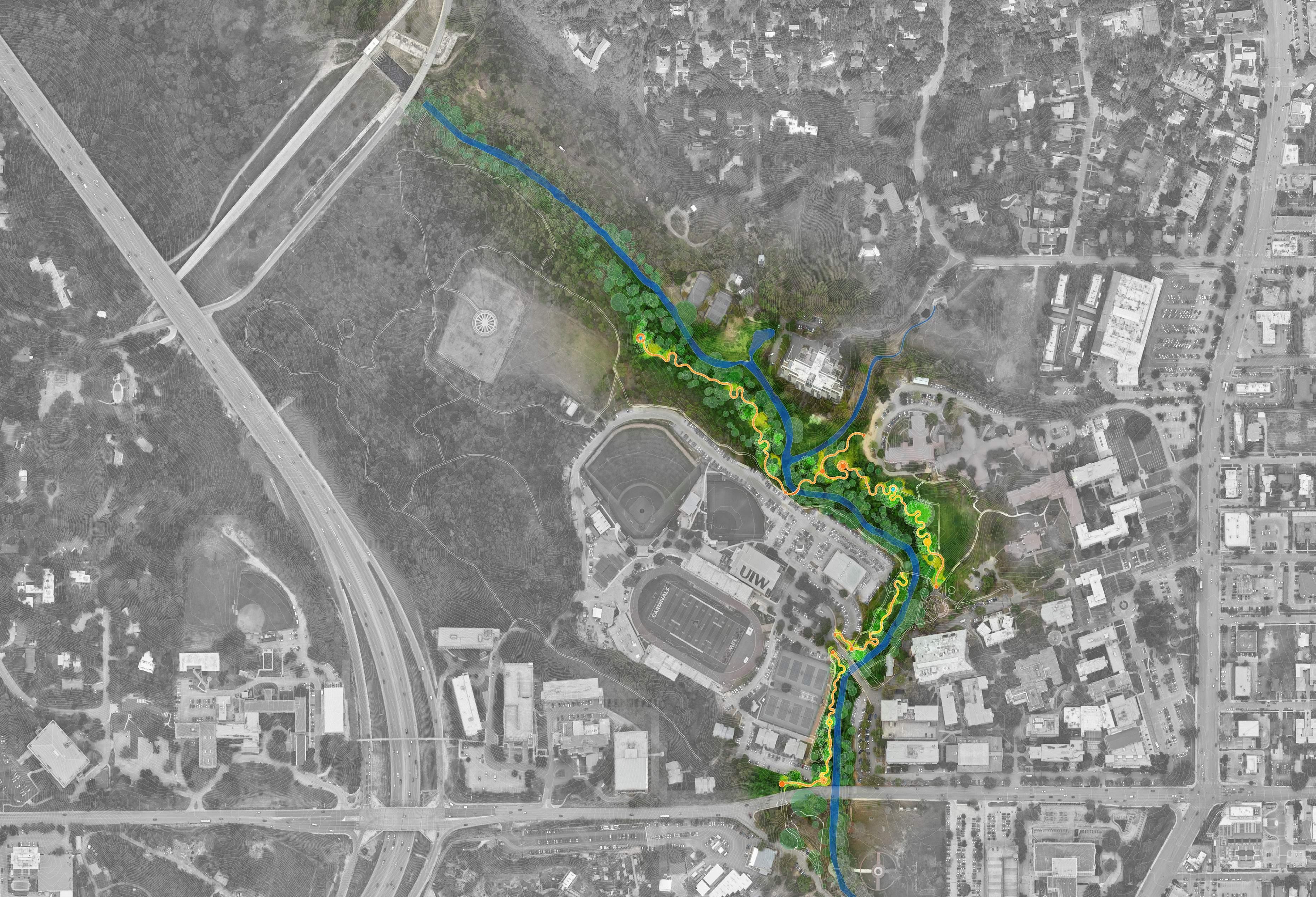
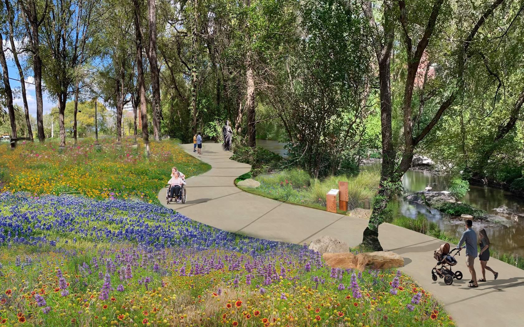
The main objective of this concept is to highlight and enhance the experience of walking by tuning into our five senses as we move through space. To achieve this, the primary focus is to slow down the movement and utilize the path itself to redirect the experiential mode. The most important functional concern is to ensure universal accessibility. Instead of choosing a dual solution with both a staircase and a ramp, it was decided to make the ramp the main entrance and develop it as an integral part of the project.
The goal is to create a safe and ADA-compliant route that offers an inspiring and captivating design solution that re-spects and enhances the balance between a fragile riparian ecology and a pathway for spiritual centering, contemplation, and prayer.
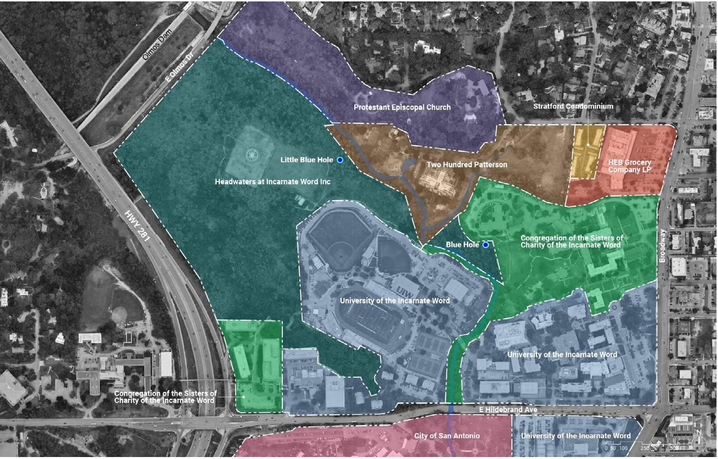
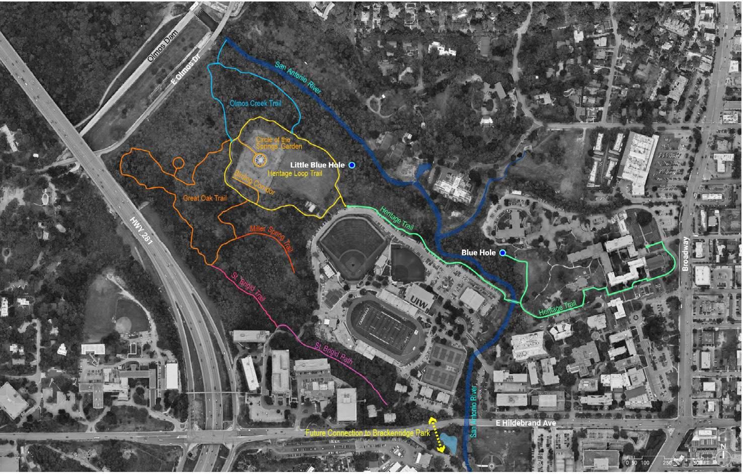
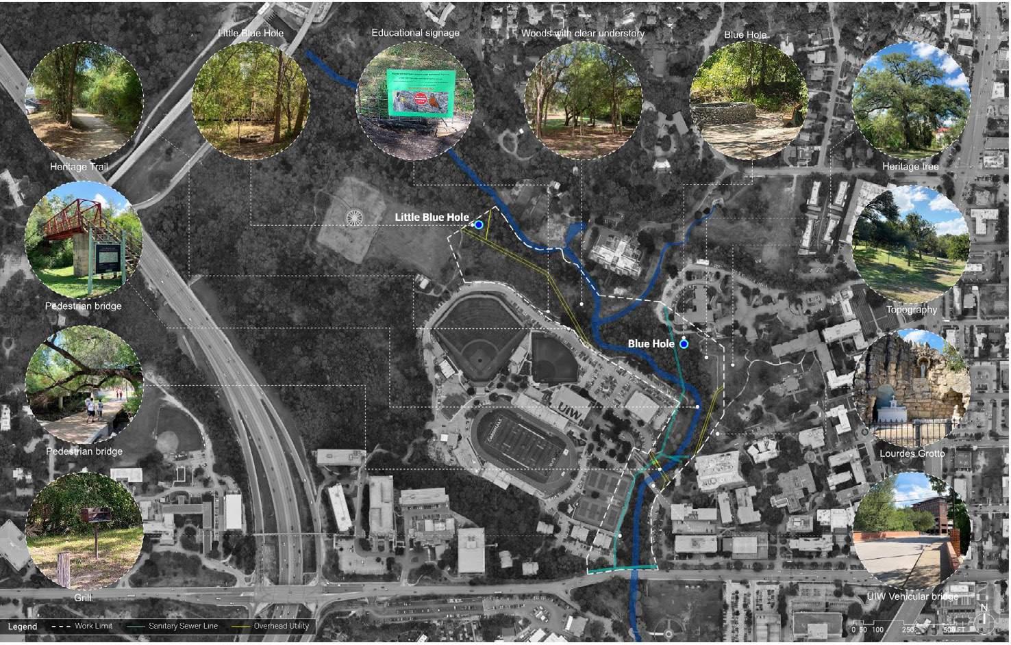
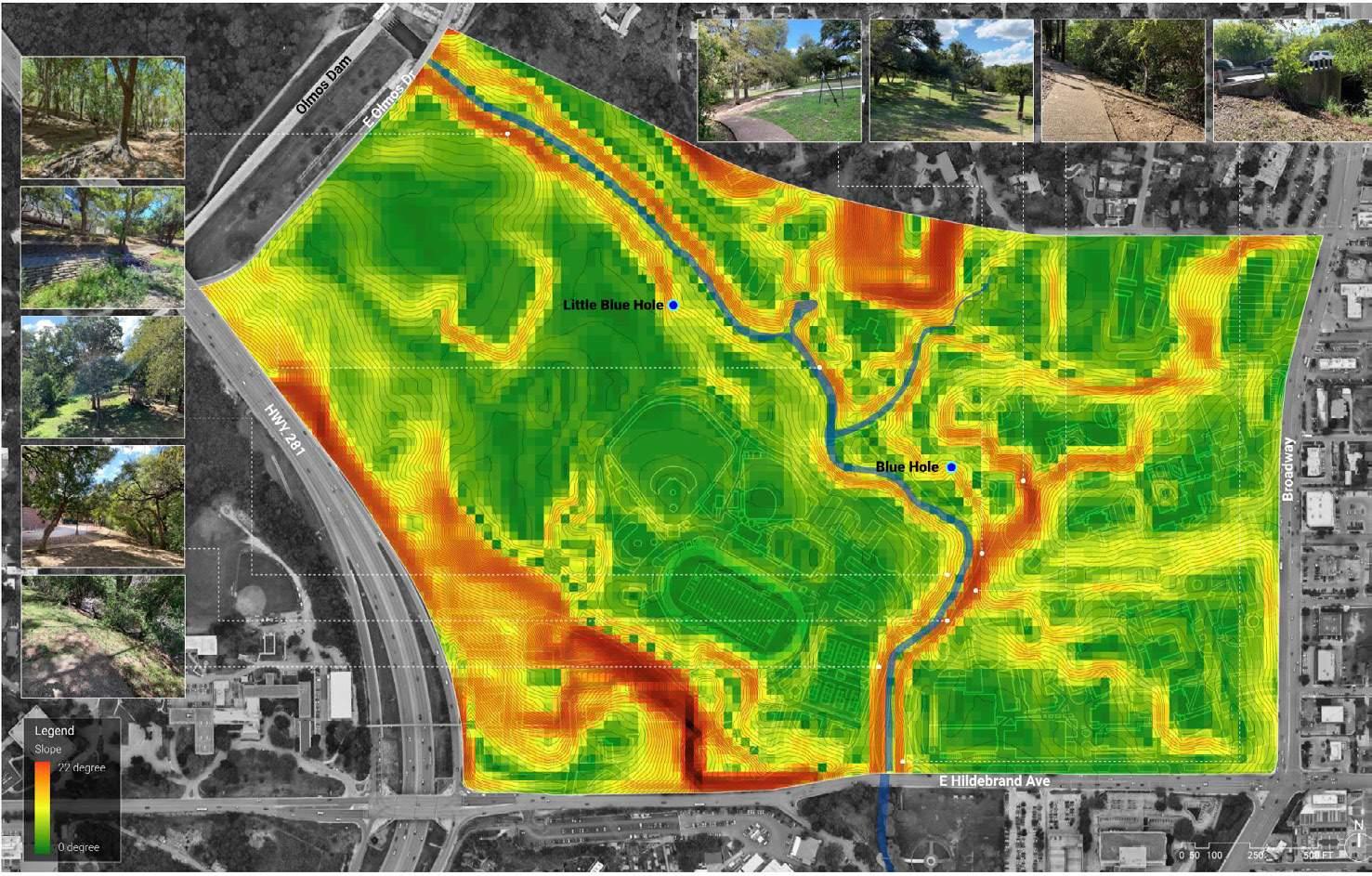
Properties Map
Existing Site Condition Map
Existing Trails Map
Existing Site Slope Map
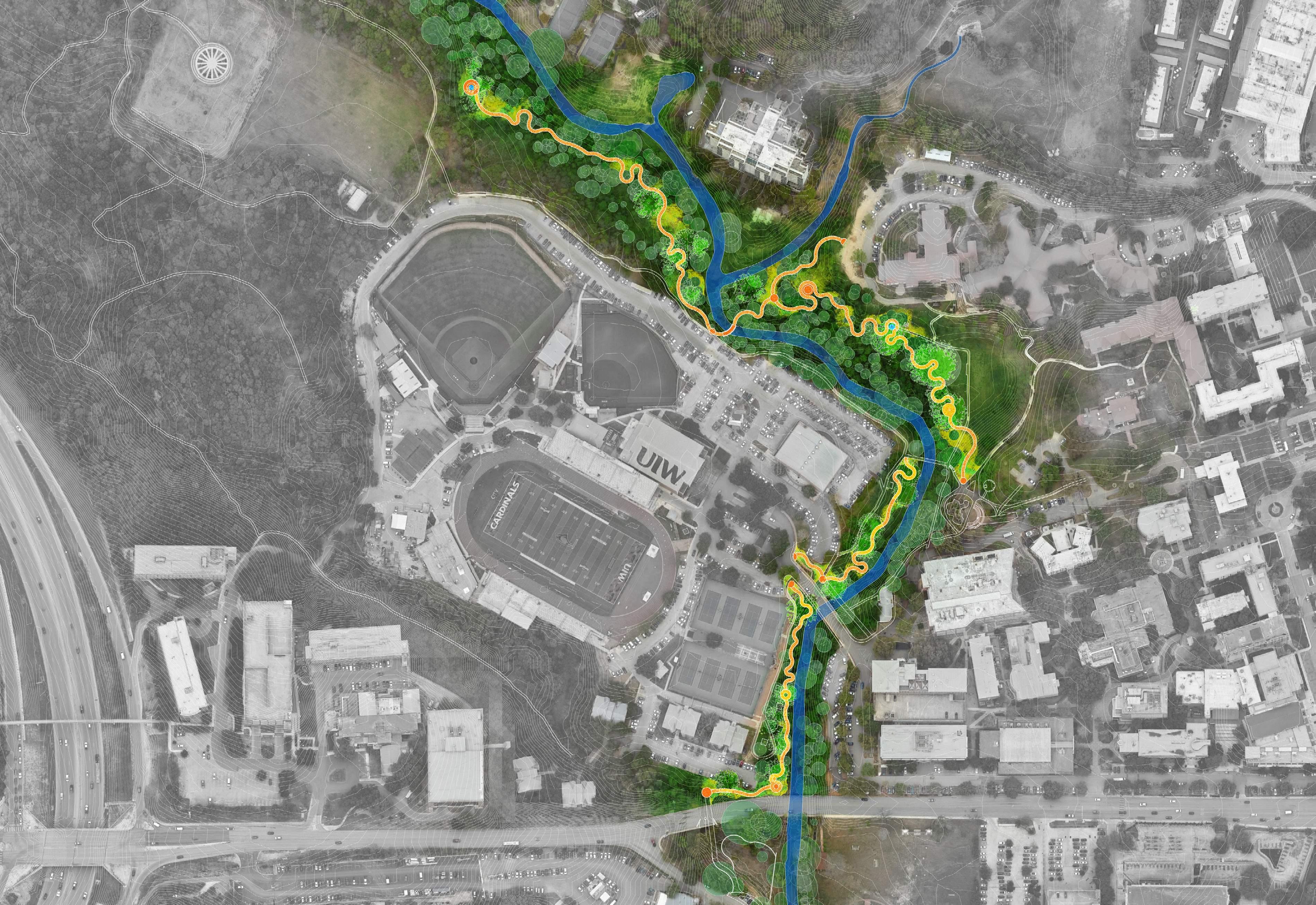
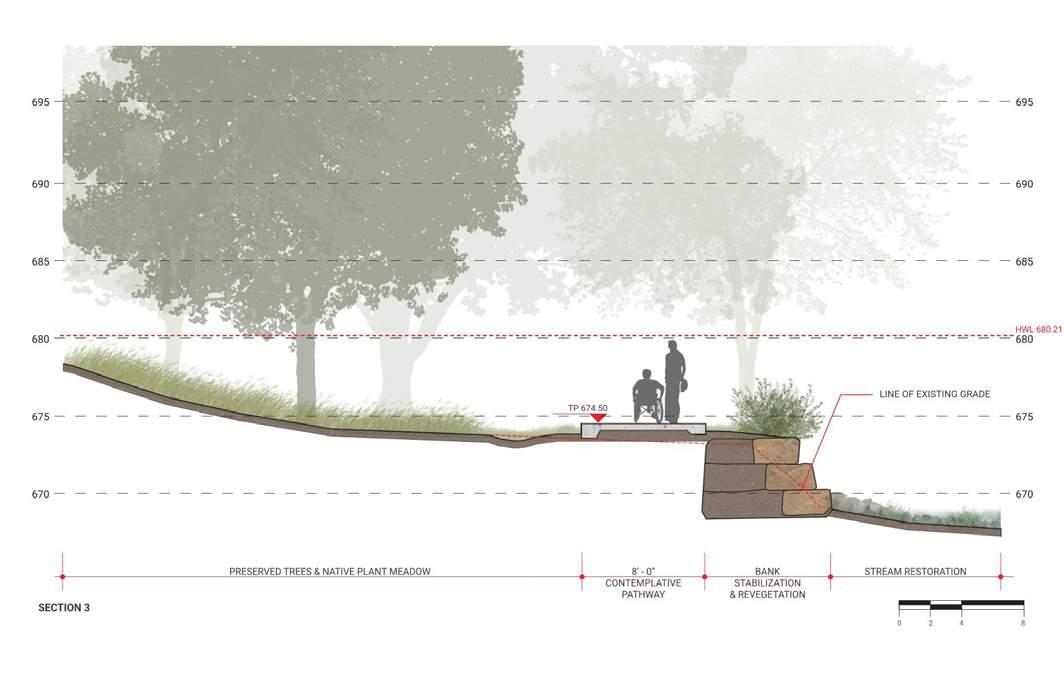
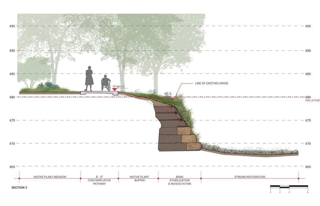
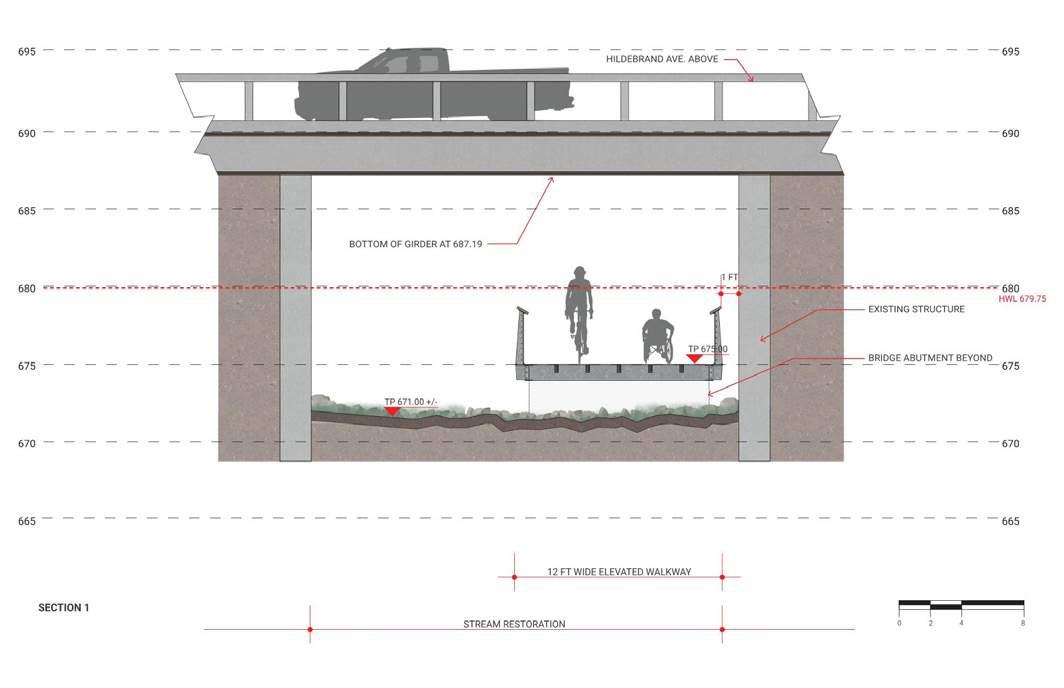
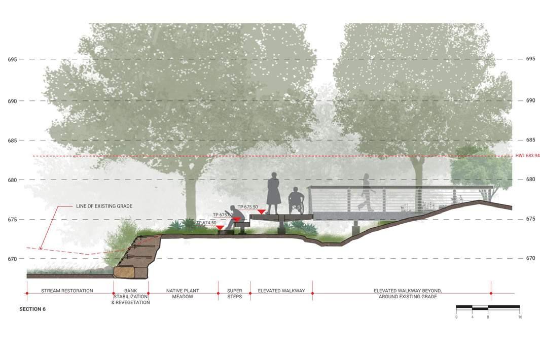
Perspective Renderings
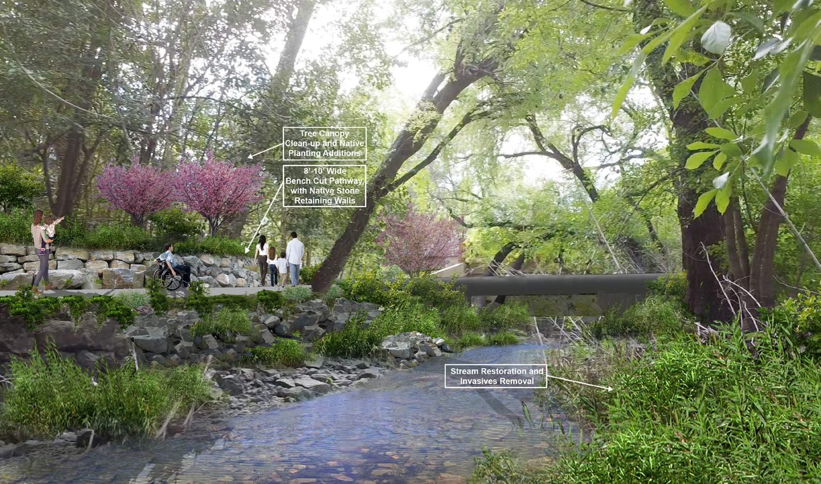
Designed to permit water flow beneath it, the walkway ensures both environmental sustainability and functional integration.
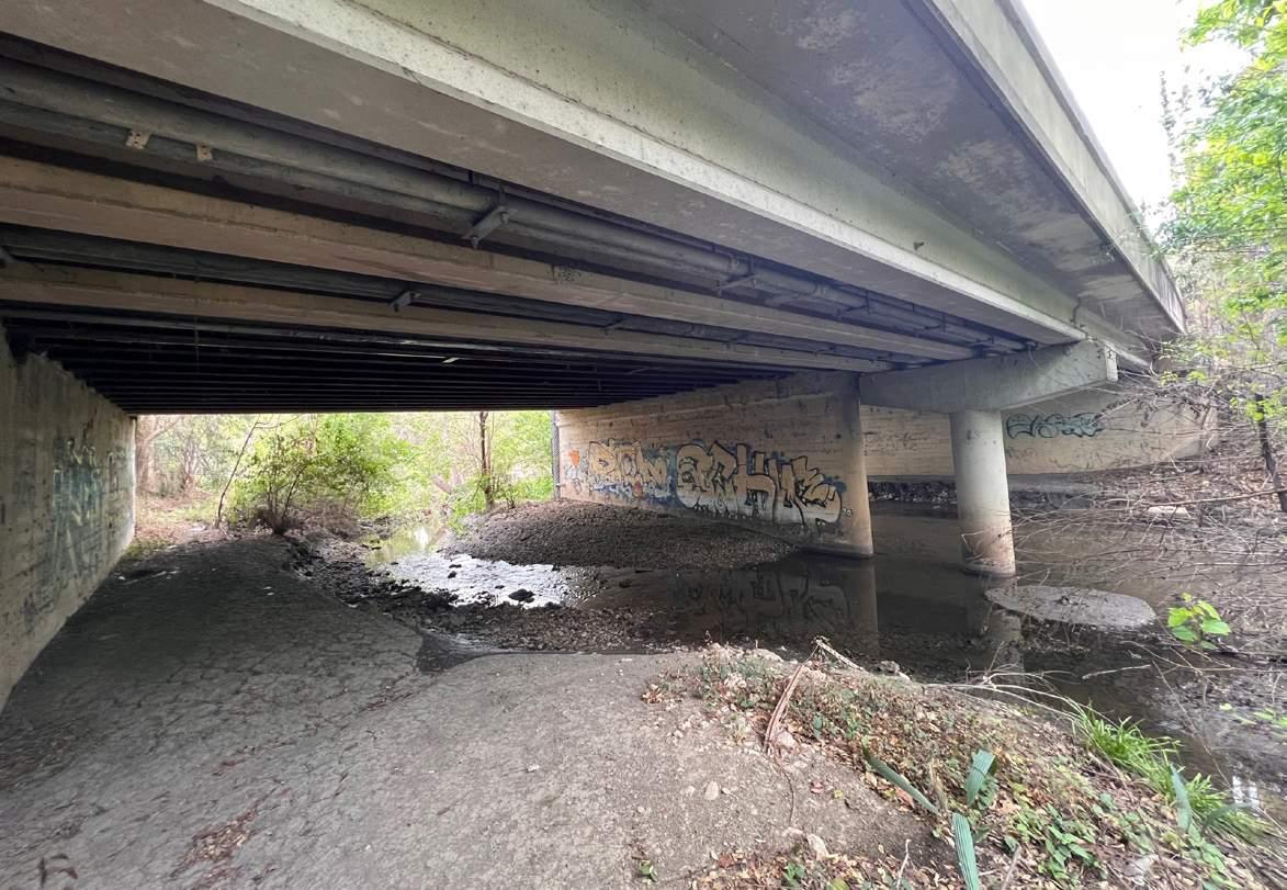
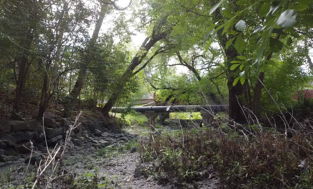
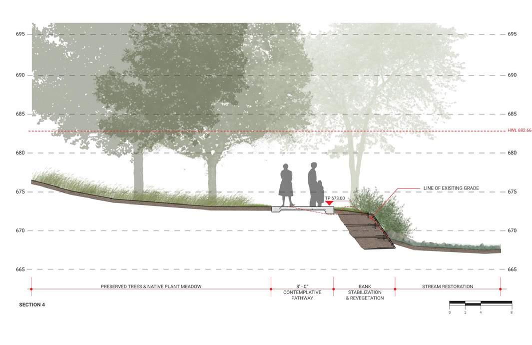
Riverbank stabilization and re-vegetation efforts will consist of quarry boulders, stone backfill, filter fabric, and live brush layering.
These efforts will mitigate future erosion and allow for the proposed contemplative path improvements adjacent to the river.
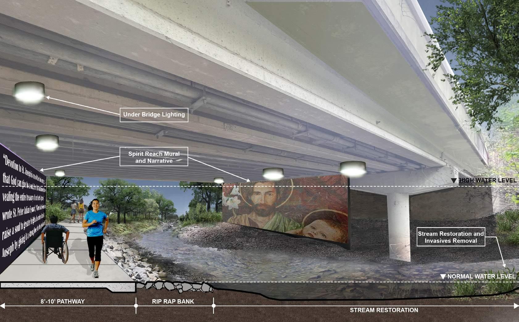
The murals also reflect the culture of the site, echoing the theme of Spirit Reach.
Trail along River - After
Trail Under Bridge - After Before
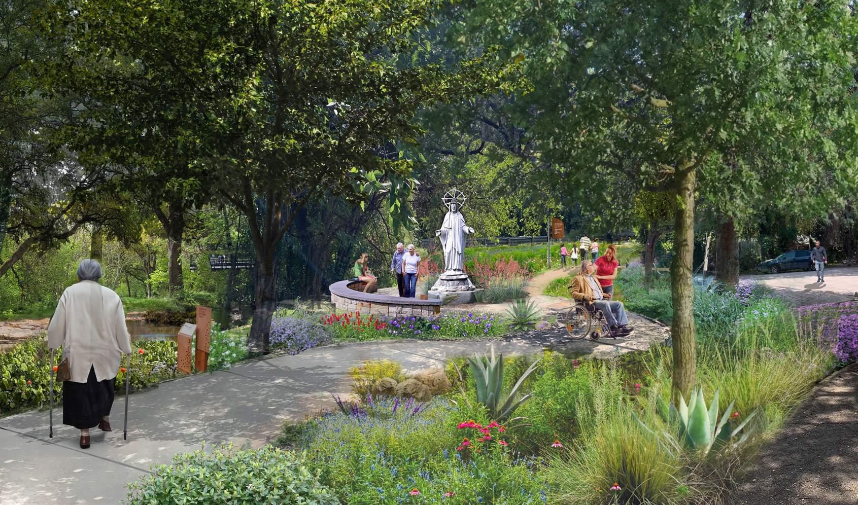
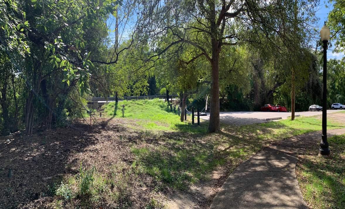
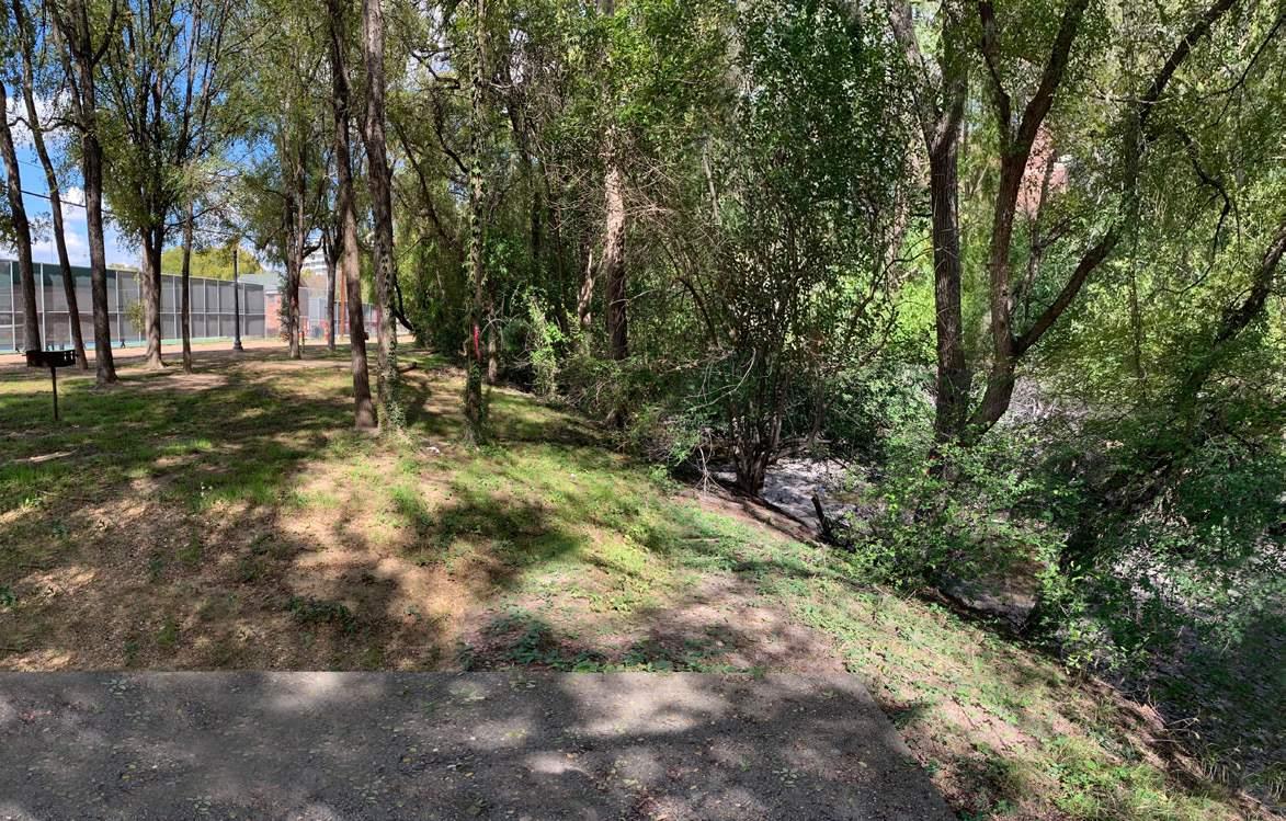
Blue Hole is the key feature at the Spirit Reach. It is the water source of the San Antonio River.
The proposed concrete trails complied the ADA access along with natural plantings all the way to the Blue Hole.
Blue Hole - After Before
Trail Head at Blue Hole - After
HEERS PARK
Type: Park Redevelopment
Location: Las Vegas, Nevada
Area: 7 acres
Time: 2024.04 - 2024.05
Phase: Schematic Design
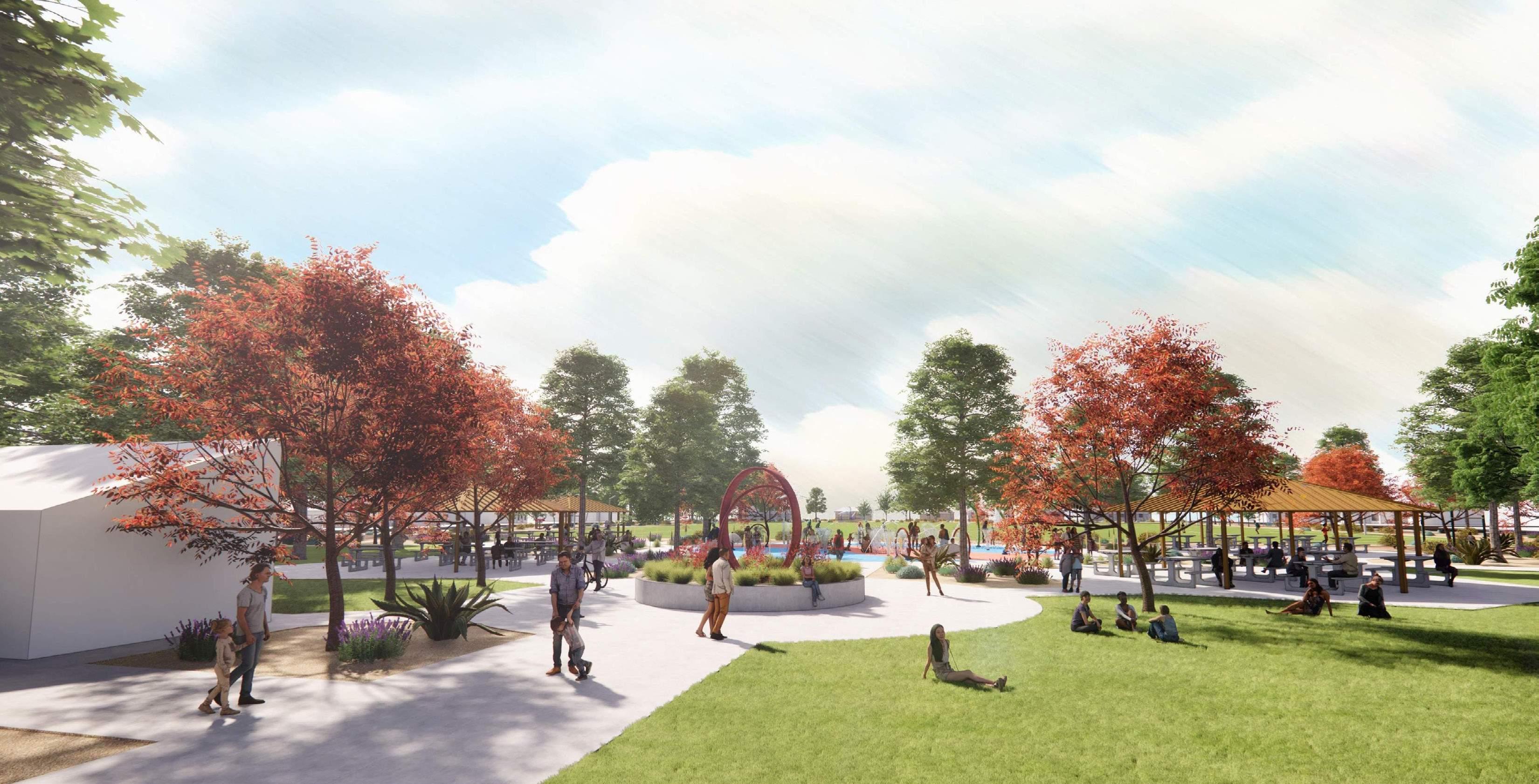
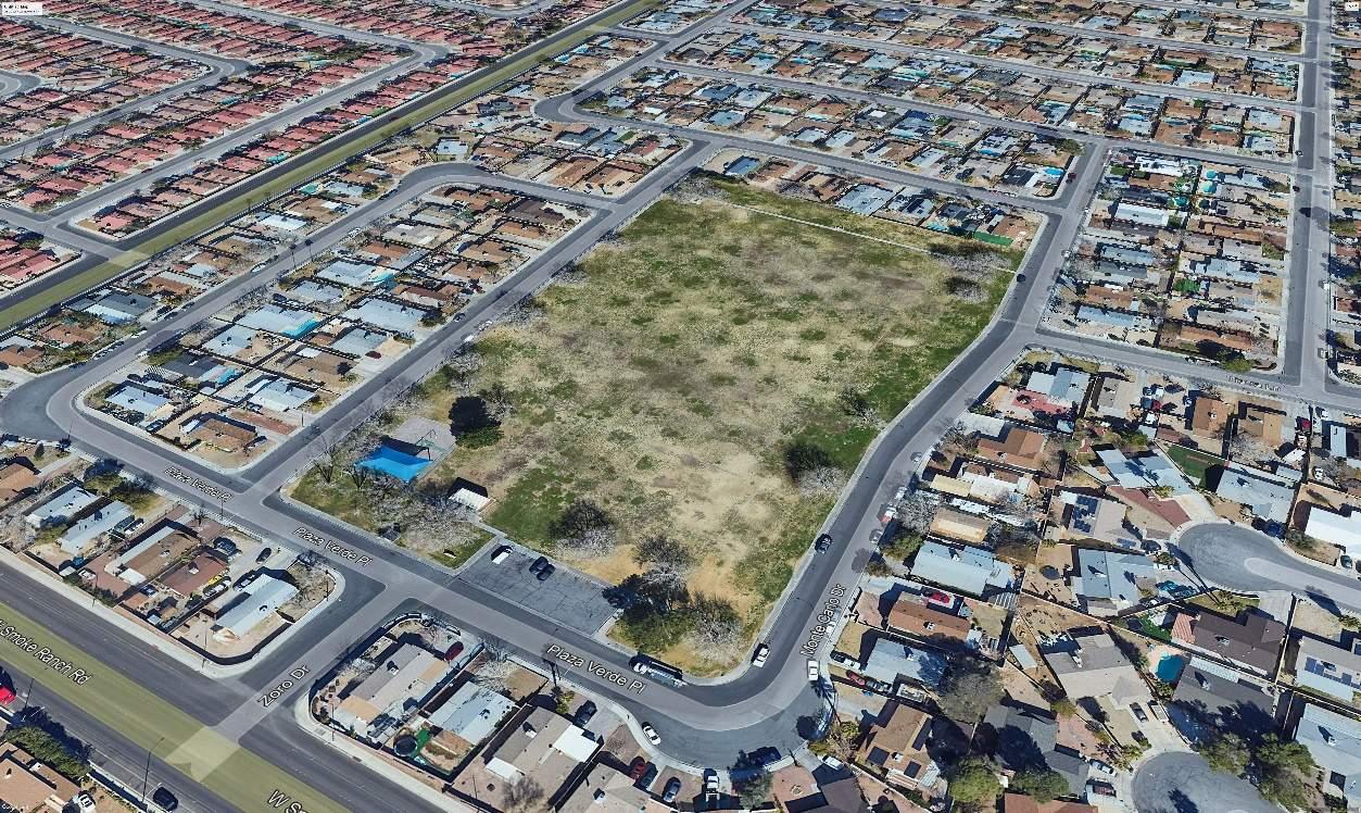
Heers Park is a mature 7-acre community park in Las Vegas, bordered by residential lots to the north. The park currently features a restroom, a playground with a shade shelter, and a single bay parking lot with no defined driveways. It is predominantly grass-lined with mature trees around the perimeter and within the playground area.
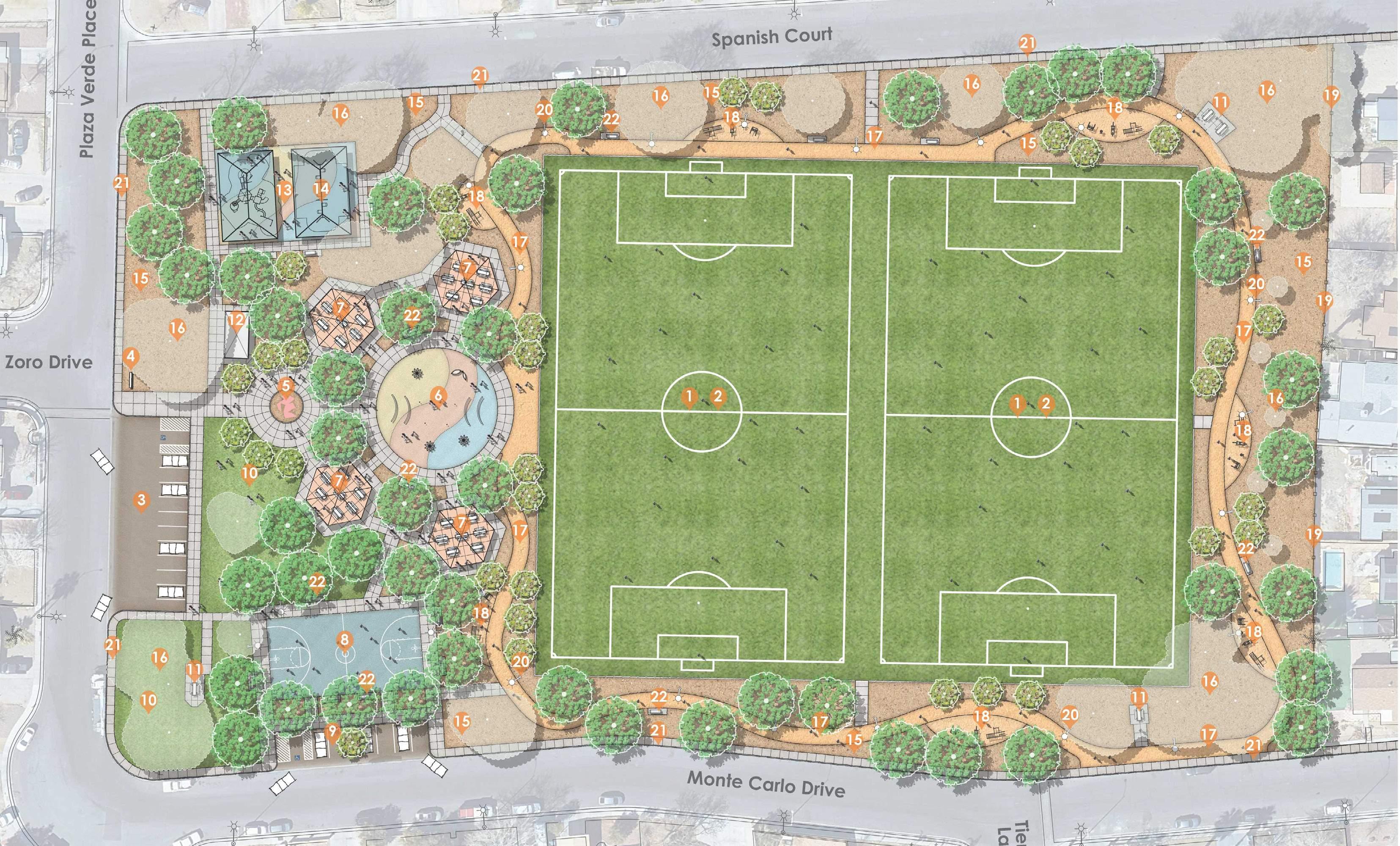
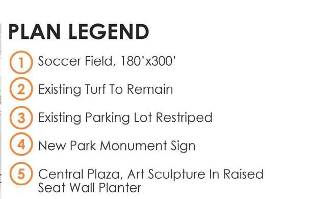
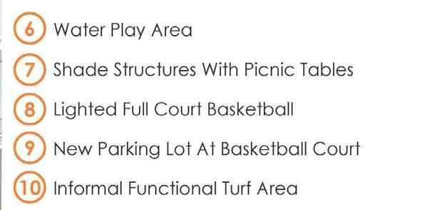
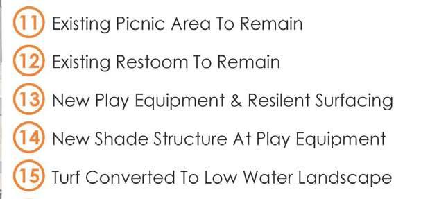
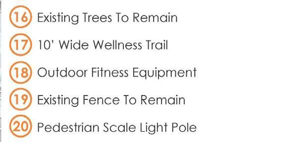
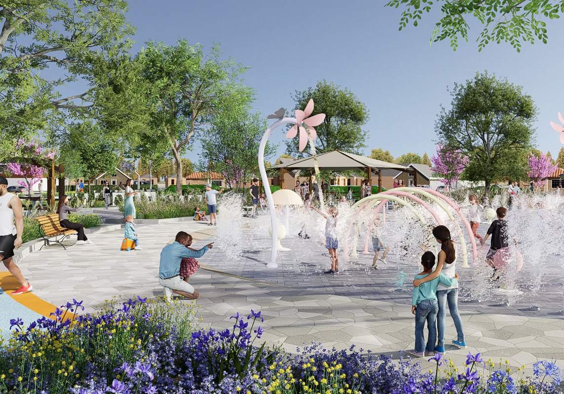
The project aims to enhance the greenspace, update park signage, and install new picnic shelters. It will also include a lighted wellness walking path around the park’s perimeter with exercise equipment stations, a water play feature, a basketball court, art murals, and playground structure and surface improvements.
Heers Park is a mature 20+ year old mature park located at 6320 Plaza Verde Place, Las Vegas, Nevada within an exis�ng established single family home neighborhood just north of Smoke Ranch Road and east of Torey Pines Drive.
Heers Park is a mature 20+ year old mature park located at 6320 Plaza Verde Place, Las Vegas, Nevada within an exis�ng established single family home neighborhood just north of Smoke Ranch Road and east of Torey Pines Drive.
II. DEFINING PARK IMPROVEMENTS
A. COMMUNITY OUTREACH
Site Analysis and Concepts
B. EXISTING PARK AMENITIES
This park features:
• 100% coverage turf open space.
B. EXISTING PARK AMENITIES
• Informal unlit prac�ce soccer fields using painted lines on grass.
This park features:
• Mature trees on all sides of the park made up of mostly ash, pistache, mondell pine, and mulberry trees.
This exis�ng park with its ameni�es has served this community and neighborhood well as an oasis in our harsh desert. As with most things, it is showing its age with its limited ameni�es and improvements in need of upda�ng. The best thing this park has going for itself is that it has mature trees that provide instant shade from our hot summers and open turf play for endless uses. However, even some of the trees are past their peak and are on a slow natural decline expedited by our harsh climate.
The City with its foresight planning knows this and in 2022, started the process of upda�ng the park by reaching out to the local community and performing a survey asking what they would like to see in the park. The results yielded the following outcomes.
COMMUNITY SURVEY Ques�on
B. PARK PROGRAM OUTCOME
Based on survey results and current an�cipated funding, the following program elements are recommended to pursue and design for this park.
• Group Picnic Shelter and Possibly a Second
• Lighted wellness loop trail with exercise/fitness sta�ons
• Splash pad
• Basketball court
• Art feature
• Improve Greenspace
• Update Park Signage
• 100% coverage turf open space.
• Exis�ng restroom building.
• Informal unlit prac�ce soccer fields using painted lines on grass.
• Exis�ng sand playground with safety surfacing at the play structure and par�al surfacing at the exis�ng swing set to provide ADA access.
• A covered shade shelter over the exis�ng play structure.
• Mature trees on all sides of the park made up of mostly ash, pistache, mondell pine, and mulberry trees.
• Exis�ng restroom building.
III. CONCEPT DEVELOPMENT
A. KIT OF PARTS
Having a construc�on budget in mind at the start, the first step taken in the design programming phase was to take the park program and develop pricing op�ons to construct the improvements for this exis�ng park. This step was taken to understand what the poten�al costs are and to use as a design tool to develop three design concepts. The unit costs prepared represents the “kit of parts” to work with. Developing costs for these
• Exis�ng sand playground with safety surfacing at the play structure and par�al surfacing at the exis�ng swing set to provide ADA access.
• A covered shade shelter over the exis�ng play struc
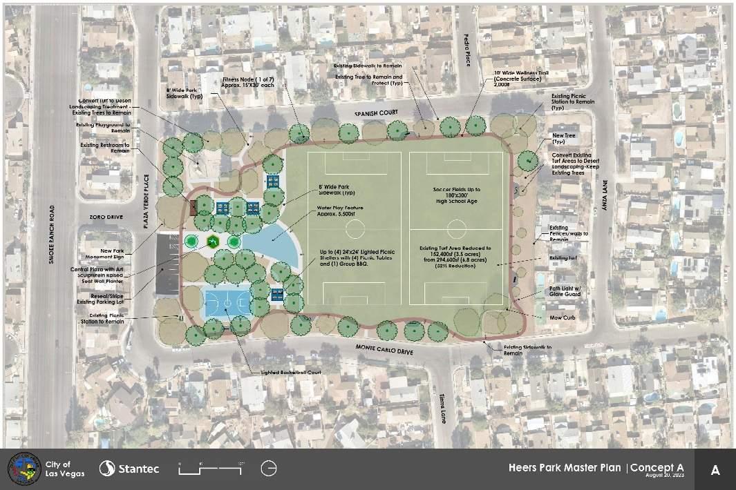
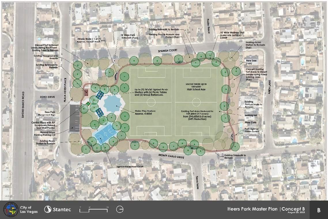
1. Concept A - $4,874,475
2. Concept B - $4.835,650
Heers Park
and Schematic Design Summary Report
1. Concept A - $4,874,475
2. Concept B - $4.835,650

ROUND ROCK PREMIUM OUTLETS WATERFALL AREA RENOVATION
Type: Shopping Mall Renovation
Location: Round Rock, Texas
Phase: Construction Documentation & Bid Set Documents
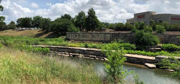
Designed with Hill Country Landscapes in mind, the goal of the refresher project is to improve aging amenities, respond to evolving needs of the development, and breathe new life into the landscape. Emphasis will be placed on updating infrastructure to meet current codes and standards and increasing opportunities for recreation while preserving desirable characteristics of the open space such as the mature tree canopy.
LANDSCAPE
Working Examples from Bid Set Documents


Enlargement Planting Plan
2.1 SCOPE OF WORK FOR THE WATERFALL AREA RENOVATION
Project Overview: The Waterfall Area Renovation project involves the design and construction activities necessary to refurbish and enhance the existing waterfall area.
The scope includes, but is not limited to, the following tasks:
1. Concrete Paving and Joints:
o Refurbishment of existing concrete paving.
o Repair and sealing of joints to ensure durability and aesthetic appeal.
2. Guardrails:
o Refurbishment of existing guardrails to meet safety standards and improve visual appearance.
3. Water Feature Area:
o Masonry repair around the water feature area.
o Inspection, repair, or replacement of water feature pumps to ensure proper functionality.
o Waterproofing measures to prevent leaks and ensure longevity.
4. Electrical:
o Upgrading or repairing electrical systems associated with the water feature and surrounding area.
o Ensuring all electrical work complies with current safety standards and regulations.
5. Planting and Irrigation:
o Installation of new plants and landscaping within the designated work limits as shown on the plans.
o Design and installation of an efficient irrigation system to support the new plantings.
General Requirements:
• All work must be performed in accordance with the provided plans and specifications.
• Contractors must obtain all necessary permits and approvals before commencing work.
• The site must be kept clean and safe throughout the duration of the project.
• Contractors are responsible for the disposal of all debris and waste materials in compliance with local regulations.
• Regular progress reports and site meetings will be required to ensure the project stays on schedule and within budget.
Deliverables:
• Detailed design plans and specifications for all refurbishment and installation work.
• A comprehensive schedule outlining the timeline for each phase of the project.
• Final inspection and approval of all completed work to ensure it meets the specified standards.
Creighton ES & Ford ES Gym Additions and Critical
2.2 SCHEDULE
1 - GENERAL
A pre-bid meeting for this project held at 10:00a.m. on Thursday August 22nd 2024 on Teams Virtual Meeting. A pre-bid meeting invite will be sent with bid documents. Topics of discussion at the meeting will be proposed scope of work, schedule, requirements, and contractor expectations; at this time any questions regarding the project will be answered.
SUMMARY
A. Section Includes 1. Watering trees.
Monitoring adjustment and minor repair of the landscape irrigation system.
Pruning and trimming of plant material.
Weed, cultivating and cleaning of planting beds.
Application of fertilizers, insecticides, and herbicides.
General site cleanup removal of trash and products of maintenance.
Extra services as needed.
Landscape rodent control.
Submittal to Owner of maintenance instructions.
B. Related Sections
Planting - Section 32 93
A. All services not covered under this contract shall be considered "extra services" and will be charged for separately according to the nature of the item of work. The consent and authorization of the Owner or their authorized representative must be obtained prior to the performance or installation of such "extra services" items and prior to purchase of any chargeable materials.
B. Such work may include replacement of dead plant materials, major repairs of irrigation system, by-products of vandalism or other contracts or other site related work.
1.3 MAINTENANCE REQUIREMENTS
A. Begin maintenance after each plant and lawn portion is installed.
B. Maintenance period shall begin upon inspection and approval at Substantial Completion of the entire project and shall be for a minimum of ninety (90) days or until Final Acceptance, whichever is longer. Partial substantial completion will not be given for portions of the project that may be completed ahead of the entire project.
C. Sprinkler Irrigation System: Maintenance of the sprinkler irrigation system shall consist of monitoring and adjustment of the duration and frequency of the watering schedule, adjustment of heads for coverage and elevation, repair of leaks in both mains and lateral lines and all other work required to establish a complete working sprinkler irrigation system.
D. Trees, Shrubs, Groundcovers and Vines:
Working Examples from Bid Set Documents
4.
3.
2.
Cost
correct.
5. The Bidder agrees to abide by the terms of this Bid Proposal for a period of Thirty (30) days from the Bid date and agrees that this Bid may be accepted by the Owner at any time before the expiration of that period. The Bid Proposal and the Owner's acceptance of
MANOR ISD ELEMENTARY SCHOOL RENOVATION
Type: School Renovation
Location: Manor, Texas
Phase: Construction Documentation & Construction Administration
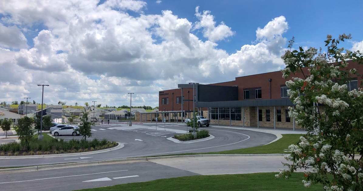
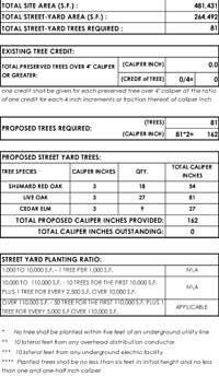
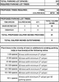
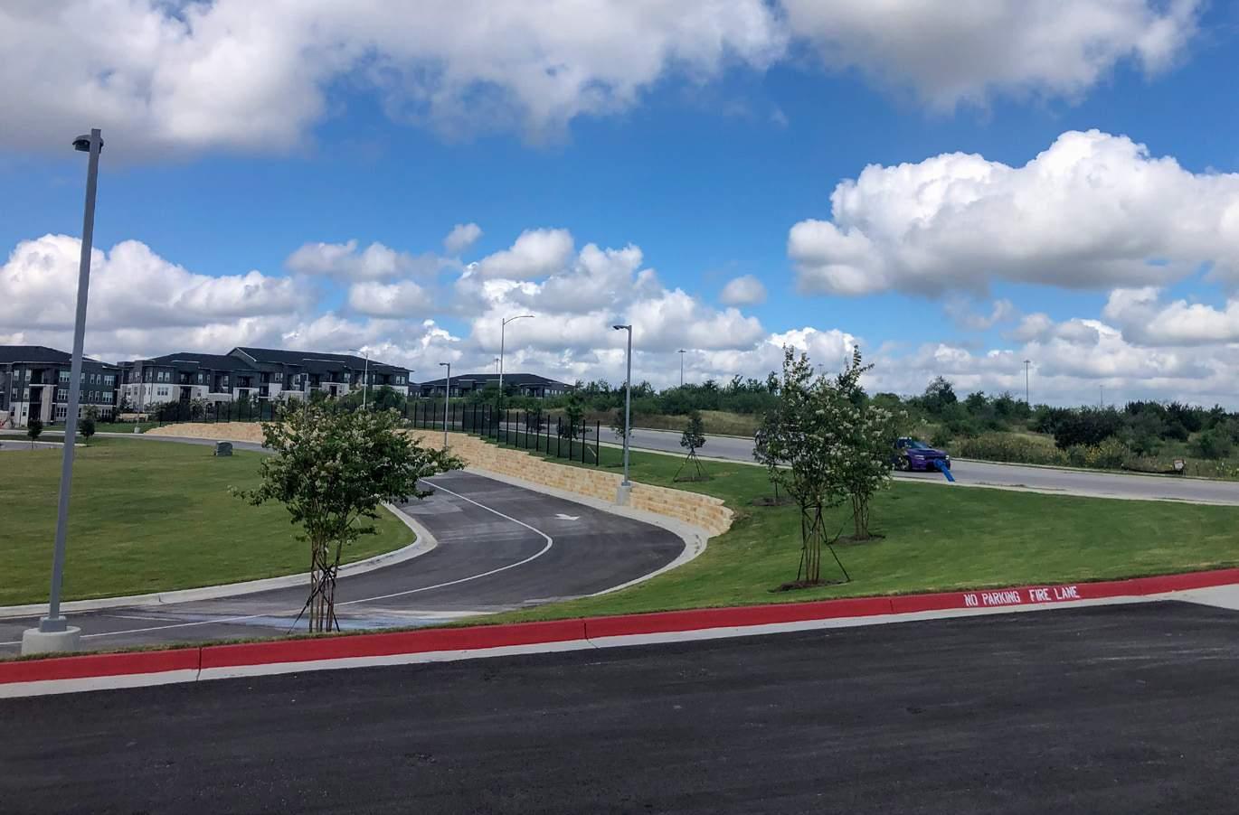
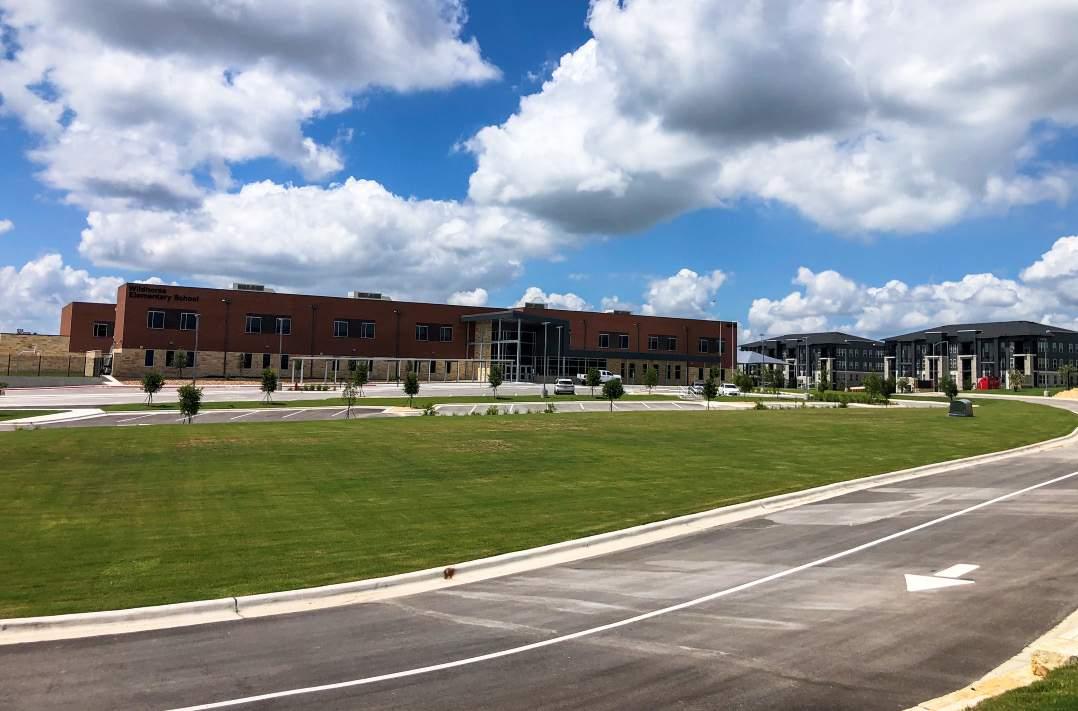
By meeting the Landscape Architecture requirements for tree mitigation, street yard buffering, parking lot screening, and parking lot tree placement as requested by the Manor Independent School District, the design enhances the aesthetic appeal of Manor Elementary School No. 10. The landscape design contributes to a visually pleasing environment while ensuring compliance with district standards.
Working Examples from Construction Documents


Planting Plan City Ordinance Compliance and Planting Schedule
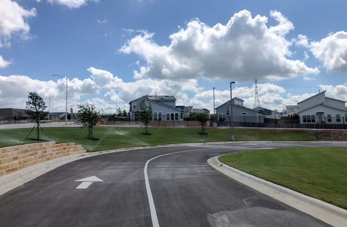
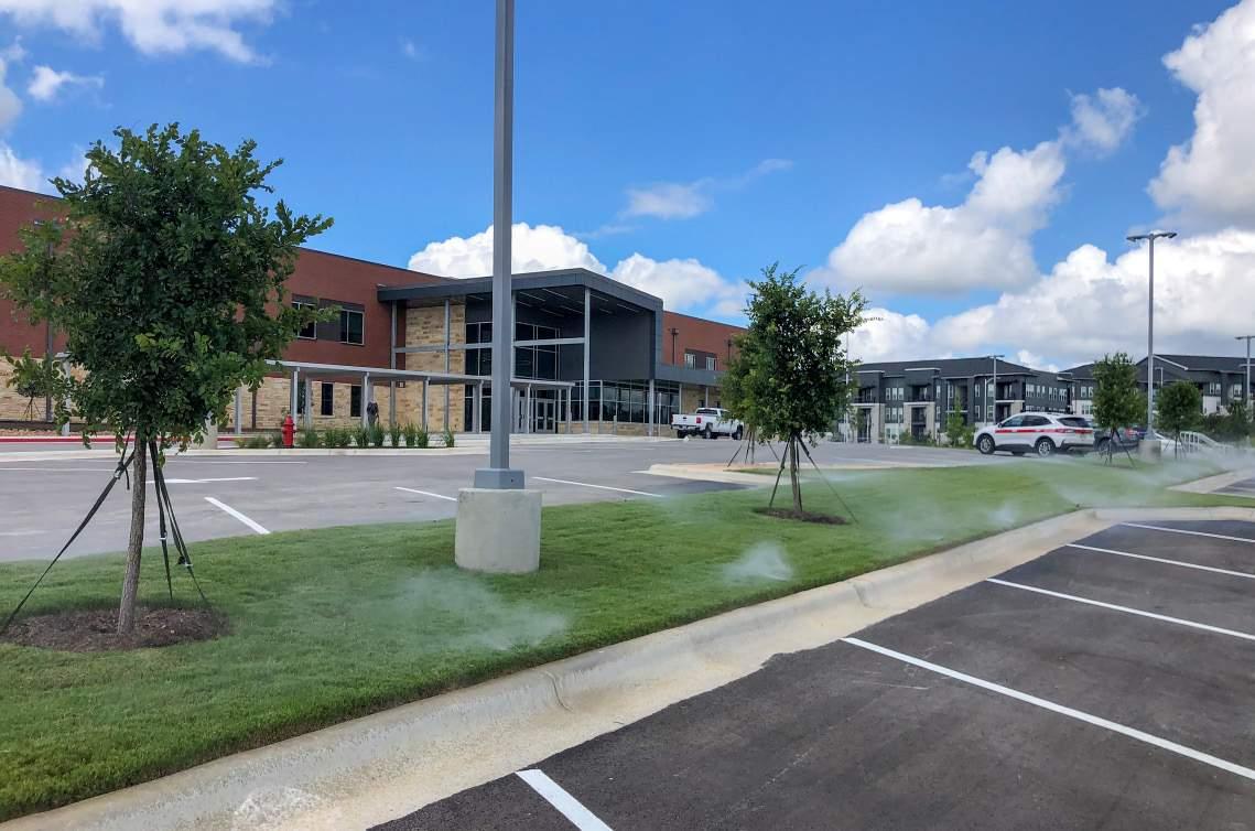
Parking Lot Entrance
View from Driveway
View to Main Entrance
Parking Lot
Working Examples from Construction Documents
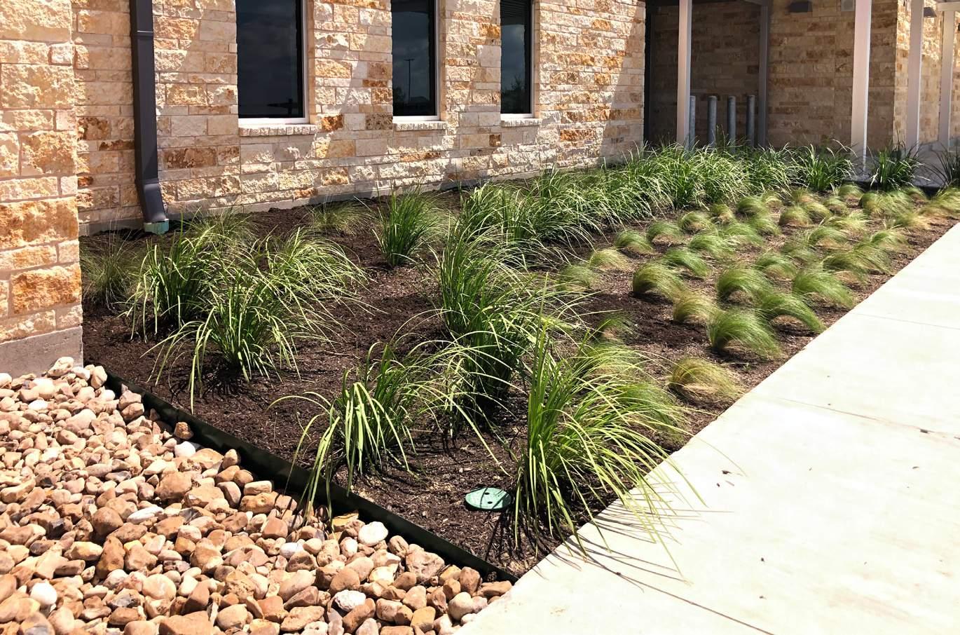
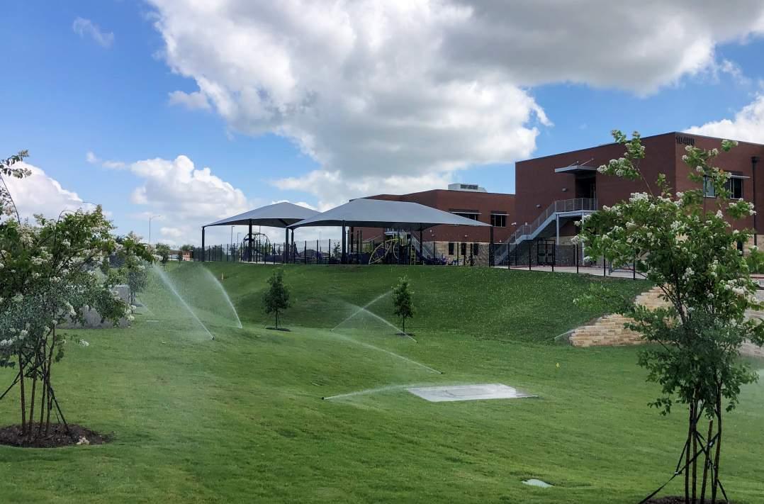

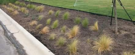
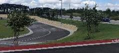
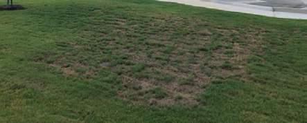
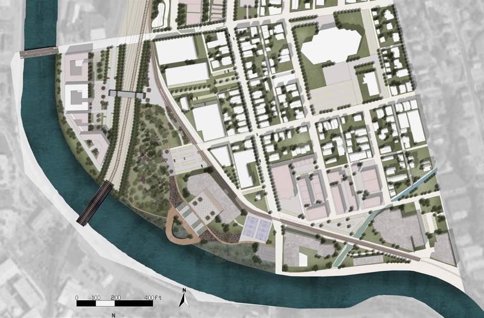
Repurposing A Deindestrialized Cityscape
Type: Urban Design
Size: 119 acres
Location: Johnstown, Pennsylvania
Time: 2019.1 - 2019.5
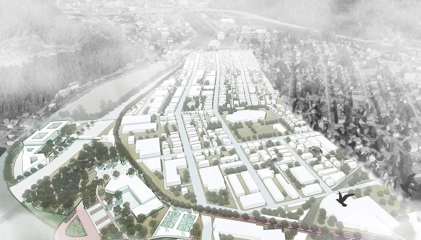
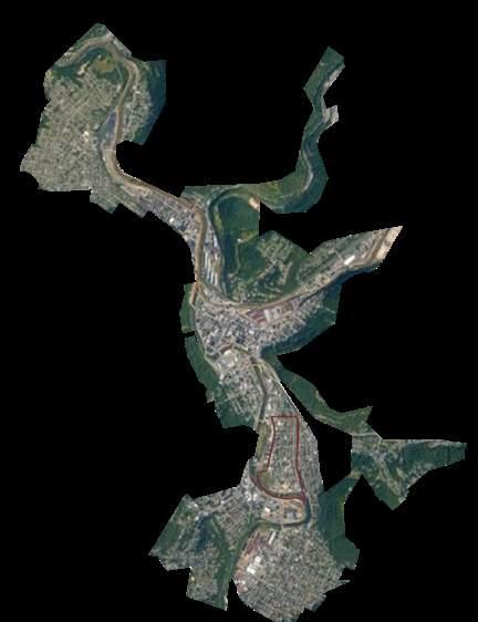
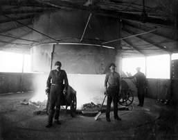
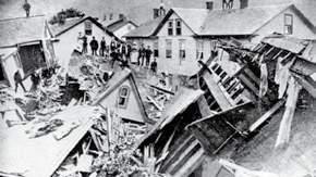
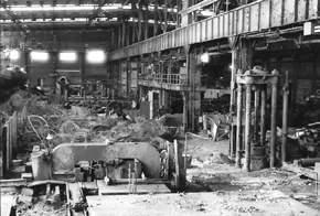
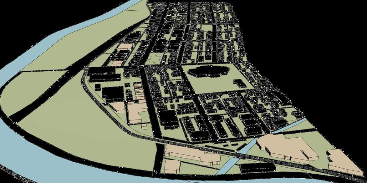
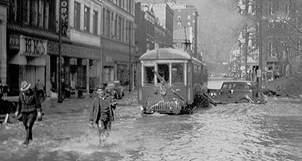
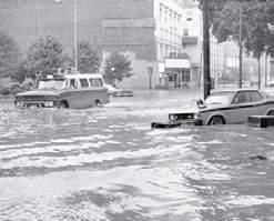
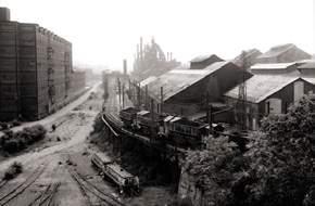
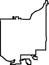
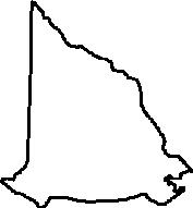
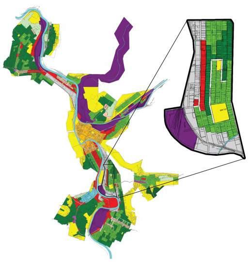
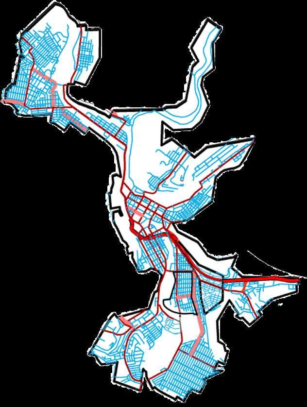
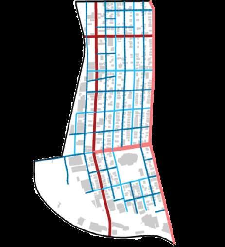
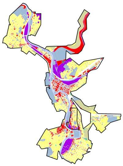
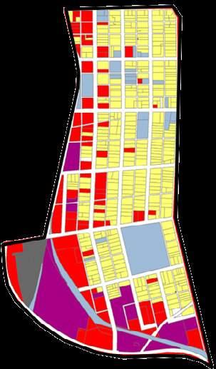
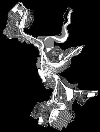
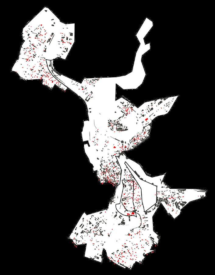
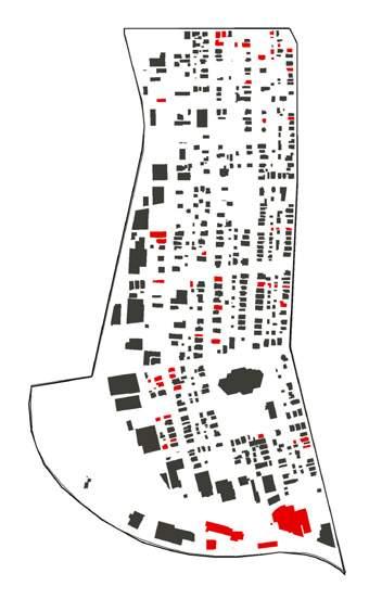
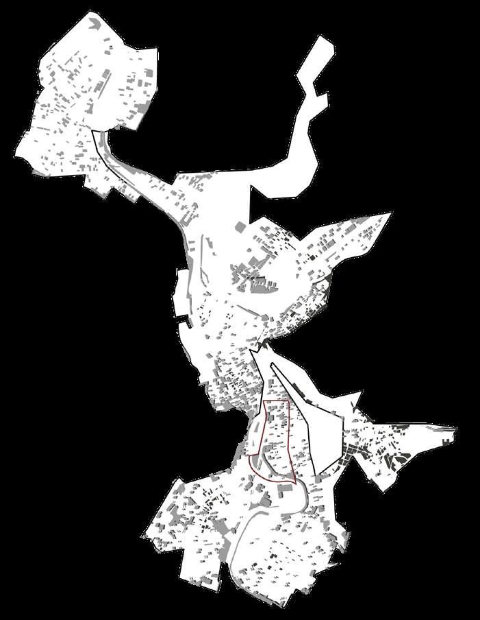
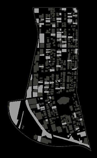
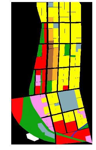
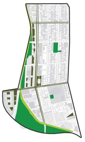
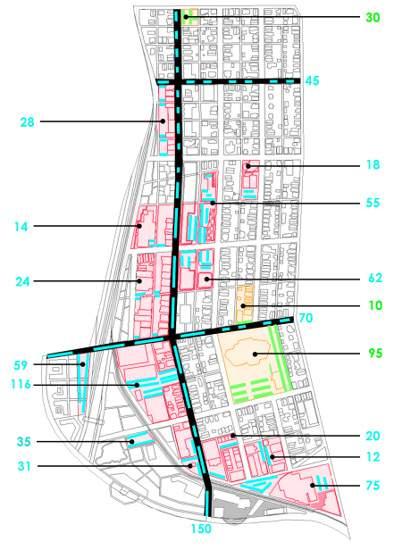
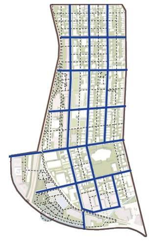
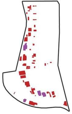
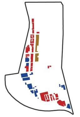
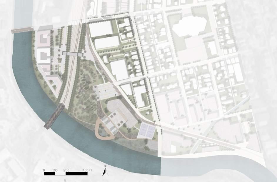
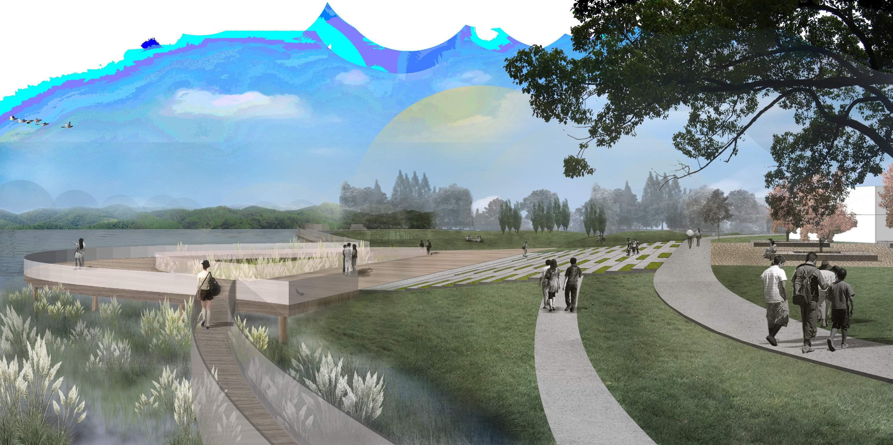
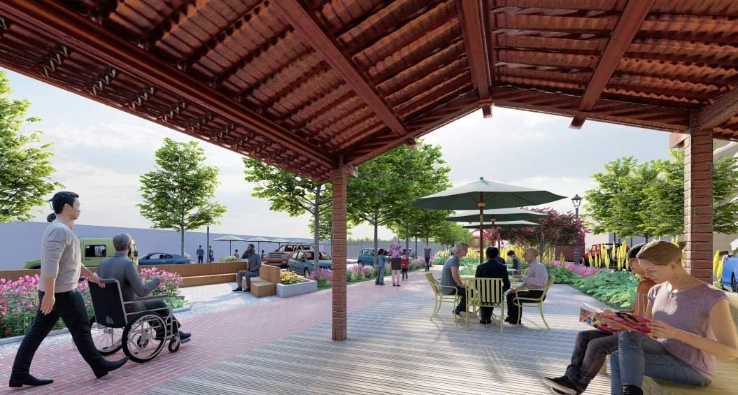
The site is in Johnstown along the Conemaugh River. Due to regional economic shifts and deindustrialization, communities in Johnstown are characterized by high rates of unemployment, crime, and abandonment. Based on site analysis on historic factors
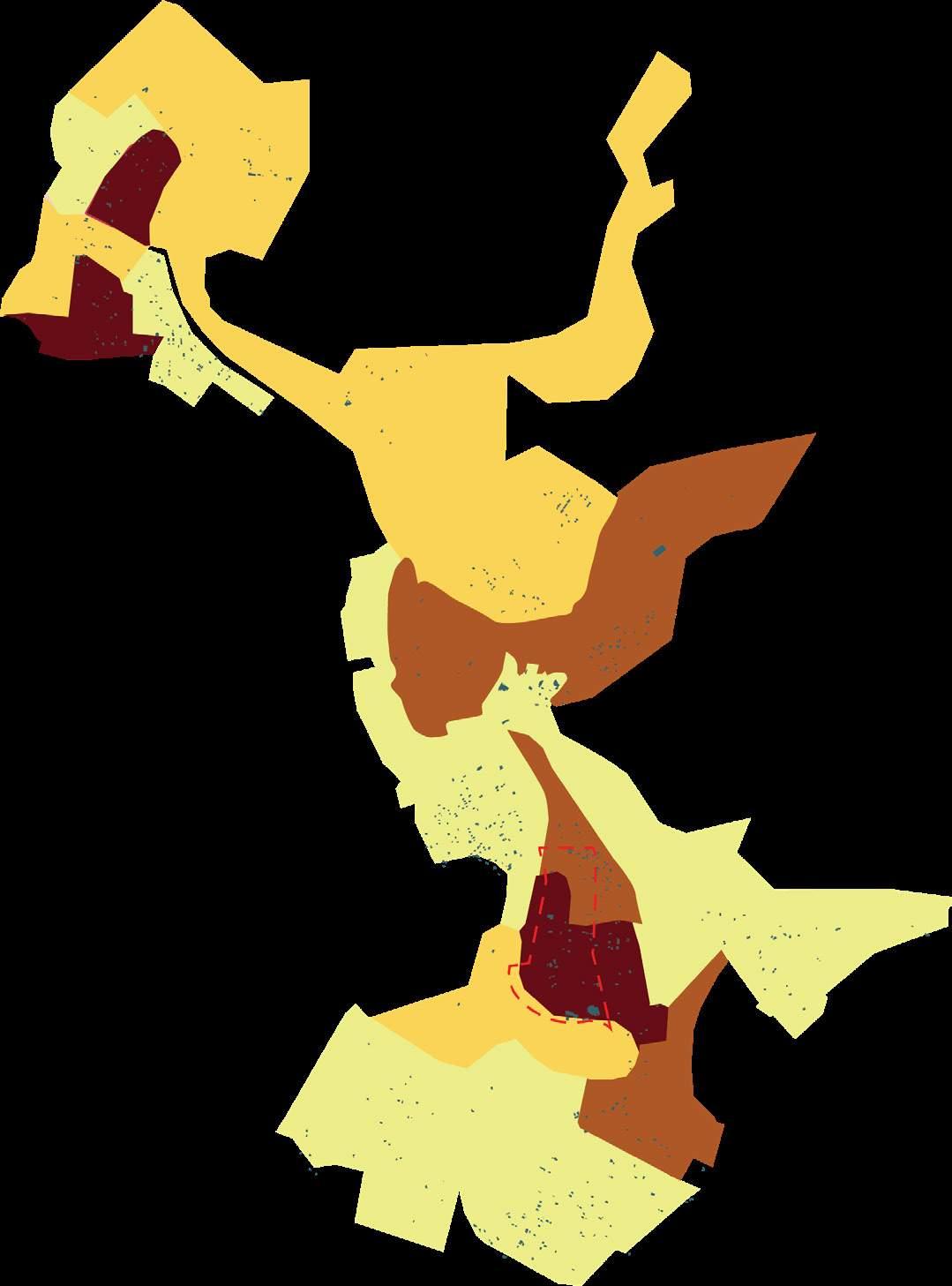
affecting population, crime in correlation to abandonment and vacancy, the existing conditions, and the suitability analysis. A set of design strategy is created to encourage vibrant variations of use within Johnstown.
Population Changes & Timeline
Crime Contrast
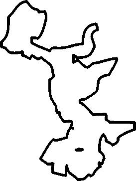
Collecting the data of total pupulation, analysing vacancy rate an number of victim and compared them to cities with similar situations.
Vacancy

Existing Section Analysis
Comparison Of Cities With Similar
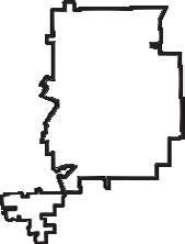

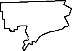

Comparison Of Cities With Similar


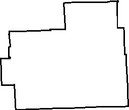


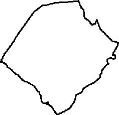





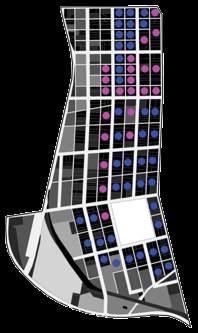
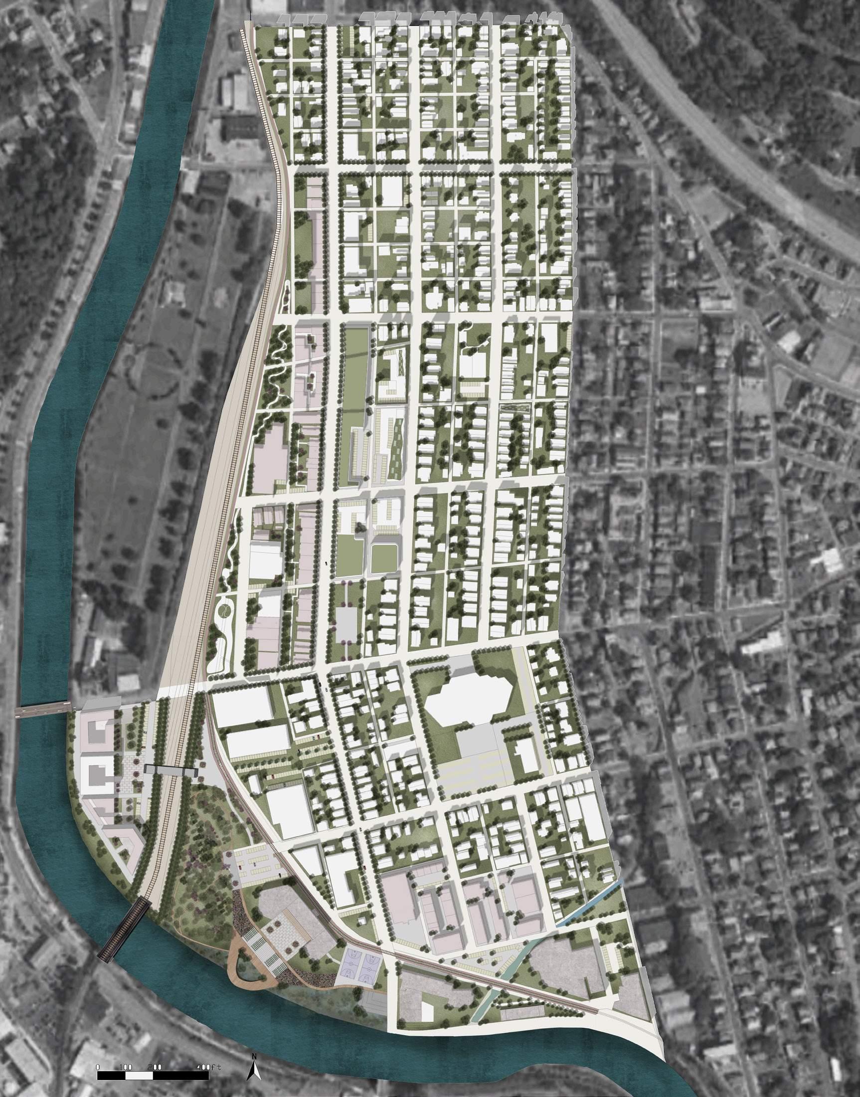
1. Art Studio
2. Music Venue
3. Hostel and Co-Op
4. Linear Park/Rail to Trail
5. Subsidized Business District
6. Co-Op Garden
7. Middle School
8. Youth Outreach Center
9. Wetland
10. Nature Trail
11. Hotels
12. Recreation Center
13. Basketball Courts
14. Office Buildings
15. Community Market
16. Mixed Use Development
17. Lofts/Condominiums
18. Skate Park
19. Community Garden
20. Apartments
21. Retail
22. Single Family Homes
23. Great Lawn
24. Retail Leisure Trail 25. Church
REDEVELOPMENT
OF DOWNTOWN BRYAN
Type: Urban Redesign
Location: College Station, Texas
Area: 55 acres
Time: 2020.08 - 2021.04
The goal of this Final Study is to put forward a proposal for the redevelopment of downtown Bryan, Texas with principles of New Urbanism and Low Impact Development (LID), based on emerging planning, and development concepts such as mixed-use development, multi-modal transportation systems, and sustainable stormwater management.
Even though there are a few examples of New Urbanism and Low Impact Development in the Bryan/College Station metro area, most development in the region is designated as single-use development with conventional stormwater management design. Therefore, it is necessary to demonstrate the benefits of New Urbanism, LID to the Bryan/College Station area through a conceptual project for the north end of downtown Bryan, Texas to demonstrate the application of these ideas locally.
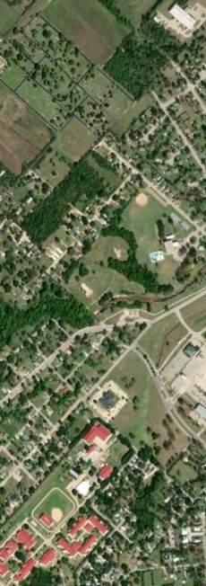
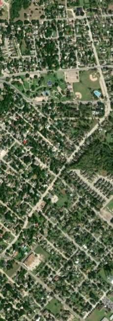
Texas State in the U.S Brazos County in Texas Bryan-College Station Metropolitan Area in Brazos
Downtown Bryan in Bryan-College Station Metropolitan Area
Bryan is a city and county seat of Brazos County, Texas State, U.S., which borders the city of College Station to its south. They are known as the Bryan College Station metropolitan area together, located in the heart of the Brazos Valley (East and Central Texas).
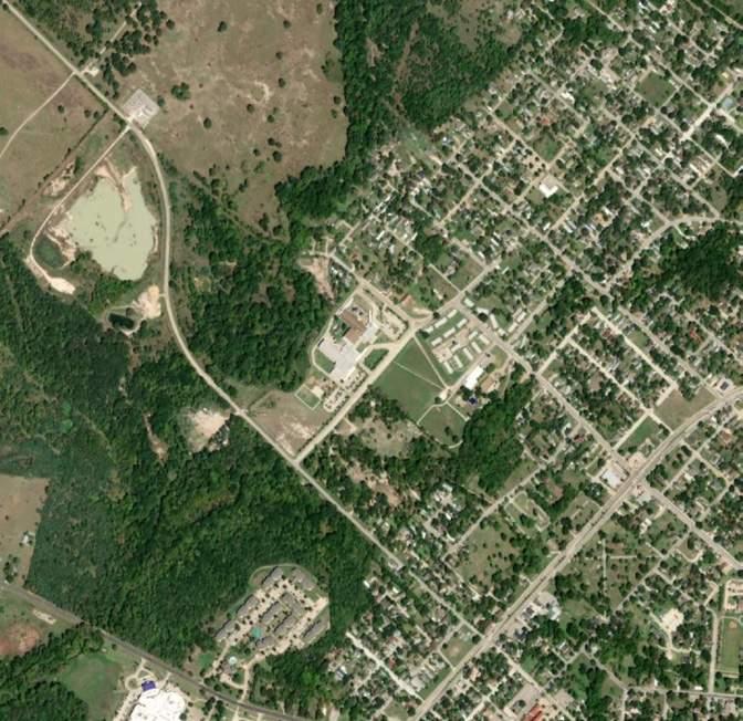
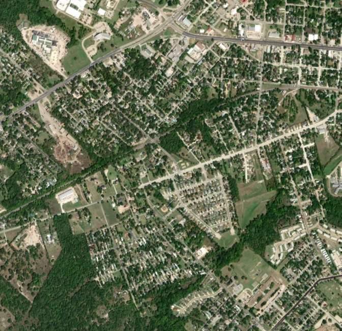
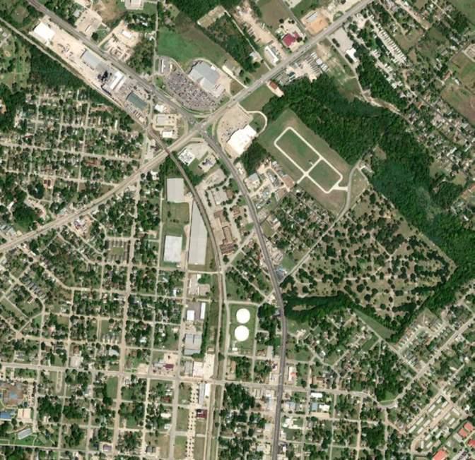
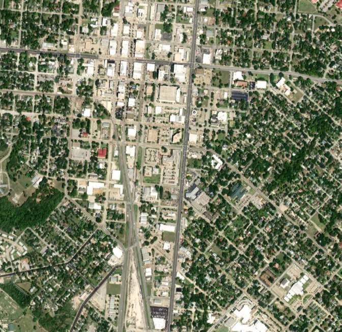
The project is located in Downtown Bryan, the heart of Brazos County with an area of around 55 acres.
Downtown Bryan is approximately 5 miles away from Texas A&M University, the largest university in Texas, and it offers many attractions to students attending TAMU.
Building Uses & Landmarks
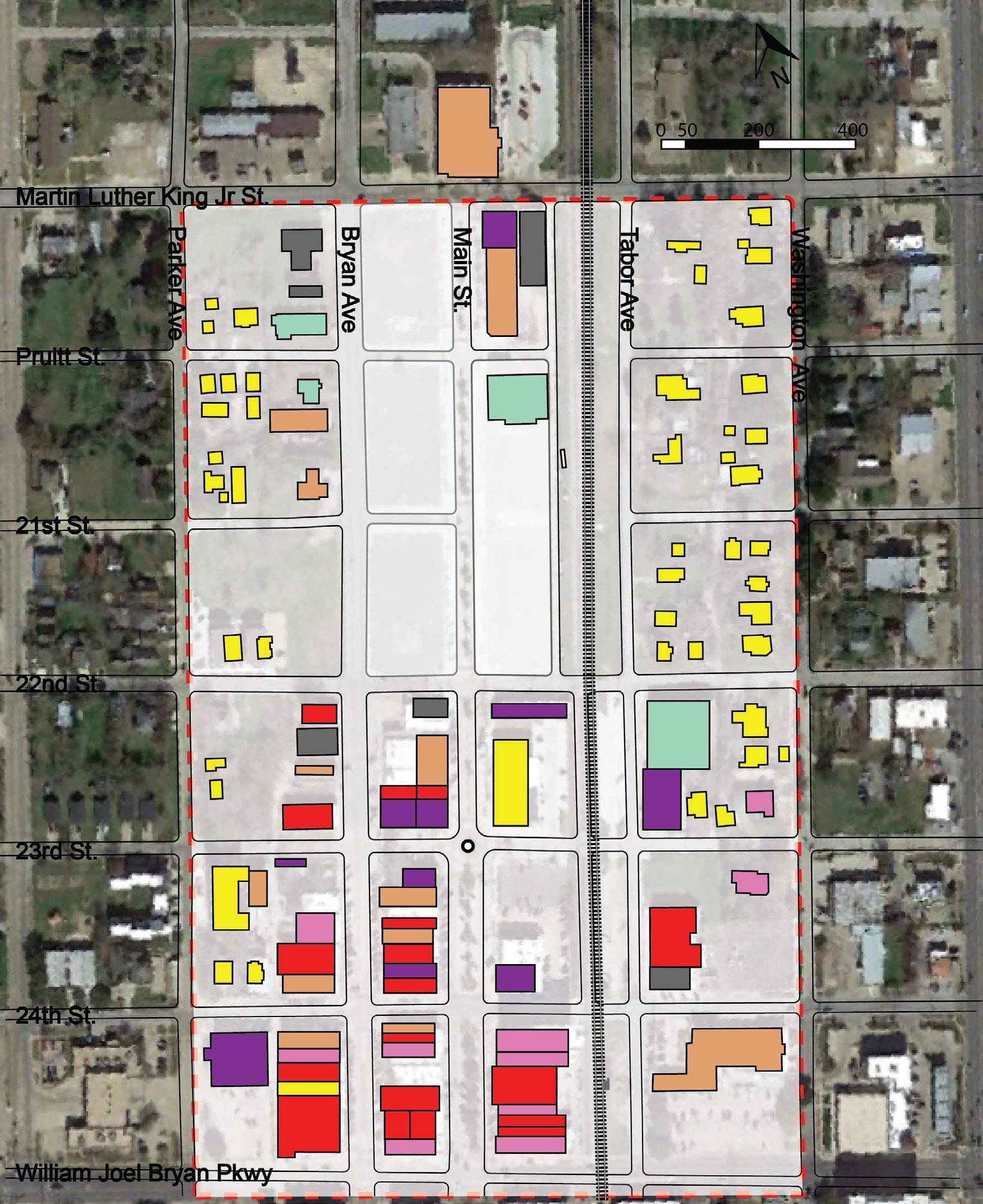
The building uses include 7 categories: retail, office, service, entertainment, institutional, residential and storage, most of which are retail and residential. Besides that, 4 blocks are currently vacant and lack of maintenance. Another 4 blocks are occupied with parking lots. Along the Main Street, 45° diagonal parking are occupying. In other words, there are potential making use of the vacant land and transferring parking space to develop a livable and walkable community with diverse events.
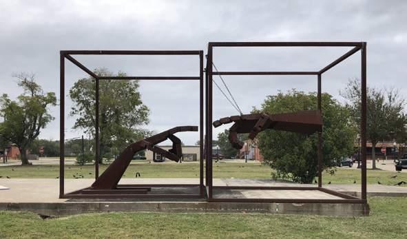
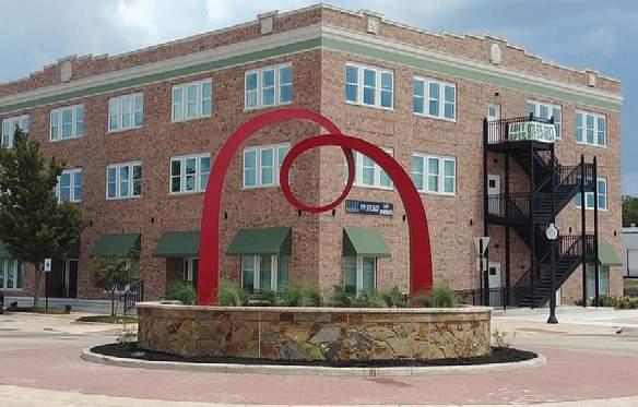
A contemporary art installation designed to fill that temporary void with an artistic intervention via community interactivity.
A public art works as a landmark at the intersection of the Main Street and the 23rd Street.
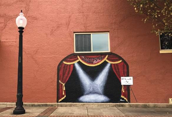
A wall painting involves visitors interacting with building.
ArtFill “Creation of Adam”
Arc de Luna
Community Theatre
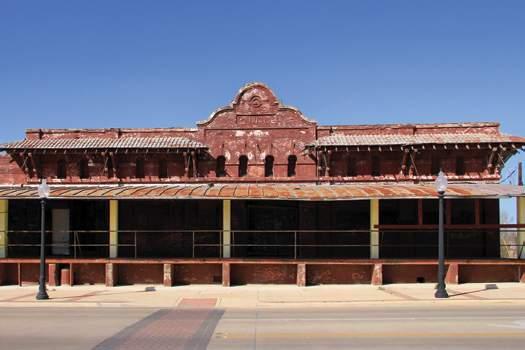
An example of Mission Revival style was constructed in 1912 for use as an ice house.
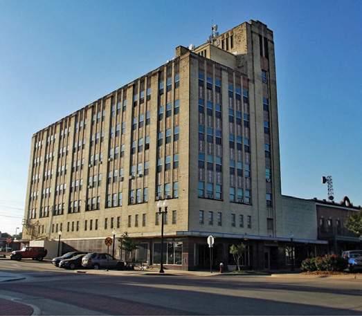
An Art Deco (Art Nouveau) commercial building was erected by Biagio Varisco, an emigrant from Italy.
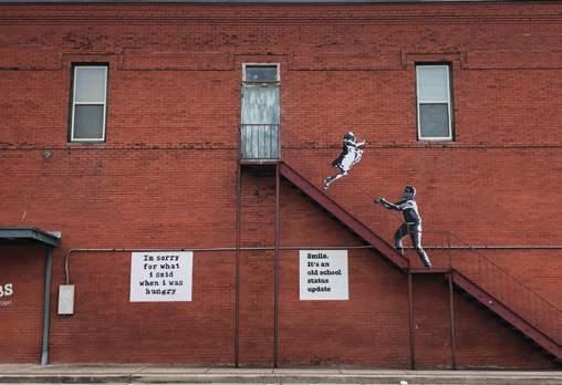
A wall painting involves visitors interacting with building.
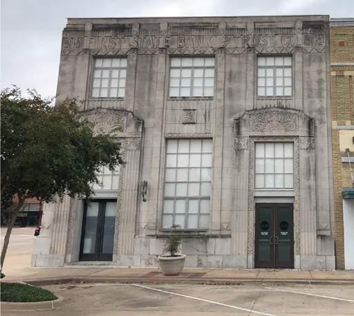
An Art Deco (Art Nouveau) style building constructed in 1930 for the First State Bank.
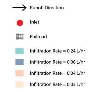
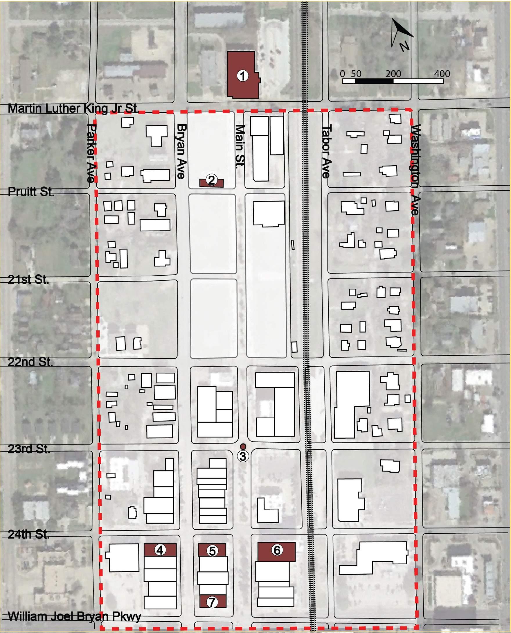
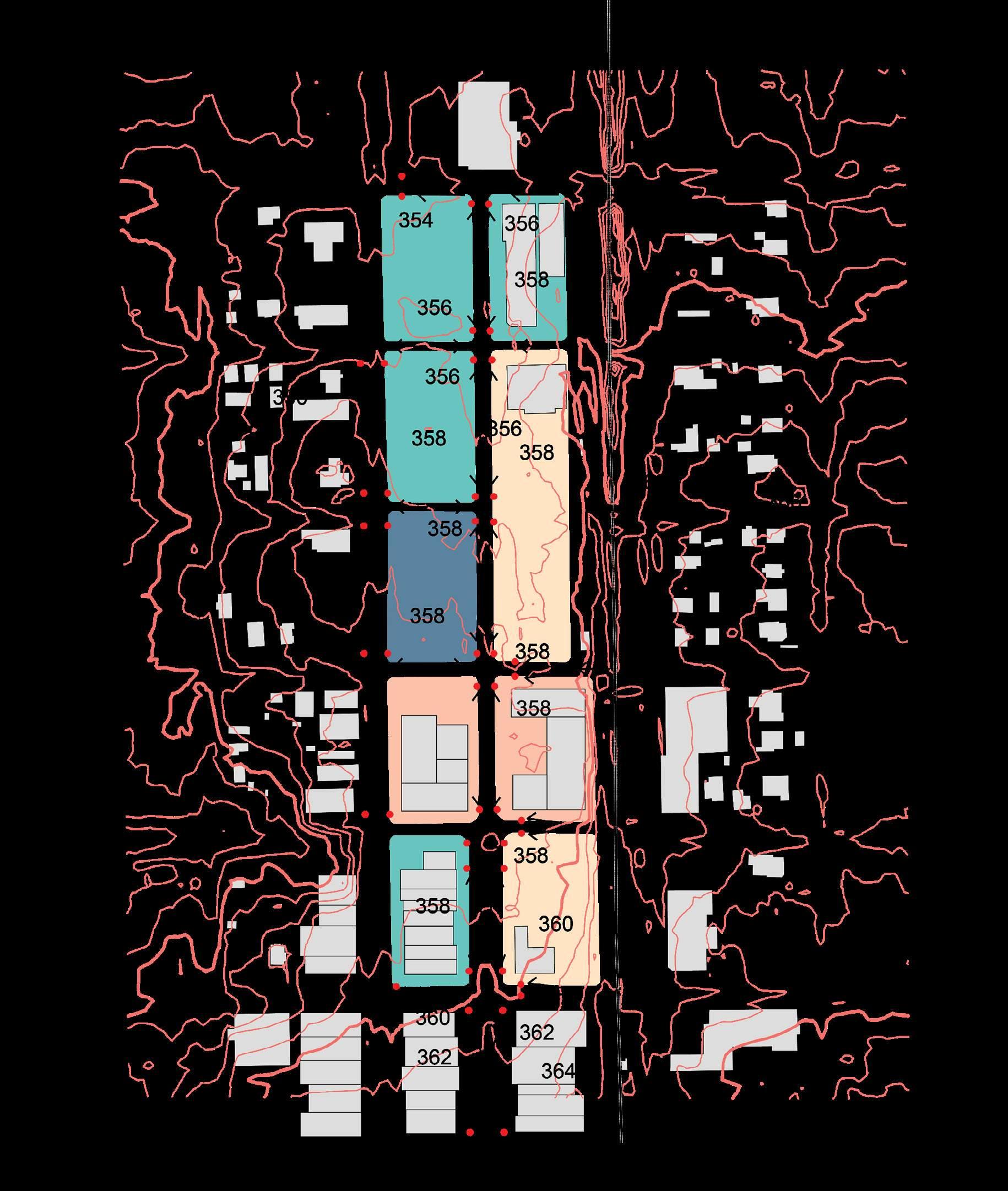
The contour line is showing interval of 2 feet. The high point of the site (HP) 374.3 feet is located at the Northeast Corner while the low point (LP) 344.3 feet is located at middle West block (between 22nd st. and 23rd st.). Overall, the drainage direction is from HP to LP (Northeast to West). Flow directions vary within each blocks, but runoff all gather at inlets either at the starting point or the end of the roads. Some inlets might be added because of the slope difference. The infiltration rate varies from 0.03L/hr to 0.24L/hr, which imply a good drainage status within each block. So Low Impact Development needs to be implemented with inlets to maintain the amount of runoff under new development.
The Ice House on Main Caffe Capri
First State Bank and Trust Building
The Varisco Building

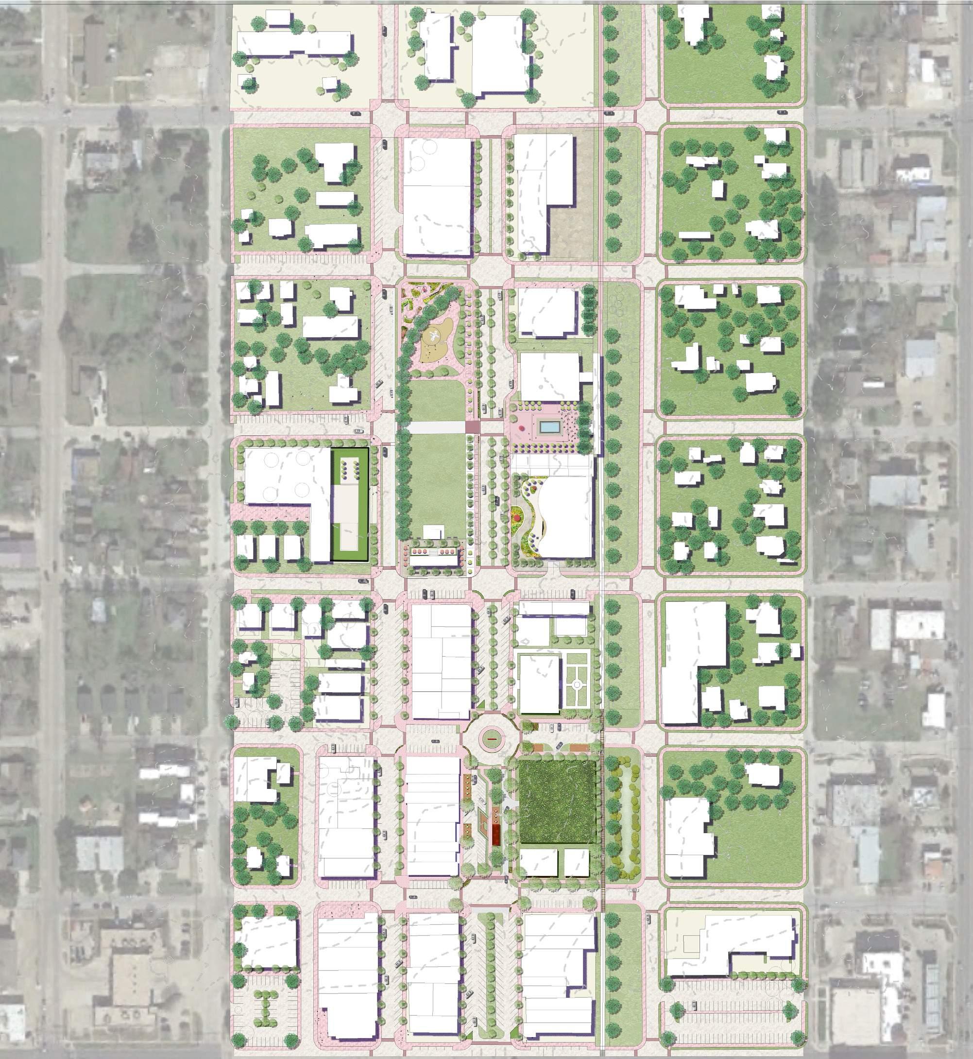
Legends
1. Ice House
2. Mixed-use Apartment
3. Iafcj Brayan Church
4. Flower Entrance
5. Art Walk
6. Playground
7. Market Lawn
8. The Great Lawn
9. Central Stage
10. Art Center (Intensive Green Roof)
11. Bryan Hotel (Intensive Green Roof)
12. AirBnB Apartments
13. Theme Restaurant
14. Transite Center
15. Station Plaza
16. Downtown Mall
17. Art of War (Bar)
18. Park Station Apartment
19. Art Sculpture
20. Rain Garden
22. Station Garage (Extensive Green Roof)
22. Bioswale
23. Stagecenter Community Theatre
24. Bryan Fire Department Station 1
25. Longhorn Tavern Steakhouse

Soil Type & Infiltration Rate Analysis
Boonville-Urban Land Complex
Zack-Urban Land Complex
Urban land
The whole site belongs to Urban land. This type of land consists of areas that are 75 to 100 percnt works and structures
Most of the rainfall run off and reach major drains rapidly.The soil have been altered and obscured to the extent that they can not be classified.
Flow Direction Analysis
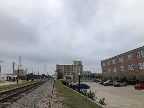
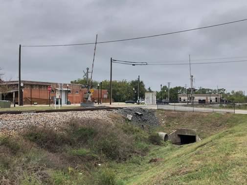
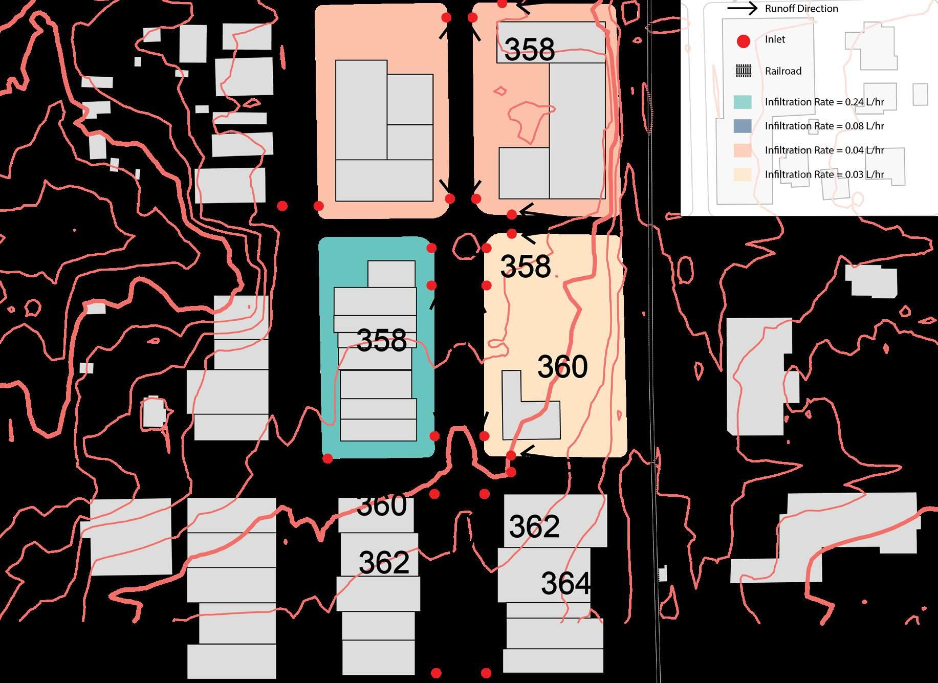
The contour line is showing interval of 2 feet. Overall, the drainage direction is from HP to LP (North-east to West).
Flow directions vary within different blocks, but basically runoff flows from center of the roads to the inlets at the edges.
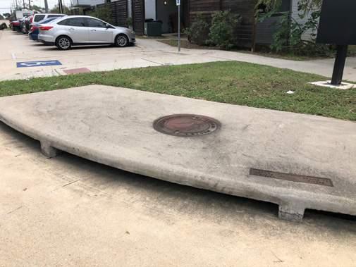
The inlets can be proposed with rain gardens, and the vacant land with slope next to railraod can be redesigned as bioswale.
24th St.
William Joel Bryan Pkwy
Inlets
Slope
Soil & Flow Analysis
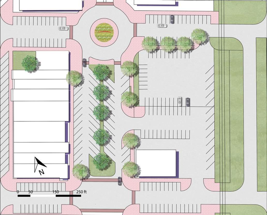
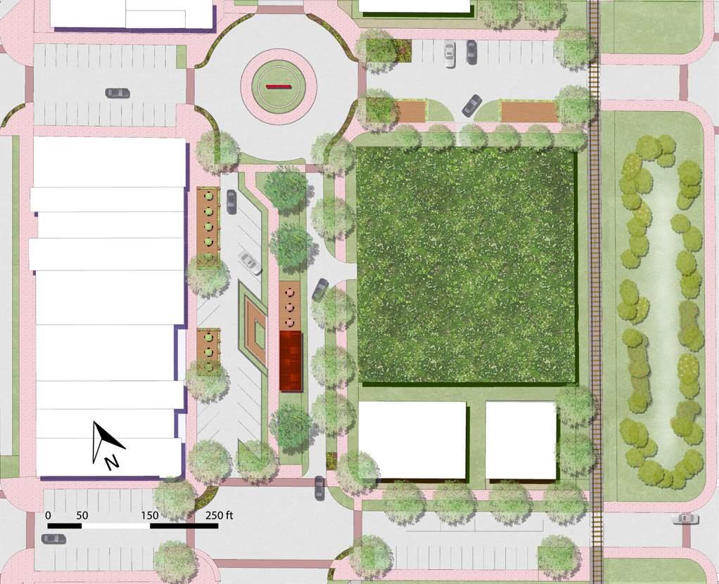
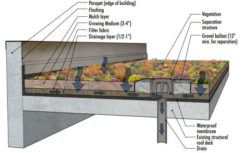
The extensive green wall with 3’’ deep is located on the proposed garage, temporarily stoarged a maximum runoff of 2,7474 cubic feet.
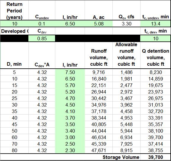
The need of runoff storage volume on pre-LID site is 39,700 cubic ft.
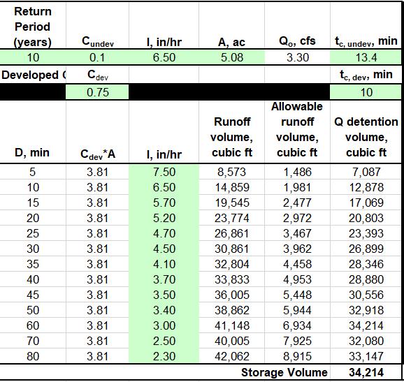
The need of runoff storage volume on LID implement site is 34,214 cubic ft.
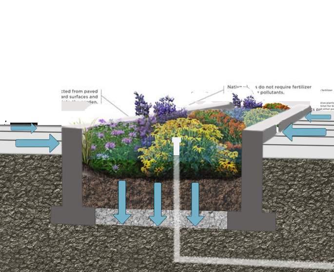
The rain garden is composed with local planting materials and the existing inlets, designed at the edges of the roads, not only improving the streetscape beauty but also storage the runoff.
3’’Extensive Green Roof
3’’Rain Garden
