
sample portfolio
by Zoe Mason - 2024

01.
Summary
Site Context
Design Strategies
02.
Summary
Project Context
Design Framework
03.


sample portfolio
by Zoe Mason - 2024

01.
Summary
Site Context
Design Strategies
02.
Summary
Project Context
Design Framework
03.

CONTACT DETAILS
zoe.anushca@gmail.com
027 526 7580
ABOUT ME
My name is Zoe, and I am currently studying to become a landscape architect, I have strong interest in hybrid spaces that support our wellbeing, enhance the local ecosystems, and improve climate resiliency. I have been developing my knowledge of plants through my current position as a Gardener, and enjoy helping others learn.
Architecture
4th Year Postgraduate
Student
ACHIEVEMENTS / AWARDS
2024
Global Landscape Architecture
Student Charrette Honours Award
Victoria University of Wellington (2024 - Present)
Bachelor of Architectural StudiesMajor in Landscape
Victoria University of Wellington (2021 - 2023)
PROFICIENCIES
• Auto CAD
• Rhino8
• ArcGIS Pro
• InDesign
• Photoshop
• Illustrator Masters of Landscape
2023
Coastal and Estuarine Research Federation Design Competition
Winner 2023
Te Tini a Rehua Excellence Award top Māori Undergraduate in the Faculty of Architecture & Design
2022
VUW Land-cult Limited Prize for top of Second year in Landscape Architecture
2021 - 2022 - 2023
Wellington Faculty of Architecture and Design Dean’s List
“Nature Home” or “Village in Nature.”
1. Embodying a “home within nature” that honours both the environment and living.
Typology: Housing Development
Location: Silverstream Road, Crofton Downs
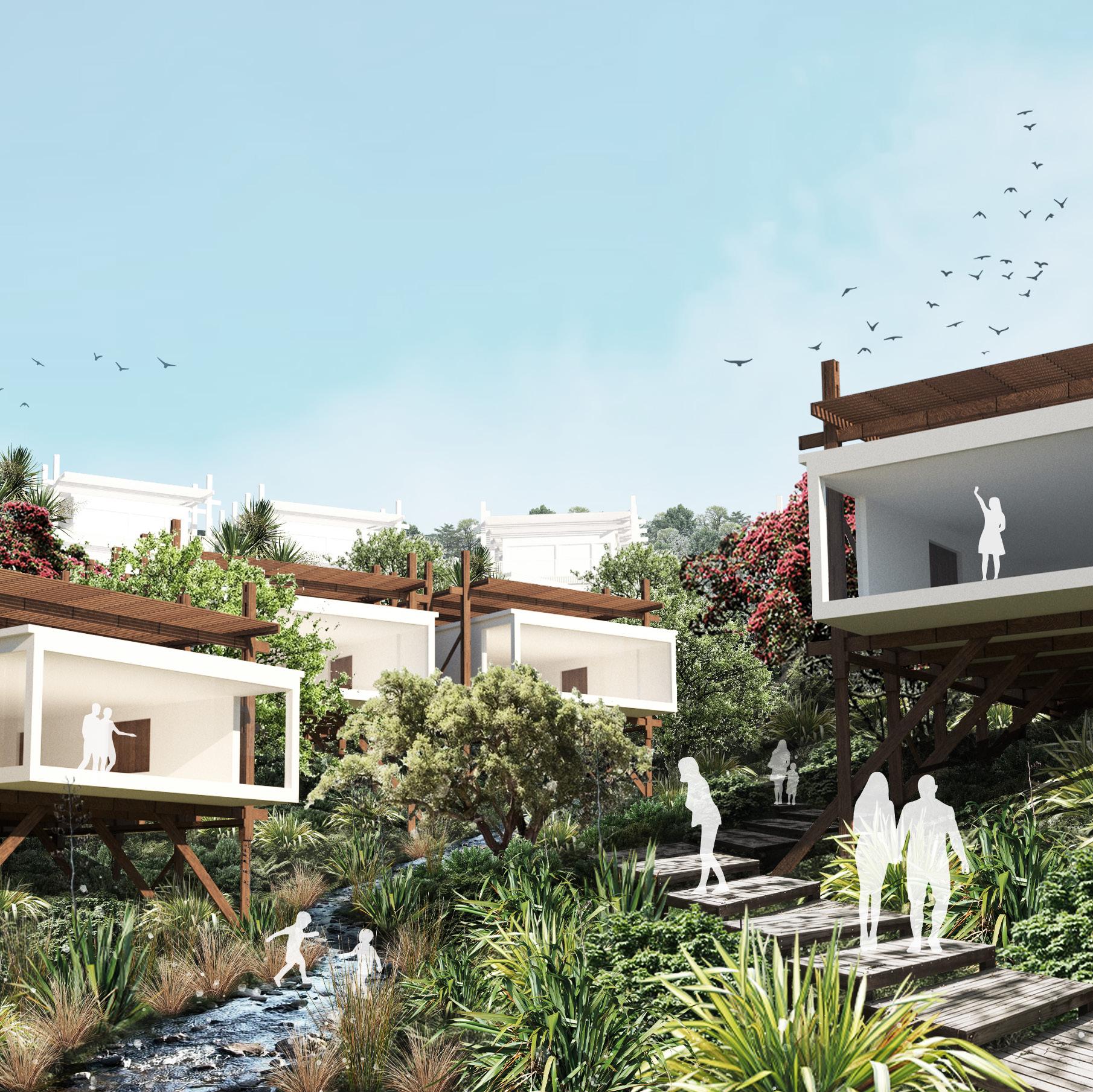
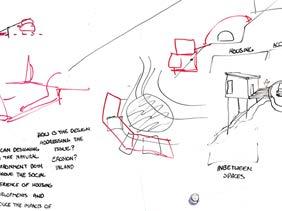
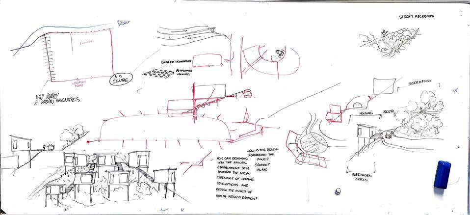
The Taiao Kāinga project examines the effects of humaninduced erosion on our natural environment, highlighting how typical housing developments in Aotearoa often disrupt natural systems; pushing streams and forests aside for conventional suburban layouts. This design proposes an alternative approach, embracing natural landforms and processes to support coexistence between built and natural environments.
The design aims to propose a papakāinga model of housing that works to create a way of living amongst nature, fostering kaitiakitanga of the land surrounding the individual houses.
The design prioritises the integration of communal spaces over traditional cul-de-sac layouts, and focuses on having the least amount of impact on the sites natural landform and environmental characteristics as a way to maintain and protect the land.
Stilted Housing
Communal Spaces
Board-walk Pathways
Inland erosion is a significant environmental concern in Aotearoa , where steep topography, deforestation, and human activities exacerbate the frequency of landslides, slope failures, and other forms of soil displacement. As a natural process driven by forces such as water, wind, gravity, and human intervention, erosion has implications for both the built and natural environments.

Erosion Zones are Uphill of Residential Areas


of Erosion Zones are Covered in Grasslands

Topic Research:


%
Erosion Zones are covered by Exotic Scrub
Erosion Zones have a Slope of >25°




2014 Site Landform
The end of Silverstream rd was close to its natural state, with a 100-meter access road along the stream. The land was covered with exotic species like gorse and broom, with patches of native forest on the eastern side. The stream maintained its natural alignment in the gully.

2020 Site Landform
The 2020 contour data shows that 48 dwellings were completed, with construction extending into the northern gully and progressing upstream. Three significant slopes of concern were created, each with a 40-meter gradient at a 35-degree angle in order to flatten the site.
The current development has altered an estimate of 2,849,294m³ of soil for 114 land parcels. I aim to explore a concept that reduces human-induced erosion, harmonising residential areas with natural landforms to foster a closer connection with the environment.
Masterplan:
Natural Stream Formation Maintained and Riparian Planting Restored
Communal Spaces Incorporating Nature Play Spaces, Seating Areas, and Gathering Spaces
Lanes Split in Elevation to Maintain Natural Slope with Minimal Alteration
Pedestrian Pathways to Connect Housing, Transport Amenities, and Communal Areas

Bridging Over Stream Systems
Project Strategies:
Stilted Housing Communal Spaces Conveyor Transport Shared Car System Split Road Elevations Board-walk Pathways
Design Systems:
Key:

Key:
: Road Lanes
: Car Share Spots
: Stream System
: Site Boundary
: Conveyors
: Pedestrian Paths
: Stream System
: Site Boundary
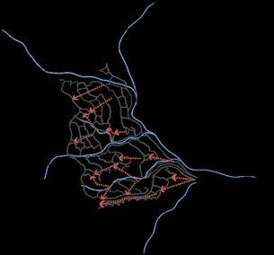
The design prioritises public transport, pedestrian access, and shared car systems to reduce reliance on private vehicles and minimize environmental impact.
The design features pedestrian and cyclefriendly infrastructure and a conveyor cart system to assist the less able to traversing the natural landform of the site.
Key:
: Space Catchment
: Communal Spaces
: Stream System
: Site Boundary
Communal Spaces Catchment
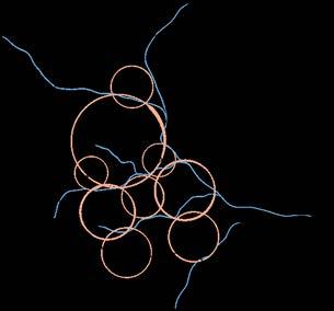
The design creates a balance between nature and community, integrating green communal areas to foster social interaction, active living, and a sense of belonging.


Communal Spaces Incorporating
Nature Play Spaces, Seating Areas, and Gathering Spaces
Stilt Housing and Raised Paths Allow the Natural Landform to Flow and be Stabilised with Planting
Pedestrian Pathways Connecting Housing, Transport Amenities, and Communal Areas






Conveyor Transport

“Restoring the Life-force of the Land.”
1. Reconnection of People, History, and Nature to restore the Mauri of the land of Mātai Moana.
Typology: Eco-sanctuary / Heritage Reserve
Location: Mātai Moana, Miramar
This project focuses on restoring the mauri (life force) of Mātai Moana, Te Motu Kairangi (Miramar), through ecological restoration and community engagement. The project aims to create an eco-sanctuary and historic reserve that reconnects people with the land, its history, and with nature.
The design focuses on the intangible stories of the land focusing on honouring the history of site and what has happened prior; the idea of this concept is to educate people on the layers of Māori, Military, and Crown heritage that lies amongst the site with a strong focus on the Māori heritage. Incorporating subtle design to bring awareness to the historic pā and kāinga sites. Working closely with the local community groups of Miramar, the project develops the concept bringing the wants and ideas of the local users of the area into our design through a series of interactive workshops.

N Mātai Moana has a complex depth of Māori, Military and Crown Heritage with bunkers scattered around the site.
The Māori heritage is less prevalent on the land due to the years of it being removed and trampled by cows.
The site offers many ecological possibilities with its location within the harbour being a key spot of penguin habitat and birds nesting due to it being predator free.

3 public workshops were held to gather design input and information. The area is a local treasure and many people were passionate about it becoming a public amenity.


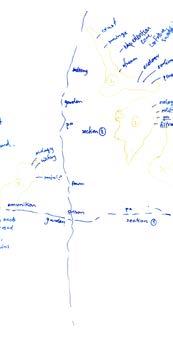
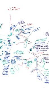
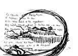

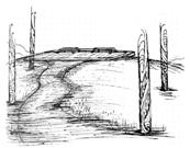
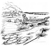


The Mātai Moana area has a complex history, marked by political tensions between two local iwi and the Wellington City Council over the site’s ownership. For 40 years, proposed housing developments have been met with opposition from one iwi, while the other iwi supports them. Many iwi representatives and locals advocate for the site to be an official public amenity due to its cultural heritage and ecological significance as one of the last patches of vegetation on Miramar. The site also serves as a key landmark for Wellington. This project aims to develop a design that reflects the community’s needs.
My cohort worked in pairs to create individual proposals, and this project is now being continued by Carles Martinez Almoyna Gual, with whom I am collaborating as a research assistant to help develop a final consensus design for proposing to the local councils and iwi. Project Website here

Project Framework:
Whakapapa represents the genealogy linking people to their ancestors and the land. This strategy designs the landscape to reflect stories and legends, honor Mātai Moana’s historical timeline, and reveal hidden histories.
Mauri is the life force in all living things. This strategy focuses on restoring the marine reserve, streams, and forests, enhancing native species populations, and connecting healthy ecosystems to restore the land’s vitality in a new eco-sanctuary.
Fostering guardianship over the land, encoraging community stewardship of the land to reduce waste, reuse demolition materials and felled pines, to be repurposed for community spaces, helping preserve the land for future generations.
Whenua represents land with ancestral and spiritual significance. This strategy involves creating a network of paths and roads and establishing learning centres to strengthen the connection between people and their land.
Kotahitanga & Whanaugatanga
Kotahitanga and whanaungatanga emphasise unity and community kinship. Focuses on expanding groups to restore the land and developing a phased design and management plan to foster unity, collective responsibility, and community identity.
Circulation Diagram:
Key: N
: Walking Pathways
: Nature Pathways
: Military Road Pathway (Accessiable, Bike, and Maintenance Access)
: Oneway Coasal Road
: Refurbished Pathways
: New Pathways
: Matariki/Star Gazing Area
: Māori Significant Sites
: Military Structures
: Entrances
: Art Centre
: Education Centres
: Resturants
: Ocean Access
: Bus Stop
: Pedestrian Route
: Bike Route
Ridgeline Tracks
Begin Native Pioneer Planting & Develop Track Connections
Military Road
New Bush Tracks
Roundabout Construction
Historic Ammunition Store Artwork & Planting
Establish a one-way road and begin felling pines
Entrance Carving
Community Involvement
Planting & Weeding:
Te Motu Kairangi Ecological Restoration
Predator Free Miramar
Forest & Bird
Track Connections:
Miramar Track Project
Plant Understory Plants
Kelp Forest Restoration
Begin riprap coastline restoration and construction of whakapapa sites
Move Farm Fences Historic Women’s Prison Site Development
Specific pine felling advisors:
Te Motu Kairangi Ecological Restoration
Management of fence relocation: Lance and Henri (Farmers)
Painting on Some Historic Ammunition Stores:
Local Schools
Local Māori Artists
Entrance Carving
Local Māori Artists
Re-design the prison into a significant community education facility
Reuse Demolition materials and Pine
Coastline management: Mountains to Sea Places for Penguins
Love Rimu-rimu
Kelp forest restoration: Mountains to Sea
Love Rimu-rimu
Māori Whakapapa Site Development:
Local Māori Artists
Mana Whenua
Tangata Whenua
Taranaki Whānui
Women’s Prison Site Garden Development :
Prison Garden Community Group
Educational Facility Construction:
Local Schools
Local Māori Artists
Transforming Demolition Materials and Pine:
Local Constrcution Workers
Continual management and care for ecosystems, sustainability practises, and whakapapa knowledge for future generations
Gardening and Sense of Community:
Prison Garden Community Group
Continual Ecological Management
Te Motu Kairangi Ecological Restoration
Predator Free Miramar
Predator Free Wellington
Forest & Bird
Mountains to Sea Places for Penguins
Love Rimu-rimu
Engagement with the site
General Public: Walkers, Runners, Bikers, Recreational Fishermen, Families, Locals, Tourists, etc
Military and Māori Heritage Sites: Te Mahanga Pā / Fort Balance
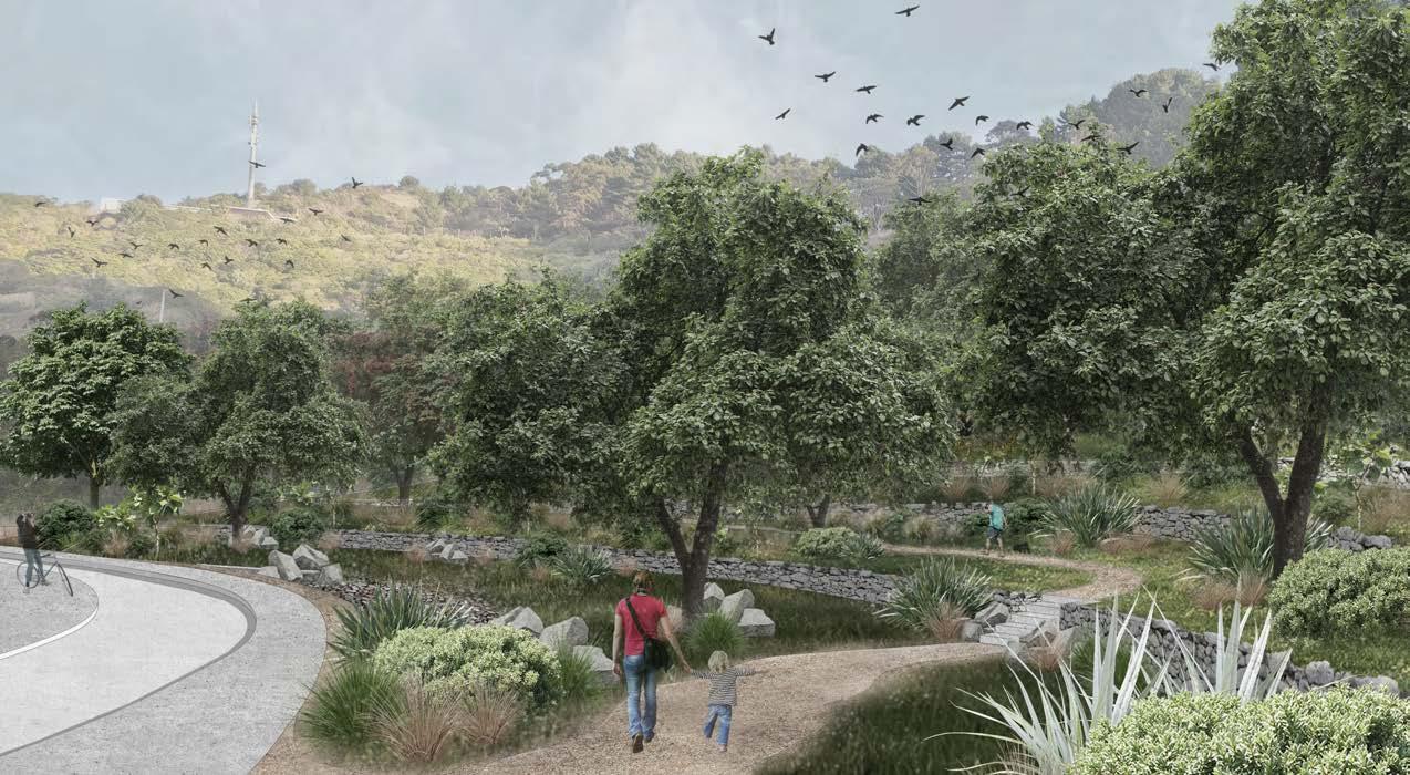
Te Māhanga Pā & Kainga sites have a mix of heritage, the areas were occupied by initially by Ngāti Mutunga then the land was transferred to Te Āti Awa. According to Elsdon Best, the sites once had small terraced hut sites, the Kainga position offered a wide vantage point to view the rising sun, while being sheltered by the winds. Fort Balance was later constructed on the Pā site; the design offers a pathway on the external of the bunker for added accessibility creating a mixed use space for people to learn about the sites Military and Māori heritage while enjoying the wide view points.

Te Mahanga Kāinga
Oneway Road
Designed Terraces Underpass for Kororā Nesting
Explorative pathway

Repurposed Prison Buildings
Ecological and Community Restoration: Shelly Bay
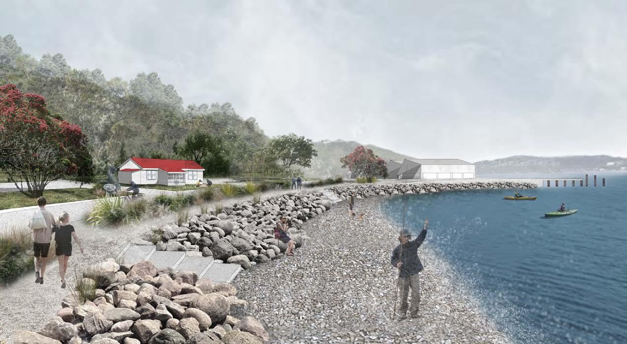
Chocolate Fish
Riprap naturalising coast edge while providing Kororā Habitat and Nesting Boxes
Redesigned Shed 8
Resturant and Art Gallery
“Connection or link” to the “Riverbank or River’s Edge”
1. To feel a subconscious connection to an opposing river and its edge.
Typology: Urban Design/Affectual Exploration
Location: Hutt Valley River, Silverstream
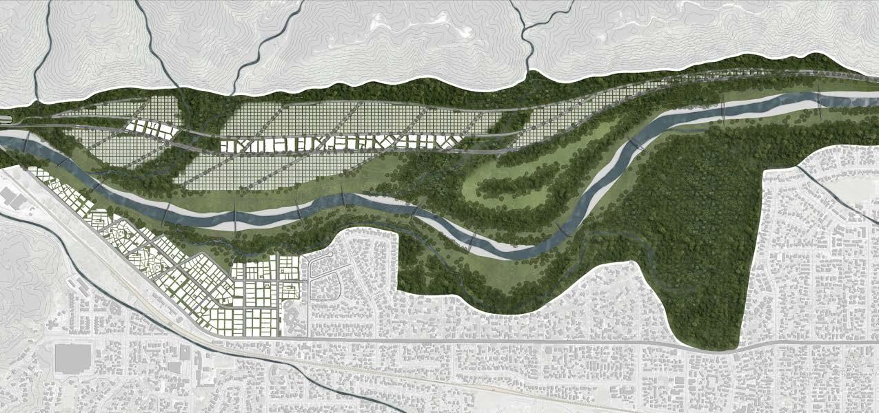
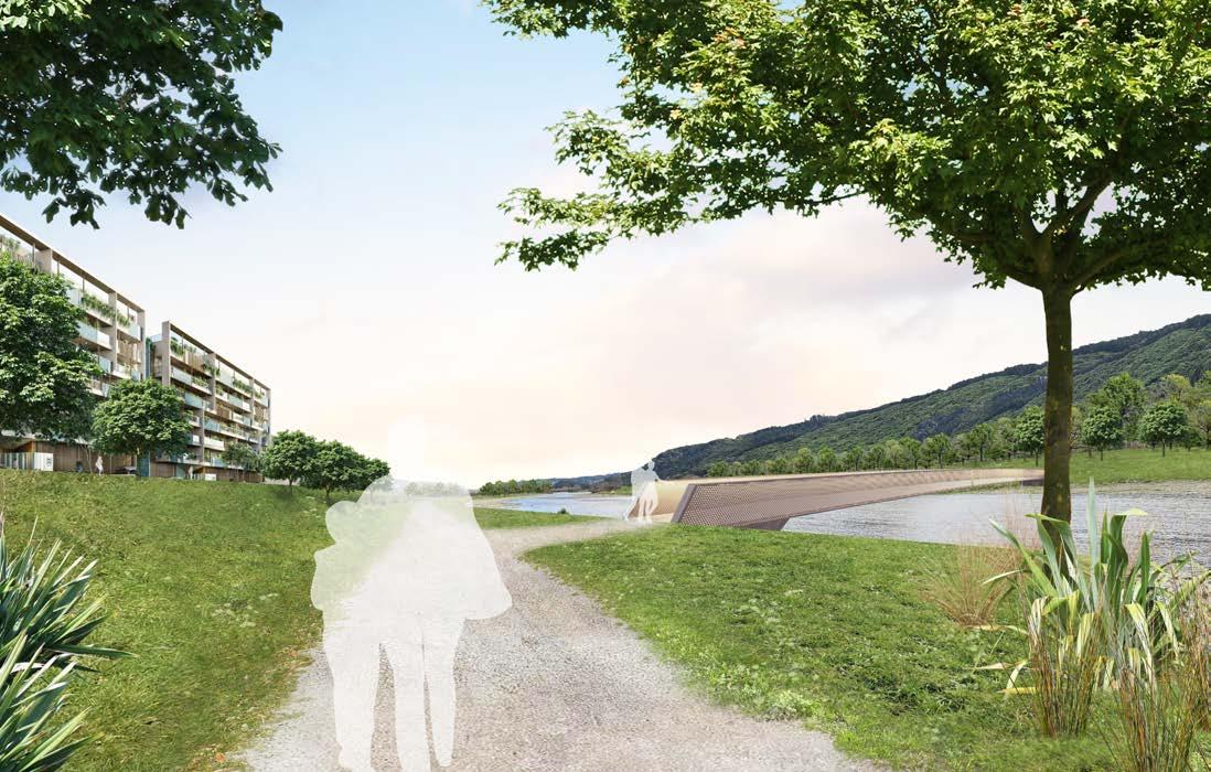
This project reimagines the Hutt Valley river’s edge to foster a vibrant, interactive connection between the urban landscape and the river. Inspired by sensory experiences observed along the river, the design incorporates spatial strategies to create moments of repelling, expanding, and embracing. Through analysis of the exisitng spatial composition of the river, I summarised key moments into these three descriptions of the events someone may feel when experiencing the river.
These experiences guide residents and visitors through a sequence of dynamic interactions with the river, enhancing their emotional and physical connection to the natural environment. By integrating life along the river into everyday urban spaces, the project proposes an engaging way of creating river-centred life that reinforces ecological awareness and community well-being.
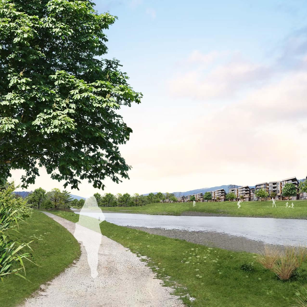




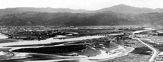
The Hutt Valley River exemplifies the ecological degradation seen across Aotearoa, where natural wetland and estuary ecosystems have been heavily modified through colonisation and urbanisation. Historically, this river spanned a broad network of wetlands across the valley; however, it has since been confined to a single, highvelocity channel along the valley’s edge. This engineered channel,
flanked by stopbanks and structured plantings of willows, poses significant flood risks to the surrounding urban area as it functions similarly to a rural river system. This project investigates design strategies for reorienting urban life around the river, aiming to foster meaningful connections with the river environment while exploring measures to mitigate flood risks effectively.
Recreation Area + Flooding Overflow Zone
Masterplan:
Key:
: Train Stations
: Train Station Catchments
: Tram Stations
: Tram Station Catchments
: Recreation Zones
: River Channel
: Gravel Beds
: Vegetation
: Housing Densities
Mixed Use Business Areas (Resturants, Stores, Amenities, etc)
Tunneled State Highway
Streams Restored to their Natural Formation

Medium Density Residential Zones
Recreation Area + Flooding Overflow Zone
Mixed Use Business Areas (Resturants, Stores, Amenities, etc)
Medium Density Residential Zones
Tram Line added Through the Centre of the Development
Adjusted River Channel Golf Course + Wetland
Structural Strategies:
Highway Infrastructure Recreational Spaces River Centred Housing Active Transportation Natural Flood Management
Experiential Strategies:
Repelling design positions external forces pushing the body toward the river; forming a forced connection with the river and its opposite bank.
SPATIAL FEATURES:
External Appeal Compression
Forceful Element
Expanding design has the occupant’s sense of space broaden, allowing them to fully experience and appreciate the river valley.
SPATIAL FEATURES:
Expanse Extension
Visual Transition
Compression
Embracing design has the occupant surrounded by the river and its elements. Creating a stronger sense of connection within the river.
SPATIAL FEATURES:
Element Proximity
Depth of Position
Immersive Softness
Depth of Position: Below Vegetation and Close to River’s Edge
Element Proximity: River’s Edge is Close and Similar Elevation
Immersive Softness:
Immediate Elements are Soft and Natural
Road Blocked by Vegetation

Road Blocked by Vegetation Passive Recreation
Depth of Position: Paths are Low in Elevation near the River


Thanks for Viewing!
PORTFOLIO Landscape Architecture 2024 - Zoe Mason