“The mixture of divinity, power, and personality that brought the ancient city into existence must be weighed out anew in terms of the ideology and the culture of our own time, and poured into fresh civic, regional, and planetary molds. ” The City in History, Lewis Mumford
THE WAY TO SCHOOL
Narrative urban design 09/2023 - 11/2023
STEPPING ISLAND
Landscape design for pollinating insect 11/2021 - 01/2022
COST OF COMMUNITY LIFE
Participatory community regeneration 03/2024 - 05/2024
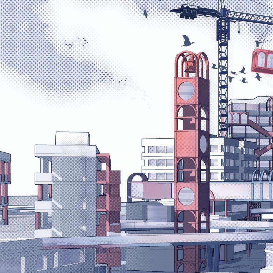
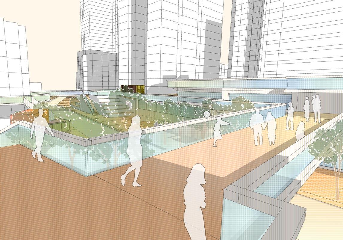
Narrative urban design / Educational immigrant city
Individual Bachelor 4th Year Project 09/2023 - 11/2023
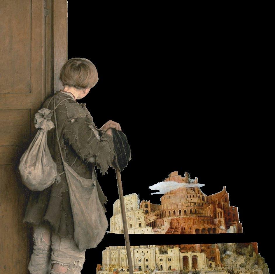
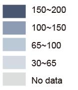
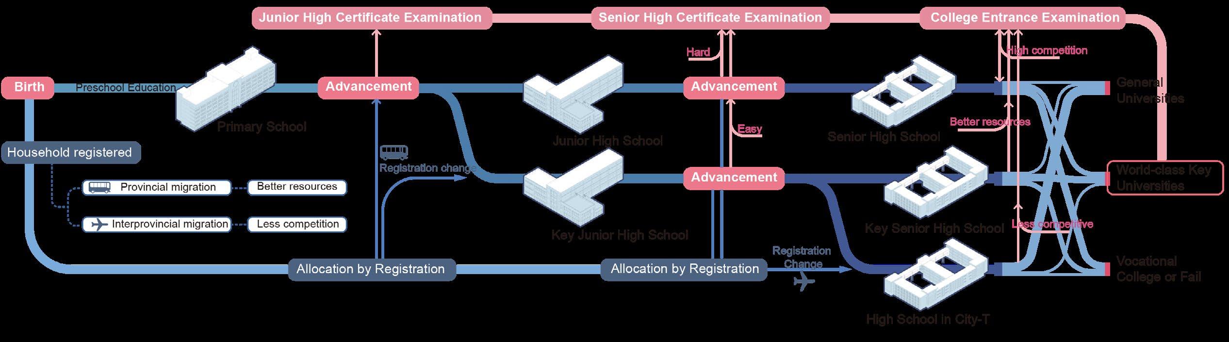
In China, the examination system is deeply tied to the household registration system. Due to the uneven distribution of educational resources, examination standards vary greatly from region to region. As a result, the phenomenon of ‘educational immigrants’, who move to make it easier to enter universities, has emerged.
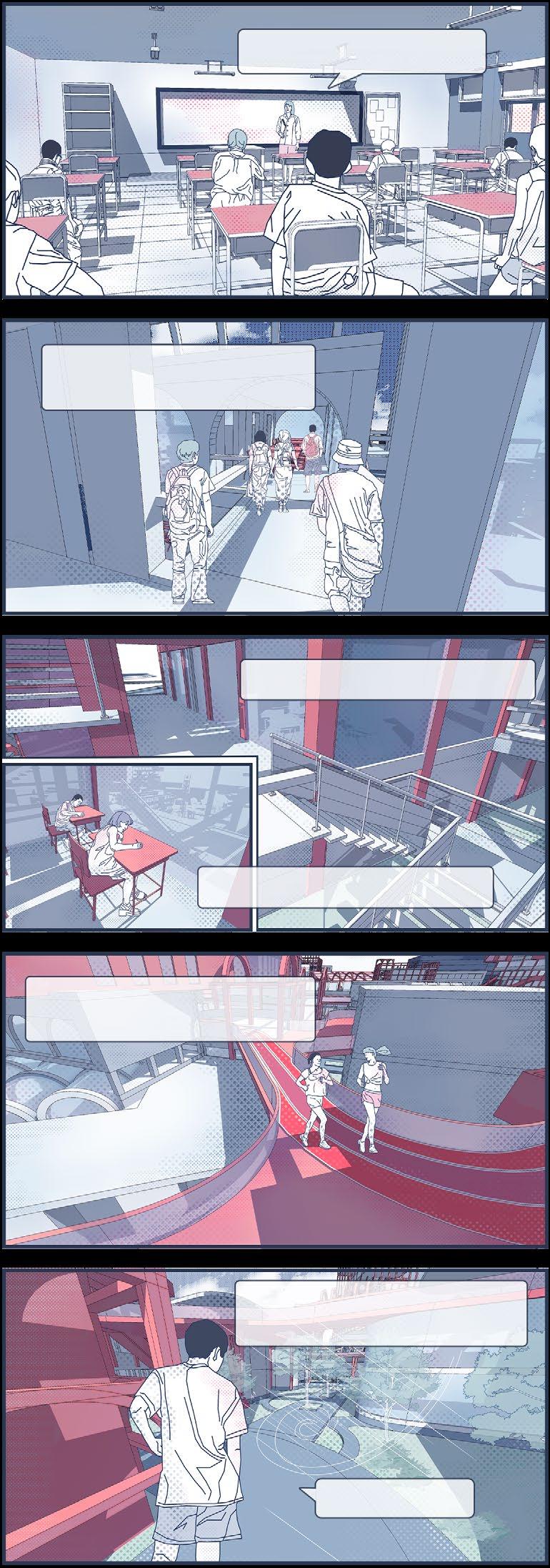
In this project, I explored themes of educational inequality by imagining an alternate life where my family moved to a city with better opportunities. I abstracted the competitive educational system into geometric forms, translating them into urban layouts, transportation, and public spaces. The narrative followed a student’s journey, using comic-style storytelling to depict the city’s evolution and decline. This project allowed me to merge personal experiences with Tschumi’s techniques and expanded my knowledge of urban forms.
Major Education Immigrant Cites
Hebei, Henan, and Shandong provinces are the main sources of education immigrants because of high competitive pressure and lack of educational resources. Tianjin and Xinjiang have become the main choices of educational immigrants because of their less competitive pressure.
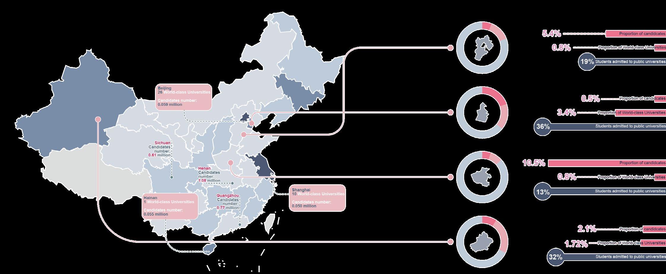
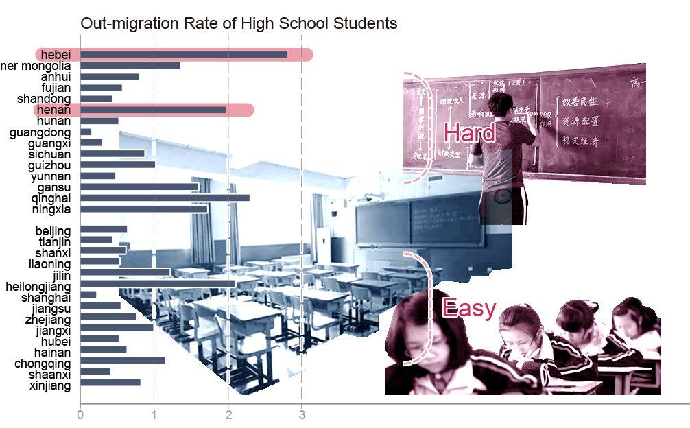
Out-migration Rate of High School Students Immigration Rate of High School Students
The highest proportion of high school students migrating to other provinces in the country is in Hebei, Henan, and Qinghai provinces, which are also among the ‘hard provinces’ for entrance examinations.
The regions with the highest number of high school students transferring into are Tianjin and Beijing. These two cities have better educational resources and are major destinations for educational immigrants.
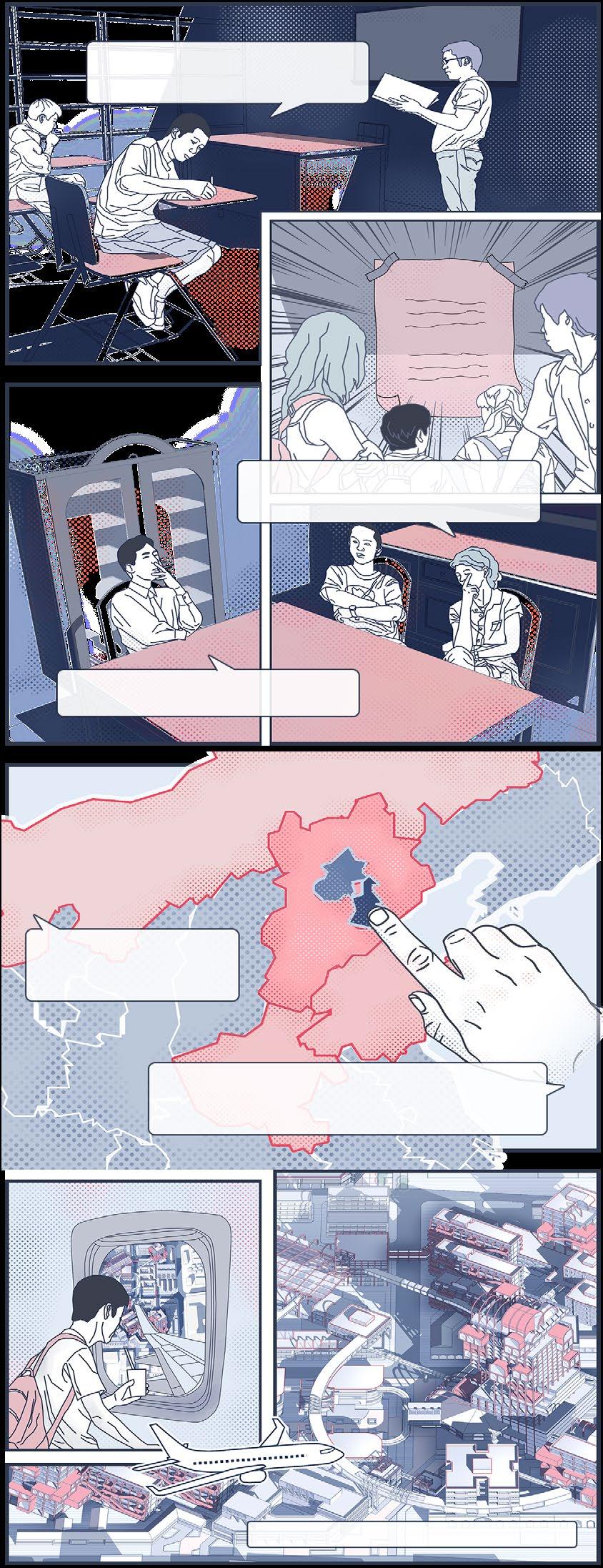
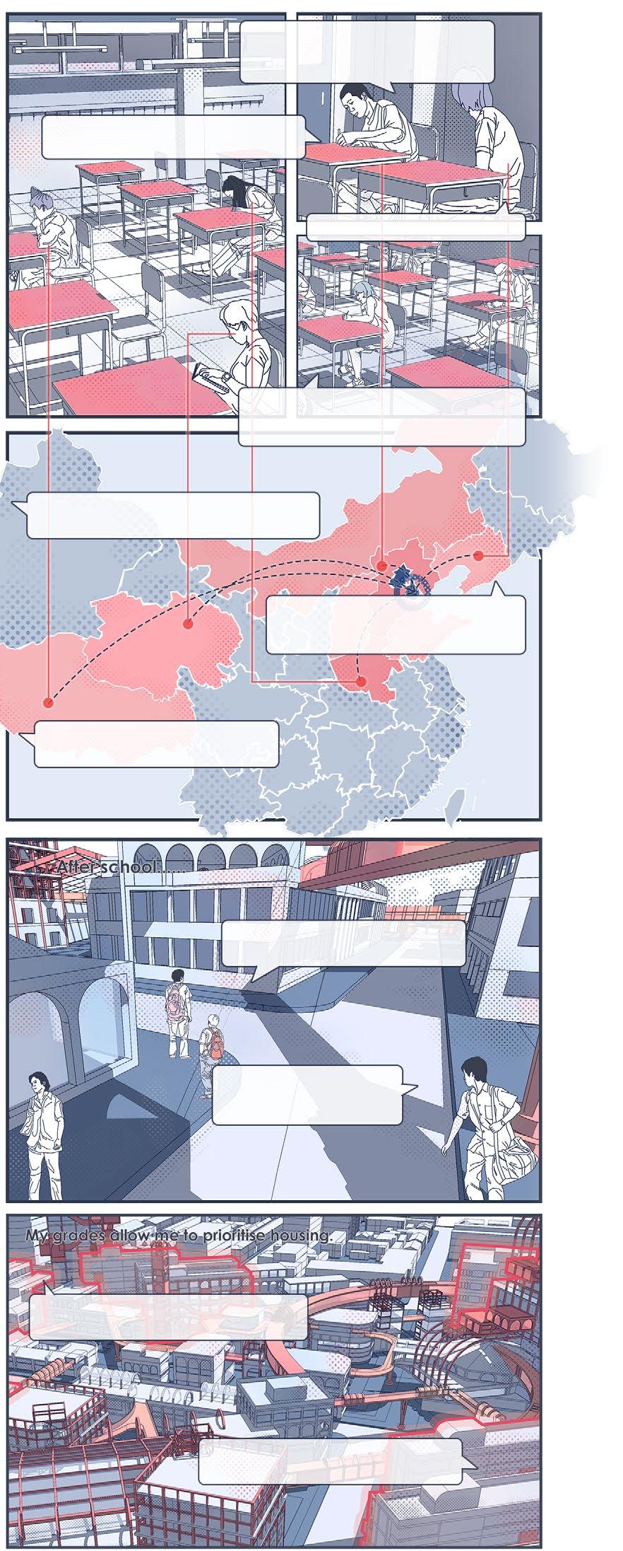
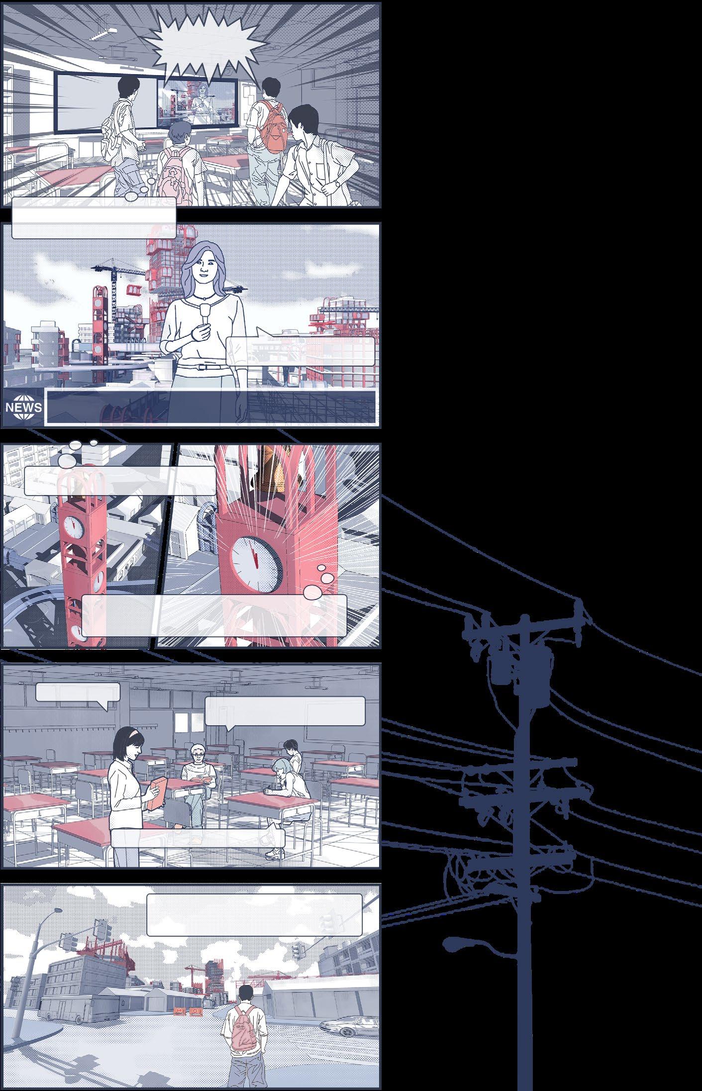
My name is Li Ming, as you can see, I'm a high school student struggling to get into college.
With your ranking in this mock exam, there's no way you can get into a major university...
...So we're planning to move to City-T where the exams are easier.
College entrance exam in City-T are easier, and you can get into a better college even if you take 50 points less.
...to the ‘ CityofLearning in City-T......
The college entrance exams in all these areas are too hard, except for City-T.
After the announcement of the examination results ......
Apparently, sucked at this exam.
My current home is in Hebei, where education resources are in short supply and competition is fierce.
So, in order to make it easier for me to go to university, my family moved...
Number of Every 1000 Students Admitted World-class Universities
Hebei Province
Tianjin City
Henan Province
Xinjiang Province
Household Registration and Education System Process
In the current education system, transferring to other provinces through migration makes it less difficult to compete for acces s to betterresourced schools. Switching Household registration before the entrance examination gives a better chance of entering a major university.
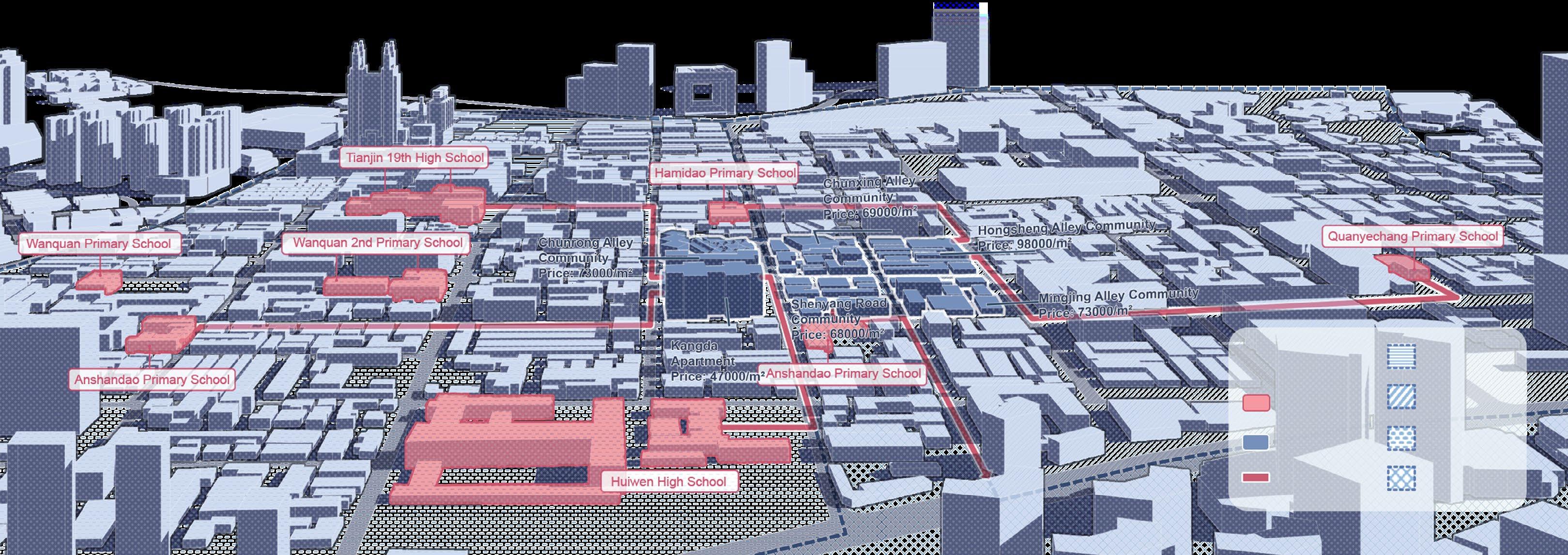
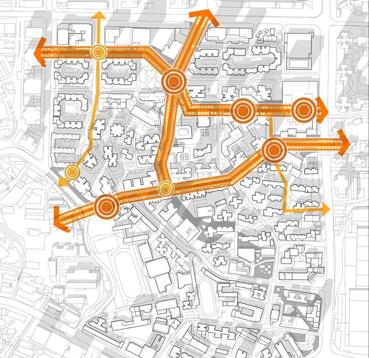
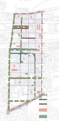
Distribution of Educational Resources in the Vicinity of the Site
Even within the same province, the distribution of educational resources in ‘school districts’ based on household registration is uneven. As a result, there is a tendency to move to better school districts. The map below shows the distribution of school districts and educational resources in the vicinity of the site.
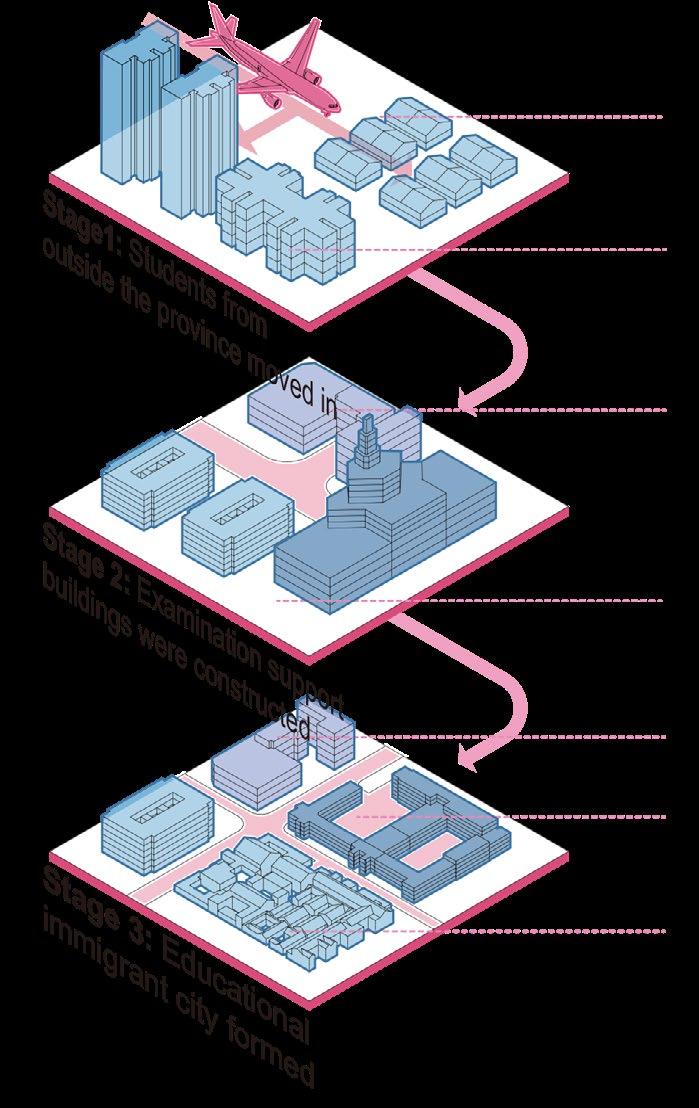
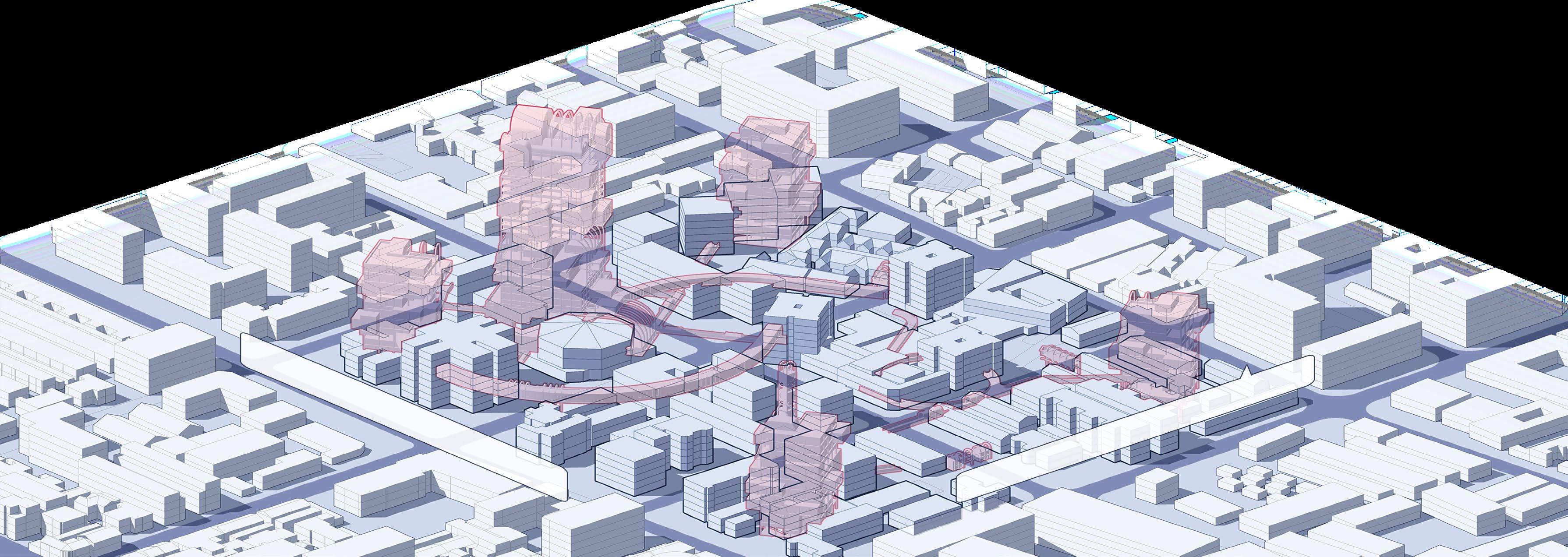
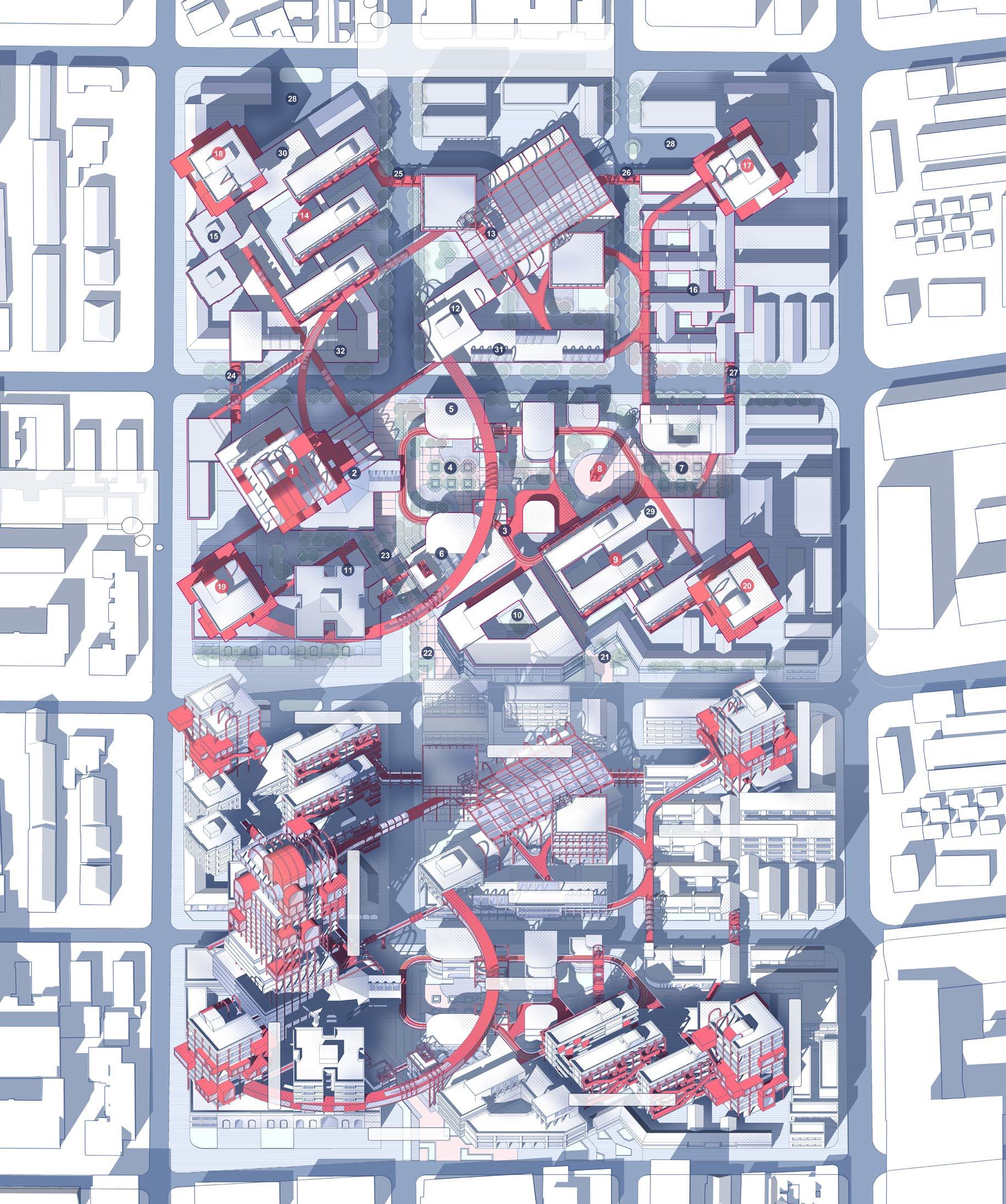
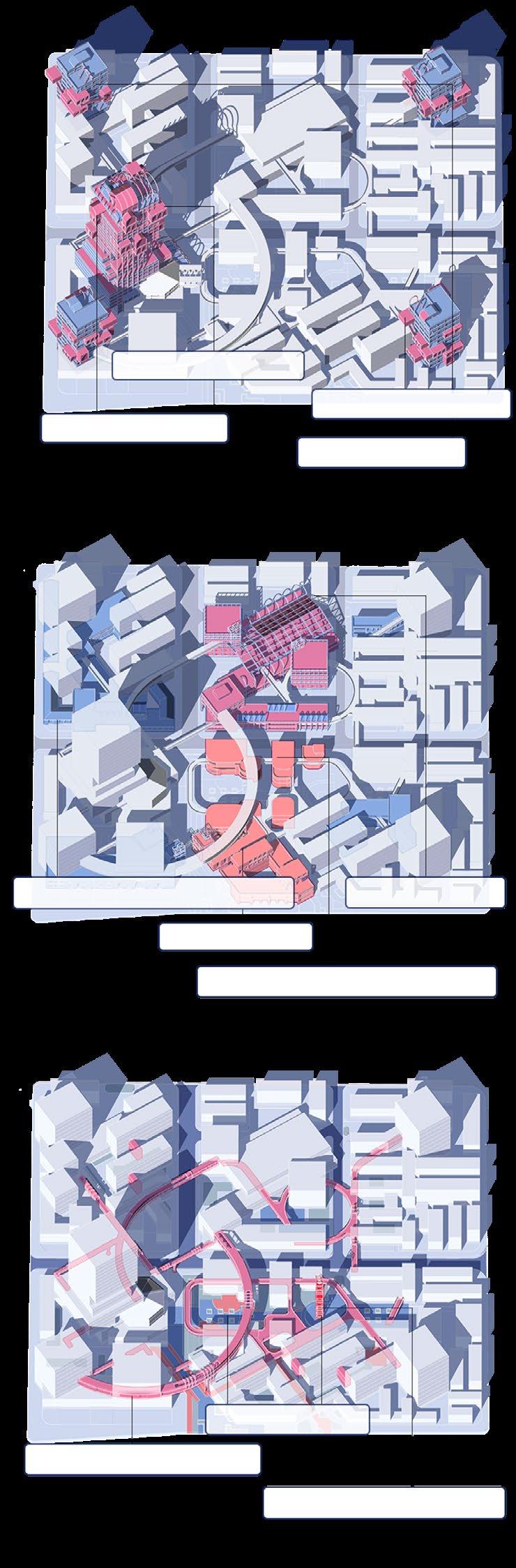
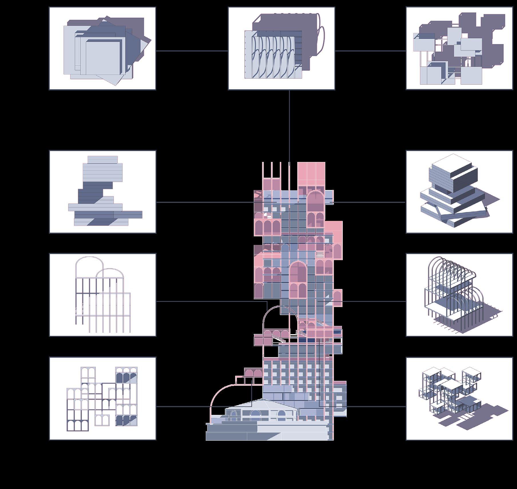
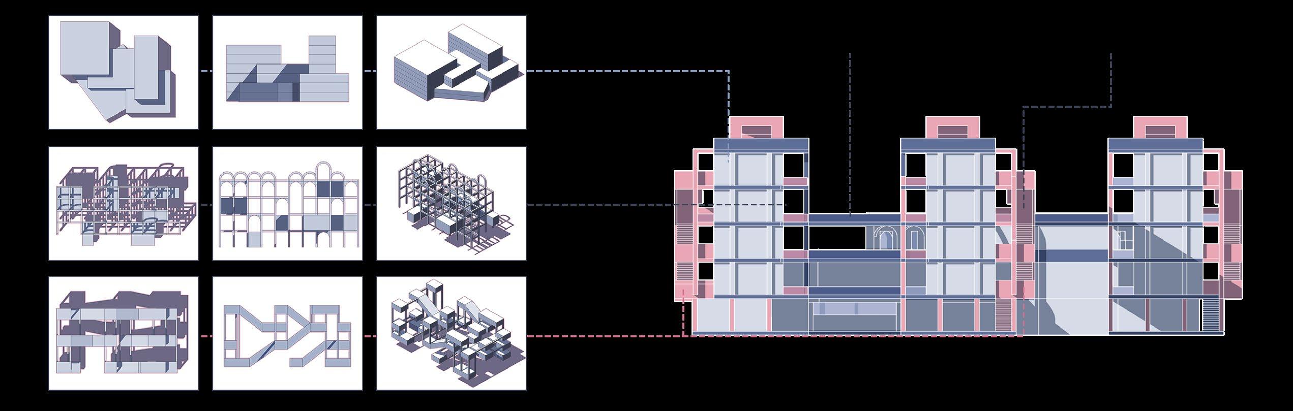
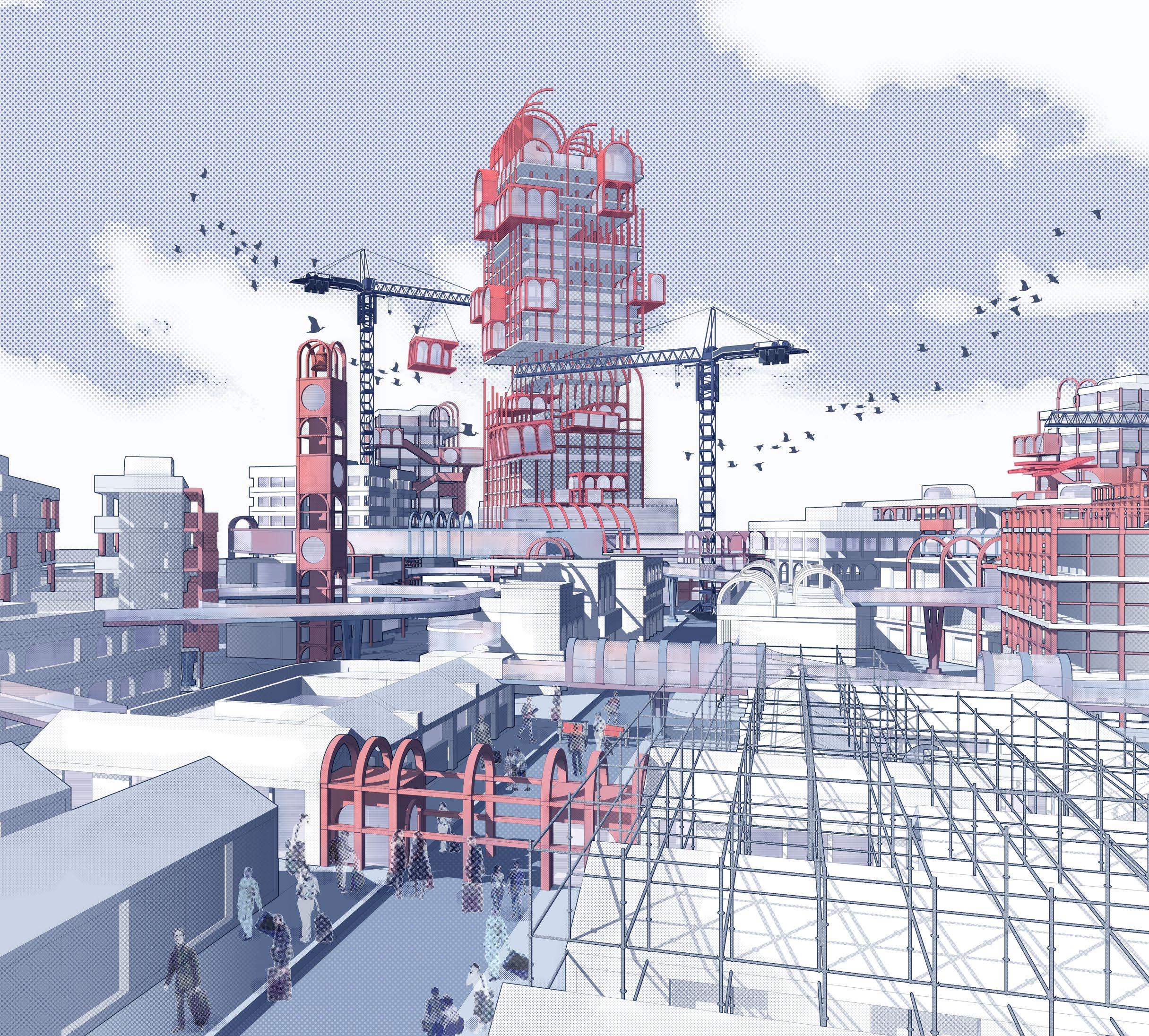
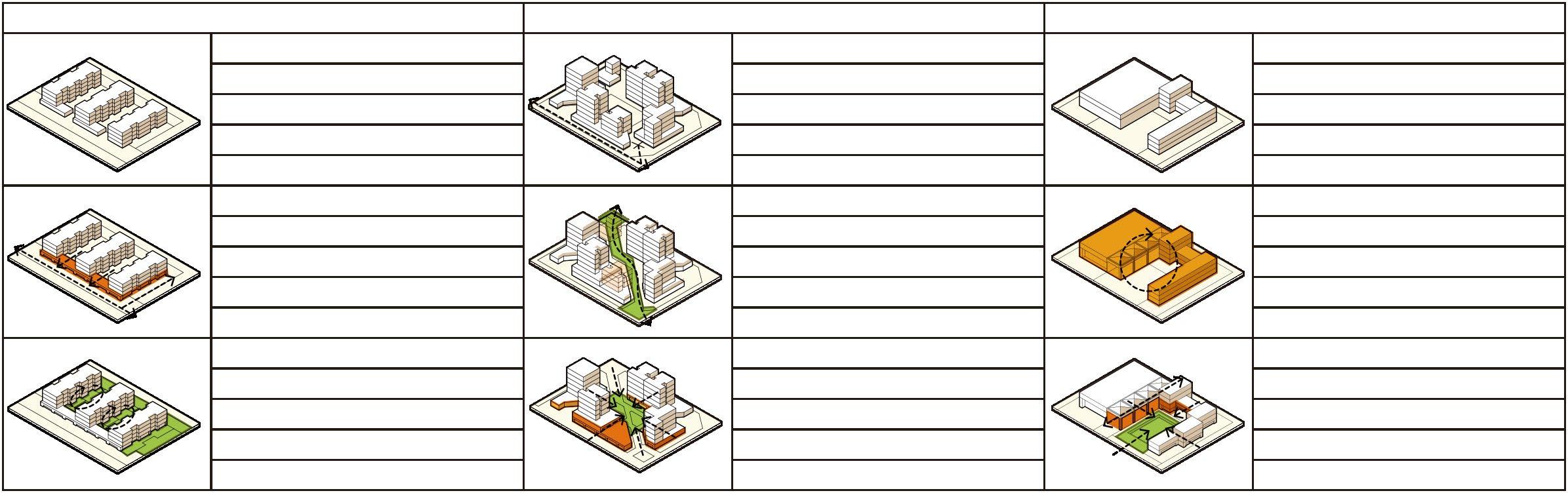
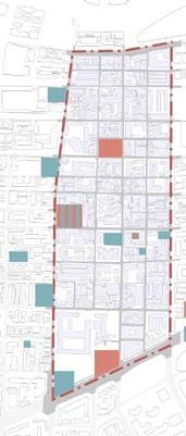
Process of City Formation
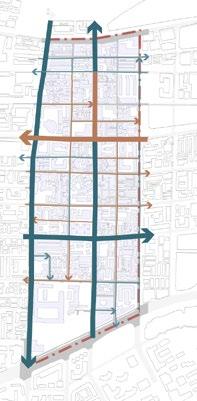
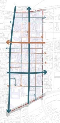
Urban space is organized in forms abstracted from the education system. Its function serves as exam-based education.
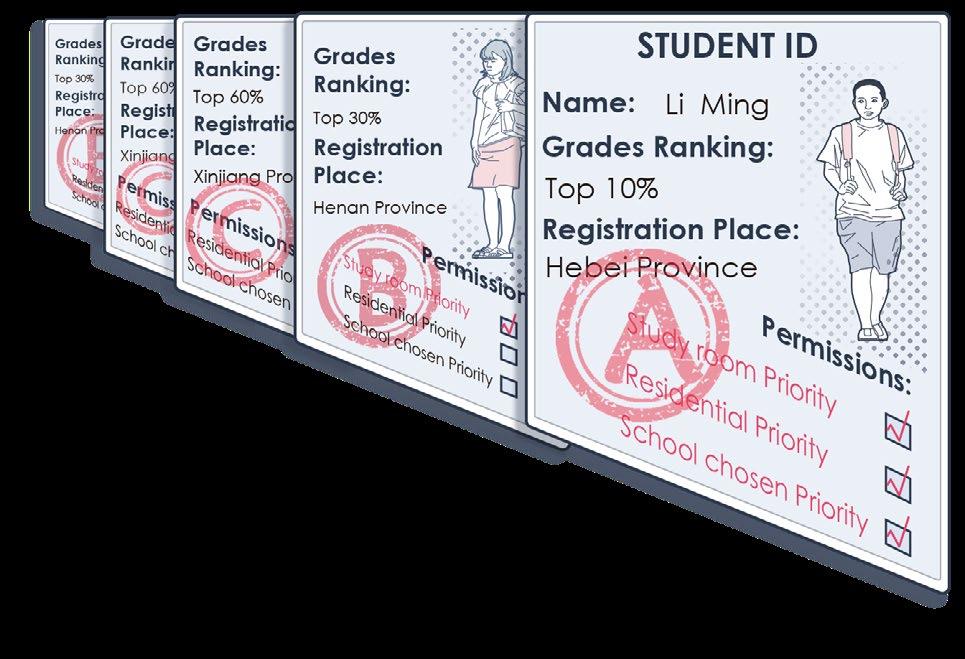
Student ID Cards
I've
...Gradually some study towers rose out of the old neighbourhoods, and people continued to add outlying rooms to them.
How's it going at the new school? Actually, a lot of our class transferred from out of the city.
Li Mei comes from Henan, and Zhang
There are even students whose hometowns are Tibet and Xinjiang. They're all here for the entrance exam...
...because the quality of education there is very
Wei is from Shandong.
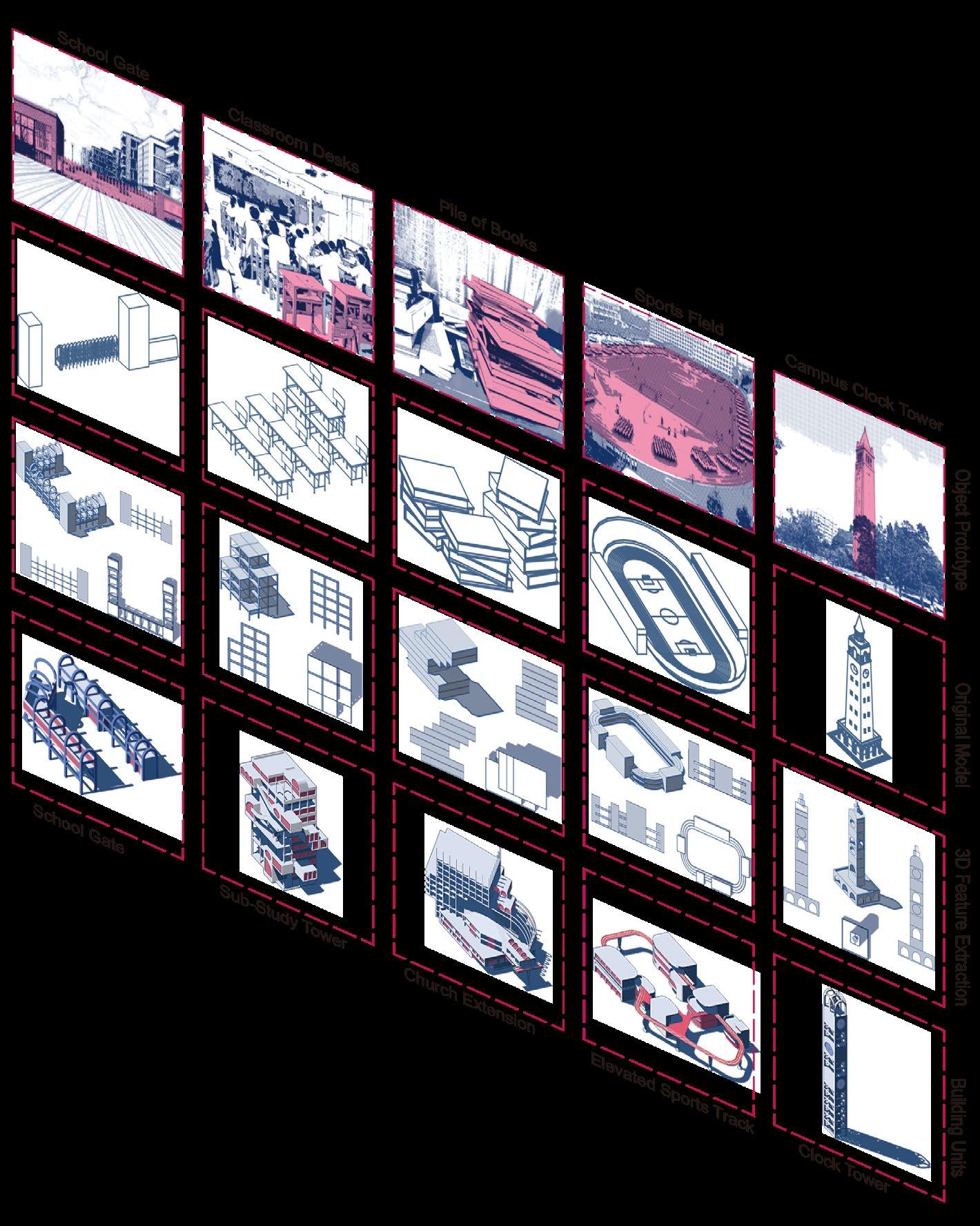
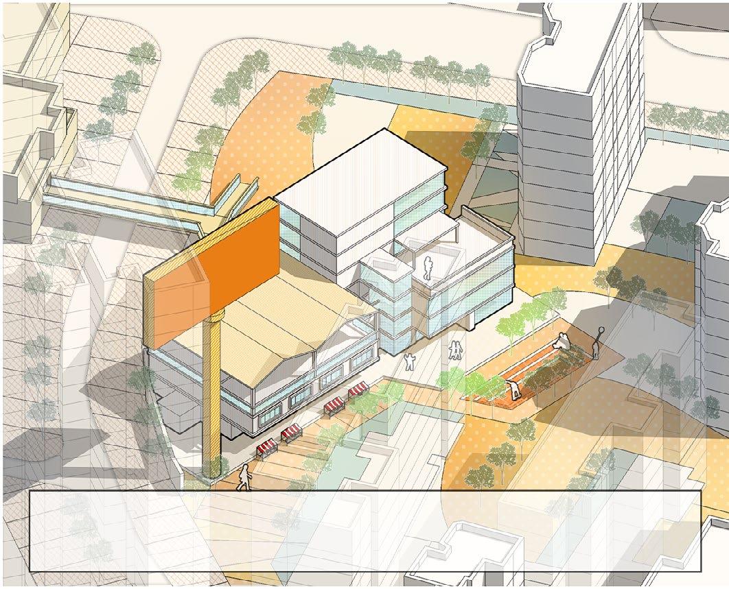
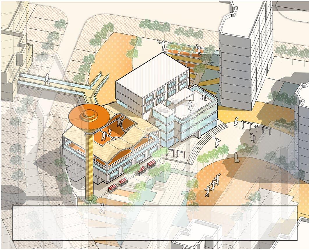
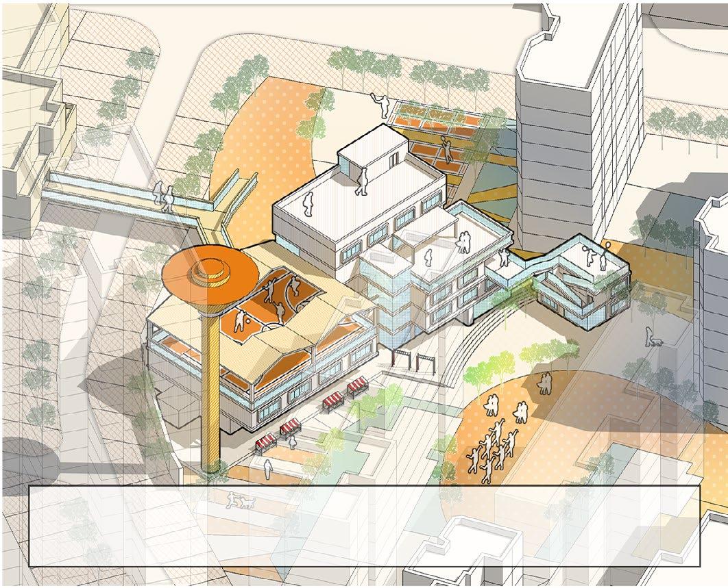
Main Study Buildings
Study Building Examples
Service Buildings
A system of learning spaces comprising a central tower and four sub-studying towers provides learning functions for classes, self-study, and examinations for students in the urban area.
Service Building Examples
An ancillary system that provides life support to area residents, especially students, includes a wide range of businesses that provide study materials (e.g., printers) and household goods.
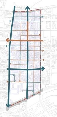
Transportation and Public Space
Space Examples
A transport system that supports the quickest movement from the residential areas to the teaching areas is mainly based on elevated walkways. Ground-level open space is provided with parks for relaxation and sports space to support student learning.
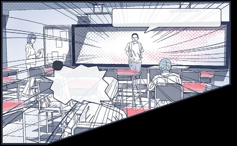
I am here to introduce the school rules to the new students.
There are plenty of convenient walk-
corridors to classrooms, so tardiness is not allowed!
Exams are held regularly and the results of each exam will determine your rating.
The order of the examination room will be determined by the ranking of your grades.
in the city centre, but I don't recommend you waste your time there.
one comes here to play or rest at all.
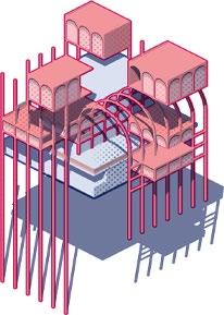
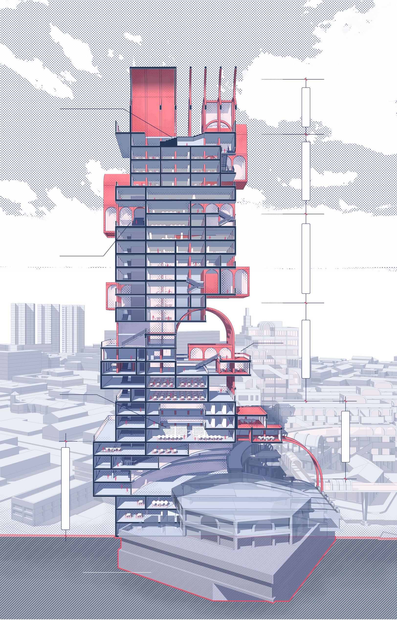
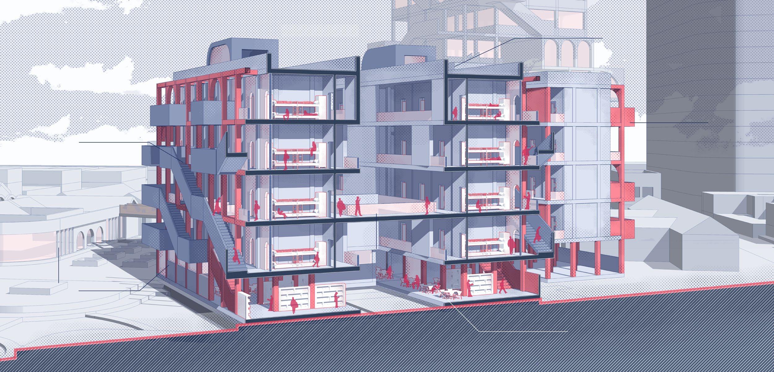
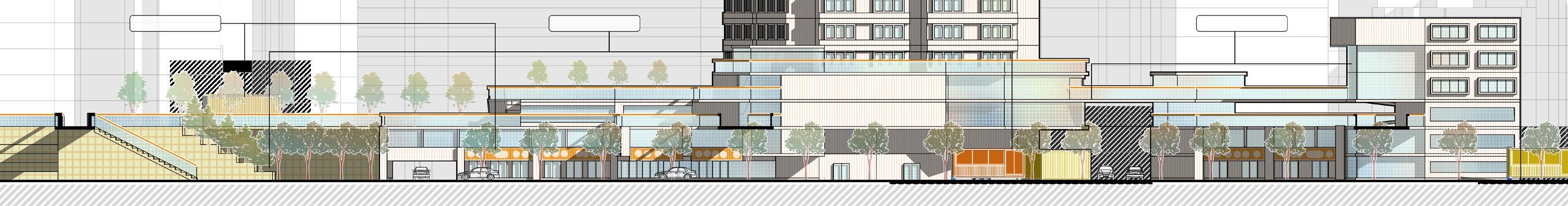
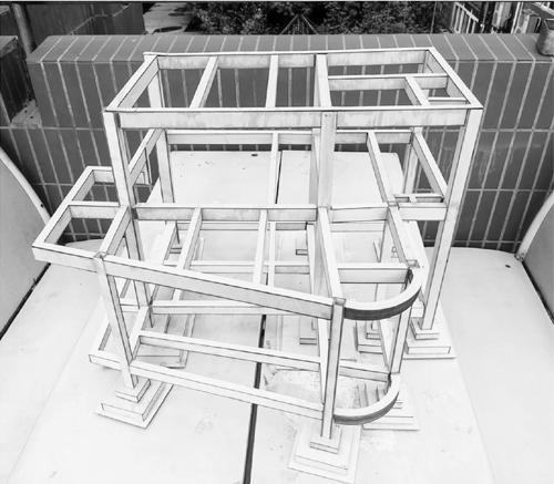
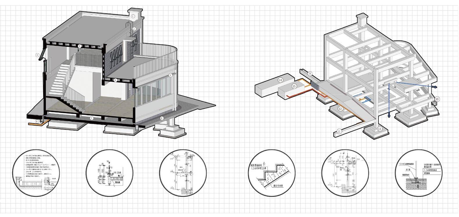
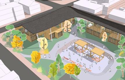
Central Study Tower Section View of the Central Study Tower
The Central Study Tower is built on the old church which now serves as a spiritual place for students. The higher floors contain study rooms and examination rooms, and the rooms in the external blocks on these floors are study rooms for top students.
Generation of the Central Study Tower
The Central Study Tower consists of three structural components: the massing block, the framework and the hanging blocks.The three components are responsible for different functions and provide the largest learning space in the entire city.
The body structure, in which main rooms are distributed
The support structure which is the support for room addition
The outbuilding structure added for increased students
Front View
Axonometric View
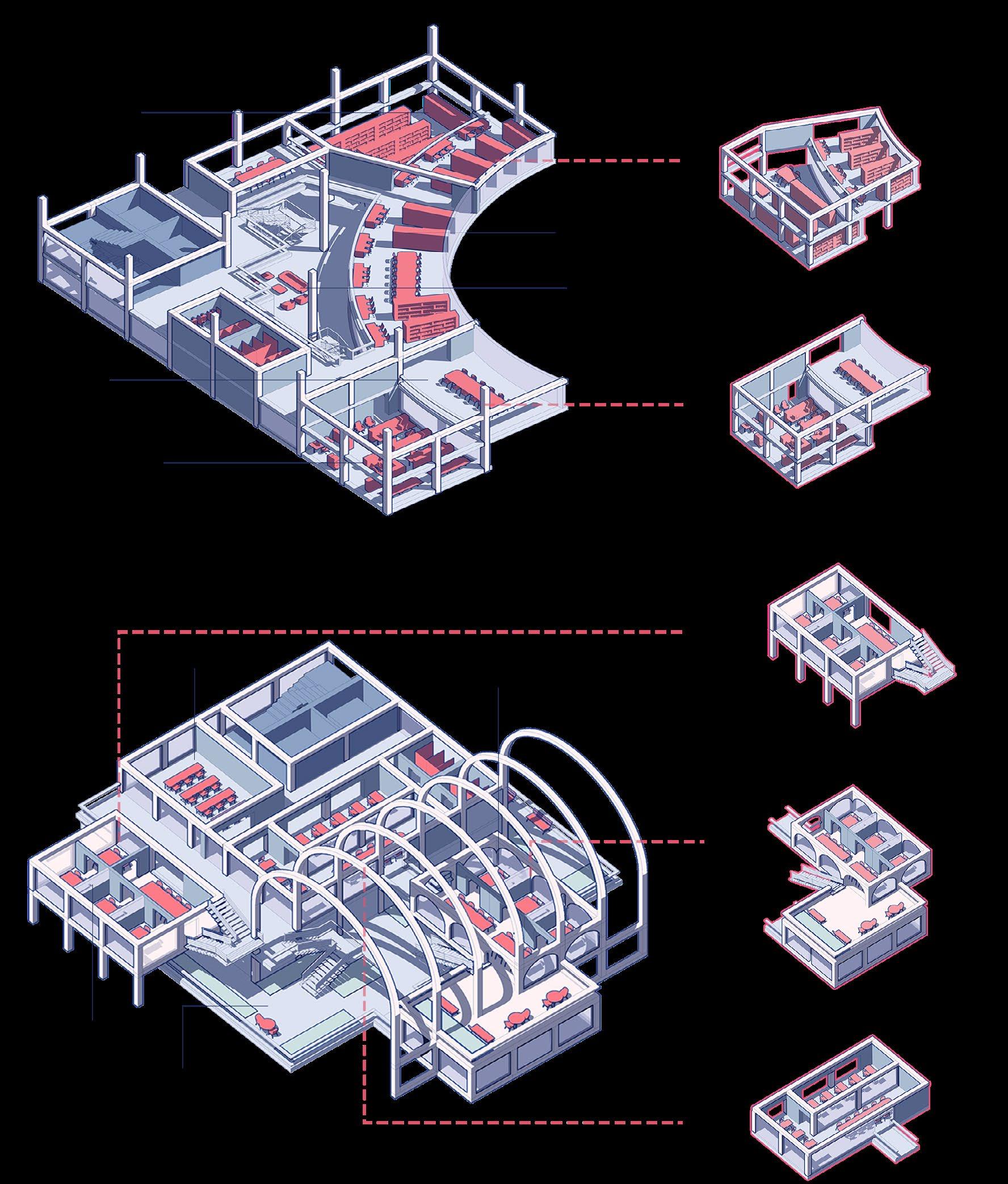
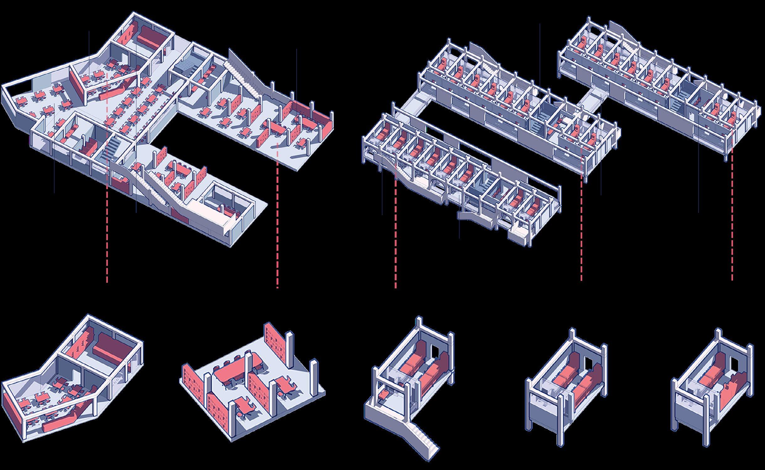
Axonometric View of Main Floors
The primary function of the Central Study Tower is to provide space for students to study, attend classes, and take exams. Its main floors are shown below.
Room Examples
Library Floor
Located on the middle and lower floors, it focuses on the two main functions of administrative office and reading.
Study Room Floor
Located on the upper floors, it contains a variety of rooms for study, teaching, and exams.
Study reading room
The reading room is open to the public and accommodates multiple students.
Office meeting room
The offices where the administrative staff work are connected to the meeting room.
Study cubicle combinations
Study cubicle combinations provide a more private study space with fewer distractions from studying.
Balcony study room
Study rooms with better environment are given priority to the top students who choose to use them.
Combined classrooms
Classroom combinations allow for more students and more efficient use of space.
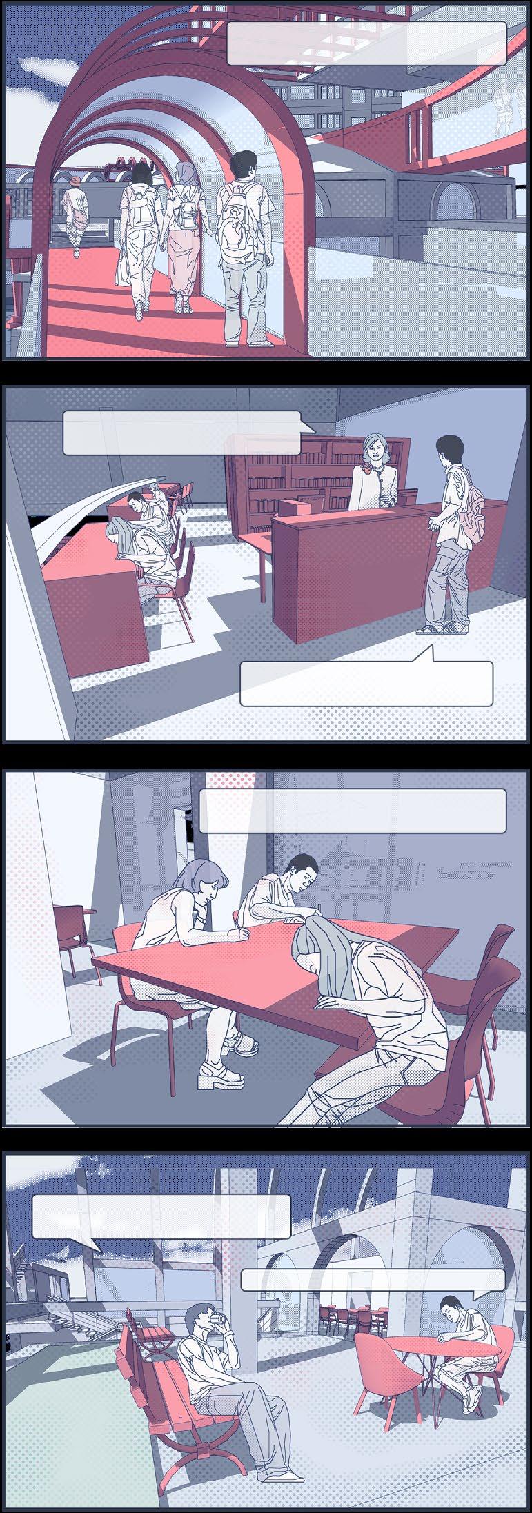
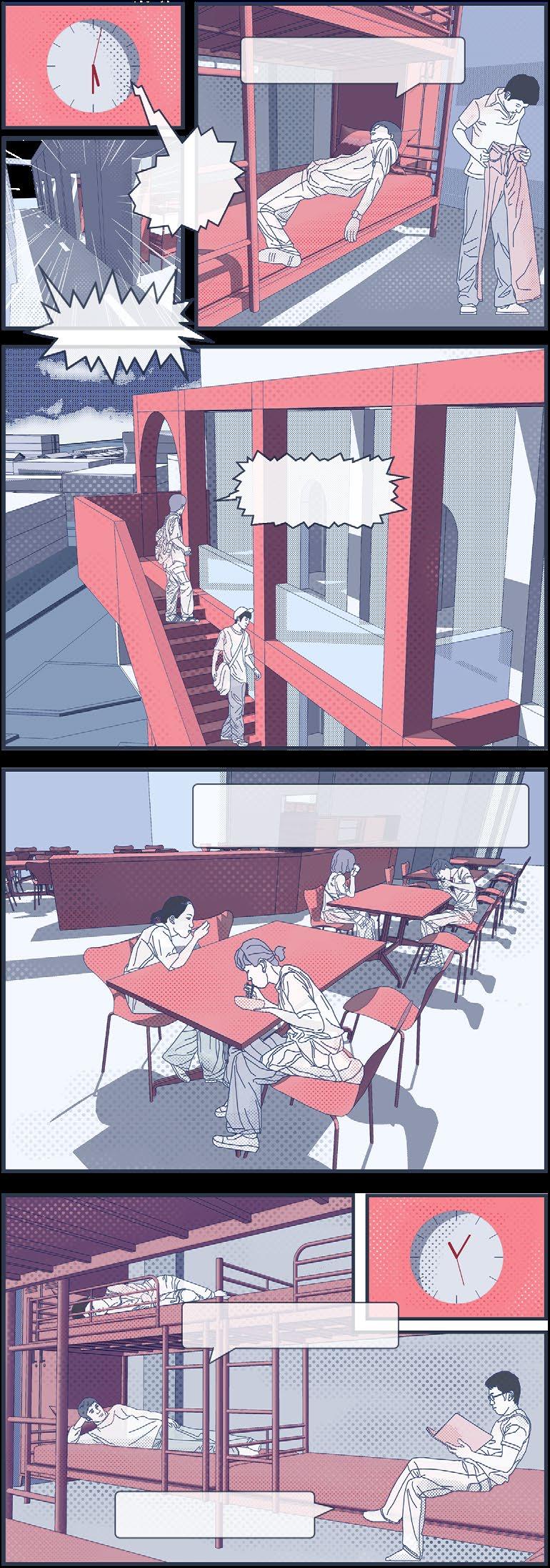
Hello, please select the study room you would like to go to.
Since I did well in my last exam, I can choose a better study room here.
The public study room is always full of people studying. But this room has a great view.
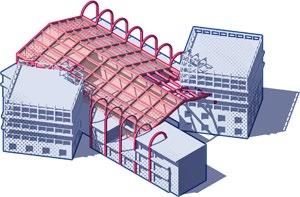
Dormitory Building
Dormitory Buildings are more efficient living spaces for students, providing quicker access to study areas. Their space efficiency is superior to that of older neighbourhoods and the cost of living is reduced. Students can apply for accommodation rooms with different conditions according to their ranking priority.
Generation of the Dormitory Building
The dormitory building also consists of three parts: the massing block, the framework and the hanging blocks. The hanging blocks of the building serves as a connection point for external pedestrian traffic.
Section View of the Dormitory Building
A group of dormitory buildings consists of three blocks, which are connected by balcony walkways.
The canteen, which is elevated and connected, is on the ground floor of the dormitory building. Cubicles surrounded by bookshelves, tables, and chairs can be used as communal study rooms.
The external balconies connect to the walkway and lead directly to the study area of the city.
The elevated ground floor connects to the canteen and provides space for reading and studying.
Axonometric View of Main Floors
The ground floor of the dormitory building consists of elevated communal spaces, while the upper floors contain dormitory rooms of various standards. Its main floors are shown below.
The function of the first floor of the dormitory building is dominated by the communal space of the canteen and the open reading room.
The living floors are connected by external balconies and corridors, allowing students to move quickly through the living areas into the study areas.
Room Examples
A standardised canteen with kitchen provides a steady supply of meals.
The outdoor space linked to the canteen is furnished with an open study space.
DormA for 8 people has balcony connecting to walkway.
DormB is the room for 8 people with private bathroom
DormC is a quadruple room for level A students.
is
that all
Vision for the End of the City
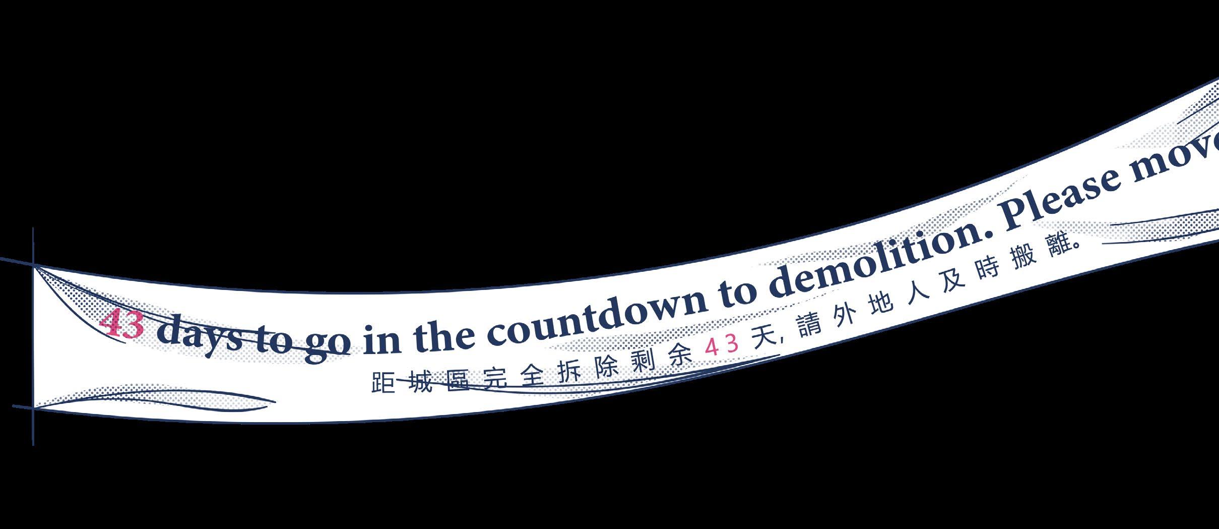
......People gradually moved out of the city and we transferred back to our hometowns to prepare for the entrance exams. This city of learning will soon be demolished, but students will still be struggling with the fierce competition for university entrance exams...... One month later...... BREAKING NEWS!!
Starting today, the City of Learning is in the countdown to demolition.
Because of the introduction of the new policy, education migrants are no longer needed.
City of Learning in City-T is about to face demolition.
It
expected
college entrance examination immigrants will be relocated within half a year, and the city will be demolished and rebuilt within a year.
Tomorrow I'm going back to my hometown.
After living and studying here for a year, I am now forced to leave. I don't know where I will take my exams in the future.
My family is leaving the city, too.
Farewell, class.
New college education entrance examination policy..
Stepping Island
Landscape design / Pollinating insects habitat
Individual Bachelor 3rd Year Project 11/2021 - 01/2022
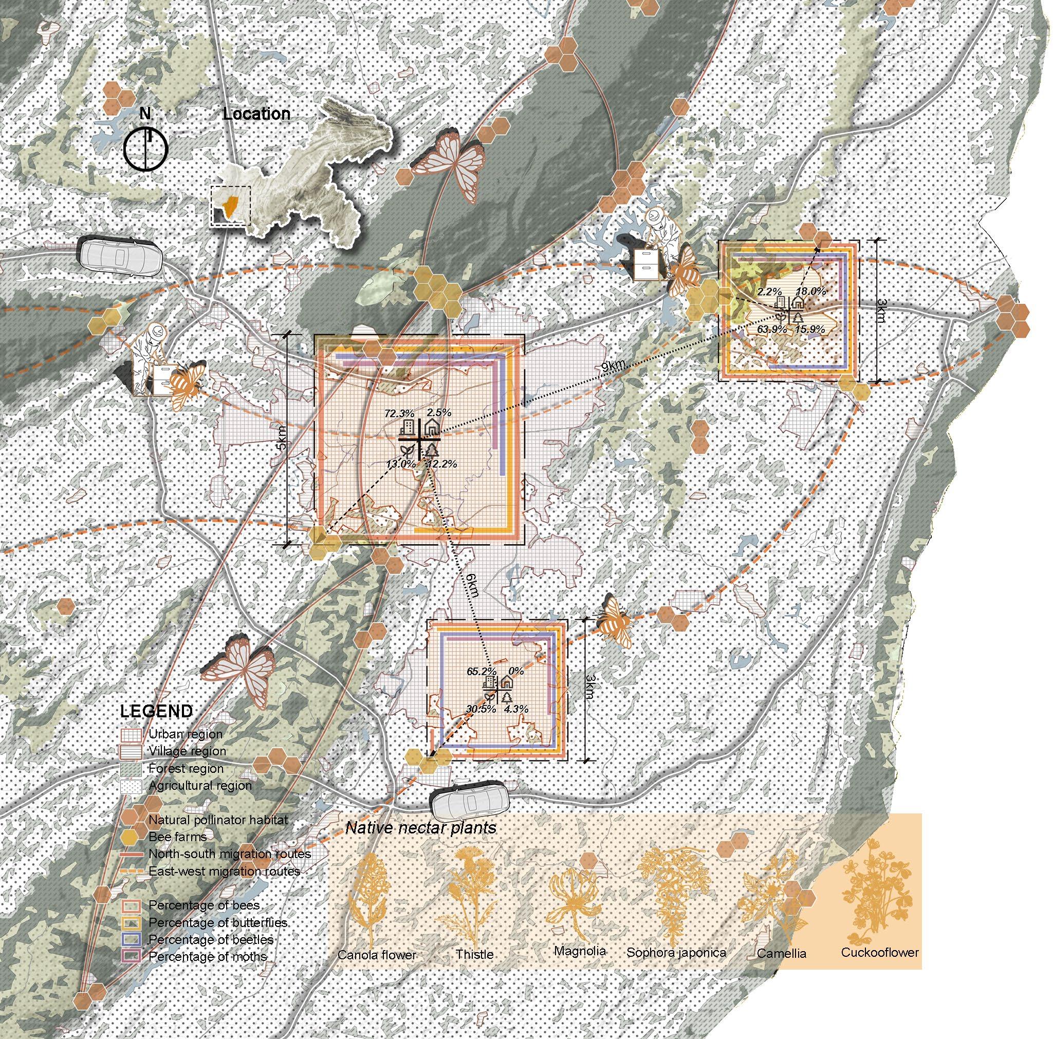
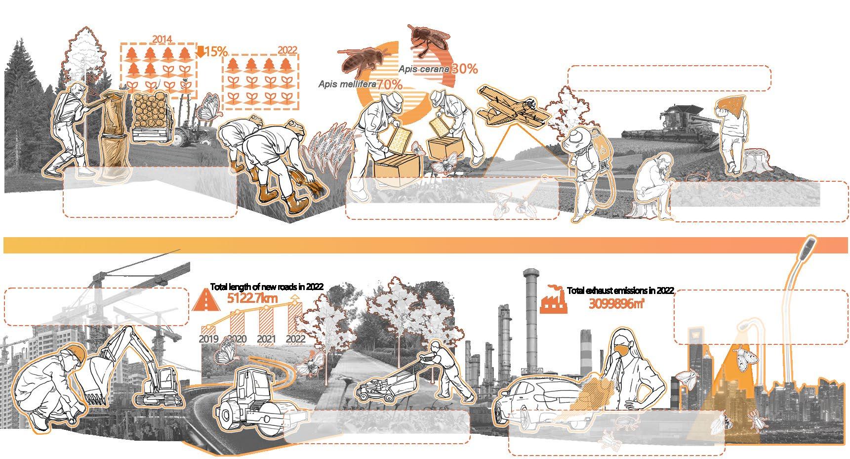
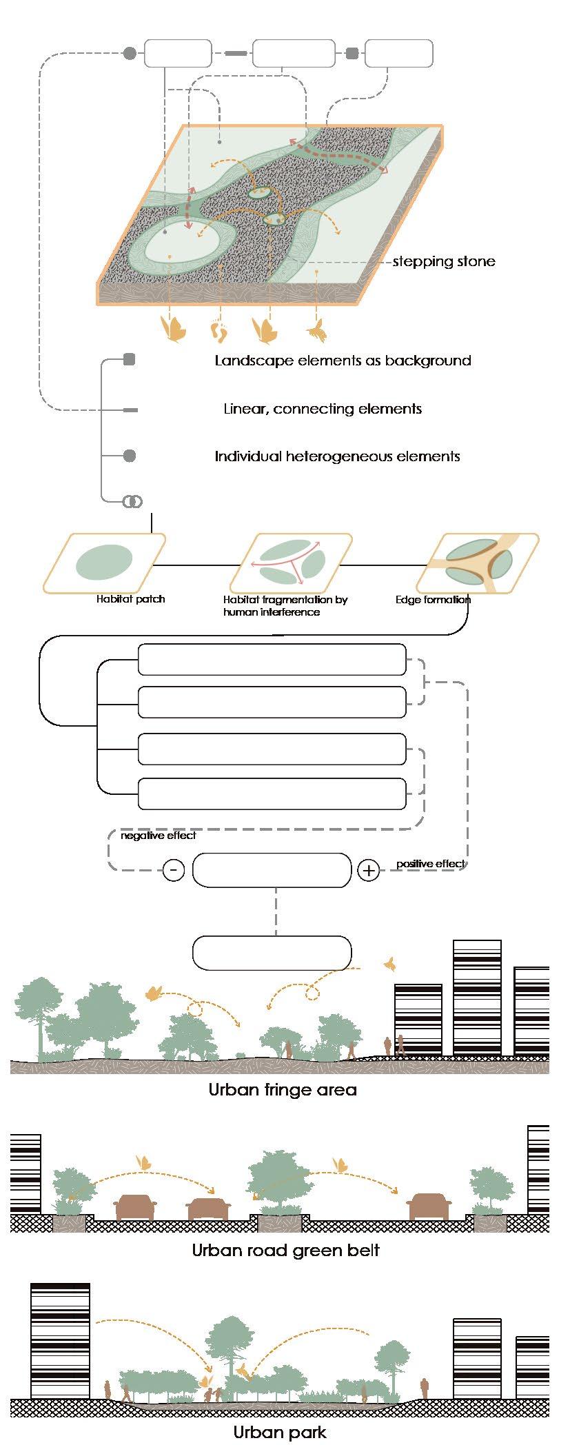
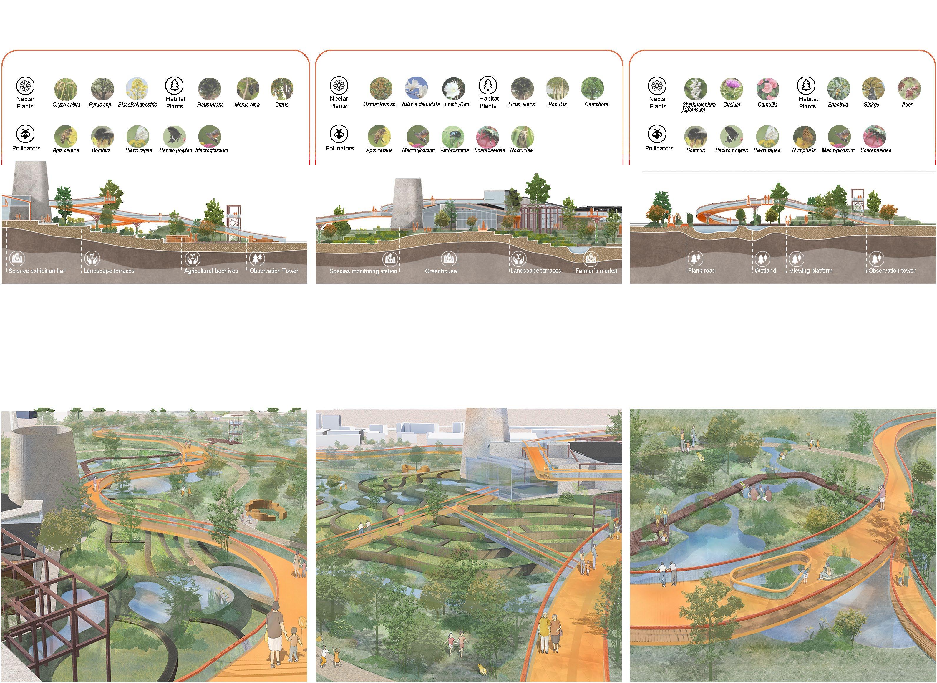
The design site is located between two natural mountains, which are natural ecological stepping stones. Considering the dual attributes of agro-economics and ecology in this area, this proposal aims to enrich species diversity through ecological boundary effects, providing ecological space for pollinators to inhabit and reproduce, as well as a transit point for migration. It will bring both agro-economic benefits and ecological conservation value.
The modern city has been used exclusively as a place that serves only human beings. City parks are often used as functional places for people to get close to nature, with other creatures in them as objects for humans to gaze upon. This project is an attempt to observe the city from a non-human point of view. I hope that there will be a place for them in the city, and their state of living in the city guides this design.
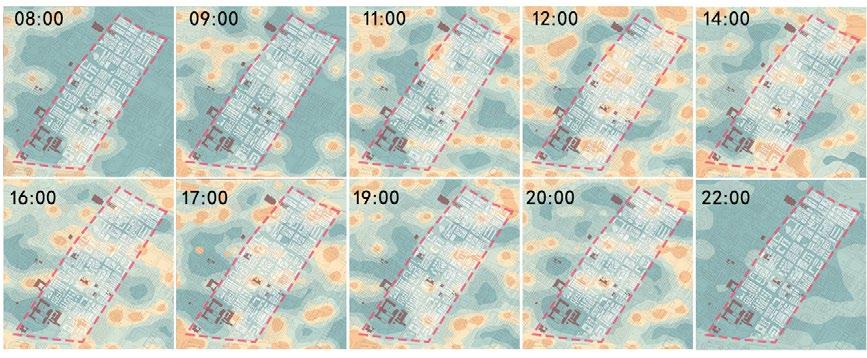
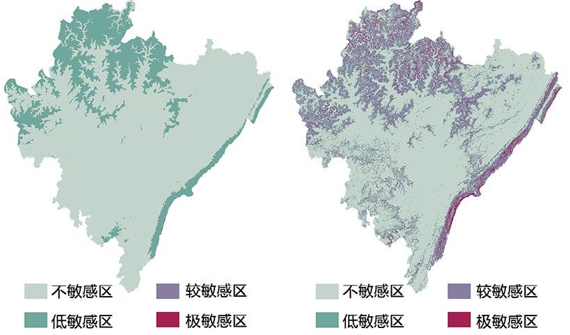
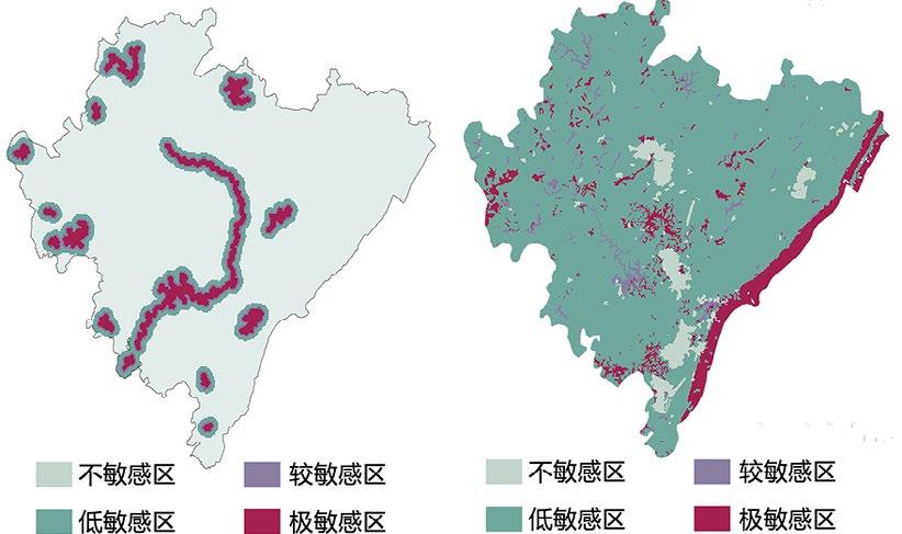
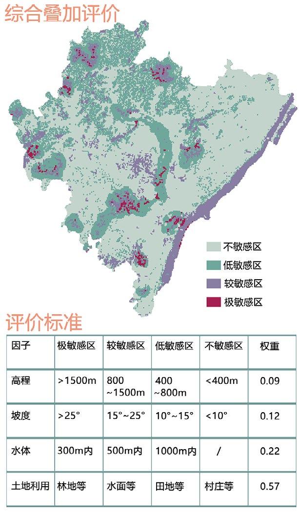
Urban Habitat Distribution of Pollinating Insects in Yongchuan
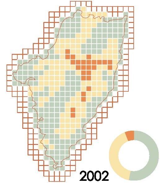
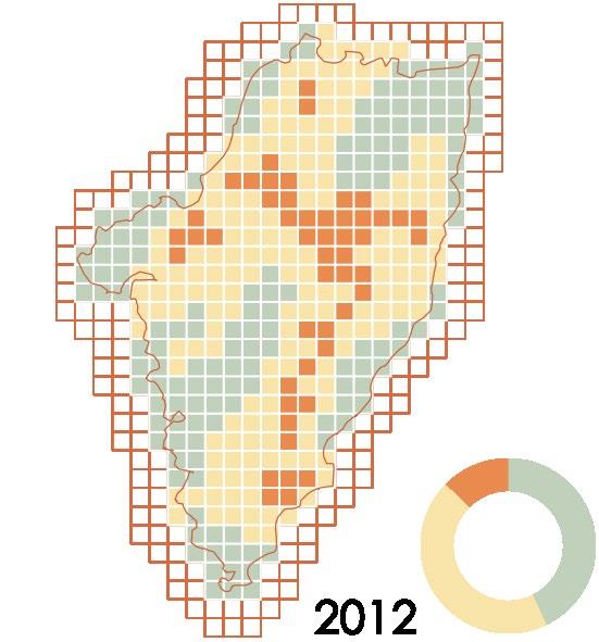
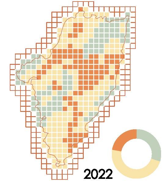
Trends in Habitat Disturbance
Human activities have gradually increased the disturbance of pollinator habitats over the last two decades.
Mild disturbance
Medium disturbance
Severe disturbance
More urban settlements formed and expanded in 2012 than in 2002, deepening their impact on pollinator habitat.
Massive urban sprawl has resulted in significant habitat fragmentation for pollinators in the Yongchuan District by 2022.
Calculated indicator reference from: Zhou L Y, Ding S Y, Lu X L, Liu Y M. Effects of anthropogenic disturbance on species diversity and niche of dominant group in pollinators community. Acta Ecologica Sinica, 2020, 40(6): 21112121.
Causes for the Decrease
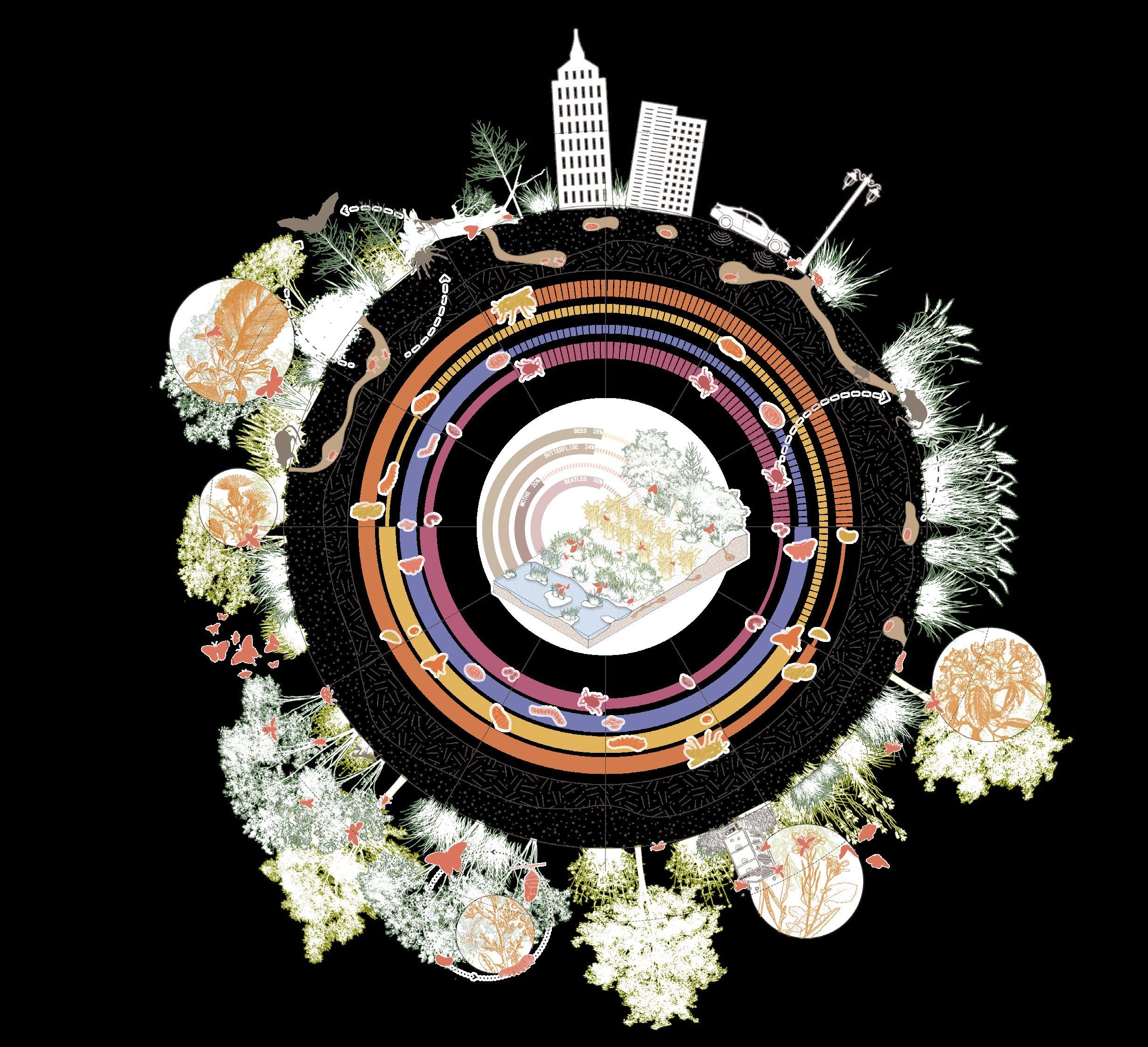
Number of pollinator species in major insect groups and proportion of insect pollinators among animal pollinators
Insects make up a significant portion of pollinators.
Agricultural Causes
Reclamation for agriculture can create hazards such as habitat destruction, a single source of food, invasive alien species, and chemical pesticide pollution.
Ubran Causes
Factors such as hardened ground, habitat fragmentation, and air and light pollution brought about by urban sprawl have also led to a decline in pollinating insect populations.
The reclamation of farmland has greatly reduced forestland and seriously damaged the habitats of pollinators.
The introduction of Italian bees(Apis mellifera) for the purpose of captive breeding can result in species invasion.
The use of pesticides has caused the death of many pollinating insects.
Excessive agricultural cultivation has deactivated the soil, making it unsuitable for insects.
Urban sprawl encroaches on large areas of natural habitat for pollinators.
The construction of roads blocked the migration routes of insects.
Harmful gases emitted by human activities cause atmospheric pollution and seriously endanger the lives of insects.
pollution in cities attracts large numbers of phototropic insects. It disorientates them and kills them.
Pollen travels with pollinators from one plant to another.
Habitat Destruction Food Deprivation
process Unban construction
Survival Competition Life Threatening Overview of Pollinators
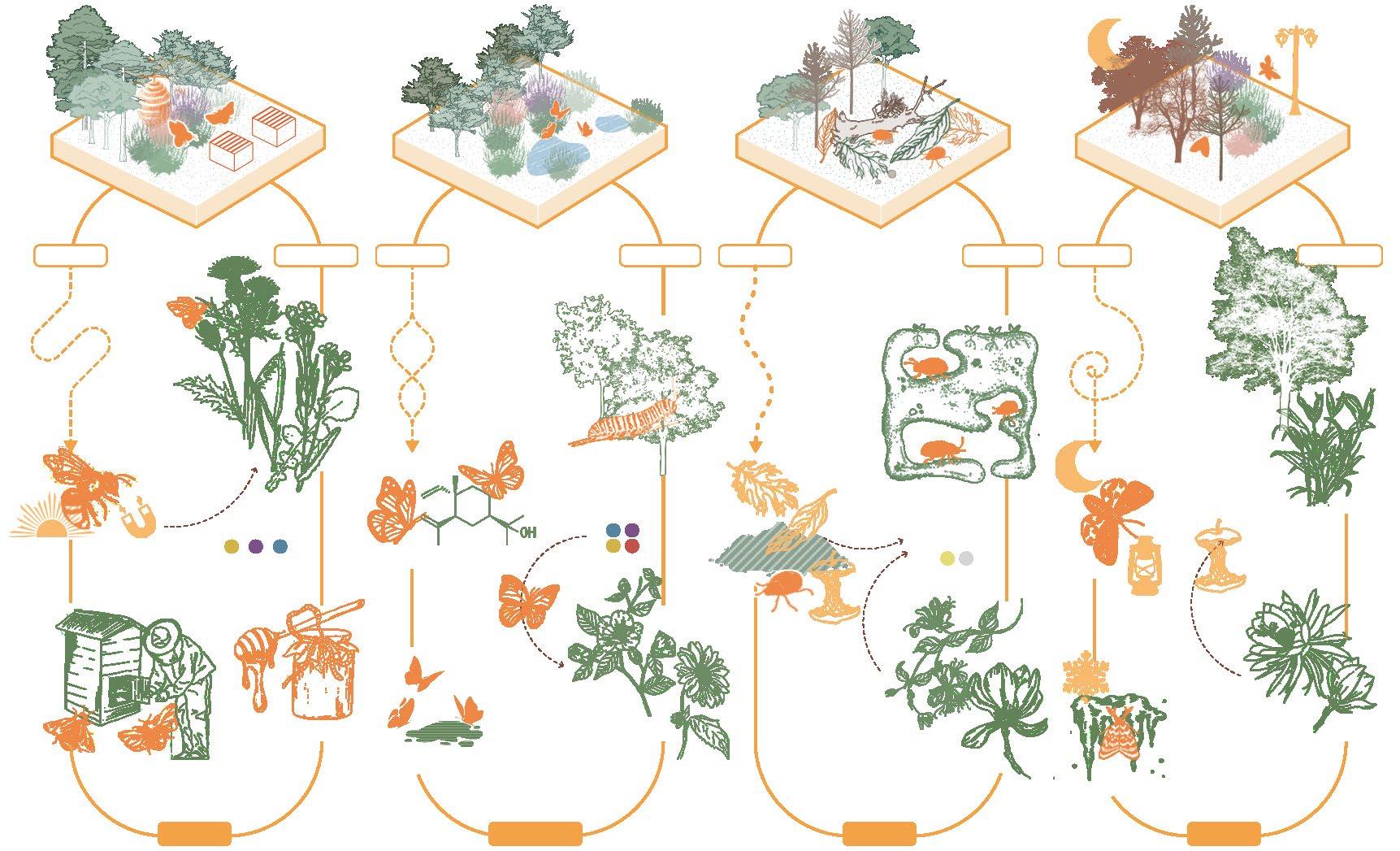
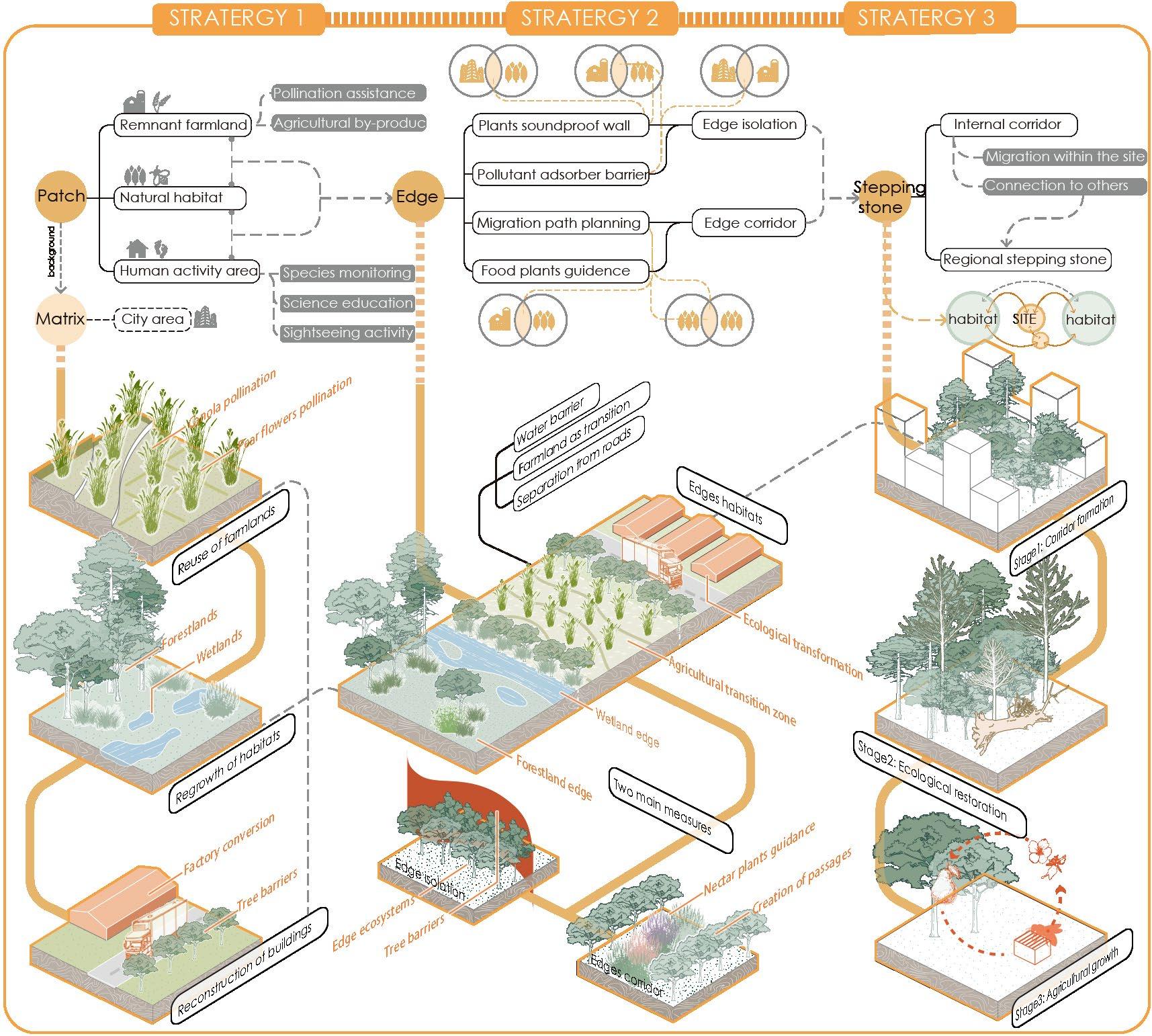
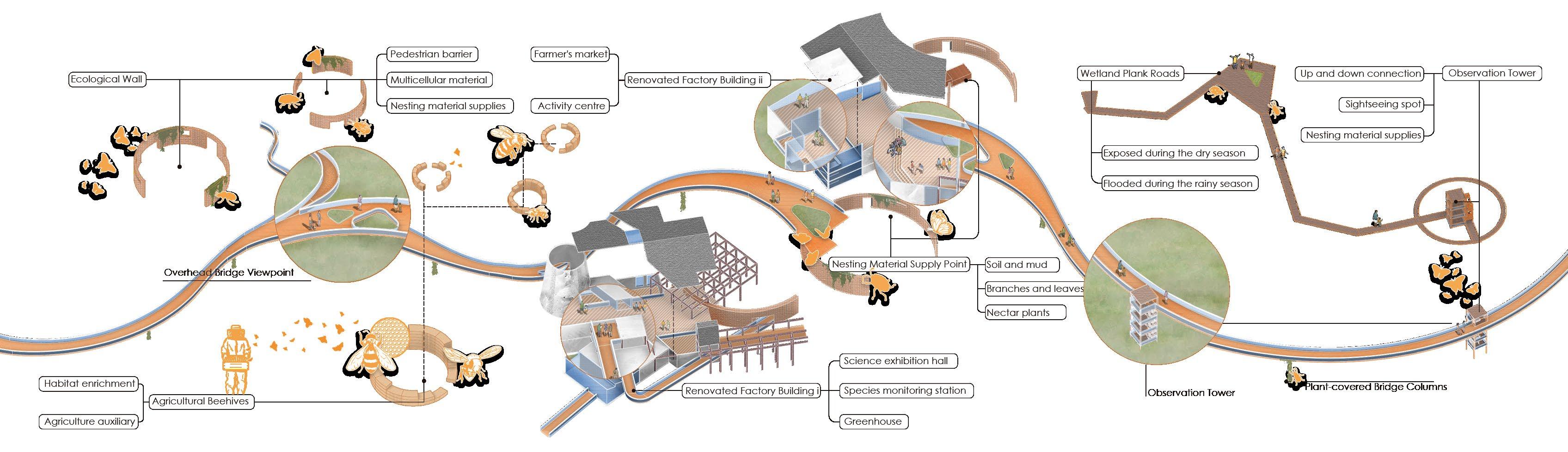
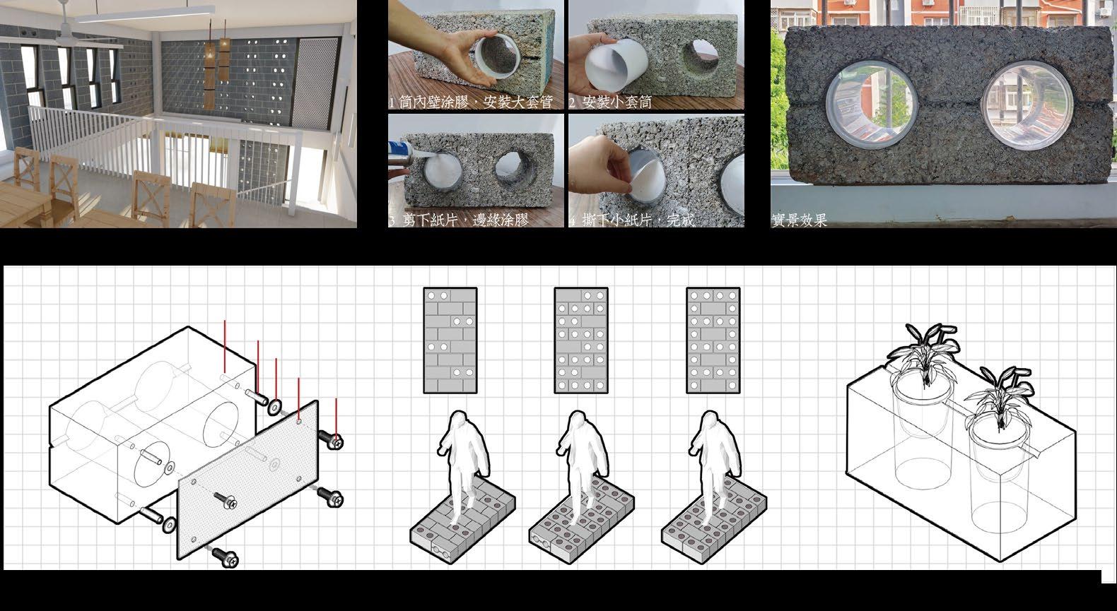
Micro edges are easily formed on steep slopes and around remnant structures. Devices such as stakes, porous walls, and artificial beehives are implanted in these areas to create micro-environments where insects can survive.
Patch edges implantation
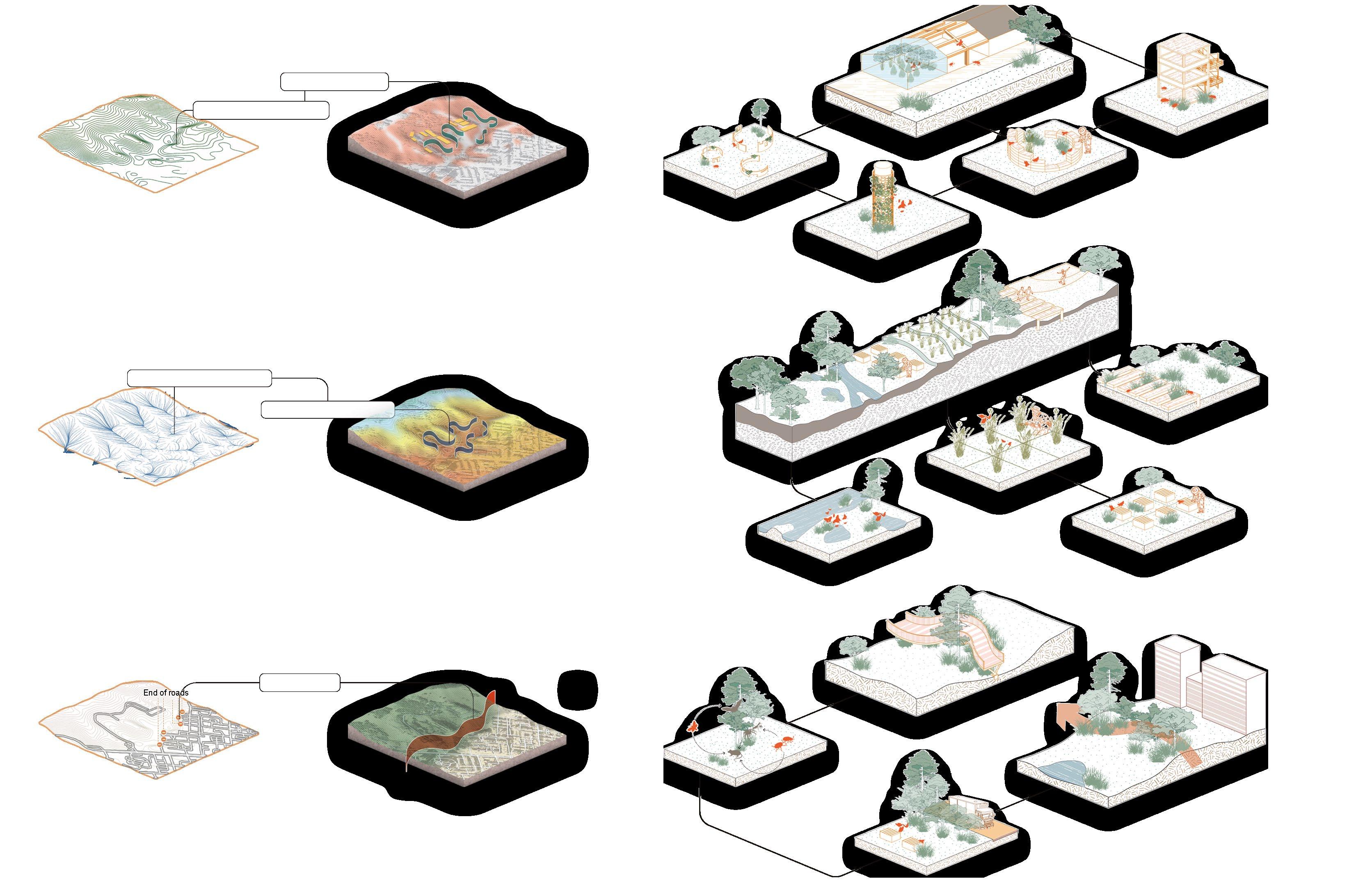
of catchment area
Catchment analysis Elevation analysis
The intersection of different patch environments creates a greater range of edge space, so patches that create different functional environments can naturally create edge effects of greater diversity.
Area edges implantation
The junction of the site boundaries and the urban area is the edge of the entire park. Enclosing this area with a variety of ecological barriers will mitigate urban disturbance and create a suitable edge environment.
Remnant Farmland
Human Activitiy Area
Natural Habitat
Steep slopes are terraced, plain terrain is restored to its original agriculture, local flower crops are grown, and bee husbandry is developed.
Retained in the form of ruins of the original factory site, with the implantation of porous wooden materials and small tubes for insect movement.
Low-lying areas create wetland water sources. Human activity areas are elevated above ground level to retain visibility while reducing disturbance.
Environmental Creation of Remnant Farmland
Environmental Creation of Human Activitiy Area Environmental Creation of Natural Habitat
Decomposition of the man-made environment
The park requires implanted devices to provide the environmental basis for rewilding, which creates man-madel environments suitable for insect habitats. Corridor bridges are facilities where humans can access the environment without disturbance, and their support structures can provide nesting space for insects. Facilities for human activities can also serve as insect habitats.
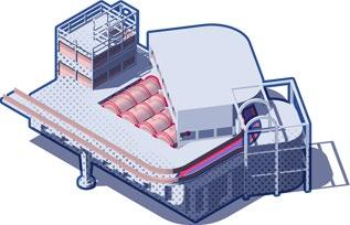
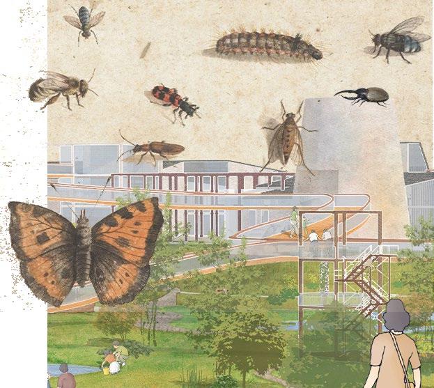
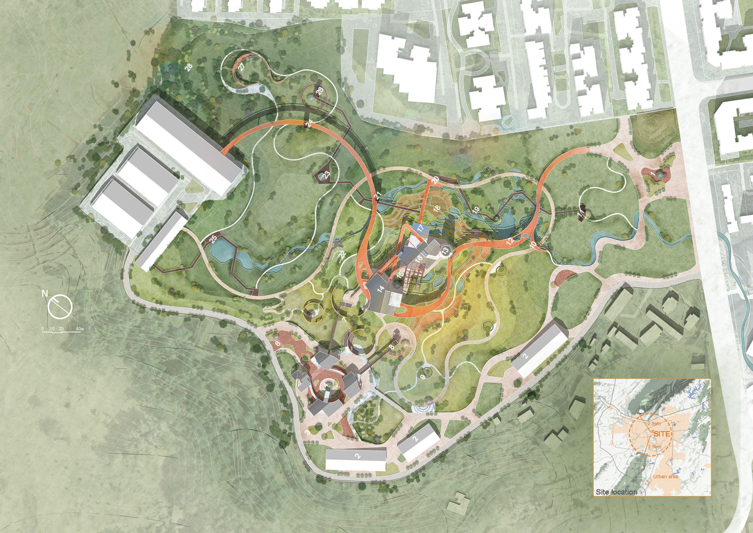
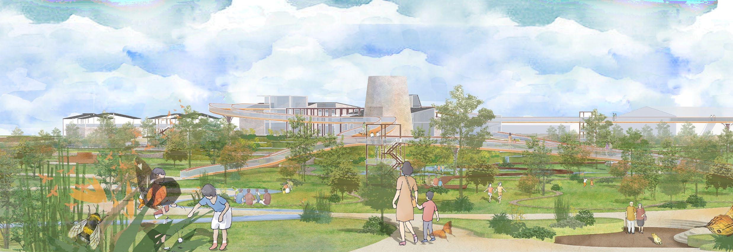
Rendering at the Entrance
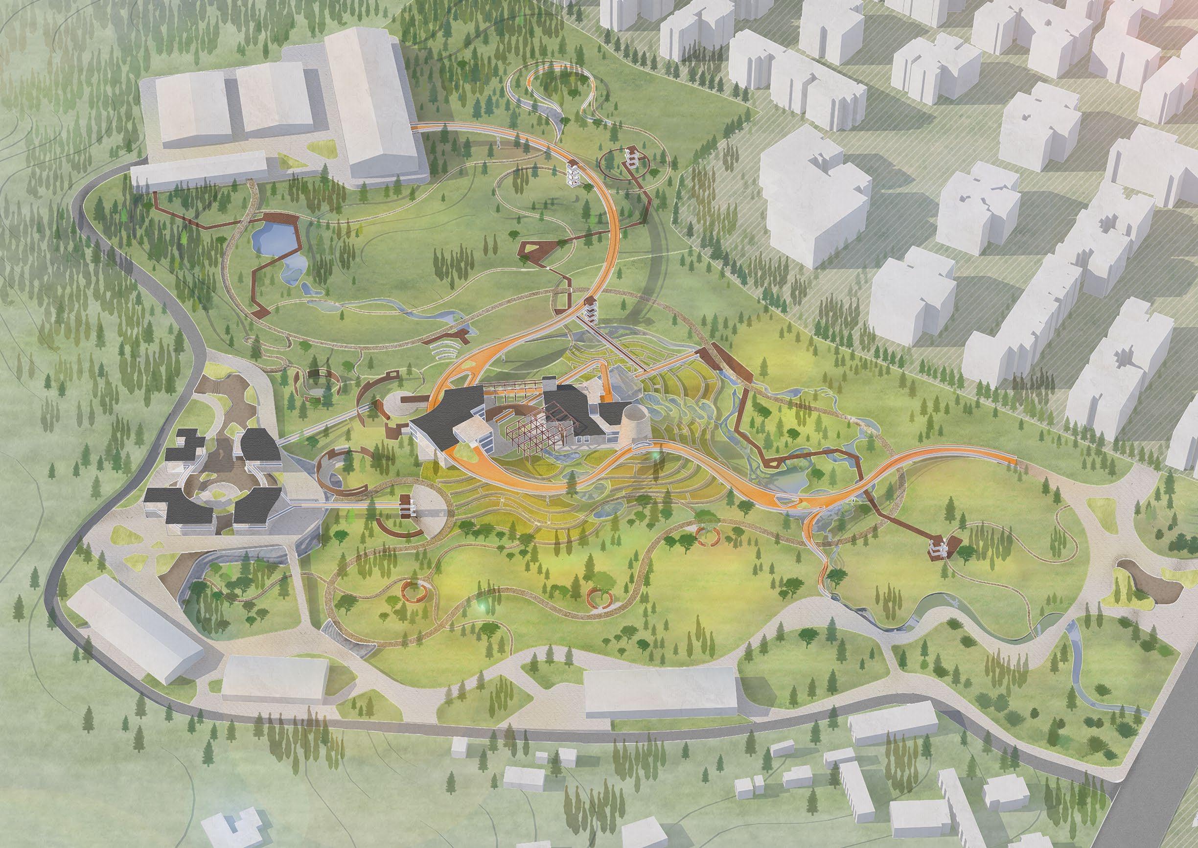
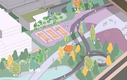
Overall bee's eye view of the park
Pictured here is a panoramic view of the park from an overhead perspective. As an urban park, this site provides a habitat and staging area for migrating pollinating insects.
COST OF COMMUNITY LIFE
Urban renewal / Participatory community regeneration
Bachelor Graduation Project 03/2024 - 05/2024
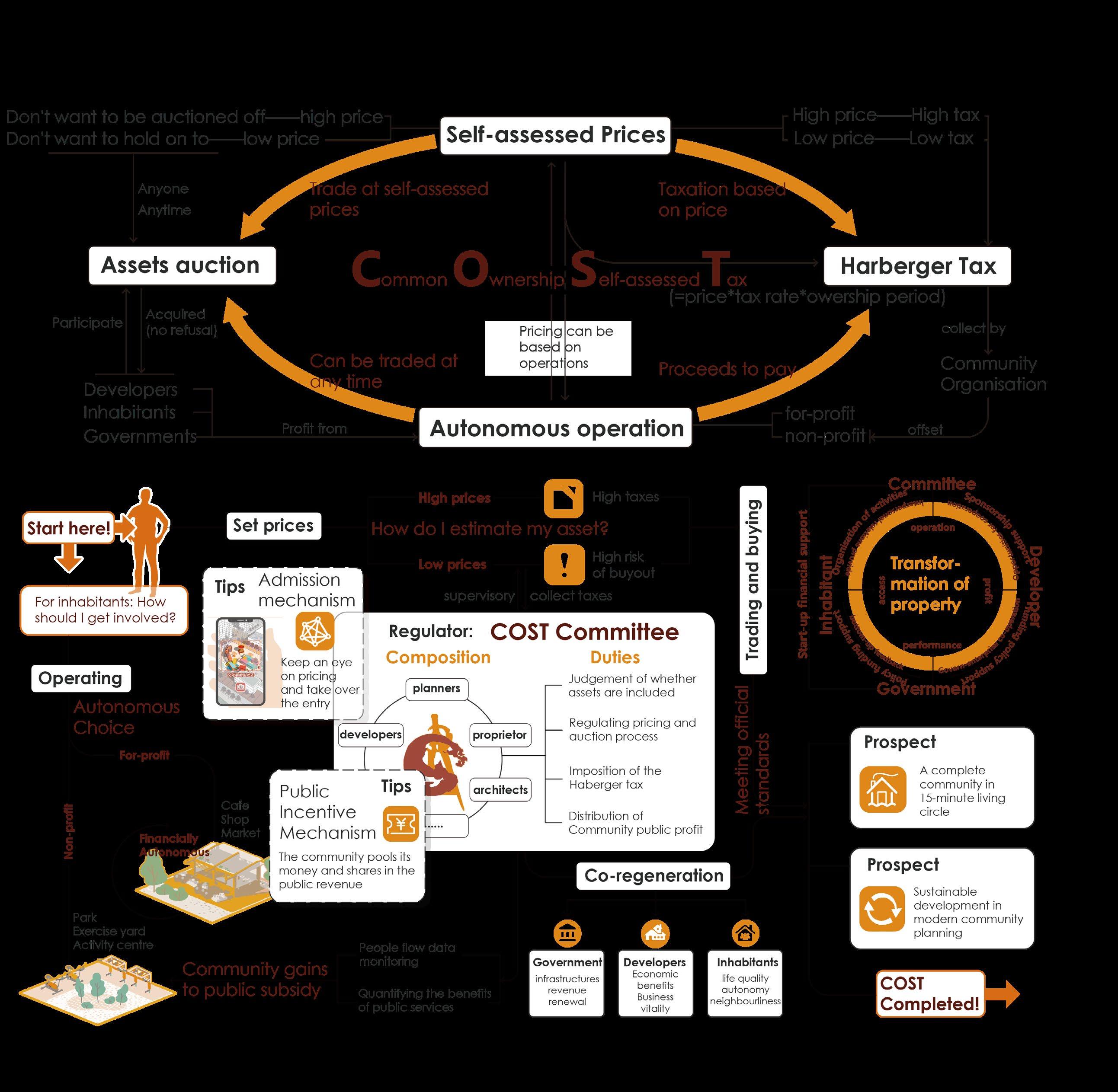
In the process of transforming Chongqing’s old communities, an operational strategy based on the COST (Common Ownership Property Self-assessed Tax) system is introduced, aiming to incentivise inhabitants, government and developers to participate and compete on their own initiative, and to realise the process of community regeneration.
This project is for the graduation design on the site of an old neighbourhood undergoing regeneration. I referenced the concepts in the book ‘Radical Markets’ and adapted the COST mechanism therein to the actual situation. This is the first time I have incorporated a specific economics system into the design. By proposing a seemingly radical strategy, the project aims to promote participatory community regeneration and balance the relationship between inhabitants, government and developers in the process of community regeneration.
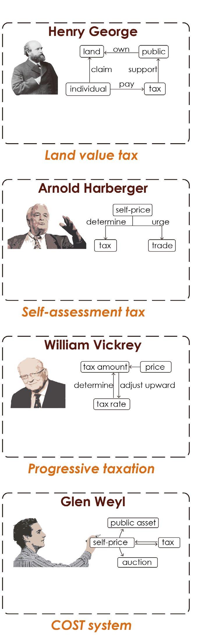
Theoretical Foundations
Processe of the COST system
The land is fully communalised and the way it is taxed is proposed. The tax on the value of land serves the public as the ultimate form of taxation.
A self-assessment tax system was first proposed to address the difficulty of collecting property taxes by Latin American governments.
Participation Guidebook
The tax system has been improved and the incentive effect of a progressive tax system on individuals has been emphasised.
Proposed redesign of the market system with self-assessment tax and auction mechanisms
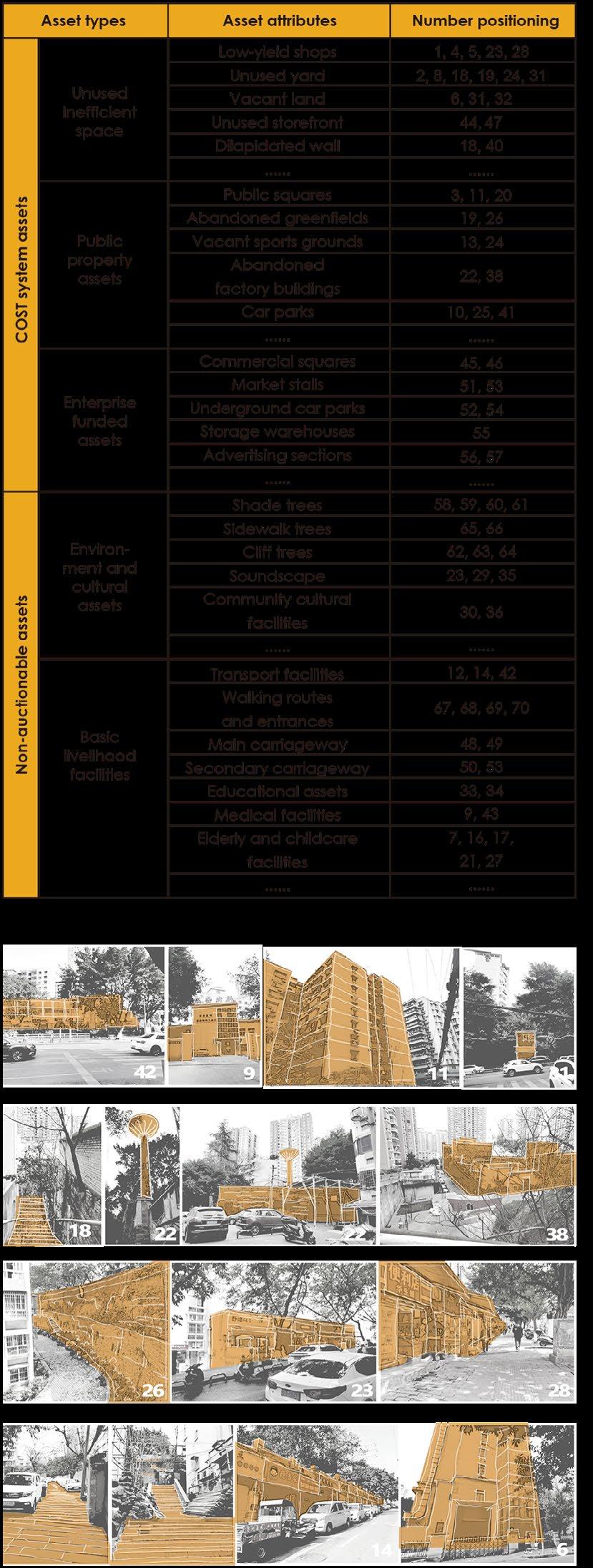
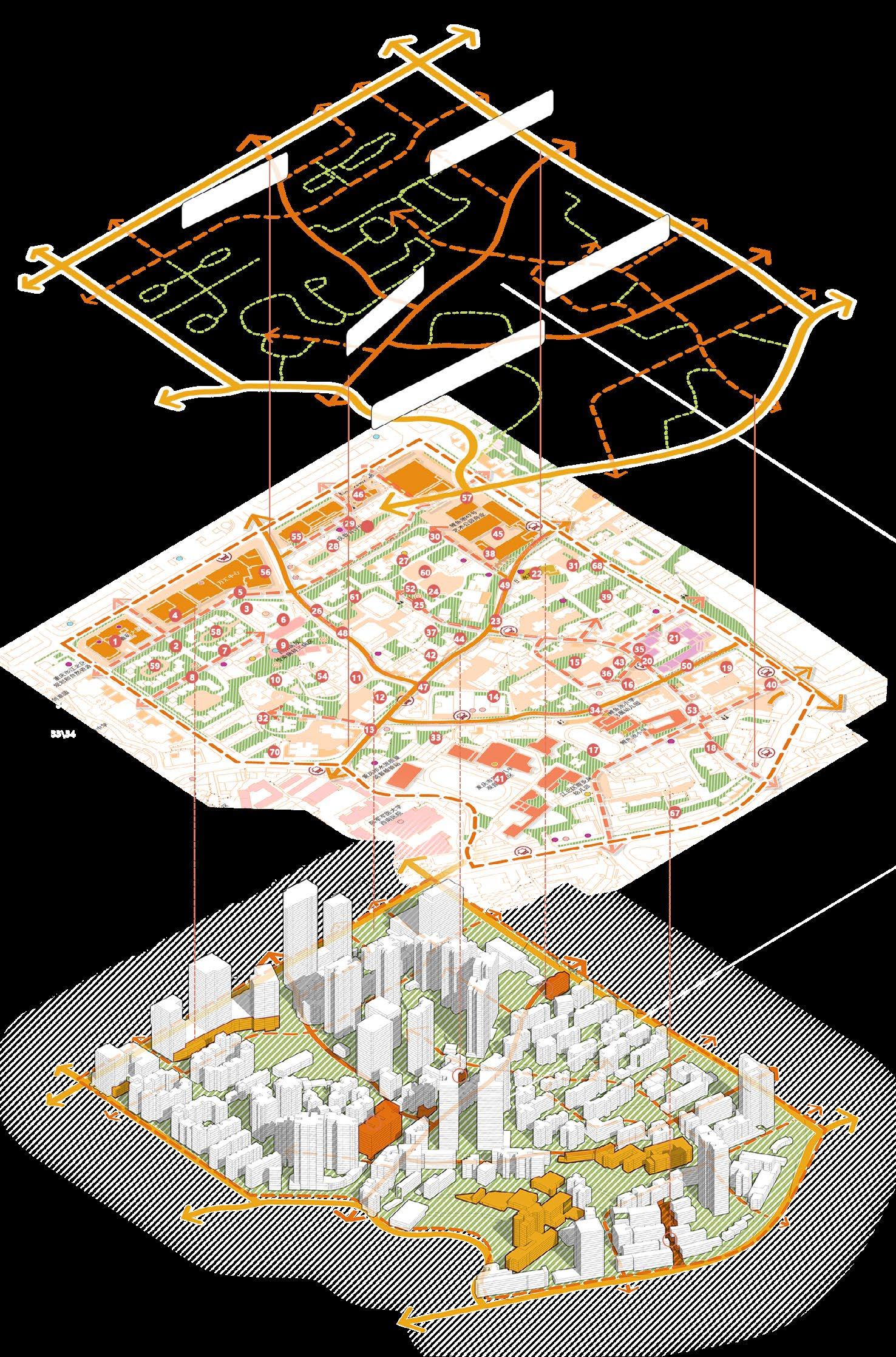
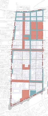
Index of Community Assets
Index of Community Assets
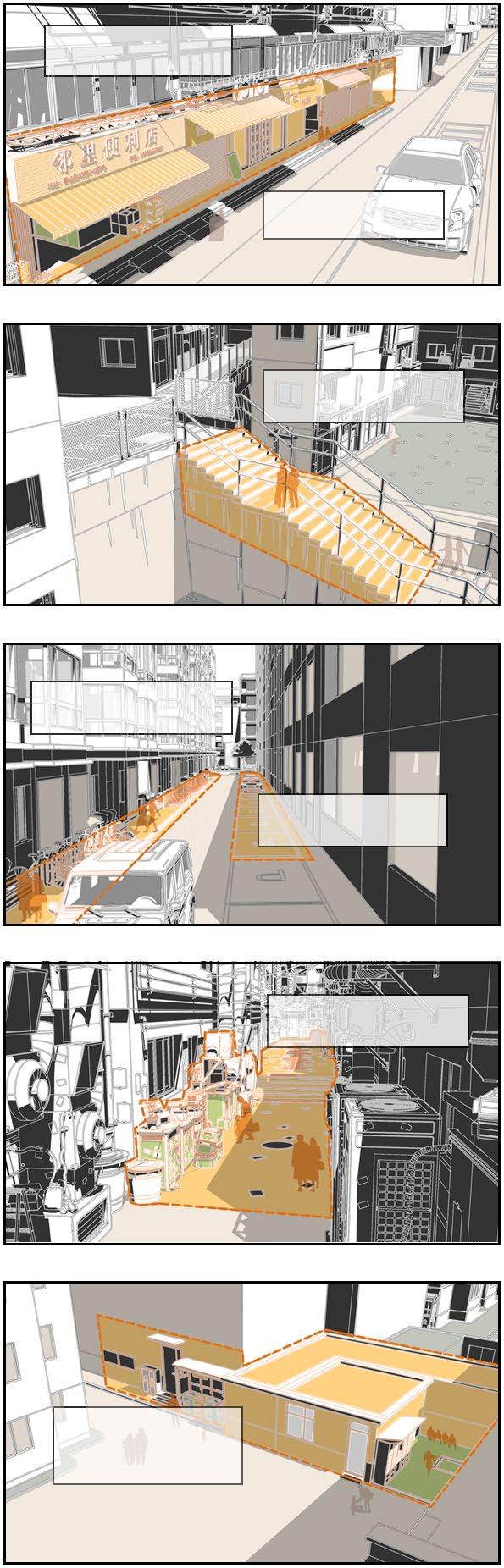
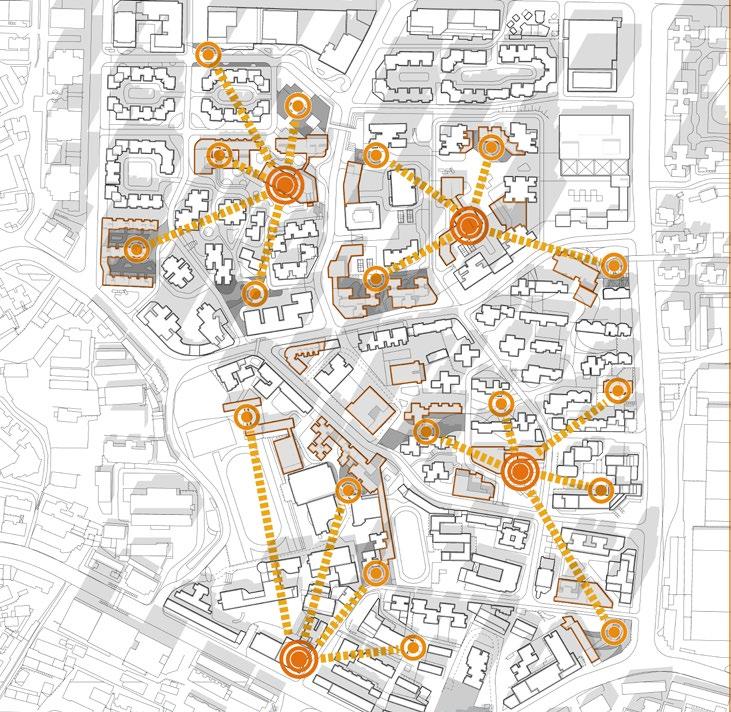
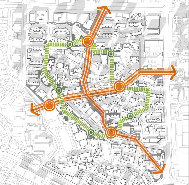
The disposable assets are predominantly located in older neighbourhoods and are mostly unused, inefficient and under-utilised spaces.
The site has well-developed vehicular traffic, but poor pedestrian connectivity.
Weak connection between different height
factory landmark
Utilisation of space assets in elevated terrain
made by multiple staircases
Status of Community Assets
Transport connectivity of assets Spatial distribution of assets
Participants in the COST System
Current owner: property developer
prospective buyer: inhabitants
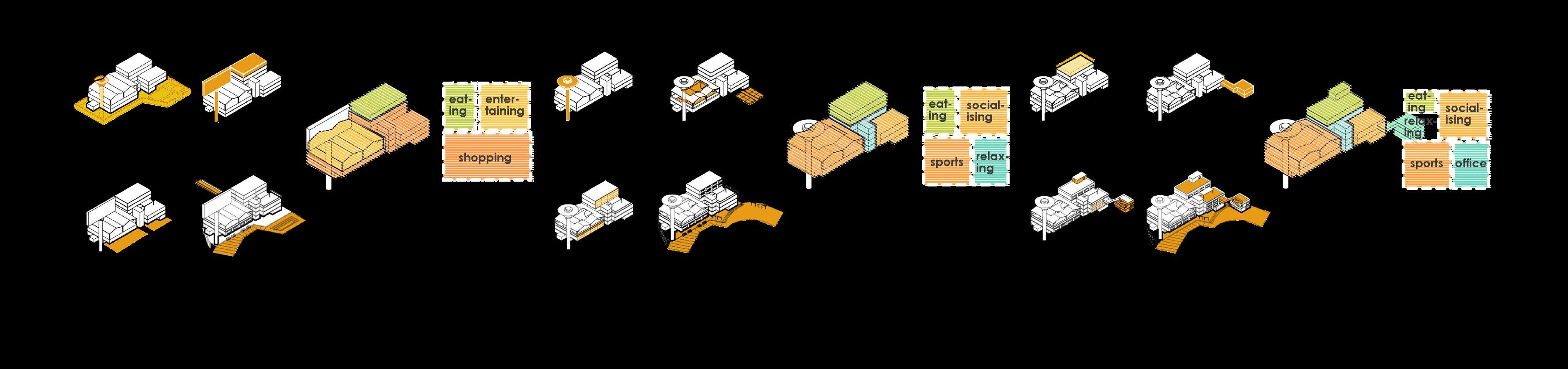
Step1: Ground floor addition
Asset: Inefficient front rooms
renewal approach: Alteration
Operating Method: For-profit
New function: individual business
Step 2: Public space optimisation
Asset: Abandoned courtyard
renewal approach: Alteration
Operating Method: Non-profit
New function: public activities
governments
Step1: Walking traffic opening
Asset: Old low-rise buildings
renewal approach: demolition
Operating Method: Non-profit
New function: pedestrian passage
Step 2: Internal courtyard creation
Asset: Abandoned courtyard
renewal approach: Alteration
Operating Method: Non-profit
New function: public activities
Step1: Conversion of old factories
Asset: former factory building
renewal approach: Alteration
Operating Method: For-profit
New function: commercial complex
Step 2: Commercial Creation
Asset: Open spaces and streets
renewal approach: Alteration
Operating Method: For-profit
New function: shopping streets
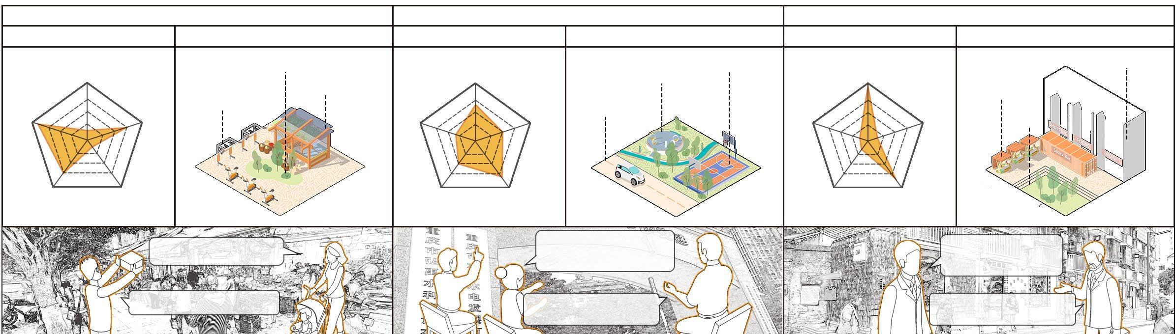
Spatial System for Autonomous Renewal
Local inhabitants tend to buy and operate small-scale vacant assets, such as courtyards and small shops, and to make limited improvements to them. These assets are scattered around community service stations in various neighbourhoods.
The Government’s increased investment in public facility assets has improved the community’s service facility system. It has also strengthened greening, completing the green space pedestrian system for the entire area.
Developers invest in large-scale commercial assets. Creating commercial complexes and neighbourhoods that attract large numbers of visitors to the community brings profits.
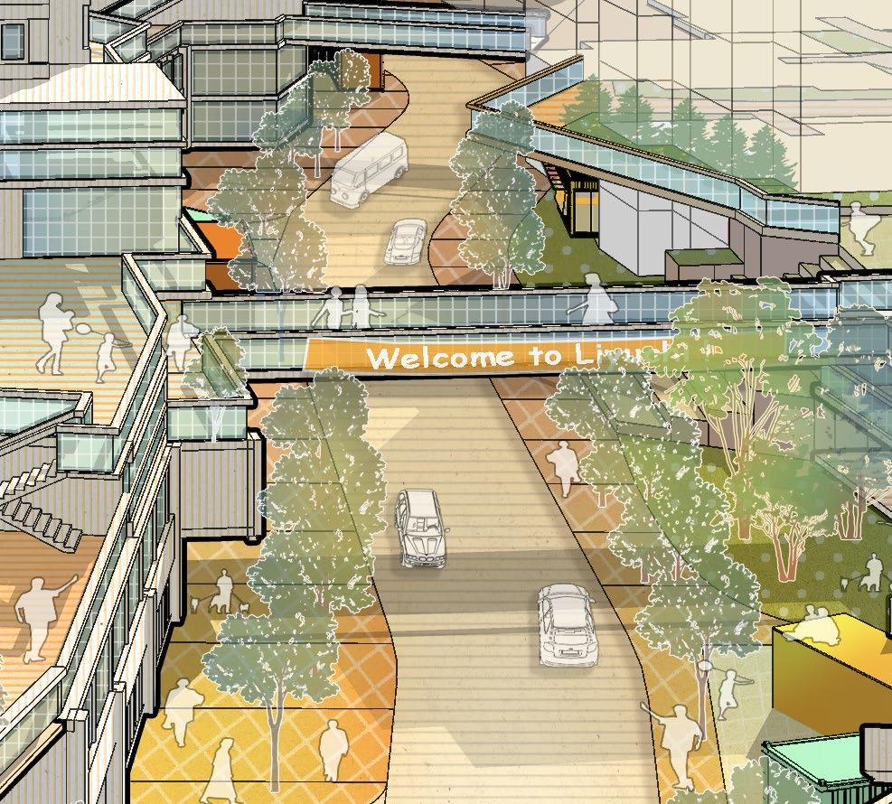
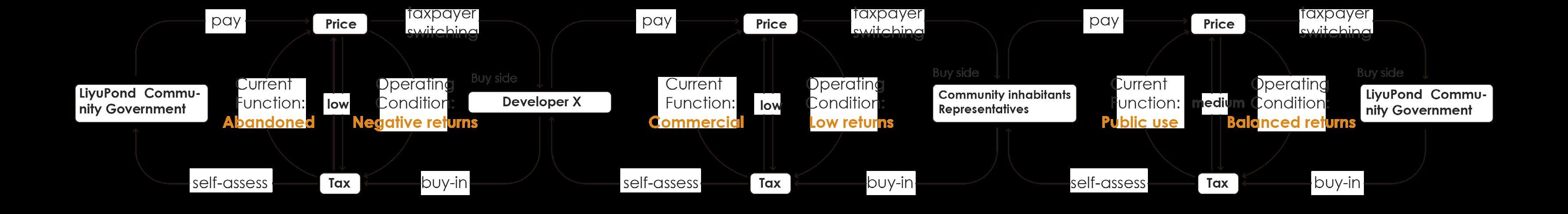
An Example of the Abandoned Waterwork
Opration by Developer X
The abandoned waterwork is a negative asset held by the LiyuPond Community Government. Developer X bought it and refurbished it to become the Waterworks Shopping Mall.
COST Process
Opration by Community inhabitants
The mall was inefficient so Developer X priced it lower to reduce tax payments. Inhabitants who had long been dissatisfied with it raised funds to buy it and turned it into a community centre.
Opration by LiyuPond Community Government
Inhabitants were gradually unable to pay for it and run it. The Government bought it and upgraded it into a multi-purpose community centre for the whole community.
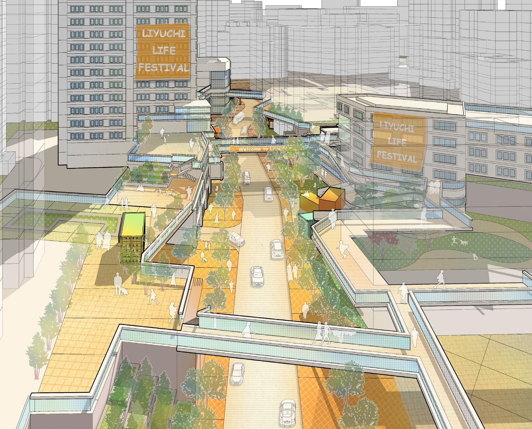
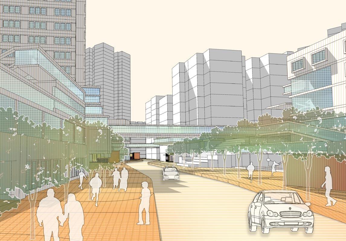
Overview of COST System Pilot Street
Public welfare assets are operated by the Government and receive dividends from the COST committee based on the number of beneficiaries.
After investing in the construction of the mall, the developers took it upon himself to build public transport facilities such as flyovers. This has led to improved pedestrian transport connectivity in the community.
Façade of Autonomous Renewal Street
The modular container shops are invested by the COST committee and inhabitants are free to buy and lease them for commercial profit.
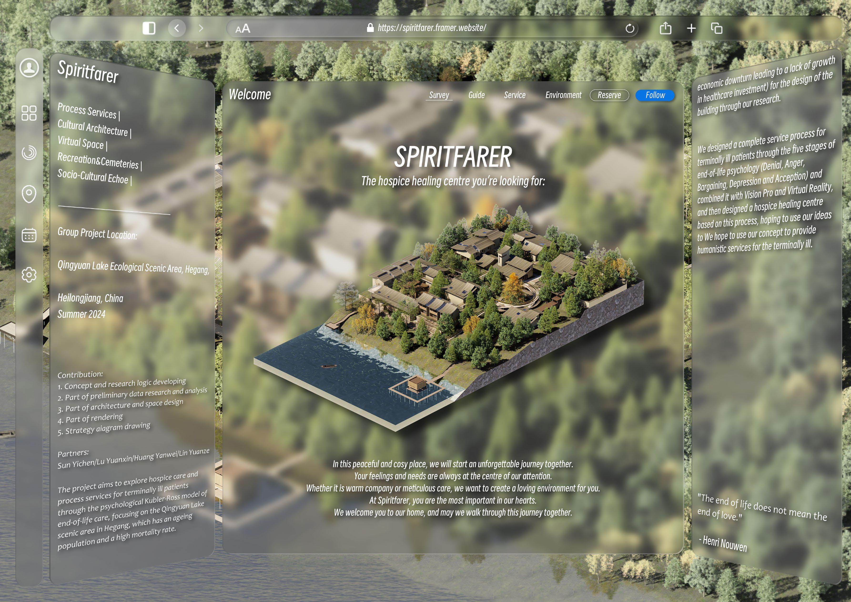
SPIRITFARER
Hospice architecture design / Website design
Group work/5 people 08/2024 - 09/2024
Partners: Sun Yichen/Lu Yuanxin/Huang Yanwei/Lin Yuanze
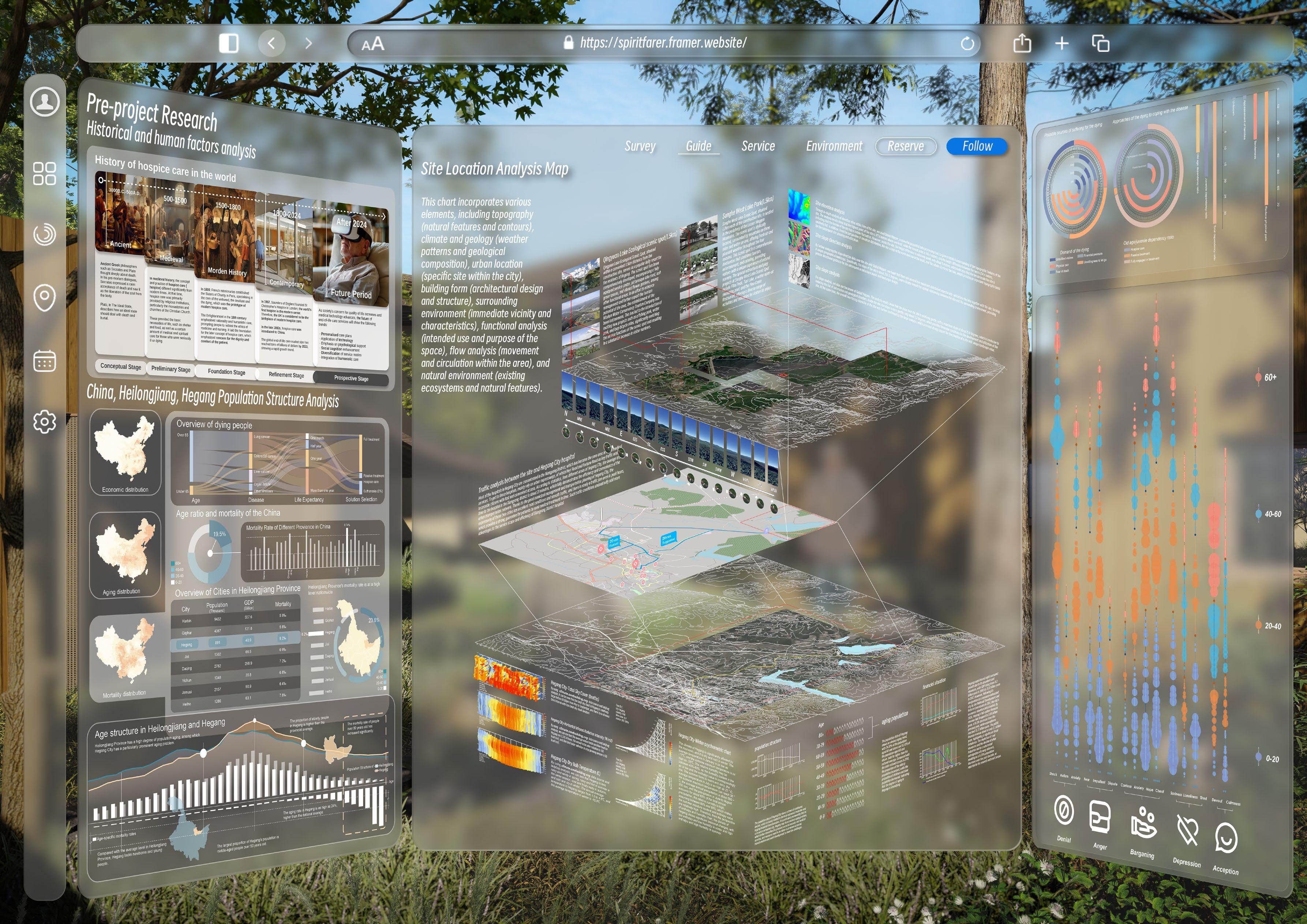
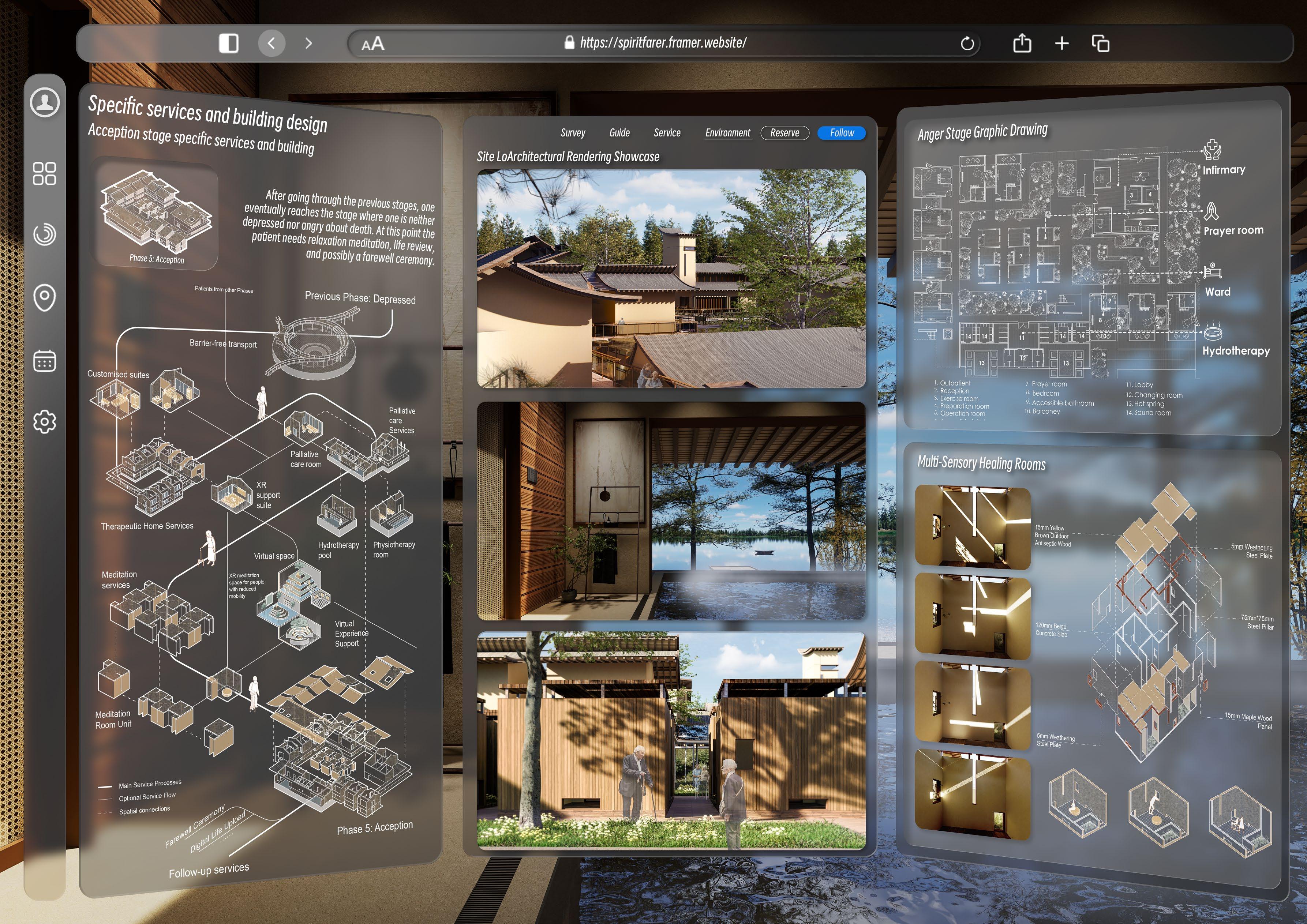
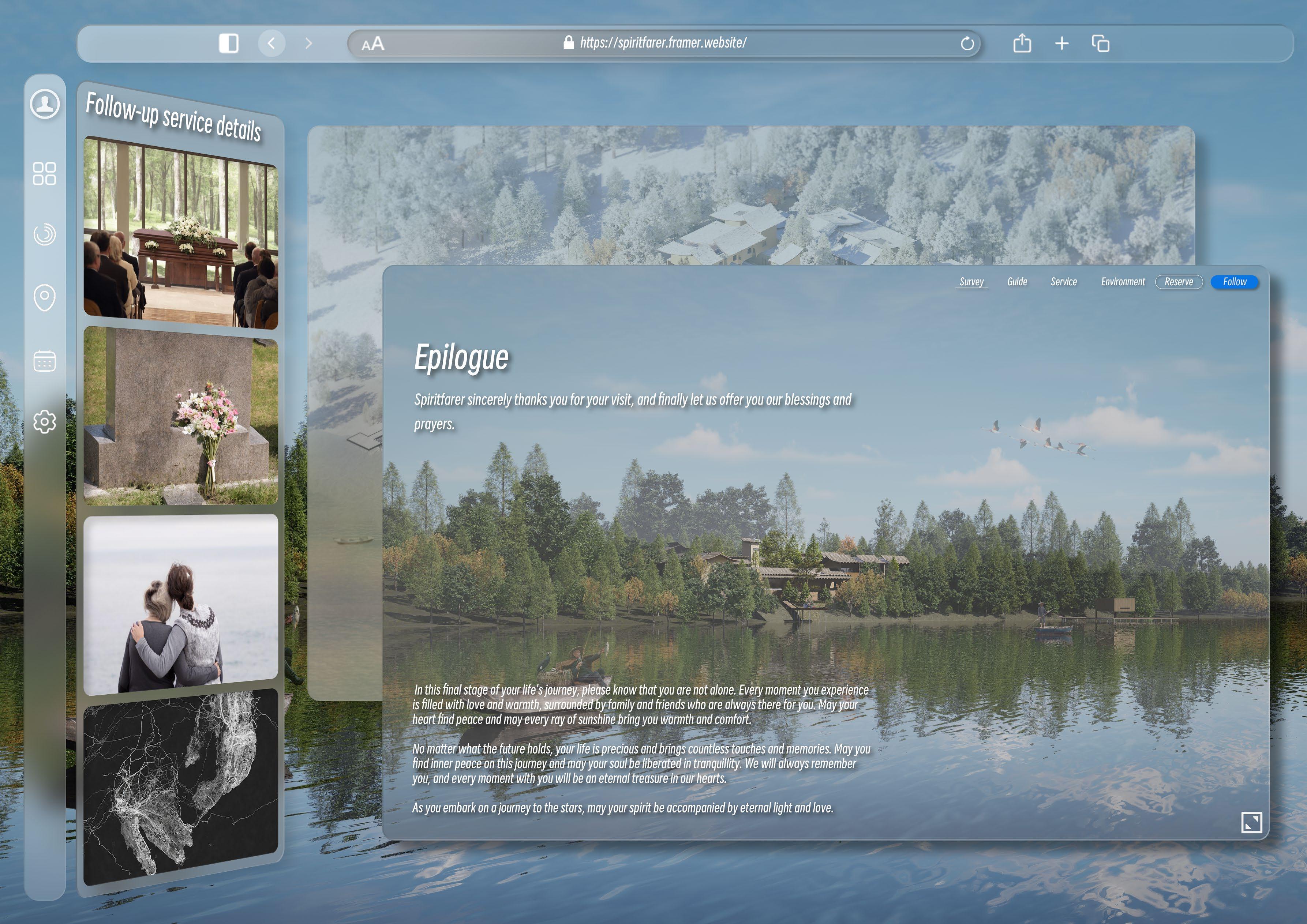
The project aims to explore hospice care and process services for terminally ill patients through the psychological Kubler-Ross model of end-of-life care, focusing on the Qingyuan Lake scenic area in Hegang, which has an ageing population and a high mortality rate.
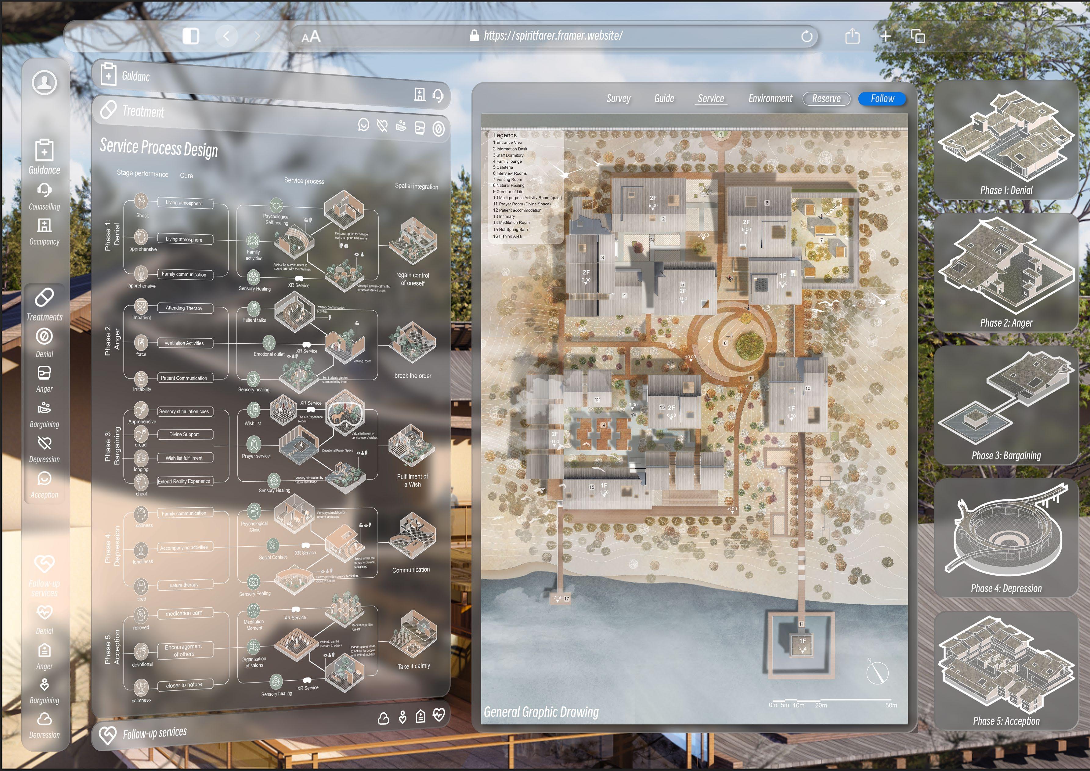
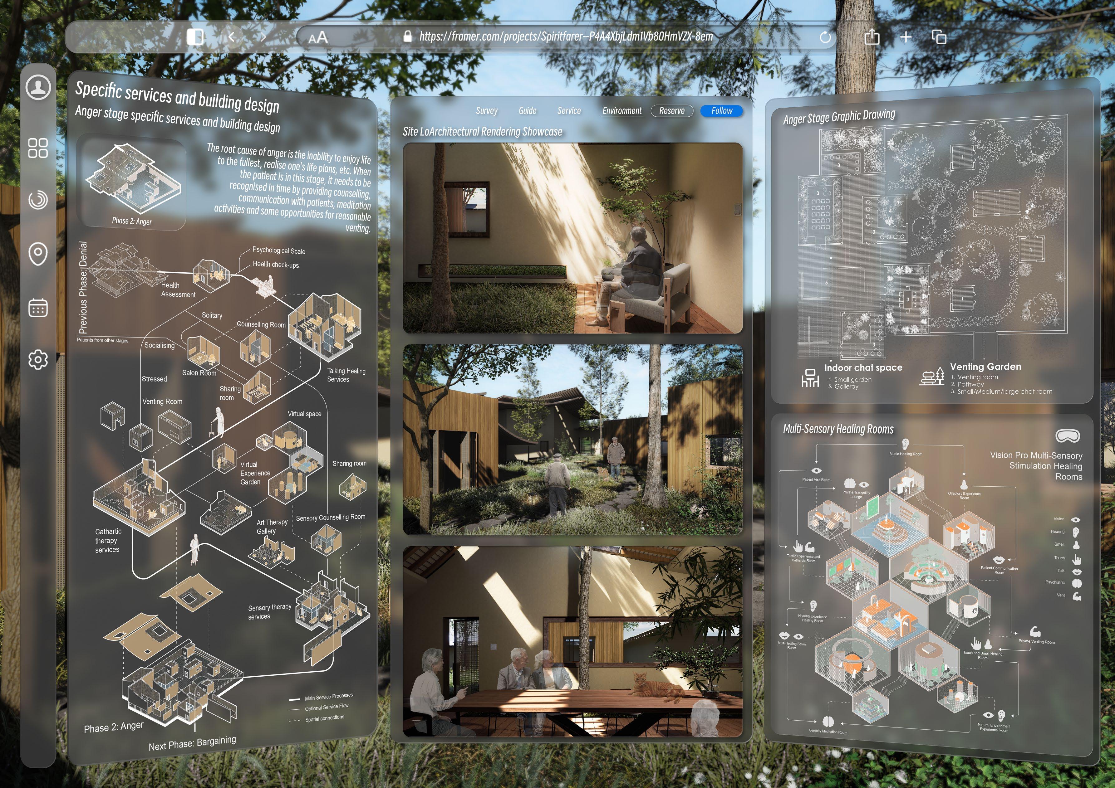
Through the web presentation of the VISION PRO UI, the programme aims to present a barrier-free service system that is closely integrated with the built environment, using VISION PRO as the operating carrier.
Contribution:
1. Concept and research logic developing
2. Part of preliminary data research and analysis
3. Part of architecture and space design
4. Part of website layout
5. Strategy diagram drawing
Click to preview the site: https://spiritfarer.framer.website
OTHER WORKS
HOUSE OF WOOD&RICE
12/2021 - 03/2022
TIDAL RISE IN TIANJIN
06/2022 - 09/2022
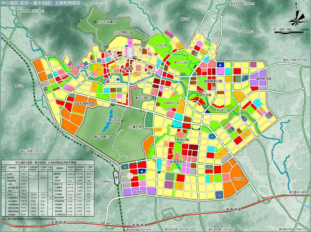
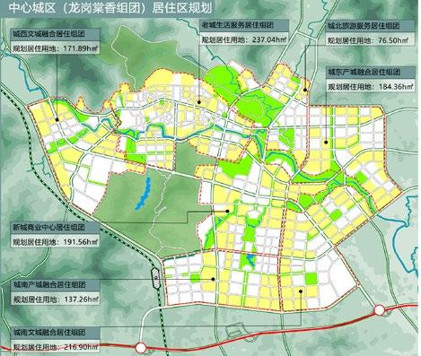
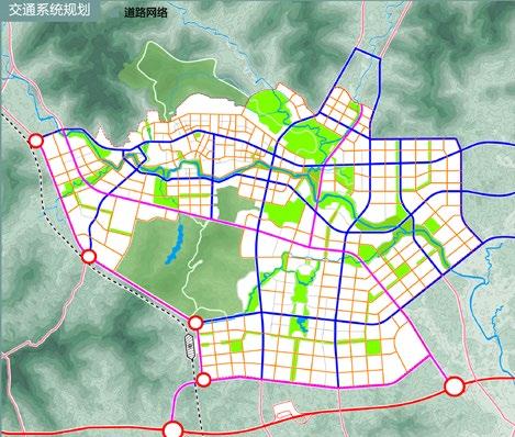
Territorial Spatial Planning in Dazu
06/2022 - 09/2022
The other works section contains field construction projects, competitions, and non-design projects I worked on during my undergraduate studies.
House of wood&rice was a rural volunteer project after participating in the Wu Zhi Qiao team at Chongqing University. In this project, the team designed and built a village canteen for a rural village in Guangxi, China. Tidal Rise in Tianjin was a national design competition in which four classmates and I proposed a new strategy to improve the living conditions in the old urban area of Tianjin and designed spaces for renewal. Territorial Spatial Planning in Dazu was a course design for an undergraduate course on territorial spatial planning. In this project, I carried out a series of analyses on the geography, population, and industry of Dazu District in Chongqing. Finally, I made a detailed plan for the future spatial layout and industrial development of Dazu District.
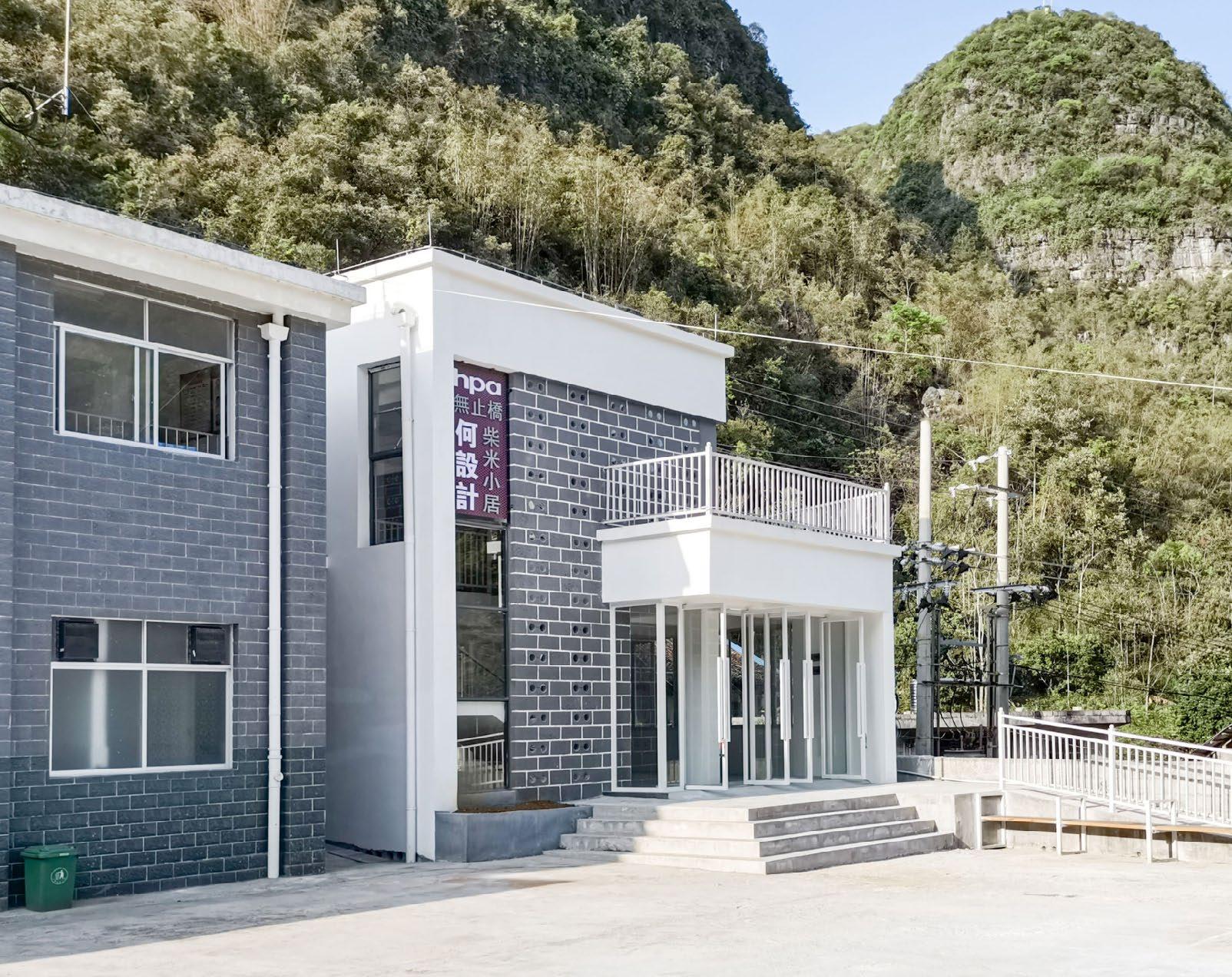
House of wood&rice
This project is a convenient service space with a cafeteria as the main function and leisure and entertainment as the auxiliary for villagers. was involved as part of Chongqing University's WuZhiQiao team which is a public welfare organization established in collaboration with the WuZhiQiao Charity Foundation of Hong Kong and Chongqing University.
Time: 12/2021 - 03/2022
Site: Guangxi, China
Teamwork (over 36 schoolmates in Wuzhiqiao Team)
Contributions:
1. Advocacy and logistics for the team
2. Part of interior design and decoration
3. Part of project solicitation and representation
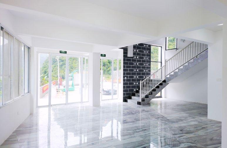
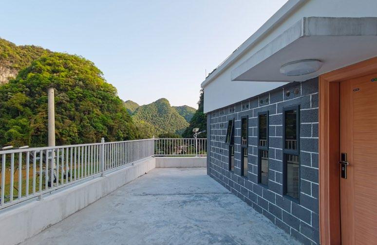
Photo of the completed building
Photos of Construction Details
Details (hollow bricks design)
Details (structure design)
Guangxi Du'an Village Canteen Project (in use)
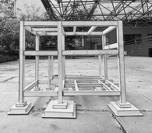
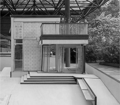
Model photos
Facade filling rendering Installation process Real scene picture
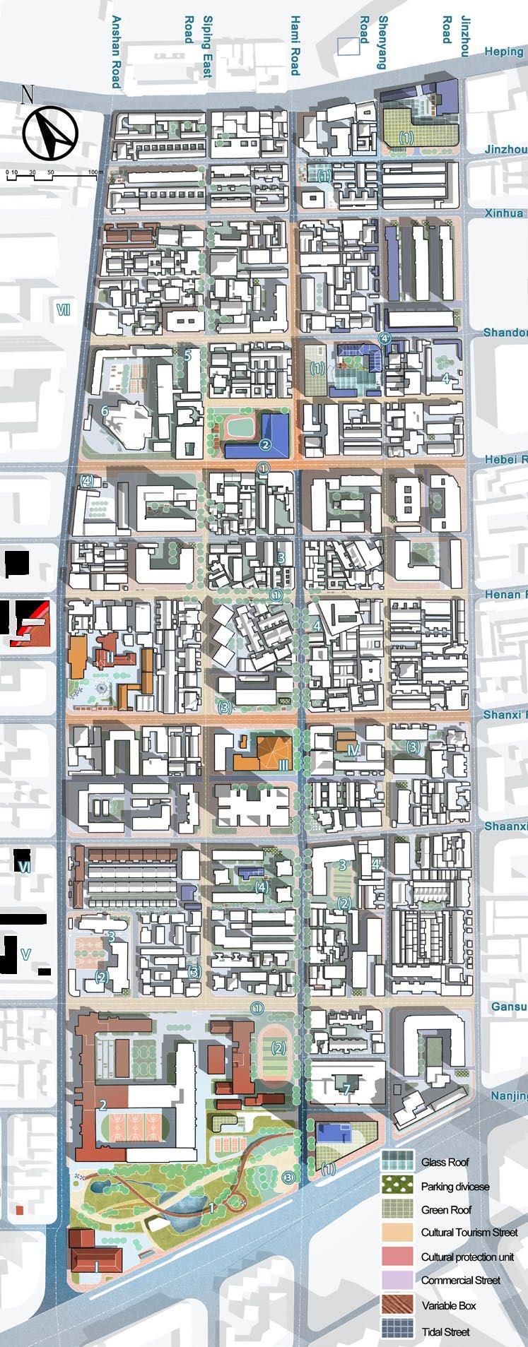
Tidal rise in Tianjin
Time: 06/2022 - 09/2022
Site: Tianjin
Teamwork(5 people)
Instructor: Zhou Lu&Li Yuyan
Contributions:
1. Concept and research logic developing
2. Part of masterplan and analysis chart
3. 3d modeling
National Urban Space Planning Design Competition (3rd prize)
This is an urban renewal competition project. In order to deal with the problems of space closure in the area, a strategy of space utilization in different time periods based on the concept of "tide" was proposed.
Territorial Spatial Planning in Dazu
Time: 10/2022 - 12/2022
Site: Dazu, Chongqing
Teamwork(2 people)
The project is located in Dazu, Chongqing Municipality. Geographic information technology through GIS was used to assess the suitability of development and estimate population projections for the whole area of Dazu. Detailed planning was also carried out for its central city.