PORTFOLIO

RUIPING CHEN 2018-2022
Apply For MLA Landscape Architecture
The University Of Edinburgh University Username:S2546922


RUIPING CHEN 2018-2022
Apply For MLA Landscape Architecture
The University Of Edinburgh University Username:S2546922
Northeast Forestry University 09/2018-06/2022
Major : Landscape Architecture, School of Landscape Architecture
Core Courses: Landscape Planning And Designing I (88/100), Preliminary Landscape Design (93/100),
The Planning Of National Park(88/100), Landscape Ecology(85/100), Landscape Design With Plants (88/100)
General Constracting Company Of China Construction Eighth Engineering Division Corp., LTD.
Design Management Assistant 08/2022-Present
Responsible for polishing the project site drawings of epc engineering
Monitored and reviewed design progress and quality
Communicated and coordinated with related departments of construction site to achieve cost optimization
Shanghai Xian Dai Architectural Design (Group) Co., Ltd 08/2021-09/2021
Landscape Designer Intern, Landscape Office 1
Shanghai Da Zhuo Landscape Planning & Design Co., Ltd 01/2021-02/2021
Landscape Designer Assistant, Scheme Group PROJECT EXPERIENCE
2020 CHSLA Landscape Design Competition for College Students 09/2020-11/2020
Team Leader (Designing)
Project: Designing a popular-science park under the principal of a shared community for mountains , waters, forests, fields and lakes
Major responsibility: Concept Design, Model making, Expressing and Drawing
Heilongjiang Landscape Construction Competition 06/2019-07/2019
Team Leader
Independently designed the major parts of the Wild Luxury Hotel model Led the team to be one of the top 8 and got Third Prize
EXTRACURRICULAR ACTIVITIES
Communist Youth League of the School of Landscape Architecture 09/2018-06/2020 Coordinator, Department of Reporting and Interviewing
Independently wrote 25 articles for various events organised by the College Committee and took photos of the events (20 events in total)
Proofread and organized the layout of 35 Wechat Push as well as posters of events
Publicity Commissary 09/2018-06/2022
Organized 10 group activities for the whole class Designed the class logo which showed out in the logo competition
MISCELLANEOUS
Skills: Rhinoceros, AutoCAD, SketchUp, Photoshop, Indesign, Illustrator, Lumion, V-ray
Nowadays, most landscape designs in domestic market cannot be truly implemented due to limited budgets, and the finished products can rarely present the designers' original blueprints. In addition, the procedure of landscape in China is still the monopoly of the A-side, which limits the designers’ innovation and imagination.
As a result, the idea of going abroad for further study gradually arose in my mind. I would like to experiencethe integration of multicultural architecture and the fancy urbanized design in developed areas; I would like to emerge myself in a freer environment of design and to engage myself in a fairer procedure of design; I would like to exchanges my ideas with designers of different cultural backgrounds so as to give birth to more creative and feasible designs; I would like to learn more about the urban design strategies and methods in developed countries, so as to make up for the shortcomings of my domestic studies. Designing as a student means creating without any burdens or boundaries. In this sense, I can try my best to convert my ideas into reality, with passion and enthusiasm that are often seen in students.
I plan to pursue a career in the design industry, especially in landscape design and in the future. The landscape industry is more like a bridge connecting we human and Mother Nature, and is closely related to the ecological environment around us. With this in mind, I aspire to make some differences, especially positive ones, to the industry and even to our planet.
Individual Work
Instructor : Yuandong Hu (huyuandong@nefu.edu.cn) Shangchun Hu (hh@nefu.edu.cn)
Type : Academic
Date: 2021.05-2021.08
Area: 15140.9ha
Location: Miami, the U.S.
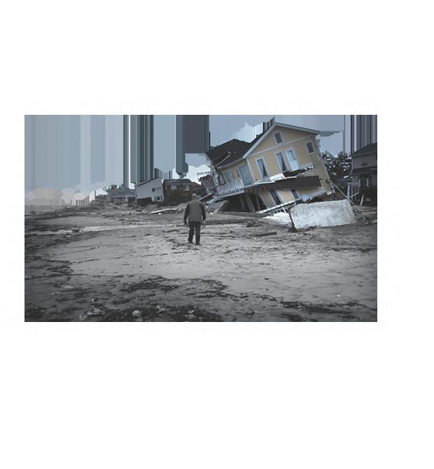
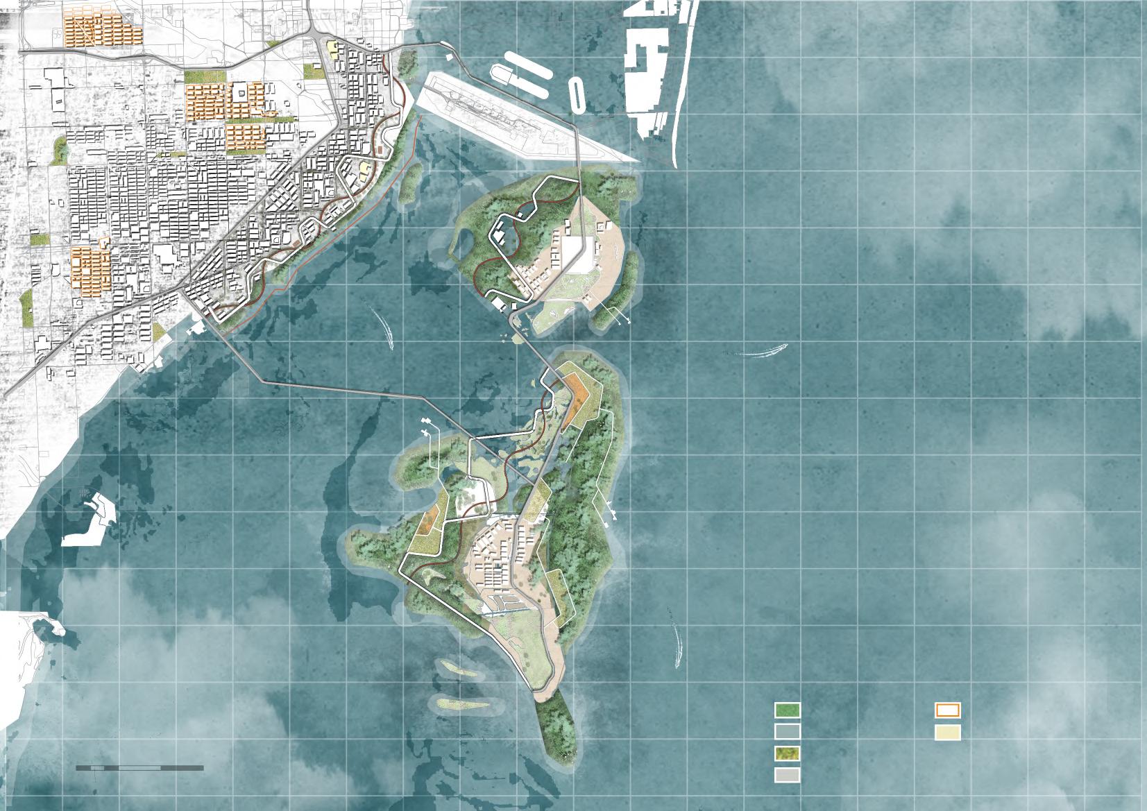
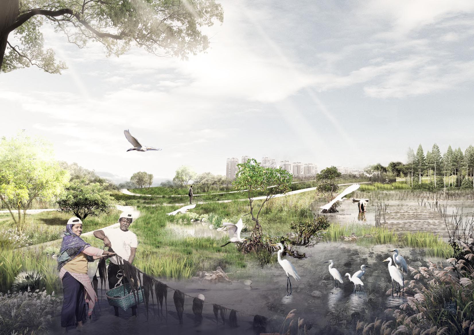
Miami, located in the southeastern corner of the United States, hurricane and flooding caused by its rising sea levels is becoming part of daily life in this low-lying resort in the U.S. The problem has been one of the major factors limiting local development, threatening the safety of local residents.To help reverse the situation, through a combination of ecological and economic means, I believe this project will create an ecologically resilient coastline for Miami and address various potential problems caused by flooding.
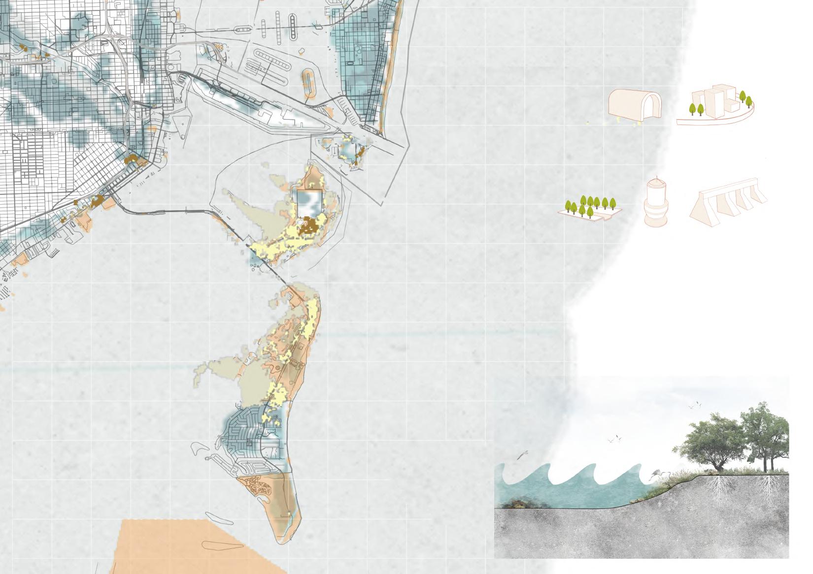
I plan to develop a living shoreline and mangrove floating breakwater, which, compared with its traditional dike structure, can make the overall planning more economical.The seaweed breeding line and shellfish breeding tank are combined, which could provide more job opportunities for the residents. By doing so, the ecological protection measures can be carried out and the economic benefits can also be secured. Finally, the vision of Eco& Eco can be realized.
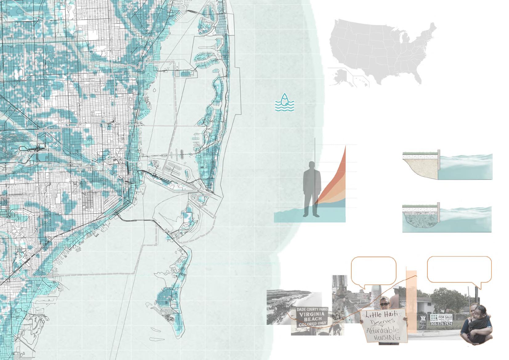
Strategy 1: Resettlement of the poor Strategy 2 : Living shoreline
1. Establish special zones for affordable housing to alleviate the housing pressure in poor areas.
2.Priority will be given to the relocation of disaster-stricken areas.
1. Restore the ecological coral reef system along the coast through artificial coral reefs to reduce the impact of the waves. 2. Coral reefs can increase the biodiversity of undersea communities.
1. Carry out volunteer activities to increase environmental awareness. 1. Recycled driftwood is reused.
Unique landscape facilities.
Wetland & mangrove restoration
1. Restore original mangrove and wetlands. 2. Wetlands and mangroves can regulate rain and floods.
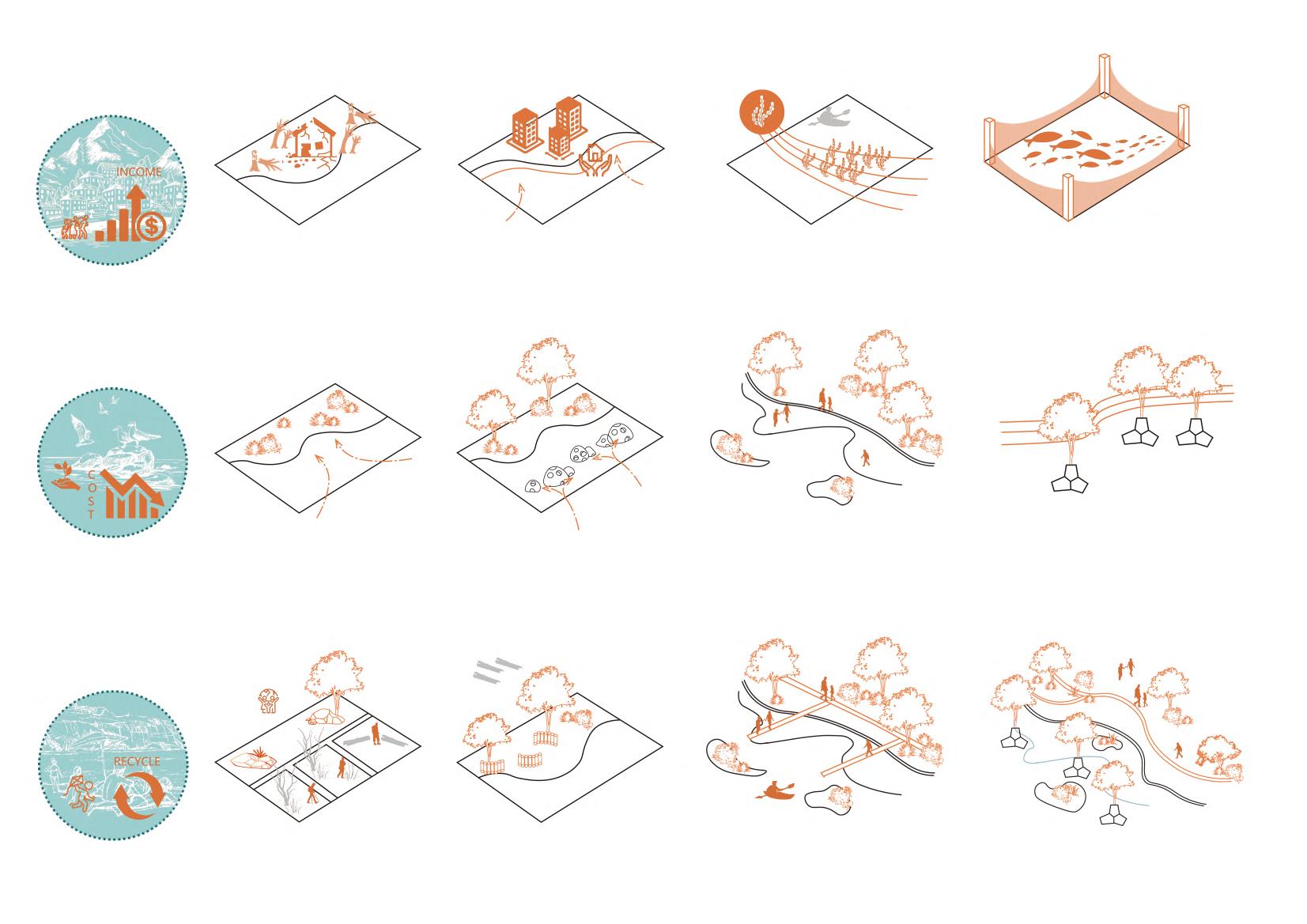
1. Ecological breakwaters are combined the mangroves with tetrapods. 2. The cost of biological breakwater is lower.
1. Seaweed farming can better restore elastic landscape zones and provide more income for the poor in miami. 2. Cages are set up in the coastal zone for shellfish culture and biodiversity restoration. reducewaveenergy 1. Establish ecological scenic spots. 2. Ecological scenic spots provide more jobs. 1. Create multiple activity spaces along the coast to increase practicality.
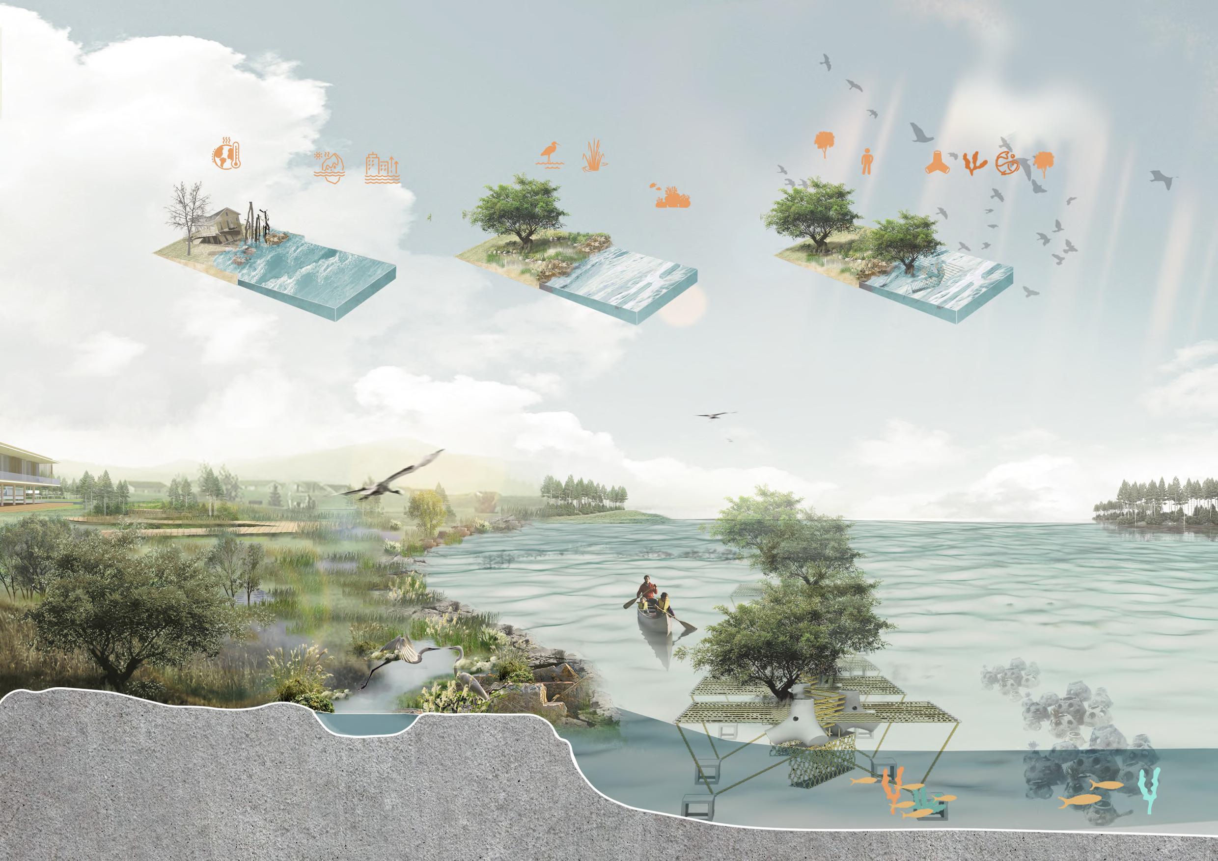
This structure combines the breakwater with agriculture and breeding, reduces the impact of flood through ecological means, and at the same time brings some income to local residents.
Type 01 Shellfish cage
Type 02
Shellfish cage + Seaweed lines
Type 03 Shellfish cage+ Seaweed lines+ Tetrapod
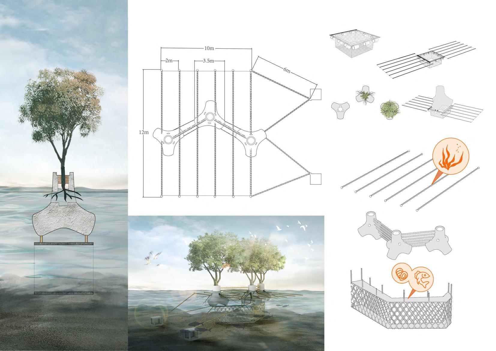
2 months
Mangrove
0 month
Type 04
14 months Soil
Seaweed lines
Mangrove breakwater Steel Concrete
Shellfish cage
Individual Work
Instructor : Yujia Li
Type: Academic
Date: 2020.03-05
Area: 0.58ha
Location: Shanghai, China
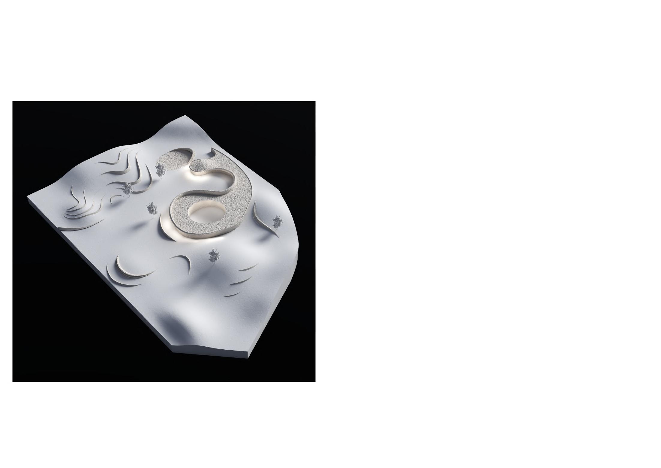
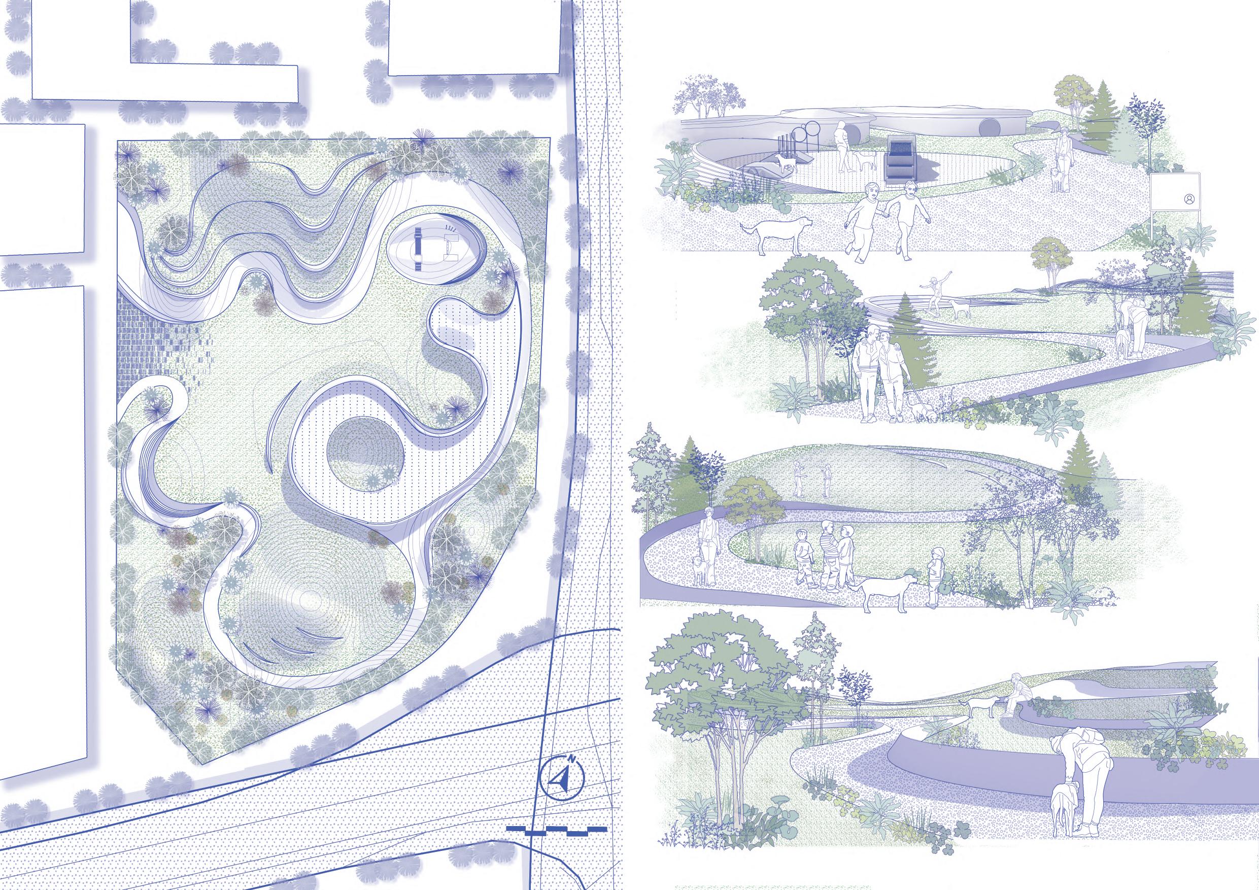
The long-term lockdown management of the epidemic has brought psychological trauma to people, and animal healing is a good way to relieve depression. People can heal each other through interaction with animals. The site of this plan is located in an old community In Shanghai, and there is a lack of space for pet dog activities.
Therefore, the main intention of the project is to provide a place for people to interact with dogs through the construction of a dog-friendly park, and a quarantine site for pet dogs.
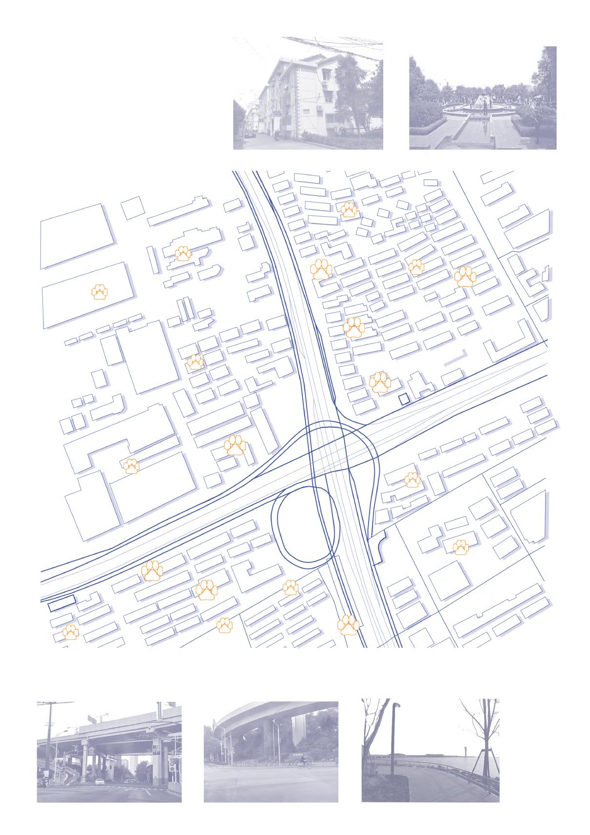
Location: Baoshan District, Shanghai
Background: The site is located next to the viaduct, surrounded by many old neighborhoods, far from the park, and lacking space for activities. There are more dog owners in surrounding communities, accounting for 43.2%
The neighborhood is too old and there is no open place to walk the dog.
I wanna go to the park but the host said it was too far away and could only go once a week.
5 minutes living circle
10minuteslivingcircle
10.4KM 12.8KM
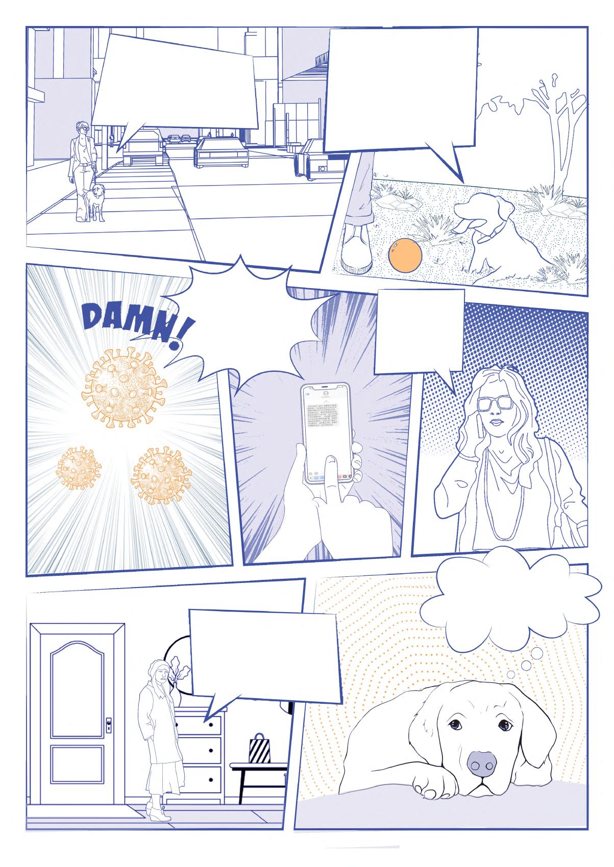
I received a text message that I was going to be quarantined.
Who will take care of my dog?
The long-term detention made me depressed, I need some company.
At home I could only eat and sleep, I feel so boring.

Ci c Cinnamomum camphora (L ) presl 20 0-25 0 2 5-3 5 25
Gi b G nkgo bi oba L 10 0-15 0 4 5-5 0 8
Yu d Yulania denudata (Desrousseaux) D L Fu 15 0-20 0 2 0-2 5 12
Ta d Taxodium dist chum (L ) R ch 25 0-30 0 6 0-8 0 10
Os f Osmanthus fragrans (Thunb ) Lour 2 0-3 0 1 5-1 8 20
Ph f Photinia × fraseri Dress 1 5-2 0 1 0-1 5 15
M f Michel a figo (Lour ) Spreng 2 0-3 0 1 5-1 8 22
legend Abbreviation Scientific name Plant height (m) Area(㎡)
Sa u Salv a ul g nosa 1 4-1 6 96
Ph d Phlox drummondii 0 15-0 45 48
V o Viburnum odorat ss mum Ker-Gawl var awabuki (K Koch) Zabel ex Rumpl 1 8-2 0 102
Hy m Hydrangea macrophylla (Thunb ) Ser 1 0-1 2 68
Ho p Hosta p antag nea (Lam ) Aschers 0 4-0 8 64
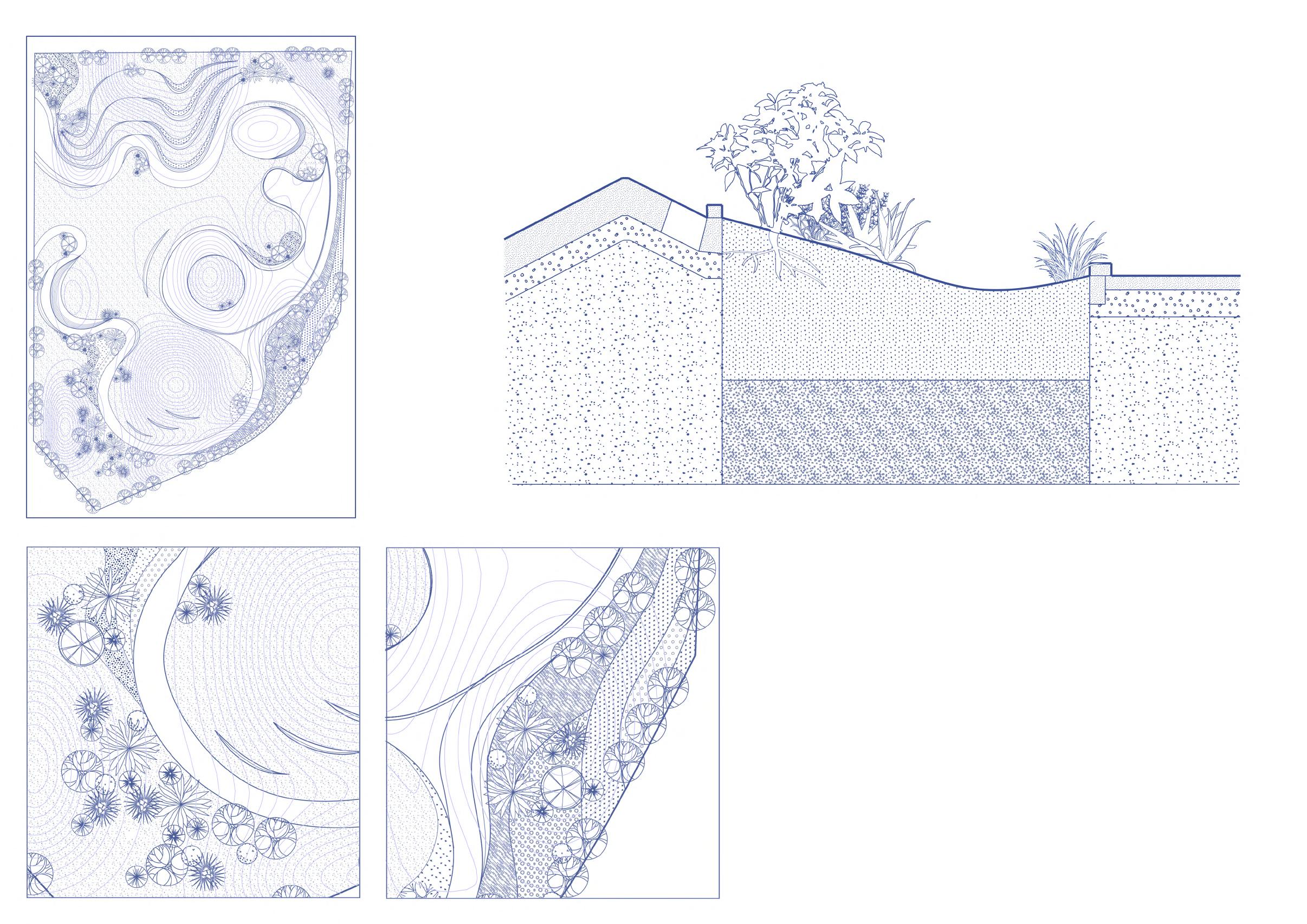
Ag a Agapanthus africanus (L ) Hoffmanns 0 5-0 7 72
Pr m Pr mula malaco des Franch 0 3-0 4 135
The zigzag path can cultivate the dog's sniffing ability and enhance the interaction between people and pets. This building can be used as a training ground when the epidemic does not occur.
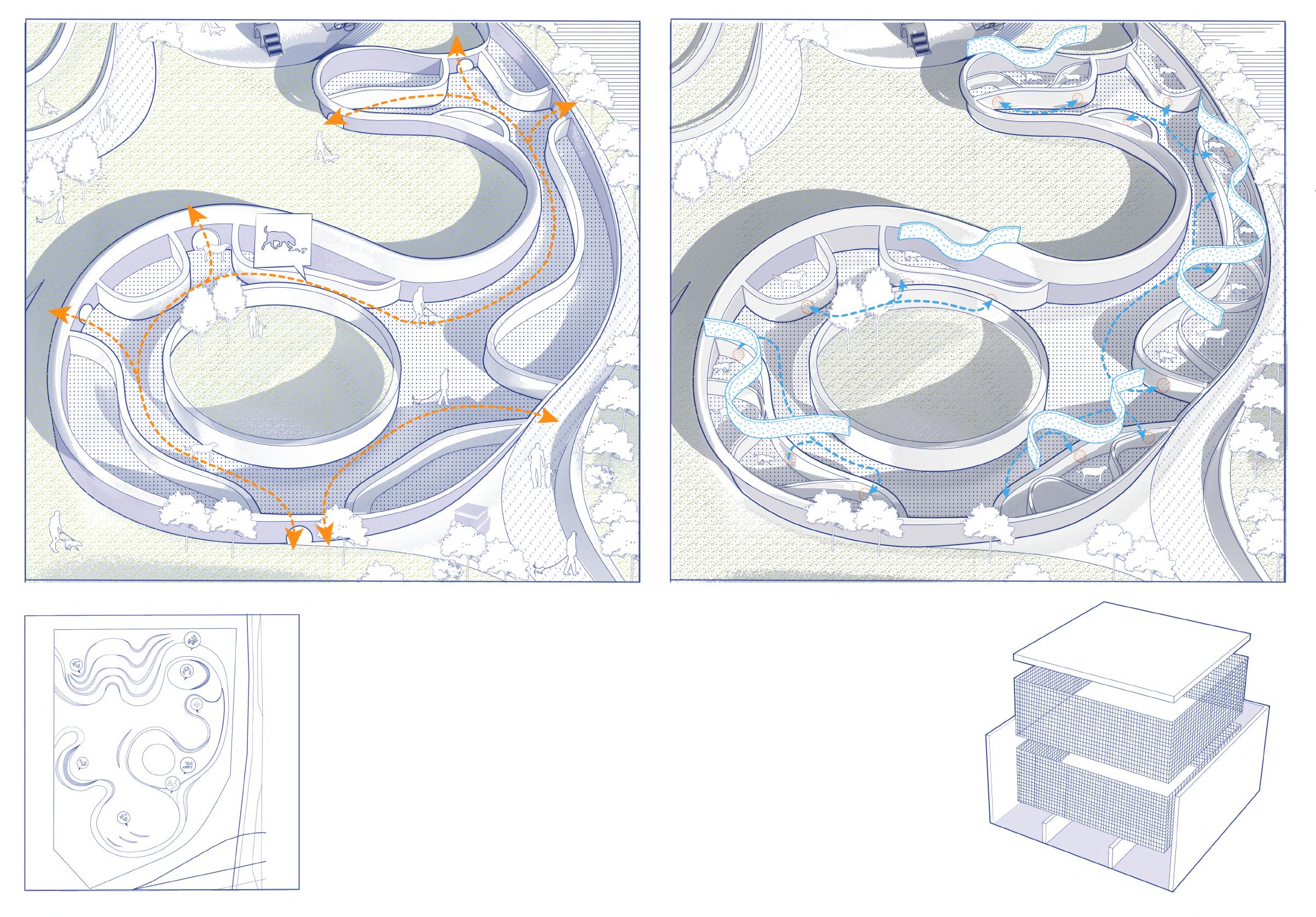
By installing temporary partitions, the inner door is opened to create a separate isolation space for the dog. The wide grass outside is available for dogs to play with, ensuring that there is plenty of space for pets.
A special box for the recycling of dog waste is placed in the park, which consists of a double-layer cage to decompose feces by vermicompost. The bottom of the box is connected to underground pipes that are transported to all parts of the park to provide natural fertilizer for plants.
The vermicompost bin Underground pipe
Fecal collection
Earthworms
Vermicompost
for soil remediation
Effects on plant growth
Repurpose the waste
Earthworms and waste Excess water
Finished compost
Individual Work
Instructor : Yunjing Hou(houyj@nefu.edu.cn)
Type : Academic
Date : 2019.09-11
Location: Shanghai, China Area : 1.29ha
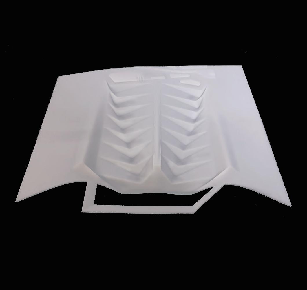
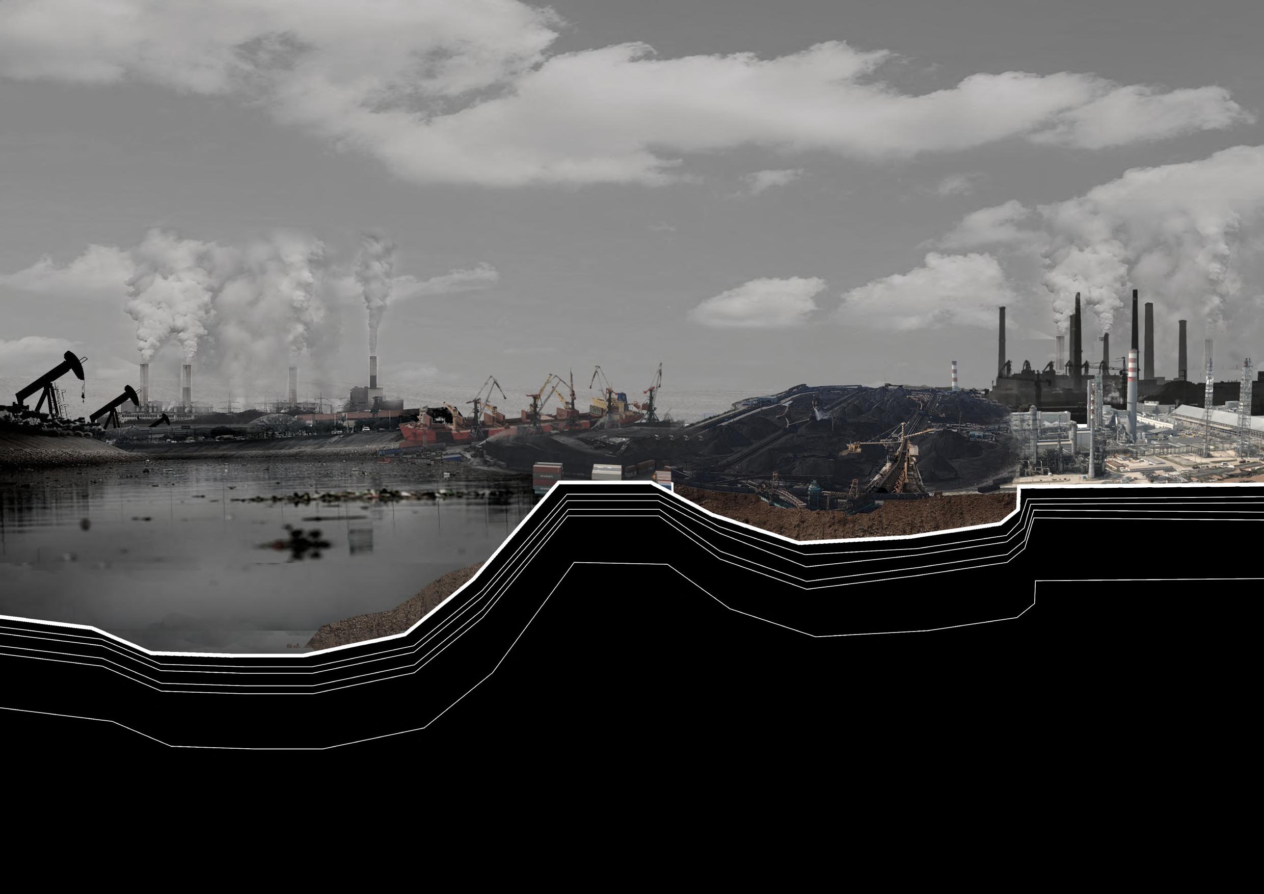
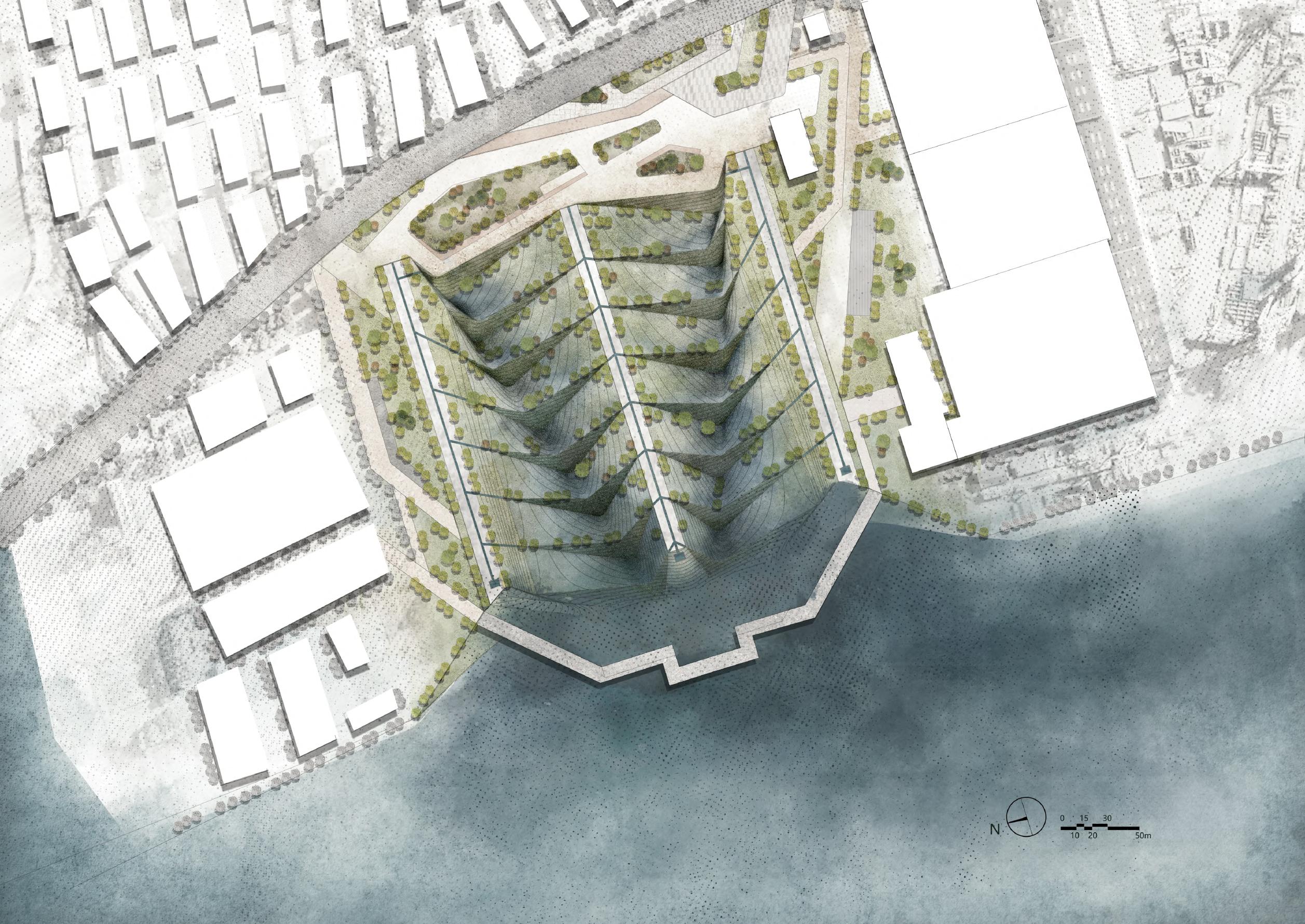
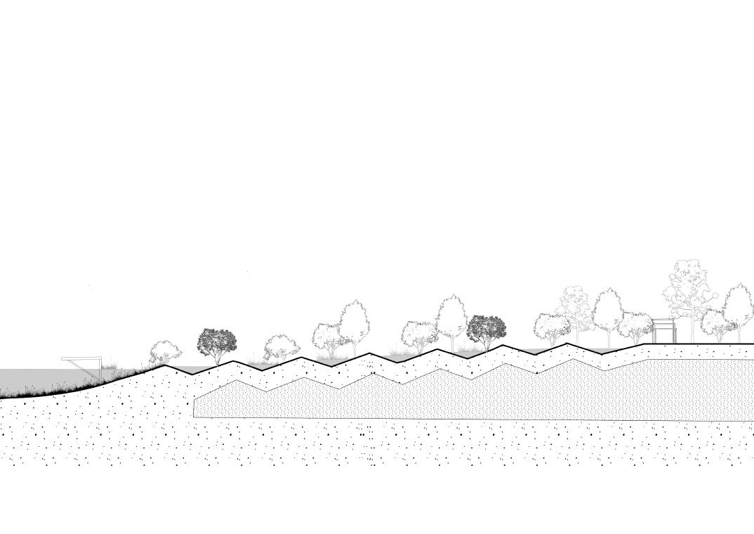
With the progress of the times, many industries have been eliminated. How to use these urban surplus spaces has become a problem to be solved. These sites are prevalent in pollution and purification and remediation are necessary means. There are many such abandoned industrial sites along the Huangpu River in Shanghai, and I have reshaped and used the terrain to purify polluted water sources and deal with polluted soil through ecological means.
Location: Shanghai, Yangpu district
The main problems on the site are heavy pollution and low accessibility. The former site of the project is a coal field.
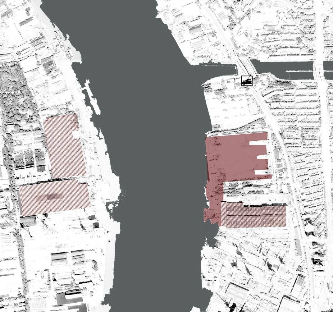
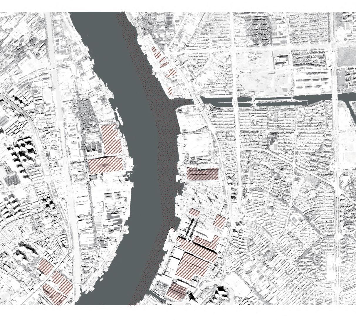
Factory Site space

Sewage Water Flow Direction Main Road
Soil Contamination

Contaminated Soil
Dig Serious Pollution
Contaminated Soil
General Pollution Transport Harmless Treatment
Sewage Water Purfilication Wetland Plant Restoration
Fill Landform Terrain
The method of dealing with contaminated soil is divided into the following steps, and the harm of soil pollution is minimized by reshaping the terrain.

Heavily contaminated material Remove the contaminated material
Contaminated soil
Clean soil
The site is now contaminated with the industrial soil.
Contaminated soil
Cut to fill
Take out the heavily contaminated material and isolate it in a special container.
Contaminated soil
1 Remove the contaminated material 2 Dig contaminated soil
Before After 3
Separation of contaminated soil
The treatment of contaminated soil is completed by using the landfill of the terrain.
Comtaminated soil
Clean soil
Geotextile
Earthworks 4
The contaminated soil is landfilled into a special shape
5
Clean soil
Contaminated soil Geotextile
Placement of isolation layer
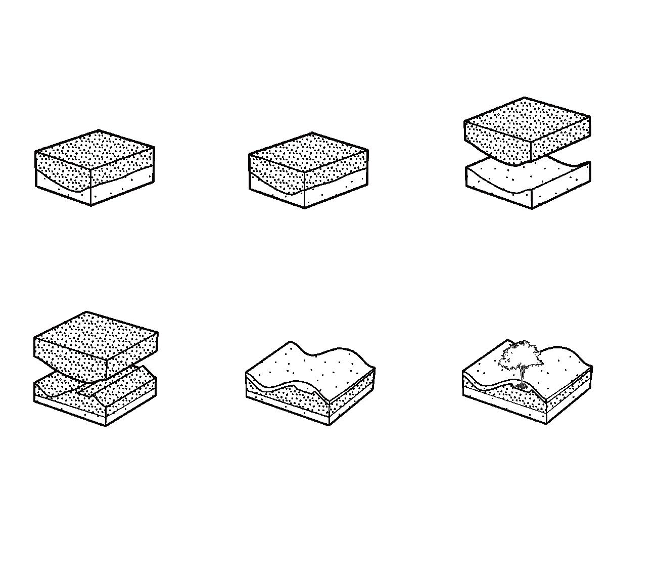

The isolation layer is used to separate the polluted soil and plant plants to restore the ecological environment of the site.
6
Plant
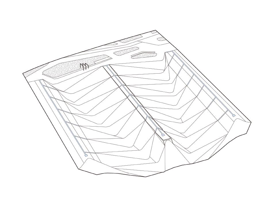
I change the earthwork structure of the site for water treatment, pumping the sewage from the Huangpu River, and sedimenting on the filter steps through the canal to form natural streams and wetlands. At the same time, the site ecosystem is reconstructed to restore the water self-cleaning function.
Canal water Surface water Pipe water
Pumping sewage
Plant restoration
Restoring plants to absorb pollution, to achieve the effect of purifying the sewage.
Wetland River Greenspace
Purification
Water seepage paving
I designed a step structure to precipitate impurities. Through the decreasing height difference, the water flow is restored to clear and returns to the Huangpu River. In the process of filtration, streams and natural wetlands are formed, so that the ecosystem of the entire site is rebuilt.
Individual Work
Instructor : Yanxue Li(1000002772@nefu.edu.cn)
Type : Academic
Date : 2021.11-2022.06
Area: 178.5ha
Location: Harbin, China
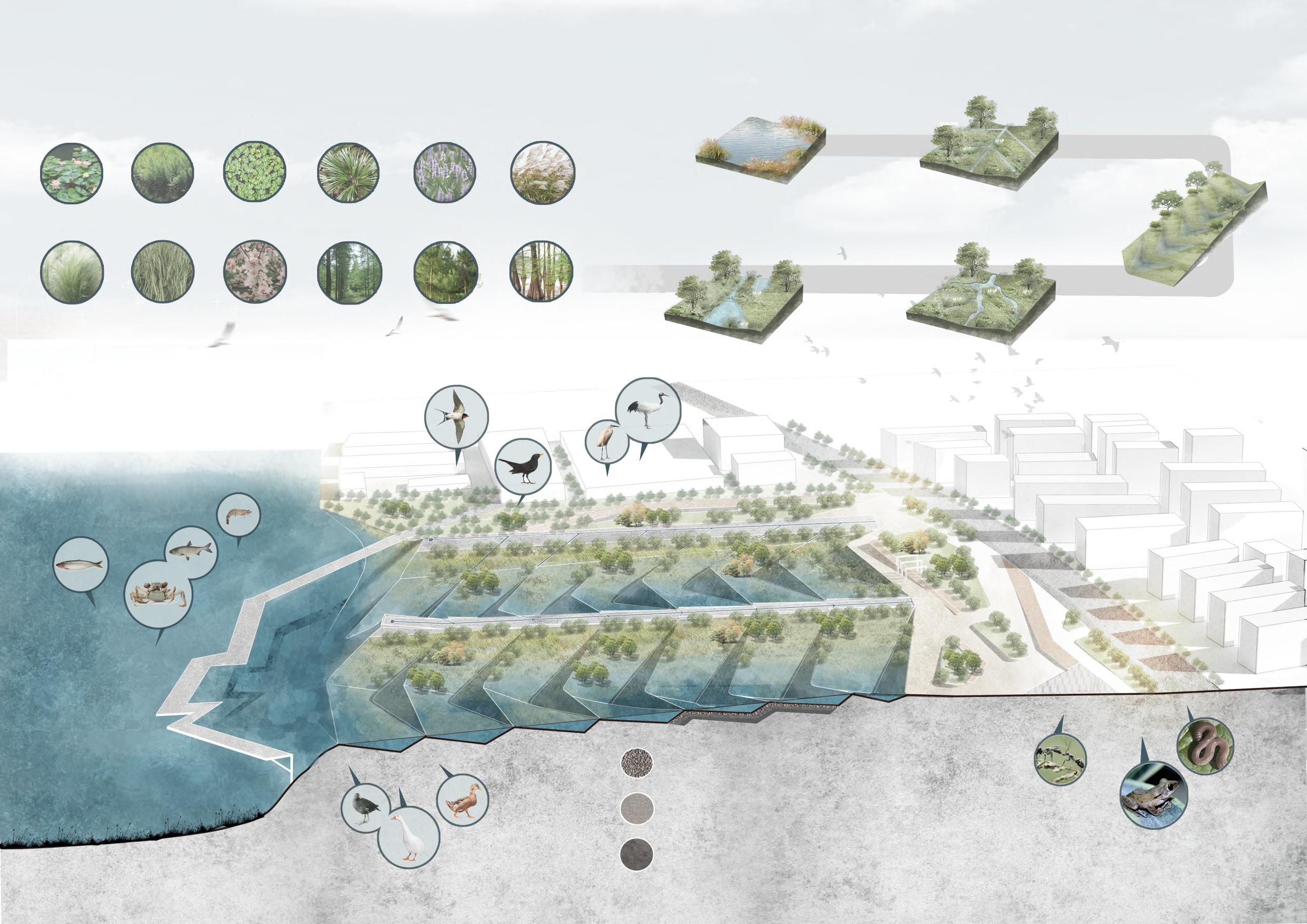
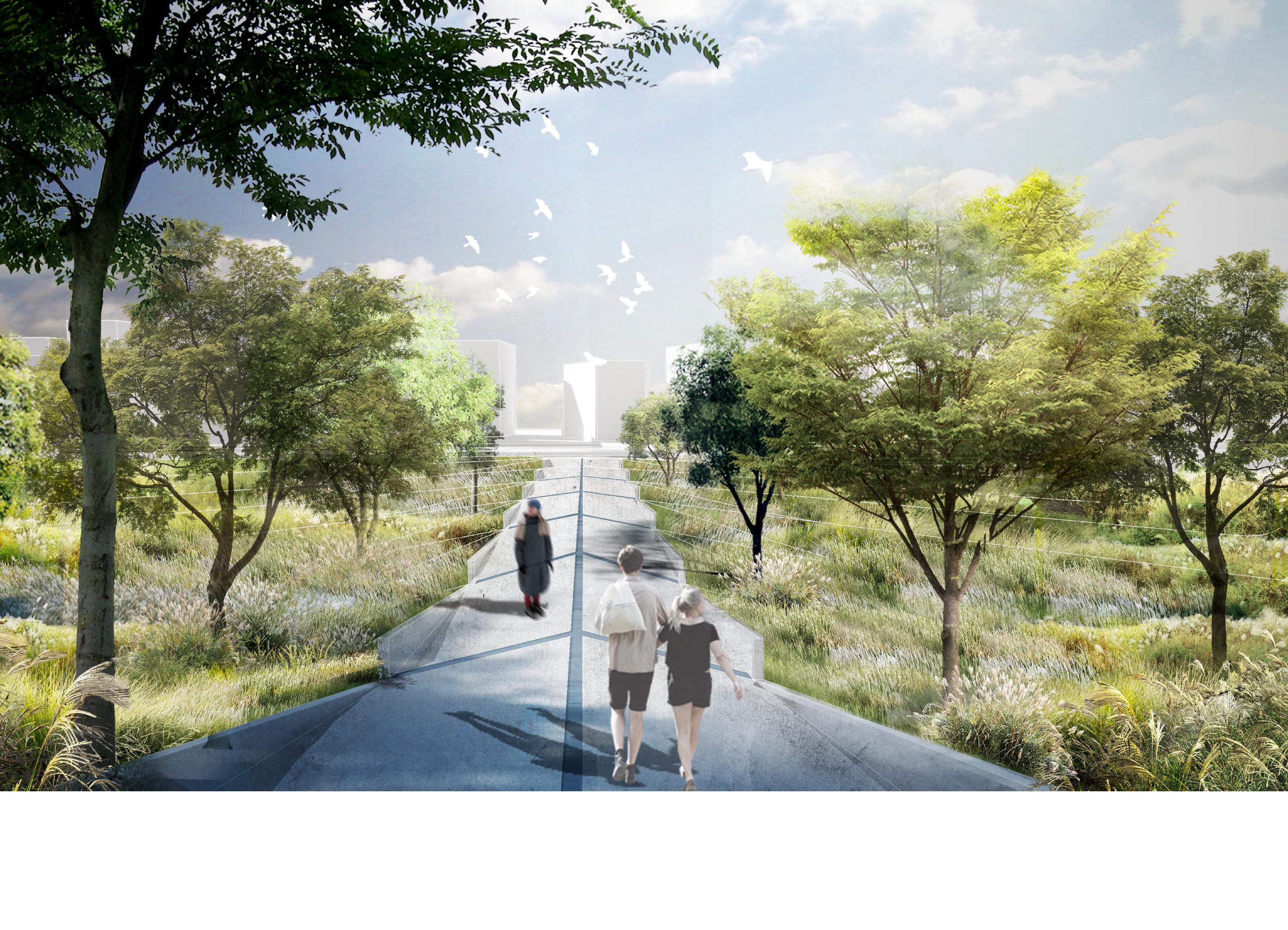
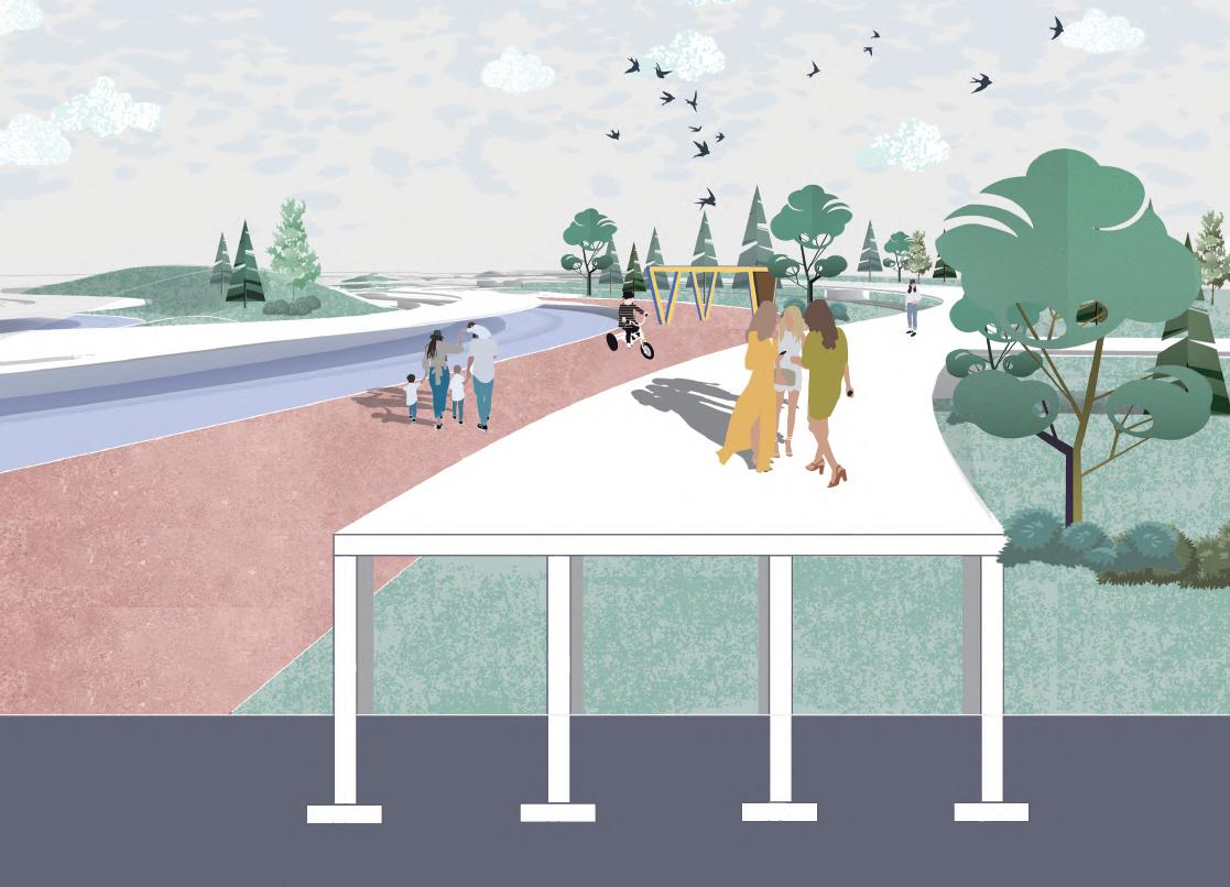
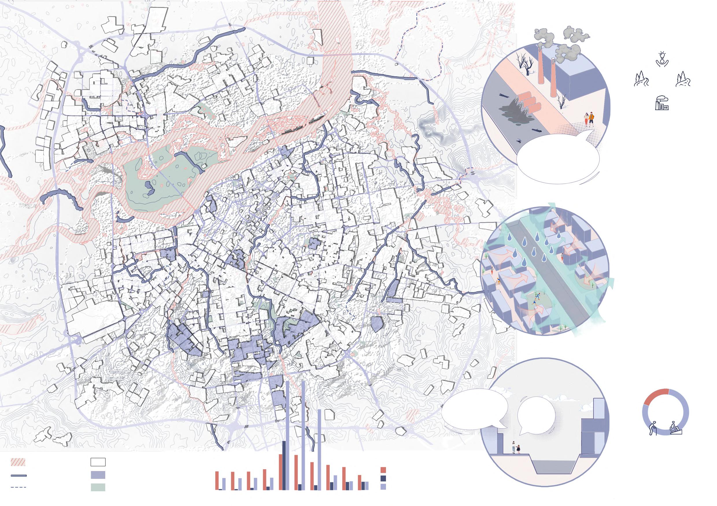
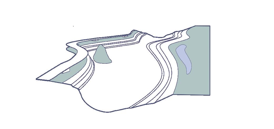
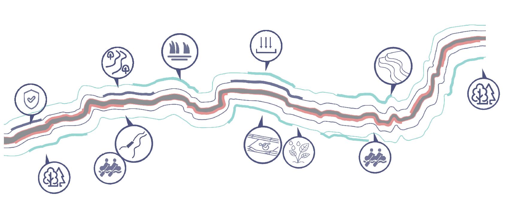
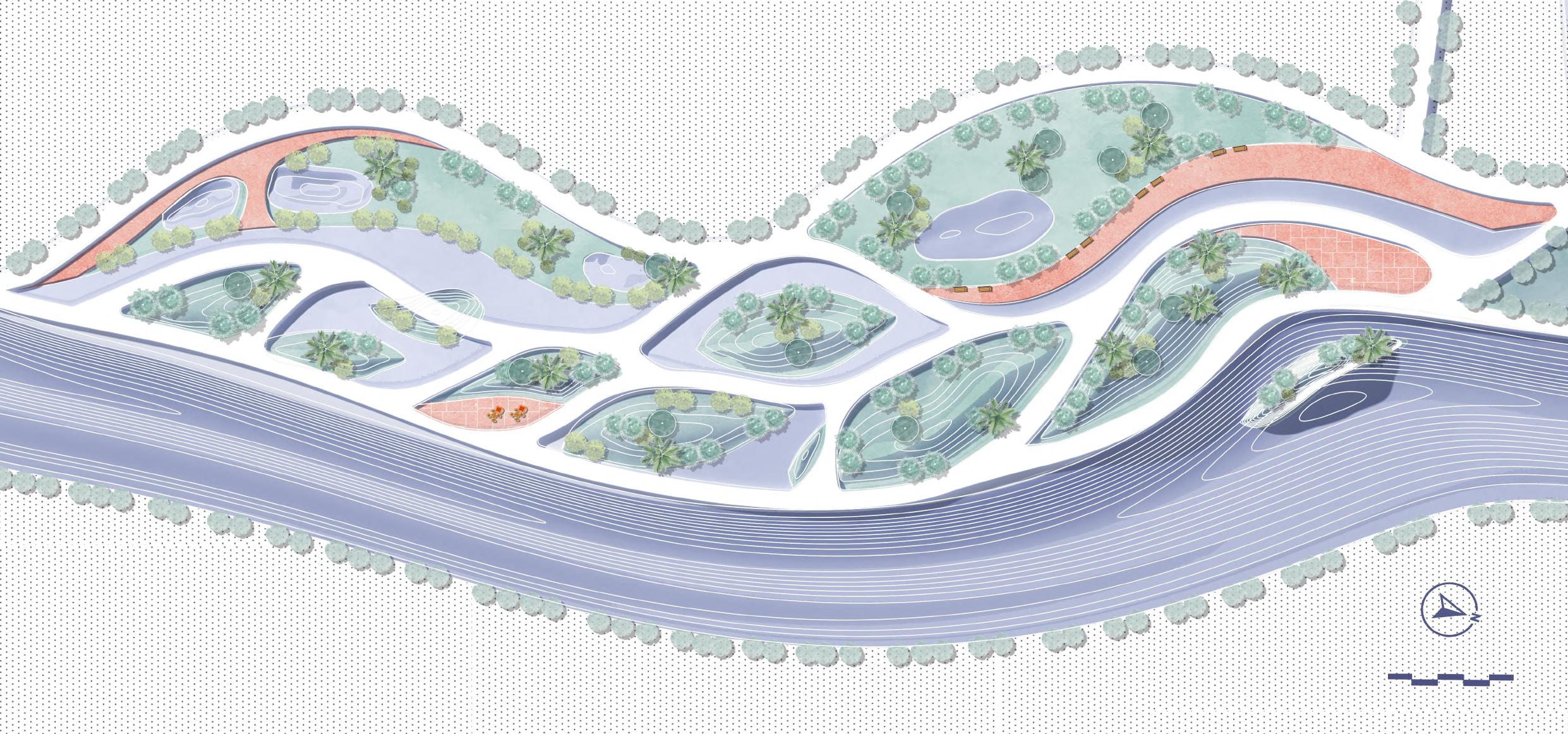
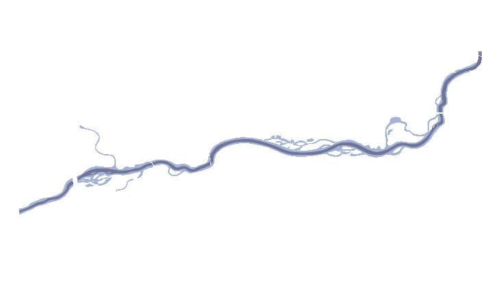
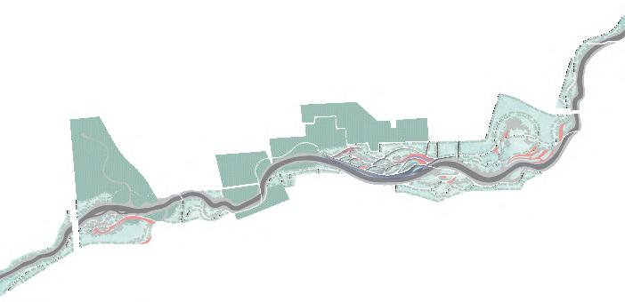
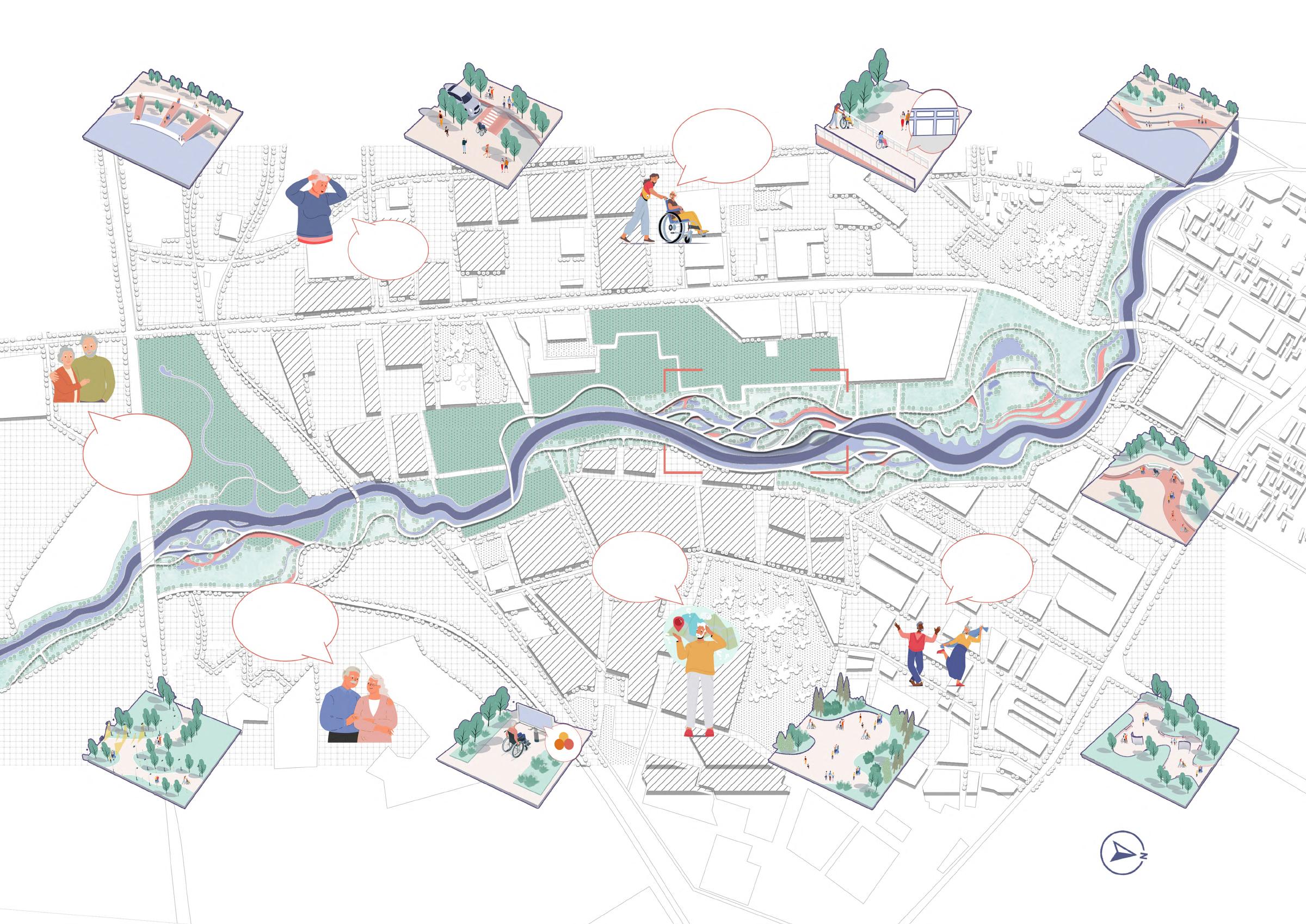
The problem of channelization of rivers in cities has always been serious. Harbin is rich in urban water systems, and the Songhua River is the main water source with a vast basin, but there are serious pollution problems and river channelization problems. The ensuing effects are flooding and poor accessibility. This project proposes several strategies to deal with the channelization of rivers, and puts forward coping strategies for the surrounding elderly groups. Increase storage capacity by rebuilding revetments, restoring wetlands, ecological islands and ecological reservoirs.
It's difficult to access to the water. We can't carry out hydrophilic activities.
The pollution here is very serious, affecting the lives of our surrounding residents. wanna play by the river!
Due to the canalization of the river, the function of regulating and storing flood has been reduced, and the phenomenon of river water backflow has occurred, affecting the residents.
Harbin Average rainfall
Due to the canalization of the river, the function of regulating and storing flood has been reduced, and the phenomenon of river water backflow has occurred, affecting the residents.
The aging of the population 20.98%
The aging of Harbin's population is becoming more and more serious, and the site is surrounded by elderly communities, and the needs of the elderly should be taken seriously.


Activity space demand
Flood management demand
Water purification demand
Dike and dam
1.Planning existing green space system
Plant restoration
Water collection River form restoration
Recreational activities
Wetland
Terrace
Plant restoration
2.Strengthening the connection between rivers and cities
Hydrophilic platform

ADA facilities Rain garden
Recreational activities
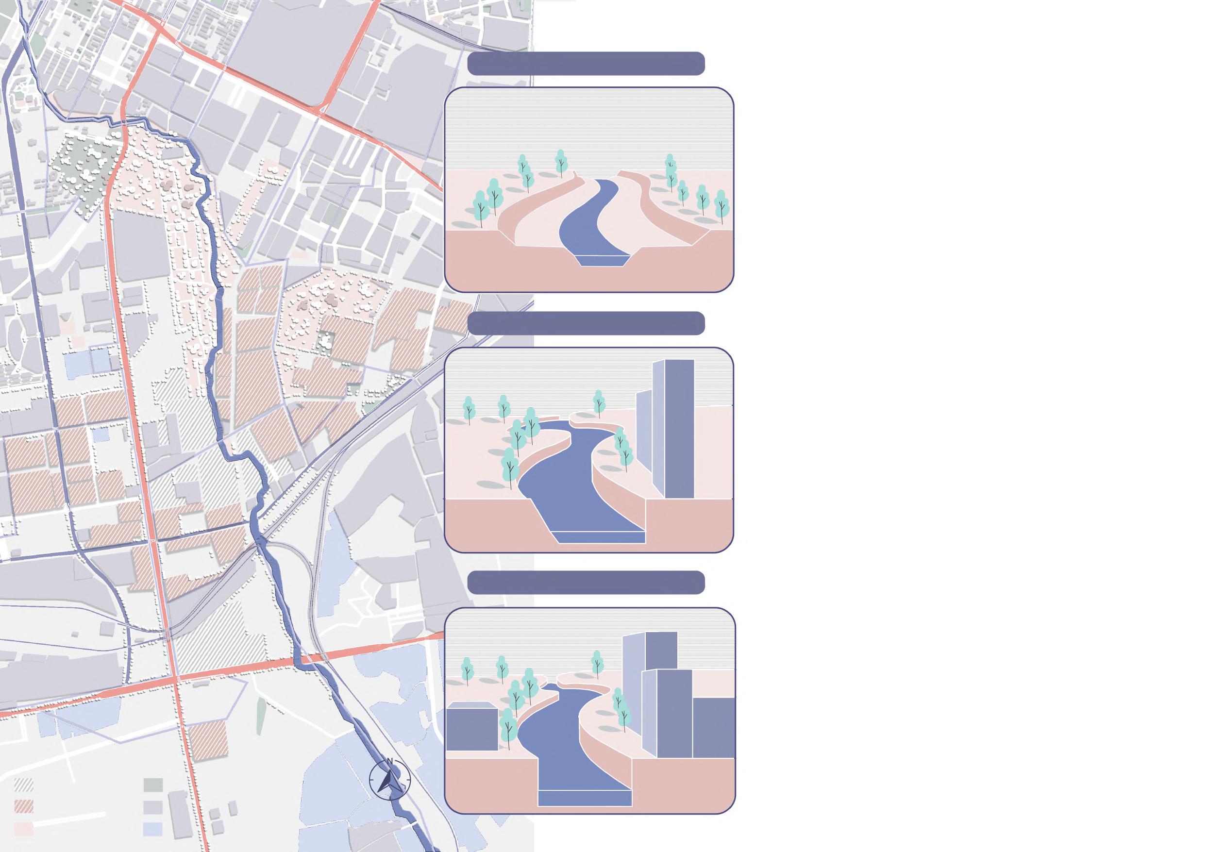
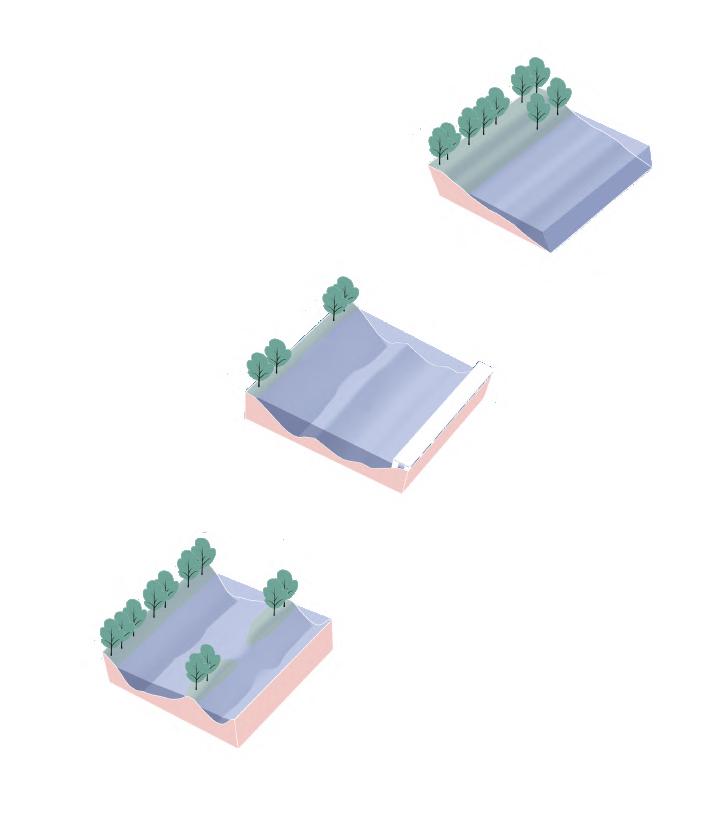
To save the problem of channelization, I reprofiled a variety of revetments, improved the storage and buffer capacity of the river, and enhanced the flood limit.
Expand the revetment and use plant community to enhance regulation and storage capacity.
Raised pavement reduces impact on ecological wetlands.
Eco-island can improve water quality and reduce pollution.
4.Increase path and activity spaces
3.Soften the river bank and straighten it into a curve AFTER
We need more entertainment. I hope more lighting at night because of my presbyopia.

find the road towards the park.


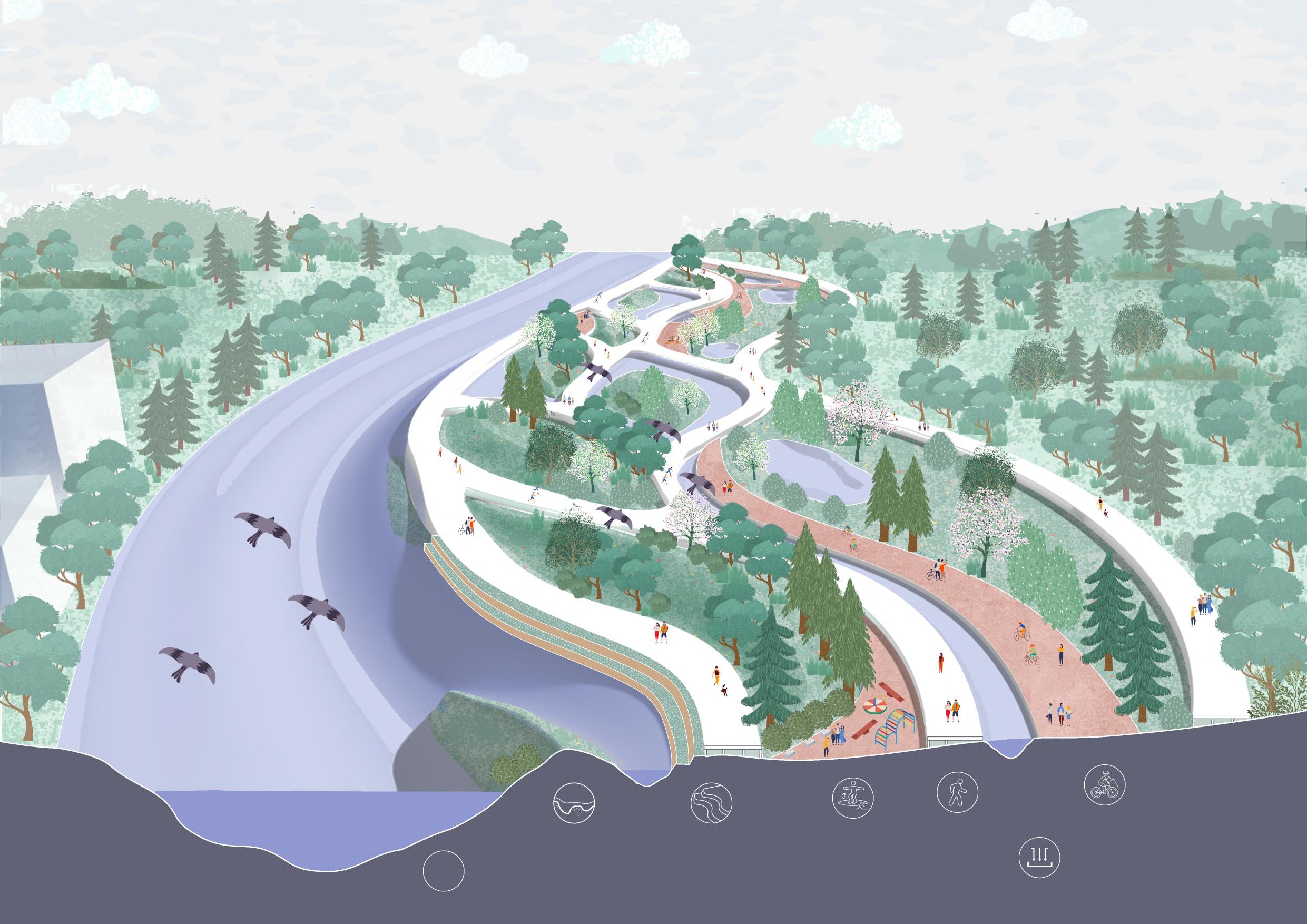

 Eco-island and shoal
Curved river
Terrace
Floating pavement
Gutter
Bike trail Plaza
