

CONTENT
WARDH TAIFI
CONCEPT MASTER PLAN COMPETITION | AECOM | 2021
PROJECT GLORY COMPETITION | AECOM | 2022
AL WADI MASTERPLAN
CONCEPT MASTER PLAN | AECOM | 2022
NAD AL SHEBA
PRE CONCEPT MASTERPLAN & CMP | AECOM | 2021
QIDDIYA THEMING CODE
THEMATIC CODING COMPETITION | AECOM | 2021
EXPLORE | EMPOWER | EXPERIENCE COMPETITION | 2020
GLACIER METAMORPHOSIS
MSC ARCH THESIS | POLIMI | 2019
SYMBIOSIS
STUDIO 8 | POLIMI | 2018
GREEN LATTICE
PUBLIC PROJECT | ZERO STUDIO | 2015
PUBLICATIONS

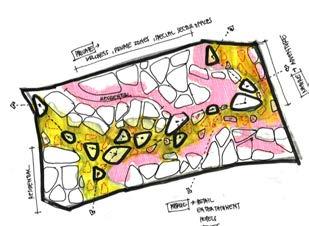
WARDH TAIFI
Location : TAIF, UAE
Type : Concept Masterplan Competition
Client : SDC
Role:
-Core Design team member
- Research, Analysis and Ideation
-Architectural Design Development
-Technical head
- Sub consultant coordination
The Public Investment Fund approved the establishment of Saudi Downtown Company (SDC) with a mandate to develop downtown precincts, hereafter referred to as “Projects” or “Downtowns” within 12 cities of Saudi Arabia. Taif is the most prominent second-tier city in the Makkah Region. This downtown aim to serve as a city platform for Saudi hospitality, culture and dialogue. The proposal for a mixed-use downtown will celebrate the Saudi culture and create a place of peaceful dialogue, while hosting cultural conferences and events.
AECOM’s proposed masterplan builds upon the experience of the Taif Rose Festival, by providing a spectacle of public realm that promotes an active lifestyle, formulated by a series of interconnected spaces. The masterplan embraces and emphasises civic pride, while marks the site as a landmark for the city of Taif, which enables it to grow as a national and international destination for residents and visitors from across the globe.
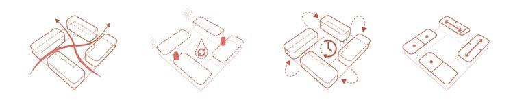
• Site as a Bridge Nature as a Connector
• Retaining And Enhancing Informal Connections
• Designing the masterplan and key attractions and integrating the site with the city urban fabric

• Activating the spine with ain attraction areas. High Quality Views Out Into the Park & overlooking Central Spine.
• Urban Form connecting City & Nature


01. A Celebration for the Senses
The rose festival is celebrated across the city , but is best experienced at Wardh Taifi. Each year, the site is transformed into a sea of pink and bouquet of sweet aromas. This happy setting will play venue to dance performances, exhibitions, carnivals and experiences revolving around the rose.


02. Balanced Living
How can the design of spaces redefine worklife relationships? The entire site uses technology to take on multiple avatars as required. Work gets done in a park, a games tournament is held on the office podium and countless business deals are made in the coffee shop. This is the new norm.

Reflecting the excitement of going to the movies in the environment around the cinema. An amalgam of digital and physical experiences, this gateway element perfectly captures the essence of the downtown environment beyond; even as the iconic building makes a sneak appearance.


02
PROJECT GLORY
Location : Riyadh, KSA
Type : Competition
Client : PIF
Role:
-Core Design team member
- Research, Analysis and Ideation
-Design scheme and Development
- Technical head
-Storyboarding Assistance
- Sub consultant coordination
GLORY’s proposed location to the South of Riyadh, encompasses a mix of existing industrial and logistics development and infrastructure, coupled with large areas of vacant or under-developed land that together are key ingredients that need to be combined to create a unique offering that realizes a new standard for industrial and logistics cities. Project GLORY’s scale and ambition required an innovative and futuristic approach to the planning, design and delivery of a city-hub that will serve the nation, the region and the world, providing “best-in-class” facilities and services, integrated with a sustainable “live-work-play” offering.
“You never change things by fighting the existing reality. To change something, build a new model that makes the existing model obsolete.”


Al
Location : Abha, KSA
Type : CMP
Client : PIF
Role:
- -Core Design team member
- Research, Analysis and Ideation
- Design Development
-Architectural Design Development
- Technical and Graphics Head
- Sub consultant coordination
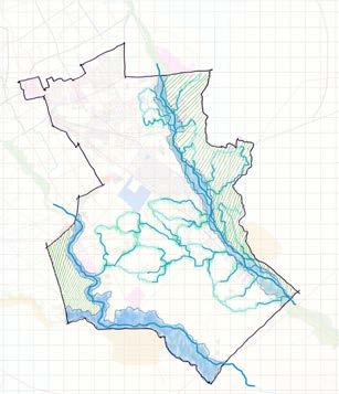
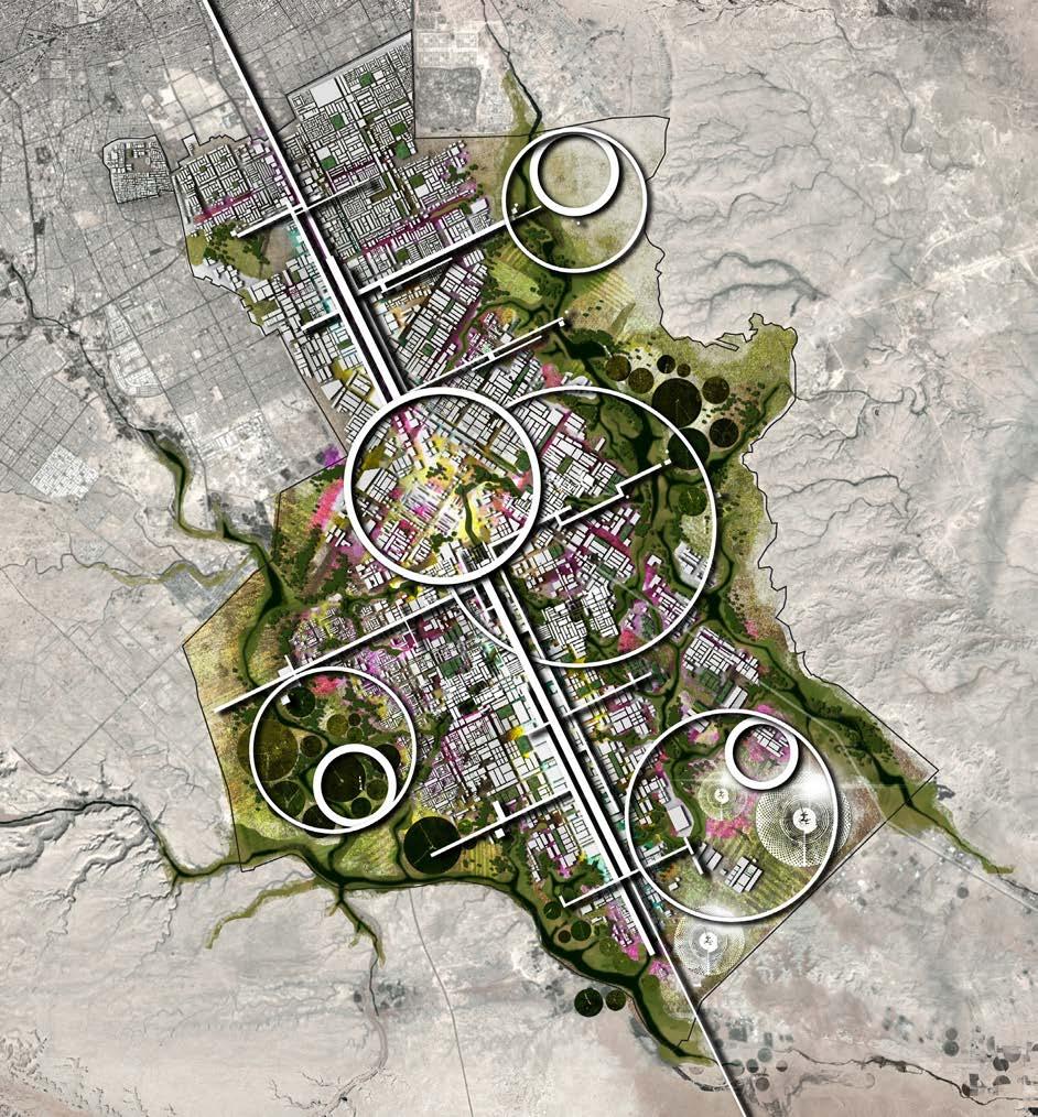
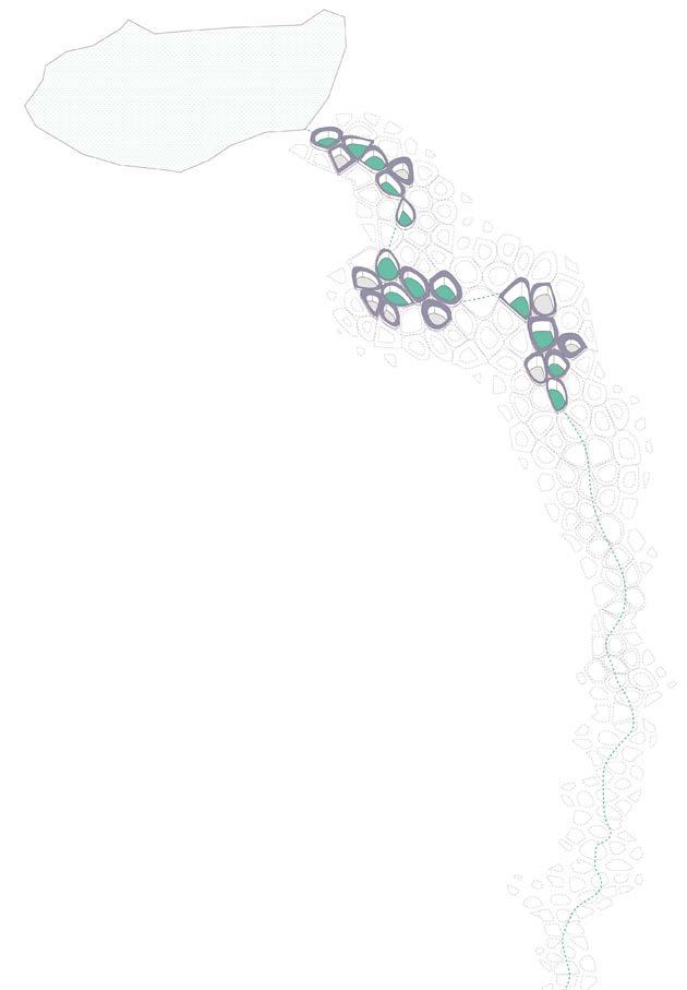
PIF intended to secure the services of a Consultant to design and deliver a visionary and iconic master plan that fosters unique and attractive destinations, vibrant communities and an unparalleled quality of life. The successful Consultant translates the overall vision for Al Wadi from a Concept Master Plan followed by a Detailed and Final Master Plan, accompanied by Development and Urban Design Guidelines.
Al Wadi is located in the Aseer Region of the Kingdom of Saudi Arabia and is envisioned as a year-round destination featuring leisure and entertainment attractions along a flowing wadi. The 2.54 km2 mixed-use destination, when fully envisioned, will showcase the authentic character of vibrant Abha including its rich art, culture, architecture and key heritage sites, while incorporating innovative design solutions and contemporary design.


Character Zone : Lake
Character Zone : Canal
Character Zone : Farms
Character Zone : Abha Gardens


04
NAD AL SHEBA MASTERPLAN
Location : Dubai, UAE
Type : Pre- CMP and CMP
Client : North 25
Role:
-Core Design team member
- Research, Analysis and Ideation
-Design Development
- Sub consultant coordination
The Nad Al Sheba Master Plan Development is in a well-located site which currently envisaged to have a mixed range of residential uses and community facilities relevant to the context and surroundings of the Nad Al Sheba Area. The Project that aims to establish a well serviced community that provides inner city living whilst located in a quiet and family orientated residential community. This development will be delivered by a world-class developer Dubai Holding / Meraas will be one of the prime flagship communities within Dubai, the UAE and the GCC region.

QIDDIYA THEMING CODE COMPETITION
Location : QIDDIYA, KSA
Type : Thematic coding Competition
Client : BCG
Qiddiya is an entertainment megaproject to be established in Riyadh. Construction started in the beginning of 2019. The project is one of the tourism megaprojects to be established in Saudi Arabia in the framework of the Saudi Vision 2030 which aims to diversify the income resources of the country
Qiddiya Investment Company appoints, through competition, a qualified firm to propose the creative stylistic identity and architectural language of the project (collectively, the “Thematic Coding” for the project). This work will be used as a basis from which to develop detailed master planning. The Thematic Code will focus on and establish the look and feel with a high level of detail on selected areas, to allow for a formal approval of the creative direction early in the process.

06
EXPLORE | EMPOWER | EXPERIENCE
Competition _ Lets Built my School- Senegal
3rd Runner up_Special Honarble mention
Let’s Build My School commenced their activities in Senegal in regions where only 50% of school-age children have access to education and where classrooms are often crammed with up to 80 students per class due to the limited number of structures. Senegal is ranked 164th out of 189 countries in the most recent UN Human Development Index report. Despite being one of the most politically and economically stable countries on the African continent, the country has a low literacy rate of about 43% and low enrollment rates in primary and secondary schools; 38% of primary school cohorts dropout before reaching secondary education.
Identifying and applying low-cost construction methods is of key importance to LBMS as it allows the community to deploy the skills and techniques acquired wherever and whenever required. This transfer of skills provides them with practical and cost-effective opportunities to expand their village, build homes, and add more classrooms to a school.

Construction methodology


GLACIER METAMORPHOSIS climate change and melting Alps
Thesis | MSc in Architecture 2019
Archue -”The dream of century” - Winner Unfuse UniATA ‘20 : Worlds best graduation project - Editors Choice Award Laka_Architecture that reacts 2020 - Laureate of Gold Prize
Humans played a vital role in upbringing ‘climate change’. Though the earth is always changing, the current speed of change is unprecedented and problematic. The drastic shreds of evidence in the high-altitude areas especially in the Alps give a clear definition of climate change and its impacts.
The Swiss glaciers, known as the water tower of Europe provides the clearest proof of these impacts. In recent decades many Alpine glaciers have shrunk to half their earlier size, and by the end of the century all the glaciers of the Alps, with a few exceptions, may well have melted away. They play a crucial role in accumulating and supplying water to the continent. Due to climate fluctuation and uneven glacial runoff due to melting, water shortage or drought is projected to occur more often. How to tackle the rising issue? the world has no history of dealing with such a difficult problem, nor the institution to do so.
The Rhone Glacier is the best-documented case in the Alps of a rapidly retreating glacier. Photographs and other documents show the history of the changing glacier since the Little Ice Age. Fluctuations of the glacier tongue reflect decadal temperature fluctuations during the observation period. The last quarter century witnessed the most spectacular retreat, resulting in the development of a glacier lake. The pro-glacial lake has increased rapidly in size to the extent that the Swiss Federal Offi ce of Cartography and Survey has given it the offi cial geographical name of “Rhonesee”.
The motion of glaciers is relevant not only for the tourism industry but also for the future management of natural risks, hydroelectric plants and water supply for agriculture.

Glacier metamorphosis_ Climate change and Melting alps

The river Rhone arises on the glacier of the same name near the Furka Pass in the Swiss Alps. After its course through
The river Rhone arises on the glacier of the same name near the Furka Pass in the Swiss Alps. After its course through the varied landscape of the Valais canton the river flows into the Lake of Geneva and continues as a river again from the city of Geneva.
The journey along the Rhone starts in the Swiss Alps at an altitude of 2.275 m. The melt water of the Rhone Glacier forms the source of the river.
The course of the young Rhone after tumbling down from the area of the glacier and flowing into the direction of Gletsch. Thirty years ago this whole area was largely covered by the glacier. It flows south through Gletsch and the Goms, the uppermost, valley region of the Valais before Brig. Shortly before reaching Brig, it receives the waters of the Massa from the Aletsch Glacier. It flows onward through the valley which bears its name and runs initially in a westerly direction about thirty kilometers to Leuk, then southwest about fifty kilometers to Martigny .

Process_finding nodes

Glacier metamorphosis_ Climate change and Melting alps
The collection chambers introduced to the landscape extracts the extra runoff glacial water and stores it in the form of reservior. The attempt to reverse the process of bringing back the glacier in a new form and nature. In time, according to the demand and necessity the chambers can grow and expand sustainably thus introducing a new age landscape infrastructure redefining concepts.


View 01_winter
View 01_winter
View 02_ spring
View 02_ spring
View 01_ Collection chamber
View 01_ Collection chamber
Introduction of new tourism where people can come and experience the space, both internally and externally. The glacial water storage frozen in winter would be a platform to host different winter sports activity for the locals and also for tourists. The restructuring of glacial runoff water into a new form would set a mark in the future landscape giving a new definition to dams and reservoirs.
In deep introducing human activity into the program would encourage people to learn more about glacial water resource and its importance. spreading awareness about climate change its
Introduction of new tourism where people can come and experience the space, both internally and externally. The glacial water storage frozen in winter would be a platform to host different winter sports activity for the locals and also for tourists. The restructuring of glacial runoff water into a new form would set a mark in the future landscape giving a new definition to dams and reservoirs.


In deep introducing human activity into the program would encourage people to learn more about glacial water resource and its importance. spreading awareness about climate change its impact on ecosystem. Every storage system is supported with a built structure hosting different type of activity according to need and arrangement.
View 02_ Landscape morphology
The sensitivity of alps and its landscape forces us to build or create something coherent, responding to the environment and landform. The built environment helps in translating the issues faced by alps and glaciers into people by hosting conferences, activities, programs and exhibitions. The same unit is transformed into different functions according to arrangement and position in the land. The flexibility of interior allows the space to host diffrerent activity. Each unit is accompanied with a platform for visitors, researchers and also for the accessibility.
Responding to the retreat and its impact on the ecosystem, there is an urgent need for water management and resource conservation. On the other hand, the dams and reservoirs built to conserve water resource fail to fulfil the needs of the ecosystem and biodiversity. The need for a new infrastructural landscape arises transforming and translating the needs. The proposal is to store the glacial excess runoff into a collection chamber. The idea is the metamorphosis of runoff to a ‘new age glacier’. This system can help in regulating the future water crisis on the continent. The Alps are not just a casualty; they are also one of the contributing factors to climate problems by bringing a whole new set of hazards and problems to the environment. the upward shift or tree line, carbon emission of permafrost melting are some notables. Built environment is introduced into the context as a backdrop supporting the landscape with specific activity including the monitoring, analysis and processing these changes. Here architecture plays a supplementary role, maintaining an equilibrium with the change by supplying energy, storing resource and exploring sustainability.
As Robert Swan said, “the biggest threat to our planet is the belief that someone else will save it”. It is the time, and we have a very short time to bring out some change for the future.
School of Urban Planning, Architecture and Construction Engineering Politecnico di Milano
School of Urban Planning, Architecture and Construction Engineering Politecnico di Milano
MSc in Architecture Thesis
Supervisor Elisa Cristiana
Supervisor : Elisa Cristiana Cattaneo
Author Aasish Janardhanan 883411
Author : Aasish Janardhanan 883411

SYMBIOSIS
Studio 03 | MSc in Architecture
A-Z International Architecture Awards 20_Education - Jury commendation 2019 International Architecture Award (IAA) - Second position
Individual Project
Many complex parameters affect the severity of an earthquake, including extrinsic factors, such as site conditions, soil composition, and topography, as well as features that are intrinsic to design, such as building weight and height, which influence its inertia force and natural period of vibration, respectively. Because of their highly complex dynamics, seismic activity is often regarded as a purely scientific field of knowledge, best handled by engineers and geologists.
Researchers started to investigate animal behaviour after seeing abnormality during earthquake. The Project tries to build a platform in which some specific animals helps in predicting earthquake


