
WALKING Your FREE guide to: New Zealand walks from 30 minutes to multi-day aatraveller.co.nz FEATURING: • Short Walks, Day Hikes & Great Walks • Trail Descriptions • Maps • Safety Tips • Things to See & Do • Places to Stay 2022/23


TE ARAROA, NEW ZEALAND’S TRAIL
This long-distance trail runs the length of New Zealand, from Cape Rēinga in the north to Bluff at the bottom of the South Island. Officially opened in 2011, the 3000km trail is New Zealand’s equivalent of the Appalachian or Pacific Crest Trail in the USA or the Bibbulmun in Australia. It follows the route of several tracks, including the Queen Charlotte and Harper Pass tracks and parts of the Travers-Sabine circuit and St James Walkway. For more information visit teararoa.org.nz
New Zealand is a world-famous walking destination and for good reason. We are home to rich, diverse and stunning scenery, and also a fantastic recreation network of tracks, huts and campsites.
Ifeel incredibly privileged as Director-General of the Department of Conservation, to be leading work to protect our natural and cultural heritage and to get people out there enjoying it.
Walking in nature, particularly with friends and family, is an essential part of my life. Doing this benefits my health and well-being immensely and also deepens my connection to Aotearoa – our wildlife, history and landscapes. It’s such a

pleasure to see that this love of nature has been passed on to my children. They tell me the tramps we did as a young family have led to their longterm love of the outdoors.
What a treat it would be to knock off all the fantastic walks listed in this guide. There are some absolute gems here that demonstrate, not just the wealth of natural beauty out there but also our rich history and significant cultural heritage.
My advice to anyone lucky enough to be heading out on these walks would be to plan and prepare well, check weather and track conditions before heading out, pack plenty of warm clothes, food and water, share your plans and take ways to get help. Importantly take time to be present and reconnect with the natural world.
PENNY NELSON Director-General of the Department of Conservation
WALKING MUST DO’S 1
A hand-reared kākāpō chick investigates DOC’s Penny Nelson after the chick’s routine weigh-in and health check, part of DOC’s kākāpō recovery work on Anchor Island in Fiordland © DOC/Brodie Philp


2 So, what goes into your outdoor plan? You can use Plan My Walk, a free platform designed to make it easy to get outdoors and make it home safe! We asked trampers what are the first five things they do when planning a tramp? PlanMyWalk.nz Choose a track Receive trip alerts Check the forecast Customise your gearlist Save +share your plan 62% LOOK AT A MAP OF THE ROUTE 65% DO ONLINE RESEARCH 54% BOOK ACCOMMODATION 45% CHECK THE WEATHER 41% PLAN THEIR LEAVE 40% CLOTHING AND GEAR 30% PLAN FOOD 17% DISCUSS GROUP NEEDS 43% ORGANISE TRANSPORT 90% SELECT A TRACK OR HUT This research was conducted online between 6 - 20 May 2020. It targeted trampers who had stayed at a DOC tramping facility, such as a hut or campsite, between 1 November 2019 - 31 January 2020. A total of n=1,707 respondents had completed the survey. You can find out more on mountainsafety.org.nz By Mountain Safety Council What would you do first? There’s plenty to do when making a plan to get outdoors.
ISBN > 978-1-98-852382-8
© The New Zealand Automobile Association Incorporated 2022. All rights reserved.


AA, the AA logo and the Tourism pictogram are registered trademarks and the colour combination YELLOW & BLACK are trademarks of The New Zealand Automobile Association Incorporated.
While every care has been taken in the compilation of this guide, the publishers cannot accept responsibility for inaccuracies or changes since going to press, or for consequential loss arising from such changes or other inaccuracies, or any other loss direct or consequential arising in connection with information provided in the publication. There is no requirement for advertisers in this guide to provide discounts for AA Members; some individual advertisers offer concessions and details of these are indicated in their listings. All content in advertisements was provided by the advertiser. Due to the COVID pandemic, we also advise you to check before you visit any establishment mentioned, as they may be in hibernation or offering limited services.
All rights reserved. No part of this publication may be reproduced (except brief passages for the purpose of review), stored in a retrieval system or transmitted in any form or by any means, electronic, mechanical, photocopy, recording or otherwise, without prior written permission of the publishers.
WALKING MUST DO’S 3
Mt Ngauruhoe, Tongariro Alpine Crossing © Adobe Stock
BELOW: Matai Peak © Visit Hurunui
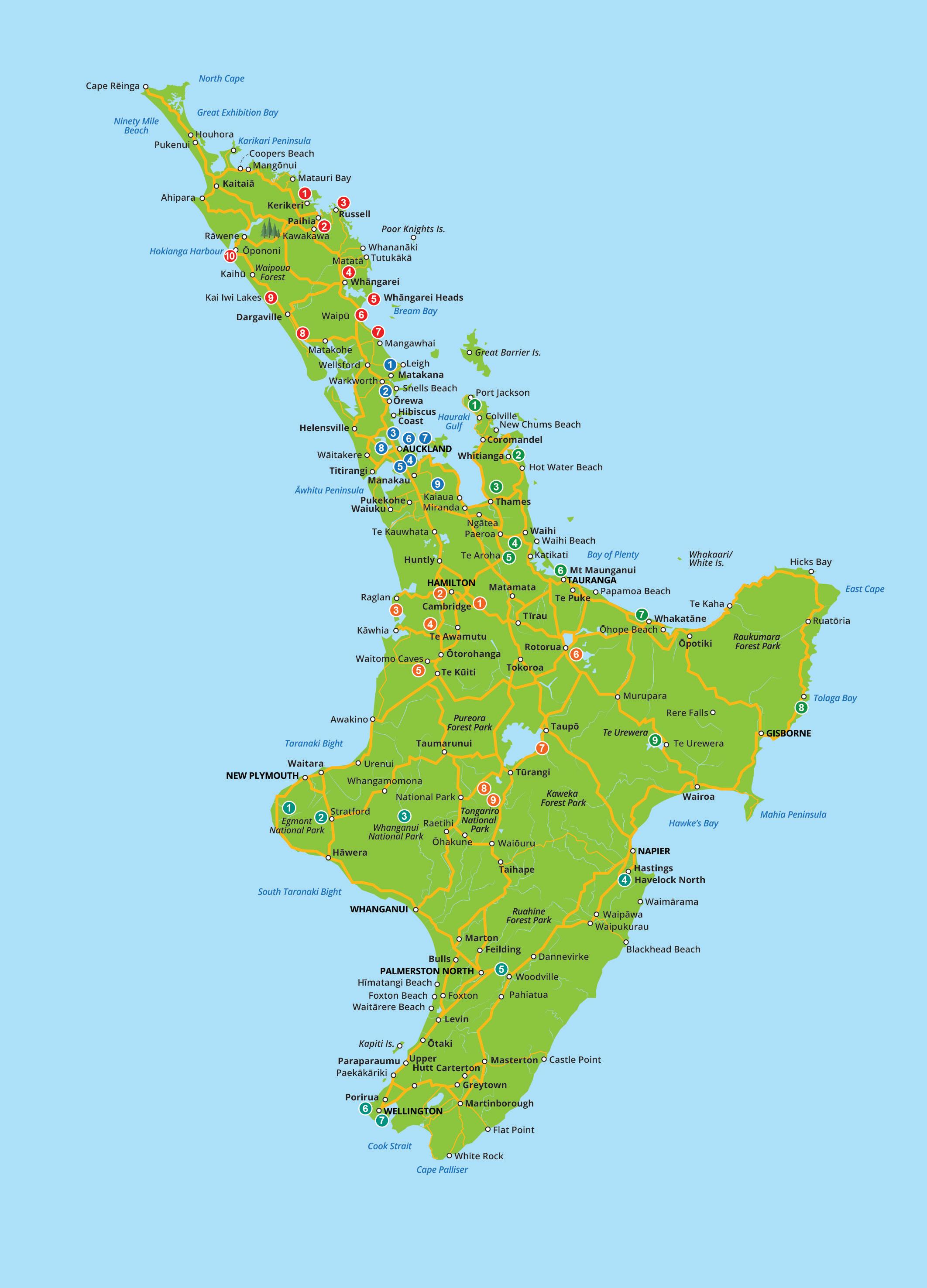
Level 1, Building 2, 61 Constellation Drive, Mairangi Bay, North Shore, Auckland 0632 PO Box 101 001, North Shore, Auckland 0745 T. +64 9 966 8720 F. +64 9 966 8721 E. tourism.images@aa.co.nz W. aatraveller.co.nz ADVERTISING ENQUIRIES: T. +64 9 966 8720 E. tourism.sales@aa.co.nz PRINTED BY: Webstar, Auckland COVER IMAGE: Routeburn Track © Adobe Stock Time and distance Loop track Track Grade No dogs Dogs allowed Track terrain WALKING TRACK KEY CONTENTS 4 NORTH ISLAND MAP 5 North Island Contents 6 SOUTH ISLAND MAP 7 South Island Contents 8 Walking in New Zealand 11 New Zealand’s 10 Great Walks 14 Northland 22 Auckland 28 The Coromandel, Bay of Plenty & Tairāwhiti Gisborne 36 Central North Island 48 Lower North Island 54 Marlborough & Nelson Tasman 60 West Coast 70 Canterbury 78 Lower South Island NEW ZEALAND Walking Must Dos ,
Published in November 2022 by AA Tourism Publishing Ltd
NORTH ISLAND
Northland Auckland The Coromandel, Bay of Plenty & Tairāwhiti Gisborne


Central North Island Lower North Island
4
WALKING MUST DO’S
NORTH ISLAND CONTENTS
14 Walking Must Do’s of Northland

Rainbow Falls Walks & Kerikeri River Track, Kerikeri
Bay of Islands Coastal Walkway, Paihia
Cape Brett Track, Bay of Islands
Hātea Loop Walkway, Whangārei
Mt Manaia Track, Whangārei Heads
Waipu Coastal Walkway, Waipu
Mangawhai Cliffs Walkway, Mangawhai
Tokatoka Scenic Reserve Track, Kaipara
Lake Taharoa Loop Track, Dargaville
Arai Te Uru Heritage Walk, Hokianga Harbour
Walking Must Do’s of Auckland
Mt Tamahunga Walkway, Matakana
Te Ara Tāhuna Estuary Walkway, Ōrewa
North Shore Coastal Walk, North Shore
Auckland Foreshore Heritage Walk, Central Auckland
Coast to Coast Walkway,
Waitematā to Manukau to Central Auckland
Rangitoto Summit Track, Rangitoto Island
Waiheke Art Walking Trail, Waiheke Island
Te Atatū Peninsula Walkway, West Auckland
Hūnua Falls Loop Track, East Auckland
Walking Must Do’s of The Coromandel, Bay of Plenty & Tairāwhiti Gisborne
Coromandel Coastal Walkway, Port Charles
Cathedral Cove Walk, The Coromandel
Kauaeranga Kauri Trail (Pinnacles Walk), The Coromandel
Karangahake Gorge Historic Walkway, Waihi
Te Aroha Summit Track, Te Aroha
Mt Maunganui/Mauao Summit Walk, Mt Maunganui 34 Ngā Tapuwae o Toi Walkway, Whakatāne
Cooks Cove Walkway, Tolaga Bay, Tairāwhiti Gisborne
Lake Waikaremoana Track, Te Urewera
Walking Must Do’s of Central North Island
Cambridge to Lake Karāpiro, Cambridge
Hamilton Lake Walkway, Hamilton
Wairēinga/Bridal Veil Falls, Raglan
Mt Pirongia Summit via Mahaukura Track, Waikato
Ruakuri Walk, Waitomo
Blue Lake Track, Rotorua
Great Lake Walkway, Taupō
Tongariro Northern Circuit, Ruapehu
Tongariro Alpine Crossing, Ruapehu
Must Do’s of Lower North Island
Pouakai Crossing, Taranaki
Dawson Falls Walking Tracks, Taranaki
to Nowhere Walk, Whanganui region
Redwoods Track,
WALKING MUST DO’S 5
15
15
16
16
17
20
20
21
21
21
22
23
23
24
24
25
36
26
26
27
27
28
29
30
31
32
32
33
35
35
38
38
39
40
41
42
46
46
47
48
50
51
51 Bridge
52
Te Mata
North 52 Manawatū Gorge Tawa Loop
Manawatū 53 Mākara Walkway, Wellington 53 City to Sea Walkway, Wellington Exploring the North Island is like ticking off nature’s checklist. Mountains? Tick. Rivers, coastlines, and rainforest? Yes. Add lakes, caves and geothermal activity and it’s the full sweep. To really be in the midst of all this, you want to be walking. Te Mata Peak, Hawke’s Bay © Hawke’s Bay Tourism TOP LEFT: Cape Rēinga, Northland FAR LEFT: Tupare Gardens, Taranaki BOTH: © Adobe Stock WHĀNGAREI DISTRICT NORTH ISLAND NORTHLAND BAY OF ISLANDS FAR NORTH HOKIANGA & KAURI COAST AUCKLAND CENTRAL AUCKLAND NORTH AUCKLAND WEST AUCKLAND SOUTH & EAST AUCKLAND LOWER & CENTRAL NORTH ISLAND Walking Must Dos ,
Walking
Big
Peak, Havelock
Walk,


6 Marlborough & Nelson Tasman West Coast Canterbury Lower South Island SOUTH ISLAND WALKING MUST DO’S
Moeraki Boulders © Adobe Stock
ABOVE:
No sooner have your eyes settled on the South Island, you’ll feel the urge to be immersed in it, to experience up close the landscape in all its magical variety. Such is the beauty here, hiking, walking or even just wandering is addictive.

SOUTH ISLAND CONTENTS
Heaphy Track, Kahurangi National Park and Karamea
Wainui Falls Track, Abel Tasman National Park
Tasman Coast Track, Abel Tasman National Park
Tākaka Hill Walkway, Tākaka
The Bay Walk, Nelson
Queen Charlotte Track, Marlborough
Chalice Hut Walk, Mt Richmond
Rotoiti Circuit, Nelson Lakes
Track, Nelson Lakes
Arch Walk, Karamea
Charming Creek North Walkway, Buller
Point Elizabeth Walkway, Greymouth
Hokitika Gorge Walk, Hokitika
Franz Josef Glacier Walkway, Franz Josef Glacier
Lake Matheson Walk, Fox Glacier
Kōkako Track, Haast
Walking Must Do’s of Canterbury
Kaikōura Peninsula Walkway, Kaikōura
Mt Isobel Track, Hurunui
Devils Punchbowl Walking Track, Arthur’s Pass
Awaroa/Godley Head Loop Track, Christchurch
Round the Mountain via Curry Track, Akaroa
Forest Park Scenic Reserve Walks, Geraldine
Caroline Bay, Timaru Botanic Gardens & Centennial Park Walks, Timaru 78 Walking Must Do’s of Lower South Island
South Hill Walkway, Ōamaru
Moeraki Boulders Beach Walk & Millennium Walkway, Waitaki 80 Harbourside Path, Dunedin 80 Nugget Pt/Tokata Walks, Clutha 80 Cathedral Caves Walk, The Catlins 81 Rakiura Track, Stewart Island
Kepler Track, Te Anau
Milford Track, Fiordland 86 Routeburn Track, Mt Aspiring/Queenstown
Queenstown Hill Time Walk, Queenstown
Bannockburn Sluicings, Central Otago
Roys Peak Track, Wānaka 88 Rob Roy Glacier Track, Wānaka
WALKING MUST DO’S 7
Abel
©
54
55
55
56
57
58
58
58
59
59
60
61
61
62
63
64
65
66
68
68
69
70
71
74
76
76
77
77
77
Tasman National Park
Lightstyle
Walking Must Do’s of Marlborough & Nelson Tasman
Abel
Lake
Lake
Speargrass
Walking Must Do’s of West Coast
Oparara
Cape Foulwind Walkway, Westport
Truman Track, Punakāiki
Paparoa Track, Punakāiki
Peel
79
79
83
85
87
87
88
SOUTH
UPPER
MARLBOROUGH NELSON
WEST
CANTERBURY NORTH CANTERBURY MID CANTERBURY SOUTH CANTERBURY BANKS PENINSULA CHRISTCHURCH CHRISTCHURCH & LOWER SOUTH ISLAND
,
ISLAND
SOUTH ISLAND
TASMAN
COAST
Walking Must Dos
NEW ZEALAND Walking in
Have wheels, will travel
Some
• Hātea Loop Walkway, Whangārei, page 16
• Te Ara Tāhuna Estuary Walkway, Ōrewa, page 23
• Te Atatū Peninsula Walkway, West Auckland, page 27
• Hamilton Lake Walkway, page 38
• Great Lake Walkway, Taupō, page 46
• Lake Matheson Walk, Fox Glacier, page 68
• Kōkako Track, Haast, page 69
• Harbourside Path, Dunedin, page 80
• Nugget Pt, Clutha, page 80
WHERE CAN I WALK?
With plenty of bush, beach and backcountry, New Zealand was made for scenic walks. Most tracks are well signposted by DOC and provide approximate time lengths.


WHAT IS DOC?
DOC stands for Department of Conservation/Te Papa Atawhai. DOC manages a network of walks and over 950 huts. Its website is your go-to for all things hiking and tramping, including information on track closures and how to book DOC campsites and huts. doc.govt.nz
WHAT ARE NEW ZEALANDS’ GREAT WALKS?
In New Zealand you’ll hear fellow walkers rave about New Zealand’s Great Walks. With jaw-dropping scenery and well-kept multi-day trails (and one is even a canoe route), these 10 walks are considered unmissable.
TOP TIP: Read more about each Great Walk on pages 11-13.
WHAT SHOULD I TAKE?
Appropriate footwear, plenty of water and, depending on the duration of your walk, ample food, first aid and, a head torch. Even in the height of summer, a rain jacket and pack cover is recommended, as are waterproof bags for your tech and maps.
TOP TIP: Don’t waste precious food on the wildlife! Feeding the birds can harm them.
WHAT CAN I DO TO STAY SAFE?
Plan well in advance and research your walk thoroughly. The weather can change quickly in New Zealand, often without warning. Always check the weather forecast and pack the right gear for the conditions. Ensure the track is well within your physical capabilities beforehand – and all those you’re going with.
8 WALKING MUST DO’S
Mt Fyffe walk © Andrew Spencer Photography
BELOW: Tolaga Bay Wharf © Brennan Thomas
RIGHT: Ōmāpere lookout © Adobe Stock
walks featured in this guide are partially or fully accessible to wheelchair users. Check for details online before leaving home.
HOW CAN I BE ENVIRO-FRIENDLY?
Leave no trace: carry out exactly what you carry in, including rubbish. Stay on marked tracks to protect the natural environment, and plan your trip well ahead so your environmental impact is minimal. Toilets aren’t always readily available, so be aware which tracks you might need to “dig and dispose”.
TOP TIP: Kauri dieback is an uncurable disease killing kauri trees. Please keep to the tracks, clean all your footwear and equipment (look out for cleaning stations) and stay away from tree roots.


TOP TIP: MetService provides New Zealand’s official weather forecasts. See metservice. com for warnings, short and long range forecasts and to download the mobile weather app.
HOW DO I STAY ON TRACK?
New Zealand’s walking tracks are vast and the bush is a labyrinth-like terrain. However, marked tracks are numerous, well-maintained and are dotted with orange triangles to guide you safely along the route.
TOP TIP: Before setting off, even if you’re in a group, let someone know where you’re going and how long you expect to be gone for.

WHAT ELSE SHOULD I KNOW?
• Care is needed when swimming on New Zealand beaches. Rips are dangerous but difficult to identify so aim to swim at patrolled beaches, stay within the flags and avoid going in alone.
• Always lock your car, keep valuables and passports at your accommodation.
• Carry a mobile phone. In an emergency call 111.
Tips from the top
The NZ Mountain Safety Council (MSC) has a range of free resources to make your next outdoor adventure a success:
PLANNING MADE EASY
Check out the Plan My Walk’ website at planmywalk.nz or download the app; it’s free to use and has over 1000 tracks to inspire your next adventure. Packed full of features from weather forecasts and alerts, to track information and updates, there are even supplies/clothing gear lists tailored to each walk.
Here are some ways to get the most from the app:
• Turn on your phone’s location and you’ll find suggestions of walks local to you, handy when at home or on your travels.

• Use the search engine’s filters. These include distance, location and ease of walk; you can also find dog-friendly walks and pushchair or wheelchair suitable tracks.
Use the ‘Plan’ feature to create a trip. Simply add in the trip details such as group members, a daily schedule and any important trip notes. All of this information is then shared to an emergency contact and to group members.
• Many walks have been reviewed by other users which can help to manage expectations. If you are lucky, they will have even shared some photos of their walk.
Look for the symbol in this guide for walks you’ll find on the Plan My Walk app.
ESSENTIAL SAFETY VIDEOS
• The Tramping Video Series: Season 1 and 2 takes you through some of Aotearoa’s most popular tramps and walks by showcasing the track and offering advice on how to prepare and what to expect on the trip.
• How-To Videos: The 29 videos in the ‘Get Outdoors Series’ detail some of the things you’ll need to know before you go. They are free to watch online and include basic outdoor survival tips. Find videos at: mountainsafety.org.nz
WALKING MUST DO’S 9
LEFT: Trounson Kauri Park boardwalk © Northland Inc.
BELOW: Mt Manaia, Northland © Fraser Clements / Tourism NZ
Keeping safe
• Plan your trip in advance by researching the terrain and suggested hike time.
• Tell someone your plans beforehand.
• Check the weather and prepare for it.
• Consider who you’re walking with and understand their fitness levels as well as your own.
• Consider all medical issues. Know the limits of every walker, pace yourselves and stay together.
• Take sufficient supplies.
• Keep cellphones and maps in waterproof bags.
• Wear the right gear. Take rain protection, avoid cotton clothing and keep your core warm.
Visit aa.co.nz/travel for inspiration and accommodation options with discounts for AA members.


For road rules, maps, time and distance calculations, an EV charge finder, as well as road closures, visit aa.co.nz
TOHU WHENUA ARE PLACES AROUND NEW ZEALAND THAT MATTER TO KIWIS. RICH IN HISTORICAL OR CULTURAL SIGNIFICANCE, VISITORS ARE PRESENTED WITH AUTHENTIC INSIGHT INTO AOTEAROA. VISIT TOHUWHENUA.NZ FOR MORE INFORMATION.
10 WALKING
MUST DO’S
Arrowtown cottages © Adobe Stock
NEW ZEALAND Our Great Walks
New Zealand’s 10 Great Walks are premier tracks, developed by DOC. They’re multi-day adventures through some of Aotearoa’s most startling landscapes; summaries of each Great Walk are featured over the page.

NEED TO KNOW
Visit doc.govt.nz for information on track closures, alerts relevant to conservation areas, weather updates and safety plans. You must pre-book your accommodation well in advance. These walks are very popular and DOC huts, campsites and lodges tend to get snapped up fast. Visit: bookings.doc.govt.nz to create an account, then proceed with booking.
What to expect:
• Multiple hours of walking per day.
• DOC huts and/or campsites: no thrills, back-to-nature accommodation.
• To carry your every provision for the duration: food, drink, tent, toilet roll! And more...
• The unexpected. Walks are at the mercy of Mother Nature so check what’s open beforehand at doc.govt.nz
• An easier option: travel companies offer itineraries with guides, pre-arranged accommodation, luggage transfer services, car relocation, pre-prepared food and gear that you can hire.
WALKING MUST DO’S 11
TOP: Rakiura Track, Lee Bay, Stewart Island © Real Journeys INSET: Heaphy Track © Department of Conservation
1TONGARIRO NORTHERN CIRCUIT: NORTH ISLAND IS AN ADVENTURE OF TOLKIEN PROPORTIONS

Most walks on Earth don’t look like this. With desert plains that crash into red craters, steaming blisters, neon-bright lakes and three enormous volcanic peaks, this is doomsday meets the great Gates of Mordor. In fact, Mt Ngāuruhoe towers one-kilometre overhead and when it’s not brooding silently, poses for The Lord of the Rings’ fans as the ominous Mount Doom. This three-day circuit initially follows the popular Tongariro Alpine Crossing, but when the path splits, a barren, lunar-like landscape dares you to go further.
For track tips Sam and Frodo could’ve done with, see page 46.
LAKE WAIKAREMOANA: NORTH ISLAND IS MAGICAL TALES ALONG MAGICAL TRAILS

No one can resist the promise of a goblin forest, ethereal waterfalls and Patupaiarehe (forest fairies). Lake Waikaremoana is located in Te Urewera, an area long considered the ancestral home of Ngāi Tūhoe – the ‘Children of the Mist’, and since 2014, an independent legal identity. This means that Mother Nature is 100% in charge here. Since Tūhoe were made legal guardians of Te Urewera, the land has been allowed to flourish. It’s a highly spiritual place that fully enchants walkers over the course of three to four days.
Read more on page 35.
WHANGANUI JOURNEY: NORTH ISLAND IS THE ONE THAT MASQUERADES AS A WALK
Is there any such thing as a 150km walk where you get to sit down the entire time? In New Zealand there is. Paddling a kayak downstream, the Whanganui Journey is a three to five-day river adventure. You can find more information online at doc.govt.nz.

ROUTEBURN TRACK: SOUTH ISLAND IS LARGER THAN LIFE
How strange it is to feel so far removed from the real world, while being in the very thick of the real world. There is no phone reception along the 32km Routeburn Track; no burning emails, social posts, messages or memes. There is only nature. On any given day (there are three in total), you’ll be walking through clouds, staring into crystalline blue lakes or trailing, like ants, between enormous glacialcarved valleys. Easily the most beautiful landscape you’ll ever have the pleasure to walk through. Get ready for this worldrenowned walk and head to page 86 for more information.

12
4
2
Kepler Track BELOW, LEFT: Tongariro National Park BELOW, RIGHT: Routeburn Track All: © Adobe Stock
WALKING MUST DO’S
5KEPLER TRACK: SOUTH ISLAND IS MOUNTAINS FOR MILES


For a trail that spends much of its time above the tree line, bathing in lofty mountainous views and never-ending panoramas, look no further than the Kepler Track. For 60km and four days, navigate knife-like ridgelines, gaze across snow-capped peaks and stare into lakes many miles below. At dusk, the sky becomes a canvas for the sun to slay with colour, and by morning mountain kea, AKA naughty alpine parrots, will be tapping at the window. These notorious thieves like to recce the area, like a feathered rendition of Ocean’s Eleven
To tackle the Kepler like a seasoned pro, see page 83.
MILFORD TRACK: SOUTH ISLAND IS THE FINEST WALK IN THE WORLD
Or so said poet, Blanche Baughan in 1908 having experienced the four-day, 53.5km walk for herself. Arriving here is like being plucked from modern life and deposited in an untouched pocket of the planet. From one beautiful waterfall to the next, mountain-reflecting lakes and a level of green that only nature knows how to create, Blanche may have been an expressive poet, but she didn’t exaggerate this one.
Feel like following in Blanche’s footsteps? Start by reading page 85.

HEAPHY TRACK: SOUTH ISLAND IS NATURE LIKE YOU’VE NEVER SEEN IT BEFORE

6If ever there were ‘Seven Natural Wonders of New Zealand’, you’d find them all on the Heaphy Track. There are nīkau palms, which means ‘no nuts’ in Māori because these nutless palm trees don’t have coconuts, and powelliphanta, giant carnivorous snails that feed on huge portions of earth worms like it’s spaghetti. There are also ruru, the native owl, and gnarly Brother Grimms-style trees called rātā, as well as fluffy kiwis, an extremely rare blue duck and the jagged peaks of the Dragons Teeth mountain range. You have 78km and four days to find them all. For help on how to make the most of Heaphy, see page 55.
PAPAROA TRACK: SOUTH ISLAND IS THE NEWEST GREAT WALK IN 26 YEARS

It’s the newest Great Walk to join the repertoire, but Paparoa Track is hugely historic. From its 1930s miners hut to a 100-year-old quartz crushing battery, remnants of the past are frozen in time; none more poignant than the memorial site commemorating 29 lost lives of the Pike River explosions. Crossing the Paparoa Range on a track built for both mountain bikers and walkers, the trail climbs steeply over 55km and three days. Steadfast trampers are rewarded with river gorges, limestone cliffs and sunsets worthy of applause. Read more on page 64.
ABEL TASMAN COAST TRACK: SOUTH ISLAND IS A BEACH HOLIDAY WITH A DIFFERENCE
Whereas many Great Walks are about the beech, this one’s all about the beach. With 60km of flat coastal track that ducks in and out of bay-peeking forest, togs are just as necessary as tramping boots.
If the weather plays nice, you’ll be presented with one blue vista after another. Navigate various low tide crossings to reach empty beaches and surprising swimming holes such as Cleopatra’s Cove. With a fresh forest scent and near silence, save for the sound of crashing waves, this one not only looks good, it sounds and smells pretty special, too.
7Familiarise yourself with this track’s every detail on page 56.
RAKIURA TRACK: STEWART ISLAND IS HEAVEN FOR KIWIS AND KIWI!
Stewart Island is the most untouched place New Zealand has to offer. It’s a wild droplet of Aotearoa that has eloped from the mainland but still plays host to the 32-kilometre, long-looped Rakiura Track. Unexpectedly radiant, the trail weaves in and out of verdant forest, dropping into secret beaches lapped by cobalt water. You won’t have to tramp far to find a private sliver of sand, or a preoccupied kiwi rustling in the bush. Stewart Island boasts high numbers of our flightless birds, and better still, they’re tamer than most.
Find out more about this beauty on page 81. Stewart Island’s weather is very changeable and difficult to predict, so check online before stepping out.
WALKING MUST DO’S 13 8
10 9
ABOVE: Abel Tasman Coast Track © Tazmin Henderson
ABOVE: Kiwi © Orana Wildlife Park
LEFT: Paparoa Track © Adobe Stock
• Whangārei New Zealand’s northernmost city is blessed with a busy marina and a slick selection of restaurants, bars and the impressive new Hundertwasser Art Centre
• Whangārei Falls These 26m-high falls are just a 10-minute drive from Whangārei city.
• Whale Bay Follow the bush trail from Matapōuri Bay and drop into this dazzling cove.
• Bay of Islands Comprising 144 islands, many of which are accessible by water taxi, ferry or kayak, the acclaimed Hole in the Rock boat tour
DON'T MISS
and the lively hubs of Paihia and Russell
• Te Ahurea Representing life before Europeans arrived, visitors can take a self-guided tour of this recently redeveloped Māori living village, interactive pā site and gardens in Kerikeri
• Waitangi Treaty Grounds Where the original treaty was drawn up, with historic sites, marae, two state-of-the-art museums and carving studio, it’s a full day out.
• Hundertwasser Memorial Park Celebrating the life and achievements of Friedensreich
Hundertwasser, find the Hundertwasser piazza near the famous toilets in Kawakawa
• Waipu is a bonny wee place with cafés and a museum. Waipu Cove is a top beach nearby.
• Visit Mangawhai, a coastal paradise.


• Soak in natural thermal waters at the renovated Ngāwhā Springs near Kaikohe
• The Tutukākā Coast is a haven for snorkellers and divers. Boat tours frequent Poor Knights Island marine reserve and there are two sunken ex-navy vessels to explore.
14 NORTHLAND
Harbour © Whangārei District Council
Whangārei
WALKS RAINBOW FALLS WALK & KERIKERI RIVER TRACK BAY OF ISLANDS COASTAL WALKWAY CAPE BRETT TRACK HĀTEA LOOP WALKWAY MT MANAIA TRACK WAIPU COASTAL WALKWAY MANGAWHAI CLIFFS WALKWAY TOKATOKA SCENIC RESERVE TRACK LAKE TAHAROA LOOP TRACK ARAI TE URU HERITAGE WALK 1 2 3 4 5 6 7 8 9 1 2 3 4 5 6 10 8 7 9 10 , COROMANDEL BAY OF PLENTY COROMANDEL WHĀNGAREI DISTRICT NORTH ISLAND NORTHLAND BAY OF ISLANDS FAR NORTH HOKIANGA & KAURI COAST AUCKLAND CENTRAL AUCKLAND NORTH AUCKLAND WEST AUCKLAND SOUTH & EAST AUCKLAND LOWER & CENTRAL NORTH ISLAND Walking Must Dos
RAINBOW FALLS WALK & KERIKERI RIVER TRACK
Walkers can stroll for mere minutes to admire the thundering falls, or venture further downriver for 3.5km to see the town basin.
TRACK OVERVIEW
The Kerikeri River is a cool spot for walking and swimming. The very short walk to the falls with its three lookouts is the perfect spot to take a break and stretch your legs when driving long distances. But if time is on your side, opt for the longer river walk (7km return) which takes you from Rainbow Falls to the town basin.
The bush is alive with birdsong, including tūī and pīwakawaka (fantails), as they flit among the kauri and tōtara trees.
Interpretation panels at the falls provide interesting information about the advent of hydroelectricity, an innovation that transformed the region from 1930. Historical remnants of the first station can still be seen today. Be sure to have your swimsuit handy if the weather is warm, as there are many pools for taking a dip; always exercise caution when swimming near waterfalls and be aware of the falls’ power, especially after rain.
Where is it?
Start at Rainbow Falls Rd for the falls, or start at Kerikeri Basin Reserve if doing the full river track.
Terrain
Easy walking along well-formed paths, much of it is stroller-friendly.
Good to know
This trail is part of Te Araroa, the walking path that goes from Cape Rēinga in the North Island to Bluff at the bottom of the South Island.
BAY OF ISLANDS COASTAL WALKWAY
TRACK OVERVIEW
5-10min to Rainbow Falls from car park. 3hr; 7km return for full walk
Basic fitness, suitable for all ages

There are several waterfalls within easy walking distance of Kerikeri. The 8km roundtrip Kerikeri Woodland River Walk includes three and can be started from the town centre, the Stone Store or points in between.
Set off from Paihia and head towards Ōpua. This leg of the journey takes you along the beach along a wellformed coastal path with views across to Russell. Pass several beaches including Sullivans and Te Haumi. From Te Haumi it’s largely paths through bush, as well as along an elegant boardwalk through mangroves. It takes about 2.5hr and includes some decent climbs so pack plenty of water. At Ōpua you’ll find shops and bathrooms. Then board the ferry to Ōkiato; they run every 10min. Enjoy the brief break before starting the second leg to Russell. From the ferry, walk uphill for about 10min before turning left onto Pipiroa Rd to walk down to the beach. This segment takes about 3.5hr with a mix of flat and steep segments, notably the steps up through native bush. High above Ōrongo Bay look out for the historic manganese mine site and make sure you have your wallet if you care to stop at the oyster farm. As you walk down to Russell, you may feel like an explorer who has chanced across the most charming historic village where numerous opportunities for refreshing yourself can be found. Stay a night in Russell or take the ferry back to Paihia, where your journey began.

A full-day walking circuit, including ferry links, that goes from Paihia to Ōpua then Ōkiato to Russell, and includes beaches, boardwalks and birdlife.


Where is it?
Start in Paihia in the Bay of Islands, Northland. This trail is wellsignposted with maps available from the information centres.
Terrain
Coastal paths, paved sections, boardwalks and a few steps.
WALKING MUST DO'S 15 1
No dogs, this is a kiwi area
Easy walking
Approximately 6hr; 16km Reasonable fitness required No dogs
Paihia Maritime Building
© Fullers GreatSights Bay of Islands
Undulating with a fair few steps
2
THE KAURI WORKSHOP Plenty of gift ideas for all budgets. • Wide range of handcrafted wood made from New Zealand native timbers including kauri, rimu, totara and pohutukawa. • Overseas shipping available. • Come on in and see our woodturner at work. www.facebook.com/profile.php?id=100075866239974 500 Kerikeri Rd, Kerikeri • P: 09 407 9196 • E: kauriw@xtra.co.nz
Waterfront dining, Paihia © David Kirkland
CAPE BRETT TRACK
8hr one way from Rawhiti to the lighthouse; 16km or 2.5hr from Deep Water Cove to the lighthouse; 6km. An A to B walk.
Advanced tramping track

Where is it?
Set off from Rawhiti, Bay of Islands (4hr from Auckland, 40min from Russell) and walk 16km or for a shorter walk, take a water taxi from Russell to Deep Water Cove for a 6km hike.


Terrain
Undulating, sometimes steep, much of it in the canopy of regenerating bush.

Need to know
A permit, available from Russell Info Centre, is required to walk this track. Bookings essential if you wish to stay at the 23-bed DOC hut.
Water supplies


Water supplies at the Cape Brett Hut are slightly salty from sea spray. Bring enough drinking water for the walk out to and back from the hut.


TRACK OVERVIEW
Picturesque Cape Brett juts out into the Pacific Ocean at the eastern end of the Bay of Islands. With two ways to attack this walk, you can choose to do the eight-hour, 16km hard way from Oke Bay in Rawhiti or arrange for a water taxi to take you from Russell (or Paihia) and start at Deep Water Cove. This second option means the walk to the lighthouse will be a much more leisurely two-and-a-half-hour


walk. Whichever you choose, you will be serenaded by choirs of birds as you wander through regenerating native bush along spectacular undulating coastal paths. Occasionally you’ll be sheltered beneath mānuka canopies, or on exposed narrow trails, before arriving at the DOC hut.


No dogs

HĀTEA LOOP WALKWAY 4


.
This 4.2km loop is an excellent way to acquaint yourself with Whangārei. Look out for artworks created by local talents including the stone sculpture Waka and Wave at Hihiaua Point, a depiction of a Māori waka (canoe) piercing a towering wave. Reyburn House is Whangārei's oldest house, built in the 1870s; today it’s where you’ll find the Northland Society of Arts. There is also a very sweet playground, complete with a liberty swing for use by visitors in wheelchairs. Stop to read the interpretation panels as you go as all sorts of interesting facts are brought to life. Time your visit to witness the impressive bascule bridge open to admit boats with masts over 6.5m entry to the basin. Called Te Matau a Pohe, The Fish Hook of Pohe, this extraordinary feat of engineering provides an exciting element to the area while at the other end the Canopy Bridge resembles vast sails.


A pretty urban walk through the Whangārei Town Basin featuring a marina, restaurants, shops, galleries, bridges, parks and playgrounds. To give the walk its full name, the Hātea Loop is also known as Huarahi o Te Whai or the 'Pathway of Opportunity'.
Where is it?
Whangārei Town Basin. This fully accessible loop circles the Hātea River, uniting the basin with William Fraser Memorial Park.
Terrain
Almost entirely paved so accessible for wheelchairs and strollers.
16 NORTHLAND
Cape Brett Track © Northland Inc.
3
One of Northland’s most exhilarating walks, the trail winds and weaves along coastal paths before arriving at a DOC hut, where you’ll find a most elegant 113-year-old lighthouse
TRACK
OVERVIEW
www.jimmyjacksribshack.co.nz 117 BANK ST, WHANGAREI | PH: 09 430 0760 | OPEN 7 DAYS FROM 11.30AM
Delicious coffee & home-cooked food
Open
Fabulous
Covered indoor & outdoor seating
FREE WiFi
Where the locals eat 6 Quayside, Town Basin P (09) 438 7557 www.mokabacafe.co.nz MOKABA
•
(incl. GF) •
7 days, 8am - 5pm •
setting overlooking river & yacht marina •
•
•
Whangārei, New Zealand’s northern most city, is a bustling hive of activity and a holiday harbour well worth a stop and stay. The yachting marina is peppered with boats and lined with restaurants. Not to be missed is the Hundertwasser Art Centre, also home to the Wairau Māori Art Gallery and the Whangārei Art Museum, displaying the city's collection.


Admire native trees at AH Reed Kauri Park from the elevated treetop walk or visit the Quarry Gardens and Botanica Whangārei for inspiration. Further afield are the epic Whangārei Falls or if you’d rather go underground, Abbey Caves are free to explore.


HIGHLIGHTS along the Hātea Loop Walkway include a fantastic children's playground and petanque court. Worth a look in are Claphams National Clock Museum and the Rolling Ball Clock kinetic sculpture. With more art works to be found scattered around this walking route; download the Street Prints Manaia Street Art Trail map.
MT MANAIA TRACK
The bush-clad mountain dominates the landscape and is irresistible to hikers who appreciate a dramatic view.
Where is it?
The track starts just above the car park next to the Mt Manaia Club on Whangārei Heads Rd above McLeod Bay, 28km east of Whangārei.
Terrain
Moderate fitness is needed, because of the steady climbing –but it’s a good track and worth the effort. The lookouts have no safety barriers, so stay well away from the drop-offs and supervise children. On your return, consider heading straight to McLeod Bay for a swim.
•
The track to Mt Manaia summit is a steady climb in the shade of regenerated native bush through groves of nīkau palms and kauri stands with glimpses of northern rātā hanging from pōhutukawa. The wide gravel path changes to wooden steps in the steepest parts and stops, occasionally, at lookouts on natural rocky outcrops. Thick native forest blankets the terrain, which rises to peaks and falls to deep valleys in mysterious folds punctuated with steep bluffs.
Close to the 420m-high peak, the gradient gets steeper and views get more impressive. From the top, the vista takes in Whangārei Harbour, the Hen and Chicken Islands, Bream Bay and the Hauraki Gulf.
WALKING MUST DO'S 17 WHANGĀREI TOP SPOTS
TOP PICKS
Hundertwasser Art Centre and the Whangārei Town Basin © Northland Inc.
2hr return;
return, via same
Moderate fitness required Steady and steep
4km
track
climb
No
Tourism 1hr; 4.2km loop track Basic fitness required Dogs are welcome Easy walking
TRACK OVERVIEW 5
dogs ABOVE: Mt Manaia © Northland
WAIPU MANGAWAI KAIWAKA WELLSFORD WHANGĀREI PATAUA HIKURANGI TUTUKĀKĀ COAST WHANGĀREI HEADS BREAM BAY Delicious café menu & fabulous cabinet selection incl gluten free Award-winning Fair Trade and Organic coffee blend by Chiasso
seating overlooking river & yacht marina Fully
with quick, friendly service
daily
• Indoor/outdoor
licensed
Open 8am – 5pm
Free WiFi hotspot 14 Quayside, Town Basin, Whangarei +64 9 430 0467 – no bookings


18 NORTHLAND
RIGHT: Tāne Mahuta © Northland Tourism


WALKING MUST DO'S 19
The beauty of this 5.3km looped walk is hinted at in the name –the coastal views come thick and fast and every new vista is a jaw dropper.
Where is it?
The walk starts from Waipu Cove (or Ding Bay) just 45m from popular Waipu Beach which is 12.5km north of Mangawhai.

Terrain
Jandals might be tempting when the walk is just inches from the sand, but ill-advised. The route follows a craggy coastal bluff with exposed cliff edges, whipped by the wind and an undulating, often lofty landscape. Wear sturdy shoes and take extra care of children.
TRACK OVERVIEW
The ocean, albeit magnificent, doesn’t steal the show on its own, on this coastal pathway. From gaps in the bluff revealing small sheltered beaches to stacks of pancake rocks and dramatic steep drops, the entire landscape dazzles. The route is stamped with plenty of picnic spots and places to fish straight off the rocks, so pack more than just your water bottle. You won’t need the agility of a mountain goat, but it is rated as moderate due to exposed tree roots and small amount of rock clambering required. Entry and exit points are found at both Waipu Cove and Ding Bay with the latter half of the loop following the main road back to the beach.
1-2hr; 5.3km loop track
Moderate fitness required
Steep in parts No dogs
7 MANGAWHAI CLIFFS WALKWAY
TRACK OVERVIEW
The track starts along the beach, then climbs quite steeply for about 20 minutes to a lookout point. It then winds past ancient pōhutukawa teetering on the sheer slopes before descending to the stony beach below. From here you can walk back along the beach, but only at low tide. Keep to the marked track as it crosses private property. From the top the view of the beaches below is amazing, and you can sometimes spot large schools of fish being chased by passing whales or schools of sharks. Once you descend to the beach the reward of a cooling dip is a must before the final journey through the archway formed by a unique rock formation leads you on the home stretch along the beach.
A visit to the Mangawhai Cliffs Walkway provides you with breathtaking coastal views that extend from Bream Head in the north down to the Tāwharanui Peninsula in the south.
The Coromandel Peninsula and Great Barrier Island/Aotea can often be seen on the horizon.

Where is it?
Mangawhai is located on the Twin Coast Discovery Highway, 20 minutes from Waipu or 30 minutes from Wellsford. Access to the track is from the Kaipara District Council car park near the Mangawhai Surf Lifesaving Club at the end of Wintle St.
Terrain
Moderate fitness is required as this is a steep climb with many steps but persevere and you’ll be rewarded with stunning views when you reach the top.
20 WAIPU COASTAL WALKWAY NORTHLAND
6
Waipu Cove © Adobe Stock
9km
Moderate
Steep
2-3hr return;
via same track
fitness required
climb; many steps
Mangawhai Heads beach © Adobe Stock
No dogs
TOKATOKA SCENIC RESERVE TRACK
Thrusting up beside the serpentine Wairoa River, this short steep walk provides walkers with impressive views.
Where is it?
Tokatoka Rd, 17km south of Dargaville, Northland.
Terrain
Steep, well-formed tracks, slippery after rain.
LAKE TAHAROA LOOP 9
This trail, often with white sand underfoot, loops around Lake Taharoa’s azure blue, crystal waters, in the winterless Northland. Ideal for families on a day trip or staying at the campgrounds. It replaces the Kai Iwi Coastal Track that is now permanently closed.
Where is it?
This trail loops around the largest of the Kai Iwi Lakes trio, just 35 minutes north west of Dargaville, along the Kauri Coast.
Terrain
Flat, sandy shores skirting the lake’s edge, also passing through native bush. Suitable for children and perfect for taking swim breaks on your way around.
Good to know
The trail is doable by bike or with off-road pushchair and can also be joined from the Promenade Pt campgrounds.
Did you know?
In the early 1890s, this was a major kauri gum digging region. By the early 1900s, in an attempt to extract more gum, a drain was dug at Lake Kai Iwi and it was lowered by about two metres.
TRACK OVERVIEW
The walk starts and ends at the Pine Beach Campground and takes you around Lake Taharoa. Head north anti-clockwise from Taharoa Domain and enjoy this easy, pretty walk marvelling at the clarity of the water and consequently all the fish you’ll spy too. There is an optional detour up the hill for a spectacular view. Most of the time you will have it to yourself, although it gets busier over the December to February summer holiday period.
You can grab some ice cream or a coffee at the Pine Beach Café as a treat after the walk. Fees are required to stay at the campsite.
No dogs
Stride to the top of Mt Tokatoka for phenomenal 360-degree views of the river, the countryside, Kaipara Harbour and the distant ranges. Follow the short, steep path up what was once a volcanic plug, the aftermath of an ancient eruption. You’ll feel on top of the world when you summit. Possibly a challenge for those who aren’t comfortable with heights, but well worth the effort. The mountain holds special significance to the people of Ngāti Whātua who believe Tokatoka is one of several mountains that made their way to Aotearoa from Hawaiki. One of the group, Manaia, made its way to the Whangārei Heads while another mountain was drowned in the Waiora River. Fearful of meeting a similar fate, Tokatoka and neighbouring Maungaraho decided to err on the side of caution and move no further. Back down at river level you’ll find the Tokatoka Tavern, where food and cool beverages can be enjoyed.
10 ARAI
TE URU HERITAGE WALK
Arai Te Uru is the name bestowed on the south head of Hokianga Harbour. Within its namesake reserve, several vantage points spill over the Tasman Sea drinking up views of the harbour and colossal sand dunes.


Where is it?
In Hokianga Heads above Hokianga Harbour, 56km west of Kaikohe and 1.7km west of Oparara.
Terrain
Suitable for children and families pushing buggies (however it’s not surfaced so expect a bumpy ride). There are a few sheer drops in places to be mindful of.
30min; 0.5km return
Basic fitness required
Easy walking
TRACK OVERVIEW
Just up the hill from Ōmāpere is Arai Te Uru Recreational Reserve and a series of scenic walks. From the car park there is a decent 30-minute ramble to stretch your legs and invigorate the lungs, following the top of the cliffs and past the remnants of an old signal station before looping back to the start. With far-reaching views across Hokianga Harbour, the station was built to navigate ships through the treacherous passage but closed in 1951 due to dwindling seafarers. The views today remain spectacular. To extend the walk, there is an optional side-track down to Martins Bay where large rock pools and tidal archways enthral.
WALKING MUST DO'S 21
40min return; 700m Medium fitness required Steep walk
TRACK OVERVIEW 8
No dogs, unless you have a DOC permit
Basic
2hr; 8km loop
fitness required Easy walking
Adobe Stock
Arai
Te Uru ©
Kai
Iwi Lakes © Adobe Stock
No dogs, unless you have a DOC permit
• Downtown Auckland Following an extensive refurb, a new and fully pedestrianised plaza spills into Commercial Bay, a world-class hub of global shopping and modern dining.
Volcanoes Scale one of Auckland’s 48 volcanoes; Mt Eden has the tallest peak, while Rangitoto’s grand stature has risen in the Hauraki Gulf.
• Britomart A cosy block of cobbled lanes and green spaces adjacent to Auckland’s main transport hub, throbbing with bars, restaurants and gorgeous fashion boutiques.
Wynyard Quarter This revived waterfront
DON’T MISS
precinct is brimming with harbourside eateries, gelato parlours, surprising silos, modern play areas and funky green spaces to sit and relax in.
• Viaduct Harbour A bustling marina of modern bars and restaurants, bordered by glamorous yachts and shimmering water.


• The North Shore offers world-class golden beaches, top eateries and community spirit. Further north, you’ll find Ōrewa, Pūhoi, Warkworth, Matakana and Leigh.
• West Auckland’s Famed for far-reaching black-sand beaches, Piha, Bethells, Karekare and Whatipu are shining examples. Muriwai also
plays host to a much-revered gannet colony. Hobsonville and Titirangi’s art and food scene are worth checking out as well.
• South Auckland is the king of Pacific culture. Don’t miss Mangere Food Market every Saturday and the Ōtara Flea Market. While here, visit the Auckland Botanic Gardens.
East Auckland top picks include Clevedon Farmers’ Market and Howick Historical Village.
• Hauraki Gulf Catch the ferry to a handful of islands, from popular holiday destinations such as Great Barrier and Waiheke to bijou drops of idyll like Tiritiri Matangi,
and Motutapu.
22 AUCKLAND Auckland © Adobe Stock
1 2 3 4 5 6 8 9 7 WALKS MT TAMAHUNGA WALKWAY TE ARA TAHUNA ESTUARY WALKWAY NORTH SHORE COASTAL WALK AUCKLAND FORESHORE HERITAGE WALK COAST TO COAST WALKWAY RANGITOTO SUMMIT TRACK WAIHEKE ART WALKING TRAIL TE ATATŪ PENINSULA WALKWAY HŪNUA FALLS LOOP TRACK 1 2 3 4 5 6 7 8 9 , COROMANDEL BAY OF PLENTY COROMANDEL TAIRĀWHITI GISBORNE WAIKATO & WAITOMO ROTORUA TAUPŌ, TŪRANGI & RUAPEHU HAWKE’S BAY FAR NORTH HOKIANGA & KAURI COAST AUCKLAND CENTRAL AUCKLAND NORTH AUCKLAND WEST AUCKLAND SOUTH & EAST AUCKLAND LOWER & CENTRAL NORTH ISLAND Walking Must Dos
Rotoroa
A pleasant walk to the summit of Mt Tamahunga through farmland and forest.
Where is it?
Start at Omaha Valley Rd, Matakana, an hour
north of Auckland.
Terrain
Private farmland, tramping tracks, sometimes rocky and slippery. Significant mud after rain.
2
TRACK OVERVIEW
3hr,
5km return
Reasonable fitness
Some steep sections No dogs
TE ARA TĀHUNA ESTUARY WALKWAY
Grassy inclines are framed by pines, palms and pūriri trees. Climb through the groves to a flat section, 437m above sea level. Later, a helipad and trig mark the peak; also the site of Otamahua Pā where 200 Māori prisoners sheltered after escaping Kawau Island.
TRACK OVERVIEW
Don’t be alarmed if you hear the shrill of a bicycle bell, the pathway is co-shared with cyclists and when the weather’s good, it’s very popular with both walkers and riders. This family-friendly walkway is flat, wide and sealed, with plenty to see along the way including Māori carvings, mangroves and crystalline water flecked with kayakers. Follow the water’s edge and explore the natural and historical significance of the area. You’ll pass beautiful homes with spectacular gardens overlooking the estuary, as well as farmland.
About halfway around, you can stop in Millwater for refreshments and the Estuary Arts Centre, at the ocean end of the estuary, is well worth a visit. Look out, too, for diverse birdlife. There are several toilets en route; in summer, take swimwear for a post-walk dip in the sea.


Approximately 1hr 45min; 7.5km return Suitable for all fitness levels
Easy walking
Dogs are allowed on leash
Skirting the beautiful Ōrewa Estuary, this picturesque pathway offers an easy, flat walk for the entire family.
Where is it?
The walk follows Ōrewa Estuary, a five-minute drive south of Ōrewa town on the Hibiscus Coast.
Terrain
Easy, flat and family-friendly.
Good to Know
The trail path is shared by both walkers and cyclists.
ŌREWA

Don’t miss this sunny seaside town just a 40-minute drive from central Auckland. The whitesand crescent beach attracts a crowd for many reasons, namely swimming and water sports.

Nearby Whangaparāoa Peninsula has top beaches including Red Beach, Stanmore Bay, Little Manly, Big Manly and Army Bay.
WALKING MUST DO’S 23
Ōrewa coast © Adobe Stock
MT TAMAHUNGA WALKWAY 1
Estuary Arts Centre – A Creative Hub • Art Exhibitions • Art Classes and Workshops • School Holiday Programmes • Venue Hire • Driftwood Café 214B Hibiscus Coast Highway, Orewa • P: 09 426 5570 E: manager@estuaryarts.org • www.estuaryarts.org Find us on Facebook • Open 7 days a week, 9am to 4pm 0800 746 390 23 Marie Avenue Red Beach Red Beach TOP 10 Holiday Park Red Beach TOP 10 Holiday Park is located 25 minutes north of the Auckland Harbour Bridge, on the beautiful Hibiscus Coast, fringing Red
Units | Cabins | Sites • TV Lounge • Private Beach • BBQ Area • Laundry • Playground
Beach.
Part of Te Araroa, this picturesque 23.5km section of that trail can be done in its entirety, from Long Bay to Devonport, or tackled in smaller, bite-sized chunks.

Where is it?


Start at the Devonport ferry building, or at Long Bay Regional Park.
Terrain
Footpaths, easy tramping tracks and coastal sections. The tide will determine if you head further ashore at some points or continue along the shoreline.

Approximately 7hr; 23.5km one way
Reasonable fitness required - good shoes are crucial Footpaths, easy tramping tracks & coastal sections
Dogs are allowed
TRACK OVERVIEW
This is a wonderful way to get to grips with the beauty of Auckland’s North Shore without having to penetrate the commercial hubs (although you will find numerous excellent cafés along the way). Departing from elegant Devonport, follow the foreshore before heading up over the crest of North Head towards Cheltenham Beach and Narrow Neck, undulating as you go. With Rangitoto Island constantly on the horizon, continue along the coast past Takapuna and towards Milford and Castor Bay. At low tide you’ll have rock pools to explore as well as a good selection of interpretation panels and relics from World War Two, gun emplacements, tunnels and sites of significance including Rahopara Historic Reserve at Castor Bay. The Mairangi Bay village is popular for lunch with several tasty options; from there press on past Murrays Bay, Rothesay Bay, Browns Bay, Waiake and Torbay before arriving at Long Bay where a swim, if you walk in warmer weather, will be welcome.
Approximately
24 AUCKLAND
3 NORTH SHORE COASTAL WALK
North Shore Coastal Walk © Tātaki Auckland Unlimited
4 AUCKLAND FORESHORE HERITAGE WALK
3hr one-way,
west
parts at either end Dogs on leashes
from
to east; 5km Average fitness required Steep
welcome
Mt Eden Motel • 25 fully self-contained units • Swimming pool, spa • Plenty of FREE on-site parking • FREE Continental Breakfast included • FREE Wireless internet • Sky TV • Close to Eden Park • Centrally located on city bus routes • Minutes to hospitals, shopping, Expo Centre, museums, zoo, Mt Smart Stadium & Vector Arena • Use your AA Card and receive fuel discount All major credit cards accepted • Tariff: $130-$160 (2p), extra person $20 Auckland’s quiet centrally located motel Email: edenres@xtra.co.nz 0800 RES NOW (737 669) For reservations only 47 Balmoral Road, Mt Eden, PO Box 96188 Balmoral Auckland 1342 • P: +64 9 638 7187 • F: +64 9 630 9563 www.mtedenmotel.co.nz
With everything from sandy beaches and rocky bays to modern city wharves and historic commercial zones, this walk reveals how the coast in the city has transformed over the years.
Where is it?
Start at Pt Erin Pools, not far from
the Auckland Harbour Bridge on the city side, and end at Parnell Baths in Judges Bay.
Terrain
Mostly easy, flat and paved but with steep parts at either end.
TRACK OVERVIEW
Auckland wasn’t always the mecca of shiny high-rises and glittering lights that you see today. Throughout history, transformation came thick and fast, and even though each century brought a wealth of change, little remnants of the past have remained in tact. Featuring ancient pā sites and old shipyards to modern suburban areas and beaches, this is an excellent walk to get to grips with Auckland’s interesting history. The walk goes through parks, past grand old homes and gardens in St Marys Bay, through land granted to Roman Catholic Bishop Pompallier in the 1850s, past heritage industrial buildings and into the merchant centre of early Auckland. Much of it follows the coastline under the shade of massive pōhutukawa trees, many of which will have witnessed the changes to the city scene over the decades. This walk is one of the official Auckland City Heritage Walks. Download a PDF of the walk from the Auckland Council website; it is an informative and detailed guide. The walk is also speckled with plaques featuring photographs and information as to how the area once looked, and because this is a self-guided walk, each sign explains how to continue onto the next section.
COAST TO COAST WALKWAY
Sixteen kilometres of urban walking. Start downtown at Princes Wharf and, as the name suggests, march all the way to the other side of the narrow Auckland isthmus to arrive in Ōnehunga on the Manukau Harbour.
Where is it?
Waitematā to Manukau, Central Auckland to South Auckland. Start at Auckland’s Britomart Train Station or walk the other way by starting in Ōnehunga.
Terrain
City streets, parks and bush tracks.
TOP SPOTS ALONG THIS
PT ERIN BATHS
This heritage walk begins at an historic Auckland swimming pool that families have enjoyed for the last 50 years. Only open during the summer months, the facilities include a 33m outdoor pool, diving boards, family spa, playground and a basketball court.
WESTHAVEN MARINA
The Westhaven Promenade is a pretty waterside boardwalk winding its way from the Viaduct and under the Harbour Bridge to Herne Bay, passing scores of boats. The route is peppered with wooden sun loungers, small but surprising green lawns and a lick of sand. Consider hiring a bike; the promenade is wide and spacious making it ideal for cycling.
SILO PARK
The six silos at the end tip of Wynyard Quarter were once used as giant containers to store cement. Silo 6 is now an art and exhibition space while Silo 7 comes alive throughout summer when free Friday night movies are projected onto its enormous cylinder.
PARNELL ROSE GARDENS
They’re in full bloom throughout summer and autumn. Even when they are not in flower, this is an idyllic spot to spread your picnic blanket.
PARNELL BATHS
Open over summer months, these public swimming pools have welcomed visitors into their outdoor salty waters since 1914. The perfect place to drop in and cool off after a walk, plus it’s free for under 16s.
TRACK OVERVIEW
You’ll pass through some of the city’s glorious park land en route: Auckland Domain is home to the rather stately-looking Auckland Museum and just a stone’s throw from the Auckland Domain’s Wintergarden. The two barrel-vaulted glasshouses will transport you back to a time of fainting couches and velvet drapes as you meander through the cultivated plant life. In Cornwall Park you’ll find the Stardome Observatory with planetarium shows to blow your mind.
Part of Te Araroa, the walkway that travels the length of New Zealand, this is a great way to get a sense of Auckland City’s heart. Winding its way through pretty suburbs and city parks, you’ll also ascend several of Auckland’s famous volcanic peaks including Maungawhau Mt Eden and Maungakiekie One Tree Hill, where the views are magnificent. Other highlights include the 200acre Auckland Domain and Albert Park beside the university. Discover Auckland’s history and geology while rubbing shoulders with the locals, but do take some provisions as there are portions of the route that aren’t well served with places to eat and drink. Wherever you finish, you’re close to trains and transport to make your way to wherever you need to be next.
Dogs on leashes welcome
5hr; 16km

WALKING MUST DO’S 25
LEFT: Sunset at Viaduct Harbour
© Tātaki Auckland Unlimited
5
Reasonable fitness required
Fernery, Auckland Domain © Adobe Stock
HERITAGE WALK
Emerging from the sea approximately 600 years ago in a series of fiery volcanic explosions, pest-free Rangitoto Island is the youngest volcano in New Zealand.
Where is it?
Take a 25min ferry ride from Queens Wharf in Auckland City.
Terrain
RANGITOTO SUMMIT TRACK
6
TRACK OVERVIEW
This is an easy climb through pōhutukawa forest and lava fields to a peak 260m above sea level. When you reach the summit of this volcanic island, you’ll be rewarded with panoramic views of Auckland and the Hauraki Gulf. You’ll walk on well-formed paths through lava fields that support over 200 species of moss, plants and trees including the largest pōhutukawa forest in the world, which provides a home for dozens of shore, sea and forest birds. After Rangitoto was declared pest-free in 2011, forest and other native birds have flocked back to the island and their birdsong will accompany you as you explore this special place.
WAIHEKE ART WALKING TRAIL
TRACK OVERVIEW
Start this easy but picturesque walk as soon as you alight the ferry at Matiatia terminal on Waiheke Island. Stroll along the foreshore to the Atawhai Whenua bush reserve track. A trail of shady forest emerges 15-minutes later on the main road where you can then nip into Alison Park. Overlooking Blackpool valley, the fields are
scattered with sculptures from bygone Sculpture on the Gulf exhibitions. Opposite Alison Park is the Artworks Centre, featuring Whittaker’s Musical Museum, the Waiheke Community Art Gallery, complete with its gorgeous gallery shop, and arguably the island’s finest piece of architecture: the local library. Amble on to Oneroa
Coastal Track
This 4.5km track runs from Rangitoto Wharf to Islington Bay Wharf and passes many old boatsheds and baches and ruins of World War II storage areas. This is a popular walk for swimmers and those looking to picnic. 2hr 30min one way. Moderate fitnesss.

Moderate fitness is required for the gradual and steady incline to the top. Good footwear is advised if you’ll be exploring the lava fields, as some areas can be uneven.
2hr return; 7km return, via same track
Moderate fitness required Moderately steep No dogs
village where you’ll find the Toi Gallery. The venue is owned by two artists and is brimming with dramatic installations and contemporary sculptures. Don’t miss the amazing Tivoli Art Gallery which is also a specialist bookstore. From here, drop down to Oneroa Beach and walk over the rocks to Little Oneroa Beach (low tide only). Check out John Freeman’s ancient kauri sculpture studio or sit and rest on the sand.

A relaxed 3km family-friendly amble which offers plenty of stops at sandy bays, art spots and lookout points.
Where is it?
The north-west coast of Waiheke Island. Accessed via a 40-minute ferry trip from downtown Auckland.
Terrain
2hr one way; 3km
A relaxed trail through natural bush, park and wetland using wellformed pathways. Some coastal and roadside walking is required, with mild inclines.
Although Waiheke Island is only a 40-minute ferry ride from the city, be warned, once there you may not want to leave! Stunning beaches, renowned wineries, top-quality restaurants, olive groves, cafés, boutique shopping, galleries, walking trails and even some historic sites to explore – it’s easy to understand its popularity.
26 AUCKLAND
Rangitoto Island summit © Tātaki Auckland Unlimited
Suitable for all fitness levels
Dogs
7 Easy walking
permitted but must be kept under control
Rocky Bay, Waiheke Island © DWB
WALKWAY
This is a pleasant urban stroll. Do the full loop or drop in anywhere along the 6.2km loop to enjoy nature, views, fresh air, birdlife and playgrounds.
Where is it?
Te Atatū Peninsula, Orangihina Park, West Auckland.
Terrain
Boardwalks, concrete paths, gravel. Would suit sturdy strollers.
TRACK OVERVIEW
Following the eastern edge of the family-friendly suburb of Te Atatū Peninsula, enjoy spectacular views across the Waitematā Harbour to the North Shore, the Chelsea Sugar Factory, Auckland Harbour Bridge, and all the way to Rangitoto Island. Starting at Orangihina Park (or wherever suits you) follow the path along the waterfront where walkers with a fondness for birds will want to keep their eyes out for fernbirds, dotterels, oyster catchers, godwits, herons and all sorts of seagulls.
1hr; 4km
Basic fitness required
Easy walking
Pretty and undemanding, this is a good walk for younger visitors who like to take things slowly, stopping at picnic tables, playgrounds, the pony club and toilets en route. Native planting is flourishing here and just a short way off the path you’ll find several excellent cafés where you can refuel. Cyclists are also welcome on much of the path, with the general philosophy ‘share with care’.
Dogs welcome on a leash
Where is it?
233 Falls Rd, Hūnua Ranges. About 50km from downtown Auckland.
Good to know
The park has three mountain bike trails, several other heartier walks and 10 camping grounds.
Need to know
Swimming is not recommended at the falls.
TRACK OVERVIEW
There’s something truly majestic about a thundering waterfall and the 30m Hūnua Falls is one of the most popular cascades in the greater Auckland region. Take the short track that follows the Wairoa River, walking through dense forest until you get to the lookout platform at the waterfall.
The Hūnua Ranges are also an excellent spot for bird watching; keep a look out for the kōkako as this is one of the few places in Auckland to see this rare bird. Because this is an extensive kauri area, be sure to give your footwear a good scrub upon entering and exiting the area to help prevent the spread of kauri dieback.
HŪNUA RANGES
REGIONAL PARK
Explore the largest area of native forest in Auckland. Due to kauri dieback disease, some tracks have been closed. Visit: aucklandcouncil.govt.nz/ protectkauri for more info on closures.
20min; 800m

WALKING MUST DO’S 27
TE ATATŪ PENINSULA
8
TRACK 9
Low level of fitness required Easy walking No dogs HŪNUA FALLS LOOP
Auckland Council’s Waiheke Backpackers Hostel is the perfect place to explore Waiheke. Enjoy the many walking tracks, beaches, cafes, restaurants and our amazing views across Onetangi Beach. We have a range of rooms plus BBQ and free Wi-Fi. 421 Seaview Road, Onetangi. Phone 09 372 7003 BACKPACKERS HOSTEL Waiheke AUCKLAND COUNCIL HOLIDAY PLACES Book your escape today aucklandcouncil.govt.nz/holidayplaces 23-PRO-0017


28 THE COROMANDEL, BAY OF PLENTY & TAIRĀWHITI GISBORNE Bowentown Heads © Bay of Plenty Tourism DON’T MISS • Charter a boat to mussel or snapper farms at Coromandel Peninsula • Indulge at The Lost Spring in Whitianga • Mercury Island for top beaches and snorkelling • Cathedral Cove’s 90-min WALKS 2 3 4 6 7 8 COROMANDEL COASTAL WALKWAY CATHEDRAL COVE WALK KAUAERANGA KAURI TRAIL (PINNACLES WALK) KARANGAHAKE GORGE HISTORIC WALKWAY TE AROHA SUMMIT TRACK MT MAUNGANUI (MAUAO) SUMMIT WALK NGĀ TAPUWAE O TOI WALKWAY COOKS COVE WALKWAY LAKE WAIKAREMOANA TRACK 1 2 3 4 5 6 7 8 9 9 5 , COROMANDEL BAY OF PLENTY COROMANDEL TAIRĀWHITI GISBORNE WAIKATO & WAITOMO ROTORUA TAUPŌ, TŪRANGI & RUAPEHU HAWKE’S BAY TARANAKI WHANGANUI & MANAWATŪ GREATER WELLINGTON SOUTH & EAST AUCKLAND LOWER & CENTRAL NORTH ISLAND COROMANDEL BAY OF PLENTY COROMANDEL TAIRĀWHITI GISBORNE WAIKATO & WAITOMO ROTORUA TAUPŌ, TŪRANGI & RUAPEHU HAWKE’S BAY TARANAKI WHANGANUI & MANAWATŪ GREATER WELLINGTON SOUTH & EAST AUCKLAND LOWER & CENTRAL NORTH ISLAND COROMANDEL BAY OF PLENTY COROMANDEL TAIRĀWHITI GISBORNE WAIKATO & WAITOMO ROTORUA TAUPŌ, TŪRANGI & RUAPEHU HAWKE’S BAY TARANAKI WHANGANUI & MANAWATŪ GREATER WELLINGTON LOWER & CENTRAL NORTH ISLAND Walking Must Dos easy walk to the famed cove • Dig your own pool at Hot Water Beach • Whenuakura Island/Donut Island • Paeroa’s giant L&P bottle • Waihi Gold Discovery Centre • Ride a vintage train through the Karangahake Gorge • Cycle the 160km Hauraki Rail Trail • Enjoy the eateries and shops then sink into the hot pools at the base of Mt Maunganui • Moutohora Island/Whale Island • Soak in Awakeri Hot Springs • 2000-year-old pūriri tree in Ōpōtiki • Catch the sunrise at the East Cape Lighthouse • Waipaoa River Valley for wine tours
COASTAL WALKWAY
Stride 10km of glorious coast and bush tracks across the northern end of the Coromandel Peninsula.


Where is it?

Start at Stony Bay, about an hour from Colville township, heading towards Fletcher Bay.
Terrain
Coastal bush paths with some steep sections.
Good to know
If you want to make it an overnight adventure, there are DOC campgrounds at Stony and Fletcher bays; if you don’t wish to carry a tent, there’s a backpackers at Fletcher Bay.
Many rental car firms don’t insure beyond Colville, but there are several shuttle services and tour operators who can assist you on this walk.
From the moment you start driving these narrow coastal roads along pōhutukawa-fringed bays, you’re deep into some spectacular scenery. This walk offers all manner of delights from regenerating native forest, dense bush, farmland and rocky coastlines. The views across the sweeping ocean go all the way to Aotea, Great Barrier Island to the north, to Cuvier Island out to the east and all the way down to Mt Moehau rising high above the peninsula. The gradient of the lovingly tended paths is mostly gentle but be prepared for a few steep sections, notably on the way to Poley Bay. Fantail Bay and Port Jackson with its pretty sandy beach are essential photo op stops, although the numerous wee coves are all very beautiful. Arguably one of the most beautiful short walks in New Zealand.
3.5hr; 10km one way
Reasonable fitness required
Some steep sections
No dogs
WALKING MUST DO’S 29
1
COROMANDEL
Port Jackson, Coromandel © Adobe Stock
TRACK OVERVIEW All Harbour View units have decks with a view Harbour View Motel Coromandel Visit: www.harbourviewmotelltd.co.nz 25 Harbour View Rd, Coromandel Ph/Fax: +64 7 866 8690 E: harbourviewmotelltd@xtra.co.nz • Peace & quiet • Private deck • Spa pool • Free WiFi • Overlooking harbour • Kayaks & bike use • 6 spacious self-contained units • All units have SKY Guest Select & air-conditioning/heat pumps • Continental breakfast available • 2min walk to new Coromandel Bike Park DirectBook forBestRates • A family friendly camp at beautiful Otautu Bay bordered by a working farm on the northern picturesque Coromandel Peninsula. • Beautiful sandy beach, great fishing, safe swimming, ideal for walking or relaxing • Power & tent sites • Unit & lodge • Laundry, hot showers, toilets, freezer, bait & ice • Tariff: camping $17 per adult per night, children (5-14yrs incl) $9 per night per child. $8 per night extra for power. Unit and lodge seasonal rates apply. Prices subject to change. OTAUTU BAY FARM CAMP 257 Port Jackson Rd, Colville Ph/Fax: +64 7 866 6801 Email: otautubaycamp@xtra.co.nz Otautu Bay Farm Camp Little Bay Coromandel Colville Port Jackson Port Charles www.otautubaycamp.co.nz OTAUTU BAY ON THE POHUTUKAWA COAST FARM CAMP
Because this track is largely all downhill as it heads to the coast, getting there is easier than returning - but it is worth making the effort. After about 10 minutes walking, look for a sign that points to Gemstone Bay; there you’ll find a popular snorkel trail with information panels on buoys that tell you more about what you’re seeing in the water. If snorkelling isn’t on your agenda, keep walking for a further 20 minutes to a sign pointing to Stingray Bay; follow that direction to enjoy the clear waters and stingrays or keep on walking directly to Cathedral Cove, said by many to be one of the most beautiful beaches in The Coromandel. Gaze at the view through the famous rock archway Te Hoho Rock, one of the most photographed outlooks in New Zealand. Be sure to wear sensible shoes, and if it’s summer take sunscreen, drinking water and your swimsuit.
Grange


Car parking here can be difficult in the height of summer.


30 CATHEDRAL COVE WALK 2
RIGHT:
90min return; 2.5km Average fitness required No dogs Undulating with some steps
stunning coastal walk in The Coromandel, featuring some of New Zealand’s finest scenery. Where is it?
Cathedral Cove arch
Steps to Hot Water Beach BOTH: © Adobe Stock
A
or 35km
Terrain
Rd, 2km from Hahei
from Whitianga.
to know
Coastal paths, handrails in places, steep at times. Good
THE COROMANDEL, BAY OF PLENTY & TAIRĀWHITI GISBORNE
OVERVIEW
TRACK
Escape to The Lost Spring WH ITIANGA ’S GE O– T HER MAL OA SI S Day Sp a Cocktail s, Po ol side Di ni ng & Re st au ra nt Geo-Ther mal Po ol s 121A Cook Drive, Whitianga 3510, The Coromandel Peninsula, New Zealand Supervised dren years & over welcome +6 4 (07) 866 0456 ww w.thelostspring.co.nz Check Website For Opening Hours Escape to The Lost Spring Geo-Thermal Pools Day Spa Cocktails, Poolside Dining & Restaurant WHITIANGA’S GEO-THERMAL OASIS 121A Cook Drive, Whitianga 3510, The Coromandel Peninsula, New Zealand Supervised children 14 years & over welcome +64 (07) 866 0456 www.thelostspring.co.nz • 15 ground-floor units and a 3-brm house for families and groups. Units range from studios to 2-brm units. 2 units purpose-built to cater for the disabled. All units have car parks, FREE WiFi, SKY TV channels and cooking facilities, some with full kitchens. Space for boat/trailer parking. • Can assist in booking any activity you would like to go on. • Close to activity departures. • Located in town, easy walk to cafés, bars, restaurants, the estuary, marina & wharf. • Kiwi owned and operated. • Tariffs range from $130-$350 depending on time of year and number of persons. Reservations: 0508 887 755 93-97 Albert St, Whitianga Ph: +64 7 866 5607 • info@peninsulamotel.co.nz www.peninsulamotel.co.nz WiFi & Flatscreen TVs PENINSULA MOTEL Newly refurbished 2020
Hot tubs and sea views are the forte of five-star hotels, right? Not so in The Coromandel. In these parts, such luxuries are compliments of Mother Nature.
Hot Water Beach is one of New Zealand’s most popular natural wonders. For two hours either side of low tide, digging out a hole in the sand will allow naturally hot water to fill your own, private jacuzzi. With the sea just inches away, the views from your homemade spa are stupendous – and free! If you’re planning on a swim in the surf, be aware that there are dangerous rips here. It’s best to stick between the flags when lifeguards are on duty.
KAUAERANGA
WALK)
Holiday mode starts now. Kick back and enjoy the café culture in Whitianga town centre, then book a boat excursion to Mercury Bay or hire an e-bike, take it on the 10-minute ferry between Whitianga and Ferry landing, and zip up the coast to Hahei Beach and Cathedral Cove. No bike? No worries. Enjoy the walk to secluded Cooks Beach, just 40 minutes each way. Later, stroll along the esplanade at Buffalo Beach and venture to The Lost Spring, where all-natural hot lagoons are fed from water sources 667m below the ground. If you have family in tow, children love the petting zoo at Whiti Farm Park and Mill Creek Bird and Animal Encounters is just 10 minutes out of Whitianga with a huge range of exotic and native birds.
A little effort is required but emerging from native bush onto New Chum Beach is like discovering a tropical island; clear blue-green water and golden sand welcomes those who tackle the 30-minute walk. Park at the end of Mangakāhia Dr in Whangapoua and clamber over the rocky headland before picking up a track that drops on to the heavenly beach.

Challenging walk
1-2 days Good fitness level required No dogs ABOVE:
Castle Rock © Adobe Stock

Beautiful sweeping views, fascinating history and extraordinary native forest. Where is it?
In the Kauaeranga Valley, 13km east of Thames.
Terrain
Bush tracks, rock steps, swing bridges, ladders.
Good to know
TRACK OVERVIEW
WALKING MUST DO’S 31
3
KAURI TRAIL (PINNACLES
The Kauaeranga Visitor Centre is an excellent place to find information on track conditions, watch an audio visual display and visit the built-to-scale model of a kauri dam.
Today visitors can follow the old packhorse tracks that took supplies to the loggers. Walking through bush canopy and regenerating forest, hikers will see giant stumps, remnants from impressive kauri dams and tramlines, while the views from the towering Pinnacles (759m) are the highlight of the trail. You will need to put in some serious effort but the reward will be stunning views across The Coromandel and out to the east coast. Choose between walking there and back on the Webb Creek Track (6-8hr return) or take the Billy Goat Track (810hr) and make a loop. This ruggedly spectacular walk is one of the country’s most popular overnight adventures. THAMES COLVILLE WAIHI KŪAOTUNU WHITIANGA WHANGAMATĀ HAURAKI PLAINS NEW CHUM BEACH COROMANDEL TOWN HAHEI & CATHEDRAL COVE THAMES COLVILLE WAIHI KŪAOTUNU WHITIANGA WHANGAMATĀ HAURAKI PLAINS NEW CHUM BEACH COROMANDEL TOWN HAHEI & CATHEDRAL COVE New Chum Beach © Adobe Stock HOT WATER BEACH
From the 1870s to the 1920s, this peaceful forest echoed with the sound of intense milling, as regal kauri giants were felled for the growing nation.
KARANGAHAKE GORGE HISTORIC WALKWAY
TRACK OVERVIEW
Cross the swing bridge and then start exploring the trails. At 2.5km, the Rail Tunnel Loop is 90min of easy walking, starting at the Ohinemuri River and passing through native bush with two notable manmade marvels, the Crown Battery Site stamper, built in 1892 for crushing quartz, and an 1100m tunnel.
The Karangahake Gorge Historic Walkway is 7km, 4hr return, another easy walk that also follows the river with old gold-mining relics providing an archaeological atmosphere. This walkway includes three bridges, a waterfall, smooth river rocks and many swimming spots. The Windows Walk is 2km return with secret tunnels and those eponymous windows cut through rock to look out to the river. You’ll find numerous information panels which really help bring history to life.
Choose between short strolls, or a four-hour walk through this stunning, historic gorge.

Where is it?
Set between the old gold-mining towns of Waihi and Paeroa, between the Coromandel and Kaimai ranges.
Terrain
Rocky paths, bush tracks, riversides, old rail corridors.
Take care
The Hauraki Rail Trail cycleway shares some of these paths, so keep your eyes and ears out for bikes. And take a torch for the tunnels.


TE AROHA SUMMIT
One to bolster your fitness levels as well as provide a good workout for your camera. The views from the summit are spectacular.
Where is it?
Te Aroha, 55km north-east of Hamilton and 75km/one hour north-west of Tauranga.
Terrain
Steep, hard and rough. Wear sturdy footwear and expect to negotiate an old mining rail track, complete with discarded machinery.
TRACK OVERVIEW

Average fitness required
Undulating with some steps
No dogs
Three hours into this uphill ascent and the track emerges at the summit of Mt Te Aroha. You’re in for a big, scenic reveal. Delivering 360-degree views across the Waikato and Bay of Plenty, on a clear day you’ll see as far as Taranaki. Starting out from the Mokena Geyser in the Te Aroha Domain, the trail initially ascends relatively pleasantly for 45 minutes, soon reaching the Whakapipi Lookout for views over the patchwork quilt of the Hauraki Plains. From here, the track rapidly intensifies: a solid two-hour grunt to the summit which, as the highest point on the Kaimai-Mamaku range, stands 952m-high. On the way up, expect dense bush littered with fallen trees and a relentless gradient hell-bent on making your thighs scream. The return descent retraces the same track downhill but is noticeably quicker. If your muscles are feeling the drudge, you’ll be heartened to know Te Aroha’s soothing natural hot springs sit at the mountain’s base.
Easy walking
32
45min loop; 2.5km or 4hr loop; 7km Walk to suit every fitness level
ABOVE: Victoria Battery, Karangahake Gorge © Destination Coromandel Dogs on a lead permitted
4
3hr one way; 3.9km
5
TRACK
THE COROMANDEL, BAY OF PLENTY & TAIRĀWHITI GISBORNE
This perennial favourite is a short yet hearty hike to the 232m summit.
Where is it?

Start at the Mt Maunganui Surf Life Saving Club at the base of the mountain in the Bay of Plenty.


Terrain
Well-maintained bush paths, some shingle and quite a few steps if you choose the steeper, quicker Waikorire track.

No dogs
No trip to Mt Maunganui is complete without a walk to this summit. Two of the most popular tracks are Oruahine and Waikorire and both begin at the base of the mountain on the ocean side, starting at the boardwalk just beyond the


TRACK OVERVIEW
Surf Life Saving Club. Māori for ‘big mountain’, the walk up Maunganui, or Mauao, is challenging, but the views when you reach the peak make every drop of sweat worthwhile. Catch your breath while gazing out upon the entire western Bay of

Plenty, south along the white sandy beaches of Papamoa, north toward the shores of Waihi and Bowentown and over to the port and Matakana Island. You can walk these trails any time of day, although sunrise and sunset are most popular. Māori also
know the mountain as Mauao which means ‘caught by the dawn’. And if you feel like you’ve earned a reward, once you return to sea level, why not treat yourself to an ice cream, a soak in the hot pools, or if the season suits, a swim in the surf?
WALKING MUST DO’S 33
40min to reach 232m
Reasonable fitness
peak
required Steep walk
Mauao © Bay of Plenty Tourism
MT MAUNGANUI/MAUAO SUMMIT WALK 6 Atlas Suites & Apartments Only 300m from beaches, harbour, Mt Drury, playground, shops, restaurants, cafés, Mt Maunganui and thermally heated pools. Contemporary-styled, self-contained, fully equipped apartments. Spacious 1, 2 and 3-bedroom with wheelchair access and elevator. Free WiFi • free parking • SKY 50+ channels • smokefree complex Tariff: $140-$450. Seasonal rates apply. Corporate and long-term rates available. 49 Maunganui Rd, Mt Maunganui P: +64 7 575 5802 F: +64 7 575 5801 E: atlasapartments@xtra.co.nz www.atlasatthemount.co.nz 0800 555 353
RESERVATIONS: 0800 682 3224 • www.mountbeachside.co.nz 1 Adams Ave (at the base of the Mount), MOUNT MAUNGANUI Ph: 07 575 4471 • Fax: 07 575 4476 • Email: info@mountbeachside.co.nz HOTPOOLS MOUNT ADAMS AVE COMMONS AVE THEMALL MAUNGANUI RD GRACE AVE MARINE PARADE For those not inclined to tackle the incline, Mauao also boasts a scenic, 3.5km mostly flat walkway around its base.
Situated at the base of the mountain (Mauao) on both ocean & harbour beaches, next to boat ramp, cafés & the hot salt-water pools. Popular family park. Ideal for schools & groups. Sites from $51, cabins from $105 (1-2 p). Seasonal rates apply.
NGĀ TAPUWAE O TOI WALKWAY
An exceptional walkway with impressive views, history, forest, birdlife and coastal scenery.

Where is it?
Walk from Whakatāne to Ōhope, starting at Rex Morpeth Park on Goulstone Rd, Whakatāne.
Terrain
There is quite of a bit of climbing, including some sections of steps, but the tracks are well formed, well maintained and well marked. If you do the entire walk you will need stamina, although you can do smaller portions.
No dogs, this is kiwi country
6-7hr; 16km coastal loop Strong fitness required Climbing with steps
TRACK OVERVIEW
Starting in Whakatāne, walk along urban paths for the first kilometre before turning onto Kohi Point Track where the uphill starts. At the top take a short detour to Kapu Te Rangi, and look out where you can see Whakaari (White Island) Putauaki (Mt Edgecumbe) and Mt Tarawera, then continue on down towards Ōhope Beach via Otarawairere Beach. This is much easier at low tide.
Cruising along the beach for a spell, your next track to look for is the Fairbrother Loop then keep looking for the markers that will take you back to Whakatāne. During this section there is some impressive forest, as well as some quite demanding climbing.
Once this region was the domain of the great chief Toi, when his empire was centred around KapuTe-Rangi, Pā of Gentle Breezes. This is one of the oldest pā sites in the country, and it was well chosen as the views make it ideal for defending.

34
7
Ngā Tapuwae o Toi Walkway © Bay of Plenty Tourism
THE COROMANDEL, BAY OF PLENTY & TAIRĀWHITI GISBORNE
2hr 30min; 5.8km return Medium fitness required Some hill climbing
No dogs - part on private farmland
Opotiki


Great views, lush farmland, instructive interpretation panels and a good swimming cove makes for an excellent day trip.
Where is it?
At the southern end of Tolaga Bay, 52km from Gisborne. Take SH 35 and turn off at Wharf Rd.
Terrain
Well-formed bush paths. Keep to the tracks to avoid coastal bluffs.
After admiring the historic Tolaga Bay Wharf, make your way to the paddock where the walkway begins. Crossing open pastureland, you will climb through low bush, with much of the walk on farm tracks. After about 20 minutes, you will find the lookout point 120m above sea level, where you’ll catch your first glimpse of Cooks Cove, a pretty sheltered inlet. Look out to the rugged Mitre Rocks that lie to the left of the entrance and Pourewa Island rising up on the right. The winding track then descends through regenerating bush until you reach the coastal flat of the bay. Explore Te Kotere o te Whenua, otherwise known as the ‘Hole in the Wall’, and take a look the New Zealand Historic Places Trust memorial, erected in 1966 to commemorate Captain Cook’s inaugural exploration of Aotearoa in 1769. Ideal for picnics and photography.
9

LAKE WAIKAREMOANA TRACK

The ground beneath your feet is the homeland of the Tūhoe people and very sacred Where is it?

Located within Te Urewera National Park, 80km from Gisborne and 163km south of Rotorua.

Terrain
The track initially follows the lake edge and is uneven in places. Some steady climbs follow.
Need to know Accommodation on this track is under review; check before you go.
TRACK OVERVIEW
Nestled within Te Urewera National Park, the Lake Waikaremoana hike is a Great Walk and multi-day excursion that takes in valleys, peaks and lakes. It can be completed year-round but excels in summer when swimming in the lake proves irresistible.

This unique Great Walk is managed by local iwi (Māori community), the Tūhoe and the land is critical to their turangawaewae (sense of identity).
The mountainous Te Urewera region was the first natural feature in New Zealand law to be recognised as a legal entity in its own right.
3-4 days; 46km one way Moderate to high fitness required Undulating terrain No dogs
Although you’ll predominately skirt the lake’s shoreline for four days, be aware that the route is not a complete circuit.
The changing landscape combines streams, steep ridge climbs, tunnellike forest trails and rolling valleys of beech, podocarp and kāmahi shrub. All along the route you’ll likely witness a community of fantail, tomtit and kererū, and hear an orchestra of bellbird and tūī. Come nightfall, calls of the North Island brown kiwi trill from the darkness.
WALKING MUST DO’S 35
Lake Waikaremoana © Hawke’s Bay Tourism
COOKS COVE WALKWAY 8
TRACK
OVERVIEW
Holiday
Accommodation: Relax in a rural setting only 200m walk to Opotiki town centre. Start of the Motu Trail on our doorstep, or we can arrange shuttle services. Secure lock-up for bikes and group rates available. Choice of self-contained units, kitchen cabins, tent sites & motel units. Features: Communal kitchen, metered showers, laundry, TV lounge, Freeview TV, Zenbu WiFi, swimming pool, playground and dump station. Tariff: 2 persons $50-$120, sites from $20, seasonal rates may apply. Visa, Mastercard, EFTPOS. 39 Potts Ave, Opotiki Phone: +64 7 315 6050 Email: opotiki.holidays @xtra.co.nz www.opotikiholidaypark.co.nz • Spacious play area & bushwalks • Set in established bush setting • Park Motel, tourist flats, cabins, power & tent sites • 16km to Whakatane • Hot Thermal Pools – Free for Guests Tariff: (2 persons) $40-$120, seasonal rates apply Awakeri HOT SPRINGS SH 30, RD 2, Whakatane Ph +64 7 304 9117 www.awakerisprings.co.nz The perfect place to explore the Bay of Plenty
Park
• Meander along the largest pest-proof fenced project in the world at Sanctuary Mountain Maungatautari near Cambridge
• Walk or cycle the Waikato River Trails and the Te Awa River Ride
• Visit Hamilton Zoo, the city’s excellent Hamilton Gardens and Zealandia Tea Estate
• Raglan is a lively seaside village with bohemian flare and epic surf beaches.
• Delve below Aotearoa at Waitomo, home to an extensive underground network of caves and adventure.
DON’T MISS
• Rotorua is New Zealand’s most active geothermal area, with spewing geysers, bubbling mud pools and steaming parks.
• Get adrenalin pumping at Rotorua’s Skyline Luge, ziplining, zorbing or buckle up at Off-Road NZ
• Mountain bike in The Redwoods, or head skywards for the exhilarating Treewalk or Nightwalk
• Immerse yourself in Rotorua’s Māori cultural experiences or trace the past at the Buried Village of Te Wairoa
• The fantasy world of Hobbiton awaits in Matamata

• Lake Taupō Roughly the size of Singapore, Taupō
is a magnet for outdoor enthusiasts. The incredible Huka Falls are nearby.
• Experience one of New Zealand’s Great Walks: The Whanganui Journey. It’s actually a 145km stretch of water, navigated by canoe or kayak.
• Tongariro New Zealand’s oldest national park, hosting three significant volcanoes: Ruapehu, Tongariro and Ngāuruhoe.
• Cycle the Ohakune Old Coach Road trail.
• Day trip to Kāwhia Hot Water Beach
• A wealth of top tramping tracks awaits in the Pirongia Forest Park

36 CENTRAL NORTH ISLAND
Stock
Fields at Te Awamutu © Adobe
6 7 WALKS CAMBRIDGE TO LAKE KARĀPIRO HAMILTON LAKE WALKWAY WAIRĒINGA/BRIDAL VEIL FALLS MT PIRONGIA SUMMIT VIA MAHAUKURA TRACK RUAKURI WALK BLUE LAKE TRACK GREAT LAKE WALKWAY TONGARIRO NORTHERN CIRCUIT TONGARIRO ALPINE CROSSING 1 2 4 5 6 7 8 9 6 7 8 9 2 3 1 4 5 3 , LOWER NORTH ISLAND CENTRAL NORTH ISLAND Walking Must Dos


WALKING MUST DO’S 37 Walk the four trail sections that follow New Zealand’s longest river through native bush, exotic forest, remote farmland, boardwalks, streams, suspension bridges and magnificent hydropower dams. 0800 874 978 www.waikatorivertrails.co.nz
CAMBRIDGE TO LAKE KARĀPIRO
Meander along boardwalks, past horse studs to the spectacular Lake Karāpiro. Where is it?


Set off from the end of Carlyle St in Leamington, Cambridge. Although access/parking can be found at Leamington Rugby Club and Lake Karāpiro Domain also.
Terrain
The path is dead flat leaving Leamington with a few short but steep hills just as you head towards Karāpiro and then beside the lake.
Good to Know
Stop in at Podium Café for spectacular lake views, or in summer, the Karāpiro Berry Box on Maungatautari Rd has rewarding real fruit ice cream.
TRACK OVERVIEW
Starting at the car park, found at the southern end of Carlyle St, you’ll follow signs taking you off-road to Maungatautari Rd, running alongside paddocks and pastures. You’ll pass homes to some of the country’s finest thoroughbreds, both past and present, and many a horse stud along the way. Around 4km, the road bends round to the right to now follow the water way. At the 5.5km mark you’ll be met by the Karāpiro Domain Podium Café, ideal for a refreshment break. The final leg travels alongside the lake for a further 2.5km, where now it’s all about boating.
This trail is part of Te Awa River Ride, the country’s longest concrete pathway, winding its way for 65km from Ngāruawāhia to Lake Karāpiro, following the mighty Waikato.
HAMILTON LAKE WALKWAY
2
From gentle strolls to lakeside jogs with dogs in tow, picnics under your arm and bread for the ducks, Hamilton Lake provides an inner-city walk that everyone can enjoy.
Where is it?
In the very heart of Hamilton city and 1.5km from the CBD.
Terrain
Flat boardwalks and open pathways with toilets, bins and water fountains.
Good to Know
The walkway can be accessed from various points, with the main car parks situated by Ruakiwi Rd and Lake Crescent (Innes Common).
TRACK OVERVIEW
Dogs on a leash
HAMILTON GARDENS

Hamilton Lake, or Lake Rotoroa as it’s officially known, welcomes every visitor. A huge playground and waddling ducks are always a big hit with children, while the flat walkway won’t tax little legs. Over the course of one hour you’ll pass vast, treedotted parkland on the western side and a bustling café and covered picnic area on the east. Dogs are also welcome, although they need to be on a lead. There is a small off-lead space near the yacht club, and the café’s alfresco area is a favourite hangout for canines. Whether you escape here for an hour or spend the entire day by the water, Hamilton Lake is the ideal option for an easy walk in the heart of Hamilton city.
Travel the entire world in one afternoon at Hamilton Gardens: with everything from Italian Renaissance shrubbery to a traditional English garden and Indian Char Bagh Garden. The latest addition is the Egyptian Garden, enclosed by mudbrick walls, fish populated pools and vine covered pergolas. Better yet, entry is free.
38 CENTRAL NORTH ISLAND
1hr; 3.8km Walk to suit every fitness level
Easy walking
Hamilton © HamiltonWaikato.com BELOW: © Hamilton Gardens
1
8km Reasonable fitness required Easy walking Dogs on a leash
Lake Karāpiro © Adobe Stock
WAIKATO RIVER TRAILS Nearby,
you’ll find this 104km track that is split into five sections so you can do it all or walk it in parts. Start the Karāpiro section from the Pokaiwhenua Bridge car park and end at Ātiamuri Village. For more info, visit waikatorivertrails.co.nz
VEIL FALLS

An excellent leg-stretcher break for those driving round these parts, the track follows the Pakoka River and leads to elegant falls.
Where is it?

28km from Raglan, turn off at SH 23 and on to Kauroa-Kāwhia Rd and enter the Wairēinga Scenic Reserve.

Terrain
The track has been upgraded at the top and includes a wide flat section so wheelchairs and strollers can gain access. To get to the lower viewing platform, follow the wooden steps, covered with mesh to prevent slipping.
Good to know
There is a pretty picnic area at the top of the falls and toilets too.
TRACK OVERVIEW
An easy walk to an impressive waterfall that plunges 55m into the pool below. Two viewing platforms at the top of the falls, accessible for wheelchairs, provide excellent views across lush tawa forest to rural Waikato. From the bush-lined track stairs descend steeply to a midway viewing point. Carved out by centuries of falling water, the sandstone pools form a natural amphitheatre, while the hard ring of basalt rock is a souvenir from an historic volcanic eruption.
WALKING MUST DO’S 39
WAIRĒINGA/BRIDAL
3
Raglan’s beaches are
There’s a beach to suit everyone,
black-sand expanses to enjoy sunset walks on and calm stretches
for family swims, to wild territory best suited to experienced surfers. The best spots for a tussle with the waves are Ngarunui Beach, Manu Bay, Whale Bay and Ruapuke Beach. 10min to lookout; 0.5km Basic fitness required 300 steps to bottom of falls
Wairēinga/Bridal Veil Falls © HamiltonWaikato.com
arguably its most famous feature.
from
perfect
TAUPŌ TŪRANGI TAUMARUNUI RUAPEHU OHAKUNE WHANGAREI RANGITĪKEI TAIHAPE BULLS PALMERSTON PAHIATUA ŌPOTIKI EAST CAPE GISBORNE AREA GISBORNE CAMBRIDGE HAMILTON RAGLAN TE KAUWHATA TE AWAMUTU TE KUITI TE AROHA Seaside & Surf No swimming No dogs Ngarunui Beach, Raglan © Adobe Stock WANT MORE? The Wainui Reserve Bush Park is home to a network of trails weaving through native bush, across farmland and down on to Ngarunui Beach.
Raglan surfing © HamiltonWaikato.com
MT PIRONGIA SUMMIT VIA MAHAUKURA TRACK
The Mahaukura Track is a challenging hike to the Mt Pirongia viewing tower, where walkers can congratulate themselves with sweeping scenes of lush Waikato farmland.


Where is it?
Just north of Pirongia, turn off SH 39 onto Te Pahu Rd, then Hodgson Rd, then Grey Rd. There are two car parks, lower and upper; at the latter you’ll find an info kiosk with maps.
Terrain
Bush paths, some clay and gravel, steep-sided ridges, rough at times, boggy after rain.
Safety first
This mountain can be unpredictable so you need to be prepared for all conditions.
TRACK OVERVIEW
Setting off from the Grey Rd car park, the trail climbs pretty steadily through forest, including some impressive stands of tawa. Follow the track to Wharauroa Lookout, stop for photography, then press on for another 30min to Mahaukura. The track undulates as it goes and is often uneven under foot so take special care. From Mahaukura, the track descends a way before climbing towards the Pirongia summit viewing tower which is found 959m above sea level. This track can also be accessed off O’Shea Rd via the Wharauroa Track.
WAITOMO CAVES The caves you see today have been 30 million years in the making, formed by underground streams carving out silent routes through the limestone rock. The caves include deep caverns, luminescent glowworms and dark waterways, as well as amazing limestone formations. This fabulous subterranean world is both eerie and captivating. Don’t worry, it’s entirely safe and you won’t be alone. Tour guides deliver an informative commentary, sharing natural history and cultural legends.
WAITOMO THRILLS Because Waitomo farmland hides such a big underground playground beneath its fertile, with giant chasms and explorable chambers, local company Waitomo Adventures will eagerly lead anyone brave enough into this dimly lit lair. A choice of spine-tingling trips range from abseils down 60m shafts to ziplining through narrow passageways with stalagmites tickling at your ear lobes. Daredevils can even tube down an underworld river on pitch-black water.
THE LOST WORLD Dangle your way into a cool underground chamber via a 100m abseil, the highest commercial one of its kind in New Zealand. Led by an experienced guide in groups of four, once you’re in, squeeze, jump and slide your way further into the abyss. If ‘dropping in’ isn’t your jam, there’s staircase access to the Lost World grotto, removing the need to abseil.
40 CENTRAL NORTH ISLAND
No dogs, this is kiwi and kōkako country
4 4-6hr one way; 9km Strong
Challenging
fitness required
hike
Mt Pirongia Summit © Adobe Stock
TAUPŌ TŪRANGI TAUMARUNUI RUAPEHU OHAKUNE WHANGAREI RANGITĪKEI TAIHAPE BULLS PALMERSTON PAHIATUA DANNEVIRKE TARANAKI NEW TONGAPŌRUTU MT EGMONT WAITARA STRATFORD INGLEWOOD HĀWERA ŌPUNAKE PĀTEA ŌPOTIKI EAST CAPE GISBORNE AREA GISBORNE CAMBRIDGE HAMILTON RAGLAN TE KAUWHATA TE AWAMUTU TE KUITI TE AROHA MATAMATA ŌTOROHANGA KĀWHIA WAIROA NAPIER HASTINGS HAVELOCK NORTH WAIPUKURAU WAITOMO CAVES PUTĀRURU ROTORUA Top Spots From casual strolls along the river to overnight bush excursions and winding mountain tracks, the Waikato region has a variety of great walking trails to suit everyone. Waikato Walks waikatonz.com/walking
One of the best things to do in Waitomo, this walk features an impressive forest gorge, limestone formations, bridges and a pretty stream.
Where is it?
Four kilometres from Waitomo Village, turn left at the roundabout into Tumutumu Rd, then head to the well sign-posted Ruakuri car park.

Terrain

Well-maintained bush paths, some steps.
Good to know

Take a torch and do this walk at night when you’ll see glowworms along the banks.


No dogs
Above ground in Waitomo
Once you’ve found what’s lurking beneath Waitomo, resurface for some above-ground exploration.
Mangapohue Natural Bridge is 30 minutes west of Waitomo village and features a 17m-high natural arch over Mangapohue Stream. Allow 20 minutes to walk the 700m loop.

TRACK OVERVIEW
Setting off from the car park, follow the stream and admire the amazing limestone walls before descending to the trail known as Ruakuri Natural Bridge Walkway.

Walk to a platform that reaches out into a large cavern-like tunnel where you can search for stalactites and stalagmites.
If you want to make the walk longer, start the trail in the Waitomo Village and go along the 3.3km Waitomo Walkway.
Look for a variety of native birds including tūī, pīwakawaka/fantail and kererū, the native wood pigeon.
45min loop; 1km
Easy fitness required
Easy walking
WALKING MUST DO’S 41 RUAKURI WALK
5
Exploring the caves in Waitomo © Discover Waitomo 1177 Waitomo Valley Rd, Waitomo Caves. Phone: +64 7 878 6666 www.woodlynpark.co.nz Stay in our Hobbit Motels, Boat, Train or Plane at Woodlyn Park. Unique Accommodation just 2 minutes from the Waitomo Caves WAITOMO Voted as one of the TOP 10 Most Unique Accommodation in the World WOODLYN PARK • Cave unitbuilt into the hill • World War II antisubmarine patrol boat • 1918 steam train • Bristol Freighter Plane • Free WiFi in units • Conference venue for hire
One of the closest lakes to Rotorua, this is a popular spot for walking, swimming and water sports.


Where is it?
Start at the Blue Lake car park at the Lake Tikitapu Scenic Reserve, where you’ll find bathrooms, a playground and barbecues.
CENTRAL NORTH ISLAND

WALKING MUST DO’S 43
Adventure Living History

Rotorua is the birthplace of zorbing and just down the road you’ll find the Skyline Luge with three new runs. For more downhill fun, there is a series of mountain bike spots and the Whaka E-bike Trail Splash down from the highest commercially rafted waterfall in the world, the 7m Tutea Falls, or book a guided river sledging adventure. Rotorua Ziplines will keep you dry while sailing over the Ōkere Falls and Redwoods Altitude’s Indiana Jones-style bridges are suspended 25m off the ground through the trees, to an awe-inspiring tree tops tour.

GEOTHERMAL WONDERS
The Pohutu Geyser, found at Te Puia, and the hot waterfall boiling away at Hell’s Gate geothermal field are both the largest of their kind in the southern hemisphere. Slather yourself in Rotorua mud and come away with skin polished to perfection in Hell’s Gate’s Sulphur Spa.
Marvel at The Lady Knox Geyser when she blows her lid, every day at 10.15am at the Wai-O-Tapu Thermal Wonderland


Visit the now Buried Village of Te Wairoa, destroyed in 1886 by the eruption of Mt Tarawera Be transported back in time with their VR experience re-enacting the events of that devasting day.
Experience rich Māori culture at Mitai Māori Village and Whakarewarewa – The Living Māori Village Te Puia is a 70ha historical site, housing the New Zealand Māori Arts and Crafts Institute and the national schools of carving, weaving and traditional arts. Te Pā Tū host visitors in their recreated traditional village with guests invited to help prepare (and eat) an authentic, delicious hāngi meal.
44 ROTORUA HIGHLIGHTS
Te Pā Tū (formerly Tāmaki Māori Village)
© Destination Rotorua
CENTRAL NORTH ISLAND
Wai-O-Tapu Thermal Wonderland © Getty Images
White-water rafting on Kaituna River
© Destination Rotorua
R&R
Polynesian Spa Sink into one of four hot spring bathing areas looking across serene lake views.
Kuirau Park Free Foot Bath Spas Centrally located, a handful of walkways lead to the crater lake, gurgling mud pools and a free thermal foot bath.
Secret Spot Hot Tubs Hidden in the Whakarewarewa Forest Park. Book a private wooden hot tub, order chilled drinks. There are also mini foot baths for ‘shinny dipping’ and an on-site café.
Volcanic Hills Winery Crafted at the base of Skyline Rotorua. Take the gondola to the top to taste it; sample all five Volcanic Hills wines over 45 minutes, or three wines if you’re in a rush.
Eat Streat This collection of top-notch eateries is located in Tūtānekai Street and is jam-packed with diverse dining options.

Secret Lake-side Glamping Te Rātā Bay boasts two of the country’s most secluded glamping spots. Kānuka and Te Rātā Family Glamping offer native bush glamping only accessible via the Tarawera Walking Trail or water taxi.
WALKING IN ROTORUA
The Rotorua Walkway links 26km of connected pathways through some seriously scenic areas. It can also be divided into eight shorter segments, with some sections considered more picturesque than others.

Walk across a series of eco-suspended bridges above the forest floor as part of Rotorua’s Redwoods Treewalk. Snaking between 75m-tall redwood trees and sprinkled with enormous wooden lanterns, come nightfall, the forest lights up to magical effect.

WALKING MUST DO’S 45
Walking in The Redwoods, Rotorua
© Destination Rotorua
Polynesian Spa
© Destination Rotorua
GREAT LAKE WALKWAY
This combined walking and cycling trail along the shores of Lake Taupō offers picturesque lake and mountain views with plenty of spots for swims, picnics and playground fun.

Where is it?
Start at Taupō Boat Harbour, at the intersection of Redoubt St and Ferry Rd or set off from the other end at Five Mile Recreation Reserve.
Terrain
TRACK OVERVIEW
Also known as The Lion’s Walk, the Great Lake Walkway sets off from the Taupō Boat Harbour, heading in the direction of the Three Mile Boat Ramp. This is a relaxed and scenic track for all ages, and as you head further out of town, the world takes on a most tranquil and picturesque quality and features show-stopping views of Mt Ruapehu, Mt Tongariro and Mt Ngāuruhoe. With several places along the way to stop for swims, picnics and ice creams, the walk concludes at Five Mile Bay Recreation Reserve.
NORTHERN CIRCUIT
The Tongariro National Park provides the backdrop for your alpine adventure with a landscape of stark contrasts and amazing views at every turn.
Where is it?
Located in the Central North Island, the Tongariro National Park is the closest national park to Auckland. It’s easily accessed from Ōhakune, Tūrangi, Taupō and SH 1. The circular Great Walk starts near Whakapapa Village.
Terrain

Moderate-to-high level of fitness and clothing suitable for alpine conditions required.
TRACK OVERVIEW
Tongariro Northern Circuit is a Great Walk and a loop track that can be walked in either direction. The track is well marked and signposted, but some sections may be steep, rough or muddy. Starting at Whakapapa Village, hike to the Mangatepopo Valley. See Pukekaikiore, one of the older vents of the Tongariro Complex of explosion craters, lava flows, and volcanic cones.

On the second day, hike through the valley and then climb up to the Red Crater (1868m) before
descending to the Emerald Lakes and down into the Oturere Valley. The next day follow the track along the foothills of Ngāuruhoe. After crossing the Waihōhonu Stream, continue through beech-forested valley, then climb over the ridge to reach Waihōhonu Hut in the next valley. On the last day, hike alongside the Waihōhonu Stream and up to the Tama Saddle. Take an optional side trip to Tama Lakes, then continue to Whakapapa Village.
46
TONGARIRO
8
Looking at Mt Ngāuruhoe across the Tongariro National Park © Visit Ruapehu
3-4 days; 43km Moderate-high fitness required
5
No
dogs
Season:
Late Oct to late Apr
7
2hr one way; 10km one way Basic fitness required Easy walking
CENTRAL NORTH ISLAND Dogs are permitted Tongariro River Trail © Martyn Davies Can be steep in places 0800 825 825 5 Moore Street, Ohakune Ohakune TOP 10 Holiday Park A beautiful bush setting with the mountain stream flowing freely along the Park offering a truly tranquil camping experience. Motels | Units | Cabins | Sites BBQ Area • Playground • WiFi • Spa Bath • Spa Pool • Jumping Pillow • Tongariro Alpine Crossing Shuttle pick up from Park ohakunetop10.co.nz
The easy undulating path is mostly paved, making it perfect for strollers, wheelchairs and bikes.
TONGARIRO ALPINE CROSSING
OVERVIEW
Leaving from the Mangatepopo car park, the trails begins with gravel and boardwalks as it makes its way steadily up to Soda Springs. You will find toilets there. Next comes the steepest part of the walk, known affectionately as The Devil’s Staircase; this takes you up to the Mangatepopo Saddle. If you’re feeling frisky, do the Extra for Experts and trot up to Mt Ngāuruhoe before returning to the main track to continue on to the saddle between Mt Tongariro and Mt Ngāuruhoe. Follow the markers to the South Crater where you’ll find the crossing’s highest point; the Red Crater is 1887m above sea level.
From here walk on past the Emerald Lakes, then it’s around the side of the Blue Lake where it’s pretty much all downhill to the Ketetahi Shelter. The last two hours, give or take, lead you through native forest before letting you out at the Ketetahi car park.
If you want to avoid peak season, walk in November when there are only two or three hundred people on the track each day.
Winding its way past Mt Tongariro and Mt Ngāuruhoe, this walk lets you explore dramatic volcanic landscapes including craters, glacial valleys, native beech forest, alpine meadows and emerald-coloured lakes in the Tongariro National Park World Heritage area.

Described as New Zealand’s greatest day walk, Tongariro Alpine Crossing features crater lakes, sweeping views and alpine majesty. This is a walk to do at least once in your life.
Where is it?

Start at either Mangatepopo car park on the west of the mountain or Ketetahi car park to the north.
TONGARIRO NATIONAL PARK
New Zealand’s oldest national park is home to three active volcanoes: Tongariro, Ngāuruhoe (aka Mt Doom in The Lord of the Rings’ movies) and Ruapehu (famous for its ski slopes). While here, discover more walking tracks that lead to jawdropping waterfalls: Waitonga Falls, the highest one in the Tongariro National Park, Mangawhero Falls (aka Gollum’s Pool and Ithilien) and Taranaki Falls to name a few.
Terrain
The climbs can be steep and the terrain includes gravel, scree, boardwalks, bush and alpine paths.
Need to know
This is alpine territory so be prepared for all weather conditions and ensure you have all the essential equipment to handle alpine conditions. Start the walk by 8am or 9am as you do not want to be finishing after dusk.
WALKING MUST DO’S 47
9
National Park Village sign © Visit Ruapehu
© Visit Ruapehu
Tongariro Alpine Crossing
TRACK
dogs Strong fitness required Steep with many steps 7-9hr one way; 19.4km one way
No
• In New Plymouth, see the Wind Wand and Te Rewa Rewa bridge on the 12.7km coastal walkway. While here, don’t miss the Puke Ariki Museum, the Govett-Brewster Art Gallery, and Pukeiti and Tupare gardens.


• Experienced hikers will be drawn to the summit of Taranaki Maunga/Mt Egmont
• Surf Highway 45 has wild surf breaks between New Plymouth and Hāwera. While in Hāwera, call in to the Tawhiti Museum’s Traders and Whalers attraction.
Dos
DON'T MISS
• Take a historic boat cruise up the Whanganui River on either the Waimarie or the MV Wairua
• Hawke’s Bay has many vineyards and paths that link wineries, allowing walkers and cyclists to tour the area safely.
• Napier is well known for its art deco architecture and annual festival which erupts every February. Visit the Botanical Gardens or wander the Ōtatara Pā Historic Reserve Te Mata Peak dominates an otherwise flat landscape and in Napier itself, the National
Aquarium is a must do.
• You’ll find the world's largest mainland colony of gannets at Cape Kidnappers' cliffs.
• He Ara Kotahi is Palmerston North's newest riverside pathway and worth a visit.
• Wellington is our cool little capital with more sass than its small scale might suggest. Visit the Te Papa Museum and ‘Beehive’ parliament buildings; jump aboard the cable car and tour Weta Workshop (the talent behind The Lord of The Rings and King Kong).
48 LOWER NORTH ISLAND Kāpiti Island from Paraparaumu Beach © WellingtonNZ.com
6 7 4 5 3 1 2 WALKS POUAKAI CROSSING DAWSON FALLS WALKING TRACKS BRIDGE TO NOWHERE WALK BIG REDWOODS TRACK, TE MATA PEAK MANAWATŪ GORGE TAWA LOOP WALK MĀKARA WALKWAY CITY TO SEA WALKWAY 1 2 3 4 5 6 7 ,
LOWER NORTH ISLAND CENTRAL NORTH ISLAND Walking Must
Pair endless tracks and trails with a magnificent maunga, beautiful gardens with decadent dining, and rich culture with world class modern art. It’s all here in Taranaki – a region like no other.


WALKING MUST DO'S 49
AN INITIATIVE OF VENTURE TARANAKI
YOUR TARANAKI ADVENTURE AWAITS It’s just around the corner!
taranaki.co.nz/visit
Lounge
Snug
Pouākai
Crossing
This spectacular one-day walk takes in the highlights of the Pouakai Circuit, with great views across a variety of landscapes. Where is it?
Starts at North Egmont Visitor Centre and finishes at the Egmont National Park boundary at Mangōrei Rd. You need to use a shuttle service or arrange transportation with two vehicles.


The best time to walk the Pouakai Crossing is from December to April. It can be walked year round but the higher parts can be affected by snow and ice in winter.

TRACK OVERVIEW
The track is well-formed and popular. Taranaki Maunga features significantly and you can also expect to frame views over north Taranaki countryside to the coast and inland to Mt Ruapehu in your camera.


The walk winds past lava columns, rivers and streams, the Ahukawakawa Swamp and across the golden tussocks of the Pouakai plateau.


It finishes with a descent through forest to the lower Pouakai Ranges. Parts of the track are muddy and it’s a very full day so be prepared, check the weather and check for alerts and changes to the track at the visitor centre or on the DOC website.

50 LOWER NORTH ISLAND 7-9hr; 19km one way Reasonable fitness required – moderately challenging walk No dogs POUAKAI CROSSING 1 Pouakai Crossing, Egmont National Park © Adobe Stock
Need to know
Explore South Taranaki www.southtaranaki.com Cnr of Waihi Road and High Street, Hāwera Egmont Street, Pātea (06) 273 8354 | museum@stdc.govt.nz 55 High St, Hāwera (06) 278 8599 | visitorinfo@stdc.govt.nz Explore the beau�ful Lake Rotokare, hike up the mountain or enjoy one of our several mul�-use pathways With nine tourism awards to its credit, Tawhiti is now considered one of New Zealand’s most innovative historical presentations. Its lifesize figures, smaller scale dioramas and vast collection of artifacts is simply like no other. 401 Ohangai Rd, Hawera Phone +64 6 278 6837 Email: info@tawhitimuseum.co.nz Website: www.tawhitimuseum.co.nz •Opening hours on website •Cafe on site Scan here
DAWSON FALLS WALKING TRACKS
Where is it?
Dawson Falls Visitor Centre, Manaia Rd, Egmont National Park.
Terrain
Well-maintained forest paths, some steps, expect mud after rain, and the river may be dangerous to cross if the rain has been heavy. These tracks are suitable for children.
Did you know?
Dawson Falls Power Station is one of the world’s longest serving generators, having been in continuous operation since 1935. Built in 1900 in New York, it was previously in service in Tasmania before being shipped to Taranaki. Walkers can look into the machine room thanks to push button illumination.
If you have a head for heights, lean slightly over the bridge to catch sight of monstrous eels skulking in the river below. Information panels flank one end of the bridge, where there's also a convenient picnic bench.
TRACK OVERVIEW
There are three main walks, and they all take around an hour.
The 1.4km Kapuni Loop down to Dawson Falls travels along Kapuni Stream, through what’s described as a ‘goblin forest' of subalpine trees. After following a short steep track, you will reach the base of Te Rere o Noke, Dawson Falls.

The 1.9km Wilkies Pools Loop Track takes you to a series of pools carved out of ancient lava flow. If you're here in summer, you’ll want swimsuits and towels as there is excellent swimming along here; the first 900m to the pools are stroller friendly.
The 1.9km Ridge Loop Track heads up through forest and crosses the stream before taking you back to the visitor centre.
BRIDGE TO NOWHERE WALK
A short walk to an impressive feat of engineering deep within the pristine Whanganui National Park. Where is it?

Two options: Start at Mangapūrua Landing on the Whanganui River with boat transport required. This will take 90min and is 3km returning the way you came. Or start at the Mangapūrua Track, with access from either Whakahoro Rd or Ruatiti Rd. To walk from Whakahoro it will take approximately 11hr, or from Ruatiti Rd end, it also takes about 11hr. The easiest way is to use river transport and opt for the 3km return walk.
Terrain
Well-maintained bush trails.
Get this
The Bridge to Nowhere experiences more traffic today, albeit foot traffic, than when it was first constructed.
TRACK OVERVIEW
This impressive concrete bridge was built in 1936 to provide a means of crossing Mangapūrua Stream, which was a significant upgrade from the swing bridge people used to cross on. Sadly, by the time the bridge was completed, only three farmers lived in the area and, with so few people located around the bridge, the government chose not to maintain the roads that connected with it. The result is a charming walk through quintessential New Zealand native bush to an unexpectedly sturdy and elegant structure.
From Mangapūrua Landing 90min return/3km or from Whakahoro 11hr or from Ruatiti Rd end 11hr
Basic
fitness
if
walking
short version
WALKING MUST DO'S 51
3
Easy walking if walking short version No dogs, unless you have a DOC permit
2
Kapuni Loop 1hr; 1.4km Wilkies Pool Loop 80min;1.9km Ridge Loop
1.9km
80min;
Basic fitness required Some steps No dogs
Bridge to Nowhere
© Visit Ruapehu
Dawson Falls
© Venture Taranaki / Ed Aish
BIG REDWOODS TRACK
There’s something undeniably magic about venturing into this large grove of Californian redwood trees.
Where is it?
The track starts out from the Main Gates Car Park at the base of Te
Mata Peak, 7km from Havelock North in the Hawke’s Bay.
Terrain
Mostly flat but a little unlevel in places due to exposed tree roots. It can be slippery after rain so sturdy footwear is recommended.
1hr; 2.7km one way
Average fitness required
Mostly flat Dogs are allowed on tracks only
TRACK OVERVIEW
It’s inevitable, when standing beneath a mob of 40m-high Californian redwood trees, you’ll strain, probably in vain, to see to the bristles of their faraway treetops. It has an almost dizzying effect, but when you’re cradled inside an army of enormous trunks, it’s also like receiving a giant, nature-sized hug. This track is the shortest and most direct pathway to see the redwood grove. Kids especially enjoy the looped 2.7km/one-hour walk that weaves a route through this giants’ kingdom on the outskirts of Havelock North. It’s rugged yet mostly flat, spread across the lower slopes of Te Mata Peak along well-formed and well-used tracks. At times, when the redwoods part and the cocoon is broken, spectacular views across the Heretaunga Plains spill into eyeshot.
MANAWATŪ GORGE TAWA LOOP WALK
A great walk for families with a rich mix of ancient native bush and expansive views. Where is it?
It starts at the Ashhurst end of the Manawatū Gorge, around 15km east of Palmerston North, adjacent to SH 3. The car park is just before the entrance to the gorge.
Terrain
Well-formed and maintained tracks. The 20-minute Manawatū Gorge Track is suitable for strollers but the longer loop track is not.
2hr; 4km loop
Medium fitness required
Some climbing
Go with the flow
The Manawatū River is the only river to flow from Hawke's Bay to the west coast, travelling 105km west rather than 40km east. Why? It’s understood that the river existed before the Tararua Mountain Ranges were formed.
TRACK OVERVIEW

This is an inspiring walk through beautiful territory, with lots of added interest. Be extra careful at the start of the track between the main highway and the river, as there are sharp dropoffs to the river. The 4km Loop Track branches off the short Manawatū Gorge Track and eventually comes back to it. It passes through tawa and podocarp forest, along with nīkau palms and a maidenhair fern unique to the area. Along the way you’ll get brilliant views across Palmerston North and come across a carving of Māori warrior Whatonga.
• New Plymouth's 12.7km Coastal Walkway
• Govett-Brewster Art Gallery/ Len Lye Centre
• Pukekura Park
• Puke Ariki – museum, library, visitor centre
• Taranaki Maunga and Egmont National Park


• Taranaki’s black-sand surf beaches
• Hillsborough Hideaway
• Fun Ho! Toy Museum

• Te Mata Peak
• Hawke’s Bay's world-famous wineries
• Napier’s art deco architecture
• Napier's National Aquarium of New Zealand
• The Redwoods, Havelock North
• The Forgotten World Highway Heritage Trail
• Exploring the Whanganui River
• Bridge to Nowhere, Whanganui National Park
• Ōpunakē Beach
• Kāpiti Island Nature Reserve
• The Beehive and Parliament Buildings
• Museum of New Zealand Te Papa Tongarewa
• Zealandia – world-first fenced eco-sanctuary
• Cable Car to the Wellington Botanic Garden
• Tour Weta Workshop
• Mt Victoria Lookout
• Cape Palliser
• Putangirua Pinnacles
The Manawatū region covers a large area including the Palmerston North. Culture vultures should explore the Te Manawa Museum of Art, Science and History here, while those still in hiking boots can stride along the Manawatū River Pathway, a 10km riverside walk. Also here is Massey University which adds a lovely bookish ambience to the area. Visit Feilding, a 20-minute drive from Palmerston North, a little nugget of niceness that has won New Zealand's most beautiful town a whopping 16 times. A tour of the Feilding Saleyards is a mustdo.
52 LOWER NORTH ISLAND
5
4
RUAPEHU OHAKUNE WHANGAREI RANGITĪKEI TAIHAPE BULLS PALMERSTON NORTH PAHIATUA DANNEVIRKE TARANAKI NEW PLYMOUTH PORIRUA PARAPARAUMU KĀPITI COAST UPPER HUTT LOWER HUTT PETONE GREYTOWN FEATHERSTON MARTINBOROUGH CARTERTON CARTERTON & MASTERTON TONGAPŌRUTU MT TARANAKI EGMONT NATIONAL PARK WAITARA STRATFORD INGLEWOOD HĀWERA ŌPUNAKE PĀTEA GISBORNE AREA GISBORNE CAMBRIDGE HAMILTON KAUWHATA AWAMUTU MATAMATA ŌTOROHANGA HASTINGS HAVELOCK NORTH WAIPUKURAU WAITOMO CAVES PUTĀRURU MANAWATŪ WAIRARAPA Explore LOWER NORTH ISLAND CENTRAL NORTH ISLAND Highlights 3 Safe bike storage 3 Close to Manawatu River Bridle Track 3 Adjacent sports grounds & Esplanade Park 3 Quiet location off main street 3 Pet-friendly by arrangement 3 WiFi, HD LCD TVs, SKY & DVD players 3 Breakfasts available 3 Walking distance (900m) to most civic amenities & CBD 3 Tariff: $145-$249 (1-2 persons) Peak rates may apply stay@bigfivemotel.co.nz • www.bigfivemotel.co.nz WATCH VIDEO 154 Park Road Palmerston North Phone - +64 6 356 7077 Fax - +64 6 356 7030 RESERVATIONS - 0800 BIG FIVE Host - Jenni Anderson Phone Direct for Best Prices Taranaki Maunga from Lake Mangamahoe © Rob Tucker
One of three tracks in the Meridian West Wind Recreation Area, this is the kind of walk that blows out the cobwebs. Starting and ending on Mākara Beach, the trail climbs upward to provide walkers with incredible views across to Kāpiti Island, the South Island and majestic wind farms. For military history buffs, make time to explore the ancient pā site of Ngati Ira, found at the western end of Fisherman’s Bay. You can also spot gun emplacements from World War Two, when Fort Opau was the garrison home to over 100 soldiers. Be sure to pack water, warm clothes and be prepared for all weather conditions as this can be a rugged section of coast.
Stride into the fresh sea air and be greeted with astonishing views, as well as historic gun emplacements, coastal delights and rich farmland.
Where is it?
Mākara Beach, 16km north of Wellington.
Terrain
Coastal paths, rough tracks, farm trails.
Need to know
The track is closed from August till Labour Weekend for lambing. When the northerly wind is blowing strongly, it is advisable to avoid this walk but if there’s a southerly the area can be pleasantly sheltered. Beware of tides when walking on the beach.
4hr; 7km loop
Average fitness required Some climbing
No dogs
7 CITY TO SEA WALKWAY
TRACK OVERVIEW TRACK OVERVIEW
A region with variety and charm, here you’ll find Martinborough’s small but globally admired vineyards, the cute but cool suburb of Greytown, and a Dark Sky that is nothing shy of a cosmic masterpiece. Visit native birds at the Pūkaha National Wildlife Centre, curious alpacas at The Alpaca Place and a full-scale adaptation of Stonehenge at Stonehenge Aotearoa which is also an open-sky observatory.

Perfect for finding your bearings in the capital city, whether you do this walk end-to-end or in small sections.
Where is it?
Start at Bolton Street Cemetery in the city and walk towards Island Bay on the south coast.
Terrain
City walking, town belt and bush tracks, pretty parks, quite hilly.
Grave news
Even when you feel as though you're deep in the wilderness, you're never too far from the bright lights of Wellington. From the bustling promenade along the waterfront and colourful street performers in Cuba Mall, to the tempting wine lists in intimate bars and pockets of gastronomic pleasure within walking distance of each other, Wellington is the perfect place to spend a weekend. There is so much to see and do here but don't miss exploring the Museum of New Zealand Te Papa Tongarewa, the eco-sanctuary of Zealandia, Wrights Hill Fortress or a trip up the city's iconic Cable Car.

TRACK OVERVIEW
Watching out for the orange trail markers, depart from the historic Bolton Street Cemetery before crossing the motorway on the Denis McGrath Bridge. Arriving in the formal rose gardens of the Wellington Botanic Gardens, 25 hectares of impressively grand planting, you’ll want to make some time to explore here before heading to the top on the Wellington Cable Car. Walk down the steps to Kelburn Park and through the grounds of Victoria University and onwards, down to Aro Valley past old houses clinging to the hillsides. Then you’ll go up through Central Park in Brooklyn before making a beeline for MacAlistair Park. Walk around the fringes of the Berhampore Golf Course before arriving on Tawatawa Bridge. This can be quite bracing when the wind is blowing but it’s also where you’ll discover some of the best views. This is also the steepest part of the walk, so ideal for a break to catch your breath. Once you see the Oku Reserve Trig, you’ll know you’re not far from Island Bay, which you’ll get to by walking down Shorland St.
Bolton Street Cemetery is made up of three separate cemeteries with gravestones dating back to the 1840s. It’s elegant, peaceful and beautifully maintained so take a moment to reflect before setting off on the walk. No dogs
6-7hr; 12km Reasonable fitness required
City walking, quite hilly
WALKING MUST DO'S 53 MĀKARA WALKWAY 6
Wellington Cable Car © WellingtonNZ
Margrain Vineyard, Martinborough © WellingtonNZ.com PAHIATUA DANNEVIRKE TARANAKI NEW PLYMOUTH FEATHERSTON MARTINBOROUGH CARTERTON CARTERTON & MASTERTON TONGAPŌRUTU MT TARANAKI EGMONT NATIONAL PARK WAITARA STRATFORD INGLEWOOD HĀWERA ŌPUNAKE PĀTEA NORTH CAVES MANAWATŪ WAIRARAPA LEVIN PORIRUA PARAPARAUMU KĀPITI COAST UPPER HUTT WELLINGTON PAEKĀKĀRIKI
• Farewell Spit, one of the largest natural sandbars in the world.
Jump on an eco-tour from Collingwood

• Explore Ngārua Caves crammed with stalactites. Located in the Tākaka Hill range.
Fish for your salmon dinner at Anatoki Salmon in Tākaka. A 10-minute drive from Tākaka, you’ll find the unmissable Te Waikoropupū Springs
• See Kahurangi National Park’s Marble Mountains where water has dissolved the stone to create a labyrinth of explorable caves.
DON’T MISS
• While in Nelson, say hello to meerkats at Natureland or visit Pic’s Peanut Butter World Mountain bike the Coppermine Trail, or ride into the sunset along the more serene Tunnel to Town Ride
• Cable Bay captures the spirit of adventure amongst its expansive natural beauty.
• Get your dose of vitamin-sea from the greenshelled beauties in Havelock, the mussel capital.
• Jump on a fishing charter from Picton’s marina
• Blenheim is jam-packed with sights such as
Marlborough Museum,
Ōmaka
Aviation Heritage Centre and Ōmaka Classic Cars
The Marlborough Wine Trail is the easiest way to sample the region’s famous wine.
• Nelson Lakes National Park hosts the startling lakes – Rotoiti and Rotoroa
• Golden Bay Drive over the Tākaka Hill and you’ll arrive in glorious Golden Bay.
Foodies will love the gourmet delights that are on offer in these parts: wine, craft beer and fresh seafood.

54 MARLBOROUGH & NELSON TASMAN
Picton © Adobe Stock
1 2 3 4 9 8 7 6 WALKS HEAPHY TRACK WAINUI FALLS TRACK ABEL TASMAN COAST TRACK TĀKAKA HILL WALKWAY THE BAY WALK QUEEN CHARLOTTE TRACK LAKE CHALICE HUT WALK LAKE ROTOITI CIRCUIT SPEARGRASS TRACK 1 4 2 6 3 7 8 5 5 9 , SOUTH ISLAND UPPER SOUTH ISLAND MARLBOROUGH FIORDLAND NELSON TASMAN WEST COAST CANTERBURY NORTH CANTERBURY MID CANTERBURY SOUTH CANTERBURY BANKS PENINSULA CHRISTCHURCH CHRISTCHURCH & LOWER SOUTH ISLAND SOUTHERN LAKES Walking Must Dos SOUTH ISLAND UPPER SOUTH ISLAND MARLBOROUGH FIORDLAND NELSON TASMAN WEST COAST CANTERBURY NORTH CANTERBURY MID CANTERBURY SOUTH CANTERBURY BANKS PENINSULA CHRISTCHURCH CHRISTCHURCH & LOWER SOUTH ISLAND SOUTHERN LAKES
Where is it?
Kahurangi National Park, Nelson Tasman and West Coast regions.

Terrain
Well-formed and well-marked track. All major stream and river crossings are bridged.
Good to know
Four-day hike. Climb to Flanaghans Corner, the highest point at 915m before descending to Heaphy River. 1080 operation at times and
some track sections will close. As one of New Zealand’s Great Walks, this track is very popular and all huts must be booked in advance especially from late October to late April. From 1 May to 30 November mountain bikers also use this track. See page 13 for full track overview.
Need to know

Due to storm damage, this track may be partially closed. Check the DOC website for the latest updates.
TRACK OVERVIEW
One end of the track is near Collingwood, Golden Bay. The first day starts at Brown Hut. Hike up to Aorere Shelter and enjoy views over the valley. The viewpoint at Flanaghans Corner is the highest point (915m). On the next day you’ll walk through areas of tussock and beech trees. Enjoy the expansive tussocklands of Gouland Downs and views of the Tasman Sea and Heaphy River. On the third day, descend to the Heaphy River then continue through native forest. Approaching the river mouth, there are more nīkau palms and the sound of the ocean on the wild West Coast. On the last day follow the track along the rugged coastline and pass through native forests. Pass Crayfish Point (tidal) and rest at Scotts Beach. Climb over Kohaihai Bluff and continue along by the river until the Kohaihai car park (near Karamea, north of Westport).
WAINUI FALLS TRACK
TRACK OVERVIEW
Start by crossing farmland for a short distance, then walk through a forest of nīkau palms, rātā trees and ferns.
The track climbs rapidly alongside spectacular granite boulders, following the Wainui River. There’s a great suspension bridge on the way; below this you can see old logs piled up after massive floods.
You will know you are close to the falls when you can hear the sound of rushing water.


Return to the Wainui Bay car park on the same track. After the walk, take some time to explore nearby Tākaka, a town full of character and friendly faces. The town is the main centre for Golden Bay with a range of accommodation options, restaurants and cafés –including some of the finest organic, vegetarian and vegan cafés in New Zealand.
If you’re interested in art and craft, you will want to follow the Art Trail.
A short walk through lush native bush leads to the cascading Wainui Falls, the largest and most accessible falls in Golden Bay/ Mohua – there’s also a long swing bridge for children to enjoy.

Where is it?
The track begins from a car park at Wainui Bay, about 20km northeast of Tākaka. Look for the directional sign about 300m after crossing the Wainui River Bridge.
Good to know
Stay together as a group and keep children close as the track has some steep drop-offs in places.
Be prepared
Ensure you take food and water and wear sturdy footwear.
Gentle, 1 flight of stairs
No dogs
Wainui Falls Track is popular with families and can be very busy throughout the day over the peak summer months when people flock to the region. The best time to complete this walk is in autumn when there are fewer people in the area, and while temperatures remain warm. You’ll also get to appreciate the natural flair and colour of nearby Tākaka.
WALKING MUST DO’S 55
2
1 HEAPHY
TRACK
4 days/3 nights; 78.4km Medium fitness required Intermediate tramping track No dogs Heaphy Track © Nelson Tasman Tourism 1hr
Low to
fitness required Kaiteriteri © Kateriteri Kayaks the teal waters by paddleboard or kayak. Cruise the coastline by bike on the
Taste Trail or simply relax on the
and drink in the holiday atmosphere. KAITERITERI This seaside resort town is in the main gateway to Abel Tasman National Park. Whether you are land or sea faring, this region has the whole package. Sail through Dont Miss , • Farewell Spit is a nature reserve and world-renowned bird sanctuary. • On our tours you’ll visit the historic lighthouse, take in the panorama from the top of one of the 100fthigh dunes & see old fossils exposed on the beach. RESERVATIONS: 0800 808 257 Tasman St, Collingwood, Golden Bay Phone: +64 3 524 8257 Email: enquiries@farewellspit.co.nz www.farewellspit.com Farewell Spit Tours
20min; 3.4km return
moderate
Great
golden sands
Blessed with a mild climate, golden beaches and coastal forest, the Abel Tasman Coast Track really does have it all. One of New Zealand’s 10 Great Walks, this track has half or multi-day options which make it ideal for families.


Where is it?

Abel Tasman National Park, Nelson Tasman region.
Terrain


Well-marked and signposted, but some sections may be steep and rough and the track could be muddy. There is one compulsory tidal crossing.
Know before you go
Check tide times for crossing Awaroa Inlet. There are four huts and 19 campsites along the track, which must be booked in advance year round. Get in quick as this track is very popular. Note: 1080 operation at times; some track sections will close.
On the first day, cross the Mārahau causeway and walk through coastal forest. The track turns inland and later descends into Anchorage Bay.
The next day you will cross the Torrent Bay Estuary and walk through forested areas then return to the coast at Bark Bay.
On the third day, walk across Bark Bay estuary or follow the all-tide track. After climbing over Tonga Saddle, descend to Awaroa Inlet.
The following day, cross Awaroa Inlet (tidal) and continue along the track, alternating between sandy beaches and rocky headlands, until Whariwharangi Bay.
On the last day climb the saddle overlooking the Wainui Inlet. The track goes down to the shore and follows the estuary to Wainui Bay car park.
56 MARLBOROUGH & NELSON TASMAN
3
ABEL TASMAN COAST TRACK
TRACK OVERVIEW 5 days/4 nights; 60km Medium fitness required Intermediate tramping track No dogs
Walkers at Awaroa • ABOVE: Walking Anchorage, Abel Tasman BOTH © Oliver Weber/www.nelsontasman.nz
4 TĀKAKA HILL WALKWAY
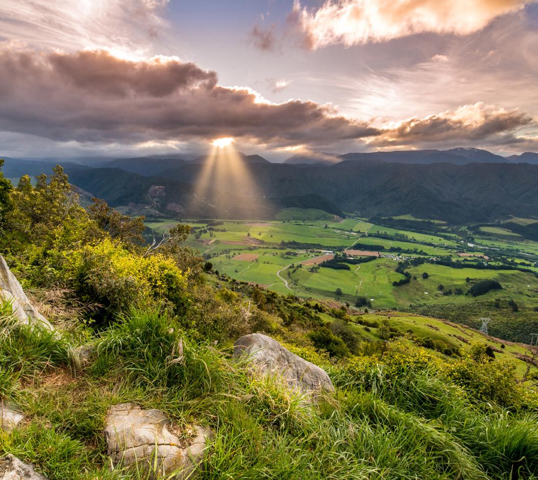

A lovely well-signposted loop walk with majestic views, beech forest and fascinating rock formations.
Where is it?

Start at the Tākaka Hill Summit, 32km from Tākaka Township, 147 Tākaka Hill Highway.
Terrain

Tramping trails, gravel roads, farm and 4WD tracks.
2-3hrs; 5.1km Average fitness required Intermediate tramping track No dogs
TRACK OVERVIEW
A well-marked trail that offers great views and all sorts of botanical and geological curiosities. Sometimes it’s referred to as Marble Mountain because this is limestone country which means you’ll find all sorts of interesting shapes in the rocks. With the highest point 950m above sea level, on a clear day the views are breathtaking; looking east you’ll see out to the Tasman Mountains in Kahurangi National Park as well as across to Tākaka Valley and Golden Bay. Do remember that this track is on private land, so please be respectful.
As one of New Zealand’s most lauded walking areas, Abel Tasman National Park fronts the ocean and days can be spent on both the water and the land.

Refreshing swims in cobalt-coloured bays are readily enjoyed, and long tramps through coastal bush are just as moreish. Half-day and full day treks are popular options, as is joining a catamaran for coastal cruises, or skirting the shoreline by kayak to find Split Apple Rock. It’s not uncommon for nosy seals to pop their head above the water while you paddle.
Listen out for wildlife such as tūī and bellbirds, picnic on deserted golden sand or sit before a stunning sunset and allow the last rays of sunshine warm your face. Create unique memories by paddling a traditional waka along the seashore, or take a small detour to Cleopatra’s Pool where you can glide down nature-made slides into a crystalline lagoon.

There are two ways to get into Abel Tasman National Park; walk in from Mārahau (20 minutes on foot and the main gateway) or, if you’re coming from the north, enter via Tākaka. Mārahau itself offers a lovely beach and plenty of places to stay. You can also book water taxis, hire kayaks and embark on the Abel Tasman Coast Track from here.
One of the country’s most prized gems, the Marlborough Sounds account for a whopping one-fifth of New Zealand’s total coastline. The Sounds are ancient hills draped in lush rainforest that roll down to the Pacific Ocean, lined by a maze of sheltered white-sand bays and inlets. Seals, penguins and rare sea birds live here, and dolphins and orcas regularly pass through.
In your journey over the hill from Nelson, check out Ngārua Caves for a spot of caving and a great view over Tasman Bay. Pull off the road for a 3km stroll to Harwoods Hole – the deepest vertical shaft in New Zealand and the most dramatic and easily visited evidence of the chasms that riddle the core of Tākaka Hill. Note: do not approach the edge of the hole.
WALKING MUST DO’S 57
Tākaka Hill © Adobe Stock
ABEL TASMAN ABEL TASMAN NATIONAL PARK TĀKAKA GOLDEN BAY TĀKAKA & GOLDEN BAY MURCHISON MARLBOROUGH SOUNDS PICTON BLENHEIM HAVELOCK Discover the beautiful Ngarua Caves. A 300m trail through a breathtaking variety of stalactites & stalagmites, also featuring a skeletal display of the extinct moa. Situated on top of Marble Mountain half an hour from Motueka on SH60 to Takaka & Golden Bay. View the caves then take in the stunning Tasman Bay & surrounding Karst landscape while enjoying a coffee & refreshments. A Middle Earth Experience TAKAKA HILL Open daily in summer. Guided tours hourly: 10am-4pm. Ph: +64 3 528 8093 www.ngaruacaves.co.nz
Awaroa beach ramp © Awaroa Lodge
Family overlooking Picton © MarlboroughNZ
It’s not what first springs to mind when envisaging a New Zealand tramp, this luxury-filled four-day walk features hot tubs and warm buttery croissants every morning. Where is it?
The Bay Lodge sits in the small and picturesque settlement of Pōhara in Golden Bay, 104km north-west of Nelson and a 30-minute drive from Abel Tasman National Park.
Good to know
Days two and three both feature hilly areas, including lofty sand dunes, with many short up and downhill ascents and descents.
4 days; Short & Long options
Moderate fitness required Hill climbs No dogs
Definitely not a ‘pack your own trail mix’ kind of adventure, each day begins and ends at the rather swish Bay Lodge in Pōhara, Golden Bay. With a maximum capacity of six walkers/guests, a spa, swimming pool and fully catered menu, you certainly don’t need your own camp stove and beans. For the discerning hiker, day one is for checking in and lounging on the day beds before a short, 45-minute guided walk into neighbouring forest. The bulk of the walking takes place on days two and three, first venturing to Farewell Spit and Wharariki Beach, then deep into the heart of Abel Tasman National Park the following day. Evenings are for sinking into steaming hot tubs and devouring multi-course dinners before a dazzling sunset. As for day four, well that’s for a lie in. Enjoy late check out and a complimentary shuttle to explore Tākaka township.
TRACK OVERVIEW
Leaving the car park, you’ll go down a steep track through forest and bush to the hut which is found at the eastern end of the peaceful two kilometre-long alpine lake. The hut has eight beds which are available on a first come, first served basis. Once at the hut, having claimed your bunk space, the loop around this beautiful body of water makes for a charming walk; it will take about two hours to complete your circumnavigation. There is a fireplace at the hut which is most welcome on cooler nights and if the skies are clear the stargazing is amazing.
Lake Chalice is the only lake in the Mt Richmond Forest Park and this delightful, not too challenging walk is excellent for children and novice hikers.
Where is it?
Staircase Rd, Mt Richmond Forest Park, Marlborough Region.
Terrain
Well-maintained tramping tracks, sometimes steep and rocky.
Take care
Wasps can be a bit of a problem, with the worst time of year between December and April. Sandflies can also be an issue.
Good to know
Forestry operations can close roads – Goulter Rd closed during the weekends.
A classic New Zealand walk, featuring coastal marvels, pristine bush and plenty of birdlife plus top accommodation in lodges.

Where is it?
In Queen Charlotte and Kenepuru sounds. Most people start at Meretoto, Ship Cove and head to Mistletoe Bay in Anakiwa, although you can do it in either direction.
Terrain
Well-formed tracks, steep, rough and muddy in some places. All major stream and river crossings have bridges.
Pedal power
This trail is also one of Ngā Haerenga New Zealand Cycle Trails’ Great Rides. Please note that even though cycling on this track is permitted all year round, the section between Meretoto/ Ship Cove and Kenepuru Saddle is closed to cyclists during the busy summer season from 1 December to the end of February.
Need to know
Due to storm damage, road access to this track may be limited. Check DOC website updates.
1hr to hut; 2.6km 2hr 30min loop from hut; 6.5km
No dogs
TRACK OVERVIEW
Have a boat drop you off at Ship Cove and, once you’ve explored this historic site and enjoyed the interpretation panels, set off through bush and admire the beech forest. After just 50min, you’ll be greeted by a stunning view across Queen Charlotte Sound before starting your descent into Resolution Bay and the DOC’s Schoolhouse Bay campsite. From here it’s another three hours to Endeavour Inlet, partially following the shore, before another four hours brings you to Camp Bay campsite. Pressing on to Torea Saddle, this is the most challenging portion, but the view from the ridge will see all your cares evaporate. Onwards to Mistletoe Bay, about four hours from Torea Saddle, then another four hours sees you pop out in Anakiwa. Here there’s a jetty, so you can arrange water transport to whisk you back to wherever you want to go to next.
58
MARLBOROUGH & NELSON TASMAN 3-5 days one way; 71km Intermediate fitness required Some climbing
TRACK
5 QUEEN CHARLOTTE
6
Ship Cove © Destination Marlborough
Strong fitness required
Sometimes steep and rocky
Access for dogs with DOC permit only
LAKE CHALICE HUT WALK 7
THE BAY WALK 5 TRACK OVERVIEW
HIGHLIGHTS
Nelson Lakes National Park is a wonderfully generous place to spend time in any season. In spring it’s all about hikes, fishing and boating. Come summer, pull on the togs; the lakes can be swum in and jetties and moored rafts make jumping in even more fun. When the weather cools, can anything top a day spent mountain biking in the Teetotal Recreation Area? Winter is snow time; skiing, snow boarding, tobogganing and – this is special – ice-skating on Duck Pond.
Your walk begins at Kerr Bay, where you’ll also find information panels telling you everything you need to know to tackle this walk. Following the markers, head along the eastern side of the lake which is fringed with mountains, notably majestic 1421m Pōrangahau (Mt Robert). Bird fanciers will stop to admire everything from korimako/bellbirds, pīwakawaka/fantails, toutouwai/robins and titipounamu/rifleman. Little spotted kiwi are also resident around here. After about three hours of walking through beautiful bush and beech forest and having crossed a couple of streams, you’ll arrive at Lake Head Jetty. Twenty minutes later you’ll find Lake Head Hut, which isn’t far from a picturesque swing bridge. Follow the markers to Travers River, then join up with Lower Travers Valley Track which will take you to Coldwater Hut. This section is more challenging, with a steady and relatively steep climb heading away from the lake before reaching a gravel road which goes to West Bay. Joining the Peninsula Nature Walk, the trails become easier, until it reaches the western end of Kerr Bay, back where you started.
A spectacular walk that can be done in a day if you employ the services of a water taxi, or stay overnight in one of the huts. Where is it?
Start from Kerr Bay on Lake Rotoiti near St Arnaud.

No dogs
SPEARGRASS TRACK
Serene St Arnaud is a beautiful alpine village on the edge of Lake Rotoiti. It’s an ideal base for those who want to explore the Nelson Lakes National Park and the Travers Sabine Circuit, a challenging but rewarding walk. Activities in the area include mountaineering, snow sports at Rainbow Ski Field, water skiing, kayaking, boating and fishing on lakes Rotoiti and Rotoroa. Head to the DOC Visitor Centre to learn about the honeydew beech forest and to join a guided walk.
Beware of wasps (at their worst December to April) and sandflies, both a nuisance here. Pack repellent and antihistamine if allergic.
A pleasant short walk that is ideal for a day trip or an overnight adventure. Where is it?

Set off from the car park at Mt Robert Rd, a short drive from St Arnaud on SH 63.
Terrain
Well-graded tramping tracks, mostly flat except for a climb at either end
Terrain
Bush tracks, some of them challenging, muddy after rain.
Still waters
Along the way you’ll see a sign for Whiskey Falls, named for an illicit still found there in the 1880s. This requires a short detour but is worth it if time is on your side.
No dogs
TRACK OVERVIEW
Make your way down from the car park, and follow the river for a decent chunk of the walk before beginning your climb to the hut; you’ll know when you’re close to your destination when you cross the sturdy bridge over Te Horowai/Speargrass Creek.
The track is largely flat although do expect a bit of uphill work at either end. When you arrive at Speargrass Hut you’ll find a very cosy double-glazed well-insulated 12-bunk hut. It’s serviced, there are mattresses and a wood burner for heating. Operating on a first-come first-served basis, you can also camp out the front on the pretty grassy clearing if you’d rather. Very peaceful.
WALKING MUST DO’S 59
9 2.5hr each way; 7.4km Intermediate fitness required Easy to intermediate tramping track
Hut, Nelson Lakes
Nelson Tasman Tourism LAKE ROTOITI CIRCUIT 8
Rotoiti, Nelson Lakes © Nelson Tasman Tourism
Bushline
©
Lake
7-10 hr loop track; 23-31km loop track Strong fitness required Advanced tramping track
TRACK OVERVIEW
• In Karamea, you'll find the Oparara Basin and Rainforest

The Old Ghost Road, formerly a gold miners' road between Seddonville and Lyell, has been transformed into a 85km walking and cycling trail.
• Kawatiri Coastal Trail connecting Westport with Charleston
• Tauranga Bay Seal Colony is located at Cape Foulwind. Walk or zipline across the 100m Buller Gorge Swingbridge

• Punakāiki Pancake Rocks in the Paparoa National Park is a definite must see.
• Greymouth is home to Shantytown Heritage Park, an 1860s gold town replicated with over 30 explorable buildings.
• Blackball has a quality museum and a cool historic hotel.
Lake Brunner is great for jet boating, paddling and fishing for the abundant brown trout.
Hokitika makes a great base for both the impossibly blue Hokitika Gorge and the twinkly Glow Worm Dell. While in In Hokitika, climb amidst rainforest giants at the West Coast Treetop Walkway
• Glide along Lake Mapourika in a kayak, with snow-capped mountains and Jurassic forest as your backdrop.
• Explore world-famous Fox and Franz Josef glaciers, as well as Lake Matheson for its perfect reflection of Aoraki Mt Cook
• Ōkārito Lagoon is a beautiful body of water perfect for kayaking.

• In Haast, take a cruise on the Waiatoto River, fish at Jackson Bay and while here, walk the Smoothwater Bay Track
• Arthur's Pass is hugely impressive.
60
WEST COAST Cape Foulwind © Adobe Stock WALKS OPARARA ARCH WALK CHARMING CREEK NORTH WALKWAY CAPE FOULWIND WALKWAY TRUMAN TRACK PAPAROA TRACK POINT ELIZABETH WALKWAY HOKITIKA GORGE WALK FRANZ JOSEF GLACIER WALKWAY LAKE MATHESON WALK KŌKAKO TRACK 1 2 3 4 5 7 8 9 DON'T MISS 1 2 3 4 5 6 7 8 9 6 10 10 , MARLBOROUGH FIORDLAND CENTRAL OTAGO OTAGO NELSON TASMAN WEST COAST CANTERBURY NORTH CANTERBURY MID CANTERBURY SOUTH CANTERBURY BANKS PENINSULA CHRISTCHURCH CHRISTCHURCH & LOWER SOUTH ISLAND SOUTHERN LAKES Walking Must Dos
OPARARA ARCH WALK

TRACK OVERVIEW
A great little walk for people of all ages. Choose the left track just before you reach the Oparara Bridge and the track will take you along the river, through beech and podocarp forest and then dense native bush, eventually arriving at phenomenal limestone outcrops. In a short time you’ll reach the impressive limestone Oparara Arch, thought to be the largest of its kind in Australasia. Featuring exquisite shapes and colours, when the light is right, this place is heaven for painters and photographers.
CHARMING CREEK NORTH WALKWAY
Scenery and history combine as you walk through past milling sites, along an abandoned bush tramway to Mangatini Falls.
Where is it?
From Seddonville, head southeast on Mokihinui Rd. After about 200m turn right onto Broome St and after 350m turn left onto Gladstone Street. Continue straight at the crossroads onto Charming Creek Road. Follow this gravel road for approximately 8.5km to the car park start point.
Need to Know
Use this track in place of the Charming Creek South Walkway, as it is currently closed due to
a large rock slip. Mangatini Falls is therefore currently inaccessible from SH 67 at Ngākawau.
An easy yet breathtaking walk to an impressive limestone arch, one of several short walks in the area.

Where is it?
McCallums Mill Rd, 25km north of Karamea.
Terrain
Well-formed easy tramping track.
Need to know
McCallums Mill Rd is narrow and steep with a gravel surface, so large vehicles and campervans are not permitted. Maximum height restriction of 2.8m. 1080 operation at times, some sections may close. Check alerts.
TRACK OVERVIEW
From the car park, you’ll see
down a moderate gradient hill and
up another
then levels out to a flat section and after 15 minutes you will
Mill historic milling site. Here you will find a sawmill steam engine, trolleys and a steam log hauler nearby. Follow the retired railway tracks through old cutover and farm paddocks to Watson’s Mill, scattered with disused steam boilers and other rusty relics. This section takes 1hr 30min. Look out for the sulphur ‘stink hole’, a remnant from a hole drilled during government coal prospecting operations from 1910 to 1912. It’s about 400m past a small suspension bridge spanning the main creek, on the right-hand side of the walkway as you move south.
The next section of track takes approximately 10 minutes and offers spectacular views of the river and the Upper Ngākawau Gorge. Follow on to the Mangatini Tunnel that delivers you to your first look at the impressive Mangatini Falls. There’s a risk of rockfall through the section so avoid the area in heavy rain or wind.
This area has one of the only remaining wooden tramline middle breaks in New Zealand; these were used to slow wagons down during the height of the mining and milling operations. Return via the same track.
Don't leave without... ,
•
•
• Visiting charming seaside villages such as Ngākawau and Hector. Check out the museums, artist studios and early mining cottages
• Exploring Little Wanganui. Popular during the whitebait season, expert surfers also head here for the beach break.
WALKING MUST DO'S 61
1
Under an hour; 2km return Basic fitness required Easy tramping track
the historic Charming Creek mine site. Walk
then
using steps. The track
reach Mumm’s
Oparara Arch © Adobe Stock
2 5.5km
one way; 9km one way
Low-moderate
fitness required
Undulating
trail with steps Access for dogs on lead only
ABOVE: Charming Creek © Miles Holden
Tasting genuine New Zealand wilderness in Karamea. This peaceful paradise of beach and bush sits at the end of a no-exit highway.
Discovering Moria Gate Arches and the Honeycomb Hill Caves, which contain moa bones, at Oparara Basin.
This spectacular coastal walkway features a seal colony, a lighthouse and panoramic views of mountains and coastline.
Panels along the track tell stories of Māori history, sea voyages and early explorers. From the seal colony, a longer walking track leads to Cape Foulwind lighthouse. Return the same way or arrange transport from Cape Foulwind car park.

Where is it?


The track is about 16km southwest of Westport. Follow Cape Foulwind Rd (SH 67A) for 11km to the former Holcim cement works. Turn left into Tauranga Bay Rd to access the Tauranga Bay car park (southern end). For visitors doing the longer walk, which includes the seal colony and the lighthouse, there is access from Cape Foulwind lighthouse car park (northern end).


Need to know

The walk is one-way and you'll need to arrange transport from Cape Foulwind car park or return along the same walkway. Be prepared for rapidly changing weather on this coastal walk; carry a weatherproof or windproof jacket, hat and gloves.
1hr 15min; 3.4km one way (car park to seal colony 30min, 1km return)
Low-moderate fitness required
Flat/undulating track
Access for dogs on a lead only
62 CAPE FOULWIND WALKWAY 3
WEST COAST Cape Foulwind © Adobe Stock If travelling for business or pleasure, make Westport Spa Motel your place to unwind, rejuvenate & enjoy. • 8 x spacious studios, 2 x 1-bedroom apartments, and a 3-bedroom villa • Double spa baths in the Superior Rooms • FREE UNLIMITED WiFi RES: 0800 375273 • P: +64 3 789 5273 E: stay@westportspamotel.co.nz • www.westportspamotel.co.nz • 50+ Guest Select SKY TV • Complimentary EV charging points • PET-FRIENDLY by prior arrangement (subject to availability) • Secure undercover BIKE STORAGE WESTPORT SPA MOTEL, 239 Palmerston Street, Westport Beautifully renovated and refurbished. BULLER COURT on Palmerston Street is comfortable and stylish but still with all those little extras that our guests love! 235 Palmerston Street, Westport P: +64 3 789 7979 • E: stay@bullercourtmotel.co.nz • FREE UNLIMITED WiFi • 50+ Guest Select Sky channels • Breakfast service • Complimentary EV charging points DIRECT BOOKING DISCOUNTS P: +64 3 789 7979 www.bullercourtmotel.co.nz • Undercover car parking • BBQ & outdoor dining facilities • DIRECT booking discounts • PET-FRIENDLY by arrangement (if available)
Starting at the southern end of the walkway, a short walk from the Tauranga Bay car park takes you to the viewpoint overlooking the Tauranga Bay seal colony. You can then return to the car park or continue the walking track over undulating farmland to the Cape Foulwind lighthouse and car park. From the viewing platform near the lighthouse, enjoy views of the Paparoa Range and Southern Alps.


TRACK OVERVIEW
The short but delightful Truman Track takes walkers through pristine subtropical forest where flourishing stands of rātā loom above the path and nīkau palms are found. If the forest alone wasn’t pretty enough, eventually you will pop out on to the fabulous cliff-lined coast with caves, a blowhole and a waterfall that thunders onto a rocky beach. Go down the stairway to gain access to the beach, but know this is a very boisterous coastline so keep your wits about you as you explore. And be respectful of the wildlife; you’ll see all sorts down here from petrels to fur seals, weka to Hector's dolphins and, when the kōwhai are in flower, the birds flock to this neck of the woods. If it’s low tide and you’ve time to explore the rock pools, look out for the magnificent starfish who also live here.

WALKING MUST DO'S 63
TRACK OVERVIEW
TRACK 4
Where is it? From SH 6, the track starts 3km north of the Paparoa National Park Visitor Centre in Punakāiki. Terrain Well-formed and maintained paths. 30min; 1.4km return Basic fitness required Easy walking track No dogs Truman Track © Adobe Stock Luxuriant coastal forest, limestone cliffs and canyons, caves and underground streams, and an absolutely spectacular coastline are all packed into the Paparoa National Park, accessible via a number of walks ranging in length. BULLER DISTRICT WESTPORT REEFTON CHARLESTON GREYMOUTH PUNAKĀIKI HOKITIKA GLACIER COUNTRY FRANZ JOSEF GLACIER AORAKI MT COOK The largest town in this region is steeped in the mining industry. Coaltown Museum details the best of it with mine exhibits, videos and hands-on displays. Carters Beach is just five minutes from town and ideal for walking, bike riding and swimming. Every Labour Weekend, the Whitebait Festival brings a host of events to Westport. • Sunny location • Walk to shops • Motorcycle & cycle friendly • Free WiFi • Tariff: from $130.00 (2 persons), extra $15 Well-travelled tourists say “the best motel we’ve stayed at” www.palmcourtwestport.co.nz www.palmcourtwestport.co.nz Reservations: 0800 472 567 306 Palmerston St, Westport For reservations: +64 3 789 7043 www.westportholidaypark.co.nz • Motels • Self-contained units • Ensuite chalets & standard chalets • Tent & powered sites • TV lounge & Kitchen/dining area • Playground • 18 hole mini-golf course on site • Covered BBQ • Dump station 10-15min walk to town centre A tranquil haven set in West Coast native bush Westport Kiwi Holiday Park WESTPORT WESTPORT KIWI HOLIDAY PARK & MOTELS 31-37 Domett Street (PO Box 294), Westport E westportholidaypark@xtra.co.nz
TRUMAN
With forest trails and coastal views, this is an easy West Coast walk with excellent information panels.
There will soon be the option to walk the Pike29 Memorial Track on day two. Here, a memorial will tell the story of the 29 men that died in the Pike River Mine disaster.

This is the newest Great Walk. It crosses the Paparoa Range and takes you through alpine tops, limestone karst landscapes and thriving rainforest.


Where is it?
The track runs from Blackball on the eastern side of the Paparoa Range to Punakāiki on the western side.
2-3 days one way; 55km one way Moderate fitness required Some steep sections
Day 1: Beginning near Blackball on the existing Croesus Track, with remnants of the area’s gold-mining history, the track ascends through beech and podocarp forest before crossing alpine scrub and tussock. You’ll be rewarded with expansive views of the Grey River to the east and the Tasman Sea to the west.
Day 2: Open tops give way to alpine forest stunted by the harsh environment. Continue along the escarpment with sheer drops and stunning views down the Pike Stream in the east, west to Punakāiki and northwest to Westport. After descending, walk through ancient podocarp forest under towering cliffs.
Day 3: Hike down into the upper Pororari River valley. The track sidles a spectacular gorge and descend towards the coast through beech forest interspersed with northern rātā. Experience the lower gorge with its limestone cliffs; and pass through lush rainforest with glades of nīkau palms. The track ends near Punakāiki.
64 WEST COAST PAPAROA TRACK 5
Paparoa Track © Adobe Stock
No dogs
TRACK OVERVIEW
Rutherglen Road, Paroa (10km south of Greymouth) Open 7 days 10:00am - 3:00pm Freephone 0800 742 689 Visit shantytown.co.nz and pre-book your place in history
PUNAKĀIKI

PUNAKĀIKI CAVERN A short walk from Punakāiki village (and a five-minute walk from Pancake Rocks), an unassuming wooden stairway descends into a cavern with over 130m of safe, explorable passages.
PETREL COLONY TOURS Between Punakāiki and Barrytown, this private wildlife sanctuary is just a seven-minute drive from either town. Join a sunrise or sunset tour of the world’s only breeding grounds of the Westland petrel. Open April to mid-December.
BLACKBALL This surprising little town is a bit of an over-achiever. It has an extra interesting history (revealed in the quality museum), a cool historic hotel and deliciously its very own famous Blackball Salami Company with meat treats.
6
POINT ELIZABETH WALKWAY
For all those who like the idea of disappearing deep into Aotearoa wilderness, but don’t have the means, time or enough instant noodles to do it for days.

Where is it?
Point Elizabeth Walkway is a 15-minute/12.5km drive north of Greymouth.
Terrain
This is a level and well-maintained track suitable for adults as well as little ones with energy to burn.
TRACK OVERVIEW

1hr 45min; 5.5km one way Basic fitness required Easy walking track
At just over 5.5km and taking roughly 1 hour 45 minutes one way, you’re not in the wilderness for long but while you're walking, it feels remote and intrepid with few others on the track. Following an old water race built by 19th century gold miners and weaving in and out of subtropical rainforest, there is a thick forest canopy overhead and, due to its proximity to the coast, a roar of pounding surf as the soundtrack. While it is graded as easy (it’s relatively flat and suitable for families with children) you’re vulnerable to nature’s wild elements, so be prepared. Rugged coastline and the decidedly rocky Point Elizabeth lookout add to the excitement, affording glorious views of the West Coast, while the birdlife, extensive in number, put on quite a show.

Top
Shantytown is a faithful replica of an 1860s gold-mining town where you can explore historical buildings, pan for gold, dress in period costumes and ride the enchanting steam train. Brunner Mine is one of
Greymouth’s most historically significant sites. Located just outside of town, a 2km walk weaves its way around a brick factory, coke ovens and longforgotten tunnel entrances.
Go for a drive: the stretch of highway between Greymouth and Westport, known as The Great Coast Road, is rated one of the top 10 scenic drives in the world and will mesmerise you at every turn. Monteith’s Brewery is a Greymouth icon. Head here to enjoy a refreshing locally brewed beer and take the excellent guided tour.

WALKING MUST DO'S 65
Punakāiki Pancake Rocks
© West Coast Tourism
BELOW: Gold mining in Shantytown, Greymouth © West Coast Tourism
PANCAKE ROCKS A series of rocks that resemble stacked pancakes, albeit ‘made’ 30 million years ago. Joined by erupting blowholes and a ferocious surge pool called the Devil's Cauldron.
While you're here , KARAMEA SEDDONVILLE BULLER DISTRICT WESTPORT REEFTON CHARLESTON GREYMOUTH PUNAKĀIKI HOKITIKA GLACIER COUNTRY FOX GLACIER FRANZ JOSEF GLACIER AORAKI MT COOK AORAKI HAAST
picks
in
Blackball – Gateway to the Paparoa Great Walk • Cosy accommodation situated minutes from the entrance to the Great Walk • Welcoming West Coast hospitality • Open 7 days for breakfast, lunch and dinner – 10am til late • Fully licensed • Immersed in Blackball’s rich history • Motorhome parking and powered sites available • Free WiFi 8 Hilton Street, Blackball P: +64 3 7324 888 • E: blackballinn@gmail.com www.blackballinn.co.nz
TRACK OVERVIEW

The walking track starts at the car park and, after the first few steps, you’ll find yourself in a cool and impressive podocarp forest .Very soon, you’ll pop out onto the viewing platform. When you look down the magnificent Hokitika Gorge, you’ll see how powerfully water carves its way through the land, capable of creating impressive gorges like this one. Up to this point, the track is accessible for strollers and wheelchairs. From here, go another short distance along elegantly constructed board walks until you reach a swing bridge for a glimpse of the turquoise waters of the Hokitika River flowing through the gorge. For more views, cross the swing bridge to another platform providing more stunning vistas. A great


Hokitika Gorge Scenic Reserve, Whitcombe Valley Rd, 33km east of Hokitika.


Hokitika is famed for the huge driftwood deposits resting on ruggedly beautiful shores, and also for the annual Hokitika Wild Foods Festival. The Ross to Rainforest Ramble is a one-day bike ride over bridges and lagoons calling in at the treetop walks and up to the 40m-high Hokitika Tower lookout. Water lovers will relish time at both Lake Kaniere and Lake Mahināpua; the three-tiered Dorothy Falls and swimming hole are also not to be missed.

66
7
HOKITIKA GORGE WALK
Where is it?
little leg stretcher for those driving around the South Island’s dramatic West Coast.
Terrain
Be prepared
30min return; 650m each way Basic fitness required Easy tramping track No dogs WEST COAST
Boardwalks, bush tracks, well maintained.
Pack insect repellent for sandflies.
Hokitika Gorge © Adobe Stock MORE HIGHLIGHTS > Glow Worm Dell > Glass Studio > Heritage Trail Walkway > Bonz 'n' Stonz Carving Studio > Mahināpua Scenic Reserve > National Kiwi Centre > Greenstone Carving > Goldsborough Camp > Sunset Pt > Rimu Lookout BULLER DISTRICT WESTPORT REEFTON CHARLESTON GREYMOUTH PUNAKĀIKI HOKITIKA GLACIER COUNTRY FOX GLACIER FRANZ JOSEF GLACIER AORAKI MT COOK AORAKI HAAST Conditions: This voucher entitles the bearer to $5 off the entry and all-day passes. Not valid with any other discount deals or special offers. (AA) $5 OFF Expires: Sep 2023 West Coast Treetop’s dual zipline starting from the existing tower 47 metres high, travelling through the giant rimu trees. Our 500 metre dual ziplines will allow you to race your partner, friend or family. A whole new way to experience the West Coast Tree Top Walk & Café, soaring metres from the treetops. Opening Summer 2022 THE WEST COAST’S Exciting NEW Attraction 1128 Woodstock-Rimu Rd, Hokitika RD 3 15 minutes south of Hokitika Freephone: 0508 TREETOPS www.treetopsnz.com Email: bookings@treetopsnz.com An exhilarating treetop adventure among temperate rainforest giants. Experience life with birds high in the ancient rimu and kamahi tree canopy. Easy access for all to enjoy along a steel platform 20 metres high and over 450 metres long. Come and enjoy a leisurely 45-minute to one-hour stroll. Freephone: 0508 TREETOPS www.treetopsnz.com 1128 Woodstock-Rimu Rd, Hokitika RD 3 • 15 minutes south of Hokitika Email: bookings@treetopsnz.com
FRANZ JOSEF GLACIER WALKWAY
The Franz Josef Glacier is a unique and awe-inspiring sight, and it’s easily accessible via this rocky riverbed path to a viewing area.
Where is it?
Head south from the Franz Josef township then turn left onto Glacier Access Rd. Starts from the car park at the end of the road.
The first 15 minutes is an easy (fully accessible) forest walk from the car park to a river bank view of the glacier. It then follows markers in the riverbed past Trident Falls to a point close to the terminal face of the glacier. This is not a track but a route over the shingle and rock of the riverbed and it can be quite rough underfoot – make sure you have suitable footwear. The final section of track to the safety barriers includes a short climb to the viewing area. Do not go past the barriers and pay attention to all signage as areas of the valley are hazardous and are not safe for visitors. The glacier is constantly moving. Ice and rock fall from the terminal face without warning. Creeks may rise up to a metre in even moderate rain. Water levels rise in as little as 15 minutes. Please note: this is a beautiful yet dangerous place that is sometimes closed due to hazardous conditions, so please check doc.govt.nz before you start to check if it's open.
1. FRANZ JOSEF is one of the most accessible glaciers in the world. A one-and-a-half-hour walk from the car park will get you to within 75m of its grand glacial face.

2. FOX GLACIER For the best views, follow the two-hour Fox Glacier South Side Walk tracing the south bank of Fox River through ancient rainforest.

3. WILDLIFE Head to the West Coast Wildlife Centre to see tuatara and kiwi. In the wild, visit glowworm dells or paddle alongside birdlife on local lakes.


4. LAKE MAPOURIKA is also a top choice for an unhurried glide along in a kayak, with snow-capped mountains and Jurassic forest as your backdrop.
5. ACTION AND ADVENTURE Skydive over Fox Glacier for the ultimate viewpoint. From gentle Grade 2 to the more thrilling
Grade 5 rapids, white-water rafting is sure to take your breath away. E-bikes can get you around with ease and speed, or for avid adventurers, quad biking through rainforest and riverbanks is the way to go.
6. GILLESPIES BEACH For views of the Southern Alps, gold-mining remnants and invigorating coastal walks, visit this beach just out of Fox Glacier.
7. SCENIC FLIGHTS Soar over ice masses by helicopter or plane. Helicopters are favoured for their snow landings, whereas flights cover a whopping 200km of alpine scenery.
8. HELI-HIKING Be dropped at the top by chopper, then forge a route through, up and over the ice. Crawl through ice caves and arches, striding over untouched snow on a guided tour.
WALKING MUST DO'S 67
Guide, Franz Josef Glacier © Adobe Stock
8 REASONS KARAMEA SEDDONVILLE BULLER DISTRICT WESTPORT REEFTON CHARLESTON GREYMOUTH PUNAKĀIKI HOKITIKA GLACIER COUNTRY FOX GLACIER FRANZ
AORAKI
to fall for
JOSEF GLACIER
MT COOK AORAKI HAAST
TRACK
1hr 30min return; 5.4km Low fitness required Easy tramping track No dogs 8 For further details visit Ph +64 3 752 0210 • 0800 752 222 E: franzjosef@aspencourt.co.nz Facilities include: • King-size beds • Kitchens • Free WiFi • Spa bath units • Radiator and underfloor heating • Guest laundry
motel complex within
luxury units.
surrounded by
and
bars, cafés etc.
www.aspencourtfranzjosef.co.nz
OVERVIEW
New
Franz Josef Village. Opened January 2014. Comprises executive studio, one and two-bedroom
Complex
native bush
only a 2-minute walk to
Tariff: from $175 (2 persons).
On tour in
HOKITIKA
GLACIER COUNTRY
FOX GLACIER

FRANZ JOSEF GLACIER AORAKI MT COOK
AORAKI HAAST
FRANZ JOSEF WILDERNESS
TOURS Will take you cruising, fishing or kayaking on Lake Mapourika.
GLACIER VALLEY ECO TOURS
Provided with big raincoats, umbrellas, hot drinks and snacks, take a guided walking tour in Glacier Country. Get ready for gigantic waterfalls, icy discoveries and an enrapturing array of flora and fauna.
SOUTH WESTLAND SALMON
FARM A beautiful pit stop along SH 6 in Paringa, call in for salmon feeding, a cosy café with wood burner, an elevated deck with views of the salmon farm.
WHITE HERON SANCTUARY
TOURS A fun tour through native forest to see the only kōtuku/white heron nesting and breeding site in New Zealand. Located near Whataroa.
LAKE MATHESON WALK
A gentle walk through native forest leads to the picturesque shores of Lake Matheson, with Aoraki Mt Cook brilliantly reflected in its waters. The lake was formed when Fox Glacier retreated from its last significant advance about 14,000 years ago. During the last major ice age, the glacier spread across the coastal plains towards the sea, dumping huge piles of rock. It ground a depression which later filled with water, forming the lake.
Where is it?
From Fox Glacier township, turn onto Cook Flat Rd. Travel 5km then turn right on to the sideroad to Lake Matheson.
TRACK OVERVIEW
The first section to Jetty Viewpoint is suitable for assisted wheelchairs. After crossing the Clearwater suspension bridge, the walk leads past tall kahikatea and rimu as well as a rich profusion of smaller plants. The jetty provides a magnificent mountain view reflected in the dark waters. From Jetty Viewpoint, continue further around the lake and you'll find a similarly magnificent mountain reflection shrouded in native foliage at the ‘View of Views’ at the top end of the lake, and again at Reflection Island. Always take warm and waterproof clothing as the weather can change rapidly. Overnight camping is not permitted in or near the car park. Drones are not permitted.
LAKE MATHESON
Easily Aotearoa's best 'mirror lake', Lake Matheson can be found just 5km from Fox Glacier township. Paddle through the gentle glass-like waters while taking in Aoraki Mt Cook’s picture-perfect reflection. The track to the jetty viewpoint is a wheelchair access track and takes 40 minutes return.

68 WEST COAST
Car park to jetty 40min; 1km return Lake Circuit 1.5hr; 2.6km return
Low fitness required Easy walking with some undulations
9
Fox Glacier © Adobe Stock
GREYMOUTH PUNAKĀIKI
No dogs
Lake Matheson © Adobe Stock
5.5km out-and-back
TRACK OVERVIEW


Easy walking
This track threads from town through native bush, and out on to the stunning Haast Beach. Shared by walkers, cyclists, runners and families.

Where is it?
Located at the end of Tahutahi Rd in Haast Township.


Terrain
Wide and flat packed gravel trail. Wheelchair accessible.
Good to know
You may come across penguins and seals; give them their space and keep dogs on a short leash while passing.
Begin in Haast Village, where there are toilets, a café, motels and a pub. Follow the signs just past the merino wool shop, near the police station and head through the native bush, along the gravel trail. There is a track accessible to walkers, which climbs to the top of a small, forested hill. From here there are two viewpoints separated by about 200m, one looking up the Haast Valley, and one over the township and out to sea. Enjoy the shade from the vast native trees towering over the trail, home to a herald of birdsong. Native species include fantails, tūī, kākā, kea, grey warblers and kārearea/falcons to name a few. At the end of the main bush track, cross the road on to a short trail to the beach. Return via the same route.
1. WAIATOTO RIVER CRUISE
You might expect a jet-boat tour on the Waiatoto River to be at hair-raising high speeds. This adventure errs on the side of slow and sedate. Passengers cruise up the river with on-board commentary and a chance to step out and absorb the scenery.
2. WHITEBAIT Haast is West Coast whitebait country so you’re never too far from a fritter or two. The Whitebait Festival is the best way to enjoy them on mass and in new ways.

3. WEST COAST SUNSETS The route from Haast to Jackson Bay is littered with irresistible beaches, as well as dunes, lakes and wetlands. As night falls, the most spellbinding sunsets are often
admired from Haast Beach, which you'll probably have all to yourself.
4. FISHING IN JACKSONS BAY

Often rated as one of the West Coast’s ‘best kept secrets’, it’s a pure visual splendour. Fish from Jacksons Bay’s natural deep-water wharf for cod and terakihi.
5. DINE AT THE CRAYPOT


Something of a local landmark and perched by the sea in a quirky converted railway carriage, guests feast on both the views and the region’s plumpest crayfish.
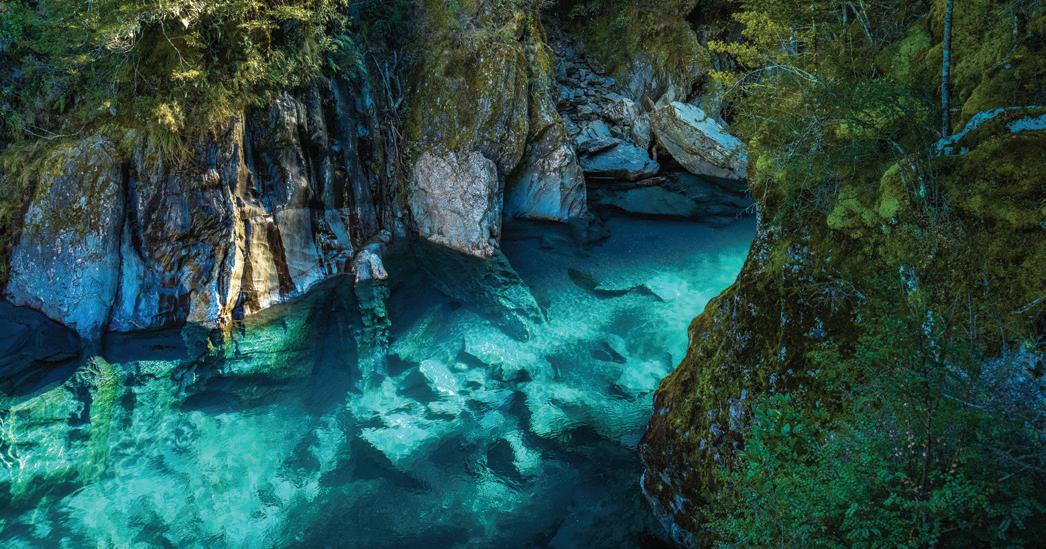
6. EASY ON THE EYE FLIGHTS
Discover pristine lakes and native rainforest by soaring over the West Coast’s dramatic landscape of hidden rivers, glaciers and cascading cliffs by plane or helicopter.
WALKING MUST DO'S 69 KŌKAKO TRACK 10
Low level of fitness required
AORAKI MT COOK AORAKI HAAST
Experiences
• Located Haast Township (just off SH 6) • Come & enjoy our iconic West Coast bar & restaurant • Excellent lunch and dinner menus • World-famous venison burger and fish & chips Open 7 days 11am to late • Buses welcome • Courtesy coach always available • Opportunities await, come live and work in paradise • Check out Spiker Café for breakfast South Westland, Haast • P: +64 3 750 0034 • E: hardantlerbar@gmail.com www.haastrivermotels.co.nz Self Contained Motels Studio Motels Bunk Room for Large Groups Powered Caravan & RV Sites Unpowered Camp Sites info@haastrivermotels.co.nz +64 3 750 0020 | 0800 624 847 • • • • • Unforgettable West Coast Ground-floor motel units in quiet native bush setting with all day sun. Studio, 1 & 2-brm family units. • Centrally located – 100m walk to shop, café, bar & restaurant. 5min drive to beach. • Free WiFi. Freeview. • Tariff: $115-$185 (2 persons). Seasonal rates. 10 Marks Rd , Haast • P: +64 3 750 0868 • Res: 0800 52 62 52 www.heritageparklodge.co.nz • E: info@heritageparklodge.co.nz Check our rates: call or book direct & SAVE Blue Pools, Haast © Adobe Stock Dogs on a lead are welcome
6
in
Walking Must Dos
DON’T MISS
• Kaikōura is the place to feast on justcaught seafood, notably crayfish.


• Hanmer Springs hot pools are a must do for a day well spent.
Unique walks can be found at Kura Tāwhiti Access Track, the Rākaia Gorge Walkway and Cave Stream Scenic Reserve while crossing Arthur’s Pass
WALKS
NELSON TASMAN WEST COAST CANTERBURY NORTH CANTERBURY MID CANTERBURY SOUTH CANTERBURY
BANKS PENINSULA
• Taste top wine in the Waipara Valley Christchurch is one of New Zealand’s most charming cities with the dreamy Avon River running through it.
• On Banks Peninsula, walk or cycle the pretty 46km Little River Trail. Hike to Port Hills’ highest point, Coopers Knob, with incredible panoramic views overlooking Lyttelton Harbour
• Admire dinky Hector’s dolphins in the waters around Akaroa
• Visit Ashburton Aviation Museum
• Foodies will love Geraldine and shouldn’t miss the Farmers’ Market held each Saturday in summer.
• Visit the Te Ana Māori Rock Art Museum in Timaru
CHRISTCHURCH CHRISTCHURCH & LOWER SOUTH ISLAND SOUTHERN LAKES
Caroline Bay’s beach offers a great swimming bay; it is also home to a rookery of little blue penguins Picture-perfect Lake Tekapō is extremely photogenic. Indulge in Tekapō Springs’ hot pools MacKenzie Country is an International Dark Sky Reserve and in winter you might even catch the Aurora Australis.
• Aoraki Mt Cook is 3724m-high and New Zealand’s highest peak.
• In Twizel see how salmon is farmed at the High Country Salmon Farm
• The two-hour return White Horse Walkway in Waimate is spectacular. In summer, take a cooling dip at Pines, Waikuku and Woodend beaches.
OTAGO
70 CANTERBURY
Akaroa
© Adobe Stock
KAIKŌURA PENINSULA WALKWAY MT ISOBEL TRACK DEVILS PUNCHBOWL WALKING TRACK AWAROA/GODLEY HEAD LOOP TRACK ROUND THE MOUNTAIN VIA CURRY TRACK PEEL FOREST PARK SCENIC RESERVE WALKS CAROLINE BAY, TIMARU BOTANIC GARDENS & CENTENNIAL PARK WALKS 1 2 3 4 5 6 7 1 2 5 3 6 7 4
,
FIORDLAND CENTRAL
SOUTHLAND OTAGO
KAIKŌURA PENINSULA WALKWAY
Start in the centre of town and head towards The Esplanade and Point Kean car park. Along the way make time to stop and read the interpretation panels which tell the stories of the area’s vibrant history. Travel across the peninsula’s cliff tops, where the views over to the Kaikōura Ranges and along the coast to South Bay are spectacular. Near historic Fyffe House learn about the significance of this area for both Māori and colonial settlers. The viewpoint at Point Kean is designed to represent a waka and the views there are excellent, also. This is a good place to see birdlife, from oyster catchers to reef herons and possibly even little blue penguins. Continue on to Whalers Bay viewpoint and learn how the forest would have looked thousands of years ago. From Whalers Bay proceed to South Bay viewpoint and the burgeoning colony of Hutton’s shearwaters, then continue towards the town centre via Scarborough St, and follow Tom’s Track back to The Esplanade. A delightful and educational walk for all ages.
Seals and seabirds, pā sites and mountain views, dramatic scenery from one end to the other.
Where is it?
In Kaikōura, on the northeast of the South Island.
Terrain
Easy walking tracks.
Need to know
Be wary of the seals in the Kean Point car park as males can be territorial.
What a legend
It’s said that when Maui fished the North Island out of the ocean, he used the Kaikōura Peninsula to brace himself.

No dogs
5min-3hr; 200m-11.7km Basic fitness required
Easy walking
Swim with dusky dolphins
Frolicking in Kaikōura waters in pods of up to several hundred, it’s not hard to get acquainted with dolphins in these parts. Join a tour to observe them from the boat, or jump in and snorkel side-by-side.
• Visit Fyffe House An easy 45-minute walk from the centre, this is the town’s oldest surviving building, creaking with tales from the 1800s.
• Find enormous whales Giant sperm whales are a captivating sight whether you spy them from a boat, helicopter or plane. Sperm whales make year-round appearances, while orca, humpback and
blue whales are seasonal.
• Climb Mt Fyffe An eight-hour return trek up this relatively unknown mountain trail presents unparalleled views across the Kaikōura Ranges.
• Photograph an albatross Kaikōura is one of the best places on Earth to see multiple species of giant albatross. Join a tour to get your head around their colossal threemetre wingspan.
• Meet fur seals Snorkel beside them in the shallow waters of Kaikōura Peninsula and walk to Point Kean Seal Colony to observe them napping on the rocks.
In Canterbury, rural meets high country meets big mountains meets even bigger skies. Bright-blue braided rivers cross the land, picturesque bays and villages line the coast, wildlife flourishes, world-class wine is produced and magical lakes abound. What better place to lace up your walking shoes?

WALKING MUST DO’S 71
1
LEFT: Kaikōura Coast © Adobe Stock TRACK OVERVIEW
PEGASUS & WOODEND PEGASUS WOODEND KAIKŌURA KĒKERENGŪ CHEVIOT HURUNUI DISTRICT WAIPARA AMBERLEY HANMER SPRINGS RANGIORA Must Dos
White Horse, Waimate © Craig Robertson – Sideline Photography


72 CANTERBURY Lewis Pass Leithfield Leithfield Beach WAIPARA CHRISTCHURCH Motunau Beach Amberley Beach Gore Bay Culverden Rotherham Waiau Hurunui Waikari Amberley HANMER SPRINGS KAIK Ō URA Conway Flat Mt Lyford Hawarden Cheviot Greta Valley Domett 70 1 1 1 72 7 7 7 1 5 6 7 8 9 10 11 2 3 4 New Zealanders have long had a love affair with walking. Hanmer Springs and the Hurunui region offers plenty of spectacular places to stretch your legs.
Springs & Hurunui KEY Alpine Pacific Touring Route Coastal Pacific Railway Gore Bay Tourist Drive Walking Track Time Difficulty
Hanmer
With magnificent mountains, rugged coastlines and beaches, lush green forests and rolling hills, the immense variety makes it easy to explore this sensational part of New Zealand.


Art in the Forest (Hanmer Springs)
Come and meet the dog at the entrance to the Hanmer Heritage Forest, and continue along the Forest Amble to find his friends and some special creatures.

Moderate

Mt Isobel (Hanmer Springs)
Mt Isobel (1319 m) forms the backdrop of Hanmer Springs. A return trip to the summit is a half-day walk and provides panoramic views of Hanmer Basin, Hanmer Range and beyond.
4 - 5 hours return
Easy
30 minutes
Hanmer Springs Forest (Hanmer Springs)
Wind your way through stands of tall trees in one of New Zealand’s oldest exotic forests. Variety of directions.
Easy

Easy


0.5 - 1 hour return
Balmoral Fire Lookout (Culverden)

A gentle climb to the top, taking approximately 30 minutes. Enjoy panoramic views over a wide area of the surrounding hills and the braided Hurunui River.
Moderate
Easy
Moderate
30 minutes
Mt Cass Walkway (Waipara)
Most of the walkway is on a formed tracked. Reasonable fitness levels are required and sturdy footwear is required.
Moderate
2 hours return
Mt Grey Track (Amberley)
Track climbs steadily through native bush and areas of pine, opening to tussock and the summit of Mt Grey (934m).
Moderate
2 - 3 hours return
Easy
Hanmer Springs’ most popular walk, 550m to reach the summit taking a zig zag trail. Views across the Hanmer Basin. Spectacular either early morning or late afternoon.
Conical Hill (Hanmer Springs) 45 minutes
St James Walkway (Lewis Pass)

66km. It starts and finishes at Lewis Pass and Boyle Village on SH7 (30km apart). An easy walk but the climate can be extreme and shouldn’t be attempted during winter months unless experienced.

4 - 5 days

Manuka Bay Track (Port Robinson Walkway)
This track hugs the coastline and provides sea views, lush forest and a number of landscape features. 3km one way.
1.75 hour return
Tiromoana Walkway (Waipara)
Approx 4km to the coast with a height difference of 280m.
A carpark is located adjacent to the Mt Cass Road, with three lookouts along the route providing spectacular views.
3 hours return Hard
Kowai Walking Track (Leithfield)
Attractive walk from Leithfield alongside the Kowai River to the coastal lagoon and beach spit. Plenty of bird life.
1.5 - 2 hours return
WALKING MUST DO’S 73
HC HST2533
MT ISOBEL TRACK 2

Described as the most climbed mountain in Canterbury. If you’re in the region, you can hike it and find out why.


Where is it?
Towering above Hanmer Springs Village, in the Canterbury region, 133km from Christchurch.

Terrain
Bush path, alpine trails some scree.


Good to know
In the winter it can snow up here and the exposed areas can be very windy, so exercise common sense and be mountain smart, dress warmly and prepare for all weather conditions.
TRACK OVERVIEW
With several short walks in Hanmer Springs, possibly the finest is the full day walk up Mt Isobel (1342m). Start at the Clarence Valley Rd car park and wander through woodland before you enter subalpine scrub and open grassland. For the botanically minded, the hebe will be of interest. As you walk above the Dog Stream catchment, you’ll link with the upper reaches of the Waterfall Track before starting your climb. Although a bit of effort is required to reach the top, the panoramic views of the Hanmer Basin, Waiau Plain and surrounding mountains, notably Organ and Hanmer, make it all worthwhile.


While in the Waimakariri region, take advantage of the many and varied walking tracks there. There is a network of family-friendly trails that connect contemporary towns with pretty braided rivers, wide-open sandy beaches and rural landscapes.


Oxford Forest Conservation Area: Trails range from a few hours to overnight through mature forest. Treat yourself with a dip in the Ryde Falls.
Mt Thomas Tracks: Forty minutes from Glentui, there are various tracks with far-reaching views of the Canterbury Plains and Banks Peninsula.
Kaiapoi Island: Part of the Waimakariri River Regional Park, find several walking tracks here, as well as fishing and swimming spots.

Matawai Park: This Rangiora park is perfect for a walk with a picnic.

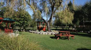
Glentui Loop Track: Crosses Glentui River and takes about one hour.
Ashley Rakahuri Regional Park: Skimming the river’s edge and weaving through forests, trails can get you from Rangiora to Waikuku.
Lake Pegasus and Te Kōhanga Wetlands: A pretty area with namesake lake and expansive wetland, with plenty of birdlife and native flora. Give your feet a rest with a horseback ride, canyoning in Glentui or a cruise up the Kaiapoi River.
74 CANTERBURY
6hr return; 7km
Good fitness required Steep climb; hard tramping track Access for dogs on lead only
© Getty Images
Mt Isobel
Conservation Park, Oxford • BELOW: Jetboating BOTH: © Visit Waimakariri This picturesque alpine village is a haven for recreation and paradise for walkers. The town’s surrounding mountains provide idyllic walking trails in summer, and powder-rich ski slopes during winter. Take 45 minutes out of your day to charge up Conical Hill – the views are postcard perfect – and discover the delightful sculptures in Hanmer Heritage
Unwind
the mineral-rich hot pools at Hanmer Springs Thermal Pools and Spa. PEGASUS & WOODEND PEGASUS WOODEND WAIMAKARIRI KAIKŌURA KĒKERENGŪ CHEVIOT HURUNUI DISTRICT WAIPARA AMBERLEY HANMER SPRINGS RANGIORA WAIMAKARIRI DISTRICT WAIKUKU GLENTUI KAIAPOI OXFORD PEGASUS & WOODEND PEGASUS WOODEND WAIMAKARIRI HANMER SPRINGS RANGIORA WAIMAKARIRI DISTRICT WAIKUKU GLENTUI KAIAPOI OXFORD Visit • Completely separate self-contained chalets set amongst spacious green grounds with stunning mountain views • 1 & 2-bedroom units with full kitchen • FREE WiFi, 50+ SKY channels & DVDs • Your own parking for car, trailer & bikes • Spacious play area, BBQ, laundry • Easy stroll to thermal pools and town centre • Rates from $145 for 2 persons 56 Jacks Pass Road, Hanmer Springs P: + 64 3 315 7097 • E: reservations@chaletsmotel.co.nz www.chaletsmotel.co.nz Proudly Kiwi owned and operated by resident proprietors Robert & Rhian Sluggett 121 Argelins Road, Hanmer Springs • Tel: +64 3 315 7211 Email: alpinespringsmotel@xtra.co.nz www.alpinespringsmotel.co.nz For extensive information and special options visit our website 10 studio & family apartments (sleeping 2-6), 1 with access facilities Gas water heating, inverter heat pumps, complimentary WiFi Sky Select all channels & flatscreen TV in all units, DVD player On-site laundry facilities Private terrace with outside dining facilities, safe on-site parking. 8 out of 10 units have double-size spa baths Ideally located for all walking & cycle trails including St James • Secure undercover bicycle storage Car parking and secure left-luggage facility whilst away on trails • Complimentary Welcome Basket Tariff: From $190 (2 persons) • Designated smoking area C When only the best will do Spa Lodge Motel • 15 Harrogate Street, Hanmer Springs P: +64 3 315 7129 • Reservations 0800 44 66 44 E: enquiries@spalodgehanmer.co.nz www.spalodgehanmer.co.nz • Spacious self-contained studios and 1 & 2-bedroom units in a peaceful garden setting • 250 metres from the thermal pools, shops and restaurants • Undercover parking • Sky TV 50+ Channels incl Sky Sport • Guest laundry • Free WiFi • Complimentary towels for the thermal pools • Tariff: (2 persons) $120-$175
Forest.
at
WHY NOT MAKE A DAY OF IT?

With over 60 kms of cycleways and tracks, river, beach, mountain walks and hikes, 10 km of coastline, 70 eateries and a number of different things to do such as cruise, kayak and row up the Kaiapoi River, find out why Waimakariri is the perfect place to make a day of it.


Find out what else is on offer at visitwaimakariri.co.nz/discover

WALKING MUST DO’S 75
9:00AM Stroll the Ohoka Farmers Market and discover the variety of local crafts and delicious produce on offer.
10:30AM Immerse yourself in New Zealand native bush and enjoy the views whilst exploring the tranquil trails of Mt Thomas Conservation Park.
1:30PM Pop into Rangiora for a quick bite or a more leisurely graze at the tasty Fresca Mediterranean.
RANGIORA OXFORD CUST OHOKA WOODEND WAIKUKU PEGASUS
KAIAPOI
DEVILS PUNCHBOWL WALKING TRACK
Feel the full force and hear the sound of fresh mountain water falling 131m down one of New Zealand’s most stunning waterfalls.

It’s suitable for a twilight/evening walk. If you venture out after dusk, there is a good chance you’ll hear or see one of the endangered great spotted kiwi/roroa, the ‘mountaineer’ of kiwi. Listen for a loud snuffling or a harsh whistling cry and you’ll know one is close by.
If you are lucky enough to see a bird don’t pursue or interfere with it or take photographs using your flash. A head-torch with an infrared light is recommended for evening walks.
Where is it?
The track starts at the northern end of Arthur’s Pass village, just off SH 73 at the Punchbowl car park (signposted off the highway).
Terrain
Note that low-to-moderate fitness is required for this track as it has a gradual incline with steps. Some people may find the large number of steps challenging.
TRACK OVERVIEW
From the start of the walk, follow the footbridge across the Bealey River. The next bridge, over Devils Punchbowl Creek, has a good view of the waterfall.
From here, wander through lush beech forest with friendly fantails/ pīwakawaka and tomtits before climbing 150m up a series of steps to a viewing platform at the base of this spectacular waterfall. Return on the same track. The top of this incredible 131m waterfall can be seen from the main road. This walk to the base can be enjoyed all year round.
AWAROA/GODLEY HEAD LOOP TRACK
TRACK OVERVIEW
Setting off from Godley Head car park, plot a course to Taylors Mistake beach and the Pilgrims Way track. Follow the well-signposted paths above Mechanics Bay and alongside remnants of the Second World War including the battery observation posts that overlook the entrance to Lyttelton Harbour.
Carry on until you reach Boulder Bay, keep on past the Godley Battery Compound and either return the same way or take the shared-use Anaconda Track to Breeze Col. If you choose the second option, be on the lookout for bikes. This walk offers gorgeous views of Christchurch city, the Heathcote and Avon estuaries, and New Brighton Beach. Sharp-eyed wildlife fans will also want to keep a watch out for dolphins, seals and whales.
For walkers who want a beach, coastal views and Second World War relics, this is an excellent stroll for all ages.


Where is it?
Start at Godley Head car park in Sumner about 20 minutes drive from Christchurch CBD.
Terrain
Well-formed trails; some of the paths down to the caves require extra care.
Good to know
There’s a campsite at Godley Head.
76
3
CANTERBURY 1hr return; 2km return Low-to-moderate fitness
Gradual incline
No
Devils Punchbowl © Visit Waimakariri
required
and steps
dogs
Walking Godley Head © ChristchurchNZ.com 3hr
Low
4
return; 9.3km loop
fitness required Easy walking track Access for dogs on a leash and not on the beach in summertime
Main Rd (SH 73), Arthur’s Pass Village www.apam.co.nz FREEPHONE: 0800 900 401 Arthur’s Pass Alpine Motel • Our clean, warm and cosy cabins each sleep 1-5 guests. • All with own bathroom, kitchen, dining table and couch. • Listen for kiwi, watch kea play, enjoy nature at its best. • Walk one of the nearby tracks in Arthur’s Pass National Park. • Free WiFi. TV and DVD player in all rooms. • Tariff: $125-$155 (1-2 guests), extra adults $25, extra children $15. Multi-night and group discounts. BOOK DIRECT FOR BEST PRICE: info@apam.co.nz
ROUND THE MOUNTAIN VIA CURRY TRACK
Native bush and spectacular views over Akaroa are the highlights of this day tramp.
Where is it?
Start at Akaroa or Heritage Park which is accessible from Long Bay Rd or on foot via Woodills Track.

Terrain
Mostly unformed track but signposted, with prolonged ups and downs. Includes some road walking.
More walks
Akaroa and Banks Peninsula have many great walks, from short hikes to all-day tramps. Even a quiet wander around the pretty town of Akaroa is worth making time for.

4hr
return; 10.9km
Reasonable fitness required
Intermediate walking track
No dogs
TRACK OVERVIEW
A satisfying and varied walk with some decent climbs that reward with expansive views. From Akaroa or Woodills North, you soon get to Purple Peak Curry Reserve which is a large, high tract of land with impressive biodiversity encompassing native plants including podocarp, cabbage trees, tōtara, mataī and kahikatea. There’s history here too, with the site of a homestead to explore before descending. Take a picnic and find a sunny spot with unencumbered views because this area is all about stunning vistas.
TRACK OVERVIEW

From easy walking on boardwalks and flat, well-formed paths to steeper more challenging bush trails, this reserve is blessed with variety. Remnants of kahikatea swamp forest, giant tōtara, māhoe, kōwhai, kānuka and fuchsia are delightful elements to the park, along with waterfalls and plentiful birdlife. There’s also history here, with saw pits, tramway routes and artefacts from the milling days of the mid-19th century. Fortunately, they weren’t all logged. An accessible highlight is the Big Tree Walk which takes in several of the remaining giants, including a tōtara almost 3m across. There’s also at least 10 species of native birds can be found here including the native wood pigeon/kererū.
Peel Forest Park Scenic Reserve is a large, DOC administered native
bush reserve with a variety of trails from 30min to 3hr. The camping ground here is an ideal base from which to explore the park’s many trails.
Where is it?

22km north of Geraldine. Follow SH 72 and after the Orari Bridge turn onto Geraldine-Arundel Rd, then left onto Peel Forest Rd. Various tracks leave from this road; others can be accessed from Blandswood Rd.
A few minutes to a few hours
Medium fitness required Easy walking to challenging trails

No dogs
7
CAROLINE BAY, TIMARU BOTANIC GARDENS & CENTENNIAL PARK WALKS
Three walks, one with views, one with gardens and one that offers some wilderness close to town.
Where is it?
Central Timaru is the starting point for the Caroline Bay and Botanic Gardens trails and Claremont Rd for the Centennial Park walks.
Terrain
Paved paths and steps for the urban walks; unpaved but well-constructed paths in Centennial Park.
This walk starts at the piazza steps and 30-45 minutes later –having meandered along the coast, up the cliff path for a view of the coast, past rose gardens, fountains, an aviary and tearooms – returns there. While in the area, Timaru Botanic Gardens trail is another delightful half-hour option. Start at the Queen St entrance, walk up past the conservatory and fernery to the rose gardens, past the hospital and duck pond to the Queen Victoria Sunken Garden, then downhill to the aviary. For a longer walk, head to the Centennial Park where, from Otipua Rd bridge, you can follow a track for about an hour and a half past a lake, through bush.
WALKING MUST DO’S 77
5
TRACK OVERVIEW PEEL FOREST PARK SCENIC RESERVE WALKS 6 From 30min to 1.5hr Easy to average fitness required Easy tramping track Dogs are allowed on the beach in winter only Timaru © Adobe Stock SPACIOUS UNITS 97 Talbot St, Geraldine • Phone: +64 3 693 8501 • Res: 0800 400 404 • Quality, spacious family and studio units, fully self-contained and sleep 2-6 persons • Off-street & covered parking, large garden, BBQ and playground • FREE WiFi • Pets welcome by arrangement • Short walk to town, river walk • Tariff: (Oct 21-Sep22) $110 to $150 (2 persons), extra $20 www.geraldinemotels.co.nz
DON'T MISS
• Ōamaru boasts tiny blue penguins, steampunk culture and an historic Victorian Precinct
• The sphere-shaped Moeraki Boulders are utterly captivating.
• Dunedin’s Lanarch Castle and Glenfalloch Woodland Gardens are must do's.
• Stewart Island offers a wild, rugged excuse to get off the grid.

The Catlins’ roving roads are a driver’s dream and Stewart Island offers a wild, rugged excuse to get off the grid.
•Take the boat across Lake Te Anau to the waterfall and glowworm grotto.
• Soar up steep mountainside to Bob’s Peak on the Queenstown gondola and then zoom halfway down on the renowned luge
• Try Gibbston Valley's world-famous

78 LOWER SOUTH ISLAND © The Remarkables
• Taste a world-famous Bluff oyster.
• Visit Bill Richardson Transport World in Invercargill
• Visit Fiordland National Park with over one million hectares of mountains, lakes and fiords.
6 8 9 7 5 4 3 2 1 12 10 11 Skyline luge, Queenstown © Adobe Stock 13 WALKS SOUTH HILL WALKWAY MOERAKI BOULDERS BEACH WALK & MILLENNIUM WALKWAY HARBOURSIDE PATH NUGGET PT/TOKATA WALKS CATHEDRAL CAVES WALK RAKIURA TRACK 1 4 2 5 3 6 7 8 9 10 11 12 KEPLER TRACK MILFORD TRACK ROUTEBURN TRACK QUEENSTOWN HILL TIME WALK BANNOCKBURN SLUICINGS ROYS PEAK TRACK ROB ROY GLACIER 13 wine, lock lips with Central Otago’s tastiest export, pinot noir. • In Arrowtown, heritage buildings flank wide, leafy streets and there's a 1880s village once occupied by Chinese gold miners.
Cardrona Distillery is the world's most southern whisky distillery. The historic Cardrona Hotel opened in 1863; take your photo next to the vintage Chrysler then head to the beer garden, cosying up in one of their glasshouses.
River Track follows
river
to the lake’s
will lead you
,
CENTRAL
SOUTHLAND
CHRISTCHURCH CHRISTCHURCH
Walking Must
•
• The Lake Hāwera
the
from Wānaka
edge in three hours. • A one-hour walk
to Mt Aspiring's Blue Pools
FIORDLAND
OTAGO
OTAGO
& LOWER SOUTH ISLAND SOUTHERN LAKES
Dos
TRACK OVERVIEW
Running between Takaro Park and Lookout Point, the South Hill Walkway winds its way through Ōamaru’s fascinating historic precinct then takes you up to the lookout with an option to detour to the Ōamaru Blue Penguin Colony. The track connects with the Skyline Walk which provides excellent views of Ōamaru, too.
A walk right in the heart of Ōamaru featuring delightful coastal views, native forest and fabulous birdlife as well as an introduction to Ōamaru’s historic landmarks.


Terrain
Hills, grass tracks, beach with rocks and some urban elements.
30min; 2km Average fitness required
Some hills and grass tracks
Admire the world's smallest penguins at Ōamaru Blue Penguin Colony. Every night, they waddle up the beach, returning from a full day at sea.


The Millennium Walkway is a lovely coastal walk, well-signposted and dotted with information boards.
Where is it?

Start at Moeraki Point, between Moeraki and Hampden on the coast of Otago.
Terrain
Tracks, boardwalks, steps, stiles, beach.
Need to know
Ensure the tide is low.
The easy option
You can visit the boulders by walking a short 150m loop from the café to view the boulders from above, which also makes it possible for people in strollers and wheelchairs to enjoy this spectacle.

The Moeraki Boulders are geological wonders, giant orbs of
rocks that were created 13-65 million years ago and exposed by erosion. Many people start The Millennium Walk at the Moeraki Village lookout, strolling past Puke Mataa, the ancient pā site, before setting off around towards Millers Bay.
WALKING MUST DO’S 79 SOUTH HILL WALKWAY 1
Penguins Crossing © Adobe Stock
TRACK OVERVIEW MOERAKI BOULDERS BEACH WALK & MILLENNIUM WALKWAY 2 3hr return; extra 1.7km along Koekohe Beach to boulders Average fitness required Some steps Moeraki Boulders, Otago Coast © Adobe Stock No dogs 114 Haven St, Moeraki, Otago • Ph/Fax: +64 3 439 4759 Email: moerakivillageholidaypark@xtra.co.nz www.moerakivillageholidaypark.co.nz Hosts: Kristina & Robbie Mitchell • Stunning views & beach frontage • Motel units, tourist flats, cabins, bunkroom (8 people) • Modern facilities, power points & tent sites • FREE WiFi • Close to penguins, seals, restaurants • Tariff: From (2 persons) $75$170, tent/power sites $40 No dogs
sedimentary
HARBOURSIDE PATH
Designed for walkers and cyclists, this path is just the beginning of a longer, wonderfully picturesque adventure. With seabirds, ships, sailboats and refreshing sea breezes in the mix, it’s hard to imagine a better family walk so close to a major city – Dunedin.

Where is it?
Along the edge of Otago Harbour from Vauxhall at the head of the harbour to St Leonards on the way to Port Chalmers. Note there are other stretches of this project under construction.
Dandy Dunedin
TRACK OVERVIEW
Eventually there will be a path from Port Chalmers all the way around to Otago Peninsula with a total distance of 42km. That’s a few years away but meanwhile, a good chunk of it can be enjoyed, tracing the harbour edge. From Vauxhall Yacht Club on Portobello Rd, the path crosses the causeway, winds through the harbourside precinct and crosses the Water of Leigh at its mouth, by way of an inspiring, architecturally-designed bridge near the Forsyth Barr Stadium. From there, it continues along the harbour edge to St Leonards. It’s an accessible, achievable walk with lots of interest and plenty of photo opportunities, too, with Mt Cargill and the peninsula providing the backdrop.
Beautiful scenery, flourishing wildlife and a lighthouse. Also great viewing of the Aurora Australis, otherwise known as the Southern Lights, from here.
Where is it?
On the Catlins Coast, drive along from Kaka Point and pull in at Kaimātaitai car park.
Terrain
The pathway leads to a platform at the base of the lighthouse and the path is suitable for strollers and wheelchairs.
Bright idea
The time to view the phenomenon of Aurora Australis is during winter.
No dogs
10-20min return; other longer tracks as well


Low fitness required Easy walking track
TRACK OVERVIEW

Visit one of the country’s oldest lighthouses, where it clings to the rocks above the surging sea. Originally called Tokata by Māori, Captain Cook dubbed the land mass Nugget Pt due to its resemblance to pieces of gold. The short walk to the lighthouse is particularly popular at sunrise and sunset, when the colours are sensational. Look to the rocks below and see fur seals going about their lives. Also look for elephant seals, sea lions, yellow-eyed penguins and Hector’s dolphins.
WANT MORE?
Walk the Blair Athol Walkway Nudging the Clutha River, this 90-minute return track is suitable for walkers and cyclists. Take in an amazing display of rhododendrons.
TRACK OVERVIEW
Walk through lush coastal bush, along the beach and into the caves which are said to be some of the longest of this kind in the world. Formed due to millions of years of erosion, there is something really extraordinary about these caverns, while the acoustics of voices and waves within the huge spaces can feel most eerie. Plan your visit around low tide and expect to get your feet wet. Do look out for penguins and sea lions; do not approach any of the wildlife.
A magical mystical coastal cave trail. Explore the cliffs at the north end of Waipati Beach and discover two passages carved by the ocean, close to 200m long and 30m wide.
Where is it?
Chaslands Rd, The Catlins. 15km south of Papatōwai Village, 2km from the main road.
Terrain
Bush track, beach walking, cave interiors.
Need to know
30min each way; 2km return Easy fitness required
Access to Cathedral Caves is only possible one and a half hours either side of low tide and only from late October to May. Adults $5, children $1, no EFTPOS. Be sure to take a torch. Insect repellent can also be handy.
80 LOWER SOUTH ISLAND
3
NUGGET PT/TOKATA WALKS 4
MacAndrew Bay, Otago Peninsula © Dunedin NZ
Easy walk
CATHEDRAL CAVES WALK 5 Approx 1hr 15min each way; 6km Low fitness required – great for families Flat, sealed and well-maintained Dogs allowed
Compact and handsome, Dunedin is dressed in Edwardian and Victorian architecture, entwined with intriguing alleyways, boutiques, cafés and gardens. ADRIAN MOTEL • 17 spacious, well-appointed studios, 1 & 2-brm units kitchen facilities & ensuites. Superior standard. • Free unlimited WiFi, Sky 50+ channels/32 inch LCD TV. Free parking. • 300m to St Kilda beach, near all city amenities. 101 Queens Dr, St Kilda P: +64 3 455 2009 E: adrianmotel@xtra.co.nz www.adrianmotel.co.nz Res: 0800 455 200 No dogs
TRACK OVERVIEW

On the first day enjoy stunning coastal views from Lee Bay to Little River. Continue around to walk along Māori Beach. After the swing bridge, climb up the forested ridge then down to the hut. The next day you will walk through beautiful regenerating podocarp forest, as well as lush and dense virgin forest. The track descends to North Arm on Paterson Inlet.
On the third day the track goes through native forest of kāmahi and rimu, with wonderful views across the inlet. Continue to follow the coast down to secluded bays, with historic mill sites along the way. Sawdust Bay has tidal mudflats, making it a great spot to watch wading birds feeding at low tide. The track ends at Fern Gully car park, 2km from Oban.
Escape on an island adventure and exchange the hustle and bustle of mainland life for the tranquillity of the Rakiura Track – one of the Great Walks. Revel in the peacefulness and idyllic surroundings with the bush, birds and beach at your side.
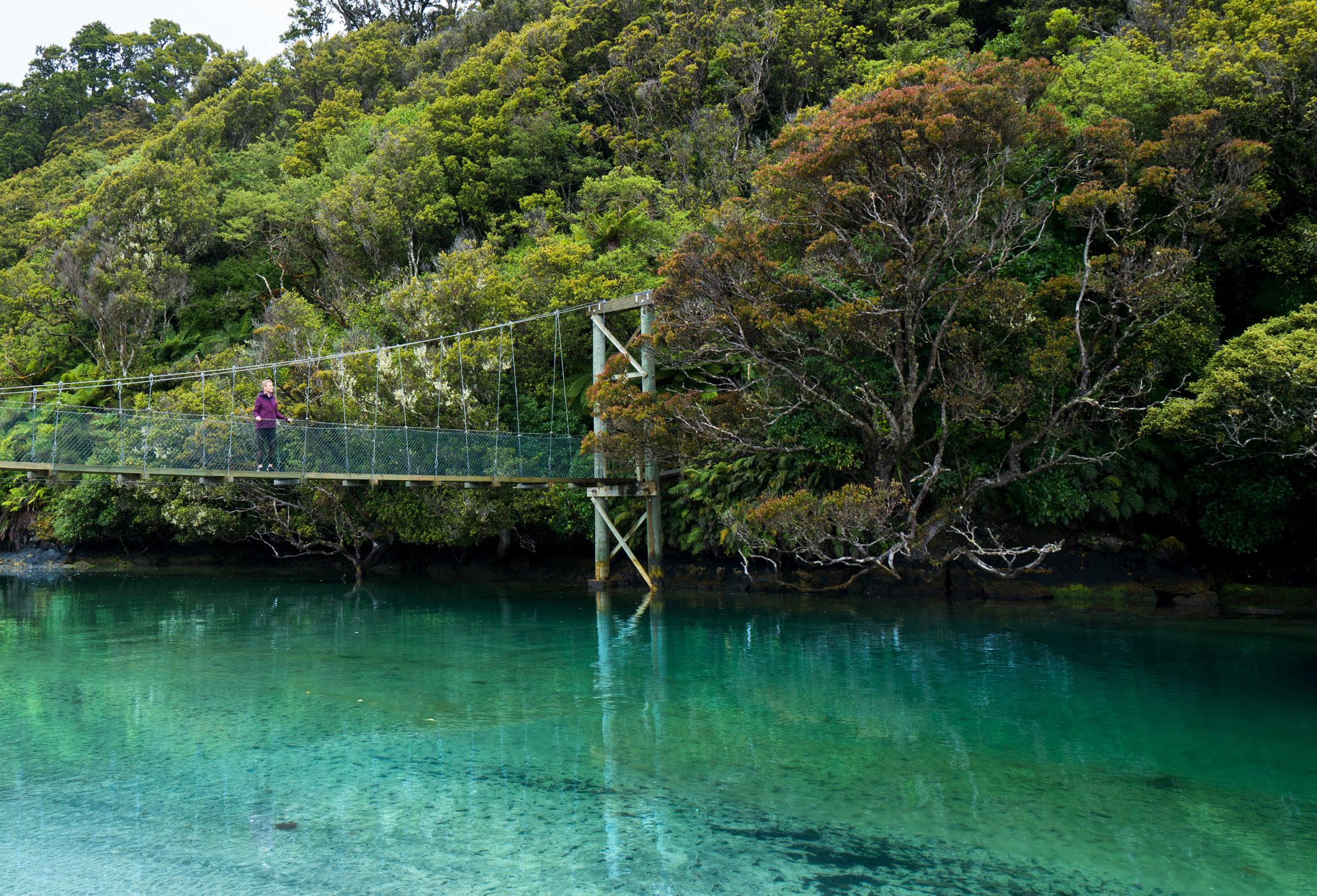

Enjoy stunning coastal views and get absorbed in lush and dense virgin forest and regenerating podocarp forest on this leisurely circular track.
This is the ultimate island wilderness experience and a taste of the way New Zealand used to be. You’ll be welcomed by a cacophony of native birdsong and a warm greeting from the locals in the tiny settlement of Oban.
The amazing Rakiura tokoeka/kiwi (unlike their cousins further north) can sometimes be seen foraging during daylight hours and can often be heard calling at the day’s end.
Immerse yourself in the history, from early Māori settlement sites around Māori Beach and Port William/Potirepo, to sawmilling
relics dispersed along the track.
If you get the chance, visit iconic Ulva Island/Te Wharawhara, off Stewart Island/Rakiura, a beautiful island sanctuary open to the public.
Where is it?
Oban, Stewart Island/Rakiura. Take a 20min flight from Invercargill or a 1hr ferry trip across Foveaux Strait from the southern port of Bluff.
Good to know
During the Great Walks season you will need to book your space in advance, so planning ahead is essential.
WALKING MUST DO’S 81
TRACK 6
Mill
Creek, Stewart Island © AdobeStock 3 days/2 nights; 32km Medium fitness required Intermediate tramping track No dogs RAKIURA
WALK
A
WALK FOR A FEW HOURS, OR WALK FOR A FEW DAYS The Catlins Gore Lumsden Stewart Island Invercargill Tuatapere Te Anau Queenstown Dunedin Milford Sound Piano Flat Loop Track Welcome Rock Trail Lake Marian Track Big Totara Walk Hump Ridge Track Whisky Creek Track Routeburn Track Waipohatu Track Ackers Point Lighthouse Walk Foveaux Walkway Observation Rock Viewpoint Kepler Track Long Hilly Track Forest Hill Track Lake Gunn Nature Walk Milford Track Rakiura Track
The walking country we all dream of...
FOR
FEW MINUTES,
INVERCARGILL
TUATAPERE
STEWART ISLAND
BLUFF
RIVERTON
Sitting 30km off the South Island, this is New Zealand's third-largest island. Known as Rakiura Island in Māori (glowing skies), in winter the Southern Lights illuminate the sky. On land, the terrain is dense with both forest and wildlife, notably because predators are scarce.
GORE TUATAPERE

INVERCARGILL


STEWART ISLAND


BLUFF
RIVERTON
Blessed with wide streets Invercargill is famed for farming and history including the story of local man, Burt Munro, a recordbreaking Kiwi motorcyclist. Motoring museums include the much-loved Transport World with its gleaming classic car collection. You'll also find some of the world's best fare here, Invercargill serves up a mix of succulent seafood including world-famous Bluff oysters, Stewart Island salmon, mussels, paua and blue cod.
82 LOWER SOUTH ISLAND View across Halfmoon Bay, Stewart Island BELOW: Ulva Island BOTH © Adobe Stock
As one of New Zealand’s best predator-free sanctuaries, the flora and fauna here is sensational. Arrive by boat from Halfmoon Bay or Golden Bay and pick up a selfguided walking and bird species book from the shelter. 189 Tay St (SH 1), Invercargill • P: +64 3 218 8881 • E: birch@birchwood.co.nz www.birchwoodmanor.co.nz RESERVATIONS: 0800 888 234 • Refurbished, modern studios • 1 & 2-bedroom units and wheelchair-accessible studios • Spa units • Off-street parking • Sky 50+ channels • Airport 4-minute drive • Tariff from $140 (corporate & group rates available) Bluff Camping Ground • For your stop-off to Stewart Island • Hard & grass powered sites • An ideal base for shark-cage diving • Centrally located • Kitchen & dining area with deck & harbourside views • Showers & laundry • Children’s playground • Waste station 21 Gregory St (off Marine Pde), Bluff • Phone: +64 27 626 2018 Email: procter01@xtra.co.nz • www.bluffcampingground.co.nz Unlimited WIFI 85 Alice St, Invercargill • Ph: +64 3 214 4504 M: +64 27 786 8627 Email: quietstay@queensparkmotels.co.nz www.queensparkmotels.co.nz Reservations: 0800 800 504 Queens Park Motels SH 6 DEE ST KELVIN ST TAY ST GALA ST QUEENS DR HERBERT ST ALICE ST To Queenstown To Bluff To Dunedin City Centre Queens Park Golf Course Queens Park Motel • Off the main roads • QUIET • Walk through our back gate into Queens Park • Close to Southern Cross Hospital, Club Southland & Southland Boys High School. 3-6min drive to inner city, Rugby Park, Stadium Southland & Velodrome, Splash Palace, airport, restaurants and Rowena Jackson Retirement Village • Ideal for families, couples, large sporting & cultural groups • Clean, tidy studio, 1-brm, 6 x 2-brm family units, self-contained for families and business • Children’s playground & park next door • Car storage for Stewart Island travellers Tariff: $130-$160 (1-2 persons), extra $20, under 12yrs $15, under 5yrs free, seasonal/corporate rates. Unlimited FREE WiFi
ULVA ISLAND
KEPLER TRACK 7
One of the Great Walks, this charming adventure features stunning lakes, rivers and bridges, alpine scenery and an everchanging landscape that includes tussock and towering forests. Where is it?


Start at the Kepler Track car park, 5km from Te Anau township. Many people choose to start in Te Anau.
Terrain
Gravel, rock, dirt, largely wellformed forest tracks and alpine trails.
Good to know
Make bookings in advance for huts and campsites through the Department of Conservation.
For visitors eager to experience the highlights of Fiordland, the Kepler Track is ideal because in a way it’s Fiordland’s ‘best of’ album, featuring mountain ranges, ridge walking, lakes, forests, waterfalls and glaciercarved valleys. The birdlife is flourishing and you could spy kea, weka and pīwakawaka (fantails) along with kererū, kaka and even kiwi. There are three huts and two campsites to choose from. At the Luxmore Hut, make a detour to explore the Luxmore Caves and pack a swimsuit as there
The Kepler Rangers were named after the 17th century German astronomer Johannes Kepler. Fiordland’s first ranger Richard Henry thought he would be the perfect namesake because the stars are so clear in this area thanks to the absence of light pollution.
are several spots that are perfect for a dip.
No dogs
3-4 days; 60km loop Intermediate fitness required
Some climbing
WALKING MUST DO’S 83
Kepler Track
© Rob Suisted / Destination Fiordland
Kepler Track © Adobe Stock
New Zealand’s best walking country... WALK FOR A FEW MINUTES, WALK FOR A FEW HOURS, OR WALK FOR A FEW DAYS Discover more walks at fiordland.org.nz Lumsden Invercargill Tuatapere Te Anau Queenstown Milford Sound Lake Marian Track Giant Gate Falls Walk Mount Luxmore Summit Track Routeburn Track Hollyford Track Hump Ridge Track Kepler Track Dusky Track George Track Lake Gunn Nature Walk Mirror Lakes Walk Mt Burns Tarns Track Rainbow Reach Walk Key Summit Track Milford Track
Te Anau is base camp of Fiordland National Park and provides the best access to exploring the Milford and Doubtful Sounds. The spectacular scenic drive from Te Anau to Milford Sound is a must-do as well as the Te Anau Glowworm Caves and jet boating on the Waiau River. Te Anau is also well-known as the walking capital of the world, with three Great Walks nearby and many top short walks such as the Lake Marian track. It's also home of the takahē.


84 LOWER SOUTH ISLAND
Te Anau © Adobe Stock
MILFORD SOUND TE
Fiordland Transport Specialists for over 30 Years Milford | Routeburn | Kepler | Queenstown | Te Anau great walks, Private Charters, Day Walks, Bike Transfers 0800 483 262 www.tracknet.net M A K E M E M O R I E S A T F I O R D L A N D ' S B A S E C A M P 77 Manapouri Te Anau Highway Te Anau 9679 T 0800 483 262 W teanauholidaypark co nz W I T H A R A N G E O F A C C O M M O D A T I O N T H A T W O R K S F O R Y O U
ANAU DOUBTFUL SOUND FIORDLAND LAKE MANAPOURI
Soar over 14 fiords by scenic flight, book a lake cruise, hire a kayak or pull on your walking boots. How about an overnight cruise that allows you to wake up in one of the world’s most heavenly places. Milford Sound is where seals, dolphins, penguins (including rare Fiordland crested penguins) and other birds live amidst the waterfalls and wide valleys. An almighty 300 metres deep, this is New Zealand’s coral diving capital and black coral grows in abundance. Dive company, Descend offers regular day dives as well as multi-day diving tours.
Lake Manapōuri is described as one of the prettiest. Glide across its glass-like water by kayak stopping to explore 33 small islands, remote bays and beaches, or take the new two-hour small boat tour with local company, Tracknet.
Doubtful Sound is the secondlargest fiord in Fiordland National Park. There is no direct road access so take a day or overnight cruise across Lake Manapōuri, along with a coach trip over Wilmot Pass. Explore Doubtful Sound’s pristine wilderness, camp overnight and relish in the isolation.
One of the world’s best-loved multiday walks and one of this country's Great Walks, it features lakes, mountains and views to remember forever.

Where is it?

Start at Glade Wharf at the head of Lake Te Anau, 27km from the township. Finish at Sandfly Point, Milford Sounds.

Terrain
Well-formed bush and forest tracks, some steps, dirt, gravel, very steep in parts and it can be slippery after rain.
Need to know
You may only walk in one direction and you must take a boat to the start at Glade Wharf. The final leg from


Sandfly Point is also by boat through the majestic Milford Sound.


For those who don't want to do the whole track, there is the option to independently day walk the track. Fiordland Co offers a drop-off and pick-up boat service to Sandfly Point.
No dogs
TRACK OVERVIEW
Valley vistas, lakes that reflect like mirrors when the wind isn’t blowing, mountain ranges and all manner of wildlife, most of it with wings, Milford Track has been charming visitors for over 150 years. Whether you walk independently or take a guided walk for a more comfortable experience, this is a seriously stunning adventure. Mackinnon Pass is the steepest section and many walkers are glad to have poles to take the strain off their knees. The huts on the Milford Track must be booked ahead of the Great Walks season from the end of October to the start of May. Mintaro Hut is new and one of the prettiest DOC huts in the country. Be prepared; it rains here 182 days of the year. Many Milford devotees say the walk is improved when the weather is moody so perhaps it’s best to subscribe to the old adage, ‘there’s no such thing as bad weather, only bad gear’.
WALKING MUST DO’S 85
Stirling Falls, Milford Sound
MILFORD TRACK 8
LEFT: Fiordland National Park BOTH © Adobe Stock
Most do it in 4 days; 53.5km Intermediate fitness required Very steep in parts
OTAGO CHRISTCHURCH CHRISTCHURCH & LOWER SOUTH ISLAND SOUTHERN LAKESUnforgettable P: +64 3 249 8801 E: theranch@xtra.co.nz www.theranchbar.co.nz Great atmosphere Friendly staff Sunday roast $20 Takeaway coffee Cosy open fire Top Bar, Function room Live music Thursday SKY TV – big screens Pool Table Gaming machines Free WiFi Open 7 days Mon - Thurs 11am till late Fri - Sun 9am till late (hours may vary in winter months) Town Centre, Te Anau Lazy tunes & sunny mountain views The Sandfly Café has all-day sun and indoor, outdoor seating. Full breakfast menu, light lunch options, superb coffee. A great place to relax, plan or reflect on your Fiordland adventures. Open 7 days. A local’s choice! No.9 The lane, Te Anau Ph/Fax +64 3 249 9529 • E: sandflycafe@gmail.com
FIORDLAND CENTRAL OTAGO SOUTHLAND
ROUTEBURN TRACK
One of the Great Walks, this trail features alpine landscapes, waterways, valleys and sublime views of the Routeburn Falls, Hollyford Mountains and Darren Mountains.


Where is it?
It is possible to start this track from the Routeburn Shelter near Glenorchy, or from the Divide Shelter near Te Anau – both options provide spectacular views.
Need to know
Avoid the Routeburn Track from May to September, when there is a higher risk of avalanches.
During the Great Walks season (end of October to the start of May), you'll need to book your space in one of the huts.


Terrain
Bush trails, mountain paths, boardwalks, some steep sections.
TRACK OVERVIEW
Walk through Mt Aspiring National Park and Fiordland National Park and find yourself surrounded by mountains in territory featuring swing bridges, lakes, waterfalls, grassy flats and rushing waterways.
The birdlife is in excellent health so look out for korimako (bellbirds) and the tiny fearless toutouwai (robins), as well as kea, the alpine parrot famous for its cheeky ways.

For many hikers the Harris Saddle is a highlight, at 1250m above sea level. This point links the Mt Aspiring and Fiordland National Parks and is home to heart-shaped Harris Lake, with views that lift the spirit, depending on the quantity of mist, cloud and rain.
No dogs


2-4 days; 33km Moderate fitness required Intermediate tramping track
WANT MORE?
Take the rough and ready out-and-back 6km track to Lake Marian near Glenorchy, while a slow and steady four to eight-day walk awaits you at the Hollyford Track. Make use of experts guides and private lodges, or go it alone and stay in DOC huts.

A fantastic place to stay and sedate when compared to Queenstown which is all hustle and bustle. Get here by driving the spectacular 46km drive that is renowned for its jaw-dropping beauty. While in town, say hello to some big personalities at Glenorchy Animal Experience and walk the Glenorchy Walkway through an enchanting wetland.

86 LOWER SOUTH ISLAND
9
Road from Queenstown to Glenorchy © Adobe Stock MAKARORA GIBBSTON FRANKTON WĀNAKA CARDRONA ARROWTOWN LAKE HĀWEA QUEENSTOWN KINGSTON GLENORCHY Discover 57‑59 Quintin Dr, Te Anau • Ph: +64 3 249 7748 • Email: info@adenmotel.co.nz www.adenmotel.co.nz • Reservations: 0800 11 66 44 • Hosts: Irene Benfell & David Herron • Relax in a homely, Kiwiana style motel • Pet friendly upon request • Full cooking facilities • FREE WiFi • Quiet location, studio, 1, 2 & 3‑brm units • Tour bookings arranged, local knowledge is best • 10min stroll to town centre, 100m to lakefront • Environmentally friendly • Luggage & vehicle storage • Playground & BBQ area Check www.adenmotel.co.nz for current best rates & to book 88 Bil Richardson Dr PO Box 313 In gil www tionsigns.c .nz Phone 03 211 0301 Appro ed By Da Appr val Signatur Please Check Pr Car fully ery car with this pr esponsibility wil be accep ed or mistakes ound fter this pr has been ed. opyrigh This pr shal no be oduced without written permission from tion Signs. Cus omer Aden Mo el Da 16 M 2019 Job Details ogo Design Spelling olours Siz File Location: Designer elly :\Cr oduction\A Z\R\R Aden Motel TE ANAU, NZ Option 1 Lakefront Lodge • Upmarket complex for business or pleasure. • Superb ground-floor SPA, 1-brm & studio kitchen units. • Continental breakfasts. • Close to town. Free tour desk/ storage/unlimited WiFi. • Tariff: $165-$305, extra $30, seasonal. Reservations: 0800 525 337 Cnr Lakefront Dr & Mokoroa St, Te Anau • Ph: +64 3 249 7728 www.lakefrontlodgeteanau.com • Email: stay@lakefrontlodgeteanau.com Te Anau Guided Walks Take a step outside your comfort zone with our Ben Lomond Guided Walks! Visit our website for seasons and trip departures. Book online at
QUEENSTOWN HILL TIME WALK
BANNOCKBURN SLUICINGS
So close to the bustling centre of Queenstown, this peaceful walk offers astonishing views when you get to the lookout at the Basket of Dreams sculpture.


Where is it?
Well signposted, it starts and ends at Belfast Tce, Queenstown.
Terrain
Forest paths, some rocks, it can be muddy after rain.
Good to know
You can bike the track, although you have to be a confident rider as there are steep elements. Riders and walkers need to share with care.
TRACK OVERVIEW
Set off beneath a forest of Douglas firs. At a point in the trail you will reach a fork; if you go left, the trail is steeper, rockier and shorter than the other path. If you choose to go right, the walk is longer but easier with several information panels along the way. When you arrive at the lookout you’ll find the Basket of Dreams sculpture, a work made of steel by artist Caroline Robinson. There you will enjoy views over the Wakatipu Basin across to The Remarkables, Cecil Peak and down to Queenstown Bay.
MORE TOP WALKS
SKYLINE LOOP TRACK 30min loop walk starts at the top of the Queenstown gondola.
TIKI TRAIL Climb Bob's Peak from the base of the gondola.
BEN LOMOND TRACK A demanding full-day hike with a 1438m elevation in Queenstown.

SAWPIT GULLY TRAIL A two to three-hour track in Arrowtown.
Cromwell is regarded as the ‘fruit bowl of the south’, summer brings peaches, nectarines, apricots and cherries, while vineyards pour a multitude of pleasant drops.
The spectacular landscape of the Bannockburn Sluicings near Cromwell can be explored on foot or by mountain bike.
Where is it?
Travel 6km southwest through Cromwell, and cross Lake Dunstan to get to Bannockburn. This site can be accessed from Felton Rd. For those with little time, there are vantage points that can be reached by car, and walks that take just 10 minutes. If you’ve got more time to spare, trace the water source back up to the Menzies Dam in Stewart Town. There are remains of a stone cottage, an early 19th century orchard, and great views across Cromwell and Bailey’s Gully.
Terrain

Moderate fitness is required as this walk climbs up above the cliff faces and includes steps. There are vantage points that can be reached by car and smaller walks also.
1.5hr; 3.5km loop track
Moderate fitness required
Cliff faces and steps
TRACK OVERVIEW
The walking track gradually climbs up above the cliff faces, where you have a wide view of how people from the past and present have shaped this land. This desert is not a natural site, but the 150-year-old aftermath of the Otago gold rush. It was created by a technique known as ‘hydraulic sluicing’ where water was blasted at the hills to release the gold.
What looks desolate from the entrance turns into a rough, raw and rewarding walk through a valley of caves, tunnels and rock tailings left untouched since abandoned by the last of the gold miners.
WALKING MUST DO’S 87
10
Queenstown Hill walkway © Adobe Stock
2hr return, add 30min to summit; 2.5km to summit Moderate fitness required Gentle gradient
No dogs. Sheep grazing, and part of the walk is on private land.
Sluicings ©
ABOVE:
©
Stock
Dogs on a leash only Bannockburn
Central Otago Tourism
Bannockburn
Adobe
11
Your perfect getaway in the
of QUEENSTOWN Book online www.theglebe.co.nz by email stay@theglebe.co.nz 1 Beetham Street, Queenstown Telephone 03 441 0310 BOOK DIRECT to receive DISCOUNTED RATES on your accommodation
HEART
ROYS PEAK TRACK
TRACK OVERVIEW
The Insta-influencers have made this already popular track even more sought after, most notably for the photographic viewpoint approximately one hour before the summit. It is here you will find a narrow, exposed path leading to a vantage point with views as far as the eye can see. Feast your eyes on Lake Wānaka, its islands and surrounding valleys. Further up you will reach Roys Peak itself, where Mt Aspiring sits grandly in the background. There is nothing technical about this hike, but the incline zigzags relentlessly to the top so expect a steady slog uphill, with very few shaded areas. You’ll descend via the same track or, if you choose to hike up in the afternoon, camp overnight and catch sunrise the following day.

Where is it?

A 10-minute drive from Wānaka.
Terrain
Steep walking track with a continuous climb. Exposed to the elements throughout.
Good to know
The track is on private property and closed from 1 October to 10 November for lambing.


No dogs
One of the most varied one-day walks in New Zealand, bringing you face-to-face with awe-inspiring glaciers, river valleys and Alpine lakes.
Where is it?
54km/one hour’s scenic drive west of Wānaka, inside of Mt Aspiring National Park. Transport services from Wānaka to the car park are available. Some rental car companies don’t insure for this road, and it is not suitable for low or large campervans or vehicles either.
Terrain
Passing through farmland, rainforest and across swing bridges. Some sections have steep drop-offs.
Good to know
There is no mobile coverage so Personal Locator Beacons are encouraged. Also check avalanche conditions with DOC in winter months before doing this walk; usually between May to November.
TRACK OVERVIEW
Start the walk from the Raspberry Creek car park on the Wānaka-Mt Aspiring Road. Head through open farmland in the main Matukituki Valley then cross the swing bridge to enter the rainforest of the Rob Roy Valley. There's a limit to the number people allowed on the swing bridges at any one time – be prepared to wait at each end if numbers allowed have been reached. The track weaves through the beautiful rainforest and beside the Rob Roy stream for some of the way until you come out into the Alpine zone, with stunning views of the Rob Roy Glacier at the head of the valley. The viewing point is a great place to stop for lunch, but do not feed the persistent kea (mountain parrots). Return via the same track.
Alpine conditions can arrive at any time of year – take appropriate clothing and check conditions before you go.
Eco Wanaka Adventures

Rob Roy Glacier Fully Guided Walk
THAT WĀNAKA TREE
Find the famous Wānaka tree, known as the ‘Lone Tree of Lake Wānaka’. The crooked trunk of one of New Zealand’s most photographed trees is possibly more famous than the lake itself. Somewhat a reluctant celebrity, this willow doesn’t reveal its whereabouts too easily. From town, face the lake and meander left along the water’s edge; you will eventually reach the leafy icon. Following a flurry of excitement on social media, hordes now flock here with cameras, selfie sticks and drones in tow.
Discover the magical Rob Roy Valley with us. Swingbridge, waterfalls, crystal clear mountain stream, rainforest and glaciers, Rob Roy Glacier Guided Walk has it all!
Adult $335, Child (8-14) $225 (valid till 30.9.23)
See our website for details of this and other fully guided walks, boat tours and heli-hikes in the Wanaka region.
LOWER SOUTH ISLAND 88
12
Roys Peak, Wānaka © Adobe Stock
5-6hr return; 16km High
RIGHT: Mt Aspiring National Park © Small World Productions
fitness required Strenuous, uphill gradient
ROY GLACIER TRACK 13
Wānaka lone tree © Adobe Stock
ROB
4hr; 12.5km return
Moderate
No
from car park
fitness required, OK for older children Some steps and steep/rough sections
dogs and No drones
ecowanaka.co.nz Freephone
926 323 • Ph: +64 3 443 2869
(NZ Only) 0800
A f t e r a l o n g h i k e , t h e r e ’ s n o t h i n g b e t t e r t h a n r e l a x i n g i n a p r i v a t e s a u n a o r h o t t u b . W e ’ v e g o t y o u c o v e r e d a t T a s m a n H o l i d a y P a r k s . H i k e t h e K e p l e r T r a c k a n d r e l a x i n o u r h o t t u b s o v e r l o o k i n g L a k e T e A n a u .

TAS M A N H O L I D AY PA R KS . C O M
Step into our beautiful backyard. Discover New Zealand’s great walks.


For over 39 years and in 45 spectacular locations throughout New Zealand, we have been carefully creating the environment for your very own, unique, quality holiday experience.


We offer a range of accommodation options, and all our Parks feature plenty of space, children’s play facilities, BBQ areas plus indoor and outdoor recreational spaces.

TENT SITES
UNITS CABINS POWERED SITES
in the places you love, with the people who matter the most
MOTELS
Join at a TOP 10 Holiday Park reception, or online Join our Club and save on TOP 10 Accommodation, Interislander Ferry Travel, Scenic Train Journeys and at over 300 activity operators, cafés and restaurants throughout New Zealand. SAVE at least 10%


