
8 minute read
4. MASTERPLAN STRATEGIES


Objectives Met: 1, 7, 9, 10
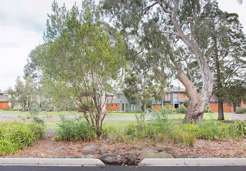
Wetlands
Advertisement
The Wetlands on the edge of the river will aid in managing the overflow from the river and act as retention ponds. They can also store water and act as a buffer during droughts. In addition to this they can be breeding grounds for habitats to grow and add biodiversity and vegetation in the region (Department of the Environment and Energy, 2016).
Green- Grid
Green grids in the region can mitigate Urban Heat Island effect and add to the making the water cleaner and ecology of the area. The green grid will contain native vegetation and trees for Liverpool such as: Broad Leaved Apple, Swamp Oak, Cabbage Gum. These native trees will help in retaining the biodiversity on the region without putting pressure for extra maintenance of the trees as they are local to the region and riparian trees (Birdlife Australia 2018).
Recreation
The pathways going across the wetlands will act as a space for recreation. like walking, cycling or even bushwalking. These spaces will act like observational decks for people to understand how wetlands work and biodiversity of the region. It will be a way through which the community can interact with water.
Case Study- Hunter Wetlands:

The masterplan strategy focuses on mitigating the effects of flooding by providing the rivers wedge with wetlands that can take the excess water overflowing from the Georges River. The aim of the wetlands is to be able to manage the floods along with provide space for biodiversity to thrive. The wetlands will also act as places for recreation for the community and a place for learning and awareness about ecology and the wetlands. The wetlands will have provision of activities like walkways, cycleways and nature trails.
Along with this a green grid is proposed across the masterplan, which will build on the regions existing open spaces by linking the trees lined on streets, corridors, waterways, open spaces, and parks. The tree canopy helps in reducing the urban heat island effect, they also aid in providing cleaner water and air, as well as reducing noise pollution. Making the community more resilient and absorbent to external forces.
The urban tree canopy is a form of green infrastructure that mitigates the urban heat island effect. The urban tree canopy also supports cleaner air and water and provides local habitat. Trees remove fine particles from the air and help insulate against urban noise pollution, particularly important along busy roads. The urban tree canopy can also help make communities more resilient by reducing the impact of heat waves and extreme heat (Greater Cities Commission, 2020).
The Hunter Wetlands Centre forms an important part of the neighbourhood, this hunter wetland includes the community centre. The wetland provides as a space for environmental education, conservation and eco-tourism. Through educational activities the wetlands are a place for the general public to get to know about wetlands and contribute to its conservation. The wetlands provide a variety of including guided tours, dip-netting, birdwatching, painting, volunteering, canoeing and walking. These spaces are informal learning environments simply by observing the wetland (Jaggers 2021).
Proposed Site Conditions

Site Area:
Built : Unbuilt
Number of houses:
Persons per house:
Total number of people:
WSUD Sizing to
Size of Swale:
Size of Wetlands:
20000 sq.m 60 : 40 32 houses 3 people 96 people
120m length 1200 sq.m
The sizing of the WSUD Strategies is done to achieve the following:
• 85% reduction in the mean annual load of Total Suspended Solids (TSS)
• 65% reduction in the mean annual load of Total Phosphorus (TP)
• 45% reduction in the mean annual load of Total Nitrogen (TN)
Various strategies will be applied on site. The swales on site will transport water from the site to the wetlands while removing TSS. They will transport water into the wetlands that will help in getting rid of the remaining nutrients. The wetlands will also provide a space fro recreation and ecology to grow. The berms on site will prevent the water from flowing back and make it flow towards the swales. In the end the gross pollutants trap will trap solid waste such as litter and coarse sediment that might have gotten collected on the way. Finally the High Flow Bypass will convey excess water into Georges river when the wetlands are overflowing.
Case Study- The Common Swales:
The Common is a Macleod suburb residential street with large, tree-lined strips in the middle that separate the two sides of the road. The strips are divided by open swales covered by grass. The swales are intended to collect stormwater and filter out contaminants before it is directed into underground stormwater drains that eventually go into Darebin Creek (Darebin City Council 2017).
When it rains, The Common’s swales collect rainwater runoff. Stormwater drains from the road surface through a series of inlets in the kerb that surrounds the median strips. The inlets are shaped with huge rock beds to stop litter and waste and restrict the flow of water, reducing soil erosion. Water flows through these rock layers before entering the swales (Darebin City Council 2017).
Objectives Met:
Wetlands
The wetlands on site will helpin preventiong flooding and also aid during conditions of draught. Apart form this wetlangs can act as an enhancer for ecology of the surrounding areas (Department of the Environment and Energy 2016).
Swales
The swales along the roads are designed to collect stormwater and filter out pollutants(TSS), (Darebin City Council 2017). They direct water underground stormwater drains that eventually lead to Wetlands.
Highflow Bypass
The wetland high flow bypass channel allows for excess water to flow around the wetland without damaging the plants specially during floods (Melbourne Water 2022).
Recreation
Creation of public amenities around the wetlands like walking tracks will increase communities inetraction with water and the ecology of their surroundings thus increasing their knowledge about water (Agency of natural resources 2022)
Berms
The berms are mounds which have vegetations covering it made of compacted soil. The berms on site are placed inn a way to divert water away from the houses and into the swales, they also help in preventing the backflow of water, and thus avoid adversely affecting properties on site (The State of Queensland 2019).
Native Vegetation
Planting along streetscapes with native vegetation will be beneficial to the community as it will add urban tree cover, improve water and air quality and reduce urban heat island effect. this will make it a friendlier neighbourhood and increase walkability (CRC for Water Sensitive Cities 2018).

Case Study- Flood Resilient Homes Queensland:
The kind of design by use of various materials, construction systems, landscaping options that can resist significant and multiple inundations while actively minimising the effects and lowering the cost of floods. Flood resilient design allows residents to store things before to flooding, then post flooding clean, repair, and rapidly re-enter with minimum long-term disturbance to everyday life (The State of Queensland 2019).
• Flood-resilient design prepares buildings to endure and recover from flooding occurrences while enhancing daily living and quality of life. It takes into account the materials used, construction methods, and home style.
• Flood-resilient design allows homeowners to safely store things before to a flood event, and then simply clean, repair, and rapidly re-enter with minimal long-term disturbance. Homeowners can actively limit or mitigate the consequences of floods by using flood-resilient architectural features.

• One method for residents to be better prepared for flooding is through flood-resilient design (The State of Queensland 2019).
Proposed Plot Conditions

Plot Area:
Roof Area:

Water Usage for 3 people/day:

Non potable rainwater demand/ yr:
Total Water Supplied
Water needs met for Non potable uses:
Rain Water Tank Sizing:
Volume of water:
Tank Size:
Objectives Met:
Rain Garden Permeable Paving Roof Filter tank Rain water tank
The plot has strategies for the build form and the landscaping as well. The landscaping includes a rain garden to soak in more water during rain and reduce stormwater runoff, the paving on site is also done through permeable paving thus reducing hard surfaces and allowing for the water to seep in. The house will have appliances that will reduce the water demand, appliance such as showers and taps that will reduce the flow of water. Adding to this the roof will collect water during rains in the rain water tank. this rainwater will meet 82% of non potable water usage. The trees and shrubs planted on the plot will add to the native vegetation on site increasing the biodiversity and deceasing soil erosion. The material used for the built form will need to be water resistant so as to be resilient during flooding events since the site falls under the 100 year flood line. Using a double brick and veneer external wall makes the house durable with minimal maintenance costs. Weep holes or vents need to be provided on the external walls to allow the water to leave faster post flooding. Glazed brick or clay tiles can act as even more durable external barriers to natural flooding hazards (The State of Queensland 2019).
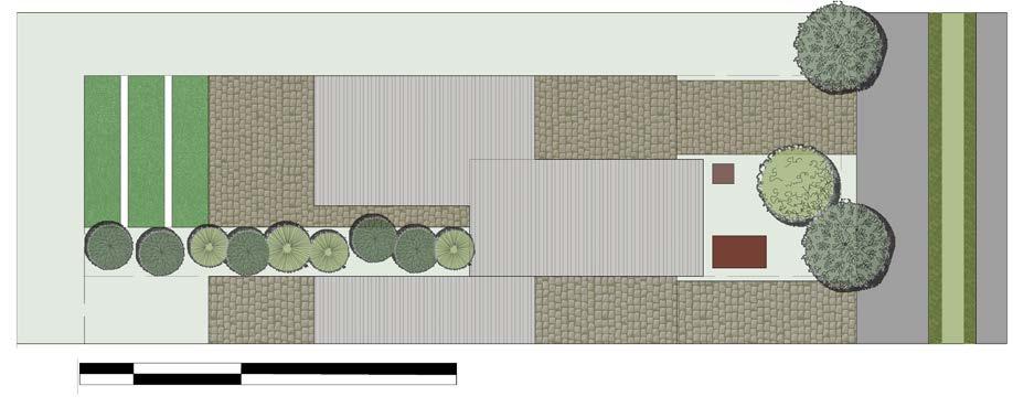
Rain Garden
Rain gardens help to collect rain water and are planted with water plants. They help to reduce the amount of storm water runoff and also adapt to the natural landscapes, while trapping a number of pollutants (The State of Queensland 2019).
Permeable Paving
Permeable paving helps in reducing the stormwater runoff on site and allow the water to seep underground and then join the main water body through an underground pipe (The State of Queensland 2019).
Rainwater tank
Rainwater tanks on site collect the runoff from the roof. The water first does into a filtration tank before entering the rainwater tank. The filter helps to remove any litter that might have been carried from the roof.
Appliances
Water-efficient appliances and fixtures, helps keep water use at sustainable levels (energy.gov.au, 2022). Use of such appliance also saves money and electricity. Water is used the most by washing machines, showers and taps (energy.gov.au, 2022).
Materials
For a flood resilient house it is necessary to use Water-resistant materials along with composite construction systems. For example, double brick and brick veneer can be used as external alls with weep holes. These are easy maintenance and will allow the water to leave through weep holes (The State of Queensland 2019).
The report has suggested strategies at three levels, the masterplan, site and plot level. At each of the levels the strategies have met their Water sensitive design objectives. The aim of the report has been met. The WSUD strategies are resilient to flooding. They encourage people to interact with water building awareness and learning on site. The wetlands used throughout the site level and masterplan level account for flooding and are hot spots for biodiversity to thrive. Along with this additional strategies are added as a back up option like berms and Wetland high flow bypass that help to direct water away from the wetland and properties that might be damaged. The WSUD strategies are capable of reducing the following:
• 85% reduction in the mean annual load of Total Suspended Solids (TSS)
• 65% reduction in the mean annual load of Total Phosphorus (TP)
• 45% reduction in the mean annual load of Total Nitrogen (TN)
The rain water gathered from the roof also reduced dependency on mains water supply by 82% for non potable uses. Thus the report has met all the aims and objectives for Water Sensitive Urban Design.
The report also has a few disadvantages, the number of houses on the site area are far lesser than what could have been added, this is because, for making the site resilient to flooding a certain amount of wetlands were required on site. This reduced the are for the number of homes that could have been added. But since it is necessary to think about the risks on site it is necessary to make the site resilient to flooding and have fewer houses than make a large number of homes get exposed to this risk and have an negative impact on their livelihoods.
Further research can be developed for this topic that can deal with existing ecology on site and to what extent will WSUD have an impact on this ecology. Further learning outcomes for students for various ages can be established by providing various activities for different age groups to increase water awareness. The activities can be more integrated and interactive with water. An additional report is needed to address design for the neighbourhood through community consultation and understanding the communities needs.

