ARCHITECTURAL PORTFOLIO
MD ABDULLAH
MD. ABDULLAH md.abdullah.dia@gmail.com +49 15750422864 ARCHITECT
I am an architect from Dhaka, Bangladesh.Recently nished my master degree at Dessau International Architecture(DIA) at Anhalt University of Applied Sciences. Architecture to me, is inherently anchored in its for spatial & social context. The process of making architecture is translating immeasurable to measurable by manipulating architectural form with re-dening it’s elements that based on the old. With the use of Architectural space, materiality & the way of construction, the measurable express itself that evokes spirituality, memory which are immeasurable. My professional career has shown me that I am an active and eager person at work, with the ability to adapt myself to different tasks and work as a team member or individually. I consider myself as a responsible, organized and creative person who always seek beauty through perfection. In this Portfolio I would like to express my critical point of view to contemporary architectural development and urbanization through my academic & professional experience, attempting to seek for new possibilities of architectural & urban forms through new meaning imposed on the older ideas.
S K I L L S
Oct 2020- Sept 2022
ANHALT UNIVERSITY OF APPLIED SCIENCES (DIA)
Dessau, Germany
Master in Architecture
Oct 2011- Oct 2016
AHSANULLAH UNIVERSITY OF SCI & TECHNOLOGY (AUST)
Dhaka, Bangladesh
Bachelor in Architecture
E X P E R I E N C E
Dec 2016 - Nov 2019
MYTH Limited (Design und Build)
Dhaka, Bangladesh
Architect
July 2018 - Dec 2019
Military Institute of Science & Technology (MIST)
Dhaka, Bangladesh
Adjunct Lecturer
Feb 2014 - Aug 2014
Studio cascade (Pvt.) Limited
Dhaka, Bangladesh
Architectural Intern
Hard Skills
Architectural Design, Urban Planning, interior Pre design research, Architectural concepts, Architectural drawings, 3D modelling
Project presentation, issuing task to other dept Working with BIM methodology ( BIM 360), Environmental anlysis with GH
Architectural model making, 3D Visualization
Softwares
Revit
Autocad
Adobe photoshop
Adobe Indesign
Adobe Illustrator
Rhino +Grasshopper
Lumion
Enscape
Sketch Up
Languages
English - C1
German - A2
Bengali - Native
E D U C A T I O N
ACADEMIC PROJECTS
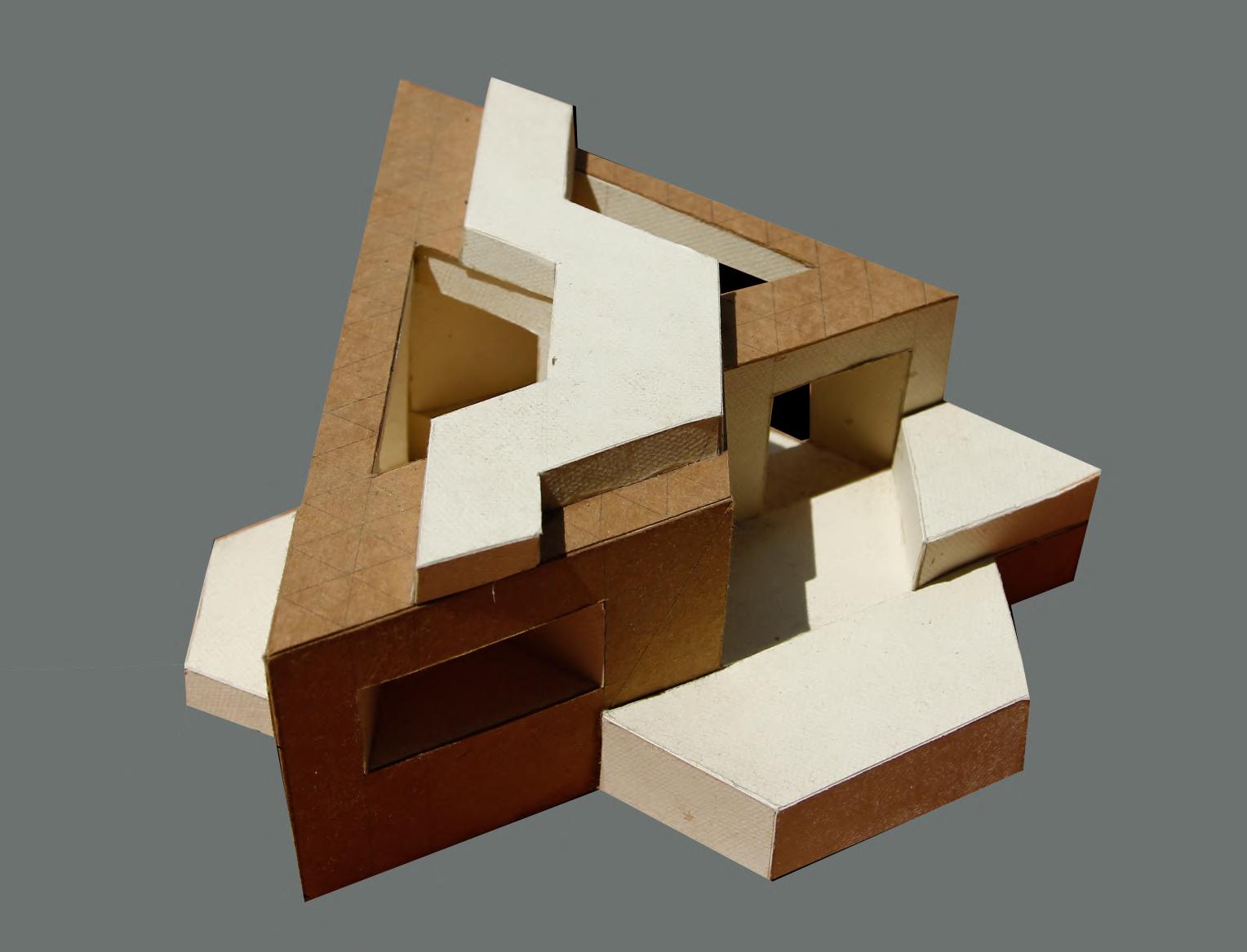
ARTICULATION
OF A 3 DIMENSIONAL BASIC FORM
UNDERGRADUATE STUDIO II
MEDIA: PAPER
CONCEPT:
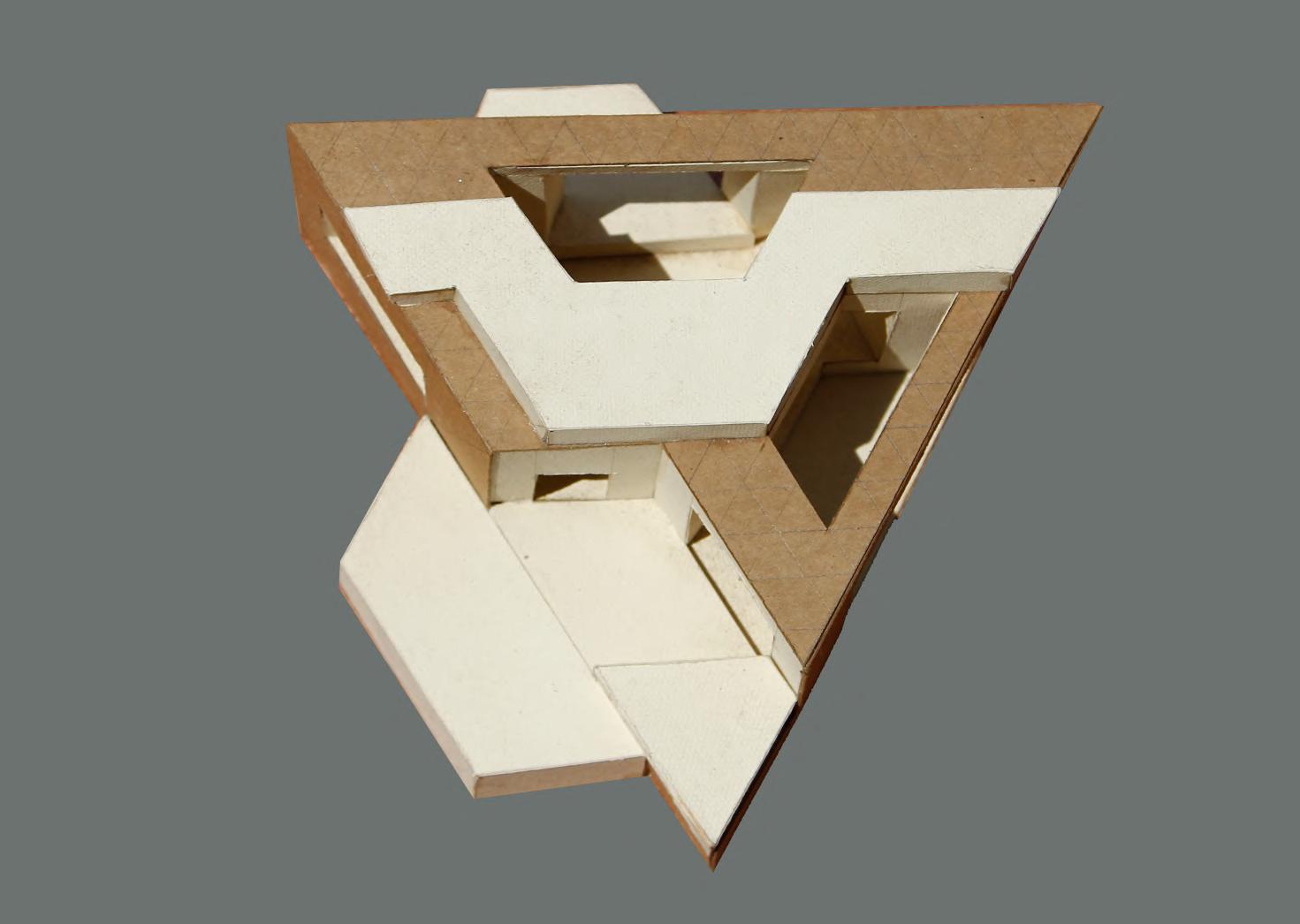
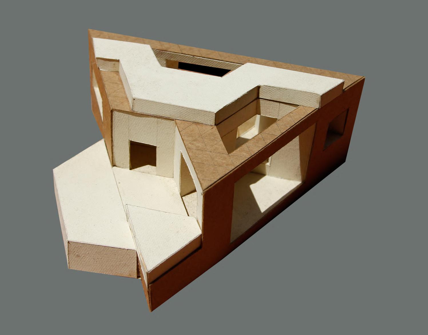
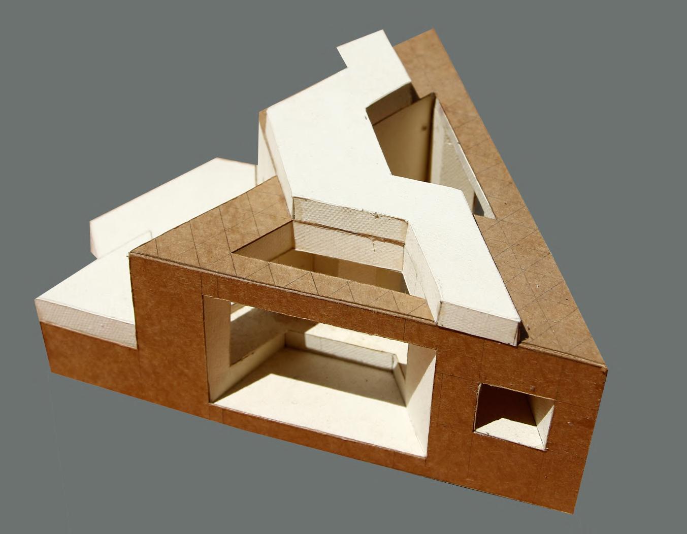
The task was to understand the basic three dimensional form and articulate it in various way to get the idea of the volume and the possibilities of the different views through it. I choose triangular form and made it 3 dimensional by extruding the footprint and articulated it by the elevation in geometrical way


ALL FOR ONE, ONE FOR ALL
A COMMUNITY SOCIAL HOUSING IN ZEITZ
MASTER THESIS WORK
SITE AREA :33014 sqm
INSTRUCTOR : Prof. Johannes Kister, Prof. Nadia Haeuple, Prof. Thilo Folkerts
INDIVIDUAL WORK
All for one, One for all, as the title stating the core intention of the project, the main focus of the project is to create a sustainable community social housing with the respect to the ideology of new European bauhaus which is beautiful, sustainable and together. Keeping in mind the basic structure of the gennossenschaft and with the urban anlysis of the area, this project started with the incorporation of existing urban fabric and historical landmarks. The building blocks are arranged in a way sothat the new architecture can easily be blended with the existing or old ones and it remains same with the building height. Respecting the existing urban situation, the housing blocks are made stagerred to connect the existing landmarkswith the new buildings visually and also have the maximum vista towards the river elster which is one of the main force of the site. The Zakiwa and archive buildings kept as the highest point in terms of oor height sothat the historical essence remain as prior element. The staggering buildings also creates a visual perforation from the other side of the river towards zakiwa area


SITE LOCATION & CONTEXT


Thematically, the New Bauhaus Project is anchored in the city of Zeitz, South Saxony-Anhalt. The closure of surrounding lignite industry will bring about a structural change that will mean radical changes for people and will have a signicant impact on social contexts and the image of cities and landscapes. In Zeitz this has been visible in large wastelands since the reunication and the disappearance of the key industries, which were a long tradition of the city's economic strength. The consequence and trigger is a shrinking process that is currently unfavorably shaping the social pyramid.
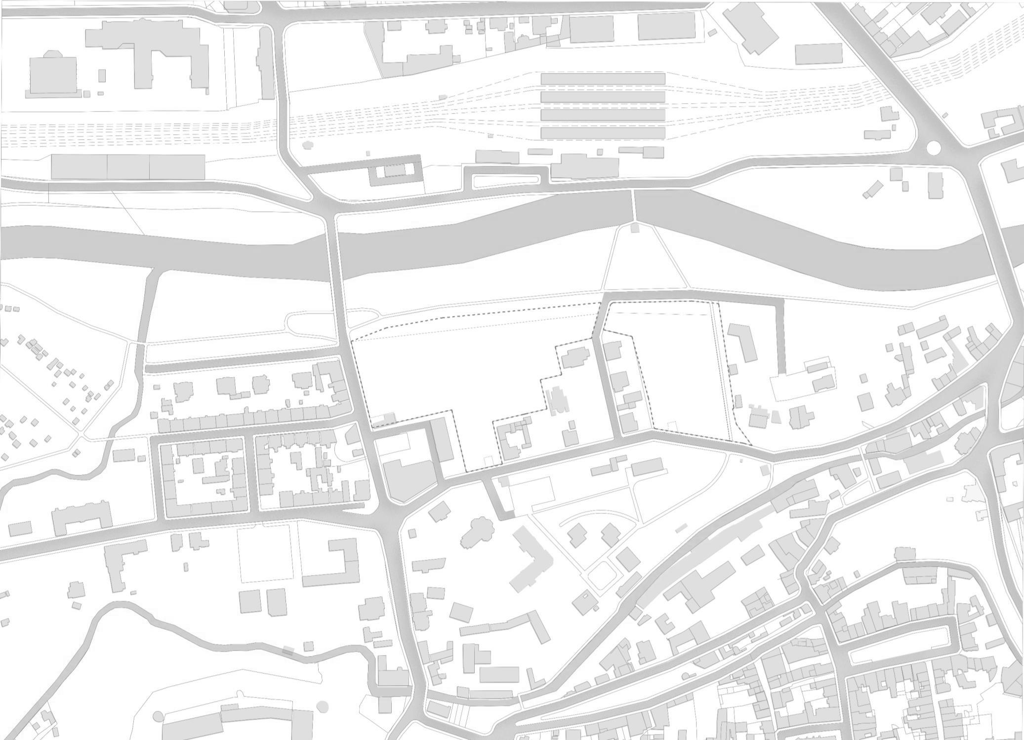
white elster hbf Site Location 0m 40m 80m
THE THINKING PROCESS
If the European Green Deal has a soul, then it is the New European Bauhaus which has led to an explosion of creativity across our Union.
Ursula Von der Leyen, President of the European Commission
The New European Bauhaus initiative connects the European Green Deal to our daily lives and living spaces. It calls on all Europeans to imagine and build together a sustainable and inclusive future that is beautiful for our eyes, minds, and souls.
The New European Bauhaus is a creative and transdisciplinary movement in the making
• It is a bridge between the world of science and technology, art and culture.

• It is about leveraging our green and digital challenges to transform our lives for the better.
• It is an invitation to address complex societal problems together through co-creation.

Beautiful Sustainable Together
Environmental Financial Social
act
New European Bauhaus Inclusive
Affordable Urban
Ownership Voluntariness Equality Affordability
Respond to needs Multi dimensional Appreciating diversity Distinctive character Local integration Adaptable space Local identity Link with neighbour wellbeing Feeling of safety Community facilities Ability to inuence Willingness to
Revitalization of Zeitz Genossenschaft
Accessible
Development Social Community
Germany
Saxony Anhalt Zeitz

1 2 3 4 4 5 6 6 7 9 8
4.
7.Commercial
8.
Site plan

9.
2.Parking Garage
0m 20m 40m
1. Vehicular Entry
3. Central Plaza
Internal courtyard or social green
5. Flood wall slope
6. Farming green / allotment garden
building with café in the ground
Café outdoor space
1 4
Existing Archive building


0m 10m 20m
Ground Floor plan
1. Vehicular Entry
2.Parking Garage
3. Central Plaza
4. Internal courtyard or social green
5. Flood wall slope
6. Firming green / allotment garden
7.Commercial building with café in the ground
8. Café outdoor space
T_01 T_01 T_02 T_02 T_02 T_02 T_03 T_03 T_03
9. Existing Archive building


EAST ELEVATION
SECTION BB’


ELEVATION


SOUTH ELEVATION
SECTION AA’

 1. Utility facilities
2. Double height space at the entrance
3. Residential unit
4. Social green / internal court
5. Indoor play area
6. Indoor play area
7. Central plaza
8. Swap station / mini market
fourth Floor
Third Floor
Housing block type_03

Second Floor
First Floor
Ground Floor
CIRCULATION PATTERN
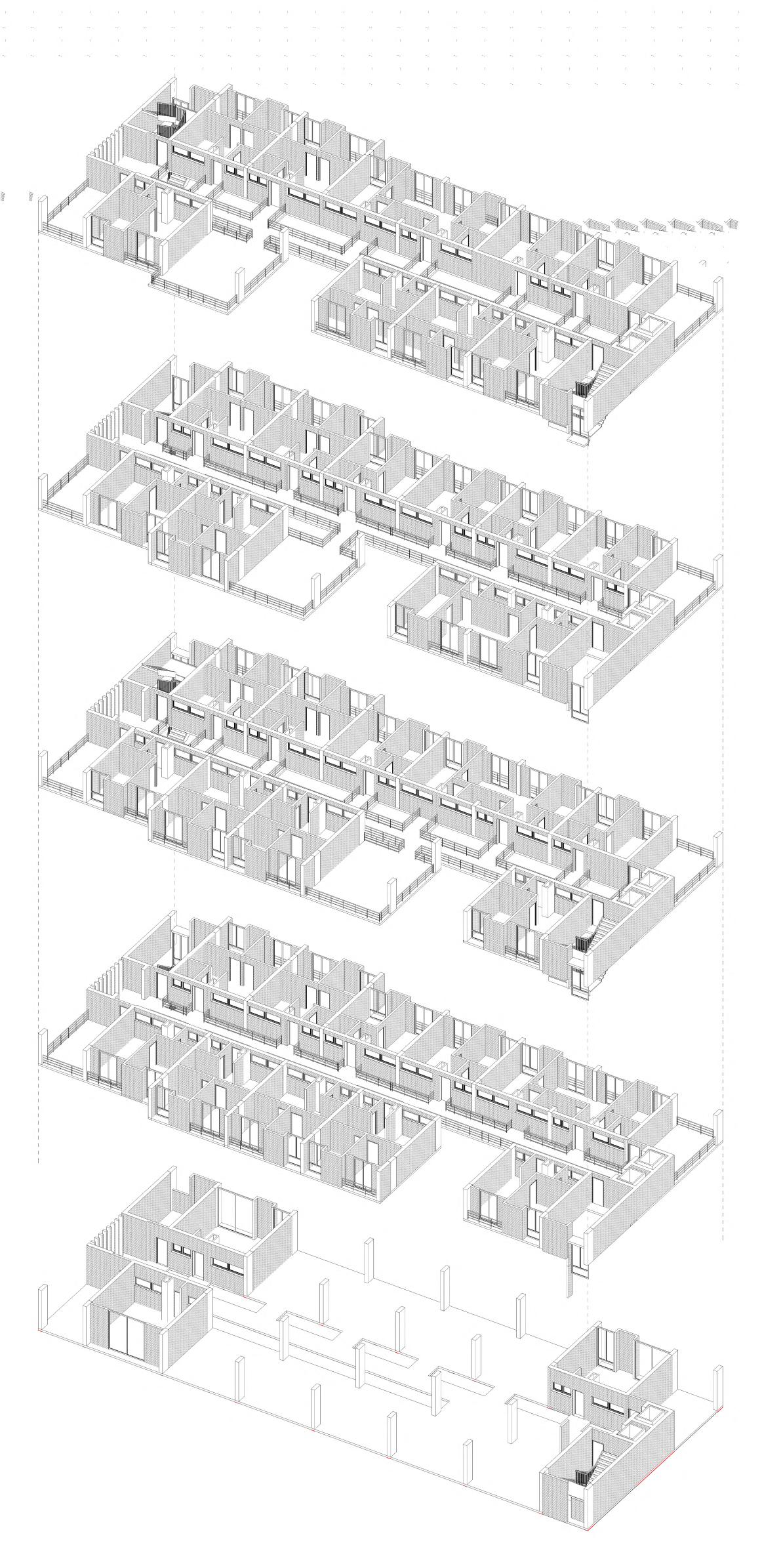


Ground Floor First Floor Second Floor Third Floor fourth Floor Ground Floor First Floor Second Floor Third Floor fourth Floor MODULER PLAN
Ground Floor plan(type_03 module)


Ground Floor 3D view

storage minimarket/ swap station laundry area tness area
outdoor play area
ofce

Ground Floor 3D exploded view oor
windows
facades
Second Floor plan(type_03 module)


Second Floor 3D view


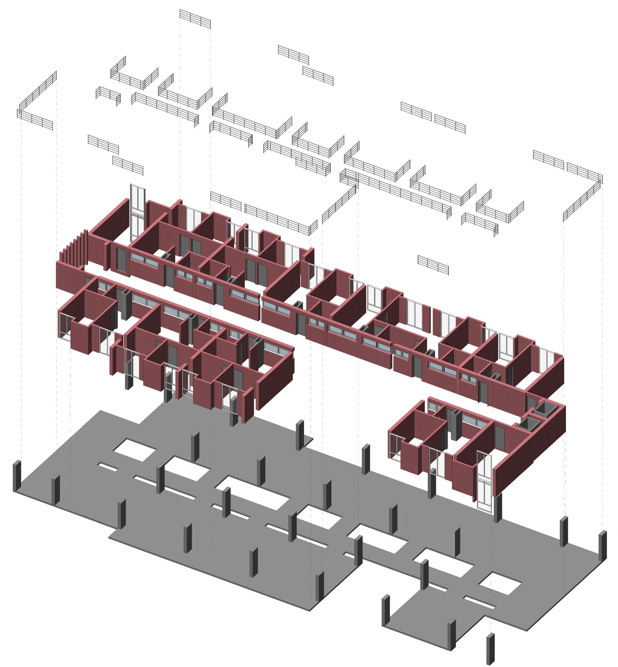
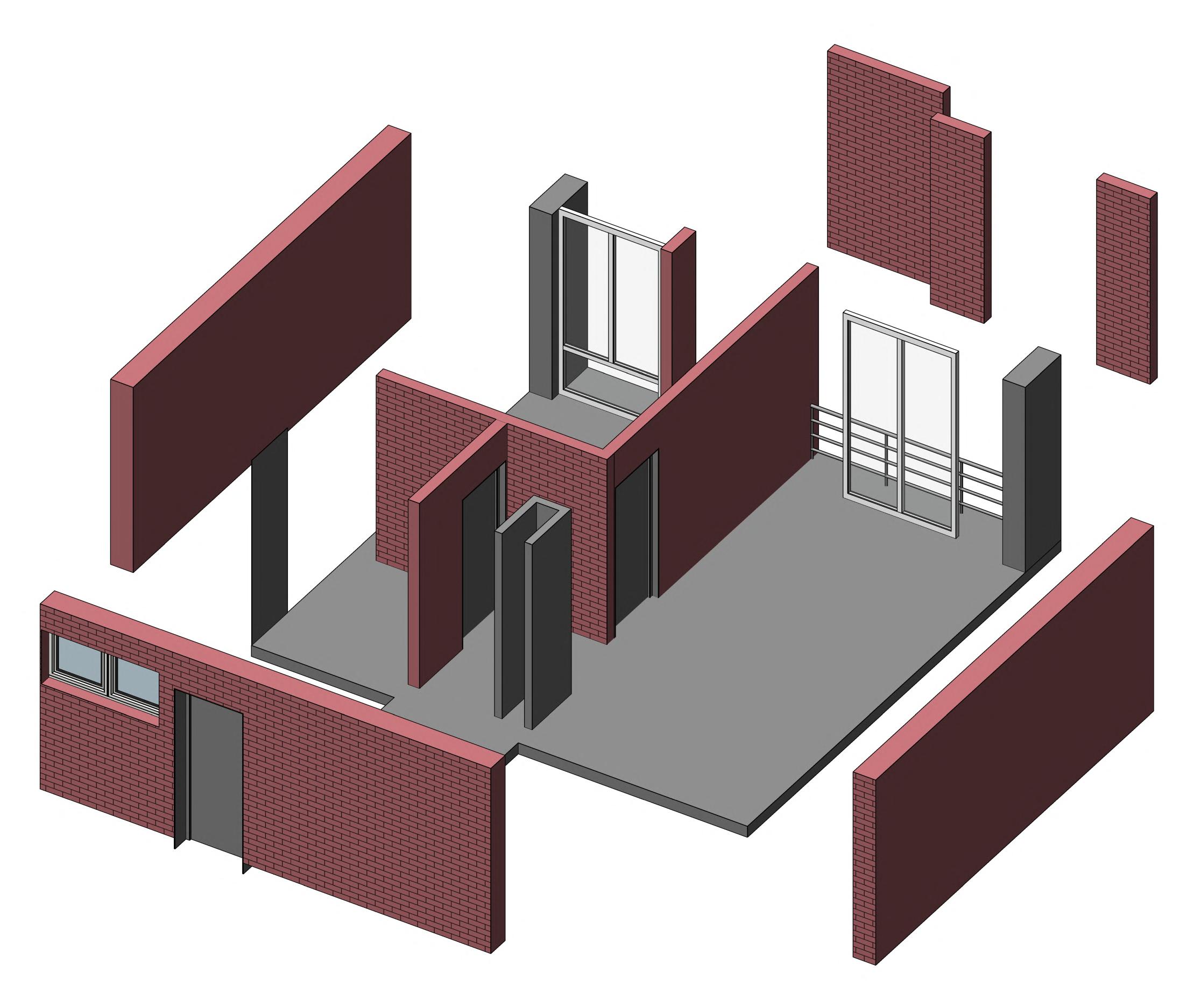
Second Floor 3D exploded view oor
facades raillings


module_03 3d view
Residential
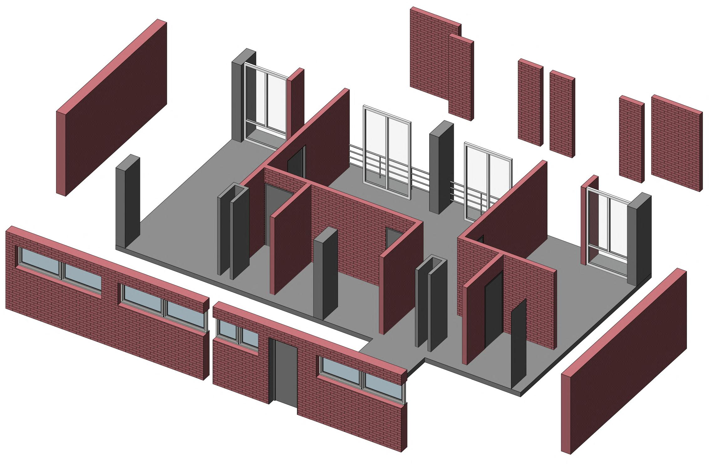 Exploded 3d view


3d
Residential module_02
view

Exploded 3d view


module_01 3d view
Residential
Exploded 3d view

The New European Bauhaus brings citizens, experts, businesses, and institutions together to reimagine sustainable living in Europe and beyond. In addition to creating a platform for experimentation and connection, the initiative supports positive change also by providing access to EU funding for beautiful, sustainable, and inclusive projects.
To accelerate the green transition, contribute to the recovery and to ensure a better living together for all, we have to capitalise on the existing wealth of knowledge, experience and capacities as much as to call for new visions, new ideas and new solutions.

JOURNEY TOWARDS LOST FREEDOM
BREAK FREE FROM CAGE
MASTER STUDIO WORK
INSTRUCTOR : Prof. Amelie Rost
INDIVIDUAL WORK
SPREE STUDIO was focused on analyzing the core area of river spree in Berlin in terms of its past and current context withe imagination of future ideas . With the process further , we tried to tell individual story of us about Spree river and how we want to see it in near future. I tried to nd out my story in my way about how I felt spree river being a valuable cultural and historical part of the heart of Berlin. We started with Spree park and nished with museum island. My story about spree was being lost and caged and I named it as JOURNEY TOWARDS LOST FREEDOM , BREAK FREE FROM CAGE.
We started working with spree and analysed its historical context and sorrundings in terms of urban layer. I mostly focused in the mitte portion of spree and anlysed accordingly.From my analysis I gured out some key points along spree shoreline which are dening the story of this portion of spree. So there was some problems, also some qualities , some new demands from the user point of view and nally my own interest how this area should be used or can be developed in terms of architectural consideration with the context keep in mind.After doing the analysis, I tried to gather some words about spree and its sorroundings and try to express it in a lyrical way .Again, I collected some words regarding the emotions I felt while analysing the spree and what its trying to tell us. And this is how I got the idea of developing my spatial design

SITE LOCATION & CONTEXT
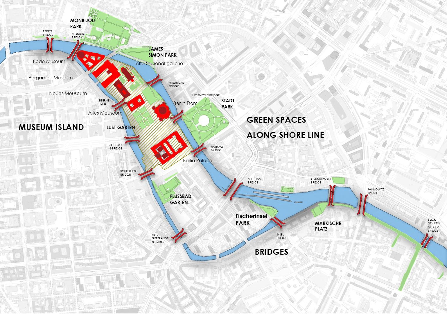
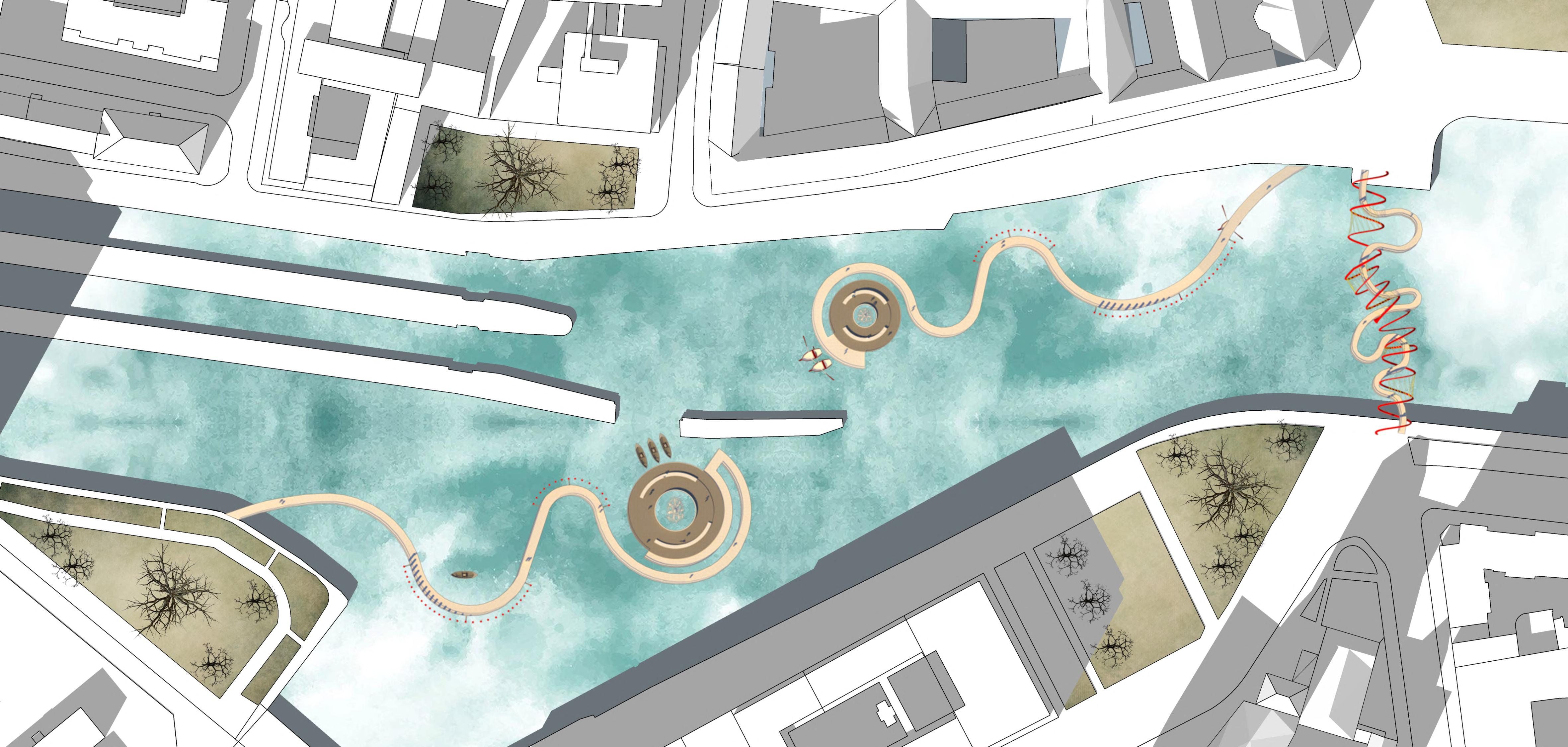
As I worked in mitte portion of spree and this area of spree already quite narrow and have some historical importance, I choose this junctional point to place my spatial design. My main idea was to create an invisible meuseum here and all the elements of my spatial design will be the exhibits of this meuseum. I selected the green area of Markischer Platz and the opposite side of this to be linked through a pedestrian bridge and this bridge will also resemble the cage . The other green area of this site is Fischerinsel park and I choose this park as a starting point of the journey towards freedom deck
 SPREE PARK
MUSEUM ISLAND
SPREE RIVER
CRITICAL OBSERVATION
PROBLEMS: Ignoring the view by placing back side of the building towards spree, Water level variation due to dam lock, Limitation on access to the water
QUALITIES: Historical importance, Tourist attraction
NEW DEMANDS : More access to the water needed, land water relationship need to increase, Canal needs to convert into vibrant water space.
INTEREST : Open spaces along shore line can be closer to water, Bridges can be utilised
S t a r t i n g o f j o u r n e y t o w a r d s f r e e d o m


J o u r n e y o f i m p r i s o n m e n t / c a g e d
F r e e d o m d e c k
G r o u n d l e v e l
Connecting ground surface with water/bringing people close to water


CONCEPTUAL APPROACH


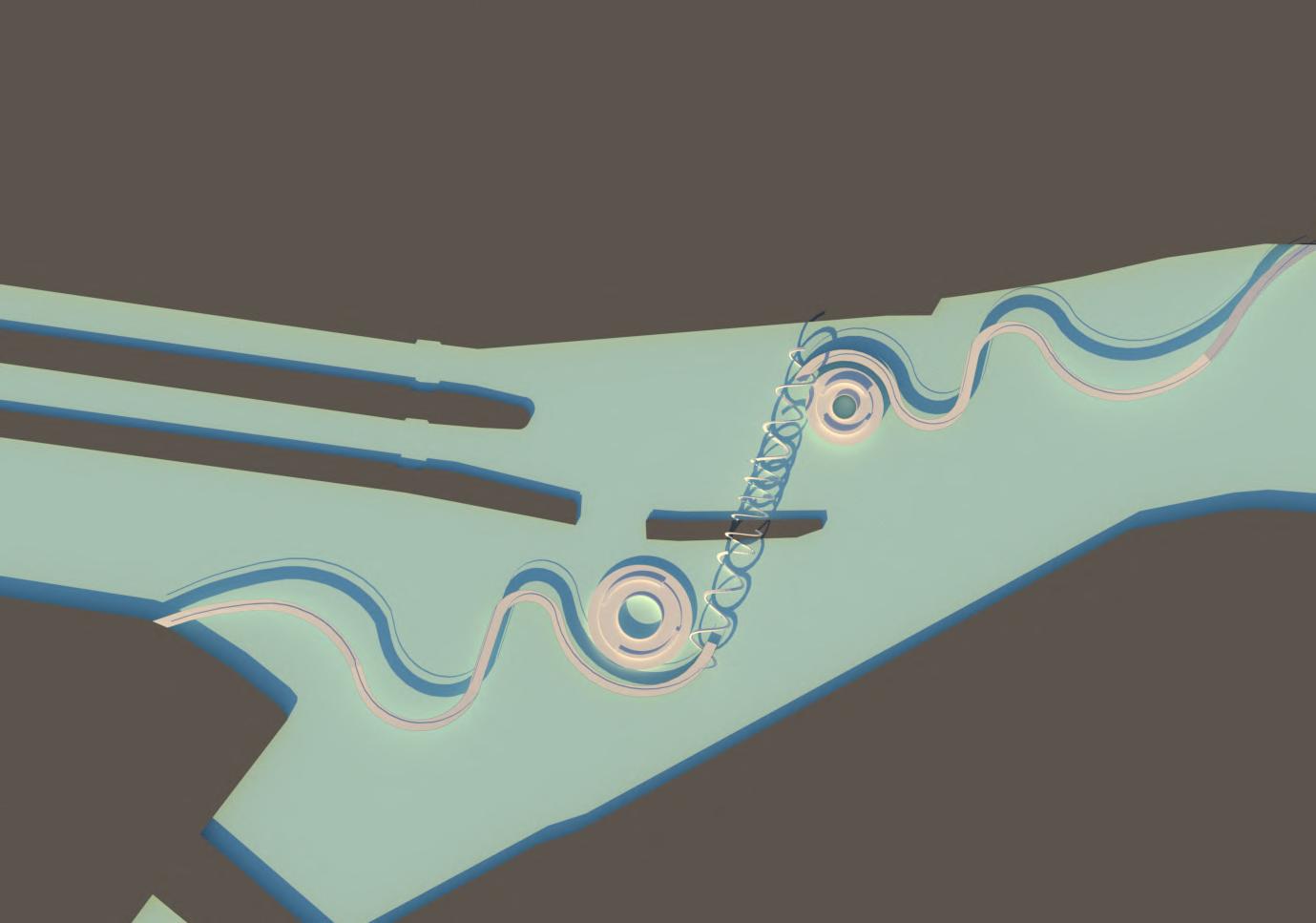
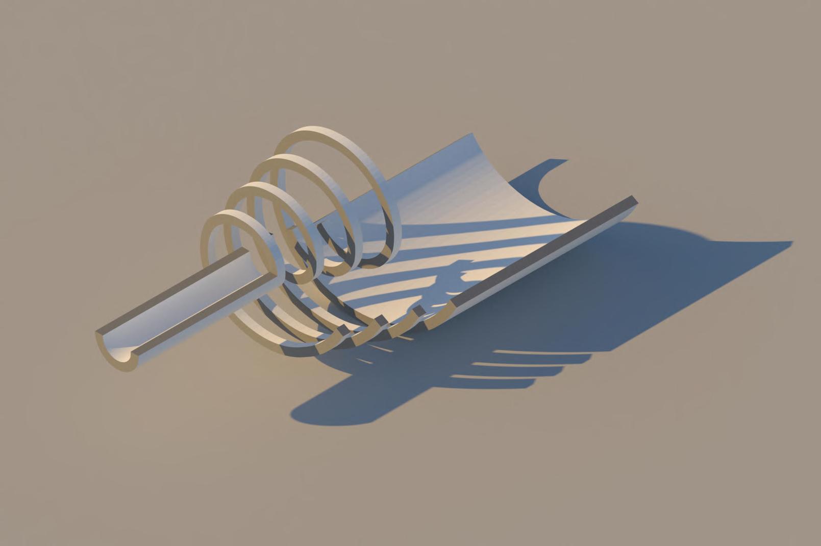
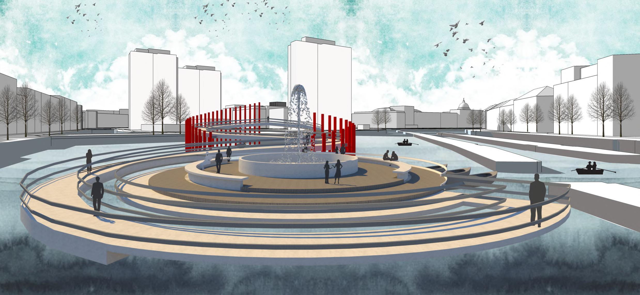
I tried to put all those emotions in a spatial design and developed a concept which I named journey towards freedom I divided this journey into three phase. It will start with the long narrow passage and will end up with a vast area which I am calling freedom deck. In between this journey there will be some ring or spiral elements which will resemble the cage or feeling of imprisonment. Through this journey people will come close to water and there will be a connection between land and water.

W a t e r l e v e l
Looking back to the journey of getting freedom
SITE MAP 01 02 03

03 02 01 04 01. Starting of the journey 02. Journey to Freedom Deck 03. Freedom Deck 04. Bridge As a Cage
BRIDGE AS CAGE
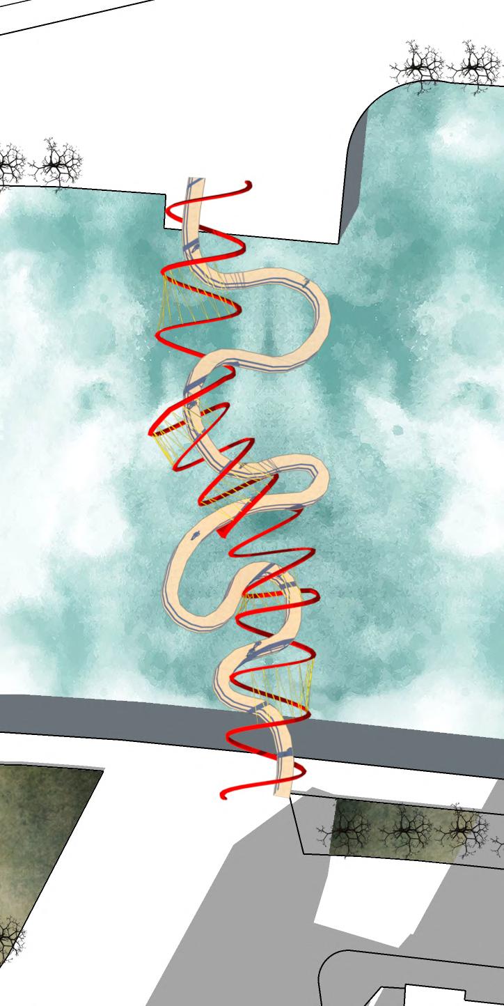
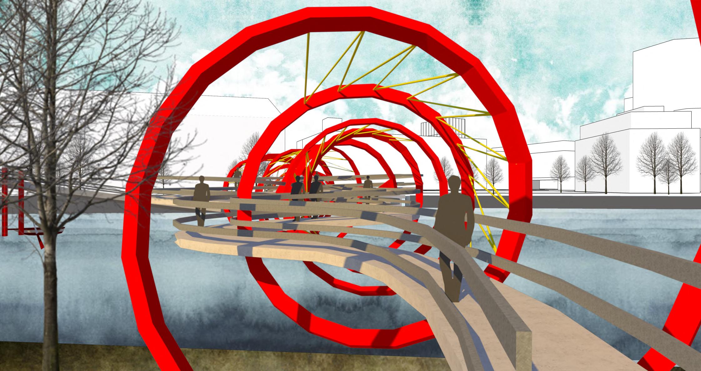
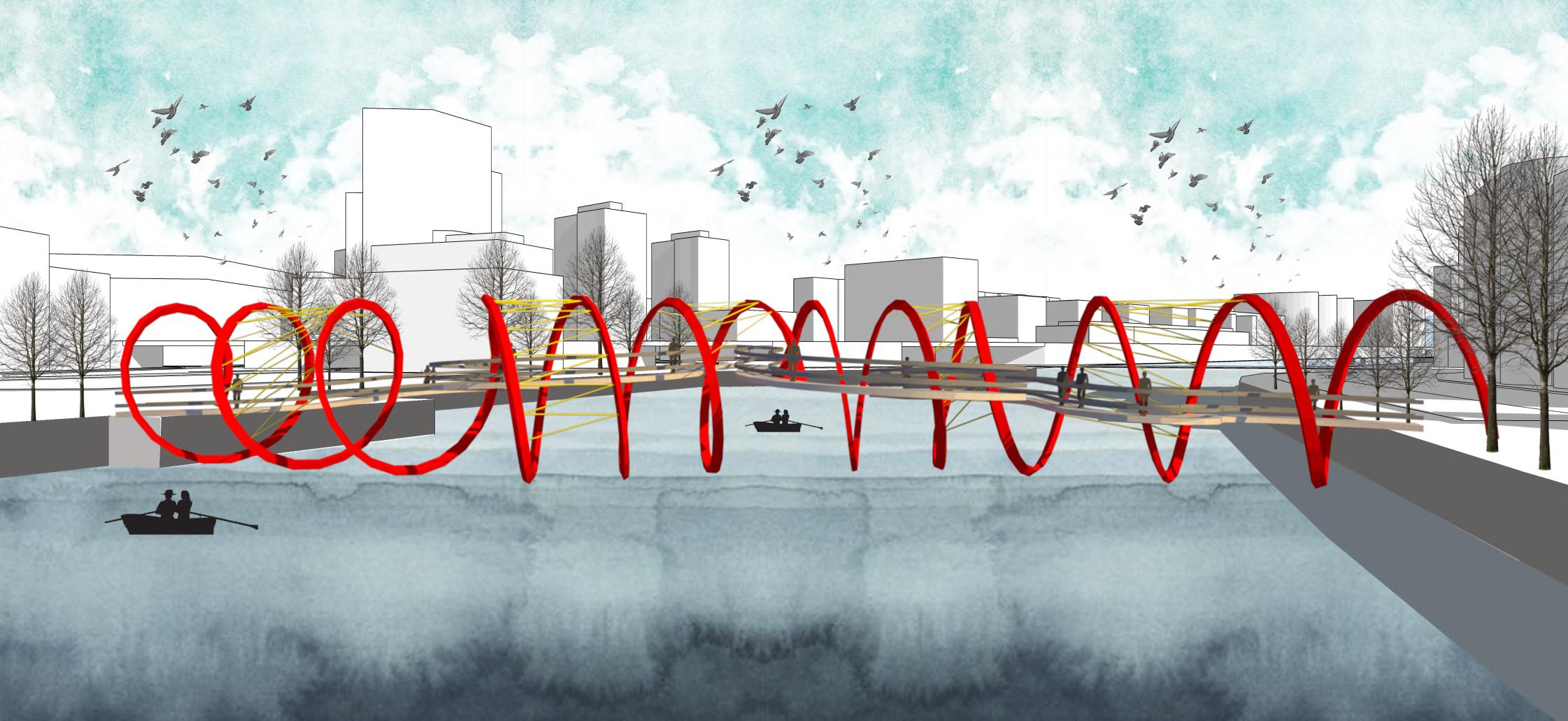
Here is the pedestrian bridge as cage I choose the curved zigzag pathway to have the feeling of struggle while passing through it and the red colored spiral curtain steel will give a contrasting look to symbolize the expression of imprisonment. I used the spikes connecting the spiral to have the feeling of more connement

spiral curtain steel
concrete pile head walkway level

pile under water
pile bored into ground
string support for spiral curtain steel spiral curtain steel as a symbol of cage
zigzag padestrian walkway as a symbol os struggle
SECTION
TOP VIEW
 VIEW FROM SHORE LNE
VIEW FROM RIVER
TOP


VIEW FROM THE DECK

curtain stell bar freedom deck fountain boating dek padestrian walkway starting of the journey
SOUTH ELEVATION VIEW
JOURNEY TOWARDS FREEDOM DECK


The long curved pedestrian walkway to freedom deck. While going for the freedom deck there will be some vertical bars as a symbol of the difculties or ups and downs, because freedom is not very easy to get. And this long curved pedestrian will also act as the observation area of the invisible meuseum I wanted to create. As there are some historical features here like MILL DAM LOCK and markishces meuseum already exist, so this pedestrian will work as the view point of this historical features also.
ELEVATION

EAST
EXPLODED VIEW
curtain steel bar horizontal support
railling
padestrian walkway
VIEW FROM WALKWAY
seating central well railling main deck boating deck

FREEDOM DECK

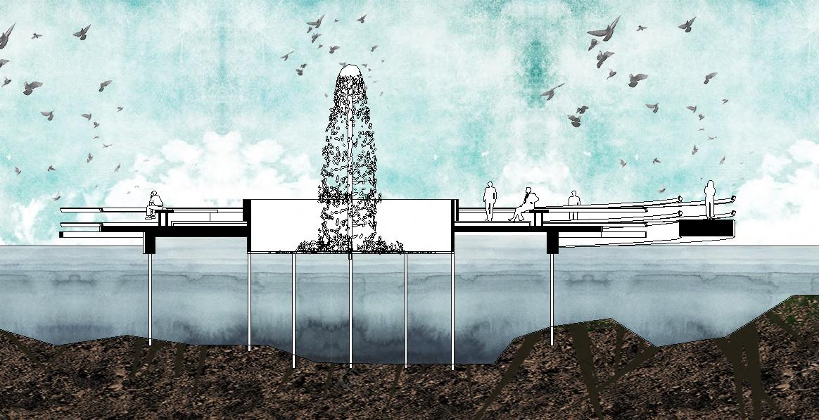
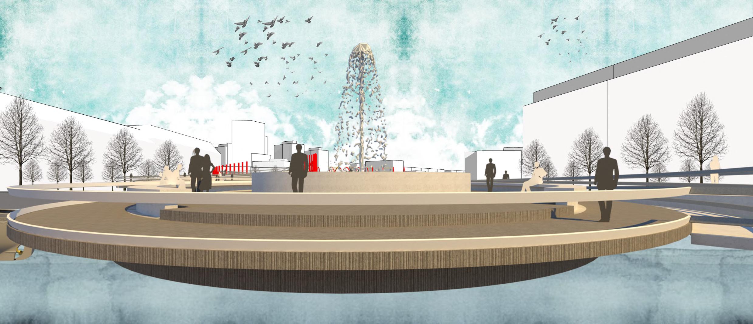
The freedom deck. I thought it as a place where people will have calm and serene environment and free from all other things and can spent a peaceful time. I put a fountain in the middle to resemble the expression of free owing water against all odd. TOP VIEW DECK_01 SECTION
 VIEW FROM BOATING DECK
VIEW FROM SHORELINE

SPREE STORY………….

I AM SPREE
The heart of mitte
You might heard of spree park,
It happened to be my eyes, but Those eyes are closed now.
You can’t see the beauty of nature as seen before through those eyes
I didn’t loose my way I sprinted through adversity, it’s on my nature
On my way, I was ignored, imprisoned, caged As if I was sinner.
Once I was the torchbearer , but now I am being subordinated, Treated like parasite
Can you break my cage?
Help me y like before?
Can you give me my freedom back ?
CULTURAL CENTRE FOR IRAN
UNDERGRADUATE DESIGN STUDIO X (THESIS)
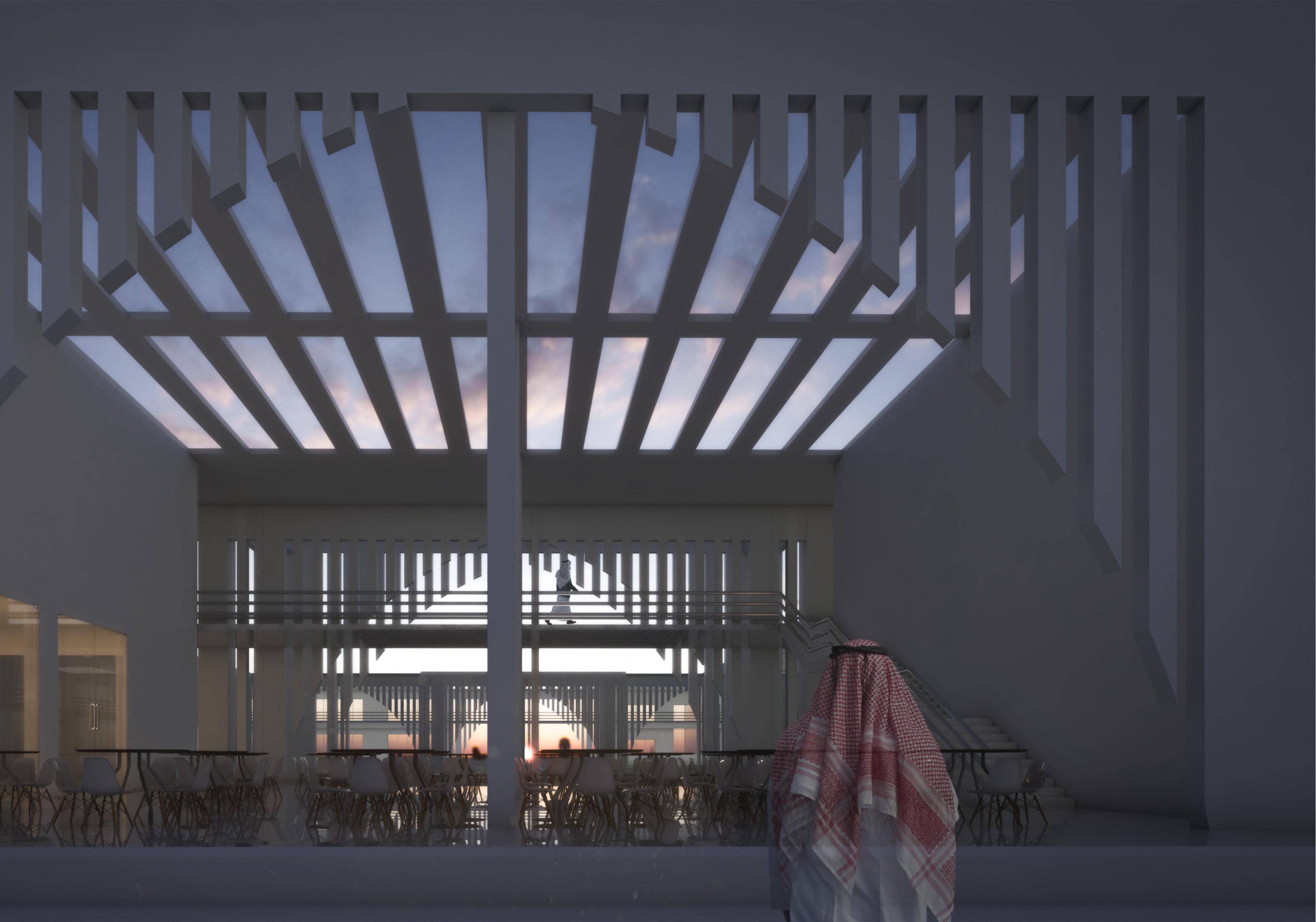
LOCATION : Tongi, Gazipur, Bangladesh
CLIENT : Cultural Counselor , Embassy of Islamic Republic of Iran, Dhaka
FINANCED BY : Government of Islamic Republic of Iran (Under the supervision of IRI , Dhaka)
SITE AREA : 8 acre (348480 SFT) apx.
BUILT AREA : 1,59,700 sft
INSTRUCTORS:
Dr. M.A. Muktadir, Dr. Bijon Bihari Sharma, Sujaul Islam Khan, Nujaba Binte Kabir, Rigu Sarkar.
SUPERVISOR:
Masudur Rashid
The site for this project is situated at Tongi, Gazipur.This area is developing day by day beside dhaka city.
The major challenge of the project was to maintain the blending character of the Persian architecture, Islamic architecture and local architecture. Because it represents Iran in Bangladesh. The main feature of that country is Islam in both politically and ethically Therefore, the project deserves the character of an Islamic complex Moreover, the location of the project is in Bangladesh, and the maximum user of the complex belongs to Bangladesh. Therefore, it should satisfy their necessity as well as the local climate.
Islam is a very simple religion all along the history. Some simple forms of architecture and simple geometry can represent the simplicity of Islam Decoration (which is derived from Persian heritage) can be expressed in somemodern ways Here ‘simplicity’ can also be a language of expression. Facing of the complex is blended with the local context When one passes beside the complex can feel it a building for his own. There is no alien use the building belongs to. So one can feel very easy to use the building, enjoy the building and after all think over the building.

THE THINKING PROCESS
Islam is a very simple religion all along the history. Some simple forms of architecture and simple geometry can represent the simplicity of Islam. Decoration (which is derived from Persian heritage) can be expressed in somemodern ways. Here ‘simplicity’ can also be a language of expression. Facing of the complex is blended with the local context. When one passes beside the complex can feel it a building for his own. There is no alien use the building belongs to. So one can feel very easy to use the building, enjoy the building and after all think over the building.

LEGEND :
1. Entry/ main Lobby
2.Temporary Exhibition
3.Auditorium
4.Cafeteria
5.Class Room
6.Open Exhibition
7.Library
8.Prayer Hall
9.Residential Block
10.Central court
11.Court of Light
12.Connecting bridge
13.Axis


SITE MAP
6 9


10 11 12 13


mosque axial fountain connecting bridge central court
north elevation
section bb’


basement
entry
central fountain
parking reception
lobby basement entry entry court


section cc’ auditorium basement parking cultural info reception calligraphic wall east elevation


academic info admin gallery parmanent exhibition outdoor exhibition
court if interaction placed between public and private functions for share transitional communication
central court linked up with strong axis to the prayer hall and enclosed with other public semi public and private functions


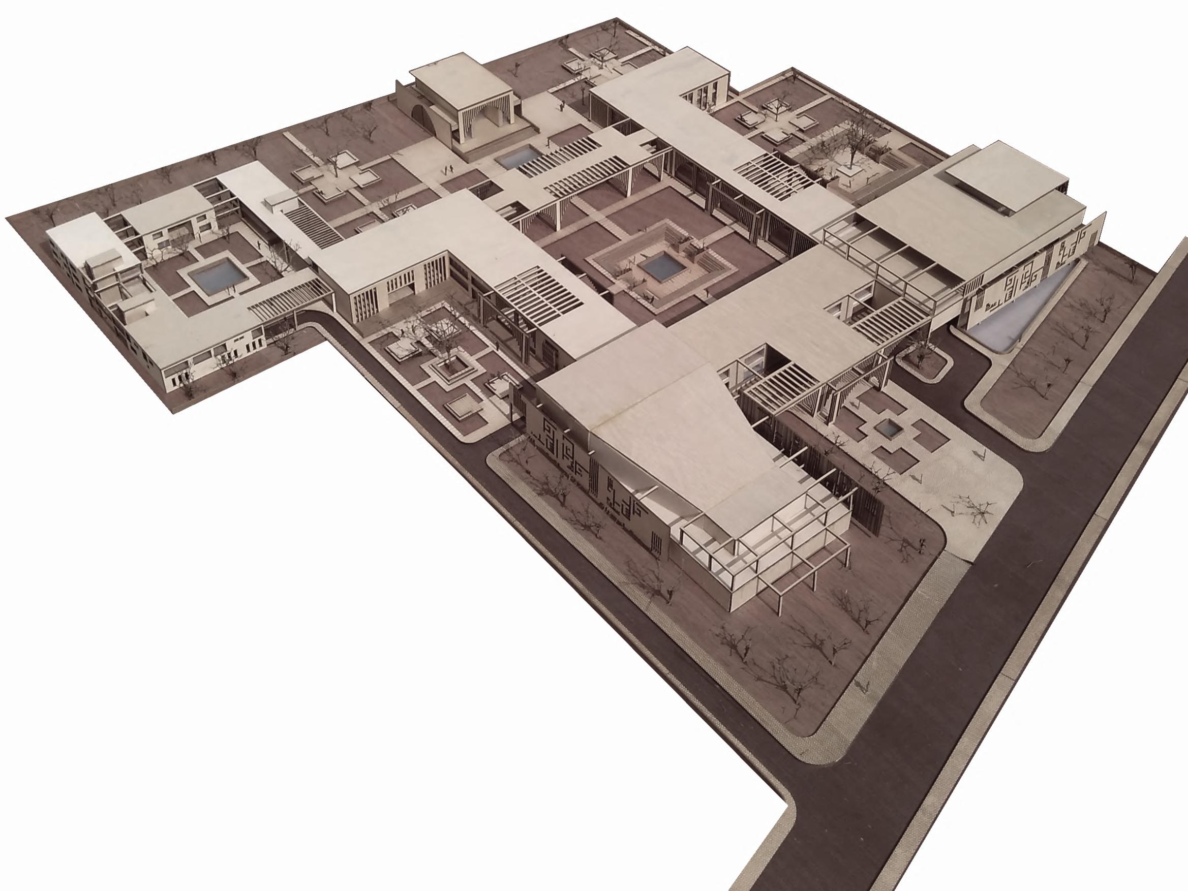 residential block residential block residential block fountain residential block entry open exhibition cultural court cafeteria caligraphic wall auditorium lobby residential block auditorium padestrian entry
ofcers block mosque fountain linking bridge library class room central court education court outdoor exhibition gallery caligraphic wall entry court basement parking
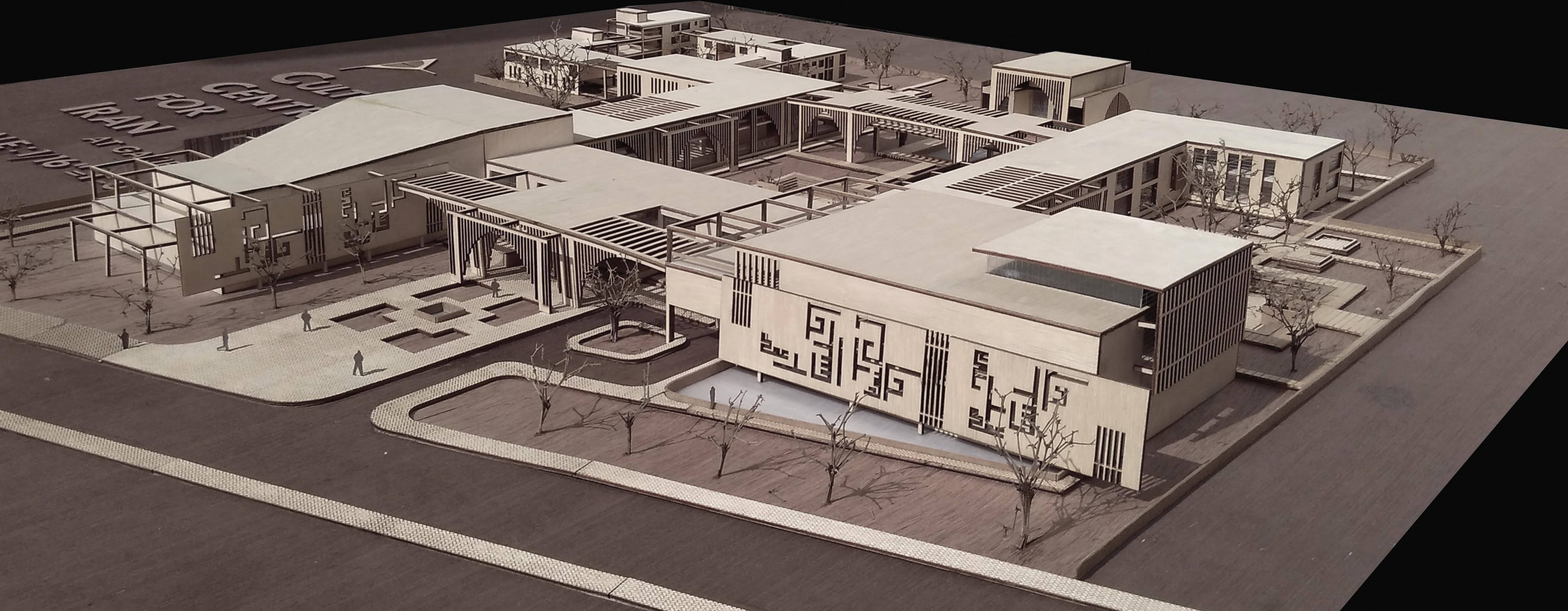
padestrian entry calligraphic wall auditorium entry court entry fountain entry gateway entry fountain admin block residential block cafeteria

central court
connecting bridge educational court exhibition calligraphic wall class rooms mosque gallery library
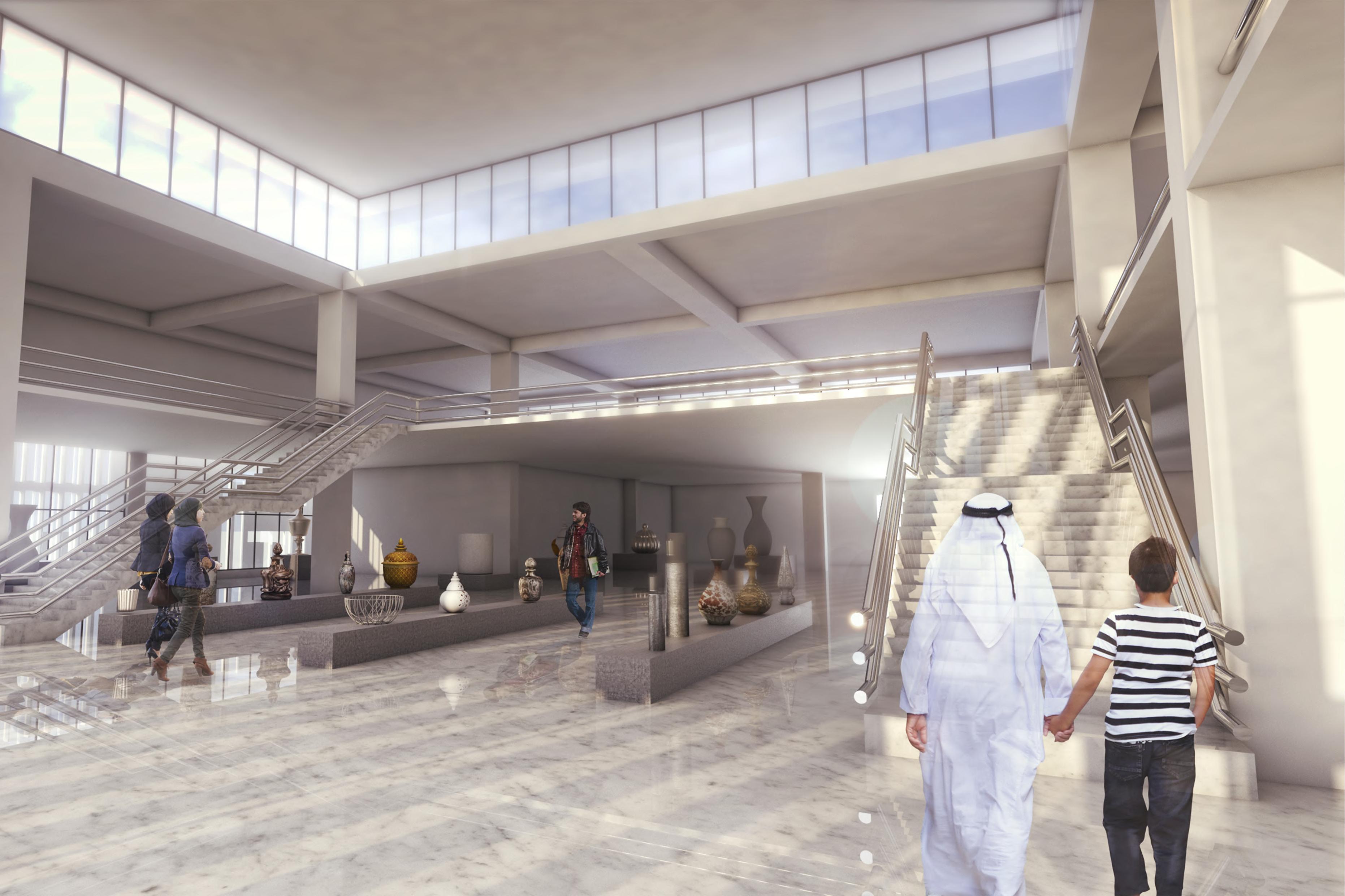 Exhibition space
The idea was to create a place for both the people of Iran and The people of Bangladesh to blend their cultural exchange in a dened place. with the involvment of many cultural organization, this place can play a great role to accomplish the dream .

MYMENSINGH STRATEGIC DEVELOPMENT PLAN (MSDP)
REDESIGN OF IMPORTANT NODAL POINTS
UNDERGRADUATE DESIGN STUDIO VI URBAN DESIGN STUDIO
(GROUP WORK)
Md. Abdullah,Rubaya Jesmin,Ireen Ahmed, Auli Hasan
INSTRUCTORS:
STRATEGIC DEVELOPMENT PLAN OF MYMENSINGH TOWN
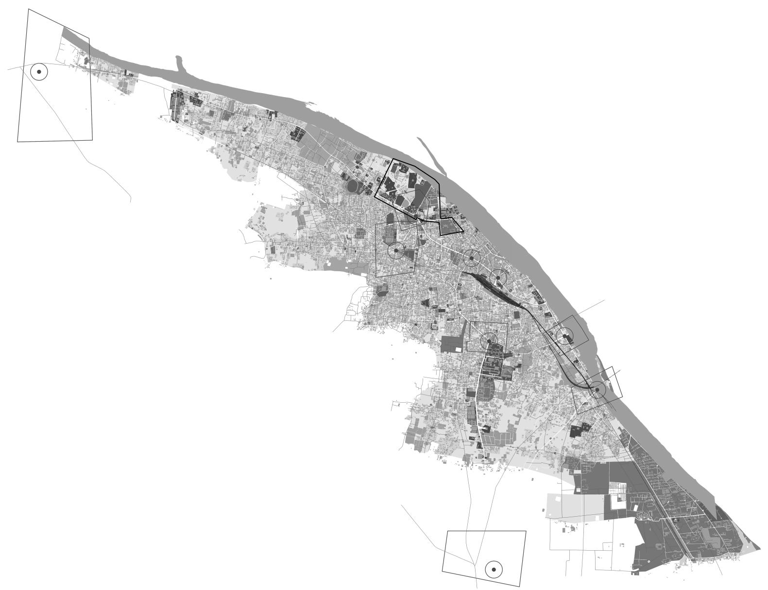
The Mymensingh Pourashava (Municipality lies between the 24043' and 24045' north latitude and 90023' and 90025' east longitude. The project areas constitutes Mymensingh municipality and surrounding 10 (ten) unions of with an area of about 27933 43 hectare ( 69024 70 acre)
Mymensingh Strategic Development Plan (MSDP), 2011 -2031 Project is a a pilot project on “Preparing a Module for Mainstreaming Disaster Risk Reduction Measures into Comprehensive Land Use Development Planning and Management” with the Memorandum of Understanding (MoU) signed between Comprehensive Disaster Management Programme (CDMP)-II of the Ministry of Disaster Management and Relief and Urban Development Directorate (UDD), Ministry of Housing and Public Works. MSDP has won the “Asian Townscape Jury's Award 2014” jointly organized by UN-Habitat for the methodology and database of MSDP Project.The project also selected as a pilot project for examining “Mainstreaming Climate Change into National Urban Policies”-the project implementing jointly by UNESCAP,UNEP and UN-Habitat.
DR. K.Z HOSSAIN TOWFIQ, DIBBENDU SHAHA, NAIMUL AZIZ, MEHER NIGAR

MSDP COLLABORATION WITH ACADEMIC SESSION
Urban Development Directorate (UDD) has taken initiative to designate particular segments of the MSDP for design exercise which is implemented by the Department of Architecture, Ahsanullah University of Science and Technology (AUST). This particular design workout is carried outas academic exercise for Design Studio VII, which is labeled for understanding of the urban complexity and interrelation of complicated issues of architecture,urban design and planning.
In this particular academic exercise, these we participated as a group and designed the project titled as mentioned bellow
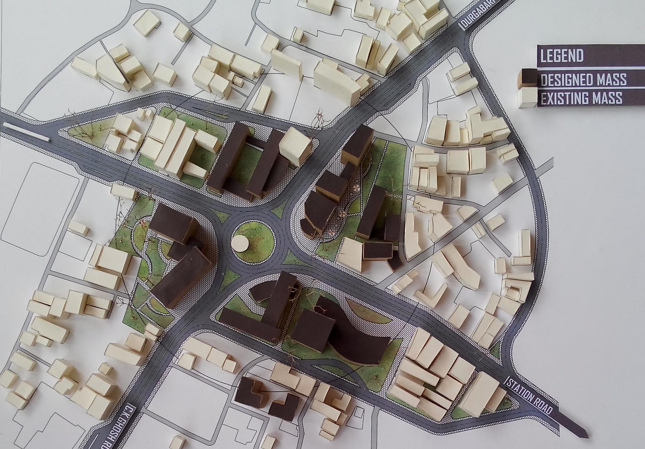
Redesign of Mymensingh Central Railway Station Area as a Central Transportation Hub.
Brahmaputra Nod: riverfront development as a dreamplace of Shilpacharya JainulAbedin
Understanding the dynamics of Shambhuganj Bazar area and its revitalization
Revitalization of Mymensingh historic city core leading to tourism utilizing existing historical and religious heritage .
RAHMATPUR BYPASS NODE
TOWNHALL NODE
SHANKIPARA NODE
GANGINARPAR NODE
STATION NODE
CHARPARA NODE
DHAKA MYM. BYPASS NODE
PATGUDAM NODE
BYPASS NODE
IMPORTANT NODAL POINTS OF MYMENSING
PRIMARY STAGE
IDENTIFICATION OF THE OBJECTS
PRIMAR COLLECTION
FORMULATION OF THE OBJECTS
SECOND COLLECTION
LITERATURE SURVEY & REVIEW
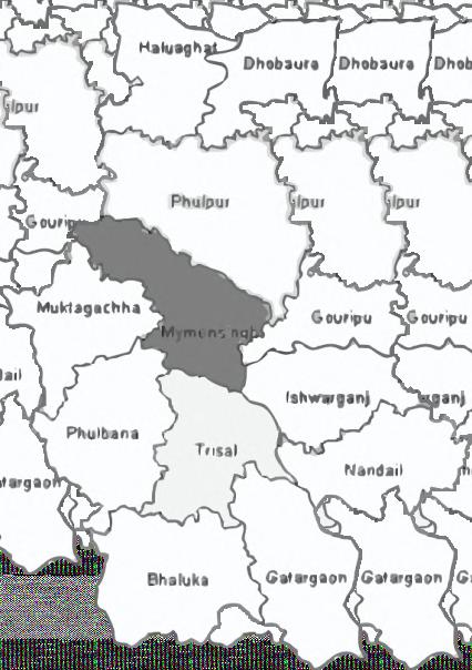
BANGLADESH MAP MYMENSINGH DISTRICT MAP
PRIMARY DATA COLLECTION
SECONDARY DATA
COLLECTION
FIELD SURVEY
LANUSE SURVEY

TRAFFIC ANALYSIS

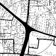

METHODOLOGY OF SURVEY PATGUDAM NODE
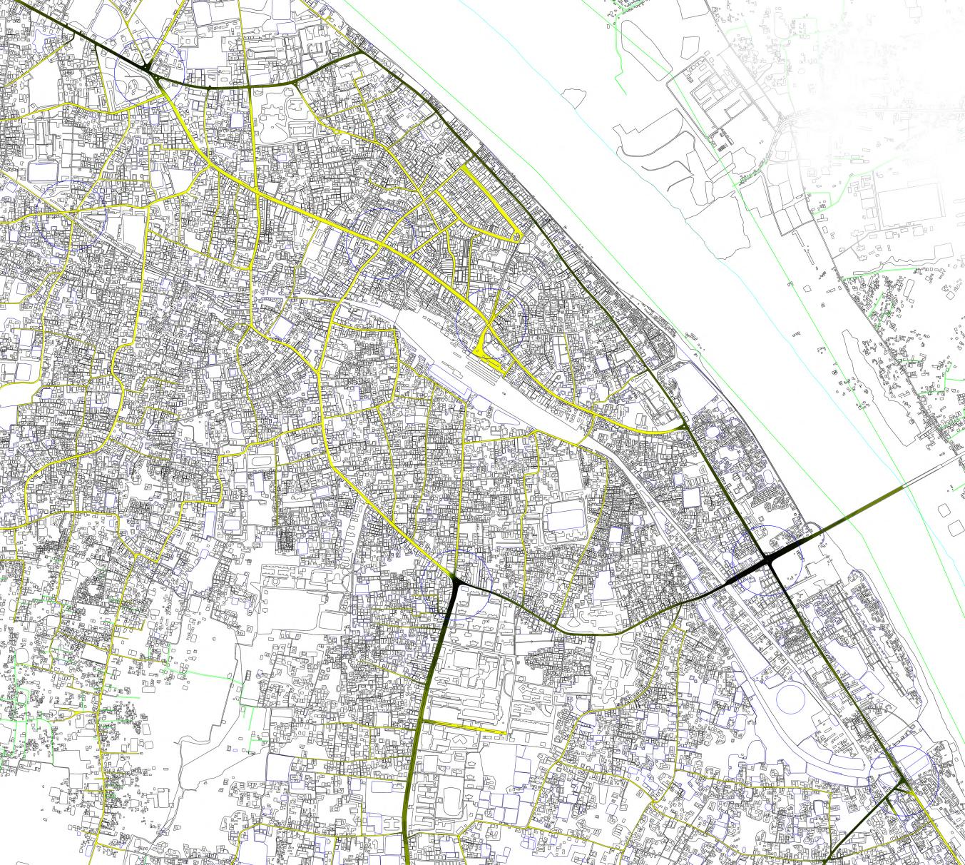
INTERLINKED 3 IMPORTANT NODES
QUES.SURVEY
ROAD USERS DEWELLERS

SPEED STUDY DATA INTERPRETATION
RECOMMENDATIONS
PROBLEM IDENTIFICATION
DIAGNOSIS OF RESULTING PROBLEMS
INTERMIDIATE STAGE FINAL STAGE GANGINARPAR NODE CHARPARA NODE
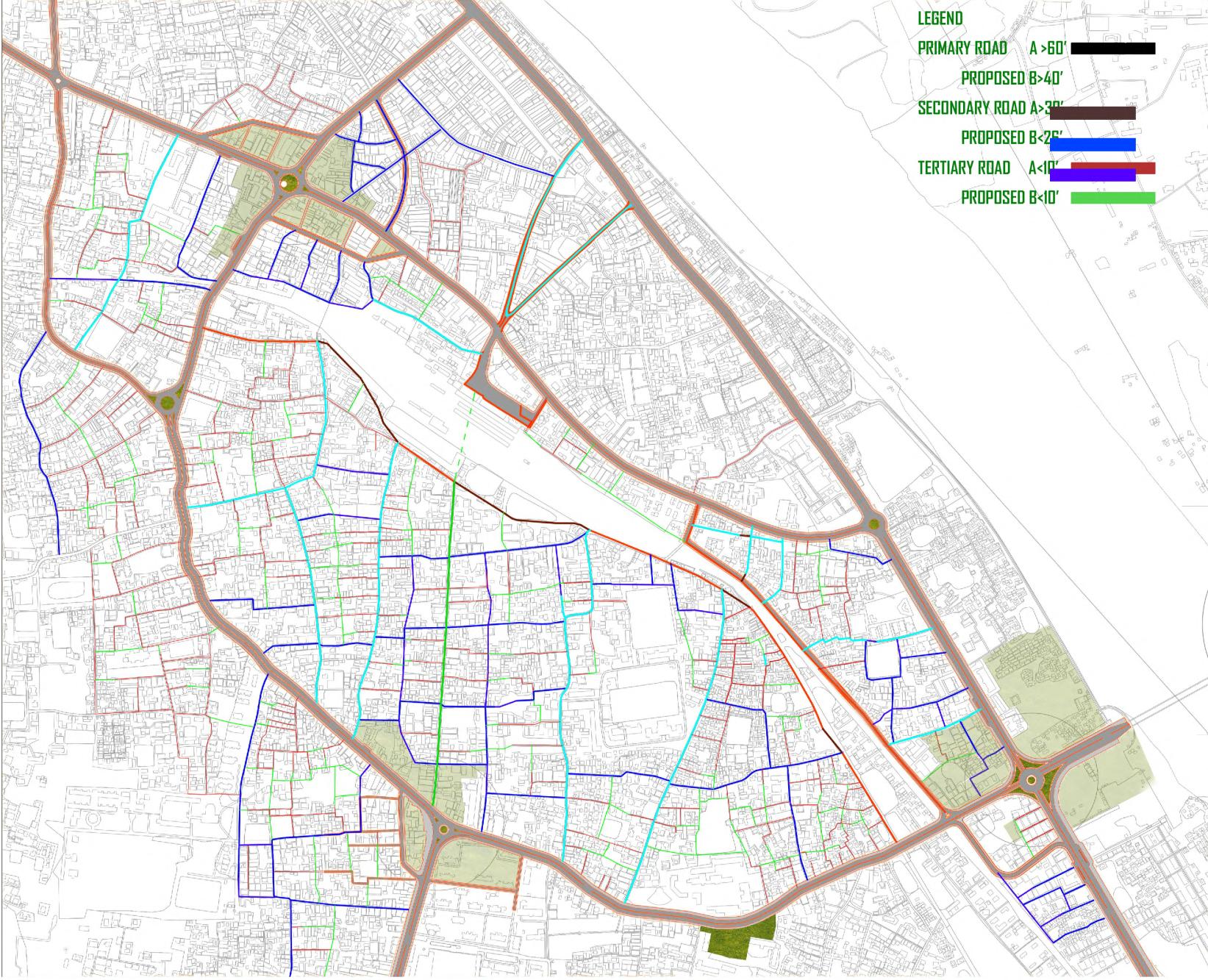
Master plan of Road Hierarchy Landuse plan analysis
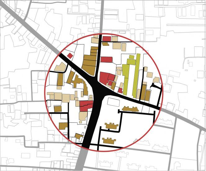



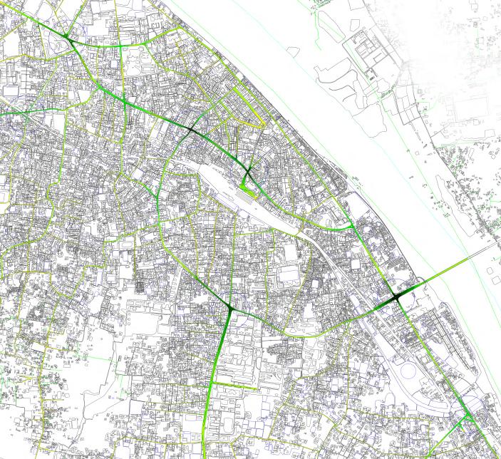

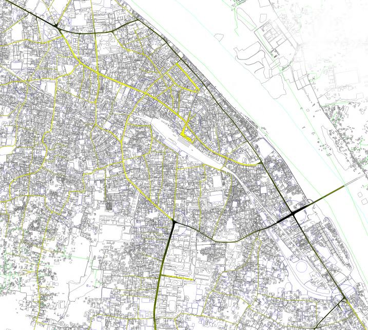
FLOW LEVEL 1 1. TOWNHALL NODE 2. SANKIPARA NODE 3. GANGINARPAR NODE 4. STATION NODE 5. CHARPARA NODE 6. PATGUDAM NODE 7. BYPASS NODE BUS ROUTE 2 3 4 6 5 7 FLOW LEVEL 1. TOWNHALL NODE 2. SANKIPARA NODE 3. GANGINARPAR NODE 4. STATION NODE 5. CHARPARA NODE 6. PATGUDAM NODE 7. BYPASS NODE RICKSHAW, AUTO,BIKE ,CNG ROUTE 1 2 3 4 6 5 7 1. TOWNHALL NODE 2. SANKIPARA NODE 3. GANGINARPAR NODE 4. STATION NODE 5. CHARPARA NODE 6. PATGUDAM NODE 7. BYPASS NODE 1 2 3 4 6 5 7
FLOW LEVEL
TRAFFIC FLOW
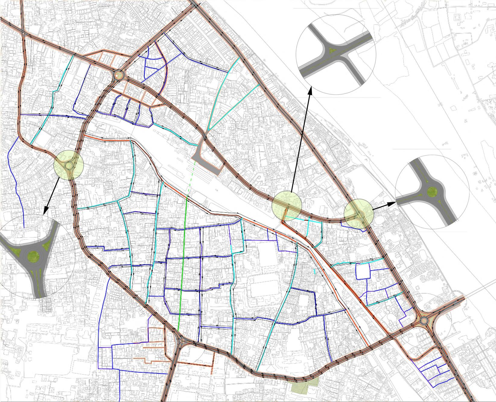
Master plan of Proposed Network


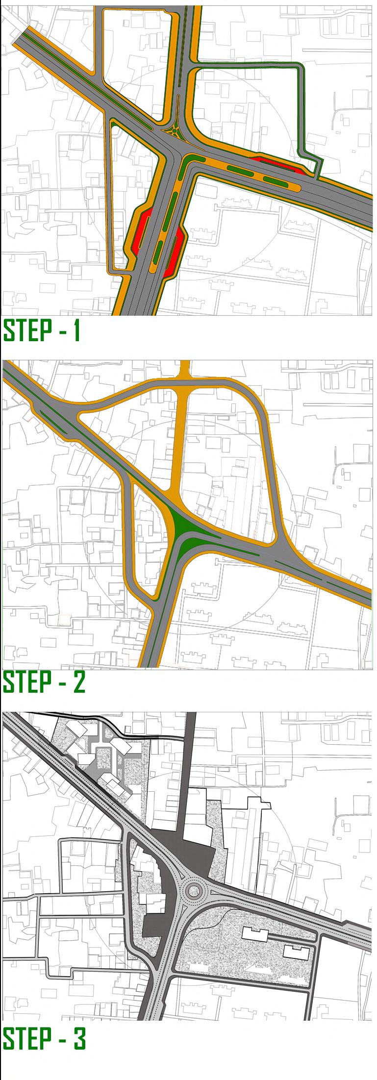
DESIGN DEVELOPMENT PHASE : 01
DESIGN DEVELOPMENT PHASE : 02
DESIGN DEVELOPMENT PHASE : 03
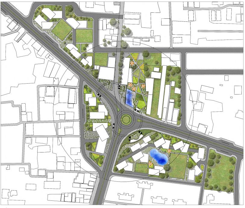
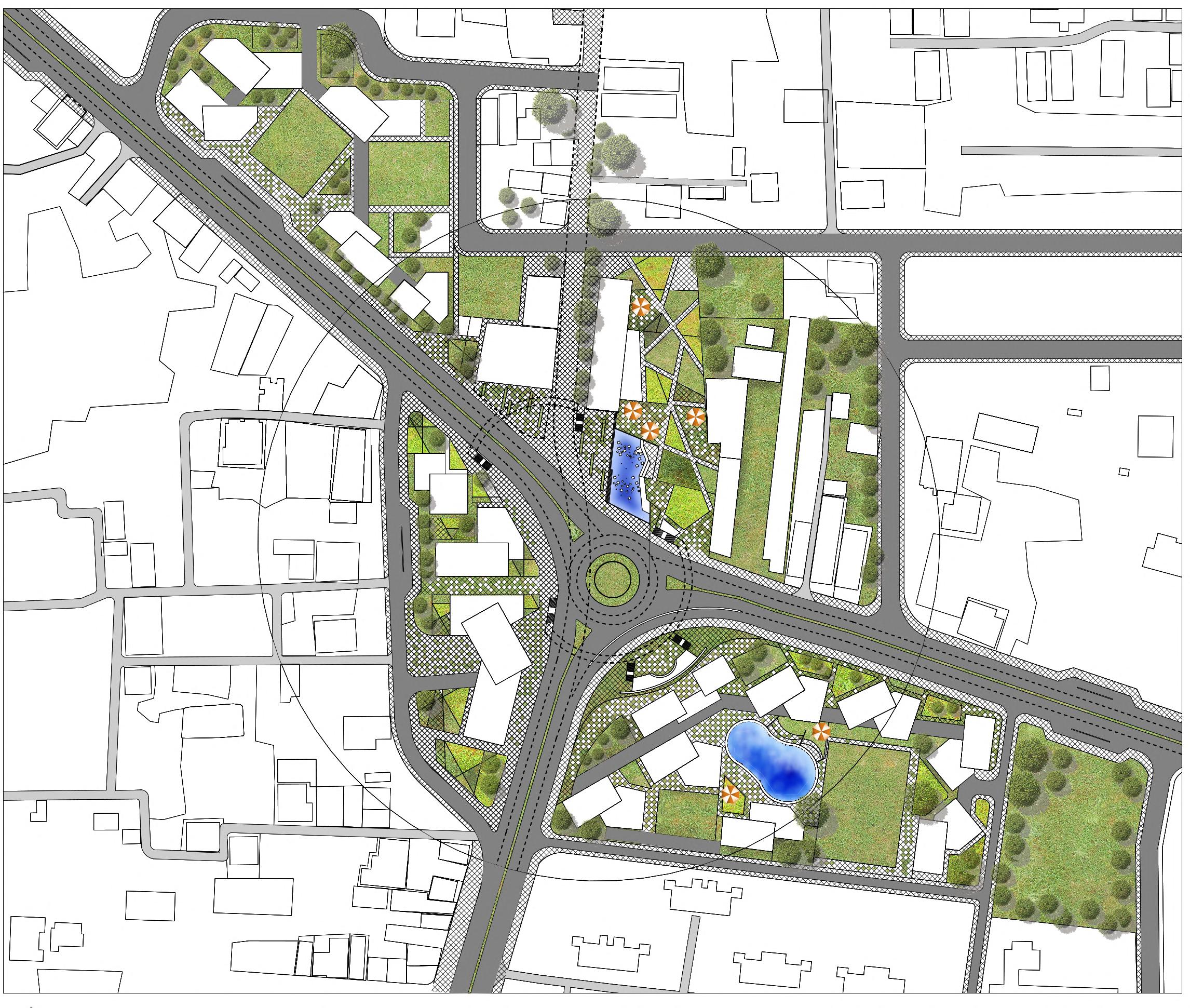
PROPOSED MASTER PLAN
PROPOSED TYPICAL FLOOR PLAN
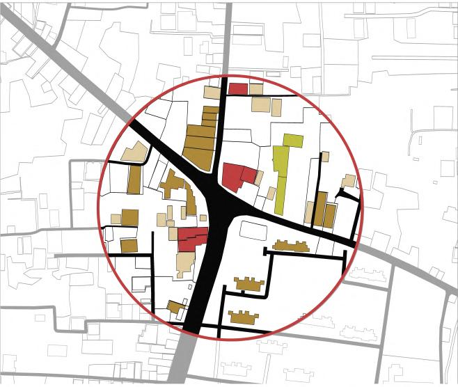
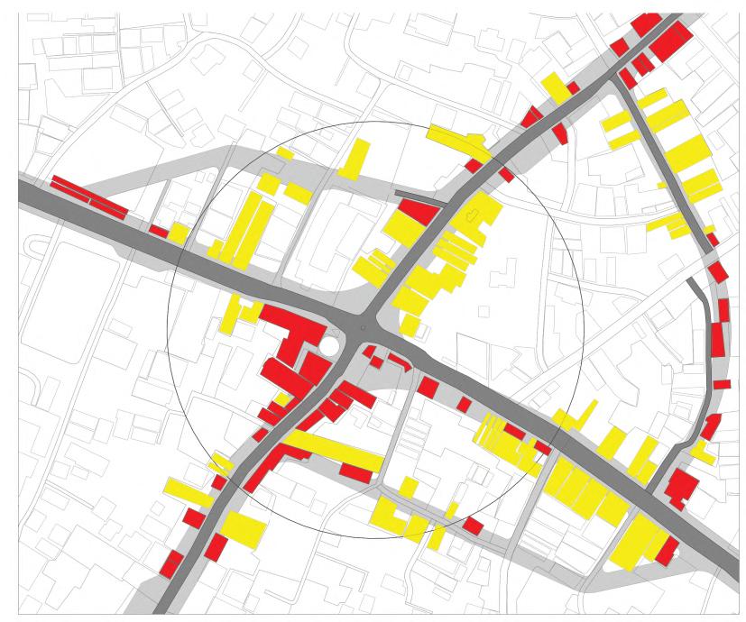
PROPOSED STRUCTURE TO BE AFFECTED
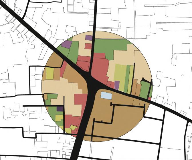
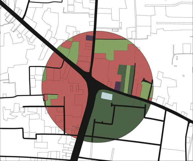
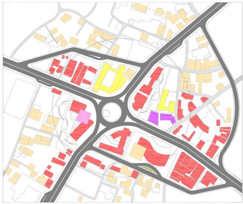
PROPOSED LANDUSE ZONING

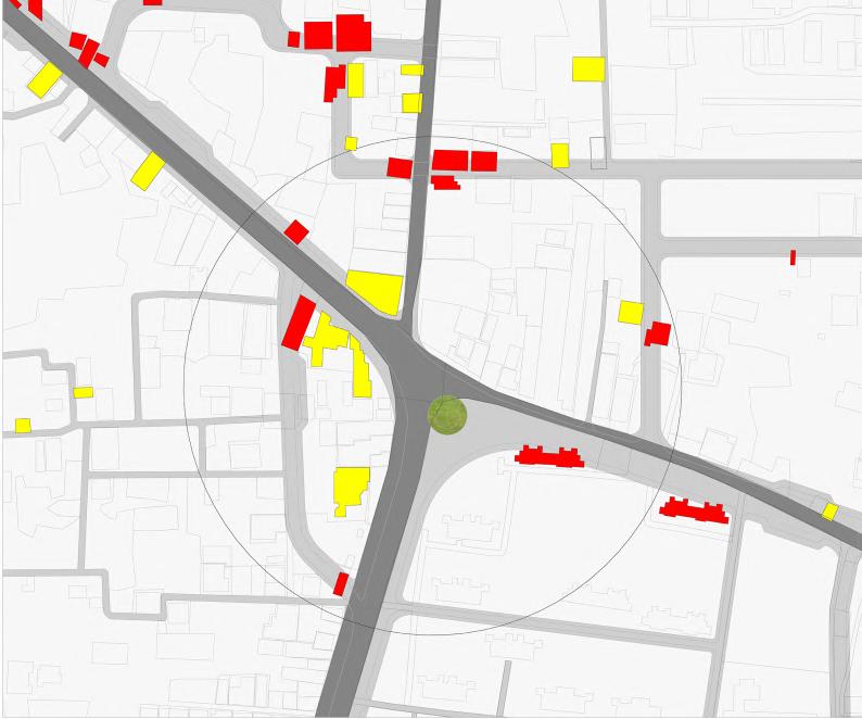
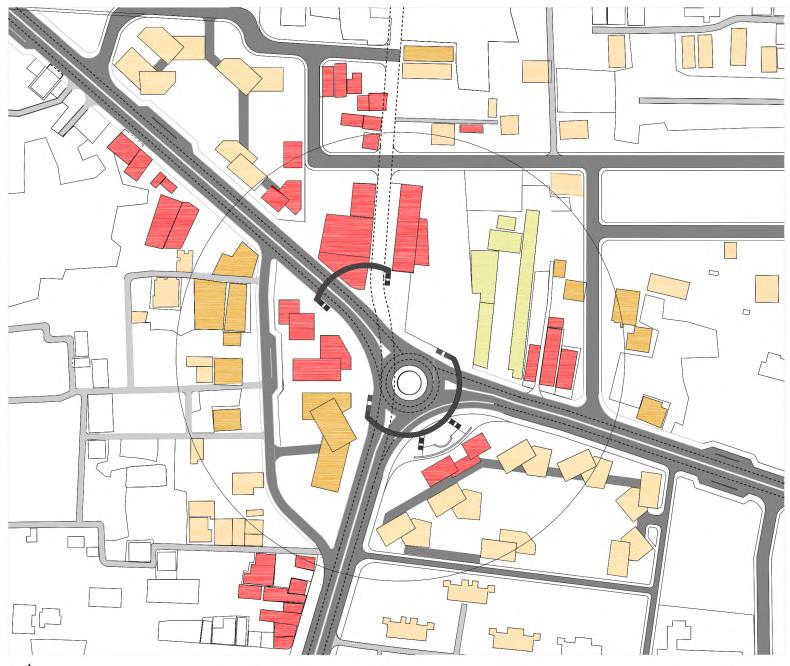

PLAN
FOR CHARPARA NODE
DESIGN DEVELOPMENT PHASE : 01
DESIGN DEVELOPMENT PHASE : 02
DESIGN DEVELOPMENT PHASE : 03 PROPOSED
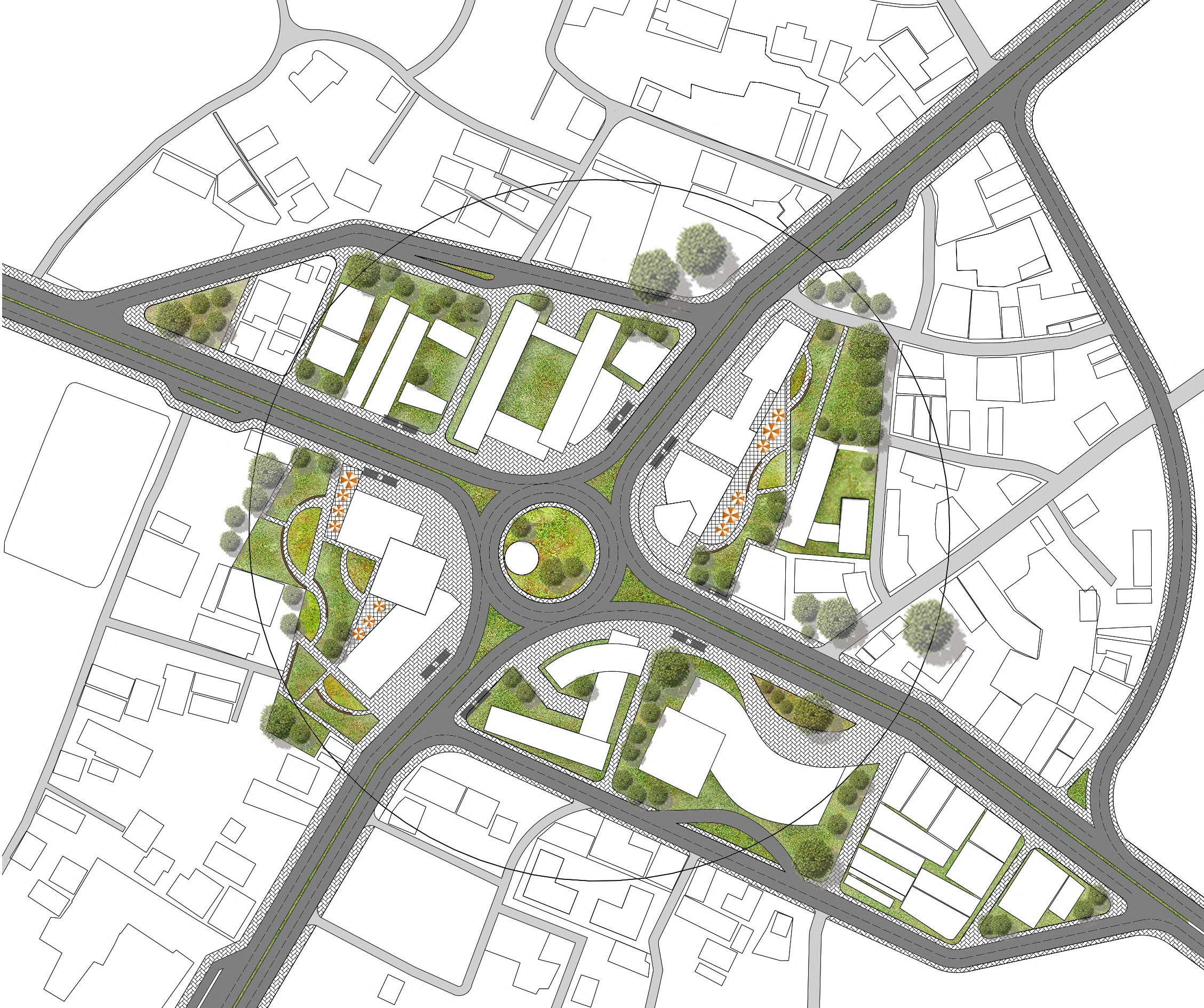

MASTER PLAN
PROPOSED TYPICAL FLOOR PLAN
PROPOSED STRUCTURE TO BE AFFECTED
PROPOSED LANDUSE ZONING


PLAN FOR GANGINAR
NODE
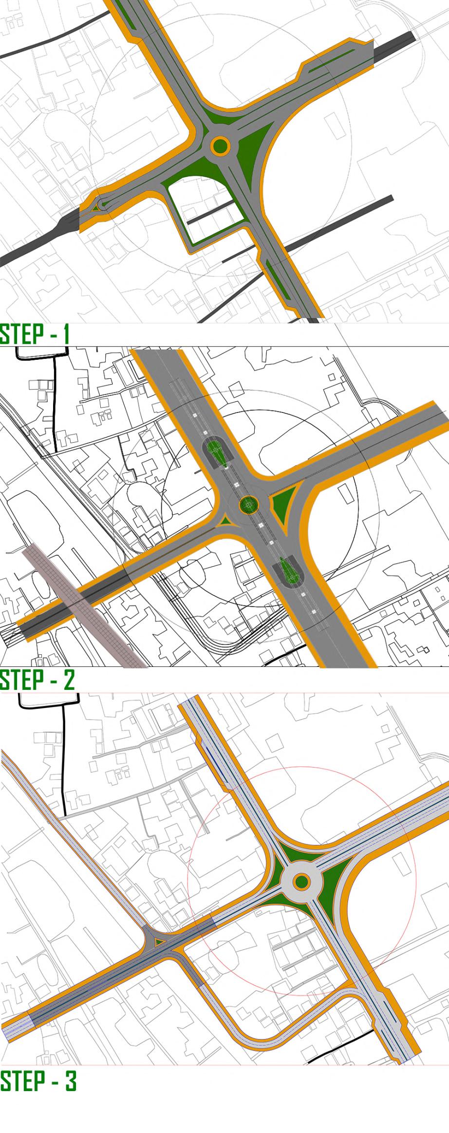
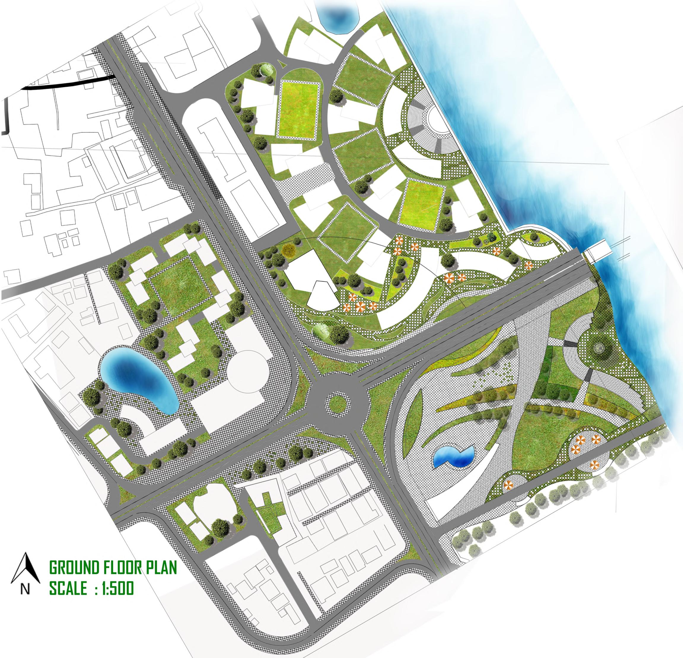
DESIGN DEVELOPMENT
: 01
PHASE
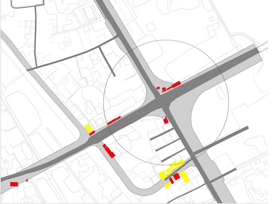
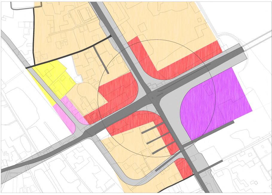
DESIGN DEVELOPMENT PHASE : 02 DESIGN DEVELOPMENT PHASE : 03
PROPOSED TYPICAL FLOOR PLAN
PROPOSED MASTER PLAN FOR PATGUDAM NODE
PROPOSED STRUCTURE TO BE AFFECTED
PROPOSED LANDUSE ZONING



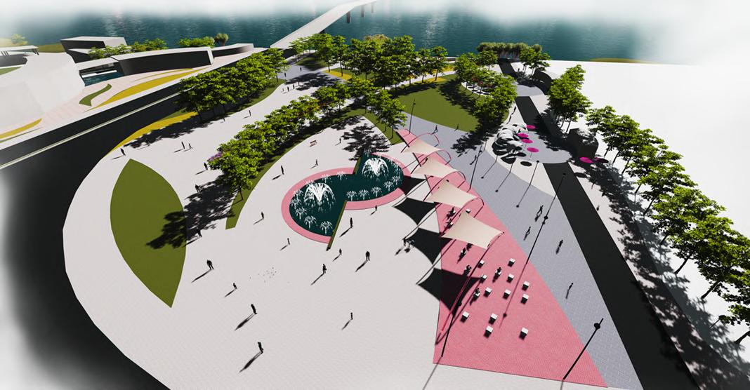
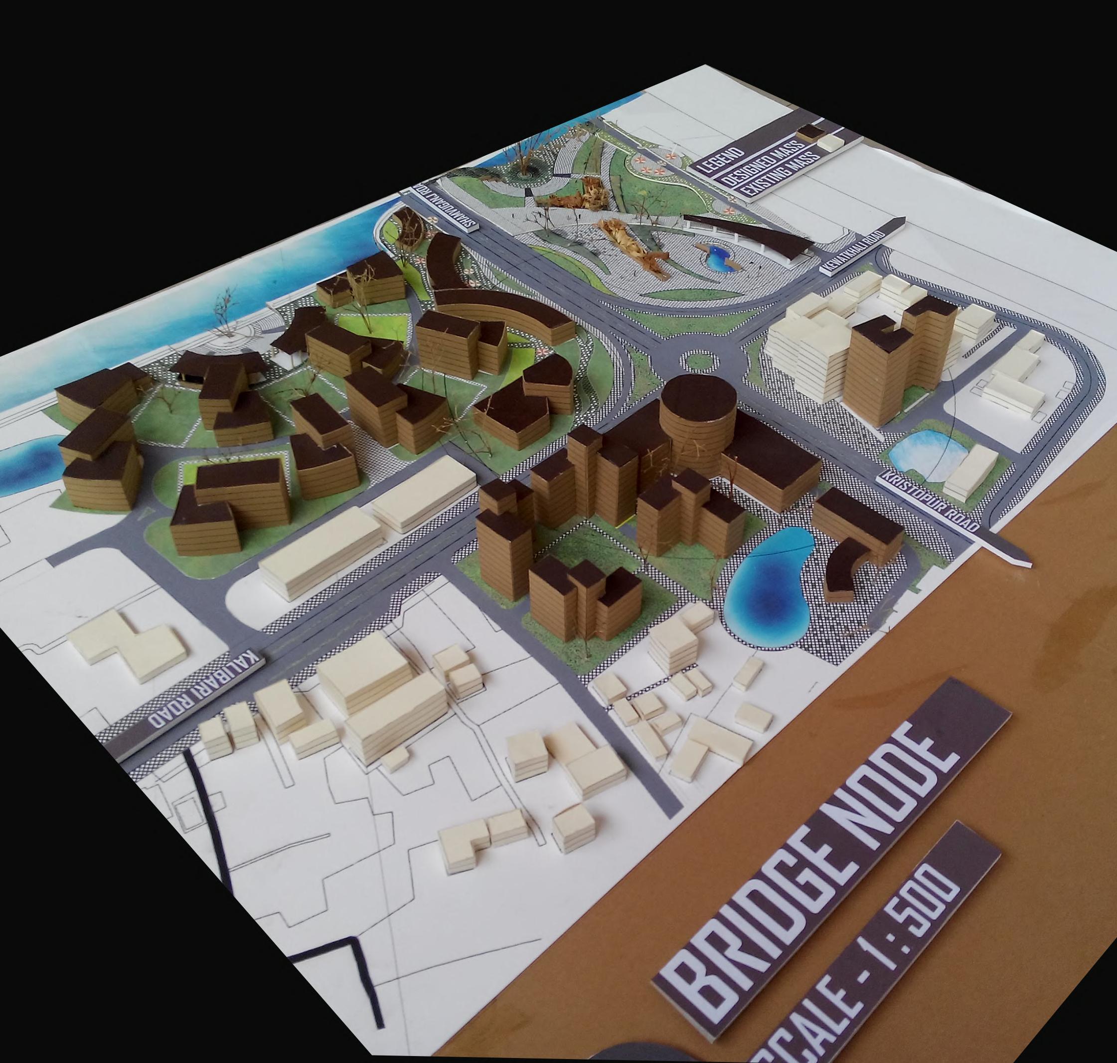
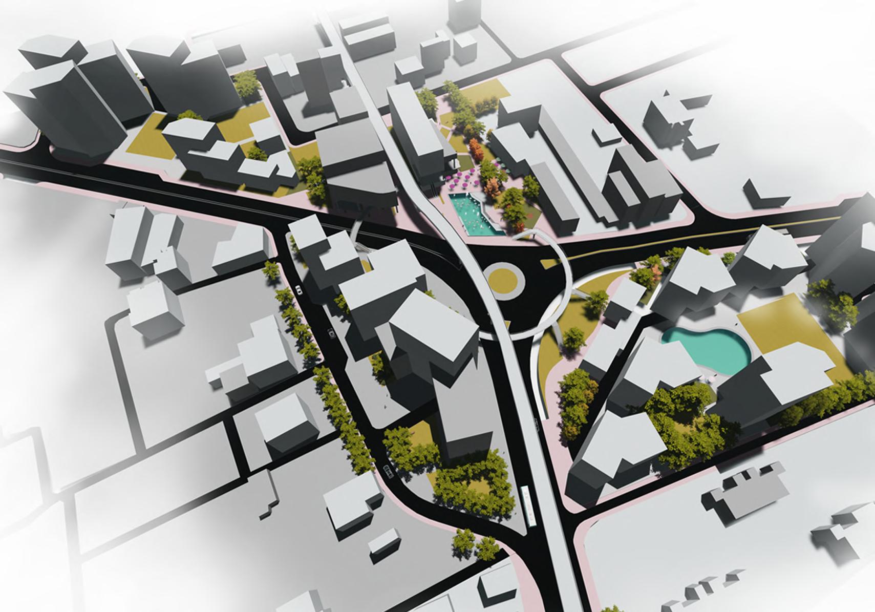
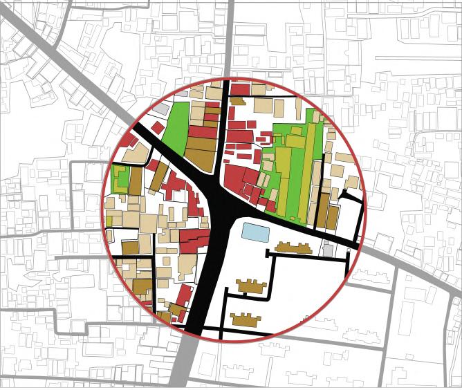
Nodes are points within the city, strategically located, into which the individual enters (and which is often the main focal point to which she or he is travelling to or from.There are often junctions – a crossing or converging of paths They often have a physical element such as a popular hangout for the individual or a plaza area.In many cases,the nodes are the centers of district that are in. A very basic feature of node is junction of transportation system and where the mode of transportation changes.The junction or place of a break in transportation.

SPORTS COMPLEX
UNDERGRADUATE DESIGN STUDIO IX
LOCATION : Dhanmondi, Dhaka, Bangladesh
SITE AREA : 8 acre (348480 SFT) apx.
BUILT AREA : 1,59,700 sft
INSTRUCTORS:
Mahbubul malik, Zishan Fuad Chowdhury.
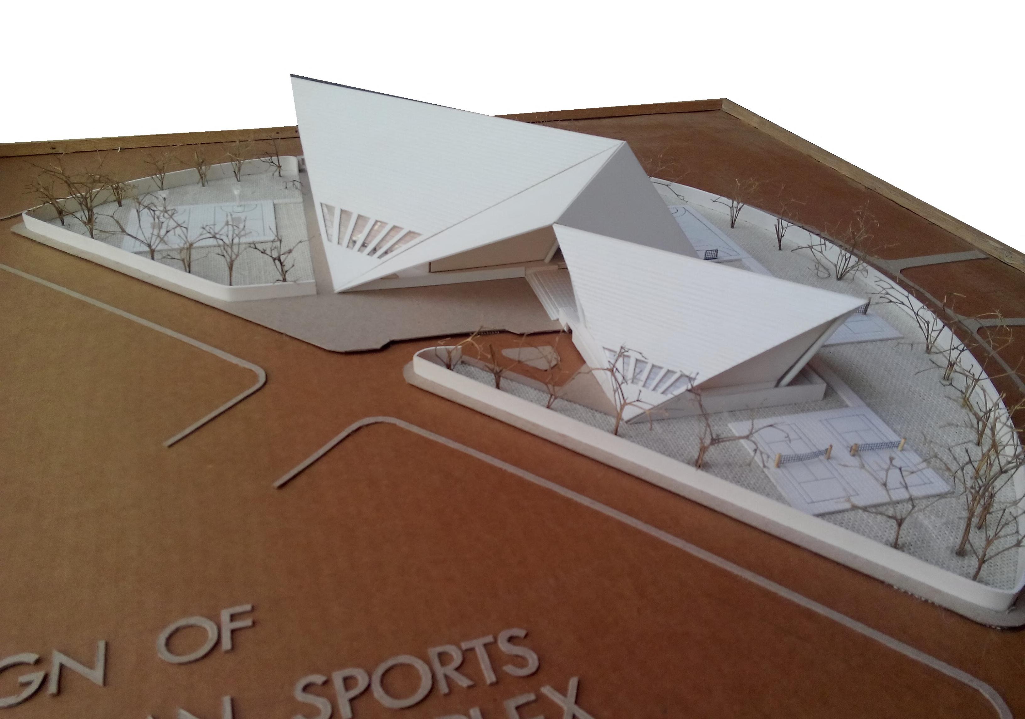
Sports complexes give people the resources they need to exercise throughout the year. Of course, indoor varieties enable you to play a sport rain or shine, but even outdoor facilities provide users with court lines, netting and smooth surfaces for gameplay.
Depending on the setup, players can be protected from environmental elements like UV rays, heavy winds and rain. Some outdoor facilities sit in a shaded location where intense heat is not an issue. An indoor or outdoor sports complex might be just what your community needs to dodge inclement weather and stay on schedule with practices and events. With an indoor sports facility, recreational and professional athletes can compete with accessible heating and air conditioning. Another perk of a sports complex is adequate lighting. Players have the freedom to start games at any time.
A sports court can also include amenities like lockers, changing rooms, restrooms and concession areas. Creating a new sports complex within a city is known to boost the local economy. The all-new sports complex will require workers. Your city could see new part-time, full-time and temporary openings for security, cleaning or food service.

SITE LOCATION & CONTEXT

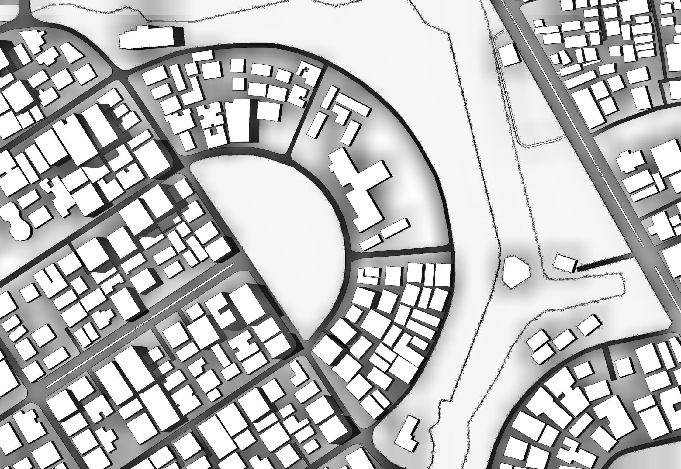
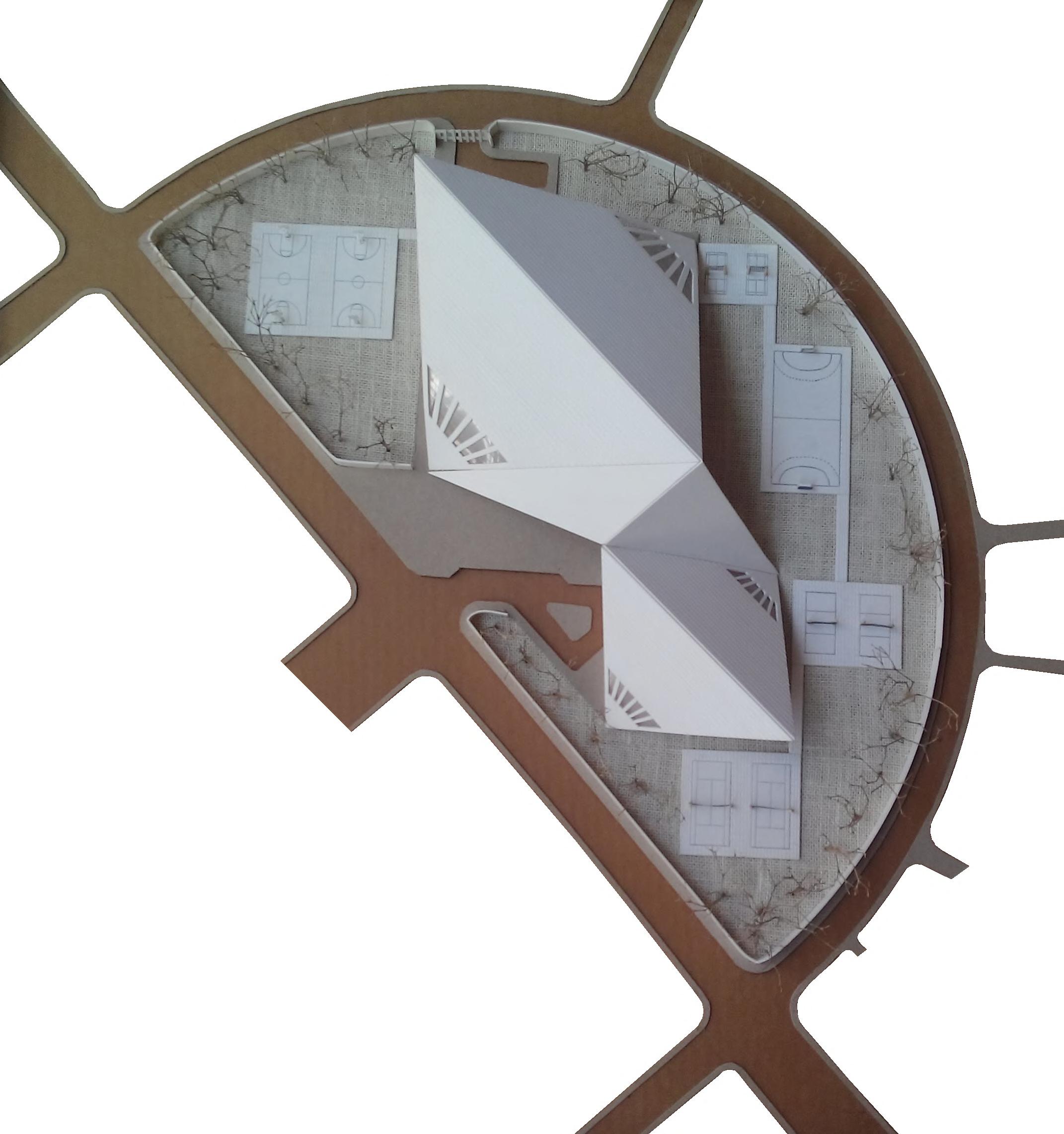
Women’s Sports complex was mainly designed to create activity space dedicated only to women. It is a multi functional complex accommodating several kind of sports and a residential dormitory for the players. The complex is located in Dhanmondi area of dhaka city. This area is mainly residential area. therefore, keeping in mind the complex was designed to create a communal space for the community as well as to promote women sports in Bangladesh. Women sports are still lagging behind in many ways. One of the main aim was to set an example of the possible ways to make more functional and encourage more women to participate in sports activity. In that way, both the sports team and government can share the benet.
SITE
The form was modied in a way that it brings pedestrians


There also needed some external court for practice session
The actual mass was modied according to the recquirements Finally the whole complex with the main hall and swimming pool

?
The site is located at the center of Dhanmondi residential area
The program requirements of the project makes up a huge MASS
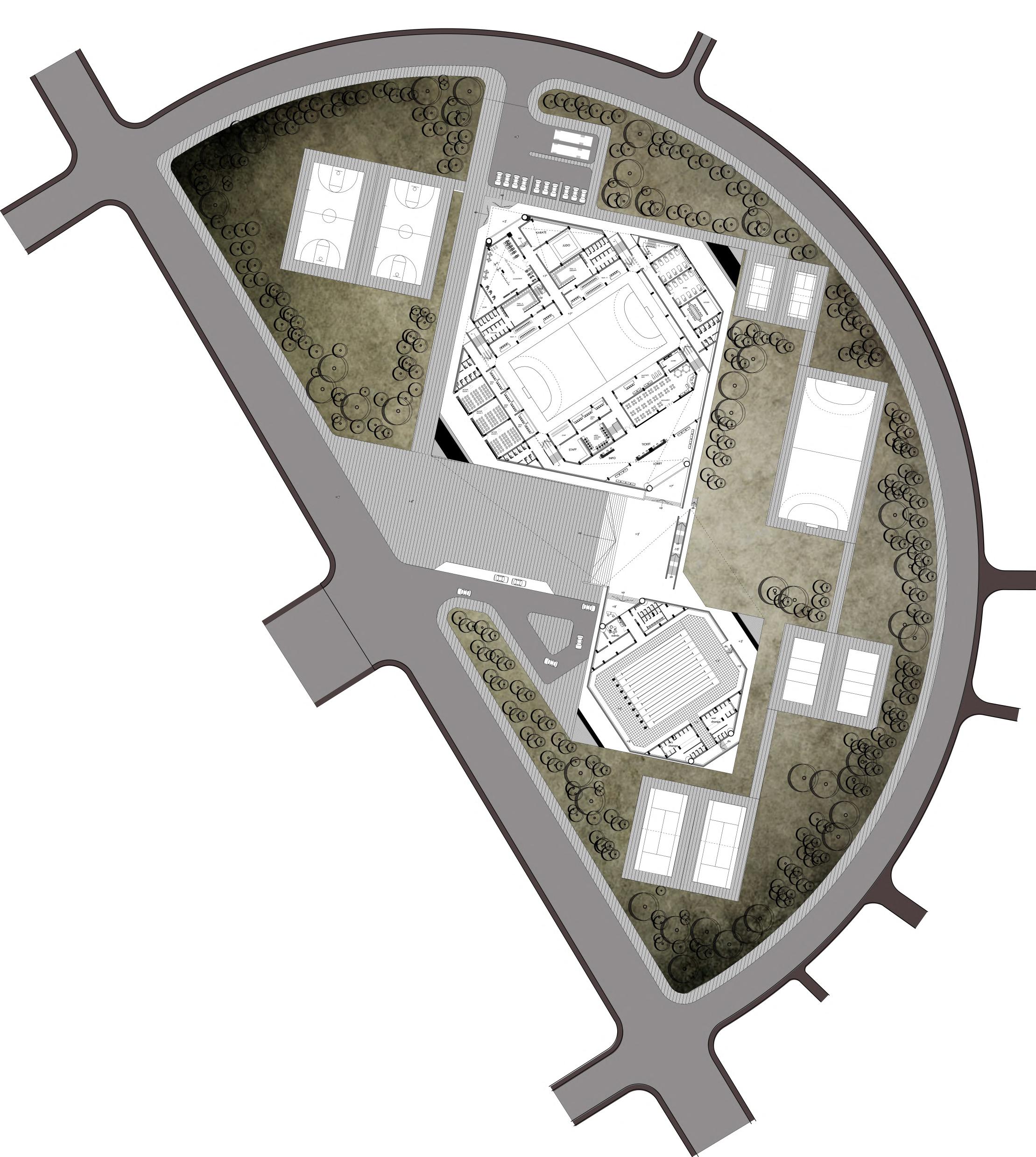
0m 20m 40m 1. Main
2. Lobby Lounge 3. Central Plaza 4. Main Hall
5. Admin 6. Services 7. Cafe 8. Gymnesium 9. Swimming
10. Indoor Stadium 11. Outdoor
12. Vehicular Entry 13. Residential
Site plan
Entry
court
Pool
Courts
Facilities
First Floor plan Second Floor plan Gallery plan
section aa’
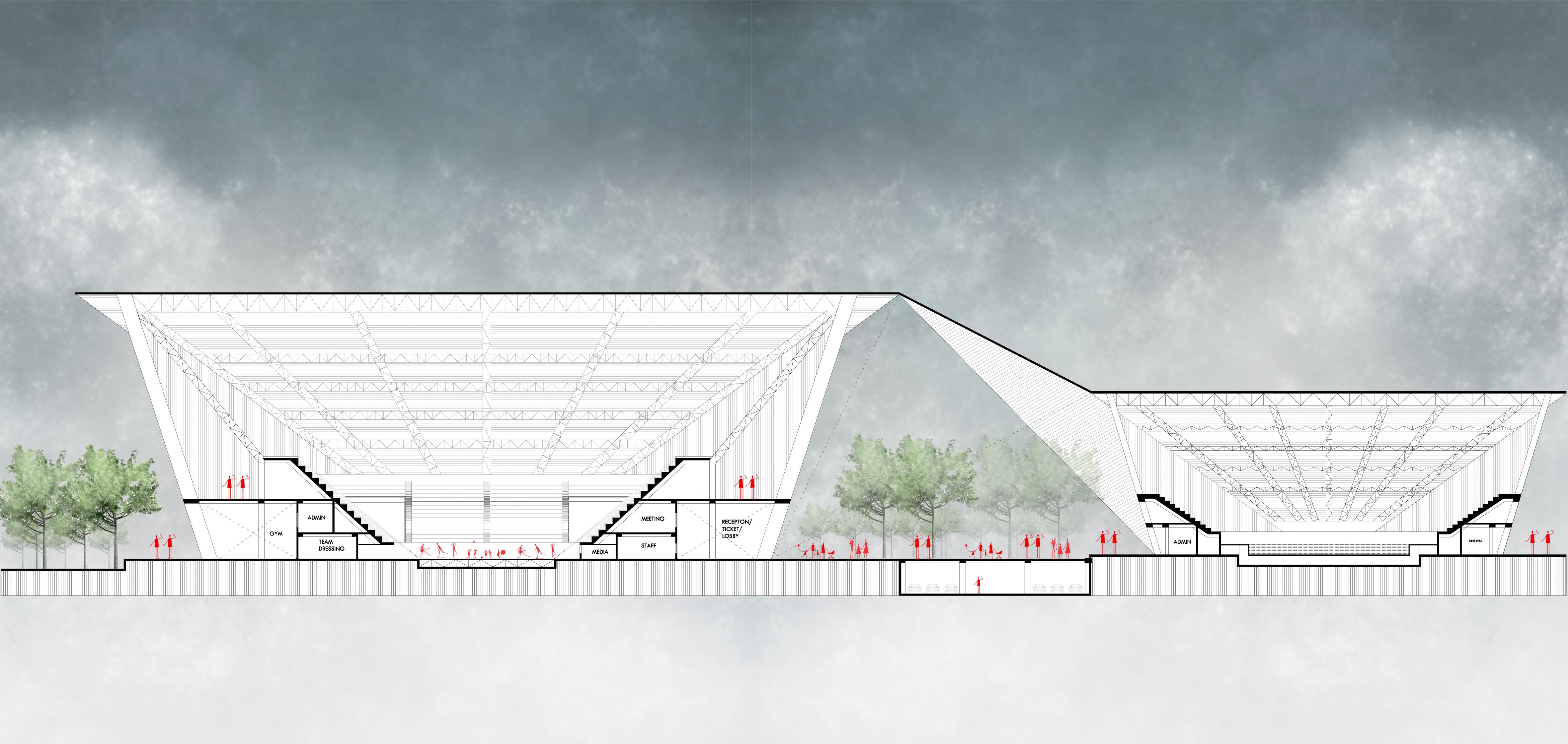

a a’

north elevation
The structural layout


 Front elevation The basic structural layout
Back elevation The basic structural layout

section bb’
b b c’ c
section cc’


Women’s Sports complex was mainly designed to create activity space dedicated only to women. It is a multi functional complex accommodating several kind of sports and a residential dormitory for the players. The complex is located in Dhanmondi area of dhaka city. This area is mainly residential area. therefore, keeping in mind the complex was designed to create a communal space for the community as well as to promote women sports in Bangladesh. Women sports are still lagging behind in many ways. One of the main aim was to set an example of the possible ways to make more functional and encourage more women to participate in sports activity. In that way, both the sports team and government can share the benet.


 Exploded 3d view


 SPREE PARK
MUSEUM ISLAND
SPREE RIVER


 VIEW FROM SHORE LNE
VIEW FROM RIVER


 VIEW FROM BOATING DECK
VIEW FROM SHORELINE


 residential block residential block residential block fountain residential block entry open exhibition cultural court cafeteria caligraphic wall auditorium lobby residential block auditorium padestrian entry
ofcers block mosque fountain linking bridge library class room central court education court outdoor exhibition gallery caligraphic wall entry court basement parking

 Exhibition space


 Front elevation The basic structural layout
Back elevation The basic structural layout


