

Chapter 1


Chapter 1
I live in Los Angeles. One of the main northsouth roads in the city is called Alvarado Street. This street looks like any other on a map: a straight line. But that line belies the reality on the ground—Alvarado Street is known as a locus for the immigrant life and culture that makes LA so distinct. A mundane straight line on a map when traversed in person is transformed. The street pulses with a vibrant hustle. People who have made this city their home have transformed this stretch of road: some make their way up and down this street, others have opened storefronts, and others still set up shop right on the sidewalk. The sidewalk itself is more a kind of linear agora than a path for mobility; shops’ wares spill out their front doors, while street vendors chat with customers, blurring the lines between interior and exterior, between public and private.
The urban plan, with its neat lines and systematic designations, can’t capture the essence of this living, breathing, joyously smelly thing we call the city. How could such a sterile thing on paper capture a serendipitous encounter with friends and acquaintances on the street, or the kaleidoscope of colors, sounds, and smells that present themselves to one’s senses? The map lacks the soul of the street. Cities—and, in turn, urban design—are not just about the arrangement of buildings,
roads, and public spaces. They are about narratives, experiences, and an element of chance—things that can’t be captured by lines on a piece of paper.
And so, with this book, I explore these dimensions of urban life often overlooked by planners and designers. Moreover, I hope to share some practices that can be used by urban designers to move beyond staid urban plans and toward more fully living visions for the future of our cities.
You hold in your hands a demonstration—a proof of concept—of how to do urban design using ideas from media and literary studies and the often under-appreciated design tactics found in strip malls, theme parks, and nightlife. You can read this book as a book—that is to say, as a creative work primarily for entertainment, edification, and visual stimulation. Or, you can use this as a how-to guide for a different kind of urban design. This is all also an experiment; to move from urban design to media studies, to theme park design and back again requires a process that I call “approximate translation.” The outcome of a work in translation isn’t ever the “right answer” so much as an answer—the result of a process of trying things out, testing, experimentation, and failure, like writing an essay (which comes from the French essayer for “to try”). Give it a whirl!
Mapping out key place-embedded histories in Allston. Source: author.

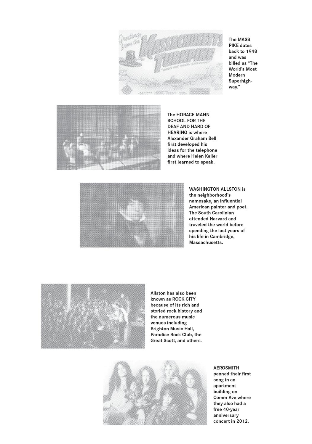


So, as we turn our gaze back to Allston, we can use these two urban design strategies to great effect. The first and most straightforward approach to analyzing urban networks is to look at the street networks in the neighborhood. Allston’s geometric nature is largely vertical; its north-south axis runs from Harvard’s holdings in Lower Allston, while the heart of Allston is to its south. The east-west axis is one of neighborhood transition: you move into Brighton toward the west, and Brookline toward the east, with the Charles River providing a hard stop to Boston’s edge. Yet this verticality is interrupted. The 90 freeway bisects Lower Allston from Allston, interrupting its continuity. The main streets that continue over the freeway are less than ideal, Everett Street is a smaller non-commercial road, and Cambridge Street is primarily east to west.
Looking at the pattern of lines, however, we can see that Harvard Street, the primary north-south thoroughfare in central Allston terminates at the 90 freeway, with the smaller Franklin Street continuing north of the freeway all the way up and back into a curiously broken Harvard Street as it re-enters the domain of Harvard
University in Lower Allston. So a first urban design move would be to reconnect these disparate networks into a single northsouth axis as a spine that runs through the whole neighborhood, providing continuity between its parts and most especially across the 90 freeway.
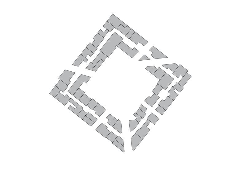
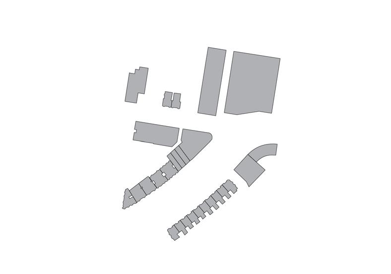
Second, after this move, we can map out the built environment along this spine to perform our figure-ground analysis, here focusing on built spaces and urban voids. We can note larger parcels in the north where Harvard University is located, starts and stops of commercial building along the spine, and a few voids that would make pedestrian life very uncomfortable indeed for a resident navigating down this boulevard. So here our second urban design move will be to focus on filling up these urban voids along the spine to reinforce continuity, transforming the handful of residential buildings along the spine to have some commercial aspect—perhaps completely, or perhaps just at the ground level—and as an added improvement on existing urban conditions, we can even build over the 90 freeway, completely obscuring its dreary existence from view by pedestrians at the ground level.
Opposite page: A perfectly fine urban design plan for Allston using the strategies of connecting networks and figure-ground analysis. Source: author.


Scan of plan for Vauxhall Gardens by Thomas Allen, 1826. Source: author. Allen includes this legend in a book titled Parish of Lambeth (J. Nichols, 1826), in the spelling of his time: "1. Fire work Tower; 2. Evening Star; 3. Hermitage; 4. Smugglers Cave; 5. House in which M. Barrett died; 6. Statue of Milton; 7. Transparency; 8. Theatre; 9. Chinese entrance; 10. Artificers work shops; 11. Octagon temples; 12. Fountain; 13. Circles of Boxes; 14. Orchestra; 15. Collonade; 16. Rotunda; 17. Picture Room; 18. Supper Room; 19. Ice House; 20. Bar; 21. Princes Pavillion; 22. Entrance; 23. Water Gate; 24. House."
Pleasure Garden: Vauxhall Gardens
Vauxhall Gardens in London became one of the first internationally recognized theme parks, then known as “pleasure gardens,” after it opened in 1661. In France, pleasure gardens began as an outgrowth of traditional gardens, but in England, they often began as an outgrowth of an inn or tavern. Incorporating visceral pleasures into the otherwise pristine garden, pleasure
Steeplechase Park can be identified as the clearest prototype of the American theme park. Officially opened in 1897 by the so-called “king of the American amusement park,”George Cornelius Tilyou, Steeplechase Park developed over a long period, beginning with Tilyou’s parents setting up a hotel on Coney Island, to their building the island’s first theater, to his importing of one of the world’s first Ferris wheels after he saw the noted first deployed at the Chicago World’s Fair. 4 Consolidating these developments around another new experience, “The Steeplechase Ride,” or an
gardens generally included circus acts, music, dancing, food, and drink, platted in relation to each other and to the garden’s plantings, providing a set of queer spaces where titillating and subversive activities could be performed in a semi-public space apart from the everyday reality of thenpuritanical England.
early form of a roller coaster, Tilyou began charging admission to the overall park and allowing free use of the amusements once inside. Tilyou also began the practice of searching around the world for new attractions that could be added to the park, constantly changing the organization and form of its plan. Such dynamism allowed Steeplechase to outlast its bigger and more lavish derivatives on Coney Island, Luna Park and Dreamland. Later, Rem Koolhaas would describe the developments on Coney Island as prototypical for a form of delirious urbanism, a congested Manhattanism:
To survive as a resort—a place offering contrast—Coney Island is thus forced to mutate: it must turn itself into a total opposite of Nature, it has no choice but to counteract the artificiality of the new metropolis with its own SuperNatural. Instead of suspension of urban pressure, it offers intensification. Even the most intimate aspects of human nature are subjected to experiment on. If life in the metropolis creates loneliness and alienation, Coney Island counterattacks this with the Barrels of Love. Two horizontal cylinders— mounted in line—revolve slowly in opposite directions. At either end, a small staircase leads up to an entrance. One feeds men into the machine, the other women. It is impossible to remain standing. Men and women fall on top of each other. The unrelenting rotation of the machine fabricates synthetic intimacy between people who would never otherwise have met...5

While theme parks, as a microcosm of their surroundings, contain transportation elements within themselves, trolley parks were intentionally planned in conjunction with the expansion of urban streetcar lines to attract riders to their terminuses. Urban rail, at this time, was typically a private enterprise as well, providing economic synergies between profits made from ridership and from attendance at trolley parks. Idora Park, in Youngstown, Ohio, was one such park; indeed, it was originally named “Terminus Park” and included free admission with the purchase of trolley fare, as it opened in 1899. Highly successful until the dominant form of transportation
in the US transitioned from urban rail lines to the automobile, Idora Park lasted to the ‘80s because its open plan allowed for changing patterns of use, even though it was constrained on its 27 acres of space— at its end, it was largely used for church and company picnics. It ultimately closed in 1984 after a fire destroyed its biggest attractions, and was purchased by the Mt. Calvary Pentecostal Church to become something of a religious theme park called “The City of God.” The church was never able to make good on its vision and a series of fires reduced the property to vacant space. Today, it remains vacant as the church is embroiled in tax and bankruptcy issues.
Factory Tour Garden: Hersheypark
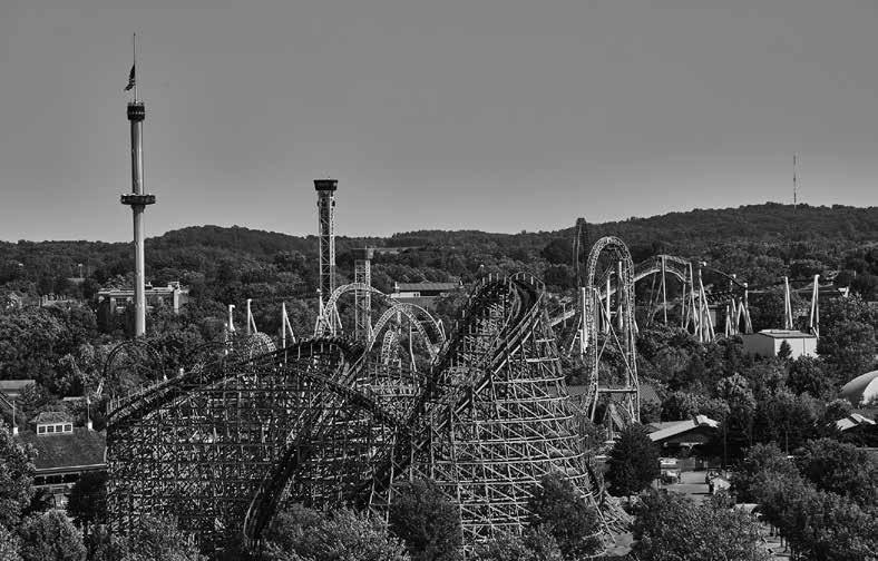
Source: Library of Congress, LC-DIG-highsm-58109.
Hersheypark relied on its own historical and social cache as a global chocolate producer rather than thrills and shows as “destinations” within its organization. After a tour of the factory, visitors could spend a relaxing afternoon in the park with rides, pools, and shows of a decidedly less flashy nature than their counterparts in other parks. Started as a place of relaxation for company employees, the factory tour garden opened in 1905 and continues to operate to this day. Hersheypark operated on these terms, slowly incorporating more conventional amusement park rides until its renovation, expansion, and theming in 1970 after the huge crowds could no longer fit into the factory, transforming the tranquil park into a hyperreal version of Hershey, typified by an entire land called Chocolate World with attractions such as “The Really Big 3-D Show” featuring John O’Hurley and Danny DeVito. This success would soon be imitated by Anheuser-Busch in their stilloperating chain of Busch Gardens.
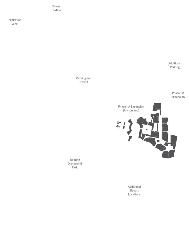
So let’s get down to business. Here we are presented with the next opportunity for an act of approximate translation, an urban design strategy of displacement. To continue our example, let’s start with our new, improved urban design for Allston. We have a fairly typical American neighborhood in an urban context, and we’ve improved its urban plan by better connecting its networks and sensibly filling in its urban form through figure-ground analysis. But let’s go a little further. What might we learn from Hong Kong and, indeed, from the mental exercise of displacement to improve upon our designs for humble Allston? What would happen if we took the essence of Allston’s urbanism—its urban syntax and its cultural content—and translated it into a theme park? And, moreover, what if we considered the implications of displacement, designing an Allston-based theme park located in Hong Kong? A mental exercise like this is a terrific approach for urban designers to shake themselves free of their assumptions, biases, and unconscious designerly routines—a cognitive shock to the system.
Due to a drawn-out political battle, a large, primed swath of land sits vacant just across Hong Kong Disneyland, waiting to be developed. Disney retained the right to develop this land for nearly a decade, though the land was turned into temporary COVID-19 facilities from 2020-23, and Disney’s right to the space has since not been renewed. As a site for our thought experiment, it is perfect: it is on the opposite side of the planet from Allston, semi-tabula rasa, and ensconced in a themed media environment. The absurdity of this thought experiment is such that we can, just maybe, suspend disbelief. Allstonland, located in Hong Kong, the product of an act of displacement, a theme park based on the cultural material of Allston. This process requires a degree of earnest respect, and we can afford it, because the project is strangely plausible.
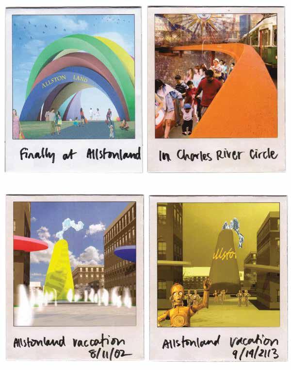
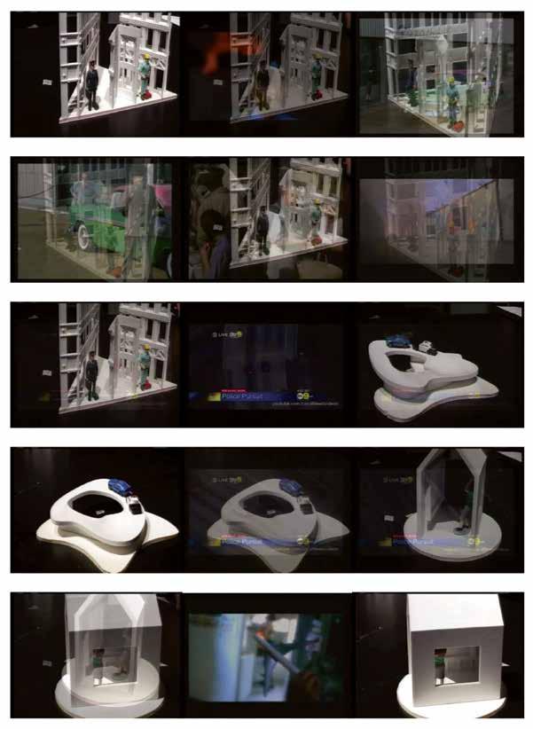
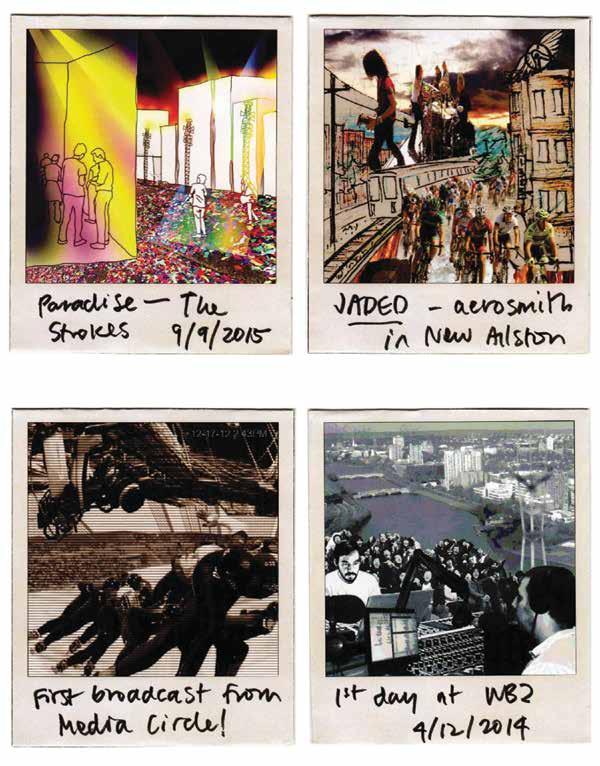
Polaroids of approximate translation in action. These renderings were produced by the author in collaboration with a number of other designers, and are placed as short interludes in between each chapter. These particular Polaroids were created in collaboration with Enas AlKhudairy, Nate Imai, and Ann Woods. Source: author.
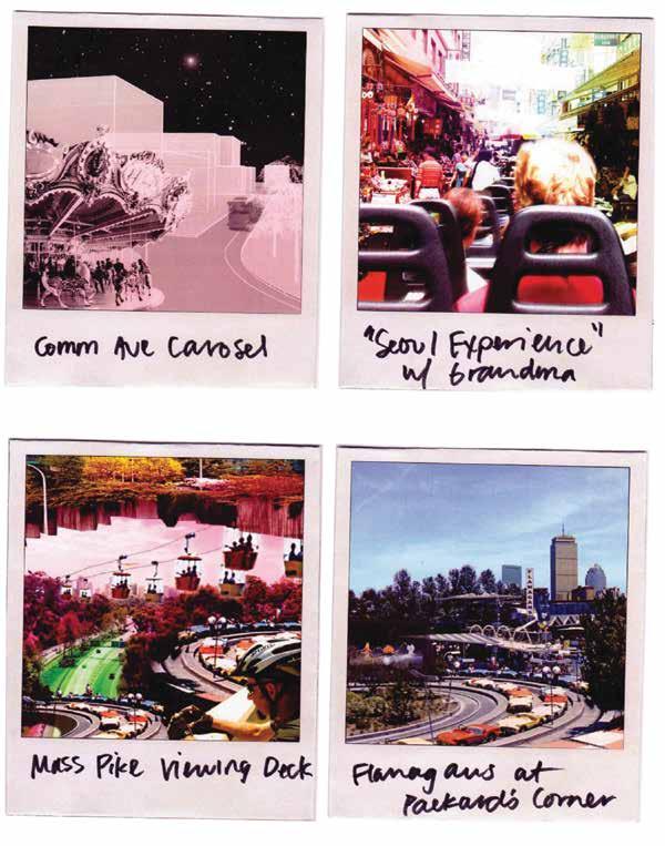

particular
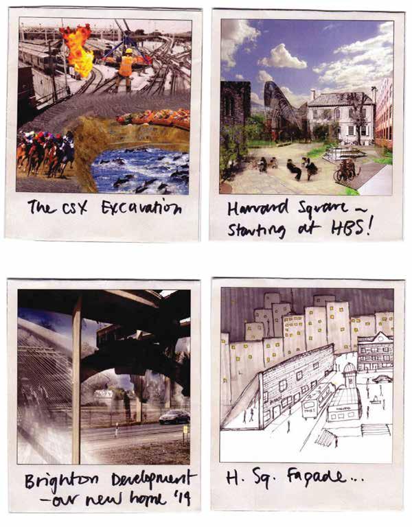



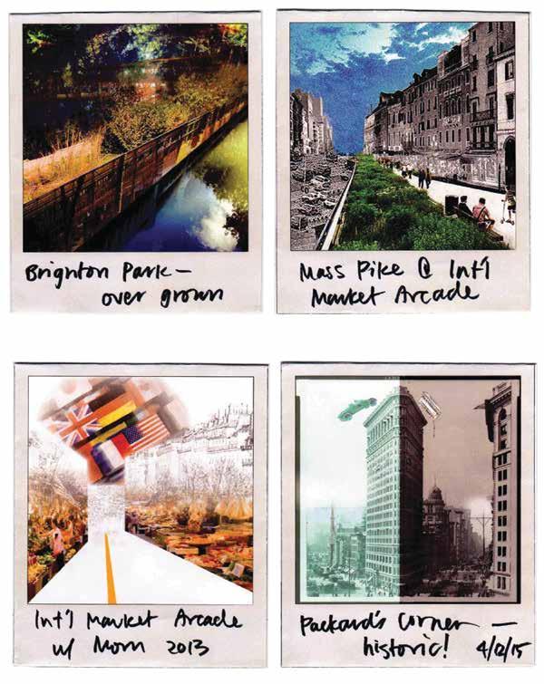
These particular Polaroids are the last of the Polaroids created for this project and were created in collaboration with Richard Ong, Jasmine Kwak, Brian Hoffer, and Beomki Lee. Source: author.
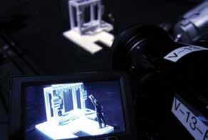


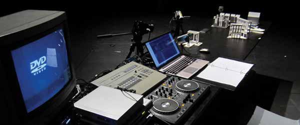
This page and next page: Interlude with behind the scenes photos of live model setup. In reading order: (1) live video feed with 3D printed model; (2) close-up of The Stage; (3) the author setting up video mixing equipment; (4) live mixing setup; (5) live mixing in action; (6–9) close-ups of The House, The Street Corner, The Classroom, and The Market; and (10) audience viewing of the live model in action. Source: author.
