4 minute read
Collecting Data for a Real-time Snapshot of Our Waterways

from America's Engineers: The People, Programs, and Projects of the U.S. Army Corps of Engineers '24-'25
BY TIM REEVES
U.S. ARMY RESEARCH AND DEVELOPMENT CENTER
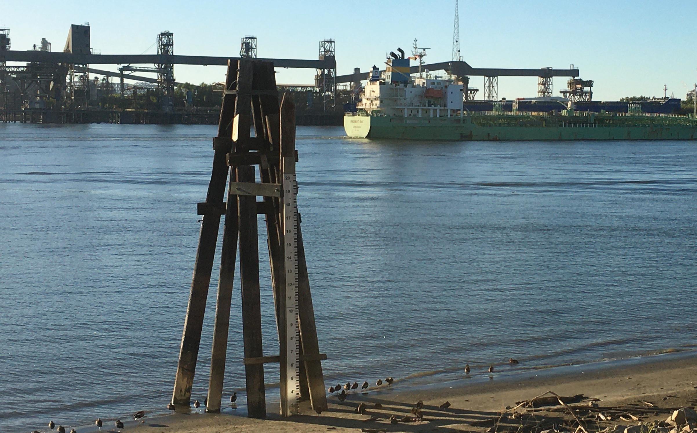
The U.S. Army Engineer Research and Development Center (ERDC) is spearheading an initiative to enhance the safety and accessibility of the nation’s inland waterways through the development of a near real-time monitoring system that aims to crowdsource bathymetric data from vessels already navigating these waters, using their existing depth finders and GPS systems to generate a continuous snapshot of channel conditions and identify potential obstructions. This innovative approach is designed to support and augment the U.S. Army Corps of Engineers’ (USACE) survey fleet, which is responsible for maintaining 25,000 miles of inland waterways across the United States.
Brandan Scully, Ph.D., a research civil engineer with ERDC’s Coastal and Hydraulics Laboratory, explained that while USACE conducts highly accurate and precise surveys, these surveys are conducted periodically due to the high costs, time constraints, and limited availability of vessels. As a result, there is no capability for continuous monitoring under the current system.
“In order for us to do that with traditional resources, it would cost millions of dollars,” Scully noted. The crowdsourcing effort aims to bridge this gap by utilizing equipment that already exists on vessels, such as depth finders and GPS, and supplementing it with a device that would transmit this data to a cloud-based system.

Once collected, the data would be quickly analyzed and aggregated with information from other vessels operating in the same area, creating a real-time picture of that portion of the waterway. Scully likens the system to a digital traffic map for inland waterways, much like popular smartphone apps that provide real-time updates on highway conditions. “Those apps tell you the speed of traffic,” Scully said. “But what this is telling us, essentially, is, where are the potholes? Where are the speed bumps?”
This dynamic and continuous flow of information could significantly enhance the USACE survey fleet’s ability to prioritize its operations, focusing on areas that require immediate attention while still being able to monitor waterways between scheduled surveys. The system would provide mariners with crucial information, allowing them to navigate more safely and avoid potential hazards.
advertisement
The project is currently in the proof-of-concept phase, with ERDC working alongside public and private organizations to determine the best technology for transmitting, collecting, and analyzing the data. There is ongoing work to identify where to house the data and how to distribute it effectively to those who need it, such as commercial operators and teams responsible for clearing navigation threats.
Scully highlighted that ERDC is uniquely positioned to “filter the solutions and find the right answer, or we find the best available answer right now,” ensuring that the final product aligns with both the Army’s mission and the capabilities of the technology providers.
Although additional funding is needed to advance the technology further, there is already strong buy-in from several USACE districts and divisions.
Scully emphasized the significant demand for this capability, noting that mariners would greatly benefit from knowing where obstructions are located, allowing them to navigate more safely.
While similar technology is already employed by the National Oceanic and Atmospheric Administration for ocean and coastal operations, this would mark the first use of such a system for inland waterways. The implementation of crowdsourced bathymetry would represent a significant step forward in the management and maintenance of the nation’s inland waterways, enhancing both safety and efficiency in navigation. AE
–
Visit www.Americas-Engineers.com to sign up for a free print edition of our annual publication and to join our weekly newsletter.