


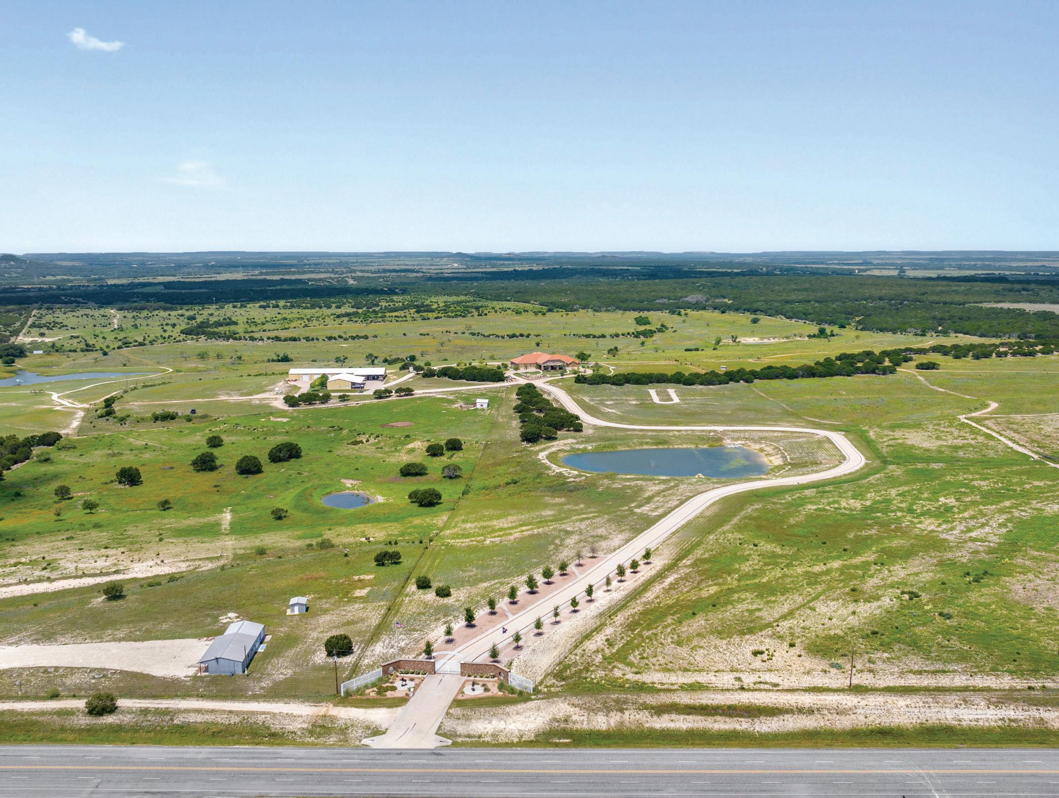
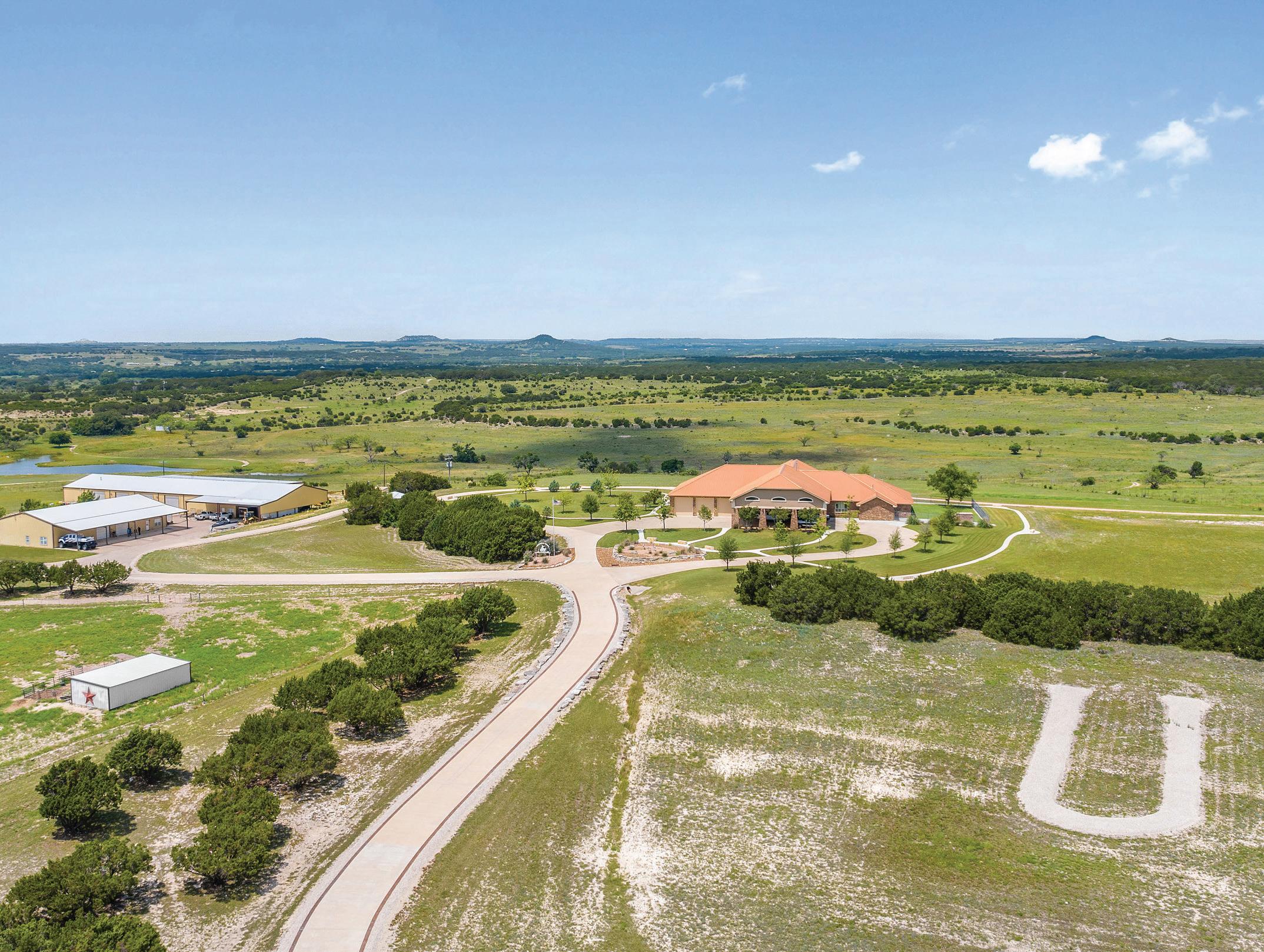
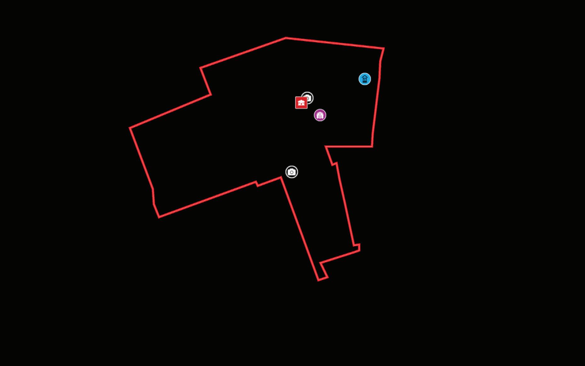
The Underwood Ranch is a remarkable property spanning 408.74+/- acres of breathtaking land. Situated conveniently on Hwy 281, it boasts a location less than 10 minutes away from Lampasas and approximately 1 hour from Austin. The ranch stands out for its exceptional improvements and distinctive features, making it a rare find in the market.
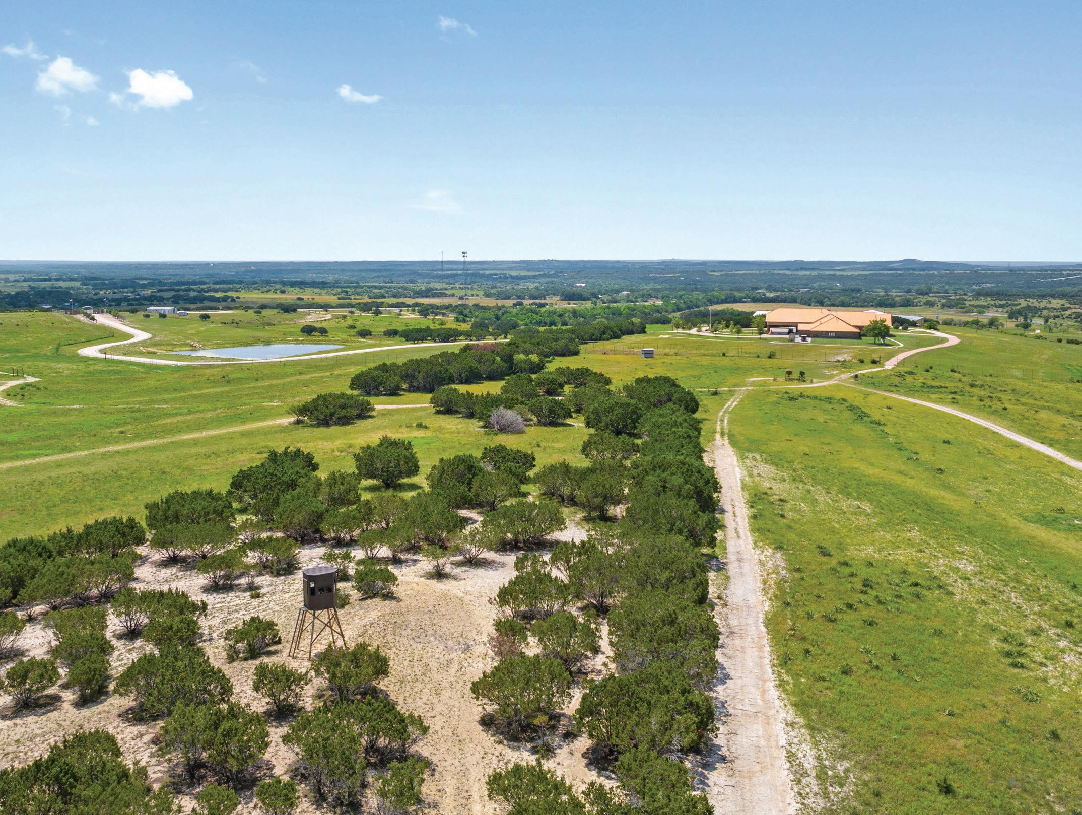
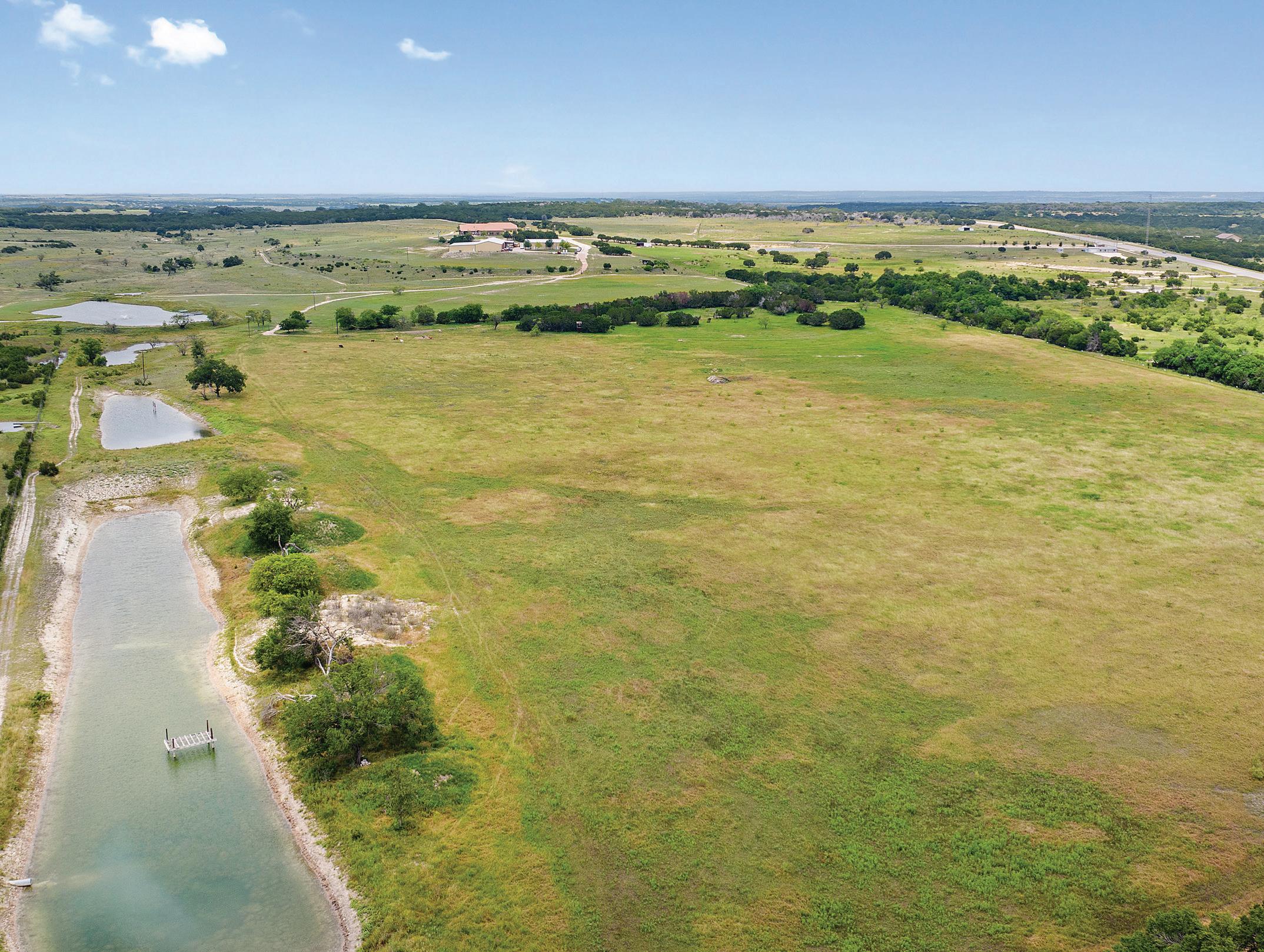
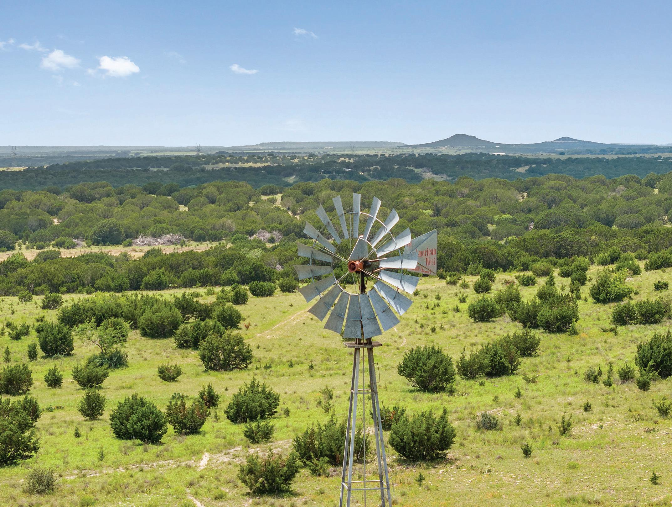
The topography of the Underwood Ranch is diverse and captivating, with over 100 feet of elevation changes that add a dramatic touch to the landscape. Despite the varying terrain, all areas of the ranch are usable and accessible. From the higher elevations, one can enjoy magnificent vistas, while the western views offer awe-inspiring sunsets. The rolling terrain presents a mix of productive bottom land and elevated areas. The majority of the cedar trees have been cleared, leaving behind scattered hardwood cover consisting of Live Oak, Spanish Oak, and Elm trees. Certain areas have been deliberately left untouched to provide game cover, and there are also approximately 34 acres of coastal fields.
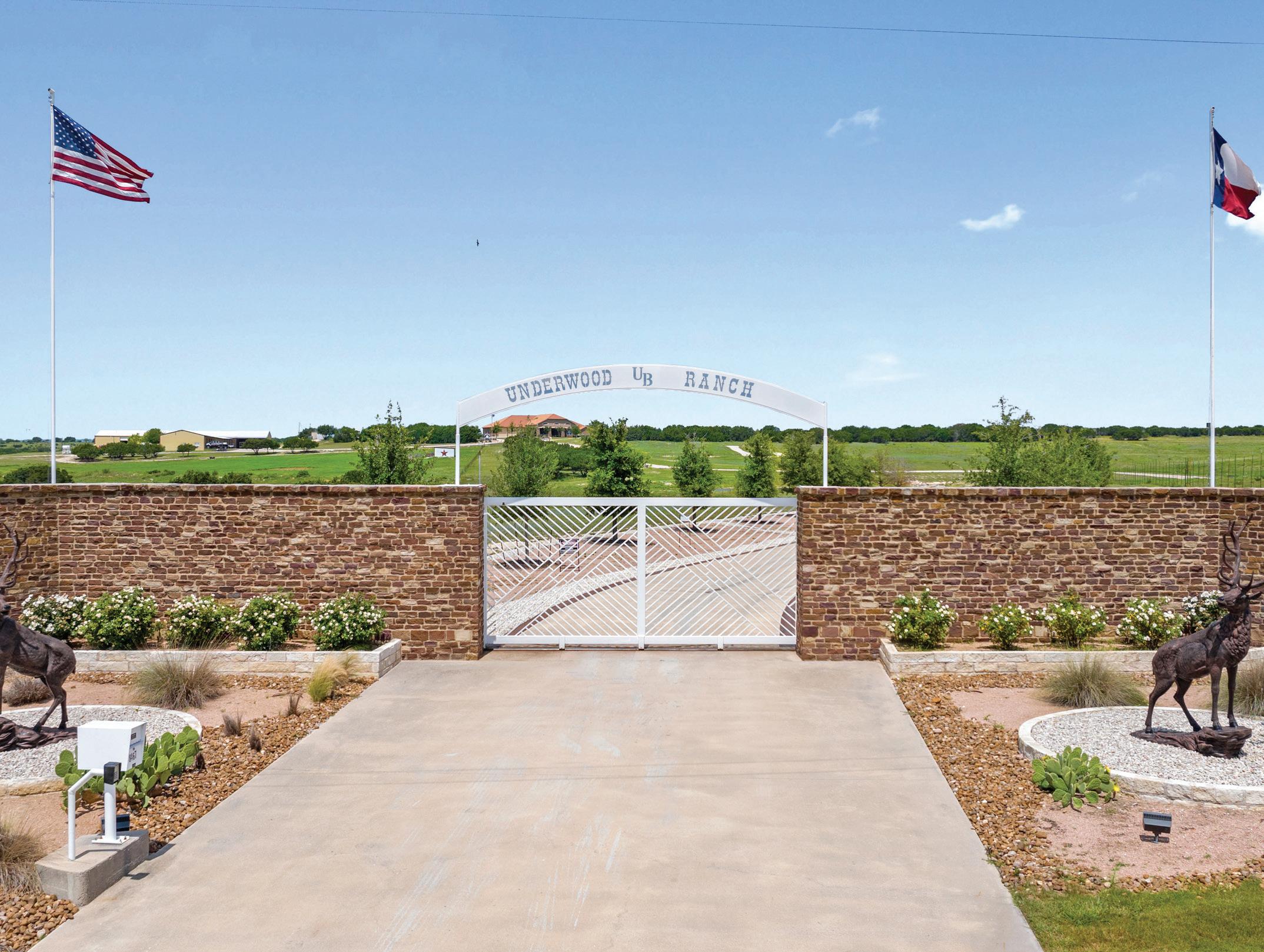
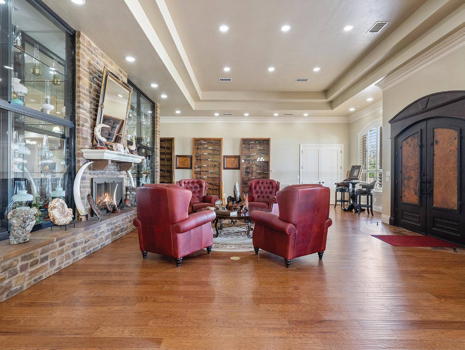
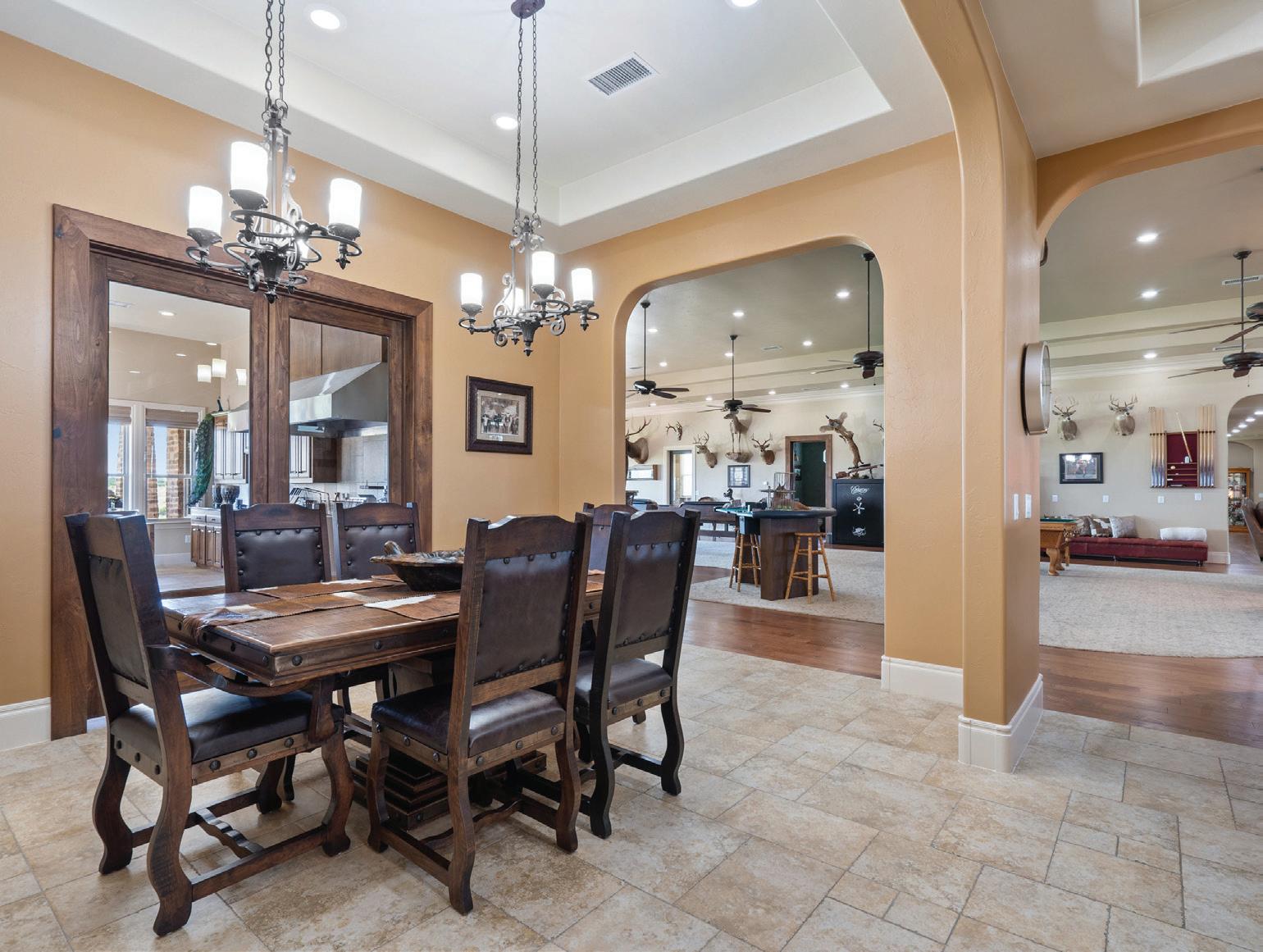
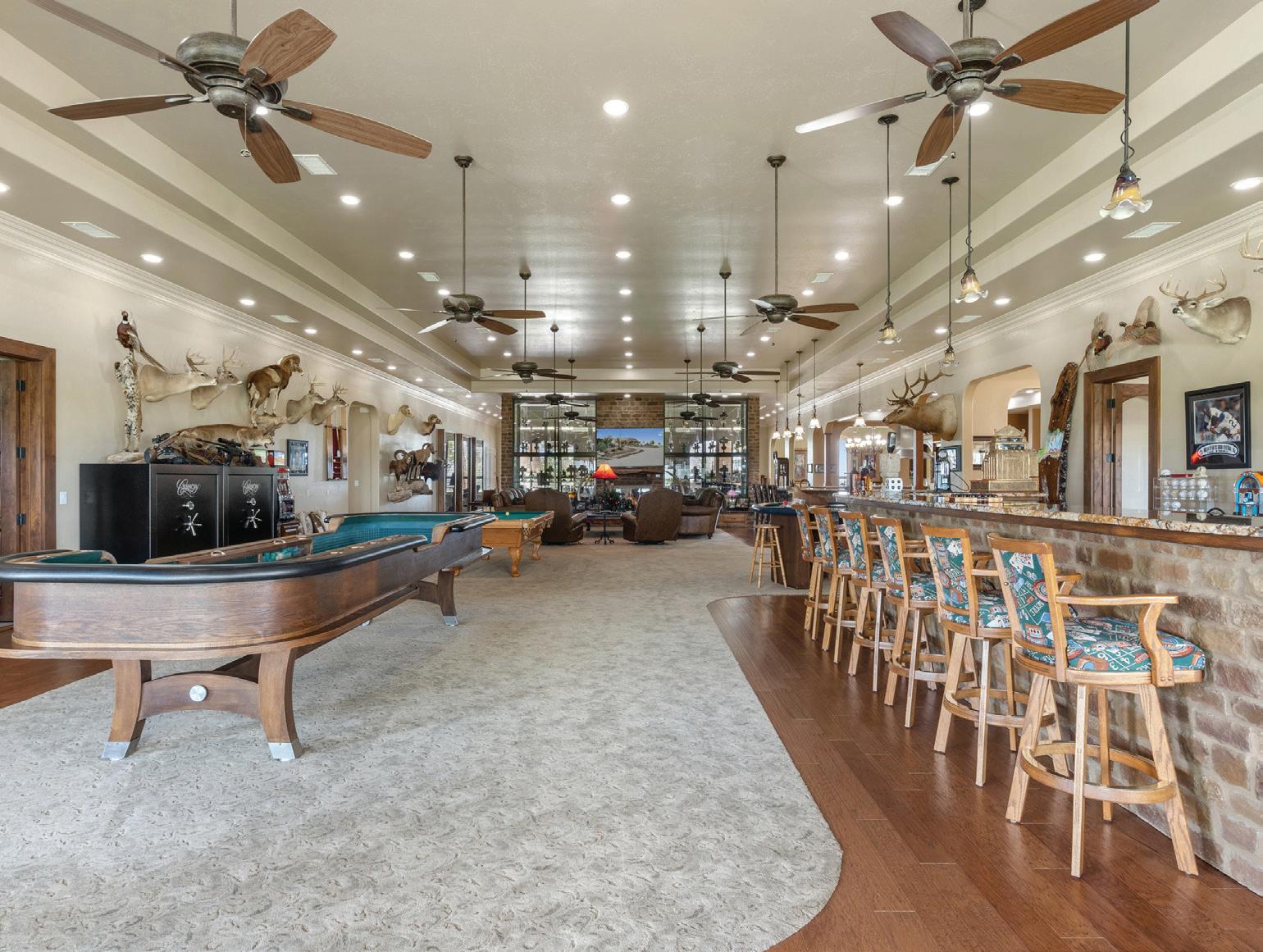
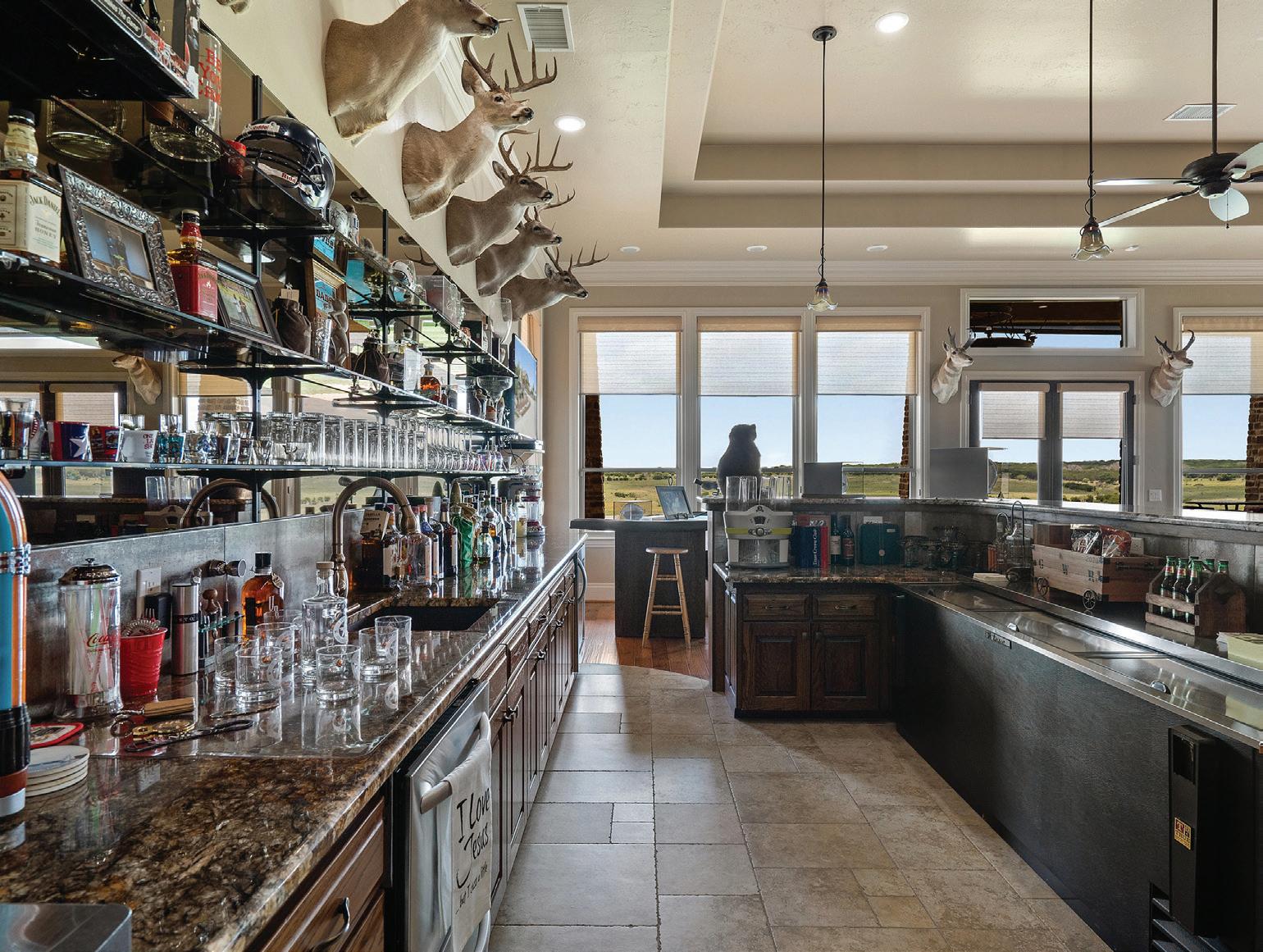
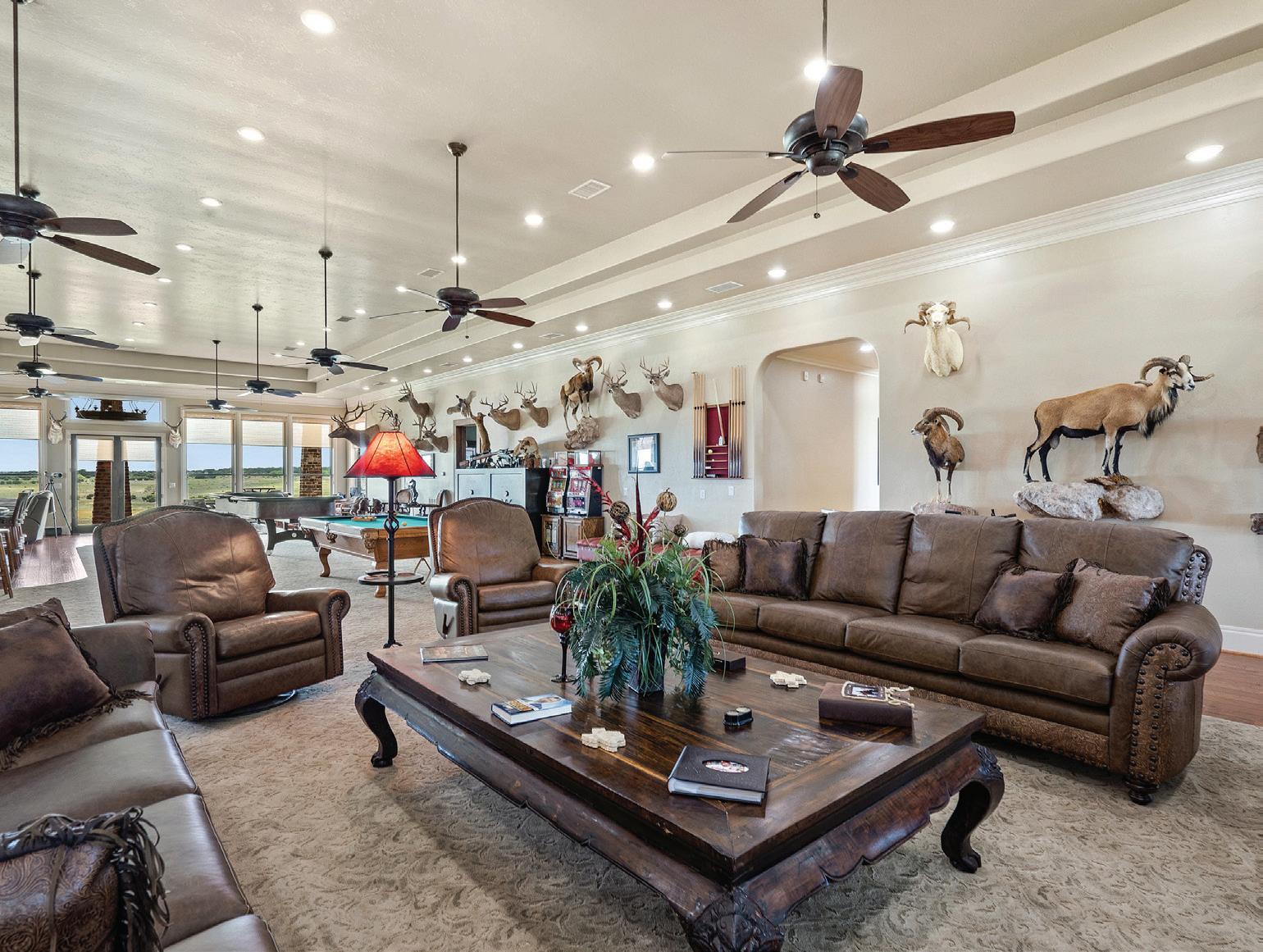
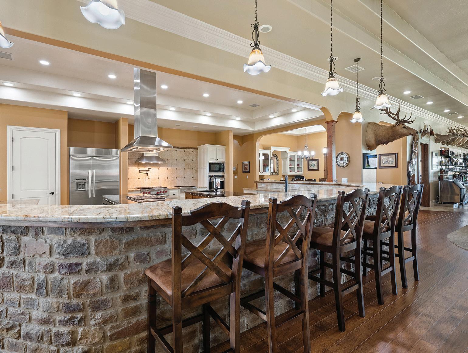
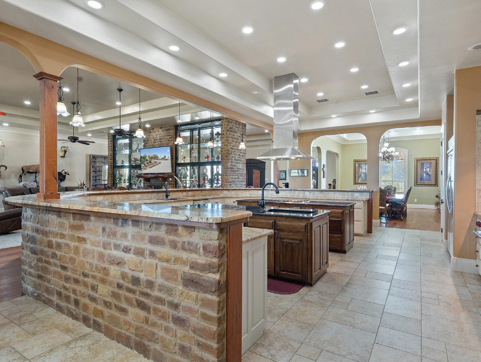
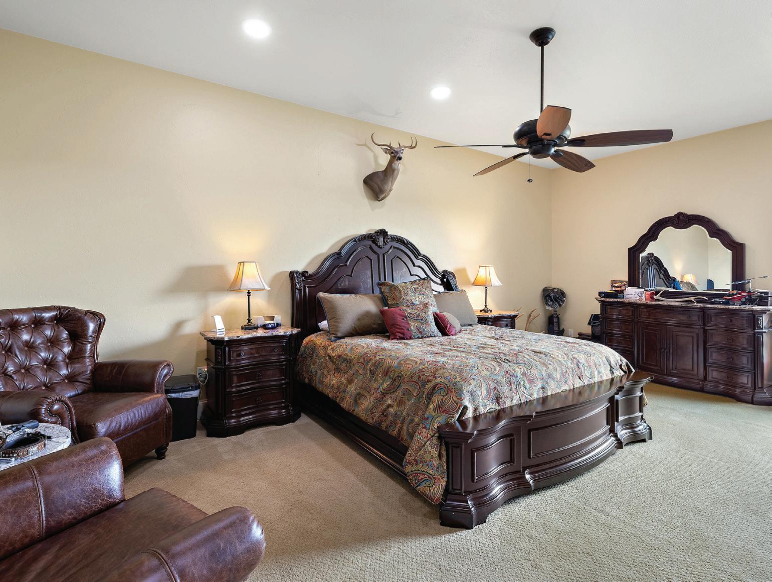
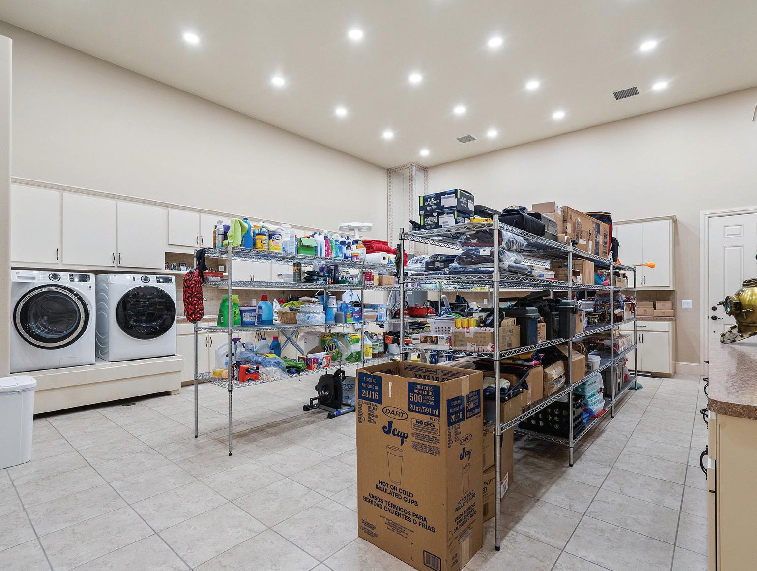
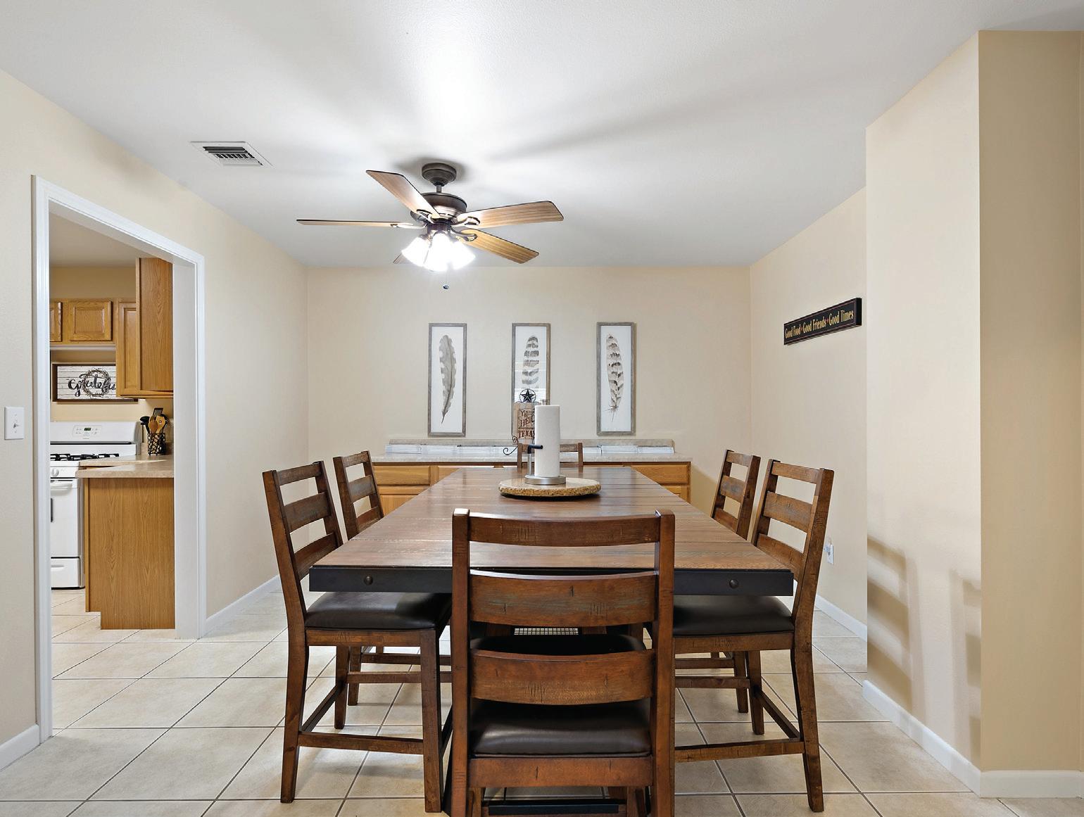
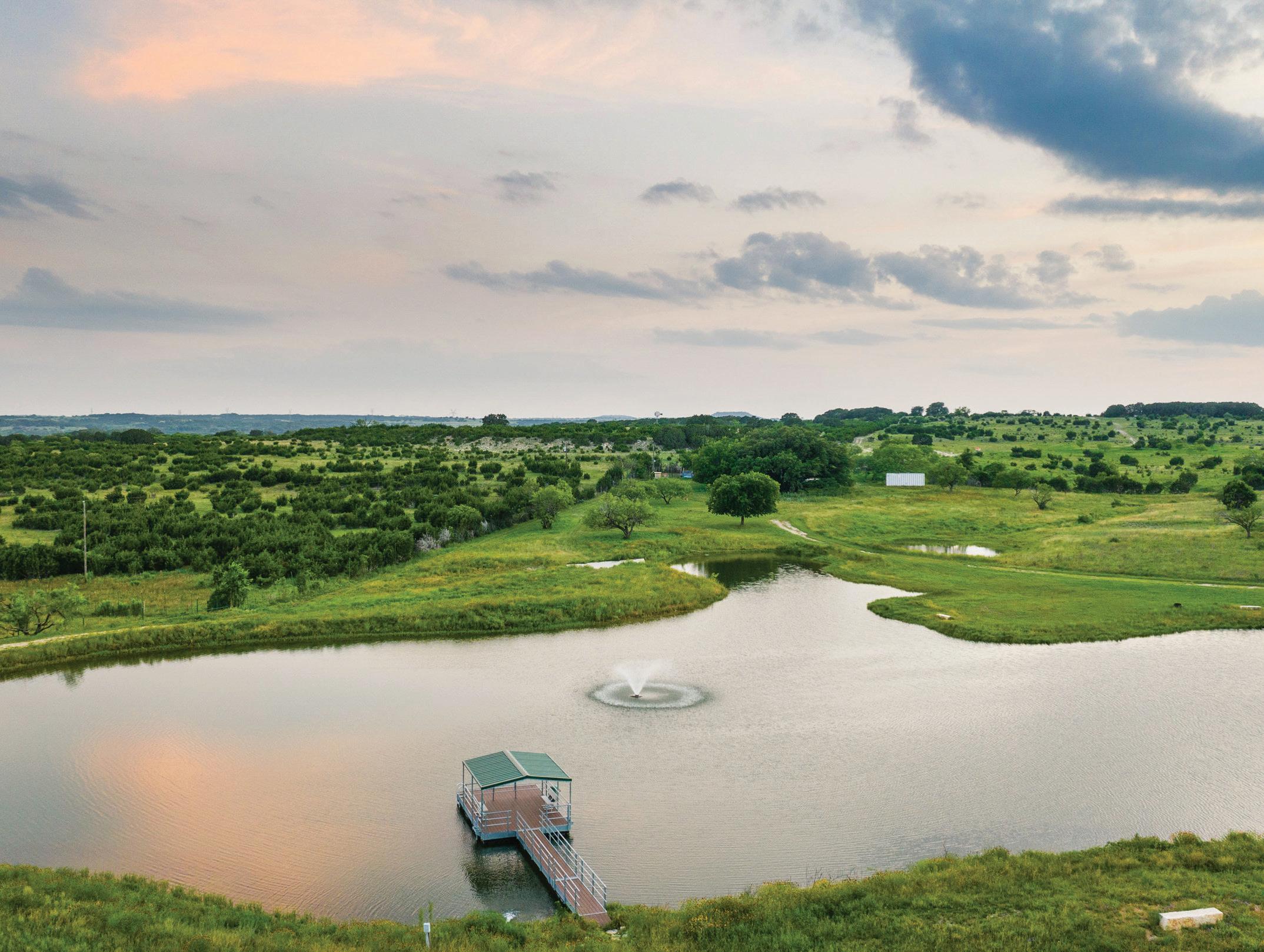
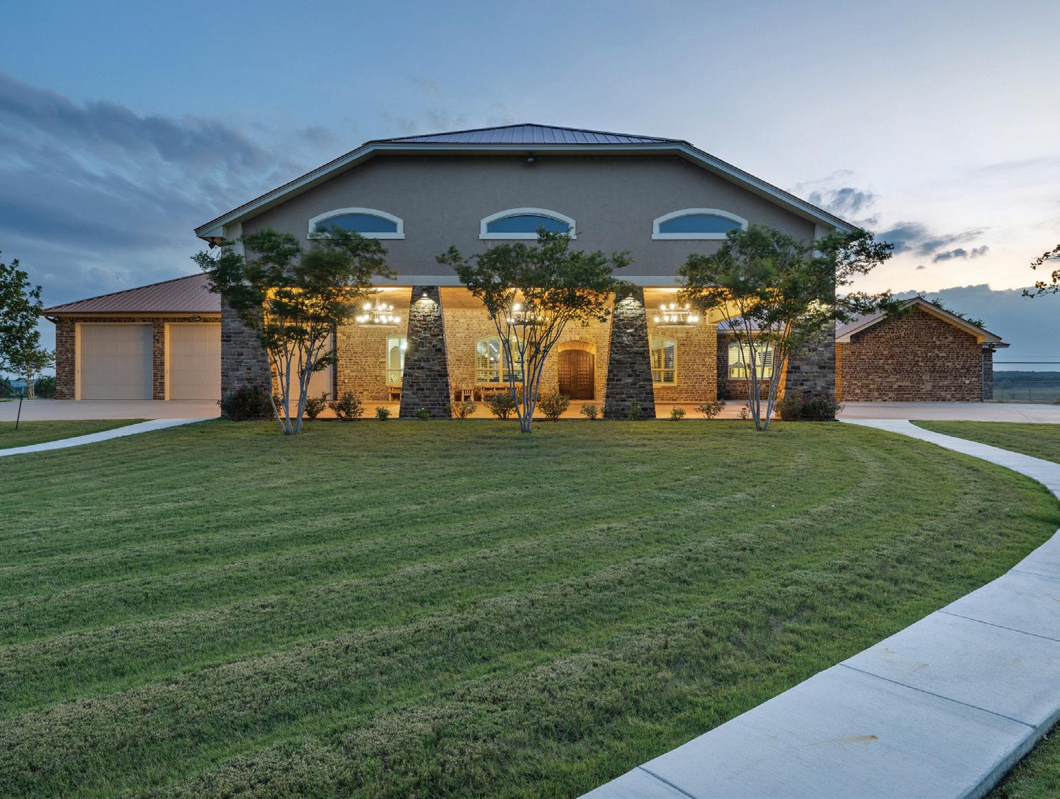
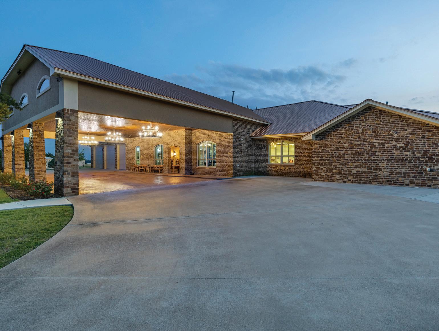
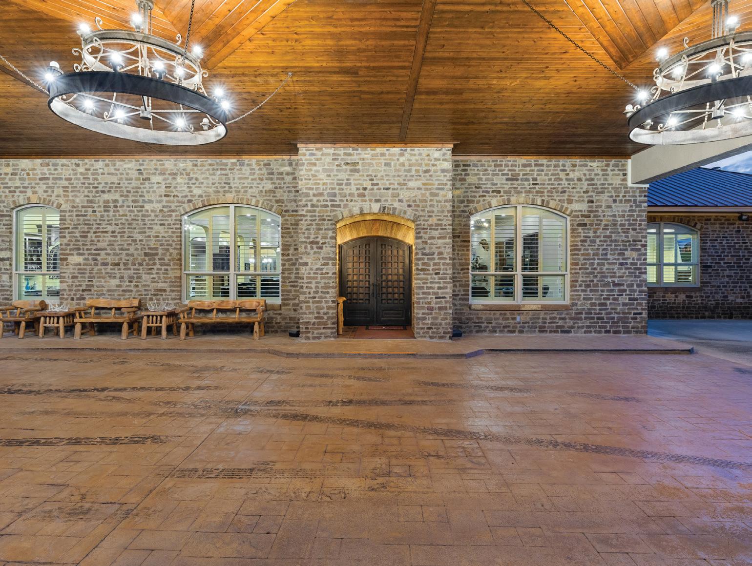
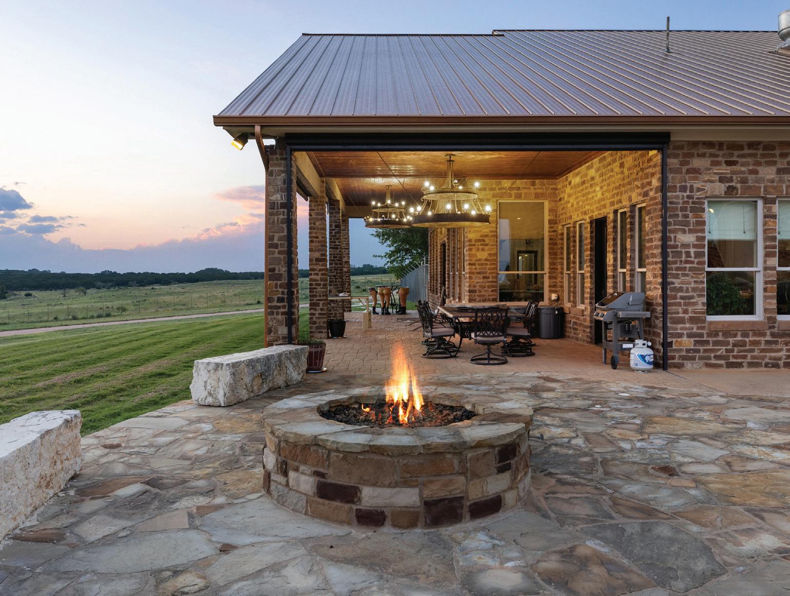
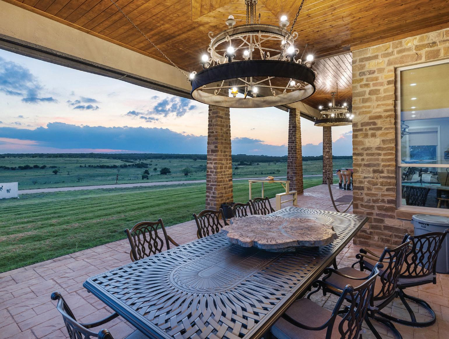
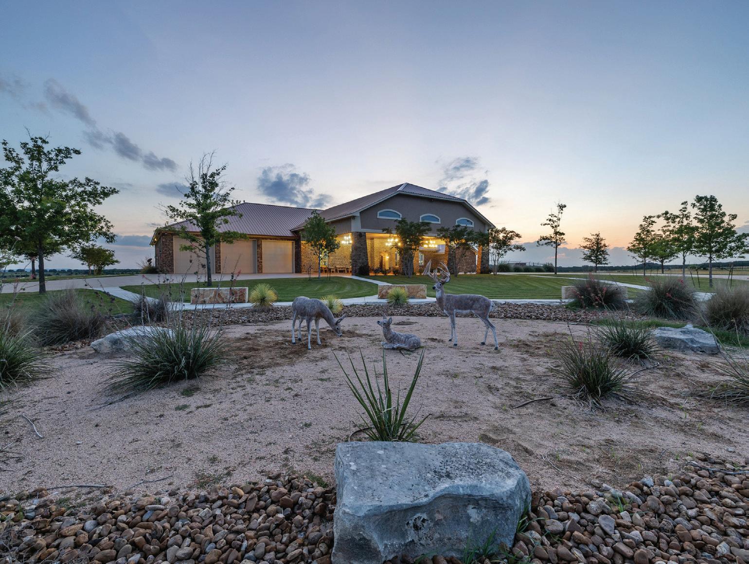
The crown jewel of the ranch is undoubtedly the spectacular main house. A true masterpiece, this stunning home showcases the finest craftsmanship of its builder. Upon entering through the gate, a half-mile concrete drive leads past a beautifully lit fountain in a lake, ultimately bringing you to the grand porte cochere. Positioned on one of the highest points of the ranch, the home offers a commanding view of the entire property, allowing for breathtaking sunrises and sunsets. The single-story residence features a rock exterior, a standing seam roof, 14-foot ceilings, 25 tons of HVAC, and elegant interior design. Although it is difficult to encompass all the highlights of this remarkable home, a few noteworthy features include 4 bedrooms, 4 baths, 3 half baths, exquisite granite counters throughout, two commercially equipped kitchens, an expansive great room with a massive free-standing bar, a dining area, and a heated and cooled 5-car attached garage, and a generator that will power the house in the event of a power outage.
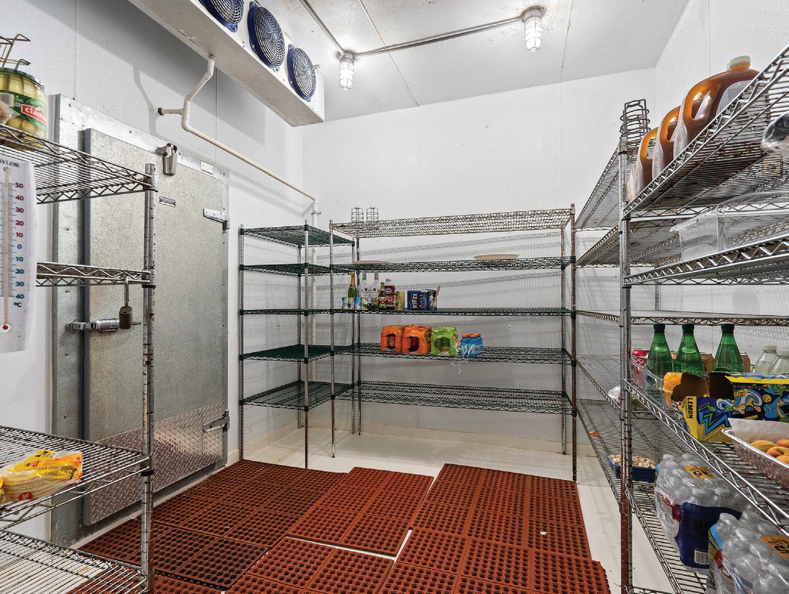
The two kitchens in the main house would excite any chef. The main kitchen boasts 2 Wolf stoves, a Wolf double oven, a Thermador grill/griddle, 2 dishwashers, a bun warmer, a Kitchen aid refrigerator, a walk-in cooler, and a walk-in freezer. The secondary kitchen features a commercial indoor BBQ pit, a fryer, a dishwasher, and an 8-foot commercial range hood. When it comes to entertaining and impressing guests, this home surpasses all expectations.
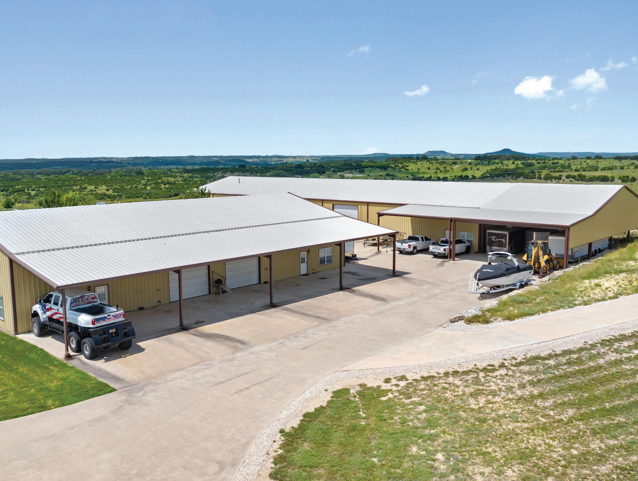
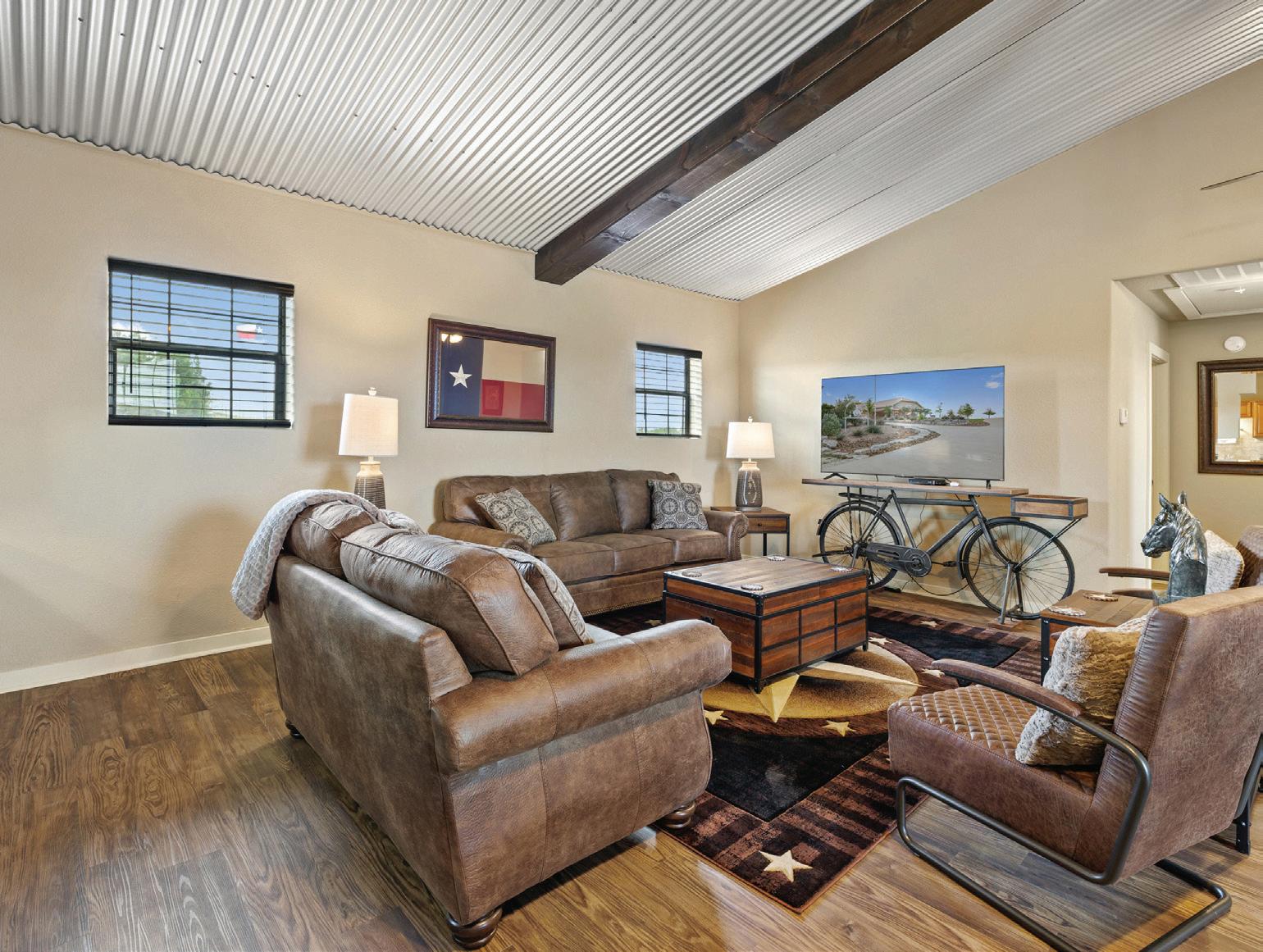
A short stroll from the main house leads to a barndominium consisting of two separate living areas. Each side offers 3 bedrooms, a full kitchen, and 2.5 baths. A covered parking area extends across the entire width of the building, providing ample space for vehicles and equipment.
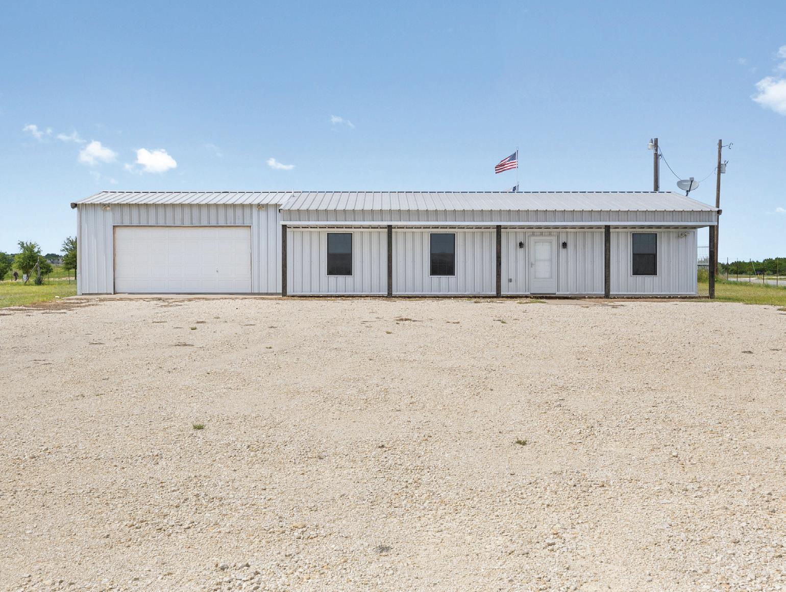
Near the entrance of the ranch, there is a foreman's/guest house that includes 2 bedrooms, 1 bath, and a garage. It serves as a comfortable and convenient space for additional accommodation needs.
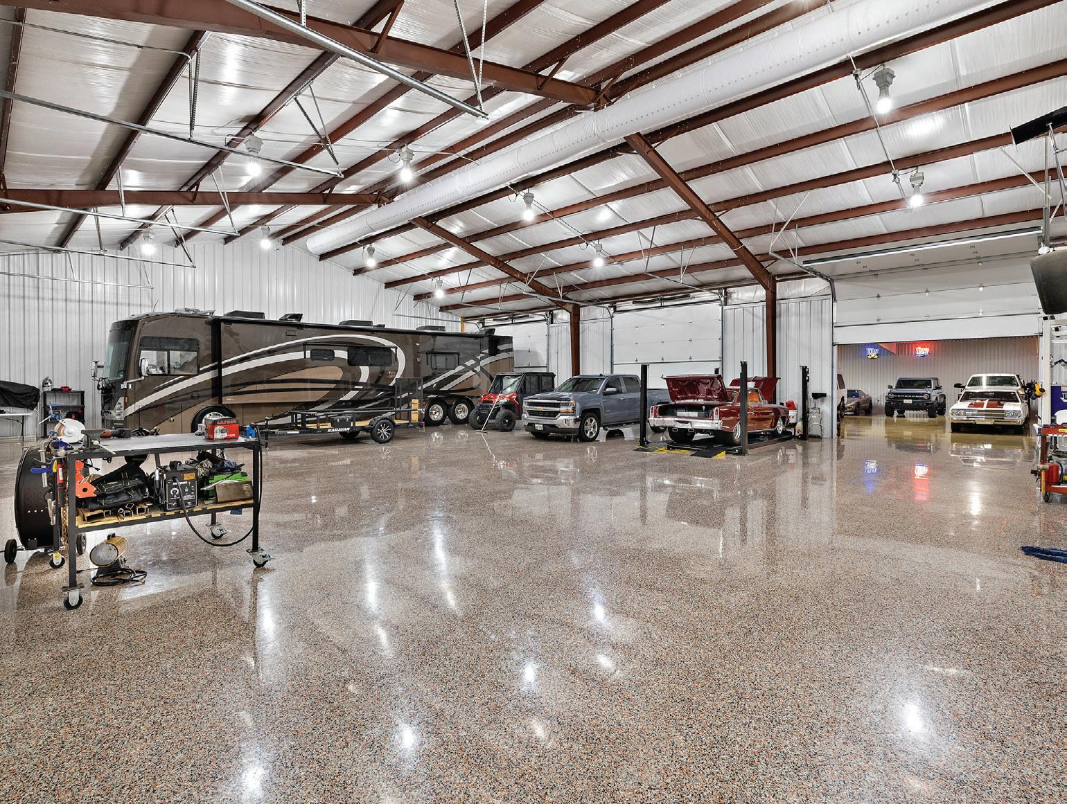
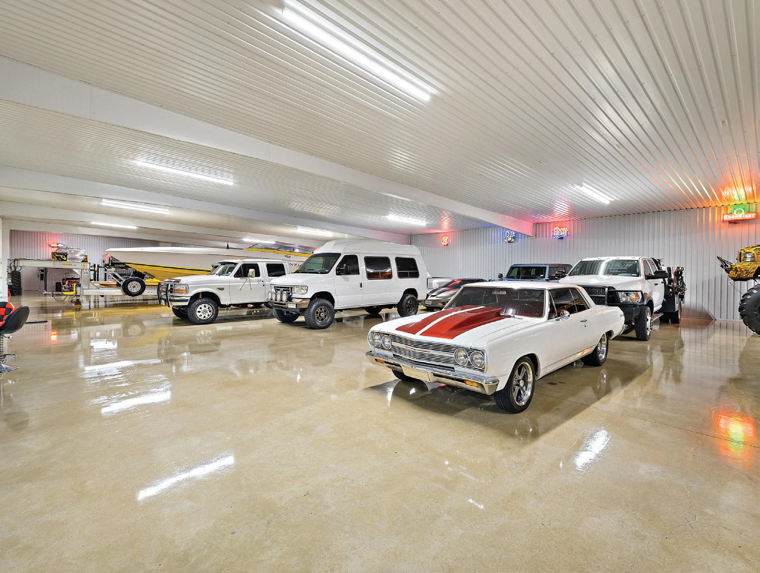
Additional improvements include a massive multi-use building that is truly exceptional. The insulated metal building is air-conditioned and heated, featuring an office, 3 baths, a fire-proof safe room, epoxy flooring and an enormous storage area, currently housing a motorcycle and car collection. It provides ample space for various purposes and ensures the utmost convenience.
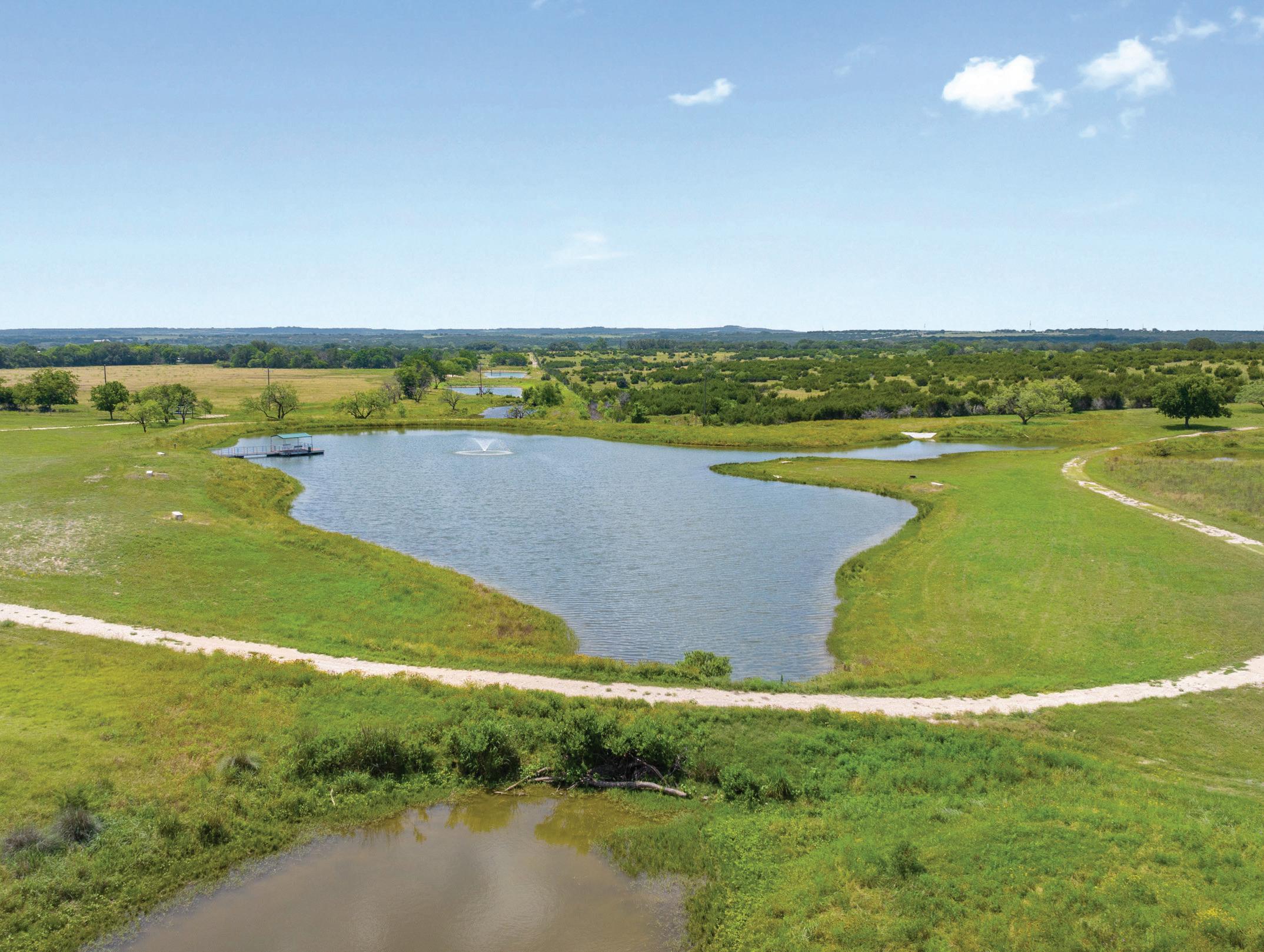
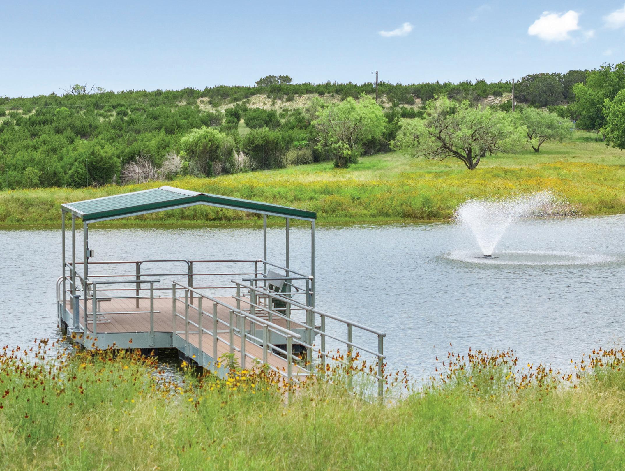
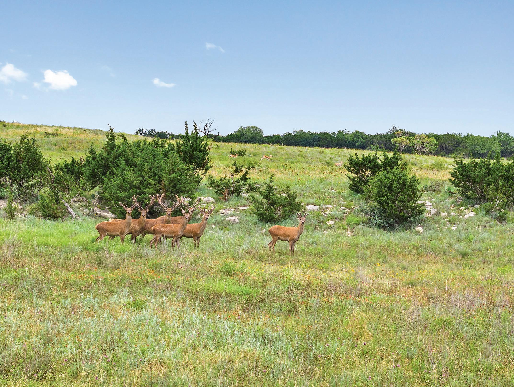
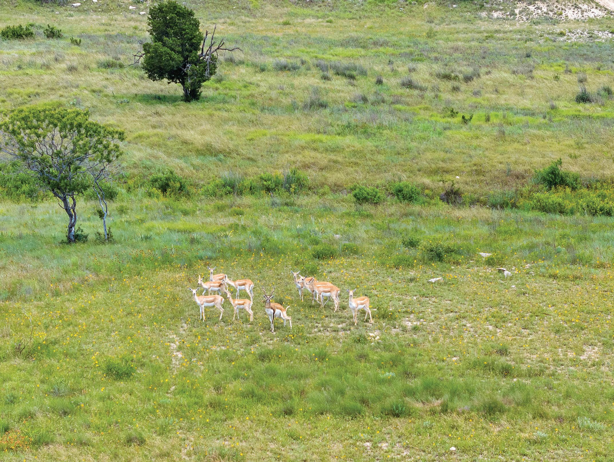
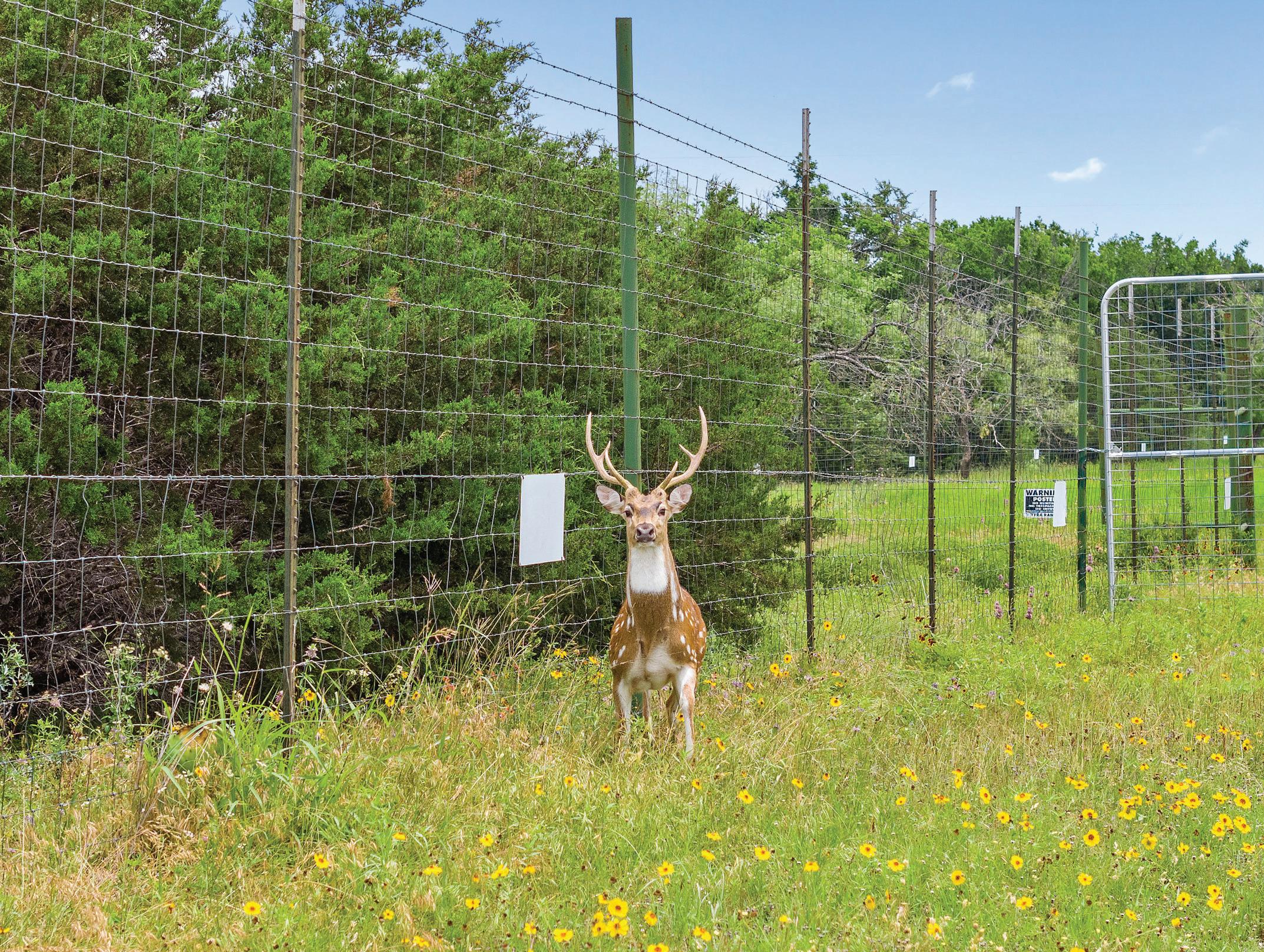
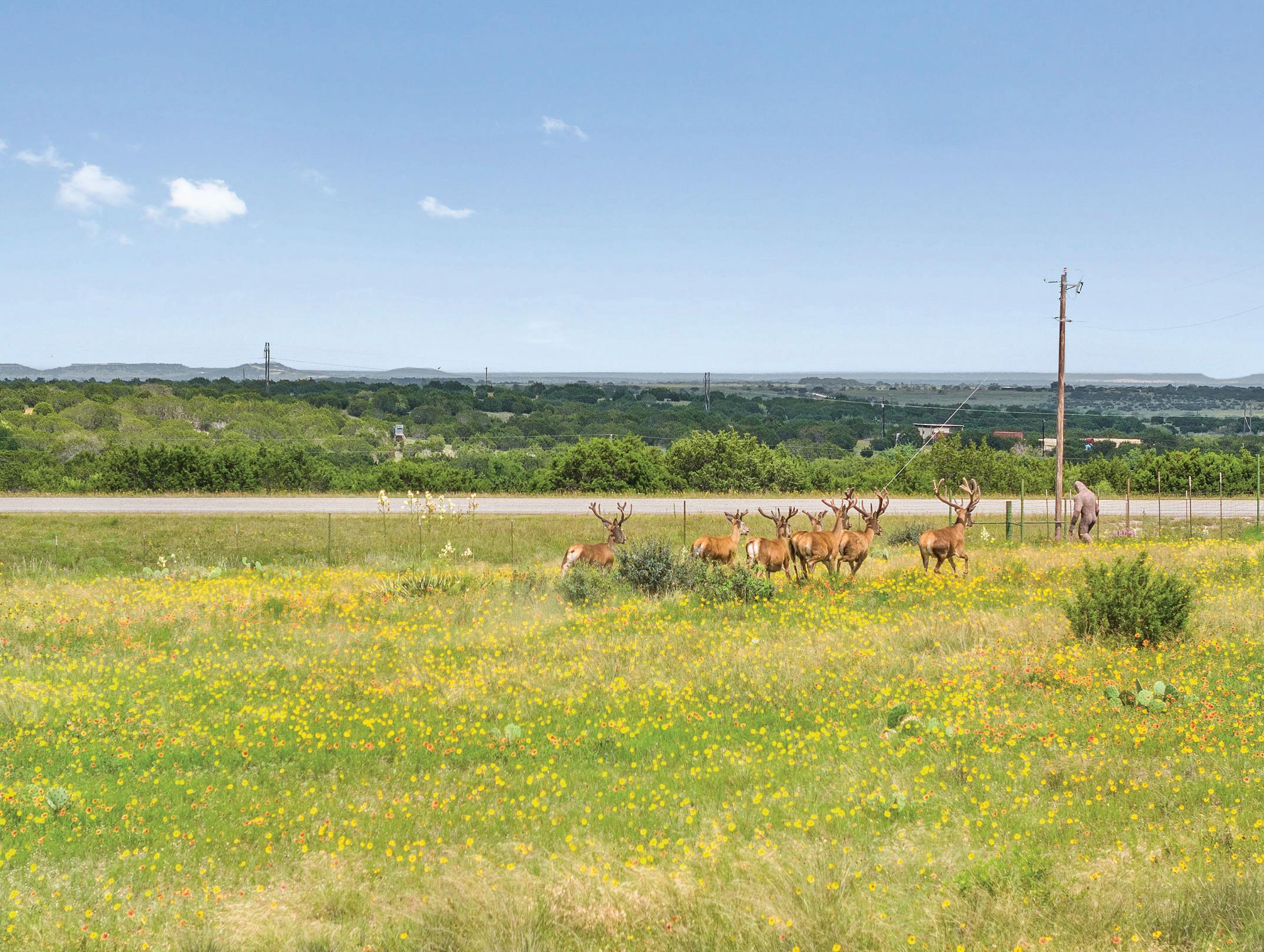
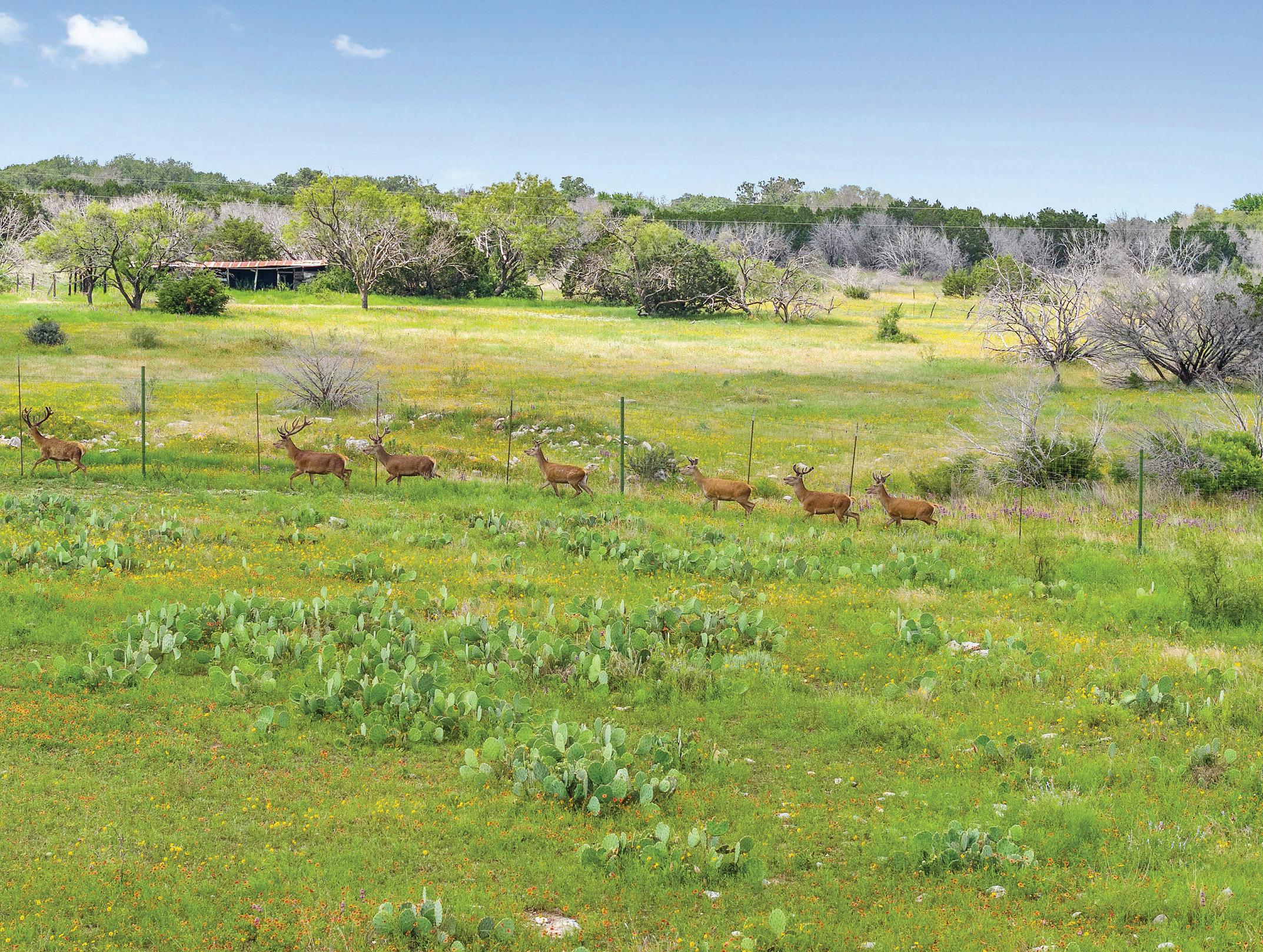
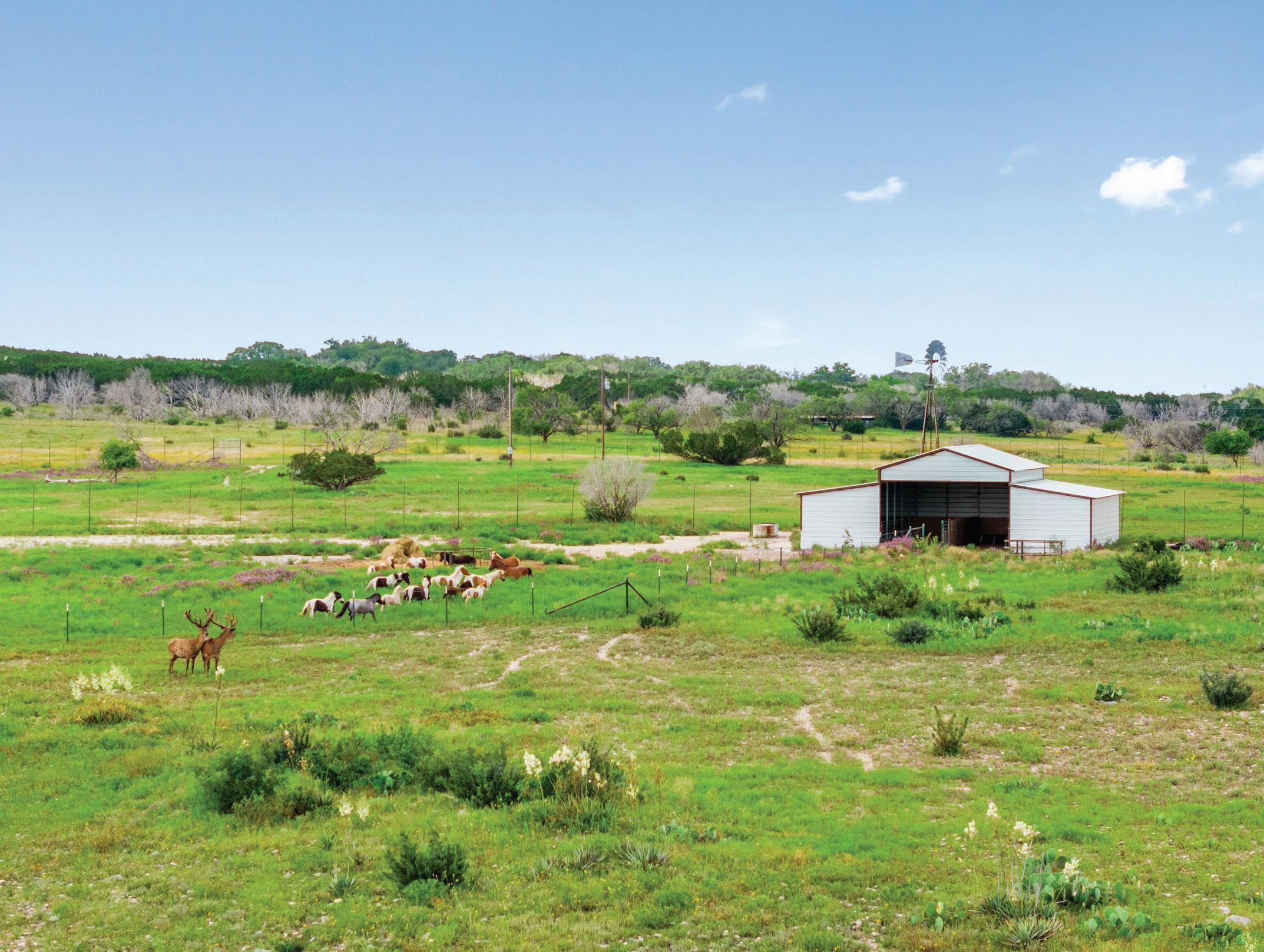
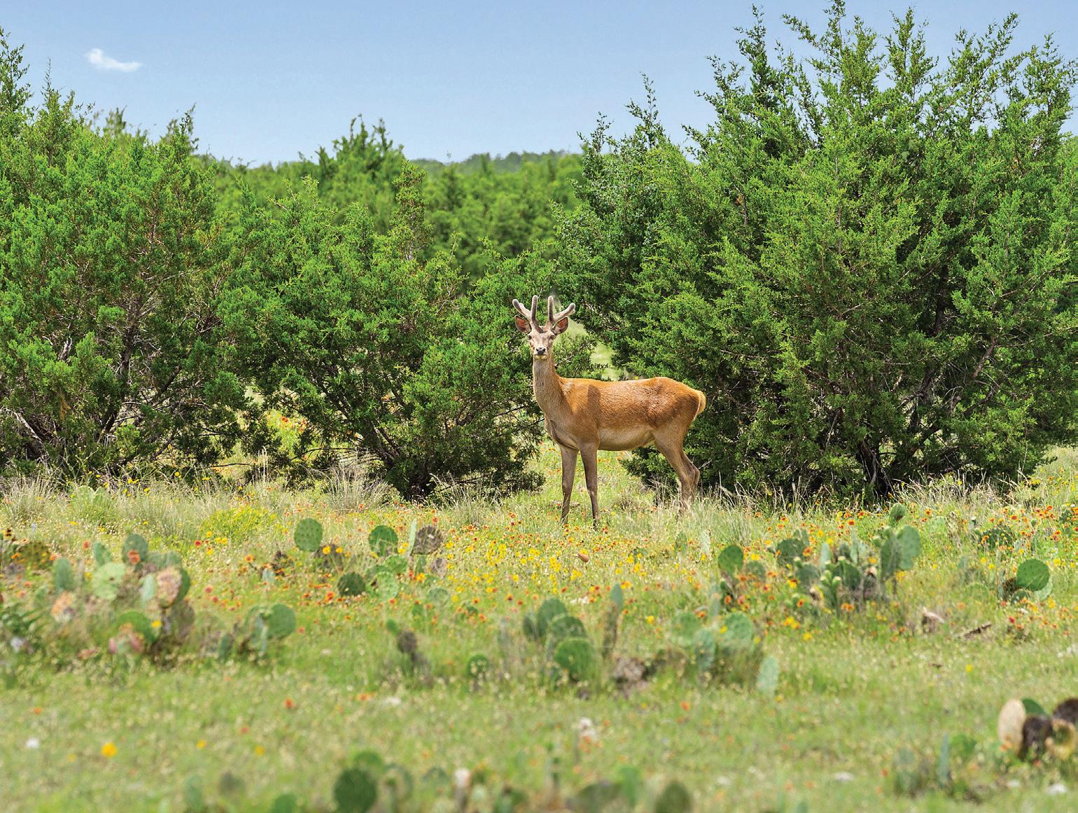
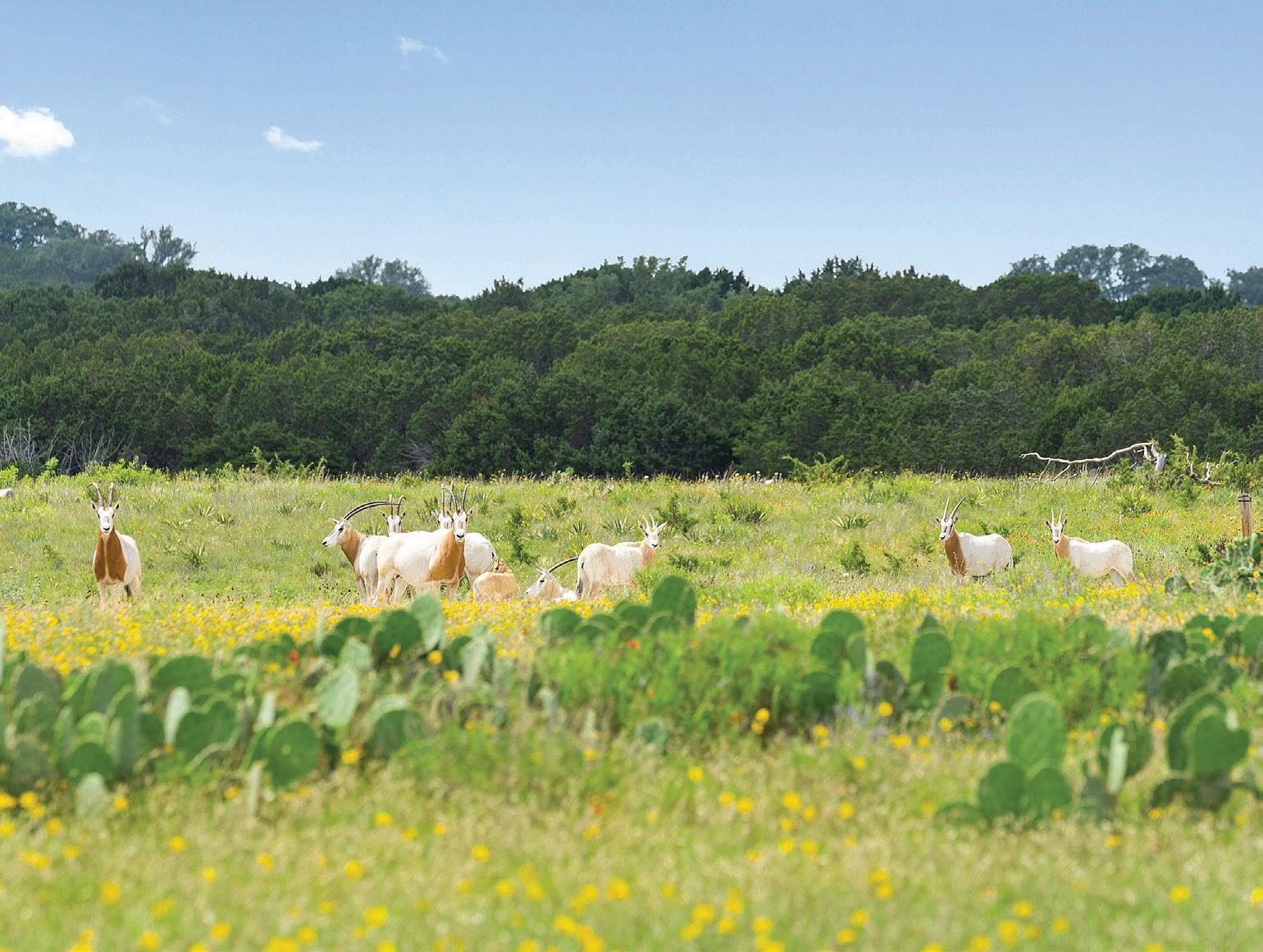
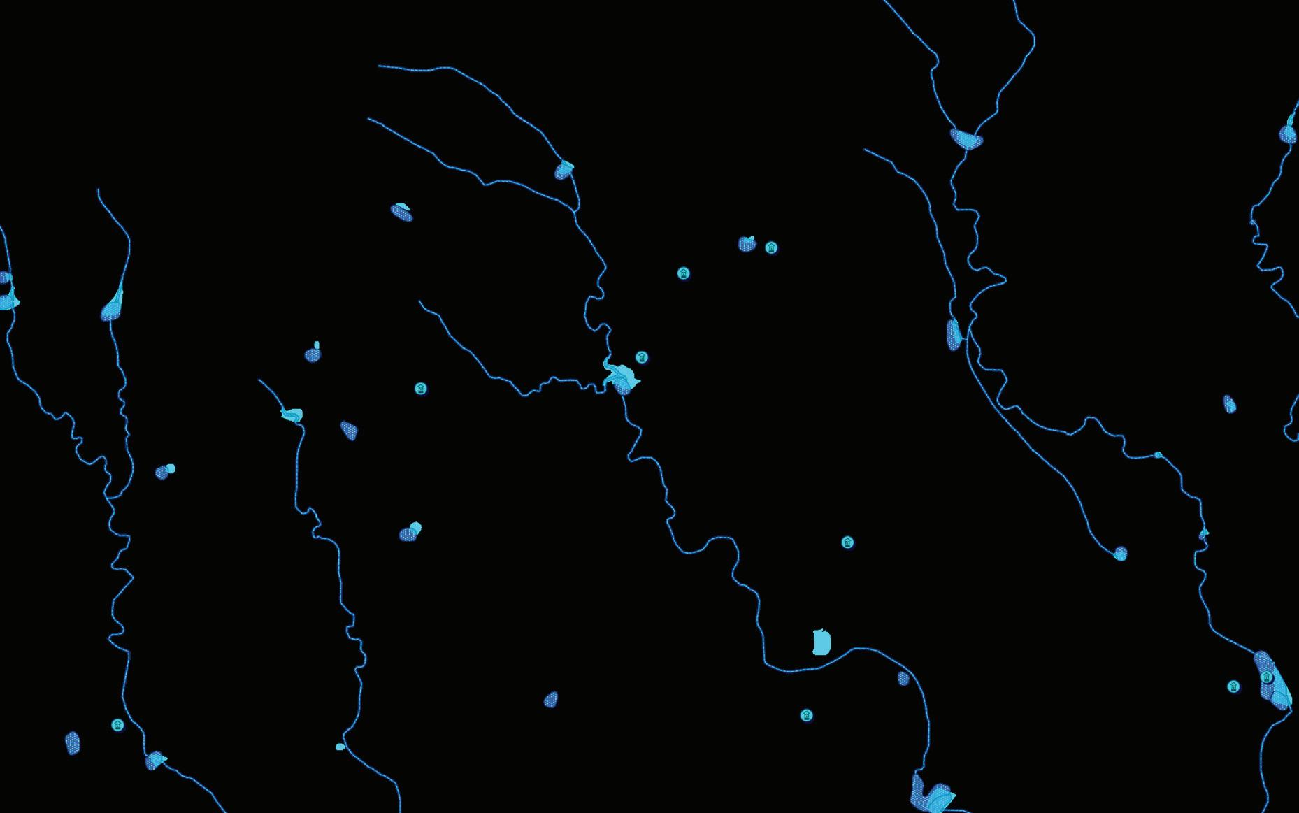
Water resources are abundant on the Underwood Ranch, making it self-sufficient in this regard. The property boasts 8 lakes/ponds scattered throughout, some of which are stocked with bass for fishing enthusiasts. Furthermore, the ranch benefits from 5 productive electric water wells and 2 windmill wells, ensuring a reliable water supply. The interior road system within the ranch includes roads paved with concrete or constructed as all-weather roads with a graded base. Approximately 300 acres of the ranch are high fenced, and it holds an MLD permit from Texas Parks and Wildlife. Through an extensive feeding program and experience, a superior whitetail deer herd has been developed by introducing genetically selected does to complement the native strain already found on the ranch. In addition to the impressive whitetail population, the ranch is home to Axis Deer, Black Buck Antelope, Red Stag, and Symitar Horn Oryx. There are also opportunities for hunting turkey, dove, and ducks.
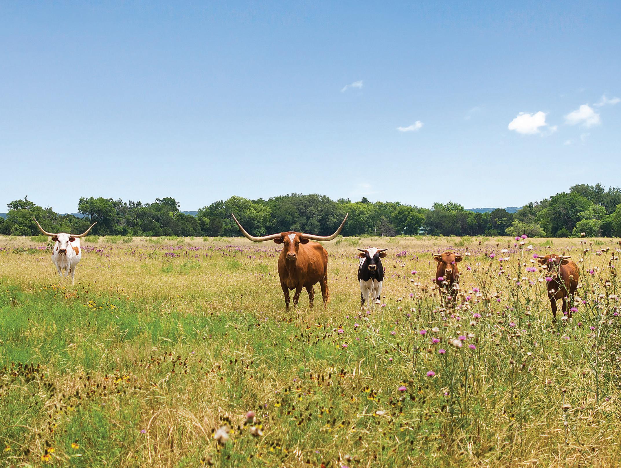
The Underwood Ranch is an executive property that offers an abundance of variety, beauty, and character. Its versatility allows for numerous possibilities, such as serving as a family or corporate retreat, event venue, horse/cattle ranch, or even future development, or just a great place to raise a family. One thing is certain: every time you pass through the gates of this premier ranch, it will bring a smile to your face.
Directions: From Lampasas take Hwy 281 north. The ranch is approximately 7 miles on your left.
For more information call Drew at 512-755-2078 or Mike at 512-940-8800.













Demasters tract and being an inside angle point of said Tyra tract and this tract;
THENCE: S 20° 59' 15" E 452.17 feet to a 1/2” iron pin with no cap found for the southwest corner of said
tract;
set for the northwest corner of said Demasters tract and being an inside ell corner of said Tyra tract and this
THENCE: S 88° 50' 59" W 1084.23 feet to a 1/2” iron pin with a yellow plastic cap inscribed “CCC 4835”
dated October 17, 2013 and recorded in Volume 492, Page 627 of said deed records;
northeast corner of that tract described in a Warranty Deed with Vendor's Lien to Edward Demasters
of the called 10.00 acre tract labeled Exhibit A-2 Page 1 of 2 in said Tyra deed and being the
9. S 02° 03' 03" W 60.25 feet to a TXDOT Type 1 concrete monument found for the southeast corner
the called 10.00 acre tract labeled Exhibit A-2 Page 1 of 2 in said Tyra deed,
5043” found for the southeast corner of the called 10.00 acre tract and being the northeast corner of
8. S 02° 05' 46" W 239.82 feet to a 1/2” iron pin with a yellow plastic cap inscribed “Maples RPLS
7. S 05° 53' 09" W 319.89 feet to a 1/2” iron pin with a yellow plastic cap inscribed “CCC 4835” set,
deed,
for the northeast corner of a called 10.00 acres tract labeled Exhibit A-2 Page 2 of 2 in said Tyra
6. S 05° 52' 30" W 831.96 feet to a 1/2” iron pin with a yellow plastic cap inscribed “CCC 4835” set
Tract 3 Frances Tracts,
5. S 05° 56' 02" W 147.41 feet to a 1/2” iron pin with no cap found for the southeast corner of said
4. S 01° 36' 52" W 276.27 feet to a TXDOT Type 1 concrete monument found,
Tract 3 Frances Tracts,
3. S 01° 35' 33" W 125.87 feet to a 1/2” iron pin with no cap found for the northeast corner of said
2. S 13° 26' 47" W 304.45 feet to a TXDOT Type 1 concrete monument found,
1. S 04° 42' 04" W 4.60 feet to a TXDOT Type
1 concrete monument found,
THENCE: with the west line of U.S. Highway 281 the following courses and distances:
this tract;
in Volume 219, Page 609 of said deed records and being the northeast corner of the called 371.33 tract and
corner of that tract described in an Exchange Deed to Richard Cobb dated September 16, 1983 and recorded
BEGINNING at a 1/2” iron pin with no cap found in the west line of U.S. Highway 281 for the southeast
being described by metes and bounds as follows:
August 14, 2008 and recorded in Volume 445, Page 460 of the Deed Records of Lampasas County and
Frances Tracts subdivision being canceled by Commissioners Court as described in an Affidavit dated
November 27, 2012 and recorded in Volume 485, Page 328 of the Deed Records of Lampasas County, said
Warranty Deed to Lewis R. Tyra and Charlyn K. Tyra, Co-Trustees of the LCT Revocable Trust dated
acres tract, a 10.00 acres tract and Tract 3, Frances Tracts, a subdivision in Lampasas County, in a Special
Abstract No. 821, Lampasas County, Texas, and being those tracts described as a 371.33 acres tract, a 10.00
Zeno Miller Survey, Abstract No. 1204 and approximately 1.14 acres out of the S.F. McBurney Survey,
acres being out of the Fernando Miller Survey, Abstract No. 1664, approximately 9.54 acres being out of the
approximately 42.89 acres being out of the D.R. Watson Survey, Abstract No. 740, approximately 14.13
Abstract No. 1563, approximately 105.98 acres being out of the R.F. Sewell Survey, Abstract No. 1606,
BEING 402.20 acres of land, approximately 228.52 acre being out of the Fernando Miller Survey No. 2,
402.20 ACRES
170715
corner of called 371.33 acre tract and this tract;
3. S 68° 57' 54" W 2419.09 feet to an 8” fence corner post found for the most westerly southwest
2. N 26° 39' 15" W 103.79 feet to a pipe fence corner post found,
1. S 68° 54' 03" W 577.85 feet to an 8” cedar fence post found,
distances:
THENCE: continuing with the southerly line of the called 371.33 acre tract the following courses and
the called 371.33 acre tract and this tract;
THENCE: N 21° 16' 55" W 2557.89 feet to an 8” cedar fence corner post found for an inside ell corner of
corner of the called 371.33 acre tract and this tract;
4. S 68° 42' 34" W 276.90 feet to a 6” cedar fence corner post found for the most southerly southwest
deed records,
Warranty Deed to Max Keele dated May 3, 1966 and recorded in Volume 130, Page 752 of said
5043” found at the corner of a rock fence found in the easterly line of that tract described in a
3. S 28° 35' 52" E 346.33 feet to a 1/2” iron pin with a yellow plastic cap inscribed “Maples RPLS
2. S 68° 26' 49" W 767.23 feet to a pipe fence post found,
found,
1. S 78° 42' 02" W 142.76 feet to a 1/2” iron pin with a yellow plastic cap (illegible inscription)
THENCE: with the south line of the called 371.33 acre tract the following courses and distances:
records and being the southeast corner of the called 371.33 acre tract and this tract;
Lien to Leemon L. Foster, et ux, dated May 11, 2008 and recorded in Volume 421, Page 183 of said deed
concrete monument found for the northeast corner of that tract described in a Warranty Deed with Vendor's
THENCE: S 05° 45' 30" W 116.22 feet with the west line of U.S.Highway 281 to a TXDOT Type 1
acre tract and this tract;
Highway 281 for the southeast corner of said Smith tract and being a northeast corner of the called 371.33
THENCE: N 79° 38' 56" E 184.37 feet to a cotton spindle inscribed “J” set in the west line of U.S.
acre tract and this tract;
in Volume 312, Page 769 of said deed records and being an inside ell corner of the called 371.33
tract described in a Warranty Deed to Eugene W. Smith, et ux, dated January 10, 1995 and recorded
4. S 10° 37' 00" E 1041.27 feet to a 1/2” iron pin with no cap found for the southwest corner of that
3. S 13° 51' 37" E 558.62 feet to a 1/2” iron pin with no cap found,
5043” found,
2. S 11° 47' 12" E 110.87 feet to a 1/2” iron pin with a yellow plastic cap inscribed “Maples RPLS
5043” found,
1. S 11° 32' 32" E 275.43 feet to a 1/2” iron pin with a yellow plastic cap inscribed “Maples RPLS
THENCE: with the east line of the called 371.33 acre tract the following courses and distances:
Volume 311, Page 299 of said deed records
remainder of that tract described in Warranty Deed to Jo A. Brown dated January 2, 2001 and recorded in
THENCE: N
67° 13' 39" E 105.63 feet to a 1/2” iron pin with no cap found for the northwest corner of the
402.20
ACRES (continued)
170715
Registered Professional Land Surveyor No. 4835 Firm
 Clyde C. Castleberry, Jr.
August 3, 2017 Lampasas, Texas 76550
Bearings based on Texas State Plane Coordinate System, Central Zone NAD 83.
4. S 85° 37' 53" E 2269.40 feet to the Point of Beginning.
3. N 68° 52' 48" E 2105.47 feet to a 1/2” iron pin with no cap found,
2. N 21° 26' 47" W 618.55 feet to a 1/2” iron pin with a yellow plastic cap inscribed “CCC 4835” set,
1. N 67° 05' 33" E 2083.54 feet to a fence corner post,
THENCE: with the north line of the called 371.33 acre tract the following courses and distances:
371.33 acre tract and this tract;
3. N 21° 47' 53" W 1521.56 feet to fence corner post found for the northwest corner of the called
2. N 05° 11' 33" W 360.61 feet to a railroad tie used as a fence post,
1. N 23° 12' 02" W 320.75 feet to a railroad tie used as a fence post,
THENCE: with the west line of the called 371.33 acre tract the following courses distances:
402.20
ACRES (continued)
JOB NO. 170715
Exhibit Attached
Page 4 of 4

Listing Agents: DREW COLVIN & MIKE BACON

313 S. Main Street, Burnet, Texas 78611
512-755-2078 / Drew@TXRanchBrokers.com
512-940-8800 / Mike@TXRanchBrokers.com




DISCLAIMER The information contained herein has been gathered from sources deemed reliable; however, Texas Ranch Brokers, LLC and its principals, member, officers, associates, agents and employees cannot guarantee the accuracy of such information. The information contained herein is subject to changes, error, omissions, prior sale, withdrawal of property from the market without prior notice, and approval of purchase by owner. Prospective buyers should verify all information to their own satisfaction. No representation is made as to the possible value of property, type or suitability of use, and prospective buyers are urged to consult with their tax and legal advisors before making a final determination. Real Estate buyers are hereby notified that real properties and its rights and amenities are subject to many forces and impact whether natural, those cause by man, or otherwise: including, but not limited to, drought or other weather-related events, disease (e.g. Oak Wilt or Anthrax), invasive species, illegal trespassing, previous owner actions, neighbor actions and government actions. Prospective buyers should investigate any concerns regarding a specific real property to their complete satisfaction. When buying real property, the buyer’s agent, if applicable, must be disclosed on first contact with the listing agent and must be present at the initial and all subsequent showing of the listing to the prospective real estate buyer in order to participate in real estate commission. If this condition is not met, fee participation will be at sole discretion of Texas Ranch Brokers, LLC.
Disclosures: https://tinyurl.com/58wahue8 & https://tinyurl.com/y6qo4o5w
