






P r a c t i c a l E x p e r i e n c e
The First Prize · UIA - CBC International Colleges and Universities Competitive Construction Workshop

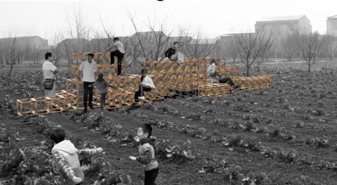
The original concept derives from the idea of a modular structure that can adapt to various sites and functions. This duplicable structure of the module will be repeated. The structural elements provide the opportunity to design various multifunctional furniture for everyday use, serving diverse purposes such as recreation, retail and relaxation. The inspirations of the modular system originate from the site landscape with numerous matrixes of fruit trees, concrete columns and vine plants. This design follows the matrix and expands throughout the territory, creating a new logical system with unlimited expansion in an organic shape. These “wooden pixels” interpret the landscape and settlement morphology in a Cartesian order.


The basic idea of extracting grid elements from the site is to use the matrix as a modular structure of the site and generate flexible functional units according to the spatial needs. Learning from the node construction method used by the local people, this work combines the traditional form of the mortise-tenon joint and optimizes the structural design in the preconstruction process. The node translation is rooted in Chinese wisdom.




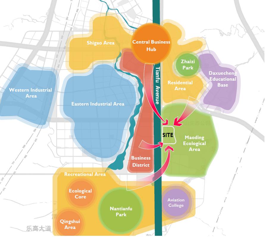


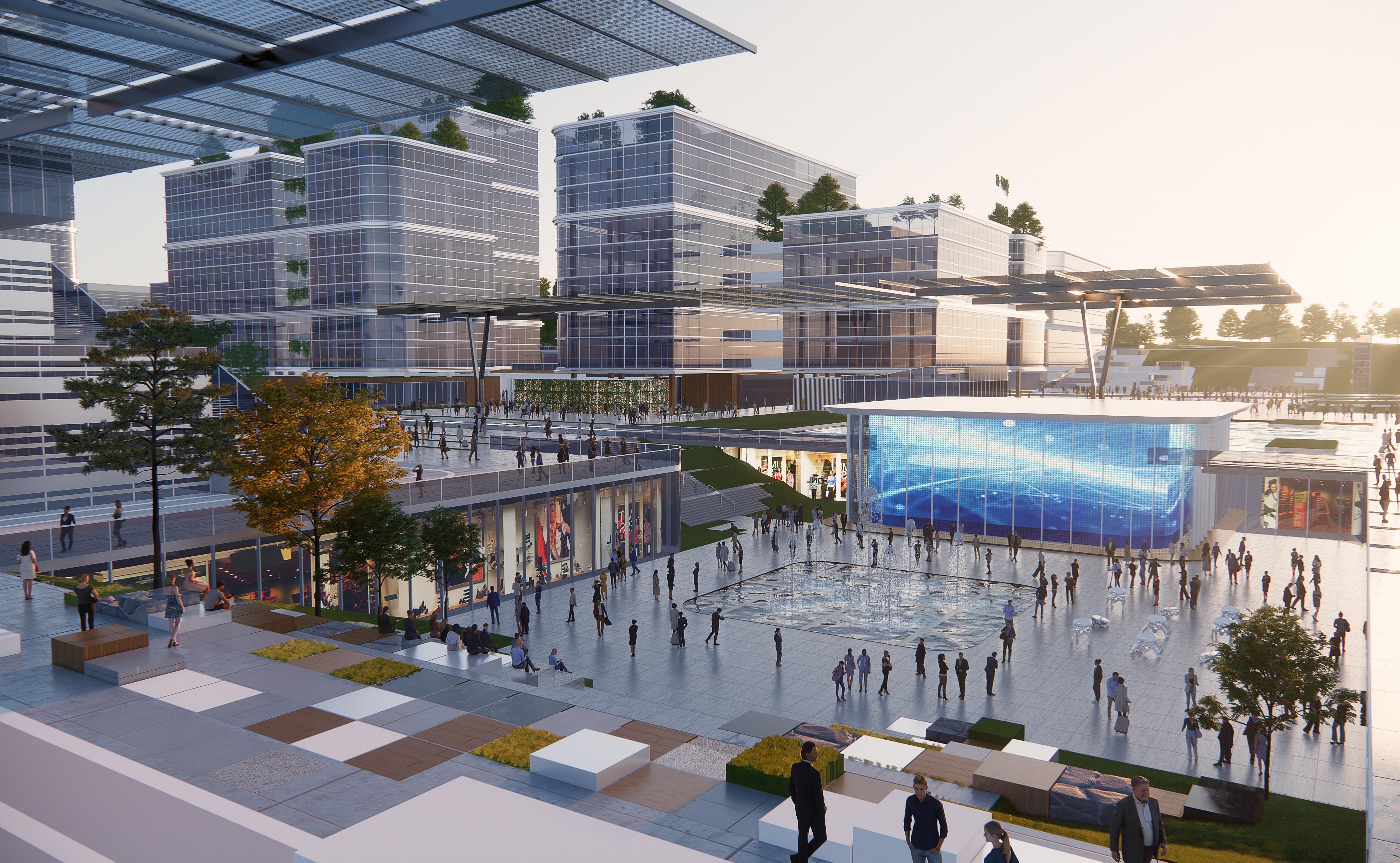


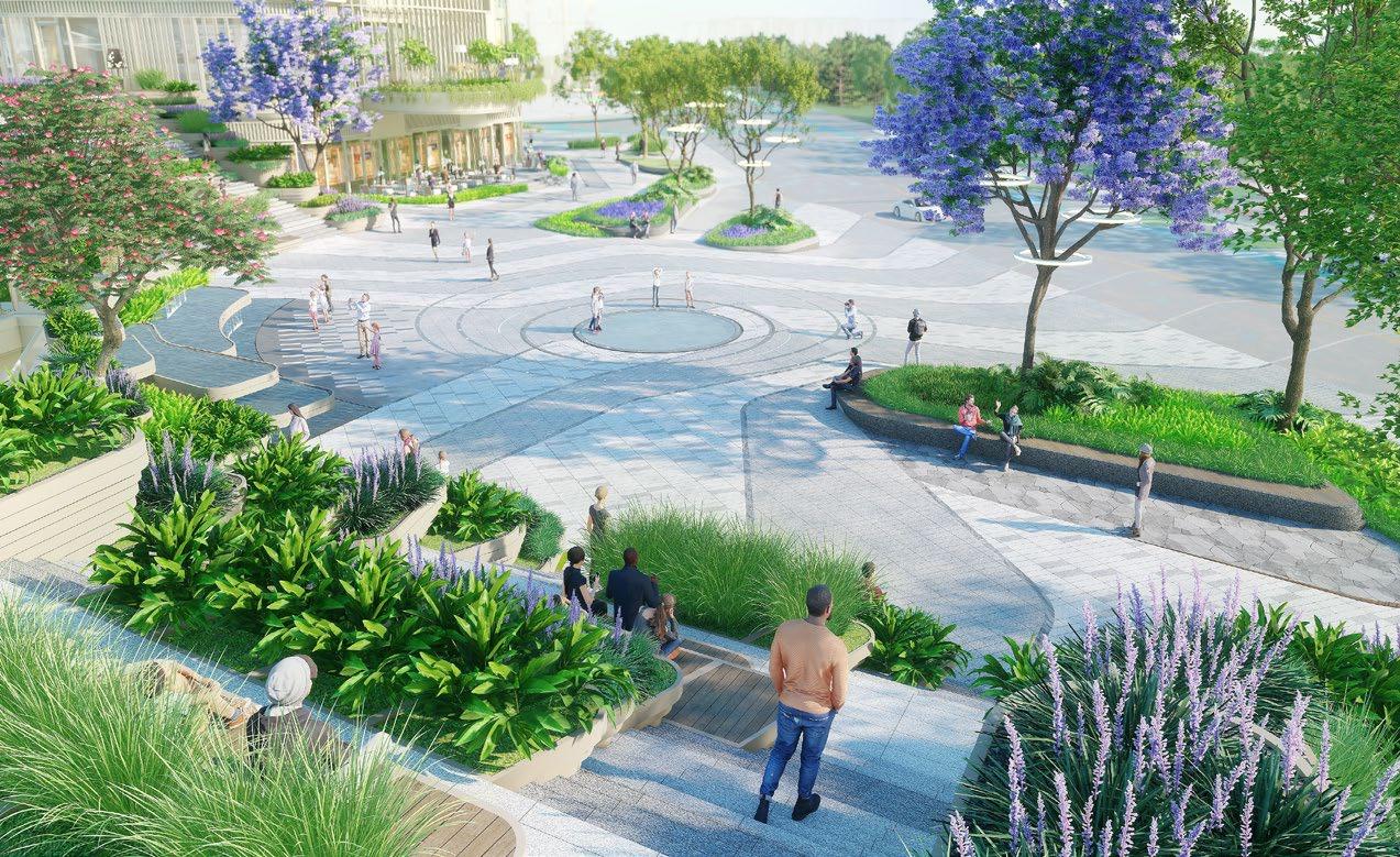
The Practical Design in Chengdu


The Practical Design in Chengdu


Outstanding Participation· SEU·ARCH - ISOCARP International Digital Urban Design Workshop

Restaurant POI
Re tail POI
H otel POI
Parking POI
Scenery POI


24:00 1:00 2:00 3:00 4:00 5:00 6:00 7:00 8:00 9:00 10:00 11:00 12:00 13:00 14:00 15:00 16:00 17:00 18:00 19:00 20:00 21:00 22:00 23:00
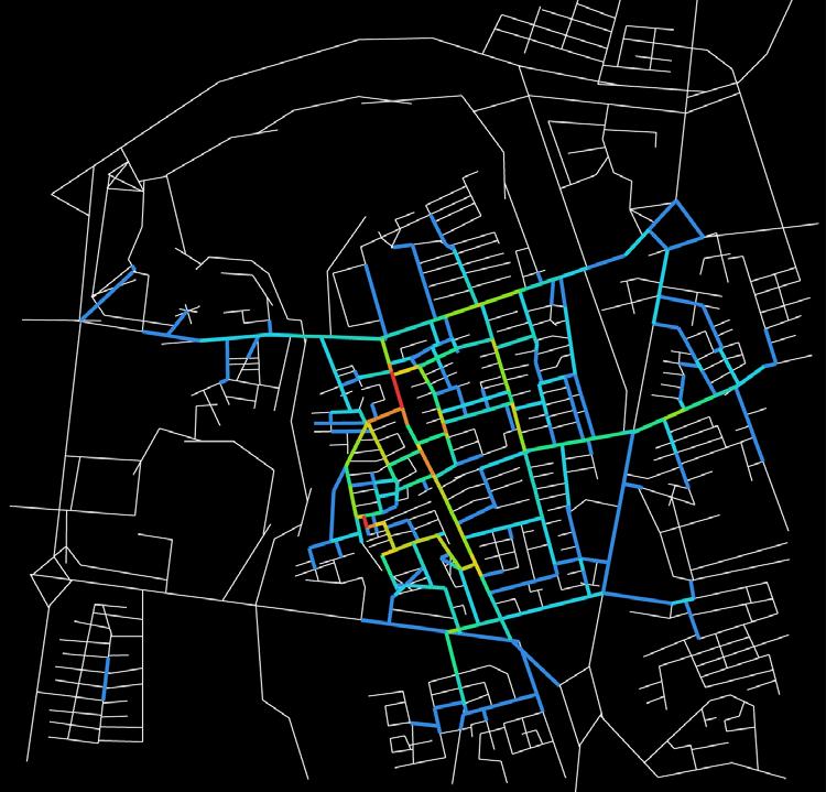


The ESA Research in Ziqing , Nanjing

The Interconnected Fields in ESAs Research from 2020 to 2024

The site, Ziqing , is located in Nanjing, situated in the Yangtze River Delta, China . Nanjing is one of the most dynamic and innovative cities in China, attracting a large influx of population . At the same time, Nanjing has a superior level of urbanization, while requiring ecological restoration . According to the bluegreen system analysis of Nanjing, there lies severe fragmentation in Nanjing’s natural spaces, necessitating the revitalization of ESAs . Multitudes of sampling blue - green spaces are small - scale . Ziqing , as a site with natural blue - green space, has affluent natural resources while rapid urbanization brings dangers to habitat loss and biodiversity decline . Ziqing is located near the entrance of the Tangshan Scenic Area on the north side of the Huning Expressway . There is a natural lake, Ziqing Lake, which is home to the nationally protected species, the Yangtze alligator . The lakeshore and highlands are densely populated with vegetation . However, some existing buildings and facilities have caused damage to the ecological environment of Ziqing Lake .
The ESAs Evaluation Framework Practical Experience | A Multi - dimensional Assessment of Ecologically Sensitive Areas
The ESA Research in Ziqing , Nanjing

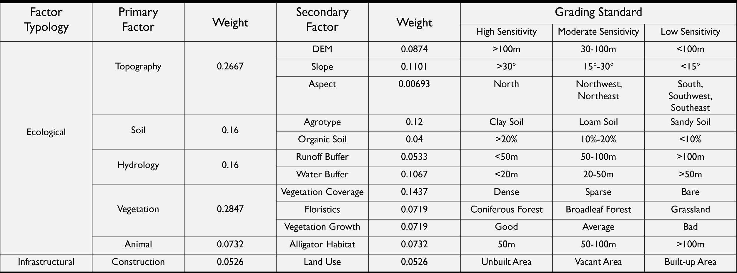

The Factor Weight Chart of ESAs
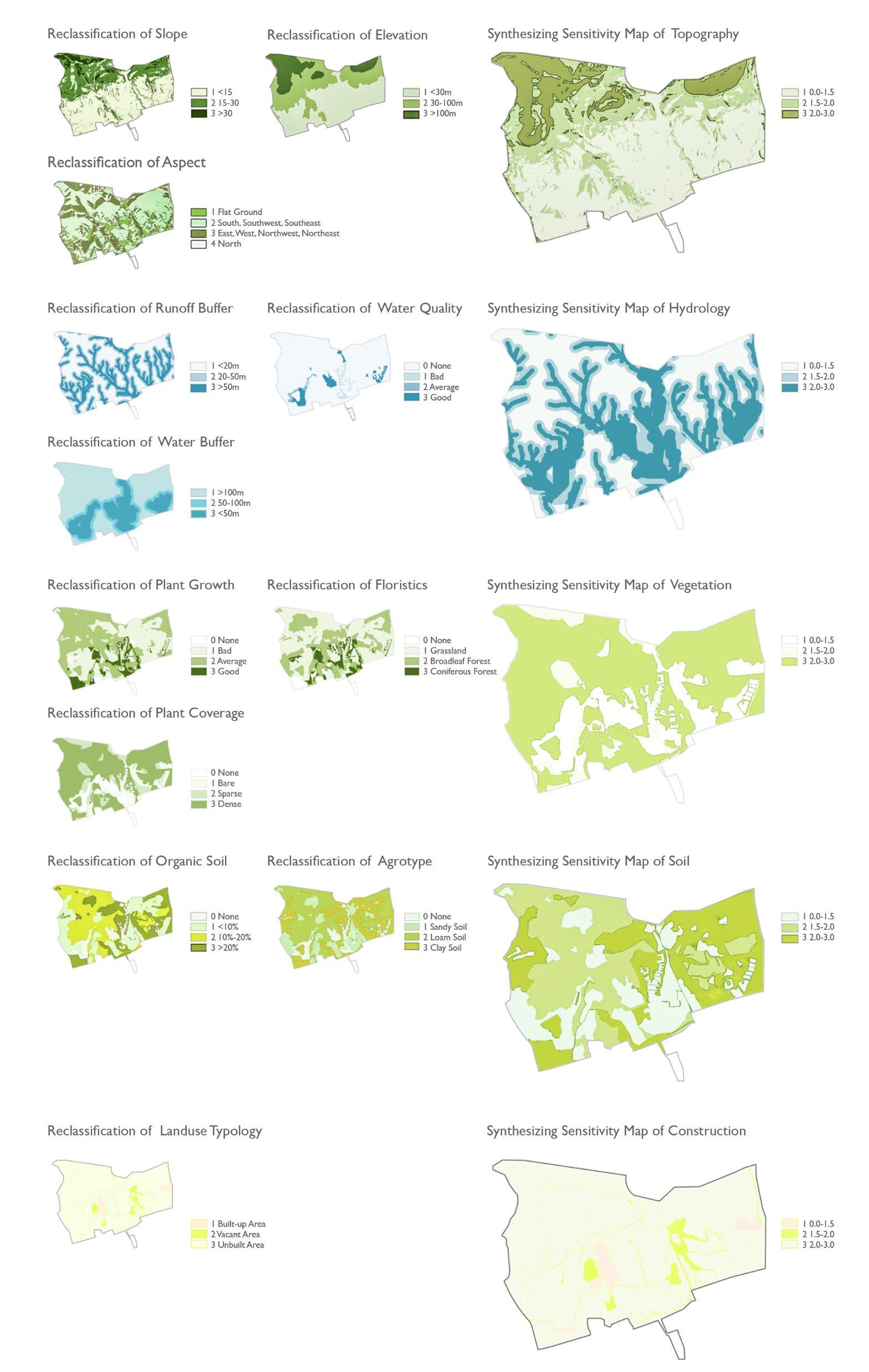
The Reclassification Maps

From the ESA map, it can be seen that areas of high ecological sensitivity are mainly distributed in the central and northern mountainous regions, where the central area has abundant water resources, the northern area has more forests, and the elevation is higher . Moderately sensitive areas are mainly found in the southern, eastern, and western regions . Low - sensitive areas are primarily concentrated in the southern plains and paddy fields, where the terrain is flat and sensitivity is below the average level .
The assessment indicators mainly include two aspects : ecological and infrastructural . Key indicators include topography, soil, hydrology, flora, fauna, and construction . Secondary indicators include relative elevation, slope, aspect, soil type, soil organic matter, water body buffer zones, watershed buffer zones, vegetation coverage, vegetation types, vegetation growth, endangered species habitats, and construction status . The grading standards include three levels : high sensitivity, moderate sensitivity, and low sensitivity, assigned scores of 3 , 2 , and 1 , respectively .


Practical Experience | Evaluating Equity for Urban Resilience in Hong Kong
Integrating Human - Centric Principle (HCP) with Geospatial Artificial Intelligence ( GeoAI )
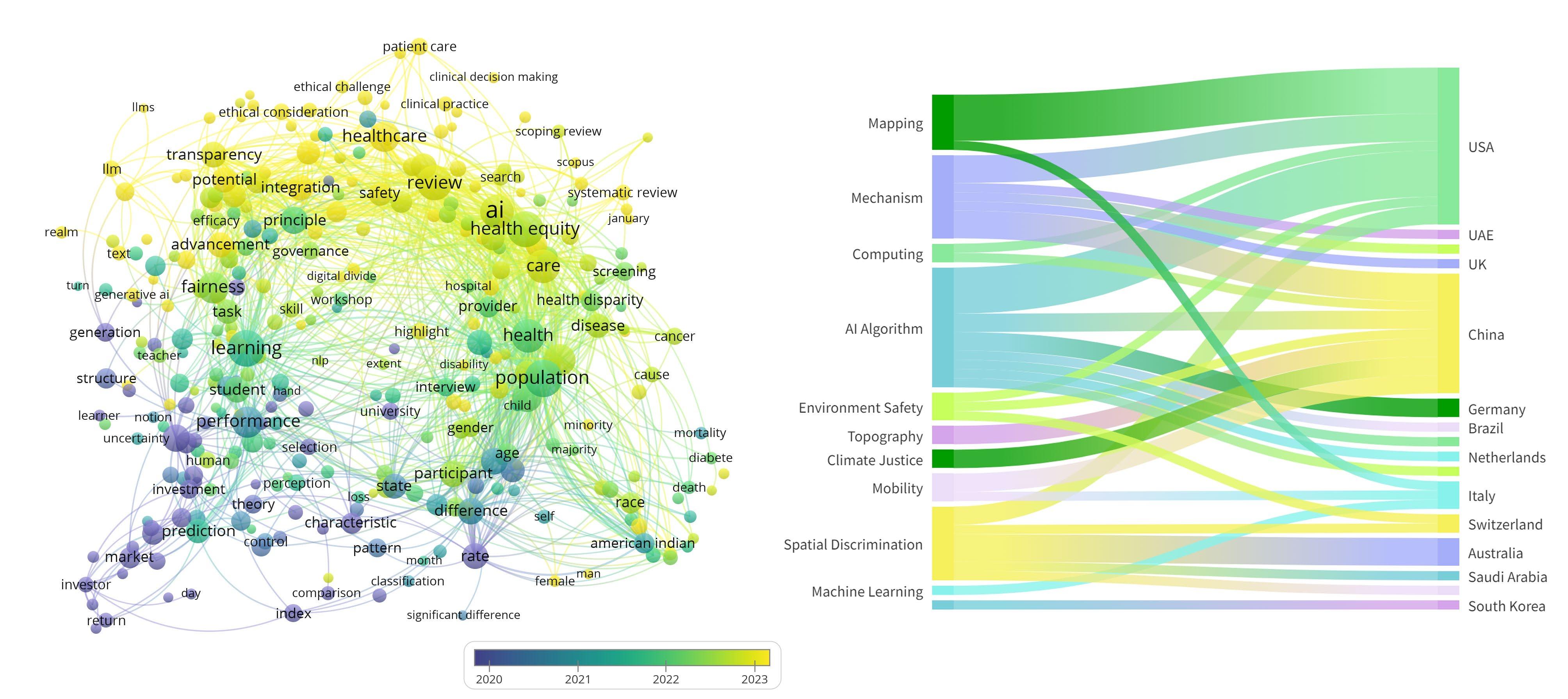

The Interconnected Fields in HCP Research from 2020 to 2023
Experience | Evaluating Equity for Urban Resilience in Hong Kong
Integrating Human - Centric Principle (HCP) with Geospatial Artificial Intelligence ( GeoAI )

The Interconnected Fields in GeoAI Researchs from 2020 to 2023
| Evaluating Equity for Urban Resilience in Hong Kong
Integrating Human - Centric Principle (HCP) with Geospatial Artificial Intelligence ( GeoAI )


The Equity Indices in Hong Kong
Integrating Human - Centric Principle (HCP) with Geospatial Artificial Intelligence ( GeoAI )
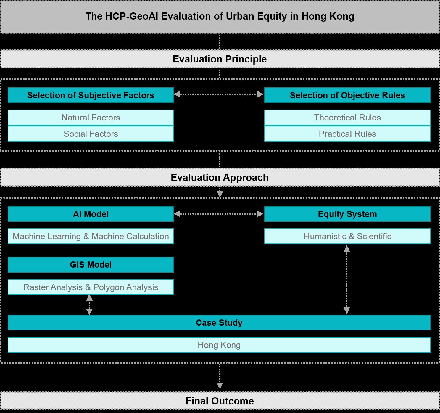
There still remain unfilled gapsthat combine HCP and GeoAI for enhancing urban resilience and equity . While GeoAI has shown great promise in addressing urban challenges, its rapid development raises concernsabout potential harms, including discrimination and inequality resulting from biased or opaque algorithms . Additionally, the concept of super - intelligent AI, often referred to assingularity, posesrisks of AI systems surpassing human control . These concerns underscore the need to integrate Human - Centric principles into GeoAI applications,especially in the context of urban evaluation . By combining HCP and GeoAI , we can mitigate theserisks and address the ethical and social challenges posed by AI in urban environments . HCP ensures that technology remains aligned with human values, emphasizing transparency,inclusivity, andjustice in evaluation processes . When applied together, HCP can provide a necessary counterbalance tothe purely data - driven nature of GeoAI , guiding the development of AI systems that are notonly technically robust but also socially reasonable . This hybrid approach fosters a symbiotic relationship between humanity andtechnology,ensuring thatevaluation contributes to qualified judgment .
| Evaluating Equity for Urban Resilience in Hong Kong
Integrating Human - Centric Principle (HCP) with Geospatial Artificial Intelligence ( GeoAI )


The F actors contributing the Equity Index of Hong Kong
Practical Experience | Evaluating Equity for Urban Resilience in Hong Kong
Integrating Human - Centric Principle (HCP) with Geospatial Artificial Intelligence ( GeoAI )

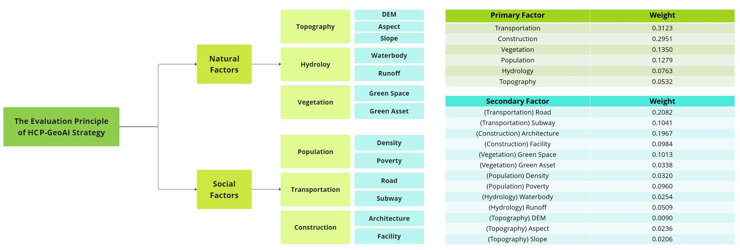
| Evaluating Equity for Urban Resilience in Hong Kong
Integrating Human - Centric Principle (HCP) with Geospatial Artificial Intelligence ( GeoAI )

The Reclassification Maps of Equity Factors of Hong Kong
| Evaluating Equity for Urban Resilience in Hong Kong
Integrating Human - Centric Principle (HCP) with Geospatial Artificial Intelligence ( GeoAI )

The Equity I ndex Maps of Hong Kong

