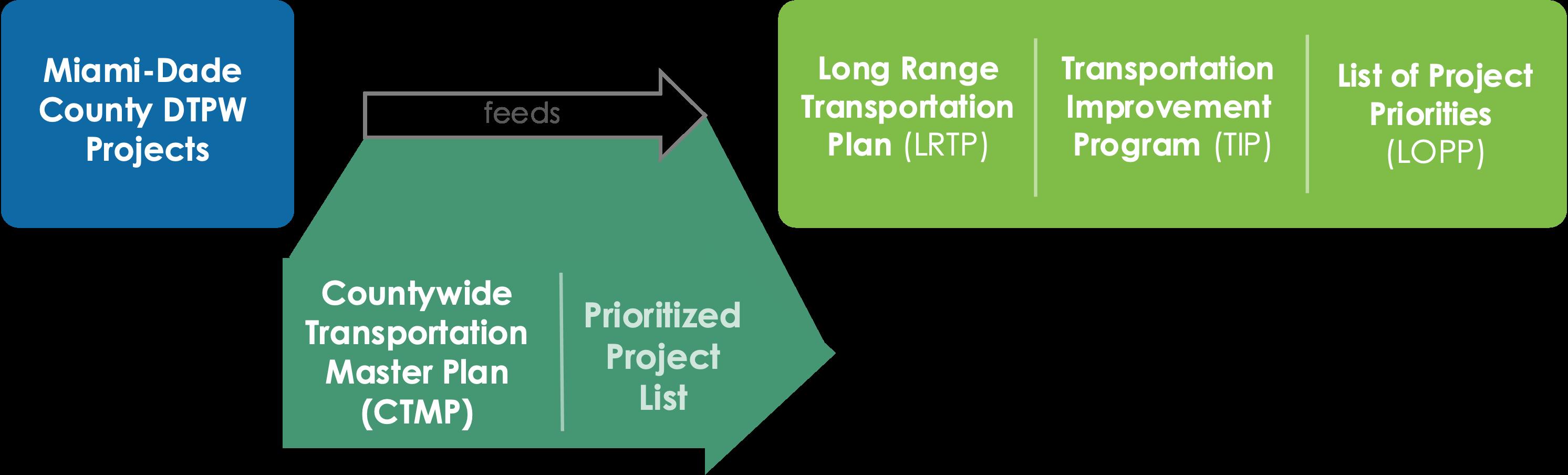
The Miami-Dade County Department of Transportation and Public Works (DTPW) is developing a countywide implementation plan for all transportation projects
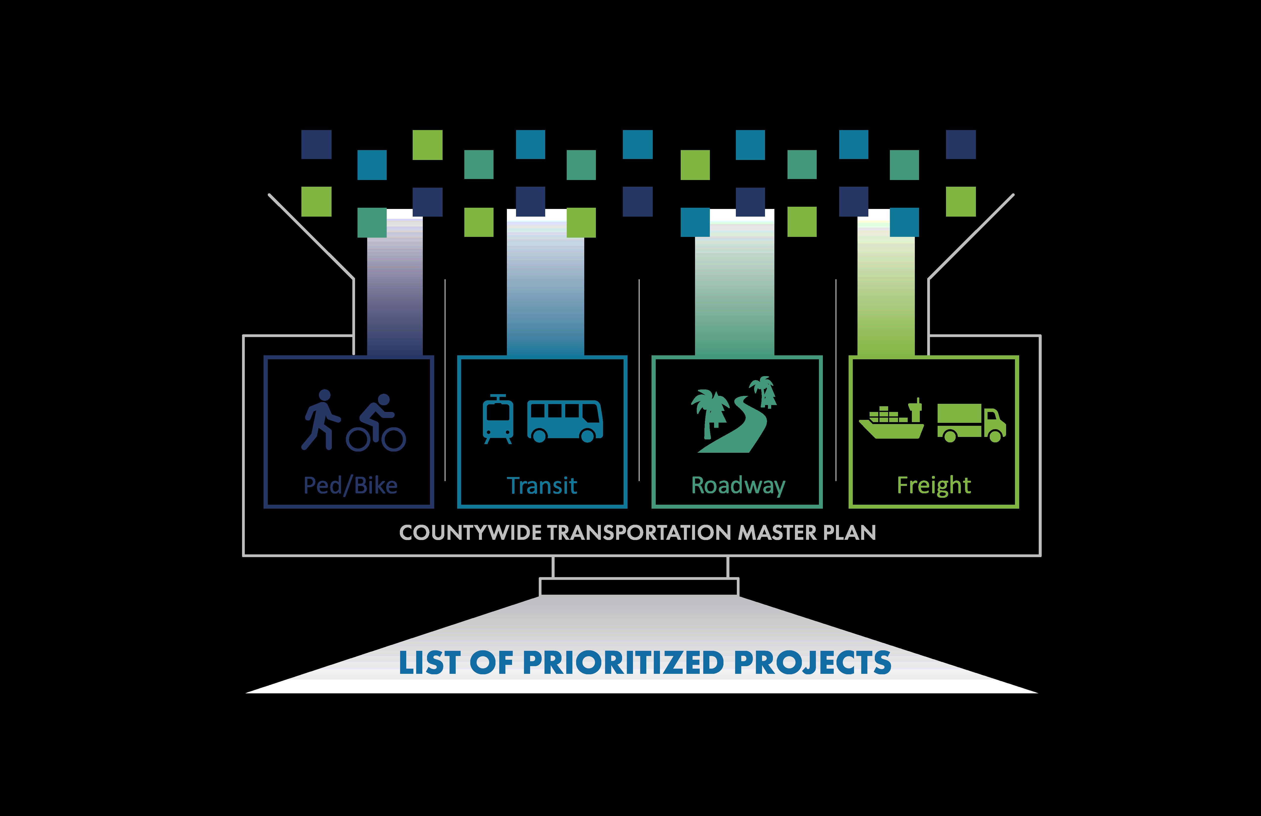
The CTMP will serve as an implementation plan for transit, pedestrian, bicycle, freight, roadway, and other transportation infrastructure projects being carried out by Miami-Dade County over the next 20 years.
Implementation Plan
Why does the CTMP Matter?
•A Methodical, Fair, and Efficient Approach
•A Unified Prioritization List
•An Informative Plan
•A Holistic View of Transportation
•Municipal and Departmental Harmonization
•Strengthening Regional Leadership
Purpose and Goals
Transportation infrastructure affects your:
Through the CTMP: Faster project implementation
Safer, more connected transportation network
Closing of gaps in transportation network
Public has a voice in the planning process
Improving Implementation Outcomes
The CTMP sounds a lot like the LRTP.
How is it different?
The CTMP is an implementation plan that prioritizes and programs mobility and infrastructure investments through a data driven methodology goals of the County
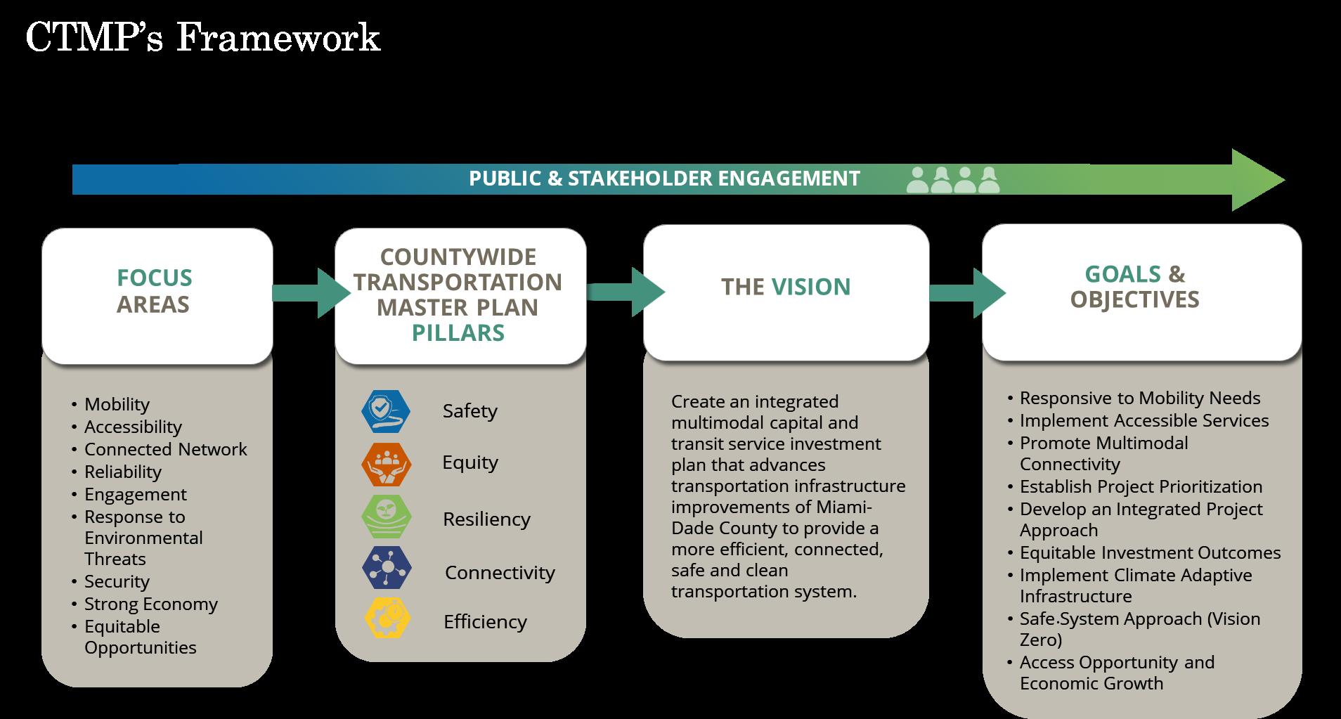
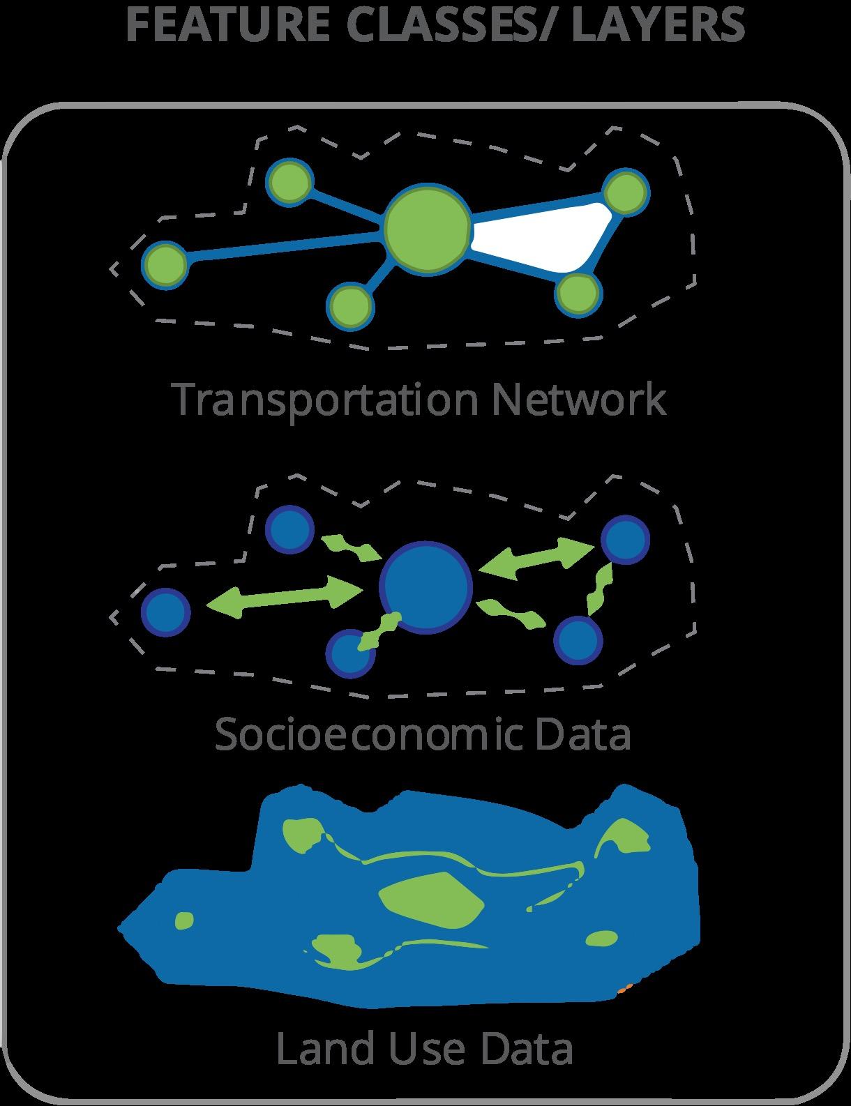
CTMP Framework
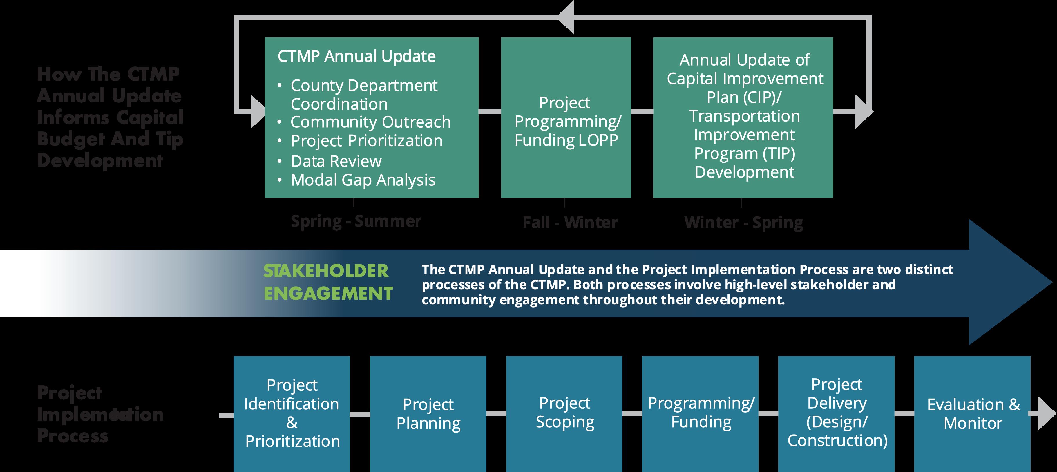
Implementation Plan CTMP Process
Implementation Plan CTMP Process
Project Prioritization
Project Prioritization Overview
The Countywide Transportation Master Plan developed a project prioritization framework that set forth specific criteria for each of the modes to prioritize projects.
The prioritization follows a methodical, fair, data-driven and efficient process.
The modal plans follow the Safe Systems Approach and consider:
• Safety
• Equity
• Resilience
• Affordable Housing
• Land Use
• Community Characteristics
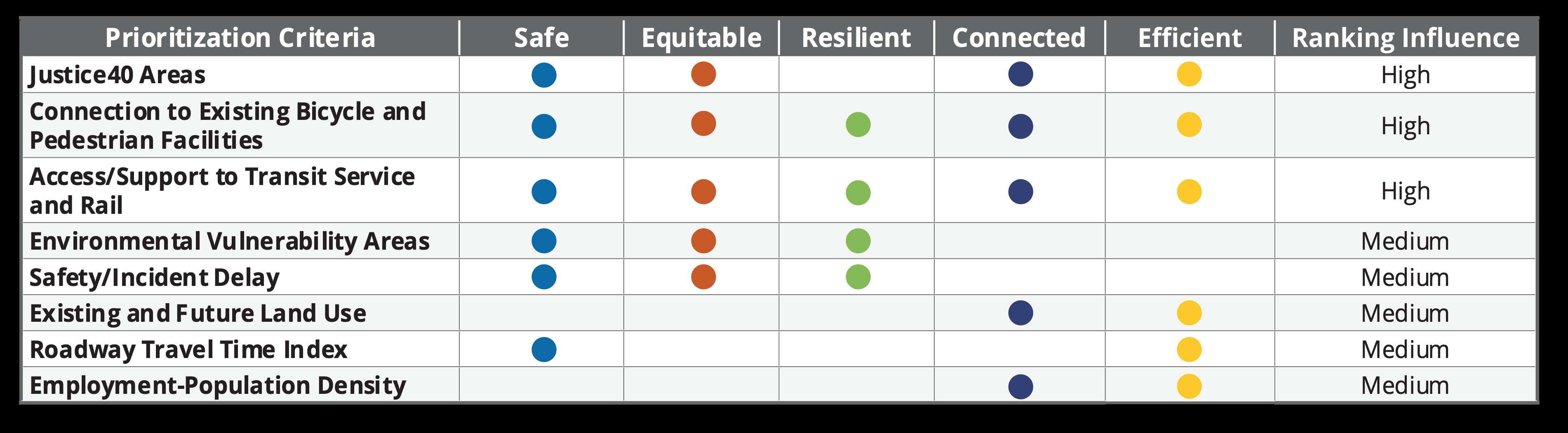
Project Prioritization Criteria
Eight criteria were developed and applied to the CTMP project prioritization process to identify and rank projects that align with the CTMP five pillars. As part of the prioritization process, CTMP projects were organized into three priority bands:
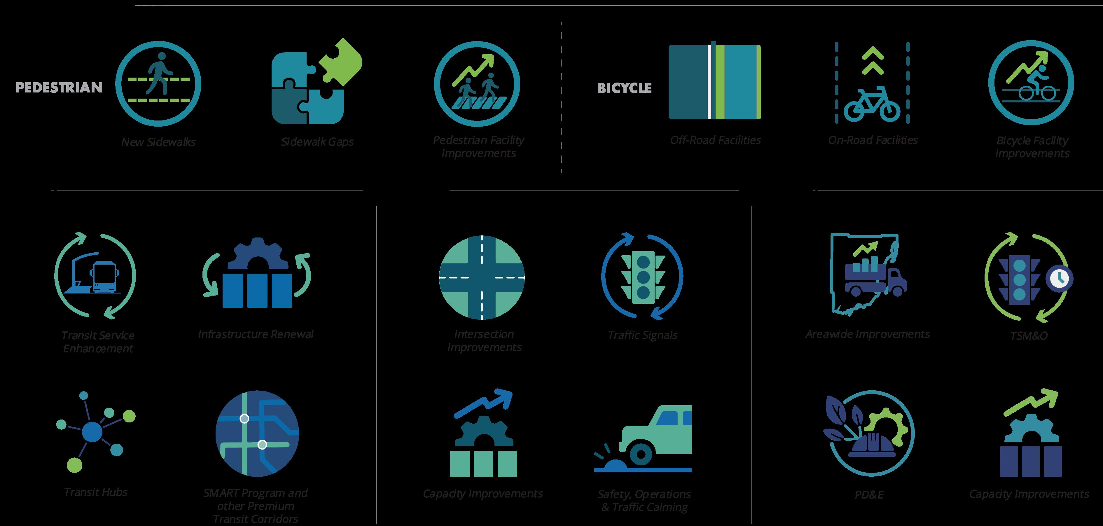
Prioritized Modal Buckets
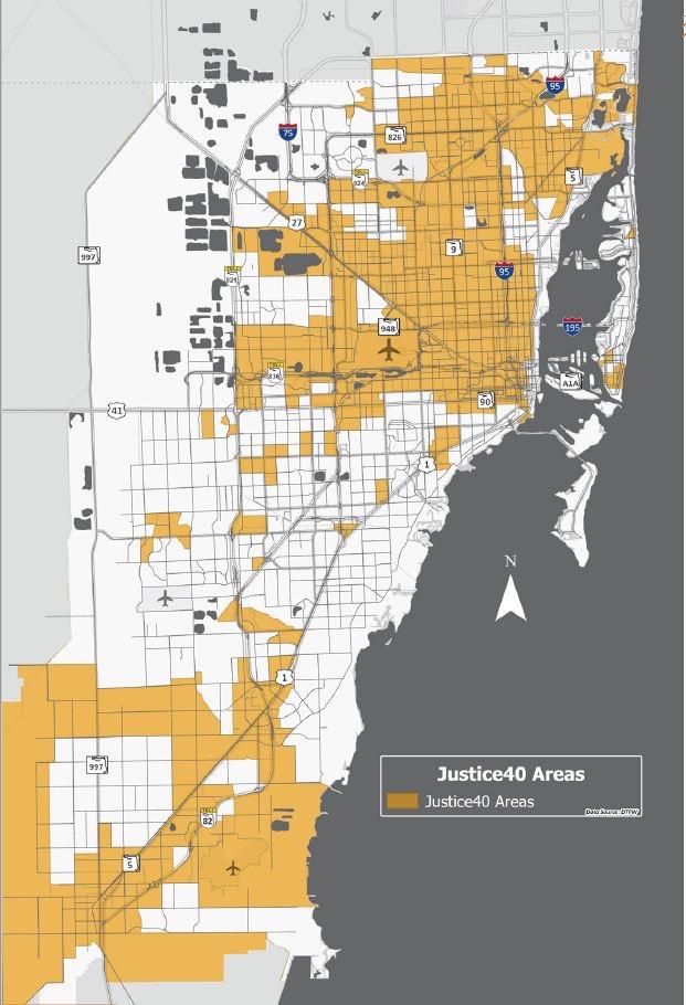
Justice40
• Prioritized projects providing enhanced connectivity and access for disadvantaged populations in Miami-Dade County.
• Based on United States Department of Transportation (USDOT) Justice40 methodology. Factors included:
• Low income
• Zero-vehicle household
• Senior household data
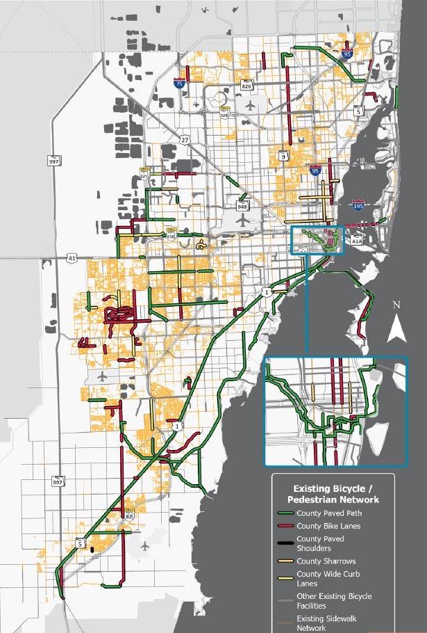
Connection to Existing Bicycle and Pedestrian Facilities
• Prioritized projects based on connections and proximity to existing bicycle or pedestrian facilities.
• New or enhanced connection to an existing facility were prioritized higher than projects that only provided a potential connection or no connection to existing facilities.
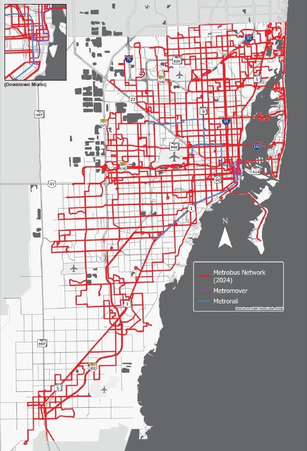
Access/Support to Transit Service and Rail
• Prioritized projects that provided and enhanced connections to existing transit services in Miami-Dade County.
• Projects located with a quarter ( ¼ ) mile of a bus route within the Metrobus network.
• Additional points for projects located with a ( ¼ ) of other transit services, such as:
• Tri-Rail
• Metromover
• Metrorail
• Community circulators
• Brightline stations
• MetroConnect service area
• Freebee service areas
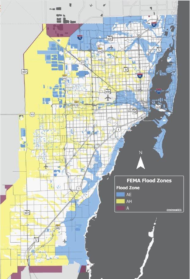
Environmental Vulnerability
• Prioritized projects that served high heat vulnerability and flood prone areas of Miami-Dade County.
• Flood zone
• High Heat Vulnerability Index
• Addressed resiliency issues
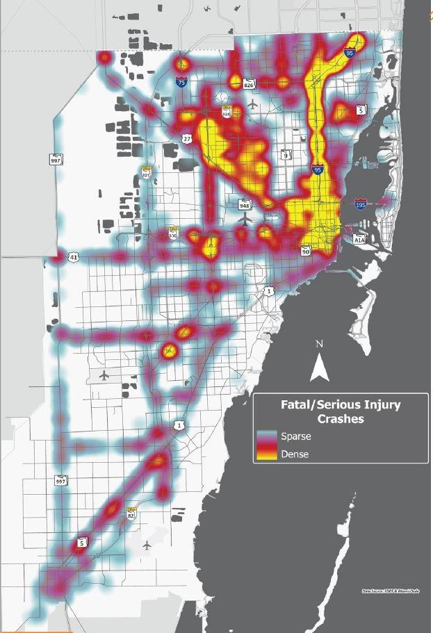
Safety/Incident Delay
• Prioritized projects that provided enhancements to and improved safety in high crash locations in Miami-Dade County.
• Based on proximity to the High Injury Network and proximity to areas of high fatal and serious injury crash densities.
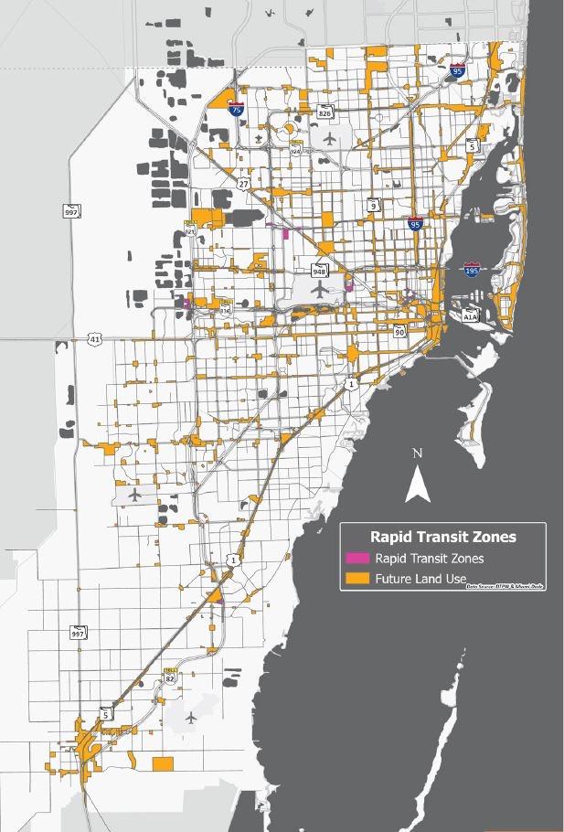
Existing and Future Land Use
• Prioritize projects that provided connections to and supported growth-focused existing and future land uses, such as Rapid Transit Zones.
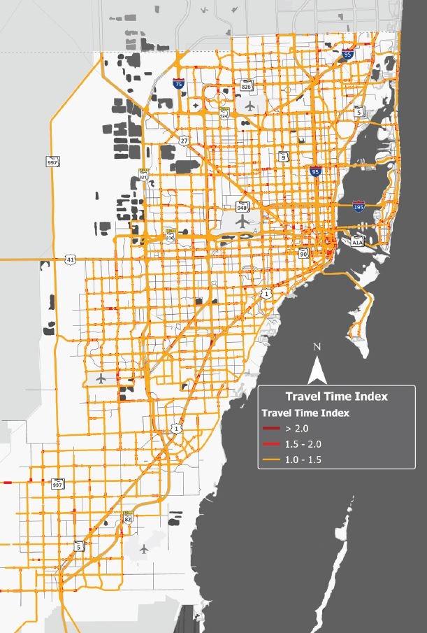
Roadway Travel Time Index
• Prioritize projects based on improvements on or near corridors with extended travel time delay.
The ratio of the travel time during the peak period to the time required to make the same trip at free-flow speeds (Bureau of Transportation Statistics)
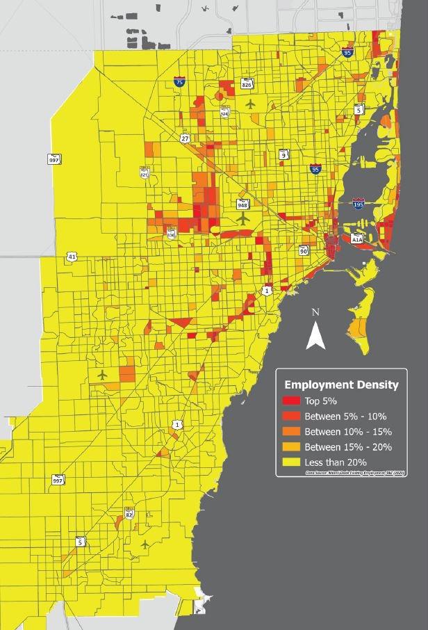
EmploymentPopulation Density
• Prioritized projects based on proximity to areas of high employment and high population density.
• Employment and Population densities evaluated separately.
Transportation Planning Areas
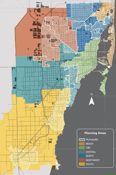
CTMP Planning Area
Grouped municipalities and unincorporated areas into six geographic areas:
1. Beach
2. Central Business District (CBD)
3. Central 4. North
5. Northwest
6. South
• Helps to understand defining characteristics of our diverse community
• Facilitate evaluation of transportation needs and opportunities by region
• Fosters inclusive and tailored solutions
• Prompt collaborative dialogue between partners and community members
Challenges with Engagement
Size of the County Regional Diversity
Equitable Engagement
Real-Time Data Collection
Concerns and Confusion Consensus Building & Support
Collaboration with Stakeholders
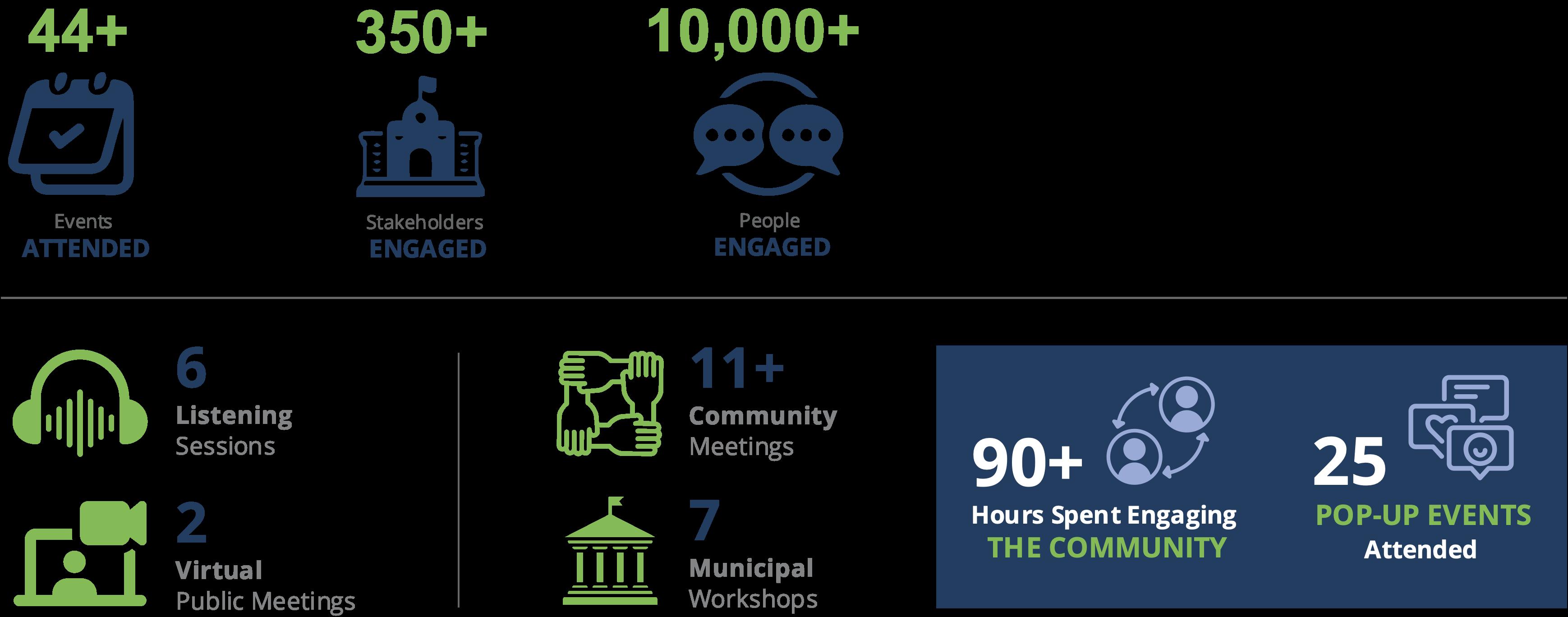
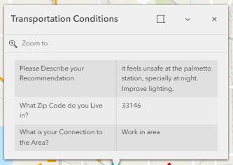
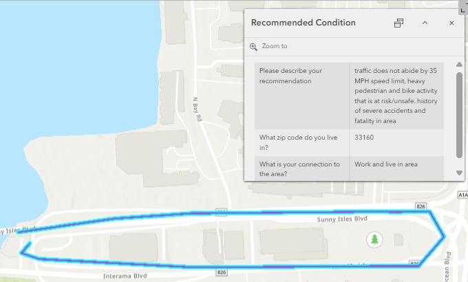
Extensive public and stakeholder engagement has been a cornerstone of the CTMP development process. This engagement ensures the plan reflects the diverse needs and priorities of Miami stakeholders.
What We Heard
• Enhanced coordination among county and partner agencies
• Constant engagement with community members
• Coordination among projects (scopes and schedules)
• Consistency with existing plans, programs, policies, and documents
• Safety enhancements
• Infrastructure mileage
• Maintenance
• Traffic management
• Safety measures
• Data sharing is necessary
• Accessibility
• Reliability
• First-/Last-Mile connectivity
• Truck parking capacity
• Illegal parking
• Roadway congestion
Tools for Engagement & Facilitation
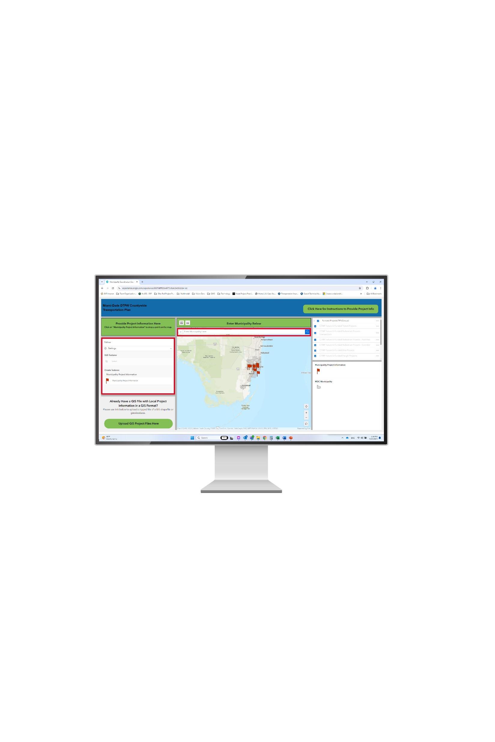
based portal for providing project information
Facilitates coordination with other partner agencies
Helps to integrate projects with existing DTPW plans
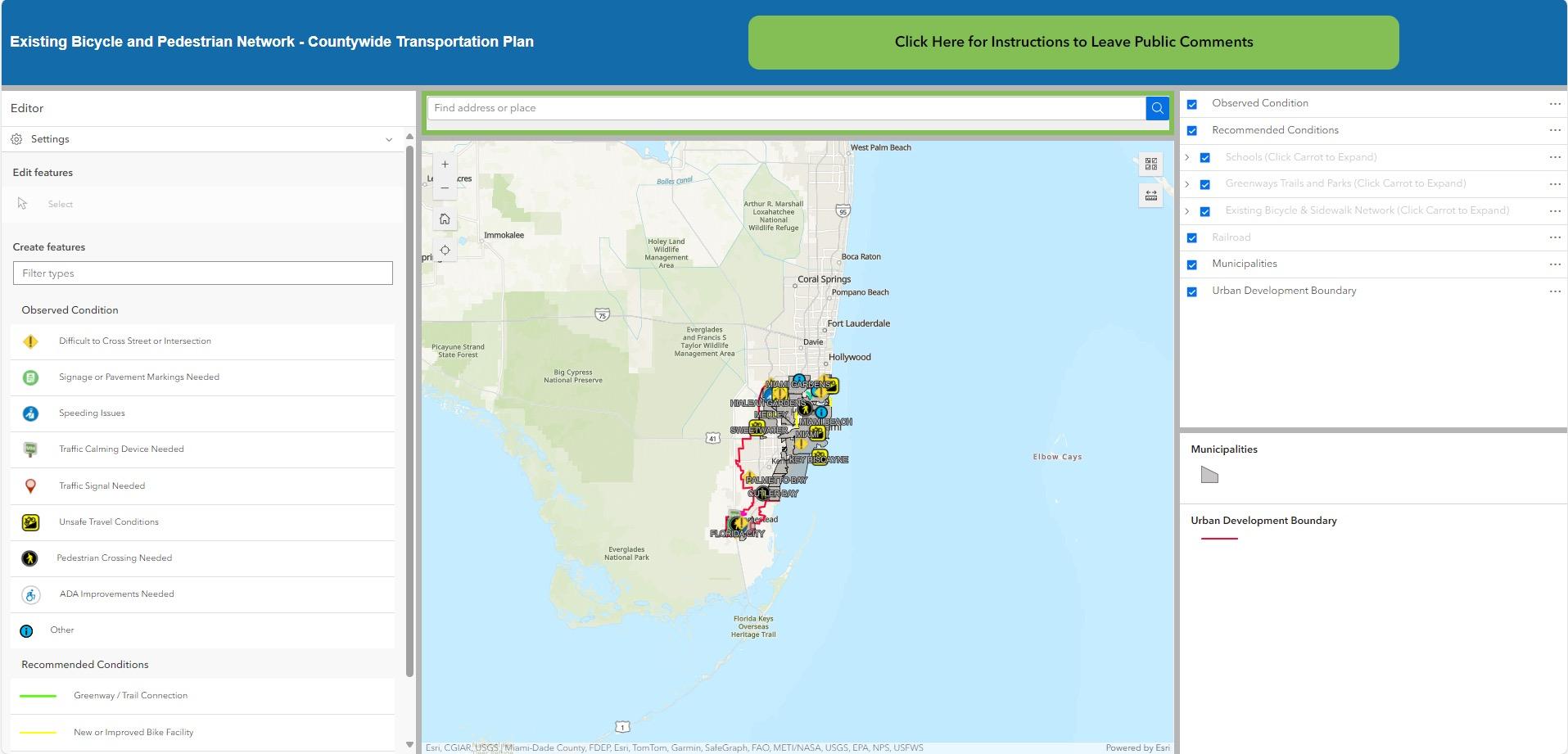
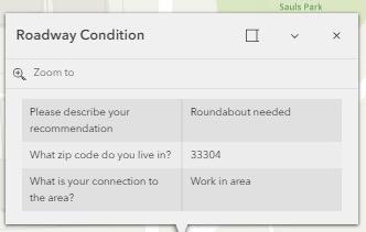
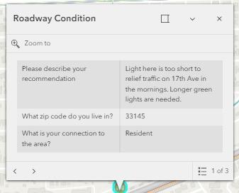
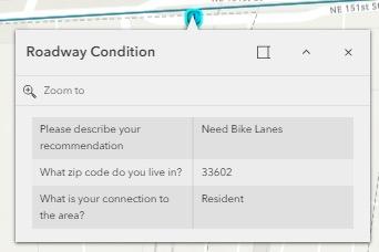
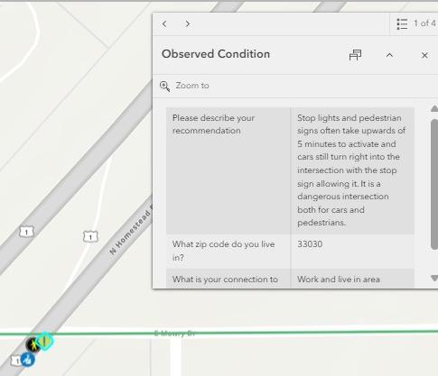
Interactive Mapping Tool
Web-based portal for reviewing project information
Displays interactions between various projects by mode
Provides inventory of existing conditions
…Online and Paper Surveys, Tabling Discussions, Radio Shows, Interviews, Briefings, Workshops, Listening Sessions, and More!