

How AI Can Enhance ADA Compliant GIS Solutions

Why is ADA Compliance so Important

Let’s Take a Look at Some
Existing Scenarios

What is ADA?
Americans with Disabilities Act of 1990
Civil Rights law to protect those with disabilities
Includes access to digital information
Levels of Conformity
Level A
Basic Accessibility
Web Content Accessibility Guidelines
Level AA
Strong Accessibility
Level AAA
Excellent Accessibility
Developed by the World Wide Web Consortium (W3C)
International Standard for accessibility DOJ points to WCAG 2.1 Level AA conformance for enforcement actions
Public Entities with a total Population with more than 50,000
Public Entities with a total Population with less than 50,000 By April 24, 2026 By April 26, 2027
Americans with Disabilities Act Title II Regulations Subpart H – Web and Mobile Accessibility Section 35.200
Accessibility Guide for Static Digital Maps
MN.gov IT Services
Americans with Disabilities Act Title II Regulations
ADA.gov
Web Content Accessibility Guidelines
W3C.org

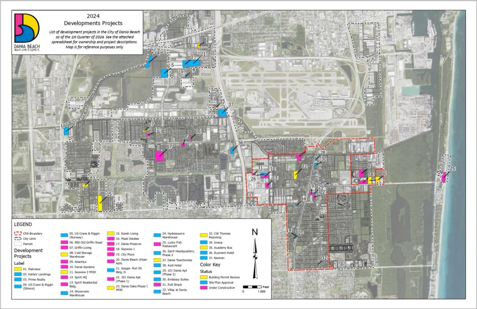
Original Map Template
01
Hard to distinguish city boundary from aerials
02
Labels difficult to see against aerials and parcels
03
Development locations do not meet color contrast guidelines

Principle Design
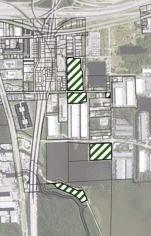
Contrasting Symbology
01
02
Symbols cannot rely on color alone
03
To preserve the city colors, additional graphics need to be added Symbols can now be distinguished even if chosen colors cannot be
Our 5
Principle Design Elements


Distinguished Labels
01
02
Previous labels blended in with basemap
03
New labels have a higher contrast and stand out
Viewer can easily tell which labels are pointing to which parcel
Our 5
Principle Design Elements

Clear Boundary Lines
01
02
Previous boundaries had similar symbology blended in with basemap
03
New boundary lines have distinct symbology
Easier to differentiate areas within boundary and outside boundary lines
Principle Design


Dampened Basemap
01
Previous basemap had a transparency of 40%
02
The current basemap has a transparency of 70%
03
Dampening the basemap provides more focus on the area of interest for the viewer
Considerations
What would you consider to be ADA Compliant?

How should our maps look to individuals of all different abilities and disabilities?
Florida Technical Consultants


Our 5 Principle Design Elements

01
02
Export your map layout as a flattened PDF
03
Think about how you would like your viewer to receive the information from the map
Open and edit alternative text in Adobe Acrobat using the Accessibility tool
Pinch Points
Time Consuming
Not necessarily user friendly
Not editable

Necessities
Streamlined Workflow
Easier Editing Capacity
Florida Technical Consultants
AI as a Solution
Assesses and provides ADA compliant text Provides recommendations on enhancing ADA Compliance
Chat GPT


Visions & End Goals


