Planning for Sea Level Rise and Resilience in Broward County


Florida American Planning Association Conference
September 6, 2023


Florida American Planning Association Conference
September 6, 2023


• Rising sea level, rainfall and storm surge
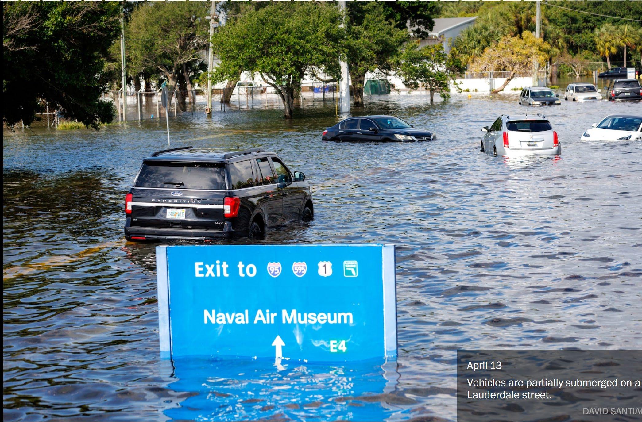
• Increases in flood severity, impacts and disruptions
• Extreme heat
• Infrastructure damage and safety concerns
• Economic implications
• Quality of life and public health considerations




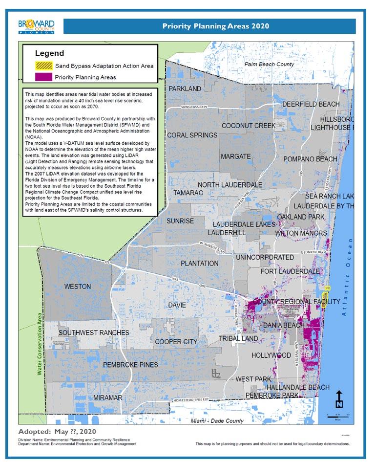
40 inches by 2070 (current)


27 inches by 2060 (previous)




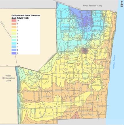
Section 27-200, Plate WM 2.1


Code of County Ordinances
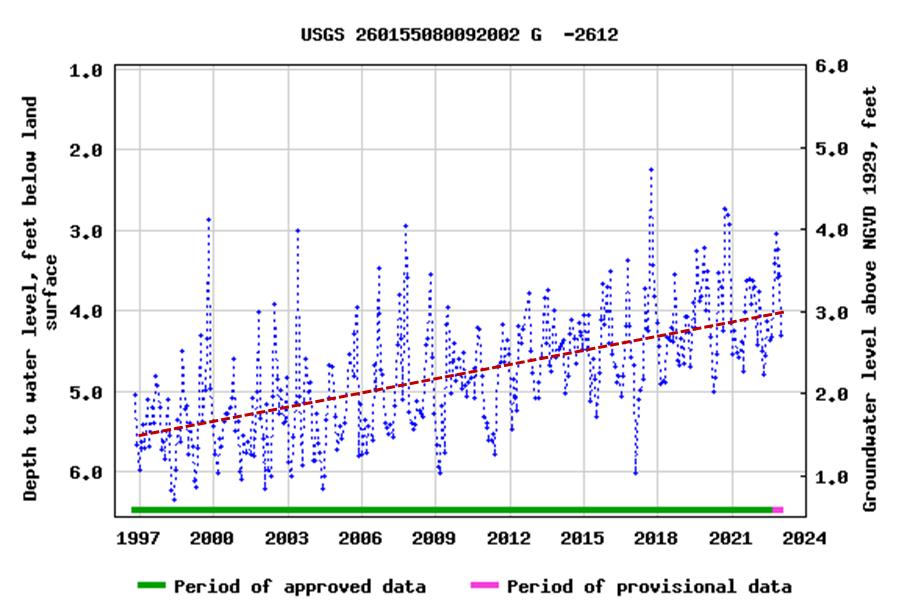
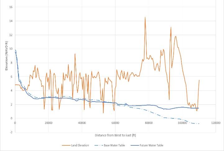
Observed Change
Modeled Change – 2.5 feet SLR New Groundwater

Table Map
* Future Conditions Groundwater Table - applies to new construction and major redevelopment


● Approved March 31, 2020
● Modeled water levels:
‒ 2 feet sea level rise
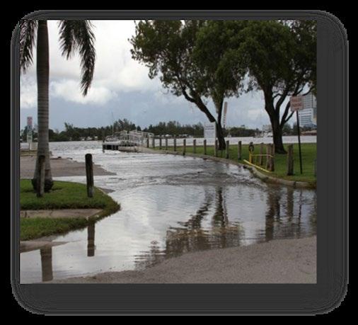

‒ High tides
‒ 25-yr storm surge

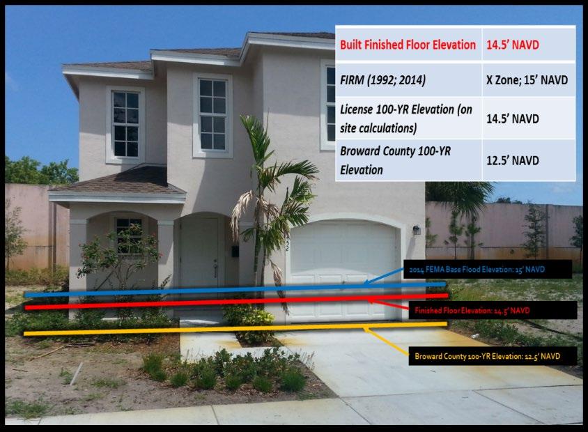
● Requires 5 feet NAVD by 2050, allows 4 feet NAVD until 2035
● Requires municipal adoption in 2 years and real estate disclosure.




● Prioritized adaptation roadmap
● Redevelopment strategies
● Green infrastructure emphasis

● Measured benefits and outcomes
● Planning level cost estimates
● On-line platform with project tracking

● Phased multi-decade implementation
● Funding strategies and cost-share


● Regional collaboration has accelerated planning and aided implementation.

● Advancements included future conditions standards, infrastructure improvements, land use considerations, and redevelopment strategies.
● Redevelopment pressures impress the importance of established resilience priorities and requirements.
● Economic consequences and benefits provide expanded basis for organized plans and investments.
● The County -wide Resilience Plan is intended to optimize benefits through shared, coordinated, and sustained implementation.

jjurado@broward.org

954-519-1464
