1 minute read
Artifacts


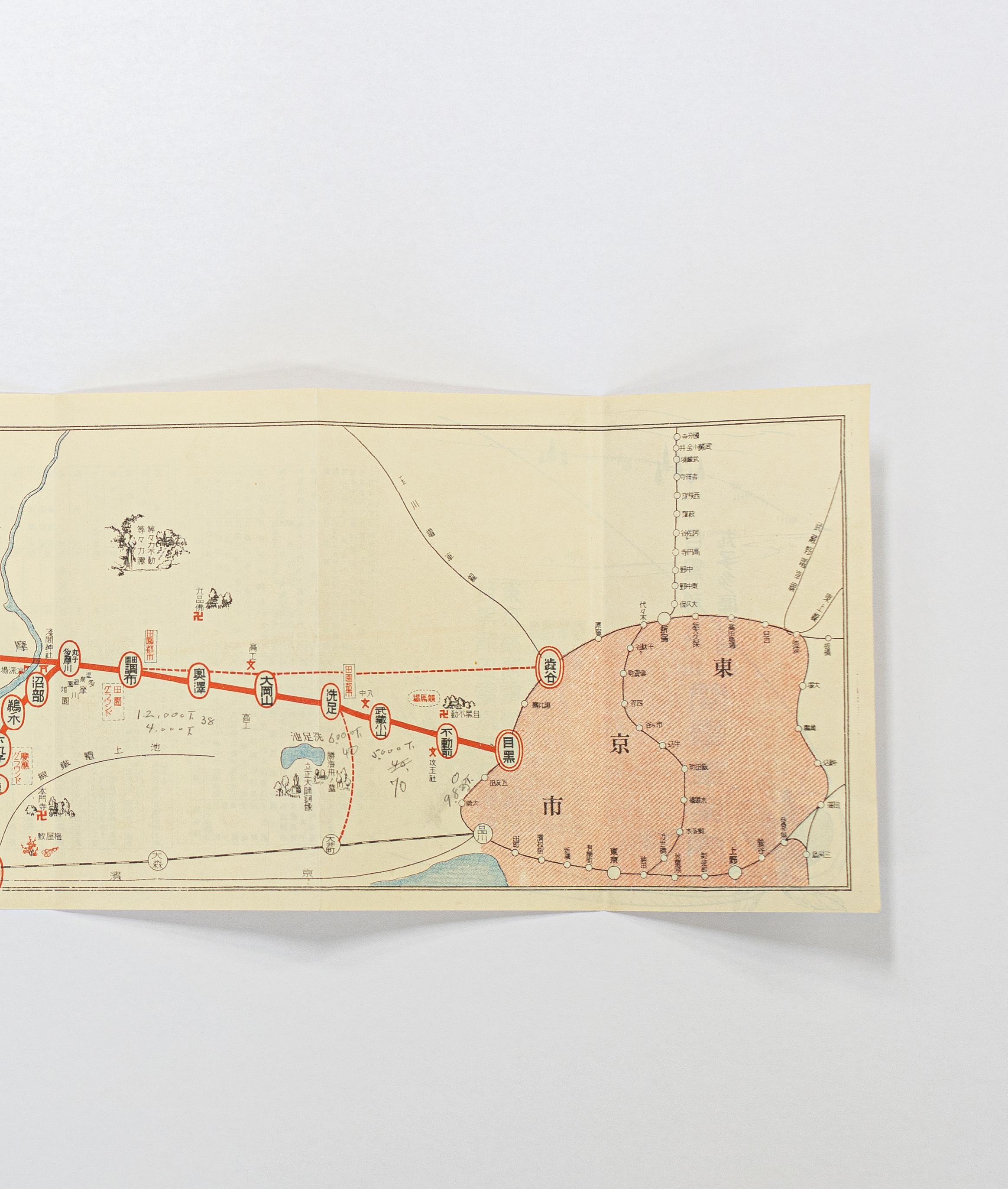
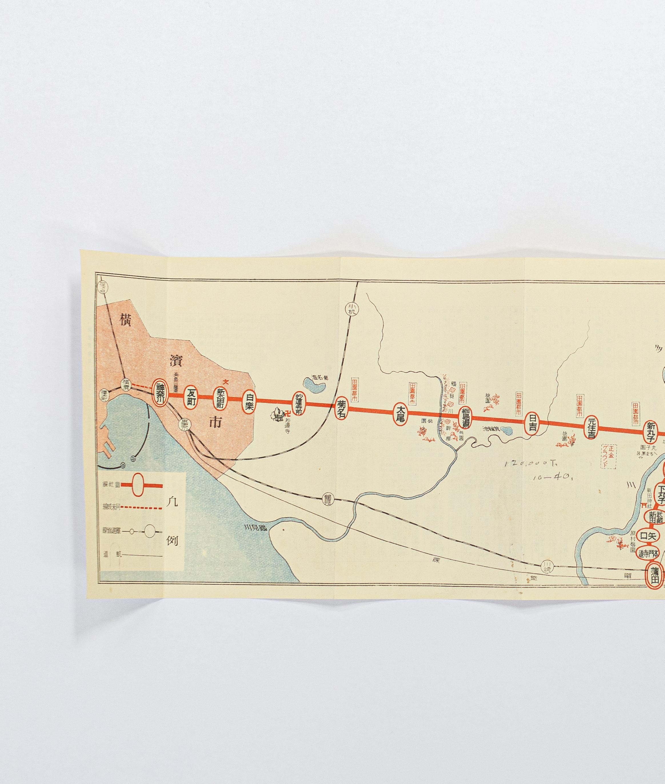
The train map below depicts what is now known as the Tokyu Meguro line circa 1927. The pink areas at each end show Yokohama, to the left, and Tokyo, to the right, bound by the Yamanote Line. The map is written in kyujitai, old forms of kanji used until the 1950s, and Tokyo interestingly uses the character for city, 市 (shi), rather than metropolis, 都 (to), reflecting its size in the period. The map was probably used by a member of the ASIJ community to show the commute from Yokohama to Meguro, where ASIJ’s Nakameguro campus opened in 1927. At the time, many families lived in the foreign settlement on The Bluff in Yokohama and easy access to ASIJ’s newly-constructed campus would have been an important consideration.