2 minute read
3D SURVEY OF THE RUINS: TWO CASE HISTORY IN SOUTH OF ITALY


Società di Topografia
info@stf-survey.com www.stf-survey.com
Advertisement
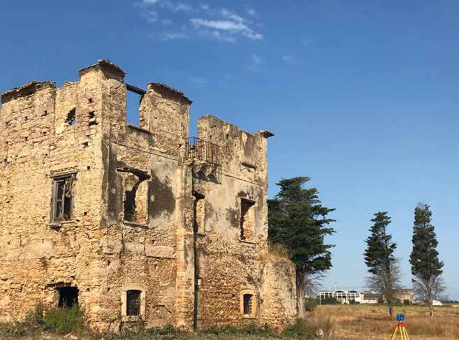
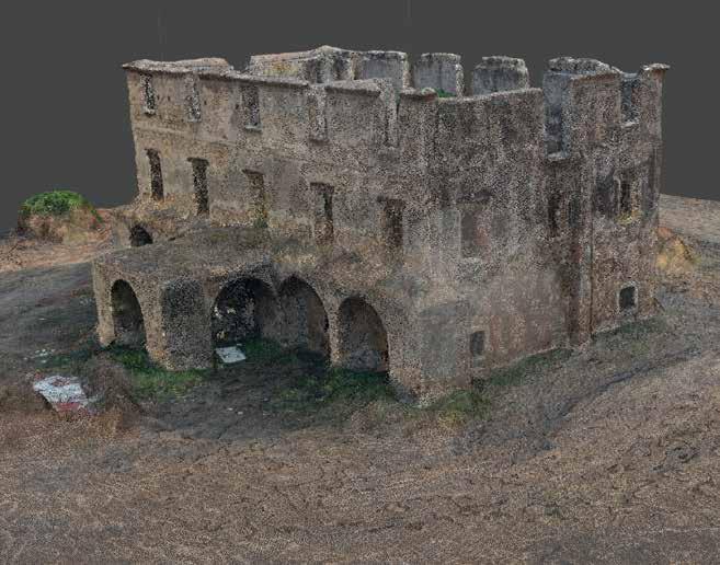
FORNACE PENNA DI SAMPIERI, RAGUSA For the realization of the three-dimensional models of the Penna furnace, it was decided to apply UAV technology by acquiring oblique images. This technique overcomes the “poor visibility” of the walls on the nadiral photos, offering new potential for the photogrammetric survey of the building, introducing variations in photographic scale and occlusions that can be significant for acquisitions at a short dis tance. The case study is representative of the situation in which a damaged building is not accessible and is detectable only through images acquired with a drone, even with “uncon ventional” gripping geometry.
Activities: _ 3D relief with Focus Faro 3d x330 laser scanner _ Aerial photogrammetric surveys with U.AV. (FlyNovex) and execution of flights for the creation of orthophotos and models _ Mission planning: - Quote 50 m (52 images) - 8 nadiral strips - 5 longitudinal and 3 transversal - Quote 50 m (41 images) - 10 inclined strips at 45° - 6 longitudinal and 4 transversal _ Image calibration - 8 calibrations, coordinate point control - Clouds dense of points:37 clouds dense from images
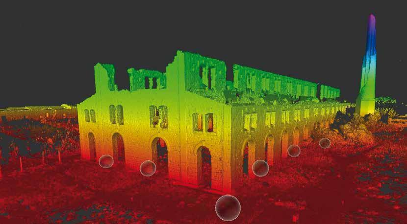
CROTONE ARCHEOLOGICAL PARK The analyzes carried out in this area fall within that strand of non-invasive archaeological research, specified with the term Remote Sensing or Remote Sensing, which deals with techniques and methodologies for acquiring, processing and interpreting phenomena without entering into direct contact with them. The methods and tools of remote sensing applied to archeology are numerous. In this specific case, the maximum degree of visibility of the buried archaeological deposit is obtained, it was decided to integrate various inves tigation tools: aerial survey, photogrammetry and laser scanner survey. The contribution of knowledge offered by this strategy of integrated imagination, both in qualitative and quantitative terms, is remarkable and currently includes an indispensable tool and all the avant-garde to acquire “direct” information on the metric and geometric characteristics of the buried evidence.
Activities: • Topographical framework with GPS equipment (Leica); • Aerial photogrammetric surveys with U.AV. (FlyNovex); • Three-dimensional reliefs with Laser scanner Focus Faro 3d x330