A M Atousa Marzban Phone:07378287778 Email: atoosa.marzban@gmail.com
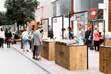
PORTFOLIO
• Portland design- UK
• ProaP- PortUgal
• academia- italy
• master dissertation - italy
A M C Ontent
•retail strategy & commercial masterPlaning
•exPerience commercial masterPlan
•airPort commercial masterPlanning
•airPort & sHoPPing mall commercial Planning
A M P ortland D esign-
k
U
Retail Strategy & Commercial Masterplan
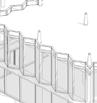
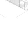
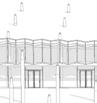
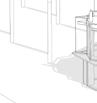
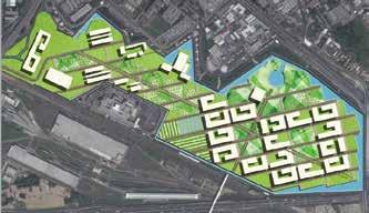
CBD East represents the pioneering first phase of the remarkable New Administrative Capital, serving as the beating heart of the central business district. With its visionary design, CBD East sets the stage for the future expansion of the North, South, and Mid-Town CBD zones.
The New Administrative Capital, an esteemed mixed-use venture, aims to create an awe-inspiring complex characterized by towering skyscrapers housing offices, hotels, and residential apartments, accompanied by an array of top-notch amenities and services.
The project is driven by the imperative to establish a seamless visual and physical integration within the commercial planning, seamlessly incorporating a versatile program accessible to all users. It goes beyond mere functionality to create an unforgettable destination, elevating the overall experience to unprecedented levels.
Central
districts key recommendation for retail destination
This strategy promotes a dynamic and activated destinations during the day and night, by triggering commercial offers, which respond to needs, desires and aspirational demands of all user groups.
Aspirational continues loop path to maximise retail exposure and unify CBD with one overarching experience
Aspirational continues experience at the heart of the development
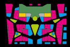
CBD EAST Masterplanning Brief - CONTEXT WIDE CBD PHASE KEY LINK WITH SURROUNDING PHASE CBD Interchange Hub PHASE PHASE
DESTINATIONAL F&B VILLAGE COMMUNITY HIGHER FLOW LUXURY/PREMIUM DESTINATION FOR ALL NIGHTLIFE ACTIVATION EMERGING DESIGNER ASPIRATIONAL F&B DESTINATION--------- -------------------------– –– –-------ENT. ENT EXIT C7 0+000 0+200 0+300 0+315 -0+000 0+100 0+200 0+300 0+400 0+500 0+600 0+700 0+800 0+900 1+000 0+100 0+200 0+300 0+400 0+415 0+200 0+261 0+000 0+100 0+164 0+000 0+100 0+200 0+600 0+700 0+800 0+900 1+000 1+100 1+400 1+500 1+600 1+700 1+800 1+844-- -- ------------ --- -- - --
Pedestrian Boulevard Night life pedestrian Commercial offer journey Pedestrian Vista Key: F&B offer journey F&B offers Pause Points | Nodes Critical mass of commercial activation
Spine
Through the analysis for creating a retail strategy the below notes and comments have considered:
• Create a series of stepping stones throughout the visitor journey shall promote dwelling opportunities
• Maximum shopfrontage activation facing central pedestrian spine
• Explore integration of welcome experience and touch points as part of a holistic branding vision
• Strong public realm activation & shading to maximise penetration
150m
“Wants” based commercial programmer for site users/ Visitors: 150m MAXIMUM WALKING DISTANCE
300m “Destination” based to communicate a place to develop a knowledge based community: 300m MAXIMUM WALKING DISTANCE
FINE HIGH END DINING PREMIUM PLACE
TYPICAL SHOPFRONTAGE RECOMMENDATIONS FOR RETAIL, F&B AND BRANDING SIGNAGES
SIGHTLINE CLEAR ZONE Fixtures must be of high
FIXTURING

SIGNAGE
WAYFINDING DESTINATIONAL OFFER NODE 1R NODE 2 R NODE 3 R CULTURAL ASPIRATION PARK OPTION + PHASE 2 ART MUSEUM
&
----–– –– –– ––– ––---------ENT. Exit ENT C5 EXIT C7 ENT C8 Exit 0+000 0+204 ENT. 0+000 0+200 0+300 0+315 -0+000 0+100 0+200 0+300 0+400 0+500 0+600 0+700 0+800 0+900 1+000 0+300 0+400 0+415 0+000 0+085 0+100 0+200 0+000 0+100 0+164 0+000 0+100 0+000 0+100 0+200 0+300 0+400 0+500 0+600 0+700 0+800 0+900 1+000 1+100 1+200 1+300 1+400 1+500 1+600 1+700 1+800 1+844--------------- - ---- -- ---MAIN VEHICULAR CIRCULATION
KEY
NODE
VISTA IDEAL PEDESTRIAN LINK
ACCESS
DROP OFF TO SITE RETAIL OFFER CULTURAL OFFER 5 4 2 C A B 1 PODIUM -SE VIEW EXPLODED 2 PODIUM -SW VIEW EXPLODED AXON BRAND BRAND BRAND BRAND BRAND BRAND BRAND BRAND BRAND BRAND BRAND 1600 1200 200-800
PEDESTRIAN CIRCULATION
MAIN
PAUSE POINT
MAIN
/
quality materials and to be no higher than 1200mm for majority of fittings BRAND
WEST ELEVATION C02 X10 C02 X09 C02 X08 C02 X07 C02 X06 C02 X05 C02 X04 C02 X03 C02 X02 324.07 (C02)-GF-FFL 330.07 (C02)-1ST-PD-FFL 6000 6000 336.07 (C02)-2ND-PD-FFL 12000 C02 X03A C02 Y04A C02 Y05 C02 Y06 C02 Y07 C02 Y08 C02 Y09 C02 Y10 C02 Y11 C02 Y12 C02 Y13 C02 Y13A C02 Y14 C02 Y15 C02 Y16 1 : 200 NORTH ELEVATION 2 Brand Signage Area Protruding Brand Signage Unit Demise Lines aligned to facade subdivision* Brand (Cut out sign) Brand (Cut out sign)
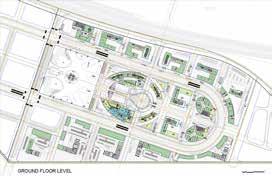
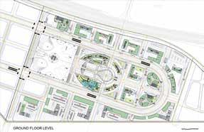
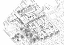
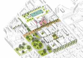
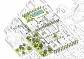
Experience Commercial Masterplan
A new mixed use development in the heart of central business district which is approximately 80% constructed.
The aim of revised masterplan re-ignites the design/ construction process, as part of the kingdom of Saudi’s Arabia’s 2030 vision and defines a clear commercial vision supporting by a compelling concept narrative as part of the authentic place vision.

The experience masterplan aim to be informed by a programme of future trend research. The objective is to position the site as a unique branded destination with a compelling mix of offers and activities for all users.
The purpose is to engender an authentic ‘Spirit of place’ for each zone, where people feel they belong; a place with great experiences that engage with curated offers, encouraging all users/visitors to dwell, enjoy and return.
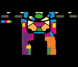
DISTRICT CHARACTERS
Define Cluster Character
Blur the Boundaries between Districts
Districting Strategy with Clusters
Live Work Signify Play Indulge LOCAL COMMUNITY BUSINESS
TECH INNOVATIONS ICONIC GATEWAY URBAN GARDEN URBAN LIFESTYLE LUXURY
HUB
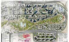
The Leaf Areas 1-5
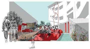
The experience masterplan aim to be focused on different part of site to create a unique branded destination for all users. Through this journey Green Spine has been selected as one of the most important part of this project.
• Depend on the internal mobility strategy the green spine becomes the fundamental element for passage across the site. Therefore, the programming in relation to slow use and pace becomes critical.
• There are key nodal interactions linking building to the public realm should be strongly encouraging connectivity across day time.
• Defined wayfinding strategy in relation to the Green Spine is key to activation of the spine itself and the surrounding building plots.

GREEN SPINE COMMERCIAL STRATEGY & CHARACTER 2
UrbanLifestyleWadi
• The Green Spine’s northern part has a strong opportunity to drive footfall due to the proximity to the Metro Station and Financial Plaza .
• Future connection adjacent to PLot 2.05 intorest of the development.
• Activate green spine public realm from north to south along the pedestrian path, but also engaging internal courtyards of the main plots.

• The courtyards along the Green Spine can accommodate activations such as:
• Event Space
• Programmable Offers
• Street Market
• Pop Ups & Kiosks
• F&B Spill out
• Water features and Seating area
• Fashion Walk events
• The Green Spine’s southern part has a strong opportunity to drive footfall due to the proximity to Financial Plaza & Conference Centre.
• The Green Spine’s southern part has a strong connectivity to Urban Lifestyle Wadi and the main mosque plaza.
• Activate Green Spine’s public realm along the pedestrian path to promote a dynamic space for business workers and residents.
• The southern Green Spine can accommodate activations such as:
• Breakfast Cafe Chat
• Pre Cinema Drink
• Lunch Time Activity / Rest Time
• Afternoon- Evening Meetings
• F&B Spill out
• Cafe Kiosk
• Offers related to the events in Conference Center
• Amenity Space
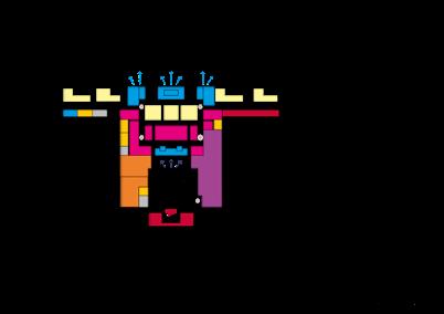
1.19 Bus iness Hub D i s C o v yre rohcnA 1.08 2.05 2.16 1.20 1.13 3.03 Key: Potential Retail Kiosks/Spill- Out Potential Retail Spill- Out Potential F&B Spill- Out/ Active Frontage Potential F&B Kiosk Potential Seating/ Landscape Decision Point/ Wayfinding/ Totem Nodal Point Pause Point/ Slow pace 2.16 1.20 2.05 1.08 Discovery Wadi Draw footfall throughout courtyard into 2.06 Metro Station Financial Plaza 3.03 1.13
Key: Potential Retail Kiosks/Spill- Out Potential Retail Spill- Out Potential F&B Spill- Out/ Active Frontage Potential F&B Kiosk Potential Seating/ Landscape Decision Point/ Wayfinding/ Totem Nodal Point Pause Point/ Slow pace Mosque Conference Center Confluence of character Green Spine Urban Lifestyle Wadi Discovery Wadi 1 1 2
Airport Commercial Masterplanning


The project intention is to expand the existing terminal facilities. This will include new emplacement location, associated gating, reformed baggage facilities, BOH distribution and an expanded and refocused IDL.
The existing IDL area of the terminal will not be sufficiently sized to cope with the envisaged increase in passenger numbers into the future.
A new passenger-centric zone will be required that can deliver base operational functions and PAX flow demands while creating a holistic commercial experience relevant to future passenger/ customer demands.
The retail strategy must establish a “passenger-centric” focus while generating non-aeronautical returns by forging a customerexperiential environment.


APRON VIEW Security WC WC WC WC Kitchen Prep GATE FUTURE EXPANSION GATE GATE Duty Free Retail Retail Retail Retail Dwell Seating Seating Seating F&B F&B F&B F&B F&B F&B F&B F&B F&B F&B F&B EVENT SPACE Retail Retail F&B Retail Retail Orientation Point Processing/ Security Retail F&B F&B Seating Lounge Seating Flexible Space (Promotional/Event/Marketplace) WC Staff’s WC Vertical Circulation BOH Duty Free KEY LEGEND N
Promotional Event Space Scenario Market Place Scenario
Airport & Shopping Mall Commercial Strategy
The Airport is undergoing a phased expansion programme of the current Terminal building and facilities to respond to future passengers forecast increase and related demands with a particular focus on:
• To deliver a seamless passengers and customers experience;
• Future commercial space proposed to highlight major risks and opportunities
• Fututeproof commercial opportunities recommendations
The scheme includes a new Terminal and landside shopping development aims to deliver a seamless passenger and customer experience.


GROUND FLOOR PLAN
The Airport Terminal has divided into two separated buildings (Arrivals and Departures terminals). The new shopping destination would captivate not only airport passengers but also visitors, tourist, and local residents.
The project aim is to make an experiential destination airport and shopping for everyone.
In order to achieve a comprehensive commercial strategy solution, it has been necessary to understand the diverse flows relationship among shopping centre and Terminal.
PROGRAM Retail Departure Hall Security Check Arrival Hall Baggage Claim Service Arrival Hall Departure Hall 5 10 20 40 M Tram to Sesto Fierentino Tram to City Buses Parking/ Stations Buses Vehicular Access Train Route Parking To Castello To AutoStrade Shopping Destination Airport Car Park Existing Terminal Departure Arrival Tram to Sesto Fiorentino Vista toward the park Vista toward the park Taxi Vista toward the park Vehicular Access/ Road Main Entrances Taxi Route Bus Route Tram Route Vistas Taxi Stops Bus-Car Parking Departure/ Arrival Tram Stops Key: VialeGiovanniLuder TrainTo/FromFlorencecentralstation MASTER PLAN PARK PHASE 1 SOCIAL HOUSING HOTEL OFFICE POLICE ACADEMY LIGHT INDUSTRIAL ARTISINAL MARKET PLACE STUDENT HOUSING PARK PHASE 2 SOCIAL HOUSING POLICE/ MILITARY ACADEMY PARK PHASE 1 Tram to/From Sesto Firentino Tram to/ From City Train to/from City central station Vehicular Access/ Road Train Route Bus- Tram Route Taxi- Tram Route Tram Stop Site Plan Key: Approx 1,5 Km Approx 300 m Bus VehicularAccess PARK PHASE 2 STUDENT HOUSING Hotel MARKET PLACE INDUSTRIAL/ ARTISINAL Taxi INFO NON SCHENGEN BAGGAGE CLAIM SCHENGEN BAGGAGE CLAIM DROP OFF DEPARTURE PICK UP ARRIVAL PLAZA RESTROOMS HEALTH CENTER LOST FOUND TECHNICAL EQUIPMENT RESTROOMS OFFICE CHECK HEALTH CENTER/ RETAIL AND SERVICE RETAIL AND SERVICE CHECKI CHECKI SUPPORT SUPPORT Shoppers Flow Passengers Flow Main Orientation Tram Stops Departure Arrival Key: Ground Floor First Floor STATE RETAIL VIP TO BELOW RETAIL DEPARTURE RETAIL OFFICE RESTROOMS RESTROOMS OFFICE Security VOID
The team carried out a commercial evaluation, where disadvantages and advantages have been scored for key retail components in the 3 options developed for both site. (New Terminal and landside shopping destination). In conclusion; the hybrid option have been created in order to achieve an hybrid strategic commercial solution to deliver an integrated solution which would be commercially viable and well designed.


THE PAVILIONS NO VOID THE AVENUES HYBRID PREFERRED OPTION 2 VOIDS NEW TERMINAL LANDSIDE SHOPPING DESTINATION THE LOOP 1
TOSCANA AEROPORTI, ITALY TOSCANA AEROPORTI, ITALY TOSCANA AEROPORTI, ITALY TOSCANA AEROPORTI, ITALY TOSCANA AEROPORTI, ITALY RETAIL STATE OFFICE RETAIL VIP RETAIL RETAIL RETAIL RETAIL RETAIL RETAIL RETAIL OPEN TO BELOW PASSPORT CONTROL SCHENGEN GATES NON SCHENGEN GATES RETAIL DUTY FREE DEPARTURE SECURITY RETAIL RESTROOMS RESTROOMS STATE OFFICE RESTROOMS RESTROOMS STATE OFFICE STORAGE WC WC WC SECURITY VIP LOUNGE VIP LOUNGE VOID PASSPORT CONTROL Retail F&B F&B Seating WC Dwell Seating Staff Areas Promo/Event Space Orientation Zone BOH Corridors Duty Free Duty Free Storage KEY LEGEND: Gate Seating Lounge Lounge Extension Vertical Circulation Differences in Floorplate Queueing Zone INFO IMMIGRATION PASSPORT CONTROL NON SCHENGEN BAGGAGE CLAIM SCHENGEN BAGGAGE CLAIM DROP OFF PICK UP ARRIVAL RESTROOMS RETAIL STATE OFFICE HEALTH CENTER LOST & FOUND TECHNICAL EQUIPMENT CUSTOM CONTROL RESTROOMS RETAIL STATE OFFICE SECURITY CHECK HEALTH CENTER/ QUARANTINE PUBLIC SPACE RETAIL AND SERVICE PUBLIC SPACE RETAIL AND SERVICE ARRIVAL HALL
• remembrance and oblivation- landscaPe masterPlanning
A M P RoapP ortugal
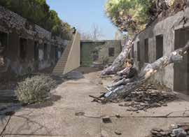
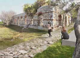
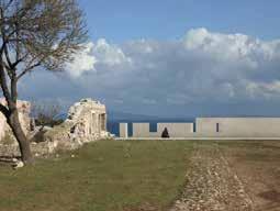
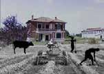
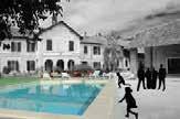
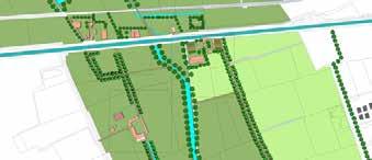
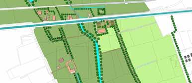
Remembrance And Oblivion
Bandirma Park’s site presents apparent contradictions that drove our exploration beyond surface qualities. We identified five key conceptual issues: bridging isolation from the city center, balancing views and comfort, integrating site poetry and time, managing scale and ruins, and harmonizing program and site. Success lies in reconciling these contradictions and materializing clear solutions that address transformation challenges. The design becomes the evident response to the problems, demonstrating coherence and serenity.

The true measure of success lies in the design’s ability to reconcile these apparent contradictions. Ultimately, the project’s success is revealed through its ability to materialize solutions and address the complex challenges of transformation with clarity. It is as if the project, with its coherence and serenity, becomes the evident and inevitable response to the existing problems once the conceptual arguments of the project are deciphered.
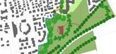
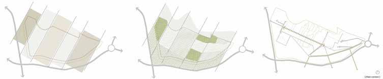 Concept of strips & sequences
Density of Green Areas
Accessibility & Connection
Concept of strips & sequences
Density of Green Areas
Accessibility & Connection
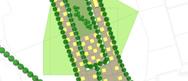
BANDIRMA PARK COMPETITION
A NEW PARK FOR THE FUTURE OF THE CITY
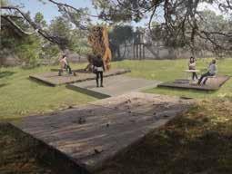

PROAP STUDIO: João Ferreira Nunes, Ricardo Bak Gordon
7th honourable mention
• discovering sUstainable oPPortUnities- Urban masterPlanning
• Urban masterPlanning- new green connection
• vibrant camPUs- regenrating Part of tHe Uni
• regenration masterPlanning for exPo site
A M A CademiaI taly
THE URBAN CORRIDOR: Discovering sustainable opportunities


Energy & Urban planning Studio


Professors:Eugenio Morello, Stefano Pareglio

Teaching Assistance: Laura Cibien
Politecnico Di Milano 2014/2015
GPA: 30/30

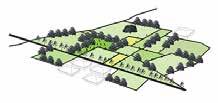
The Urban Corridor is about discovering sustainable opportunities in the area. Milano- Ortica is currently an area located in between the city centre of Milano, and the periphery where other cores of urban development are located.
Some main elements are important to highlight in the area, such as the big infrastructure nodes created by the tangenziale Est, the parco Forlanini; Lambro river and the amount of open spaces. There are four maun aspects taking in count to analyse the area: Accessibility, People, Energy, Environment.
The final result was the creation of a sustainable territory, working with the existing reality, improved by some eco-action. We focused on a territory that can work as a model for same scenarios presented along the Lambro river, trying to be the less invasive as possible, and taking in count a time-line for the actions, knowing that some of them could be implemented at the present and others in the future.

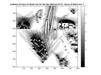
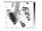
Greenery Ways Agricultural Use Pasture or Fallow Parks Water Bodies Water Routes Water Banks Constructed Environment _05 Open spaces Types of green Greenery Ways Agricultural Use Pasture or Fallow Parks Water Bodies Water Routes Water Banks Constructed Environment _05 Open spaces Types of green Agriculture Mobility infrastructure Public and private services Mixed-use Green space Residential Military _06 Land-use functions Agriculture Mobility infrastructure Public and private services Mixed-use Green space Residential Military _06 Land-use functions Tree Lines Tree 47,346 41.5 km 6.65 km 8,648 Research Area Total Area 01_ Quantification of Trees T=8,648 UA=3.6 sq km TQ= T=47,346 UA=13.7 sq km TQ= Quantification of Trees "Lc=lunghezza corridoi verdi Ls=lunghezza sezioni stradali sup_AV= superficie aree verdi (pubbliche, condominiali, private) Stot=superficie di riferimento Sv= spazi verdi terra So=superficie d’ombra h=ora Stot=superficie totale, durante solstizio estivo e il solstizio Trees lines Public Private 02_ Green Areas per Population GA_p=public green areas pop._loc=local population Green Areas Tree Lines Tree 47,346 41.5 km 6.65 km 8,648 Research Area Total Area 01_ Quantification of Trees T=8,648 UA=3.6 sq km TQ= T=47,346 UA=13.7 sq km TQ= Quantification of Trees "Lc=lunghezza corridoi verdi Ls=lunghezza sezioni stradali sup_AV= superficie aree verdi (pubbliche, condominiali, private) Stot=superficie di riferimento Sv= spazi verdi terra So=superficie d’ombra h=ora Stot=superficie totale, durante solstizio estivo solstizio Trees lines Public Private Total Area 02_ Green Areas per Population GA_p=public green areas pop._loc=local population Green Areas A_imp impermeable surfaces Tree Lines Tree 47,346 41.5 km 6.65 km Research Area Total Area 01_ Quantification Trees T=8,648 UA=3.6 sq km TQ= T=47,346 UA=13.7 km TQ= Quantification of Trees "Lc=lunghezza corridoi verdi Ls=lunghezza sezioni stradali sup_AV= superficie aree verdi (pubbliche, condominiali, private) Stot=superficie riferimento Sv= spazi verdi terra So=superficie d’ombra Stot=superficie totale, durante solstizio estivo solstizio Trees lines Tree Lines Tree 47,346 41.5 km 6.65 km 8,648 Research Area Total Area 01_ Quantification of Trees T=8,648 UA=3.6 sq km TQ= T=47,346 UA=13.7 km TQ= Quantification of Trees "Lc=lunghezza corridoi verdi Ls=lunghezza sezioni stradali sup_AV= superficie aree verdi (pubbliche, condominiali, private) Stot=superficie riferimento Sv= spazi verdi terra So=superficie d’ombra Stot=superficie totale, durante solstizio estivo solstizio Trees lines 02_ Green Areas per Population GA_p=public green areas pop._loc=local population Green Areas Tree Lines Tree 47,346 41.5 km Total Area 01_ Quantification of Trees T=8,648 UA=3.6 km TQ= T=47,346 UA=13.7 km TQ= Quantification of Trees "Lc=lunghezza corridoi verdi Ls=lunghezza sezioni stradali sup_AV= superficie aree verdi (pubbliche, condominiali, private) Stot=superficie riferimento Sv= spazi verdi terra So=superficie d’ombra h=ora Stot=superficie totale, durante solstizio estivo solstizio Trees lines 01_ Quantification of Trees T=8,648 UA=3.6 sq km TQ= Quantification Trees "Lc=lunghezza corridoi verdi Ls=lunghezza sezioni stradali sup_AV= superficie aree verdi (pubbliche, condominiali, private) Stot=superficie riferimento Sv= spazi verdi terra So=superficie d’ombra h=ora Stot=superficie totale, durante solstizio estivo solstizio Trees lines Forest Parco Agricolo Sud Lambro River Water Bodies Lambro Ecological Corridor _07 Open spaces Green corridor Forest Parco Agricolo Sud Lambro River Water Bodies Lambro Ecological Corridor _07 Open spaces Green corridor Scala 1:50000 _07 Land-use functions Adminastrative Education Social Services Commercial Sports Facilities Cascine Functional services Semi Abandond Religious Equipment _07 Land-use functions Digital Evaluation Model Number of hours for direct sun for the day Sky view Factor Digital Evaluation Model Number of hours for direct sun for Sky view Factor MAin Information from MAtlab Max Height 47.3 Mean height 11.6 Mean hours shadows streets Mean percent per hour18.6 percent area open space According to this iimage from matlab analysis that shows the shadow analusis in the place that we will impliment the Basins it confirms our idea, cause according to this image there are not much shadows during the 7 hours of day that we can implement also solar panel on basin and use the direct sun light during the day in order to save the energy and also for purification of water that will collect in the basins from the lambro flooding Digital Evaluation Model Number of hours for direct sun for the day Sky view Factor Digital Evaluation Model Number of hours for direct sun for the day Sky view Factor MAin Information from MAtlab Analysis: Max Height 47.3 Mean height 11.6 Mean hours shadows streets 2.8030 Mean percent per hour18.6 percent area open space 11.4 According to this iimage from matlab analysis that shows the shadow analusis in the place that we will impliment the Basins confirms our idea, cause according to this image there are not much shadows during the hours of day that we can implement also solar panel on basin and use the direct sun light during the day in order to save the energy and also for purification of water that will collect the basins from the lambro flooding _08 Matlab analysis _09 Area of Transformation Existing plans. _08 Matlab analysis _09 Area of Transformation Existing plans. PROJECT Via Civitavecchia Cantiere Cascina Gobba Parco Forlanini P.I.I. RogoredoMontecity Basins in the project


ECO TRIANGLE: East of milano symbiosis
Urban Planning and Design Studio

Professors: Bertrando Bonfantini Antonio Longo Marco Mareggi
Politecnico Di Milano 2013/2014
GPA: 27/30
According to the investigation perspectives, the territory of the eastern part of province of Milan is mix land use with a wide picture of morphology of patterns. In general, the north of this area is privileged with industry, while through the south of the territory it is more gravitated towards agriculture. This is an area of stereotyped cities; this is because the biggest part of them has a certain number of common elements, which could be found in almost the whole side, for instance urban cores with historical centers and residential areas, or productive areas with planned or unplanned organization.

ECO TRIANGLE
East of Milano symbiosis
The proposal consists on an eco-triangle, working with the specialization of the territories versus a homogeneous competition. With a previous analysis, some tendencies were determined for the territory, identifying special things made there, or even specific activities people do. With this, the main idea was to find the advantages of developing different strategies to avoid conflicts in the use of a resource in this territory.
Master Plan Studio

Professors: Marialessandra Secchi, Michele Vianello
Politecnico Di Milano 2013/2014

GPA: 29/30


Gaggiano is located in south west of Milan. Historical city with great accessibility to Main roads and train line which is divided to two parts during years because of growing industrial parts.
slums guidelines


abandoned connection to North erent tools

existing taking advantage of spaces
the VISION FOR GAGGIANO CASCINE AGRICULTURAL AREA OPEN SACE NATURAK ELEMENTS ARCHITECTURAL HERITAGE


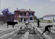


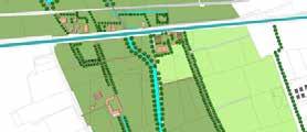


So basically there are three main elements in horizontal aspect which are Naviglio, train infrastructure and main road. Then, the city is fragile from north to south that there are some historical Cascine in between. The aim of this project is connecting north and south among creation two green corridor which one is natural one and the other is artificial and connect by nodes with different role between agriculture lands and man made parks and historical elements to improve quality for local people and make more pedestrian and bicycle path and make Gaggiano more eco-friendly city.

“Cascine” are crucial points for Gaggiano´s future. The expected interventions include renew some agricultural buildings and use them for other activities, like holding ceremony, restaurants, bars and maybe hostels and hotels. The objective is to attract more people and revitalise this traditional architecture.

Gaggiano is located inside Parco Agricolo Sud. It is surrounded by agricultural areas and most of residents income is produced by farming and raising agricultural products.
Gaggiano has this opportunity to be a main core of agricultural products and improve economic level of residents by using more mechanical and technological process for producing goods.
Gaggiano’s open space include parks, semi private open space among new residential area, linear parks along canals, etc. Interventions can help to create more liveable spaces, incentivating people to come out and have more communication in great public spaces.


The city of Gaggiano counts with different natural elements around the municipality, such as the canal Naviglio Grande, lakes, natural parks and the Parco Agricolo Sud. The important aspect of this is to preserve these areas giving mantainance where needed and trying to create quality public spaces. Also they can be used as the main connectors for the city, for example with the lines of tree from North to South.
Gaggiano’s architectural heritage is present in different important buildings around the
city center, with

giving mantainance where needed and trying to create quality public spaces. Also they can be used as the main connectors for the city, for example with the lines of tree from North to South.


The transportation in Gaggiano consist mainly on a train railway, water lines and pedestrian paths. Improving these connections this infrastructure could gain more quality of space.
Gaggiano’s architectural heritage is present in different important buildings around the


Gaggiano has this opportunity core of agricultural products economic level of residents mechanical and technological 7 8 T Create an entrance to the fields, adding green spaces to the industrial area. adding greenhouses and a market GAGGIANO MAIN CHARACTERISTICS OF THE TERRITORY OF GAGGIANO: ARCHITECTURAL HERITAGE CONCLUSION PROBLEMS MERGING THE CITY: NEW GREEN CONNECTION OF GAGGIANO. Gaggiano’s architectural heritage is present in different important buildings around the city center, with an homogenous architecture between them. To improve this public spaces such as the Chiesa Parrocchiale di Sant’Invenzio; it is recommended to create more spaces MERGING THE CITY: NEW GREEN CONNECTION OF GAGGIANO. Gaggiano’s architectural heritage is present in di erent important buildings around the city center, with an homogenous architecture between them. To improve this public spaces such as the Chiesa Parrocchiale di Sant’Invenzio; it is recommended to create more spaces Create an entrance to the fields, adding green spaces to the industrial area. MAIN CHARACTERISTICS OF THE TERRITORY OF GAGGIANO: STRATEGY NATURAL SURFACE + URBAN PATH ARCHITECTURAL HERITAGE Gaggiano is located inside Parco Agricolo Sud. It is surrounded by agricultural areas and most of residents income is produced by farming and raising agricultural products. Gaggiano has this opportunity to be a main core of agricultural products and improve economic level of residents by using more mechanical and technological process for producing goods. Gaggiano’s open space include parks, semi private open space among new residential Interventions can help to create more liveable spaces, incentivating people to come out and have more communication in great The city of Gaggiano counts with di natural elements around the municipality, such as the canal Naviglio Grande, lakes, natural parks and the Parco Agricolo Sud. The important aspect of this is to preserve these areas
STRATEGY OPPORTUNITIES
STRATEGY
OPPORTUNITIES STRATEGY The park will work as stripe between the agricultural elds and the industrial.
T
entranceadding the
an
architecture
To improve this public spaces such as the Chiesa Parrocchiale di Sant’Invenzio; attract products. liveable The connectors architecture Sant’Invenzio;
The transportation in Gaggiano consist mainly on a train railway, water lines and pedestrian paths. Improving these connections this infrastructure could gain more quality of space.
homogenous
between them.
MERGING THE CITY: New green connection of gaggiano
VIBRANT CAMPUS: Experiencing the senses
CI Architectural & Urban Simulation
Professors:Rosella Salerno, Barbara Piga
Politecnico Di Milano 2014/2015
GPA: 30 L/30
The main aim of this contribution is to provide some crucial references that would encourage our inspiration for the conceptual framework of the project. As a result of some basic ideas that we considered relevant for the space, such as:
- Connectivity through all the area
- Unifying element
- A main structure for the central area
PIAZZA LEONARDO «fa e» of Polimi main ep esen tiv place using mainly as a pa
VIA MPERE main poin or a chi ctu al students of Polimi. Waiting g the ing d in ing ca e and pa king bikes
PISCINA PONZIO en ed with wall om olimi, it has pa and 50m swimming poo No st aigh c ess but ni e view
TRIFOGLIO AREA pla e which is in a users aks OWN IDENTI Y!!!
A QUARIO plac with an can een and some tables or h ving lunch
VIA BONARDI st eet dividing campus a ea with a t am and double ow of ee Has pa king slots or cars and bike
CONCEPT DEVELOPMENT
GREEN OU T small quiet eas inside the campu mainly used or studing a ely o h v lunch.
h e a spac or esting waiting and sittin
E e cise 04 NOTED MAP AND DESIGN GUIDELINES
o Rossella ale no Ba ba a .A. iga Tu ors u a C b n n a Leg agn Pa lo egar n
Vibant Campus Con ept de elopment G oup
app oach taken and the onclusions eache o em ipsum dolor sit ame onsec etuer adipiscing eli enean me tum ipsum eu sapien. Mau is p etium, elit sed ele isque blandi mau is diam me tum nis quis vulput odio quam id lacu Vestibulum ellu Suspendisse dictum eleme tum nisi. Quisque pla e a a ius nis Maecenas lao eet nibh sed nisi. quis e onec a o em ipsum dolor sit ame conse etuer adipiscing eli Aenean me tum ipsum eu sapien. Mau is p etium, elit sed ele isque blandi mau is diam e mentum nis quis vulput odio quam id lacu estibulum ellu Suspendisse di tum elementum nisi. Quisque plac ra ius nis M lao eet nibh sed nisi. quis
Donec e at o em ipsum dolor sit ame onse etuer adipiscing eli enean e mentum ipsum eu sapien. Mau is etium, elit sed ele isque blandi mau is diam e mentum nis quis vulput odio quam (max 1000 cara on spazi)
The master rences and concept plan
In this map not only the of creating defined in this each of them, ture. The other greenery that weaknesses Also it is important in the interior architecture glio and the interaction also continue neity, that de

S hool o Architectu e C Architectural and Urban Simulation
a.a. 2014-2015
Proje V ualization. “Hea his is visualiz tion can see the most this is so of “HEA ed oads vibe people m cul tion but also ou tain, smell anda, se S ool o Arc te Architectural and Urban Simulation a.a. 2014-2015 E PROJECT DEAS ossella Sale no Ba Tu ors aura b en Anna his visualiz tion can see qui ea na w pla be w h e shad the his pla good p opose make demolish the wall in N ou can eel poi of perspe ooden he nal nitu whe om c ol Arc te Architectural a.a. 2014-2015 PROJECT DEAS ossella ale Tu S hoo o r h c u C Architectural and Urban Simulation a.a. 2014-2015 Public ea m guidelines Analysis of opportunities Group 4 PARK ENVIRONMENT
he public ealm map desc ibes the so called sensitispa es near oglio ea. he public spa es th we think impo tan a e: Piazza eona d Via Ampe e and ia Bona di, cqua io and se e een cou ts ac oss the uni ersi y campu he main idea of the map is o emphasi and distinguish oglio ea as a sepa a public spa with its wn iden y otally a ea as pla which most of the students g the ing and al n ti v nts will happened our vision of T oglio we ima ine it as al e n ti e squa not ne essa y a pa on th ea the onnection be ween g een ea can not be same quiet as n nal campus ou y ds because of amou of peopl but it still should a spa e or estin waiting and sitting SQUARE LEASURE & SPORT ? ? ? ZONA CAFE STREET GREEN COURT x cise 04 NOTED MAP AND DESIGN GUIDELINES PIAZZA LEONARDO «fa e» of Polimi main ep esen tiv plac using mainly as a pa VIA MPERE main poin or a chi ctu al students of olimi. Waitin g the ing in ing ca e and par ing bikes PISCINA PONZIO en ed with a wall om olimi, it has a pa and 50m swimming poo No st aigh ccess but ni e view TRIFOGLIO AREA pla e which is in a users t ak OWN IDENTITY!!! ACQUARIO plac with an can een and some tables or having lunch VIA BONARDI st eet dividing campus ea with am and double ow of ees Has pa ing slots or cars and bike GREEN COUR small quiet a eas inside the campu mainly used or studin ely h ve lunch. P ossella ale no Ba ba .A. Piga Tu ors aura en Anna gnagni o o Se ar Sc oo of A h c u C Architectural and Urban Simulation a.a. 2014-2015 Public ea m guidelines Analysis of opportunities Group 4 PARK PUBLIC
he public ealm map desc ibes the so called sensitispaces near oglio ea. The public spa es th we think e impo ta e: iazza Leona d Via Ampe e and ia Bona di, Acqua io and se e al een cou ts ac oss the universi y campu The main idea of the map is o emphasi e and distinguish oglio ea as a separa public spa with its wn iden y otally ea as a pla which most of the students g the ing and al e ti e e nts will happened our vision of oglio w ima ine as al e ti e squa is not necessa y o e pa k on th ea the connection be ween een a ea can not be same quiet as n nal campus cou y ds because of amoun of peopl but it still should a spa e or estin waiting and sitting SQUARE LEASURE & SPORT ZONA CAFE STREET GREEN COURT E e cise 04 NOTED MAP AND DESIGN GUIDELINES Rossella ale no Ba ba .A. iga Tu ors L n n Leg agn Paolo Segar PIAZZA LEONARDO «fa e» of Polimi main ep esen tiv pla e using mainly as a pa VIA AMPERE main point or a chi ctu al students of Polimi. Waiting g the ing d in ing ca and pa king bikes PISCINA PONZIO en ed with wall om Polimi, it has pa k and 50m swimming poo No st aigh a cess but nic view TRIFOGLIO AREA pla e which is in users aks OWN IDENTI Y!!! A QUARIO pla e with an can een and some tables or h ving lunch VIA BONARDI st eet dividing campus a ea with a am and double ows of ee Has pa king slots or cars and bikes GREEN COU S small quiet a eas inside the campus mainly used or studing a ely o ha e lunch. OPPORTUNITIES FOR TRIFOGLIO AREAM ch o A c e u e C Architectural and Urban Simulation a.a. 2014-2015 Public rea m gu delines Analysis of opportunities Group 4 PARK PEOPLE ACTIVITIESThe public ealm map desc ibes the so called sensitispa es near T oglio a ea. he public spa es th w think a impo ta e: iazza eona o ia Ampe and Via ona di, A qua io and sev al g een ou ts ac oss the uni ersi campu he main idea of the map emphasiz and distinguish T oglio a ea as sepa e public spa e with its own ide ti otally ea as pla e which most of the stude ts athe ing and al a v e ts will happened n our vision of oglio w imagine as al a v squa e is not ne essa e pa on tha ea the onne tion be ween een ea can not be same quiet as e nal campus ou ds because of amoun of people but still should
GUIDELINES
REALM GUIDELINES
SQUARE LEASURE & SPORT ZONA CAFE STREET GREEN COURT
E e cise
PROJECT DEAS AND ALTERNATIVES
05
Rossella ale
.A. iga Tu ors aura C b en Anna egna ni a Segar n -Su fa e in be ween buildings - mpo ta and dominan e er spac - agmen ed spac because of onstruc ve elements like b idges and buildings such as pedest ian, bikers and cars -No p esenc of g eene UNIFY elements of the a ea, plus the p oposed ones MULTIFUNCTIONAL diverse tmosphe es FLEXIBLE c e ting spa es tha can SUSTAINABLE Following the p inciples of the xisting plan of Campus Sostinibile CONFLICT ONCEPT PLAN CHAR CTERISTICS: CURRENT SITUATION as passing a ea, with no tt ction or eason o st y The c n al spac has no identi or o ien ation. ts agmen tion make some a eas not ccesable or hidden om peopl The mix of mobili y makes it chaotic the momen they os he lack of g eene A A ed line will be the main conne or of p veme wall atment or the eation of volum c a ed in be ween the p ths and on the main n erse tion Divided acc ding o the function th wants The g eene will be odu e in the p th roviding not only g ass also
no Ba ba
RESILIENT KNOWLEDGE PATTERN:
III INTERNATIONAL WORKSHO LASUE MILANO 2016
Professors:Alberto Aschieri
Politecnico Di Milano 2016
University, park & research center
Master plan
SITE LOCATION IN RELATION WITH GREEN SPACES OF MILAN METROPOLITAN SITE LOCATION AND MAIN ELEMENTS AND GREEN SPACES IN SMALL SCALE ISOLATED AREA BETW EEN TWO DIFFERENT AMBIANCE INTERNAL ISOLATED AREA SURROUNDED WITH WATER & GREEN ISOLEATED AREA BET WEEN MOBILITY INFRUSTRUCTURE STRATEGY DIAGRAMS MEMORIAL AXES BET WEEN PAVILION ZERO AND CASCINA COMBINATION OF 3 MAIN AXES MAKE THE GRIDS INSIDE THE AREA PRINCIPAL SET TELMETS UNIQUE AREA BETW EEN MAIN AXES TW O FUNCTION OF UNIVERSITY AND RESEARCH CENTER AS UNIQUE MAIN CORRIDOR BET WEEN EXSIDTING TWO MAIN CORE OF EACH FUNCTION MEMORIAL AXES BETW EEN CASCINA AND REPETETIVE GRID FOR CONNECTIVITY GREEN CORRIDOR AND INTEGRATED FUNCTIONS CONCEPT DIAGRAMS BUILT UP AREA OPEN SPACE SEMI PUBLIC SPACE PUBLIC SPACE MOBILITY INFRASTRUCTURE DESIGN LAYERS
• ecological resilience in soUtHeast asian mega
delta citie
A M M aster D issertation
Ecological Resilience In southeast Asian Mega delta cities: The contribution of urban ecosystem services for
Master Thesis
Professors:Eugenio Morello, Scott Hawken
Politecnico Di Milano 2015/2016
This Thesis describes an integral approach to recognise grene infrastructure and ecosystem service by spatial analysis that allow for an active involvement of landscape architecture and flood risk interventions within the Southeast Asia deltas.
The cities of Ho Chi Minh city in Vietman and Yangon in Myanmar with different sizes and land covers have been selected as the case studies. The purpose of this thesis is to investigate in the ecosystem services in order to rectify or minimise the risk of ecological phenomenon such as flood. A spatial assessment framework is used to test the physical impact of different ecosystem services intervention at different location, and determine where the intervention is more required from a spatial point of view.
Furthermore, spatial assessment and analysis of ecosystem services will lead to determining landscape pattern from an urban ecology point of view. Based on the above-mentioned type of analysis and also considering the concepts of adaptation and mitigation methods in accordance with the green infrastructure approach sustainable actions can be introduced. These might be effective to prevent natural hazards and preparation in both urban and rural environments with different types of landscape pattern. All requires a review of urban environment resilience and sustainability by using soft infrastructure rather than hard infrastructure.
assessing adaptation strategies
HO CHI MINH CITY, VIETNAM
YANGON, MYANMAR
Source: https://knoema.com/atlas/Viet-Nam/Ho-Chi-Minh-Sai-Gon
Source: http://sdwebx.worldbank.org/climateportal/index.cfm?page=country_vulnerabilities&ThisRegion=Asia&ThisCcode=VNM
Hazards
Typhoons with excentive flooding
Terrain
Mekonge delta in the south and Red river delta in the north central highlands mountains in north and northwest
Density 293 Inhabitants/Sq Km
Water network 17702 km
Highest point of country 3144m
Coastline 3444 km
Hazards
Vulnerable to a wide range of hazards, including floods, cyclones, earthquakes, landslides and tsunamis.
Terrain
It is rimmed in the north, east and west by mountain ranges forming a giant horseshoe. Enclosed within the mountain barriers are the flat lands of Ayeyarwady, Chindwin and Sittaung River valleys
Density 82 Inhabitants/per Sq Km
Water 23,070 sq km
Highest point of country 5,881 m
Coastline 1,930 km
Source: https://knoema.com/atlas/Viet-Nam/Ho-Chi-Minh-Sai-Gon
Source: http://sdwebx.worldbank.org/climateportal/index.cfm?page=country_vulnerabilities&ThisRegion=Asia&ThisCcode=VNM
Yangon Ho chi Minh City Irrigated surface 24.8% Slum population 41% Urban Population 34 % Rural Population 66 % Population growth 0.9% Population 2014 53,437,159 Agriculture 19.3% Improved water resources 81% Forest Area 46.1% Arable land 16.5% Total 653,080 thousand Sq km 50000 150000 250000 300000 Sq Km 50,000,000 100,000,000 Irrigated surface 23,4 % Slum population 27% Urban Population 33,5 % Rural Population 66,5 % Population growth 1.07% Population 2015 91,714,000 Agriculture 35% Improved water resources 98% Forest Area 47,64% Arable land 20,67% Total 310,070 thousand Sq km 50000 150000 250000 300000 50,000,000 100,000,000 Sq Km
Based on general knowledge about cities from different aspect of historical, environmental and socio-economical, some areas have been chosen to start doing of land cover mapping plan. Recognizing ecosystem services and variety of biodiversity in each of them compare each area with others internal of city and externaly with counterpart area base on location and landscape coverage.
Investigation about green infrastructure opportunities and how soft infrastructure could be efficient in order to solve obstacles and improve people life style.
Consciously cognition of urban issues they are deal with because of geographical location and natural hazards such as rising level of sea and rivers then flooding because monsoon rainfall and poverty conditions of informal settlements, might leads to rethink of design with landscape in the way of use mostly soft and green infrastructure in order to prevent natural hazard distribution and preserve crucial elements of landscape for next generation.
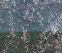
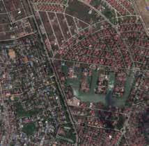
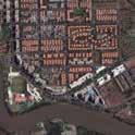
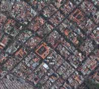
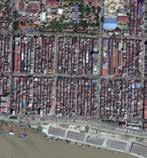
0,5 2,5Km Scale 5000 GOOGLE EARTH STREAMING, HCMC CITY, 21.4.2015 TOTAL AREA: 1000000 SQ METER BUILDINGS WATER BARE SOIL TREE COVERS PAVEMENT 0.9% 0.9% 39% 36% 0.6% 0.4% 22% GRASS/ PLANT SPORT FACILITY Phu My Hung-HCMC-Vietnam 0,5 0 2,5Km Scale 1: 5000 17% 15% 9% 11% 18% 30% TOTAL AREA: 1000000 SQ METER BUILDINGS WATER GREEN FIELDS URBAN GREENERY TREE COVERS PAVEMENT Thunh Xuan-HCMC-Vietnam TOTAL AREA: 1000000 SQ METER BUILDINGS AGRICULTURE WATER GREEN FIELDS TREE COVERS PAVEMENT 13% 38% 1.7% 8% 12% 26% 0,5 2,5Km Scale 5000 0,5 1 2,5Km Scale 1: 5000 TOTAL AREA: 1000000 SQ METER BUILDINGS WATER BARE SOIL TREE COVERS PAVEMENT GOOGLE EARTH STREAMING, YANGON CITY 21.4.2015 37% 10% 9% 5% 39% TOTAL AREA: 949825 SQ METER BUILDINGS 16% PRIVATE GARDEN 28% PAVEMENT 10% NATURAL AREA 20% WATER 5% UNDER CONSTRUCTION 16% URBAN GREENERY 2% BROWNFIELD 1% WETLANDS 2% Fmi City-yangon-myanmar 0,5 2,5Km Scale 1: 5000 TOTAL AREA: 1000000 SQ METER BUILDINGS AGRICULTURE WATER INDUSTRIAL BARE SOIL BROWNFIELD FOREST GRASS TREE COVERS PAVEMENT 20% 5% 10% 1% 14% 3% 8% 1% 25% 7% Dala Village-yangon-myanmar 0,5 2,5Km Scale 5000
Basically here actions for improve, increase green areas, preserve natural element, prevent artificial man made intervention and etc, have divided to two categories of Hi-tech actions and low-tech actions. Hi-tech actions are mostly some kind of interventions which have need and require more alerts or sometime stronger construction or basic changes of infrastructure. Besides, they are base on new urban technologies such as green roofs or sloral panels on roof and etc. Additionally most of these actions need financial supports as well.
water supply Irrigation roof Irrigation Heating Green Roof convertor Lighting Heating Apply from main electricity system Pv Panel underground water pump High level grey water storage tank grey water filter Stormwater Tree Trench System of trees connected by a subsurface infiltration to detain and release runoff Green Roof Vegetated surface installed over a roof surface is effective in reducing runoff Renewal Energy PV panels for the production of energy and use for indoor consumes and also adopting Radiator panels for heating Recycling and Reuse internal Use of recycled wastewater indoor after filteration and use it for some indoor consumes Leisure/ Entertainment Space Consideration of main infrastructure for implementation and providing people’s nessds Stormwater Tree Tree that has stormwater runoff directed to its pit HI-TECH ACTIONS Pervious Paving Hard permeable surface commonly composed of concrete, asphalt, or pavers. Multifunctional Green Boulevard Creating enough infrastructure & equipments for different kind of mobility and notice to pedestrian path attraction Green Corridor Managing the street space according to divers users such as cars, pedestrians, bikes and share green space users Suspended Pathway additional and emergent construction could be helpful in ooding situation Terraces Providing multifunctional space with all equipment that might be e ective in water rising level seasons Balconies Construction base on enough knowledge and data and create nice view and scenery toward river Overhangs Attribute the space to di erent users and also provide equipment in ooding hazard situation Underwater Steps Boulders & Steping Stones Setting Back The Dike HI-TECH ACTIONS
Second categories is low-tech actions, which these actions acts as more sustainable and natural interventions. they are basiclly intervention by design landscape or efforts for preserv and prevent hazard with natural elements and simple ideas. Besides, they are mainly cheap ideas which could implement quickly and being effective in short term plannings.
for instance adding some water storage to existing and poor buildings also could be valuable in order to collect rain water in monsoonseasons and prevent flow water along streets, inaddition this water could circulate and reuse for some kind of cosume inside the buildings.
Cistern/Rain Barrel Storage receptacle that captures and stores runo for up to 72 hours and can thereby reduce runo Stormwater Planter Structure lled with soil media and planted to collect and then disperse water Natural water cleaning Make natural water cleaning by ood pocket which keep water and prevent ooding Enhanced aquaculture Semi intensive Farming Stormwater Bump-out Vegetated curb extension that intercepts street and sidewalk ow along the curb-line Disconnection When runo from an impervious area is directed to available adjacent pervious area Rain Garden Vegetated area designed to in ltrate, detain and/or release stormwater runo Swale Channel designed to convey stormater In ltration/Storage Trench Subsurface structure designed to in ltrate and /or detain and release stormwater runo LOW-TECH ACTIONS Stormwater Basin Depression that is vegetated, designed to in ltrate, detain, and /or release runo Pedestrian Path Along River Design pedestrian path along river due to consideration of plants and species and river tidal water Backwaters Create natural embeded that prevent high rising water level Flood Channels Prevent ood by vencular strategies Retention Basins Collecting runo water and make puri cation through lterS Submergible Planting New Embankmnet Wall Foreshores Branches LOW-TECH ACTIONS
Section proposal ideas have been shown in order to emphasize on opportunities and capacities of each area to adapt base on ecosystem approaches. Since, the case studies are different from each other and after all analysis and understanding of landscape pattern, basic knowledge abot different species and green elements which live in these areas, proposal are base on contribution of ecosystem services and green infrastructure, to improve quality of area and make better spaces which provide quality of life from different point of view for inhabitants. More green spaces, not only provide better air quality, and invite more species which are effective, but also, the local species such as mangroves ,are specific species which could be quite effective in order to prevent flooding with strong roots which live in water.


Dwellings Dwellings Green/blue Boulevard Green/blue Boulevard Urban Green Space Street Street CONSIDERING THE MAIN INFRASTRUCTURE FOR IMPLIMENTATION & RECOGNISING NEEDS OF PEOPLE PROVIDING ORGANIZATION FOR MARKETS ALONG STREETS AND PUBLIC SPACE FOR NEIGHBORHOOD COMMUNITY THAT NEED TO BE CONTROL AND SUPPORT BY SOEM ASSOCIATIONS USE RECYCLE WATER BY COLLECTING WATER storage SECTION LOCATION Stormwater Planter Structure lled with soil media and planted to collect and then disperse water Stormwater Bump-out Vegetated curb extension that intercepts street and sidewalk ow along the curb-line Stormwater Planter Structure lled with soil media and planted to collect and then disperse water PROVIDING MULTIFUNCTIONAL SPACE WITH ALL Stairs Open Green Space School Main Street Dwelling Green Space EXISTING SITUATION SECTION LOCATION RECOGNIZING VENCULAR LOCAL SPECIES, THEN ENCOURAGING LOCAL PEOPLE FOR IMPLEMENTATION IN PRIVATE GARDENS CREATE NATURAL CHANNELS THE MIGHT BE USEFUL FOR AGRICULTURE IRRIGATION Wetland /Mangrove Agriculture land Channel Mangrove Stream Green Field Basin Dwelling Green Space Stormwater Basin Depression that is vegetated, designed to infiltrate, detain, and /or release runoff
Therefore, recognising these kind of species that unfortunately some of them have been disturbed along years with man made intervention. It might be new approaches for sustainable adaptation. Then, this sections have been effort to show some possible intervention through add green species, green areas, provide water channels or basins in order to collect water, add water collectors along streets, provide more green boulevard which are not only aesthetic and liveable, but also helpful for decreasing temperature and also prevent water flowing in monsoon seasons and etc.


RECOGNISING NATURAL SPECIE THAT MIGHT BE EFFECTIVE IN ORDER TO ABSORB WATER AND ALSO, CONSTRUCTION OF WALL CONSTRUCTION BASE ON ENOUGH KNOWLEDGE AND DATA AND CREATE NICE VIEW AND SCENERY TOWARD RIVER Parking Green/blue Boulevard Dwellings Street Urban Area Platform Orchard SECTION LOCATION USE RECYCLE WATER BY COLLECTING WATER underground water Wetland Street Street Rural area Cistern/Rain Barrel Storage receptacle that captures and stores runo for up to 72 hours and can thereby reduce runo In ltration/Storage Trench Subsurface structure designed to in ltrate and /or detain and release stormwater runo DALA VILLAGE YANGON, MYANMAR Mangrove Rural Area Brown eld/factory Street Wetland+aquaculture ADDITIONAL AND EMERGENT CONSTRUCTION COULD BE HELPFUL IN FLOODING SITUATION PREVENT FLOOD BY VENCULAR STRATEGIES COLLECTING RUNOFF WATER AND MAKE PURIFICATION THROUGH FILTERS RECOGNISING NATURAL SPECIE THAT MIGHT BE EFFECTIVE IN ORDER TO ABSORB WATER AND ALSO, CONSTRUCTION OF WALL IMPLEMENTATION OF GREEN ROOF SPECIALY FOR EXISTING BUILDING IS VERY EXPENSIVE & IT NEEDS COLLECTING OF ENOUGH DATA TO UNDERSTAND WHERE AND HOW IT IS POSSIBLE water supply Irrigation roof Heating

