Master of Landscape Architecture ‘22 University of Virginia 949.573.1682 avgrospe@gmail.com 2024 Portfolio
GROSPE
ANDRE
2
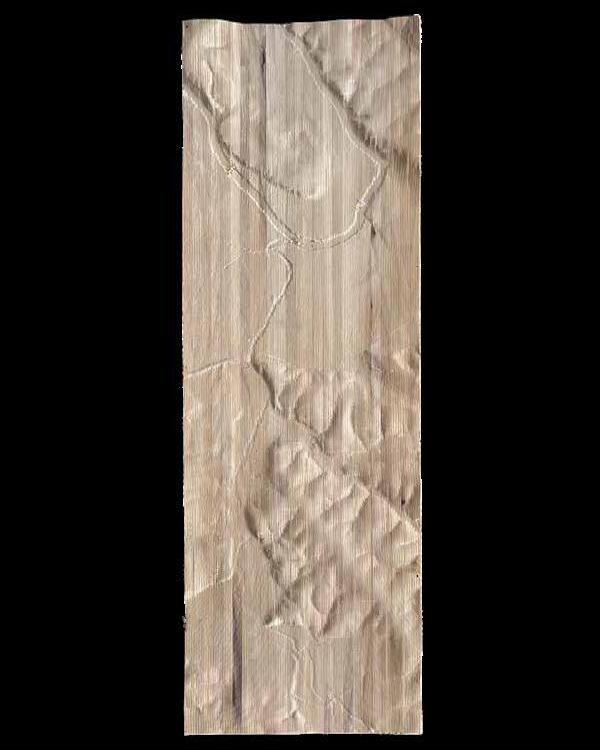
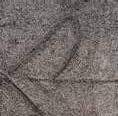
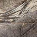
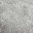
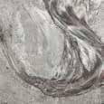
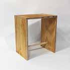
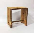
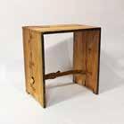
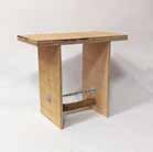
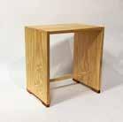
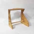
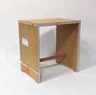
James River Floodplain, 2021
CNC poplar
ANDRE VICTOR GROSPE
P: 949 573 1682
E: avgrospe@ gmail.com
EDUCATION
Charlottesville, VA
2016 - 2020
2020 - 2022
Los Angeles, CA 04.23 - current
Remote 11.22 - 06.23
UNIVERSITY OF VIRGINIA School of Architecture
B.S. Architecture with High Honors
Master of Landscape Architecture
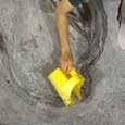
PROJECT DESIGNER, Elysian Landscapes
Assisted in the design and development for several residential and commercial projects throughout Los Angeles. Created planting plans, construction documents, and details for a six-thousand square foot commercial design studio. Assisted in the construction administration of a 374-unit affordable housing project for the VA campus.
RESEARCH ASSISTANT, Proof Projects
In collaboration with The Nature Conservancy, Anchor QEA, and the Port of Baltimore, analyzed the mouth of the Patapsco River as a potential site for the beneficial reuse of dredged sediment. Established drawing standards, layouts, and a graphic language for a prospectus of the work.
Minneapolis, MN 06.22 - 08.22
Remote 01.21 - 08.21
EXPERIENCE
Charlottesville, VA
Fall 2021
Spring 2022
Charlottesville, VA
Fall 2021 Spring 2023
Charlottesville, VA
Fall 2018
Fall 2021
INTERN, TEN x TEN
Researched and visualized the social life of South Minneapolis, a predominantly Black community displaced by the construction of I-35W. Created diagrams, base plans, and renders for a two-week competition for a memorial in Waukesha, WI. Designed, modeled, and prototyped a repeating fence module for a ski resort in Vail, Co.
INTERN, Stoss Landscape Urbanism
Created diagrams, renders, animations, and other marketing material for over six different projects located across North America, including the Boston Urban Forest Plan, Edmonton’s Touch the Water Promenade, the Los Angeles Urban Forest Equity Streets Guidebook, and the Nantucket Coastal Resiliency Plan.
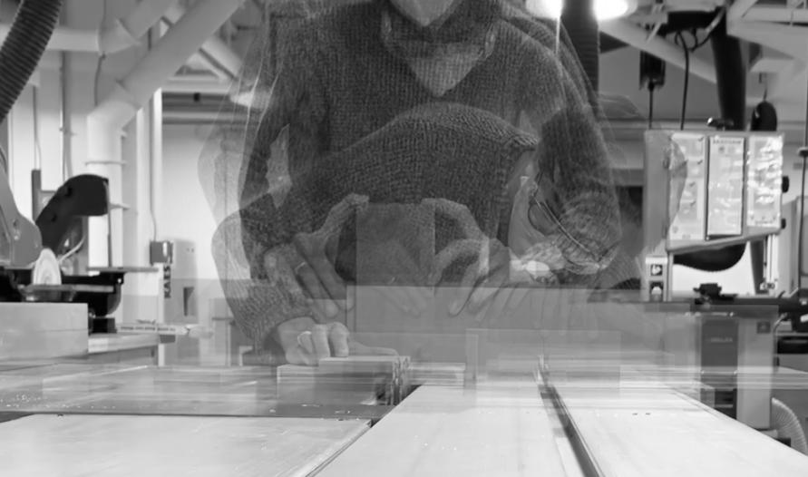
FABRICATION ASSISTANT | School of Architecture Fabrication Lab
Helped maintain a clean, safe, and supportive student fabrication space. Learned and maintained wood shop tools, CNC routers, laser cutters, 3D printers, water jets, and more. Trained dozens of first-year graduate and undergraduate students in basic wood shop safety. Designed and ran a stool making short course that taught students intermediate joinery and table saw safety.
EDITOR | LUNCH 17
Co-edited the 17th issue of the School of Architecture’s independent student journal. Helped curate and edit over 30 articles, visual essays, and art pieces dissecting and expanding the notion of craft in design.
TEACHING ASSISTANT, ARCH 1020 | Lessons in Making
Guided sections of first-year undergraduate students through the fundamental elements of architecture and design. Through five exercises and a final project, each student learned critical drawing, model making, and design thinking techniques.
AWARDS
Spring 2023
Spring 2020
Spring 2020
Spring 2019
Fall 2018
Fall 2018
SKILLS
ASLA MERIT AWARD
FACULTY OF ARCHITECTURE AWARD FOR DESIGN EXCELLENCE
SEAN STEELE-NICHOLSON MEMORIAL AWARD
UVA ARTS COUNCIL DISTINGUISHED ARTIST AWARD IN ARCHITECTURE
INTERMEDIATE HONORS
RAVEN SOCIETY MEMBER
RHINO 6, 7 (with V-RAY, GRASSHOPPER)
AUTOCAD (with LandFX)
ADOBE CREATIVE SUITE (PHOTOSHOP, INDESIGN, ILLUSTRATOR, AFTER EFFECTS)
ARCGIS (PRO, ARCMAP)
FABRICATION (WOODWORKING, CNC, LASER CUTTING, 3D PRINTING, CASTING)
WORK
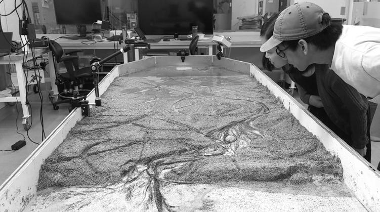
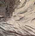
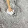
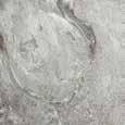
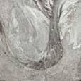
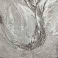
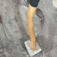
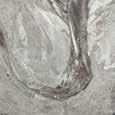
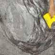
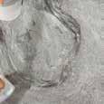
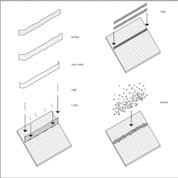
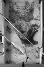
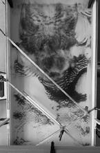
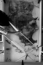
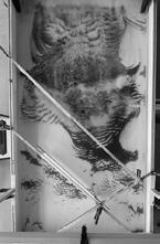
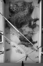
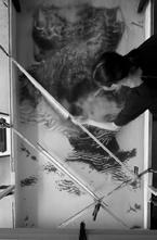
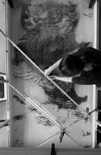
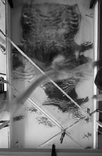
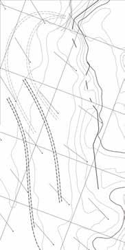
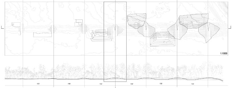
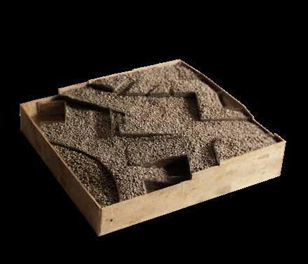
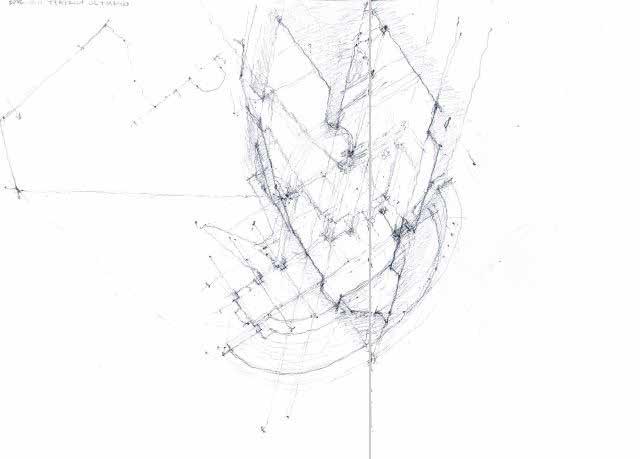
DRAWING WATER | Experiments
Water Table Experiments with Brian Davis
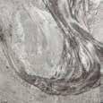
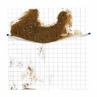
The water table does not recreate real world conditions. Only after careful observation and representation through models, animations, and drawings can this device become a useful design tool.
The table is a place to simulate and play with the natural processes of sediment deposition, erosion, wave action, and delta formation. To communicate the aesthetic potential of these forces, we used rotoscoping, photogrammetry, and overlay to represent phenomena in novel yet still descriptive ways.
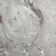
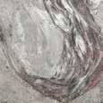
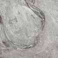
4
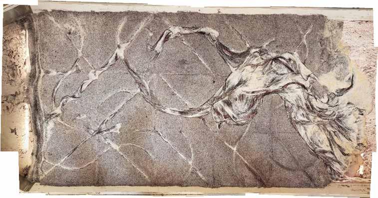
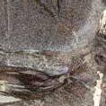
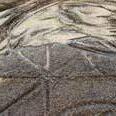
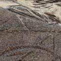
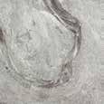
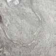
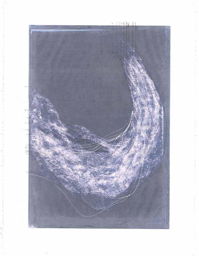
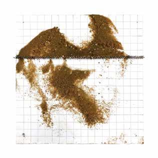
Untitled Sediment Drawing, 2021 Sediment, Water
The table allows us to test formal ideas, like ditch patterning shown above, against the unpredictable dynamics of moving water. Because the final striations of sediment were produced by our constraints, we see these psuedo-landscapes as a loose kind of descriptive drawing.
5
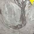

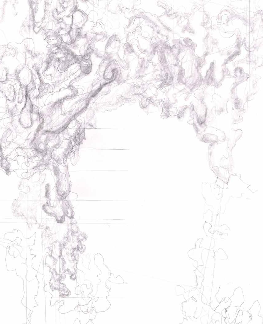
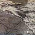
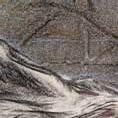
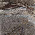
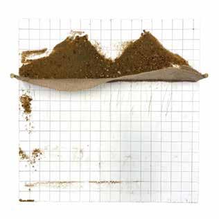
Point Bars
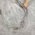
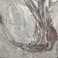
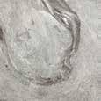
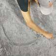
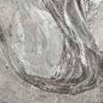
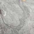
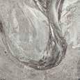
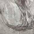
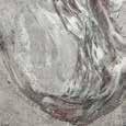

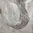
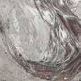
Point bars are sediment deposits at the bends of rivers. While evident when simulated in the table, these formations take years to morph and grow, invisible to human perception. The drawing on the right is a palimpsest of the channel’s wavering thalweg and the accumulating landmass on the inside bend.
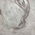
6
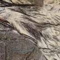
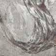
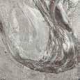
Untitled, 2021 graphite, ink on trace
7
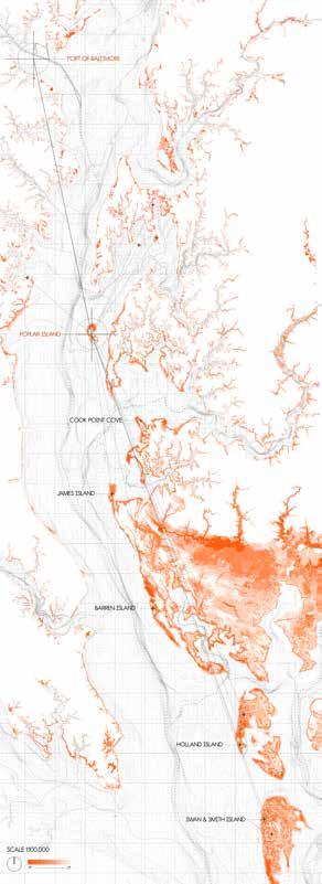
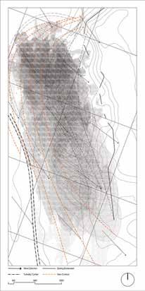
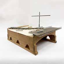
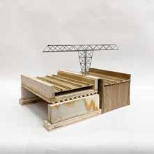
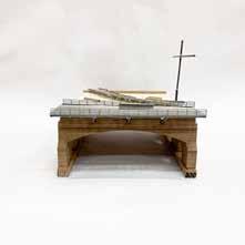
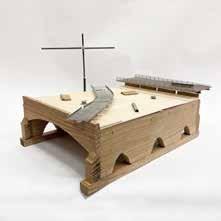
PATAPSCO BENEFICIAL REUSE FRAMEWORK |
Proof Projects | Baltimore, MD
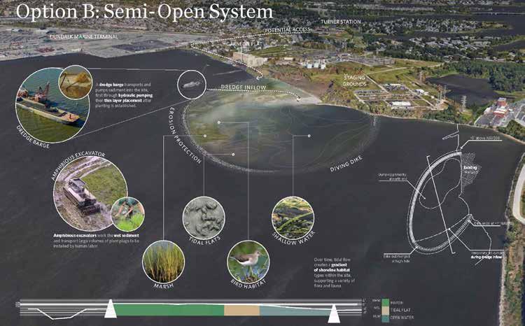
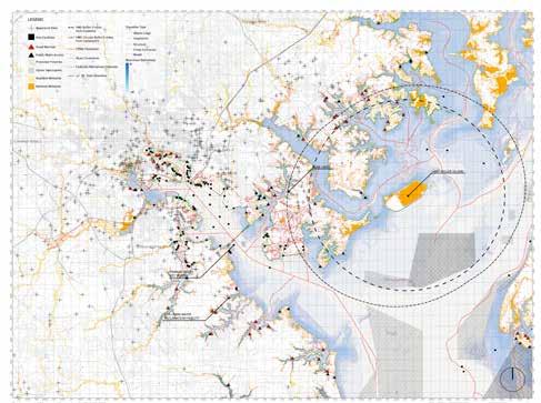
In 2010, the Port of Baltimore declared a moratorium on accepting private dredged material into state dredge containment facilities. This project proposes several nature based containment systems to not only store dredge material, but also leverage tidal and wave action to regenerate lost wetland habitat.
In collaboration with Ailsa Thai, Brian Davis, Austin Bamford, and Isaac Hametz of Proof Projects and the Nature Conservancy.
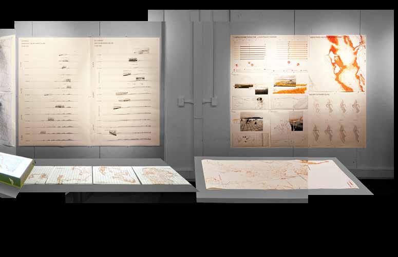
Above: Infographic of developed habitat
Left: Site Analysis
8
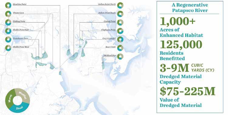
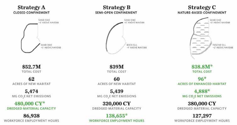
Above: Statistics from final report
9
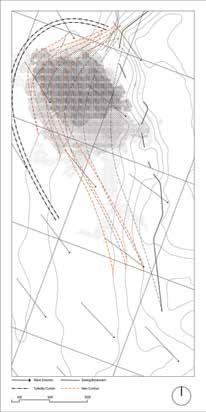
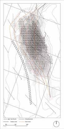
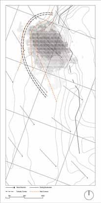
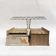
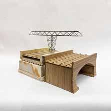
PUNCTUATING DREDGE | Davis, Shivers, Cantrell | Chesapeake Bay
All work was produced collaboration with Judy Chen and Ailsa Thai
Existing protection and containment measures for dredge are crude and unsightly. Facilities like Craney and Poplar rely on isolation and armory. These islands are both literal, surrounded by water, and metaphorical, separating themselves from the natural processes of the bay.
Using existing technologies of turbidity curtains, fences, and pumping equipment, this project seeks to punctuate this process of beneficial reuse, calling to attention the aesthetic potential of island building.
10
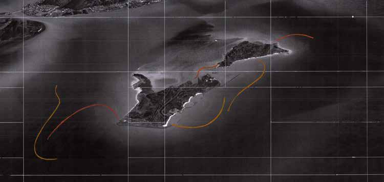
Doctored aerial of Barren Island showing deployed sediment curtains. Drawing by Ailsa Thai
The Chesapeake Bay is remarkably shallow. Many “disappearing islands” are submerged by less than ten feet of water. This is the same effective depth for sediment curtains and fences. The orange area corresponds to potential deployment sites.
Barren Island is one such island. The curtains’ deployment is choreographed over a ten year period, allowing sediment to gather at its base before shifting to expand the newly consolidated shallow landmass.
11
Barren Island zoom in plan by Ailsa Thai Mid Bay Shallow Zone map by Judy Chen and Andre Grospe
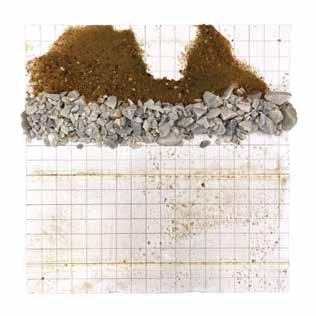
Consolidation Studies
water, sand mix, burlap, rock, nails, gauze, plywood, foam core
While most forms of dredge containment are solid, the group was interested in a more leaky approach. We focused on what kind of material (pebbles, sand, or silt) passed through or accumulated against the screen.
12


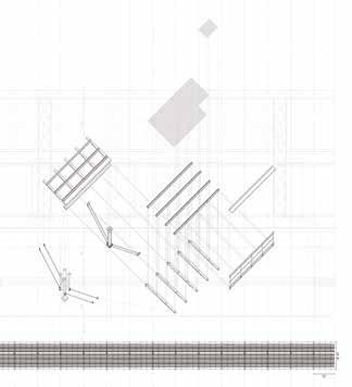
Tools and Experiments
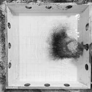
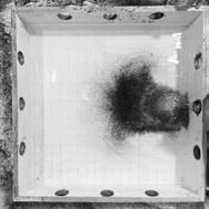
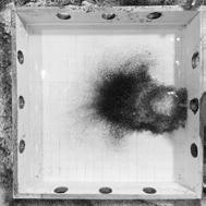
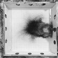
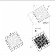
In order to understand how a sediment slurry accumulates and consolidates, the group used the water table alongside several custom observation devices like the plywood pump box above. The holes allowed sediment to be pumped from various angles while the foam core inserts could test the stopping power of different materials.
13
Diagrams by Ailsa Thai

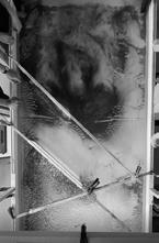
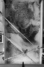

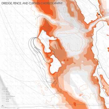
Curtains and Fences
From the previous tests, we concluded that a semi-permeable fabric would best hold the sediment while also being a completely temporary solution. In shallow areas, the fabric would be deployed as a fence, while in deeper areas, they would be suspended as a sediment curtain. The tests above examines the repeated effect of wave action and sediment accumulation against different angles and layering of these systems.
14
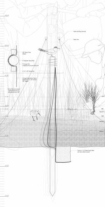
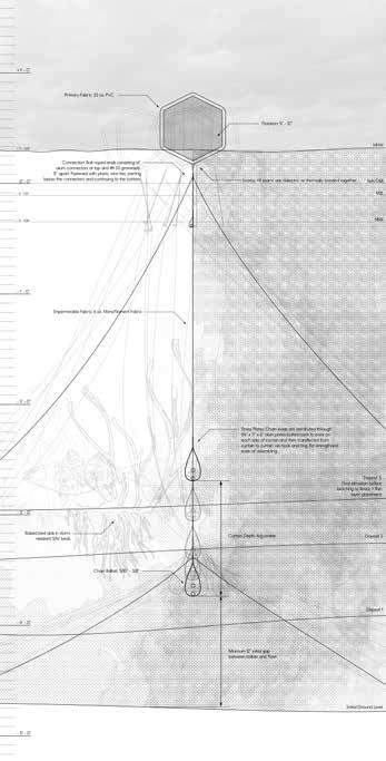
1:1 Construction Drawings
Sediment Fence (left)
Sediment Curtain (right) digital drawing
In order to convey the shallowness of the near shore, the group took care to draw the interventions at a 1:1 scale and presented them as such. A mock up of the sediment curtain was made to further convey the true scale of these devices usually submerged in murky water.
15
Fence drawing by Ailsa Thai Curtain drawing by Andre Grospe
Choreography
Curtain and fence deployment follow typical marine construction standards. Dredge placement also relies on existing thin layer placement techniques albeit in an unorthodox fashion. The innovation lies in the movement of equipment after wave action has pushed and consolidated sediment into a more stable position.
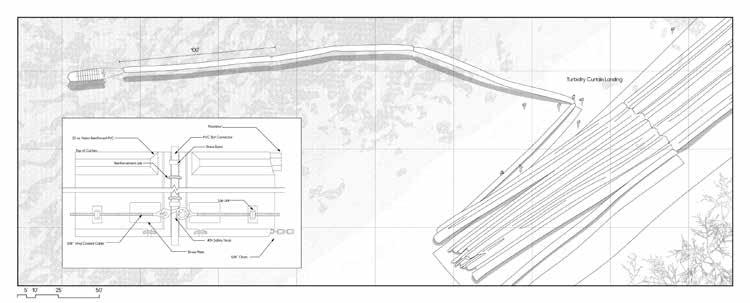
1. Curtains are assembled on shore and towed into place and deployed with the help of shallow draft boats
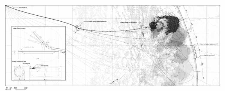
2. Dredge boats loaded with slurry anchor at a safe depth. Floating docks help support and direct the spray of material.
16

Stage 0: Before placement
Stage 3: Further growth and consolidation.
Stage 1: Initial curtain and sediment placement
Stage 4: Curtain movement and further placement.
Stage 2: Sediment movement and growth
Stage 5: Consolidation. Land is built and technique is switched to silt fences.
17
Sketch Wall with collages, pastel drawings, and wave simulations by Judy Chen, Andre Grospe, and Ailsa Thai
1:1 Section Details
by Andre Grospe, and Ailsa Thai Mock Sediment Curtain made of custom water jet hardware, rip stock nylon, geotextile fabric, stainless shackles, foam by Andre Grospe
Digital Presentation
Prospective Aerials and Perspectives pastel, pencil, collage by Ailsa Thai
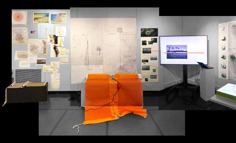
Exhibition
The group’s studies spanned from collages, sketches, videos, overlays, and mapping. This breadth was presented as an interactive exhibit in order to invite guests into our process. The goal was to convey both the plausibility of the intervention and the aesthetic potential of these mysterious lines and mounds emerging from the water.
18
Predicted Sediment Movement Drawing
digital drawings traced and animated from experiments drawings and animations by Andre Grospe
Section Development over time
digital drawing and collage by Judy Chen
Deployment Schedule (above) and Installation Plans and Vignettes (below)
digital drawings, pastel overlay, collage by Ailsa Thai and Andre Grospe Barren Island Plan
digital drawing by Ailsa Thai
Light Box with alternate sites
digital drawings on vellum box by Andre Grospe drawings by Ailsa Thai and Judy Chen
Mid Bay Shallows Map
digital drawing by Judy Chen and Andre Grospe
19
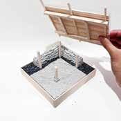
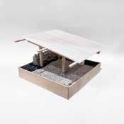
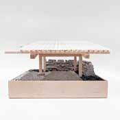
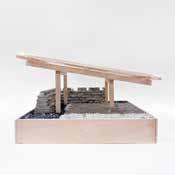
“PLUG-IN” WETLANDS |
Floyd, Seibert | Milton Land Lab
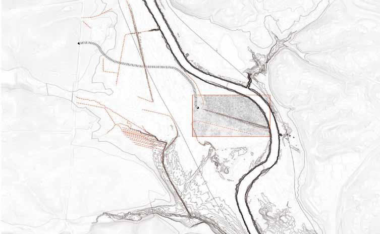
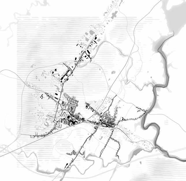
The Milton Land Lab is a disturbed floodplain prairie ecosystem and the grounds for an intensive on site course meant to train us in field work, local ecology, landscape technology, and construction documentation. Produced collaboration with Nita Wareechatchai and Ailsa Thai, this final project manipulates the remnants of several drainage ditches along an abandoned aircraft runway in order to restore pre-colonial wetland habitats.

20
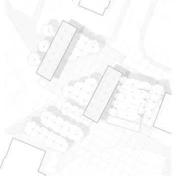
Above: Site Plan
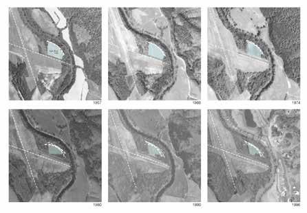
Right: Historic Aerial Analysis
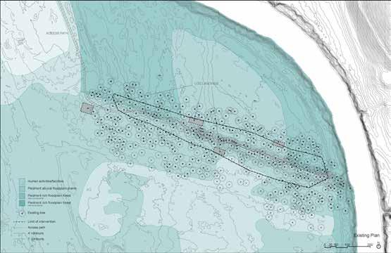
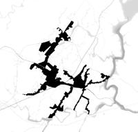
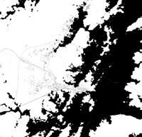
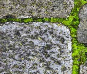
Existing Ecology
A combination of historical aerial photography, topographic analysis, and on site ecological survey work allowed us to identify several native and non native habitats in various stages of succession.
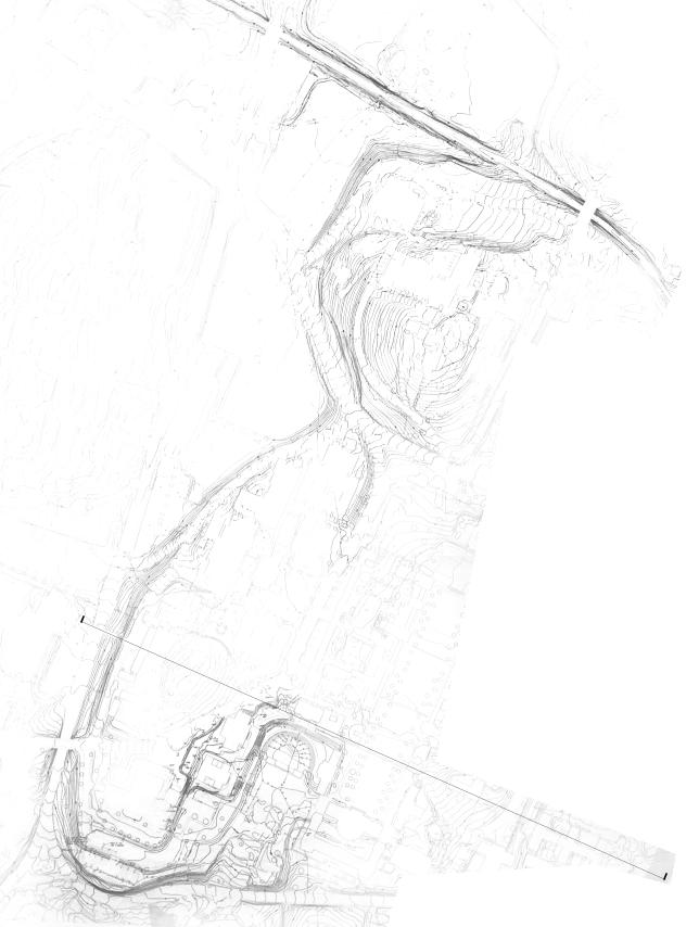
Grading Plan
Along the secondary runway is a drainage ditch leading directly into the Rivanna River. Using simple cut and fill operations, we create a series of ditch plugs that slow the outflow of water.
21
Former Runway Edge
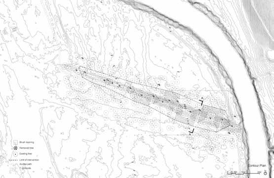
Overtime, the ditch plugs will erode and soften. The variation in size mimics naturally occurring pockets of wetlands. The existing planting is a dense and overgrown web of native and exotic species which prevents the growth and succession of native plants.
After the initial disturbance of construction, diligent weeding and maintenance ensures the establishment of a healthy floodplain forest with a tall over story of Acer negundo, Juglans nigra, and Platanus occidentales, and an open under story and groundcover of Asimina triloba, Lindera benzoin, Viola striata, and Carex blanda.
Above: Enlarged Grading Plan and Section Right: Existing and Proposed Sections
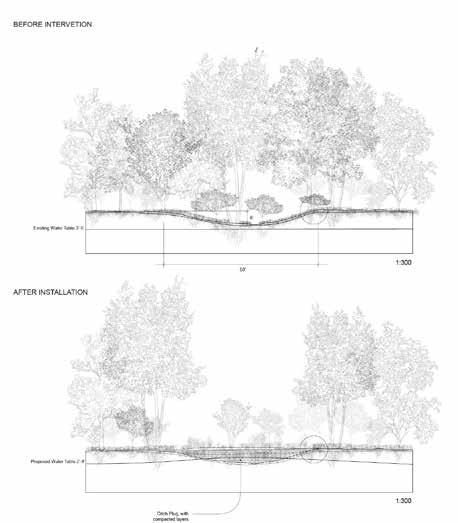
22
Existing Water flow
Water flow After Ditch Plug Installation
23
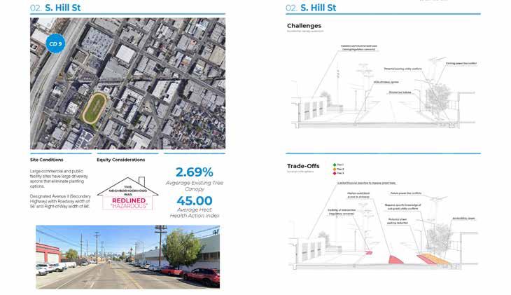
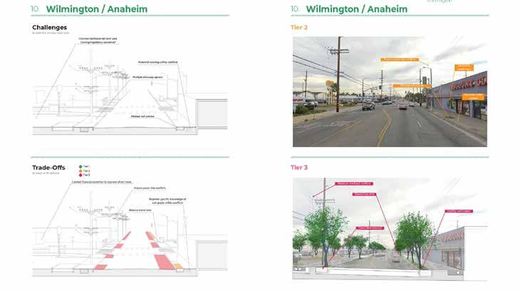
INTERNSHIP | STOSS | Los Angeles, CA
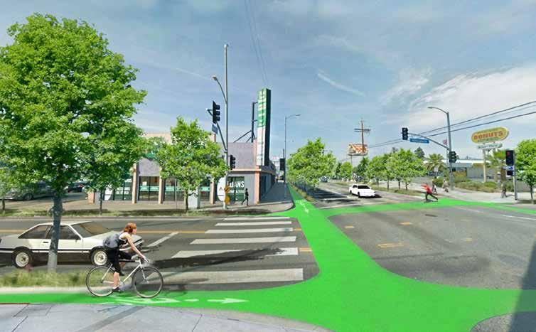
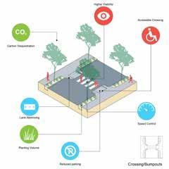
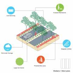
Images from the LA Urban Forest Equity Streets Guidebook done with City Trees. The renders, diagrams, and sections show the challenges and benefits of planting in certain areas. It also shows how planting can coincide with better pedestrian infrastructure. The selected spreads (left) were done by Davi Parente Schoen and graphics team at CAPA Strategies.
24
25
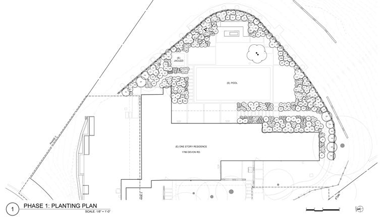
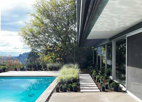
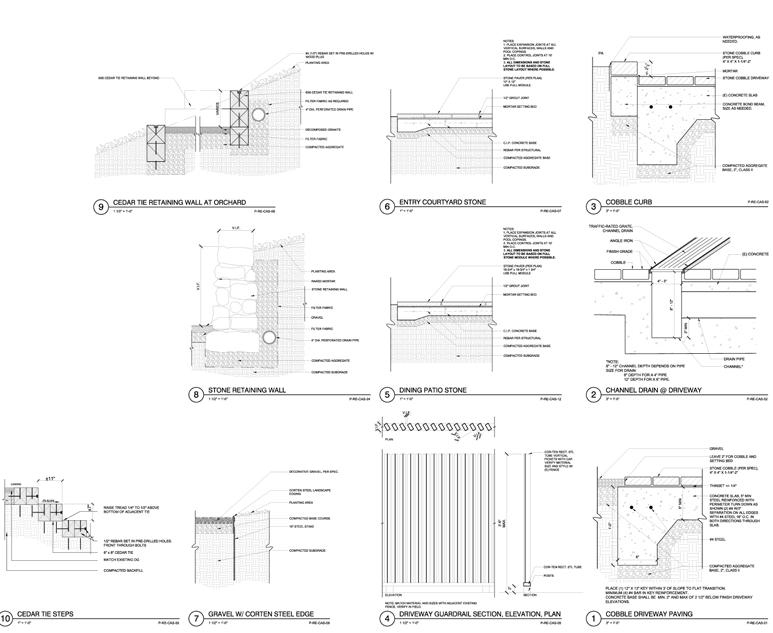
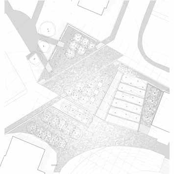
Planting plan and details from a residential garden in Pasadena. In collaboration with Judy Kaemon and Eiko Hamada-Ano, I developed a planting, groundcover, and lighting plan alongside several details for built in seating, paving, drainage, paths, and retaining walls. I also helped locate and place plants on site according to plan.
Left: Plant placement
Right: Selected Details Above: Planting Plan
26
RESIDENTIAL
Elysian
PROFESSIONAL
WORK |
Landscapes | Pasadena
27
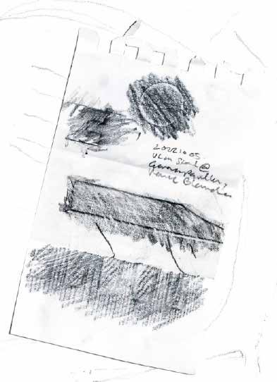
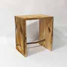
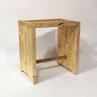
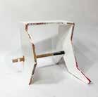
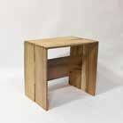
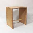
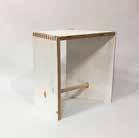
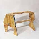
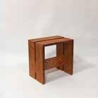
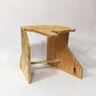
100 DAYS OF MAKING | Sanda Illiescu
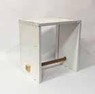
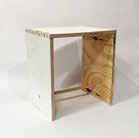
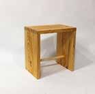
Max Bill was broke when he started the Ulm School of Design. Not even enough money for chairs. Thus his students’ first assign ment was to build their own portable stools. Its made of three boards connected by 34 box joints and a broom handle dowel for shear strength. Today, the stool is prohibitively expensive, but I still wanted one.
Over 100 days, I replicated and iterated on this simple design. Dialing in the jig was simple if not tedious. The challenge was finding wood. Within the school there is no shortage of awkward wood scraps and waste. The simple construction allowed me to use whatever I could find. Each of the 25 stools keeps the charac ter of the scrap that it came from.
28
The Ulm Stool
Rubbings from a real Ulm stool, found at the German Pavilion in Venice (right)

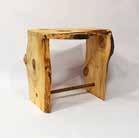
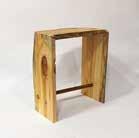
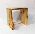
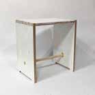
29
2021
25 Stools salvaged plywood, pine, ash, etc.
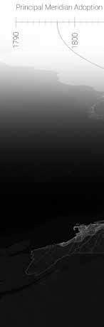
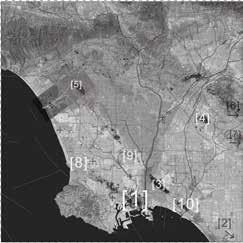
US MEGAREGION RESEARCH | Somatic Collaborative
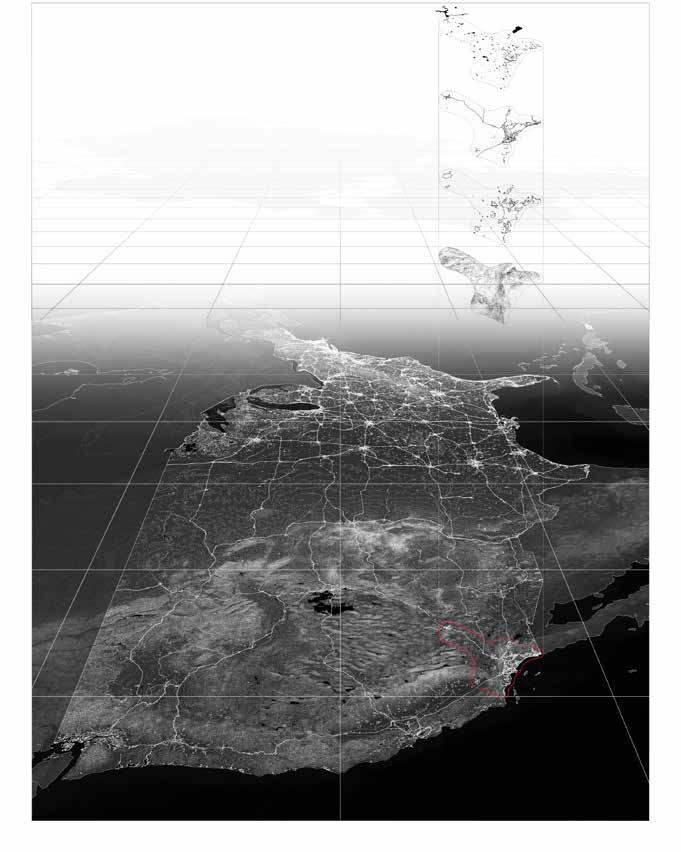
Exploded axonometric of Southern California Infrastructure and Natural Resources
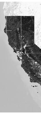
30
topography urban area road water
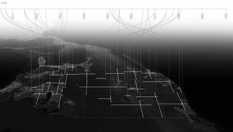
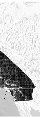


Summer research assistantship with Felipe Correa and Devin Dobrowolski analyzing the contemporary impact of the US Rectangular Survey System which dates back to the country’s founding. The work spans from large scale visualizations of the country and its history to a close analysis of each of the 50 states and their infrastructure’s adherence and adaptations to the Jeffersonian Grid. This exercise in rigorous cartography emphasizes how the simple layering and processing of publicly accessible datasets can weave a powerful story of our nation’s history of land acquisition and management.
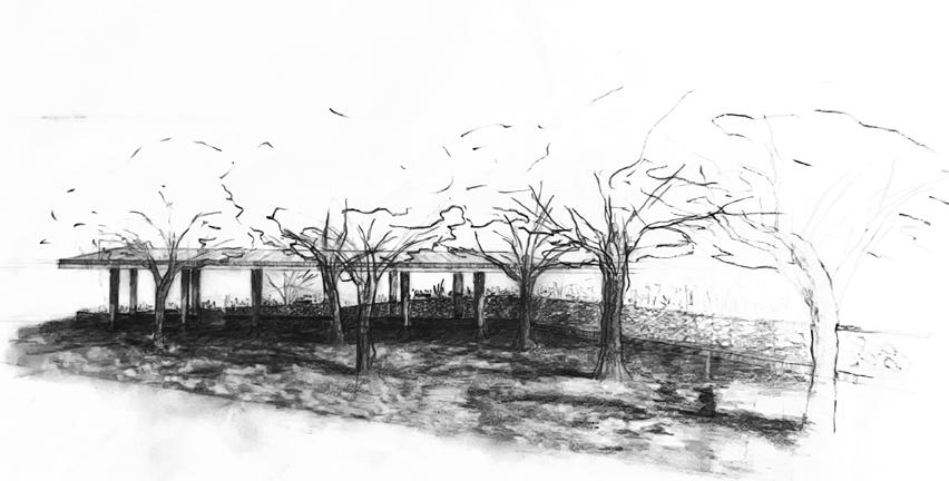
STAGING THE STREET |
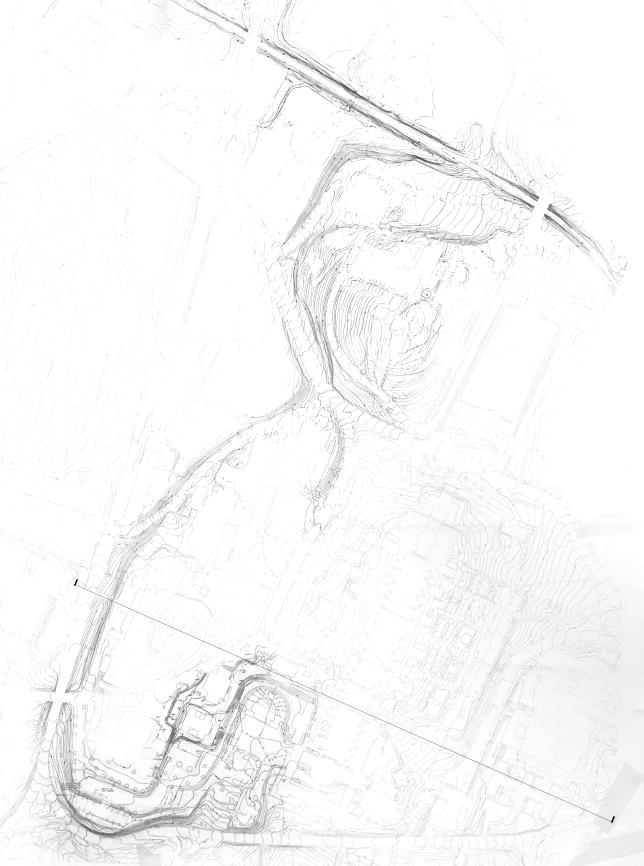
Meyer, Mitchell | University of Virginia Grounds
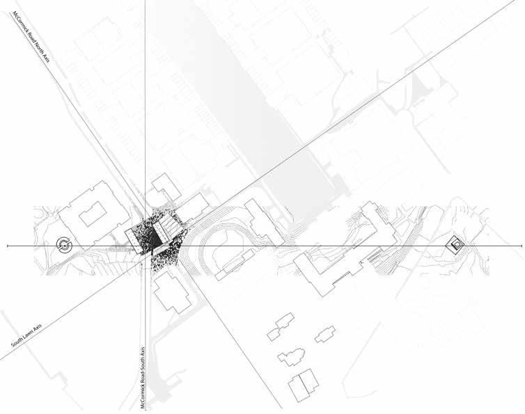
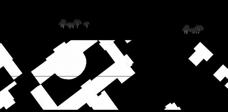
Site Plan with significant axes
32
B A B’ A’
Canopy Study Model
Racialized Topographies
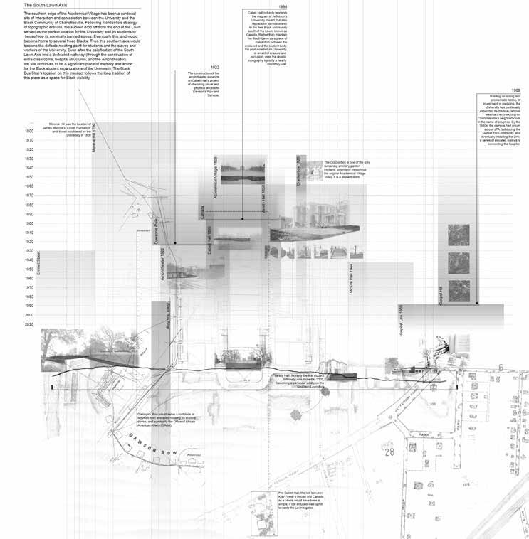
Currently, the Black Bus Stop is a 50’ x 50’ UTS bus stop located at a middle ground, both in plan and section, on the South Western edge of the Lawn, at the base of the former plantation Monroe Hill. However, this seemingly banal point within the University proved a significant space for Black visibility and gathering during the 70s-00s, serving as both everyday meeting place and stage for initiation and celebration events, all in the informal confines of a bus stop.
This project takes inspiration from the ways in which a critical mass can transform a space of transience to a place of joy and conviviality. By expanding the paving from the sidewalk, across the road, the bus stop further asserts itself as a space for pedestrians rather than traffic. The built canopy and planting help turn this space into an outdoor room.
33
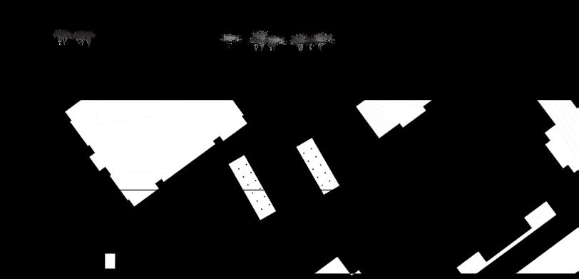
Paving Plan Retaining Wall Study Model (above)
Canopy Plan
34
A A’
Defining Ridge line
35
Topography, Hydrology, and Urban Morphology of Charlottesville
Urban Figure
Lowland Figure
Thick Sections
University of Virginia planned its architecture to displace, segregate, and hide Black communities. These communities found home in the lowest lying areas of the city, the only land available to them. The Black Bus Stop exists at the juncture of this racialized topography. The ridge the BBS sits upon was a contact zone between students and enslaved laborers. The drawing above reveals the thick and erased history embedded in the land.
36
A A’
The thick section drawing helped clarify the form of the design. The retaining walls push land back to form a stage that rests on a ridge. This gives the BBS a topographic presence at the end of this ridge.
37
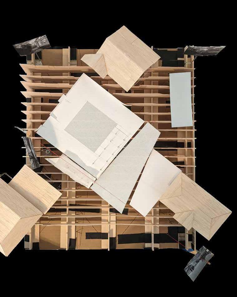
Sketch Model, 2021 basswood, mesh, cardstock, thread
The Black Bus Stop finds itself topographically situated between multiple notable spaces of memorial and rest. Carpinus caroliniana trees extends the shaded area created by the timber framed structure.
Shaded spaces for resting, studying, and people watching are a valued necessity in such a hot climate. The dense grid of trees and structures transforms an average transit stop into a place of gathering and rest.
Section C-C’ - Memorials as Spaces of Rest
38
Shade
FrankHumeMemorial
BlackBusStop
B
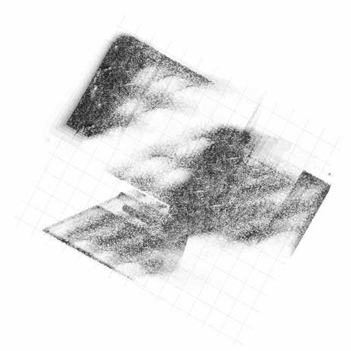
Shade Analysis - Summer Solstice
39
NewCabellHallCourtyard KittyFosterMemorial
B’
Shade Study Sketch
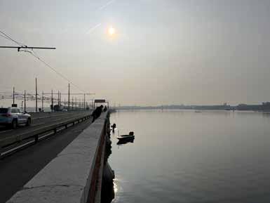
THE GREEN IN BETWEEN | Sherman, Fard | Venice, Italy
All work was produced collaboration with Ailsa Thai
The walk from mainland Italy to Venice is a delirious, monotonous, and poetic 2 mile walk. Crossing the bridge is often the closest one gets to the lagoon, though one rarely notices. Over the edge, oysters, fish, and crabs dwell in riprap and seagrass. The walk gives time to speculate the inevitable changes coming to Venice. On one end of the horizon, one sees a dying industrial site and on the other, a city trapped in time. Both threatened by sea level rise and decay.
Inspired by our daydreams during this walk, this project reveals the bridge as critical joint between Mestre and Venice. We imagine a bridge without cars, oriented towards pedestrian mobility. The bridge acts like a warm-up to a city where walking is the only sensible way to navigate.
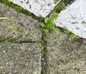
Embracing and amplifying its proximity to the water, the project subtracts paving to make space for spontaneous vegetation to take over, while also adding elevated pathways that allow one to explore spaces above, below, and between this often ignored Venetian infrastructure.
40
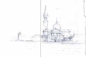
Venice from the Bridge (above, right)
Study models for grooving patterns (below, right) Spontaneous vegetation in Venice (opposite, full spread)
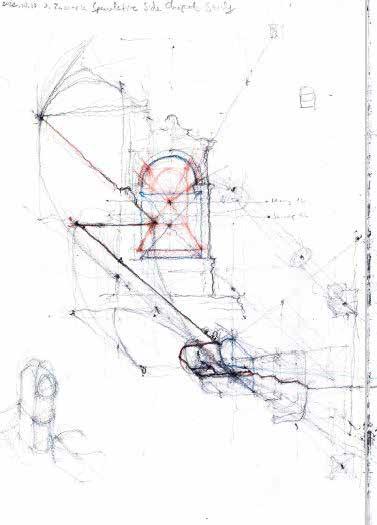
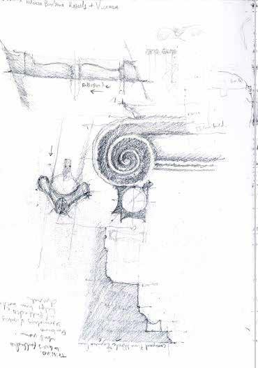
Urban Sketching
During our six week stay in Venice, sketching became the primary way of record keeping. Of particular interest to us were the details both old and new. The joint work of Carlo Scarpa, corner details of Palladio, and historical palimpsests of Codussi keyed us into the Venetian mindset. This was critical in attempting to weave the bridge into the city’s urban fabric.
42
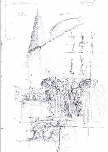
Selection of sketches by Andre Grospe
43
Most only experience this bridge through the window of a train or car. The journey lasts less than five minutes. The walkway is for those wanting a slow experience full of distractions.
We deconstruct the street with existing surface groovers, allowing spontaneous vegetation to thrive. The elevated walkway still allows cyclists and joggers to speed across the bridge. But the more adventurous can always step off to stick their nose amongst the weeds and rocks.
44
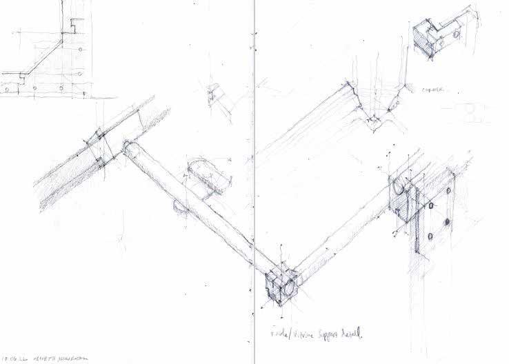
Walkway Exploded Axon (above, right)
Study models of sections of the bridge (above, below) Section, plan, elevation, and axon of walkway and floating dock (opposite)
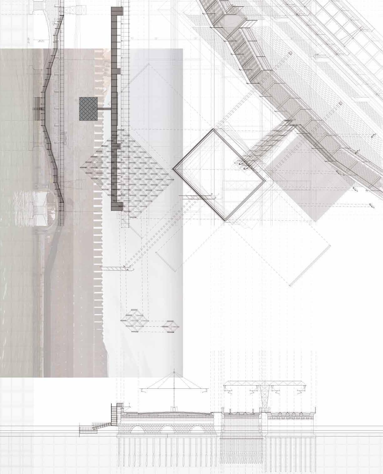
There are no shortages of sneaky paths in and around the city. Behind the Arsenale on the northeastern edge of the island is a precarious walkway. We found this by accident. The walkway contorted around portals and walls of the city like it was avoiding capture. Less than twenty feet from the edge, we could spot the mud flats that under gird the city. The excitement of that proximity inspired us to give access to the inaccessible.
How do you convey the daydreams that flood your mind on a long walk? We used an accordion book with a drawing and aerial of the bridge on either side. This allowed us to parse the bridge
46 Accordion
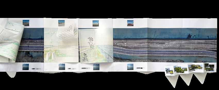
47
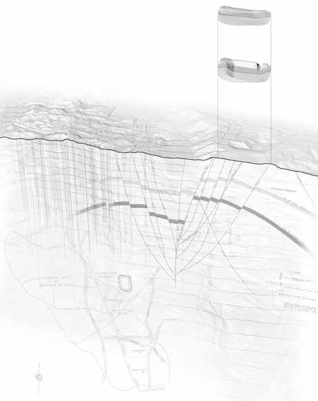
WIP | Independent Research | Los Angeles, CA
Since my first time witnessing the awesome vistas of Kenneth Hahn State Recreation Area, I was struck by the overwhelming overlap of recreational and industrial space. Expanding on my undergraduate thesis (which is what solidified my interest in landscape architecture) using the tools and theories I have since learned in graduate school, I have begun to delve deeper into the root of my sublime sentiments.
Drawing from theories on hauntology, thick sections, asymmetrical landscapes, and the postmodern and industrial sublime, I have started to rationalize through drawing, writing, and modeling the potential of the Baldwin Hills as a prominent LA post -industrial public space.
48
Above: Ranked Oil Fields
Upper Right: Thick Section WIP
1951
Current
1963
Lower Right: Plug-in Model
Dam
1963
Dam Break Current Topography
Dam Break
The 1x1 mile grid creates a framework to analyze the spread of post-oil landscapes.
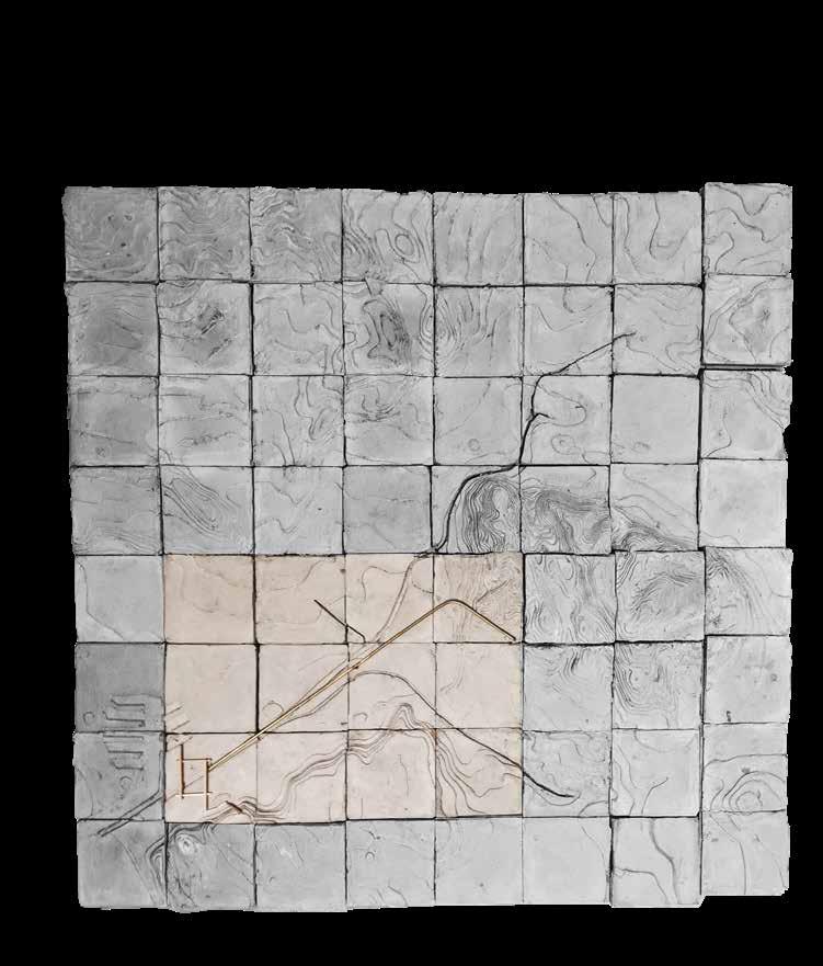
49
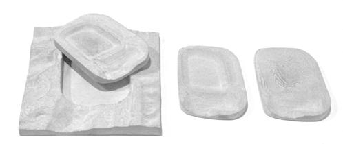
Ballona Wetland Tiles concrete, basswood, brass
