 BAICHI CHAKI, M.ARCH, LEED GA
M.Arch Project
Re-envisioning Green Lanes of Montreal
B.Arch Projects

Rethinking Rajshahi Divisional Public Library: An Interactive Learning Platform
Museum as Monument
Sustainable Restoration of Urban Community Park
Design of Affordable Housing
Reintegrating Central Jail : Appropriating Old Dhaka as Art of Placemaking
Rise High: Design of a Highrise Building
Design of Bangladeshi Council in Dubai
Rest House Design for Nature Watchers
Installation : Creative Space Utilizing Recycled Materials
CONTENTS
Projects
Project Community Center Design 2019 2018 2017 2017 2016 2016 2015 2014 2014 2013 2020 2019
Professional
Canada Malting Redevelopment
DESIGN IS NOT MAKING BEAUTY, BEAUTY EMERGES FROM SELECTION, AFFINITIES, INTEGRATION & LOVE - LOUIS KAHN

Re-envisioning Green Lanes of Montreal
M.Arch Design Studio
Site Location: Montreal, QC.
Team of 5 members.
Duration: 3 months.
Year: 2019
Studio Tutor: Dr. Vikram Bhatt.
Software Used: Rhino, Grasshopper, Revit. Project Contribution: Algorithmic Urban Analysis, Site Survey and Analysis, Guideline Development.
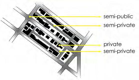
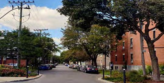
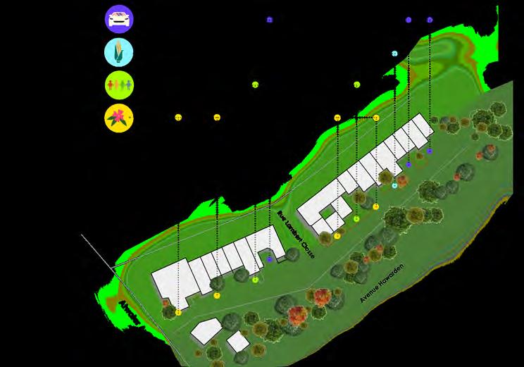
The term Ruelle Verte or Green Lanes refer to the linear back alleys that are converted under EcoQuartier’s program. Anyone can feel the reduced heat island effect within the lane with a calmer atmosphere and better air quality. They are also a perfect spot for building micro-habitats for birds and insects to allow Montreal Island’s biodiversity to thrive. Such green back alleys that are usually shared by two rows of houses on either side are a great setting for the nei-ghbours to conduct various social activities.
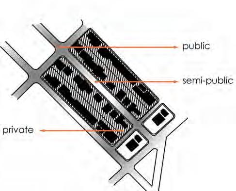
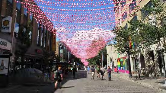
The objectives of this studio project was to analyze the green lanes of Montreal from the urban designer’s perspectives; recognize the design features, range of activities, materials used in transforming the lanes, vegetation and how it is grown and tended, how events and community activities are accommodated and celebrated by the neighboring community within the lanes. After the analytical review of green lanes, we have demonstrated our concerns as an urban designer and provided recommendation for the improvements.

Montreal’s Hierarchy of Streets

 Secondary Lane
Tertiary Green Lanes
Primary lane
Urban Pedestrian Analysis of Montreal (Mercier Hochelaga

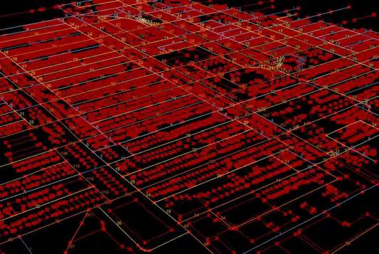


Pedestran Travel Radius Pedestrian Magnitude Amenities Magnitude
Borough)
What Is A Green Lane?
A place for sharing common objectives, dreams and values;
A Place for citizen mobilization;
A safe place for children, parties, sport activites and meditation;
A social hub between boroughs and families;
A living places where environmental actions are taken, such as gardening, own vegetation and decoration;
A source of art and fantasy.
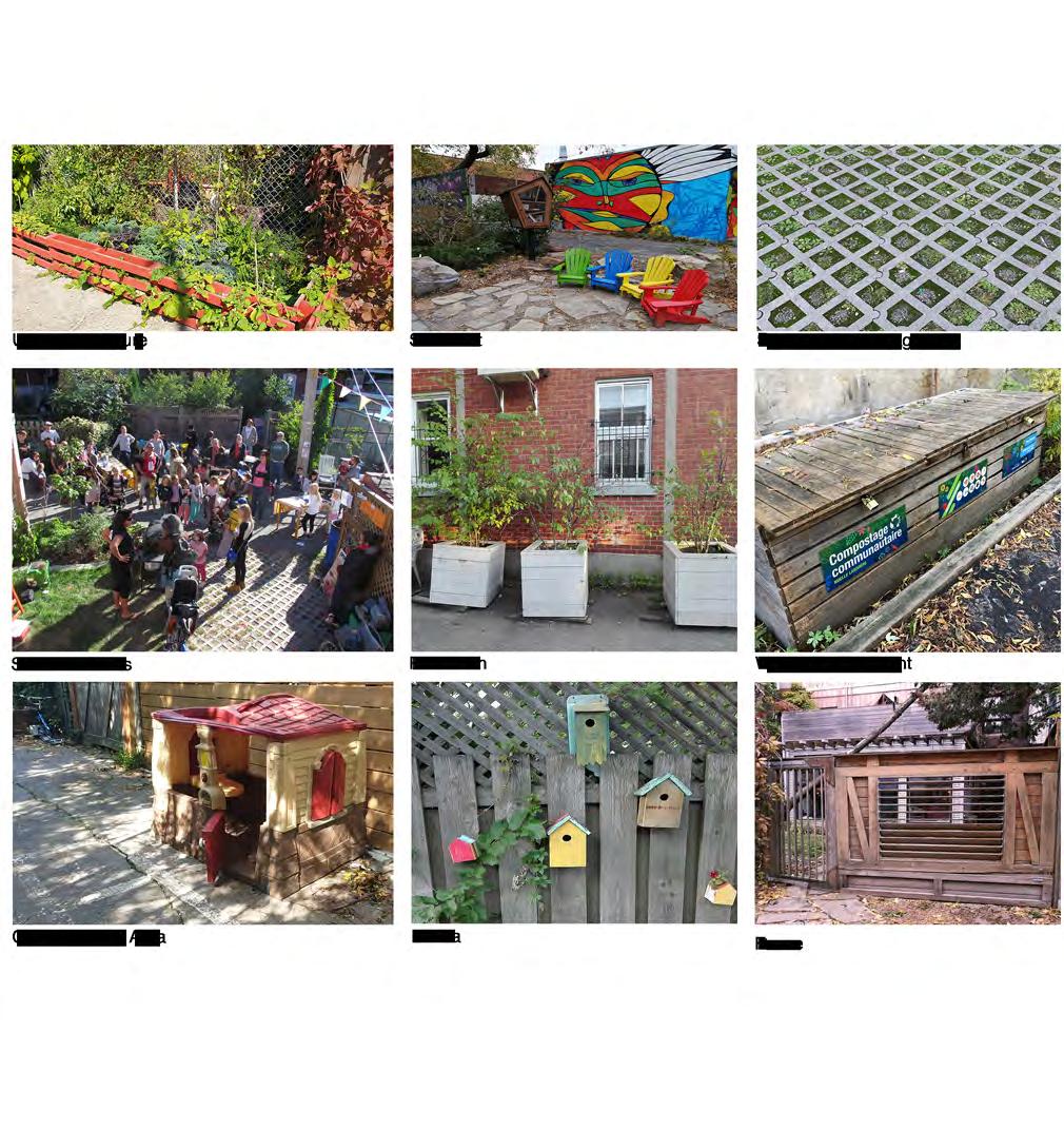
Elements of Typical Green Lane
Yeary
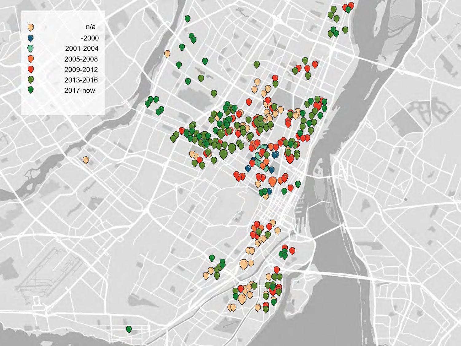
Evolution of Green Lanes Organized by EcoCartier Montreal
Throughout the Island of Montreal, 444 green alleys can be found, which represents a total length of over 90 kilometres
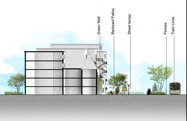
Recommended Green Lane Design for Typical Green Lane

(Borough: Ville-Marie)
Hawarden, Montreal
Axonometric View of Green lane in Avenue
Top View
Section Parking Edible Landscape Community Living Environmental Sustainability
An Interactive Learning Platform
Rethinking Rajshahi Divisional Public Library

B.Arch Thesis
Site Location: Rajshahi, Bangladesh
Academic Project
Individual Project Level 5, Term 2
Duration 14 weeks
Year: 2018
Studio Tutors: Ahsan Ullah Mozumdar, Maherul Kader Prince.
Software Used: Rhino, Grasshopper, 3ds Max, Revit.
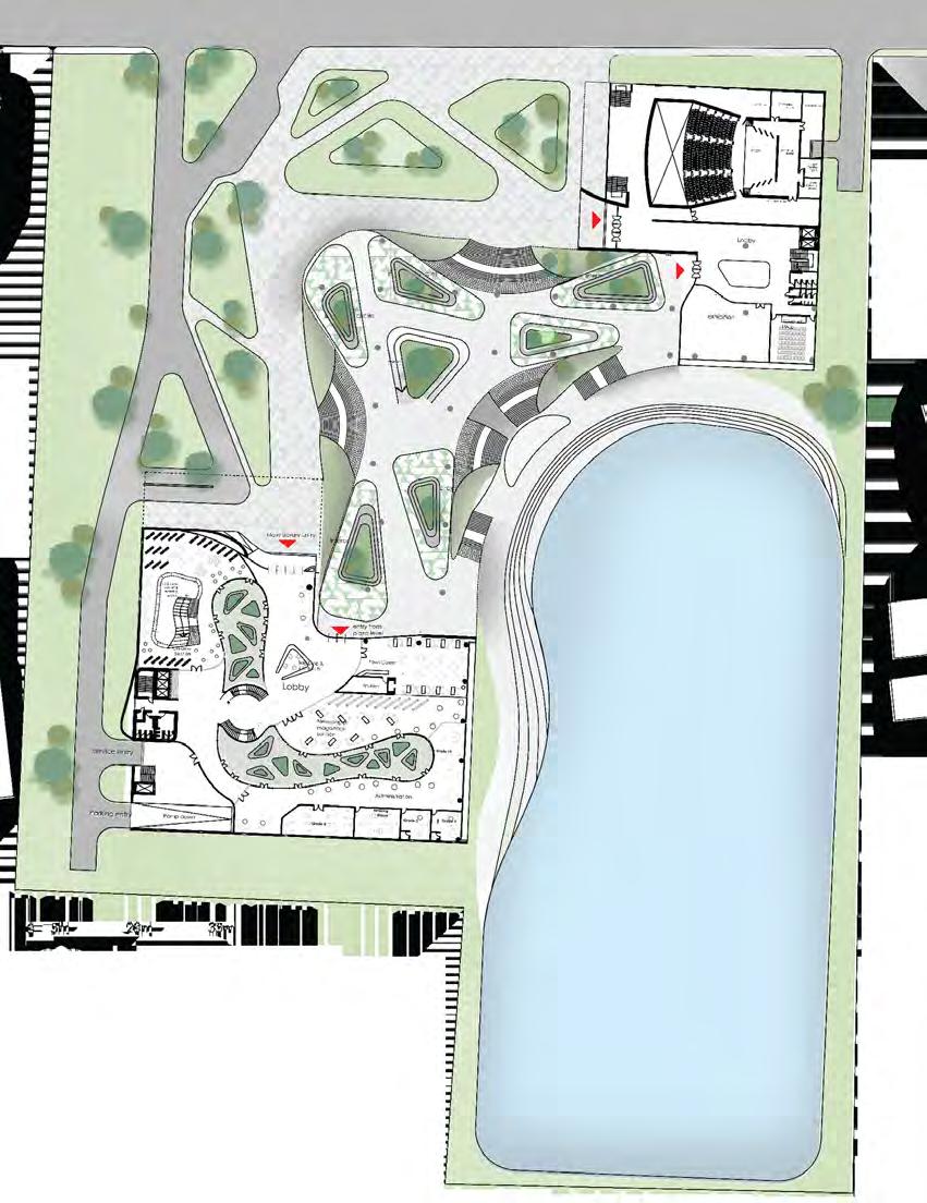
Today we are living in a world where getting information is a matter of seconds. Hence, the purpose of the library is also changing day by day. Yesterday’s library was silent but today the library should be more vibrant so that people can share their knowledge and information among themselves. People should feel more welcomed to take part in knowledge sharing activities. In the age of e-learning, the main goal of this project was to create a public platform for learning, interacting and sharing knowledge among the community. The library was intended to design as a civic space so that people can maximize their shared ideas, knowledge and information. A large ground was uplifted to generate interactive activities for the community holders, such as readers circle, writer circle, drama circle, music circle and poetry circle.
Master
Building
04
The building mass was extruded to accommodate the library program.
The entry of the building was cantilevered to invite public gatherings.
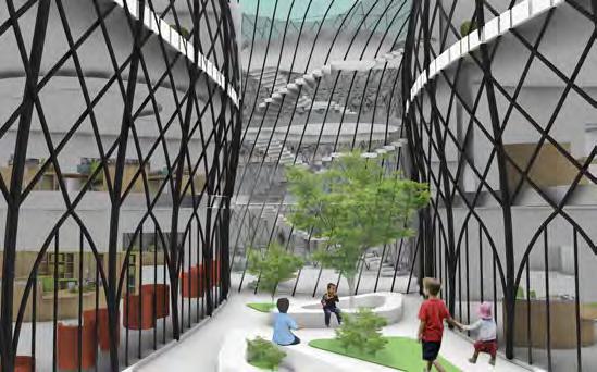
The courtyard is introduced to supply daylight deeper into the building and to create breathing space for the readers.
The courtyard section was designed inspired by antelope canyon to encourage light beam coming deeper into buildings.
Building mas was cut in the north and south to encourage diffuse light in the reading areas.

The courtyard is supported by diagrid along with concrete walls.
 Plan Development
01 Volume
02 Publicness
Daylight
05 Final Form
03 Daylight
02 Buildings are divided by functional zoning facing towards the existing waterbody.
01 Stacked library program.
03 Buildings are extended to north and south to create an enclosure for public activities.
04 Large ground has been pulled upward in front of the waterbody to create an active public plaza.
05 Interactive activities like readers circle, writers circle, music circle are placed under the public plaza and entry from the plaza and entry from the plaza to the buildings.
Form Development



Floor
Floor
Floor
Floor Master Plan (First Floor Level) A D E B C C B E D A
Ground
First
Second
Third
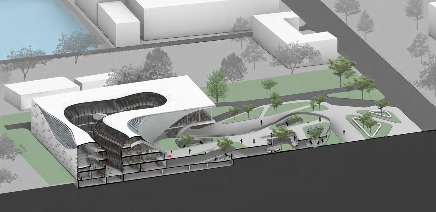
Sectional Perspective A-A


 Sectional Perspective B-B
Sectional Perspective D-D
Sectional Perspective C-C
Sectional Perspective E-E

 Grasshopper Script for Library Diagrid Structure
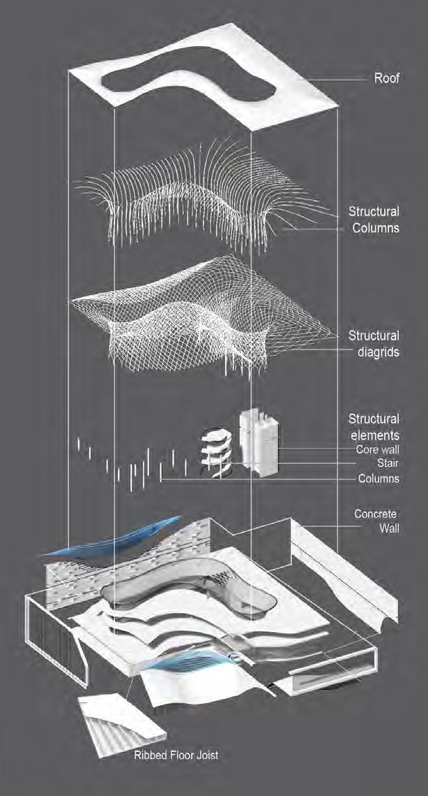
 Structure Diagram of Library Building

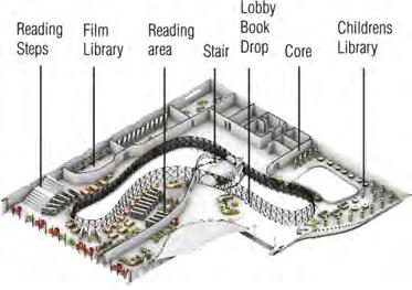
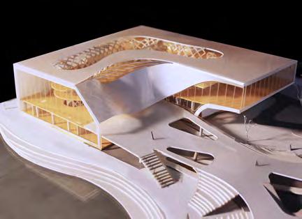
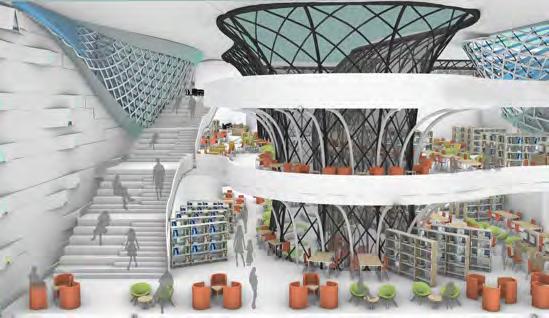
The program is comprised of multifunctional reading spaces, archives, a reference section, children’s section, e-library, administration and accounting section, auditorium, seminar hall, exhibition spaces, cafeteria, and other ancillary functions. These functional volumes are clustered and arranged in two building masses which are the library building and auditorium building. The building forms are intended not to create any room; rather it is intended to create flexible spaces that can be changed according to the need of the future. The contemporary fluid building form gives an inviting appearance for urban dwellers to enter and participate in the vibrant reading activities.


 Childrens Library
Library Reading Area
Courtyard space
Structure Model
Library building Model
Museum as Monument
Design of Liberation War Museum
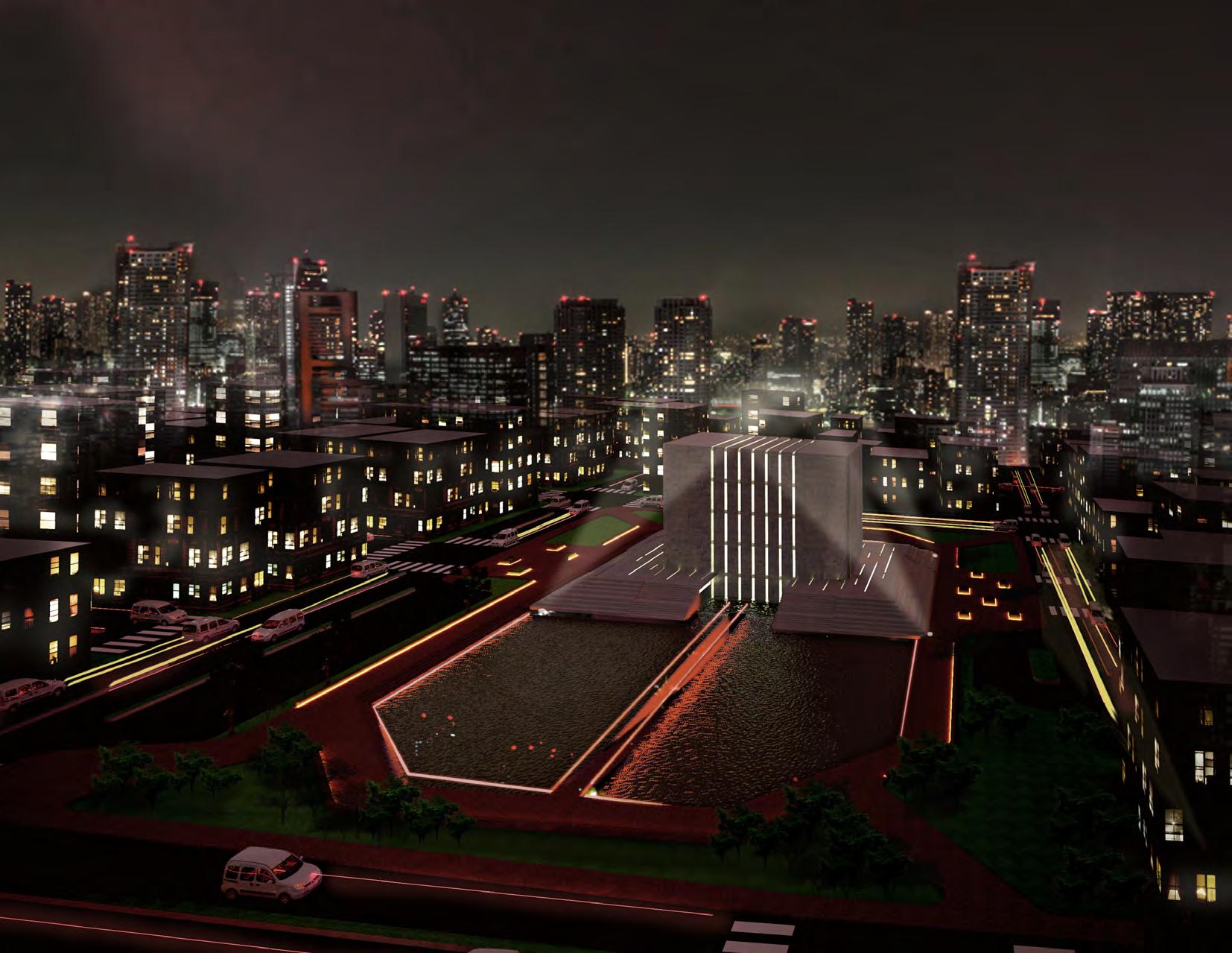
Site Location: Mirpur Killing Land of 1971 War, Dhaka, Bangladesh
Academic Project
Individual Project Level 5, Term 1
Duration 7 weeks
Year: 2017
Studio Tutors: Dr. Qazi Azizul Mowla, Patrick D’ Rozario. Software Used: 3ds Max, Revit.
The site is located in Muslim Bazar, a killing land of liberation war between Bangladesh- Pakistan. The main challenge of this project is to recall the dark memory of genocide during 1971 war along with designing a liberation war museum.
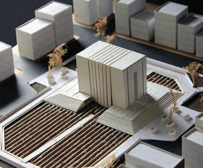
As the site is located in one of the killing lands of liberation war, the museum itself should give a monumental expression of the heinous genocide. So primary consideration is taken to give museum a monumental expression as well as making it a successful urban place


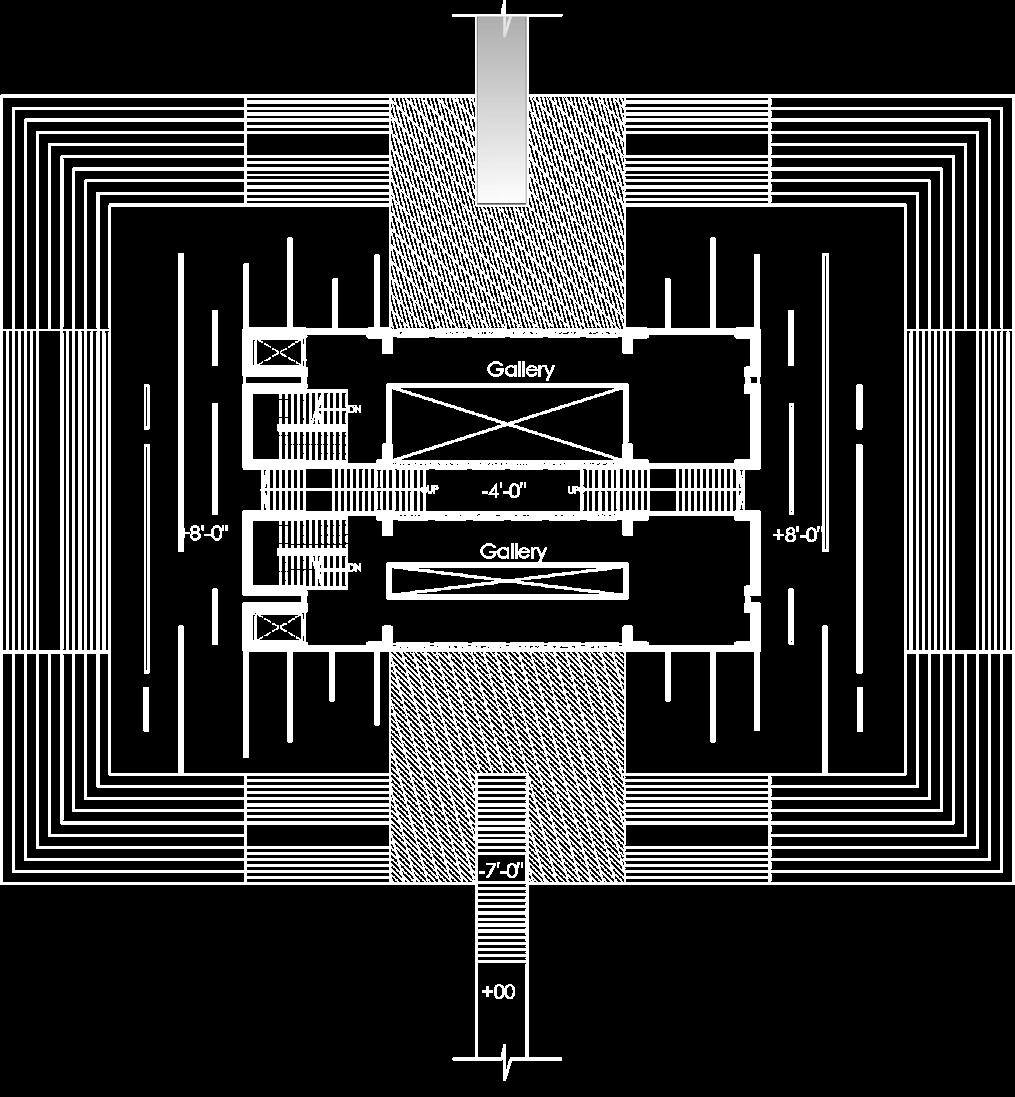
0 1 5 10m Master Plan Plan @ 3m Semi Basement Plan @ 0.3m B B A A C C
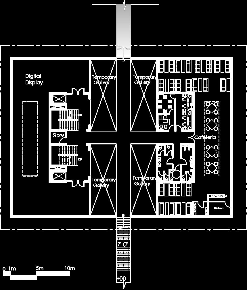

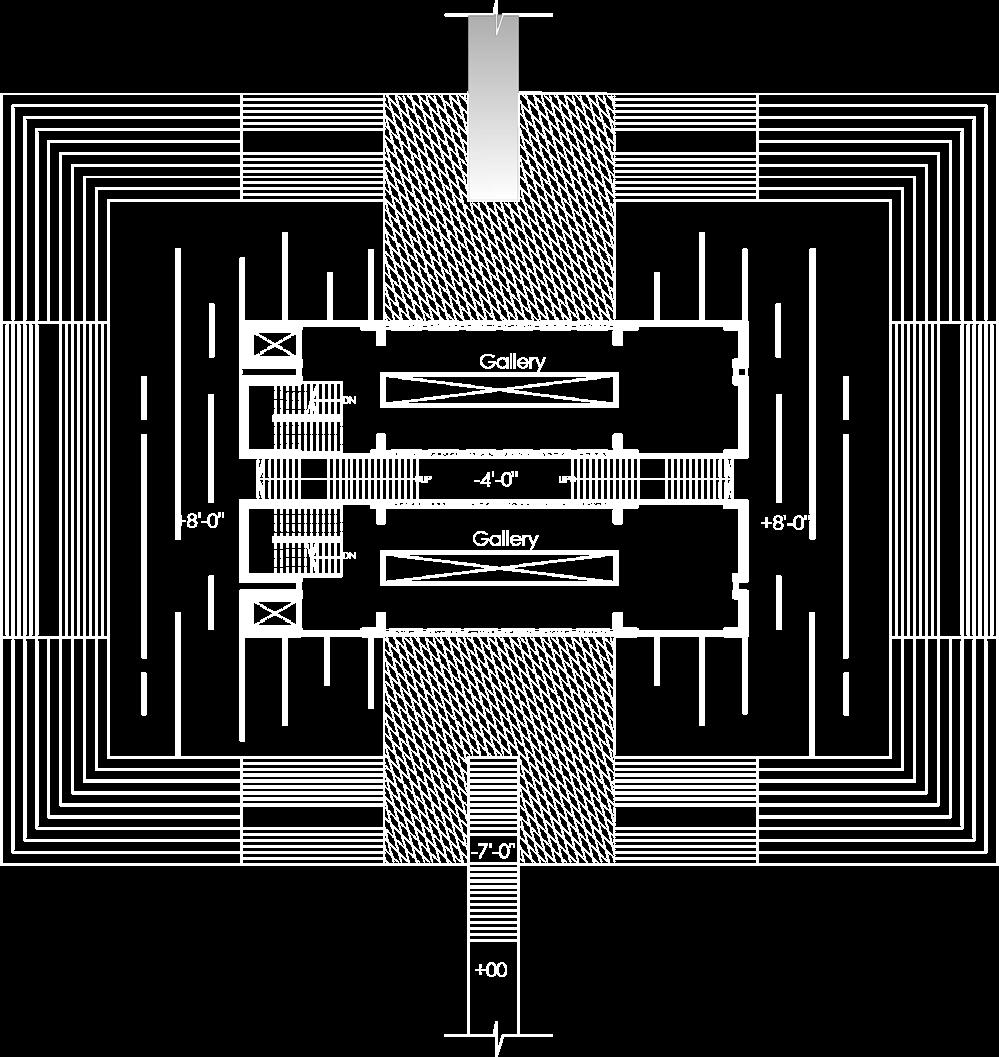 Plan @ -3m
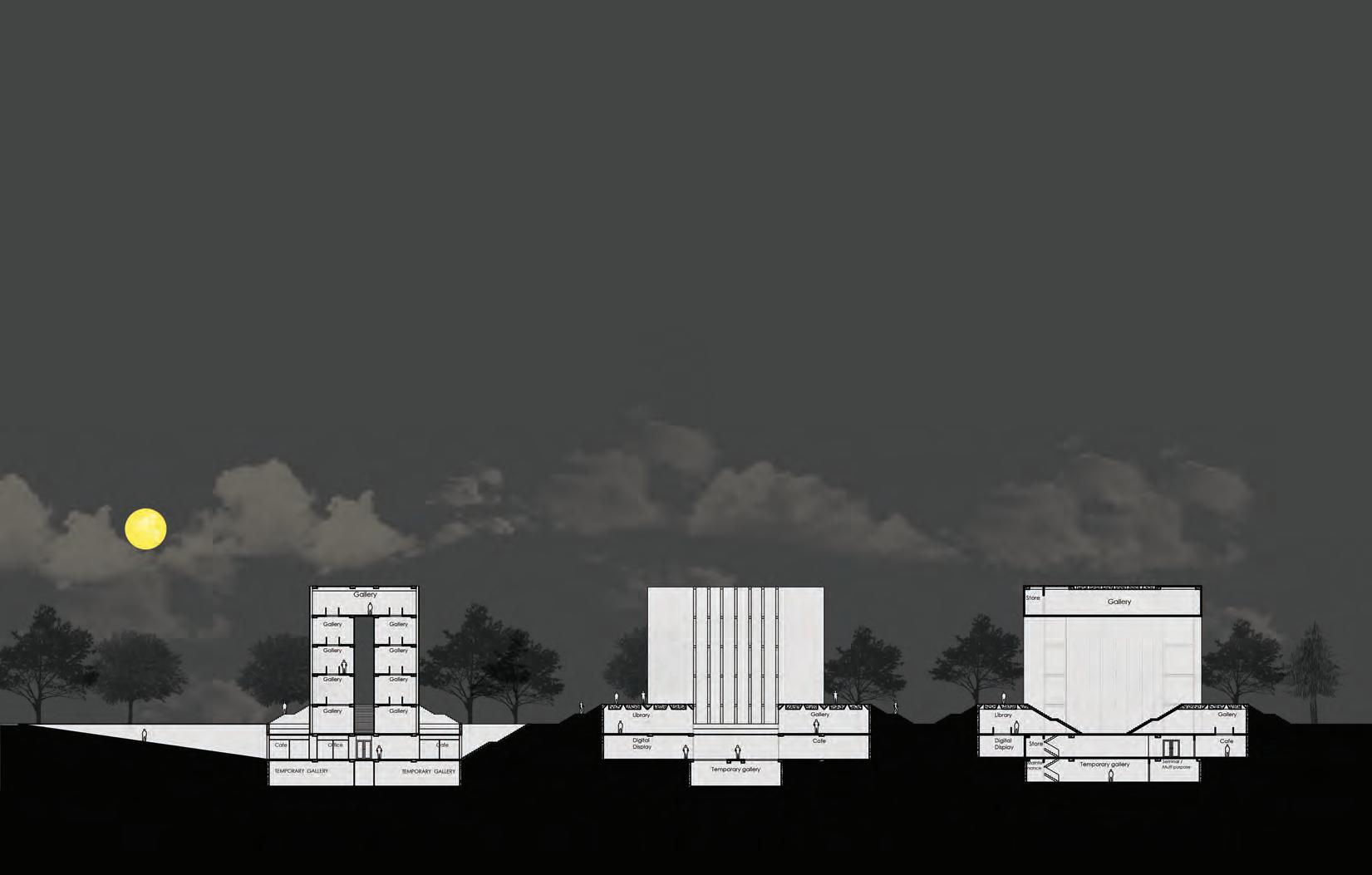
Section B-B
Section C-C
Section A-A
Plan @ -6m
Plan @ 6m, 9m
The museum is intended to create various layering of spaces. Slit window lighting, underground caustics lighting, underground gallery lighting all creates variety of dramatic lighting. The semi basement entry, the underwater entry to the museum creates variety of spaces. The monumentality and grandness of its building form along with its circulation from darkness to light reminds the visitors of the 1971 war.



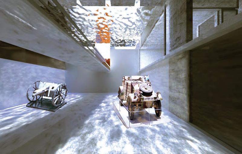 View of the Museum Gallery
View of the Underground Gallery
View of the Dramatic Caustic Lighting in the Gallery
Sectional Model Model Image
Urban Park Design
Sustainable Restoration of an Community Park
Site Location: Gulshan, Dhaka, Bangladesh
Academic Project
Group of 3 Students
Level 5, Term 1
Duration 3 weeks
Year: 2017
Studio Tutors: Dr. Qazi Azizul Mowla, Patrick D’ Rozario.
Software Used: 3ds Max, AutoCAD, Lumion.
Thiswas a competition project for the restoration of an existing community park in Dhaka. Among all students, our group achieved the best design recognition and certificate from the Mayor of Dhaka city for this design. The objective of this project is to analyze Land use patterns and growth trends, proximity and catchment area of the neighborhood using visual analysis, connectivity with surrounding and urban amenities in the park. As Dhaka is one of the most populated cities in the world, it has limited open spaces like urban parks. Moreover, Gulshan 2 park was encroached upon or underutilized due to a lack of proper planning. So the major priority was given to restore an existing park into an ecologically balanced and self-sustaining one besides making it accessible to the community people.
- Connectivity with surrounding open spaces and urban amenities
- Current and prospective functions
- Microclimatic Aspect
- Landscape and urban Ecological symbiosis.

Master Plan Development
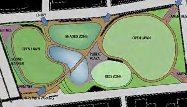
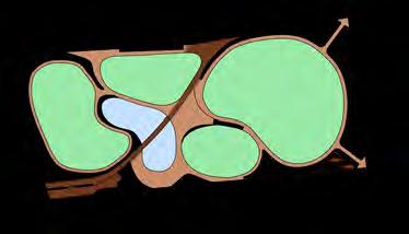


 PROGRAM:
1 1 1 1 6 2 3 4 4 5 A A B B C C
1. AMENITIES - WASHROOM - FOOD COURT - WASTE DISPOSAL
Master Plan
01 Main entry connection with mosque and community area
02 Open lawn area and waterbody is designed to attract community
03 Walking track and public plaza was created surrounding the waterbody and lawn
04 Final zoning of plan including amenities and childrens play area
2. JOGGING & WALKING TRACK
3. RECREATIONAL PLAZA
4. OPEN LAWN PLAYFIELD
5. KIDS ZONE
6. NOISE BARRIER

Primary Road Sound Barrier Walking Track Open Lawn Open Lawn Walking Track Road Water Body Plaza Area Bridge
Section A-A
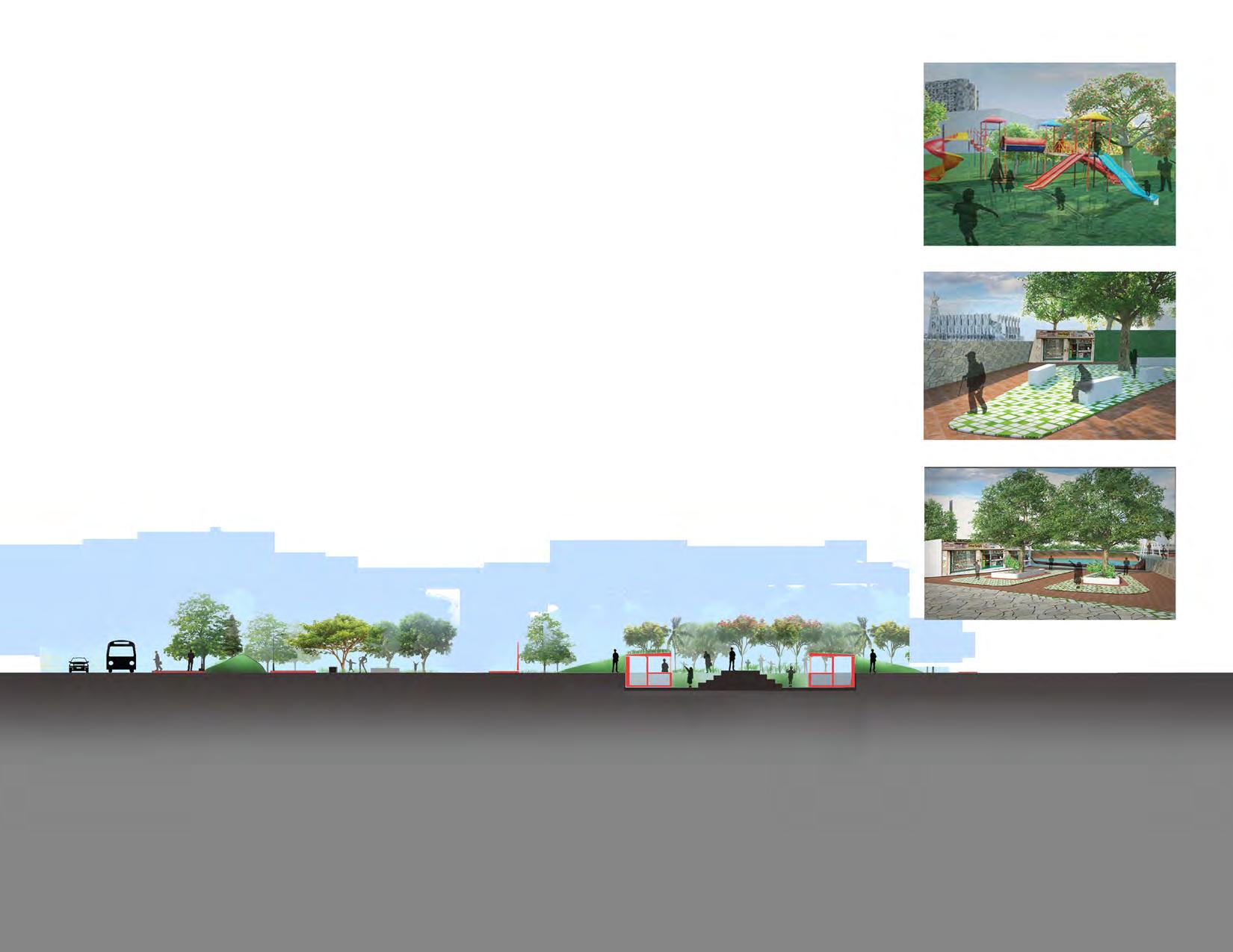 Section B-B
Section C-C
Childrens Play Area
Entry Plaza
Water Front Plaza
Road Sidewalk Sound Barrier Walking Track Open Lawn Shops Shops Pathway
Innovative Housing Model
Design of Affordable Housing for the Largest Slum in Bangladesh
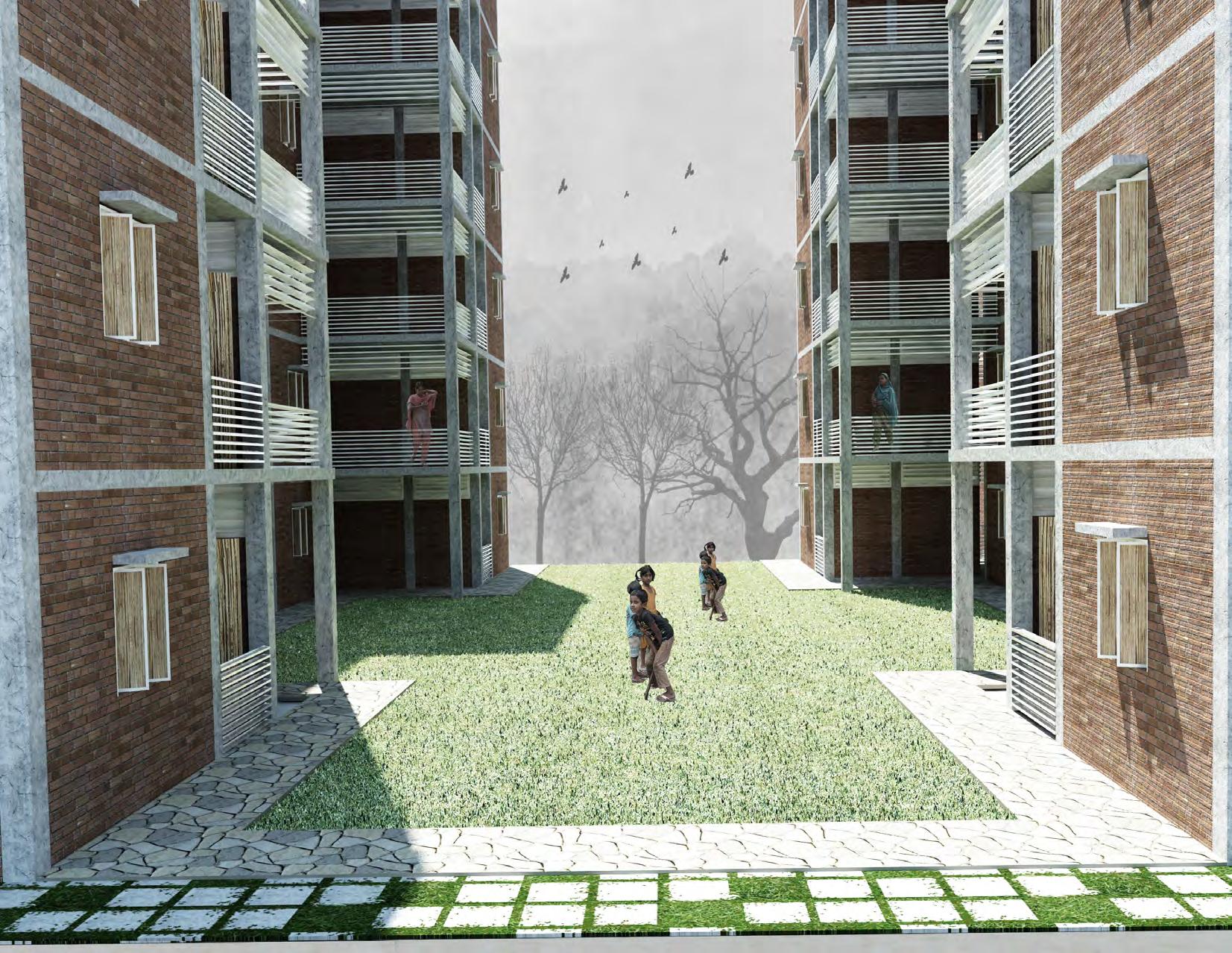
Site Location: Korail Slum, Dhaka, Bangladesh.
Academic Project
Group of 3 Students
Level 4, Term 2
Duration 6 weeks
Year: 2016
Studio Tutors: Dr. Qazi Azizul Mowla, Dr. Md.Shahidul Ameen, Dr. Nayma Khan, Faruk Ahmed.
Dhaka being the most demanding place to live in Bangladesh has become one of the most densely populated cities in the world. Therefore, there is a need for ensuring basic needs for the huge population living in the small land.
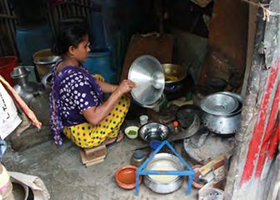
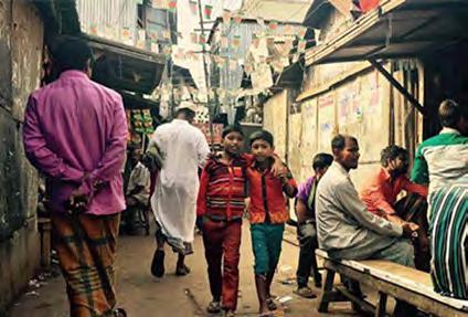
Korail is one of the largest slums in Dhaka city with an estimated area of 90 acres, having an estimated population of 70,327. The slum is located at the heart of the city in the Gulshan area. The objective of this project was to design affordable housing for the people living in the slum. The main challenge of this project was to provide a huge population with a proper living condition as well as amenities and community places.
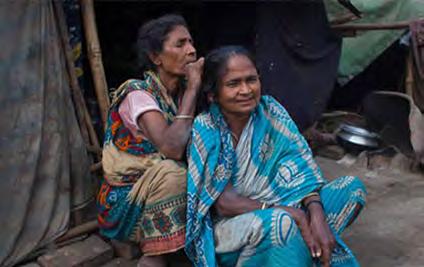
Existing Site Images
Master Plan Development
1. The 81.25-acre site has a demand of 860 people per acre density. Initially, the site is divided into three categories according to income level: High, Middle and Low-income zone. Three types of income levels are placed in a way so that all can get access to amenities and commercial zone.
2. Four types of access are introduced to the neighbourhood


•The secondary road as vehicular access from the main primary road.
•The tertiary road as a non-motorized vehicular road.
•Water vehicular stops on certain points.
•Pedestrian footpaths.
3. Continuation of the flow of green and hierarchy of open space is kept within the cluster zone.
4. Distribution of central amenities along with primary road and sub amenities distributed throughout the masterplan so that all categories can get access to amenities easily and equally.

Master Plan (Ground Floor Level)


Zone Position in Master Plan Use of Space Ground Floor Plan Perspective View Perspective View Perspective View Ground Floor Plan Ground Floor Plan Use of Space Use of Space Zone Position in Master Plan Zone Position in Master Plan Low Income Zone Middle Income Zone High Income Zone
Reintegrating Central Jail
Appropriating Old Dhaka as Art of Placemaking
Site Location: Dhaka, Bangladesh.
Academic Project
Group of 3 students.
Level 4, Term 1.
Duration: 4 weeks
Year: 2016
Studio Tutors: Dr. Shayer Ghafur, Dr. Catherine Daisy Gomes, Faruk Ahmed, Md. Tariquzzaman.
Software Used: 3ds Max, SketchUp, AutoCAD.
The jail was built in the Mughal period and worked as central jail until 2014. Being located in the heart of Old Dhaka, the Central Jail of Dhaka is bearing the footmarks of all the cultural, social and political changes that took place for more than 200 years. It exists as an integral part of the morphology and infrastructure of old Dhaka and yet detached from its surroundings, with its boundaries. The 22’ high boundary walls of the colonial period create a mixed sense of curiosity, fear and safety among the citizens.
After the jail was evacuated, the government declared the old jail would open as a public space.
While reintegrating the core jail area with the surrounding context, we intend to facilitate the area conserving and preserving the ‘Cultural Heritage’ of Old Dhaka, ensuring new developments not coming in conflict with the heritage sites with all preserved buildings for adaptive reuses, trees and open spaces.


A A
Master Plan
1. Heritage Buildings Zone
2. Commercial Building 3. School
4. Mosque 5. Jail Authority Plot
6. Retail Shops 7. Amenities
8. Central Pavillion
01 The heritage buildings and entry of the site are connected by the horizontal and vertical axis.
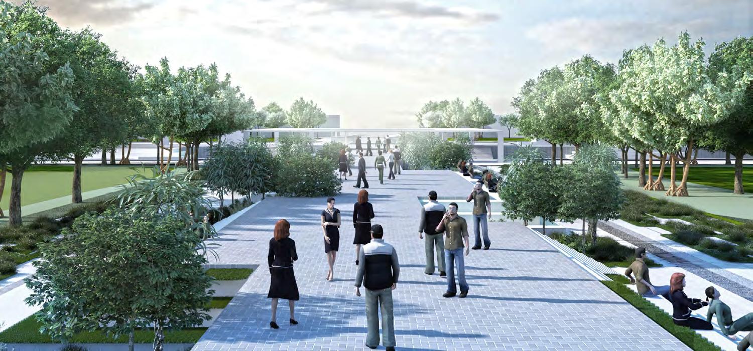
02 The two axis ways divide the site into four green open spaces creating public breathing spaces.
03 Along with two existing waterbodies an artificial waterbody is introduced to integrate with the site.
04 Final design
Master Plan Development
Model Images


Section A-A


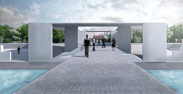
 View of the Entryway
Pavillion View
Top View of the Entryway
Plaza in front of Heritage Buildings
Rise High
Design of A Highrise Building
Site Location: Dhaka, Bangladesh
Academic Project
Individual Project Level 3, Term 2
Duration 4 weeks
Year: 2015
Studio Tutors: Dr.Mohammed Zakiul Islam, Atiqur Rahman & Maherul Qader Prince
Software Used: Rhino, Autodesk Flow Design, 3ds Max, Revit.
Asite with simple office function is given for design. Apart from addressing the usual iconic potentials, the key concept of the highrise building is to bring life into a highrise office building. To break the monotony of the employees, the primary focus is given to create breathing spaces in the building.
Besides, as skyscraper is a massive concentration of inorganic mass in a small area, this concentration should be environmentally sustainable. Therefore, primary concern of the design is to create sustainable highrise structure with conscious energy saving design, outdoor microclimate and indoor natural ventilation.
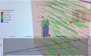
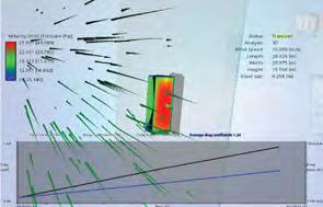
Moreover, one of the greatest problems of highrise is their vulnerability to environmental excitations, such as, wind leading to horizontal vibration. In this regard, wind action is taken into consideration from the very beginning of the architectural design process by considering building aerodynamics.

Chamfered Solid Form Drag Co-efficient 1.34
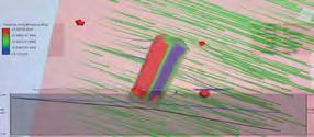
Rounded Twisted Form Drag Co-efficient 1.42
Sharp Tapered Form Drag Co-efficient 1.69

Rounded Tapered Form Drag Co-efficient 1.71
Form Finding Using Autodesk Flow Design





Wind
Rounded
Tapered Recess Form Drag Co-efficient 1.09
Load Reducing Highrise Form
Solid Form Drag Co-efficient 1.77 Wind
Result of Wind Flow Simulation
Direction: South to south east Wind Speed: 0.86 MPH (Ref: 2010-14 Wind Data for Dhaka)
Form Drag
Form Drag Co-efficient
Form Drag Co-efficient
Ways for Reducing Wind Load in Highrise Building 2D Design Solution Chamfering Corner Smoothing Corner Recessing Corner 3D Design Solution Tapering Solid Twisting Solid Tapered Recess Form 2.0 1.8 1.6 1.4 1.2 1.0 0.8 0.6 0.4 0.2 0 Recessed Solid Form Chamfer Solid Form Sharp Twisted Form Rounded Twisted Form Chamfer Twisted Form Sharp Tapered Form Rounded Tapered Form Rounded Solid Form
Chamfered Twisted
Co-efficient 1.45 Sharp Twisted
1.40 Recessed Solid
1.24

Master Plan (Ground Level) 41st Floor Plan 1st Floor Plan Typical Office Layout Core Plan
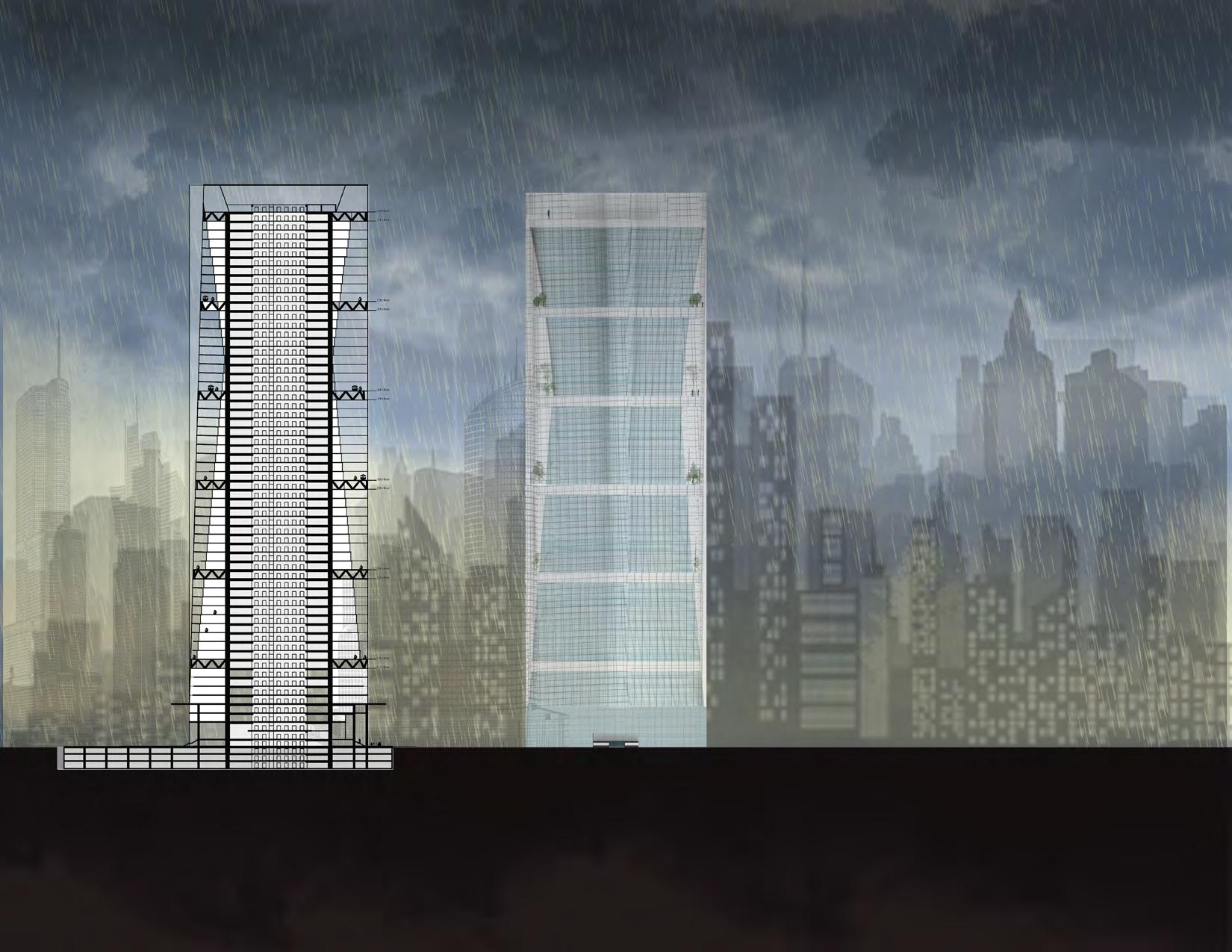
 Section A-A
South Elevation
View from Atrium
Rest House Design
A Space for the Nature Watchers
Site Location: Sylhet, Bangladesh.
Academic Project
Individual.
Level 2, Term 2.
Duration: 7 weeks
Year: 2014
Studio Tutors: Dr. Zakiul Islam, Atiqur Rahman, Tareq Haider, Samina Mazumder Tuli.
Software Used: 3ds Max, SketchUp, AutoCAD.
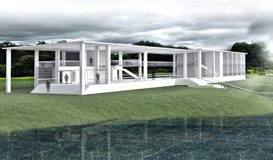
The site is located in Sylhet, a place for breathtaking natural beauty. From the site, a beautiful creek view along with hills and three natural fountains can be seen. Moreover, in front of the site, there are long paddy fields. Sylhet is an important place for biodiversity in Bangladesh. The rest house is designed inspiring from the butterflies in Bangladesh. There is a courtyard garden designed inside the building, where the plants that attract the butterflies can be planted. Therefore, nature watchers can enjoy the magnificent view of the natural landscape and the butterflies while staying in the rest house.
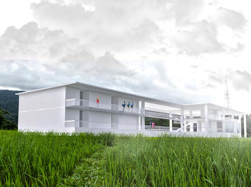
Design Development
Site Images
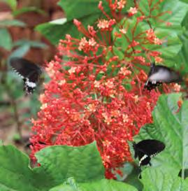
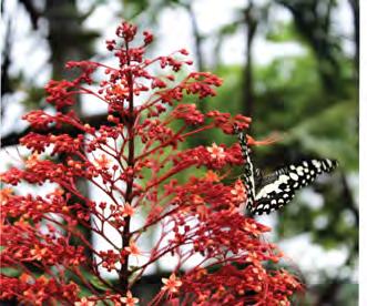

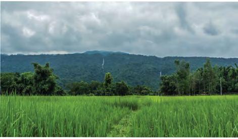
 01 The building mass is placed in a way from where a view of the creek, hills, waterfalls and paddy field can be seen.
02 The space between the intersection of two rectangles is used as a garden where the plants that attract the butterflied are planted.
03 From the building a stairway leading to the deck in the creek is designed so that the nature watcher can enjoy the outdoor space.
View of 3 Natural Waterfalls& Paddy Field View of Creek View of Rare Butterfly Species View of Rare Butterfly Species

LINEN ROOM MULTIPURPOSE HALL STORE DINING HALL LINEN ROOM MULTIPURPOSE HALL STORE DINING HALL LINEN ROOM MULTIPURPOSE HALL STORE DINING HALL LINEN ROOM MULTIPURPOSE HALL STORE DINING HALL LINEN ROOM MULTIPURPOSE HALL STORE DINING HALL LINEN ROOM MULTIPURPOSE HALL STORE DINING HALL LINEN ROOM MULTIPURPOSE HALL STORE DINING HALL LINEN ROOM MULTIPURPOSE HALL STORE DINING HALL LINEN ROOM MULTIPURPOSE HALL STORE DINING HALL LINEN ROOM MULTIPURPOSE HALL STORE DINING HALL Ground Floor Plan First Floor Plan A A


 Section A-A
View of the Courtyard Garden
View from the Bedroom
View from Rest House from the Creek
Installation
Creative Space Utilizing Recycled Materials

Site Location: School of Architecture Building, BUET.
Academic Project
Group of 3 Students
Level 1, Term 2.
Duration: 4 weeks
Year: 2013
Studio Tutors: Dr. Nasreen Hossain, Md. Tarek Haider, and Syed Abu Sufian Kushol.
Materials Used: Umbrella, Used Tracing Papers.
Software Used: 3ds Max, SketchUp, AutoCAD.
In this project, the task was to design an installation in the premise of an architecture building using everyday recycled materials. The project was executed in two phases. In the first phase, we designed the primary composition of installation using a used umbrella. Our site was located in a corner of double-height space in the premise which is not regularly used by the faculty and students. We developed the installation in a way so that space will become vibrant and attract the users. After the preliminary design development, we started the final installation with used umbrellas and tracing papers that were thrown away by the architecture students. After installation, lights were used for the regeneration of the space.
Preliminary Design Model
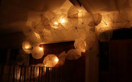
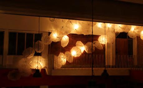
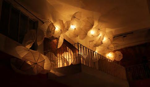



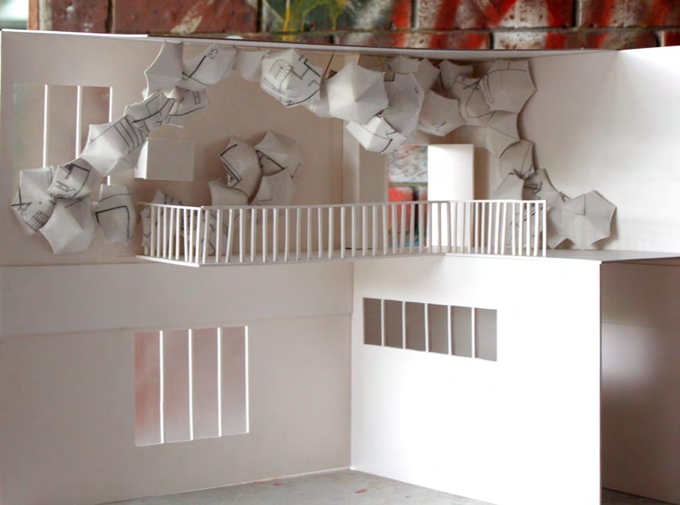
after Installation Installation Process Used Umbrella Removed Cover and Used Structure Covered Umbrella with Wasted Tracing Papers by the Architecture Students
Views
 BAICHI CHAKI, M.ARCH, LEED GA


 Secondary Lane
Tertiary Green Lanes
Primary lane


 Plan Development
01 Volume
02 Publicness
Daylight
05 Final Form
03 Daylight
02 Buildings are divided by functional zoning facing towards the existing waterbody.
01 Stacked library program.
03 Buildings are extended to north and south to create an enclosure for public activities.
04 Large ground has been pulled upward in front of the waterbody to create an active public plaza.
05 Interactive activities like readers circle, writers circle, music circle are placed under the public plaza and entry from the plaza and entry from the plaza to the buildings.
Form Development


 Sectional Perspective B-B
Sectional Perspective D-D
Sectional Perspective C-C
Sectional Perspective E-E

 Grasshopper Script for Library Diagrid Structure

 Structure Diagram of Library Building


 Childrens Library
Library Reading Area
Courtyard space
Structure Model
Library building Model


 Plan @ -3m
Section B-B
Section C-C
Section A-A
Plan @ -6m
Plan @ 6m, 9m


 View of the Museum Gallery
View of the Underground Gallery
View of the Dramatic Caustic Lighting in the Gallery
Sectional Model Model Image


 PROGRAM:

 Section B-B
Section C-C
Childrens Play Area
Entry Plaza
Water Front Plaza
Road Sidewalk Sound Barrier Walking Track Open Lawn Shops Shops Pathway


 View of the Entryway
Pavillion View
Top View of the Entryway
Plaza in front of Heritage Buildings


 Section A-A
South Elevation
View from Atrium


 01 The building mass is placed in a way from where a view of the creek, hills, waterfalls and paddy field can be seen.
02 The space between the intersection of two rectangles is used as a garden where the plants that attract the butterflied are planted.
03 From the building a stairway leading to the deck in the creek is designed so that the nature watcher can enjoy the outdoor space.
View of 3 Natural Waterfalls& Paddy Field View of Creek View of Rare Butterfly Species View of Rare Butterfly Species


 Section A-A
View of the Courtyard Garden
View from the Bedroom
View from Rest House from the Creek


