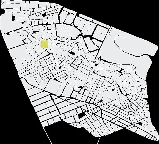
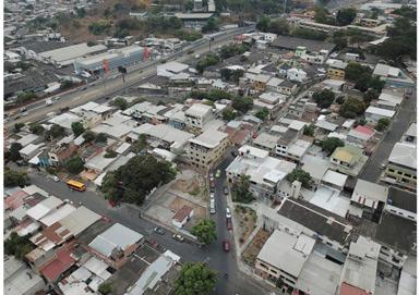
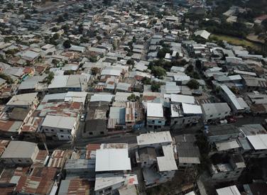
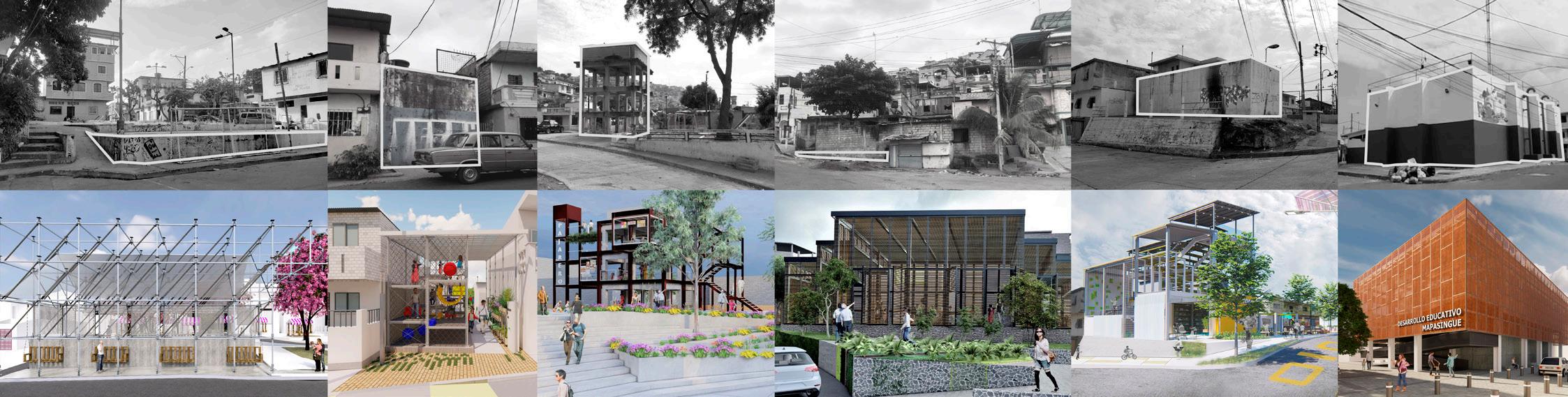
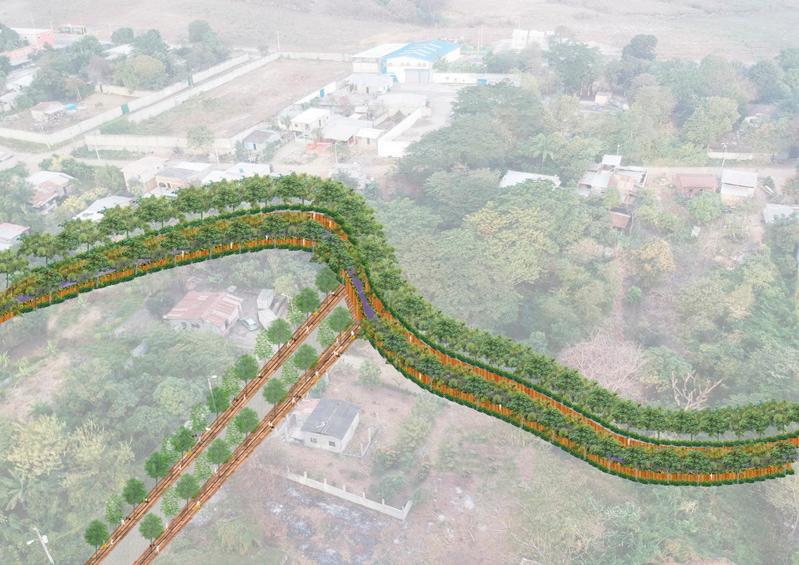
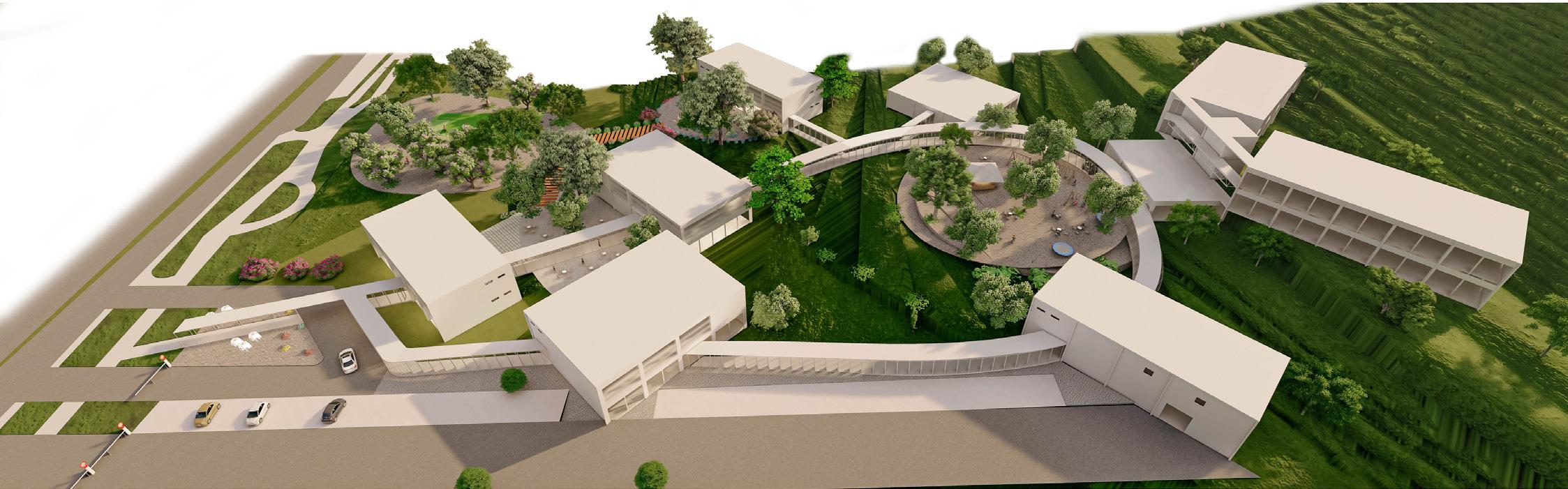
CONNECTING MAPASINGUE EAST
Year: 2020
Project: Rehabilitation public space
Topic: Architectural and urban intervention
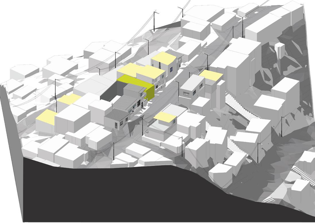
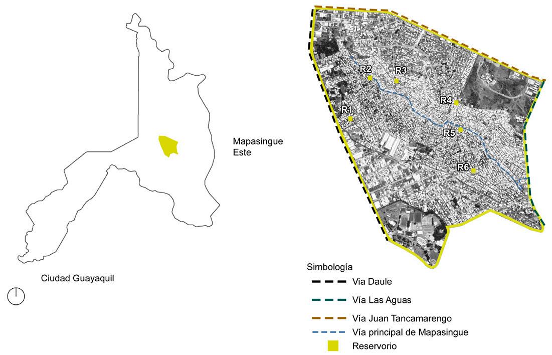
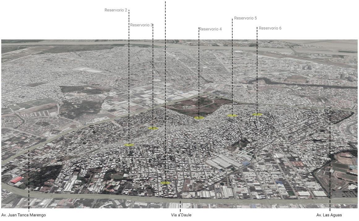
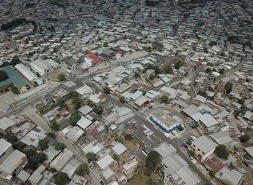
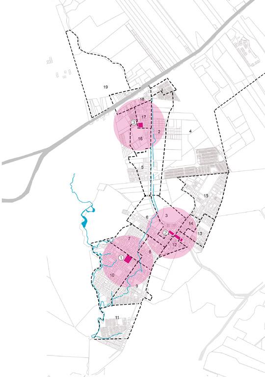
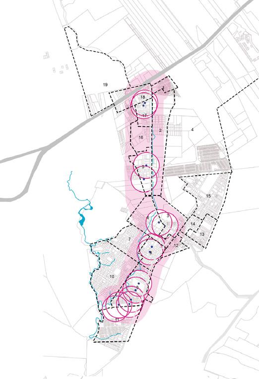
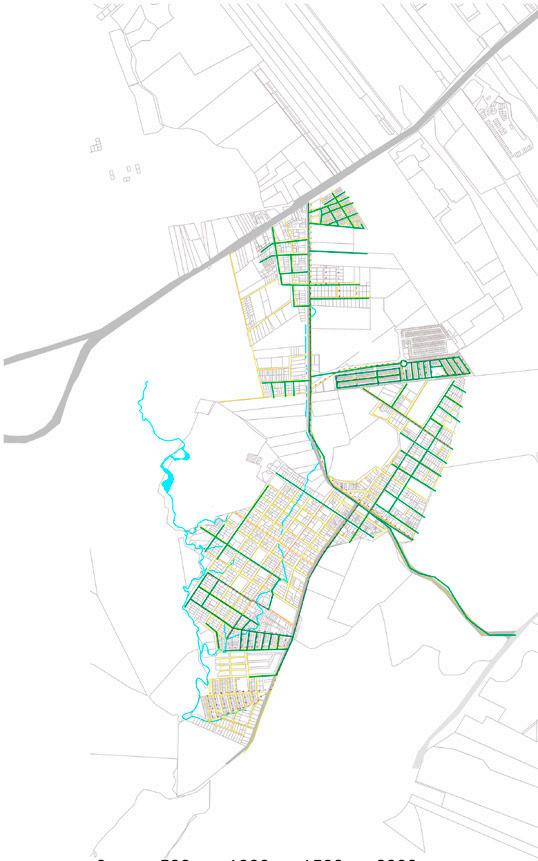
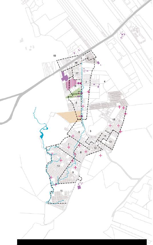
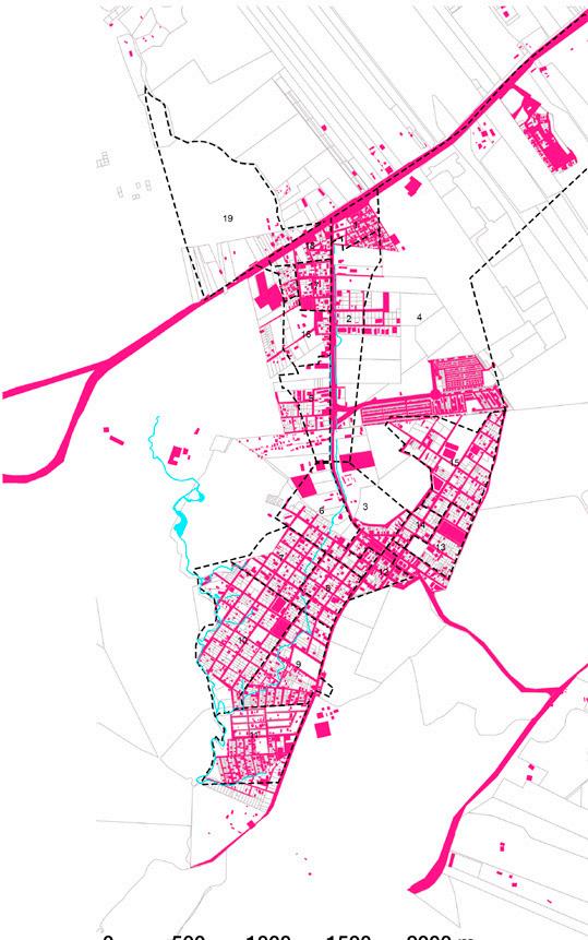
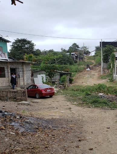
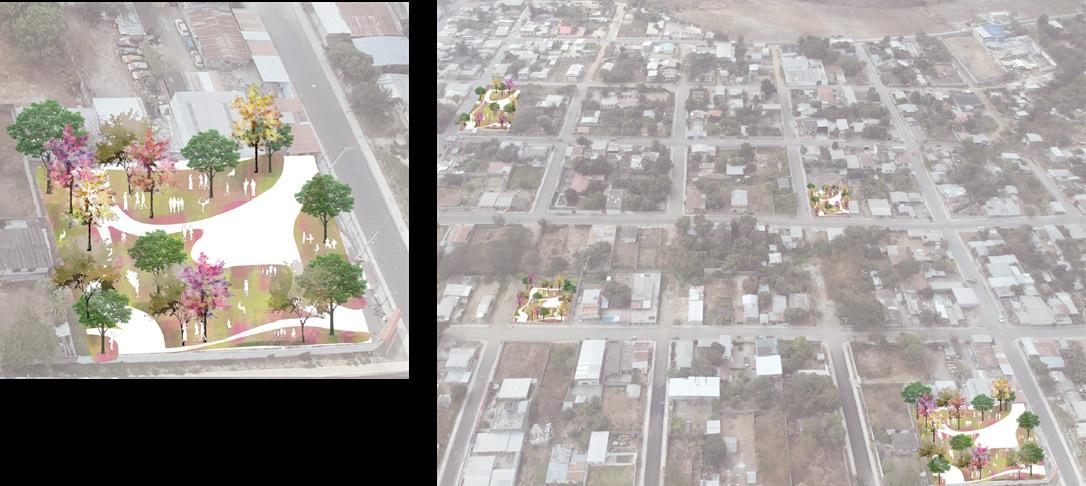
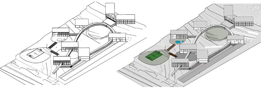
Development of an adaptive architectural design project with urban image competence. Covered in phases of architectural - urban intervention on the study of the context of Mapasingue Este, Guayaquil. The objective of the project is the recovery of abandoned spaces where old disused water reservoirs are located. It is proposed to intervene in these spaces by rehabilitating the reservoirs and adapting their use to the needs of the sector. The proposals are called strategic points that spread the revitalizing effect through recreational corridors. the articulation, preservation and potentiation of the surrounding context are promoted.
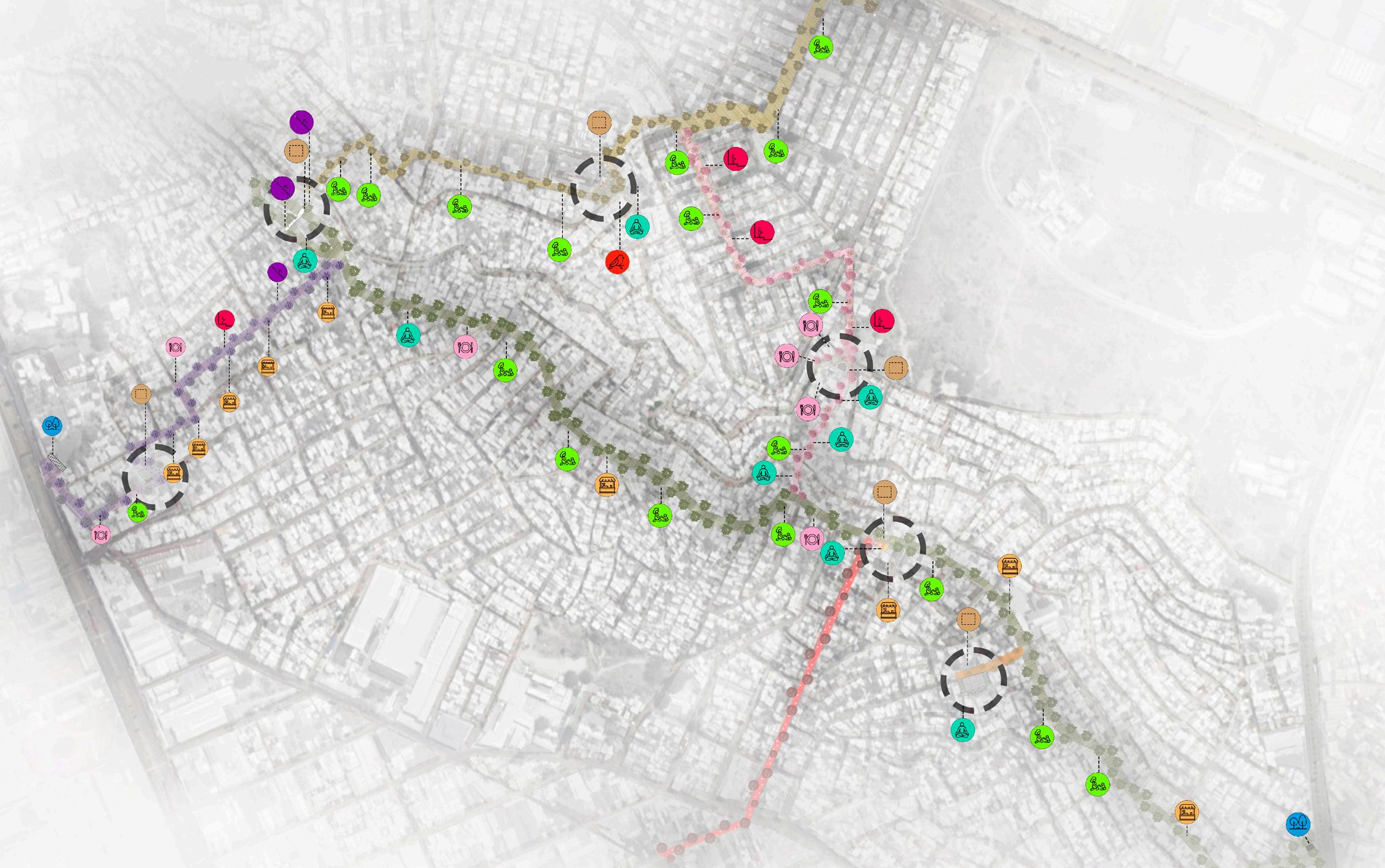
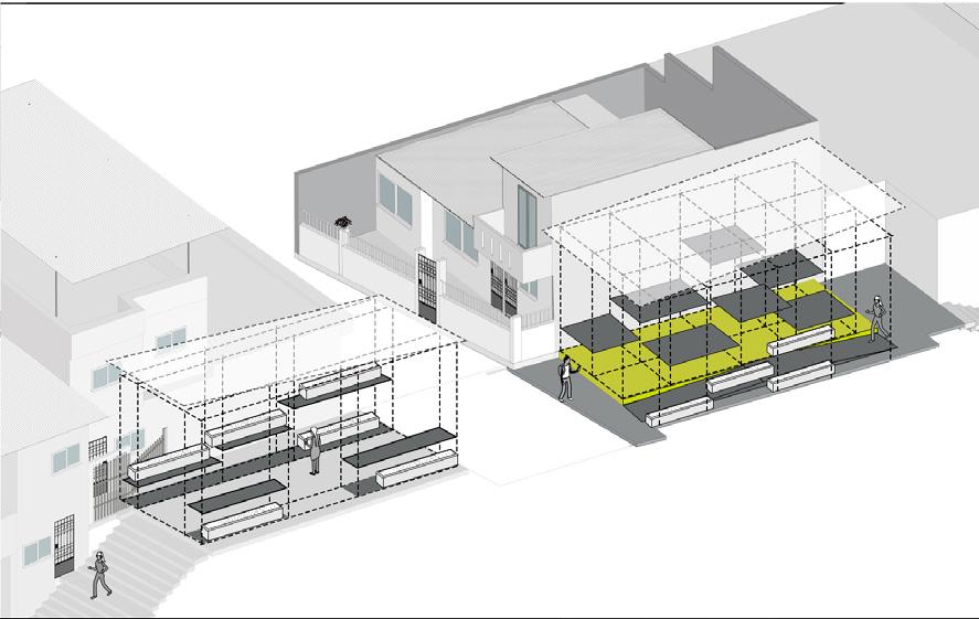
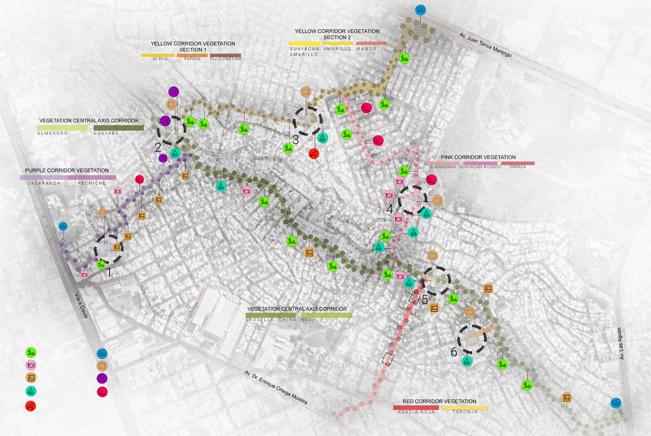
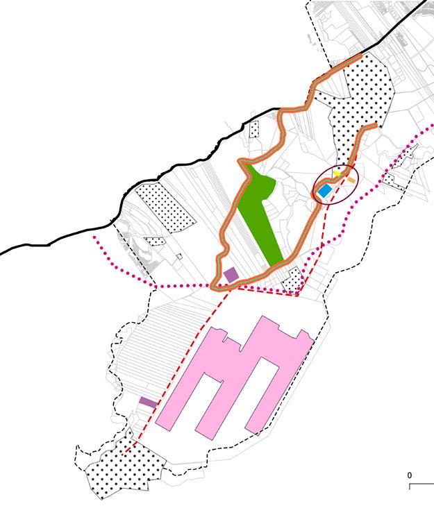
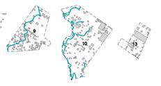
symbology
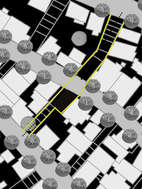
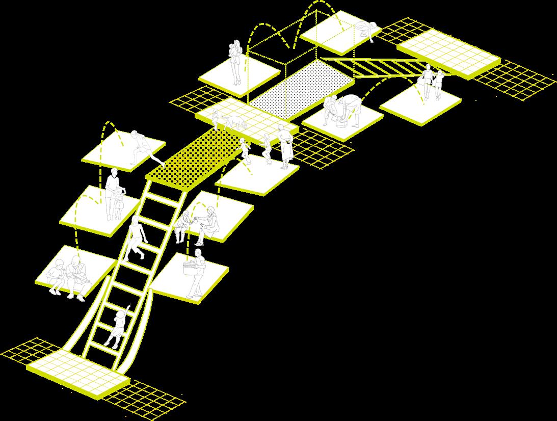
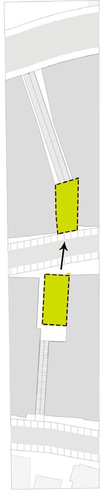
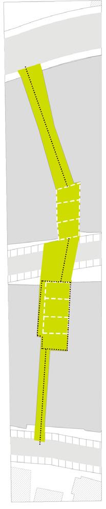
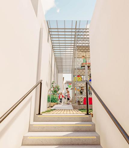
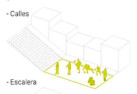
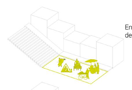
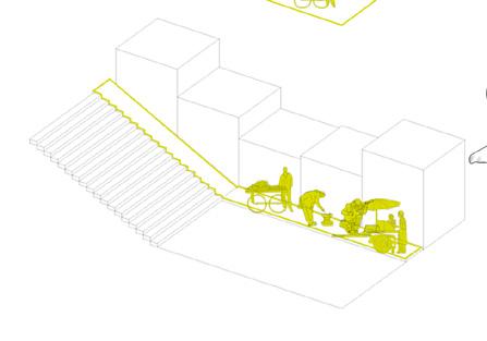
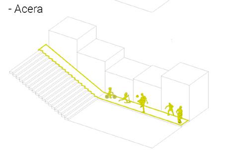
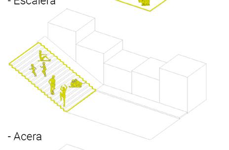
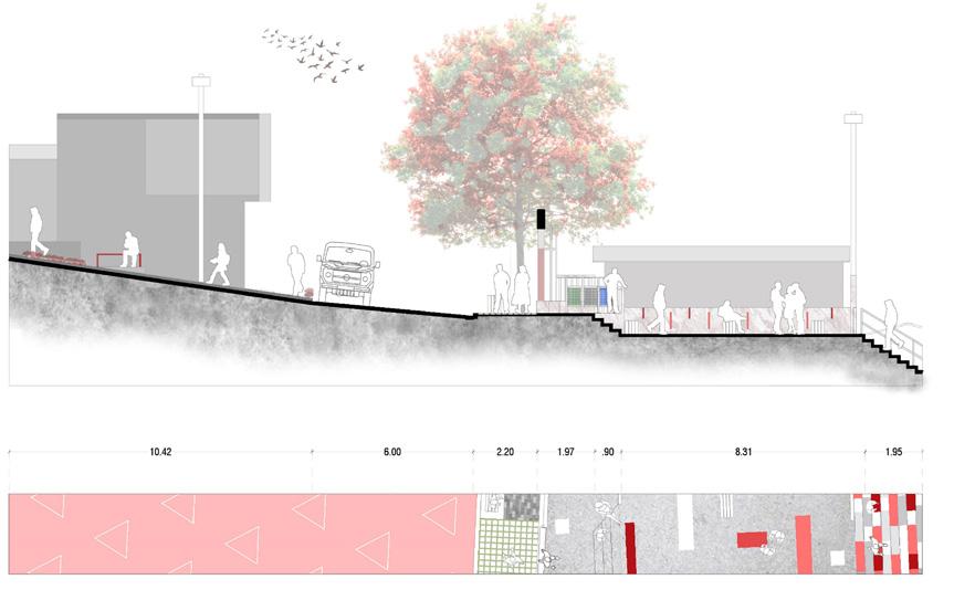
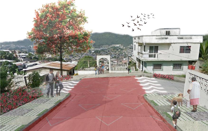
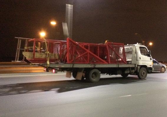
reservoir pathways ladders
Characteristic
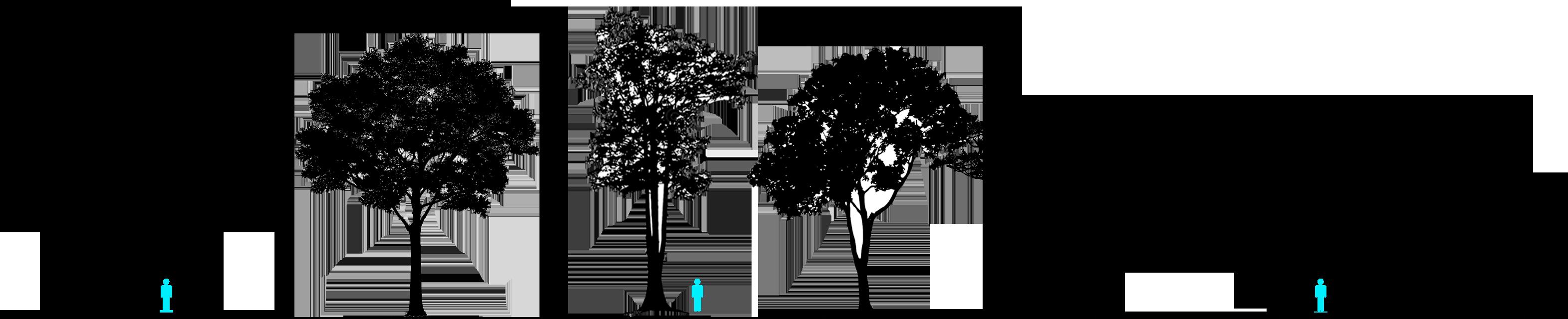
360º visuals
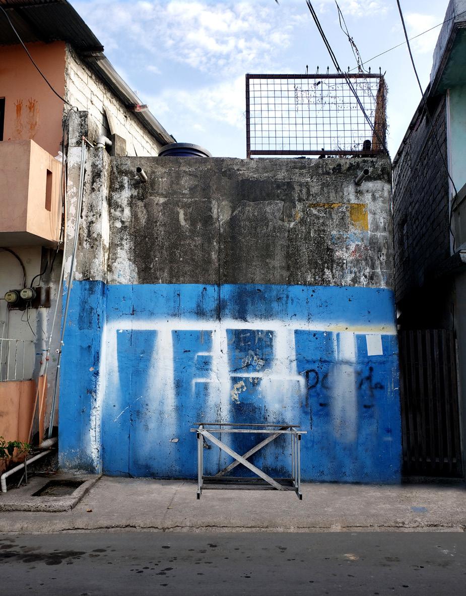
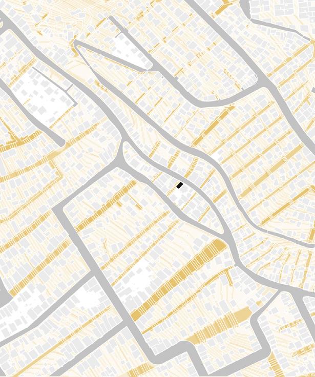
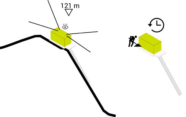
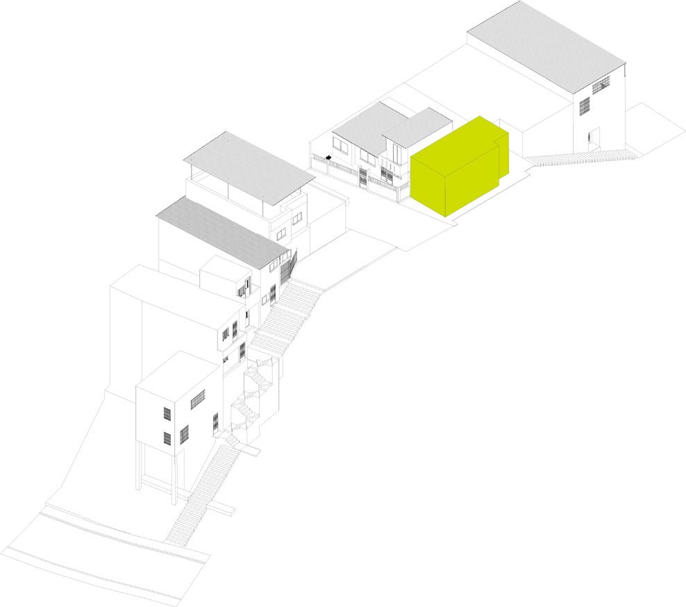
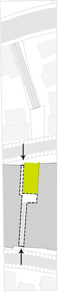
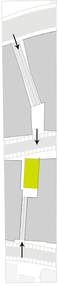
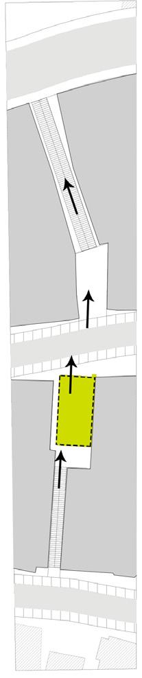
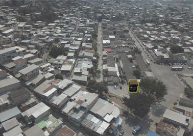
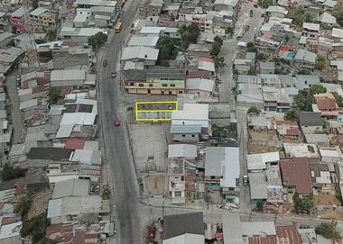
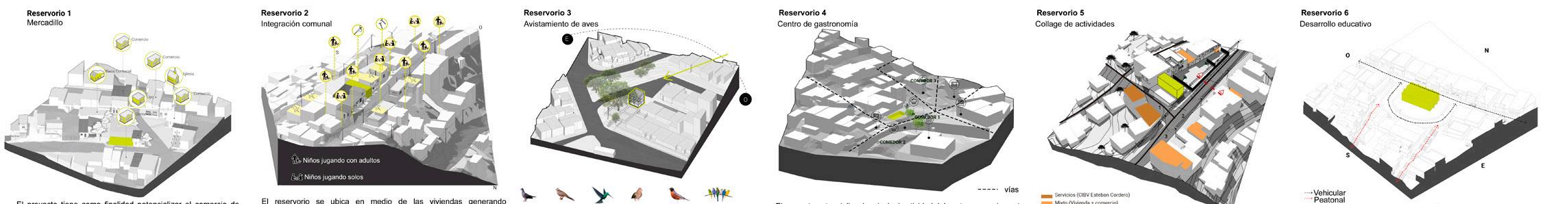
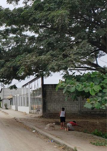
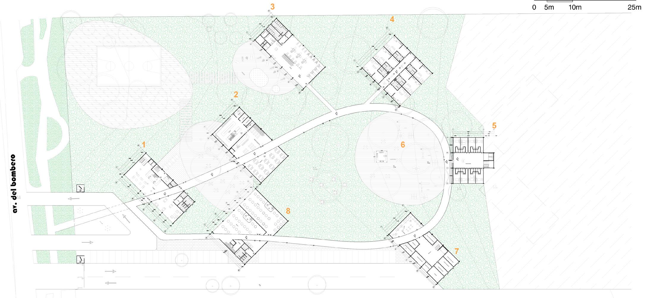
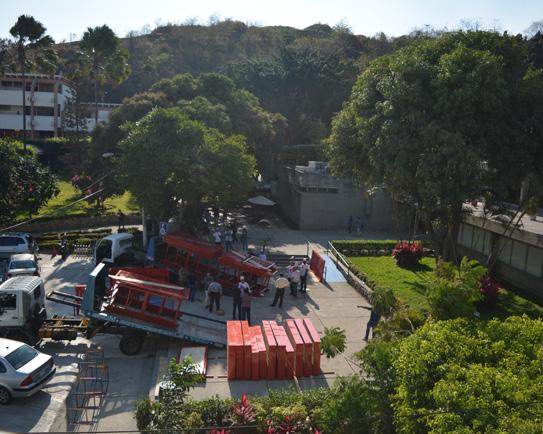
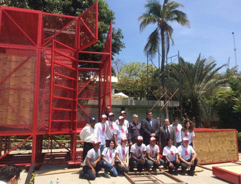
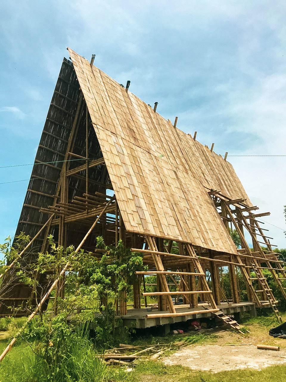
Highest point of Mapasingue East Antiquity First reservoir built in 1980 by the settlers.
Direct connection It has a ladder on its back
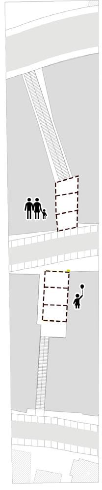
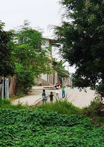
Neighborhood activities
Hidden It is located between medians
Concept
Re-interpret the
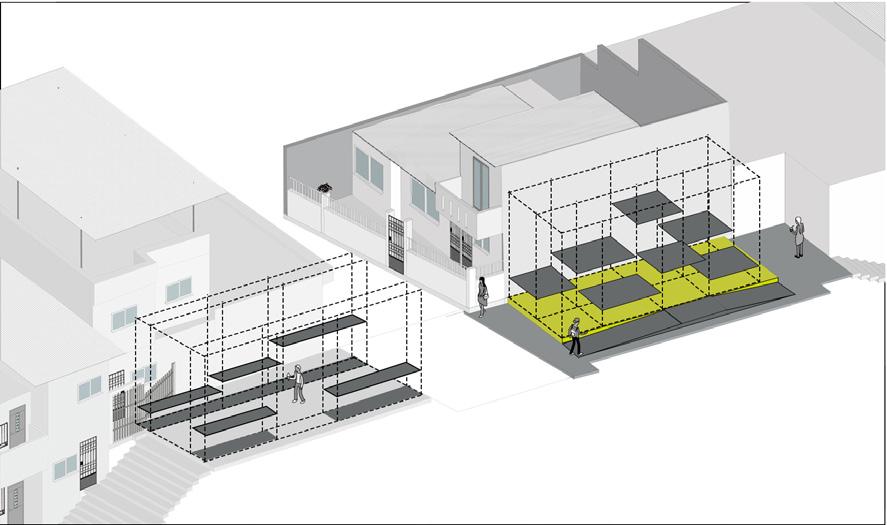
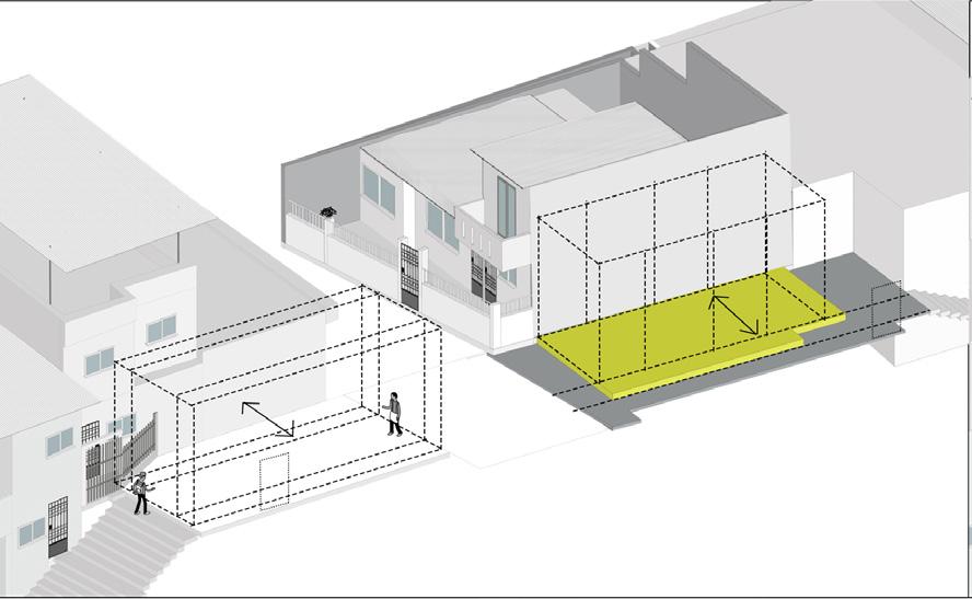
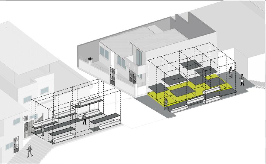
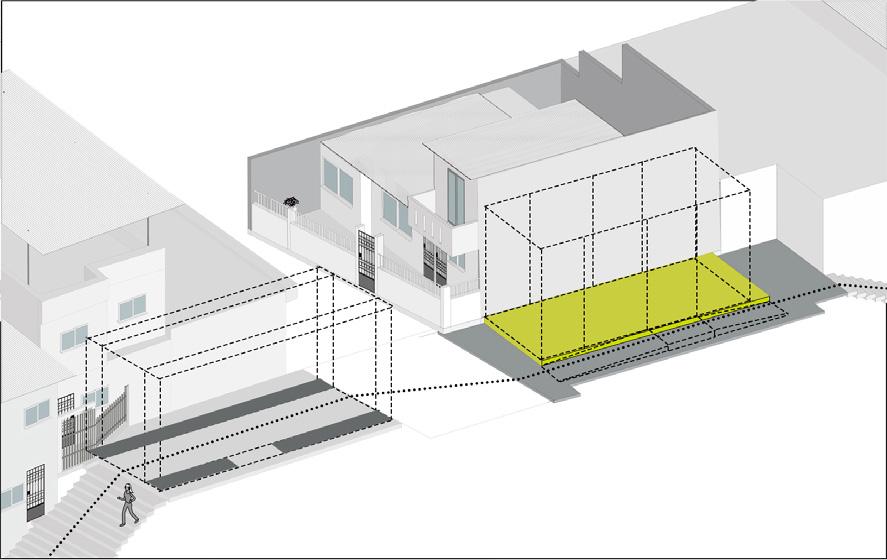
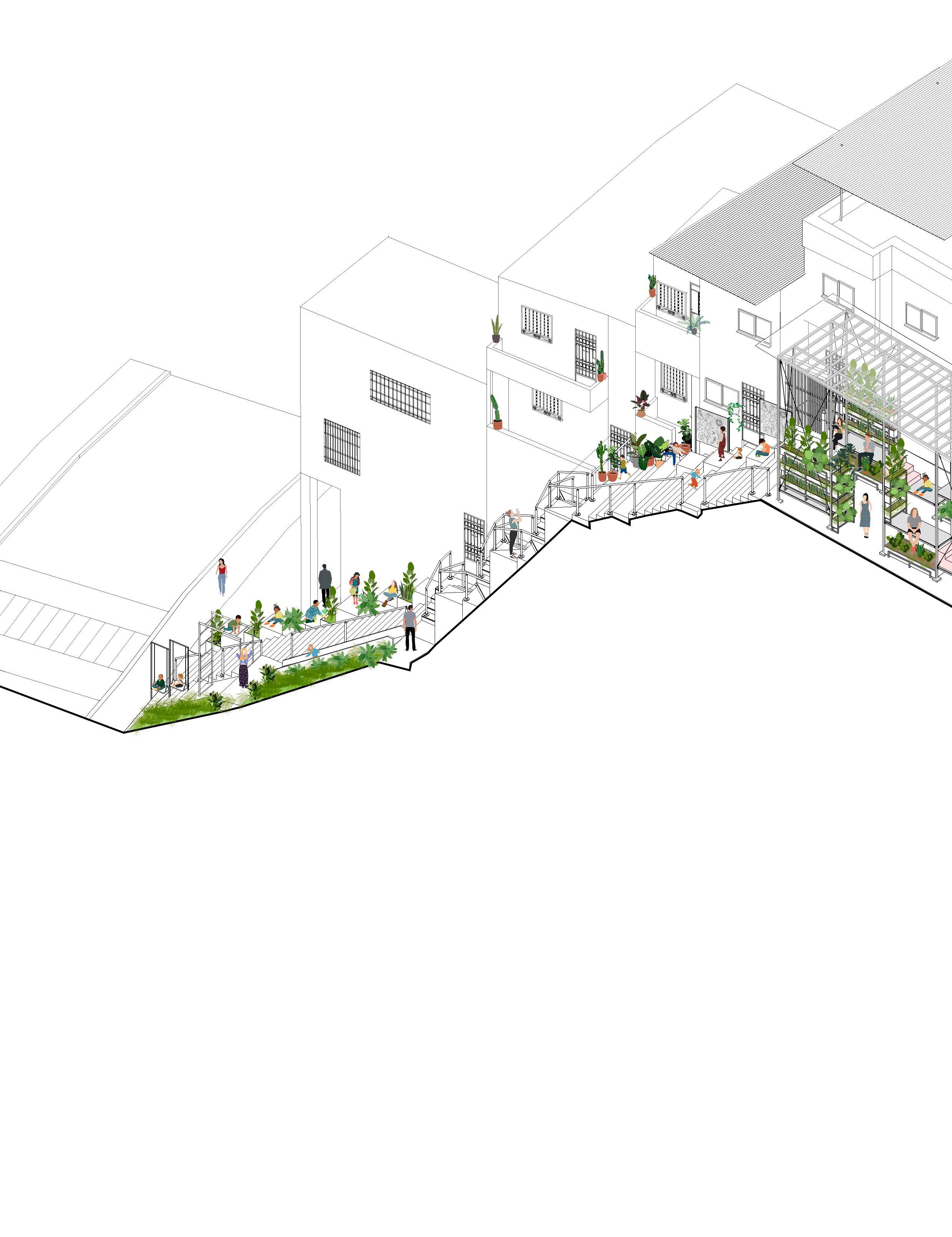
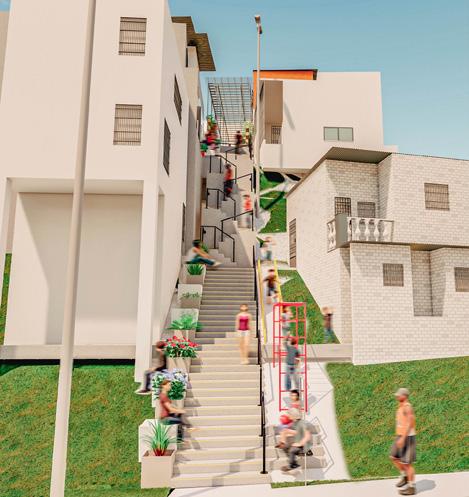
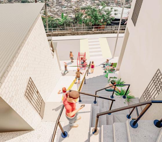
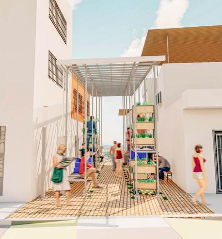
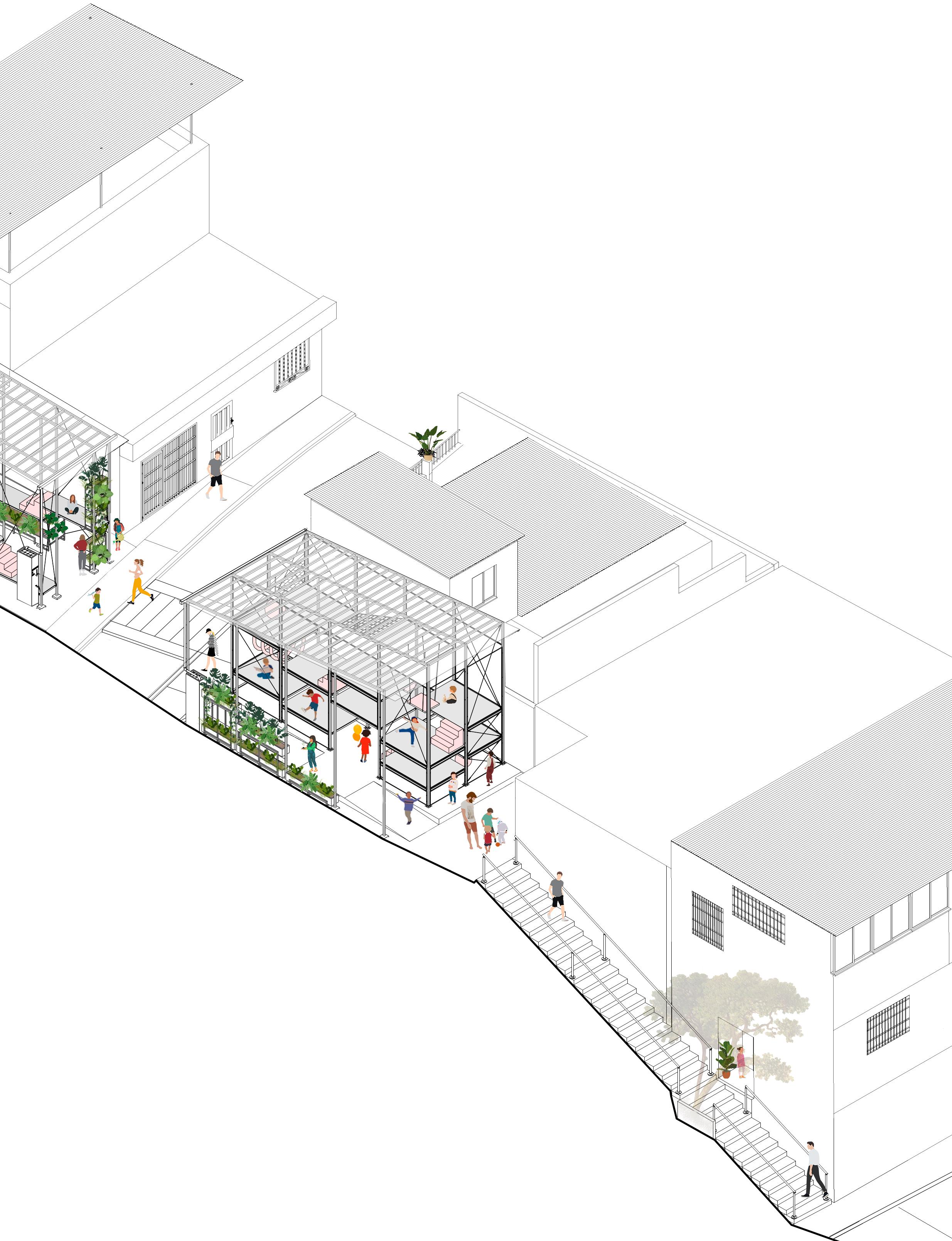
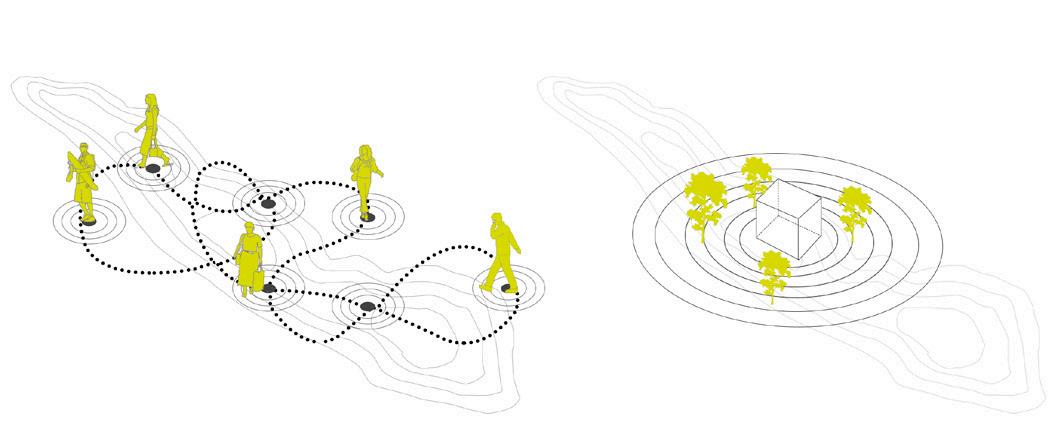
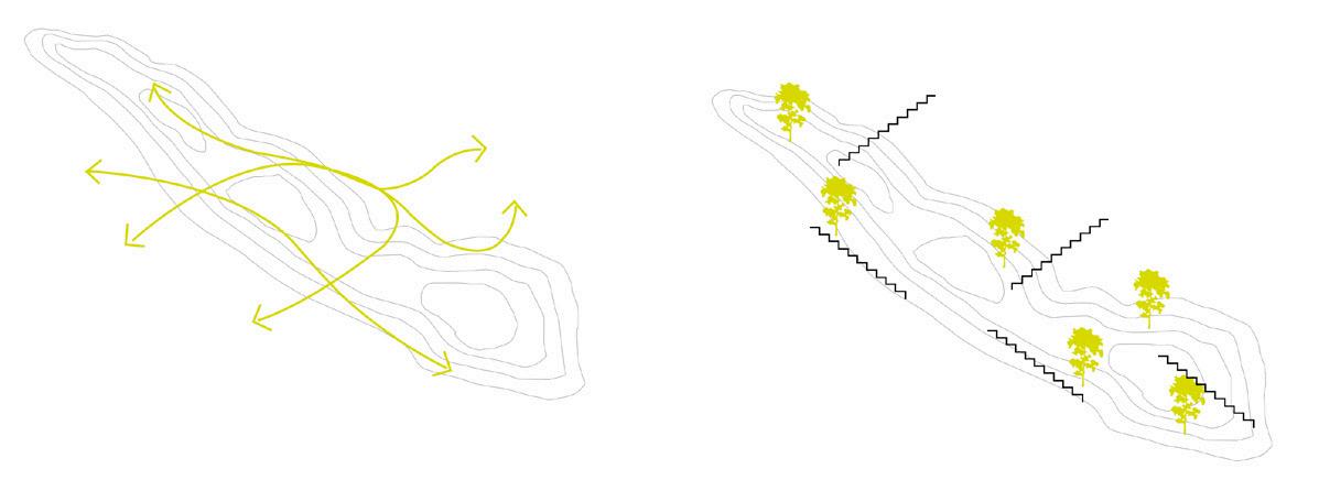
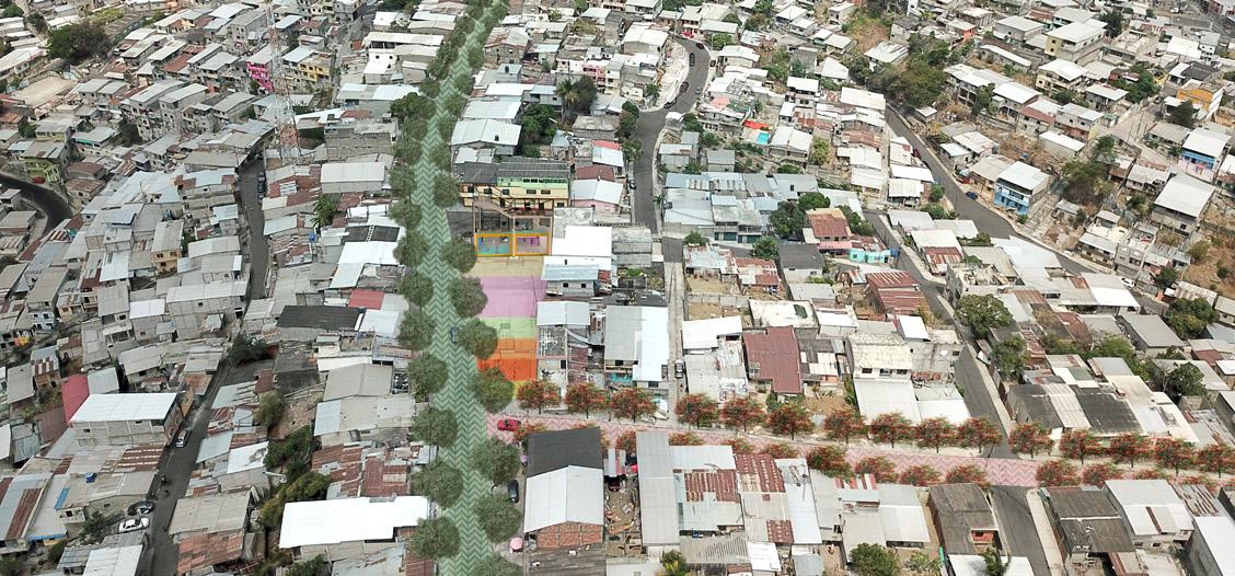
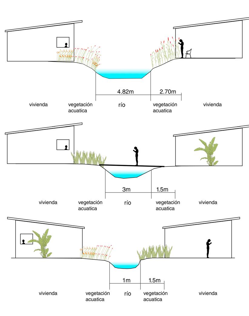
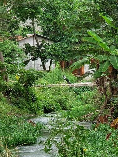
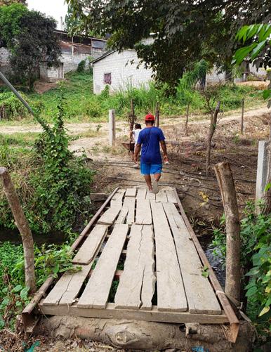
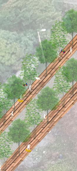
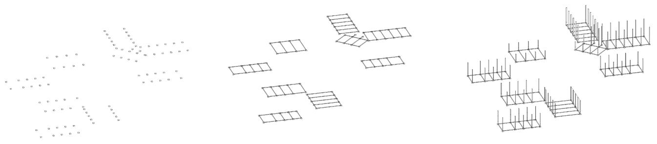
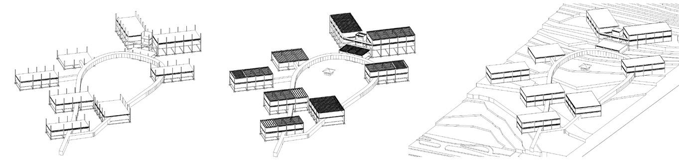
The circulation system that the inhabitants have generated by adapting to their immediate environment generates a strong link between people and the pedestrian paths, developing their lives and the homes around them. Providing a great value of neighborhood life through a fluid mobility route, which at the time of inserting the reservoir generated problems for neighborhood coexistence, forcing them to privatize public access to it.
This circulation system is synthesized in a system of connected platforms that, when introducing the activities, make up a system of neighborhood life typical of the sector.
stores
metal and wood workshop
tailor shop
Adults with children Kids playing
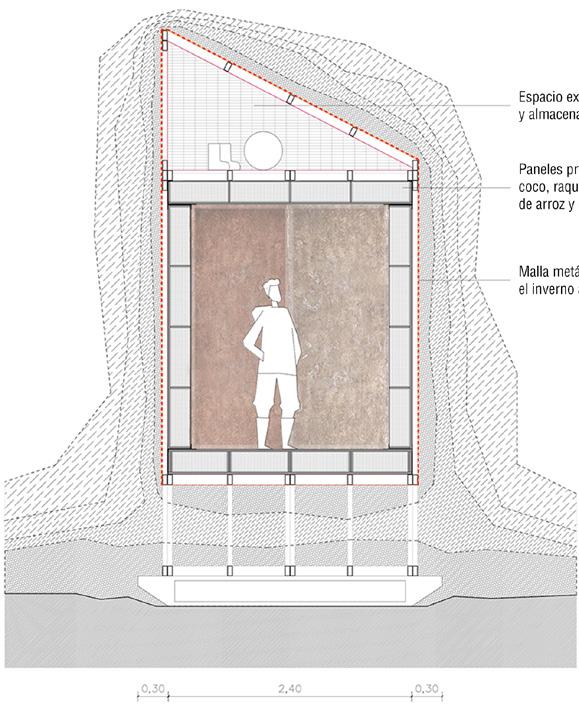
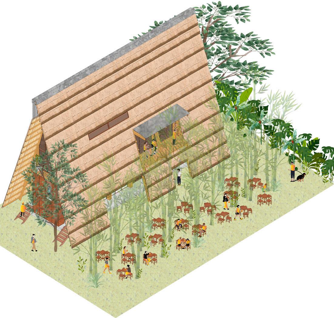
BUNKER
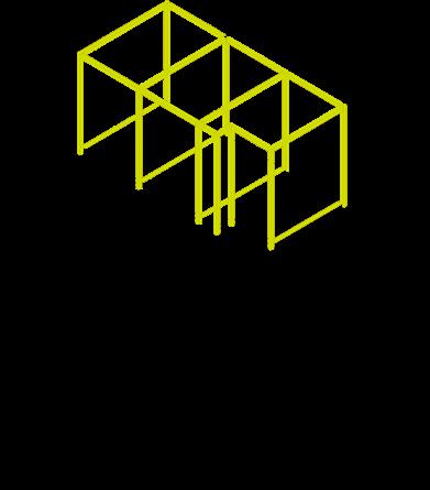
STEREOTOMIC Body
TECTONIC soul
Modulor
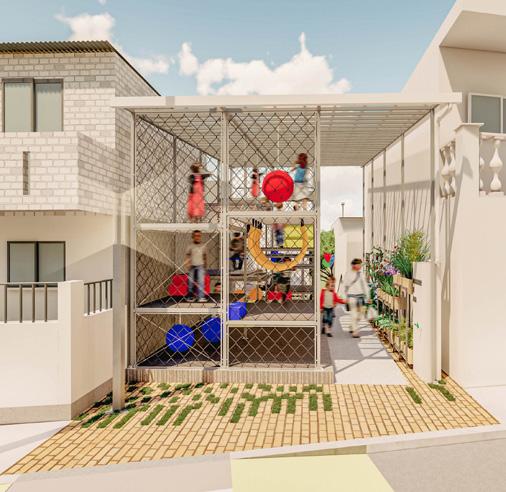
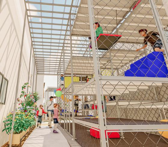
Childish games
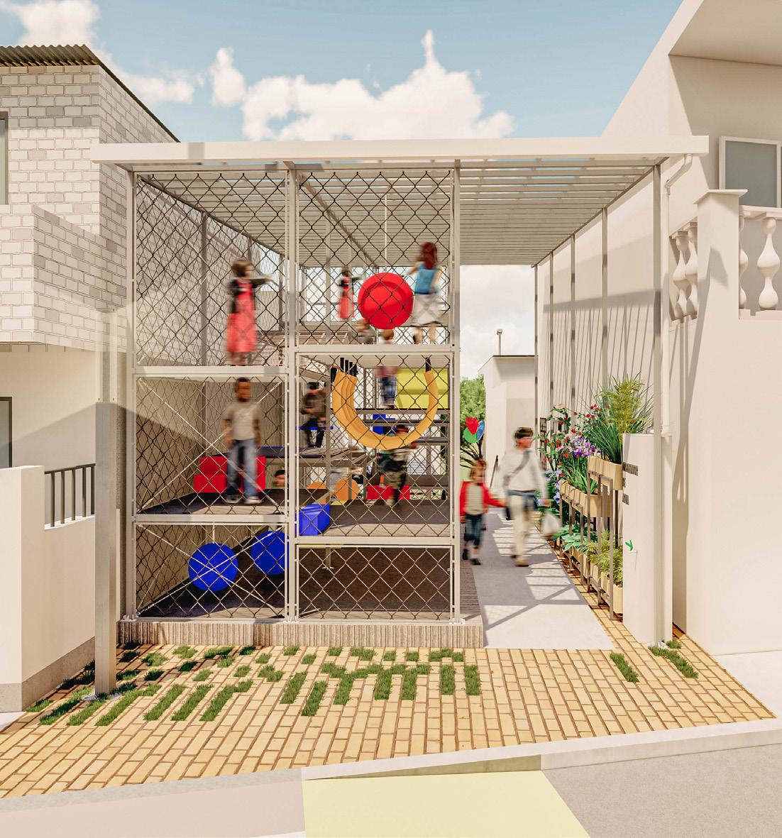
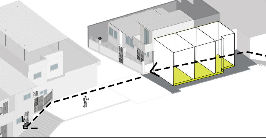
Receiver / Access
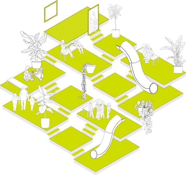
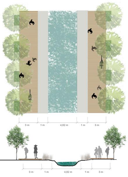
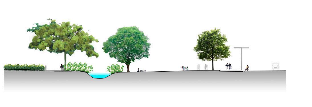
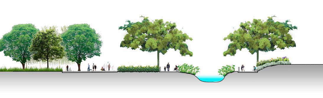
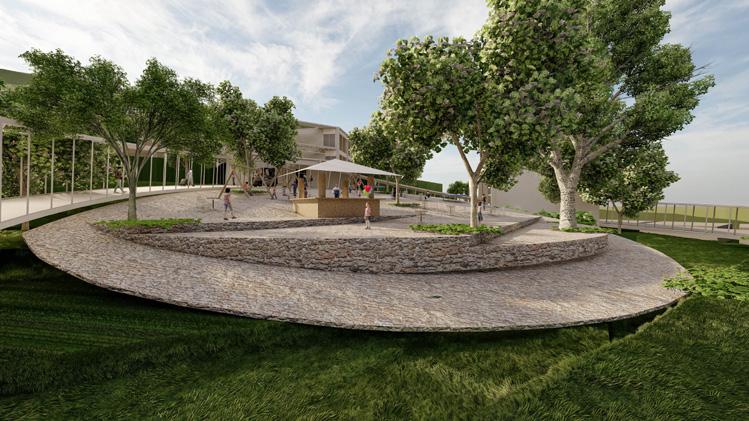
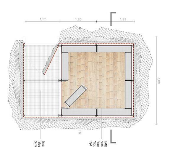
Contemplation area and communal gardens
2.Contemplation area Communal Gardens Learning zone
1. Children’s area
Implementation of community gardens to provide planting and harvesting areas to the sector.
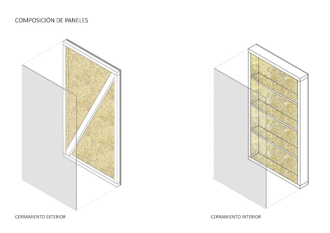
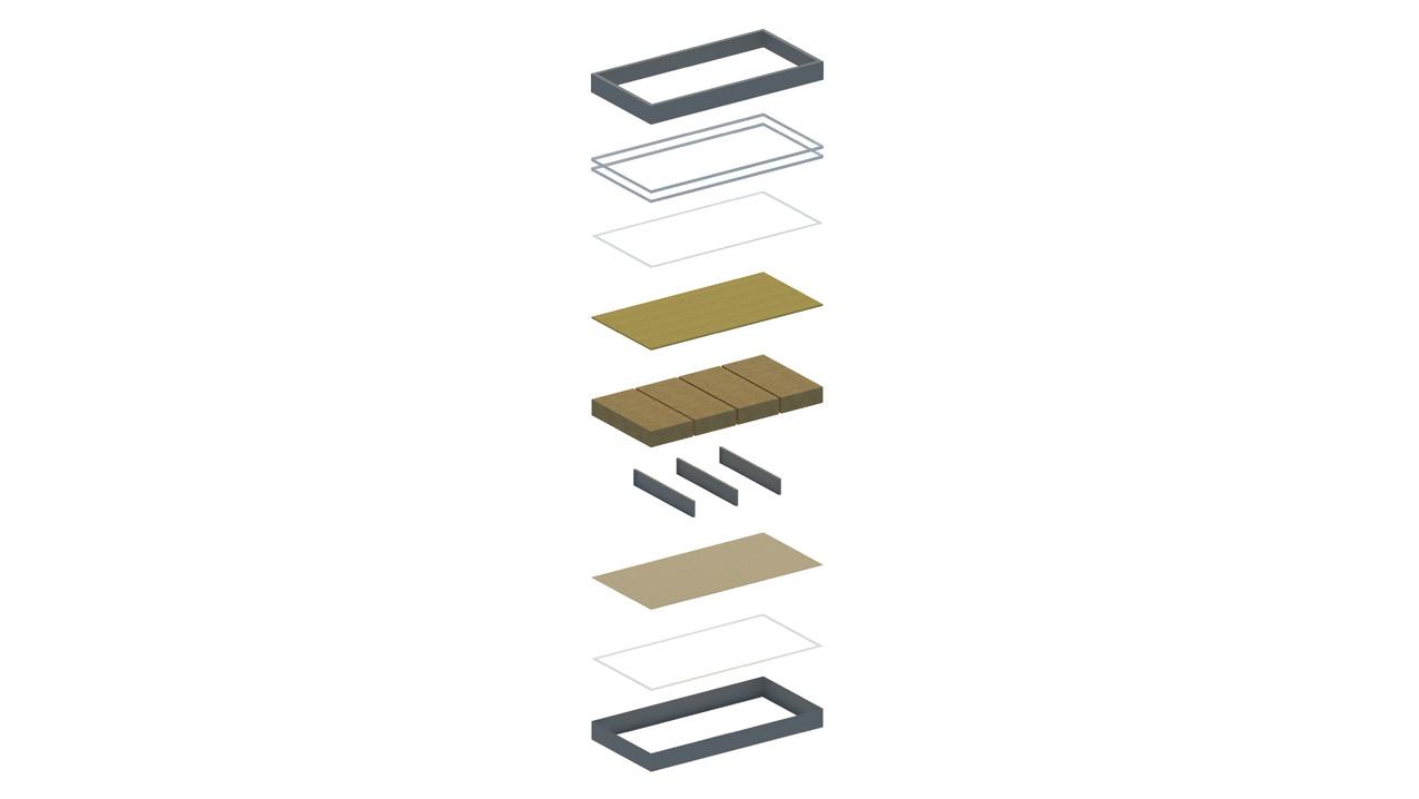
Translucent cover to allow the permeability of natural light in a dividing space.
ORCHARDS REST SPACES
LEARNING ZONE
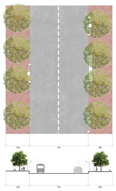
Configure a modulation that allows both parties to modify around the circulation they have.
Condition the circulation area for continuous accessibility
CONTEMPLATIONORCHARDSSPACE
CHILDISH GAMES
Light cover that allows the collection of rainwater so that the inhabitants maintain their crops.
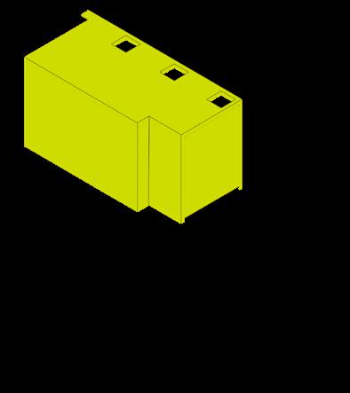
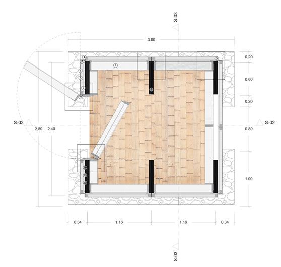
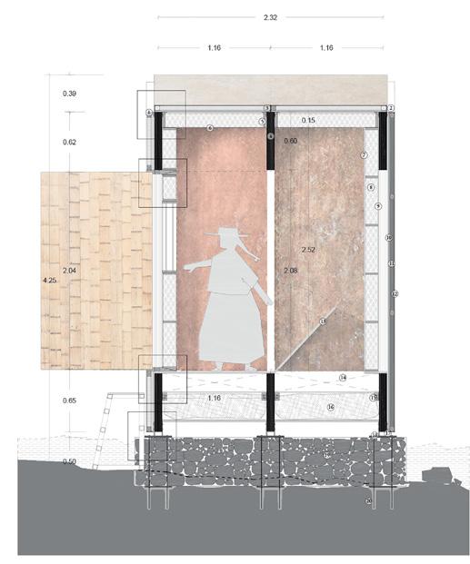
Maintain the height of the reservoir to stay aligned with the context.
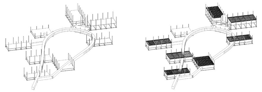
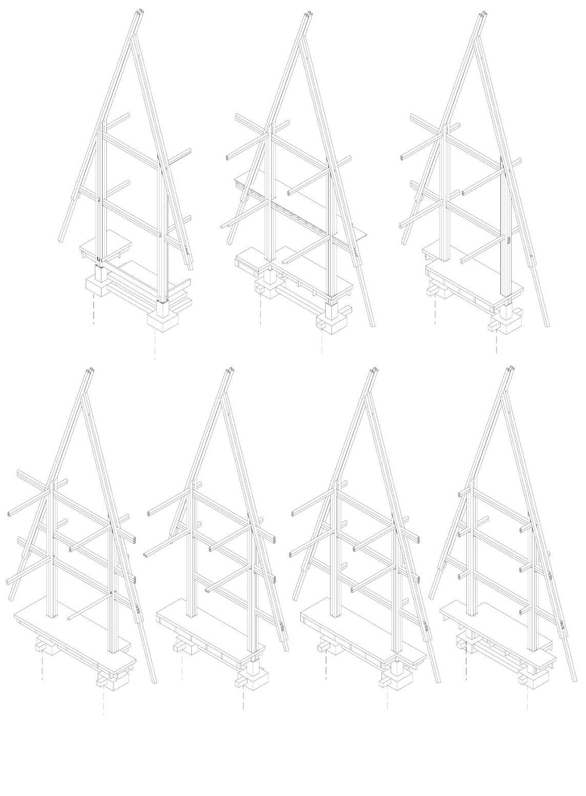
Modular platforms at various levels to generate an interaction system between the user and the proposal.
the area of public space.
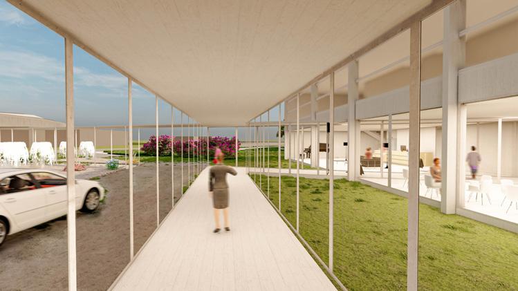
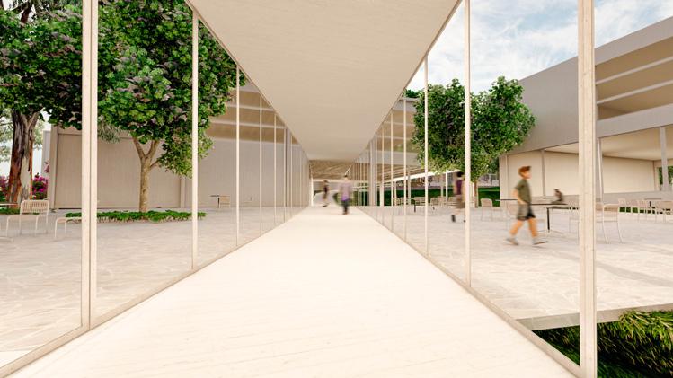
Slender metal pillars to generate double-height spaces.
CHILDREN’SZONE ORCHARDS
Respect and configure the modulation in the accesses of dwellings
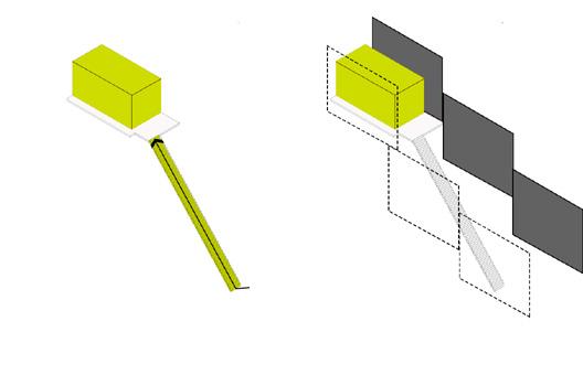
Pillars anchored to the base of the reservoir. The pillars outside the base are anchored by plinth
Maintain the base of the reservoir to preserve its footprint
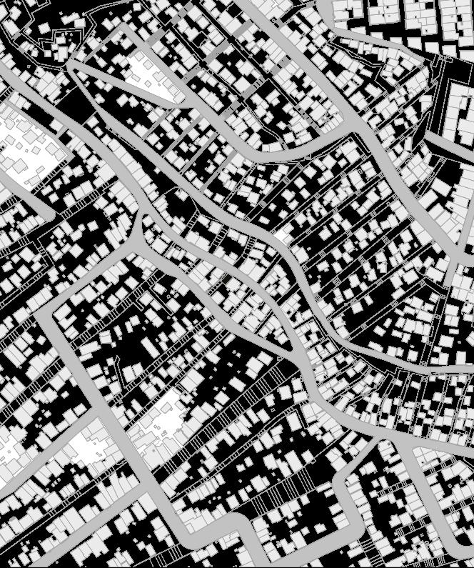
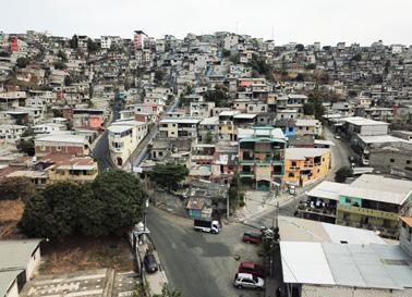
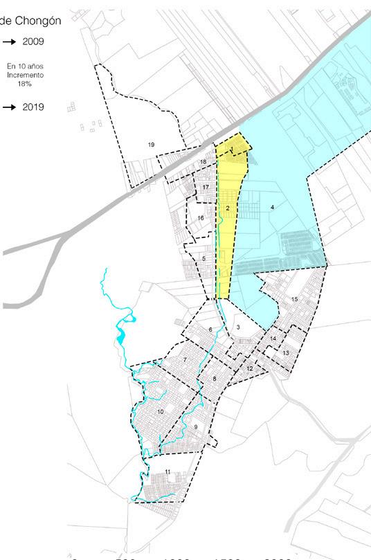
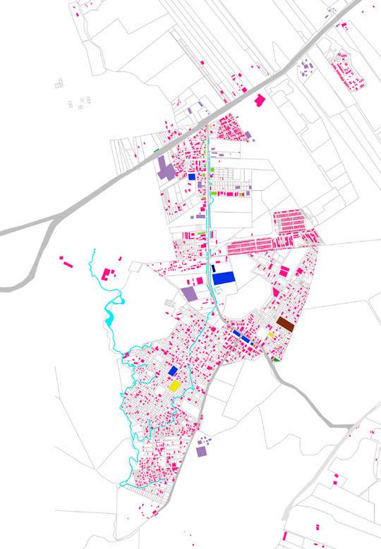
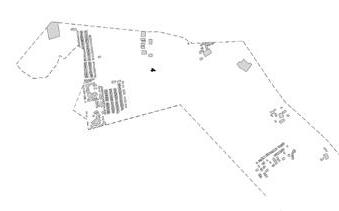
First occupied lots destined for industries. Formation of the first settlement The first 8 cooperatives established without planning. The cooperatives grow towards the top of the hill.
Population and public space
Objectives
Creation of planned cities.
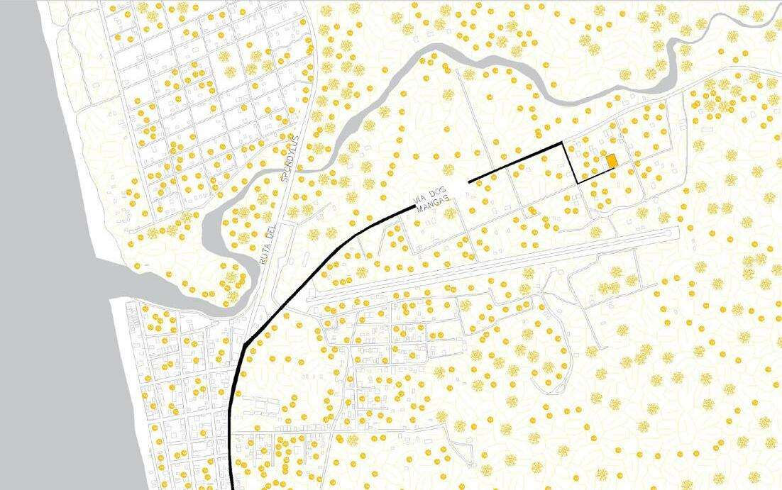
Link with the city
Rehabilitation of the sector
Revaluation of vertical connections Community integration
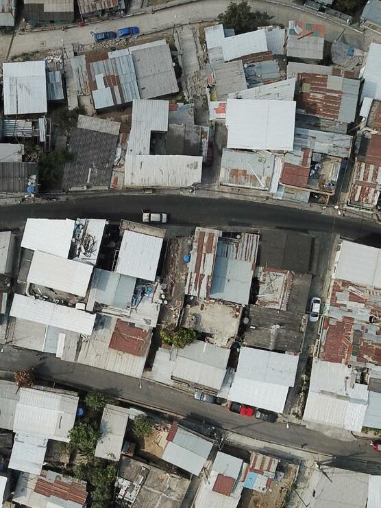
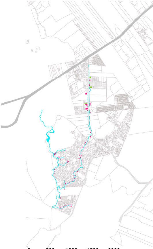
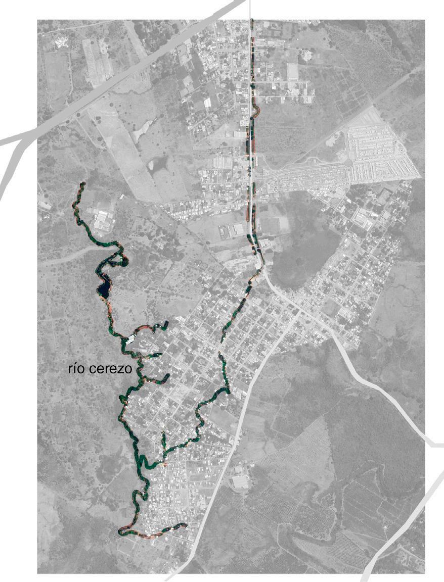
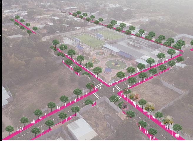
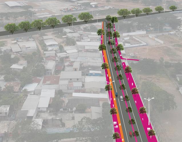
The Reservoirs
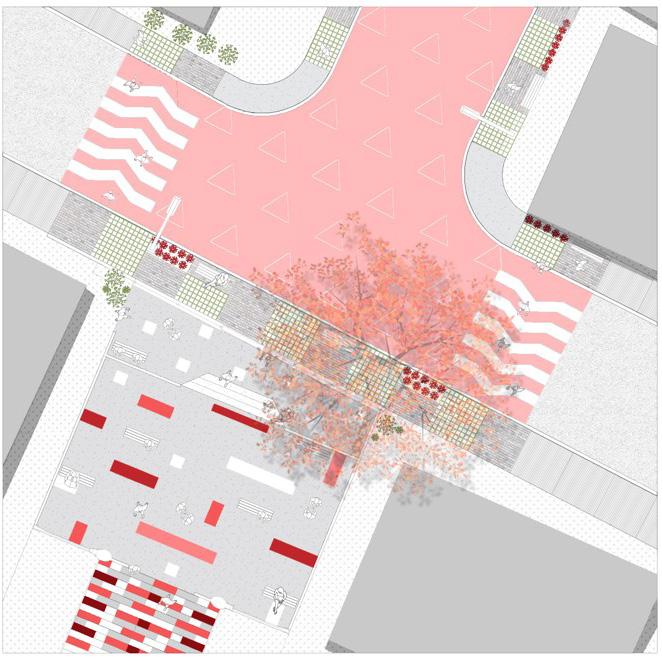
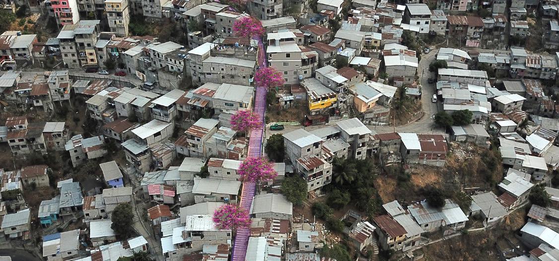
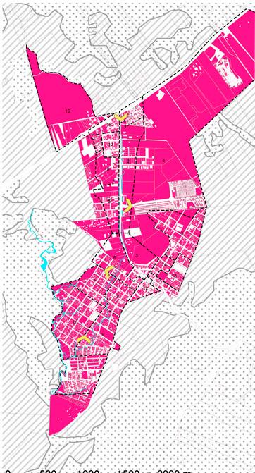
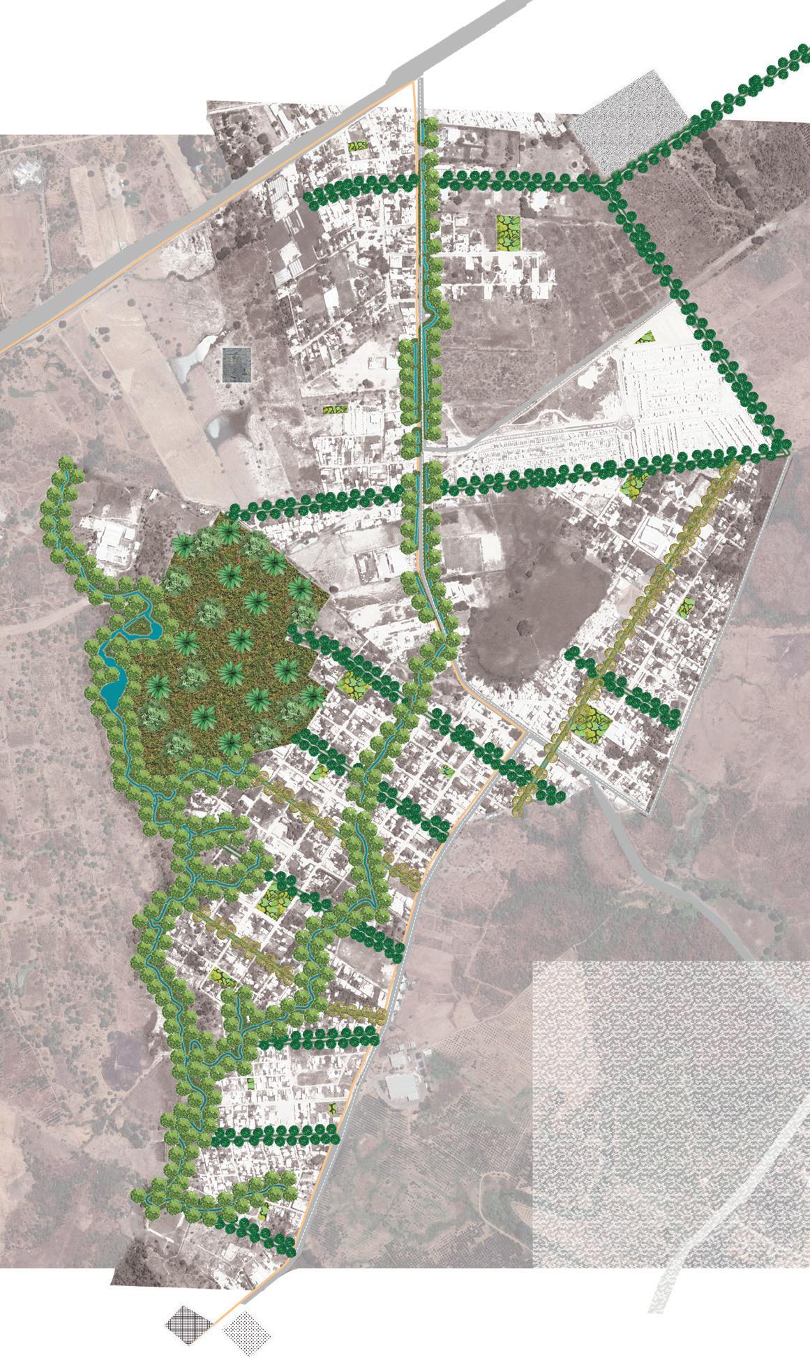
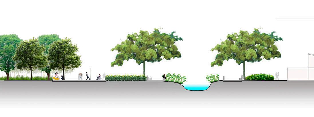
Simbología Corredores recreacionales. Paradas de bus. Paradas de aero vía.
Simbología corredores Espacios de estancia barreras vegetales
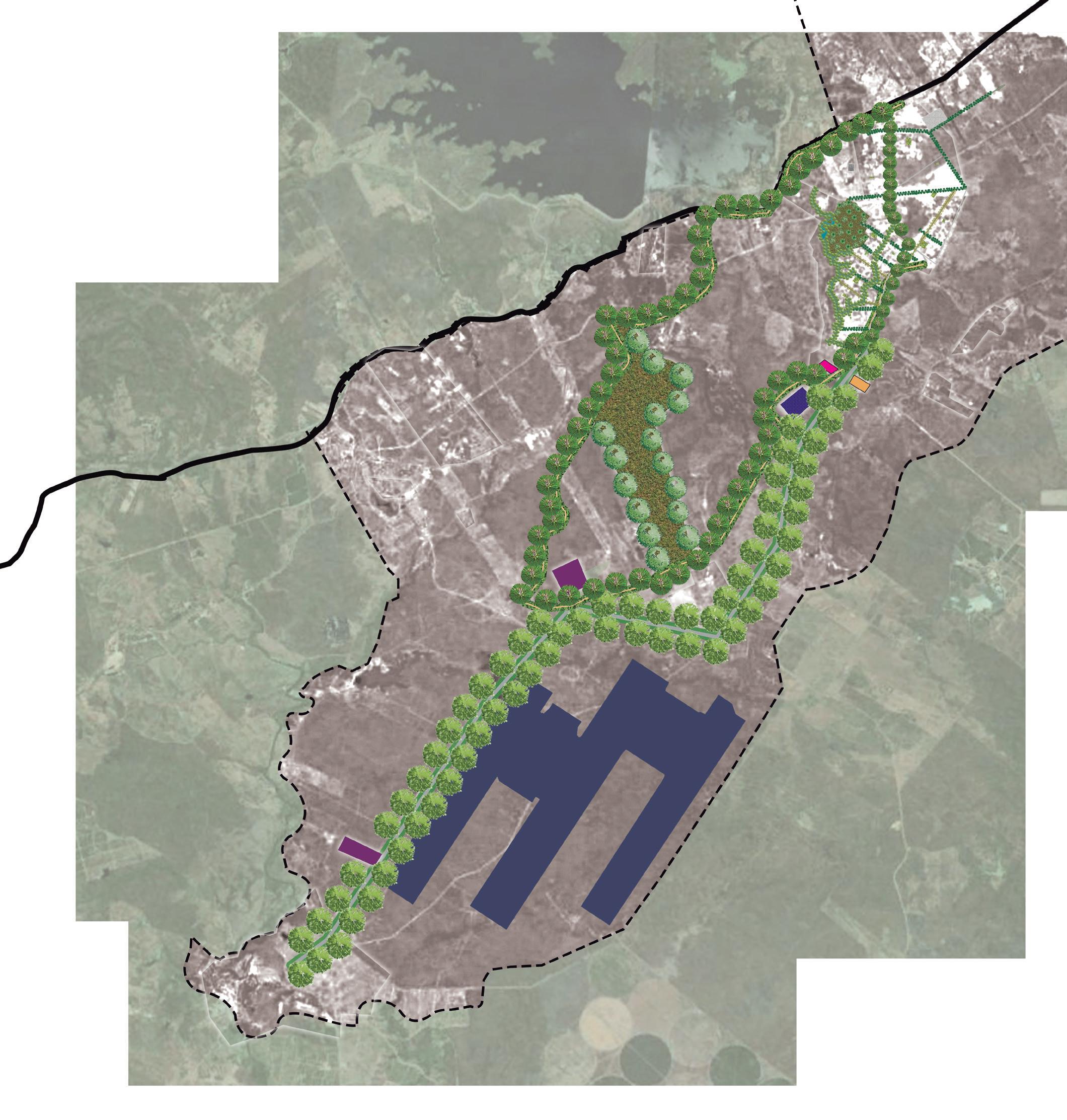
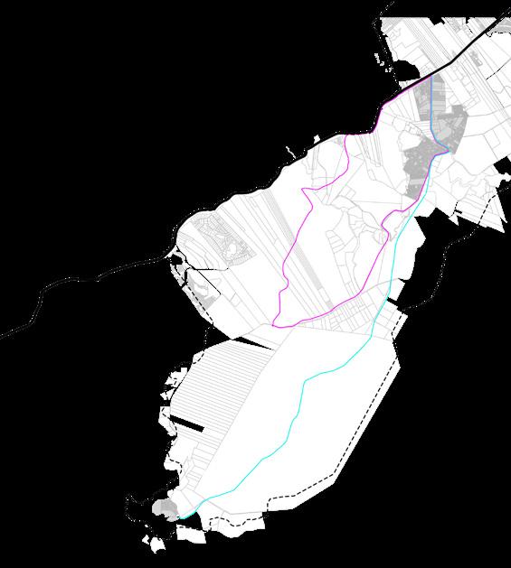
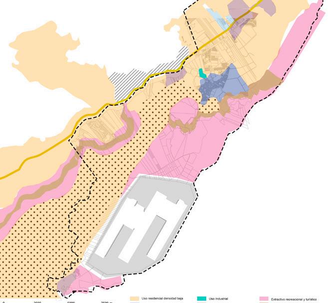
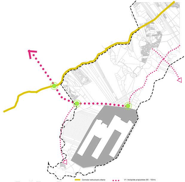
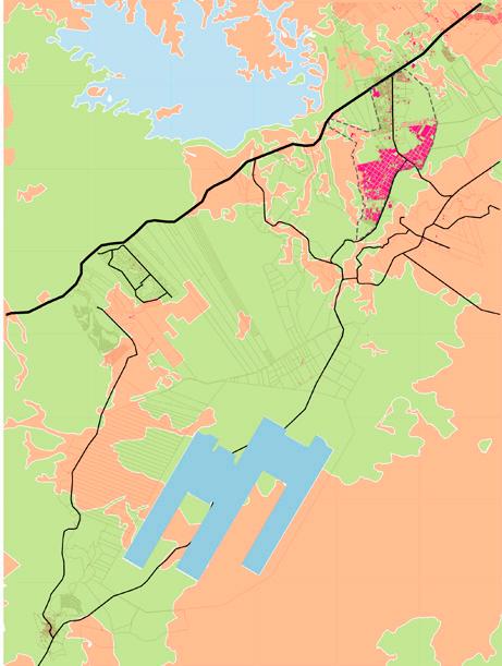
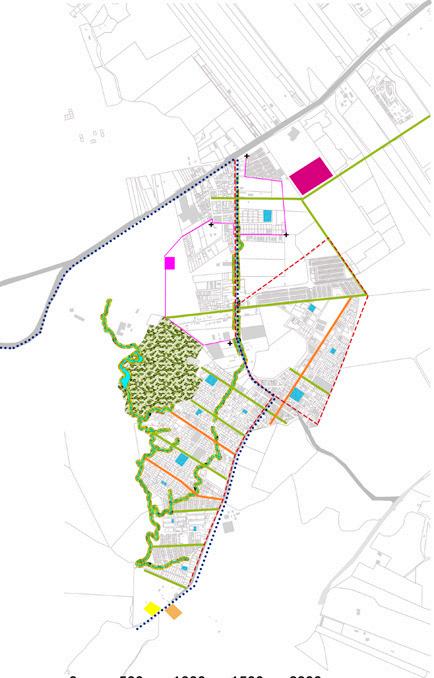
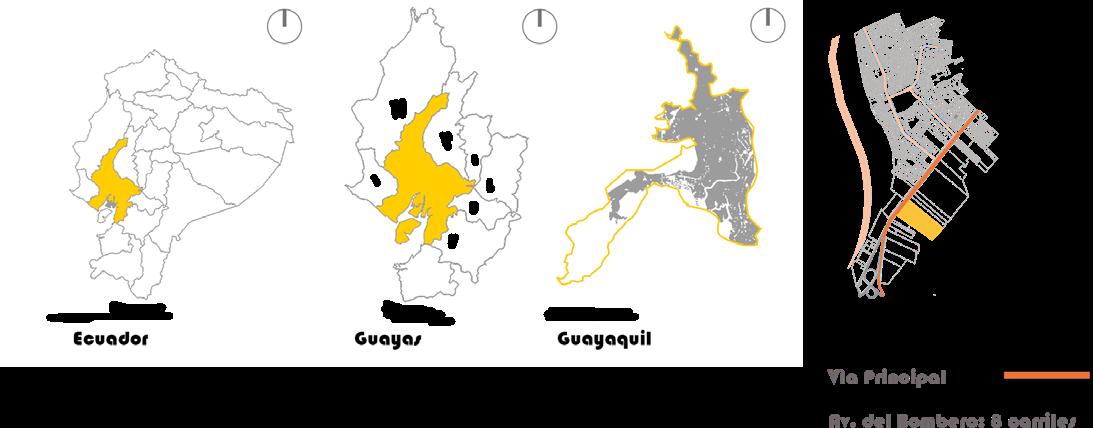
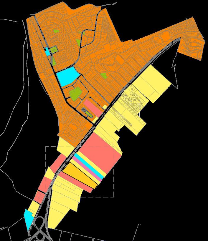
MASTER PLAN FOR CHONGÓN
Year: 2019
Project: Territorial Planning
Topic: Urban Intervention
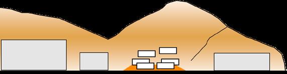
Development of a Master Plan for Chongón, considering the strategic location between the city of Guayaquil and the new airport. The project is based on an on-site investigation and analysis of the 2015 Territorial Ordering Plan and Gazette 94 issued by the city’s municipality. The study of indicators based on the parameters of the Urban Agenda of Malaga 2015 is carried out, once the indicators are related to the analysis, a diagnostic synthesis is carried out that includes the problems that directly affect the study sector. Strategies are projected as solutions to the problem, so that they allow an adequate model of urban functioning, good quality of urban life, integration in the natural environment and sustainable mobility.
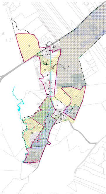
Master Plan
Chongón
Daular
Green area
Pedestrian and equestrian trail Market Education Airport Hotel Hospital Bikeway
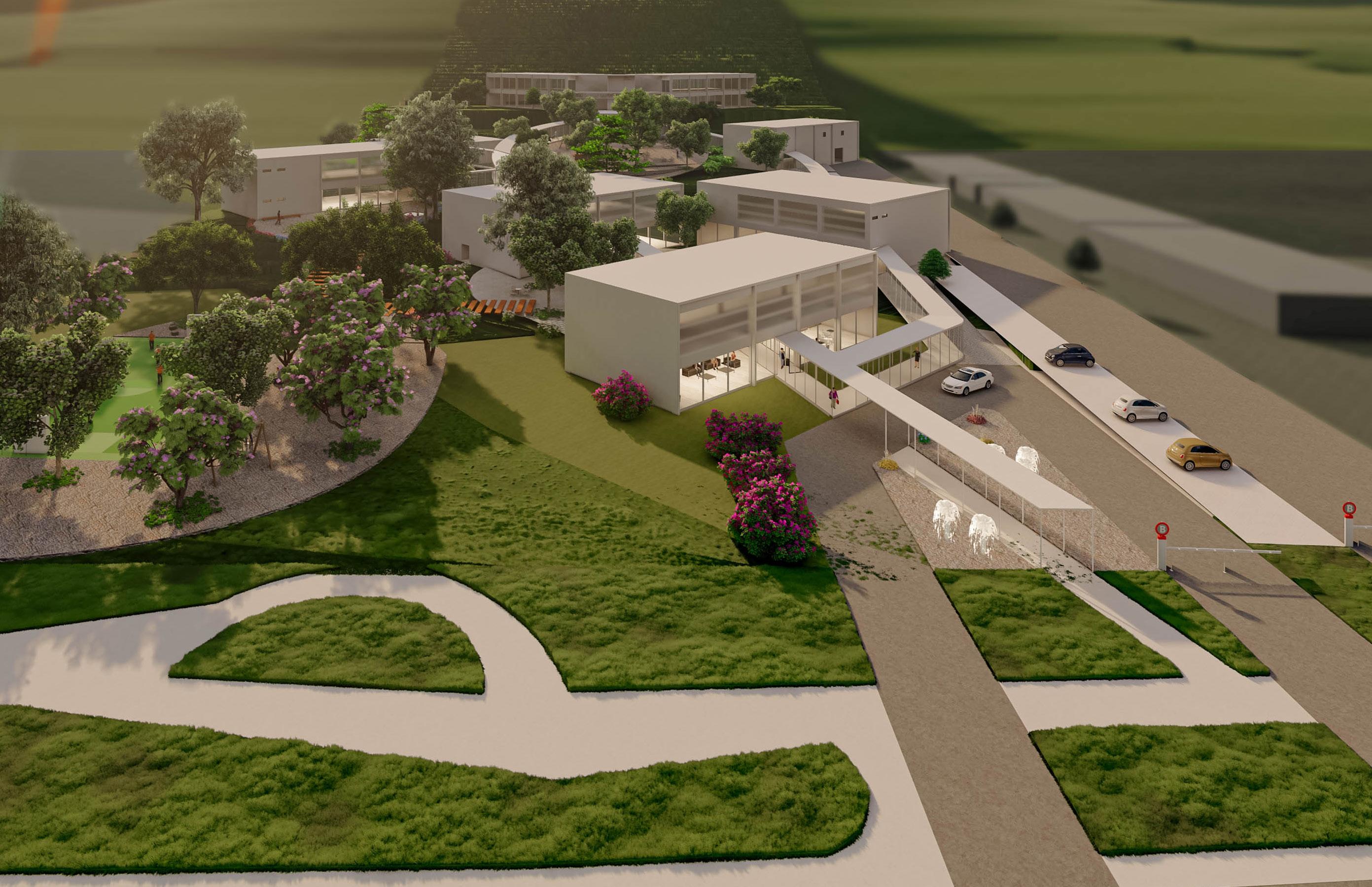
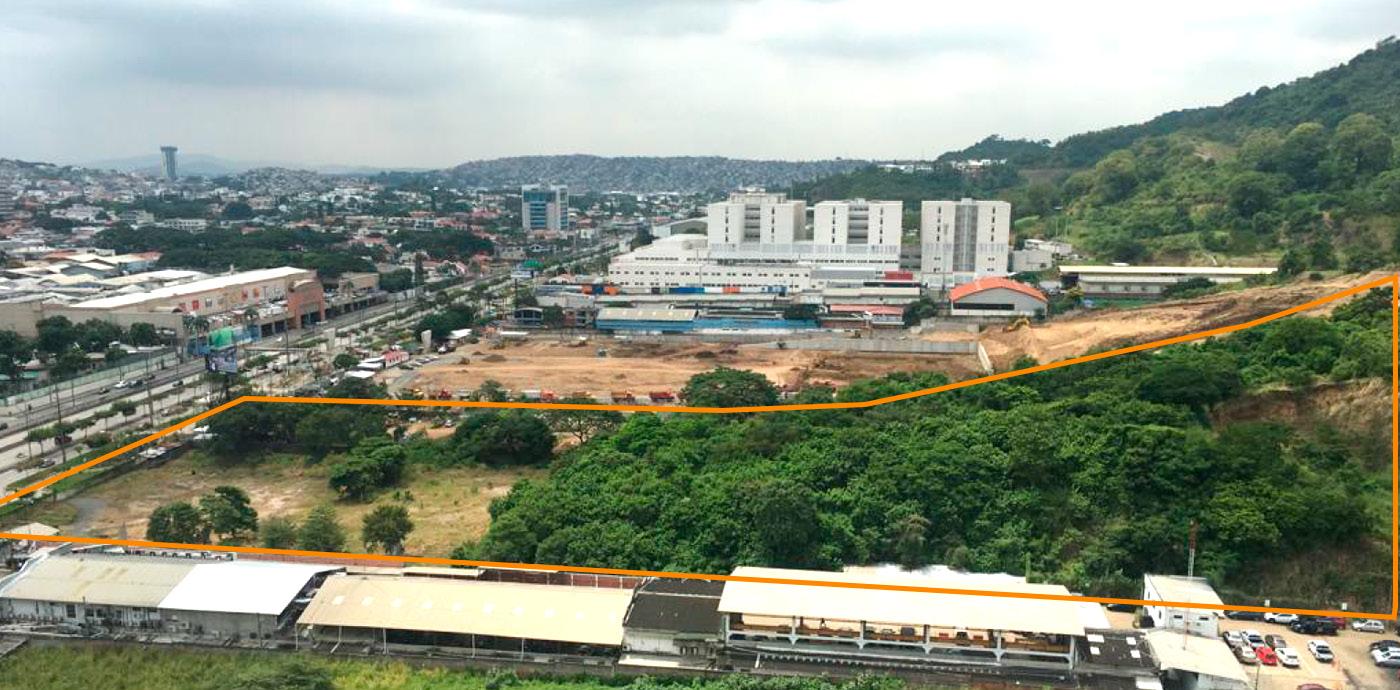
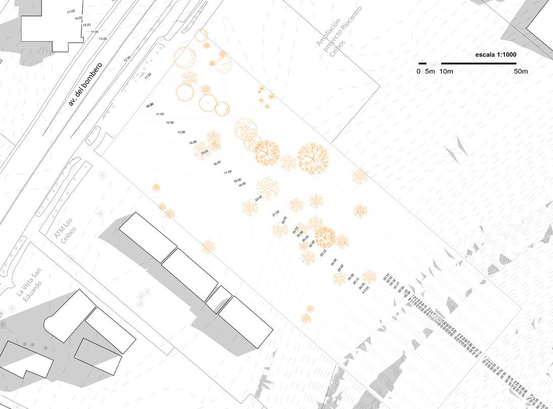
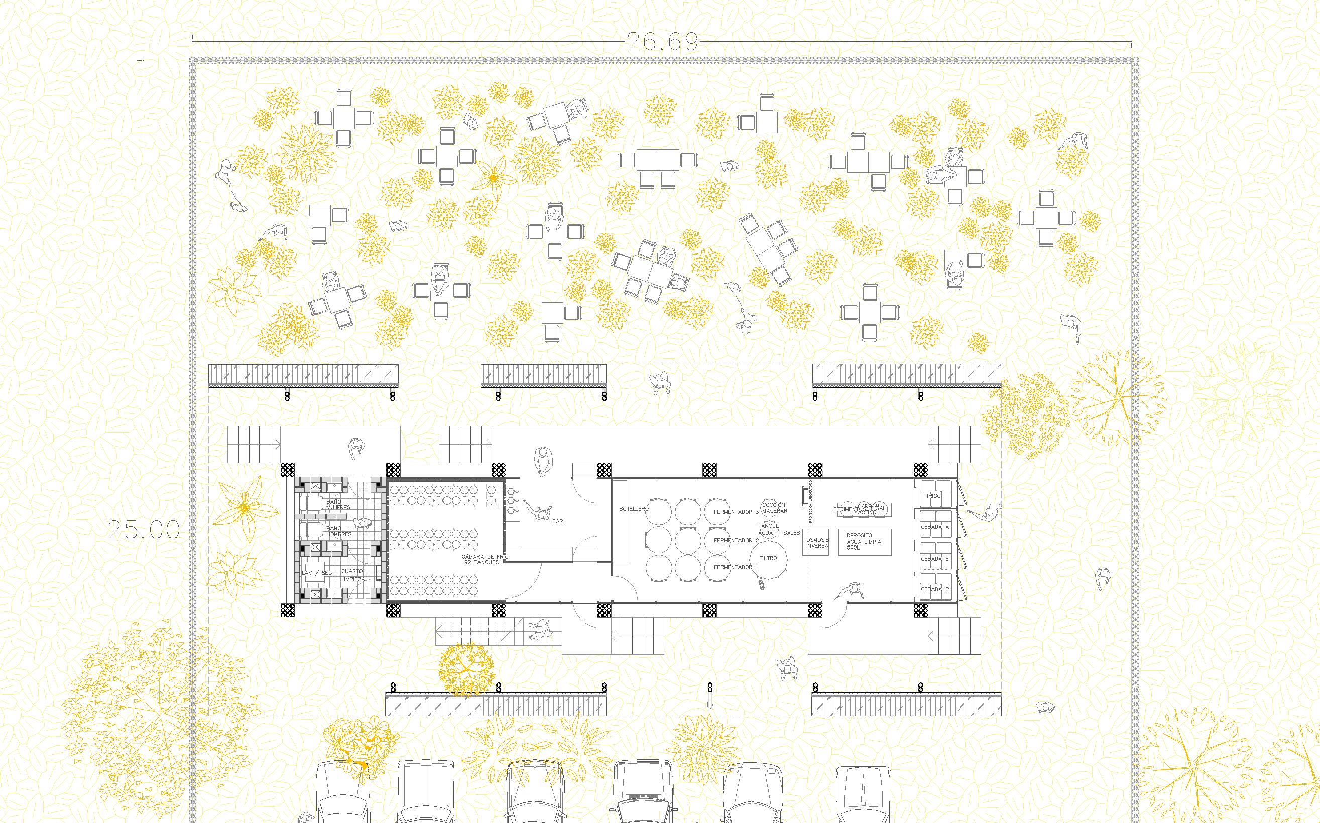
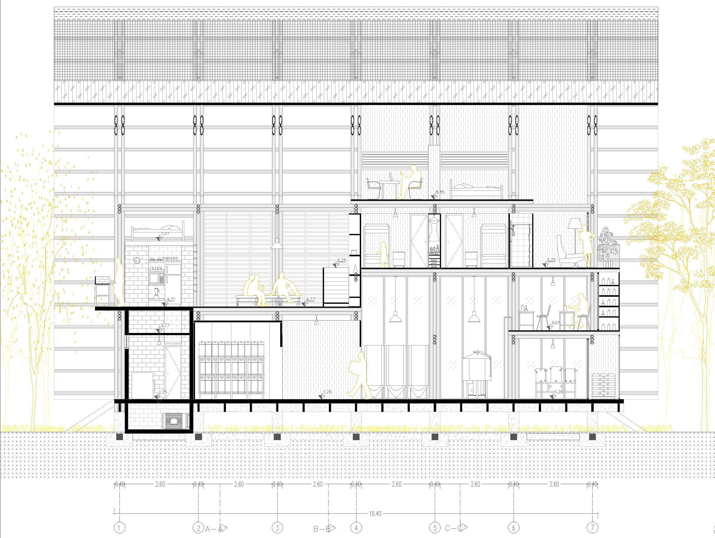
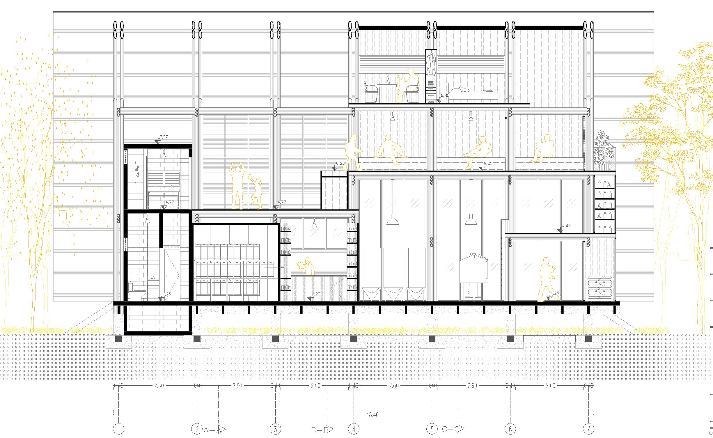
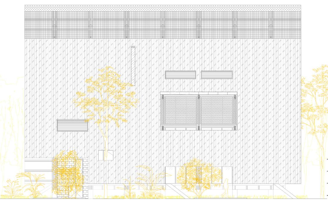
HOTEL IN CEIBOS
Year: 2019
Project: Hotel
Topic: Architectural design
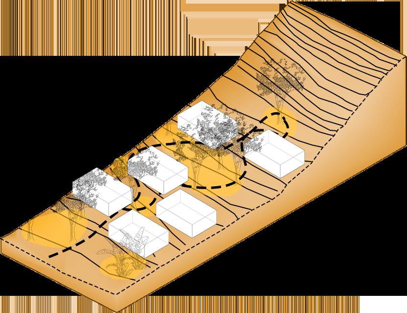
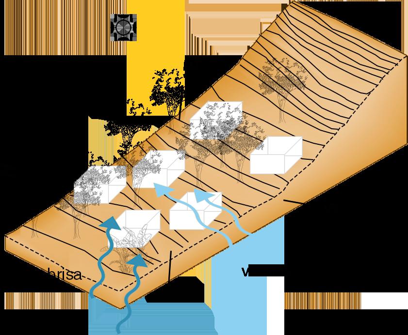
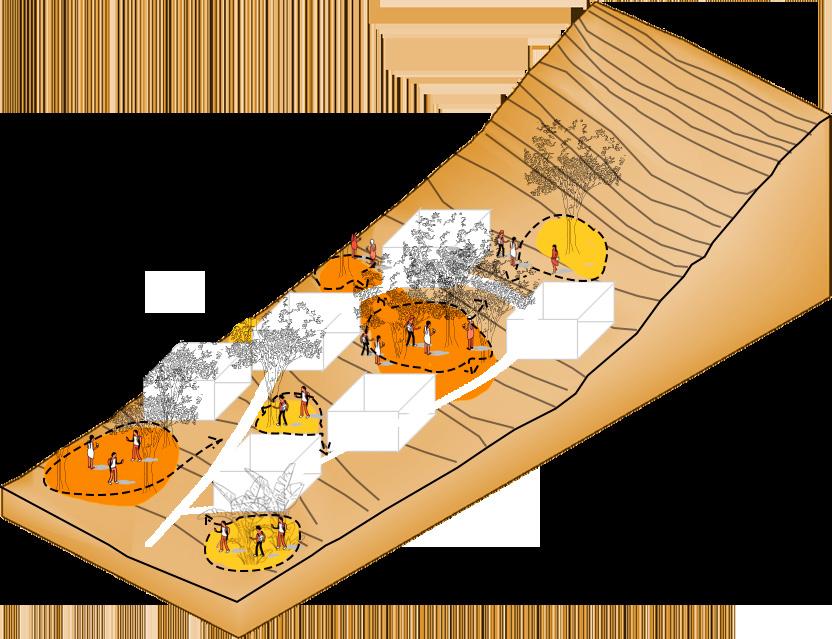
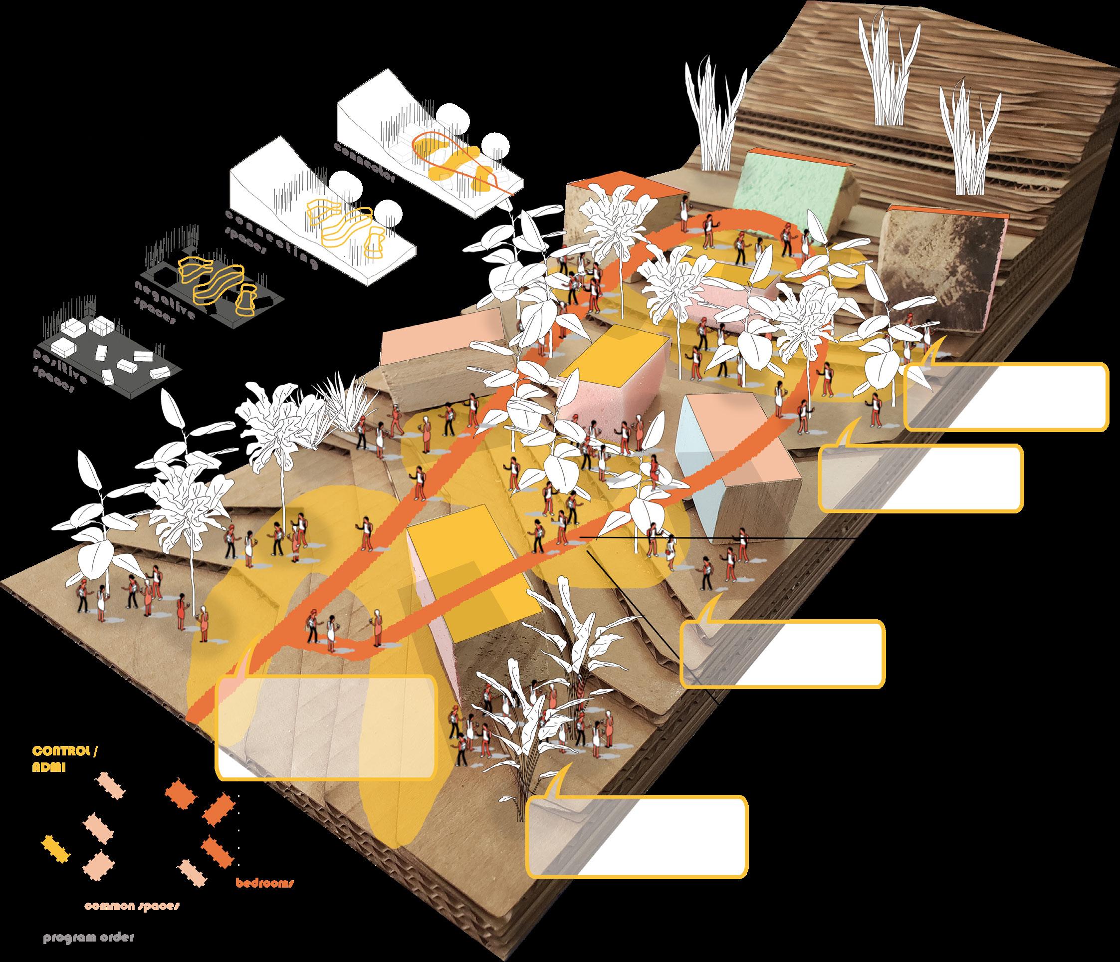
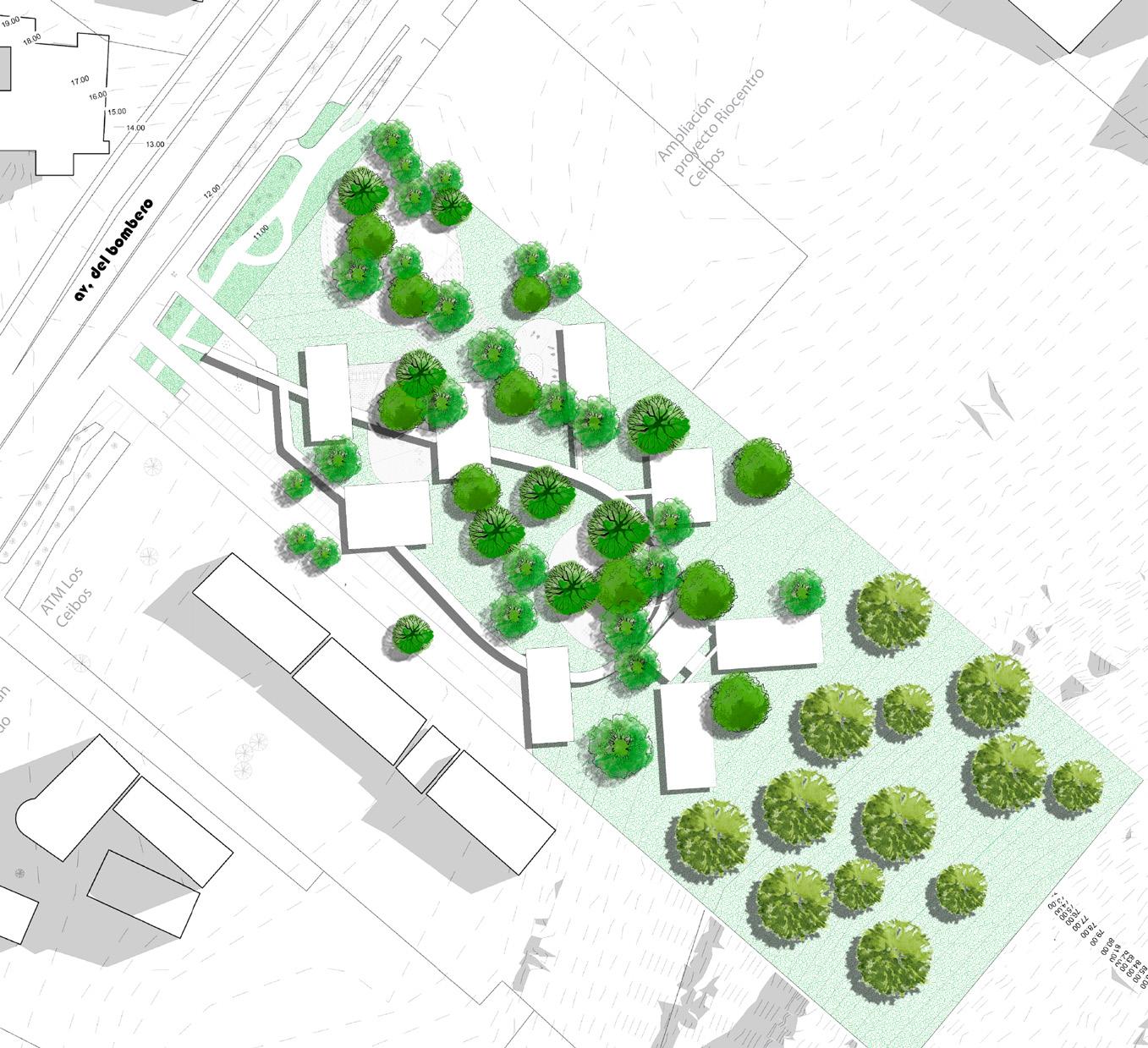
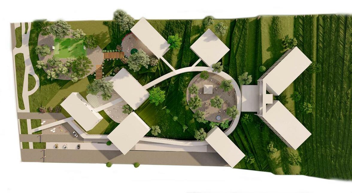
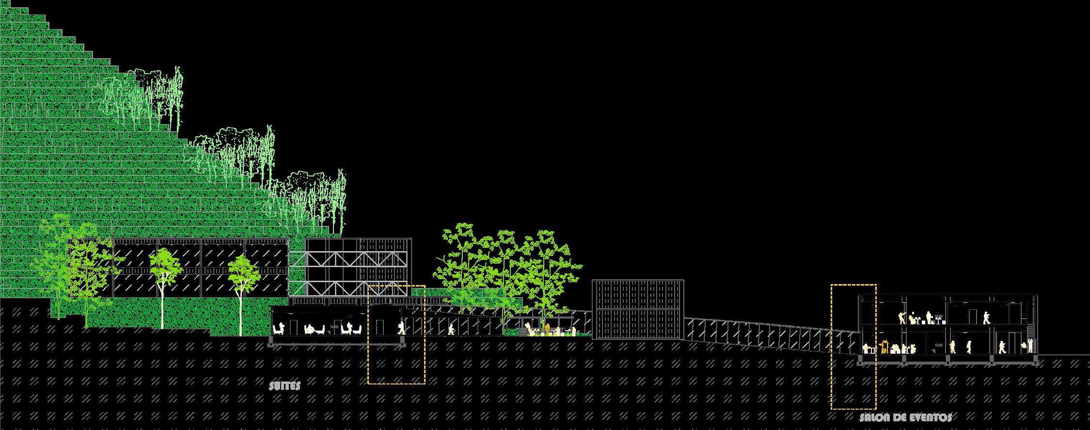
Architectural proposal for a hotel located in Los Ceibos sector due to the equipment deficit of a hotel in the area. The land has conditions of marked topography and predominant vegetation generating the two strengths of the project. The spaces of the program are defined in configuration of the physical conditions of the land through the distribution of the program in strategic places connected through a circulation route that crosses the spaces of the program and structures the interior landscape of the land.
Concept
Strategies
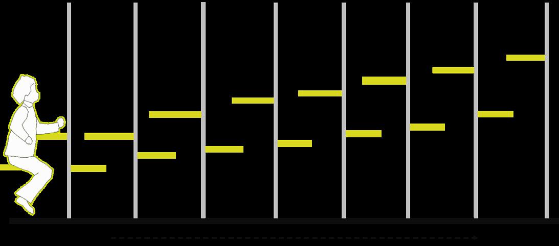
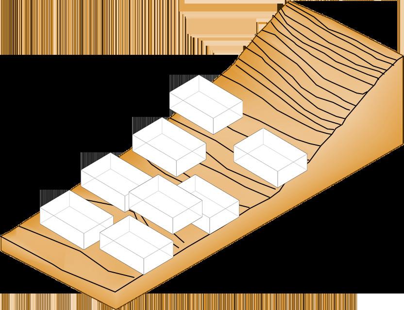
The terrain has a slope, the design of the program is fragmented and generates a set of heights between the different spaces of the program.
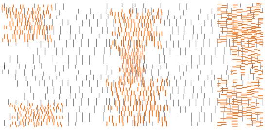
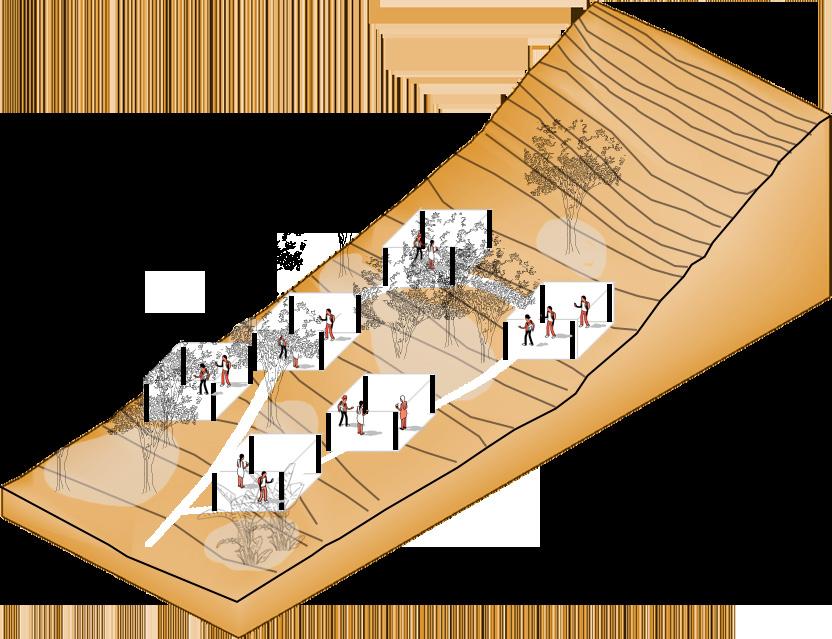
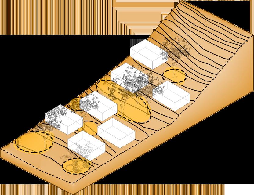
The land has abundant vegetation and generates patterns of routes and organization of the program.
Generate spaces for flexible routes through the vegetation where they contain recreation activities and coexistence with users.
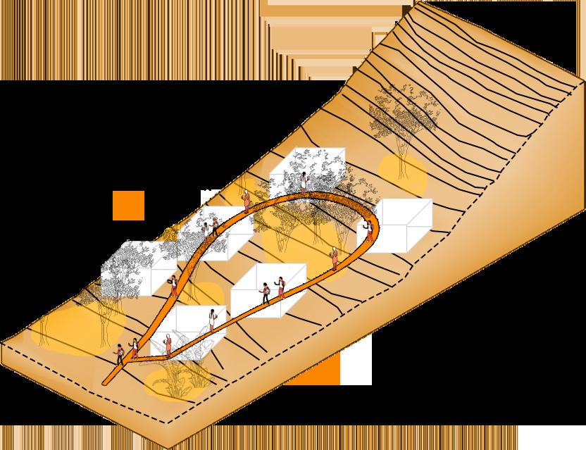
Establish project unity through a link that links the project activities.
Generate a fluid main route that crosses the different spaces of the project that allows the user to go through the project without interruptions.
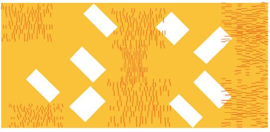
connector connections Unifies program fragmentation
Recreational spaces that link the indoor to outdoor program
Establish the direction of the project in the direction of the sun so that the facades are positioned in the direction of the winds and breeze to generate spaces of comfort for the user.